-
Christian Collectibles
-
Christian Sheet Music
-
Vatican Stamps
-
Vatican Coins & Paper Money
-
Antiques
-
Antiquities
-
Architectural & Garden
-
Decorative Arts
-
Ethnographic
-
Furniture
-
Maps, Atlases & Globes
-
United States (Pre-1900)
-
United States (1900-Now)
-
AK, HI
-
AL, FL, GA, MS, NC, SC
-
AR, IA, KS, LA, MO, NE
-
AZ, CA, CO, NM, NV, UT
-
CT, MA, ME, NH, RI, VT
-
DC, DE, MD, NJ, NY, PA
-
ID, OR, WA
-
IL, IN, MI, OH, WI
-
MN, MT, ND, SD, WY
-
OK, TX
-
VA, WV, KY, TN
-
Entire US
-
United States (Date Unknown)
-
Africa
-
Asia
-
Australasia/ Oceania
-
Canada
-
Central America/ Caribbean
-
Europe
-
India
-
Ireland
-
Mexico
-
Middle East
-
North America
-
South America
-
United Kingdom
-
Maps on CD
-
World Maps
-
Globes
-
Mixed Lots
-
Reproductions
-
Price Guides & Publications
-
Other
|
In
Order by: Available to: This site contains affiliate links for which I may be compensated
|
Buy It Now
$4.95 Shipping Location: Castle Rock, United States
Buy It Now
$4.55 Shipping Location: Oakland, United States This antique map of Ireland is a rare find for collectors and history enthusiasts alike. Dating back to 1869, it provides a fascinating glimpse into the ... morepolitical and geographical landscape of Ireland during that time. Measuring at 8.5 x 7 inches, it is a compact and easy-to-display piece that would make a great addition to any collection.Featuring intricate details and vibrant colors, this map accurately captures the topography, cities, and landmarks of Ireland. Whether you are a seasoned collector or a curious beginner, this antique map is a must-have for anyone interested in the rich history of Ireland.
Buy It Now
$4.55 Shipping Location: Oakland, United States This antique map of Central and Southern Europe from the year 1869 is a one-of-a-kind piece for collectors of historic maps. Measuring 8.5 x 7 inches, ... moreit showcases the geographical features and boundaries of the region during that time. The map is made of high-quality materials and is perfect for display or framing.
Buy It Now
$4.55 Shipping Location: Oakland, United States This antique map of England and Wales from 1869 is a true gem for collectors of historic maps. It features intricate details and labeling of cities, rivers, ... moreand topographical features. The size of 8.5 x 7 inches makes it a perfect addition to any collection or display.The map originates from England and showcases the cartography skills of the time period. It is a unique piece of history that can bring a touch of elegance to any room or setting. Don't miss out on the opportunity to own this beautiful antique map.
Buy It Now
$1.49 Shipping Location: Gresham, United States Map of Paris. 2018 TOURISME - TRANSPORT. Shipped with USPS Retail Ground.
Buy It Now
Free Shipping Location: Cambridge, United States Brand new and unused London Underground Tube Map- September 2004. Cover artwork- You Are In London. Emma Kay 2004. Pocket-sized map(15 x 30cm) Please ... morefeel free to ask any questions or for a more detailed description. Thank you for your interest. Please have a look at my other items for sale including more LU maps. Continuing Your Journey maps and street maps. Postage discounts apply for multiple purchases. Posted with
Buy It Now
Free Shipping Location: Monroe, United States ORIGINAL 1855 ANTIQUE MAP OF THE ROMAN EMPIRE. VERY DETAILED MAP SHOWING THE ROMAN EMPIRE WITH POLITICAL BORDERS AND WATERWAYS. REMOVED FROM MARCIUS WILLSON'S ... moreOUTLINES OF HISTORY. ORIGINAL 1855 ANTIQUE HAND-COLORED MAP OF THE ROMAN EMPIRE AT IT'S GREATEST EXTENT.
Buy It Now
$4.13 Shipping Location: Bloomfield, United States This lithograph map was produced by Meyers in the 1890s. It features Romania, Bulgaria, Serbia, and Montenegro, and is a physical map. The map is an antique ... moreoriginal and was created during the 19th century, specifically between 1800 and 1899.Measurements: 12” L x 10” HThe lithograph map overall is in Very God condition and shows sign of age.The lithograph will be shipped using poly bags with background for protection.Free USPS Mail Shipping.
Buy It Now
$4.13 Shipping Location: Bloomfield, United States A lithograph map from the 1890s depicting the Ottoman Balkans, Hungary, Greece, Romania and Albania. The map is an antique and falls under the category ... moreof Europe Maps.Measurements: 12” L x 10” HBibliographisches Institut in LeipzigMeyers Konv. Lexicon 6 Aufl Zum drtikel ‚balkanhalbinsel'The lithograph map overall is in Very God condition and shows sign of age.The lithograph map will be shipped using poly bags with background for protection.Free USPS Mail Shipping.
$3.95 Shipping Location: Columbia, United States This antique expandable booklet is a panoramic river map of the Rhein river, covering the stretch between Mainz and Cöln. The map is designed to be easily ... moreexpandable and foldable.
Buy It Now
$4.95 Shipping Location: Willow Grove, United States This is an LARGE ORIGINAL Central and Southern Italy map taken from a 1920 atlas. This map includes Sicily and shows a map detail of Naples. There is ... moretext on the reverse side of this map page.
Buy It Now
$4.00 Shipping Location: Harborton, United States It is in very good condition - note very light creasing and there is another map on the reverse side.
$5.99 Shipping Location: San Antonio, United States
Buy It Now
Free Shipping Location: Kansas City, United States PRICE PER SINGLE MAP. Size: 24" x 20".
Buy It Now
Free Shipping Location: Carmichael, United States Size 24"x18".

Buy It Now
$4.13 Shipping Location: Skaneateles, United States . Title: Europa waerhrend des XXX jaehrigen Krieges und bis zurZersplitterung der grossen spanischen Monarchie 1700. Description: Fine hand colored ... moremap of Europe. See: Tooleys dictionary of mapmakers. P. 199. Phillips. 151. From: HISTORISCH– GEOGRAPHISCHER HAND ATLAS ZUR GESCHICHTE DER STAATEN EUROPA’S VOM ANFANG DES MITTELALTERS BIS DIE NEUESTE ZEIT VON Dr. KARL SPRUNER von MERZ GOTHA: BEI JUSTAS PERTHES 1846. WE SELL ONLY ORIGINAL ANTIQUE MAPS Map is Guaranteed authentic. Original hand colored direct takenfrom Atlas. A Certificate of Authenticity will be on request forwarded for eachindividual map or print. Size: Sheet app. 44.5 x 36.5 cm. 17.5 x 14.5” Image app. 41 x 31 cm. 16 x 12.25” Condition: View overall very good. Light spotted/soiledpaper. All maps and prints are genuine. Authentic, published at the date stated in this listing! For better quality pictures please go to our web site: WWW.MAPANDMAPS.COM I offer a no questions returns policy. All maps and prints are genuine. Authentic, published at the date stated above. Worldwide shipping by signed registered mail or Global Express courier. Shipping fee is per combined shipment. Including handling and insurance. Free shipping worldwide if three items or more purchased. .
Buy It Now
Free Shipping Location: Sayville, United States Shows German and French positions. Printed in the German language in 1908 by the Bibliographisches Institut in Leipzig. See photo's.
Buy It Now
Free Shipping Location: Monroe, United States LIST AT LEFT OF A REFERENCE OF THE GERMAN STATES. DATED 1853 AT LOWER RIGHT. SCARCE AND VERY DETAILED PRUSSIA AND GERMANY.
$9.00 Shipping Location: Slovakia Condition can be see from the scan. (SEE PICTURE)! DO NOT DUPLICATE OR COPY! The print was folded inside the book and has original centrefold. I believe ... morein and encourage good communication!
Buy It Now
$6.00 Shipping Location: Carefree, United States MAP HAS SCALES BELOW TITLE. GOOD CONDITION, DISCOLORATION, CENTER CREASE AS ISSUED.
Buy It Now
Free Shipping Location: Sayville, United States Shows German and French positions. Printed in the German language by the Bibliographisches Institut in Leipzig. See photo's.
Buy It Now
$9.85 Shipping Location: Livingston Manor, United States
Buy It Now
$7.75 Shipping Location: Montrose, United States Date: August 6, 1870.
$9.00 Shipping Location: Slovakia Original old German lithograph map/double page OLD BOOK PLATE. The print was folded inside the book and has original centrefold. DO NOT DUPLICATE OR COPY! ... moreCondition can be see from the scan. (SEE PICTURE)!
$9.00 Shipping Location: Slovakia Original old German lithograph map/double page OLD BOOK PLATE. DO NOT DUPLICATE OR COPY! Condition can be see from the scan. (SEE PICTURE)! The print ... morewas folded inside the book and has original centrefold.
Free Shipping Location: Monroe, United States ORIGINAL ANTIQUE 1897 COLOR MAP OF ITALY. ORIGINAL 1897 ANTIQUE MATTHEWS NORTHUP DOUBLE PAGE ATLAS MAP OF ITALY. MAP HAS SCALES BELOW TITLE.
Buy It Now
Free Shipping Location: Carefree, United States BEAUTIFULLY COLORED AND VERY DETAILED WITH BORDER SURROUNDING MAP. DATE-1956, NOT DATED ON MAP. VERY GOOD CONDITION, MAP ON REVERSE.
$9.00 Shipping Location: Slovakia Original old German lithograph map/double page OLD BOOK PLATE. DO NOT DUPLICATE OR COPY! Condition can be see from the scan. (SEE PICTURE)! The print ... morewas folded inside the book and has original centrefold.
Buy It Now
$13.71 Shipping Location: MANCHESTER, United Kingdom This map is from General Atlas of The World by Sidney Hall, William Hughes etc, published by Adam & Charles Black, Edinburgh, 1854. This interesting map ... moreis an original antique which is over 165 years old.
Buy It Now
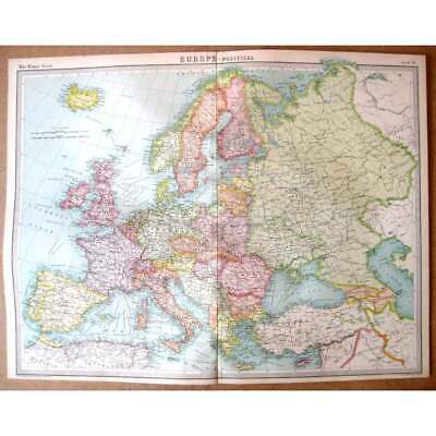
$4.55 Shipping Location: Oakland, United States This antique multicolor map of Europe from 1885 measures 12x10 inches and would make a great addition to any collection or display. The map features vibrant ... morecolors and intricate details, showcasing the political and geographical landscape of Europe at the time. It is a unique piece of history that would make a great gift or conversation starter.
Buy It Now
$16.25 Shipping Location: Bastrop, United States Beautiful colors and interesting images. This print is museum quality. Made with 192gsm paper and archival giclee inks. With care it is made to last at ... moreleast 100 years. Its in very good confdition.
Buy It Now
$18.00 Shipping Location: Saint Louis, United States This is a nice antique hand colored map Isles Britannique.
$9.00 Shipping Location: Slovakia Original old German lithograph map/double page OLD BOOK PLATE. Bright stripes on the print does only the scanner it is not on the original print !! The ... moreoverall size of this print with margins approx 11 3/4" x 9 3/4" or 30cm x 24,5cm and suitable for framing.
$9.00 Shipping Location: Slovakia Original old German lithograph map (HAS MAP ON THE HALF OF BACKSIDE) /double page OLD BOOK PLATE. DO NOT DUPLICATE OR COPY! Condition can be see from ... morethe scan. (SEE PICTURE)! The overall size of this print with margins approx 11 3/4" x 9 3/4" or 30cm x 24,5cm and suitable for framing.
Buy It Now
$24.57 Shipping Location: PORTSMOUTH, United Kingdom This is a vintage river map of England and Wales, produced by renowned cartographer and publisher Stanford in the 1960s. The map is printed on a folding ... morepaper format, with a scale of 14 miles to an inch, and is perfect for canoeing enthusiasts or collectors of antique maps. The map covers multiple counties and features rivers and canals, making it a valuable resource for anyone interested in the waterways of England and Wales. It is a unique piece of history that would be a great addition to any collection of maps, atlases, or globes.
Free Shipping Location: Monroe, United States ORIGINAL ANTIQUE 1897 COLOR MAP OFDENMARK. ORIGINAL 1897 ANTIQUE MATTHEWS NORTHUP DOUBLE PAGE ATLAS MAP OF DENMARK. MAP HAS SCALES BELOW TITLE.
Buy It Now
$10.00 Shipping Location: Montrose, United States Publisher: J.H. Colton & Co. Date: 1856 First Edition (on the map it says "Entered as an Act of Congress in the year 1855" but the atlas was published ... morein 1856). Size: 13" x 15 1/2" (including margins 16" x 18 ") 33 x 39 cm (including margins 41 x 47cm).
Buy It Now
Free Shipping Location: Carefree, United States DATED 1853 AT LOWER RIGHT. SCARCE AND VERY DETAILED PRUSSIA AND GERMANY.
Buy It Now
$10.16 Shipping Location: Homestead, United States Powered by Antique. Color, 1889 Atlas FRAMED map of ITALY THIS IS A VERY NICE MAP WITH SO MUCH DETAIL! Frame measures 10 X 13 inches AND IS MADE OF SOLID ... moreWOOD READY TO HANG! GREAT UNIQUE GIFT IDEA FOR THE PERSON WHO HAS EVERYTHING AND WOULD LOOK GREAT HANGING IN A HOME OR OFFICE. GREAT CONVERSATION PIECE! The map image is in GREAT CONDITION. Image is very CLEAR. Legible, and COLORFUL. I SHIP MAPS BOXED AND PROTECTED 6 DAYS A WEEK. I ALWAYS LEAVE FEEDBACK. BUY WITH CONFIDENCE! THIS MAP WAS PRINTED IN 1889. ALSO WOULD BE IDEAL FOR A SCHOOL PROJECT. PLEASE EMAIL WITH YOUR QUESTIONS. THE MAP IS IN EXCELLENT CONDITION AND IS VERY CLEAR AND LEGIBLE. I COMBINE MULTIPLE AUCTIONS TO SAVE SHIPPING COSTS. I ship daily and always give feedbacks and always appreciate those left for me. BID WITH CONFIDENCE! Powered by The free listing tool. List your items fast and easy and manage your active items.

Buy It Now
$14.95 Shipping Location: San Jose, United States 1882 ANTIQUE MAP OF EUROPE AUSTRIA HUNGARY GERMANY ITALY POLAND RUSSIA TURKEY This original antique map gives you an opportunity to examine in exquisite ... moredetail a piece of history. If you are interested in the past of this country and its people or have a desire to study where your family may have come from. Then this map gives you a rare look as the area was about 130 years ago. Once matted and framed, this map would make a perfect gift for a family member or friend they'll cherish forever. Origin of the map: Stielers Handatlas" Published in Gotha, Germany by Justus Perthes. Date of issue: 1882 Size: The sheet measures 18 3/4" x 15" 47.5 x 38 cm) S/H: The map will be shipped by Air Mail. The shipping charge is: USA- 7.50 USD. World- 8.50 USD, Canada- 8.50 USD. The price includes the insurance and a strong, cardboard tube with plastic plugs. Attention! There is no additional shipping charge for multiple purchases! Pay me securely with any major credit card through PayPal! Payment methods: US/Canada Buyers: Paypal. International Buyers: Paypal. Click Here. Double your traffic. Get Vendio Gallery- Now FREE!
$9.00 Shipping Location: Slovakia Original old German lithograph map/double page OLD BOOK PLATE. DO NOT DUPLICATE OR COPY! Condition can be see from the scan. (SEE PICTURE)! The overall ... moresize of this print with margins approx 11 3/4" x 9 3/4" or 30cm x 24,5cm and suitable for framing.
$9.00 Shipping Location: Slovakia Original old German lithograph map/double page OLD BOOK PLATE. Condition can be see from the scan. (SEE PICTURE)! Has torn on the right edge. DO NOT DUPLICATE ... moreOR COPY! The print was folded inside the book and has original centrefold.
Buy It Now
Free Shipping Location: Monroe, United States ORIGINAL 1855 ANTIQUE MAP OF FRANCE, SPAIN AND PORTUGAL. MAP WAS REMOVED FROM MARCIUS WILLSON'S OUTLINES OF HISTORY. ORIGINAL 1855 ANTIQUE HAND-COLORED ... moreMAP OF FRANCE- SPAIN AND PORTUGAL. DATE-1855, NOT ON MAP.
Buy It Now
$6.00 Shipping Location: Carefree, United States ORIGINAL 1898 HISTORICAL MAP OF FRANCE. MAP HAS A SCALE BELOW AT TOP LEFT. ORIGINAL 1898 ANTIQUE HISTORICAL MAP OF FEUDAL FRANCE AD 1152-1207. DATE-1898, ... moreNOT ON MAP.
Buy It Now
Free Shipping Location: Monroe, United States ORIGINAL ANTIQUE 1897 COLOR MAP OFCENTRAL AND SOUTHERN ITALY. ORIGINAL 1897 ANTIQUE MATTHEWS NORTHUP DOUBLE PAGE ATLAS MAP OF CENTRAL AND SOUTHERN ITALY. ... moreMAP HAS SCALES BELOW TITLE. GOOD CONDITION, DISCOLORATION, CENTER CREASE AS ISSUED.
Buy It Now
$6.00 Shipping Location: Monroe, United States ORIGINAL ANTIQUE 1897 COLOR MAP OFRUSSIA. ALSO SHOWN IS THE BLACK SEA, CASPIAN AND PARTS OF ASIA.MAP HAS SCALES BELOW TITLE. DATED-1897 BELOW TITLE.
Buy It Now
$9.96 Shipping Location: GLASGOW, United Kingdom This Auction is for an Unframed MODERN REPRINT of an Antique Map as detailed below. This map is reproduced on specially coated. Matte finish, paper for ... moresharper print quality and colors that are vivid. These maps are created from VERY high resolution uncompressed TIFF files(averaging 200+ megabytes) and are much sharper that the image shown here. Approximate Image Size 16.5 X 21.5 inches, Original Atlas Title Mapping of the world. The Edinburgh Geographical Institute. John Bartholomew& Son, Ltd. The Times" atlas. London: The Times, 1922) WE HAVE MANY HISTORIC REPRINT MAPS AND OTHER ITEMS ON MANY DIFFERENT SUBJECTS Please check out store for additonal products NO ADDITIONAL SHIPPING ON MULTIBLE ITEM ORDERS-FREE SHIPPING BY MAIL(GENERALLY 2 TO 5 DAY DELIVERY) FOR ANY NUMBER OF MAPS SHIPPED IN THE US. SHIPPING IS $15 FOR THE FIRST AND $1 FOR EACH FOR ADDTIONAL MAPS TO ANYWHERE ELSE IN THE WORLD. WE SHIP ALL MAPS ROLLED IN A MAILING TUBE TO PROTECT THE MAP. IF YOU ARE UNHAPPY WITH YOUR PURCHASE SIMPLY RETURN IT AND WE WILL REFUND YOUR MONEY. Ad copyright 2013 All Rights Reserved Powered by The free listing tool. List your items fast and easy and manage your active items.

Buy It Now
Free Shipping Location: Monroe, United States Lake Erie Maps& Prints! An Original Antique Map: Not a Reproduction! See Our Ebay Store for other! Free Shipping on Purchases of 5 or More Maps and ... morePrints Description: It is an authentic Antique map over 150 years old with original handcoloring as issued. It is from Mitchell's School Atlas(Philadephia: Cowperthwait. 1855) The map has a copyright date of 1852 in small print in the bottom margin. A copy of the title page is included for authenticity. The map is not mounted nor matted, being sold as a single sheet as seen in the first pic. A very nice map in great shape. Size: The map image measures approximately 8 by 10 1/2 inches on a 9 by 11 1/2" page with a margin all around for matting as seen in the pic. Condition: It is in Very Good condition for its age with overall light tonal ageing. There are a couple of minor light stains in the margin as seen. Otherwise it is very clean with nice color that would frame up well, see the pics for more on condition. It is blank on the reverse with original hand coloring. The pics are of the actual map and very accurate of the condition and color. Payment Details: We accept most major credit cards through Paypal and Ebay. Please ask if you have any questions about payment. International and New Bidders are welcomed and encouraged. Payment is expected within 7 days. After which Nonpaying Bidders will be reported to Ebay to recoup our listing fees. Save on Shipping: We only charge one shipping fee based on the largest map or print with multiple items shipped along with it for no extra costs. Purchase 5 or more maps or prints and receive Free First Class shipping in USA or First Class International elsewhere in the world. Although registration may be required on shipments of high value. International Customs and VAT Fees: It is the responsibility of the buyer to pay all Customs Taxes. VAT or other fees that may be due upon arrival. These fees vary greatly from country to country and ebay policy is that the buyer is responsible for their country's taxes and fee
Buy It Now
$6.00 Shipping Location: Carefree, United States ORIGINAL ANTIQUE 1899 COLOR MAP OFTHE NORTHERN PART OF THE GERMAN EMPIRE. SCARCE AND VERY INTERESTING MAP OF THE EMPIRE. ORIGINAL 1899 ANTIQUE MATTHEWS ... moreNORTHUP DOUBLE PAGE ATLAS MAP OF THE NORTHERN PART OF THE GERMAN EMPIRE.
Buy It Now
$7.00 Shipping Location: South Jordan, United States This is a reprint of the original. You won't be disappointed. Amazing Detail!
Buy It Now
$6.00 Shipping Location: Carefree, United States ORIGINAL ANTIQUE 1899 COLOR MAP OF SPAIN AND PORTUGAL. ORIGINAL 1899 ANTIQUE MATTHEWS NORTHUP DOUBLE PAGE ATLAS MAP OF SPAIN AND PORTUGAL. MAP HAS SCALES ... moreBELOW TITLE.
Buy It Now
$6.00 Shipping Location: Pawtucket, United States GOOD CONDITION, VERY MINOR DISCOLORATION AT EDGES, TEXT ON REVERSE.
Buy It Now
Free Shipping Location: Carefree, United States ORIGINAL 1899 ANTIQUE MATTHEWS NORTHUP DOUBLE PAGE ATLAS MAP OF SWITZERLAND AND LIECHTENSTEIN. ORIGINAL ANTIQUE 1899 COLOR MAP OFSWITZERLAND AND LIECHTENSTEIN. ... moreMAP HAS SCALES BELOW TITLE.
Buy It Now
Free Shipping Location: Carefree, United States ORIGINAL ANTIQUE 1853 HAND-COLORED ENGRAVED MAP OF THE BRITISH ISLES. INSET MAP AT TOP LEFT OF THE SHETLAND ISLANDS. ORIGINAL ANTIQUE 1853 HAND-COLORED ... moreENGRAVED MAP OF THE BRITISH ISLES. DATED 1853 AT LOWER LEFT CORNER.
Buy It Now
$6.00 Shipping Location: Monroe, United States REMOVED FROM MARCIUS WILLSON'S OUTLINES OF HISTORY. GOOD CONDITION, DISCOLORATION, TEXT ON REVERSE.
Buy It Now
Free Shipping Location: Carefree, United States ORIGINAL ANTIQUE 1899 COLOR MAP OF GREECE. INSET MAP AT SIDES OF CRETE AND ATHENS. ORIGINAL 1899 ANTIQUE MATTHEWS NORTHUP DOUBLE PAGE ATLAS MAP OF GREECE. ... moreDATED-1897 BELOW TITLE-PUBLISHED IN 1899. MAP HAS SCALES BELOW TITLE.
Buy It Now
$6.00 Shipping Location: Carefree, United States RARE ORIGINAL 1907 ANTIQUE MAP OF BELGIUM AND LUXEMBURG. MAP HAS REFERENCE AT LEFT. RARE ORIGINAL DOUBLE PAGE 1907 ANTIQUE MAP OF BELGIUM AND LUXEMBORG.
$9.00 Shipping Location: Slovakia Original old German lithograph map/double page OLD BOOK PLATE. Condition can be see from the scan. (SEE PICTURE)! DO NOT DUPLICATE OR COPY! Bright stripes ... moreon the print does only the scanner it is not on the original print !!
Buy It Now
$6.95 Shipping Location: Dover, United States Issued c.1790-1810, Paris, by Brion. Any age flaws minor and easy to overlook or forgive. Charming little engraved map, with very attractive hand color. ... moreA superior visual example.
Buy It Now
$25.00 Shipping Location: Great Barrington, United States Antique 1784 Brion De LaTour Map Of EUROPE. Measures approximately 20 x 29 1/2 inches, with vertical fold in middle as issued. Hand colored. Has small ... moretears and minor losses in margins and corners as seen in photos. Will frame up nicely I think. This is a period 1784 map and not a modern reproduction. Guaranteed to be original. $750 or best offer. $25 for shipping in a tube, via Ups or Fedex. Sold as is in period vintage condition.
|
|
|
In
|
VINTAGED 1950s Pull Down Map's School,NORTH AMERICA,EUROPE,ASIA,S AMERICA
UP FOR YOUR CONSIDERATION. A ANTIQUE PULL DOWN, SCHOOL ROOM SET OF MAPS. THERE ARE 8 MAPS IN ALL FROM 1949-1951 ASIA MAP J3 RP UNITED STATES& MEXICO MAP J1 RP PHYSICAL AND POLITICAL KANSAS J11 5 RP EUROPE MAP J2 RP POLAR AIR AGE WORLD MAY J 57 AUSTRALIA AND THE PHILIPPINES MAP J10RP SOUTH AMERICA MAP J5 6RP NORTH AMERICA MAP JI5 RP COPY RIGHT DENOYER-GEPPERT CO CHICAGO DRAWN BY R.B. BLAIR IN NICE DISPLAY CONDITION. PULL DOWN AND SPRING LOCK STILL WORK GREAT. COLORS ARE EXQUISITE. EA MAP ARE LARGE SIZE 43" WIDE BY 64" LONG. COMES IN OAK HOLDER WITH SNAPS TO HOLD THE BARS ON THE BOTTOM OF MAPS. NICE NICE NICE ~! the whole thing weights in 40 to 50 lbs ~!
|
|
|
Antique Map Eastern Europe 1929 Color 11 x 14
This map is from a 1929 atlas that was given by the Detroit News to the champion speller of 1930 at Custer School in Metro Detroit. An image of the title page is shown for authentication purposes only and is not included in the auction. This page measures 11 x 14 inches. All maps are in very good condition. Attractive, original, and suitable for framing. Buy two maps and pay shipping for just one. Buy three or more maps of this size and USA shipping is free. If you do purchase more than one map or vintage ad. Please do not pay until you receive my combined invoice that reflects your shipping discount. International buyers. Purchase as many ads or maps as you like and pay shipping for just one. Maps will be shipped flat reinforced with rigid cardboard and wrapped in plastic. Thanks for looking and happy bidding! Powered by f04.RcmdId ViewItemDescV4,RlogId ... morep4%60bo7%60jtb9%3Fuk.rp*6%3D%3F%3Ef04-13de8555843-0xf9-
|
|
|
Rare WW 1 Europe old map made by "The Ferris delicious hams and bacon" NY 1915
Rare WW 1 All Europe in the throes of war old map made by"The Ferris delicious hams and bacon" NY 1915 In 1836. F.A. Ferris& Company, Inc. was founded by a man named John Cape in Ridgewood, New York. Ferris was widely known for its delicious old world recipes and tradition of making top quality smoked products, ham, pastrami, corned beef, bologna, and other quality deli items. This very rare map was the nº 12 of a series of maps presented with the compliments of F. A.Ferris& Company to offer to their customers in 1915 60.6 x 45 cms when unfolded, 20,9 x 9,3 when folded Very good condition. Except for a very small rip on the center, not visible on the pictures Shipping and handling cost Wordlwide by prioritary registered air mail is $8 USD They will be sent in a good package with cardboard I combine shipping so please ... moresee my other items Happy bidding
|
|
|
Vintage Pull Down Roll Up School Map The Crusades Religious Europe 1140 R99
Click Here. Double your traffic. Get Vendio Gallery- Now FREE! SHIPPING IS FREE FOR BUY IT NOW Shipping is a flat $25 for this map Coast to Coast for best offers if excepted Posted with
|
|
|
RARE VINTAGE PULLDOWN SCHOOL MAP 1938 EUROPE LINEN BACKED ~ SPRING LOADED
OFFERED FOR SALE IS AN EXCELLENT VINTAGE PULL DOWN SCHOOL MAP OF EUROPE IN 1938. JUST BEFORE THE START OF WWII. IT WAS MADE AND DISTRIBUTED BY THE BECKLEY-CARDY CO. CHICAGO. IT MEASURES 40 X 56 INCHES AND IS LINEN BACKED. IT IS CONTAINED IN A SPRING LOADED METAL CASE WITH A DOWEL ATTACHED TO THE BOTTOM. YOU JUST PULL THE RING ON THE BOTTOM AND THE MAP GOES UP AND DOWN. IT HAS A LITTLE TONING ON THE BOTTOM 6 INCHES AND SOME FRAYED EDGES ON THE BOTTOM RIGHT, BUT OVERALL IS IN GREAT CONDITION FOR AGE AND TYPE. Please e-mail any? before bidding. Buyer pays all shipping fees and charges. Check out my!
|
|
|
1917 Original Railroad Map SOUTH AMERICA / EUROPE Western DATED 96 Yrs Old
1917 Original Railroad Map SOUTH AMERICA/ EUROPE Western DATED 96 Yrs OldY MAP FROM A COLLIERS ATLAS& GAZETTEER OF CITIES& TOWNS OF THE WORLD DATE IS PRINTED ON THE MAP BORDER Offered here is a old great detailed map of the areas(back to back) The map shows roads railroads in RED. Cities, towns and a lot more The map measures approx. 10 x 11 inches(larger than my Scanner) The overall page size is 11 x 14 inches. The map is in Good condition. Clean, no stains, no markings and would frame nicely. This is a great map ideal for collecting. Framing& decorating or for tracing the travels of your ancestors. The map is fully guaranteed to be in original and unaltered condition. Check out my STORE for a great selection of 1.00 Maps. S&H 5.00 to the United States;1?RcmdId ViewItemDescV4,RlogId p4%60bo7%60jtb9%3Feog4d72f%2B%3E%3B1%3F-143104e9eeb-0x100-
|
|
|
1921 Original Railroad Map Western EUROPE / NETHERLANDS DATED 92 Yrs Old
1921 Original Map Western EUROPE/ NETHERLANDS DATED 92 Yrs Old MAP FROM A COLLIERS ATLAS& GAZETTEER OF CITIES& TOWNS OF THE WORLD DATE IS PRINTED ON THE MAP BORDER Offered here is a old great detailed map of the areas(back to back) The map shows roads railroads in RED. Cities, towns and a lot more The map measures approx. 10 x 11 inches(larger than my Scanner) The overall page size is 11 x 14 inches. The map is in Good condition. Clean, no stains, no markings and would frame nicely. This is a great map ideal for collecting. Framing& decorating or for tracing the travels of your ancestors. The map is fully guaranteed to be in original and unaltered condition. Check out my STORE for a great selection of 1.00 Maps. S&H 5.00 to the United States
|
|
|
1942 Original Antique McNally Map ASIA SIAM INDIA CHINA / EASTERN EUROPE
1942 Original Antique McNally Map ASIA SIAM INDIA CHINA/ EASTERN EUROPE MAP FROM A COLLIERS ATLAS& GAZETTEER OF CITIES& TOWNS OF THE WORLD Offered here is a old great detailed map of the areas(back to back) The map shows roads railroads cities towns and a lot more The map measures approx. 10 x 13 inches. The overall page size is 11 x 14 inches. The map is in Great shape. Clean, no stains, no markings and would frame nicely. This is a great map ideal for collecting. Framing& decorating or for tracing the travels of your ancestors. The map is fully guaranteed to be in original and unaltered condition. Check out my STORE for a great selection of 1.00 maps. S&H 5.00 to the US S&H is 1.00 extra for each extra map
|
|
|
Farm and Fireside Magazine Wisconsin/U.S./Reconstructed Europe/World Map
National farm magazine Farm and Fireside poster map circa 1920-23. Measures approximately 25.75" x 36" Maps produced by the Kenyon Company of Des Moines. Iowa. Wisconsin map shows congressional districts and steamship routes on the Great Lakes. The United States map shows banking towns, railroads, rivers, mountains, steamship lines, and belts of standard time. The European map shows reconstruction after WWI. The World Map on Mercators Projection shows steamship lines in red. Also has pictures of all world and United States flags and portraits of world leaders of the time. Condition is not the best. Creasing, missing parts on the bottom of the Wisconsin page, and some tape repair to some areas. It was rolled up in a cardboard tube for storage and will be delivered as such. Shipping to destinations within the continental United States ... morewill be $7 USPS economy shipping. Destinations outside the continental United States will require additional postage. International bidders please confirm shipping costs before bidding. Thanks for looking. RcmdId ViewItemDescV4,RlogId p4%60bo7%60jtb9%3Fvo%7B%3Dd70f%2Bf54%3E-1446c066804-0x10a-
|
|
|
1942 Vintage Map EUROPE / BRITISH ISLES England
1942 Vintage Map EUROPE/ BRITISH ISLES England MAP from Collier's World ATLAS Offered here is a 71 year old great detailed map of the areas(back to back) The map measures approx. 11 x 13 inches The map is in Great shape. Clean, no markings and would frame nicely. The map is fully guaranteed to be in original and unaltered condition. Check out my STORE for a great selection of 1.00 Maps. S&H 5.00 to the US
|
|
|
Vintage 1937 Pre World War WWII Atlas Map SOVIET UNION EASTERN EUROPE McNally
Pre World War II map from Colliers Atlas and Gazetteer with Rand McNally maps c. 1937, Full page measures 11 x 14 1/4 inches. Both sides of the page have a map. One is of the Soviet Union and the other is Eastern Europe. There is a tear on one margin and a stain at the top. Singapore is circled in pencil on the Soviet Union side. If you need additional pictures or if I left out any other information you may need. Please let me know. I am always happy to answer any questions. 1st class mail will be in a padded and reinforced envelope. I am listing a large number of these maps plus other paper ephemera. So please check out my other auctions. I am always happy to combine shipping. Thank you. RcmdId ViewItemDescV4,RlogId p4%60bo7%60jtb9%3Feog4d71f%2B0a7%3E-1450519061c-0x102-
|
|
|
1920 1924 MAP NEW YORK USA RECONSTRUCTED EUROPE MOTIVE POWERS CHATHAM COURIER
FROM THE CHATHAM COURIER COMPANY THIS IS A VINTAGE 3 PAGE PAPER WALL MAP DATED 1924 AND USING 1920 CENSUS THE BOTTOM OF EACH PAGE IS TATTERED AND TORN BUT IS MOSTLY ALL THERE THE MAP IS 25 3/4" WIDE AND 36" LONG SHIPS TO USA ONLY 8% NEW YORK RESIDENT TAX
|
|
|
1943 Vintage Map ASIA Sian China India Mongolia / EASTERN EUROPE
1943 Vintage Map ASIA/ EASTERN EUROPE MAP from Collier's World ATLAS Offered here is a old great detailed map of the areas(back to back) The map measures approx. 11 x 13 inches The map is in Great shape. Clean, no markings and would frame nicely. The map is fully guaranteed to be in original and unaltered condition. Check out my STORE for a great selection of 1.00 Maps. S&H 6.00 to the US
|
|
|
1886 STIELERS SCHUL ATLAS German School maps ORIGINAL MAP OF EUROPE 5
This Auction is for an Unframed ORIGINAL ANTIQUE MAP NOT a reproduction as detailed below. I have many additional maps from this volume Please see my store for what is available. The prints are much sharper that the image shown here. Taken from: STIELERS SCHUL-ATLAS Dr. Hermann Berghaus 1886 Map Size 10 X 12.25 inches WE HAVE MANY HISTORIC MAPS. PRINTS AND OTHER ITEMS ON MANY DIFFERENT SUBJECTS Please check out store for additonal products IF YOU ARE UNHAPPY WITH YOUR PURCHASE SIMPLY RETURN IT AND WE WILL REFUND YOUR MONEY. Powered by The free listing tool. List your items fast and easy and manage your active items.
|
|
|
1911 US Census era Antique MAP CENTRAL EUROPE color WORLD history ORIGINAL 69
x This Auction is for an Unframed ORIGINAL ANTIQUE MAP NOT a reproduction as detailed below. I have many additional maps from this volume Please see my store for what is available. The prints are much sharper that the image shown here. Taken from: People's Handy Atlas of the World By Geographic Publishing Company 1910 Census Edition 1911 Map Size 5.5 X 7.75 inches. WE HAVE MANY HISTORIC MAPS. PRINTS AND OTHER ITEMS ON MANY DIFFERENT SUBJECTS Please check out store for additonal products IF YOU ARE UNHAPPY WITH YOUR PURCHASE SIMPLY RETURN IT AND WE WILL REFUND YOUR MONEY. Powered by The free listing tool. List your items fast and easy and manage your active items.
|
|
|
1936 Vintage Map ASIA Sian China India Mongolia / EASTERN EUROPE
1936 Vintage Map ASIA/ EASTERN EUROPE MAP from Collier's World ATLAS Offered here is a old great detailed map of the areas(back to back) The map measures approx. 11 x 13 inches The map is in Great shape. Clean, no markings and would frame nicely. The map is fully guaranteed to be in original and unaltered condition. Check out my STORE for a great selection of 1.00 Maps. S&H 6.00 to the US
|
|
|
1936 ORIGINAL Vintage Map EUROPE / BRITISH ISLES England
1936 Vintage Map EUROPE/ BRITISH ISLES England MAP from Collier's World ATLAS Offered here is a great detailed map of the areas(back to back) The map measures approx. 11 x 13 inches The map is in Great shape. Clean, no markings and would frame nicely. The map is fully guaranteed to be in original and unaltered condition. Check out my STORE for a great selection of 1.00 Maps. S&H 6.00 to the US
|
|
|
1903 Cram's Atlas Map 2 Page,Europe,Nice Color,Suitable To Frame 14"X21"
Description: This is a double page from a Geo. F. Cram Atlas dated 1903. George F. Cram(1842-1928) Served in the during the. After the war ended. Cram joined his uncle's map business in 1867. Two years later, he formed the George F. Cram Co. which became a leading map firm and first American firm to publish a world. It employed a relief process Photos are of actual product you will be receiving. Measurement: 14 1/2” x 21 1/4” Condition: Very Good.No rips or tears. Slight discoloring due to age. Suitable for framing. Shipped folded flat. Payment: PayPal Only. Shipping: Buyer responsible for all shipping upgrades. Will combine items from multiple purchases whenever possible to save on your shipping costs. Worldwide Shipping. International First Class. Please advise prior to purchasing if you would prefer upgraded shipping. Returns: Accepted ... morewithin 14 days. Return shipping policy: Buyer’s responsibility if product sold as described; however buyer had a change of mind. Should item sold not arrive as described; return shipping will be seller’s responsibility. Comments: We try to be as descriptive as possible; however we are not graders. Should you have any questions. Please do not hesitate to ask. Thank you. On Feb-27-13 at 16:12:43 PST. Seller added the following information:
|
|
|
1940 ORIGINAL Vintage Map EUROPE Soviet Union / BRITISH ISLES England
1940 Vintage Map EUROPE/ BRITISH ISLES England MAP from Collier's World ATLAS Offered here is a great detailed map of the areas(back to back) The map measures approx. 11 x 13 inches The map is in Great shape. Clean, no markings and would frame nicely. The map is fully guaranteed to be in original and unaltered condition. Check out my STORE for a great selection of 1.00 Maps. S&H 6.00 to the US 16.RcmdId ViewItemDescV4,RlogId p4%60bo7%60jtb9%3Feog4d71f%2B%3E16%3E-14a042df13c-0x10a-
|
|
|
1939 Vintage Map ASIA India Thailand Soviet Union / EASTERN EUROPE
1939 Vintage Map ASIA/ EASTERN EUROPE MAP from Collier's World ATLAS Offered here is a great detailed map of the areas(back to back) The map measures approx. 11 x 13 inches The map is in Great shape. Clean, no markings and would frame nicely. The map is fully guaranteed to be in original and unaltered condition. Check out my STORE for a great selection of 1.00 Maps. S&H 6.00 to the US
|
|
|
1916 RAND MCNALLY & CO LARGE 2-SIDED SCHOOL WALL MAP USA ROADS & EUROPE ANTIQUE
OFFERED FOR SALE IS A PRETTY HARD TO FIND EARLY 20th CENTURY LARGE SIZE SCHOOL MAP OF THE UNITED STATES WITH AUTO ROADS MADE BY RAND MCNALLY AND CO. CIRCA 1916-1917. THE MAP MEASURES 58 X 42 INCHES AND IS IN BETTER THAN ACCEPTABLE CONDITION FOR THIS TYPE. IT IS 2 SIDED.ONE SIDE IS A COMPLETE MAP OF THE UNITED STATES WITH CHARTS FOR POPULATION( 1910 CENSUS) RAILROAD MILES UP TO 1916, MAJOR CITIES AND INTERESTINGLY THE MAP HAS ALL THE ROADWAYS OR TRAILS USED TO TRAVEL THE 48 STATES. THE REVERSE SIDE IS A MAP OF EUROPE AND RUSSIA AS IT WAS DRAWN AT THE BEGINNING OF WWI WITH BOTH THE GERMAN EMPIRE AND AUSTRIA-HUNGARY EMPIRE.THIS MAP IS TITLED THE"RAND McNALLY NEW COMMERCIAL MAP OF EUROPE" GREAT OLD MAP.HAS 2 REPAIRED TEARS AND HAS TONING DISCOLORATION ESPECIALLY ON THE TOP OF THE EUROPE SIDE.I'M SURE THIS IS FROM BEING STORED ROLLED ... moreWITH THE PAINTED WOOD TOP AND BOTTOM PIECES.LOOK AT THE PICS AND EMAIL ANY?
|
|
|
Vintage Roll Up Pull Down School Map EUROPE Old Wall Canvas Retro Colours
CLASIC Very old School map around 1949-1954 Dark wood dowels no mechanical hanging hardware. Yellow Tape is from previous repairs Wood dowel at top ends has chipped ends areas may need tape lowest price on the net for 100% original school Maps see pictures for title some frayed edges very bottom corner pulled out off dowel rod easy to repair Shipping is via USPS Flat rate $6.99 56" x 36" RcmdId ViewItemDescV4,RlogId p4%60bo7%60jtb9%3Fuk.rp*3A%3Cd%3Ff6%3E-14b30c89273-0x108-
|
|
|
1885 ORIGINAL MAP OF EUROPE CRAM FAMILY ATLAS
This Listing is for an Unframed ORIGINAL(not a reprint) map as pictured above and detailed above. Each Page has TWO maps one on each side. Original Atlas Title Cram's Unrivaled Family Atlas 1885 Engraved by George F. Cram Approximate Image Size Map size is 11.5 X 13.5 inches WE HAVE MANY HISTORIC MAPS AND OTHER ITEMS ON MANY DIFFERENT SUBJECTS Please check our store for additonal products FREE SHIPPING BY MAIL(GENERALLY 2 TO 5 DAY DELIVERY) FOR ANY NUMBER OF MAPS SHIPPED IN THE US. Due to huge recent increases in international shipping costs and issues with deliverly I no longer ship outside the US. To protect it during shipment this map will be shipped rolled in a heavy tube and protected by a plastic sleeve. IF YOU ARE UNHAPPY WITH YOUR PURCHASE SIMPLY RETURN IT AND WE WILL REFUND YOUR MONEY. Ad copyright 2015 All Rights Reserved Powered ... moreby The free listing tool. List your items fast and easy and manage your active items.
|
|
 |