-
Christian Collectibles
-
Christian Sheet Music
-
Vatican Stamps
-
Vatican Coins & Paper Money
-
Antiques
-
Antiquities
-
Architectural & Garden
-
Decorative Arts
-
Ethnographic
-
Furniture
-
Maps, Atlases & Globes
-
United States (Pre-1900)
-
United States (1900-Now)
-
AK, HI
-
AL, FL, GA, MS, NC, SC
-
AR, IA, KS, LA, MO, NE
-
AZ, CA, CO, NM, NV, UT
-
CT, MA, ME, NH, RI, VT
-
DC, DE, MD, NJ, NY, PA
-
ID, OR, WA
-
IL, IN, MI, OH, WI
-
MN, MT, ND, SD, WY
-
OK, TX
-
VA, WV, KY, TN
-
Entire US
-
United States (Date Unknown)
-
Africa
-
Asia
-
Australasia/ Oceania
-
Canada
-
Central America/ Caribbean
-
Europe
-
India
-
Ireland
-
Mexico
-
Middle East
-
North America
-
South America
-
United Kingdom
-
Maps on CD
-
World Maps
-
Globes
-
Mixed Lots
-
Reproductions
-
Price Guides & Publications
-
Other
|
In
Order by: Available to: This site contains affiliate links for which I may be compensated
|

Buy It Now
$5.61 Shipping Location: Bothell, United States You are bidding on an awesome piece of vintage WW2 era ephemera! Up for grabs is a 1942 Atlas of the World at War from Matthews-Northrup. The piece features ... more47 pages of full-color maps and commentary on the politics of the day. The cover has a few minor condition issues as pictured. But it is otherwise in remarkable condition! It will make a wonderful addition to your collection! This lot is part of an estate from Greenville. SC. We have several other vintage lots listed from this estate. Bid on multiple items for a hefty shipping discount! My wife and I pride ourselves on the vintage treasures we sell and we make every effort to effectively describe the items. Having said that. We are not experts in all types of collectibles so please ask questions! We ship within 2 business days of payment via US Postal Service Parcel Post to keep your shipping costs low. We include tracking at no additional charge! If you would like insurance or expedited shipping. Please let us know ahead of time. Any additional cost will be assessed to the buyer. BID WITH CONFIDENCE! We have an impeccable sales history(see for yourself) We will gladly combine shipping on multiple purchases. So please check out my!
Buy It Now
$5.75 Shipping Location: Malden, United States Great OLD Map from the "COLLIER'S WORLD ATLAS & GAZETTEER". World War II Era. Very Educational. See what the City used to look like! A Really Nice Gift! ... moreNOT a Copy! 82 Years Old! The Actual Page!
Buy It Now
$4.00 Shipping Location: Harborton, United States The map is in very good condition - note light creasing and there is another map on the reverse side.
Buy It Now
$4.00 Shipping Location: Harborton, United States ANTIQUE LOUISIANA STATE MAP. There is another map on the reverse side.
Buy It Now
$4.00 Shipping Location: Harborton, United States ANTIQUE OREGON STATE MAP. There is another map on the reverse side.
Buy It Now
$4.00 Shipping Location: Harborton, United States It is in very good condition - note light stain on the right border between "L" and the "M," light scuffing, and there is another map on the reverse side.
Buy It Now
$4.95 Shipping Location: Willow Grove, United States This is an ORIGINAL San Francisco map which was taken from a 1942 atlas. There is text on the reverse side of this map page.
Buy It Now
Free Shipping Location: Willow Grove, United States This is an ORIGINAL MASSACHUSETTS STATE map taken from a 1942 atlas. There is a map image and text on the reverse side of this map page.
Buy It Now
Free Shipping Location: Portland, United States This is a page from a 1942 atlas that was falling apart.
Buy It Now
$5.75 Shipping Location: Malden, United States Great OLD Map from the "Collier's World Atlas & Gazetteer". Great Colors. From Early 1942. A Fantastic Gift For The WWII Buff! GREAT WAR MAP. World War ... moreII. A Great Addition To Your World War II Collection!
Buy It Now
$4.00 Shipping Location: Harborton, United States This is a Connecticut map which was carefully removed from a Rand McNally atlas published in 1942. It is in very good condition - note light creasing ... moreand there is a Florida map on the reverse side.
Buy It Now
Free Shipping Location: Portland, United States This is a page from a 1942 atlas. It is ready for framing.
Buy It Now
$4.00 Shipping Location: Harborton, United States The map is in very good condition, note tiny dark spot near Eureka.
Buy It Now
$8.50 Shipping Location: Bentonville, United States Tokyo Northwest Pacific Countries.
Buy It Now
$4.00 Shipping Location: Harborton, United States This is an antique Colorado map which was carefully removed from a Rand McNally atlas published in 1942.
Buy It Now
$4.00 Shipping Location: Harborton, United States The map is in very good condition - notice small dot stain on the right edge.
Buy It Now
$4.00 Shipping Location: Harborton, United States It is in very good condition - note there is another map on the reverse side.
Buy It Now
$4.00 Shipping Location: Harborton, United States A Rand McNally atlas published in 1942.
Buy It Now
Free Shipping Location: Portland, United States This is a page from a 1942 atlas. A map of Indiana is on one side and a map of Illinois is on the other side. They are ready for framing.
Buy It Now
$4.00 Shipping Location: Harborton, United States This is an antique Colorado map which was carefully removed from a Rand McNally atlas published in 1942.
Buy It Now
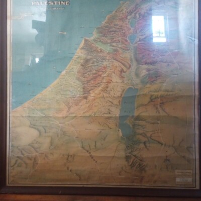
$4.43 Shipping Location: Clinton, United States Turkey Syria Iraq Palestine Lebanon Cyprus 1942 vintage Rand McNally color map Turkey. Syria and Iraq Issued 1942. New York by Rand McNally Fine original ... moreantique offset color map. Printed on quality paper which retains its inherent structural flexibility and soundness. In VG or better condition. Light trivial age wear but the image remains clean, attractive and very presentable[note: we grade very conservatively and always seek to disclose any noteworthy flaws] The printed area remains visually pleasing. A nice impression of an interesting antique map. Any minor defects along the sheet edges and in the margins may be seen in the photos. Sheet measures c. 14 1/8" W x 11" H. Engraved area measures c. 12 3/8" W x 9 1/8" H. 38707] note: All old sheets of printed paper possibly have short edge splits. Each sheet has existed for a very long time and has probably been handled repeatedly in the course of it's existence. It has a history unique to it as an object. Most of the time any edge splits are short. Minor, insignificant and have been closed- either long ago or more recently with small pieces of archival tape. Most often these splits are trivial and easy to overlook visually. Basically, they would not significantly affect the piece adversely. The item is offered as seen. Please look carefully and make your decision knowing this antique image is nice. But it is not in perfect"like new" condition. However, with whatever flaws it possesses, it remains entirely worthy of ownership and inclusion in any related collection. We feel it will prove very pleasing to its new owner. We stand behind everything we sell. Everything we offer is guaranteed to be an authentic original antique item as described. We do not sell modern reproductions. Please visit our eBay Store. We happily accept PayPal! WE OFFER FLAT RATE SHIPPING WORLD WIDE! Please request an invoice before paying for multiple items so that we can ensure that y
Buy It Now
$4.00 Shipping Location: Harborton, United States
Buy It Now
$4.00 Shipping Location: Harborton, United States It is in very good condition - note light creasing and there is another map on the reverse side.
Buy It Now
$4.50 Shipping Location: Portland, United States This is a page from a 1942 atlas. It a map of the airlines in 1942.
Buy It Now
$4.00 Shipping Location: Harborton, United States It is in very good condition - note there is another map on the reverse side.
Buy It Now
$5.75 Shipping Location: Malden, United States On one side is Puerto Rico On The Other Side Is The Philippine Islands. Great OLD Map from the "Collier's World Atlas & Gazetteer". From Early 1942. World ... moreWar II. Great Colors. Map shows The Atlantic, Caribbean & Pacific Oceans, Mountains, Lakes, Islands, Etc.
Buy It Now
$4.00 Shipping Location: Harborton, United States Removed from a Rand McNally atlas published in 1942.
Buy It Now
Free Shipping Location: Lincoln, United States Overall condition is very good.
Buy It Now
$4.00 Shipping Location: Harborton, United States
Buy It Now
$14.56 Shipping Location: Mount Morris, United States This vintage topographical map of Lake Tapps in Washington state is a rare find for any collector or enthusiast. The sheet map, originally surveyed in ... more1942, showcases the city in stunning detail and highlights its unique features. The map is in excellent shape and comes in its original form, making it a true treasure for any antique or map lover. With its intricate details and historical significance, this vintage original map is a must-have for those who appreciate the beauty of topographical maps and the artistry of vintage cartography. It is perfect for display in a home, office, or any space that requires a touch of sophistication and elegance.
Buy It Now
$3.50 Shipping Location: Dover, United States Drakesboro Quadrangle Kentucky- 15 Minute Series. Places: Drakesboro, Greenville, Powderly, Beechmont, Weir, Belton, Kirkmansville. Year Published: 1942. ... moreThe map in the photo is the actual map you will receive.
Buy It Now
$5.00 Shipping Location: Thatcher, United States A nice slice of history ready for your collection!
Buy It Now
Free Shipping Location: Portland, United States This is a page from a 1942 atlas. It is ready for framing.
Buy It Now
$4.95 Shipping Location: Willow Grove, United States This is an ORIGINAL World War II Era map showing the Union of Soviet Socialist Republics which indicates the 'Russian Front'. In the area of the front ... moreis marked '2000 Mile Battle Front, Longest in History and Farthest Advance of the Germans', which graphically is a little difficult to read.
Buy It Now
$4.95 Shipping Location: Willow Grove, United States This is an LARGE ORIGINAL map titled Area of the Black Sea which was taken from a 1942 atlas. Unique to this map is that it indicates the oil fields in ... moreBaku and shows oil pipelines through southern Russia.
Buy It Now
$4.00 Shipping Location: Harborton, United States There is another map on the reverse side. It is in very good condition - note very light creasing and there is another map on the reverse side.
Buy It Now
Free Shipping Location: Schertz, United States This Map was removed from a 1942 Pictorial Atlas and is in very good acceptable condition. The map is not " new " or in " new " condition, it was printed ... morein 1942. The map is not dated. Study the photos carefully, this is the actual map you will receive.
Buy It Now
$9.00 Shipping Location: Dover, United States Hydrographic Office U.S NAVY 1942 Mercator Projection Maps WW2 1ST EDITION 4 different maps Maps are in great condition These are original vintage ww2 ... moremaps and not reproductions Also contains 1945 weather map issued by the US Dept of Commerce
Buy It Now
$3.50 Shipping Location: Dover, United States Clanton Quadrangle Alabama- 30 Minute Series. Places: Clanton, Jemison, Valley Grande, Billingsley, Maplesville, Thorsby, Lawley, Randolph, Lomax, Pletcher, ... moreVerbena, Cooper, Stanton, Plantersville, Booth, Jones.
Buy It Now
$4.50 Shipping Location: Pinetop, United States On offer, an original USGS topographic map depicting Malibu California 1921 Edition (Reprinted 1942.) It is completely clean and uncreased and in excellent ... morecondition. It measures 20 inches long and 16.5 inches wide. Scale is 1 over 62500. It will frame up beautifully and immediately become a personalized antique heirloom. This map could be your favorite gift to your Malibu friends and family. Make any reasonable offer. Four dollar USPS shipping.
Buy It Now
Free Shipping Location: Portland, United States This is a page from a 1942 atlas. They are ready for framing.
Buy It Now
$4.95 Shipping Location: Willow Grove, United States This is an ORIGINAL Turkey map taken from a 1942 atlas. On the reverse side of this map page is text and a map image of the Eastern Hemisphere. (different ... moreorientation).
Buy It Now
$3.99 Shipping Location: Boston, United States Details: Map is Nat Geo's Oct. 1942 edition. This is an authentic map. General Info.
Buy It Now
$4.00 Shipping Location: Harborton, United States ANTIQUE COLLECTIBLE MAP OF ITALY. There is another map on the reverse side.
Buy It Now
$5.75 Shipping Location: Malden, United States Great OLD Map from the "COLLIER'S WORLD ATLAS & GAZETTEER". The Edges Of The Page Are Lightly Yellowed, From Age, As Expected. 82 Years Old! Great Detail! ... moreVery Educational. See What These States used to look like!
Buy It Now
$4.95 Shipping Location: Willow Grove, United States There is a map image and text on the reverse side of this map page. This is an ORIGINAL Hawaii map taken from a 1942 atlas.
Buy It Now
Free Shipping Location: Portland, United States This is a page from a 1942 atlas. They are ready for framing.

Buy It Now
$5.75 Shipping Location: Malden, United States Vintage 1943 WWII Era Atlas City Map of Los Angeles. California A Wonderful Gift! L.A. Great OLD Map from the"COLLIER'S WORLD ATLAS& GAZETTEER" ... moreCopyright 1943 World War II Era 70 Years Old! The Actual Page! NOT a Copy! Los Angeles. California(Contact Us For More Scans) This Map Measures About 10 3/4 x 14 1/8" Map Shows Points of Interest. Airport, Parks, Golf Courses, Loyola University, Country Clubs, Mountains, Hollywood, Universal City, Watts, Compton, Beaches, Many Airports, Cemetaries, Etc. Very Educational. See what the City used to look like! WWII Black& White Will look great Matted& Framed See All Pics! A Nice Gift! A GREAT House Warming Gift! The Perfect Anytime Gift! Teachers& Politicians LOVE Them! Super For a Local Business or Office! Shipping by 1st Class Mail We Will Combine Shipping on Up To 4 Maps for the same shipping fee Email Us With Any Questions or For an International Shipping Quote Check out my other items! Be sure to add me to your favorites list! Thanks For Looking! International Buyers– Please Note: Import duties. Taxes, and charges are not included in the item price or shipping cost. These charges are the buyer's responsibility. Please check with your country's customs office to determine what these additional costs will be prior to bidding or buying. Certain images and/or photos used in this template are the copyrighted property of JupiterImages and are being used with permission under license.
Buy It Now
$3.50 Shipping Location: Dover, United States Dearborn Quadrangle Missouri- 15 Minute Series. Water Bodies: Bee Creek, Contrary Creek, Contrary, Lake, Dearborn Reservoir, Horseshoe Lake, Missouri ... moreRiver, Muskrat Lake, New Mud Lake, Old Mud Lake, Ralphs Lake, Sugar Creek.
Buy It Now
$7.09 Shipping Location: Irene, United States
Buy It Now
$4.00 Shipping Location: Pasadena, United States Geological MAP. Geological surveyed in 1939-1942. Monterey County, CA. State of California. Walter W. Bradley, State Mineralogist. Edition 1921. Survey ... more1917.
Buy It Now
$4.87 Shipping Location: Braham, United States KANDIYOHI COUNTY MINNESOTA. NORTHER PLAT BOOK CO. PLAT BOOK AND ATLAS.
Buy It Now
$6.90 Shipping Location: Newark, United States Topo Map Tulare California 17 X 22". See dates in photos of bottom edge.
Buy It Now
$21.62 Shipping Location: HULL, United Kingdom It was published by Humphrey Milford / The Oxford University Press.
Buy It Now
Free Shipping Location: Schertz, United States This Map was removed from a 1942 Pictorial Atlas and is in very good acceptable condition. The map is not " new " or in " new " condition, it was printed ... morein 1942. The map is not dated. Study the photos carefully, this is the actual map you will receive.
Buy It Now
$6.75 Shipping Location: Marion, United States Original Vintage 1942 Illinois and Idaho Atlas State Map. Nice thick paper this map was removed from the New World Wonder Atlas published in 1942. The ... moremap has the state of Illinois on one side and Idaho on the other. It measures 14 1/2" by 10 1/4". There is a small corner fold and some staining along one side. Please see pictures for condition.
Buy It Now
$5.95 Shipping Location: Malden, United States Great OLD Map from the "COLLIER'S WORLD ATLAS & GAZETTEER". New York City. City Hall, The Financial District, Jersey City, Hoboken, Tunnels, Ferries, ... moreWelfare Island, The Lower Half of Central Park, Madison Square .
Buy It Now
$3.50 Shipping Location: Dover, United States Roseburg Quadrangle Oregon- 30 Minute Series. Year Published: 1942. The map in the photo is the actual map you will receive.
Buy It Now
$5.95 Shipping Location: Rexford, United States This is an authentic 1910 edition, 1942 reprint from the U.S. Geological Survey and NOT a computer reproduction. Original vintage topographical map of ... morethe Stony Creek, New York area including Edinburg, Hope, Day, Wells, Thurman, and Sacandaga River. Good condition. Sheet size is 20"h x 16.5"w.Lots of intricate details and geological contours. On the back is a description of topographic symbols and map guide.Perfect for the historian, map-lover, the curious or just as a conversation starter. Wonderful and rare. Vintage maps such as this make great gifts and look great framed for the home or office!This item will ship in a tube. If you want it flat (unrolled) there will be an extra fee.
|
|
|
In
|
1942 VINTAGE CITY MAP INDIANAPOLIS INDIANA 70 yrs old
1942 VINTAGE CITY MAP INDIANAPOLIS INDIANA 70 yrs old MAP FROM A COLLIERS ATLAS& GAZETTEER OF CITIES& TOWNS OF THE WORLD Offered here is a 70 yr old detailed map of the city. The map shows streets. Street names, railroads, prominent buildings, parks and water features. The map measures approx. 10 x 13 inches. The overall page size is 11 x 14 inches. The map is in Great shape. Clean, no stains, no markings and would frame nicely. This is a great map ideal for collecting, framing& decorating or for tracing the travels of your ancestors. The map is fully guaranteed to be in original and unaltered condition. Check out my STORE for a great selection of 1.00& 2.00 Maps. S&H 5.00 in a cardboard tube
|
|
|
Early Highways United States Transcontinental 1942 vintage automobile theme map
Early Highways United States Transcontinental 1942 vintage automobile theme map Transcontinental Mileage Chart of the United States(showing early automobile routes& highways) Issued 1942. New York by Rand McNally Fine original antique offset map. Printed on quality paper which retains its inherent structural flexibility and soundness. Interesting World war II era highway route map of the country. Not common or easy to locate. In VG or better condition. Light trivial age wear but the image remains clean, attractive and very presentable[note: we grade very conservatively and always seek to disclose any noteworthy flaws] Text on verso as issued. The printed area remains visually pleasing. A nice impression of an interesting antique map. Any minor defects along the sheet edges and in the margins may be seen in the photos. Sheet measures c. ... more14 1/8" W x 11" H. Engraved area measures c. 12 3/8" W x 9 1/8" H. 38704] note: All old sheets of printed paper possibly have short edge splits. Each sheet has existed for a very long time and has probably been handled repeatedly in the course of it's existence. It has a history unique to it as an object. Most of the time any edge splits are short. Minor, insignificant and have been closed- either long ago or more recently with small pieces of archival tape. Most often these splits are trivial and easy to overlook visually. Basically, they would not significantly affect the piece adversely. The item is offered as seen. Please look carefully and make your decision knowing this antique image is nice. But it is not in perfect"like new" condition. However, with whatever flaws it possesses, it remains entirely worthy of ownership and inclusion in any related collection. We feel it will prove very pleasing to its new owner. We stand behind everything we sell. Everything we offer is guaranteed to be an authentic original antique item as described. We do not sell modern reproductions. Please visit our eBay Store. We happi
|
|
|
Railroad United States 1942 vintage Rand McNally map
Railroad United States 1942 vintage Rand McNally map Handy Railroad Map United States Issued 1942. New York by Rand McNally Fine original antique offset map. Printed on quality paper which retains its inherent structural flexibility and soundness. In VG or better condition. Light trivial age wear but the image remains clean, attractive and very presentable[note: we grade very conservatively and always seek to disclose any noteworthy flaws] Text on verso as issued. The printed area remains visually pleasing. A nice impression of an interesting antique map. Any minor defects along the sheet edges and in the margins may be seen in the photos. Sheet measures c. 14 1/8" W x 11" H. Engraved area measures c. 12 3/8" W x 9 1/8" H. 38703] note: All old sheets of printed paper possibly have short edge splits. Each sheet has existed ... morefor a very long time and has probably been handled repeatedly in the course of it's existence. It has a history unique to it as an object. Most of the time any edge splits are short. Minor, insignificant and have been closed- either long ago or more recently with small pieces of archival tape. Most often these splits are trivial and easy to overlook visually. Basically, they would not significantly affect the piece adversely. The item is offered as seen. Please look carefully and make your decision knowing this antique image is nice. But it is not in perfect"like new" condition. However, with whatever flaws it possesses, it remains entirely worthy of ownership and inclusion in any related collection. We feel it will prove very pleasing to its new owner. We stand behind everything we sell. Everything we offer is guaranteed to be an authentic original antique item as described. We do not sell modern reproductions. Please visit our eBay Store. We happily accept PayPal! WE OFFER FLAT RATE SHIPPING WORLD WIDE! Please request an invoice before paying for multiple items so that we can ensure tha
|
|
|
Physical Commercial United States Economic 1942 vintage Rand McNally map
Physical Commercial United States Economic 1942 vintage Rand McNally map Physical and Commercial Analysis of the United States Issued 1942. New York by Rand McNally Fine original antique offset color map. Printed on quality paper which retains its inherent structural flexibility and soundness. In VG or better condition. Light trivial age wear but the image remains clean, attractive and very presentable[note: we grade very conservatively and always seek to disclose any noteworthy flaws] The printed area remains visually pleasing. A nice impression of an interesting antique map. Any minor defects along the sheet edges and in the margins may be seen in the photos. Sheet measures c. 14 1/8" H x 11" W. Engraved area measures c. 12" H x 9 1/2" W. 38743] note: All old sheets of printed paper possibly have short edge splits. Each ... moresheet has existed for a very long time and has probably been handled repeatedly in the course of it's existence. It has a history unique to it as an object. Most of the time any edge splits are short. Minor, insignificant and have been closed- either long ago or more recently with small pieces of archival tape. Most often these splits are trivial and easy to overlook visually. Basically, they would not significantly affect the piece adversely. The item is offered as seen. Please look carefully and make your decision knowing this antique image is nice. But it is not in perfect"like new" condition. However, with whatever flaws it possesses, it remains entirely worthy of ownership and inclusion in any related collection. We feel it will prove very pleasing to its new owner. We stand behind everything we sell. Everything we offer is guaranteed to be an authentic original antique item as described. We do not sell modern reproductions. Please visit our eBay Store. We happily accept PayPal! WE OFFER FLAT RATE SHIPPING WORLD WIDE! Please request an invoice before paying for multiple items so that
|
|
|
Economic Map United States Tobacco Cotton Fruit 1942 vintage Rand McNally map
Economic Map United States Tobacco Cotton Fruit 1942 vintage Rand McNally map Physical and Commercial Analysis of the United States Issued 1942. New York by Rand McNally Fine original antique offset color map. Printed on quality paper which retains its inherent structural flexibility and soundness. In VG or better condition. Light trivial age wear but the image remains clean, attractive and very presentable[note: we grade very conservatively and always seek to disclose any noteworthy flaws] The printed area remains visually pleasing. A nice impression of an interesting antique map. Any minor defects along the sheet edges and in the margins may be seen in the photos. Sheet measures c. 14 1/8" H x 11" W. Engraved area measures c. 12" H x 9 1/2" W. 38744] note: All old sheets of printed paper possibly have short edge splits. ... moreEach sheet has existed for a very long time and has probably been handled repeatedly in the course of it's existence. It has a history unique to it as an object. Most of the time any edge splits are short. Minor, insignificant and have been closed- either long ago or more recently with small pieces of archival tape. Most often these splits are trivial and easy to overlook visually. Basically, they would not significantly affect the piece adversely. The item is offered as seen. Please look carefully and make your decision knowing this antique image is nice. But it is not in perfect"like new" condition. However, with whatever flaws it possesses, it remains entirely worthy of ownership and inclusion in any related collection. We feel it will prove very pleasing to its new owner. We stand behind everything we sell. Everything we offer is guaranteed to be an authentic original antique item as described. We do not sell modern reproductions. Please visit our eBay Store. We happily accept PayPal! WE OFFER FLAT RATE SHIPPING WORLD WIDE! Please request an invoice before paying for multiple items so
|
|
|
Turkey Syria Iraq Palestine Lebanon Cyprus 1942 vintage Rand McNally color map
Turkey Syria Iraq Palestine Lebanon Cyprus 1942 vintage Rand McNally color map Turkey. Syria and Iraq Issued 1942. New York by Rand McNally Fine original antique offset color map. Printed on quality paper which retains its inherent structural flexibility and soundness. In VG or better condition. Light trivial age wear but the image remains clean, attractive and very presentable[note: we grade very conservatively and always seek to disclose any noteworthy flaws] The printed area remains visually pleasing. A nice impression of an interesting antique map. Any minor defects along the sheet edges and in the margins may be seen in the photos. Sheet measures c. 14 1/8" W x 11" H. Engraved area measures c. 12 3/8" W x 9 1/8" H. 38707] note: All old sheets of printed paper possibly have short edge splits. Each sheet has existed ... morefor a very long time and has probably been handled repeatedly in the course of it's existence. It has a history unique to it as an object. Most of the time any edge splits are short. Minor, insignificant and have been closed- either long ago or more recently with small pieces of archival tape. Most often these splits are trivial and easy to overlook visually. Basically, they would not significantly affect the piece adversely. The item is offered as seen. Please look carefully and make your decision knowing this antique image is nice. But it is not in perfect"like new" condition. However, with whatever flaws it possesses, it remains entirely worthy of ownership and inclusion in any related collection. We feel it will prove very pleasing to its new owner. We stand behind everything we sell. Everything we offer is guaranteed to be an authentic original antique item as described. We do not sell modern reproductions. Please visit our eBay Store. We happily accept PayPal! WE OFFER FLAT RATE SHIPPING WORLD WIDE! Please request an invoice before paying for multiple items so that we can ensure that y
|
|
|
Official Aviation Guide United States 1942 vintage Rand McNally map
Official Aviation Guide United States 1942 vintage Rand McNally map Airway Map of the UnitedStates Showing Passenger. Mail and Cargo Routes in Operation Issued 1942. New York by Rand McNally Fine original antique offset map. Printed on quality paper which retains its inherent structural flexibility and soundness. Unusual and early aviation-themed map. In VG or better condition. Light trivial age wear but the image remains clean, attractive and very presentable[note: we grade very conservatively and always seek to disclose any noteworthy flaws] Text on verso as issued. The printed area remains visually pleasing. A nice impression of an interesting antique map. Any minor defects along the sheet edges and in the margins may be seen in the photos. Sheet measures c. 14 1/8" W x 11" H. Engraved area measures c. 12 3/8" W x 9 1/8" ... moreH. 38750] note: All old sheets of printed paper possibly have short edge splits. Each sheet has existed for a very long time and has probably been handled repeatedly in the course of it's existence. It has a history unique to it as an object. Most of the time any edge splits are short. Minor, insignificant and have been closed- either long ago or more recently with small pieces of archival tape. Most often these splits are trivial and easy to overlook visually. Basically, they would not significantly affect the piece adversely. The item is offered as seen. Please look carefully and make your decision knowing this antique image is nice. But it is not in perfect"like new" condition. However, with whatever flaws it possesses, it remains entirely worthy of ownership and inclusion in any related collection. We feel it will prove very pleasing to its new owner. We stand behind everything we sell. Everything we offer is guaranteed to be an authentic original antique item as described. We do not sell modern reproductions. Please visit our eBay Store. We happily accept PayPal! WE OFFER FLAT RATE
|
|
|
Chief Air Carriers United States Canada 1942 vintage Rand McNally chart map
Chief Air Carriers United States Canada 1942 vintage Rand McNally chart map Chief Air Carriers of the United States and Canada Issued 1942. New York by Rand McNally Fine original antique offset aviation map. Printed on quality paper which retains its inherent structural flexibility and soundness. Interesting and early avaition themed map. In VG or better condition. Light trivial age wear but the image remains clean, attractive and very presentable[note: we grade very conservatively and always seek to disclose any noteworthy flaws] Text on verso as issued. The printed area remains visually pleasing. A nice impression of an interesting antique map. Any minor defects along the sheet edges and in the margins may be seen in the photos. Sheet measures c. 14 1/8" H x 11" W. Engraved area measures c. 5 5/8" H x 9 1/8" W. 38752] ... morenote: All old sheets of printed paper possibly have short edge splits. Each sheet has existed for a very long time and has probably been handled repeatedly in the course of it's existence. It has a history unique to it as an object. Most of the time any edge splits are short. Minor, insignificant and have been closed- either long ago or more recently with small pieces of archival tape. Most often these splits are trivial and easy to overlook visually. Basically, they would not significantly affect the piece adversely. The item is offered as seen. Please look carefully and make your decision knowing this antique image is nice. But it is not in perfect"like new" condition. However, with whatever flaws it possesses, it remains entirely worthy of ownership and inclusion in any related collection. We feel it will prove very pleasing to its new owner. We stand behind everything we sell. Everything we offer is guaranteed to be an authentic original antique item as described. We do not sell modern reproductions. Please visit our eBay Store. We happily accept PayPal! WE OFFER FLAT RATE SHIPPING WORL
|
|
|
Vintage 1942 World War WWII Atlas City Map Pittsburgh, PA Penn Pennsylvania OLD
Great Gift! Vintage 1942 World Atlas City Map Pittsburgh. PA Penn. Great OLD Map from the"COLLIER'S WORLD ATLAS& GAZETTEER" Copyright 1942 World War II Era 71 Years Old! The Actual Page! NOT a Copy! Pittsburgh. Pennsylvania(Contact Us For More Scans) This Map Measures About 10 3/4 x 14 1/8" Map Shows Points of Interest. Parks, Cemetaries, Rivers, University of Pittsburgh, Hospitals, Schools, Bedford Dwellings, St. Michaels Orphan Asylum, Pitt. Stadium, Bureau of Mines, Carnegie Library, Mt. Washington, City Hall, Railroads, National Tube Co. Jones& Laughlin Steel Co. National Casket Co. Keystone Lumber Co. Etc. Very Educational. See what the City used to look like! WWII Era Black& White Will look great Matted& framed(see all photos) A Nice Gift! A GREAT House Warming Gift! The Perfect Anytime Gift! Teachers& ... morePoliticians LOVE Them! Super For a Local Business or Office! Shipping by 1st Class Mail We Will Combine Shipping on Up To 4 Maps for the same shipping fee Email Us With Any Questions or For an International Shipping Quote Check out my other items! Be sure to add me to your favorites list! Thanks For Looking! International Buyers– Please Note: Import duties. Taxes, and charges are not included in the item price or shipping cost. These charges are the buyer's responsibility. Please check with your country's customs office to determine what these additional costs will be prior to bidding or buying. Certain images and/or photos used in this template are the copyrighted property of JupiterImages and are being used with permission under license.
|
|
|
Map of England & Wales / Scotland - 1942 14" X 11" Rand McNally Vintage Detailed
~~~~~~~~~~~~~~~~ ~~~~~~~~~~~~~~~~ Thank you for viewing my Collectible Map Auction! Satisfaction Guaranteed* ~Rare and Quality Items~ Fast& Free Shipping~ Important: International Customers. If you do not mind this map folded, I will quote you a much lower shipping price- just send me a message. Domestic Customers: If you do not mind this map being folded. Just include a lower price in the Best Offer with a note saying folding is ok. ~~~~~~~~~~~~~~~~ ~~~~~~~~~~~~~~~~ Front: Back: ~~~~~~~~~~~~~~~~~~~~~~~~~~~~~~ Source: Approximate Size: 14" X 11" ~~~~~~~~~~~~~~~~ ~~~~~~~~~~~~~~~~ ~ Pick up this Map for your Collection ~. While digital maps are great. There is still nothing like holding a'real' map in your hands! ~~~~~~~~~~~~~~~~ ~~~~~~~~~~~~~~~~ If you have any other questions. Do not hesitate to ask! Trusted Ebay Seller ... moreSince 2004* Check out my other auctions! ~~~~~~~~~~~~~~~~ ~~~~~~~~~~~~~~~~ Please note: Single maps under 9 ounces will be mailed via first class mail. Those over 9 ounces(or combined orders over 9 ounces) will be mailed via standard mail. Unless other services are purchased. I will be more than happy to ship any single map via Priority Mail when the price exceeds $50 at the buyer's request. If no request is made. The map will ship through normal means. Insurance will be included for free on these purchases. Buy 5 Items and Get one Free(of average or lessor value) Just let me know what item you want(any as long as it is not an auction with bids) and I will include that item in your order. Powered by The free listing tool. List your items fast and easy and manage your active items. Powered by The free listing tool. List your items fast and easy and manage your active items. 5v.RcmdId ViewItemDescV4,RlogId p4%60bo7%60jtb9%3Fuk%601d72f%2Bkw72shq%3E5v-13f4f44e246-0xf5-
|
|
|
1942 Vintage Map SOUTH AFRICA / MOROCCO
1942 Vintage Map SOUTH AFRICA/ MOROCCO MAP from Collier's World ATLAS Offered here is a 71 year old great detailed map of the areas(back to back) The map measures approx. 11 x 13 inches The map is in Great shape. Clean, no markings and would frame nicely. The map is fully guaranteed to be in original and unaltered condition. Check out my STORE for a great selection of 1.00 Maps. S&H 5.00 to the US
|
|
|
1942 Vintage Map INDIA / IRAN AFGHANISTAN
1942 Vintage Map INDIA/ IRAN AFGHANISTAN MAP from Collier's World ATLAS Offered here is a 71 year old great detailed map of the areas(back to back) The map measures approx. 11 x 13 inches The map is in Great shape. Clean, no markings and would frame nicely. The map is fully guaranteed to be in original and unaltered condition. Check out my STORE for a great selection of 1.00 Maps. S&H 5.00 to the US
|
|
|
1942 Vintage CITY Map MEMPHIS TENNESSEE
1942 Vintage CITY Map MEMPHIS TENNESSEE MAP from Collier's World ATLAS Offered here is a 71 year old great detailed map of the area The map measures approx. 8 x 10 inches The map is in Great shape. Clean, no markings and would frame nicely. The map is fully guaranteed to be in original and unaltered condition. Check out my STORE for a great selection of 1.00 Maps. S&H 5.00 to the US
|
|
|
1942 Vintage Map AUSTRALIA / OCEANIA
1942 Vintage Map AUSTRALIA/ OCEANIA MAP from Collier's World ATLAS Offered here is a 71 year old great detailed map of the areas(back to back) The map measures approx. 11 x 13 inches The map is in Great shape. Clean, no markings and would frame nicely. The map is fully guaranteed to be in original and unaltered condition. Check out my STORE for a great selection of 1.00 Maps. S&H 5.00 to the US
|
|
|
1942 Vintage CITY Map PHILADELPHIA PENNSYLVANIA
1942 Vintage CITY Map PHILADELPHIA PENNSYLVANIA MAP from Collier's World ATLAS Offered here is a 71 year old great detailed map of the area The map measures approx. 10 x 12 inches The map is in Great shape. Clean, no markings and would frame nicely. The map is fully guaranteed to be in original and unaltered condition. Check out my STORE for a great selection of 1.00 Maps. S&H 5.00 to the US
|
|
|
1942 Vintage CITY Map ST LOUIS MISSOURI
1942 Vintage CITY Map ST LOUIS MISSOURI MAP from Collier's World ATLAS Offered here is a 71 year old great detailed map of the area The map measures approx. 11 x 14 inches The map is in Great shape. Clean, no markings and would frame nicely. The map is fully guaranteed to be in original and unaltered condition. Check out my STORE for a great selection of 1.00 Maps. S&H 5.00 to the US 1.RcmdId ViewItemDescV4,RlogId p4%60bo7%60jtb9%3Fuk.rp73%28b0g%60%60%3E1-143104e9ff8-0xf6-
|
|
|
1942 Vintage CITY Map MINNEAPOLIS MINNESOTA
1942 Vintage CITY Map MINNEAPOLIS MINNESOTA MAP from Collier's World ATLAS Offered here is a 71 year old great detailed map of the area The map measures approx. 9 x 9 inches The map is in Great shape. Clean, no markings and would frame nicely. The map is fully guaranteed to be in original and unaltered condition. Check out my STORE for a great selection of 1.00 Maps. S&H 5.00 to the US
|
|
|
1942 Vintage CITY Map LOWER MANHATTAN NEW YORK
1942 Vintage CITY Map LOWER MANHATTAN NEW YORK MAP from Collier's World ATLAS Offered here is a 71 year old great detailed map of the area The map measures approx. 10 x 12 inches The map is in Great shape. Clean, no markings and would frame nicely. The map is fully guaranteed to be in original and unaltered condition. Check out my STORE for a great selection of 1.00 Maps. S&H 5.00 to the US
|
|
|
1942 Vintage Map PARAGUAY URAGUARY / ARGENTINA & CHILI
1942 Vintage Map PARAGUAY URAGUARY/ ARGENTINA& CHILI MAP from Collier's World ATLAS Offered here is a 71 year old great detailed map of the areas(back to back) The map measures approx. 11 x 13 inches The map is in Great shape. Clean, no markings and would frame nicely. The map is fully guaranteed to be in original and unaltered condition. Check out my STORE for a great selection of 1.00 Maps. S&H 5.00 to the US
|
|
|
1942 Vintage Map SWITZERLAND / ITALY
1942 Vintage Map SWITZERLAND/ ITALY MAP from Collier's World ATLAS Offered here is a 71 year old great detailed map of the areas(back to back) The map measures approx. 11 x 13 inches The map is in Great shape. Clean, no markings and would frame nicely. The map is fully guaranteed to be in original and unaltered condition. Check out my STORE for a great selection of 1.00 Maps. S&H 5.00 to the US
|
|
|
1942 Vintage CITY Map MONTREAL Quebec Canada
1942 Vintage CITY Map MONTREAL Quebec Canada MAP from Collier's World ATLAS Offered here is a 72 year old great detailed map of the area The map measures approx. 10 x 12 inches The map is in Great shape. Clean, no markings and would frame nicely. The map is fully guaranteed to be in original and unaltered condition. Check out my STORE for a great selection of 1.00 Maps. S&H 5.00 to the US Only 1.00 extra S&H cost for each extra map
|
|
|
1942 Vintage Map EUROPE / BRITISH ISLES England
1942 Vintage Map EUROPE/ BRITISH ISLES England MAP from Collier's World ATLAS Offered here is a 71 year old great detailed map of the areas(back to back) The map measures approx. 11 x 13 inches The map is in Great shape. Clean, no markings and would frame nicely. The map is fully guaranteed to be in original and unaltered condition. Check out my STORE for a great selection of 1.00 Maps. S&H 5.00 to the US
|
|
|
1942 Vintage Map NETHERLANDS BELGIUM LUXEMBOURG / DENMARK
1942 Vintage Map NETHERLANDS BELGIUM LUXEMBOURG/ DENMARK MAP from Collier's World ATLAS Offered here is a 72 year old great detailed map of the areas(back to back) The map measures approx. 11 x 13 inches The map is in Great shape. Clean, no markings and would frame nicely. The map is fully guaranteed to be in original and unaltered condition. Check out my STORE for a great selection of 1.00 Maps. S&H 5.00 to the US 336.RcmdId ViewItemDescV4,RlogId p4%60bo7%60jtb9%3Fvo%7B%3Dd70f%2B%3E336-145055858f6-0x112-
|
|
|
AAA AUTO CLUB MAP #8 SOUTH CENTRAL STATES 1942 WWII VINTAGE TRAVEL
AAA AUTO CLUB MAP#8 SOUTH CENTRAL STATES 1942 WWII VINTAGE TRAVEL Description: AAA American Automobile Association map#8 South Central States highway road map circa 1942 WWII. Measures 18 X 23 1/2 inches in size when fully opened(46 X 60cm) Map is an authentic original in good condition as shown in photos.
|
|
|
Authentic Colored 1942 Vintage Map of Dominion Of Canada & United States
DOUBLE SIDED! On one side of it is a Map of Dominion of Canada and Newfoundland/ the other side is a map of the United States. Take your pick of which side you want to display. You will get the exact print that is shown in the pictures. This is an Authentic colored original map from 1942"not a copy or reprint" This comes from a nicely aged atlas that was past it's prime for use as a"page turning book" It is perfect though for being a piece of framed art to be hung for display. It is approximately 10"x 13" ten inches by thirteen inches) IT DOES NOT COME FRAMED. YOU ONLY RECEIVE THE PAPER THAT IS READY TO BE FRAMED. I am not an expert or claim to be one. I find old treasures and try to put them with someone that will enjoy them again. I try to do the best research that I can. There is no way for me to know ... moreeverything about everything. As this is not a new item. Condition perspectives may vary from person to person. All buyers are strongly advised to inspect the items pictures, descriptions and ask all questions before bidding. All vintage, antique, collectibles, and art items are sold AS-IS. Although I try to express accurate descriptions(I wouldn't get very far as an eBay seller if I didn't) I make no guarantee or warranty of any kind with respect to the physical condition, originality, size, quality, rarity, medium and materials, age, provenance, culture, any unknown repairs or damages, source, or historic significance of any goods. Assume all weights and measurements are approximately what the item is. Buyers must depend on their knowledge and review the merchandise before bidding. YOU ARE BIDDING ON WHAT IS IN THE PICTURES*If you are not happy with your purchase after it arrives. PLEASE contact me before leaving feedback, to try and resolve issue. It isn't told to buyers that negative or neutral feedback affects how much you can sell on here, not just a percentage rating. I do this 12 hours a day, I am human and bound to make a mistake here and there so please just
|
|
 |