|
|
Order by: Available to: This site contains affiliate links for which I may be compensated
|
Buy It Now
$34.66 Shipping Location: CORNHILL-ON-TWEED, United Kingdom An accompaniment to a lavishly decorated chromo-lithographic children's map published in the 1870's. (Map not included!) In very good condition with minor ... morefading to boards. This appears to be a rare book as l can not find another one although there seems to be a few maps out there.

$8.00 Shipping Location: Delray Beach, United States Click on the image for a detailed view. Maker:A. J. Johnson Date:1867. New York Short Title:Diagram Exhibiting the Difference of Time between the Places ... moreShown& Washington. Full Title:A Diagram Exhibiting the Difference of Time between the Places Shown& Washington. Ex. the figures on the Dials denote the Air_line distances from Washington. By A. J. Johnson Source:Johnson's New Illustrated(Steel Plate) Family Atlas, With Physical Geography, And With Descriptions Geographical, Statistical, And Historical. By Richard Swainson Fisher, M.D. Maps Compiled, Drawn, And Engraved Under The Supervision Of J.H. Colton And A.J. Johnson. New York: Johnson And Ward, Successors To Johnson And Browning(Successors To J.H. Colton And Company, No. 113 Fulton Street. 1865. Entered. One Thousand Eight Hundred and Sixty-seven, by A.J. Johnson. New York Size of Map:47 x 38 cm. approximately(18.50 x 14.96 in. Description:Dials in color and in five rings around the center dial showing Washington at 12:00. References:David Rumsey Historical Map Collection; Tooley’s Dictionary of Mapmakers Revised Edition Vol. E– J) p. 443; P843 We Now Accept PayPal. Click on the logo for more information. RcmdId ViewItemDescV4,RlogId p4%60bo7%60jtb9%3Fvo%7B%3Dd70f%2Bf52%3E-13f6e7c3049-0x103-
Buy It Now
$5.65 Shipping Location: Saint Louis, United States (Below from Tunison's Atlas. Counties) f rom Tunison's Atlas from 1885. The full page size. dated 1885. Subject Hand Colored Map as listed. picture processor. ... more2312.6 OTS
Buy It Now
$13.58 Shipping Location: David City, United States Nova Totivs Terrarvm Sive Novi Orbis Tabvla Silver Foiled World Map 24x30/16x20.
$15.00 Shipping Location: CAERSWS, United Kingdom rare NATIONAL GEOGRAPHIC MAP- ATLANTIC OCEAN- dated DECEMBER 1955 condition- very good/ excellent(unused)
Buy It Now
$17.49 Shipping Location: NORWICH, United Kingdom 1907 Antique Colour Map. Presented in a 10" x 8" soft white matt or mount ready for framing.
Buy It Now
$22.54 Shipping Location: MANCHESTER, United Kingdom Has been folded for many years and has minor scuffs around the edges and corners.
Buy It Now
$11.60 Shipping Location: Belton, United States PR AA1 7-5-22, side 2 #45.
Buy It Now
$6.05 Shipping Location: Tilton, United States
Buy It Now
$10.00 Shipping Location: Jacksonville, United States A beautiful and colorful map from the Géographie Moderne Atlas - Paris - 1st edition published in 1767 by Clouet, Mr. l'abbé (Jean Baptiste Louis). This ... moremap has great presence and nice original hand coloring.
Buy It Now
Free Shipping Location: Portland, United States Made in USA.
Buy It Now
$3.50 Shipping Location: Winter Springs, United States Rare, fine, early antique 1854 handcolored Morse map. One side is Western Hemisphere, many interesting areas, much has changed, antique ink spots at bottom, ... moreit gives the map a nice aged appearance, reverse is New England, Southern part and Boston and Vicinity.
Buy It Now
$18.81 Shipping Location: YORK, United Kingdom AN ORIGINAL ANTIQUE MAP OVER 90 YEARS OLD RESCUED FROM A DISBOUND ATLAS RAND MCNALLY Original map and not a later reprosuction This larege FOLD-OUT map ... moremeasures : 27 inches by 20 inches THIS LISTING IS FOR THE SINGLE MAP SHOWN Â ****CONDITION**** PLEASE VIEW IMAGES TO SEE ANY HANDLING/AGE MARKS /REPAIRS/DAMAGE/EXTENT OF MARGINS etc Please message with any questions regarding this item BEST OFFERS PLEASE FOR A QUICK SALE AT A FAIR PRICE If you like the item, but do not like the price, then make a realistic offer to us using the MAKE OFFER BUTTON Powered by eBay Turbo Lister.
Buy It Now
$5.00 Shipping Location: Costa Mesa, United States Act fast on this one!
Buy It Now
$20.01 Shipping Location: KETTERING, United Kingdom South Central United States Vintage Folding Map 1947.
$15.00 Shipping Location: CAERSWS, United Kingdom rare NATIONAL GEOGRAPHIC MAP- EASTERN SOUTH AMERICA- dated MARCH 1955 condition- very good/ excellent(unused)
Buy It Now
$16.16 Shipping Location: Bethel Park, United States Produced by National Geographic, this collectible map was made in the United States with great detail and accuracy. It is a rare find for any map enthusiast ... moreor collector. Featuring the countries and regions of the Bible, this map is a great addition to any collection.
Buy It Now
$6.00 Shipping Location: Neuendettelsau, Germany Age/Published: 1718. Original print from.

Buy It Now
$3.75 Shipping Location: Winter Springs, United States Click Here. Double your traffic. Get Vendio Gallery- Now FREE! Superb. A masterpiece of early American Federal Period cartography, important 1824 period ... moremap. Very rare and important period map. This is an antique 1824 map and not a reprint or reproduction. Very fine antique 1824 handcolored Finley map, titled, in fancy antique lettering, Western Hemisphere. Many interesting areas, United States is in different form, Mexico is different, Canada is different, Alaska is Russian Possessions and much more, many more fascianting areas. The map is in very fine condition. Printed at bottom is Published by A. Finley, Philada. This was produced in the United States by Anthony Finley, of Philadelphia, Pennsylvania, a very highly regarded early and important American mapmaker of this period. The condition of the map is excellent, many fascianting areas on the map, the detail is amazing. The map is printed on very fine thick superb paper, with gorgeous delicate period handcoloring. There is no printing on reverse. Nicely detailed and attractive period map of this area. The delicate period handcoloring is gorgeous. The size of the map is 10" by 13.5" Rare. Winning bidder pays $3.75 shipping domestic, more foreign. Payment I accept the following forms of payment: PayPal Click to View Image Album Shipping& Handling US Shipping. $3.75 USPS First-Class Mail® International Shipping. $11.50 USPS First-Class Mail International FREE scheduling. Supersized images and templates. Get Vendio Sales Manager. FREE scheduling. Supersized images and templates. Get Vendio Sales Manager.
Buy It Now
$7.75 Shipping Location: La Follette, United States We travel constantly from the Florida Keys to the mountains of Eastern Kentucky searching for the odd and unusual. We work with a team of pickers that ... moreare constantly on the prowl for antiques and collectibles.
Buy It Now
$5.95 Shipping Location: Dayton, United States This is for an authentic, original map that was published by Gotha Justus Perthes in 1879. It is in very good condition, slight creasing to edges.
Buy It Now
$5.95 Shipping Condition: New Location: Las Vegas, United States This Beautiful detailed map of the world as it was known in 1689. Year: 1689. Each of our prints are custom reproductions printed on 68lb Heavyweight ... moreEnhanced Matte Art Paper. These Historic Art Prints are suitable for framing, mounting or direct display on any wall!
Buy It Now
$10.85 Shipping Location: Franklin, United States He served in the court of the King of France, Louis XIV. Map of Turkey & Asia. Print Style:Engraving. Special Features:Originally Hand-colored Engraving. ... morePaper Size:~ 13" by 8 1/2".
Buy It Now
$59.95 Shipping Location: Benicia, United States

Buy It Now
$16.40 Shipping Location: Tilton, United States 9 1/2 by 11 1/2" format atlas Includes 17 printed color maps. 88 pgs. The complete book details the physical geography of all the regions of the ... moreworld. Hardbound with pictorial paper cover boards with wear as shown. back cover is connected at one spot only. Nevada and Arizona are yet to be as now and Dakota is still one. TERMS AND CONDITIONS 1. Paypal users must be verified. And have a confirmed address. 2. Payment must be received within 5 days. Or sale is voided, and item may be relisted. 3. Shipping is done by USPS or FEDEX. If you require a specific carrier. Please inform me before I send an invoice. The seller reserves the right to change shipping carriers without notice to the buyer. 4. Seller assumes no responsibility with regards to loss. Damage of property, or personal injury. 5. Bidder must be 18 years or older to participate in this auction. 6. By placing a bid. You are accepting these terms and conditions. Powered by The free listing tool. List your items fast and easy and manage your active items. code: box maps
Buy It Now
Free Shipping Location: Linden, United States This is a vintage map as used in WWII by the US military. In very good condition .
Buy It Now
$11.60 Shipping Location: Belton, United States Size: approx. 23" x 18" unfolded.
Buy It Now
$5.95 Shipping Condition: New Location: Las Vegas, United States Year: 1585. The Voyages of Sir Francis Drake. This great Historic Map print shows Sir Francis Drake's voyage to the new world during his West Indian voyage ... moreof 1585-1586. “Vibrant and bright! Pic does not do it justice.looks amazing!”.
Buy It Now
$9.00 Shipping Location: Oakland Gardens, United States UP FOR AUCTION IS: WORLD Map"Nova Totivs Terrarvm Orbis Geographica AC Hydrographica Tabvla" GOOD CONDITION. GENTLY USED. 22 1/2" X 18 ... more1/2" CHECK OUT MY OTHER AUCTIONS FOR MORE GREAT COLLECTIBLES! NO PROBLEM COMBINING SHIPPING FOR MULTIPLE ITEMS. INTERNATIONAL SHIPPING IS AVAILABLE. IF YOU HAVE ANY QUESTIONS OR WOULD LIKE EXTRA PICTURES JUST E-MAIL ME. If for any reason you are not happy with your purchase. Or feel that you cannot leave a rating of 5 in all areas, please contact me before leaving feedback. I aim to please!
Buy It Now
$11.60 Shipping Location: Belton, United States Reverse blank.
Buy It Now
$30.00 Shipping Location: Paris VI, France This is a double-hemisphere map. An armillary sphere and 32-point compass rose are tucked between the hemispheres. Edition : by Jodocus Hondius, Amsterdam, ... more1623, 17th century, French edition. The North Pole is depicted as a landmass surrounding a sea from which four rivers radiate and there is a well depicted Northwest Passage.
Buy It Now
$33.18 Shipping Location: STOCKPORT, United Kingdom A mid 19th century map of Great Britain and Ireland produced by A. Vuillemin Geographie of Paris . It is in the form of a jigsaw , I don't know if the ... moreitem itself dates from the middle of the 19th century or not however it is certainly not of recent manufacture. It measures approximately 31cm x 23cm and is in good condition .
Buy It Now
$16.25 Shipping Location: Santa Ana, United States This vintage reproduction world map, titled "Nova Totivs Terrarvm Orbis Geographica Tabvla," is a stunning addition to any antique map collection. The ... moresilver foil finish adds a touch of elegance to the framed atlas map, which dates back to the 1960s. The map showcases a view of the world, and is formatted as an atlas map. It is perfect for history buffs, map enthusiasts, or anyone looking for a unique and beautiful piece of decor. Don't miss out on the opportunity to own this rare and valuable item.
Buy It Now
Free Shipping Location: Riverside, United States The map is printed on a large folded plate.
Buy It Now
$4.50 Shipping Location: Holyoke, United States Page size approx.
Buy It Now
$8.00 Shipping Location: Gadsden, United States DATE PRINTED ON MAP: 1872. CONDITION: Good condition, perfectly suitable for framing, especially since this map is over 145 years old, there are minor ... moresigns of age, see photos. Pre folded and creased.
Buy It Now
$9.99 Shipping Condition: Unspecified Location: LONDON, United Kingdom 'The World in Hemispheres, on various projections; The world on the plane of the Equator; Southern Circumpolar regions; The world on the plane on the ... morehorizon of London'. Caption below picture:'The World in Hemispheres, on various projections; The world on the plane of the Equator; Southern Circumpolar regions; The world on the plane on the horizon of London'.
Buy It Now
$3.99 Shipping Location: Lakewood, United States
Buy It Now
$9.20 Shipping Location: Poland
Buy It Now
$5.95 Shipping Condition: New Location: Las Vegas, United States Year: 1585. The Voyages of Sir Francis Drake - Santiago Cape Verde Islands. This great Historic Map print shows Sir Francis Drake's voyage to Santiago, ... moreCape Verde Islands during his West Indian voyage of 1585-1586.
Buy It Now
$8.00 Shipping Location: Casper, United States SHIPPING PRICE IN USA WILL BE $15.00* HARDCOVER/ HARDBACK BOOK LARGE and Heavy Book weighs nearly 7 pounds. Has been used and referenced but in solid ... moreshape. SHIPPING PRICE WILL BE $15.00* I am not a book collector so I will not necessarily have all the right terminology. The cover is sturdy with minor signs of age. The magnifying capability of eBay should answer your questions. I do not see tears on pages. This book is EXTREMLY LARGE and HEAVY and I will plan to send it Media Mail* SHIPPING COST WILL BE $15.00* PLEASE ASK QUESTIONS- I want you to be satisfied with your purchase. I will send other photos if you need them. shipping price will be $15.00*
Buy It Now
$5.00 Shipping Location: Costa Mesa, United States Act fast on this one!
Buy It Now
$9.57 Shipping Location: Belfast, United States S. Augustus Mitchell, 1875. Folio size, 12 3/8" x 12 3/4". 3/4 brown leather, blind-stamped, green, pebbled cloth with bright gilt title. It should be ... morea collector's choice! Very Good+ condition. FREE scheduling, supersized images.
Buy It Now
$12.95 Shipping Location: Weatherly, United States ITEM :Up for sale is this antique map produced by D.F. Robinson and presented inside the Olney School Atlas, both the map and the atlas dated 1844. What ... morean interesting and historic map. Suitable for framing and would look fantastic in your map collection.
Buy It Now
$4.93 Shipping Location: BROADSTONE, United Kingdom This is a genuine map and not a copy, facsimile or computer generated image. In good condition for its age being over 100 years old. Overall size approx: ... more44.0(w) x 58.0(h) cms.
Buy It Now
Free Shipping Location: Perryville, United States Antique, color, 1894 GEORGE F. CRAM map of MINNEAPOLIS MINNESOTA. GREAT CONVERSATION PIECE! Image is very clear, legible, and COLORFUL. TRULY A BEAUTIFUL ... moreHISTORICAL MAP ! THIS MAP WAS PRINTED IN 1894.
Buy It Now
$2.99 Shipping Location: Kansas City, United States As it was a harder material than wood it gave the engraver the ability to render more detail. MAP OF NOVA HISPANIA.
Buy It Now
$29.75 Shipping Location: North Port, United States Children’s Map of the World. Condition is "New". Shipped with USPS First Class.
Buy It Now
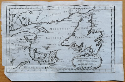
$6.00 Shipping Location: Neuendettelsau, Germany MORE HISTORY COPPER ENGRAVING MAPS IN OUR AUCTIONS! WEITERE HISTORISCHE KUPFERSTICH KARTEN IN UNSEREN AUKTIONEN! Original and decorative coloured copper ... moreengraving map by Jaques-Nicolas Bellin. Published in Nuremberg about 1750 AD map of Newfoundland- Canada"Carte von der Insel Terre-Neuve. Cartographer: Jaques-Nicolas Bellin(1703- 21st March 1772) was a hydrographer and geographer as well as chief cartographer of the French Navy. Description: We offer an original and detailed coloured copper engraving map by Jaques-Nicolas Bellin. The map shows Newfoundland- Canada. With many detailed and recorded villages and towns. Very rare collection item! Size: Leaf app. 27.0 x 42,8 cm engraving app. 22.7 x 23,0 cm Condition: in good condition strong print and paper marginal stained Please have a look at the pictures! Combine shipping is possible with only 1x calculated shipping cost! Please note all items auctioned are genuine. We do not sell reproductions. A Certificate of Authenticity(COA) can be issued on request. Original und dekorative kolorierte Kupferstich Karte von Jaques-Nicolas Bellin. Veröffentlicht in Nürnberg um 1750 AD Karte von Neufundland- Kanada"Carte von der Insel Terre-Neuve. Kartograph: Jaques-Nicolas Bellin(1703- 21. März 1772) war ein französischer Hydrograph und Geograph sowie Oberster Marineingenieur und-geograph. Beschreibung: Wir bieten eine originale und detaillierte kolorierte Kupferstichkarte von Jaques-Nicolas Bellin an. Diese interessante Karte zeigt Neufundland- Kanada mit den Ortschaften und Städten. Sehr dekoratives Sammelobjekt! Maße: Blatt ca. 27.0 x 42,8 cm Kupferstich ca. 22.7 x 23,0 cm Zustand: guter Zustand kräftiger Druck& festes Papier geringfügig fleckig Sehen Sie sich die Bilder an! Kombiversand ist möglich mit nur 1x Portoberechnung! Bitte beachten Sie. Alle Einzelteile die versteigert werden sind echt, wir verkaufen keine Reproduktionen. Ein Echtheitszertifikat(COA) kann auf Wunsch ausgestellt werden. Powered by The free
Buy It Now
$6.00 Shipping Location: Neuendettelsau, Germany Sheetsize: 30 x 24 cm. Original print from a.
Buy It Now
Free Shipping Location: Monroeville, United States Source - Sinai and Palestine, in Connection of their History. Date - 1856. FROM THE SOURCE/DATE LISTED.
Buy It Now
$6.00 Shipping Location: Neuendettelsau, Germany Semler: Astrognosia nova. Age/Published: 1742. Original print from.
Buy It Now
$11.60 Shipping Location: Belton, United States Reverse blank.
Buy It Now
$9.99 Shipping Condition: Unspecified Location: LONDON, United Kingdom PROVENANCE: "Stanford's London Atlas of Universal Geography", folio edition. London, Edward Stanford, Geographer to Her Majesty. Large (folio) antique ... moreatlas map, 1894. DATE PRINTED: 1894. CONDITION: Good; suitable for framing.
Buy It Now
$8.00 Shipping Location: Houma, United States Orbis terrarium descriptio duobis planis hemisphariis comprehesa Wall Plaque. Shipped with USPS Ground Advantage.
Buy It Now
Free Shipping Location: Riverside, United States ~ British Isles : Density of Population ~.
Free Shipping Location: Traverse City, United States Up for bid here is a 1979 First Edition Book titled"National Geographic Picture Atlas Of Our World. This is a large hardcover book measuring 10-7/8 ... moreinches by 10-3/4 inches so it is almost square. It contains 312 pages of great photos and information. As for condition. It looks real good to me. I don't see anything worth noting wrong with it. The map is still included and in the pocket inside the back cover. I'm not sure what else to say about it except for Happy Bidding!
Buy It Now
$6.00 Shipping Location: Neuendettelsau, Germany Original engraving from.
Buy It Now
Free Shipping Location: China

Buy It Now
$34.75 Shipping Location: Boynton Beach, United States   Description Shipping and Handling Return Policy Feedback Contact us Inflatable World Globes Teacher Aid Educational Earth Map Atlas Beach Ball ... moreToy Description:font These inflatable world globes with clear and detailed illustrations could be used as a teaching supply or funny beach balls.   100% brand new and high quality. Brightly colored plastic inflatable globe Super quick and easy to inflate Convenient to carry and store when deflated Great addition to the classroom. Home, pool and beach Nice quality inflatable world globe with detailed illustrations. Such as continents, countries, oceans Dual purpose globe. That can be fun as well as educationa High quality and fine workmanship Size: 38cm/ 15" length without inflation) Color: As the picture show Quantity: 1pc Note: Due to the difference between different monitors. The picture may not reflect the actual color of the item. Thank you! Package includes: 1 x Inflatable world globe Payment: We accept payment through Paypal ONLY. If you do not have Paypal account. Please registered with(http:www.paypal.com) Payment must be received within 5 days after auctions ended. Please do not bid if you are not intending to buy. Unpaid dispute will be filed to ebay for the non payable bidders Shipping and handling: Return Policy: We could offer refund. And refund request is available only requests within a week after parcel received& returning the item as the same condition as received. We offer 100% refund if the item is broken before arrival. All you need to do is sending us the clear pictures to show it is broken. Defective situation must be noticed within 7 days after delivery. Please do not leave negative feedback to me. If you are not satisfied with the item, please feel free to contact us. We will response in 24 hours to resolve the problems even offer full refund to you. Feedback: Dear buyers. We appreciate your business, if you are satisfied with our service, please rate the details of the transaction(Detailed Seller Ratings) on eBay with a&quo
|
|
|
|