-
Christian Collectibles
-
Christian Sheet Music
-
Vatican Stamps
-
Vatican Coins & Paper Money
-
Antiques
-
Antiquities
-
Architectural & Garden
-
Decorative Arts
-
Ethnographic
-
Furniture
-
Maps, Atlases & Globes
-
United States (Pre-1900)
-
AK, HI
-
AL, FL, GA, MS, NC, SC
-
AR, IA, KS, LA, MO, NE
-
AZ, CA, CO, NM, NV, UT
-
CT, MA, ME, NH, RI, VT
-
DC, DE, MD, NJ, NY, PA
-
ID, OR, WA
-
IL, IN, MI, OH, WI
-
MN, MT, ND, SD, WY
-
OK, TX
-
VA, WV, KY, TN
-
Entire US
-
United States (1900-Now)
-
United States (Date Unknown)
-
Africa
-
Asia
-
Australasia/ Oceania
-
Canada
-
Central America/ Caribbean
-
Europe
-
India
-
Ireland
-
Mexico
-
Middle East
-
North America
-
South America
-
United Kingdom
-
Maps on CD
-
World Maps
-
Globes
-
Mixed Lots
-
Reproductions
-
Price Guides & Publications
-
Other
|
In
Order by: Available to: This site contains affiliate links for which I may be compensated
|
Buy It Now
$6.00 Shipping Location: Greenacres, United States This map would make an impressive display in your den or office.
Free Shipping Location: Schertz, United States The map is not " new " or in " new " condition, it was printed in 1889. The map is dated. Study the photos carefully, this is the actual map you will ... morereceive. The page is approx. 20" x 28.
Buy It Now
$10.20 Shipping Location: Tonawanda, United States Includes Counties, County Seats, Cities; many Small Towns and Villages; Ports, Military Airfields and Forts; Rivers, Streams, Lakes, Mountains, and other ... moretopographical features are located on this map.
Free Shipping Location: Schertz, United States The map is not " new " or in " new " condition, it was printed in 1889. The map is dated. Study the photos carefully, this is the actual map you will ... morereceive. The page is approx. 14" x 20.
Free Shipping Location: Schertz, United States The map is not " new " or in " new " condition, it was printed in 1889. The map is dated. Study the photos carefully, this is the actual map you will ... morereceive. The page is approx. 14" x 20.
Free Shipping Location: Schertz, United States The map is not " new " or in " new " condition, it was printed in 1889. The map is dated. Study the photos carefully, this is the actual map you will ... morereceive. The page is approx. 20" x 28.
Buy It Now
Free Shipping Location: Schertz, United States This antique original map of Missouri from 1886 features all the townships and railroads of the state. With vibrant colors, the map measures 17x27 inches ... moreand was published by J.T. Barker and H.R. Page & Co. The map is a rare find, printed over a century ago and still in great condition. The cartographer and publisher put careful attention to detail, making it a valuable piece for collectors of North American maps and antiques. This map is a unique representation of Missouri's history and would make a great addition to any collection.
Buy It Now
$8.95 Shipping Location: Eden, United States (See photos) A nice example of railway infrastructure during the the late Victorian period.
Free Shipping Location: Schertz, United States The map is not " new " or in " new " condition, it was printed in 1889. The map is dated. Study the photos carefully, this is the actual map you will ... morereceive. The page is approx. 20" x 28.
Buy It Now
$8.70 Shipping Location: Bluffton, United States Antique Railroad Maps: (7). See pictures.
Free Shipping Location: Schertz, United States The map is not " new " or in " new " condition, it was printed in 1889. The map is dated. Study the photos carefully, this is the actual map you will ... morereceive. The page is approx. 14" x 20".
Free Shipping Location: Schertz, United States The map is not " new " or in " new " condition, it was printed in 1889. The map is dated. Study the photos carefully, this is the actual map you will ... morereceive. The page is approx. 14" x 20.
Buy It Now
$10.20 Shipping Location: Tonawanda, United States Includes Counties, County Seats, Cities; many Small Towns and Villages; Ports, Military Airfields and Forts; Rivers, Streams, Lakes, Mountains, and other ... moretopographical features are located on this map.
Buy It Now
$6.00 Shipping Location: Greenacres, United States There is excellent detail throughout. Original 1889 antique color lithographed map of New York City and vicinity, printed more than 130 years ago. the ... moreLunatic Asylum on Ward's Island. It was published by George Franklin Cram, Chicago in 1889 and is an original, authentic antique map,not a reproduction or modern reprint.
Free Shipping Location: Schertz, United States The map is not " new " or in " new " condition, it was printed in 1889. The map is dated. Study the photos carefully, this is the actual map you will ... morereceive. The page is approx. 14" x 20.
Buy It Now
Free Shipping Location: Monroeville, United States Click Here. Double your traffic. Get Vendio Gallery- Now FREE! Gorgeous. Antique 1875 handcolored map, the map is a large folding map, titled New Map ... moreof Ohio, Prepared Especialy for Evert's Illustratd Historical Atlas, by H.H. Lloyd& Co, 21 John St N.Y. Has Population of Ohio, by Counties, 1870, also United States and Principal Cities, alldated 1870. This dates the map nicely. The map has some large tears repaired on reverse with archival paper and tape, the tears were at the bottom and some of the map is lost at lower right, but has archival paper replacing it, see my photo, still a fascianting gorgeous huge period Ohio map. The map is printed on very thick paper. The superb handcoloring is period to the map. The map is from the rare 1875 Everts Atlas of Tuscarawas County Ohio. The map is in nice condition, and would frame and display beautifully. The size of the map is 23" by 25.5" Rare. Winning bidder pays $4.00 shipping domestic, more foreign. Payment I accept the following forms of payment: PayPal Click to View Image Album Shipping& Handling US Shipping. $4.00 USPS First-Class Mail® International Shipping. $9.00 USPS First-Class Mail International FREE scheduling. Supersized images and templates. Get Vendio Sales Manager. FREE scheduling. Supersized images and templates. Get Vendio Sales Manager. di,RcmdId ViewItemDescV4,RlogId p4%60bo7%60jtb9%3Fuk%601d72f%2Bishhov%3C%3Edi-13cf165eb66-0xf7-
Buy It Now
Free Shipping Location: Schertz, United States This Map was removed from an 1894 Atlas and is in good acceptable condition. The map is not " new " or in " new " condition, it was printed in 1894. The ... moremap is not dated. Study the photos carefully, this is the actual map you will receive.
Buy It Now
$4.95 Shipping Location: Willow Grove, United States There is a map image and text on the reverse side of this map page.
Buy It Now
$4.95 Shipping Location: Willow Grove, United States On the reverse side of this map page is an Arizona index.
Buy It Now
$4.95 Shipping Location: Willow Grove, United States There is a partial map image on the reverse side of this map page.
Buy It Now
$14.00 Shipping Location: Detroit, United States Map of Michigan Central Railroad & Principal (early version). Shipped with USPS Media Mail.
Buy It Now
$7.00 Shipping Location: Auburn, United States I believe the paper is vellum and it is hand colored because I can see a few places where the coloring went a slight bit out of the line.
Buy It Now
$4.95 Shipping Location: Willow Grove, United States This is an ORIGINAL Illinois map taken from a 1920s atlas. There are 4 small City vicinity map images and text on the reverse side of this map page. (different ... moreorientation).
Buy It Now
Free Shipping Location: Iowa City, United States This color map ofNevada is dated 1907 on the face. Counties, County Seats,Cities; many Small Towns and Villages, Ports; Military Airfields and Forts; ... moreRivers and Streams, Lakes; and other topographical features are located on this map.
Buy It Now
$4.95 Shipping Location: Willow Grove, United States There is text on the reverse side of this map page.
Buy It Now
Free Shipping Location: Schertz, United States This antique original map of the Dakota Territory from 1886 features all the townships and railroads of the state. With vibrant colors, the map measures ... more17x27 inches and was published by J.T. Barker and H.R. Page & Co. The map is a rare find, printed over a century ago and still in great condition. The cartographer and publisher put careful attention to detail, making it a valuable piece for collectors of North American maps and antiques. This map is a unique representation of Dakota Territory history and would make a great addition to any collection.
Buy It Now
$4.95 Shipping Location: Willow Grove, United States On the reverse side of this map page is an Alabama map index.
$6.00 Shipping Location: Monroe, United States ORIGINAL ANTIQUE 1897 COLOR MAP OFOREGON. MAP HAS SCALES BELOW TITLE.
Buy It Now
Free Shipping Location: Carefree, United States ORIGINAL ANTIQUE 1863 LARGE DOUBLE PAGE HAND-COLORED MAP OF FRANCE, HOLLAND AND BELGIUM. MAP HAS A SCALE BELOW EACH TITLE. LARGE ORIGINAL 1863 ANTIQUE ... moreJOHNSON AND WARD MAP OF BELGIUM, HOLLAND AND FRANCE.
Buy It Now
$4.95 Shipping Location: Willow Grove, United States There is a map image and text on the reverse side of this map page.
Buy It Now
$4.95 Shipping Location: Willow Grove, United States
Buy It Now
Free Shipping Location: Monroeville, United States Date - 1876. Source - Illustrated Atlas of Noble County, Ohio. Size - about - 17.5x27", hand-colored.
Buy It Now
Free Shipping Location: Monroe, United States ORIGINAL ANTIQUE 1897 COLOR MAP OFSOUTHERN OHIO. MAP HAS SCALES BELOW TITLE.
Buy It Now
$22.00 Shipping Location: Toms River, United States Map is loose from Folder where glue dried up.
Buy It Now
$9.99 Shipping Location: Millbrook, United States Good example of Colton’s 1864 foldout map of New York State. Beautiful border in great condition bedsides tape stain. Colton’s map are some of the best ... moremaps from this time.
Buy It Now
Free Shipping Location: Schertz, United States This Map was removed from a 1875 Plat Atlas and is in good acceptable condition. The map is not " new " or in " new " condition, it was printed in 1875. ... moreThe map is not dated. Study the photos carefully, this is the actual map you will receive.
Buy It Now
Free Shipping Location: Owego, United States Total size is 15 1/2 x 20 1/4 inches to edges of page. Vertical fold across center. Otherwise overall nice condition. Check our listings for more vintage ... moremaps.
Free Shipping Location: Carefree, United States MAP HAS POPULATION COUNT AND AREA IN SQUARE MILES FOR EACH COUNTRY BELOW TITLE. DATE-1891, NOT ON MAP. STUNNING HAND-COLORING AND VERY DETAILED TUNISON ... moreMAP.
Buy It Now
$4.95 Shipping Location: Willow Grove, United States
Buy It Now
$4.99 Shipping Location: Fairview, United States , published in Chicago by the Rand, McNally & Co., 1881, a facsimile copy of the title page is included for authenticity. An Authentic Antique Map: Not ... morea Modern Reproduction! Condition: The map is in Excellent condition printed on a bright page, no centerfold great for framing, very clean and well preserved, see the pics for more on condition.
Buy It Now
$4.02 Shipping Location: Valparaiso, United States There is a handwritten note saying that the map is from 1907 but no other proof of age. It folds to about 3.5" x 5.5".

Buy It Now
Free Shipping Location: Iowa City, United States 1907 Engraved Color Map: Florida Satisfaction Guaranteed This color map of Florida is dated 1907 on the face and was included in an encyclopedia set published ... morein 1907-1908. It was engraved and printed by the LL Poates Co. NY, NY. The map shows all of the state's counties; county seat towns; major cities and many small towns& villages; rivers& streams; and topographic detail. Most of the state's railroads and all of the Major railroads are shown in red. The map is printed on medium weight paper. Blank on the reverse and with a fold in the center(as issued) Bordered map area is about 8.5" x 10.5" with margins of between 1/2" to 1 inch all the way around to allow convenient matting. This is a very attractive older map and would look beautiful- matted and framed. If you want a detailed map showing the state as it was 100 years ago. This is a good one. Map is shown below without full margins; and the second image below is a close-up of the area around Jacksonville and is included to show quality and detail. One of the following copyright dates appears on the face of this map. Bid with confidence- Returnable for any reason within 10 days for prompt refund. Powered by The free listing tool. List your items fast and easy and manage your active items.
Buy It Now
Free Shipping Location: Willow Grove, United States This is an ORIGINAL Nevada map which has been cut from a larger 1920 atlas. On the back of this map page is partial and cut off text.
Buy It Now
$4.95 Shipping Location: Willow Grove, United States
Free Shipping Location: Schertz, United States The map is not " new " or in " new " condition, it was printed in 1889. The map is dated. Study the photos carefully, this is the actual map you will ... morereceive. The page is approx. 20" x 28.
Buy It Now
$4.95 Shipping Location: Willow Grove, United States On the reverse side of this map page is an index and other information on Utah.
Buy It Now
Free Shipping Location: Iowa City, United States This color map ofIndiana is dated 1907 on the face. Counties, County Seats,Cities; many Small Towns and Villages; Ports, Canals, Military Airfields and ... moreForts; Rivers, Streams, and Lakes; and other topographical features are located on this map.
Buy It Now
$4.95 Shipping Location: Willow Grove, United States There is a map image and text on the reverse side of this map page.
Buy It Now
Free Shipping Location: Schertz, United States The map is not " new " or in " new " condition, it was printed in 1889. The map is dated. Study the photos carefully, this is the actual map you will ... morereceive. The page is approx. 14" x 20.
Free Shipping Location: Schertz, United States The map is not " new " or in " new " condition, it was printed in 1889. The map is dated. Study the photos carefully, this is the actual map you will ... morereceive. The page is approx. 14" x 20.
Free Shipping Location: Schertz, United States The map is not " new " or in " new " condition, it was printed in 1889. The map is dated. Study the photos carefully, this is the actual map you will ... morereceive. The page is approx. 14" x 20.
Buy It Now
$4.95 Shipping Location: Willow Grove, United States There is text on the reverse side of this map page that does not relate to this map.
Buy It Now
$5.75 Shipping Location: Malden, United States Very Educational. A Wonderful. Great OLD Map from the COLLIER'S "NEW ENCYCLOPEDIC ATLAS & GAZETTEER OF THE WORLD". 110 Years Old! World War I Era. There ... moreIs Yellowing, As Expected, From Age. The Actual Page!
Buy It Now
$6.00 Shipping Location: Corunna, United States This is an original 108 year old map, not a copy or reprint.
Free Shipping Location: Schertz, United States The map is not " new " or in " new " condition, it was printed in 1889. The map is dated. Study the photos carefully, this is the actual map you will ... morereceive. The page is approx. 14" x 20.
Buy It Now
Free Shipping Location: Schertz, United States The map is not " new " or in " new " condition, it was printed in 1889. The map is dated. Study the photos carefully, this is the actual map you will ... morereceive. The page is approx. 14" x 20.
Buy It Now
$4.99 Shipping Location: Fairview, United States , published in Chicago by the Rand, McNally & Co., 1881, a facsimile copy of the title page is included for authenticity. Condition: The map is in Very ... moreGood to Excellent condition printed on a bright page, no centerfold great for framing.
Buy It Now
$5.55 Shipping Location: Cambridge, United States One edge is raw. Opposite side may or may not have prints or text which may or may not be related to one shown. Your opinion may differ.
Buy It Now
$8.00 Shipping Location: Bristol, United States Very Rare and Original Hand Drawn map of Cincinnati Ohio Dated April 1, 1882Showing United Railroads stockyard, houses, Rivers, roads and even the baseball ... moregrounds 56” X 20”

Buy It Now
$5.95 Shipping Condition: New Location: Las Vegas, United States Colton's Railroad and Military Map of the United States. Mexico, and the West Indies Size: 24" x 32" 61 cm x 81 cm) x Also Available in ... more18" x 24" from our eBay Store This is a great Classic Map originally Published circa 1862. This is a detailed general map of portions of North America. Framed in decorative borders. Showing drainage, international and state boundaries, cities and towns, forts. Railroads in operation, and proposed lines. Insets: Colton's map of the Americas, Africa and a portion of Europe showing the Atlantic and part of the Pacific oceans. New Orleans and delta of the Mississippi. Louisiana.Mobile harbor, Alabama. Key West and Tortugas. Florida reefs.Wilmington and vicinity, N. Carolina. Beaufort and vicinity. N. Carolina.Norfolk, fortress Monroe, James River, Richmond, Petersburg&c&c. Map of Charleston. Port Royal& Savannah vicinities. Washington, Manassas Junction. Harpers Ferry, Baltimore, Annapolis This poster. Which evokes the vivid images of a simpler time, is a custom reproduction printed on 68lb Heavyweight Enhanced Matte Art Paper. This Historic Art Print is suitable for framing. Mounting or direct display on any wall! 000 Artscape Galleries/ Posters Past More Prints and Posters Available from our eBay Store! Shipping price includes delivery confirmation. We combine shipping for multiple purchases- add $1.00 for each additional poster. All posters are professionally packaged to ensure that they arrive safely and undamaged: Your poster is first rolled and inserted into a plastic sleeve before being placed into a Heavy-Duty mailing tube for delivery. We stand behind the quality of every poster. If you are not satisfied with your purchase. Please contact us within 30 days to arrange for either an exchange or a full refund. gsrx_vers_468(GS 6.4(468)
|
|
|
In
|
Original 1873 Antique Map US Central & Union PACIFIC RAILROAD Altitude Profile
Fine Adornment of American Railroad History. Impressive on Any Home or Office Wall. Imaginative& Creative Gift. 1873 Appleton Profile Map of Pacific Railroad Fine D. Appleton Map. Fascinating Subject. Original 1873. 139-ys-old. Map is in Good/Very Good Condition: No marks. Writings, or fraying. Mild foxing. Single fold as Issued. Not a Reproduction. Original Map Drawn and Engraved by John Bartholomew for the 1873 Edition of"Appleton's American Cyclopaedia: A Dictionary of General Knowledge. Edited by George Ripley and Charles M. Dana; John Bartholomew, Engraver. Published by D. Appleton& Company, 1873; a copy of the Title Page of which is Included. Intricately Engraved. Handsome Map for Any Home of Office Wall. A Fine Map for the Collector or Makes Quite an Impressionable Gift. I Sell Only Original Maps: No copies or reproductions. ... morePress Here to View my Collection. Impressive on Any Home or Office Wall Dimensions: 9.25" x 11.75" John Bartholomew Engraved. Exceptional Color. Fine Adornment of American Railroad History. The Auction is for the Map Itself. A Frame is Not Included. The Framed Map Pictured is a Personal 1873 Bartholomew Map Featured to Show the Beauty of the Maps when Framed. Free Shipping Special. All Credit& Debit Cards along with Electronic Checks accepted through Paypal. Please email with any questions. Greetings from Historical Savannah. Georgia; founded 1733. Some. To beautify their halls, chambers, studies, and libraries.loveth, getteth, and useth maps, charts, geographical globes. John Dee. Advisor to Elizabeth I. Press the Link Below to View My Collection. Powered by The free listing tool. List your items fast and easy and manage your active items.
|
|
|
Antique 1854 Original Map of the Postal and Railroad Routes in the USA
Antique 1854 Original North American Map"Neueste post und eisenbahnkarte der vereinigten staaten von nordamerika 1854" Translation: Latest Postal and Railroad Routes 1854 map of the United States of America This German map was made in the middle 1800's. The map measures approximately 32 x 25 The map was printed and then the railroad lines were added by hand. It is neat to see the layout of the States as documented in 1854. The map has two inserts. The first insert documents the Oregon. Utah, Nebraska, California, and New Mexico Territories. The second insert shows Cuba, Jamaica, Haiti, and the Eastern Countries of South America. The detail in the map is outstanding. The colors outlining the states are still vivid! I know the history of this map. It was framed between late 1920's and the mid- late 1950's, when Houston ... morestill used four digit phone numbers. It was framed by"Wellhausen Pictures and Frames. Since the early 1960's, it hung in my Pop's double-car garage, where he housed his O Gauge Model Train Layout. Pop was a member of the Houston Model Railroad Club. The Houston Model Railroad Club had their layout on the top floor of Houston's Old Grand Central Station until 1959 when it was torn down to make way for a new Post Office. This map may have been displayed there; however, I am not sure. Many of Pop's trains and items in his collection came from that layout. In the early 2000's, the map was moved to Midland, TX for safe storage after Pop's passing. It has been in storage till June of 2011 when it was appraised by PBS Antiques Road Show for an estimated value of $1000- $1200. It was placed back in storage until last month. This map is being sold in the frame seen in the pictures, so extra care will be taken when packing this item for shipping. Note: This item is also available for local pickup. Thank you for taking time to view this listing. If you have any questions please let me know and I will do my best to answer them. This is an Original Vintage. 1854
|
|
|
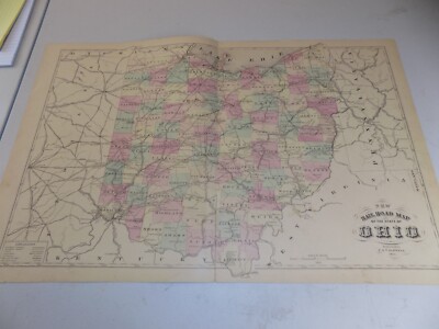
1890 ANTIQUE RAILROAD MAP OF OHIO VERY GOOD CONDITION
THIS MAP IS 1890 OHIO RAILROAD MAP THE PAGE HAS YELLOWED BUT IN CONDITION PREPAIRED BY J. A. NORTON COMMISSIONER OF RAILROADS& TELEGRAPHY NICE MAP CANT FIND ONE ANY NICER Check out my! Be sure to add me to your! THANK YOU FOR LOOKING WE HAVE MANY DIFFERENT RAILROAD ITEMS IF YOU HAVE ANY QUESTIONS PLEASE CONTACT US IF FOR ANY REASON YOU CANT GIVE US A FIVE STAR POSITIVE FEEDBACK PLEASE CONTACT US THANK YOU HAVE A GREAT DAY ITEM NO 30
|
|
|
1858 United States MAP, America 22"x15" Print, Railroad, William Perris, antique
1858 MAP* A new and complete rail road map of the United States 22"x15" HIGH QUALITY GICLEE REPRODUCTION Quality by William Perris. Trim room around edges for custom framing. THIS IS AN EXACT REPRODUCTION DIRECTLY FROM THE ORIGINAL SOURCE We use archival quality papers and ink Looks amazing framed! All prints are delivered in a heavy duty poster tube for safe delivery. Customer satisfaction guaranteed! If for some reason you want to return the item. Or your print is damaged, you can return for a full refund no worries. Maine 3c0.RcmdId ViewItemDescV4,RlogId p4%60bo7%60jtb9%3Feog4d71f%2B%3E3c0-141df16feb7-0x102-
|
|
|
Antique Color Map Michigan & Wisconsin or Illinois 1886 Cram's Railroad & County
This auction is for a two sided double page map of Michigan and Wisconsin and on the back is a single page map of Illinois and a page of state shields. Single page maps are 10.5 x 13.5 inches and double page maps are 21.5 x 13.5 inches. Please note. These are pages from an antique atlas so only one side can be framed for display. This map is from a"Cram's Unrivaled Family Atlas World Indexed 1883 revised for 1886" The photo of the title page of the atlas is for authentication purposes only and is not included in the auction. Thanks for looking and please be sure to visit my other auctions for more antique and vintage maps. Ads, magazines, post cards, books, and more. Powered by
|
|
|
Antique Color Map Florida or Alabama 1886 Cram's Railroad & County
This auction is for a two sided single page. Single page maps are 10.5 x 13.5 inches. Please note. These are pages from an antique atlas so only one side can be framed for display. This map is from a"Cram's Unrivaled Family Atlas World Indexed 1883 revised for 1886" The photo of the title page of the atlas is for authentication purposes only and is not included in the auction. Thanks for looking and please be sure to visit my other auctions for more antique and vintage maps. Ads, magazines, post cards, books, and more. Powered by
|
|
|
Michigan Railroad Rare Original 1887 Rand Mcnally Antique World Atlas State Map
This beautiful colored map comes from the original 1887 Rand McNally& Company World Atlas. 125 years old! 100% Original and Authentic. Gorgeous ant ique m ap shows cities. Towns, railroads, rivers, islands, and topography in great detail. Map measures 15" X 11" It is ready to frame and would look great on the wall of your office or study. Will ship in a tube. I have the entire World Atlas available and as it has fallen apart I will be separating it and selling the maps individually so they can be enjoyed. If you are interested in any particular States or Countries please let me know.
|
|
|
UNITED STATES authentic Antique Map RAILROAD TIME ZONES 119 years old - 1895
This image is enlarged to show representative detail. UNITED STATES DIVISIONS OF STANDARD(RAILROAD) TIME Authentic 119-Year-Old Antique Map Printed in 1895. This is a beautiful, 119-year-old full color map of the United States showing Railroad Standard Time zones. It measures about 11 by 14 inches(about 28 by 36 cm. and is in Fine condition. The United States did not establish time zones by law until the 20th century. Prior to that, the major railroad companies joined to establish"Standard Time" for the USA. Up until that point, local time was observed throughout the USA. This map shows the newly established Standard Time zones. Notice that there are a number of differences between this map and modern Standard Time Zone maps. For example, Ohio, Michigan, Florida and Georgia are in the Central Time Zone. Northern Maine is in the ... moreAtlantic Time Zone. And state borders are almost completely ignored so that about one-third of the states and territories are divided by two or more time zones. The table at top lists major cities, and the difference in minutes between local time and Standard Time. This is a guaranteed genuine antique map! Perfect for genealogical or other historical research. This map was printed on a single sheet of stock and bound whole in an antique book. Highly suitable for framing, this item would look great in your office, den, great room or study. It is similar to many of the maps sold in expensive stores, with one important difference: this is an actual antique. NOT a modern reproduction. An excellent investment. This map is certain to appreciate in value over time. Please ask all questions before making your purchase. FREE SHIPPING anywhere in the USA by USPS First Class Mail. Priority and Express services also available. Shipped rolled in a sturdy tube. I ship worldwide! cua95a
|
|
|
RARE ANTIQUE 1863 LLOYDS NEW MAP of UNITED STATES w RAILROAD & STATIONS - TEXAS
ORIGINAL*LLOYDS NEW MAP OF THE UNITED STATES. THE CANADAS AND NEW BRUNSWICK FROM THE LATEST SURVEYS SHOWING EVERY RAILROAD AND STATION FINISHED TO JUNE 1862& THE ATLANTIC AND GULF COASTS. 1863 WALL MAP THIS IS A REALLY GREAT PIECE. I CANNOT ACTUALLY FIND ANOTHER COPY OF THIS ORIGINAL MAP. WHAT I FIND MOST INTERESTING ABOUT THE MAP IS HOW IT IS ONLY ABOUT HALF THE COUNTRY. THE LEFT EDGE CONSISTS OF TEXAS. THE INDIAN TERRITORY, KANSAS AND NEBRASKA. NO MENTION OF CALIFORNIA IN THIS MAP. MAP MEASURES 38 X 54 INCHES PLUS THE ORIGINAL WOOD RAILS. THE TOP 6 INCHES OF THE MAP HAVE GOTTEN TORN OVER TIME THE WAY MOST OF THESE ANTIQUE WALL MAPS HAVE. IT HAS HAD TAPE REPAIRS, VERY OLD, OLD, AND SOMEWHAT RECENT. THERE ARE A FEW LOSSES IN DIFFERENT SPOTS BUT NOTHING TOO BAD. THE TAPE REPAIRS ARE MOSTLY ON THE BACK BUT SOME ARE ON THE FRONT. THE REST ... moreOF THE MAP IS SURPRISINGLY EXCELLENT. THERE IS SOME TONING AND CONSISTENT BROWNING BUT REALLY IT IS IN OUTSTANDING CONDITION FOR THE AGE. REALLY VERY CLEAN. THE DAMAGE AND REPAIRS UP AT THE TOP ARE NOT TOO BAD TO DETRACT FROM HOW GREAT THE REST OF THE MAP IS- A REAL PRE CIVIL WAR DETAILED MAP OF THE UNITED STATES. DO YOUR OWN RESEARCH ON THIS PARTICULAR MAP. I CANT SEEM TO FIND ANOTHER ONE. CHECK THE PICTURES ON THIS GREAT PIECE. DONT MISS THIS OPPORTUNITY. SHIPPING AND HANDLING AND INSURANCE CAN BE CALCULATED. ALL ITEMS ARE BEING SOLD AS IS. PICTURES ARE AN EXCELLENT INDICATION OF CONDITION. CHECK MY FEEDBACK AND YOU WILL SEE THAT MY CUSTOMERS ARE HAPPY. I GENERALLY SHIP ONCE A WEEK SO PLEASE BE PATIENT. IT TAKES TIME TO MAKE SURE ALL OF THIS ART AND ANTIQUES ARRIVE SAFELY. PLEASE DONT HESITATE TO EMAIL ANY QUESTIONS. THANKS FOR LOOKING AND HAPPY BIDDING. 643.RcmdId ViewItemDescV4,RlogId p4%60bo7%60jtb9%3Feog4d71f%2B%3E643-1474882bba4-0x11b-
|
|
|
Railroad Network United States Lines Communication 1894 antique lithograph map
Railroad Map of the United States showing the Through Lines of Communication from the Atlantic to the Pacific Together with the Various Steamship Lines along the Seaboard Issued 1894. New York, by A.L. Smith Scarce antique lithograph map. Printed on period paper as issued which retains its inherent structural flexibility and soundness. In near VG[or better] condition: displays normal light age toning as typical. Scattered small spotting, and light soiling; overall the image remains clean and very attractive- please inspect zoomable visual scan closely- note the zoom feature which allows for very close inspection. note: we grade conservatively and always seek to disclose any noteworthy flaws. Pleasing old printed paper image entirely worthy of any collection and/ or display. A depiction captured in a manner entirely unique to this particular ... morehistorical era. Not only is the artistic style interesting. But the historical method used for printing it essentially no longer exists. This renders the sheet of paper utterly historically unique, as you will observe when you see it in person. Any minor defects along the sheet edges and in the margins may be seen in the photos. Extracted from a very scarce late 19th century atlas. Printed on back with part of a different map. Sheet measures c. 24 1/4" W x 15 1/8" H. Printed area measures c. 20 1/8" W x 13" H. Original fold line as issued. We guarantee this printed sheet of paper to be old. Printed many years ago, not recently. We stand behind the authenticity of everything we sell- forever. 72975] Guaranteed Authentic! We do not sell modern reprints. Condition: We only handle. Sell& ship original vintage and antique items. Old sheets of paper, printed long ago. Items which are really old, like we say. Not modern copies or modern reproductions. It's amazing how many people still ask us if an item is truly old& genuine. We strive to describe our items accurately. We understand you cannot see it in person. We are trying to present it accurately an
|
|
|
United States Railroad Texas & California 1894 antique lithograph hand color map
Map of the United States and Territories Together with Canada& c. Issued 1894. New York, by A.L. Smith Scarce antique lithograph map with original hand color. Printed on period paper as issued which retains its inherent structural flexibility and soundness. In near VG[or better] condition: displays normal light age toning as typical. Scattered small spotting, and light soiling; overall the image remains clean and very attractive- please inspect zoomable visual scan closely- note the zoom feature which allows for very close inspection. note: we grade conservatively and always seek to disclose any noteworthy flaws. Pleasing old printed paper image entirely worthy of any collection and/ or display. A depiction captured in a manner entirely unique to this particular historical era. Not only is the artistic style interesting. But the historical ... moremethod used for printing it essentially no longer exists. This renders the sheet of paper utterly historically unique, as you will observe when you see it in person. Any minor defects along the sheet edges and in the margins may be seen in the photos. Extracted from a very scarce late 19th century atlas. Sheet measures c. 24 1/4" W x 15 1/8" H. Printed area measures c. 19 7/8" W x 12" H. Original fold line as issued. We guarantee this printed sheet of paper to be old. Printed many years ago, not recently. We stand behind the authenticity of everything we sell- forever. 72974] Guaranteed Authentic! We do not sell modern reprints. Condition: We only handle. Sell& ship original vintage and antique items. Old sheets of paper, printed long ago. Items which are really old, like we say. Not modern copies or modern reproductions. It's amazing how many people still ask us if an item is truly old& genuine. We strive to describe our items accurately. We understand you cannot see it in person. We are trying to present it accurately and convey condition correctly with careful digital photography. Accurate flat-bed scans of the item which are zoomable, pre
|
|
|
1871 WARREN Antique Map/UNITED STATES RAILROAD ROUTES/Hand-Colored
THIS ITEM IS A GENUINE ORIGINAL VINTAGE MAP FROM THE SOURCE/DATE LISTED Name of Map- United States Railroads Date- 1871 Issued by- Warren Size- about 10x12" Misc. geography text and engravings on reverse, hand-colored Condition- Very Nice Yes! We Do Combine Shipping on Multiple Purchases! NO RESERVE! Happy Bidding! Buyer pays shipping/packing. We use very secure packaging methods and materials. And all shipments within the United States will be made with the protection of the new USPS Parcel shipping category. First Class or Priority. Depending on weight) Note that certain items may be shipped in the USPS Media Mail category. If appropriate. Payment due within 14 days after our initial after auction contact. Pennsylvania residents MUST add applicable SALES TAX or send resale number. Thanks. Good Luck! To See Our Other Auctions and Store ... moreItems CLICK HERE! Powered by g6.RcmdId ViewItemDescV4,RlogId p4%60bo7%60jtb9%3Fuk%601d72f%2B%3Eg6%3E-1477687c019-0x114-
|
|
|
ANTIQUE MAP 1879 RR WHITE MOUNTAIN DELAWARE HUDSON CANAL RAILROAD SARATOGA ANGEL
THE POPULAR ROUTE TO THE SOUTH AND WEST JOS ANGEL. DATED 1879 approximately 6.1/2 x 4 in. when closed) Condition: With some torn losses to margin of first sheet. Paper remains clean. Some minor small tears and bends.
|
|
|
Rand McNally "Handy Railroad Map" UNITED STATES Antique Map, 11"x14", 1890s
Antique Black& White Map Region: United States. Handy Railroad Map Date/Publisher: c.1890s(I think) Rand McNally World Atlas and Gazetteer Size: 11" x 14" Condition: Very nice condition. No creases or tears, some toning. This is not a copy. It was removed from an old atlas book. Please Zoom-in on photos for more details regarding content and condition. ~~ Please be sure to check out my! I'm listing many more Antique Maps& Prints. Shipping is just $0.50 more for each additional map ~~ Thanks for looking at this listing. If you have any questions. Just ask! Payment and Shipping Info: eBay wants payment through PayPal or Cash upon Pickup. Email regarding other options. I ship 5 days a week Mon-Fri and will usually ship within 24 hours of payment clearing. I will be happy to combine shipping when possible! When purchasing ... moremore than one item just wait for an invoice that will reflect combined shipping savings. If you'd like a quote ahead of time feel free to contact me. Some items cannot be combined. Your satisfaction is extremely important to me. Once you receive your item/s and are happy with them I hope you will consider leaving me positive feedback. As I will be doing the same for you. Thank you for looking. Good luck bidding, and please don't hesitate to contact me with any questions!
|
|
|
UNITED STATES authentic 1885 Antique Map RAILROAD TIME ZONES 129 years old
UNITED STATES DIVISIONS OF STANDARD(RAILROAD) TIME Authentic 129-Year-Old Antique Map Created by: George F. Cram Date: 1885 Size: About 25x30cm. 10x13 inches) Condition: Fine Printed in 1885. This is a beautiful, 129-year-old full color map of the United States showing Railroad Standard Time zones. It measures about 10 by 13 inches(about 25 by 30 cm. and is in Fine condition. The United States did not establish time zones by law until the 20th century. Prior to that, the major railroad companies joined to establish"Standard Time" for the USA. Up until that point, local time was observed throughout the USA. This map shows the newly established Standard Time zones. Notice that there are a number of differences between this map and modern Standard Time Zone maps. For example, Ohio, Michigan, Florida and Georgia are in the Central Time ... moreZone. Northern Maine is in the Atlantic Time Zone. And state borders are almost completely ignored so that about one-third of the states and territories are divided by two or more time zones. The table at bottom lists major cities, and the difference in minutes between local time and Standard Time. The entire map is surrounded by an ornate engraved border typical of finer maps of the Victorian era. This is a guaranteed genuine antique map! Perfect for genealogical or other historical research. This map was printed on a single sheet of stock and bound whole in an antique book. Highly suitable for framing, this item would look great in your office, den, great room or study. It is similar to many of the maps sold in expensive stores, with one important difference: this is an actual antique. NOT a modern reproduction. An excellent investment. This map is certain to appreciate in value over time. Please ask all questions before making your purchase. FREE SHIPPING anywhere in the USA by USPS First Class Mail. Priority and Express services also available. Shipped rolled in a sturdy tube. I ship worldwide! cufaw85e
|
|
|
AM22 ANTIQUE 1879 GRAY'S MAP OF THE UNITED STATES RAILROAD TRAIN ROUTES ILLUST
AM22 ANTIQUE 1879 GRAY'S MAP of the UNITED STATES RAILROAD TRAIN ROUTES ILLUSTRATED(not a reproduction) GOOD FRAMEABLE CONDITION NR UP FOR AUCTION ANTIQUE RAILROAD MAP MADE BY DRAWN BY FRANK A. GRAY AND ENGRAVED BY WILLIAM H. HOLMES TITLE GRAY'S NEW MAP OF THE UNITED STATES WITH BOTH REGULAR AND NARROW GAUGE RAILROADS SHOWN IN THE 1870S PUBLISHED ENTERED IN THE ACT OF CONGRESS IN THE YEAR 1879 CONDITION THIS LARGE MAP IS IN VERY GOOD CONDITION WITH SOME MINOR FOXING FROM 112 YEARS OF AGING; YOU WILL FIND GOOD COLOR. ONE FOLD, MISSING PAPER ALONG THE BOTTOM, SEE PHOTO, STILL GOOD FOR FRAMING SIZE 29-1/2 BY 18-1/2 INCHES FEATURES SEE PHOTOS FOR SPECIAL FEATURES METHOD HAND COLORED LITHOGRAPH SHIPPED SHIPPED ROLLED IN TUBE PHOTOS THE DETAIL IN THE FULL PHOTO IS POOR. THERE'S BETTER DETAIL IN THE CLOSE UP SHOTS NOTICE I AM NOT AN ... moreEXPERT; but I have described this item to the best of my ability; my description is based on internet research of similar items. BE YOUR OWN JUDGE PLEASE REVIEW THE PHOTOS AND BE YOUR OWN JUDGE; I WILL BE HAPPY TO ANSWER QUESTIONS 14.00 Normal 0 false false false false EN-US X-NONE X-NONE
|
|
|
HUGE SUPERB ANTIQUE 1876 UNITED STATES CANADA RAILROAD HANDCLR MAP TEXAS FLORIDA
Click Here. Double your traffic. Get Vendio Gallery- Now FREE! ANY UNUSUAL SHADOWS OR FUZZINESS IS ON THE PHOTO ONLY. Vintage antique 1876 handcolored map. This is the finest map of this area I've ever seen. The condition is amazing. The map is 4 pages and any side would frame and display quite nicely, the first page is a color lithographed map titled Senatorial Districts and Representative Districts, the next 2 pages is a large and outstanding map, titled New Railroad Map of the United States and Dominion of Canada, below the title is a fie engraving of an agricultural scene. Great map of the United States at this time, with gorgeous period handcoloring, Oklahoma is Indian Territory, North and South Dakota are Dakota, the railroads are shown and much more. The last page is Population United States Census, 1870, and Irish Population. ... moreThe condition is just amazing, beautiful topflight condition. Very finely produced map, printed on thick fine paper. This is an antique map and not a reprint or reproduction. The map is from the very rare Illustrated Historical Atlas of the State of Indiana, by Baskin, Forester& Co. produced in 1876. The map is a fascinating and historic period look at this area at this time. The photo wont show the full beauty of the map. The map is in nice shape and would frame and display quite beautifully. The size of the single page map is 14" by 17.5" and the 2 page map is twice that size. Winning bidder pays $4.00 shipping domestic, more foreign. Payment I accept the following forms of payment: PayPal Click to View Image Album Click to View Image Album Click to View Image Album Shipping& Handling US Shipping. $4.00 USPS First-Class Mail® International Shipping. $11.50 USPS First-Class Mail International FREE scheduling. Supersized images and templates. Get Vendio Sales Manager. FREE scheduling. Supersized images and templates. Get Vendio Sales Manager. 40g.RcmdId ViewItemDescV4,RlogId p4%60bo7%60jtb9%3Fuk%601d72f%2B%3E40g-14c0dc6bbe1-0xff-
|
|
 |