-
Christian Collectibles
-
Christian Sheet Music
-
Vatican Stamps
-
Vatican Coins & Paper Money
-
Antiques
-
Antiquities
-
Architectural & Garden
-
Decorative Arts
-
Ethnographic
-
Furniture
-
Maps, Atlases & Globes
-
United States (Pre-1900)
-
AK, HI
-
AL, FL, GA, MS, NC, SC
-
AR, IA, KS, LA, MO, NE
-
AZ, CA, CO, NM, NV, UT
-
CT, MA, ME, NH, RI, VT
-
DC, DE, MD, NJ, NY, PA
-
ID, OR, WA
-
IL, IN, MI, OH, WI
-
MN, MT, ND, SD, WY
-
OK, TX
-
VA, WV, KY, TN
-
Entire US
-
United States (1900-Now)
-
United States (Date Unknown)
-
Africa
-
Asia
-
Australasia/ Oceania
-
Canada
-
Central America/ Caribbean
-
Europe
-
India
-
Ireland
-
Mexico
-
Middle East
-
North America
-
South America
-
United Kingdom
-
Maps on CD
-
World Maps
-
Globes
-
Mixed Lots
-
Reproductions
-
Price Guides & Publications
-
Other
|
In
Order by: Available to: This site contains affiliate links for which I may be compensated
|
Buy It Now
Free Shipping Location: Sayville, United States
Buy It Now
$11.85 Shipping Location: Dover, United States Issued 1890, NY by Scribner & Black. Scarce oversized folio sheet late 19th century color lithographed map. Texas and Indian Territory.
Buy It Now
$6.95 Shipping Location: Dover, United States Issued 1895, Buffalo, New York by the Matthews-Northrup Co. Texas - Oklahoma - Indian Territory. Late 19th century color lithograph detailed map. Inset ... moremap of west Texas.
Buy It Now
Free Shipping Location: Carefree, United States ORIGINAL 1909 GUIDE BOOK WITH MAP OF TEXAS AND OKLAHOMA. DATED- MAY 1909. POOLE BROTHERS.
Buy It Now
$4.99 Shipping Location: Fairview, United States Co., stated in small print in the bottom margin.It is from Reynold's After-War Atlas and Gazetteer of the World, published in Toronto, 1919, a copy of ... morethe title page is included. The map has no centerfold so it would be very good for framing.
Buy It Now
$5.95 Shipping Condition: New Location: Las Vegas, United States This is a great map of the Counties of the State of Texas & Indian Territory Circa 1875. County map of Texas, and Indian Territory. “Vibrant and bright! ... morePic does not do it justice.looks amazing!”.
Buy It Now
Free Shipping Location: Monroeville, United States Date - 1885. Source - Harper’s School Geography Atlas. inventory # j74096. Condition - Very Nice.
Buy It Now
$5.55 Shipping Location: Bar Harbor, United States Hammond Map. C. S. Hammond & Co. Original Antique. This map is from. (atlas cover and title page are not part of the sale). With New Census.
Buy It Now
$25.00 Shipping Location: Belvedere Tiburon, United States While this particular map is undated, we feel comfortable tentatively proposing a date around 1915. We already noted how our map shows the Permian Basin ... moreas unexploited, which pushes it back before the first serious prospections in 1920.
Buy It Now
$10.04 Shipping Condition: Unspecified Location: LONDON, United Kingdom Antique colour map, 1892. DATE PRINTED: 1892. CONDITION: Good; suitable for framing. The map you will receive is in good condition but there may be minor ... morevariations in the condition from that shown in the image.
Buy It Now
$4.13 Shipping Location: Mason, United States Quadrangle Sherman, Texas; Oklahoma. Western United States 1:250,000. US Geological Survey Topography Map,1954, Revised 1977. In very good condition. ... moreSee pictures.
Buy It Now
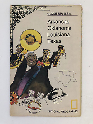
$5.49 Shipping Location: Georgetown, United States Template By Froo! National Geographic Map- 1974 Close-Up USA Oklahoma Texas Louisiana Arkansas National Geographic Map- 1974 Close-Up USA Oklahoma Texas ... moreLouisiana Arkansas Vintage 1974 two sided map Close-Up USA. Map shows Oklahoma, Louisiana, Arkansas, and Texas. The opposite side includes lots of historical information on the area by National Geographic Society. The map measures approx 35" x 23" in size. Never Unfolded. Shipping: All orders are carefully packaged. With a(Handle With Care Sticker) on the packaging. All orders ship the same or next business day. We ship orders Monday to Saturday. Orders placed before 2 pm(CST) on Fridays will ship on Saturday. We ship all orders via the United States Postal Service: First Class. Media Mail, Parcel Post, or Priority Mail, all include tracking numbers. Multi-Item Orders: We do combine shipping costs on multi-item orders. In order to receive the best shipping cost possible for your specific order please place your order. But before paying, request an invoice from us with combined shipping. We will return to you an adjusted invoice with the best shipping price for your order. Return Policy: Refunds given as money back or exchange(buyer’s choice) The buyer must pay return shipping. Please contact me within 14 days after receiving the item. Privacy Policy: Our company will never share your personal information in any way with an outside company. Our company will not send you unsolicited advertisements. Most reasonable offers are accepted. PayPal only. Please. Payment is expected within 2 days of auction end; immediate payment if you use Buy It Now. I will try and answer any questions. I am not an expert on anything I sell. And do my best to describe each item accurately. I buy many different items for the purpose of reselling them here on ebay. Any descriptions I give indicating the condition of item(s) such as: vintage. Antique, excellent, very good, good, and poor, or levels of functioning are purely subjective to what I observe, test and think of the item.
Buy It Now
$4.99 Shipping Location: Fairview, United States An interesting map in a rare format with Oklahoma & Indian Territory at the top and Texas below printed on an extended foldout page with two horizontal ... morefolds. An Authentic Antique Map: Not a Modern Reproduction!
Buy It Now
$6.95 Shipping Location: Dover, United States Issued c. 1899, Buffalo, New York by the Matthews-Northrup Co. Texas - Oklahoma - Indian Territory. Late 19th century color lithograph detailed map. Inset ... moremap of west Texas.
Buy It Now
$6.95 Shipping Location: Dover, United States Issued 1895, Buffalo, New York by the Matthews-Northrup Co. Texas - Oklahoma - Indian Territory. Late 19th century color lithograph detailed map. Inset ... moremap of west Texas.
Buy It Now
$6.95 Shipping Location: Dover, United States Original center fold as issued.
Buy It Now
$6.90 Shipping Location: HORNCASTLE, United Kingdom
Buy It Now
$4.99 Shipping Location: Fairview, United States The title of the atlas appears in the top left margin, the plate number in the upper right and the Printer Julius Bien & Co. NY (Lithography). A copy ... moreof the title page is included with all the publishing details for authenticity.
Buy It Now
$4.99 Shipping Location: Fairview, United States It is fromWarren's Common- School Geography, published in Philadelphia by Cowperthwait & Co., 1882, a copy of the title page is included. An Authentic ... moreAntique Map: Not a Modern Reproduction! Condition: It is in Good to Very Good condition for its age with overall light tonal ageing and darkening around the edges.
Buy It Now
$4.55 Shipping Location: Oakland, United States 12x10 inches This antique map features the states of Texas and Oklahoma, previously known as Indian Territory, as well as public land. The colorful and ... moreintricate design of the map is sure to catch the eye of any collector interested in North American maps from the late 19th century.With its detailed representation of geographical features and landmarks, this map is a valuable addition to any antique collection. Whether you're a history buff or simply appreciate the beauty of vintage cartography, this 1885 map is a must-have for your collection.
Buy It Now
$4.99 Shipping Location: Fairview, United States There is a date of 1880 on the bottom left corner in small print just inside the border of the map. The labeling language is in German. Overall a beautiful ... moremap in great condition. An Original Antique Map: Not a Modern Reproduction!
Buy It Now
$6.95 Shipping Location: Dover, United States Texas - Oklahoma - Indian Territory. Late 19th century antique color lithographed map. Original fold lines as issued.
Buy It Now
$5.75 Shipping Location: Malden, United States A Beautiful Antique 1924 World Atlas Map of Texas, Oklahoma & South Dakota. Great OLD Map from the COLLIER'S "THE NEW ENCYCLOPEDIC ATLAS & GAZETTEER OF ... moreTHE WORLD". There Is Also An Index of Counties, Principal Cities & Towns in Texas & South Dakota, Not Oklahoma!
Buy It Now
$5.00 Shipping Location: Canada DATE OF ISSUE: 1936.
Buy It Now
$8.78 Shipping Location: United Kingdom "Stielers Atlas of Modern Geography" by Adolf Stieler. Center fold as published. Antque Lithograph Map Published 1909 by Justus Perthes, Gotha for.
Buy It Now
$5.00 Shipping Location: Canada DATE OF ISSUE: 1904. ORIGIN OF THE MAP: "The World-Wide Atlas of Modern Geography" published by W. & A. K. Johnston Ltd., Edinburgh and London, UK.

Buy It Now
Free Shipping Location: Brookline, United States An Authentic Antique Map: Not a Modern Reproduction! See Our Ebay Store for More! Free US Shipping on Purchases of 5 or More Maps and Prints Description: ... moreIt is an authentic antique map approximately 110 years old with printed color. It is from the 1903 edition of the Century Atlas of the World(New York: The Century Co. Although the map has a copyright date of 1897 in the title area and was designed by Matthew-Northrup, Buffalo, NY, which is stated as M.N. Co. on the map in fine print on the bottom right corner. Size: The map image measures approximately 10 1/2 by 15 inches(27x38cm) on a 12 by 16 1/2" 30x42cm) page with a margin all around as seen. Condition: The map is in Good condition for its age with light overall tonal ageing as expected. Blank on the reverse with a centerfold as issued, see the pics for more on condition. There is a slight split at the bottom of the fold, margin only, and there is some minor light spots mainly in the margins, otherwise the map is very clean with plenty of margin for framing. The pics are of the actual map.
Buy It Now
$5.00 Shipping Location: Canada DATE OF ISSUE: 1912. ORIGIN OF THE MAP: "Stielers Handatlas", published in Gotha, Germany by Justus Perthes.
Buy It Now
$6.95 Shipping Location: Dover, United States Issued 1880 Gotha by Justus Perthes for Stieler. Very detailed 19th century engraved map with original outline hand color. Original center fold as issued.
Buy It Now
$6.95 Shipping Location: Dover, United States Issued c. 1930's, Milan, Italy by C.T.I. Original center fold as issued. Early 20th century color lithographed map.
Buy It Now
$6.95 Shipping Location: Dover, United States Issued 1872, New York by Asher & Adams. United States and Territories. Late 19th century lithographed map with original hand color.
Buy It Now
$12.00 Shipping Location: Rockville, United States Up for sale is the very scarce 1822 map Geographical, Statistical and Historical Map of Arkansas Territory. Published by Carey and Lea this map shows ... morewhat was then U.S. western territory from the Great Lakes through what are now Minnesota and the Dakotas, the plain states of Nebraska, Kansas, Iowas, Oklahoma, parts of Texas etc.
$16.00 Shipping Location: Poland Date of issue: 1782 (dated map). THIS IS AN ORIGINAL MAP, NOT A RECENT COPY OR REPRODUCTION. by Vaugondy R., engr. by Mounier S., publ. by Leroy A., Lyon ... more(France). HAND COLORED.
Buy It Now
$4.50 Shipping Location: Slingerlands, United States This is an Army Map Service map (AMS V783) of Direct Texas (printed 1948 based on 1940-42 aerial photography) showing from south of Monkstown north into ... moreOklahoma. This map is bisected by the Red River.
Buy It Now
Free Shipping Location: Colorado Springs, United States
Buy It Now
Free Shipping Location: Dallas, United States Original 1891 Map of. Texas, Oklahoma and Indian Territory. Map did not quite fit on my large scanner; thus there. An historic conversation piece. are ... moretwo scans which show the full content. (BR) Box 329.
Buy It Now
$4.99 Shipping Location: Fairview, United States An Authentic Antique Map: Not a Modern Reproduction! Condition: It is in Very Good condition. There is another map on the reverse. The pics are of the ... moreactual map.
Buy It Now
$5.95 Shipping Condition: New Location: Las Vegas, United States This is a great map of the Counties of the State of Texas & Indian Territory Circa 1875. Year: 1875. County map of Texas, and Indian Territory. “Vibrant ... moreand bright! Pic does not do it justice.looks amazing!”.
Buy It Now
$4.95 Shipping Location: Bar Harbor, United States 1911 Original Antique Hammond Atlas Map. Handy Atlas of the World. and on reverse. This map was taken from (The cover & title pages shown are not part ... moreof the sale).
Buy It Now
$6.95 Shipping Location: Dover, United States Issued 1885, Glogau by C. Flemming. Uncommon and very detailed 19th century German color lithographed map with original outline hand color. Original center ... morefold as issued. Dictionary of Mapmakers, vol.
Buy It Now
$9.89 Shipping Location: Staffordsville, United States This vintage Fisk & Co map depicts the territories of Texas, Oklahoma, and Indian Territory in the late 1800s. Highlighting the cities of Dallas and other ... moreurban centers, the map provides a glimpse into the region's history and geography. With intricate detailing and an authentic vintage feel, this map is a unique addition to any collection of North American maps and atlases. Map size 9 x 11.5 size in frame 13.5x16 I know very little about this item I do not have a certification of authenticity. Obviously someone thought it was worth having it professionally framed.
Buy It Now
$4.15 Shipping Location: Saco, United States 11 7/8" x 9". This Map was Harvested from an 1854 Smith's Atlas of Modern and Ancient Georgraphy Book which was Published by Daniel Burgess & Co. Last ... more2 Photos will show the actual Atlas Cover and Title Page, neither are included and are only shown as Proof of Authenticity.
Buy It Now
$4.99 Shipping Location: Fairview, United States It is by Henry Tunison (1855-1915) published inTunison's Peerless Universal Atlas of the World, Jacksonville, Illinois 1886, a copy of the title page ... moreis included for authenticity. It is from one of the rarer early editions of the Peerless Atlas, in which he used very strong and vibrant colors, especially the pinkish reds that have a fluorescent quality.
Buy It Now
$5.00 Shipping Location: Canada DATE OF ISSUE: 1908.
Buy It Now
Free Shipping Location: Anaheim, United States Typically that map at hand, the one being looked at, is in the center box. feature within the bounds of the map, which frequently is a community, town, ... moreor city. The map covers a specific amount of area.
Buy It Now
Free Shipping Location: Iowa City, United States This color map ofTexas & Oklahoma is dated 1907 on the face. Counties, County Seats,Cities; many Small Towns and Villages, Ports; Military Airbases and ... moreForts; Rivers, Streams, and Lakes; and other topographical features are located on this map.
Buy It Now
$5.00 Shipping Location: Canada DATE OF ISSUE: 1938. ORIGIN OF THE MAP: "Der Neue Brockhaus" (Atlas), published by F. A. Brockhaus, Leipzig, Germany.
Buy It Now
$5.00 Shipping Location: Canada DATE OF ISSUE: 1914.
Buy It Now
$4.99 Shipping Location: Fairview, United States , published in Gotha by Justus Perthes, a copy of the title page is included. The map is dated 1834, revised in 1847, as stated in the title area along ... morewith Ad. Stieler's Hand Atlas. An Authentic Antique Map: Not a Modern Reproduction.
Buy It Now
$4.99 Shipping Location: Fairview, United States , published in Chicago by the Rand, McNally & Co., 1881, a facsimile copy of the title page is included for authenticity. Condition: Very Good to Excellent ... moreespecially for a large folding map, blank on reverse with a vertical and horizontal fold as issued.
Buy It Now
$4.95 Shipping Location: Dover, United States Issued 1874, New York by J. Bien. General Topographical Map. Sheet XXI. Mid 19th century color lithographed map. Original center fold as issued.
Buy It Now
Free Shipping Location: Portland, United States 1884 first issue! Large folding map showing the territory originally assigned to the Cherokee "nation of" Indians West of the Mississippi. Also the boundaries ... moreof the territory now occupied or owned by them.
Buy It Now
$5.00 Shipping Location: Canada DATE OF ISSUE: 1907. ORIGIN OF THE MAP: "The Handy Royal Atlas of Modern Geography", published in Edinburgh/London by W. & A. K. Johnston.
Buy It Now
$4.99 Shipping Location: Fairview, United States It is from Warren's Common- School Geography, published in Philadelphia by Cowperthwait & Co., circa 1889, showing North and South Dakota after the split ... morein 1889 and the Unassigned Lands of Oklahoma in the middle of Indian Territory.
Buy It Now
$4.99 Shipping Location: Fairview, United States Stieler's Hand Atlas., published in Gotha by Justus Perthes, a copy of the title page is included. The map is dated "1836, improved 1841, Texas added ... moreto US 1847" in the title block.Stieler's Hand Atlas appears in the top right margin.

Buy It Now
$4.00 Shipping Location: Portland, United States 1974 National Geographic Map of Arkansas Oklahoma Louisana Texas This map is in excellent condition. It is approximately 35 x 24 inches in size. Please ... morebe aware that these National Geographic Maps are anyware from 30 to 80 years old. They are printed on paper that is not acid free and in most cases have not been stored in the best way. So some of the maps you are buying will be in a condition that reflects both of these facts. The map you get may be worn or lightly torn along the fold lines due to the acidity of the paper and being folded for years. They may also be discolored or mottling spots again due to the acidity of the paper. The borders of the maps may also have small tears. On occasion maps may smell musty from the way they have been stored in the past. When the map is kept in an open area the musty smell will fade away in time. Any damage that is above and beyond the norm will be disclosed. Payment through Paypal only. Payment is required within four days. I do combine multiple purchases for shipping. If you have bought an item and are going to bid on a future item(s) you must let me know if you want them shipped together. I usually ship by Parcel Post or First Class Postage in order to save money on shipping costs. This does mean that often the delivery time will take longer. If you prefer that your item be shipped by Priority Mail to get it quicker please let me know and I will adjust your invoice accordingly. All items are sold in"as in" condition. Should you have any problem with the item or you feel that it has been misrepresented. Please contact me so that we can reach a mutually satisfactory solution. Sorry but no overseas bidding without contacting me first. If your feedback score is less than 20 then please contact me before bidding.
Buy It Now
$5.65 Shipping Location: Saint Louis, United States From Cram's Universal Atlas. Cram's Universal Atlas from 1899. dated 1899. The page is not quite as White as. it appears. This is caused by my scanner ... moreand picture processor. 2312.5 OTS
Buy It Now
$8.00 Shipping Location: Denver, United States First edition. Map scale: 1 to 125,000. An early atlas of this asphaltic (!). bearing region located in the Chickasaw Nation of Indian Territory (now ... moresoutheastern Oklahoma) west of the Atoka folio and just north of the Oklahoma-Texas border.
Buy It Now
$5.00 Shipping Location: Canada DATE OF ISSUE: 1922.
Buy It Now
$6.95 Shipping Location: Dover, United States Issued 1879, Philadelphia by O.W. Gray. Map by Frank Gray. Note how Oklahoma and Indian Territory divide the future state, Alaska is labelled as a "territorial ... moredistrict". Inset at top of Westward expansion from 1790 to 1880.
|
|
|
In
|
National Geographic MAP 1974 Close-Up USA SOUTHCENTRAL Oklahoma Texas LA Arkansa
Description: Double sided MAP/Supplement of Close-Up U.S.A: SOUTH CENTRAL(Arkansas. Louisiana, Oklahoma, Texas) by NATIONAL GEOGRAPHIC SOCIETY Date: October 1974 Supplement Condition: very good condition Size: 35 x 22 3/4 inches Magazine is not included. Please check out my store for its availability Serious Bidder Only Please. Ask question if any. Shipping: USA: $2.50 first class or $5.49 Priority Mail within the lower 48 states. For each additional map. Add $1 Free shipping with purchased of any magazine. Canada: $3.99 first class mail or $13.99 priority mail For each additional map. Add $1 Free shipping with purchased of any magazine. International: $5.99 first class mail or $17.99 priority mail For each additional map add $1 Free shipping with purchased of any magazine. Payment: Payment is due within 7 days. Please contact me within 3 ... moredays to arrange payment if you do not pay instantly by Paypal. Return: I do not except return unless I send the wrong item(s) or item(s) that are not as described. Item(s) returned must be in the same condition it was sent. Refund will cover the bid amount but not shipping.
|
|
|
TEXAS & Oklahoma Map: 100 Years Old showing Counties, Towns, Topography, RRs
1911 Engraved Color Map: Texas and Oklahoma Satisfaction Guaranteed This color map of Texas& Oklahoma was included in an encyclopedia set published in 1911. It was engraved and printed by the LL Poates Co. NY, NY. The map shows all of the state's counties; county seat towns; major cities and many small towns& villages; rivers& streams; and topographic detail. Most of the state's railroads and all of the Major railroads are shown in red. The map is printed on medium weight paper. Blank on the reverse and with two folds(as issued) Bordered map area is about 8.5" x 12" with margins of between 1/2" to 1 inch all the way around to allow convenient matting. This is a very attractive older map and would look beautiful- matted and framed. If you want a detailed map showing the state as it was 100 years ago. This ... moreis a good one. Map is shown below without full margins; and the second image below is a close-up of the area around Dallas/ Fort Worth and is included to show quality and detail. Bid with confidence- Returnable for any reason within 10 days for prompt refund. Powered by The free listing tool. List your items fast and easy and manage your active items.
|
|
|
1895 Map of OKLAHOMA and INDIAN TERRITORY - Map of TEXAS on reverse (11"x14")
Authentic Antique map of Oklahoma and Indian Territory. Map of Texas is on reverse. Historic! Shows the Indian Territory that is now part of Oklahoma. If you like history. You might also be interested in my map of the Territorial Growth of the United States. Map is 11" by 14" This is an original page(not a reproduction) from the Philadelphia Public Ledger's Unrivaled Atlas of the World prepared and published especially for The Public Ledger. George W. Childs Drexel, Editor and Publisher. Map Copyright. 1895, by Rand, McNally& Co. In excellent condition for a map of this age. Would be nice framed for a history buff or a current resident/college student. Makes a unique gift. I ship my maps rolled in a mailing tube for protection. I am happy to combine shipping. Second and all subsequent maps ship free in the same mailing tube. ... moreFeel free to contact me with any questions. Please look at my other historic maps of states and countries that are listed. Happy Bidding!
|
|
|
INDIAN TERRITORY (TEXAS/TX) & OKLAHOMA/OK 1889 MAP MOTP
This is an exquisite full-color Reproduction printed on heavyweight(7.0 MIL) Glossy Photo Paper. These maps are perfect for framing. Or a wonderful and unique gift for family members, friends or co-workers! All Information is Carefully Compiled from Actual Surveys Original Maps are often difficult to find and usually have fold lines. Identifying stamps or markings, tears, ragged edges, and assorted other natural signs of age that detract from their beauty. All of our maps have been professionally restored to depict their original beauty, while keeping all historical data intact. These maps are fabulous pieces of history full of information useful to Historians. Genealogists, Cartographers, Relic Hunters, Others. They make fascinating conversation pieces and splendid works of art for the home or office. Map Size: 30.63 x 23 Site Specifics ... moreTo This Map Are: References for: Townships. Capitals of Nations, Towns, Villages, Military Reservations, Boundaries of Indian, Reservations, Roads and Trails, Railroads(Constructed and Proposed) Lands Occupied by Native Americans, Lands ceded from Native Americans, San Bols Mountains, and Missouri Pacific Railroad. The following towns are featured: Rome. Atoka, Goodland, Stonewall, Frazer, and Keystone. This Map is Situated in: States of Texas. Oklahoma, and Surrounding Area. SKU: ZZIN0002 and Powered By:
|
|
|
1895 Texas Dated Color Map* Oklahoma & Indian Territory map on back..118 yrs-old
1895 Texas Dated Color Map* Oklahoma& Indian Territory map on back.118 yrs-old Gorgeous. Original 1895 Texas Dated Color Map. Oklahoma& Indian Territory color map is on the back. This is an ORIGINAL.NOT A REPRINT. 118 + year old Dated atlas map.that measures 14" x 11" with the borders. The map is indexed on the borders where it lists the land area and 1895 Population broken down by race and gender. Plus the major towns and cities with their population. Austin had 15.000 people) Also included on the map are the major railroads. Rivers and other geographic features, etc. Wonderful antique map. NOTE CONDITION: This map has lite border and corner wear. And NOTE: The map has a paper crease on the lower corner section. this doesn't show in the scan but please be aware of it, o t herwise. It is Nice Condition. Please see the ... moreattached photo to view the several scans of the map. NOTE: the map is too large for my scanner.There is a border all the way around the map.Also. The map is much clearer than the scan illustrates.All of the printing is very clear and readable* Purschase this antique Texas map for $23.95. U.S. Buyer pays $3.00 for shipping. 1-4 maps can be combined to save on shipping. D ue to the massive increase in international shipping co sts, I NO LONGER SELL TO INTERNATIONAL BUYER S UNLESS THEY ARE WILL ING TO PAY THE $ 10.00 MINIMUM POST AGE COST S. PLEASE READ: This is an original Dated 1895 atlas map.If you have any questions about his map or any of my items. Please email me before bidding. I prefer satisfied customers. Thanks! 050213 Okla95.1(R) Please Visit My Ebay Store to View My Indian Territory. Oklahoma, Texas, Dallas and Other Vintage Antique Maps. Thanks for Looking! D ue to the massive increase in international shipping co sts, I NO LONGER SELL TO INTERNATIONAL BUYER S UNLESS THEY ARE WILL ING TO PAY THE $ 10.00 MINIMUM POST AGE COST S.
|
|
|
1898 Oklahoma & Indian Territory Dated Color Map* Texas map on back..115 yrs-old
1898 Oklahoma& Indian Territory Dated Color Map* Texas map on back.115 yrs-old Gorgeous. Original 1898 Oklahoma& Indian Territory Dated Color Map. Texas color map is on the back. This is an ORIGINAL.NOT A REPRINT. 115 + year old Dated atlas map.that measures 14" x 11" with the borders. The map is indexed on the borders where it lists the land area and 1898 Population broken down by race and gender. Plus the major towns and cities with their population. Oklahoma City had 10.000 people) Also included on the map are the major railroads. Rivers and other geographic features, etc. Wonderful antique map. NOTE CONDITION: This map has lite border and corner wear. And NOTE: A Paper crease on the lower border/corner section. o t herwise. It is Nice Condition. Please see the attached photo to view the map and a couple of scans of the ... moremap. NOTE: the map is too large for my scanner.There is a border all the way around the map.Also. The map is much clearer than the scan illustrates.All of the printing is very clear and readable* Purschase this antique Oklahoma/Indian Territory map for $19.95. U.S. Buyer pays $3.00 for shipping. 1-4 maps can be combined to save on shipping. D ue to the massive increase in international shipping co sts, I NO LONGER SELL TO INTERNATIONAL BUYER S UNLESS THEY ARE WILL ING TO PAY THE $ 10.00 MINIMUM POST AGE COST S. PLEASE READ: This is an original Dated 1898 atlas map.If you have any questions about his map or any of my items. Please email me before bidding. I prefer satisfied customers. Thanks! 060113 Okla98.1(R) Please Visit My Ebay Store to View My Indian Territory. Oklahoma, Texas, Dallas and Other Vintage Antique Maps. Thanks for Looking! D ue to the massive increase in international shipping co sts, I NO LONGER SELL TO INTERNATIONAL BUYER S UNLESS THEY ARE WILL ING TO PAY THE $ 10.00 MINIMUM POST AGE COST S.
|
|
|
1847 Map COLOR Texas TX Oklahoma OK Arkansas AR Louisiana LA Mississippi Atlas
United States Map Texas. Arkansas, Louisiana, Mississippi, Oklahoma 1847 click picture to enlarge click picture to enlarge For your consideration is this Original Color Map of The States of Texas(TX) Arkansas(AR) Louisiana(LA) Mississippi(MS) Indian Territory(Oklahoma, OK) from the year 1847. Map is in Excellent Condition without any rips or tears. Small stain on the outer border towards the bottom on the left-hand side. Which is visible in the photographs. Map includes: Counties Capitals Towns State Populations Railroads Canals Indian Tribes Rivers Etc. Map Measures 9-1/4" x 11-3/4" Please refer to the photographs for details. for more great items! click picture to enlarge click picture to enlarge click picture to enlarge click picture to enlarge click picture to enlarge click picture to enlarge After making a purchase. Or after ... morethe end of an auction, please send payment via Paypal within the next three days. After receiving a cleared payment. Your item will be packaged and shipped within the next 48 hours. If you purchase more than one item. Please wait until I send you an updated invoice with combined shipping. txzj pxzj7579 txzj1.RcmdId ViewItemDescV4,RlogId p4%60bo7%60jtb9%3Fvo%7B%3Dd70f%2Bf52%3E-13faab10791-0xfb-
|
|
|
Texas Oklahoma Indian Territory Kansas 1896 Stieler antique engraved color map
Untitled(Texas/ Oklahoma/ Indian Territory) Issued 1896. Gotha Germany by Perthes for Stieler. Fine antique engraved map. With original outline hand color. Made approximately 115 years ago. Printed in the late 19th century, on quality paper which retains its inherent structural flexibility and soundness. A beautifully engraved and very detailed map of this region. With a profusion of details not often seen. The key identifies dozens of detailed tracks of explorers, each labelled with precision. In near VG or better condition. Some light scattered foxing as typical[note: we grade very conservatively and always seek to disclose any noteworthy flaws] The printed area remains visually pleasing, a nice impression of an interesting map. Sheet measures c. 18 3/4" W x 15" H. Engraved area measures c. 15 3/4" W x 13" H. 10845] ... moreGuaranteed Authentic! We do not sell modern reprints. Condition All of our items are original antique pieces and it is important to keep in mind that many of them have been around for 100 years or more. Individual pieces may have seen many owners and been handled many times over the course of their existence and as a result each piece has developed a history of it's own. Short edge splits(often repaired with archival tape) Foxing, discoloration, etc. are all things to expect on items of this type. They rarely distract from the piece and often add to the overall character of the item. Keep in mind when you receive your item that you are not handling a modern copy, you are holding a piece of history, an item that has been around for a very long time and will, with proper care, be around for a long time to come. We try to note any significant flaws in the description, but less noticeable or common characteristics may not be mentioned. As we are a US based company all of our measurements are in Inches. If you need the size in Centimeters please multiply the supplied measurement by 2.53. Payment and Shipping We happily accept PayPal! Payment is appreciated within 5 days of invoici
|
|
|
Antique 1898 INDIAN TERRITORY OK OKLAHOMA Map. Choctaw, Creek. TX TEXAS State.
Combined shipping is offered to US buyers in the shopping cart. Just use the blue" Add to Cart" button located by the price. Just pay the highest priced shipping of one item and all others ship at no extra postage charge if you Paypal in ONE transaction and all ship in the same envelope. This is the real deal ORIGINAL map. NOT a reproduction. You will receive the map in the photos. Rand McNally's Indexed Indian Territory and the Hardeman western portion of Oklahoma dated 1895& 1898. Indian Nations in the index: Cherokee. Chickasaw, Choctaw, Creek, Modoc, Ottawa, Peoria, Quapaw, Seminole, Seneca, Shawnee, and Wyandotte. Multicolor in pink and yellow. Large 11" x 14" The other side features the state map of Texas with multicolor counties. Zoom the photos. Indiana residents add 7% sales tax. Shipped flat with cardboard. ... moreReturns only for listing errors. The photos are part of the description. INV: Craig00 55-56
|
|
|
Antique Color Map Texas or Indian Territory Oklahoma & Arkansas 1886 Cram's
This auction is for a two sided double page map of Texas and on the back is two single page maps of The Indian Territories Oklahoma and Arkansas. Single page maps are 10.5 x 13.5 inches and double page maps are 21.5 x 13.5 inches. Please note. These are pages from an antique atlas so only one side can be framed for display. This map is from a"Cram's Unrivaled Family Atlas World Indexed 1883 revised for 1886" The photo of the title page of the atlas is for authentication purposes only and is not included in the auction. Thanks for looking and please be sure to visit my other auctions for more antique and vintage maps. Ads, magazines, post cards, books, and more. Powered by
|
|
|
1883 Map Western United States Texas Oklahoma with Indian Territory and Railways
SOUTHERN STATES. Western Part Issued: 1883. New York Method: Wax Engraving( Cerograph) Size: 12 x 9.5 in. 30.5 x 24.5 cm) Paper: Wove(coated) Reverse side: Blank Issued in 1883 in New York. This original print is over 120 years old. It is not a modern reproduction. This is an authentic 1883 colored engraved map of the western part of the Southern United States and territories. Featured states are: Texas. Arkansas, Louisiana and Mississippi. Oklahoma is defined as Indian Territory in this map. Railroad transportation routes are included. Highly detailed. The center crease is original from the time of publication. The margins are full(approx 3/4 inch) on all sides. But were cut off by my scanner. A full view photograph can be seen above. click to enlarge Condition- notes and observations: The printed surface is smooth and flat. Very clean. ... moreNo marks or blemishes. There is a heavy crease through the center, and the remains of a binding strip on the back side. Light age tanning along all edges. Series: Maps see more from this series in my eBay store. Packing: Your artwork will be enclosed in archival safe. Waterproof materials and shipped flat with a hard cardboard backing. Shipping: We ship next business day via USPS First-Class Parcel(Priority Mail is available on request) USA: $3.50 Canada: $8.55 Elsewhere: $12.75 Shipping Discount for Multiple Purchases: There is no additional charge for multiple prints sent in the same package. Want to see what else I have? Powered by SixBit's eCommerce Solution
|
|
|
Productive Oil Wells North Texas Oklahoma Kansas 1930 Map Hand Colored
Productive Oil Wells North Texas Oklahoma Kansas 1930 Map Hand Colored OIL WELLS Original 1930"Productive area of North Texas Oklahoma Kansas" Hand colored. This 74 year old map is in good condition, overall size 16' x 10' Purchase with confidence. We have been in the antique print, map, and document business since 1976 and guarantee our items as advertised. See additional photos below! The black circles that show in some of the listings are magnets that we use to hold image. To See More Photos/Scenes Powered by Click Here. Double your traffic. Get Vendio Gallery- Now FREE!
|
|
|
1886 Cram Map of Arkansas Texas and Indian Territory/Oklahoma #4
On one side. Texas 21.5"x 13.5" doubled) is shown and the other side has 2 individual maps of Indian Territory(now Oklahoma) and Arkansas(single maps are each 11.75'x13.5" The condition of these maps is good and they have some discoloration to the edges. See details and know that due to the extenuating age, small wear. dog ears, bends and slight discoloration are common. The actual map coloring is awesome though! Please see photos for individual map condition. These are wonderful for framing. From what I can tell. The book is probably from 1886 and this is based solely on the information in the atlas. That lists dates up to 1886. I am not an expert on maps or old books. Each map has the following information: Geo F. Cram Engraver and Publisher Chicago Ill. Many countries and their borders have changed DRASTICALLY since ... morethe engraving of this map. I will be leaving the paper edge as it was attached to the binding, in order to avoid damage to the map. This is from a book my mom had that was missing the cover and first few pages. She had this for quite a few years and has decided to part with some of the maps included. We carefully took the book apart to retain the character. Please see the other maps we are listing. As we have a total of 26 maps from this book. We are donating 20% to Mercury One and the rest of the proceeds are going to fund the start of our family bakery headed by my dad! IMPORTANT INFO: All photos taken in natural light using no flash. Please use the magnifying tool for close up inspection of these amazing finds! We WILL combine shipping(please contact me for quote) and we do ship internationally utilizing the Global Shipping Program. This is a 7 oz. package and the size is 13”x15”x.50” for one map. Originating from zip code 24557* Priority will be an option as well!
|
|
|
1895 Beautiful Antique Color County Map of Texas & Oklahoma & Indian Territory
$19 Shipping Included 1895 Beautiful Antique Full Page Color Maps of Texas& Oklahoma& Indian Territories Each map is one side of a single page Source: Antique Map. Never a reproduction. Rand McNally Universal Atlas Publisher: Rand McNally& Co. Chicago- New York Year: 1898 Approximate size: Single Page 11" X 14" Images slightly smaller with Printed Border Condition: Original Antique Map. Condition is Near Mint within the image, edges could have light toning, occasional foxing spots, otherwise no issues. These pictures are the actual maps(real image is not cropped) These maps contain, cities, counties and villages as well as geographical landmarks(lakes rivers mountains etc. streets and point of interest. About Condition: Having grown up in the antique business. Back in the day we used words like patina, aged and original ... moreto describe beautiful things that had some wear. Today we use words like, rugged, shabby chic and re-purposed. These maps fall into those categories. The images are well produced, great strong colors and excellent materials. The margins may have small edge tears, occasional foxing or old creases in the margin. These flaws could be damage or patina. Please look closely at the images and make your own call. If the maps look damaged, then they are probably are not for you, if however you see the beautiful image framed and hung in a favorite place then they are right up your alley. if you need help ask questions and I will get back to you quickly, better to ask before you purchase than to create any stress later on. Shipping Included USA. $7 Canada, and $10 Worldwide. Images will be shipped with cardboard backing and celowrap to help protect them from damage. Check my feedback. My customers are happy! I gladly combine shipping on multiple purchases.
|
|
|
1905 PEERLESS OKLAHOMA / INDIAN TERRITORY - TEXAS - KANSAS COUNTY MAPS
I PACK ALL THE ITEMS I SELL ON EBAY SEALED IN PLASTIC AND WITH A PIECE OF CARDBOARD IN EACH SIDE OF THE ITEM. THIS MAY INCREASE THE SHIPPING COST SLIGHTLY BUT I THINK THAT IT IS WELL WORTH IT. THIS IS AN ORIGINAL 1905 PEERLESS OKLAHOMA/ INDIAN TERRITORY- TEXAS- KANSAS COUNTY MAPS ON EACH SIDE OF THE SHEET. THEY CAME OUT OF A 1905 PEERLESS/ CROWELL PUBLISHING COMPANY UNITED STATES AND WORLD ATLAS. THE ATLAS WAS IN SUCH POOR CONDITION THAT I HAD TO REMOVE ONLY THE GOOD CONDITION MAPS AND TOSS THE REST. THEY MEASURE ABOUT 21 X 13. HAS 2 PAGES/ 3 PANELS/ 2 FOLDS AND THEY ARE IN VERY GOOD+++ CONDITION. PLEASE LOOK AT THE PICTURE(S) BELOW FOR MORE DETAILS. IF YOU HAVE ANY QUESTIONS. PLEASE EMAIL ME. MULTIPLE WINNERS WILL SAVE ON SHIPPING. HIGH BIDDER PAYS $3.50 FOR SHIPPING AND HANDLING WITHIN THE UNITED STATES. FOR INTERNATIONAL WINNERS. SHIPPING ... moreCOSTS WILL BE CALCULATED. PLEASE NOTE THAT I PACK MY ITEMS VERY WELL(CHECK MY FEEDBACK)
|
|
|
Antique 1895 Map, TEXAS with OKLAHOMA & INDIAN TERRITORY on Reverse
Antique 1895 Rand McNally map from Spofford's Cabinet Cyclopaedia Atlas of the World showing TEXAS with marginal index and inset of The Panhandle of Texas on one side and map of OKLAHOMA& INDIAN TERRITORY on reverse. It measures 14" x 11" Very light foxing at bottom edge; otherwise EX condition. Thank you. 1.RcmdId ViewItemDescV4,RlogId p4%60bo7%60jtb9%3Fuk.rp73%28b0g%60%60%3E1-1440a3ae4be-0xe7-
|
|
|
National Geographic Map - 1974 Close-Up USA Oklahoma Texas Louisiana Arkansas
Template By Froo! National Geographic Map- 1974 Close-Up USA Oklahoma Texas Louisiana Arkansas National Geographic Map- 1974 Close-Up USA Oklahoma Texas Louisiana Arkansas Vintage 1974 two sided map Close-Up USA. Map shows Oklahoma, Louisiana, Arkansas, and Texas. The opposite side includes lots of historical information on the area by National Geographic Society. The map measures approx 35" x 23" in size. Never Unfolded. Shipping: All orders are carefully packaged. With a(Handle With Care Sticker) on the packaging. All orders ship the same or next business day. We ship orders Monday to Saturday. Orders placed before 2 pm(CST) on Fridays will ship on Saturday. We ship all orders via the United States Postal Service: First Class. Media Mail, Parcel Post, or Priority Mail, all include tracking numbers. Multi-Item Orders: We do combine ... moreshipping costs on multi-item orders. In order to receive the best shipping cost possible for your specific order please place your order. But before paying, request an invoice from us with combined shipping. We will return to you an adjusted invoice with the best shipping price for your order. Return Policy: Refunds given as money back or exchange(buyer’s choice) The buyer must pay return shipping. Please contact me within 14 days after receiving the item. Privacy Policy: Our company will never share your personal information in any way with an outside company. Our company will not send you unsolicited advertisements. Most reasonable offers are accepted. PayPal only. Please. Payment is expected within 2 days of auction end; immediate payment if you use Buy It Now. I will try and answer any questions. I am not an expert on anything I sell. And do my best to describe each item accurately. I buy many different items for the purpose of reselling them here on ebay. Any descriptions I give indicating the condition of item(s) such as: vintage. Antique, excellent, very good, good, and poor, or levels of functioning are purely subjective to what I observe, test and think of the item.
|
|
|
19th century map South Western US Texas Oklahoma w Indian Territory and Railways
19th century map of the SOUTHERN UNITED STATES- Western Part. Issued: 1883. New York, Method: Lithograph. Engraving, Size: 12 x 9.5 in. 30.5 x 24.5 cm) Paper: Wove(coated) Reverse side: Blank, Issued in 1883 in New York. This original print is over 120 years old. It is not a modern reproduction. This is an authentic 19th century colored engraved map of the western part of the Southern United States and territories. Featured states are: Texas. Arkansas, Louisiana and Mississippi. Oklahoma is defined as Indian Territory in this map. Railroad transportation routes are included. Highly detailed. The center crease is original from the time of publication. The margins are full(approx 3/4 inch) on all sides. But were cut off by my scanner. A full view photograph can be seen above, with the black background. Condition: The printed surface is smooth ... moreand flat. Very clean. No marks or blemishes. There is a heavy crease through the center, and the remains of a binding strip on the back side. Light age tanning along all edges. Free Domestic Shipping. Reduced International Shipping. Authentic. Original, antique print. Not a reproduction. Comes with any available provenance documentation. And a signed Certificate of Authenticity. Shipped in an archival grade sleeve in a reinforced mailer. for more information about how we ship artwork. Vintage Art Prints make a unique and thoughtful gift. Want to see what else we have? Visit our eBay Store OPS Serial# IC87-020. Powered by SixBit's eCommerce Solution
|
|
|
Antique Map Of Texas, Oklahoma, And Indian Territory From 1897
Map of Texas. Oklahoma, and the Indian Territory from 1897. Map is from an atlas from that was printed in 1897. Map is an original and not a modern reprint. Feel free to check out my other maps and documents. Posted with.RcmdId ViewItemDescV4,RlogId p4%60bo7%60jtb9%3Fvo%7B%3Dd70f%2Bf54%3E-14505571193-0x10a-
|
|
|
1875 Antique Map Texas Oklahoma Indian Territory Nebraska Colorado Kansas
Click Map Above To Enlarge Click Map Detail Above To Enlarge Reference Map of United States Section 4 Texas. Kansas, S. Nebraska, Colorado, New Mexico and the Indian Territory This is an authentic 1875 reference map of Texas. Kansas, S. Nebraska, Colorado, New Mexico and the Indian Territory, which the publisher referred to as Section 4. It was produced using a process called cerography where a wax engraving plate was used to imprint the paper, after which, the map was hand colored. Details include: large and small mountain ranges. Mountain peaks, rivers, creeks, lakes, cities, towns and upon close examination what appears to be railroad lines. Carefully removed from an 1875 atlas. There is mild age toning, smudging and minor staining in margins. Map protrudes into the margins. It measures 9.5 x 11 inches and is a very attractive and colorful ... more19th century map. SW You may be interested in on eBay. Store Keyword Search Frequently Asked Questions Why do people purchase antique prints and maps? Antique prints and maps portray a moment in history. Because they represent a broad range of subjects. They are particularly useful when looking for a unique gift. Interior design has become a huge market for antique prints. From small framed botanicals to large Civil War maps, from large framed old city views to a collection of framed Harper's satirical cartoons, antique prints provide a world of design possibility. If properly framed, antique prints and maps can be preserved for many decades. Is this item really authentic or just a reproduction? You can have confidence that the item you purchase is guaranteed to be an original and not a modern day reproduction of any kind. Can I return an item I purchase? All purchases come with a 100% satisfaction guarantee. If you are not completely satisfied. Return the item within 14 days for a full refund. We do ask you pay the return shipping costs. inkfrog terapeak. InkFrog Analytics.
|
|
|
1890 ORIGINAL ANTIQUE MAP OF TEXAS / INDIAN TERRITORY OKLAHOMA / ARKANSAS
1890 ORIGINAL ANTIQUE MAP OF TEXAS/ INDIAN TERRITORY OKLAHOMA/ ARKANSAS This original antique map gives you an opportunity to examine in exquisite detail a piece of history. If you are interested in the past of this country and its people or have a desire to study where your family may have come from. Then this map gives you a rare look as the area was about 120 years ago. Once matted and framed, this map would make a perfect gift for a family member or friend they'll cherish forever. Origin of the map: The Home Knowledge Atlas" Published by Home Knowledge Association, Toronto, Canada. Date of issue: 1890 Size: The sheet measures 21 1/2" x 13 1/2" 54 x 34 cm) S/H: The map will be shipped by Air Mail. The shipping charge is: USA- 8.00 USD. World- 9.00 USD, Canada- 9.00 USD. The price includes the insurance and a strong, ... morecardboard tube with plastic plugs. Attention! There is no additional shipping charge for multiple purchases! Pay me securely with any major credit card through PayPal! Payment methods: US/Canada Buyers: Paypal. International Buyers: Paypal. Click Here. Double your traffic. Get Vendio Gallery- Now FREE! USED USED. AN ORIGINAL ANTIQUE MAP. USED.
|
|
|
1895 Oklahoma & Indian Territory Dated Color Atlas Map* Texas map on back
1895 Oklahoma& Indian Territory Dated Color Atlas Map* Texas map on back Gorgeous. Original 1895 Oklahoma and Indian Territory Dated Color Atlas Map. Texas color map is on the back. This is an ORIGINAL.NOT A REPRINT. 119 + year old Dated on the front of the atlas map.that measures 14" x 11 1/2" with the borders. The map is indexed on the borders where it lists the land area and(1890) Population broken down by race and gender. Plus the major towns and cities with their population. Oklahoma(City) had 5.000 people) Also included on the map are the major railroads, Several forts, rivers and other geographic features, etc. Wonderful antique map. NOTE CONDITION: This map has lite border and corner wear, o t herwise. It is in Nice Condition. Please see the attached photo to view the map and a closeup section of the map. Also Please ... morenote that the color of the map is actually brighter than my poor scans show. NOTE: the map is too large for my scanner.There is a border all the way around the map.Also. The map is much clearer than the scan illustrates.All of the printing is very clear and readable* Purchase this vintage Oklahoma/Indian Territory map for only $19.95. U.S. Buyer pays $3.00 for shipping. 1-4 maps can be combined to save on shipping. PLEASE READ: This is an original Dated on the front atlas map.If you have any questions about his map or any of my items. Please email me before bidding. I prefer satisfied customers. Thanks! 062414 Okla95.2(R) Please Visit My Ebay Store to View My Indian Territory. Oklahoma, Texas, Dallas and Other Vintage Antique Maps. Thanks for Looking! RcmdId ViewItemDescV4,RlogId p4%60bo7%60jtb9%3Fuk.rp*3A%3Cd%3Ff6%3E-146d64423ba-0x106-
|
|
|
1910 MINIATURE HAMMOND MAP OF TEXAS / OKLAHOMA ON REVERSE SIDE
1910 MINIATURE HAMMOND MAP OF TEXAS/ OKLAHOMA ON REVERSE SIDE This original antique map gives you an opportunity to examine in exquisite detail a piece of history. If you are interested in the past of this country and its people or have a desire to study where your family may have come from. Then this map gives you a rare look as the area was about 100 years ago. Once matted and framed, this map would make a perfect gift for a family member or friend they'll cherish forever. Origin of the map: Atlas of the World" C. S. Hammond& Co. New York, USA. Date of issue: 1910 Size: The sheet measures 7 3/4" x 5 1/2" 19.5 x 14 cm) S/H: The map will be shipped by Air Mail as a Letter. The shipping to USA: 4.00 USD. World: 6.00 USD. The price includes a strong, secure envelope. Attention! There is no additional shipping charge for ... moremultiple purchases. Pay me securely with any major credit card through PayPal! Payment methods: US/Canada Buyers: Paypal. International Buyers: Paypal. Click Here. Double your traffic. Get Vendio Gallery- Now FREE! USED USED. AN ORIGINAL ANTIQUE MAP. USED.
|
|
|
Original 1891 Map of Texas, Oklahoma & The Indian Territory by Hunt & Eaton
Original 1891 Map of Texas. Oklahoma& The Indian Territory by Hunt& Eaton. Includes cities, major towns, reservations, railroads, mountains and lakes. On the rear is a table showing the population by county based on the 1890 census. Measures approximately 13.62" by 11.12" Will look great matted and framed. See photo's. Free Shipping to anywhere in the US. Your order will always ship within ONE BUSINESS DAY. Well packaged in a sturdy waterproof mailer and sent with a delivery confirmatio n. I ship worldwide. Froo www.froo.com | Froo Cross Sell. Free Cross Sell, Cross promote, eBay Marketing, eBay listing Apps, eBay Apps, eBay Application. 1?RcmdId ViewItemDescV4,RlogId p4%60bo7%60jtb9%3Feog4d72f%2B%3E%3B1%3F-147f8fe6a58-0x112-
|
|
|
Original 1882 Map of Texas & Oklahoma - Indian Territory by Phillips & Hunt
Original 1882 Map of Texas& Oklahoma- Indian Territory by Phillips& Hunt. Shows counties. Major cities, Reservations, Tribal Lands and the Railroads throughout the region. Has a table on the reverse showing the population and demographics of the various counties in Texas. Measures approximately 13.12" by 10.62" Will look great matted and framed. See photo's. Free Shipping to anywhere in the US. Your order will always ship within ONE BUSINESS DAY. Well packaged in a sturdy waterproof mailer and sent with a delivery confirmatio n. I ship worldwide. Froo www.froo.com | Froo Cross Sell. Free Cross Sell, Cross promote, eBay Marketing, eBay listing Apps, eBay Apps, eBay Application.
|
|
|
Antique 1895 Oklahoma Texas Map Indian Territory Apaches Kiowas McNally Atlas
Please read the description. See the photos added, ask any questions before bidding/ buying. Antique 1895(copyright) Original McNally map Oklahoma& Indian Territory/ Texas not matted. Not framed approx. 14" x 11" sheet Map comes from an 1898 German McNally atlas. In VERY GOOD condition. With normal overall tonal aging, light staining, minor creases and scuffing(spine side) INTERNATIONAL BUYERS Import duties. Taxes and charges are not included in the item price or shipping charges. These charges are the buyer's responsibility. Please check with your country's customs office to determine what these additional costs will be prior to bidding/buying. These charges are normally collected by the delivering freight(shipping) company or when you pick the item up– do not confuse them for additional shipping charges. We do not ... moremark merchandise values below value or mark items as"gifts" US and International government regulations prohibit such behavior. We are not responsible for customs delays. This is an original Vintage/ Antique item. It shows signs of age and wear. There might be missing parts. Please check the pictures. Read the description What you see is what you get. Please ask any questions before bidding/buying.
|
|
|
TEXAS:Showing counties.Indian Territory;Oklahoma.Britannica 9th edition 1898 map
Texas and Indian Territory; Inset map of Western part of Texas Antique coloured map. 1898 Title of map: Texas and Indian Territory; Inset map of Western part of Texas' The image below shows an enlarged cross section from the centre of the map to show the level of printed detail. This map is folding hence the centrefold line may show on the image below: DATE PRINTED: 1898 IMAGE SIZE: Approx 35.5 x 25.0cm. 14 x 10 inches(Large) Please note that this is a folding map. ARTIST/CARTOGRAPHER/ENGRAVER: Unsigned PROVENANCE: The Encyclopaedia Britannica" Published by Edinburgh: Adam& Charles Black. London; 9th Edition TYPE: Antique coloured map VERSO: There is nothing printed on the reverse side. Which is plain CONDITION: Good; suitable for framing. However. Please note: The image shown may have been taken from a different example of this ... moremap than that which is offered for sale. The map you will receive is in good condition but there may be minor variations in the condition from that shown in the image. Please check the scan for any blemishes prior to making your purchase. Virtually all antiquarian maps and prints are subject to some normal aging due to use and time which is not obtrusive unless otherwise stated. I offer a no questions asked return policy- see below. AUTHENTICITY: This is an authentic historic print. Published at the date stated above. I do not offer reproductions. It is not a modern copy. The term'original' when applied to a print means that it was printed at the first or original date of publication; it does not imply that the item is unique. Print' means any image created by applying an inked block to paper or card under pressure by any method including wood engraving, steel engraving, copperplate, wood cut and lithography. REMARKS: FRANCE: Gravures et Cartes anciennes. DEUTSCHLAND: Alte Lankarten und Stadt ansichten. ITALIA: Stampe e Mappe antiche. ESPAÑA: Mapas antiquos y impresiones antiguas. E and OE. Force Majeure. English law shall apply. RETURNS POLICY: I offer a no
|
|
|
HUGE GORGEOUS ANTIQUE 1882 TEXAS INDIAN TERRITORY OKLAHOMA MAP RAILROAD SUPERB N
Click Here. Double your traffic. Get Vendio Gallery- Now FREE! Very fine antique 1882 color lithographed map. Titled Map of Texas and Indian Territory. Indian Territory is now called Oklahoma. Nicely detailed, many fascianting areas. Nice outside ornate border as well, large gorgeous map, printed on superb vellum type paper, with no printing on reverse. The map is in excellent condition, with a small bit of of clean seperation on the middle fold, this is common in large old antique maps, if framed would be fine. This is an antique 1882 map and not a reprint or reproduction. The map is in excellent condition, and would frame and display beautifully. Rare. The size of the map is 20" by 26" Winning bidder pays $4.00 shipping domestic, more foreign. Payment I accept the following forms of payment: PayPal Click to View Image Album Shipping& ... moreHandling US Shipping. $4.00 USPS First-Class Mail® International Shipping. $11.50 USPS First-Class Mail International FREE scheduling. Supersized images and templates. Get Vendio Sales Manager. FREE scheduling. Supersized images and templates. Get Vendio Sales Manager.
|
|
|
1936__OKLAHOMA_ BUS_COMPANY_ TEXAS_ SCHEDULE_ ROUTE_MAP __TRANSPORTATION COMPANY
Oklahoma/ Transportation/ Company/ Bus Schedule/ Effective August 1936 Russell's Railway& Motor Bus Guide Co. Cedar Rapids. Ia; 1936 Good Condition Single sheet. 9.25 x 16.25" printed on both sides and folded to four panels. The exterior has the title panel. Boasting of safety glass. Puncture proof tires, radios and reclining chairs. There is also a station stop index and two-panel simplified route map of the all the lines in Oklahoma and north Texas. The interior has timetables for the various routes: Oklahoma City- Chickasha- Lawton- Duncan- Walters- Burkburnett- Wichita Falls Lawton- Duncan- Davis- Sulphur- Ardmore Shawnee- Sulphur- Ardmore Lawton- Duncan- Waurika- Bowie- Fort Worth- Dallas DFW- Bowie- Waurika- Duncan- Lawton OKC- Shawnee- Holdenville. McAlester- Heavener- Poteau- Fort Smith OKC- Sulphur- Ardmore-Denton- DFW ... moreOKC- Chickasha- Anadarko- Hobart- Mangum Two of the folds have been reinforced with modern tape. By bidding on this item. You agree to these Terms of Sale_ U.S.A. TERMS of SALE_ Shipping See Ebay Ad for Cost( Post Office Only) We Pack for the Apocalypse) PayPal Preferred Pre-Payment must be received within 7 days of the close of auction or eBay notifications will be generated. Returnable If not as described. WITH careful packing& prior notification. For Refund of Bid Price width: 750px; border="2" cellpadding="10" Foreign Terms of Sale These terms apply to ALL bidders registered outside the U.S.A. Depending on the nature of the item. We automatically accept bids from Canada/ United Kingdom/ Germany/ Japan/ Australia If you do not live in those nations& have a PayPal account& wish to bid on our sales. Just ask to be put on our eBay list of pre-approved bidders Please ask at least one day before the sale closes. Just use Ebay's" link at the ebay ad. FOREIGN payments MUST be made with PayPal PayPal payment must be initiated within 3 days of the close of auction. FOREIGN SHIPPING ALL FOREIGN SHIPMENTS OVER 4 POUNDS MUST BE
|
|
|
Original 1895 Map of Texas, Oklahoma & Indian Territory by Hunt & Eaton
Original 1895 Map of Texas. Oklahoma& Indian Territory by Hunt& Eaton. Includes counties, cities, major towns, reservations, railroads, mountains and rivers. On the rear is a table showing the population by county based on the 1890 census. Measures approximately 13.5" by 11.12" Will look great matted and framed. See photo's. Free Shipping to anywhere in the US. Your order will always ship within ONE BUSINESS DAY. Well packaged in a sturdy waterproof mailer and sent with a delivery confirmatio n. I ship worldwide. Froo www.froo.com | Froo Cross Sell. Free Cross Sell, Cross promote, eBay Marketing, eBay listing Apps, eBay Apps, eBay Application. 40g.RcmdId ViewItemDescV4,RlogId p4%60bo7%60jtb9%3Fuk%601d72f%2B%3E40g-14bc2917868-0x115-
|
|
 |