-
Christian Collectibles
-
Christian Sheet Music
-
Vatican Stamps
-
Vatican Coins & Paper Money
-
Antiques
-
Antiquities
-
Architectural & Garden
-
Decorative Arts
-
Ethnographic
-
Furniture
-
Maps, Atlases & Globes
-
United States (Pre-1900)
-
AK, HI
-
AL, FL, GA, MS, NC, SC
-
AR, IA, KS, LA, MO, NE
-
AZ, CA, CO, NM, NV, UT
-
CT, MA, ME, NH, RI, VT
-
DC, DE, MD, NJ, NY, PA
-
ID, OR, WA
-
IL, IN, MI, OH, WI
-
MN, MT, ND, SD, WY
-
OK, TX
-
VA, WV, KY, TN
-
Entire US
-
United States (1900-Now)
-
United States (Date Unknown)
-
Africa
-
Asia
-
Australasia/ Oceania
-
Canada
-
Central America/ Caribbean
-
Europe
-
India
-
Ireland
-
Mexico
-
Middle East
-
North America
-
South America
-
United Kingdom
-
Maps on CD
-
World Maps
-
Globes
-
Mixed Lots
-
Reproductions
-
Price Guides & Publications
-
Other
|
In
Order by: Available to: This site contains affiliate links for which I may be compensated
|
Buy It Now
$5.95 Shipping Location: York, United States The map depicts points of interest from NYC north along the Atlantic coast and on to the Gulf of Saint Lawrence, and from the Hudson River Valley to the ... moreAtlantic Seaboard. This map is reproduced from an original in our map collection, a pocket map, which folded down to a 3.5” x 6.5”.
Buy It Now
$4.95 Shipping Location: Dover, United States Tunison's Massachusetts, Connecticut, and Rhode Island. Issued c. 1892-6, Chicago by Tunison. Late 19th century lithographed map with original hand color. ... moreMap is set within decorative border, as is the title.
Buy It Now
$4.99 Shipping Location: Fairview, United States , published in Chicago by Tappan, McKillop, 1886-7. A facsimile copy of the title page is included for authentication. Condition: The map is in Good to ... moreVery Good condition with a centerfold as issued and typical tonal ageing, blank on the reverse.
Buy It Now
$4.99 Shipping Location: Fairview, United States Atlas of the State of Maine by J.H. Stuart & Co., South Paris, Maine, 1900. A copy of the title page is included for authenticity. There is text or a ... moresimilar map on reverse, printed on thick paper.
Buy It Now
$5.95 Shipping Location: West Newfield, United States VT Vermont USGS Topographic Topo Map. The Topo map is original and has no tears or stains. North Adams Mass.
Buy It Now
$4.99 Shipping Location: Fairview, United States Stieler's Hand Atlas., published in Gotha by Justus Perthes, a copy of the title page is included. The map is dated "1836, improved 1841, Texas added ... moreto US 1847" in the title block.Stieler's Hand Atlas appears in the top right margin.
Buy It Now
$4.99 Shipping Location: Fairview, United States It is fromCollier's World Atlas and Gazetteer, New York, 1937, a copy of the title page is included for authenticity. Condition: It is in Very Good condition ... morefor its age, very clean on strong flexible paper, text on reverse.
Buy It Now
$4.99 Shipping Location: Fairview, United States It is from Rand McNally's. New Household Atlas, published for the Chicago Weekly News, 1885, a facsimile copy of the title page is included for authenticity. ... moreCondition: The map is in Good condition with very light tonal aging and slight darkening around the edges.
Buy It Now
$4.99 Shipping Location: Fairview, United States Atlas of the State of Maine by J.H. Stuart & Co., South Paris, Maine, 1900. A copy of the title page is included for authenticity. There is text or a ... moresimilar map on reverse, printed on thick paper.
Buy It Now
$36.55 Shipping Location: Tappan, United States
Buy It Now
Free Shipping Location: Stillwater, United States 1850 MAP COWPERTHWAIT ORIGINAL. Published Thomas, Cowperthwait & Co. THIS MAP WAS REMOVED FROM ATLAS, TITLE PAGE, SHOWN, NOT INCLUDED. ORIGINAL, AUTHENTIC.
Buy It Now
$4.95 Shipping Location: Dover, United States Issued c. 1882, Chicago, by Rand McNally. Rhode Island.
Buy It Now
$5.95 Shipping Location: West Newfield, United States The Topo map is original and has no tears or stains. Northfield Mass.

Buy It Now
$8.00 Shipping Location: Monroeville, United States THIS ITEM IS A GENUINE ORIGINAL VINTAGE MAP FROM THE SOURCE/DATE LISTED Name- Connecticut backed with Rhode Island(single page) Date- 1904 Source- Crams ... moreNew Unrivaled Modern Atlas By- George F. Cram Published By- George F. Cram Size- about 14.5x22.25" Double-page, reverse has index of towns, may be related or not Condition- Very Nice. Light corner wear Yes! We Do Combine Shipping on Multiple Purchases! NO RESERVE! Happy Bidding! Buyer pays shipping/packing. We use very secure packaging methods and materials. And all shipments within the United States will be made with the protection of the new USPS Parcel shipping category. First Class or Priority. Depending on weight) Note that certain items may be shipped in the USPS Media Mail category. If appropriate. Payment due within 14 days after our initial after auction contact. Pennsylvania residents MUST add applicable SALES TAX or send resale number. Thanks. Good Luck! To See Our Other Auctions and Store Items CLICK HERE! Powered by 1.RcmdId ViewItemDescV4,RlogId p4%60bo7%60jtb9%3Fuk.rp73%28b0g%60%60%3E1-13eb6877eaa-0xfd-
Buy It Now
Free Shipping Location: Augusta, United States This 14 1/2" x 22" map is in VERY GOOD condition with light tone, soil, and a fold in the middle as issued, from a disbound Cram's atlas ©1903. "An Authentic ... moreOriginal Map Not A Reproduction".
Buy It Now
$5.00 Shipping Location: Canada DATE OF ISSUE: 1957.
Buy It Now
$4.99 Shipping Location: Fairview, United States Condition: The map is in Very Good condition with very light tonal aging, text on reverse. There is a soft bend on one corner, otherwise it is very clean, ... moresee the pic for more on condition. The pics are of the actual map.
Buy It Now
Free Shipping Location: Monroeville, United States Date - 1891. Approximate Location - Counties in the Northwest Corner of MA. Source - Atlas of Massachusetts. Counties Included - Cheshire, Adams, North ... moreAdams, Clarksburg, Williamstown, New Ashford, Hancock, Lanesborough, Dalton, Windsor.
Buy It Now
$4.99 Shipping Location: Fairview, United States Atlas of the State of Maine by J.H. Stuart & Co., South Paris, Maine, 1900. A copy of the title page is included for authenticity. There is text or a ... moresimilar map on reverse, printed on thick paper.
Buy It Now
$4.99 Shipping Location: Fairview, United States ,(New York: John Beatson, 1904), a copy of the title page is included for authenticity. Condition: The map is in Good to Very Good condition printed with ... morelight tonal ageing and typical darkening around the edges.
Buy It Now
$4.50 Shipping Location: Slingerlands, United States This is a USGS map of Newport 1904 edition, printed May 1912 (based on a 1888 survey). A nicer copy of this map won't be found.
Buy It Now
Free Shipping Location: Augusta, United States This 14 1/2" x 11 1/2" map is in GOOD condition with light tone, soil and edge wear including a crease across the bottom right corner, from a disbound ... moreGeorge Cram atlas 1899. FREE: Acid-free date card (a modern lithographic copy) included with your map.
Buy It Now
$4.99 Shipping Location: Fairview, United States It is from Rand McNally's. New Household Atlas, published for the Chicago Weekly News, 1885, a facsimile copy of the title page is included for authenticity. ... moreCondition: The map is in Very Good condition with very light tonal aging and slight darkening around the edges, very clean, see the pic for more on condition.
Buy It Now
$4.99 Shipping Location: Fairview, United States Co., stated in small print in the bottom margin. It is from Collier'sWorld Atlas and Gazetteer as stated in the top margin. There is a similar map of ... moreanother state on the reverse. An interesting map showing early highways prior to the interstate system.
Buy It Now
$6.90 Shipping Location: North Grosvenordale, United States vintage Connecticut topo map Thompson CT RI 1945 Geographical SurveyVintage map: quite a few flaws. Signs of age & wear not limited to: discoloration ... more(particularly around the edges), tears (particularly around the edges), creases, folds, small stains/spots, marks, etc. please see photos for approximate measurements. Listing is for map only: any plastic or measuring tape shown is not included. Has been rolled up & secured with rubber bands. Please see photos as part of the description.
Buy It Now
$3.25 Shipping Location: Orlando, United States 16 x 25 inch An original map from the Beers Atlas of the State of Rhode Island and Providence Plantations published in 1870. A photo of the title page ... moreis shown for the purpose of Provenance. The listing is for the map only. And does not include the title page.
Buy It Now
$9.99 Shipping Location: Sahuarita, United States KINGSTON RI RHODE ISLAND ORIGINAL 1966 USGD QUADRANGLE MAP 30X22. SHIPPED IN A SHIPPING TUBE COMBINED SHIPPING IS AVAILABLE. PLEASE SEE PHOTOS FOR CONDITION ... moreAND WHAT YOU WILL RECEIVE. SATISFACTION ALWAYS GUARANTEED
Buy It Now
Free Shipping Location: Jacksonville, United States This map shows both the Republic of Texas & Russian Alaska - Lithographed edition. Overall, very good+ condition, the map is linen backed. The decorative ... moreborder & margins are present, but my widetek 25 scanner has a max scan size of 25" x 18.5" and this map is larger than that!
Buy It Now
Free Shipping Location: San Antonio, United States This Map was removed from a 1862 Atlas and is in good acceptable condition. This map is not new or in new condition, it was printed in 1862. Including ... moreHundreds of RareCivil War. pencil marks & brittle paper from over 160+ years of aging.
Buy It Now
Free Shipping Location: Schertz, United States This Map was removed from a 1870 Worcester County Plat Atlas and is in very good condition. The map is not " new " or in " new " condition, it was printed ... morein 1870. Study the photos carefully, this is the actual map you will receive.
Buy It Now
Free Shipping Location: San Antonio, United States This Map was removed from a 1904 Atlas and is in good acceptable condition. ~ CRAMRR1904/022722. The page is approx. 18" x 26 1/2". There is no date on ... morethis map. Study the photos carefully, this is the actual map you will receive.
Buy It Now
Free Shipping Location: Marana, United States This Map was removed from a 1863 Atlas and is in good acceptable condition. ~ JOHNSON1863/070821. Only Authentic Originals. 150+ years of aging. Study ... morethe photos carefully, this is the actual map you.
Buy It Now
$4.99 Shipping Location: Fairview, United States Atlas of the State of Maine by J.H. Stuart & Co., South Paris, Maine, 1900. A copy of the title page is included for authenticity. There is text or a ... moresimilar map on reverse, printed on thick paper.
Buy It Now
$9.85 Shipping Location: Pawtucket, United States The piece will make a fine addition to any collection. CONDITION: The map presents well and is in very good condition considering age and type of use. ... moreGet images that. make Supersized seem small. INVENTORY CODE: 22GW/697/KP/F.
Buy It Now
$15.45 Shipping Location: Harrisburg, United States A beautiful and well-preserved piece of local Pennsylvania history, showcasing the area in the latter half of the 19th Century.
Buy It Now
$5.00 Shipping Location: Southampton, United States
Buy It Now
$3.25 Shipping Location: Orlando, United States
Buy It Now
$4.50 Shipping Location: Slingerlands, United States This is a USGS map of the Taunton Quadrangle, 1893 edition, printed 1910 (based on a 1885 survey). Note that the map is a scale of 1:62,500. A nicer copy ... moreof this map won't be found.
Buy It Now
$5.95 Shipping Location: West Newfield, United States The Topo map is original and has no tears but has a light stain on the map and on the top right edge.
Buy It Now
$6.00 Shipping Location: Fort Lee, United States
Buy It Now
Free Shipping Location: Monroeville, United States Date - 1891. Approximate Location - Counties just north of Connecticcut and West fo the Connecticut River.
Buy It Now
$6.35 Shipping Location: Hanover, United States This is an original 1875 Map of Middlesex County Mass. published by Beers Atlas.The reverse side shows a half page map of Massachusetts, Rhode Island ... moreand Connecticut.This is an original and not a reproduction.The map measures approx 24” x 15.5”.It is in excellent condition with original hand coloring. The map will be shipped flat to prevent damage or wrinkles.Please see our other listings for additional maps.
Buy It Now
$3.25 Shipping Location: Orlando, United States
Buy It Now
$4.99 Shipping Location: Fairview, United States It is fromThe Literary Digest Atlas of the World and Gazetteer, published by Funk & Wagnalls, 1927, a copy of the title page is included. There is a similar ... moremap of another state on the reverse. An Authentic Antique Map: Not a Modern Reproduction!
Buy It Now
Free Shipping Location: Schertz, United States This Map was removed from a 1870 Worcester County Plat Atlas and is in very good condition. The map is not " new " or in " new " condition, it was printed ... morein 1870. Study the photos carefully, this is the actual map you will receive.
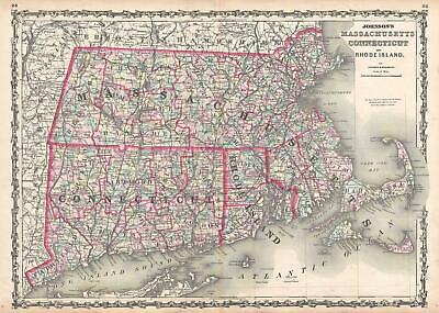
Buy It Now
$15.00 Shipping Location: Brooklyn, United States 1861 Johnson Map of Massachusetts. Connecticut and Rhode Island WE SELL ONLY ORIGINAL ANTIQUE MAPS- NOT REPRODUCTIONS Title: Johnson's Massachusetts. ... moreConnecticut, and Rhode Island. Description: This is Johnson and Browning’s 1861 map of Massachusetts. Connecticut and Rhode Island. Covers the states divided into counties with special attention to transportation, especially roads, railroads, and canals. Includes parts of Long Island(East Hampton and Montauk) as well as Nantucket, Cape Cod and Martha’s Vineyard. Features the ribbon style border common to Johnson’s atlas work from 1860 to 1862. Steel plate engraving prepared by A. J. Johnson for publication as plates no. 25 and 25 in the 1861 edition of his New Illustrated Atlas… This is the last edition of the Johnson’s Atlas to bear the Johnson& Browning imprint. Size: Printed area measures 17.5 inches high by 24 inches wide. Condition: Very good condition. Original centerfold. Minor toning. Blank on verso. Shipping: Due to recent increases in United States Postal Service rates we have been forced to increase our shipping rates. Shipping rates are not negotiable. Items are shipped within three business days of receiving payment. We are happy to consolidate shipping where possible. The following shipping options are available: 1. USPS Domestic Express Mail(35 USD) USA Only. 2. USPS Priority Mail(15 USD) USA Only. 3. USPS International Express(35 to 55 USD) Recommended service for all international parcels. You will be invoiced at the lowest Express Mail rate possible. 4. USPS Priority Mail(35 USD) Available to only certain countries. Due to high instances of loss. This service is specifically NOT AVAILABLE to MAINLAND CHINA or INDIA. 5. Federal Express is available upon request. This is the only service option available to India and Africa. Price is quoted upon request following the auction. We can also use your Federal Express Account. Insurance: All shipments are insured privately against loss and damage. All of our shipments require a signature. If yo
Buy It Now
$9.99 Shipping Location: Canaan, United States Condition: Good antique condition with light paper discoloration. Good Luck!
Buy It Now
Free Shipping Location: Hampton, United States Hand-Colored Antique Map An original antique map from an 1870 Atlas of Worcester Country. Massachusetts, from actual surveys by and under the direction ... moreof F. W. Beers, assisted by Geo. P. Sanford and Others. Published by F. W. Beers& Co. 1870. Louis E. Neuman, Engraver. Chas. Hart, Lithographer. Size: 15 1/2" x 12 3/4. Hand-colored. A detailed map. Showing building placement and building owners' names. Condition: Roughness along edge from atlas binding. 5 small holes in the margin from the binding stitching. Lightly yellowed, small finger print in left margin, tiny corner crease at upper-right. Faint rippling in margins. In very good condition. Clean. Colors bright. Guaranteed original from 1870. A nice antique map that will look great framed!
Buy It Now
$4.50 Shipping Location: Slingerlands, United States This is a USGS map of the Barnstable Quadrangle, 1893 edition, printed 1913. Note that the map is a scale of 1:62,500. A nicer copy of this map won't ... morebe found.
Buy It Now
Free Shipping Location: Monroeville, United States Date - 1898. Condition - Very Nice.
Buy It Now
Free Shipping Location: San Antonio, United States 1861 Johnson Atlas Hand Colored Print of WORLD MOUNTAINS* Original Antique! This beautiful map is from the famous Johnson Family Atlas with original hand ... morecoloring. Johnson was one of the two premium American map publishers of the era from 1860 to 1885. They are renown for their Civil War era maps. This is an original antique. NOT a reproduction and guaranteed to be over 150 years old. Size: Sheet size of print is 18" x 26" or 46cm x 66cm. Please click on my"ME" page to learn more about us. Looking for additional quality items? Check out our other auctions for more that we have listed on eBay! Powered by The free listing tool. List your items fast and easy and manage your active items.

Buy It Now
$19.10 Shipping Location: Lorain, United States 1863 JOHNSON MASSACHUSETTS CONNECTICUT RHODE ISLAND MAP Hand Colored No Reserve. Call us at 615-983-6460 for more information Item Description: Johnson's ... moreMassachusetts. Connecticut, and Rhode Island(by Johnson and Ward) hand colored map. Culled from Johnson's New Illustrated Family Atlas from 1863. Measures 26.75 x 18 inches(unfolded) Edge wear and toning. A few small stains. Good condition. Shipping Policy: RETURN POLICY: We ship everyday domestic and international via USPS or UPS. Most items are packaged in a box with bubble wrap and other packing materials for maximum protection. Please feel free to contact us with any questions or prefer to use a different carrier. We can accommodate your special needs! We do offer combined shipping on items. If you are bidding on multiple items. Contact us so we know that is what you want to do. If after you have received your item you desire to return it. Please contact a member of our staff via phone, email, or eBay message IMMEDIATELY. We request after you contact us that you return the item within 14 days. We will issue the refund by method of payment or by PayPal. We will provide you with the information needed to process the return and send it back to us via UPS to ensure it is returned to us as quickly and safely as possible. WE ACCEPT PAYPAL AND ALL MAJOR CREDIT CARDS DIRECT! As with all of our items. We stand behind what we sell. We would like to take a moment to remind you that an eBay auction is a buying experience and not a"buy, use and return" experience. Please ask questions before you bid if you have them. Please bid based upon what is actually DESCRIBED and SHOWN in our photographs. All items are sold"AS IS" unless you find our written description and/or photos do not match what you purchased. inkfrog terapeak. I000000. InkFrog Analytics.
Buy It Now
$4.99 Shipping Location: Fairview, United States It is fromWarren's Common- School Geography, published in Philadelphia by Cowperthwait & Co., 1882, a copy of the title page is included. An Authentic ... moreAntique Map: Not a Modern Reproduction! Condition: It is in Good to Very Good condition for its age with overall light tonal ageing and darkening around the edges.
Buy It Now
$4.15 Shipping Location: Saco, United States Up for Sale is a Beautiful Multi State Map with Colored Counties.This Single Sheet Double Page Map was Extracted by Myself from an 1867 A. J. Johnson's ... moreFamily Atlas. The Outer Edge or the Map will have Browning, Smudges and/or Stains.
Buy It Now
$4.95 Shipping Location: West Newfield, United States The Topo map is an original and has no stains or tears.
Buy It Now
Free Shipping Location: New Bedford, United States
Buy It Now
$3.75 Shipping Location: United States The size of the map is 11" by 14". FREE scheduling, supersized images.
Buy It Now
Free Shipping Location: Hampton, United States Munroe & Rowe, Massachusetts. An original antique map from an 1871 Atlas of Franklin Country, Massachusetts, from actual surveys by and under the direction ... moreof F. W. Beers, assisted by Geo. P. Sanford and Others.
Buy It Now
$4.99 Shipping Location: Fairview, United States Atlas of the State of Maine by J.H. Stuart & Co., South Paris, Maine, 1900. A copy of the title page is included for authenticity. There is text or a ... moresimilar map on reverse, printed on thick paper.
Buy It Now
$4.99 Shipping Location: Fairview, United States Atlas of the State of Maine by J.H. Stuart & Co., South Paris, Maine, 1900. A copy of the title page is included for authenticity. There is text or a ... moresimilar map on reverse, printed on thick paper.
|
|
|
In
|