-
Christian Collectibles
-
Christian Sheet Music
-
Vatican Stamps
-
Vatican Coins & Paper Money
-
Antiques
-
Antiquities
-
Architectural & Garden
-
Decorative Arts
-
Ethnographic
-
Furniture
-
Maps, Atlases & Globes
-
United States (Pre-1900)
-
AK, HI
-
AL, FL, GA, MS, NC, SC
-
AR, IA, KS, LA, MO, NE
-
AZ, CA, CO, NM, NV, UT
-
CT, MA, ME, NH, RI, VT
-
DC, DE, MD, NJ, NY, PA
-
ID, OR, WA
-
IL, IN, MI, OH, WI
-
MN, MT, ND, SD, WY
-
OK, TX
-
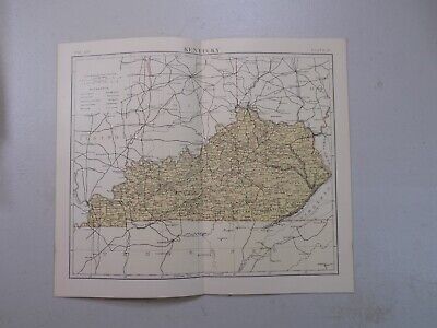
VA, WV, KY, TN
-
Entire US
-
United States (1900-Now)
-
United States (Date Unknown)
-
Africa
-
Asia
-
Australasia/ Oceania
-
Canada
-
Central America/ Caribbean
-
Europe
-
India
-
Ireland
-
Mexico
-
Middle East
-
North America
-
South America
-
United Kingdom
-
Maps on CD
-
World Maps
-
Globes
-
Mixed Lots
-
Reproductions
-
Price Guides & Publications
-
Other
|
In
Order by: Available to: This site contains affiliate links for which I may be compensated
|
Buy It Now
Free Shipping Location: Augusta, United States This 14 1/2" x 11" map is in VERY GOOD+ condition with light tone and soil, from a disbound Cram's atlas ©1900. "An Authentic Original Map Not A Reproduction".
Buy It Now
$4.55 Shipping Location: Oakland, United States This antique map from 1914 depicts the city of Louisville, Kentucky in stunning detail. Measuring 11x15 inches, it is a beautiful piece that would make ... morea great addition to any collection. The map showcases the city's layout, including its streets, buildings, and landmarks. It also includes some interesting historical details, making it a fascinating glimpse into the past. This map is perfect for those who are interested in the history of Louisville, Kentucky, or for collectors of antique maps or Americana. It is in excellent condition and has been well-preserved over the years. Don't miss out on the opportunity to own this unique piece of history!
Buy It Now
Free Shipping Location: Augusta, United States This 14 1/2" x 11" map is in VERY GOOD+ condition with very light tone, soil and edge wear, from a disbound Cram's atlas ©1892. "An Authentic Original ... moreMap Not A Reproduction".
Buy It Now
Free Shipping Location: Augusta, United States This 14 1/2" x 11" map is in FINE condition with very light soil and edge wear, from a disbound Cram's atlas ©1892. "An Authentic Original Map Not A Reproduction".
Buy It Now
$3.85 Shipping Location: Franklin, United States This vintage 1956 map of Kentucky, measuring 30x15 inches, is an original piece from the US Department of Interior. Featuring geological details, this ... moresheet map is a great addition to any antique map collection. The map showcases the state of Kentucky in the United States of America, and is perfect for those interested in history and geography. Whether you're a collector or simply looking to decorate your home, this rare find is a must-have.
Buy It Now
$5.00 Shipping Location: League City, United States This map has been carefully removed from the atlas it originally appeared in and is perfect for display purposes. It may have writing or other images ... moreon the reverse side of it. It is in very good condition for its age with overall tonal aging and yellowing on the edges.
Buy It Now
$3.85 Shipping Location: Nashville, United States
$7.00 Shipping Location: North Wales, United States 1849 SMITH'S GEOGRAPHY ATLAS MAP-KENTUCKY, TENNESSEE-UNITED STATES-HAND COLORED ORIGINAL ANTIQUE ATLAS MAP PLEASE SEE PHOTOS AS PART OF THE DESCRIPTION ... moreCONDITION: MAP IS IN GOOD CONDITION. SIZE: APPROXIMATELY 14" X 21" SHIPPING: U.S. FIRST CLASS RATE - $7.00 - ANY ITEM WHICH SELLS FOR OVER $100 WILL REQUIRE INSURANCE WE COMBINE SHIPPING FOR MULTIPLE WINS. THANK YOU FOR YOUR INTEREST IN OUR AUCTIONS!.
Buy It Now
Free Shipping Location: Willow Grove, United States This is a KENTUCKY map taken from a 1920s atlas that indicates the Interurban Electric Railway Lines in red. O n the reverse side of this map page is ... morea similar map of Tennessee. (different orientation).
Free Shipping Location: Schertz, United States This authentic Mitchell Atlas map from 1887 features the US states of Kentucky and Tennessee. The antique original map is over 130 years old and has a ... moredouble-page size of 15x23. The hand-tinted highlights add to the map's visual appeal. The cartographer/publisher of the map is M. Bradley and S. A. Mitchell. The map comes with free S&H within the USA, while the S&H worldwide is calculated. Please note that the book cover shown in the image is only for reference purposes.
Buy It Now
$6.95 Shipping Location: Dover, United States Original mid- 19th century wax engraved (cerographic) gazetteer map with lovely hand color. Text on reverse as always, the only way to own this map. A ... moresuperior visual example of a map rarely encountered with such pleasing hand color.
Buy It Now
$4.95 Shipping Location: Willow Grove, United States
Buy It Now
$5.95 Shipping Condition: New Location: Las Vegas, United States “Vibrant and bright! Pic does not do it justice.looks amazing!”. Each of our prints are custom reproductions printed on 68lb Heavyweight Enhanced Matte ... moreArt Paper. These Historic Art Prints are suitable for framing, mounting or direct display on any wall!
Buy It Now
$46.45 Shipping Location: Vero Beach, United States Slight damage One corner is torn completely off and there are 2 small tears in the edging not affecting the original art Original 1838 Antique Map KENTUCKY ... moreAlBy Bradford Authenticity. Guaranteedcertificate of AuthenticityPrice is reflecting damage 22 inches x 19 inches
Buy It Now
Free Shipping Location: Augusta, United States This 14 1/2" x 11" map is in VERY GOOD condition with light tone, soil, and edge wear, from a disbound Cram's atlas ©1891. "An Authentic Original Map ... moreNot A Reproduction".
Buy It Now
$6.00 Shipping Location: Carefree, United States 1875 LARGE ANTIQUE COLOR MAP OFOHIO, KENTUCKY, TENNESSEE, VIRGINIA, WEST VIRGINIA, NORTH CAROLINA, MARYLAND, DELAWARE, INDIANA AND ILLINOIS. ALSO SHOWN ... moreARE MOUNTAIN RANGES AND CAPITALS FOR EACH STATE.
Buy It Now
Free Shipping Location: Schertz, United States This Map was removed from an 1857 COLTON ATLAS and is in good acceptable condition. The map is not " new " or in " new " condition, it was printed in ... more1857. The map is dated. Study the photos carefully, this is the actual map you will receive.
Buy It Now
$6.00 Shipping Location: North Wales, United States 18 ANTIQUE CRAM ATLAS MAP OF KENTUCKY-UNITED STATES-EXCELLENT DETAIL ORIGINAL ANTIQUE ATLAS MAP PLEASE SEE PHOTOS AS PART OF THE DESCRIPTION CONDITION: ... moreMAP IS IN GOOD CONDITION. SIZE: APPROXIMATELY 14" X 21" SHIPPING: U.S. FIRST CLASS RATE - $7.00 - ANY ITEM WHICH SELLS FOR OVER $100 WILL REQUIRE INSURANCE WE COMBINE SHIPPING FOR MULTIPLE WINS. THANK YOU FOR YOUR INTEREST IN OUR AUCTIONS!.
$25.00 Shipping Location: Perugia, Italy Covers the state of Ohio in its entirety along with parts of neighboring Indiana, Kentucky and Virginia. This map was originally published in 1833 by ... moreBaldwin and Cradock in S.D.U.K. Atlas. It was engraved by John Walker of J. and C. Walker.
Buy It Now
Free Shipping Location: Sayville, United States
Free Shipping Location: Schertz, United States The map is not " new " or in " new " condition, it was printed in 1892. The map is not dated. Study the photos carefully, this is the actual map you will ... morereceive. The page is approx. 17" x 25".
Buy It Now
$4.55 Shipping Location: Oakland, United States This antique map of Kentucky from 1923 is a true gem for collectors and lovers of vintage maps. Measuring 9x6 inches, it features intricate details of ... morethe state's geography, including cities, rivers, and mountains. The map is in excellent shape and has been well-preserved over the years.Whether you're a history buff, a cartography enthusiast, or simply looking for a unique piece of decor, this antique map is sure to impress. It makes a great addition to any collection, and its compact size makes it easy to display on a desk, shelf, or wall. Get your hands on this beautiful piece of Kentucky history today.
Buy It Now
$4.55 Shipping Location: Oakland, United States This antique map from 1908 showcases the beautiful state of Kentucky. The intricate detail and historical value make it a must-have for any map collector ... moreor Kentucky enthusiast. The map measures 6x8 and is in excellent condition for its age, with no notable flaws or damage. Featuring counties, cities, and railroads, this antique map is a unique piece of history that captures the spirit of Kentucky in the early 1900s. It would make a great addition to any home, office, or collection. Don't miss out on the opportunity to own this rare piece of Kentucky's past.
Buy It Now
Free Shipping Location: Willow Grove, United States This is an ORIGINAL Louisville (Kentucky) and vicinity map taken from a 1927 atlas. There is text on the reverse side of this map page that does not relate ... moreto this map.
Buy It Now
$6.00 Shipping Location: Monroe, United States ORIGINAL ANTIQUE 1953 COLOR MAP OF THE STATE OFNORTH CAROLINA. MAP HAS SCALE BELOW TITLE. SOURCE/REMOVED FROM- 1953 INTERNATIONAL STANDARD ATLAS OF THE ... moreWORLD. LAST PICTURE IS THE TITLE PAGE FROM WHICH THE MAP WAS REMOVED.
19h 40m 13s 0 bids
$60.00 Now
$15.56 Shipping Location: Nashville, United States Map features an incredible amount of detail, from cities, highways, and mountain ranges, to valleys, rivers, and small towns.
Buy It Now
$6.00 Shipping Location: Monroe, United States RARE ORIGINAL 1853 ANTIQUE COLOR MAP OF OHIO, KENTUCKY, TENNESSEE AND INDIANA. RARE ORIGINAL 1853 ANTIQUE COLOR MAP OF OHIO, KENTUCKY, TENNESSEE AND INDIANA. ... moreDATED 1853 AT BOTTOM LEFT CORNER.
Buy It Now
$6.00 Shipping Location: Corunna, United States This map is from Mitchell's New General Atlas published in Philadelphia 1864. This is an original 160 year old map, not a copy or reprint.
Buy It Now
$5.00 Shipping Location: Nashville, United States Up for sale is an original antique 1888 map of KENTUCKY. Removed from an antique 1888 Alden’s Atlas.
Buy It Now
Free Shipping Location: Augusta, United States "An Authentic Original Map Not A Reproduction".
Buy It Now
Free Shipping Location: Santa Fe, United States PARTS OF MISSOURI, ILLINOIS, KENTUCKY, TENNESSE, ALABAMA, MISSISSIPPI AND ARKANSAS. Image:12 ½ x 14”. Published under the Superintendence of the Society ... morefor the.
Buy It Now
$5.12 Shipping Location: Mount Washington, United States Dimensions : Approximately 34 x 34 Binding: paper Dust Cover?: no Price Clipped?: na Dust Cover Condition: na Condition Interior: Condition Exterior: ... morevery good Ex Library: no Writing in Book: Number of pages: 1 No Reasonable Offer Refused SKU: 1535.
Free Shipping Location: Schertz, United States This authentic atlas map from 1892 measuring 14x21 inches. Created by cartographer George Cram and published during the late 19th century, this antique ... moreoriginal is a unique piece of history. The map is not *new* or in *new* condition, it was printed in 1892. View photo for best description. The map showcases the boundaries, cities, and topography of the region, providing a glimpse into the past. Ideal for collectors of North America maps or antique maps, this piece would make a great addition to any collection. Its format as an atlas map allows for easy referencing and studying of the territory. Free USA shipping and handling are included in the purchase of this item.
Free Shipping Location: Schertz, United States This Map was removed from a 1892 Popular Atlas and is in good acceptable condition. The map is not " new " or in " new " condition, it was printed in ... more1892. The map is not dated. Study the photos carefully, this is the actual map you will receive.
Buy It Now
$4.00 Shipping Location: Harborton, United States This is an antique Louisville map which was carefully removed from an atlas published in 1921.
$6.00 Shipping Location: Corunna, United States This is a beautiful map with very nice detail.Map is hand colored and is dated 1865. This is an original 156 year old map, not a copy or reprint.
$7.00 Shipping Location: North Wales, United States 1874 MITCHELL'S NEW GEOGRAPHY MAP-OHIO, MICHIGAN, INDIANA, KENTUCKY-HAND COLORED ORIGINAL ANTIQUE ATLAS MAP PLEASE SEE PHOTOS AS PART OF THE DESCRIPTION ... moreCONDITION: MAP IS IN GOOD CONDITION. SIZE: APPROXIMATELY 14" X 21" SHIPPING: U.S. FIRST CLASS RATE - $7.00 - ANY ITEM WHICH SELLS FOR OVER $100 WILL REQUIRE INSURANCE WE COMBINE SHIPPING FOR MULTIPLE WINS. THANK YOU FOR YOUR INTEREST IN OUR AUCTIONS!.
Buy It Now
$4.95 Shipping Location: Alfred, United States 12" x 15". Good condition.
Buy It Now
$7.00 Shipping Location: Rockville, United States Up for sale is a great, original, hand-colored, ANTIQUE MAP from MITCHELL'S NEW GENERAL ATLAS - 1880. Published by S. Augustus Mitchell, Philadelphia: ... more1880. TITLE: COUNTY MAP OF KENTUCKY AND TENNESSEE.
Buy It Now
$5.95 Shipping Condition: New Location: Las Vegas, United States Lexington 1871. Year: 1871. Lexington, Kentucky. Bowling Green 1871. Frankfurt 1871. These Historic Art Prints are suitable for framing, mounting or direct ... moredisplay on any wall! “Vibrant and bright! Pic does not do it justice.looks amazing!”.
Free Shipping Location: Schertz, United States This antique map from Adam & Charles Black's Atlas depicts the border of Tennessee and Kentucky from 1884. The colors on the map are original and vibrant, ... moremaking it a beautiful addition to any collection. The map measures 13x17 inches and is in its authentic, original state. It is perfect for any enthusiast of North American cartography.
Buy It Now
Free Shipping Location: Augusta, United States This 14 1/2" x 11" map is in GOOD condition with light tone and soil, from a disbound Cram's atlas ©1902. "An Authentic Original Map Not A Reproduction".
Free Shipping Location: Schertz, United States This Map was removed from a 1932 Pictorial Atlas and is in good acceptable condition. The map is not " new " or in " new " condition, it was printed in ... more1932. The map is not dated. Study the photos carefully, this is the actual map you will receive.
Buy It Now
Free Shipping Location: Augusta, United States This 14 1/2" x 11" map is in VERY GOOD condition with light tone, soil, and edge wear, from a disbound Cram's atlas ©1891. "An Authentic Original Map ... moreNot A Reproduction".
Buy It Now
$4.55 Shipping Location: Oakland, United States This antique map from Rand McNally & Co. is a beautiful piece of history, depicting the states of Tennessee and Kentucky in 1904. The intricate details ... moreand accuracy of the cartography are impressive, making it a valuable addition to any antique map collection. The map measures 7x6 inches and is in excellent condition, with no tears or significant wear and tear. The colors are still vibrant and the lines are clear, making it easy to read and appreciate. This is a wonderful opportunity to own a piece of America's past, and it would make a great gift for any history or map enthusiast.
Buy It Now
Free Shipping Location: Schertz, United States This antique map from 1867 by A.J. Johnson features Kentucky and Tennessee and is over 150 years old. The double-page measures 18x26 inches and is an ... moreauthentic original from the post-Civil War era. The map is shipped free within the USA and worldwide shipping is calculated at checkout.
Buy It Now
$4.13 Shipping Location: Canyon, United States A.J. Johnson 1865 Map Kentucky & Tennessee (REPRINT) 24x18. Please look at the photos for description and condition. I am not an expert. I can take more ... morepictures. If you need to see something, let me know. All sales final.
Free Shipping Location: Schertz, United States This authentic McNally Atlas Map from 1884 features the states of Kentucky and Tennessee. The lithography printing technique used in its creation ensures ... morethat this antique original is both unique and of high quality. The map was published by Rand McNally & Co. and measures 15x21 inches. Free shipping and handling is available for customers within the United States, while calculated shipping and handling rates apply worldwide. This vintage map is a great addition to any collection and a must-have for avid map collectors.
Buy It Now
$4.00 Shipping Location: Harborton, United States Neat Kentucky picture map features sketches of people, vegetation, farming, animals, and more. These make fun gifts!
Buy It Now
Free Shipping Location: Monroeville, United States Date - 1883. Condition - Quite Nice, a very light blank border damp stain, not into map image. Source - Hardesty’s Historical and Geographical Encyclopedia ... moreIllustrated.
Buy It Now
Free Shipping Location: Augusta, United States This 14 1/2" x 11" map is in NEAR FINE condition with very light tone and soil, from a disbound Cram's atlas ©1900. "An Authentic Original Map Not A Reproduction".
Buy It Now
$6.00 Shipping Location: Blue Bell, United States THIS MAP IS IN GOOD CONDITION AND PUBLISHED BY MORSE. CONDITION: MAP IS IN GOOD. OVER 175 YEARS OLD! Over 100,000,000 served. MULTIPLE WINS.
Buy It Now
$4.95 Shipping Location: Willow Grove, United States This is an ORIGINAL map page showing a 1903 map of Louisville Kentucky (dated) that was revised in 1910 (dated) and taken from a 1928 atlas. There is ... moretext and small images on the reverse side of this map page which does not relate to this map image.
Buy It Now
$4.55 Shipping Location: Oakland, United States 12x10 inches This antique multicolor map from 1885 showcases the states of Michigan, Wisconsin, Illinois, Ohio, Kentucky, and Indiana. The map features ... moreintricate details of the various counties, cities, rivers, and lakes in the region. It is a great addition to any collection of antique maps and will surely be the centerpiece of any room.The map is a true testament to the craftsmanship of the cartographers of that era and is in excellent shape for a piece of its age. It will be shipped to you with the utmost care to ensure that it reaches you in the same condition as it left our warehouse. Add this beautiful piece of history to your collection today!
Buy It Now
Free Shipping Location: San Antonio, United States This Map was removed from a 1882 Atlas and is in good acceptable condition. This map is not new or in new condition, it was printed in 1882. pencil marks ... more& brittle paper from over 140+ years of aging.

Buy It Now
$5.50 Shipping Location: Easton, United States Ohio. On verso Kentucky and Tennessee Map of the Ohio. Virginia, Kentucky and Tennessee on verso. by Cram Issued 1887. Chicago, published by Henry S. ... moreStebbins In VG condition or or better. Minor soiling, trivial spotting or foxing, some pencilling on ohio pannel, well worthy of hanging for display. Sheet measures c. 11" x 21 1/2" Click Image For Larger Picture Scroll down for 2 more pictures below! We do not sell modern printings or modern reproductions. All of our maps and prints are genuine vintage or antique which will make great additions to a portfolio or look attractive on hanging on your restaurant. Store, office or home wall. Please see the photos or scans embedded in this description to inspect the individual item. To see a higher resolution version of the image. Click on the image. We do not use stock photos, these are the images of the item you will receive. As with all old paper, there will be imperfections such as foxing, age toning, staining, splits, uneven edging and possibly unrelated printing on the back side. We strive to capture these details within the photos. Should you have any questions about a print or map you are interested in, please do not hesitate to ask. Most old maps and prints were originally issued in a bound form. We do not actively“break” books and atlases for prints and maps. Especially books in the very good to fine condition where market value would deter this. Only on the rare occasion where a book is in poor condition and has lost desirability due to low shelf appeal but the contents are still in good condition and worthy of preservation. Most of our prints and maps are obtained loose from collections and in larger batches. Keep in mind. You can return the item within 14 days, hassle free. The only thing we ask is that the item is returned within the same condition it was sent. All Items are shipped in quality materials and packed with care. Smaller items are stored in archival grade bags and boards. And mailed in study stay flat mailers. Larger items are stored fl
Buy It Now
$5.95 Shipping Location: Woodstock, United States It is an antique lithograph of a political map of the eastern section of the Central States of the U.S. including Illinois, Indiana, Ohio, and Kentucky. ... moreThere is a map of the city of Cincinnati which is an inset at the bottom right hand corner and a map inset of the city of Chicago at the bottom left hand corner.
Buy It Now
Free Shipping Location: Monroeville, United States Fine Adornment of Tennessee& Kentucky History. Impressive on Any Home or Office Wall. Imaginative Gift. 1882 Map of Kentucky& Tennessee Fine Phillips& ... moreHunt Map. Engraved by E.F. Fisk. Original 1882. 131-ys-old. Map is in Very Good/Excellent condition: No marks. Writings, rips, tears, fraying, or foxing. Single fold as Issued. Not a Reproduction. Original Map Drawn& Engraved by E.F. Fisk for Phillips& Hunt's 1882 Edition of The People's Cyclopaedia of Universal Knowledge. Published by Phillips& Hunt, New York& San Francisco, and Jones Brothers& Company of Cincinnati& St. Louis; William H. Depuy, Editor. E.F. Fisk, Engraver, 1882; a copy of the Title Page of which is Included. An Exceptionally Fine Map for the Collector or Makes Quite an Impressionable Gift for Someone Living in or From Tennessee or Kentucky. I Sell Only Original Maps: No copies or reproductions. Press Here to View My Collection. Impressive On Any Home or Office Wall Dimensions: 10.5" x 13.25" Intricate Detail. Exceptional Color. Handsome Map. 1882 County Populations Listed on Reverse. Great for Family History/Genealogy as Map Shows Towns& Landmarks of 1882. Some of Which No Longer Exist Today. Fine Adornment of Kentucky& Tennessee History. The Auction is for the Map Itself. A Frame is Not Included. The Framed Map Pictured is a Personal 1882 Phillips Hunt Map Featured to Show the Beauty of the Maps when Framed. Free Shipping Special. All Credit& Debit Cards and Electronic Checks Accepted Through Paypal. Please email with any questions. Imaginative& Creative Birthday. Christmas, Graduation. Or Other Special Occasion Gift. Greetings from Historical Savannah. Georgia; founded 1733. Some. To beautify their halls, parlors, chambers, or libraries.loveth, getteth, and useth maps, charts, geographical globes. John Dee. Advisor to Elizabeth I. Press The Link Below To View My Collection. Powered by The free listing tool. List your items fast and easy and manage your active items.
Buy It Now
$6.95 Shipping Location: Dover, United States Issued 1887 Philadelphia by Bradley, successor to S.A. Mitchell. This late Mitchell map was issued by Bradley for a short period before disappearing from ... morepublication. County Map of Kentucky and Tennessee.
Buy It Now
$7.00 Shipping Location: Rockville, United States Published by Johnson and Ward, New York - 1863. Up for sale is a great, colored antique MAP - JOHNSON'S MAP OF KENTUCKY AND TENNESSEE - 1863. I would ... morebe happy to include a copy if requested.
|
|
|
In
|
2 -KENTUCKY LAKE MAPS - SOUTH AND NORTH MAP - WATERPROOF
Kentucky Lake Map North and Land Between the Lakes- Kentucky Dam to Mile 82. Kentucky Lake Map South- River Mile 82 to Pickwick Dam. These maps have GPS Coordinates for Underwater Structure. These are waterproof maps. Buyer to pay First Class Rate of $3.00. Thanks for looking. Bid Early. Bid Often.
|
|
|
1897 DATED ANTIQUE MAP OF KENTUCKY / RAILROADS / BATTLES
Antique. Color, 1902 New York Century Company Atlas map of KENTUCKY THE MAP SHOWS: PRINCIPAL RAILROADS IN RED, ALONG WITH MUCH MORE. THESE ARE MY BEST SELLING MAPS BECAUSE THEY ARE THE MOST DETAILED OF ALL THE MAPS I SELL) THIS IS TRULY AN EXTRAORDINARILY DETAILED MAP. MAP IS COPYRIGHT DATED 1902. COLORS ARE BEAUTIFUL! Map image is 10.5 X 15 inches with a border making it PERFECT FOR FRAMING. The map image is in GREAT CONDITION. Image is very CLEAR. Legible, and COLORFUL. I SHIP MAPS FLAT AND PROTECTED. Will ship worldwide. I ALWAYS LEAVE FEEDBACK. BID WITH CONFIDENCE! GREAT FOR GIFT OR SCHOOL PROJECT I COMBINE MULTIPLE AUCTIONS TO SAVE SHIPPING COSTS. I ship daily and always give feedbacks. BID WITH CONFIDENCE! PLEASE CHECK OUT MY FEEDBACKS VERY NICE MAPS- I DO NOT POST REPRODUCTIONS. Powered by
|
|
|
ANTIQUE 1833 MAP NORTH AMERICA OHIO WITH PARTS OF KENTUCKY AND VIRGINIA
Original Antique Map 1833 North America Ohio. With Parts of Kentucky and Virginia Hand Coloured Published by Baldwin& Cradock 1 May 1833 Engraved by J& C Walker Condition: corner and edging rub. Paper aged Size: ca 40 x 34 cm If you have any questions please do not hesitate to contact me Will be posted in protective packaging All items are covered for up to £46.00 anything selling above this will have insured and signed for added to the invoice. In this instance please wait for the invoice. Please note that the buyer is responsible for any customs charges incurred. Please note should you not be entirely satisfied I will give a full refund once the item is returned in it's original condition and having been checked for my security markings. I cannot give partial refunds.
|
|
|
1835 Thomas Bradford Atlas Map Kentucky Very Rare
You are bidding on a very extremely rare and 100% authentic antique hand colored map of the above cartographer/map maker. Region, and year. I am a very close friend of eBay seller DIVEL3. My antique maps and reputation are 100% fully endorsed and I am recommended by DIVEL3. So bid with absolute 100% confidence and assurance on this item. Please contact and send a message to DIVEL3 and he will confirm this. I sell only original antique maps. This is NOT a copy or reproduction and is an original antique map from the year shown. General Description: The atlas that this map is from is extremely rare and hard to find because there are not too many left. A complete 1835 Bradford Comprehensive Atlas edition can sell upwards for $7.000! The outline handcoloring that you see is all original and is how it was issued in the atlas. The border is a sage ... moregreen wash as originally issued as well. This is a stunning and very detailed map which is hand colored in wonderfully intense colors. Political boundaries as well as individual regions/counties and shows towns. Roads, railways, rivers, lakes, bays, harbors, islands and other important places are shown. The map is in great condition considering the age of the map. The overall size of the map sheet is large at approximately 11 inches by 9 inches. The map is far more beautiful than my pictures show. This map will look wonderful when matted and framed and will be a great addition to your collection. The map is a 100% original and genuine antique map created and printed in the year shown. Payment Terms: US bidders: Terms: PayPal is accepted. Payment is expected within 7 days of the end of the auction. I ship a couple of times per week. All sales are final so bid carefully and ask any questions prior to the end of the auction. I ship these rolled and in strong reinforced heavy tubes. Buyer will pay shipping and handling charges of $8.00 for the US. Insurance starts at $5.00. I will combine the shipping charges if you win more than one item. International bidders: Terms: PayPal
|
|
|
1871 ANTIQUE MITCHELL COUNTY MAP: TENNESSEE & KENTUCKY
Click to Enlarge Click to Enlarge 1871 ORIGINAL. ANTIQUE MITCHELL MAP. ENGRAVED. COUNTY MAP OF TENNESSEE& KENTUCKY. DRAWN AND ENGRAVED BY W.H. GAMBLE OF PHILADELPHIA. BEAUTIFUL MAP FROM MITCHELL'S NEW GENERAL ATLAS. QUITE DETAILED. SHOWING CITIES AND TOWNS AND RAILROAD LINES, AS WELL AS GEOGRAPHIC FEATURES. MAP WRAPPED IN A"GRAPE-VINE" BORDER, WITH PLENTY OF MARGIN SPACE FOR MATTING AND MOUNTING WHEN FRAMED. Size: Approx 12.25 X 15.25 INCHES. INCLUDING MARGINS. TEXT AT LOWER MARGIN: ENTERED ACCORDING TO ACT OF CONGRESS IN THE YEAR 1870 BY S. AUGUSTUS MITCHELL IN THE CLERK'S OFFICE OF THE DISTRICT COURT FOR THE EASTERN DISTRICT OF PENNSYLVANIA. Condition: VERY GOOD. SEE PHOTO. SINCE THIS MAP IS OVER 139 YEARS OLD. IT IS NORMAL FOR IT TO EXHIBIT SOME FLAWS AS COMMENSURATE WITH AGE: SOME TANNING OF EDGES(MARGINS) A FEW ... moreFOX SPOTS CAN ALSO BE SEEN IN MARGINS. AMPLE MARGINS FOR MATTING& MOUNTING. LOVELY& AUTHENTIC PIECE OF HISTORY. Please view the photo to make your own assessment. Returns: Any item may be returned for a refund. Please contact us within 7 days of receipt of your item if you feel an error has been made. We combine shipping. Additional items in the same order are shipped free of charge. We do not deal in modern reproductions. All of our prints& maps are original and authentic. Please browse other prints at our store. Visit My eBay Store inkfrog terapeak. I000000.
|
|
|
Louisville Kentucky Street Map: Authentic 1887; Stations, Landmarks & more
1887 Large Color Map City Plan of Louisville. Kentucky This is a 120+ Year-Old Map- NOT a Reproduction(Scan from Atlas Copyright Page below) Printed on a single sheet with NO fold. Bordered area is about 9.75" x 13" with margins sufficient to allow easy framing. A laser-printed facsimile of the copyright information as it appears in the atlas from which this original map was removed will be included. On a peel-off. Self-adhesive sheet. Purchasers who frame their maps frequently affix that copyright statement to the back of the frame. This color map of Louisville. Kentucky was taken from a Cram Atlas published in 1887. Very detailed city plan with streets identified. The close-up below is included to exhibit the detail and quality of the map. The close-up below is included to give an example of the detail and quality of this map. ... moreThe map is printed on medium weight paper. And is in very good condition-as shown. Bid with confidence- Returnable for any reason within 10 days for prompt refund. Powered by The free listing tool. List your items fast and easy and manage your active items.
|
|
|
Civil War Map - Tennessee Nashville Knoxville Louisville Lexington Kentucky
Lake Erie Maps& Prints An Original Antique Map: Not a Reproduction! Plate CL Atlas to Accompany the Official Records of the Union and Confederate Armies Currently Listing Many Civil War Maps and Prints Check out my! Description: It is an original general topographical map of the region of Central Kenutcky and Tennessee including Nashville and Knoxville. It is from the Atlas to Accompany the Official Records of the Union and Confederate Armies. Published by the Secretary of War, Washington: Government Printing Office, 1891-1895) undoubtedly the most complete set of accurate maps of the Civil War ever published. The title of the atlas appears in the top left margin and plate number in the upper right. A copy of the title page is included with all the publishing details for authenticity. The atlas was published in a very limited context ... moreto be distributed to government officials in the three houses of government as a reference for assessing the Civil War. This is from the original first publishing, that lasted from 1891-5. Size: The map image measures 16 by 27 inches on a page measuring approximately 18 by 29 inches with plenty of margin all around for framing. It is a full double page sheet with a centerfold as issued. Condition: The map is in Very Good condition with overall light tonal aging. Blank on the revers, printed on heavy pliable paper. The map is very clean with only some minor darkening along the edge, hardly worth mentioning. Overall a very nice map that would frame up nicely. Pics are of the actual map. Payment Details: We accept most major credit cards through Paypal and Ebay. Please ask if you have any questions about payment. International and New Bidders are welcomed and encouraged. Payment is expected within 7 days. After which Nonpaying Bidders will be reported to Ebay to recoup our listing fees. Shipping: $2.90 for First Class or $4.95 for Priority Mail with Delivery Confirmation in the USA; $4.95 for First Class International to Canada; $8 for International Airmail elsewhere in the World
|
|
|
1897 DOUBLE PAGE MAP, KENTUCKY, CENTURY ATLAS, COLOR, GOOD DETAIL, MARGINS
This very attractive double page map sheet of KENTUCKY is from the 1899 printing of The Century Atlas of the World. The map itself is dated 1897. The atlas was"Prepared under the superintendence of Benjamin E. Smith. A.M. and published by The Century Company, New York. The highly prized maps in this atlas were engraved by The Matthews-Northrup Company of Buffalo, NY. The maps from The Century Atlas are acknowledged to be among the finest of the late 19th century. Displaying plenty of sharp detail. Attractive colors, and good margins for framing. The page is about 12 1/2 by 17 inches in size. The reverse is blank. The page has a vertical center fold. As published. Condition is very good with slight age toning at the edges and very minor damp staining at a couple of corners that intrudes less than 1/4 inch into the blank margin. Well away ... morefrom the engraved area of the map. High bidder to pay $3.50 toward shipping. International would be additional. I package carefully and am happy to combine shipments whenever possible to reduce your costs. Authenticity and buyer satisfaction always guaranteed. Check out my!
|
|
|
1886 Kentucky & Tennessee Antique Atlas Map^ 126 years old!
1886 Kentucky and Tennessee Original Atlas Map. 126 years-old! Description. Gorgeous. Original 188 6 Kentucky& Tennessee Antique Atlas map. A Section of Ea stern Pennsylvania map is on the back. This is an ORIGINAL.NOT A REPRINT. 12 6 + year-old undated atlas map.The total size of the entire map measures 13 1/2" x 10 1/2" with the borders. The map includes area and population for each state; It shows towns and cities. Railroads, rivers and other Geographic features, etc. Great, Historic Item. NOTE: This map doesn't show roads. NOTE CONDITION: The map has some lite border and corner wear. Otherwise. It is in Nice Condition and will look wonderful matted and framed(These old maps make great gifts) Please see the attached photo to view the Map. And a couple of closeup sections of the map plus a section of the Conneticut index. ... morePlease note that the map is too large for my scanner.There is a border all the way around the map.Also. The map is much clearer than the scan illustrates. The printing is small but very clear and readable* Minimum bid for this 12 6 year-old map starts at only $1 4.95 or purchase it for only $1 6.95. U.S. Buyer pays $3.00 for shipping. $4.00 shipping to Canada; $6.00 to Europe. 1-4 maps can be combined to save on shipping. Maps are shipped in sturdy mailing tubes. Please Note: This is an original 188 6 undated atlas map. For the winning bidder. I will enclose a copy of the dated 188 6 copyright page to keep with their map. If you would like a copy of the original index for this map which includes towns and cities with respective populations for many of them.Please email me for the price.Probably $2-5.00. This depends on the# of pages.ie. Connecticut is less than one page and would be $1.00.Pennsylvania is several pages. Please see a scan of a section of the Connecticut index as an example If you have any questions about this map or any of my items. Please email me before bidding. Thanks! 120 8 12 KentTenn 86. 1( P) Please visit my Ebay store
|
|
|
1866 Johnson Map of Kentucky and Tennessee
1866 Johnson Map of Kentucky and Tennessee WE SELL ONLY ORIGINAL ANTIQUE MAPS- NOT REPRODUCTIONS Title: Johnson's Kentucky and Tennessee. Description: A beautiful example of A. J. Johnson’s 1866 map of Kentucky and Tennessee. Represents Johnson's third iteration of this map. Which he updated in 1865 to reflect changes to these secessionist states following the American Civil War. Map shows both states in full with color coding according to county. Inset views of the Nashville State House and the Entrance to Mammoth Cave decorate the map in the upper left and lower right quadrants, respectively. Features the fretwork style border common to Johnson’s atlas work from 1863 to 1869. Published by A. J. Johnson and Ward as page numbers 48-49 in the 1866 edition of Johnson’s New Illustrated Family Atlas. This is the last edition of the Johnson ... moreAtlas to bear the Johnson and Ward" imprint. Size: Printed area measures 17.5 inches high by 23.5 inches wide. Condition: Very good condition. Original centerfold. Text on verso. Shipping: Items are shipped within three business days of receiving payment. We are happy to consolidate shipping where possible. The following shipping options are available: 1. USPS Domestic Express Mail(25 USD) USA Only. 2. USPS Priority Mail(12 USD) USA Only. 3. USPS International Express(35 to 55 USD) Recommended service for all international parcels. 4. USPS Priority Mail(25 USD) Available to only certain countries. Due to high instances of loss. This service is specifically NOT AVAILABLE to MAINLAND CHINA or INDIA. 5. Federal Express is available upon request. This is the only service option available to India and Africa. Price is quoted upon request following the auction. We can also use your Federal Express Account. Insurance: All shipments are insured privately against loss and damage. All of our shipments require a signature. If you have any questions please feel free to email us through eBay or contact us by telephone at 646-320-8650. Additional Services Conservation Framing Servic
|
|
|
1887 Bradley Map of Kentucky and Tennessee
1887 Bradley Map of Kentucky and Tennessee WE SELL ONLY ORIGINAL ANTIQUE MAPS- NOT REPRODUCTIONS Title: County Map of Kentucky and Tennessee. Description: A fine example of William M. Bradley's 1887 map of Kentucky and Tennessee. The map covers both states in fine detail along with parts of neighboring Missouri. Illinois, Ohio, Virginia. Bradley also delineates survey grids west of the Tennessee River, referencing the work of the U.S. Land Survey. Also noted are various cities, towns, rivers, railroads, settlements and an assortment of additional topographical details. Map is color coded according to territorial and political boundaries with elevation rendered by hachure. Copyrighted 1887 by Wm. M. Bradley& Bro. as plate nos. 50 and 51 in the 1890 edition of Mitchell's New General Atlas. Size: Printed area measures 15 inches high ... moreby 23 inches wide. Condition: Very good. Blank on verso. Original centerfold. Small verso repair along centerfold. Shipping: Items are shipped within three business days of receiving payment. We are happy to consolidate shipping where possible. The following shipping options are available: 1. USPS Domestic Express Mail(25 USD) USA Only. 2. USPS Priority Mail(12 USD) USA Only. 3. USPS International Express(35 to 55 USD) Recommended service for all international parcels. 4. USPS Priority Mail(25 USD) Available to only certain countries. Due to high instances of loss. This service is specifically NOT AVAILABLE to MAINLAND CHINA or INDIA. 5. Federal Express is available upon request. This is the only service option available to India and Africa. Price is quoted upon request following the auction. We can also use your Federal Express Account. Insurance: All shipments are insured privately against loss and damage. All of our shipments require a signature. If you have any questions please feel free to email us through eBay or contact us by telephone at 646-320-8650. Additional Services Conservation Framing Services: Geographicus recommends basic conservation framing services for an
|
|
|
Original 1872 Antique LOUISVILLE Kentucky KY Engraved Panoramic View Map
Fine Adornment of Louisville History. Impressive on Any Home or Office Wall. Creative& Imaginative Gift. 1872 Steel Engraved Panoramic View Map City of Louisville Drawn by A.C. Warren. E.P. Brandard Engraved. Original 1872. 141-ys-old. Steel Engraving is in Good/Very Good condition: No writings. Tears, or fraying. Mild foxing. Not a Reproduction. Original E.P. Brandard Steel Engraving for the 1872 Edition of The Picturesque America. Drawn by A.C. Warren, and Published by D. Appleton& Co. New York, 1872; a copy of the Title Page of which is Included. Fine Engraved Detail. Exceptional for the Collector or Makes Quite An Impressionable Gift for Someone Living in or From Louisville. I Sell Only Original Antique Maps: No copies or reproductions. Press Here to View My Collection. Impressive On Any Home or Office Wall Dimensions: 9.25" ... morex 12.5" Intricate Detail. Beautiful View. Fine Steel Engraving. Reads Along Bottom: Entered According to Act of Congress in the Year 1872 by D. Appleton& Company in the Office of the LIbrarian of Congress in Washington. Imaginative& Creative Gift for Someone Living in or From Louisville. The Auction is for the Map Itself. A Frame is Not Included. The Framed Map Pictured is and Example Featured to Show the Beauty of the Maps when Framed. Free Shipping Special. All Credit& Debit Cards along with Electronic Checks Accepted Through Paypal. Maps are mailed within 1-3 days of payment and normally arrive within 3-7 days. Please email with any questions. Fine Adornment of Louisville History. Greetings from Historical Savannah. Georgia; founded, 1733. Some. To beautify their libraries, chambers, parlors, studies.loveth, getteth, and useth maps, charts, geographical globes. John Dee. Advisor to Elizabeth I. Press The Link Below To View My Collection. Powered by The free listing tool. List your items fast and easy and manage your active items.
|
|
|
KENTUCKY: State map showing civil war battlefields & dates. Britannica, 1903
Kentucky Colour antique lithographic map. 1903 Title of map: Kentucky' The image below shows an enlarged cross section from the centre of the map to show the level of printed detail. This map is folding hence the centrefold line may show on the image below: The sites of important battles and their dates are marked on this map for the following conflicts: American Civil War. DATE PRINTED: 1903 IMAGE SIZE: Approx 27.5 x 39.0cm. 10.75 x 15.25 inches(Large) Please note that this is a folding map. ARTIST/CARTOGRAPHER/ENGRAVER: Unsigned PROVENANCE: Encyclopaedia Britannica" 10th edition Maps; published by Adam& Charles. Black. Edinburgh, London TYPE: Colour antique lithographic map VERSO: There is nothing printed on the reverse side. Which is plain CONDITION: Good; suitable for framing. Please check the scan for any blemishes prior ... moreto making your purchase. Virtually all antiquarian maps and prints are subject to some normal aging due to use and time which is not obtrusive unless otherwise stated. I offer a no questions asked return policy- see below. AUTHENTICITY: This is an authentic historic print. Published at the date stated above. I do not offer reproductions. It is not a modern copy. The term'original' when applied to a print means that it was printed at the first or original date of publication; it does not imply that the item is unique. Print' means any image created by applying an inked block to paper or card under pressure by any method including wood engraving, steel engraving, copperplate, wood cut and lithography. REMARKS: FRANCE: Gravures et Cartes anciennes. DEUTSCHLAND: Alte Lankarten und Stadt ansichten. ITALIA: Stampe& Mappe antiche. ESPAÑA: Mapas antiquos y impresiones antiguas. E and OE. Force Majeure. English law shall apply. RETURNS POLICY: I offer a no questions returns policy. All I ask is that you pay return shipping and mail back to me in original condition. Suitably packed& insured, within 14 days of receipt.
|
|
|
1878 Map of Kentucky and Tennessee - S Augustus Mitchell - Shrink Wrapped w/Mat
1878 Map of Kentucky and Tennessee- S Augustus Mitchell- Shrink Wrapped With Mat and Backing ~ MEASURE ~ 16" x 20" including mat which fits a standard size frame. See photos for map condition. Maps were matted and shrink wrapped when I purchased them. Shrink wrap may have some sticker glue and other imperfections. Mat board should be clean and free of defects other than along the edges that would be covered when framed. Powered by The free listing tool. List your items fast and easy and manage your active items.
|
|
|
Vintage Map 1929 Kentucky
This page measures12 1/4 x 9 1/2 inches All maps are in very good condition. Attractive, original, and suitable for framing. Please note that if this is a 2 sided page. Only one of the maps can be displayed. Buy two maps and pay shipping for just one. Buy three or more maps of this size and USA shipping is free. If you do purchase more than one map or vintage ad. Please do not pay until you receive my combined invoice that reflects your shipping discount. International buyers. Purchase as many ads or maps as you like and pay shipping for just one. Maps will be shipped flat reinforced with rigid cardboard and wrapped in plastic. Thanks for looking and happy bidding! Powered by
|
|
|
Large Antique Color 1865 Johnson's Map Kentucky & Tennessee
WELCOME TO BEANSANTIQUES We are proud to announce that we are ebay.ca's winner of the 2010 Family Business Of The Year If photos do not download for you. Please let us know and we will email them to you directly. We are offering to you a lovely antique map. This great antique map is a Johnson's of New York map titled; Kentucky& Tennessee It is about 18" x 26.5" A lovely color and would look just great in a frame. Dated 1865 In good shape with normal age wear and toning. A crease in the center, some minor stains. Published by A J Johnson on New York. A very rare old piece that will look wonderful in a frame We recently bought a collection of maps that all came out an 1870 Johnson's map book/atlas. These maps were mounted with paper hinges so they could be removed from the book. There is some of the hinge paper still ... moreattached on the back at the center fold. Has printed pages on the back. This printing does not show through the map. See our other listing to see all of these wonderful pieces. No additional shipping charges for multiple purchases. You only pay for shipping one piece no mater how many you buy and have shipped at the same time. This piece will be rolled lightly and placed in a box for shipping A great addition to your collection! Any questions please email. Check our other listings to combine shipping. We NEVER CHARGE a handling fee just actual mailing costs through Canada Post. We mail next day after payment. Why drive all over when you can get i t here! and have i t delivered to you. Please consider the photos to be part of the description. SHIPPING: We invite you to click on this link to see our shipping info and our GUARANTEE to you SHIPPING& GUARANTEE This link will also show you who we are and what we do Cost is actual mailing. WE DO NOT CHARGE A HANDLING FEE. We do professional packing on site and this is FREE to you. We as the Seller. TAKE RESPONSIBILITY FOR ANYTHING DAMAGED in transit. This is absolutely not your job. Refunds come directly from us. Please check our
|
|
|
PAN AM SOUTHERN CORPORATION 1950 ROAD MAP OF KENTUCKY TENNESSEE
PAN AM SOUTHERN CORPORATION 1950 ROAD MAP OF KENTUCKY TENNESSEE This auction is for PAN AM SOUTHERN CORPORATION 1950 ROAD MAP OF KENTUCKY TENNESSEE. The map is in very nice condition. Thanks for looking.
|
|
|
ANTIQUE MAP - CITY OF LOUISVILLE KENTUCKY 1889 DETAILED HISTORICAL BUILDINGS
Antique. Color, 1889 Atlas map of LOUISVILLE KENTUCKY. STREETS ARE NAMED. POINTS OF INTEREST INCLUDE ITEMS LISTED IN THE ITEM SPECFICS SECTION ABOVE. ALONG WITH MANY OTHERS. THIS IS A VERY NICE MAP WITH SO MUCH DETAIL! GREAT UNIQUE GIFT IDEA FOR THE PERSON WHO HAS EVERYTHING AND WOULD LOOK GREAT HANGING IN A HOME OR OFFICE. GREAT CONVERSATION PIECE! The map image is in GREAT CONDITION. Image is very CLEAR. Legible, and COLORFUL. I SHIP MAPS FLAT AND PROTECTED 5 DAYS A WEEK. I ALWAYS LEAVE FEEDBACK. BUY WITH CONFIDENCE! SEE MY FEEDBACKS! THIS MAP IS WAS PRINTED IN 1889. GREAT UNIQUE GIFT IDEA FOR THE PERSON WHO HAS EVERYTHING! ALSO WOULD BE IDEAL FOR A SCHOOL PROJECT. SEE MY PROMOTIONAL SHIPPING RATES! I WILL SHIP TO MULTIPLE ADDRESSES WHICH IS IDEAL FOR GIVING GIFTS. UPON REQUEST. I WILL PUT A NICE CARD WITH THE MAP WITH THE MESSAGE YOU PROVIDE. ... moreYOU DON'T HAVE TO GO SHOPPING AND IT WILL BE DELIVERED AT THE DOOR! IT DOESN'T GET ANY EASIER THAN THAT! TAKE A LOOK AT MY OTHER MAPS! 4g3ba.RcmdId ViewItemDescV4,RlogId p4%60bo7%60jtb9%3Fuk.rp73%28%3E%3E4g3ba-13d075463a4-0xf5-
|
|
|
USA: KENTUCKY.TENNESSEE.Old map. Armstrong. 1891
THIS IS A GENUINE ANTIQUE MAP FREE SHIPPING WORLDWIDE TITLE KENTUCKY AND TENNESSEE An interesting series of attractive detailed colored maps of the United States of America. Canada& Other Countries. Numerous cities, towns and villages are shown and in some cases Indian Reservations etc. DATE PUBLISHED 1891 SIZE Approximately OVERALL: 6x4 inches. IMAGE: 4.25x2.75 inches. 11x7.5 cms. Map area only) CONDITION Good. There is text on the back. But no obtrusive show through or'bleed' 8 = NOT COMMON CERTIFICATE OF AUTHENTICITY This is a genuine original vintage item warranted to have been printed at the date stated. IT IS NOT A MODERN DAY REPRODUCTION. The Buyer may wish to print this page. RETURNS POLICY YOUR COMPLETE SATISFACTION GUARANTEED or your money back. INVENTORY Do please visit my Store for a full list of KENTUCKY items PROVENANCE ... moreTHE LITTLE GIANT ENCYCLOPAEDIA The author was K. L. Armstrong. Published by F. J. Schulte& Co of Chicago. An attractive small map. With Original Coloring(Colour) applied at the time of publication& text along side the map, outlining the State's main products, when first settled, date when admitted to the Union, Etc. PAYMENT Preferred please A part from vacations. Etc. I normally mail orders within 1 business day of payment. Virtually all historical& antiquarian items are subject to some normal aging. Which is not obtrusive, unless stated otherwise. FRANCE: Gravures et Cartes anciennes. DEUTSCHLAND: Alte Lankarten und Stadt ansichten. ITALIA: Stampe& Mappe antiche. ESPAÑA: Mapas antiquos y impresiones antiguas. EandOE. Force Majeure. English law shall apply. Many thanks for looking. My name is Julie. I've retired after a career in education in the UK. Do for many great gift ideas. Created by eBay Blackthorne ver. 3.2.146.0 7.RcmdId ViewItemDescV4,RlogId p4%60bo7%60jtb9%3Fum.rp73%28df%3B35%3E7-13d091d585a-0xf8-
|
|
|
1893 Antique Map Kentucky & Tennessee Nashville Memphis
Lake Erie Maps& Prints An Authentic Antique Map: Not a Modern Reproduction! Free Shipping on Purchases of 5 or More Maps or Prints See our Gallery Below and Store Listings for more Great Antique Maps! Description: It is an authentic engraved antique map over117 years old from the Columbian World's Fair Atlas published in Chicago by the World's Fair Atlas Company in 1893. The maps were designed by the Chicago publisher George Cram. A copy of the Atlas title page is included for authenticity. It is being sold as a single sheet. Not mounted, matted nor framed, basically as seen in the pic, photographed against a dark background so you can see all the edges and actual condition. It is a steel engraved map with ceragraphic color. There is a similar map of Ohio on the reverse. Size: The map image measures approximately 9 by 12 1/2(22x30cm) ... moreinches on a 11 by 13 1/2" 28x34cm) page with a margin all around for matting. As seen in the main pic. Condition: It is in Good condition for its age with light tonal ageing and darkening around the edges as seen. It is basically as seen in the pic. There are a couple of short edge tears in the upper left margin. One repaired archively. Other than a couple of light stains in the upper corners as can be seen in the pic, it is very clean and would frame up well. See the pic of the actual map for a better idea of the actual condition. Payment Details: We accept most major credit cards through Paypal and Ebay. Please ask if you have any questions about payment. International and New Bidders are welcomed and encouraged. Payment is expected within 7 days. After which Nonpaying Bidders will be reported to Ebay to recoup our listing fees. Shipping: $2.90 for First Class or $4.95 for Priority Mail with Delivery Confirmation in the USA; $4.95 for First Class International to Canada; $8 for International Airmail elsewhere in the World. We ship daily. So if still bidding send us a quick email to hold or better just pay all at once at the end. Save on Shipping: We only charge one
|
|
|
1849 Mitchell "A New Map of Kentucky with its Roads & Distances...."
Title: 1849 Mitchell“Map of Kentucky with its Canals Roads& Distances from p lace to place along the S tage& Steam Boat Route s” Cartographer: S. Augustus Mitchell Time and Place: 1849; Philadelphia Reference: New Universal Atlas Containing maps of the various Empires. Kingdoms, States, and Republics of the World” Dimensions& Type: 13 x 16 on a slightly larger sheet; lithograph from a steel plate engraving, hand color Condition: VG- A bit of soiling along the margins; Image sound Description: ORIGINAL MAP. One of the most attractive of the maps in this already quite handsome atlas. Three inset maps plus a table of the Steamboat Routes From Louisville to Pittsburgh and New Orleans. The inset maps are"Falls of Oh io" The Ohio River between Clarksburg and"Maysville or Limestone" and Fayette County" with portions ... moreof the surrounding counties. Colored by counties with numerous towns and villages noted. Also visit“mapseller01” or Google“Pacific Shore Maps” for more cartography
|
|
|
Kentucky: Authentic 1876 Map: Counties, Cities, Topography, RRs: W & AK Johnston
Authentic 1876 Engraved Color Map of Kentucky Small. But extremely detailed color map showing all counties; many cities and towns; railroads; rivers; and general topography of the state Satisfaction Guaranteed This color map of Kentucky was included in Encylopaedia(Encyclopedia) Britannica's Ninth Edition as published between 1875 and 1881. It was engraved by the W& AK Johnston Company of Edinburgh. Scotland; and the map is finely engraved and extremely detailed and accurate. This is a genuine 130+ year-old map-NOT a reproduction. The map is printed on medium weight paper. Blank on the reverse. Bordered map area is about 9.25" x 7" Condition is very good-as shown. The above illustration is a very accurate representation of the map. And below is a close-up to show detail and quality. Map is identified on the face as being ... morefrom Britannica's Ninth Edition which was published by a number of publishers over a period of years-primarily between 1875 and 1889. Bid with confidence- Returnable for any reason within 10 days for prompt refund. Powered by The free listing tool. List your items fast and easy and manage your active items.
|
|
|
KENTUCKY & TENNESSEE Map: Dated 1891 showing Towns, Counties, RRs / Populations
1891 Engraved Color Map: Kentucky and Tennessee This is a genuine map from 1891- NOT a Reproduction This color map of Kentucky and Tennessee is dated 1891 on the face and was included in an encyclopedia set published between 1891 and 1896. Major railroads are shown and it is interesting to see where they run-and where they don't! The map is printed on medium weight paper. Blank on the reverse with the exception of area and population figures(by county) from the 11th Census of 1890. Total Population in Kentucky was 1.767,518; and in Tennessee it was 1.858,635. Shelby County[Memphis] had a population of 112,740! This printing is NOT part of the encyclopedia text. But was printed by the lithographer when the map itself was prepared. Sheet size is 9.75" x 12.5" and the image is approximately 8.25" x 10.5" There is a fold ... morein the center. Condition is Excellent The above illustration is a fairly accurate representation of the map. The close-up image below shows the area around Nashville and is included to give an idea of the map's detail and quality. This is an attractive map and would look good in an antique or contemporary frame. Bid with confidence- Returnable for any reason within 10 days for prompt refund_ charges. Powered by The free listing tool. List your items fast and easy and manage your active items. 3.RcmdId ViewItemDescV4,RlogId p4%60bo7%60jtb9%3Fud.ro77%2861m25%3E3-13d09ad1f2a-0x10c-
|
|
|
1898 Map of KENTUCKY and TENNESSE - MISSISSIPPI (on reverse)
Authentic Antique map of KENTUCKY/TENNESSEE. Map of MISSISSIPPI is on reverse. Map is 11" by 14" These are original pages(not reproductions) from the Philadelphia Public Ledger's Unrivaled Atlas of the World prepared and published especially for The Public Ledger. George W. Childs Drexel, Editor and Publisher. Map Copyright. 1898, by Rand, McNally& Co. In excellent condition for a map of this age. Would be nice framed for a history buff or a current resident/college student. A bit of history makes a thoughtful gift. I ship my maps rolled in a mailing tube for protection. I am happy to combine shipping. Feel free to contact me with any questions. I will be listing maps of other states and countries within the next few days/weeks. Please look at my other historic maps. Happy Bidding! 35dd,RcmdId ViewItemDescV4,RlogId p4%60bo7%60jtb9%3Fuk.rp*0%3C%3E35dd-13d09ad1e99-0x100-
|
|
|
Kentucky: Authentic 1889 Map showing Counties, Cities, Topography, Railroads
Authentic 1889 Color Map of Kentucky Showing all counties; many cities and towns; rivers; railroads& general topographical features Satisfaction Guaranteed This color map of Kentucky was included in Encylopaedia(Encyclopedia) Britannica's Ninth Edition as published in 1889. This is a genuine 1889 map-NOT a reproduction. The map is printed on medium weight paper with a fold in the center-blank on the reverse. Bordered area is about 11" x 8.5" Condition is very good-as shown. The above illustration is a very accurate representation of the map. And below is a close-up to show detail and quality. Bid with confidence- Returnable for any reason within 10 days for prompt refund(minus shipping charges. Powered by The free listing tool. List your items fast and easy and manage your active items.
|
|
|
Antique 1882 Map KENTUCKY Lexington Frankfort KY TENNESSE Nashville Knoxville TN
Fine Adornment of Tennessee& Kentucky History. Impressive on Any Home or Office Wall. Imaginative Gift. 1882 Map of Kentucky& Tennessee Fine Phillips& Hunt Map. Engraved by E.F. Fisk. Original 1882. 131-ys-old. Map is in Very Good/Excellent condition: No marks. Writings, rips, tears, fraying, or foxing. Single fold as Issued. Not a Reproduction. Original Map Drawn& Engraved by E.F. Fisk for Phillips& Hunt's 1882 Edition of The People's Cyclopaedia of Universal Knowledge. Published by Phillips& Hunt, New York& San Francisco, and Jones Brothers& Company of Cincinnati& St. Louis; William H. Depuy, Editor. E.F. Fisk, Engraver, 1882; a copy of the Title Page of which is Included. An Exceptionally Fine Map for the Collector or Makes Quite an Impressionable Gift for Someone Living in or From Tennessee ... moreor Kentucky. I Sell Only Original Maps: No copies or reproductions. Press Here to View My Collection. Impressive On Any Home or Office Wall Dimensions: 10.5" x 13.25" Intricate Detail. Exceptional Color. Handsome Map. 1882 County Populations Listed on Reverse. Great for Family History/Genealogy as Map Shows Towns& Landmarks of 1882. Some of Which No Longer Exist Today. Fine Adornment of Kentucky& Tennessee History. The Auction is for the Map Itself. A Frame is Not Included. The Framed Map Pictured is a Personal 1882 Phillips Hunt Map Featured to Show the Beauty of the Maps when Framed. Free Shipping Special. All Credit& Debit Cards and Electronic Checks Accepted Through Paypal. Please email with any questions. Imaginative& Creative Birthday. Christmas, Graduation. Or Other Special Occasion Gift. Greetings from Historical Savannah. Georgia; founded 1733. Some. To beautify their halls, parlors, chambers, or libraries.loveth, getteth, and useth maps, charts, geographical globes. John Dee. Advisor to Elizabeth I. Press The Link Below To View My Collection. Powered by The free listing tool. List your items fast and easy and manage your active items.
|
|
|
Kentucky Map: Authentic 1897; showing Counties, Cities, Towns, Topography, RRs
1897 Engraved Color Map: Kentucky Showing all counties; major cities& many towns; rivers; topographic features; and railroads. Satisfaction Guaranteed The map is printed on medium weight paper-blank on the reverse; with a fold in the center. The bordered map area is approximately 11" x 8.5" Condition is very good. As shown. Final scan below is a close-up to demonstrate detail and quality. This map was prepared by the noted Scottish cartographer. John Bartholomew of Edinburgh. This example was published in 1897 by J.B. Lippincott for their edition of the Chambers's Encyclopaedia. The Chambers's Encyclopedia was first published in London& Edinburgh in 1874 with a revised edition in 1879; so this map. No doubt represent conditions some years prior to the 1897 publication date. Buy with Confidence. Returnable for any ... morereason within 10 days for prompt refund. Powered by The free listing tool. List your items fast and easy and manage your active items.
|
|
|
1856 Colton Map of Kentucky and Tennessee
1856 Colton Map of Kentucky and Tennessee WE SELL ONLY ORIGINAL ANTIQUE MAPS- NOT REPRODUCTIONS Title: Kentucky And Tennessee. Description: An excellent 1855 first edition example of Colton's map of Kentucky and Tennessee. Like most of Colton's state maps. This map was derived from an earlier wall map of North America produced by Colton and D. Griffing Johnson. Covers the both Kentucky and Tennessee in full as well as parts of the adjacent states. This map was issued at the height of the American westward expansion. Six years before this map was drawn the California gold discovery of 1849 enticed thousands to embark upon the rigorous transcontinental emigration. Meanwhile, with the rise in territorial population to the west of the Mississippi, the eastern states were becoming increasingly divided over the issues of slavery and state ... morevs. federal sovereignty. Within five years these disputes would lead to the American Civil War. Although many major Civil War battles were fought in Tennessee, Kentucky officially remained'neutral' throughout the war. This map also identifies various forts, rivers, mountain passes, fords, and an assortment of additional topographical details. Map is hand colored in pink, green, yellow and blue pastels to define state and territorial boundaries. Surrounded by Colton's typical spiral motif border. Dated and copyrighted to J. H. Colton, 1855. Published from Colton's 172 William Street Office in New York City. Issued as page no. 38 in volume 1 of Colton's 1856 Atlas of the World. Size: Printed area measures 14 inches high by 17.5 inches wide. Condition: Very good. Blank on verso. Even overall toning. Shipping: Items are shipped within three business days of receiving payment. We are happy to consolidate shipping where possible. The following shipping options are available: 1. USPS Domestic Express Mail(25 USD) USA Only. 2. USPS Priority Mail(12 USD) USA Only. 3. USPS International Express(35 to 55 USD) Recommended service for all international parcels. 4. USPS
|
|
|
KENTUCKY & TENNESSEE Map: 100 Years Old with Counties, Towns, Topography, RRs
1911 Engraved Color Map: Kentucky and Tennessee Satisfaction Guaranteed This color map of Kentucky and Tennessee was included in an encyclopedia set published in 1911. It was engraved and printed by the LL Poates Co. NY, NY. The map shows all of the state's counties; county seat towns; major cities and many small towns& villages; rivers& streams; and topographic detail. Most of the state's railroads and all of the Major railroads are shown in red. The map is printed on medium weight paper. Blank on the reverse and with a fold in the center(as issued) Bordered map area is about 8.5" x 10.5" with margins of between 1/2" to 1 inch all the way around to allow convenient matting. This is a very attractive older map and would look beautiful- matted and framed. If you want a detailed map showing the state as it was ... more100 years ago. This is a good one. Map is shown below without full margins; and the second and third images below are close-ups of the areas around Frankfort and Nashville and is included to show quality and detail. Bid with confidence- Returnable for any reason within 10 days for prompt refund. Powered by The free listing tool. List your items fast and easy and manage your active items.
|
|
|
1899 McNally atlas page map Mississippi / Kentucky Tennessee
Map page from the Rand McNally Universal Atlas of the World Published in 1900- Page is m ap of Mississippi Each page measures 11-1/4" X 14" Copyright date is 1895 and 1898 + + + The reverse side of the page is a map of Kentucky/ Tennessee Copyright date is 1895 + + + Lots of details on map. See close ups. There is some darkening from age and handling damage around the edges of the pages. But overall in good condition for a document that is 112 years old! All of my maps are originals. I do not destroy good books. But rescue pages from damaged and ruined atlases. I mail maps rolled up in shipping tubes for protection. Which I have found to be the best way to get the item delivered safely. Buyer pays for additional cost if shipping outside the US. So please check pricing before bidding. If you cannot find the map you are looking for. ... moreLet me know. I have over a thousand old– city– state– region– territory– country– maps that are not yet listed. If you don't like your purchase. It can be returned. + + + Ask any questions. RcmdId ViewItemDescV4,RlogId p4%60bo7%60jtb9%3Fv%7F.rpn36%3E-13d0c21c6a0-0x103-
|
|
|
Lake Cumberland Kentucky Wooden Map - 3D Map
Lake Cumberland Kentucky map has been created using a laser engraving machine. After the lake has been cut out with the laser. And points of interest have been engraved into the surface, the detailed map is then mounted over a tranquil blue background. Map comes ready to hang.
|
|
|
Kentucky 1896 Map & Poem Daniel Boone Reprint
Kentucky 1896 Map& Poem Daniel Boone Reprint KENTUCKY 1896 MAP& POEM"Kentucky" 1896 map with poem REPRINT. This unique print features a map of Kentucky with a pot and a tavern pipe in the shape of the state. Also shown is a portrait of Daniel Boone. Tobacco curing on a stick, and grazing horses. This unusual print is a great collectible suitable for framing. Overall size 11" x 8" See our store for more state maps with poems. Please note any black circles in the pictures are magnets we used to hang the pieces while taking the picture(s) Purchase with confidence. We have been in the antique print, map, and document business since 1976 and guarantee our items as advertised. See additional photos below! To See More Maps Pay via PayPal. US Funds only. We ship 7 business days(excludes Saturday and Sunday) from receipt ... moreof payment. Shipping if buying multiple items within 7 day period. We will ship in one package for one item's shipping fee( as long as size permits) International shipping please contact us for a quote prior to bidding. Thank you for your business. Powered by I am retiring and offering for sale all of my maps as a complete collection. To view this collection go to item#350488142304 for complete details. We ship in 5 business days form receipt of payment. If you need it faster please advise. We can usually meet most dead lines.
|
|
|
KENTUCKY authentic Antique Map w 1880 census genuine 128 years old made in 1885
This scan is enlarged to show representative detail. KENTUCKY& TENNESSEE Authentic 128-Year-Old Antique Map FREE SHIPPING ANYWHERE IN THE USA! Engraved by E. F. Fisk and printed in 1885 by Phillips& Hunt. This is a beautiful, 128-year-old color map of the States of Kentucky and Tennessee. It measures about 11 by 13 1/2 inches(about 28 by 34 cm. and is in Fine condition. The map contains a wealth of detail including latitude and longitude, topographical features, counties, cities and villages, routes of old railroads, canals, and more. There are even a few ghost towns, no longer in existence today. This is a guaranteed genuine antique map! Ideal for genealogy or other historical research. This map was printed on a single sheet of stock, hinged in the center, and bound whole in an antique book. There are no marks or stains, and the ... morepaper is clean and not brittle. 1880 census data by county is printed on the reverse for each state. Highly suitable for framing, this map would look great in your office, library, den or study. It is similar to many of the maps sold in expensive mail-order catalogues and department stores, with one important difference: this is an actual antique. NOT a modern reproduction. An excellent investment. This map is certain to appreciate in value over time. Please ask all questions before making your purchase. SAMPLE DISPLAY IDEA SAMPLE DISPLAY IDEA FREE SHIPPING within the USA by USPS First Class Mail. Priority and Express services also available. pcuk85b
|
|
|
Antique Map of KENTUCKY and TENNESSEE Vintage 1886 Atlas Map BEAUTIFUL
Be sure to add me to your! This is an original. Not reproduction, vintage map of Kentucky and Tennessee which was carefully removed from an atlas. This map measures approximately 9" by 13" and is in very good condition. Notice that the map extends to the edge on both sides. Your item will be packaged in a plastic sleeve. With a thin piece of backing, then in a manila envelope with a very stiff and thick piece of cardboard or in a cardboard mailing tube. We happily combine purchases to save on shipping fees. Please email with questions. We will answer your email promptly! Please visit our ebay store. Plaindealing Vintage Paper. We have stocked it with thousands of vintage advertisements, prints, and historical articles. Check out my! Powered by The free listing tool. List your items fast and easy and manage your active items.
|
|
|
KENTUCKY & TENNESSEE 1895 Antique State Map - 117 Year Old
Method of payment Kentucky& Tennessee 1895 Antique Color State Map- 117 Year Old This is an original color map- 117 years old. 1895 Year date printed on map. It is not a reproduction. Map measures approximately 11" x 8" Great list of of cities& counties on reverse The digital image does not capture all of the detail in the engraving. Other 1895 maps are also available Condition: It is in very good condition with very minor handling wear. Shipping costs: Shipping costs on this item are $2.95. P/H combined for additional maps mailed at the same time. My shipping costs are calculated on three factors- getting your item to you as quickly as possible. As cost effectively as possible, and as safely as possible. I pride myself in providing optimal protection. I use First Class mailing tubes for most maps. You may request expedited ... moreshipment if you are willing to pay costs. Buy additional maps and save on P/H. Item P0212R-968
|
|
|
Louisville Kentucky city plan c.1875 Colton antique detailed hand color map
Louisville Kentucky city plan c.1875 Colton antique detailed hand color map City of Louisville. Kentucky Issued c.1875. NY by J.H. Colton or Mitchell( Fine original antique lithographed city plan. Printed in the mid-19th century. On quality paper which retains its inherent structural flexibility and soundness. Original hand color. Map is very detailed for this date. In near VG or better condition. Light minor age wear, overall very presentable and attractive[note: we grade very conservatively and always seek to disclose any noteworthy flaws] The printed area remains visually pleasing. A fine impression of an interesting antique map which will look nice when displayed. Sheet measures c. 17 1/4" W x 14 1/4" H. Printed area measures c. 15 3/4" W x 11 3/4" H[19405] Any defects along the sheet edges and in the margins may be ... moreseen in the photos. note: All old sheets of printed paper possibly have short edge splits. Each sheet has existed for a very long time and has probably been handled repeatedly in the course of it's existence. It has a history unique to it as an object. Most of the time any edge splits are short. Minor, insignificant and have been closed- either long ago or more recently with small pieces of archival tape. Most often these splits are trivial and easy to overlook visually. Basically, they would not significantly affect the piece adversely. The item is offered as seen. Please look carefully and make your decision knowing this antique image is nice. But it is not in perfect"like new" condition. However, with whatever flaws it possesses, it remains entirely worthy of ownership and inclusion in any related collection. We feel it will prove very pleasing to its new owner. We stand behind everything we sell. Everything we offer is guaranteed to be an authentic original antique item as described. We do not sell modern reproductions. Please visit our. We happily accept PayPal! WE OFFER FLAT RATE
|
|
|
1835 Mammoth Cave Kentucky Spelunking Map - 20x24
Mammoth Cave 1835 Size: 20" x 24" 51 cm x 61 cm) x Also Available in 24" x 28" from our eBay Store This is a great Classic Map originally Published circa 1835. This Map shows a Map of the Mammoth Cave. Complete with cross-sections This poster. Which evokes the vivid images of a simpler time, is a custom reproduction printed on 68lb Heavyweight Enhanced Matte Art Paper. This Historic Art Print is suitable for framing. Mounting or direct display on any wall! 000 Artscape Galleries/ Posters Past More Prints and Posters Available from our eBay Store! Shipping price includes delivery confirmation. We combine shipping for multiple purchases- add $1.00 for each additional poster. All posters are professionally packaged to ensure that they arrive safely and undamaged: Your poster is first rolled and inserted into a plastic sleeve ... morebefore being placed into a Heavy-Duty mailing tube for delivery. We stand behind the quality of every poster. If you are not satisfied with your purchase. Please contact us within 30 days to arrange for either an exchange or a full refund. gsrx_vers_468(GS 6.4(468)
|
|
|
Map of Kentucky and Tennessee 1900 Population of Different Races Indian African
document.writeln( document.writeln( document.writeln( document.writeln( document.writeln( document.writeln( document.writeln( document.writeln( else{document.write( Store' Color Map Print of Kentucky and Tennessee 1900. Printed on the back of the map is the following information. Land surface. Water surface. Population. White. African. Indian. Chinese. Japanese. Native born. Foreign born. Males. Females. Counties. Cities- Towns. ORIGIN/ AGE: A print from a 1905 publication. PRINT SIZE(approx) 11 inches wide x 14 inches tall IMAGE SIZE(approx) 8 inches wide x 11 inches tall CONDITION: Very good. The top border shows where it was removed from the source publication. The page was folded to fit in the book. A copy of the title page(shown in the photos) of the source publication will be sent with the print to serve as a Certificate of Authenticity. ... moreThe original title page is not included in this auction. This auction is for the print only. Not to include the original title page. Shipped in rigid photo mailer or tube. Will combine shipping for multiple print purchases. I am not an expert on this subject and I have described this as best I can. Any questions or comments are welcomed. Thanks for your interest* Browse my for other items. Combined shipping where possible. Please ask questions before bidding. All items sold as described and shown in photos. I am not affiliated with any company whose items I offer for sell. All items from a smoke-free home. Please use the shipping calculator for estimated shipping costs. I try to ship within 24-48 hours of payment. Excluding holidays and weekends. I try to give accurate shipping weights and costs. If shipping cost is less than estimated, a refund for that difference will be given. Payment is due within 10 days of auction end. If payment is not received at the end of 10 days. The item will be relisted. International payment in U.S. dollars only. International Buyers– Please Note: Import duties. Taxes and
|
|
|
United States Georgia Alabama Kentucky 1880 Stieler antique map w/ hand color
United States Georgia Alabama Kentucky 1880 Stieler antique map w/ hand color Vereinigte Staaten von Amerika(Southern United States) Issued 1880. Gotha Germany by Perthes for Stieler Fine antique engraved map. With original outline hand color. Printed in the late-19th century, on quality paper which retains its inherent structural flexibility and soundness. A beautifully engraved and very detailed map of this region. With a profusion of details and small towns not often seen. In near VG or better condition. Some light scattered foxing as typical[note: we grade very conservatively and always seek to disclose any noteworthy flaws] The printed area remains visually pleasing, a nice impression of an interesting map. Sheet measures c. 18 1/2" W x 15 1/8" H. Engraved area measures c. 15 7/8" W x 13" H. Folio. Original fold line ... moreas issued. 20132] Any defects along the sheet edges and in the margins may be seen in the photos. note: All old sheets of printed paper possibly have short edge splits. Each sheet has existed for a very long time and has probably been handled repeatedly in the course of it's existence. It has a history unique to it as an object. Most of the time any edge splits are short. Minor, insignificant and have been closed- either long ago or more recently with small pieces of archival tape. Most often these splits are trivial and easy to overlook visually. Basically, they would not significantly affect the piece adversely. The item is offered as seen. Please look carefully and make your decision knowing this antique image is nice. But it is not in perfect"like new" condition. However, with whatever flaws it possesses, it remains entirely worthy of ownership and inclusion in any related collection. We feel it will prove very pleasing to its new owner. We stand behind everything we sell. Everything we offer is guaranteed to be an authentic original antique item as described. We do not sell modern reproductions. Please visit our. We happily
|
|
|
1863 CIVIL WAR MAP MUNFORDVILLE LOUISVILLE KENTUCKY
1863 CIVIL WAR MAP MUNFORDVILLE LOUISVILLE KENTUCKY Condition for age as shown. FRESH FROM A LOCAL CINCINNATI OHIO ESTATE RESIDENCE. Long hidden away from the light of day. This new found treasure is availible for your collection. Your getting this just the way I found it. Nice addition for any ESTATE ANTIQUE 1863 1864 1865 CIVIL WAR MAP MUNFORDVILLE LOUISVILLE CAMP NELSON KENTUCKY KY. collector. Just remember enlarged scans or photos tend to exaggerate any flaws. ORIGINAL 114 YRS OLD COLOR LITHO JULIUS BIEN& CO. MAP. Very nice for 114 years old. I've blown the scans up big enough that they pretty well explain the map for itself. They say a picture is worth a thosand words. Has a horizontal fold line thru center because it was made that way. You may see some lighting shadows lines on some photos. THIS IS AN ORIGINAL AND NOT A REPRODUCTION. ... moreDate: 1895. Region: Munfordville Region(Ky. Author: Simpson. James H. Slayton, Chester M. United States. War Department Publisher: Washington: U.S. Government Printing Office. Type: Atlas Map. City: Louisville(Ky. Camp Nelson(Ky. Region: Munfordville Region(Ky. Short Title: Munfordville. Camp Nelson, Louisville, Ky. Full Title: Defenses of Munfordville. Ky. Surveyed and drawn under authority of Maj. J.B. Simpson, Corps of Engineers, U.S.A. by Corporal Chester M. Slayton. 1863. with) Defenses of Camp Nelson, Ky. main line across neck of land from Kentucky River to Hickman Creek. Constructed under direction of. J.H. Simpson. commenced by Capt. O.M. Poe. Finished by J.R. Gilliss. Surveyed and drawn by Geo. B. Nicholson. August, 1864. with) Louisville and its defenses. Office U.S. Engineers, Cincinnati, O. June 1865. Official: J.H. Simpson. Julius Bien& Co. Lith. N.Y. 1891-1895) Engraver or Printer: Julius Bien& Co. Poe. Orlando M. Gilliss, John R. Nicholson, George B. Pub Title: Atlas to accompany the official records of the Union and Confederate armies. Published under the direction of the Hons. Redfield Proctor. Stephen B. Elki
|
|
|
Ohio Kentucky West Virginia Cincinnati nice c.1895 antique folio Civil War map
Ohio Kentucky West Virginia Cincinnati nice c.1895 antique folio Civil War map Atlas to Accompany the Official Records of the Union and Confederate Armies 1861-1865 Plate CXLI GENERAL TOPOGRAPHICAL MAP. SHEET VI(Ohio/ Kentucky/ West Virginia/ Virginia) Etc. Issued Washington. D.C. 1891-95 by the US Government Printing Office. Printed by Julius Bien& Co. Lithographers, N.Y. Published under the direction of Daniel S. Lamont. Secretary of War. Originally issued in the"Atlas to Accompany the Official Records of the Union and Confederate Armies" Which was issued in parts to subscribers over a period of years, but is sometimes found bound up later into atlas volumes. This oversize and attractive lithographed 19th century sheet depicts in great detail the specific events and locations of the Civil War. Astoundingly detailed. With an ... moreemphasis upon precision and accuracy, attempting to capture visually and cartographically the regions and battles depicted. Unlike topographical maps or state maps of the era issued by most cartographers. The underlying premise of these Civil War maps was to depict the cartography as it specifically related to events of the Civil War. Thus, individual battles, small forts, troop movements, local rail lines, panoramic views, etc. are often rendered and explained with precision in a manner quite unique. Also, the very large format of the sheet allows for a level of detail which makes the map perfect for display or study by a Civil War buff, since the detail it contains is to be found almost no where else on this scale. In near VG. Mostly clean condition. Map displays numerous short minor edge-splits in the wide blank margins as well as a large chip at bottom, all of which will disappear once the map is matted for display. Also some light minor age-wear- typical for maps of this era, and in no way offensive or severe. Overall a pleasing example of this interesting map. Which is well worthy of display. Elephant folio sheet measures c. 29 1/2" W x 18 1/2" H. 6464] Any defe
|
|
|
1893 ORIGINAL ANTIQUE CITY MAP OF LOUISVILLE KENTUCKY / MILWAUKEE WISCONSIN
1893 ORIGINAL ANTIQUE CITY MAP OF LOUISVILLE KENTUCKY/ MILWAUKEE WISCONSIN This original antique map gives you an opportunity to examine in exquisite detail a piece of history. If you are interested in the past of this country and its people or have a desire to study where your family may have come from. Then this map gives you a rare look as the area was about 117 years ago. Once matted and framed, this map would make a perfect gift for a family member or friend they'll cherish forever. Origin of the map: International Office and Family Atlas of the World" Published by John F. Waite. Chicago, USA. Date of issue: 1893 Size: The sheet measures 13 3/4" x 11 1/2" 35 x 29 cm) S/H: The map will be shipped by Air Mail. The shipping charge is: USA- 7.50 USD. World- 8.50 USD, Canada- 8.50 USD. The price includes the insurance and ... morea strong, cardboard tube with plastic plugs. Attention! There is no additional shipping charge for multiple purchases! Pay me securely with any major credit card through PayPal! Payment methods: US/Canada Buyers: Paypal. International Buyers: Paypal. Click Here. Double your traffic. Get Vendio Gallery- Now FREE!
|
|
|
Kentucky Tennessee Knoxville Nashville 1879 Black folio antique color map
Kentucky Tennessee Knoxville Nashville 1879 Black folio antique color map KENTUCKY and TENNESSEE Issued 1879. Edinburgh by A& C Black Fine original antique lithographed map. With pleasing lithographic color. Made approximately 130 years ago. Printed in the mid-19th century, on quality paper which retains its inherent structural flexibility and soundness. In VG or better condition. Light suface dusting or small age spotting[note: we grade very conservatively and always seek to disclose any noteworthy flaws] The printed map area remains visually pleasing. A nice impression of an interesting image. Sheet measures c. 17 1/4" W x 12 1/2" H. Engraved area measures c. 15" W x 10 1/2" H. 8591] Any defects along the sheet edges and in the margins may be seen in the photos. note: All old sheets of printed paper possibly have ... moreshort edge splits. Each sheet has existed for a very long time and has probably been handled repeatedly in the course of it's existence. It has a history unique to it as an object. Most of the time any edge splits are short. Minor, insignificant and have been closed- either long ago or more recently with small pieces of archival tape. Most often these splits are trivial and easy to overlook visually. Basically, they would not significantly affect the piece adversely. The item is offered as seen. Please look carefully and make your decision knowing this antique image is nice. But it is not in perfect"like new" condition. However, with whatever flaws it possesses, it remains entirely worthy of ownership and inclusion in any related collection. We feel it will prove very pleasing to its new owner. We stand behind everything we sell. Everything we offer is guaranteed to be an authentic original antique item as described. We do not sell modern reproductions. Please visit our. We happily accept PayPal! WE OFFER FLAT RATE SHIPPING WORLD WIDE! Please request an invoice before paying for multiple items
|
|
|
Original 1895 Johnson Color Map KENTUCKY
Auction Wizard 2000 Listing Template- AW2KLOT#4944 tincuptom Auctions Original 1895 Johnson Color Map KENTUCKY 116 years old. A. J. Johnson Map ORIGINAL 1895. not a reproduction. Copper Plate Engraving Tipped-in Double-page Map No printing on reverse side Shipped folded as issued Map measures approximately 11 x 13 inches Great Condition The USA Shipping is First Class mail. View my other listings for more antiques. Shipping and handling in the USA is $0.00. Payments are due in 7 day. You may pay by Paypal only. Please E-mail for International Shipping rates.
|
|
|
Rand McNally 1924 auto trails map Indiana Kentucky Tennessee
Good condition Rand McNally road map 1924. Old petroleum. Hotel, auto ads. Great graphics. Posted with b36.RcmdId ViewItemDescV4,RlogId p4%60bo7%60jtb9%3Fuk.rp*3Aac%3Eb36-13d16f05cbf-0xf3-
|
|
|
Kentucky Soil map lot of 1 McCracken county KY Paducah Ohio river geology
This is a lot of 1 Kentucky soil maps for McCracken county. 0 false 18 pt 18 pt 0 0 false false false This lot contains one normal soil map. The maps are dated 1904 and 1905. But this may be the original year the maps were projected and designed rather than the actual year of production. Each map came folded in a rectangular shape about 9 x 5 inches. Which is how you will receive them. You can use that to multiply the rectangular segments on each pictured map if you require full dimensions. These maps cam from a University set that I bought as a local auction lot. General disclaimer: I am listing around 180 soil maps from all around the US. There is wear. Tears and sometimes water damage on some of these maps. Most of these issues are visible in the pictures or noted in this description if present on a map. However, some of these are in pristine ... morecondition. If you require a certain map in pristine condition, please contact me before bidding. I dont know much else about these. But I will try and answer any questions you have.
|
|
|
1905 Antique Map Ohio OH Kentucky Tennessee
1905 Kentucky. Tennessee Ohio Please note: This is a two sided map with an image on either side. You will not receive two separate maps. They are on heavy paper and the image on the backside cannot be seen through to the other side. Item: This is a rare. 107 year old, authentic 1905 map. It is NOT a reproduction. Book Title: Hammond's Modern Atlas of the World" Publisher: C. S. Hammond& Company 1905 Size: Approx. 9 1/2" x 12" There is a 1 inch border on two sides and a 1/2 inch border on the other two sides which my scanner cuts off. COA: You will receive a copy of the title page and copyright page from the original book to show authenticity. Condition: These maps seem to be in very good condition. Please note that I am not an expert in judging the condition of antique maps. See scan for condition and if you have any ... morequestions. Please let me know. Shipping: I am always happy to combine shipping when I can. Please just wait for an invoice if you purchase more than one item. I always do my best to save you as much as I can on shipping costs. Refund policy: I offer a lifetime. No questions asked refund. If you are unhappy with your purchase, simply return it for a full refund. It's that simple. For my international customers: You will be responsible for any import taxes. Duties, or custom charges that may by required by your country. Those costs are not included in the price of this item.
|
|
|
Antique map of Tennessee & Kentucky. by C. Morse, 1856
Genuine Antique map of Tennessee and Kentucky from General Atlas of the World by Charles Morse. Published by D. Appleton and Company, New York, 1856. This hand colored map shows excellent detail of railroads, canals, waterways, lakes and the Cumberland and Alleghany mountains. Place names are clearly marked on this brightly colored, attractive map. Very good condition with only slight age toning. Image measures 12"x 16 3/4" THIS IS NOT A REPRODUCTION! All of our items are genuine antiques as described.
|
|
|
Genuine Antique Hand Colored map of Kentucky. by Meyer,1845
Genuine antique map"Neueste Karte von Kentucky. from Meyer's Hand Atlas. Published in Paris in 1845. Hand colored map of Kentucky shows the Ohio River and tributaries, and roads and cities existent in the early 1700s. Three insets show the Lexington vicinity, vicinity of Clarksburg on the Ohio River, and"Falle des Ohio" Map is in very good condition. Image measures 11 3/4" x 14 3/4" NOT A REPRODUCTION. All of our items are genuine antiques as described.
|
|
|
Genuine Antique Hand Colored Map of Kentucky & Tennessee. Johnson 1870
Genuine Antique map"Johnson's Kentucky& Tennessee" from Johnson's Family Atlas of the World published by A. J. Johnson. New York, 1870. Bright hand coloring on this map delineates counties of Kentucky and Tennessee with roads, railroads, lakes, mountains and waterways shown in great detail. Many cities are named on this image surrounded by an elegant border. Good condition with only slight age toning.Center fold as issued. Image measures 16 3/4" x 23" THIS IS NOT A REPRODUCTION! All of our items are genuine antiques as described.
|
|
|
State Maps - KENTUCKY (KY) STATE MAP BY ENOCH G. GRIDLEY 1814
This is an exquisite full-color Reproduction printed on heavyweight(7.0 MIL) Glossy Photo Paper. These maps are perfect for framing. Or a wonderful and unique gift for family members, friends or co-workers! All Information is Carefully Compiled from Actual Surveys Original Maps are often difficult to find and usually have fold lines. Identifying stamps or markings, tears, ragged edges, and assorted other natural signs of age that detract from their beauty. All of our maps have been professionally restored to depict their original beauty, while keeping all historical data intact. These maps are fabulous pieces of history full of information useful to Historians. Genealogists, Cartographers, Relic Hunters, Others. They make fascinating conversation pieces and splendid works of art for the home or office. Map Size: 23.00 x 38.85 Site Specifics ... moreTo This Map Are: Clarksville. Eddyville, Greeneville, Henderson, Yellow Bank, Hardensburg, Glasgow, Riceton, Harlepatch, Danville, Stamford, Bairdton, Harrodbury, Richmond, Somerset, Louisville, Lexington, Frankfort, Paris, Cincinnati, Columbia, Newport, and other small towns. The following towns are featured: waterways include the Ohio River. Tennessee River, Cumberland River, Wabash River, Powell's River, Kentucky River, Big Sandy River, and many smaller creeks and tributaries. Trails between cities are clearly marked. In the Eastern part of the state, the Appalachian Mountains are designated with topographical shading. This Map is Situated in: State of Kentucky(KY) SKU: KYZZ0005 and Powered By:
|
|
|
Kentucky county map 1853 Phelps original antique cerographic map
Kentucky county map 1853 Phelps original antique cerographic map KENTUCKY issued New York: 1853; by Phelps& Fanning Fine original antique cerographic(wax-engraved) printed map. Printed in the mid-19th century on quality paper which retains its inherent structural flexibility and soundness. In Very Good or better condition. Very light foxing, mostly in blank margins, sheet is moderately and evenly age-toned[note: we grade very conservatively and always seek to disclose any noteworthy flaws] Text on verso as issued. The printed area remains pleasing. A nice impression that would look great framed. Sheet measures c. 8 7/8" W x 5 1/2" H. Engraved area measures c. 8" W x 4 5/8" H. 20264] note: All old sheets of printed paper possibly have short edge splits. Each sheet has existed for a very long time and has probably been ... morehandled repeatedly in the course of it's existence. It has a history unique to it as an object. Most of the time any edge splits are short. Minor, insignificant and have been closed- either long ago or more recently with small pieces of archival tape. Most often these splits are trivial and easy to overlook visually. Basically, they would not significantly affect the piece adversely. The item is offered as seen. Please look carefully and make your decision knowing this antique image is nice. But it is not in perfect"like new" condition. However, with whatever flaws it possesses, it remains entirely worthy of ownership and inclusion in any related collection. We feel it will prove very pleasing to its new owner. We stand behind everything we sell. Everything we offer is guaranteed to be an authentic original antique item as described. We do not sell modern reproductions. Please visit our. We happily accept PayPal! WE OFFER FLAT RATE SHIPPING WORLD WIDE! Please request an invoice before paying for multiple items so that we can ensure that you are not overcharged for shipping! To receive our fla
|
|
|
1839 KY MAP MONTGOMERY MORGAN MUHLENBERG NELSON NICHOLAS COUNTY Kentucky History
This is a huge BLACK& WHITE(NO COLOR) COPY of an original 1839 Map of KENTUCKY titled: Map Of KENTUCKY& TENNESSEE Exhibiting the Post Offices. Post Roads, Canals, Rail Roads, etc By David H. Burr(Late Topographer to the Post Office) Geographer to the House of Representatives of the U.S. This map is HUGE- 40 inches by 30 inches! I will mail out in a large mailing tube. Again. This is a COPY of the map. NOT THE ORIGINAL. I have the original and it is not for sale. I accept PAYPAL and personal checks. Would make a great gift! Thanks for looking!
|
|
|
Kentucky Tennessee w/ Nashville, Knoxville c.1895 antique folio Civil War map
Kentucky Tennessee w/ Nashville. Knoxville c.1895 antique folio Civil War map Atlas to Accompany the Official Records of the Union and Confederate Armies 1861-1865 Plate CL GENERAL TOPOGRAPHICAL MAP. SHEET XV(Kentucky/ Tennessee) Etc. Issued Washington. D.C. 1891-95 by the US Government Printing Office. Printed by Julius Bien& Co. Lithographers, N.Y. Published under the direction of Daniel S. Lamont. Secretary of War. Originally issued in the"Atlas to Accompany the Official Records of the Union and Confederate Armies" Which was issued in parts to subscribers over a period of years, but is sometimes found bound up later into atlas volumes. This oversize and attractive lithographed 19th century sheet depicts in great detail the specific events and locations of the Civil War. Astoundingly detailed. With an emphasis upon precision ... moreand accuracy, attempting to capture visually and cartographically the regions and battles depicted. Unlike topographical maps or state maps of the era issued by most cartographers. The underlying premise of these Civil War maps was to depict the cartography as it specifically related to events of the Civil War. Thus, individual battles, small forts, troop movements, local rail lines, panoramic views, etc. are often rendered and explained with precision in a manner quite unique. Also, the very large format of the sheet allows for a level of detail which makes the map perfect for display or study by a Civil War buff, since the detail it contains is to be found almost no where else on this scale. In near VG. Mostly clean condition. Map displays numerous short minor edge-splits in the wide blank margins, all of which will disappear once the map is matted for display. Also some light minor age-wear- typical for maps of this era, and in no way offensive or severe. Overall a pleasing example of this interesting map. Which is well worthy of display. Elephant folio sheet measures c. 29 1/2" W x 18 1/2" H. 6480] Any defects along the sheet edges and in the margins may be seen
|
|
|
Ohio Indiana Kentucky Tennessee Illinois 1853 Burgess antique map hand color
Ohio Indiana Kentucky Tennessee Illinois 1853 Burgess antique map hand color UNITED STATES(Indiana/ Ohio/ Kentucky/ Tennessee/ Illinois) Issued New York. 1853 by Burgess. Attractive mid 19th century antique engraved map. With full original hand color. Nicely detailed, with populations of various regions highlighted- for instance, Indiana has 982,000 which is hard to believe for this date. We also note numerous tiny sailing ships within the water areas, depicting routes of trade(also indicated in the key below the title) In good+ to near VG. Mostly clean condition. Some light age wear and spotting, light surface soiling. Still very attractive- great for framing or display. An uncommon 19th century map. Sheet size c. 9 1/4" W x 11 1/2" H. Image area c. 8 1/2" W x 10 1/4" H. 6671] Any defects along the sheet edges and in ... morethe margins may be seen in the photos. note: All old sheets of printed paper possibly have short edge splits. Each sheet has existed for a very long time and has probably been handled repeatedly in the course of it's existence. It has a history unique to it as an object. Most of the time any edge splits are short. Minor, insignificant and have been closed- either long ago or more recently with small pieces of archival tape. Most often these splits are trivial and easy to overlook visually. Basically, they would not significantly affect the piece adversely. The item is offered as seen. Please look carefully and make your decision knowing this antique image is nice. But it is not in perfect"like new" condition. However, with whatever flaws it possesses, it remains entirely worthy of ownership and inclusion in any related collection. We feel it will prove very pleasing to its new owner. We stand behind everything we sell. Everything we offer is guaranteed to be an authentic original antique item as described. We do not sell modern reproductions. Please visit our. We happily accept PayPal!
|
|
|
map state greeting multi view linen postcard Kentucky
Map multi view Linen greetings postcard Kentucky card will be in a protective sleeve and shipped in envelope with stiff cardboard. Shipping is free $2.00 international shipping
|
|
|
SMITHLAND, GILBERTSVILLE, BURNA KENTUCKY, 1926 TOPO MAP
SMITHLAND. GILBERTSVILLE, BURNA KENTUCKY, 1926 TOPO MAP Shipping Info | Business Policies | Also Available Description crystal clear. And is in mint condition! Shipping Info Business Policies Also Available.RcmdId ViewItemDescV4,RlogId p4%60bo7%60jtb9%3Fuk.rp*3A%3Cd%3Ff6%3E-13d38ed1249-0xf7-
|
|
|
1921 Rand McNally Auto Trails Map District 2,Indiana,So. Michigan,Ohio,Kentucky
You are bidding on a 1921 Rand McNally Auto Trails Map for District No.2.Indiana,Sourthen Michigan, Western Ohio and Northern Kentucky. The map is from Ross Motor Co. in Crawfordsville, Indiana. The map is in very good condition and the cover is a little worn. Thanks for you interest! Shipping is within the United States only. Check out my! Be sure to add me to your!
|
|
|
Dept of the Army Map Reading Pamphlet USATC Armor Fort Knox, Kentucky
Map Reading Pamphlet USATC Armor Fort Knox. Kentucky Great Condition- Does have some writhing as shown Fast Shipping! Combined Shipping. Please Look AT My Other Items Questions? Please Ask& Will Respond ASAP I do prefer payment within 7 days on all auction items. If& when I sell international: International Buyers– Please Note: Import duties. Taxes, and charges are not included in the item price or shipping cost. These charges are the buyer's responsibility. Please check with your country's customs office to determine what these additional costs will be prior to bidding or buying. As Far as Feedback: PLEASE leave feedback when you have received your purchased item. This communicates to me you have received your item and in good condition. I then I will also provide positive feedback. If you’re not satisfied with your purchase ... morePLEASE notify me. I offer 14 day returns on 99% of my items. I am honest. Reputable and describe my items to the best of my ability. Thanks& Good Luck! Posted with
|
|
|
1862 Philadelphia Inquirer Civil War newspaper w Map FRANKFORT Kentucky to OHIO
Please visit our EBAY STORE at the link directly below for HUNDREDS of HISTORICAL NEWSPAPERS on sale or at auction: http:stores.ebay.com/Steve-Goldman-HISTORICAL-NEWSPAPERS_W0QQsspagenameZL2222QQtZkm SEE PHOTO- COMPLETE. ORIGINAL Civil War NEWSPAPER, the Philadelphia Inquirer(PA) dated Oct 14. 1862. This newspaper contains a prominent front page. 6" x 5" map headlined: Map of the Movements in Kentucky. Great display newspaper for a collector of Civil War newspapers. Living in present-day Kentucky. The Philadelphia Inquirer is one of the most desired Civil War era newspapers for collectors because of its front page ILLUSTRATIONS and MAPS. The Philadelphia Inquirer was the only daily Civil War newspaper that had engravings and maps of this magnitue this early in the Civil War. Harpers Weekly and Leslies Illustrated newspapers had ... moreillustrations but they were a weekly newspaper devoted to the illustrations of events that occurred several weeks earlier. Kentucky was a border state of key importance in the American Civil War. President Abraham Lincoln recognized the importance of the Commonwealth when he declared"I hope to have God on my side. But I must have Kentucky. In a September 1861 letter to Orville Browning. Lincoln wrote"I think to lose Kentucky is nearly the same as to lose the whole game. We would as well consent to separation at once, including the surrender of the capital. Kentucky. Being a border state, was among the chief places where the" Brother against brother" scenario was prevalent. Kentucky was officially neutral at the beginning of the war. But after a failed attempt by Confederate General Leonidas Polk to take the state of Kentucky for the Confederacy. The legislature petitioned the Union for assistance, and thereafter became solidly under Union control. Kentucky was the site of fierce battles. Such as Mill Springs and Perryville. It was host to such military leaders as Ulysses S. Grant on the Union side. Who first encountered serious Confederate gunfire coming from
|
|
|
c1895 Hand Colored County Map of KENTUCKY - The Bluegrass State
c1895 Hand Colored County Map of KENTU CKY Beautifully Detailed An outstanding hand colored Rand McNally county map of KENTUCKY c1895. Each county as then configured is shown in different color. Map image size is 7 1/4" by 10 3/4" Condition This 118 year map is in very good shape. Centerfold as issued. This is a must see/buy. U.S. mail shipping. Packing and handling charges are a flat $2.50 in the United States, international charges will vary by the location. This item is unconditionally guaranteed to be original and as described. We do not sell reproductions or copies. We are proud of our outstanding feedback rating. Thank you for bidding. Westside Antiques Norman Riggs 9/9/12
|
|
|
MURRAY, HAZEL, DEXTER, STELLA, KENTUCKY, 1951 TOPO MAP
MURRAY. HAZEL, DEXTER, STELLA, KENTUCKY, 1951 TOPO MAP Shipping Info | Business Policies | Also Available Description crystal clear. And is in mint condition! Covers latitude 36 degrees 30' to 36 degrees 45' and longitude 88 degrees 15' to 88 degrees 30' I do not have any adjoining quadrangles available for this map at this time. Shipping Info Business Policies Also Available
|
|
|
BROWNSVILLE, BOWLING GREEN, KENTUCKY, 1920 TOPO MAP
BROWNSVILLE. BOWLING GREEN, KENTUCKY, 1920 TOPO MAP Shipping Info | Business Policies | Also Available Description Covers latitude 37 degrees 00' to 37 degrees 15' and longitude 86 degrees 15' to 86 degrees 30' Fits beside the Mammoth Cave quadrangle(east) and the Bowling Green quadrangle(south) Which I also have listed! Map has Earth Sciences Department Western Connecticut State College stamped in a margin. This map is a more modern copy. Is crystal clear. And is in mint condition! Shipping Info Business Policies Also Available
|
|
|
TOMPKINSVILLE, MT. GILEAD, BOLES KENTUCKY 1954 TOPO MAP
TOMPKINSVILLE. MT. GILEAD, BOLES KENTUCKY 1954 TOPO MAP Shipping Info | Business Policies | Also Available Description crystal clear. And is in mint condition! Shipping Info Business Policies Also Available
|
|
|
1942 Kentucky & Tennessee Road Map Standard Oil Crown Gasoline Esso Motor Oil
Up for bid is a 1942 Kentucky& Tennessee Road Map. Shows some light staining& a couple of page seperations. Also shows a tear to front cover& holes in paper. Take a look at all pictures for condition specifics. Poor- Fair condition. Take a look at all pictures for condition specifics. Buying AS-IS. Okay. Lets start the map at $6.99& sell to the HIGHEST Bidder! Be sure& check out our other Road Maps listed this week! FREE SHIPPING to the lower 48 states! 5 Day Auction listing! Check out my!
|
|
|
1923 Original Antique CITY MAP LOUISVILLE KENTUCKY 90 years old
1923 Original Antique CITY MAP LOUISVILLE KENTUCKY 90 years old MAP FROM A COLLIERS ATLAS& GAZETTEER OF CITIES& TOWNS OF THE WORLD Offered here is a 90 old detailed map of the city. The map shows streets. Street names, railroads, prominent buildings, parks and water features. The map measures approx. 9 x 11 inches. The overall page size is 11 x 14 inches. The map is in Great shape. Clean, no stains, no markings and would frame nicely. This is a great map ideal for collecting. Framing& decorating or for tracing the travels of your ancestors. The map is fully guaranteed to be in original and unaltered condition. Check out my STORE for a great selection of 1.00 Maps. S&H 5.00 in a cardboard tube to the US
|
|
|
1968 Gulf Oil Company Tourgide Map Alabama Kentucky Tennessee
1968 Gulf Oil Company Tourgide Map Alabama Kentucky Tennessee A Gulf Oil Company Tourgide Map of Alabama Kentucky Tennessee in crisp very fine condition. Rand McNally code 685714-29. or 1968 Our Policies: COMBINED SHIPPING OF ITEMS We are always happy to combine items for shipping when possible to save you on Shipping cost. If you purchase multiple items and would like the items combined for shipping. Please let us know. PLEASE NOTE: If you would like combined shipping. The payment for ALL of the items MUST be combined into ONE payment. WE SHIP WORLD WIDE Please contact us for shipping costs outside the United States. If not included in the listing. STATE TAX Shipments in the State of TEXAS will be charged 8.25% sales tax. Powered by SixBit's eCommerce Solution `0d.RcmdId ViewItemDescV4,RlogId p4%60bo7%60jtb9%3Fuk.rp*fc%3E%3E%600d-13d46771996-0xf1-
|
|
|
Kentucky/ Tennessee map taken from Killebrew’s Large map – Rand McNally -Chicago
Up for auction is an old map. The legend states“Map of the State of Tennessee by Permission Taken from Killebrew’s Large Map of Tennessee…Rand McNally& Co. Engravers, Chicago.New County and Railroad Map of Kentucky. I find no date on the map. has been engraving maps since 1872. Neatly folded and one panel neatly glued into an apparently unrelated book cover which says“Sutton’s Railway Map of Ohio” Condition is good overall. With a few fold tears. The photos are definitive. Terms of Sale Item will be sent by US Post Office unless otherwise requested. Payment due within 3 business days after close of auction or we may offer to underbidder. Returns accepted if not as described and pictured. Please request RMA within 24 hours of receipt and ship back within 3 business days. Feedback is appreciated. We will always leave feedback but request ... morethat the buyer do so first. Thanks for your interest and good luck bidding! RcmdId ViewItemDescV4,RlogId p4%60bo7%60jtb9%3Fv%7F.rpn34%3E-13d47d2e409-0x105-
|
|
|
1888 Original Map KENTUCKY & TENNESSEE listing Population ....125 Yrs old
Map lists population and area of state The map measures approx. 3 x 5 inches The map is in fair condition. Clean, light stains, no markings and would frame nicely Check out my STORE for a great selection of maps
|
|
|
1878 LOUISVILLE KENTUCKY FALLS CITY SHIPPINGPORT MAP. ARMY CORPS OF ENGINEERS
1878 LOUISVILLE KENTUCKY FALLS CITY SHIPPINGPORT MAP. ARMY CORPS OF ENGINEERS 1878. 8 X 14. EXCELLENT CONDITION. WAR DEPT. U.S. ARMY CORPS OF ENGINEERS. If you click on the photos. They will fill your screen, and the map's details will be easily seen. I hope you also take a moment to view my other maps listed this week. Thanks, Wayne
|
|
|
Map Greetings From Kentucky Blue Grass State 1950s Vintage Postcard KY Horse
POSTCARD: Standard size(about 3 1/2" x 5 1/2" Our inventory number: KMM 55 CONDITION: Light surface and corner wear. Please see pictures of front and back for condition and age. Click on pictures to enlarge. SHIPPING: USA shipping is $1.00 for one or two postcards sent in an envelope with a lightweight backing. Which the Post Office requires to be flexible. If you want a rigid backing, please add $.75 to the shipping total, or ask me to send you an invoice with a corrected $1.75 shipping. If you pay $1.00 each for two postcards, they will be sent on a rigid backing. COMBINED SHIPPING IN THE USA: For three or more postcards is $1.75. Which are sent as a First-Class package on a rigid backing. For combined shipping, the postcards must be bought in the same week, sent to the same address, and paid for with one PayPal payment. When ... moreyou are finished buying, please ask for an invoice with combined shipping. FOREIGN SHIPPING: Is $2.45 for one or two postcards sent in a flexible envelope. Foreign shipping for multiple postcards will cost more. You are welcome to ask for a quote before you buy) Canada: If you ask for an invoice before you pay. I will reduce shipping to $1.45. PAYMENT: Payment must be made within five days after the end of the listing. COMMENTS: We accept PayPal. And other forms of payment. We have more postcards listed. If you have any questions, please ask before you buy. Thank You for taking a look! Powered by The free listing tool. List your items fast and easy and manage your active items.
|
|
|
1921 Vintage Map KANSAS / KENTUCKY TENNESSEE Dated
1921 Vintage Map KANSAS/ KENTUCKY TENNESSEE Dated MAP FROM A COLLIERS ATLAS& GAZETTEER OF CITIES& TOWNS OF THE WORLD Offered here is a old great detailed map of the areas(back to back) The map shows roads railroads cities towns and a lot more The map measures approx. 10 x 11 inches(larger than my Scanner) The overall page size is 11 x 14 inches. The map is in Great shape. Clean, no stains, no markings and would frame nicely. This is a great map ideal for collecting, framing& decorating or for tracing the travels of your ancestors. The map is fully guaranteed to be in original and unaltered condition. Check out my STORE for a great selection of 1.00& 2.00 Maps. S&H 5.00 to the United States
|
|
|
1887 Bradley Map - Kentucky & Tennessee - Nashville Memphis Louisville Lexington
Click Here. Double your traffic. Get Vendio Gallery- Now FREE! Lake Erie Maps& Prints! An Authentic Antique Map: Not a Modern Reproduction! See Our Ebay Store for other! Free Shipping on Purchases of 5 or More Maps and Prints Description: It is an original engraved antique map approximately 125 years old with original hand coloring and a centerfold as issued. It is from Bradley's Atlas of the World published in Philadelphia by William Bradley& Bro. 1887. A facsimile copy of the title page will also be included for authenticity. The map is not mounted, matted nor framed, being sold as a large double page elephant size folio sheet as shown in the main pic. Overall, a beautiful map with nice color very well preserved. Size: The map image measures approximately 14 by 22 inches on a 19 by 26" 42x66cm) page with a margin all around ... morefor framing as seen in the pic. Condition: The map is in Excellent condition with original hand coloring and a centerfold as issued. Blank on the reverse, very clean with no distracting defects to mention, see the pics for more on condition. Overall, a very nice map printed on heavy paper in great shape with an antique appearance that would frame up nicely. The pics are of the actual map. Payment Details: We accept most major credit cards through Paypal and Ebay. Please ask if you have any questions about payment. International and New Bidders are welcomed and encouraged. Payment is expected within 7 days. After which Nonpaying Bidders will be reported to Ebay to recoup our listing fees. Shipping: $3.50 for First Class or $4.95 for Priority Mail with Delivery Confirmation in the USA; $5.95 for First Class International to Canada; $10 for International Airmail elsewhere in the World. We ship daily. So if still bidding send us a quick email to hold or better just pay all at once at the end. Save on Shipping: We only charge one shipping fee based on the largest map or print with multiple items shipped along with it for no extra costs. Purchase 5 or more maps or prints and recei
|
|
|
VIRGINIA == SOUTH CAROLINA == KENTUCKY TENNESSEE Road Maps map
THREE maps in good condition. FREE Postage in the USA. Kentucky/Tennesse 2001 South Carolina 2003. VIRGINIA 1994-95Please check my other MAP Auctrions, I have a box of 1990's to present maps to list. Sales help fund my Roadster project.
|
|
|
1904 auth KENTUCKY TENNESSEE STATES major CITIES Color Map USA antique AMERICA
Welcome to Art2Love1! Best Customer Service. Faster Shipment, Honest Description and Commitment to Excellence Since 2005! ~~~DESCRIPTION~~ WE EXPECT PAYMENT WITHIN 24 HOURS OF PURCHASE. WE SHIP WITHIN A DAY! Thank you for visiting us. 1904 Americana Company centerfold map on paper STATE OF KENTUCKY AND TENNESSEE WITH POPULATION COUNT OF MAJOR CITIES PERFECT CONDITION 12.5" BY 10" WE ARE LISTING ABOUT 50 OTHER ANTIQUE MAPS. WE COMBINE SHIPPING. Check out my other items! Please read our Terms& Conditions First: Your Bid is a Contract 1. Please note that we issue no refunds or returns on our vintage items. 2. Our shipping rates are estimates for shipping items with tracking and insurance whenever possible. Our shipping quotes include a small handling charge. We always strive to ship our items within a day of your payment. 3. If ... moreyou need more information and pictures. Write to us and we will respond within a day. 4. We expect you to pay for your item within 24 hours of receiving our invoice on PayPal. 5. If you wish to process another form of payment(we accept Certified Checks) advise us within 24 hours of winning a bid. All our sales are final. 6. Our descriptions reflect our personal and honest estimate and idea of the items we list: we do our research but are not experts in every area. If you need to clarify information we provide. Do so before bidding. 7. We expect you to communicate with us if there is a gross problem with the item you receive. And leave your positive feedback. In exceptional cases only, we will consider accepting item back, but you must incur shipping charges back to us and a 20% restocking fee. 8. We are not responsible for any duty or customs fees and the like in your destination. Those expenses are to be wholly and solely borne by each buyer. We do. However, provide proper shipping information, with your winning bid as the value of each object. 9. IF YOU WISH TO BUY SEVERAL ITEMS AT ONCE. WE WILL ALWAYS AND GLADLY COMBINE SHIPPING. Powered by
|
|
 |