-
Christian Collectibles
-
Christian Sheet Music
-
Vatican Stamps
-
Vatican Coins & Paper Money
-
Antiques
-
Antiquities
-
Architectural & Garden
-
Decorative Arts
-
Ethnographic
-
Furniture
-
Maps, Atlases & Globes
-
United States (Pre-1900)
-
AK, HI
-
AL, FL, GA, MS, NC, SC
-
AR, IA, KS, LA, MO, NE
-
AZ, CA, CO, NM, NV, UT
-
CT, MA, ME, NH, RI, VT
-
DC, DE, MD, NJ, NY, PA
-
ID, OR, WA
-
IL, IN, MI, OH, WI
-
MN, MT, ND, SD, WY
-
OK, TX
-
VA, WV, KY, TN
-
Entire US
-
United States (1900-Now)
-
United States (Date Unknown)
-
Africa
-
Asia
-
Australasia/ Oceania
-
Canada
-
Central America/ Caribbean
-
Europe
-
India
-
Ireland
-
Mexico
-
Middle East
-
North America
-
South America
-
United Kingdom
-
Maps on CD
-
World Maps
-
Globes
-
Mixed Lots
-
Reproductions
-
Price Guides & Publications
-
Other
|
In
Order by: Available to: This site contains affiliate links for which I may be compensated
|
Buy It Now
$59.95 Shipping Location: Benicia, United States

Buy It Now
$40.00 Shipping Location: De Fryske Marren - Langweer, Netherlands Les Etats Unis de L'Amerique Septentrionale(United States. Virginia, Maryland, New England) Issued ca. 1780. Paris by R. Bonne Engraved by Andre Fine ... moreand uncommon old map of United States. With attractive hand color. A picture is worth a thousand words. The photos are a major part of the item description. Please examine them closely. As what you see is what we will send you. note: we grade conservatively and always seek to disclose any noteworthy flaws. Map remains well preserved. 2" closed tear at left side which extends just a bit into the engraved area(amateur repair on back) Couple spots in blank magins, otherwise clean& nice. Some light age wear or surface spotting/ soiling which is visible within the scan. Paper and image remains overall clean& sound. Old maps& prints often display small minor repairs on the back. Could have uneven blank margins, might have extraneous fold-lines or other small minor age flaws which do not detract from the visual appeal or value. Condition is carefully considered in arriving at our price. Great antique map entirely worthy of hanging for display. A depiction captured in a manner entirely unique to this era. Sheet measures c. 18" H x 12" W. Printed area measures c. 13 1/2" H x 9 1/4" W Tooleys Dictionary of Mapmakers. V. 1, p. 162* R1540] Everything we offer is guaranteed to be an authentic original antique item as described. We stand behind everything we sell. Important information for International Buyers* You may be charged customs. Taxes or other import duties by your country! this has nothing at all to do with us. Please do not hold us responsible if your Government wants to collect tax when you buy something outside of your country] Import duties. Taxes, and customs fees are not included in the item price or shipping cost. These charges are normally collected by the shipping service when the package is delivered or when you pick the item up. They are the buyer's responsibility and are not additional shipping charges. Please un
Buy It Now
$44.99 Shipping Location: Ivanhoe, Australia Under Seutters direction Lotter created theAtlas Minor between 1740 and 1744. The title is placed within an attractive decorative border surmounted by ... morethe British Royal arms. Date: - 1776. (Ref: Tooley, M&B).
Buy It Now
$15.00 Shipping Location: Viadana, Italy Handcoloured woodcut Maine White Island Light Isles of Shoals. From a drawing. Gibson.
Buy It Now
$40.05 Shipping Location: Matthews, United States Original 1996 urban development map of uptown Charlotte, NCFrame end to end measures 21.5 in x 27.5 inPurchased from a city engineer’s estate Nice Wooden ... moreframe and real glass
Buy It Now
$25.00 Shipping Location: OXFORD, United Kingdom The map depicts Florida following the early exploration of Jacques le Moyne and René Goulaine de Laudonnière who established Fort Caroline during a failed ... moreFrench attempt at colonising Florida. An excellent opportunity to obtain this rare and important map.
Buy It Now
$15.00 Shipping Location: Brooklyn, United States The map depicts the state from Kentucky and Ohio to Maryland and the Chesapeake Bay and from Ohio, Pennsylvania, and Maryland to North Carolina and Tennessee ... morein Finley's classic minimalist style. Washington, D.C., labeled here as District of Columbia, is also illustrated.
Buy It Now
$9.00 Shipping Location: Jacksonville, United States This map has great presence and nice original hand coloring. Overall, good condition.
Buy It Now
$7.00 Shipping Location: Jacksonville, United States A beautiful and colorful map from the Mitchell General Atlas, published in 1849. Overall, very good condition.
Buy It Now
$17.45 Shipping Location: Chico, United States Map Compiled, Drawn, and Engraved under the supervision of J.H. Colton and A. J. Johnson. Published by Johnson and Ward, New York - 1863.
Buy It Now
$35.00 Shipping Location: Atlanta, United States Date: 1806. Several historical curiosities are depicted including: East Florida, New Albion & a massive Louisiana.
Buy It Now
$7.50 Shipping Location: Jacksonville, United States A beautiful and colorful map from the Historical Atlas of the World, published in 1876. Overall, very good condition.
Buy It Now
$15.00 Shipping Location: Poland Date of issue: 1836 (dated map). THIS IS AN ORIGINAL MAP, NOT A RECENT COPY OR REPRODUCTION. by "Verlad des Bibliographischen Instituts", Hildburghausen ... more(Germany). HAND COLORED.
Buy It Now
$15.45 Shipping Location: Bolivia, United States Original Double-Page Hand-Colored Gray's New Map of Alabama By Frank A. Gray. Philadelphia, PA: O.W. Gray & Son, 1882.
$7.50 Shipping Location: Delray Beach, United States Interesting and detailed county map printed before the Civil War. Image area is 16.25" wide x 8.25" high. Original hand colored engraving as issued. Blank ... moreon verso. Dated in the plate. Overall very good condition with moderate ageing.
Buy It Now
Free Shipping Location: Stevens Point, United States I have for sale one 1883 United States Map, Cram's Unrivaled Family Atlas of the World.
Buy It Now
$14.00 Shipping Location: Poland Date of issue: 1898. THIS IS AN ORIGINAL MAP, NOT A RECENT COPY OR REPRODUCTION. Origin of the map: Schrader F., Prudent F., Anthoine E., "Atlas de Geographie ... moreModerne.", publ. HAND COLORED.
Buy It Now
$16.00 Shipping Location: Poland Date of issue: 1862. THIS IS AN ORIGINAL MAP, NOT A RECENT COPY OR REPRODUCTION. Origin of the map: "Le Tour du Monde. by Erhard, publ. HAND COLOURED.
Buy It Now
$15.00 Shipping Location: Brooklyn, United States The map depicts the region from Ohio and Kentucky to the Atlantic Ocean and from New York to North Carolina. This is the first edition of Johnson's map ... moreto depict a partitioned Virginia, as West Virginia was admitted to the Union in June of 1863.
$10.00 Shipping Location: Delray Beach, United States Interesting and detailed map printed before the Civil War. Image area 8.5" wide x 10.5" high. Original hand colored engraving as issued. Overall good ... morecondition with moderate ageing. Populations are given for each state.
Buy It Now
$16.23 Shipping Location: New York, United States Robinson, Pratt & Co., (New York) 1837. Nice early map of the Middle States of the United States include Virginia, Maryland, Delaware, Pennsylvania, New ... moreJersey, New York and parts of North Carolina.
Buy It Now
$16.00 Shipping Location: Poland Date of issue: 1876 (dated map). THIS IS AN ORIGINAL MAP, NOT A RECENT COPY OR REPRODUCTION. by Stulpnagel, publ, by Perthes Justus, Gotha (Germany). ... moreHAND COLORED.
Buy It Now
$14.00 Shipping Location: Poland Date of issue: 1898. THIS IS AN ORIGINAL MAP, NOT A RECENT COPY OR REPRODUCTION. by "Geographischer Verlag", Leipzig (Germany). HAND COLORED.
Buy It Now
$10.00 Shipping Location: Jacksonville, United States 1767 antique map of North & South showing Lakes, Rivers, Streams & Mountains by Clouet, Jean Baptiste Louis. A beautiful and colorful map from the Géographie ... moreModerne Atlas - Paris - 1st edition published in 1767 by Clouet, Mr. l'abbé (Jean Baptiste Louis).
Buy It Now
$6.80 Shipping Location: Eagle, United States Presented is an authentic, old map taken from a dis-bound atlas published in c. 1885. Original hand color. Map reverses to show New Jersey and North Carolina.
Buy It Now
$40.00 Shipping Location: De Fryske Marren - Langweer, Netherlands Antique map of part of the United States showing Alabama, Georgia, North Carolina, South Carolina, Tennessee, Kentucky, Virginia and part of Florida. ... moreThis map originates from Stielers Handatlas, published circa 1879.
Buy It Now
$10.00 Shipping Location: Jacksonville, United States 1767 antique map of North & South showing Islands, Capes & Seaports by Clouet, Jean Baptiste Louis. A beautiful and colorful map from the Géographie Moderne ... moreAtlas - Paris - 1st edition published in 1767 by Clouet, Mr. l'abbé (Jean Baptiste Louis).
Buy It Now
$9.00 Shipping Location: Cincinnati, United States Date: 1874. Title: County Map of the States of Arkansas, Mississippi, and Louisiana. This beautiful and originally hand colored county map of Arkansas, ... moreMississippi, and Louisiana [with grape vine border] was from.
Buy It Now
$10.00 Shipping Location: Hungary Published : Homann Heirs (publishing house of the Heirs of Homann), Nürnberg - 1746 Size: 62 x 55 cm.
Buy It Now
$5.00 Shipping Location: Dallas, United States Folio 10" x 12.5". Boards and spine are straight. Spine shaken but binding is tight. pages are clean and in very good condition.

Buy It Now
Free Shipping Location: Cyprus leather atlas De Exiles Histoire Generale des Voiages published by Prevost. Chez didot, PARIS, 1757. 17 th-18th Century maps& atlases& prints. ... moreORIGINAL ANTIQUE COPPER PLATE ENGRAVING. HAND COLORED. Engraving is Absolutely Guaranteed authentic original map. A Certificate of Authenticity(in one shipment) will be enclose on request. Size: Sheet app. 38 x 26 cm. 15 x 10 inches. Image app. 29 x 19 cm. 11.5 x 7.5 inches. Condition: Fine hand colored map in very good condition. Folds as published. The map is suitable for framing. All maps and prints are genuine. Authentic, published at the date stated in this listing! We sell Real Antique. No Reproduction, no Copy! THE PERFECT GIFT! For better quality pictures please go to our web site: WWW.MAPANDMAPS.COM I offer a no questions returns policy. All maps and prints are genuine. Authentic, published at the date stated above. Shipping: Worldwide shipping by signed registered mail or Global Express courier. Standard Int'l Shipping means registered airmail of Europe. If you want to receive the item quickly. Ask for Expedited Int'l Shipping or a 3 days Shipping by FedEx. ask for price) Shipping fee is per combined shipment. Including handling and insurance. Free shipping worldwide if three items or more purchased. 0fe.RcmdId ViewItemDescV4,RlogId p4%60bo7%60jtb9%3Fuk%601d70f%2B%3E0fe-1499924c80e-0x111-
Buy It Now
$15.00 Shipping Location: Viadana, Italy View of Washinton from the Presidents house circa 1840. From a drawing by W.H.Bartlett.

Buy It Now
$16.00 Shipping Location: Poland Click Here. Double your traffic. Get Vendio Gallery- Now FREE! Lake Erie Maps& Prints An Authentic Antique Map: Not a Modern Reproduction! No Additional ... moreShipping Fees on Multiple Maps Shipped with the Largest Free Shipping on 5 or More Maps and Prints Description: It is an authentic Antique Map approximately 175 years old with original hand coloring as issued. It is from Chambers's Atlas for the People. Published in Edinburgh by W. R. Chambers, c. 1840. A copy of the title page is included. The map is not mounted, matted nor framed being sold as a single sheet as seen in the first pic. The map clearly shows an Independent Texas Republic as it existed around 1840, alsow showing New California amnd Russia Alaska. Overall. A Beautiful Map with Superb Color! Size: The map image measures approximately 8 by 10 inches(21x26cm) on a 9 1/4 by 11 1/2" page(24x30cm) with a margin all around as seen in the pic. Condition: It is in Very Good condition with overall tonal ageing. Basically as seen in the pics, blank on the reverse, printed on heavy paper with original hand coloring as issued. There is some very light handling around the edges and minor browning, nothing distracting, otherwise it is very clean in general with a nice antique quality that would frame up well, see the pics for more on condition. The pics are of the actual map. Payment Details: We accept most major credit cards through Paypal and Ebay. Please ask if you have any questions about payment. International and New Bidders are welcomed and encouraged. Payment is expected within 7 days. After which Nonpaying Bidders will be reported to Ebay to recoup our listing fees. Shipping: $ 3.50 for First Class or $4.95 for Priority Mail with Delivery Confirmation in the USA; $4.95 for First Class International to Canada; $8 for International Airmail elsewhere in the World. We ship daily. So if still bidding send us a quick email to hold or better just pay all at once at the end. USPS Express Mail is also available upon request, the actual rate will depen
Buy It Now
$14.00 Shipping Location: Poland Date of issue: 1873. THIS IS AN ORIGINAL MAP, NOT A RECENT COPY OR REPRODUCTION. by Stulpnagel, publ, by Perthes Justus, Gotha (Germany). HAND COLORED.
Buy It Now
$11.80 Shipping Location: Eagle, United States Antique Map 1839 Smith's Geography, Tennessee, Florida, Georgia, Louisiana. Presented is an authentic, old map taken from a dis-bound atlas published ... morein 1839. Original hand color. Map is pleasingly age toned with an occasional fox spot or stain.
Buy It Now
$14.00 Shipping Location: Poland Date of issue: 1898. THIS IS AN ORIGINAL MAP, NOT A RECENT COPY OR REPRODUCTION. Origin of the map: Schrader F., Prudent F., Anthoine E., "Atlas de Geographie ... moreModerne.", publ. HAND COLORED.
Buy It Now
$15.00 Shipping Location: Poland Date of issue: 1836. THIS IS AN ORIGINAL MAP, NOT A RECENT COPY OR REPRODUCTION. by "Verlad des Bibliographischen Instituts", Hildburghausen (Germany). ... moreHAND COLORED.
Buy It Now
$15.00 Shipping Location: Viadana, Italy View of Philadelphia Fairmount gardens and Schuilkill Bridge circa 1840. From a drawing by W.H.Bartlett.
Buy It Now
$14.00 Shipping Location: Poland Date of issue: 1848. THIS IS AN ORIGINAL MAP, NOT A RECENT COPY OR REPRODUCTION. by Flemming Carl, Glogau / Glogow (Germany / Poland). HAND COLOURED.
Buy It Now
$12.45 Shipping Location: Berkeley Heights, United States The map is especially interesting west of the Mississippi, where it shows a double wide Arkansa Territory, Oregon Territory extending from the Mississippi ... moreto the Paicfic, early regional reference to Texas, two Salt Lakes w/two rivers flowing to the Pacific, fabulous detail in the Pacific Northwest relying upon Lewis & Clark and the Hudson's Bay Co writings, etc.
Buy It Now
$14.00 Shipping Location: Poland Date of issue: 1844. THIS IS AN ORIGINAL MAP, NOT A RECENT COPY OR REPRODUCTION. Origin of the map: Monin C.V., "Atlas de Géographie Ancienne et Moderne", ... moreParis (France); HAND COLOURED.
Buy It Now
$14.00 Shipping Location: Poland Date of issue: 1856. THIS IS AN ORIGINAL MAP, NOT A RECENT COPY OR REPRODUCTION."; publ. by Flemming Carl, Glogau / Glogow (Germany / Poland). MODERN ... moreHAND COLORED.
Buy It Now
$18.95 Shipping Location: YORK, United Kingdom  AN ORIGINAL ANTIQUE MAP OVER 130 YEARS OLD FROM: LETTS'S COMPLETE POPULAR ATLAS - 1ST EDITION 1883 HIGHLY DETAILED WITH ORIGINAL LITHOGRAPHIC COLOR ... moreTo find the approximate size of this map please check against the 2cm scale shown ****CONDITION**** PLEASE VIEW IMAGES TO SEE ANY HANDLING/AGE MARKS/ ANNOTATIONS/REPAIRS/DAMAGE/EXTENT OF MARGINS etc SOME MINOR CREASING IN MARGIN Please message with any questions regarding this item BEST OFFERS PLEASE FOR A QUICK SALE AT A FAIR PRICE If you like the item, but do not like the price, then make a realistic offer to us using the MAKE OFFER BUTTON (Letts 2).
Buy It Now
$14.00 Shipping Location: Poland Date of issue: 1856. THIS IS AN ORIGINAL MAP, NOT A RECENT COPY OR REPRODUCTION. by Debes, publ. by Perthes Justus, Gotha (Germany). HAND COLOURED.
Buy It Now
$18.95 Shipping Location: YORK, United Kingdom  AN ORIGINAL ANTIQUE MAP OVER 130 YEARS OLD FROM: LETTS'S COMPLETE POPULAR ATLAS - 1ST EDITION 1883 HIGHLY DETAILED WITH ORIGINAL LITHOGRAPHIC COLOR ... moreTo find the approximate size of this map please check against the 2cm scale shown ****CONDITION**** PLEASE VIEW IMAGES TO SEE ANY HANDLING/AGE MARKS/ ANNOTATIONS/REPAIRS/DAMAGE/EXTENT OF MARGINS etc SOME MINOR CREASING IN MARGIN Please message with any questions regarding this item BEST OFFERS PLEASE FOR A QUICK SALE AT A FAIR PRICE If you like the item, but do not like the price, then make a realistic offer to us using the MAKE OFFER BUTTON (Letts 2).
Buy It Now
$15.00 Shipping Location: Viadana, Italy View of Lake George from the banks of the Lake circa 1840. Edited in London by George Virtue, 26 Ivy Lane. From a drawing by W.H.Bartlett.
Buy It Now
Free Shipping Location: Stevens Point, United States
Buy It Now
Free Shipping Location: Argentina Map Maker: Bonne. State boundaries are picked out in different hand coloured outlines, and a scale in the top left corner shows distances in French and ... moreEnglish miles. Coloring: Hand colored. Place / Date: 1783.
Buy It Now
$12.00 Shipping Location: Brighton, United States
Buy It Now
$12.45 Shipping Location: Warren, United States Antique Map #4 of United States Geography of Delaware, Maryland, Virginia, North Carolina by Cady and Burgess 1847, New York.
Buy It Now
$12.00 Shipping Location: Brighton, United States
Buy It Now
$12.45 Shipping Location: Potomac, United States Uncolored map of the southeastern colonies, featuring most prominently North Carolina and South Carolina from the London edition of John Marshall’s Life ... moreof George Washington. Does not show any troop locations.
Buy It Now
$12.00 Shipping Location: Brighton, United States
Buy It Now
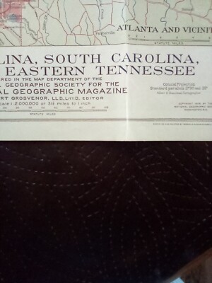
Free Shipping Location: Clarksville, United States Description: MAP of North Carolina. South Carolina, Georgia and Eastern Tennessee from NATIONAL GEOGRAPHIC SOCIETY Date: Sept 1926 Supplement Size: 15 ... more1/2 x 19 1/2 inches Condition: very good condition. Stock photo only Magazine is not included. Serious bidder only please, ask questions if any Shipping: USA: $2.50 first class mail or $5.50 priority mail For each additional map. Add $1 Free shipping up to 5 maps with a purchase of any magazine Canada: $3.99 first class mail( For each additional map. Add $1) Or $13.99 priority mail Free shipping up to 5 maps with a purchase of any magazine International: $5.99 first class mail( For each additional map. Add $1) Or $16.99 priority mail Free shipping up to 5 maps with a purchase of any magazine Payment: Payment is due within 7 days. Please contact me within 3 days to arrange payment if you do not pay instantly by Paypal. Return: I do not except return unless I send the wrong item(s) or item(s) that are not as described. Item(s) returned must be in the same condition it was sent. Refund will cover the bid amount but not shipping.
Buy It Now
Free Shipping Location: Roan Mountain, United States I have a couple other FLORIDA ones listed- would make a nice group. Turtle Island FLORIDA. Caeser Creek FLORIDA. AUTHENTIC 129 year old item. OVERALL ... morePAGE SIZE IS 7 1/2" x 11.25". Image size is ~6.25" x ~10".
Buy It Now
$29.66 Shipping Location: Rockford, United States
Buy It Now
$15.60 Shipping Location: Montoursville, United States Detail for Estero Bay and. East Fort Myers. Details are included for Estero Bay and Hancock Creek. on the water without this Barrier Islands map. make ... moreit very easy to use. Colored Key makes chart easy to understand.
Buy It Now
$29.66 Shipping Location: Rockford, United States Includes gold region.
Buy It Now
$4.75 Shipping Location: Roan Mountain, United States It is amazing to see how little developed it was 129 years ago. STUNNING 1893 color lithograph map of. Boston Harbor, MASS. Chatham Harbor, Virginia. ... moreTurtle Island FLORIDA. Hilton Head Island, SC. LONG ISLAND SOUND, NY.
Buy It Now
Free Shipping Location: Roan Mountain, United States STUNNING 1893 color lithograph map of the Carolinas Coast from Cape Romain to Cape Hatteras includes pamlico Sound Cape Lookout Cape Fear. Hilton Head ... moreIsland, SC. Turtle Island FLORIDA. LONG ISLAND SOUND, NY.
|
|
|
In
|