-
Christian Collectibles
-
Christian Sheet Music
-
Vatican Stamps
-
Vatican Coins & Paper Money
-
Antiques
-
Antiquities
-
Architectural & Garden
-
Decorative Arts
-
Ethnographic
-
Furniture
-
Maps, Atlases & Globes
-
United States (Pre-1900)
-
AK, HI
-
AL, FL, GA, MS, NC, SC
-
AR, IA, KS, LA, MO, NE
-
AZ, CA, CO, NM, NV, UT
-
CT, MA, ME, NH, RI, VT
-
DC, DE, MD, NJ, NY, PA
-
ID, OR, WA
-
IL, IN, MI, OH, WI
-
MN, MT, ND, SD, WY
-
OK, TX
-
VA, WV, KY, TN
-
Entire US
-
United States (1900-Now)
-
United States (Date Unknown)
-
Africa
-
Asia
-
Australasia/ Oceania
-
Canada
-
Central America/ Caribbean
-
Europe
-
India
-
Ireland
-
Mexico
-
Middle East
-
North America
-
South America
-
United Kingdom
-
Maps on CD
-
World Maps
-
Globes
-
Mixed Lots
-
Reproductions
-
Price Guides & Publications
-
Other
|
In
Order by: Available to: This site contains affiliate links for which I may be compensated
|
Buy It Now
$7.83 Shipping Location: Indiana, United States California USGS Topographical Geological Geologic Survey Quadrangle Topo Topographic Map 22" x 27". (see pics). Picture details are best viewed on a computer.
$25.00 Shipping Location: Perugia, Italy Robert Wilkinson (fl. c. 1758 - 1825) was a London based map and atlas publisher active in the late 18th and early 19th centuries. Wilkinson updated and ... moreretooled the Bowles plates over several years until, in 1794, he issued his first fully original atlas, The General Atlas of the World.
Buy It Now
$3.54 Shipping Location: Mishawaka, United States Maxwell California Antique USGS Topographic Map Printed 1913 16x20 Art and would look great in a frame. If you have any questions please ask. Feel free ... moreto visit my store for more antique maps and prints on American History and many other subjects. Most offers accepted.
Buy It Now
$5.95 Shipping Condition: New Location: United States Shows a bird’s eye view as it looked in the late 19th century. Year: 1895. These Historic Art Prints are suitable for framing, mounting or direct display ... moreon any wall! San Francisco Fire 1906. “Vibrant and bright!
Buy It Now
$4.00 Shipping Location: Columbus, United States The map shows San Bernardino, Corona, Redlands, Riverside, Perris, Moreno, Pomona, and more. THIS IS AN ORIGINAL PRINTING - NOT A MODERN REPRODUCTION. ... moreHOFFMAN BOOKS, ABAA, IOBA.
Buy It Now
$11.85 Shipping Location: Dover, United States Issued c. 1855, London by G. Virtue for Tallis. Wonderful mid 19th century engraved map, with original outline hand color and lovely engraved decorative ... morevignettes depicting Whaling, Buffalo Hunting, Niagara Falls, Polar Bears, etc.
Buy It Now
$5.25 Shipping Location: Dayton, United States 26-62d Congress, 2d Session, December 4, 1911-August 26, 1912: Examinations Of River and Harbors III.". Has a Couple Pin-Hole Tears on Inside Folds but ... moreMap is in Very Good Condition! Great Map! Any Browning On Folds Is Enhanced By My Phone!
Buy It Now
$11.85 Shipping Location: Dover, United States Issued 1889 Gotha by Justus Perthes for Stieler. Map consists of 6 sheets which form a wall size map of the era. A large and very detailed 19th century ... moreengraved multi-sheet map with original outline hand color.
Buy It Now
Free Shipping Location: Pacoima, United States Up for auction is a collection of about 70 Nautical charts maps from all over the world. This collection came from a wealthy Palm Beach estate. All maps ... morehave been used and have been used. Some are better than others see pictures for condition. Measures: 33 inches by 51 inches Good Luck Paypal Only On Apr-16-14 at 19:25:10 PDT. Seller added the following information:
Buy It Now
$10.05 Shipping Location: Rathdrum, United States It is a perfect addition to your antique collection and a valuable item for collectors. The map shows the city of Richardson Springs and includes important ... moreaspects such as the date range, type, year, original/reproduction, and country/region.
Buy It Now
$3.50 Shipping Location: Dover, United States Venice Quadrangle California- 7.5 Minute Series. Year Published: 1975. The map in the photo is the actual map you will receive. Water Bodies: Ballona ... moreCreek, Santa Monica Bay.
Buy It Now
$7.00 Shipping Location: North Wales, United States 1897 ANTIQUE CENTURY ATLAS MAP-CALIFORNIA, SOUTHERN PART-EXCELLENT DETAIL ORIGINAL ANTIQUE ATLAS MAP PLEASE SEE PHOTOS AS PART OF THE DESCRIPTION CONDITION: ... moreMAP IS IN GOOD CONDITION. SIZE: APPROXIMATELY 10.5" X 15" SHIPPING: U.S. FIRST CLASS RATE - $6.00 - ANY ITEM WHICH SELLS FOR OVER $100 WILL REQUIRE INSURANCE WE COMBINE SHIPPING FOR MULTIPLE WINS. THANK YOU FOR YOUR INTEREST IN OUR AUCTIONS!.
Buy It Now
Free Shipping Location: Schertz, United States This Map was removed from a 1887 Cram's Atlas and is in good acceptable condition. The map is not " new " or in " new " condition, it was printed in 1887. ... moreThe map is not dated. Study the photos carefully, this is the actual map you will receive.
Buy It Now
$4.13 Shipping Location: Milwaukee, United States Notes: Like new map. Contents clean and unmarked. Binding: map. Imperial Books and Collectibles presents. Sku: 037883. ISBN: 1564134032. Condition: Used: ... moreExcellent. Qty Available: 1.
Buy It Now
$3.54 Shipping Location: Mishawaka, United States Antique Huron California Original USGS Topographic Map Printed 1937 Art 16x20 Inches and would look great in a frame. Please see pictures for condition ... moreIf you have any questions please ask. Feel free to visit my store for more antique maps and prints on the subjects of the American Revolution, Civil War, Spanish American War, Medical, Science and famous locations. Most offers accepted. I will combine shipping and be sure to ask about bulk pricing or if you are looking for a map of a specific area as I have thousands in my inventory.
Buy It Now
$6.95 Shipping Location: Dover, United States Issued 1869, Philadelphia by Butler. Map by Mitchell. California, Oregon, Idaho, Utah, Nevada, Arizona, and Washington. Mid 19th century engraved map ... morewith original hand color.
Buy It Now
$3.50 Shipping Location: Dover, United States Picacho Peak Quadrangle California- 15 Minute Series. Year Published: 1957.
Buy It Now
$5.00 Shipping Location: Wilmington, United States Published in 1939, Collier's Atlas. San Francisco. City Map of.
Buy It Now
$7.00 Shipping Location: Rockville, United States Published by W. W. Gray & Son - Philadelphia - 1893. Up for sale is a great, colored antique MAP - GRAY'S MAP OF CALIFORNIA - THE NATIONAL ATLAS - 1893. ... moreI would be happy to include a copy if requested.
Buy It Now
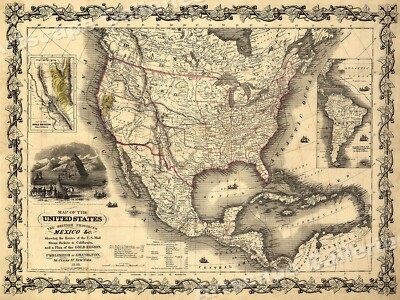
$64.65 Shipping Location: Bar Harbor, United States Upper California extends eastward to the Rio Grande and Oregon Territory to the Continental Divide. This is an original (1846) but smaller school atlas ... moreversion of Mitchell’s well-known map, which is itself based largely on John C. Frémont’s map of 1845.
Buy It Now
$4.00 Shipping Location: Mobile, United States Topographical Map. Geological Survey. San Luis Ranch Quadrangle. San Luis Obispo County, California. 1916 Edition, Reprinted 1947. Suitable for framing.
Buy It Now
$8.99 Shipping Location: Sacramento, United States We try to describe the item(s) in as much detail as possible. We will not be responsible for wrong item bought or does not fit.
Buy It Now
$6.00 Shipping Location: Tiffin, United States See photos for condition.
Buy It Now
$4.55 Shipping Location: Oakland, United States 12x10 inches This antique map from 1885 features the stunning states of California, Utah, Arizona, New Mexico, and Colorado. The vibrant colors and intricate ... moredetails make this piece a perfect addition to any collection. The map measures 12x10 inches and is sure to be a conversation starter. With a focus on the unique aspects of these states, this piece provides a glimpse into the history and geography of the American Southwest. Whether you're a collector or simply appreciate the beauty of antique maps, this piece is not to be missed.
Buy It Now
$7.83 Shipping Location: Indiana, United States California State USGS Topographical Geological Geologic Survey Quadrangle Topo Topographic Map. Picture details are best viewed on a computer.
Buy It Now
$6.05 Shipping Location: Newark, United States 1/4 fold lines. Small hole in center of map. Browning down fold line top center to middle of map. See last 2 photos.
Buy It Now
$6.05 Shipping Location: Newark, United States
Buy It Now
Free Shipping Location: Marana, United States This Map was removed from a 1891 Atlas and is in good acceptable condition. ~ GASKELL1891/020921. Including Hundreds of RareCivil War. 130+ years of aging. ... moreStudy the photos carefully, this is the actual map you.
Buy It Now
Free Shipping Location: Anaheim, United States Color Coded Freeways for Easy Reference. Greater San Diego Freeway System. Greater Los Angeles Freeway System. Bio-predation & Oxidation (aging, age discoloration ... moremainly on the outside panels). Bio-predation along title panel top edge that may have made small holes on the crease-folds when opened.
Buy It Now
Free Shipping Location: Schertz, United States This Map was removed from an 1889 Cram's Atlas and is in very good condition. () Nice original coloring. This map is not dated. This map in not new or ... morein new condition. It was printed in 1889.
Buy It Now
$6.05 Shipping Location: Newark, United States
Buy It Now
$6.05 Shipping Location: Newark, United States Stains in borders. Stamp bottom border. 1/4 fold lines. Burn spot lower right corner.
Buy It Now
Free Shipping Location: Schertz, United States This antique original railroad and county map of California was made by George Cram in 1889 using lithography printing technique. The map is beautifully ... morecolored and measures XL17x23. It is a great addition to any collection of North America maps, maps, atlases, and globes, or antiques. The buyer can enjoy free shipping and handling within the USA and calculated shipping and handling worldwide. This piece is a classic representation of California's geography and history. Don't miss the chance to add it to your collection!
Buy It Now
$4.50 Shipping Location: United States The map is large and detailed. The size is a large 18.5" by 27". FREE scheduling, supersized images.
Buy It Now
$4.99 Shipping Location: Fairview, United States The Reverse side has "Fireman's Fund INS. Condition: The map is in Very Good condition printed on a stiff buffed page with light tonal aging and a couple ... moreof minor spots. The pics are of the actual map.
Buy It Now
$6.95 Shipping Location: Dover, United States Southeastern Portion of California. Issued 1882, Chicago by Rand McNally. Large, oversized late 19th century color lithographed map. Original center fold ... moreas issued.
Buy It Now
$4.95 Shipping Location: Willow Grove, United States This is an ORIGINAL 1895 San Francisco map titled Main Portion of San Francisco which was taken from a 1895 atlas. On the reverse side of this map page ... moreis a map of California.
Buy It Now
$5.95 Shipping Condition: New Location: United States Placerville, California. shows a bird’s eye view as it looked in the late 19th century. Placerville 1888. Year: 1888. These Historic Art Prints are suitable ... morefor framing, mounting or direct display on any wall!
Buy It Now
$5.95 Shipping Condition: New Location: Las Vegas, United States United States and British Provinces- 1849 Size: 24" x 32" 61 cm x 81 cm) x Also Available in 18" x 24" from our eBay Store This is ... morea great Classic Map originally published circa 1849. This Map shows the United States California's gold region and popular western trails as they were in 1849. This poster. Which evokes the vivid images of a simpler time, is a custom reproduction printed on 68lb Heavyweight Enhanced Matte Art Paper. This Historic Art Print is suitable for framing. Mounting or direct display on any wall! 000 Artscape Galleries/ Posters Past More Prints and Posters Available from our eBay Store! Shipping price includes delivery confirmation. We combine shipping for multiple purchases- add $1.00 for each additional poster. All posters are professionally packaged to ensure that they arrive safely and undamaged: Your poster is first rolled and inserted into a plastic sleeve before being placed into a Heavy-Duty mailing tube for delivery. We stand behind the quality of every poster. If you are not satisfied with your purchase. Please contact us within 30 days to arrange for either an exchange or a full refund. gsrx_vers_468(GS 6.4(468)

Buy It Now
$10.05 Shipping Location: Belvedere Tiburon, United States 1915 Sacramento. CA Land District Map This is large original“outline map” of California. Showing position of Sacramento Land District. Map measures about ... more19 by 27 ½ inches. Printed on thin glossy paper. Back is blank. Map has been folded. And there is separation along the creases. Thin paper is fragile. There is some loss along fold in lower right quadrant and top and left edge. Please see photos for condition issues. Please see my other auction for scales and California Gold Rush items. California bidders must pay sales tax or provide resale info. International Shipping: International bidders pay the actual shipping cost to be calculated after the auction. Not the cost listed for U.S. bidders. Please wait until after I invoice you with the correct total to pay. Due to past problems insuring and shipping international packages. I am not currently shipping to certain locations. If Ebay does not accept your bid, it means that I do not ship to your location. Packages shipped outside of the U.S. are sent at BUYER’S RISK unless fully insurable by the USPS. Sorry, no returns unless something is accidentally misrepresented.
Buy It Now
$4.99 Shipping Location: Fairview, United States The Reverse side has "Fireman's Fund INS. Condition: The map is in Good condition printed on a stiff buffed page with light tonel aging and a light stain ... moreon the left side, see the pics. The pics are of the actual map.
Buy It Now
$6.05 Shipping Location: Newark, United States

Buy It Now
$10.04 Shipping Condition: Unspecified Location: LONDON, United Kingdom The farther environs of San Francisco Antique colour map; Scale 1:700.000. 1909 The image below shows an enlarged cross section from the centre of the ... moremap to show the level of printed detail: Places shown on the map include: San Francisco Bay. Golden gate. Oakland Berkeley Monterey. DATE PRINTED: 1909 IMAGE SIZE: Approx 15.0 x 10.0cm. 6 x 4 inches(Small) ARTIST/CARTOGRAPHER/ENGRAVER: Wagner& Debes PROVENANCE: The United States with excursions to Mexico. Cuba, Porto Rico, and Alaska" by Karl Baedeker, Published by Karl Baedeker, London: 4th Edition TYPE: Antique colour map; Scale 1:700.000 VERSO: There is nothing printed on the reverse side. Which is plain CONDITION: Good; suitable for framing. However. Please note: The image shown may have been taken from a different example of this map than that which is offered for sale. The map you will receive is in good condition but there may be minor variations in the condition from that shown in the image. Please check the scan for any blemishes prior to making your purchase. Virtually all antiquarian maps and prints are subject to some normal aging due to use and time which is not obtrusive unless otherwise stated. I offer a no questions asked return policy- see below. AUTHENTICITY: This is an authentic historic print. Published at the date stated above. I do not offer reproductions. It is not a modern copy. The term'original' when applied to a print means that it was printed at the first or original date of publication; it does not imply that the item is unique. Print' means any image created by applying an inked block to paper or card under pressure by any method including wood engraving, steel engraving, copperplate, wood cut and lithography. REMARKS: FRANCE: Gravures et Cartes anciennes. DEUTSCHLAND: Alte Lankarten und Stadt ansichten. ITALIA: Stampe e Mappe antiche. ESPAÑA: Mapas antiquos y impresiones antiguas. E and OE. Force Majeure. English law shall apply. RETURNS POLICY: I offer a no questions returns policy. All I ask is that you pay
Buy It Now
$3.50 Shipping Location: Dover, United States Oroville Quadrangle California- 7.5 Minute Series. Places: Thermalito, Oroville. Year Published: 1973.
Buy It Now
$5.55 Shipping Location: Bar Harbor, United States Year of Statehood Feb. 14, 1912. Original Antique. Hammond Map. This map is from. (atlas cover and title page are not part of the sale). With New Census. ... moreHandy Atlas of the World.
Buy It Now
$3.54 Shipping Location: Mishawaka, United States El Monte Los Angeles California Vintage USGS Topographic Map 1972 22x27 Art(Creases as pictured) and would look great in a frame. If you have any questions ... moreplease ask. Feel free to visit my store for more antique maps and prints on American History and many other subjects. Most offers accepted.
Buy It Now
$3.50 Shipping Location: Dover, United States Bollibokka Mountain Quadrangle California- 15 Minute Series. Year Published: 1959. The map in the photo is the actual map you will receive. Other Features: ... moreShasta-Trinity National Forest.
Buy It Now
$9.43 Shipping Location: Olympia, United States · Location: Fort Bragg, California. · Published by: US Dept of the Interiors Geological Survey. The front and back sides of the map have Scotch tape in ... moreareas of integrity concerns (see photos). The map has a stamp on the bottom right corner Douglas J. Canning.
Buy It Now
$3.50 Shipping Location: Dover, United States The map in the photo is the actual map you will receive. Year Published: 1976. Oil Center Quadrangle California- 7.5 Minute Series.
Buy It Now
$3.54 Shipping Location: Mishawaka, United States Del Sur California Antique Original USGS Topographic Map 1936 16x20 and would look great in a frame and will shipped rolled. If you have any questions ... moreplease ask. Feel free to visit my store for more antique maps and prints on American History and many other subjects. Most offers accepted.
Buy It Now
$3.50 Shipping Location: Dover, United States Valyermo Quadrangle California- 15 Minute Series. Year Published: 1961. The map in the photo is the actual map you will receive. Water Bodies: Big Tujunga ... moreCreek, Crystal Lake, Governor Edmund G Brown California Aqueduct, Little Rock Creek, North Fork San Gabriel River.
Buy It Now
$4.00 Shipping Location: Harborton, United States This is an antique California map which was carefully removed from an atlas published in 1934. ANTIQUE CALIFORNIA STATE MAP. There is another map on the ... morereverse side.
Buy It Now
$4.95 Shipping Location: Shasta Lake, United States
Buy It Now
$6.90 Shipping Location: Audubon, United States It is an old, original map that was rescued from an unusable atlas. You will receive the exact antique map in the photos. Condition is very good, age ... moreconsidered. This map would look great displayed in any room.
Buy It Now
$9.06 Shipping Location: Carlsbad, United States Approximately 14.25 x 12 inch spiral bound, soft cover photo atlas.Excellent reference to see expansive development of last 40 years in San Diego County. ... moreAlso contains some gorgeous full page photos. cartography, mapping, aerial photography, cartographer, surveying.Slight wear on edges, corners, covers, but generally in great condition.
Buy It Now
Free Shipping Location: Schertz, United States This Map was removed from an 1894 Atlas and is in good acceptable condition. The map is not " new " or in " new " condition, it was printed in 1894. The ... moremap is not dated. Study the photos carefully, this is the actual map you will receive.
Buy It Now
Free Shipping Location: Salt Lake City, United States C ompiled from Official Records & Surveys by Geo. A. Kneese, County Surveyor. Large wall map fitted on dowels and backed with linen.
Buy It Now
$4.95 Shipping Location: Willow Grove, United States There is text on the reverse side of this map page that does not relate to this map.
Buy It Now
$5.95 Shipping Condition: New Location: United States Shows a bird’s eye view as it looked in the late 19th century. Year: 1894. Los Angeles 1894. These Historic Art Prints are suitable for framing, mounting ... moreor direct display on any wall! Los Angeles, California.
Buy It Now
$6.95 Shipping Location: Dover, United States Issued 1912, Chicago by Rand McNally. Large, oversized early 20th century color lithographed map. This size allows for much more detail.
|
|
|
In
|
Antique 1900 Bartholomew Map [ YOSEMITE VALLEY ] California El Capitan Merced
Yosemite Valley- Antique Map from The Graphic Atlas and Gazetteer of the World Edited by J.G. Bartholomew Thomas Nelson& Sons. London and Edinburgh- Page dimensions 10.75" x 8.25" Map dimensions 8.75" x 6.5" Map is in excellent antique condition. FREE SHIPPING with"BUY-IT-NOW" shipping will be deducted on the invoice) Posted with
|
|
|
Southern California 1912 Rand McNally folio map
Southern California 1912 Rand McNally folio map Southern California Issued 1912. Chicago. Published by Rand McNally and Co. Massive 20th century offset color printed map. Overprinted with railroad lines and stops as well as Electric Lines and Steamship Lines. A monumental early 20th century map of this state. With hundreds of place names not typically found on smaller maps and a level of detail approaching wall map. In VG condition. Light minor surface soiling. Will look very nice for display. Once framed a huge map. Not to be confused with the much more common small quarto format issues of similar titled maps. Sheet size measures c. 28" W x 20 1/2" H. Engraved area c. 26 5/8" W x 18 1/2" H. 4579] Any defects along the sheet edges and in the margins may be seen in the photos. note: All old sheets of printed paper possibly ... morehave short edge splits. Each sheet has existed for a very long time and has probably been handled repeatedly in the course of it's existence. It has a history unique to it as an object. Most of the time any edge splits are short. Minor, insignificant and have been closed- either long ago or more recently with small pieces of archival tape. Most often these splits are trivial and easy to overlook visually. Basically, they would not significantly affect the piece adversely. The item is offered as seen. Please look carefully and make your decision knowing this antique image is nice. But it is not in perfect"like new" condition. However, with whatever flaws it possesses, it remains entirely worthy of ownership and inclusion in any related collection. We feel it will prove very pleasing to its new owner. We stand behind everything we sell. Everything we offer is guaranteed to be an authentic original antique item as described. We do not sell modern reproductions. Please visit our. We happily accept PayPal! WE OFFER FLAT RATE SHIPPING WORLD WIDE! Please request an invoice before paying for multip
|
|
|
1970 Geologic Map Daggett, San Bernardino County, California ~ bright colors ~
1970 Geologic Map Daggett. San Bernardino County, California compiled by T. W. Diblee, Jr. Brilliant colors and outstanding shape for a large map as it was kept in the original envelope.
|
|
|
Vintage MOBILGAS City Map SAN FRANCISCO CALIFORNIA ++
Vintage MOBILGAS City Map SAN FRANCISCO CALIFORNIA ++ Original Mobilgas city map for San Francisco and East Bay Cities. Rand McNally. In very good condition with some light wear/ tiny seam tears. I am putting up a large group of vintage so click to see the of my store if interested. Shipping will be combined and discounted for multiple purchases(see shipping below for instructions. Pictures are taken with a high quality camera so please see them for further condition analysis. For questions about condition or otherwise feel free to ask. Click the image below or the red door to see hundreds of other great collectibles. inkfrogproseries. U.S. Shipping: $2.99 If purchasing multiple items or buying Internationally please wait for us to combine/ calculate shipping and invoice you the adjusted amount. If you pay right away we may not be able to ... moreadjust shipping appropriately. Occasionally. On larger or unusual items shipping may vary by location or country. Paypal or E-Mail for other options. inkfrog terapeak. I000000.
|
|
|
1908 MAP OF WESTERN USA / CALIFORNIA TEXAS ARIZONA / CHICAGO SAN FRANCISCO MAPS
1908 MAP OF WESTERN USA/ CALIFORNIA TEXAS ARIZONA/ CHICAGO SAN FRANCISCO MAPS This original antique map gives you an opportunity to examine in exquisite detail a piece of history. If you are interested in the past of this country and its people or have a desire to study where your family may have come from. Then this map gives you a rare look as the area was about 100 years ago.Once matted and framed, this map would make a perfect gift for a family member or friend they'll cherish forever. Origin of the map: Bacon's Popular Atlas of The World" Published in London by G. W. Bacon. Date of issue: 1908 Size: The sheet measures 21" x 13 1/2" 54 x 34 cm) S/H: The map will be shipped by Air Mail. The shipping charge is: USA- 7.50 USD. World- 8.50 USD, Canada- 8.50 USD. The price includes the insurance and a strong, cardboard ... moretube with plastic plugs. Attention! There is no additional shipping charge for multiple purchases! Pay me securely with any major credit card through PayPal! Payment methods: US/Canada Buyers: Paypal. International Buyers: Paypal. Click Here. Double your traffic. Get Vendio Gallery- Now FREE! 265ae.RcmdId ViewItemDescV4,RlogId p4%60bo7%60jtb9%3Fuk.rp73%28%3E%3F265ae-13e04d7844d-0xfe-
|
|
|
1849 ORIGINAL Map of Mexico, Guatimala, Cuba, Bahamas, Upper California
Original hand colored engraving as issued. Blank on verso. Dated in the plate. Engraved by J.H. Young. Entered into U.S Congress by S. Augustus Mitchell. 1849. Image area is 10.5" wide x 8.0" Interesting and detailed map extending from Mexico to Barbadoes and from Texas to Venezuela. Early mapping showing Upper California as part of the United States just after the Mexican-American War. Inset map of the"Country between the Cities of Mexico and Vera Cruz. Beautifully hand color. Will frame nicely. Overall average condition with moderate ageing. Typical spotting toning and chipping for an item of this age. See photos. Low starting bid with no reserve. Postage charge is for domestic insured priority mail.
|
|
|
1685 Mallet Map of World - California as Island
1685 Mallet Map- Carte ou Planisphere General du Monde Allain Mallet whose professional occupation was a military engineer. Is known more for his authorship of the five volume"Description de l'Univers' one of the earliest printed miniature, illustrated world history/geography books. It contains numerous decorative maps, views, portraits etc. which are the best source of reasonably priced material for the collector of early illustrated material. This map comes from the first German edition of'Description de l'Univers' It shows the world and is particularly noted for its depiction of California as an island. This misconception was not totally disproved until 1720. There are also divided globes showing various parts of the world. The map measures 5.5" by 4" Has wash hand colouring, and is in very good condition. ... moreWe have included an image of the title page for reference(not for sale) The engraving is guaranteed to be over 325 years old. Shipping United States- Regular airmail $5.00US. Registered/insured airmail(optional) is an additional US$12.00 for a total of US$17.00US. Canada- $3.00US for regular mail. $9.00US for registered mail. Canadian customers please add GST or HST as applicable. Sorry, we cannot arrange for pick up of ebay items. Rest of the world- Regular air mail $8.00US. Registered/insured airmail(optional) is is an additional US$12.00 for a total of US$20.00. Terms and Conditions Please note- We can only take responsibility for delivery if the optional registration/insurance is added. Regular airmail is usually very safe and reliable. But items sent by regular airmail are at the buyers risk- regular airmail provides no tracking number, no proof of shipping or delivery, and no insurance in case of loss or damage. Please note- Mailing from Canada to the United States and all other international destinations can sometimes take over three weeks for delivery. We will combine shipment of multiple purchases- several items can be shipped together for one shipping cost. Paymen
|
|
|
1872 Mitchell's MAP OF OREGON KANSAS CALIFORNIA & TERRITORIES * Hand Coloring
Auction Wizard 2000 Listing Template- AW2KLOT#6216 Please note that Customs delays for international shipping have been SIGNIFICANT lately- days or even weeks longer than they should be! Please take this into consideration Our goal is 5 star service! If you feel we have not lived up to a 5 star rating. Please contact us as we only want 100% satisfied customers and NO misunderstandings! Description below pictures* 1872 Mitchell's MAP OF OREGON KANSAS CALIFORNIA& TERRITORIES* Hand Coloring* $28.00 An Original Vintage Antique Map: Not a Reproduction! See Our Ebay Store for other Antique Maps! Free US Shipping on Purchases of $100 value or more of Maps and Prints Description: This is an authentic antique map approximatley 141 years old! Published by E.H. Butler& Co. for Mitchell's New Intermediate Geography in 1872(photo of title ... morepage shown but NOT included with this map) Hand colored copper plate engraving. Text on reverse. The map is not mounted. Matted or framed and is being sold as a single sheet as shown in the first picture. Size: Map measures approximately 12 by 9 5/8 inches(30.4 x 24.4 cm) as seen in the pictures. Condition: This map is in good to very good condition. Some soiling evident along edges. Light foxing as seen in the pics. It is basically as seen in the pics. Will frame up nicely. See pictures for more on condition. The pictures shown are of the actual print being sold. Shipping: Please use the calculator under the"Shipping and payments" tab above to determine shipping for your location. All packages are sent with Delivery confirmation where possible. We always combine shipping. So on multiple items please wait until we send you an invoice with the correct shipping applied. Maps and Prints will be shipped either flat or rolled depending on the items being shipped. We use only sturdy shipping materials to make sure the package arrives at its destination in undamaged condition. Insurance is on US! Please ask if you have any questions about shipping. Payment Details: We acce
|
|
|
1877 Map Steinwehr California Arizona Utah Idaho WA OR
This item is an 1877 atlas page featuring a map of the Western States drawn by Adolph von Steinwehr. States shown are: Washington/ Oregon/ California/ Nevada/ Idaho/ Utah/ Arizona/ Montana/ Wyoming/ Colorado/ New Mexico. On the reverse is an engraving and some text. Page dimensions: 12 3/8 by 9 7/8 inches. Top and left margin stained, in very good condition. Online image shows watermark that is not on original item. Combined shipping available. Shipped from a Canadian location. Canadian residents. Please wait for an invoice before sending a paypal payment. Powered by The free listing tool. List your items fast and easy and manage your active items.
|
|
|
Southern California 1905 original antique color lithograph U.S. regional map
SOUTHERN CALIFORNIA(United States) issued Leipzig: 1905; by Wagner& Debes. Fine original antique color lithographed map of this region. Printed on quality paper which retains its inherent structural flexibility and soundness. Showing Los Angeles to San Bernadino. In Very Good or better condition. Sheet displays a light age-wrinkling which does not detract visually[note: we grade very conservatively and always seek to disclose any noteworthy flaws] The printed area remains pleasing. A nice impression that would look great framed. Sheet measures c. 6 1/8" W x 4 1/4" H. Engraved area measures c. 5 3/4" W x 3 7/8" H. 30704] Guaranteed Authentic! We do not sell modern reproductions. Condition All of our items are original antique pieces and it is important to keep in mind that many of them have been around for 100 years ... moreor more. Individual pieces may have seen many owners and been handled many times over the course of their existence and as a result each piece has developed a history of it's own. Short edge splits(often repaired with archival tape) Foxing, discoloration, etc. are all things to expect on items of this type. They rarely distract from the piece and often add to the overall character of the item. Keep in mind when you receive your item that you are not handling a modern copy, you are holding a piece of history, an item that has been around for a very long time and will, with proper care, be around for a long time to come. We try to note any significant flaws in the description, but less noticeable or common characteristics may not be mentioned. As we are a US based company all of our measurements are in Inches. If you need the size in Centimeters please multiply the supplied measurement by 2.53. Payment and Shipping We happily accept PayPal! Payment is appreciated within 5 days of invoicing. Once payment has been received we do our best to make sure all orders are shipped within two business days and often have them shipped within one. We send payment confirmation and a copy of
|
|
|
HS629 Colorado Road Map 1938 Calso Gas RPM Oil California Co Golden Gate Expo
I was cleaning out a closet for my aunt and uncle who moved into a retirement home when I came across this vintage Calso Gasoline. California Company Road Map of Colorado. Advertising to"Drive to The Golden Gate International Exposition on the San Francisco Bay, 1939" Outside of map show some wear, interior in Extra Super condition. Shipping is for U.S. only. All others email for cost. Powered by The free listing tool. List your items fast and easy and manage your active items.
|
|
|
UNITED STATES WEST COAST CALIFORNIA 1914-18 original antique map
Good quality ORIGINAL antique lithograph map( two sheets joining to make one map) Title: United States- West" Publication& Date: issued in London between 1914-18 by Amalgamated Press for the Harmsworth" Atlas of the World" Description: Interesting and detailed map. Inset San Francisco. Key to Railways- Cables- Steamship Routes- Distances in Nautical Miles. Photos of local buildings on reverse. Condition& Size: Clean and good condition- printed area 17"x12.75" 44x33cm) plus good margins. Litho colour Postage: UK- £3.00- Europe. Rest of World and USA- £7.00 Visit our many other interesting listings of maps& prints on our Site(rediiwi) and in our E-BAY STORE Payment: Use Paypal or ask for details/ Thanks for looking
|
|
|
Picture Map of California Plate Vernon Kilns USA
Picture Map of California Plate 10 3/8" plate in white and blue. Transfer in great shape. No chips or crazing. Marked on the back: Vernon Kilns U.S.A.
|
|
|
Santa Rosa California 1876 Historic Panoramic Map 20x30
Santa Rosa. CA 1876 Size: 20" x 30" 51 cm x 76 cm) x Also Available in 24" x 36" or 16" x 24" from our eBay Store This is a classic Panoramic City Map. Originally published in 1876. This print shows a bird's eye view of Santa Rosa. Sonoma County, California as it looked in the late 19th century. This print. Which evokes the vivid images of a simpler time, is a custom reproduction printed on 68lb Heavyweight Enhanced Matte Art Paper. This Historic Map is suitable for framing. Mounting or direct display on any wall! Other Great Maps available: 000 Artscape Galleries/ Posters Past More Prints and Posters Available from our eBay Store! Shipping price includes delivery confirmation. We combine shipping for multiple purchases- add $1.00 for each additional print. All maps are professionally packaged to ensure that ... morethey arrive safely and undamaged: Your print is first rolled and inserted into a plastic sleeve before being placed into a Heavy-Duty mailing tube for delivery. We stand behind the quality of every print. If you are not satisfied with your purchase. Please contact us within 30 days to arrange for either an exchange or a full refund. gsrx_vers_468(GS 6.4(468)
|
|
|
Military Map of Fort Irwin California used NTC Training Facilities Map
U.S. Military U.S. Army Map of the National Training Center. Ft. Irwin, CA from 2009. Starting to tear at creases but very usable yet or presentable on a wall. Ed. 04-ITAM
|
|
|
ANTIQUE DATED FRAMED CITY MAP OF SAN FRANCISCO CALIFORNIA STREETS NAMED NICE!
Antique. Color, 1895 Atlas FRAMED map of CITY OF SAN FRANCISCO CALIFORNIA. MAP ITSELF IS DATED 1895. STREETS ARE NAMED. POINTS OF INTEREST INCLUDE DEPOTS. PARKS, SQUARES, RAILROADS, STREET CAR LINES, ALONG WITH MANY OTHERS AND EACH BUILDING 7 STREET IS REFERENCED. THIS IS A VERY NICE MAP WITH SO MUCH DETAIL! Frame measures 11 X 14 inches AND IS MADE OF SOLID WOOD. GREAT UNIQUE GIFT IDEA FOR THE PERSON WHO HAS EVERYTHING AND WOULD LOOK GREAT HANGING IN A HOME OR OFFICE. GREAT CONVERSATION PIECE! The map image is in GREAT CONDITION. Image is very CLEAR. Legible, and COLORFUL. READY TO HANG! I SHIP MAPS BOXED AND PROTECTED 5 DAYS A WEEK. I ALWAYS LEAVE FEEDBACK. BUY WITH CONFIDENCE! THIS MAP IS DATED AND COPYRIGHTED 1895& PUBLISHER'S NAME IS PRINTED ON THE MAP. GREAT UNIQUE GIFT IDEA FOR THE PERSON WHO HAS EVERYTHING! ALSO WOULD BE IDEAL ... moreFOR A SCHOOL PROJECT. SEE MY PROMOTIONAL SHIPPING RATES! I WILL SHIP TO MULTIPLE ADDRESSES WHICH IS IDEAL FOR GIVING GIFTS. UPON REQUEST. I WILL PUT A NICE CARD WITH THE MAP WITH THE MESSAGE YOU PROVIDE. YOU DON'T HAVE TO GO SHOPPING AND IT WILL BE DELIVERED AT THE DOOR! IT DOESN'T GET ANY EASIER THAN THAT! TAKE A LOOK AT MY OTHER MAPS! THE MAP IS WRAPPED THOROUGHLY IN BUBBLE WRAP AND IS ALSO PROTECTED WITH CARDBOARD. I WRITE ON THE BOX"FRAGILE GLASS" IN SEVERAL PLACES.
|
|
|
ANTIQUE FRAMED CITY MAP OF SACRAMENTO CALIFORNIA NICE
Antique. Color, 1889 CRAM'S ATLAS OF THE WORLD FRAMED map of SACRAMENTO CALIFORNIA. SHOWS ALL THE DETAILS LISTED IN THE ITEM SPECIFIC SECTION ABOVE. AND JUST TOO MUCH TO MENTION! ALL STREETS ARE NAMED. TRULY A BEAUTIFUL MAP! WHAT A GREAT UNIQUE GIFT FOR THE PERSON WHO HAS EVERYTHING! WOULD LOOK GREAT HANGING IN A HOME OR OFFICE. Frame is 10 x 13 inches and solid wood. The map image and frame is in EXCELLENT CONDITION. Image is very clear. Legible, and COLORFUL. I combine multiple items to save on shipping fees. I SHIP MAPS BOXED AND PROTECTED 5 DAYS A WEEK. GREAT FOR SCHOOL PROJECT! BUY WITH CONFIDENCE! THIS MAP WAS PRINTED IN 1889& IS NOT A REPRODUCTION. GREAT UNIQUE GIFT IDEA FOR THE PERSON WHO HAS EVERYTHING! ALSO WOULD BE IDEAL FOR A SCHOOL PROJECT. SEE MY PROMOTIONAL SHIPPING RATES! I WILL SHIP TO MULTIPLE ADDRESSES WHICH IS ... moreIDEAL FOR GIVING GIFTS. UPON REQUEST. I WILL PUT A NICE CARD WITH THE MAP WITH THE MESSAGE YOU PROVIDE. YOU DON'T HAVE TO GO SHOPPING AND IT WILL BE DELIVERED AT THE DOOR! IT DOESN'T GET ANY EASIER THAN THAT! TAKE A LOOK AT MY OTHER MAPS! THE MAP IS WRAPPED THOROUGHLY IN BUBBLE WRAP AND IS ALSO PROTECTED WITH CARDBOARD. I WRITE ON THE BOX"FRAGILE GLASS" IN SEVERAL PLACES. RcmdId ViewItemDescV4,RlogId p4%60bo7%60jtb9%3Fvo%7B2d71f%2Bb%3A%60%3E-13e0c54ac8c-0xff-
|
|
|
1950's Road Map of California Union 76
1950's Road Map of California Union 76 Minute Man Service Nice Condition Thank you For Looking Please Check Out My Other Auctions I Do Combine Postage.Just Let Me Know When You are Done Bidding. ag6 2.RcmdId ViewItemDescV4,RlogId p4%60bo7%60jtb9%3Fuk.rp73%28c%3Eag6%3E2-13e0db68ea5-0xf6-
|
|
|
United States Air Force 1953 MOJAVE DESERT Aeronautical MAP #404 CALIFORNIA
MOJAVE DESERT WORLD Aeronautical Chart CALIFORNIA#404 US Air Force Edition 18th Edition September 10. 1953 Golden Anniversary Wright Bros. 7 1/4 x 11" folded size. Opens to 8-panel map. CONDITION: Excellent. no holes or writing. Very clean. Dimensions given. If any, are approximate. Defects not visible in scan[s] are described. Item is complete as issued unless otherwise stated. NO facsimiles, copies, reprints or reproductions unless specifically stated in description above. CHECK OUT MY OTHER MAPS BECAUSE I DO COMBINE ON SHIPPING! Published at Washington. D.C. U.S. Department of Commerce; Environmental Science Services Admin; Coast and Geodetic Survey. Base edition of April 1945. On reverse side are aeronautical and topographical symbols; Aerodromes and sectional charts; restricted areas; and assigned radio frequencies for air navigation, ... moreetc. CHECK OUT MY FEEDBACK& BID WITH CONFIDENCE! I do combine on shipping so please wait to pay until I send you an invoice! Delivery Confirmation is always included unless you live in another country! Insurance upon request. I pack my items with the utmost care but I encourage the purchase of insurance. $1.75 for up to $50 anything above $50 we will discuss. Policies Buyer pays shipping. I do combine on shipping whenever possible. I only refund if I have made an error in my listing description otherwise my items are sold. AS IS. I try my best to describe my items as accurately as possible but if you have any questions, concerns or need more photos please let me know. If you have any issues with your newly purchased items please let me know. I don't know there is a problem if I don't know one exists. We are all human and from time to time I may make a mistake so please don't leave negative feedback until you have contacted me. Thanks.
|
|
|
CALIFORNIA National Geographic CD-ROM TOPO Map for Windows
National Geographic's best selling. Top-of-the-line, digital map software is the easiest way to create and print detailed maps. Each program includes thousands of the highest quality USGS topographic maps, optimized for printing and ease of use. TOPO! gives you five levels of map detail. From two National Geographic Atlas maps to a USGS 1:24,000 scale(7.5’ seamless topographic map—the most detailed outdoor recreation maps available. Maps include: National Geographic Atlas Maps USGS 500.000 Scale Maps— Highlights public lands USGS 100.000 Scale Topographic Maps— Mid-Scale topos perfect for long trips USGS 24.000 Scale Topographic Maps— The most detailed terrain maps available Test drive the TOPO! State Series With TOPO!s dynamic search features. You can quickly find your area of interest. Or simply browse the map to locate your desired ... moredestination. TOPO! maps are full color. High resolution scans of authentic USGS topographic maps, providing the best image quality available. All maps are seamless, and easily printed from your home printer. Paired with National Geographic AdventurePaper, our waterproof, tear-resistant material, your maps become trail-tough. TOPO! is the easiest way to tell your GPS where to go. Simply trace your route and upload to your receiver. Use in reverse to create detailed trail maps from your adventures. From creating custom map to viewing detail elevation profiles and connecting to your GPS. TOPO! is loaded with enhanced mapping tools to get you where you need to go. Create your perfect map— Add routes. Symbols, photos& notes Communicate with our GPS— Transfer routes. Waypoints, and tracks Explore in 3D— See you route via a 3D fly-through Profile Your Route— Survey distances. Elevations, and more Search for Destinations— Find trails. Parks, campsites, and more Print oversized maps Import Geocaches and GPX files Export detailed maps to other programs Stay current with easy and automatic LiveMap updates NORMALLY SELLS FOR $49.00 http:shop.nationalgeographic.com/ngs/product/map
|
|
|
Jan 13 1964 LA Times Banking Supplement, California Map 4-color
From an estate. Here is the January 13, 1964, supplement to the Los Angeles(CA) Times. This featured banking in California, and was apparently sponsored by Crocker-Citizens National Bank. Measures standard newsprint size when unfolded: 30" x 21" or so(not a measuring guru.sorry) The ink and newsprint are both solid and in terrific shape. There is a set of small tears on the center section of the sheet(easiest seen on the second image on the left side of it) They are about 1" long. Paper has been folded for some time, but there aren't any tears or thinning at the folds, and should flatten out nicely when framed. Wonderful old school map, with the rest terrific vintage banking industry. Please note: flat rate shipping is for continental US buyers only; I'll contact all others with actual costs. If not in continental US. ... moreDO NOT pay prior to receiving an invoice from me, please. Int'l shipping costs do NOT include tariffs, etc. Buyer's responsibility) Please ask any questions. I'm happy to combine shipping. Note: we have a cat in our house. So please consider if you are allergic. Thanks for looking!
|
|
|
1956 California road map Flying A oil route 66
1956 California road map Flying A oil route 66. Check out my! Check out my store. All the Old Roads. I have over 4,000 maps and brochures most dated and all with accurate descriptions. Be sure to add me to your! If I have made a mistake in dating or in the description of the item. I will refund your money and pay for return postage. Powered by The free listing tool. List your items fast and easy and manage your active items.
|
|
|
1962 MAP OF LOS GATOS CALIFORNIA CHAMBER OF COMMERCE
1962 MAP OF THE CITY OF LOS GATOS CALIFORNIA. GREAT CONDITION LISTING OF ALL MEMBERS OF THE CHAMBER OF COMMERCE.
|
|
|
CALIFORNIA HIGHWAY MAP 1966 STATE DEPT PUBLIC WORKS
GREAT CONDITION COLORFUL CALIFORNIA STATE HIGHWAY MAP 1966.
|
|
|
1846 LARGE WALL MAP OREGON, NEVADA, CALIFORNIA UNUSUAL
New Page 2 History-Image Photo. Map& Poster Archive Search in titles& descriptions Browse Photographs by Category Historic Posters Historic Maps Photography Books Shipping& Payment We combine shipping so you only pay one shipping charge regardless of how many items you purchase U.S. $ 6.00 Canada& Mexico $ 7.50 International $ 10.00 You will receive an email at the close of auction. Click on the payment link to complete payment. We accept all forms of auction payments that are allowed by ebay. You can also pay for your purchase over the phone with a credit card: 503) 408-2360 See our Framing work work This is a large and extraordinarily detailed map of the areas that would become Oregon California. Nevada, and New Mexico. There is an interesting note on this one that shows how little was actually known about some areas of ... morethe West in the 19th century: Over the area of present-day Nevada is, This region has never been explored, and is supposed to be impassable on account of its immense plains of sand, alike destitute of vegetation and water. From Map: Map of Oregon. California, New Mexico, N.W. Texas& the proposed Territory of Ne-Bras-Ka. By Rufus B. Sage. Actual map is much sharper and detailed than the low resolution scanned image used here. Map measures approximately 24" by 30" 61 by 76cm) The maps are reprinted(a modern reprint) using premium semi-matte photographic paper and Ultrachrome ink which has an archival rating of 125+ years. Custom Framing& Matting Options We offer a variety of sizes and options for framing your purchase. to see frames and prices Example of map detail: Frequently Asked Questions Is the resolution disappointing? No. Is the simple answer. Because we are dealing with historical pieces from a wide range of regions, creators and time periods, there is variation in the quality. However, we always ask ourselves if we would be pleased with a particular image framed and on display before we add it to our inventory. We do not carry low-quality"snapshots,
|
|
|
Original 1903 Map CALIFORNIA Railroads Los Angeles San Francisco Lake Tahoe Cram
Original 1903 Map CALIFORNIA Railroads Los Angeles San Francisco Lake Tahoe Cram Original antique map of California. Lithographed in color by county and printed more than 108 years ago. This handsome map has wonderful detail. Including railroads, cities, towns, and natural features. There are large insets of metropolitan San Francisco and Los Angeles. Longitude is measured from Greenwich and Washington. The scans below give a closer look: This is an original. Authentic antique map, not a reproduction or modern reprint. And it is fully guaranteed to be genuine. It was published by George Franklin Cram, Chicago, in 1903. The image measures 51 x 34.1 cm[20" x 13-1/2" Condition: This map is in very good condition. Bright and clean, with a horizontal fold, as issued, and no marks. Rips, or tears. This original antique map would make ... morean impressive display in your den or office. It would also make a perfect gift. And we'll include our helpful framing tips, along with a copy of the dated title page from the book in which it was published. We are pleased to offer it with our unconditional. Money-back guarantee. SHIPPING: We gladly ship anywhere in the World. And we use sturdy, professional packing materials to assure safe delivery. The shipping charges are as follows: Within the United States. Including Alaska, Hawaii, and APO addresses: $6.00 To Canada or Mexico: $11.59 To all other international destinations: $16.49(These charges reflect recent increases made by the United States Postal Service for international delivery. We will appreciate your prompt payment for this item. If you need more time or have any other questions about making your payment. Or if you may desire any special services, such as overnight delivery or tracking number, please contact us. Florida residents add 6.5% sales tax. Be sure to check our auction listings on eBay for other antique and collectible maps and ephemera. Simply click on the link below. Many of the items offered can be combined with this purchase so you can save on ship
|
|
|
1960 (1975) Clark Lake, California USGS Topographic Map
This is an original 1960(1975 print) Clark Lake. California USGS Topographic Map. Mapped, Edited and Published by the US Geological Survey Derived from aerials in 1954 and1956 and compiled in 1961 from the 1960 1:24,000 scale maps of Clark Lake NE, Collins Valley, Borrego Palm Canyon and Clark Lake. Scale 1:62.500 Contour Interval = 80' Features shown: Cities. Towns& Crossroads: Borrego Springs(portion) Counties: Riverside. San Diego Rivers and Lakes: Clark Lake. Coyote Creek, Cottonwood Spring, Hidden Spring, Santa Catarina Spring Railroads: none Roads: Palm Canyon Drive. Lazy Drive, Verbena Drive, Santa Rosa Drive, Truckhaven Trail, Borrego Valley Road, Di Giogio Road, Rockhouser Truck Trail and a few other unnamed roads and trails Mountains: Santa Rosa Mountains. Buck Ridge, Coyote Mountain, San Ysidro Mountain Other Geologic Features: ... moreMartinez Canyon. Aider Canyon, Rockhouse Canyon, Butler Canyon, Clark Valley, Alcoholic Pass, Galleta Meadows, Henderson Canyon, Borrego Palm Canyon, Hellhole Flat, Palm Mesa, Indian Canyon, Valley of the Thousand Springs, Deering Canyon, Bennis Bowl, Cougar Canyon, Collins Valley, Sheep Canyon, Lower and Middle Willows, Box Canyon, Borrego Badlands(portion) and few other features Schools: Borrego School Churches: a couple of unnamed churches Miscellaneous Points of Interest: Anza-Borrego Desert State Park. Pegleg Smith Historical Mark, Borrego Valley Airport, Borrego Palms Resort, De Anza Desert Country Club, State Park Headquarters, Campground, El Vado Historical Marker, Rancho De Anza, Anza Trail Adjacent quads for sale on Ebay: Idyllwild(available) Palm Desert(n/a) Coachella(n/a) Rabbit Peak(n/a) Borrego Mountain(n/a) Borrego(available) Santa Ysebel(n/a) Warner Springs(n/a) n/a = not available Please check my Ebay Store, Dave’s Maps and More for more Alaska, Arizona, California, Delaware, Georgia, Illinois, Indiana, Iowa, Kentucky, Michigan, Minnesota, New York, Ohio, Pennsylvania, Tennessee, Texas, Virginia, Washington, West Virginia and Wisconsin topogr
|
|
|
ANTIQUE 1852 NORTH AMERICA UNITED STATES TEXAS CANADA CALIFORNIA ALASKA MAP NR
Click Here. Double your traffic. Get Vendio Gallery- Now FREE! THE PHOTO MAY HAVE COME OUT BRIGHT ON THIS. THE MAP IS NOT BRIGHT OR LIGHT AT ALL, THE FINE PERIOD HANDCOLORING IS NICE, DARK AND ATTRACTIVE. This is an early and attractive period map of this area. Superb, rare, antique 1852 handcolored map, titled North America. Very interesting period map of the North America, beautiful United States, with huge Upper California, Canada as British America, and New Britain, Alaska as Russian Possessions, and much more. Printed on fine superb paper, with no printing on reverse. The superb handcoloring is period to the map, this is before color printing. Fascianting, detailed and attractive period map of this area at this time. The map is in excellent condition, and would frame and display beautifully. The size of the map is 5.25" by 7" ... moreRare. Winning bidder pays $3.00 shipping domestic, more foreign. Payment I accept the following forms of payment: PayPal Click to View Image Album Shipping& Handling US Shipping. $3.00 USPS First-Class Mail® International Shipping. $5.50 USPS First-Class Mail International FREE scheduling. Supersized images and templates. Get Vendio Sales Manager. FREE scheduling. Supersized images and templates. Get Vendio Sales Manager.
|
|
|
1892 map state of CALIFORNIA Columbian Fair Atlas page Nevada Oregon
Nice old maps from The Columbian World's Fair Atlas Published in late 1892 and 1893 California this page does not show a copyright date + + + Reverse side of page is smaller maps of Nevada and Oregon + + + Page measures 21-1/2" X 13-1/2" lots of details on map- see closeup Good condition with some smudges and foxing. As well as darkening aroung the page edges, that is typical for this vintage. All of our maps are originals. We do not destroy good books. But rescue pages from damaged and ruined atlas books. Old maps are mailed rolled up in a tube for protection. Which we have found to be the best way to get them there safely. Buyer pays for mailing outside the US. So please check before bidding. If you cannot find what you are looking for. Let us know. We have over a thousand– city– state– region– territory– country– maps available. ... moreAsk any questions. Thank you.
|
|
|
California, Nm Az, Co, Nevada and Utah 1864 Johnson & Ward original Map
Cartographer: Alvin Jewett Johnson(September 23. 1827- April 22, 1884) was a American map publisher active from 1856 to the mid-1880s. The 1864 issue of the Family Atlas is the first true Johnson and Ward atlas. Johnson maps from the Family Atlas are notable for their unique borders. Johnson maps are known for their size. Accuracy, detail, and stunning, vivid hand coloring. Johnson maps, purely American in their style and execution, chronicle some of the most important and periods in American history including the Civil War, the Westward Expansion, and the Indian Wars. 1864 map of the American southwest. Depicts the state of California and the territories of Nevada, Utah, Colorado, Arizona and New Mexico. Offers superb detail noting mining districts, emigrant trails, the Santa Fe Trail, the Pony Express Route and several proposed railroads ... moreas well as American Indian tribes, geological features, and local political divisions. Features the fretwork border common to Johnson’s atlas work from 1864 to 1869. the 1864 Johnson and Ward version represents a complete re-engraving of the 1862-1863 map. Johnson added considerable detail in the mountainous regions of California, Nevada and Colorado. Arizona and New Mexico appear as independent territories. The southern boundary of Nevada with Arizona is set at 37 degrees of Latitude such that Las Vegas, which is noted, rests firmly within Arizona. The Utah-Nevada Border is set at 115 degrees of Longitude, roughly one degree further west than it is today. 18x26 inches in size page 58 and 59 The image is of the map that is being sold in this offering. The ima ge of the title pa ge is for your reference purposes only and is not included in the offering.
|
|
|
Vintage California Charm Shape of State Map Sterling Silver Disneyland
You are looking at a small vintage charm in the form of the state map of California. It is marked sterling on the back. It is in very good shape. With some light surface wear. It is about 1 1/4" long. Please view scans for additional details on condition and content. I represent each item in the description and with detailed photos and scans. However. Please do not hesitate to ask me any questions regarding condition or shipping. All old items will be listed as used, due to their vintage age and wear, whether they were used or not. I can combine shipping, so if you purchase multiple items, please wait until I send you a combined invoice. International bidders, please note, I do not charge handling fees, only the actual shipping. Thanks for viewing my items!
|
|
|
1883 CA Map Santa Venetia Ynez Shingle Springs Shingletown CALIFORNIA History
This is a huge BLACK& WHITE COPY(NO COLOR) of an original 1883 Map of California titled: RAND. McNALLY& CO.S NEW ENLARGED SCALE Railroad and County MAP OF CALIFORNIA SHOWING EVERY RAILROAD STATION AND POST OFFICE IN THE STATE- Published by RAND. McNALLY& CO. CHICAGO This map is HUGE- 42 inches by 36 inches! ALSO ON MAP IS INSET OF THE ENTIRE UNITED STATES Check out the population of California 140 years ago.only 864.694! The city and county names in the TITLE BLOCK are not necessarily shown on this map. I will mail out in a large mailing tube. Again. This is a BLACK& WHITE COPY of the huge map. NOT THE ORIGINAL. I have the original and it is not for sale. I accept PAYPAL and peronal checks. Would make a great gift! Can't Beat the Price for this GIGANTIC MAP! Thanks for looking!
|
|
|
1895 1906 Orginal Map - California - Rand McNally & Co. Unbound 10 x 13 Chambers
For sale is this original unbound map of California dated 1895 and produced by Rand McNally. A great looking map with strong original color. Unbound from a WR Chambers book dated 1906. The map is in good condition with a center fold. The map measures 10" x 13" Including borders. Free shipping inside the US. All of my items are packed with care and shipped as quickly as possible. International shipping is $16.99 USPS Registered or $7.99 USPS First Class Intl at your own risk. I guarantee my items 100% I offer a no hassle. No small print return policy. If the item arrives and is not as described, return the item for a full refund including shipping costs. Check out my other listings for more unique items.
|
|
|
1908: MOUNTAIN GLACIATION COALFAX, SHASTA, CA CALIFORNIA. ORIGINAL ANTIQUE MAP
Click to Enlarge Click to Enlarge 1908 ANTIQUE MAP: MOUNTAIN GLACIATION IN COALFAX& SHASTA. CA. 2 SMALL MAPS ON ONE PAGE. PUBLISHED BY THE GOVERNMENT PRINTING OFFICE. WASHINGTON, DC. 1908 FOR THE UNITED STATES GEOLOGICAL SURVEY. Size: Approx 11.5 X 9 INCHES(ENTIRE SHEET) IMAGE AREA A LITTLE SMALLER. Condition: IMAGE AREA IS FINE. MARGINS ARE VERY GOOD. SEE PHOTO. DUE TO AGE. SMALL IMPERFECTIONS ARE TO BE EXPECTED, Please view the photos to make your own assessment. Returns: Any item may be returned for a refund. Please contact us within 7 days of receipt of your item if you feel an error has been made. We do not deal in modern reproductions. All of our prints& maps are original and authentic. Please browse other prints& maps at our store. Inv# MPP1 inkfrog terapeak. I000000.
|
|
|
Yosemite Valley California 1904 original antique color lithograph map
YOSEMITE VALLEY(California- United States) issued Leipzig: 1904; by Wagner& Debes. Fine original antique color lithographed regional map. Printed on quality paper which retains its inherent structural flexibility and soundness. An uncommon early 20th century American map. Very detailed, with transistional details not seen in earlier or later versions. In Very Good or better condition. Sheet displays a light age-waviness which does not detract visually[note: we grade very conservatively and always seek to disclose any noteworthy flaws] The printed area remains pleasing. A nice impression that would look great framed. Sheet measures c. 6 1/4" W x 4 1/8" H. Engraved area measures c. 5 3/4" W x 3 3/4" H. E942] Guaranteed Authentic! We do not sell modern reproductions. Condition All of our items are original antique pieces ... moreand it is important to keep in mind that many of them have been around for 100 years or more. Individual pieces may have seen many owners and been handled many times over the course of their existence and as a result each piece has developed a history of it's own. Short edge splits(often repaired with archival tape) Foxing, discoloration, etc. are all things to expect on items of this type. They rarely distract from the piece and often add to the overall character of the item. Keep in mind when you receive your item that you are not handling a modern copy, you are holding a piece of history, an item that has been around for a very long time and will, with proper care, be around for a long time to come. We try to note any significant flaws in the description, but less noticeable or common characteristics may not be mentioned. As we are a US based company all of our measurements are in Inches. If you need the size in Centimeters please multiply the supplied measurement by 2.53. Payment and Shipping We happily accept PayPal! Payment is appreciated within 5 days of invoicing. Once payment has been received we do our best to make sure all orders are shipped within two business
|
|
|
1889: HYDROGRAPHIC BASIN LAKE MONO,CALIFORNIA CA ORIGINAL ANTIQUE LITHOGRAPH MAP
1889 ANTIQUE MAP: HYDROGRAPHIC BASIN OF LAKE MONO" SCALE: 1:250000. LITHOGRAPHY BY GILES COMPANY LITH. NY. TOPOGRAPHER: W.D. JOHNSON. GEOLOGIST: T.C. RUSSELL. PUBLISHED BY THE GOVERNMENT PRINTING OFFICE. WASHINGTON, DC. 1889 AS PART OF THE REPORT OF THE SECRETARY OF THE INTERIOR. Size: Approx 14.25 X 11.25 INCHES(ENTIRE SHEET) IMAGE AREA A LITTLE SMALLER. Condition: VERY GOOD. SEE PHOTO. Due to age. Small imperfections are to be expected. Please view the photos to make your own assessment. ONE FOLD IN CENTER, AS PUBLISHED& BOUND INTO BOOK. Returns: Any item may be returned for a refund. Please contact us within 7 days of receipt of your item if you feel an error has been made. We do not deal in modern reproductions. All of our prints& maps are original and authentic. Please browse other prints& maps at our store. Inv# 12-1889.8 ... moreinkfrog terapeak. I000000.
|
|
|
Topographical Maps - USGS TOPO MAP SEARLES LAKE QUAD CALIFORNIA (CA) 1915
This is an exquisite full-color Reproduction printed on heavyweight(7.0 MIL) Glossy Photo Paper. These maps are perfect for framing. Or a wonderful and unique gift for family members, friends or co-workers! All Information is Carefully Compiled from Actual Surveys Original Maps are often difficult to find and usually have fold lines. Identifying stamps or markings, tears, ragged edges, and assorted other natural signs of age that detract from their beauty. All of our maps have been professionally restored to depict their original beauty, while keeping all historical data intact. These maps are fabulous pieces of history full of information useful to Historians. Genealogists, Cartographers, Relic Hunters, Others. They make fascinating conversation pieces and splendid works of art for the home or office. Map Size: 23 x 29.75 Site Specifics ... moreTo This Map Are: Butte Valley. Panamint Valley, South Park Canyon, Panamint Range, Slate Range, Brown Mountain, Wingate Pass, Layton Canyon, Lone Willow Spring, Eagle Crags, Indian Springs, Pilot Knob, Slocum Mountain, Opal Mountain, Black Mountain, Black Canyon, Water Valley, Blacks Ranch, Harper Lake, McDonalds Ranch, Tremont Peak, Mohave Desert, Cuddeback Lake, Dome Mountain, Trona Railroad, Salt Wells Valley, Salt Wells Canyon, Searles Lake, Borax Flat, Manly Pass, Arando Mine, Argue Peak, Graham and Jones Mine, Argus Range, Wilson Canyon, Volcano Butte, Mountain Springs Canyon, Star of the West Mine, Deadman Canyon, Paxton Ranch Camps, Indian Wells Valley, China Lake, Laurel Mountain, Summit Range, El Paso Peaks, Klinker Mountain, Lava Mountains, Red Mountain, Government Peak, Rand Mountains, Castle Butte, Desert Butte, Southern Pacific Railroad, El Paso Mountains, Dreeman Canyon, Grapevine Canyon, Indian Wells Canyon, Sierra Nevada, Rose Valley and many wells. The following towns are featured: Copper City. Spangler, Trona, Searles, Johannesburg, Randsburg, Atolia, St. Elmo, Fremont, Cantil, Ricardo, Ceneda, Koehn Spring and Brown. This Map is Situated in: Inyo. Kern, Sa
|
|
|
VINTAGE CALIFORNIA DIST O MAP
We are viewing a vintage California Dist O Map. It is a neat map. You pick the city you are in and it will tell you the distance to the other cities. All items are sold as is. I will only ship to the 48 cont. US States. Shipping will be $3.25 Item will be shipped within 5 business days. Once payment is cleared thru Paypal Thanks for looking at our ad, but before you go do you know the Lord, Jesus Christ as your Saviour? If not, don't wait until it is eternally too late. You are only one heartbeat away from eternity. Never know when it will be your last. Repent and trust the Lord today as your Saviour! Posted with
|
|
|
Old Vintage Map California CA Mineral King 2
Old Vintage Map California CA Mineral King 2(Topographic Quadrangle Map) Large size: map image is about 13" inches by 18" inches plus border margins. Please. Look at the picture to see the condition.
|
|
 |