-
Christian Collectibles
-
Christian Sheet Music
-
Vatican Stamps
-
Vatican Coins & Paper Money
-
Antiques
-
Antiquities
-
Architectural & Garden
-
Decorative Arts
-
Ethnographic
-
Furniture
-
Maps, Atlases & Globes
-
United States (Pre-1900)
-
AK, HI
-
AL, FL, GA, MS, NC, SC
-
AR, IA, KS, LA, MO, NE
-
AZ, CA, CO, NM, NV, UT
-
CT, MA, ME, NH, RI, VT
-
DC, DE, MD, NJ, NY, PA
-
ID, OR, WA
-
IL, IN, MI, OH, WI
-
MN, MT, ND, SD, WY
-
OK, TX
-
VA, WV, KY, TN
-
Entire US
-
United States (1900-Now)
-
United States (Date Unknown)
-
Africa
-
Asia
-
Australasia/ Oceania
-
Canada
-
Central America/ Caribbean
-
Europe
-
India
-
Ireland
-
Mexico
-
Middle East
-
North America
-
South America
-
United Kingdom
-
Maps on CD
-
World Maps
-
Globes
-
Mixed Lots
-
Reproductions
-
Price Guides & Publications
-
Other
|
In
Order by: Available to: This site contains affiliate links for which I may be compensated
|
Buy It Now
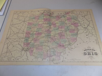
$5.95 Shipping Condition: New Location: Las Vegas, United States Sandusky, Ohio. Sandusky 1870. Sandusky 1883. Sandusky 1898. Year: 1883. These Historic Art Prints are suitable for framing, mounting or direct display ... moreon any wall! “Vibrant and bright! Pic does not do it justice.looks amazing!”.
Buy It Now
$8.51 Shipping Location: Medford, United States In Bromley's Atlas of 1883, this map is identified as Plate K. Assessors and various other city officials (planners, fire and police forces, utility and ... moreservice providers, etc.) thereby had critical information readily available.
Buy It Now
Free Shipping Location: Augusta, United States FREE: Acid-free date card (a modern lithographic copy) included with your map. "An Authentic Original Map Not A Reproduction".
Buy It Now
$8.00 Shipping Location: Bristol, United States Very Rare and Original Hand Drawn map of Cincinnati Ohio Dated April 1, 1882Showing United Railroads stockyard, houses, Rivers, roads and even the baseball ... moregrounds 56” X 20”
Buy It Now
$7.00 Shipping Location: North Wales, United States 1870 ANTIQUE TITUS ATLAS OF CLARKE COUNTY OHIO-MAP OF SPRINGFIELD ORIGINAL ANTIQUE ATLAS MAP PLEASE SEE PHOTOS AS PART OF THE DESCRIPTION CONDITION: MAP ... moreIS IN GOOD CONDITION. SIZE: APPROXIMATELY 10" X 13" SHIPPING: U.S. FIRST CLASS RATE - $7.00 - ANY ITEM WHICH SELLS FOR OVER $100 WILL REQUIRE INSURANCE WE COMBINE SHIPPING FOR MULTIPLE WINS. THANK YOU FOR YOUR INTEREST IN OUR AUCTIONS!.
Buy It Now
Free Shipping Location: Augusta, United States "An Authentic Original Map Not A Reproduction".
Buy It Now
Free Shipping Location: Schertz, United States This Map was removed from a 1899 Cram's Atlas and is in good acceptable condition. The map is not " new " or in " new " condition, it was printed in 1899. ... moreThe map is not dated. Study the photos carefully, this is the actual map you will receive.
Buy It Now
Free Shipping Location: Carefree, United States TITLE AT TOP WITH BORDER SURROUNDING MAP. SCARCE AND VERY DETAILED ORIGINAL PLAT MAP.
Buy It Now
Free Shipping Location: Schertz, United States This antique plat atlas map is a rare find for collectors and enthusiasts alike. Printed in 1876, this map page features Perry Township, Fayetteville, ... moreand Verra Cruz in Ohio. Measuring approximately 17" x 27", this lithographic map is in its original coloring and is an antique original. The cartographer/publisher is LAKE & GRIFFING / LAKE, GRIFFING & STEVENSON. The map is in good shape and can be a valuable addition to any collection. Shipping is free within the USA and calculated for worldwide orders. Don't miss out on the chance to own a piece of history with this antique plat atlas map.
Buy It Now
$4.69 Shipping Location: Greenacres, United States Original 1897 antique color lithographed map of northern Ohio, with decorative piano-key border, printed more than 115 years ago. This map is a great ... moreresource for researching family history, and it would make an impressive display in your den or office.
Buy It Now
Free Shipping Location: Monroeville, United States Source - Atlas of Cuyahoga County, Ohio. Date - 1874. Condition - Quite Nice.
Buy It Now
Free Shipping Location: Augusta, United States "An Authentic Original Map Not A Reproduction".
Buy It Now
Free Shipping Location: Monroeville, United States Date - 1870. Condition - Nice, both vertical folds have fold-splits at the bottom, each repaired on the reverse as best as we could.
Buy It Now
$5.95 Shipping Condition: New Location: Las Vegas, United States Akron 1882. Akron, Ohio. Akron 1870. Year: 1882. Akron-Middlebury 1882. Bellaire 1882. Niles 1882. Ravenna 1882.

Buy It Now
$11.00 Shipping Location: Rockville, United States Up for sale is an ANTIQUE TOPOGRAPHIC map of"MARION. OHIO" Includes Mansfield and Columbus, as well. Printed by the Army Map Service. Corps ... moreof Engineers, Department of the Army. Edition of 1950. This map measures approximately 29 x 24 inches. Including the border area. On the reverse side, there is 1 gray& white map of Williamsport, PA& Vicinity. The map has specific details to it and shows various attributes- different road surfaces. Buildings, barnes, greenhouses, railroads, national boundaries, State boundaries, towns, woods, vineyards, marshes, mine tunnels, steep slopes, tunnels, bridges, etc. Map is generally in Good condition. It has been stored in a roll for many years. So it naturally rolls up now. The map has some wear and browning. There are some creases and tears around the edges of the paper and other stains along the edges. It is"crumpled" along the top edge. There are other creases and dings here and there. As well. This map is a great piece of history! It will look very nice when framed. Please see my store for other great items. Inventory MS- Box 1- Map#27
Buy It Now
$4.00 Shipping Location: Harborton, United States It is dated 1904 on the bottom left corner. This is an antique map of Cincinnati, Ohio which was carefully removed from an atlas published in 1927. It ... moreis in very good condition - note light creasing and there is text on the reverse side.
Buy It Now
Free Shipping Location: Schertz, United States This antique county map of Holmes, Ohio was published in 1875 by cartographer Henry Cring and J.A. Caldwell. Measuring approximately 14" x 17", it is ... morea plat atlas map that features original coloring and was printed using lithography. The map page shows the townships of Killbuck, Paint, Middletown and Oxford. The map is an authentic piece of history, with free shipping within the USA and calculated shipping worldwide. It is a wonderful addition to any collection of North America maps, maps, atlases & globes, or antiques.
Buy It Now
Free Shipping Location: Anaheim, United States Central Ohio including the following counties Central Ohio incluing portions of the following countie One Regional/City/Local Sheet Map that is production ... morefolded. Bio-predation & Oxidation (aging, age discoloration mainly on the outside panels).
Buy It Now
Free Shipping Location: Monroeville, United States Date - 1875. Size - about 13.75x16.25", hand-colored.
Buy It Now
Free Shipping Location: Augusta, United States
Buy It Now
Free Shipping Location: Monroeville, United States Source - An Atlas of Van Wert County, Ohio. Date - 1886.
Buy It Now
$4.99 Shipping Location: Fairview, United States It is by George Cram and was published in the Monarch Standard Atlas, Chicago, IL, 1899, a copy of the title page is included. There is a similar or partial ... moremap of another state on the reverse. Overall a nice antique map in great condition with beautiful color.
Buy It Now
Free Shipping Location: Monroe, United States ORIGINAL 1931 ANTIQUE COLOR GEOLOGICAL MAP OF PARTS OF MARYLAND, DELAWARE, VIRGINIA, WEST VIRGINIA, OHIO, PENNSYLVANIA, NORTH CAROLINA, NEW JERSEY AND ... moreSOUTH CAROLINA. RARE LARGE ORIGINAL 1931 ANTIQUE COLOR GEOLOGICAL MAP OF PART OF THE MID-ATLANTIC STATES.
Buy It Now
Free Shipping Location: Augusta, United States This 14 1/2" x 22" map is in VERY GOOD condition with light tone, soil, errant yellow ink from publishing as seen in the last photo, and a fold in the ... moremiddle as issued, from a disbound Cram's atlas ©1901.
Buy It Now
Free Shipping Location: San Antonio, United States This Map was removed from a 1891 Cram's Atlas and is in very good condition. This map is not " new " or in " new " condition, it was printed in 1891. ... moreIncluding Hundreds of RareCivil War Period United States.
Buy It Now
Free Shipping Location: Monroeville, United States Date - 1868. Source - Atlas of the State of Ohio. Condition - Very Nice. Size - about 14.5x17".
Buy It Now
Free Shipping Location: Schertz, United States This antique original 1874 plat atlas lithography map features the Third Ward and Second Ward of Akron, Ohio. Measuring approximately 14" x 17", this ... moremap page was printed by Tackabury, Mead & Moffett. The US state of Ohio is highlighted on this North America map and it is a perfect addition to any collection of maps, atlases, and globes. Free shipping is available for customers within the USA, while calculated shipping is available worldwide.
Buy It Now
Free Shipping Location: Mcminnville, United States Original and authentic, this 1911 Century Atlas map plate from the Century Dictionary Cyclopedia is a remarkable find. I can always make a deal for multiple ... moreas well!
Buy It Now
$4.00 Shipping Location: Harborton, United States This is an antique map of Ohio which was carefully removed from a Rand McNally atlas published in 1913. It is dated 1911 on the bottom left corner. ANTIQUE ... moreOHIO STATE MAP. and there is another map on the reverse side.
Buy It Now
$11.85 Shipping Location: Dover, United States Issued 1797-1804, United States by Bradley. Map is perfect candidate for basic cleaning restoration but worthy of display as it survives.
Buy It Now
$6.95 Shipping Location: Dover, United States Issued 1832, Boston by S. G. Goodrich. Engraved by G. Boynton. Western States. There are different variant versions of this map, this example being the ... morefirst issue.
Buy It Now
$11.00 Shipping Location: Rockville, United States Large with hand colored outlines.
Buy It Now
Free Shipping Location: Monroeville, United States Click Here. Double your traffic. Get Vendio Gallery- Now FREE! Gorgeous. Antique 1875 handcolored map, the map is a large folding map, titled New Map ... moreof Ohio, Prepared Especialy for Evert's Illustratd Historical Atlas, by H.H. Lloyd& Co, 21 John St N.Y. Has Population of Ohio, by Counties, 1870, also United States and Principal Cities, alldated 1870. This dates the map nicely. The map has some large tears repaired on reverse with archival paper and tape, the tears were at the bottom and some of the map is lost at lower right, but has archival paper replacing it, see my photo, still a fascianting gorgeous huge period Ohio map. The map is printed on very thick paper. The superb handcoloring is period to the map. The map is from the rare 1875 Everts Atlas of Tuscarawas County Ohio. The map is in nice condition, and would frame and display beautifully. The size of the map is 23" by 25.5" Rare. Winning bidder pays $4.00 shipping domestic, more foreign. Payment I accept the following forms of payment: PayPal Click to View Image Album Shipping& Handling US Shipping. $4.00 USPS First-Class Mail® International Shipping. $9.00 USPS First-Class Mail International FREE scheduling. Supersized images and templates. Get Vendio Sales Manager. FREE scheduling. Supersized images and templates. Get Vendio Sales Manager. di,RcmdId ViewItemDescV4,RlogId p4%60bo7%60jtb9%3Fuk%601d72f%2Bishhov%3C%3Edi-13cf165eb66-0xf7-
Buy It Now
Free Shipping Location: Schertz, United States This Map was removed from an 1870 CLERMONT Co., OH Plat Atlas and is in good acceptable condition. The map is not " new " or in " new " condition, it ... morewas printed in 1870. The map is not dated. Study the photos carefully, this is the actual map you will receive.
Buy It Now
Free Shipping Location: Augusta, United States "An Authentic Original Map Not A Reproduction".
Buy It Now
Free Shipping Location: Schertz, United States The map is not " new " or in " new " condition, it was printed in 1897. Study the photos carefully, this is the actual map you will receive. The map is ... moreapprox. 15" x 18". The book & title page are not included but only used as a verification reference.
Buy It Now
Free Shipping Location: Augusta, United States This 14 1/2" x 22" map is in NEAR FINE condition with very light tone soil, and a fold in the middle as issued, from a disbound Cram's atlas ©1903. "An ... moreAuthentic Original Map Not A Reproduction".
Buy It Now
Free Shipping Location: Schertz, United States This Map was removed from a 1870 Johnson's Atlas and is in good acceptable condition. The map is not " new " or in " new " condition, it was printed in ... more1870. The map dated. Study the photos carefully, this is the actual map you will receive.
Buy It Now
Free Shipping Location: Augusta, United States "An Authentic Original Map Not A Reproduction".
Buy It Now
$4.00 Shipping Location: Harborton, United States
Buy It Now
Free Shipping Location: Augusta, United States "An Authentic Original Map Not A Reproduction".
Buy It Now
Free Shipping Location: Monroeville, United States Date - 1870. Condition - Very Nice. Size - about 12x14.75", hand-colored.
Buy It Now
Free Shipping Location: Monroeville, United States Date - 1875. Size - about 13.75x16.25", hand-colored.
Buy It Now
Free Shipping Location: Monroeville, United States Source - Atlas of Muskingum County, Ohio. Date - 1866.
Buy It Now
Free Shipping Location: Augusta, United States "An Authentic Original Map Not A Reproduction".
Buy It Now
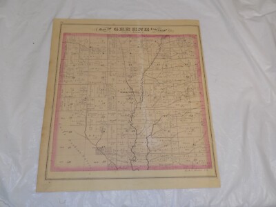
Free Shipping Location: Monroeville, United States Click Here. Double your traffic. Get Vendio Gallery- Now FREE! Vintage antique 1874 handcolored map. The map is 2 sided and either side would frame and ... moredisplay nicely. One side is Map of Greene Township. I see Greensburg and much more. Verso is a superb antique lithograph print page, showing 2 superb views at Fowler Township, both have horse drawn carriages in the views, top view is Res of John Jones, and bottom is Res of Tp Craft. This is an antique map and not a reprint or reproduction. The handcoloring on the map is period to the map, this is before color printing. The last page is a fine lithograph print showing a view of Res. of G.E. Shank. The map is from the very rare 1875 Everts Atlas of Trumbull County Ohio. The map is a fascinating and historic period look at this area at this time. The map shows the home and land owners, the business and industry, the few roads, railroads etc that existed at that time. The photo wont show the full beauty of the map. The map is in nice shape,tight and clean. The size of the map is 14" by 17" Winning bidder pays $4.00 shipping domestic, more foreign. Payment I accept the following forms of payment: PayPal Click to View Image Album Click to View Image Album Shipping& Handling US Shipping. $3.75 USPS First-Class Mail® International Shipping. $11.50 USPS First-Class Mail International FREE scheduling. Supersized images and templates. Get Vendio Sales Manager. FREE scheduling. Supersized images and templates. Get Vendio Sales Manager. RcmdId ViewItemDescV4,RlogId p4%60bo7%60jtb9%3Fuk.rp*a4%601gc%3E-14706552125-0x10f-
Buy It Now
Free Shipping Location: Augusta, United States "An Authentic Original Map Not A Reproduction".
Buy It Now
$5.40 Shipping Location: Elkhorn, United States X-------x Map from 1911 Rand McNally Atlas with State History. I also rely on internet research.
Buy It Now
Free Shipping Location: Monroeville, United States Date - 1874. Source - Combination Atlas Map of Trumbull County, Ohio. Size - about 13.75x16.5", hand-colored.
Buy It Now
Free Shipping Location: Augusta, United States FREE: Acid-free date card (a modern lithographic copy) included with your map. "An Authentic Original Map Not A Reproduction".
Buy It Now
Free Shipping Location: Monroeville, United States Date - 1876. Source - Illustrated Atlas of Noble County, Ohio. Size - about - 13.75x17.5", hand-colored.
Buy It Now
Free Shipping Location: Cincinnati, United States RARE ORIGINAL 1875 HAND-COLORED ANTIQUE PLAT OF SWAN CREEK OHIO. FAIR CONDITION, DISCOLORATION, STAINING, TEXT ON REVERSE.
Buy It Now
$6.00 Shipping Location: Corunna, United States This is a beautiful map with very nice detail.Map is hand colored and is dated 1864. This is an original 156 year old map, not a copy or reprint.
Buy It Now
Free Shipping Location: Willow Grove, United States This is an ORIGINAL Cleveland (Ohio) and vicinity map taken from a 1919 atlas. There is a similar map of Toledo on the reverse side of this map page. ... more(different orientation).
Buy It Now
Free Shipping Location: Augusta, United States "An Authentic Original Map Not A Reproduction".
Buy It Now
Free Shipping Location: Schertz, United States This antique plat atlas map features Mechanics Township in Holmes County, Ohio. Printed using the lithography technique in 1875, the map measures approximately ... more14" x 17" and comes with original coloring. It was published by Henry Cring and J.A. Caldwell, with the map page being an original piece from 1875. This item comes with Free S&H in the USA and calculated S&H for worldwide shipping.
Buy It Now
Free Shipping Location: Augusta, United States "An Authentic Original Map Not A Reproduction".
Buy It Now
Free Shipping Location: Kennebunk, United States This Map was removed from a 1874 Atlas and is in good acceptable condition. Study the photos carefully, this is the actual map you. Including Hundreds ... moreof RareCivil War.
Buy It Now
$6.95 Shipping Location: Dover, United States Issued 1840 & 1851, Boston by S.G. Goodrich. Close inspection reveals they are variants. Western States - Lot x 2. Any age flaws mostly minor and easy ... moreto overlook or forgive.
Buy It Now
$6.95 Shipping Location: Dover, United States Issued 1859, Boston. Engraved by Boynton. Mid 19th century miniature engraved map with original hand color. Map identifies area in square miles and state ... morepopulations.
|
|
|
In
|
ANTIQUE MAP OF FREEDOM TOWNSHIP PORTAGE COUNTY OHIO~EARLY 1900 ORIGINAL MAP
~ANTIQUE MAP OF FREEDOM TOWNSHIP. PORTAGE COUNTY OHIO~ THIS ORIGINAL MAP CAME FROM A ATLAS OF THE TOWNSHIPS OF PORTAGE COUNTY DATED 1900. PAGE HAS WEAR AND MEASURES 17" BY 15" PERFECT FOR FRAMING TO PUT INTO YOUR HOME OR OFFICE. LOOK TO MY OTHER AUCTIONS FOR MORE MAPS FROM THIS COUNTY. VIEW THE PHOTOS PROVIDED FOR BEST DESCRIPTION. I sell Vintage and Used items with character and wear. No Reproductions found here. Please review all photos I have provided and please ask any questions before bidding. I sell all items AS-IS with No Returns. Please make Paypal payment with-in 2 days of auction end. Thanks Powered by The free listing tool. List your items fast and easy and manage your active items.
|
|
|
ANTIQUE MAP OF HIRAM TOWNSHIP PORTAGE COUNTY OHIO~EARLY 1900 ORIGINAL MAP
~ANTIQUE MAP OF HIRAM TOWNSHIP. PORTAGE COUNTY OHIO~ THIS ORIGINAL MAP CAME FROM A ATLAS OF THE TOWNSHIPS OF PORTAGE COUNTY DATED 1900. PAGE HAS WEAR AND MEASURES 17" BY 15" PERFECT FOR FRAMING TO PUT INTO YOUR HOME OR OFFICE. LOOK TO MY OTHER AUCTIONS FOR MORE MAPS FROM THIS COUNTY. VIEW THE PHOTOS PROVIDED FOR BEST DESCRIPTION. I sell Vintage and Used items with character and wear. No Reproductions found here. Please review all photos I have provided and please ask any questions before bidding. I sell all items AS-IS with No Returns. Please make Paypal payment with-in 2 days of auction end. Thanks Powered by The free listing tool. List your items fast and easy and manage your active items.
|
|
|
ANTIQUE MAP OF MANTUA TOWNSHIP PORTAGE COUNTY OHIO~EARLY 1900 ORIGINAL MAP
~ANTIQUE MAP OF MANTUA TOWNSHIP. PORTAGE COUNTY OHIO~ THIS ORIGINAL MAP CAME FROM A ATLAS OF THE TOWNSHIPS OF PORTAGE COUNTY DATED 1900. PAGE HAS WEAR AND MEASURES 17" BY 15" PERFECT FOR FRAMING TO PUT INTO YOUR HOME OR OFFICE. LOOK TO MY OTHER AUCTIONS FOR MORE MAPS FROM THIS COUNTY. VIEW THE PHOTOS PROVIDED FOR BEST DESCRIPTION. I sell Vintage and Used items with character and wear. No Reproductions found here. Please review all photos I have provided and please ask any questions before bidding. I sell all items AS-IS with No Returns. Please make Paypal payment with-in 2 days of auction end. Thanks Powered by The free listing tool. List your items fast and easy and manage your active items.
|
|
|
ANTIQUE MAP OF NELSON TOWNSHIP PORTAGE COUNTY OHIO~EARLY 1900 ORIGINAL MAP
~ANTIQUE MAP OF NELSON TOWNSHIP. PORTAGE COUNTY OHIO~ THIS ORIGINAL MAP CAME FROM A ATLAS OF THE TOWNSHIPS OF PORTAGE COUNTY DATED 1900. PAGE HAS WEAR AND MEASURES 17" BY 15" PERFECT FOR FRAMING TO PUT INTO YOUR HOME OR OFFICE. LOOK TO MY OTHER AUCTIONS FOR MORE MAPS FROM THIS COUNTY. VIEW THE PHOTOS PROVIDED FOR BEST DESCRIPTION. I sell Vintage and Used items with character and wear. No Reproductions found here. Please review all photos I have provided and please ask any questions before bidding. I sell all items AS-IS with No Returns. Please make Paypal payment with-in 2 days of auction end. Thanks Powered by The free listing tool. List your items fast and easy and manage your active items.
|
|
|
1900 Antique CLEVELAND Ohio MAP Vintage Map BEAUTIFUL 1800s Collectible
ANTIQUE CLEVELAND COLLECTIBLE MAP This is an original. Not reproduction, vintage map which was carefully removed from an atlas. Item measures approximately 9" by 12.5" and is in very good condition. There is light staining on the border, beyond the map and index. I happily combine purchases to save on shipping fees. Your item will be packaged in a plastic sleeve. And shipped in a cardboard mailing tube. Please email with questions. I will answer your email promptly! Be sure to add me to your! Check out my! Powered by The free listing tool. List your items fast and easy and manage your active items.
|
|
|
VAN WERT COUNTY OHIO authentic Antique Highway Map genuine 103 years old - 1910
VAN WERT COUNTY. OHIO Authentic 103-Year-Old Antique Highway Map FREE SHIPPING ANYWHERE IN THE USA! Printed in 1910 by the Ohio Highway Department. This is a beautifully detailed, 103-year-old map of Van Wert County Ohio. It measures about 13 by 16 inches(about 33 by 41 cm. and is in Very Good condition. This map is very detailed showing topographical features(rivers, lakes, creeks, etc. townships, cities, villages and Post Office towns, routes of old railroads, and of course old roads and highways, including gravel roads, macadam roads, brick roads, and dirt roads. There are no asphalt or concrete roads- nothing like what we would call a highway today. Scale is three miles to the inch. This is a guaranteed genuine antique map! It was printed on a single sheet of very nice stock. Blank on the reverse. About one-inch margins on all sides. ... moreThe image above is cropped by my scanner. Highly suitable for framing, this GENUINE ANTIQUE would look gorgeous in your office, den, library or study. It is similar to many of the maps shown in expensive mail-order catalogues, only this is an actual antique, not just made to look like one. NOT a modern copy or reproduction! An excellent investment. This map is certain to appreciate in value over time. Please ask all questions before making your purchase. This scan is enlarged to show representative detail. FREE SHIPPING anywhere in the USA by USPS First Class Mail. Priority and Express services also available. Shipped rolled in a sturdy tube. hmoh10a
|
|
|
ANTIQUE MAP OF ATWATER TOWNSHIP PORTAGE COUNTY OHIO~EARLY 1900 ORIGINAL MAP
~ANTIQUE MAP OF ATWATER TOWNSHIP. PORTAGE COUNTY OHIO~ THIS ORIGINAL MAP CAME FROM A ATLAS OF THE TOWNSHIPS OF PORTAGE COUNTY DATED 1900. PAGE HAS WEAR AND MEASURES 17" BY 15" PERFECT FOR FRAMING TO PUT INTO YOUR HOME OR OFFICE. LOOK TO MY OTHER AUCTIONS FOR MORE MAPS FROM THIS COUNTY. VIEW THE PHOTOS PROVIDED FOR BEST DESCRIPTION. I sell Vintage and Used items with character and wear. No Reproductions found here. Please review all photos I have provided and please ask any questions before bidding. I sell all items AS-IS with No Returns. Please make Paypal payment with-in 2 days of auction end. Thanks Powered by The free listing tool. List your items fast and easy and manage your active items.
|
|
|
ANTIQUE MAP OF AURORA TOWNSHIP PORTAGE COUNTY OHIO~EARLY 1900 ORIGINAL MAP
~ANTIQUE MAP OF AURORA TOWNSHIP. PORTAGE COUNTY OHIO~ THIS ORIGINAL MAP CAME FROM A ATLAS OF THE TOWNSHIPS OF PORTAGE COUNTY DATED 1900. PAGE HAS WEAR AND MEASURES 17" BY 15" PERFECT FOR FRAMING TO PUT INTO YOUR HOME OR OFFICE. LOOK TO MY OTHER AUCTIONS FOR MORE MAPS FROM THIS COUNTY. VIEW THE PHOTOS PROVIDED FOR BEST DESCRIPTION. I sell Vintage and Used items with character and wear. No Reproductions found here. Please review all photos I have provided and please ask any questions before bidding. I sell all items AS-IS with No Returns. Please make Paypal payment with-in 2 days of auction end. Thanks Powered by The free listing tool. List your items fast and easy and manage your active items.
|
|
|
ANTIQUE MAP OF BRIMFIELD TOWNSHIP PORTAGE COUNTY OHIO~EARLY 1900 ORIGINAL MAP
~ANTIQUE MAP OF BRIMFIELD TOWNSHIP. PORTAGE COUNTY OHIO~ THIS ORIGINAL MAP CAME FROM A ATLAS OF THE TOWNSHIPS OF PORTAGE COUNTY DATED 1900. PAGE HAS WEAR AND MEASURES 17" BY 15" PERFECT FOR FRAMING TO PUT INTO YOUR HOME OR OFFICE. LOOK TO MY OTHER AUCTIONS FOR MORE MAPS FROM THIS COUNTY. VIEW THE PHOTOS PROVIDED FOR BEST DESCRIPTION. I sell Vintage and Used items with character and wear. No Reproductions found here. Please review all photos I have provided and please ask any questions before bidding. I sell all items AS-IS with No Returns. Please make Paypal payment with-in 2 days of auction end. Thanks Powered by The free listing tool. List your items fast and easy and manage your active items.
|
|
|
Ohio c. 1853 original Boynton antique hand colored map
OHIO issued Boston: c. 1853; by Boynton Fine original antique map. Printed in the mid-19th century on quality paper which retains its inherent structural flexibility and soundness, with full hand color. In Very Good or better condition. Very light surface toning[note: we grade very conservatively and always seek to disclose any noteworthy flaws] The printed area remains pleasing. A nice example of a Boynton map. Sheet measures c. 5 3/8" W x 7" H. engraved area measures c. 4 1/4" W x 6 1/4" H. 20169] Guaranteed Authentic! We do not sell modern reproductions. Condition All of our items are original antique pieces and it is important to keep in mind that many of them have been around for 100 years or more. Individual pieces may have seen many owners and been handled many times over the course of their existence and as a result ... moreeach piece has developed a history of it's own. Short edge splits(often repaired with archival tape) Foxing, discoloration, etc. are all things to expect on items of this type. They rarely distract from the piece and often add to the overall character of the item. Keep in mind when you receive your item that you are not handling a modern copy, you are holding a piece of history, an item that has been around for a very long time and will, with proper care, be around for a long time to come. We try to note any significant flaws in the description, but less noticeable or common characteristics may not be mentioned. As we are a US based company all of our measurements are in Inches. If you need the size in Centimeters please multiply the supplied measurement by 2.53. Payment and Shipping We happily accept PayPal! Payment is appreciated within 5 days of invoicing. Once payment has been received we do our best to make sure all orders are shipped within two business days and often have them shipped within one. We send payment confirmation and a copy of the receipt to the email address associated with your PayPal payment. All orders are shipped well protected in sturdy tubes or
|
|
|
USA 1866: Ohio.Kentucky.Indiana. Interesting old Antique Map. Cornell #9
THIS IS A GENUINE ANTIQUE MAP FREE SHIPPING WORLDWIDE TITLE UNITED STATES#9. Kentucky. Indiana. Ohio. Inset panels of Chicago. Louisville, Cincinnati& Cleveland DATE PUBLISHED SIZE Approximately OVERALL SIZE: 11x9 inches IMAGE SIZE: 9.5x8 inches( 25x21 cms) CONDITION Good. A nice inexpensive colored(Colour) map. Text verso. But no'bleed' nor show through. 8 = NOT COMMON CERTIFICATE OF AUTHENTICITY This is a genuine original vintage item warranted to have been printed at the date stated. IT IS NOT A MODERN DAY REPRODUCTION. The Buyer may wish to print this page. RETURNS POLICY YOUR COMPLETE SATISFACTION GUARANTEED or your money back. INVENTORY Do please visit my Store for a full list of KENTUCKY items PROVENANCE PUBLISHER: D. APPLETON& COMPANY. 443& 445, Broadway, New York CARTOGRAPHY: Sarah Sophia Cornell. One of the earliest ... moreof American female Cartographers PAYMENT Preferred please A part from vacations. Etc. I normally mail orders within 1 business day of payment. Virtually all historical& antiquarian items are subject to some normal aging. Which is not obtrusive, unless stated otherwise. FRANCE: Gravures et Cartes anciennes. DEUTSCHLAND: Alte Lankarten und Stadt ansichten. ITALIA: Stampe& Mappe antiche. ESPAÑA: Mapas antiquos y impresiones antiguas. EandOE. Force Majeure. English law shall apply. Many thanks for looking. My name is Julie. I've retired after a career in education in the UK. Do for many great gift ideas. Created by eBay Blackthorne ver. 3.2.146.0
|
|
|
Ohio Indiana Northern Kentucky 1830 antique engraved map
Ohio Indiana Northern Kentucky 1830 antique engraved map Ohio& Indiana Issued 1830. Connecticut by D.F. Robinson Fine original antique engraved map. Printed in the 19th century, on quality paper which retains its inherent structural flexibility and soundness. With beautiful original hand color. In near VG or better condition. Light minor age wear, overall very presentable and attractive[note: we grade very conservatively and always seek to disclose any noteworthy flaws] The printed area remains visually pleasing. A nice impression of an interesting antique map which will look nice when displayed. Sheet measures c. 10 7/8" H x 8 7/8" W. Printed area measures c. 9 1/2" H x 7 3/8" W. 31528] Any defects along the sheet edges and in the margins may be seen in the photos. note: All old sheets of printed paper possibly have ... moreshort edge splits. Each sheet has existed for a very long time and has probably been handled repeatedly in the course of it's existence. It has a history unique to it as an object. Most of the time any edge splits are short. Minor, insignificant and have been closed- either long ago or more recently with small pieces of archival tape. Most often these splits are trivial and easy to overlook visually. Basically, they would not significantly affect the piece adversely. The item is offered as seen. Please look carefully and make your decision knowing this antique image is nice. But it is not in perfect"like new" condition. However, with whatever flaws it possesses, it remains entirely worthy of ownership and inclusion in any related collection. We feel it will prove very pleasing to its new owner. We stand behind everything we sell. Everything we offer is guaranteed to be an authentic original antique item as described. We do not sell modern reproductions. Please visit our. We happily accept PayPal! WE OFFER FLAT RATE SHIPPING WORLD WIDE! Please request an invoice before paying for multiple item
|
|
|
1909 Antique State Map OHIO or INDIANA
Auction Wizard 2000 Listing Template- AW2KLOT#4375 tincuptom Auctions 1909 Antique State Map OHIO or INDIANA Original 1909 dated McNally Map Excellent Condition Measures 11 x 14 inch View my other listings for more antique maps. Shipping and handling in the USA is $0.00. Payments are due in 7 day. You may pay by Paypal only. Please E-mail for International Shipping rates.
|
|
|
ANTIQUE MAP OF RAVENNA TOWNSHIP PORTAGE COUNTY OHIO~EARLY 1900 ORIGINAL MAP
~ANTIQUE MAP OF RAVENNA TOWNSHIP. PORTAGE COUNTY OHIO~ THIS ORIGINAL MAP CAME FROM A ATLAS OF THE TOWNSHIPS OF PORTAGE COUNTY DATED 1900. PAGE HAS WEAR AND MEASURES 17" BY 15" PERFECT FOR FRAMING TO PUT INTO YOUR HOME OR OFFICE. LOOK TO MY OTHER AUCTIONS FOR MORE MAPS FROM THIS COUNTY. VIEW THE PHOTOS PROVIDED FOR BEST DESCRIPTION. I sell Vintage and Used items with character and wear. No Reproductions found here. Please review all photos I have provided and please ask any questions before bidding. I sell all items AS-IS with No Returns. Please make Paypal payment with-in 2 days of auction end. Thanks Powered by The free listing tool. List your items fast and easy and manage your active items. RcmdId ViewItemDescV4,RlogId p4%60bo7%60jtb9%3Fuk.rp*a4%601gc%3E-13e1512872d-0xf4-
|
|
|
ANTIQUE MAP OF SUFFIELD TOWNSHIP PORTAGE COUNTY OHIO~EARLY 1900 ORIGINAL MAP
~ANTIQUE MAP OF SUFFIELD TOWNSHIP. PORTAGE COUNTY OHIO~ THIS ORIGINAL MAP CAME FROM A ATLAS OF THE TOWNSHIPS OF PORTAGE COUNTY DATED 1900. PAGE HAS WEAR AND MEASURES 17" BY 15" PERFECT FOR FRAMING TO PUT INTO YOUR HOME OR OFFICE. LOOK TO MY OTHER AUCTIONS FOR MORE MAPS FROM THIS COUNTY. VIEW THE PHOTOS PROVIDED FOR BEST DESCRIPTION. I sell Vintage and Used items with character and wear. No Reproductions found here. Please review all photos I have provided and please ask any questions before bidding. I sell all items AS-IS with No Returns. Please make Paypal payment with-in 2 days of auction end. Thanks Powered by The free listing tool. List your items fast and easy and manage your active items. ag6 2.RcmdId ViewItemDescV4,RlogId p4%60bo7%60jtb9%3Fuk.rp73%28c%3Eag6%3E2-13e15128645-0x100-
|
|
|
ANTIQUE MAP OF WINDHAM TOWNSHIP PORTAGE COUNTY OHIO~EARLY 1900 ORIGINAL MAP
~ANTIQUE MAP OF WINDHAM TOWNSHIP. PORTAGE COUNTY OHIO~ THIS ORIGINAL MAP CAME FROM A ATLAS OF THE TOWNSHIPS OF PORTAGE COUNTY DATED 1900. PAGE HAS WEAR AND MEASURES 17" BY 15" PERFECT FOR FRAMING TO PUT INTO YOUR HOME OR OFFICE. LOOK TO MY OTHER AUCTIONS FOR MORE MAPS FROM THIS COUNTY. VIEW THE PHOTOS PROVIDED FOR BEST DESCRIPTION. I sell Vintage and Used items with character and wear. No Reproductions found here. Please review all photos I have provided and please ask any questions before bidding. I sell all items AS-IS with No Returns. Please make Paypal payment with-in 2 days of auction end. Thanks Powered by The free listing tool. List your items fast and easy and manage your active items.
|
|
|
Ohio Indiana 1860 Mitchell antique hand color lithograph map
Ohio Indiana 1860 Mitchell antique hand color lithograph map County Map of Ohio and Indiana Issued 1860. By S. A. Mitchell, Philadelphia Fine original antique hand colored lithographed map. Printed on quality paper which retains its inherent structural flexibility and soundness. Map is surrounded by a lovely decorative border. In near VG or better condition. Light minor age wear, overall very presentable and attractive[note: we grade very conservatively and always seek to disclose any noteworthy flaws] The printed area remains visually pleasing. A nice impression of an interesting antique map which will look nice when displayed. Sheet measures c. 15 1/4" W x 12 3/8" H. Printed area measures c. 13 1/4"W x 10 5/8" H. 18386] note: All old sheets of printed paper possibly have short edge splits. Each sheet has existed for ... morea very long time and has probably been handled repeatedly in the course of it's existence. It has a history unique to it as an object. Most of the time any edge splits are short. Minor, insignificant and have been closed- either long ago or more recently with small pieces of archival tape. Most often these splits are trivial and easy to overlook visually. Basically, they would not significantly affect the piece adversely. The item is offered as seen. Please look carefully and make your decision knowing this antique image is nice. But it is not in perfect"like new" condition. However, with whatever flaws it possesses, it remains entirely worthy of ownership and inclusion in any related collection. We feel it will prove very pleasing to its new owner. We stand behind everything we sell. Everything we offer is guaranteed to be an authentic original antique item as described. We do not sell modern reproductions. Please visit our eBay Store. We happily accept PayPal! WE OFFER FLAT RATE SHIPPING WORLD WIDE! Please request an invoice before paying for multiple items so that we can ensure that you ar
|
|
|
CINCINNATI Ohio - 1898 Antique Color City Map - 115 Years Old
Method of payment Cincinnati Ohio 189 8 Antique Color City Map- 11 5 Years Old- Steam railroads and Horse Paths marked This is an original color map- 113 years old. 189 8. It is not a reproduction. Map measures approximately 12" x 9" Map is printed right out to edges) Blank on reverse. The digital image does not capture all of the detail in the engraving. Published a s an insert in a Polish language encyclopedia(map is in English) As such. The map has a natural fold in the center. Condition: It is in good+ condition with very minor handling wear(image area is unaffected) Shipping costs: Shipping costs on this item are $3.00. P/H combined for additional maps mailed at the same time. My shipping costs are calculated on three factors- getting your item to you as quickly as possible. As cost effectively as possible, and as safely as ... morepossible. I pride myself in providing optimal protection. I use First Class mailing tubes for most maps. You may request expedited shipment if you are willing to pay costs. Buy additional maps and save on P/H. Item M 31 3-R2939
|
|
|
1893 OHIO Color Antique State Map 119+ Years Old
British Parliament 1925 Vintage Lithograph 1893 Ohio Color Antique State Map More than a century old original color antique map. Published by J. B. Lippincott Company. Philadelphia. Size: Approximately 10" X 12" Natural center fold as published Blank on Reverse Condition: Excellent- Very Good+- Good- Fair- Poor(but of historical interest) Very minor handling wear(Note: Electronic scans of lithographs/engravings can produce a honeycomb(or color fringed) interference pattern in the image that is NOT in the actual print) This is an Original Print- Not a Reproduction Important: P/H is combined on multiple items that can be mailed together. BUT. With the new Ebay shopping cart, you must wait for combined invoice. The Fine Print Alabama residents responsible for 8.5% sales tax. International buyers are responsible for all import fees ... moreand taxes. Shipping costs: Shipping costs on this item are $2.95 in U.S. My shipping costs are calculated on three factors- getting your item to you as quickly as possible. As cost effectively as possible, and as safely as possible. I pride myself in providing optimal protection. I use First Class or Priority Mail on most small items; Parcel Post on larger items; and Media Mail on books and magazines. You may request expedited shipment if you are willing to pay costs. P/H is combined on multiple prints mailed at the same time. Please make your purchases from my auctions or store. I will send a combined invoice reflecting your savings. The Nature of Prints& Engravings: It was not until the 20th century that prints were commonly produced for the print itself. Prior to this. Virtually all prints(and engravings) were produced as illustrations to be included in a manuscript. Book, newspaper, or pamphlet. Therefore, a vast majority of original prints have been over the years removed from these original sources. Prints are produced using many different techniques: relief printing(woodcut& wood engraving) Intaglio printing(steel& copper plate engraving. Drypoint, aquatint, e
|
|
|
ANTIQUE MAP OF PALMYRA TOWNSHIP PORTAGE COUNTY OHIO~EARLY 1900 ORIGINAL MAP
~ANTIQUE MAP OF PALMYRA TOWNSHIP. PORTAGE COUNTY OHIO~ THIS ORIGINAL MAP CAME FROM A ATLAS OF THE TOWNSHIPS OF PORTAGE COUNTY DATED 1900. PAGE HAS WEAR AND MEASURES 17" BY 15" PERFECT FOR FRAMING TO PUT INTO YOUR HOME OR OFFICE. LOOK TO MY OTHER AUCTIONS FOR MORE MAPS FROM THIS COUNTY. VIEW THE PHOTOS PROVIDED FOR BEST DESCRIPTION. I sell Vintage and Used items with character and wear. No Reproductions found here. Please review all photos I have provided and please ask any questions before bidding. I sell all items AS-IS with No Returns. Please make Paypal payment with-in 2 days of auction end. Thanks Powered by The free listing tool. List your items fast and easy and manage your active items.
|
|
|
ANTIQUE MAP OF PARIS TOWNSHIP PORTAGE COUNTY OHIO~EARLY 1900 ORIGINAL MAP
~ANTIQUE MAP OF PARIS TOWNSHIP. PORTAGE COUNTY OHIO~ THIS ORIGINAL MAP CAME FROM A ATLAS OF THE TOWNSHIPS OF PORTAGE COUNTY DATED 1900. PAGE HAS WEAR AND MEASURES 17" BY 15" PERFECT FOR FRAMING TO PUT INTO YOUR HOME OR OFFICE. LOOK TO MY OTHER AUCTIONS FOR MORE MAPS FROM THIS COUNTY. VIEW THE PHOTOS PROVIDED FOR BEST DESCRIPTION. I sell Vintage and Used items with character and wear. No Reproductions found here. Please review all photos I have provided and please ask any questions before bidding. I sell all items AS-IS with No Returns. Please make Paypal payment with-in 2 days of auction end. Thanks Powered by The free listing tool. List your items fast and easy and manage your active items.
|
|
|
ANTIQUE MAP OF RANDOLPH TOWNSHIP PORTAGE COUNTY OHIO~EARLY 1900 ORIGINAL MAP
~ANTIQUE MAP OF RANDOLPH TOWNSHIP. PORTAGE COUNTY OHIO~ THIS ORIGINAL MAP CAME FROM A ATLAS OF THE TOWNSHIPS OF PORTAGE COUNTY DATED 1900. PAGE HAS WEAR AND MEASURES 17" BY 15" PERFECT FOR FRAMING TO PUT INTO YOUR HOME OR OFFICE. LOOK TO MY OTHER AUCTIONS FOR MORE MAPS FROM THIS COUNTY. VIEW THE PHOTOS PROVIDED FOR BEST DESCRIPTION. I sell Vintage and Used items with character and wear. No Reproductions found here. Please review all photos I have provided and please ask any questions before bidding. I sell all items AS-IS with No Returns. Please make Paypal payment with-in 2 days of auction end. Thanks Powered by The free listing tool. List your items fast and easy and manage your active items.
|
|
|
1899 Antique Map of CINCINNATI Ohio Vintage 1800s Atlas Map
Be sure to add me to your! This is an original. Not reproduction, vintage map of Cincinnati Ohio which was carefully removed from an atlas. There is surrounding border beyond the map. This map measures approximately 9" by 12" and is in very good condition. Your item will be shipped First Class. Packaged in a plastic sleeve, in a cardboard mailing tube. We happily combine purchases to save on shipping fees. Please email with questions. We will answer your email promptly! Please visit our ebay store. Plaindealing Vintage Paper. We have stocked it with thousands of vintage advertisements, prints, and historical articles. Check out my! Powered by The free listing tool. List your items fast and easy and manage your active items.
|
|
|
Antique 1921 OHIO STATE FAIR Road Map & 1920 Official Census Old Vtg Historical
This is an Antique 1921 Ohio State Fair Road map and 1920 Official Census. Shows some edge wear and tears. GREAT FIND GOOD Condition and FREE SHIPPING! SELLER NO T RESPONSIBLE FOR ERRORS*View ALL pictures and you be the judge. WE ARE NOT EXPERTS SO YOU ARE BUYING AS IS WITH NO GUARANTEE. Please view ALL pictures. Pictures are part of description. Thank you for stopping by! Happy Bidding! View My Other Items For Sale.
|
|
|
1855 Genuine Antique map of Ohio. Hand colored. Colton
Genuine antique map"Colton's Ohio" Entered according to act of Congress in the year 1855 by J.H. Colton. from Colton's General Atlas published by G.W. C.B. Colton& Co. 172 William St, New York. The image shows nice detail of counties, railroads, roads and cities. Inset depicts the city of Cleveland. O riginal hand coloring and surrounded by Colton's signature intertwining border. Page is in good condition. Measures 12 3/4" x 15 1/2" NOT A REPRODUCTION. All of our items are genuine antiques as described.
|
|
|
Antique Map of Ohio The Buckeye State 1881 Lithograph
You are getting the whole print as shown in image 2 SUBJECT: Maps. United States, Ohio DATE: 1881 9th Edition MEDIUM OR PRINTING METHOD: Chromolithograph. Lithography ORIGIN: Encyclopedia Britannica SIZE: 7.5 x 10.5 TAKE A CLOSE LOOK AT OUR IMAGES TO SEE THE CONDITION OF THIS PRINT. CONDITION: This is an antique print. While our prints are generally in very good condition. You should expect some yellowing, minor blemishes, minor soiling or other small imperfections. There is no black border on the original as shown in image 1. It's just for Purdy! SHIPPING AND PACKAGING: We ship carefully in sturdy acid free shipping materials. We'll gladly ship International but can not be responsible for prints lost or damaged in transit. This is an original print. Not a reproduction. Your item will be shipped carefully in cardboard backed non acid ... morepackaging to assure it's safe arrival. SC02827Ohio
|
|
|
MAP ANTIQUE CENTURY ATLAS MAPS 1897 TO 1902 OHIO NORTH
Size/ Format In millimetres(and inches) Sheet: 400 x 300(16" x 12" The Margins on all four sides are 18 mm(0¾" These maps were all'tipped in' to the atlas. Meaning that they could be removed as a single intact sheet. The maps have a single fold in the center. The maps are high quality lithographs with tasteful and appealing colors. The maps are printed on one side only. Condition These maps are very good condition. The maps themselves are clean and bright. There are a few marks in the margins of a few of the maps. This will be evident in the scanned images. Which are high quality and unedited. The maps are untrimmed and are suitable for framing. Remarks The quality of these maps surpasses that of most. If not all, its American-produced contemporaries. These maps are much nicer than any of the Rand McNally or Cram's ... moreAtlas editions I've seen. For the 55 maps covering U.S. states. I haven't seen better maps anywhere. The maps are also very detailed. Many states are treated on two separate maps.
|
|
|
Antique Map United States Ohio Oklahoma 1927
These are nice smaller maps if you're looking for a smaller piece to frame for your home or as a gift. If you plan on buying more than one. Please wait for an invoice so I can combine shipping costs for you. Item: This is a rare. 85 year old, authentic 1927 map. It is NOT a reproduction. Book Title: The Literary Digest Atlas of the World and Gazetteer" Publisher: Funk& Wagnalls Company- New York and London Size: Approx. 6" x 9 1/4" COA: You will receive a copy of the title page and copyright page from the original book to show authenticity. Condition: This is a two sided map with an image on both sides. Please note that I am not an expert in judging the condition of antique maps. See scan for condition and if you have any questions. Please let me know. Shipping: I am always happy to combine shipping when I can. Please ... morejust wait for an invoice if you purchase more than one item. I always do my best to save you as much as I can on shipping costs. Refund policy: I offer a lifetime. No questions asked refund. If you are unhappy with your purchase, simply return it for a full refund. It's that simple. For my international customers: You will be responsible for any import taxes. Duties, or custom charges that may by required by your country. Those costs are not included in the price of this item. Also, please note that depending on where you live overseas, it can take two to six weeks to receive your map. I'm afraid, I have no control over the postal system or customs. Thanks! On Mar-18-13 at 03:46:30 PDT. Seller added the following information: Every buyer gets a MyStoreRewards invitation for cash back
|
|
|
CINCINNATI OHIO authentic Antique Map genuine 122 years old made in 1891
CINCINNATI OHIO Authentic 122-Year-Old Antique Map FREE SHIPPING ANYWHERE IN THE USA! Printed in 1891. This is a beautiful, 122-year-old color map of the city of Cincinnati, Ohio. It measures about 11 by 14 inches(about 28 by 36 cm. and is in Fine condition. The map contains a wealth of detail reight down to the street level, and includes routes of old railroads and horse-drawn street cars. Several old landmarks are shown, many of which are no longer in existence today. A list of them, printed in the corner, is indexed to the map. This is a guaranteed genuine antique map! Ideal for genealogy or other historical research. This map was printed on a single sheet of stock and bound whole in an antique book. There are no folds, creases, marks or stains, and the paper is clean and not brittle. A similar map is of a portion of Philadelphia is printed ... moreon the reverse. Highly suitable for framing, this map would look great in your office, library, den or study. It is similar to many of the maps sold in expensive mail-order catalogues and department stores, with one important difference: this is an actual antique. NOT a modern reproduction. An excellent investment. This map is certain to appreciate in value over time. Please ask all questions before making your purchase. SAMPLE DISPLAY IDEA SAMPLE DISPLAY IDEA FREE SHIPPING anywhere in the USA by USPS First Class Mail. Priority and Express services also available. Shipped rolled in a sturdy tube. cua91g e5b.RcmdId ViewItemDescV4,RlogId p4%60bo7%60jtb9%3Fuk.rp*b7g%3Ee5b-13eb6997f2c-0xfe-
|
|
|
Antique MAP of OHIO 1899 Atlas Map Vintage 1800s BEAUTIFUL MAP
ANTIQUE MAP OF OHIO This is an original. Not reproduction, vintage map of Ohio which was carefully removed from an atlas. This map measures approximately 9" by 12" and is in very good condition. There is surrounding border and index. Your item will be shipped First Class. Packaged in a plastic sleeve, in a cardboard mailing tube. We happily combine purchases to save on shipping fees. Please email with questions. We will answer your email promptly! Please visit our ebay store. Plaindealing Vintage Paper. We have stocked it with thousands of vintage advertisements, prints, and historical articles. Be sure to add me to your Check out my! Powered by The free listing tool. List your items fast and easy and manage your active items.
|
|
|
Ohio 1st separate map of state 1805 Arrowsmith & Lewis rare original antique map
Ohio Issued 1805. Philadelphia by Arrowsmith& Lewis Drawn by S. Lewis Engraved by A. Lawson(1773-1846) Fine antique engraved map printed in the early 19th century. The first separately printed map of the state. Depicts early settlement. Army Lands, Virginia Donation, Seven Ranges, a vast Indian Land, forts, rivers, etc. In Good+ condition. Light minor age wear, a light impression, a minor light yellow highlight around the names of Chilecothe& Marietta, original hand written number"48" at top right corner, overall remaining clean and attractive. Still overall a very pleasing and acceptable example of this desirable original antique map. Sheet measures c. 10 1/2" H x 8 1/2" W. Engraved area measures c. 9 3/4" H x 7 5/8" W. Smith. Mapping of Ohio. P. 155(plate IV) Rumsey Map Collection. 2436.053. Stauffer. ... moreAmerican Engravers Upon Copper& Steel, pp. 156-8. Tooleys Dictionary of Mapmakers. Vol. 1, p. 49. R801. Guaranteed Authentic! We do not sell modern reproductions. Condition All of our items are original antique pieces and it is important to keep in mind that many of them have been around for 100 years or more. Individual pieces may have seen many owners and been handled many times over the course of their existence and as a result each piece has developed a history of it's own. Short edge splits(often repaired with archival tape) Foxing, discoloration, etc. are all things to expect on items of this type. They rarely distract from the piece and often add to the overall character of the item. Keep in mind when you receive your item that you are not handling a modern copy, you are holding a piece of history, an item that has been around for a very long time and will, with proper care, be around for a long time to come. We try to note any significant flaws in the description, but less noticeable or common characteristics may not be mentioned. As we are a US based company all of our measurements are in Inches. If you need the size in Centimeters please multiply the supplied
|
|
|
1895 Antique McNally Map OHIO / CINCINNATI Dated listing Population
1895 Antique McNally Map OHIO/ CINCINNATI Dated listing Population MAP from Antique McNally World ATLAS Offered here is a 119 year old great detailed map of the areas(back to back) The map measures approx. 11 x 14 inches with a column listing Area and Population. Counties, Nations and Chief Cities The map is in Great shape. Clean, no markings and would frame nicely. The map is fully guaranteed to be in original and unaltered condition. Check out my STORE for a great selection of 1.00 Maps. S&H 5.00 to the US(cardboard tube)
|
|
|
Original 1882 Antique Phillips Hunt Map CINCINNATI Ohio OH
A Fine Adornment of Cincinnati History. Impressive on any Home or Office Wall. Imaginative& Creative Gift. 1882 Map of Cincinnati Phillips-Hunt Map. Engraved by E.F. Fisk. Original 1882. 130-ys-old. Map is in Very Good/Excellent condition: No writings. Fraying, or foxing. Single fold as Issued. Not a reproduction. Original Map Drawn& Engraved in 1882 For Phillips& Hunt's 1882 Edition of The People's Cyclopedia of Universal Knowledge. Published 1882 by Phillips& Hunt, New York& San Francisco and Jones Brothers of Cincinnati& St. Louis. W.H. De Puy, Editor. E.F. Fisk, Engraver, 1882; a copy of the Title Page of which is Included. Fine Map for the Collector or Makes Quite an Impressionable Gift for Someone Living in or From Cincinnati. I Sell Only Original Maps: No copies or reproductions. View my other items ... morefor more of my collection. Impressive on Any Home or Office Wall. Dimensions: 10.5" x 12.5" Imaginative& Creative Birthday. Christmas, Graduation, or Other Special Occasion Gift. Great for Genealogy as Map Shows Streets. Avenues, Boulevards, Landmarks of 1882, Some of Which No Longer Exist Today. Intricate Engraved Detail. Exceptional Color. Handsome Map. The Auction is for the Map Itself. A Frame is NOT included. The Framed Map Pictured is a Personal 1882 Phillips Hunt Map Featured to Show the Beauty of the Maps when Framed. Free Shipping Special. All Credit& Debit cards along with Electronic Checks accepted through Paypal. Please email with any questions. Fine Adornment of Cincinnati History. Greetings from Historical Savannah. Georgia; founded 1733. Some. To beautify their halls, parlors, chambers, galleries, studies, or libraries.liketh, loveth, getteth, and useth maps, charts, and geographical globes. John Dee, Advisor to Elizabeth I. Press The Link Below To View My Collection. Powered by The free listing tool. List your items fast and easy and manage your active items.
|
|
|
Antique Map United States Cleveland Ohio Cincinnati Ohio 1899
Item: This is a rare. 113 year old, authentic 1899 map. It is NOT a reproduction. Book Title: The Century Atlas of the World" Publisher: The Century Co. New York 1899 Size: Approx. 16" x 11 3/4" Engravings: Maps specially engraved for the Century Co. by The Matthews-Northrup Co. Buffalo. NY COA: You will receive a copy of the title page and copyright page from the original book to show authenticity. Condition: This is a two page map and does contain the original fold line in the middle. Please note that I am not an expert in judging the condition of antique maps. See scan for condition and if you have any questions. Please let me know. Shipping: I am always happy to combine shipping when I can. Please just wait for an invoice if you purchase more than one item. I always do my best to save you as much as I can on shipping costs. ... moreRefund policy: I offer a lifetime. No questions asked refund. If you are unhappy with your purchase, simply return it for a full refund. It's that simple. For my international customers: You will be responsible for any import taxes. Duties, or custom charges that may by required by your country. Those costs are not included in the price of this item. On Mar-18-13 at 03:35:33 PDT. Seller added the following information: Every buyer gets a MyStoreRewards invitation for cash back
|
|
|
Original 1892 Antique Johnson Map OHIO Cleveland Toledo Akron Athens Columbus OH
Fine Adornment of Ohio History. Impressive on Any Home or Office Wall. Creative& Imaginative Gift. 1892 Johnson Map of Ohio Fine A.J. Johnson Map. Copper-Plate Engraved. Original 1892. 120-ys-old. Map is in Good/Very Good condition: No marks. Writings, or tears. Mild to No foxing. Single fold as issued. Not a Reproduction. Original Map Expressly Engraved on Copper-Plate for the 1892 Edition of Johnson's Universal Cyclopaedia. A Scientific& Popular Treasury of Useful Knowledge, Frederick F. Barnard& Arnold Guyot, Editors, Published by A.J. Johnson& Co. 1892; a copy of the Title Page of which is Included. Exceptional Map for the Collector or Makes Quite An Impressionable Gift for Someone Living in or From Ohio. I Sell Only Original Antique Maps: No copies or reproductions. Press Here to View My Collection. Impressive On ... moreAny Home or Office Wall Dimensions: 10.5" x 13.5" Copper-Plate Engraved. Intricate Detail. Great for Family History/Genealogy as Map Shows Cities. Towns, Landmarks of 1892, Some of Which No Longer Exist Today. Imaginative& Creative Birthday. Christmas, Graduation. Or Other Special Occasion Gift for Someone Living in or From Ohio. The Auction is for the Map Itself. A Frame is Not Included. The Framed Map Pictured is a Personal 1892 Johnson Map Featured to Show the Beauty of the Maps when Framed. Free Shipping Special. All Credit& Debit Cards along with Electronic Checks Accepted Through Paypal. Maps are mailed within 1-3 days of payment and normally arrive within 3-7 days. Please email with any questions. Fine Adornment of Ohio History. Greetings from Historical Savannah. Georgia; founded, 1733. Some. To beautify their libraries, chambers, parlors, studies.loveth, getteth, and useth maps, charts, geographical globes. John Dee. Advisor to Elizabeth I. Press The Link Below To View My Collection. Powered by The free listing tool. List your items fast and easy and manage your active items. RcmdId ViewItemDescV4,RlogId p4%60bo7%60jtb9%3Fvo%7B%3Dd70f%2Bf54%3E-13eb92871
|
|
|
Large Original 1873 Antique Ellwood Zell Map OHIO INDIANA ILLINOIS KENTUCKY
Impressive Adornment of History on Any Home or Office Wall. Imaginative& Creative Gift. 1873 Map of Kentucky. Ohio, Indiana, Illinois T. Ellwood Zell Map. Engraved by John Bartholomew. Original 1873. 139-ys-old. Map is in Very Good condition: No marks. Writings, or fraying. Mild foxing along border. Single fold as Issued. Not a reproduction. Original Map Drawn& Engraved by John Bartholomew for T. Ellwood Zell's 1873 Edition of Zell's Popular Encyclopedia. A Complete Dictionary of the English Language with A Pronouncing Vocabulary and a Gazetteer of the World, Edited by L. Colange, L.L.D. Accompanied by an Index of Each Map Forming a Complete Atlas of the World; John Bartholomew, F.R.G.S, Engraver, and Published by T. Ellwood Zell, Davis, Co. Philadelphia, 1873; a copy of the Title Page of which is Included. Beautiful Large ... more17" Map with Intricate Engraved Detail and Exceptional Color. Handsome Adornment of History on Any Home or Office Wall. A Fine Map for the Collector or Makes Quite An Impressionable Gift. I Sell Only Original Maps: No copies or reproductions. Press Here to View My Collection. Impressive on Any Home or Office Wall. Dimensions: 12.5" x 17" John Bartholomew Engraved. Intricate Detail. Large Beautiful Map. Imaginative& Creative Birthday. Christmas, Graduation, or Other Special Occasion Gift. Free Shipping Special. All Credit& Debit Cards along with Electronic Checks accepted through Paypal. Please email with any questions. Great for Family History/Genealogy As Map Shows Cities. Towns, Landmarks of 1873, Some of Which No Longer Exist Today. Fine Adornment of Ohio. Indiana, Illinois, Kentucky History. Greetings from Historical Savannah. Georgia; founded 1733. Some. To beautify their halls, parlors, studies, or libraries.loveth, getteth, and useth maps, charts, and geographical globes. John Dee. Advisor to Elizabeth I. Press the Store Link Below to View My Collection. Powered by The free listing tool. List your items fast and easy and manage your active items.
|
|
|
OHIO River Valley authentic Antique Map 13x17 genuine 116 years old - 1897
SOUTHERN OHIO Authentic 116-Year-Old Antique Map Printed Double-Size FREE SHIPPING ANYWHERE IN THE USA! Please see below for close-up scans. Printed in 1897(DATED) This is a beautifully detailed, 116-year-old color map of the southern part of the State of Ohio. It measures about 12 3/4 by 16 3/4 inches(about 32 by 43 cm. and is in FINE condition. It is very detailed showing topographical features, latitude and longitude, counties, townships, cities and villages, routes of old railroads(in red) the old Ohio and Erie Canal system and more. An inset shows enlarged detail of Cincinnati; another shows Cleveland. Terrain elevations are shown in gorgeous reliefed hachures as was the practice in 19th Century cartography and showing altitudes above sea level. There are also marked sites of historic battlefields, primarily of the War of 1812 and Indian ... morewars. There are even several ghost towns on this map! Perfect for family genealogy or the history buff. This map was printed on a single sheet of stock. Hinged in the center and blank on the reverse, and bound into an antique book. The coloring is very fresh, and the registration and typography are particularly fine. There are no marks or stains and the paper is clean and not brittle. It is untrimmed. exactly as printed. Highly suitable for framing, it would look gorgeous in your great room, office, den or study. Similar to many of the maps shown in expensive mail-order catalogues, only this is an actual antiques NOT a modern copy or reproduction! An excellent investment. This map is certain to appreciate in value over time. Please ask all questions before making your purchase. This scan is enlarged to show representative detail. FREE SHIPPING anywhere in the USA by USPS First Class Mail. Priority and Express services also available. Shipped rolled in a sturdy tube. ca97e
|
|
|
1892 Original Antique A.J. Johnson Map CINCINNATI Ohio OH
Fine Adornment of Cincinnati History. Impressive on any Home or Office Wall. Imaginative& Creative Gift. 1892 Map of Cincinnati A.J. Johnson Map. Intricate Engraved Detail. Original 1892. 120-ys-old. Map is in Very Good condition: No writings. Marks, tears, or fraying. Mild foxing. Single fold as Issued. Not a reproduction. Original Map Expressly Drawn and Engraved on Copper-Plate for the 1892 Edition of Johnson's Universal Cyclopaedia. A Scientific& Popular Treasury of Useful Knowledge, Published by A. J. Johnson& Co. 1892; Frederick F. Barnard& Arnold Guyot, Editors; a copy of the Title Page of which is Included. A Fine Map for the Collector or Makes Quite an Impressionable Gift for Someone Living in or From Cincinnati. I Sell Only Original Antique Maps: No copies or reproductions. Press Here to View My Collection. Impressive ... moreon Any Home or Office Wall. Dimensions: 11.125" x 13.25" Copper-Plate Engraved. Fine Detail. Handsome Map. Great for Family History/Genealogy as Map Shows Streets. Avenues, Boulevards, Parks, Other Landmarks of 1892, Some of Which No Longer Exists Today. Imaginative& Creative Birthday. Christmas, Graduation, or Other Special Occasion Gift. The Auction is for the Map Itself. A Frame is NOT Included. The Framed Map Pictured is a Personal 1892 A.J. Johnson Map Featured to Show the Beauty of the Maps when Framed. Free Shipping Special. All Credit& Debit Cards along with Electronic Checks accepted through Paypal. Please email with any questions. Fine Adornment of Cincinnati History. Greetings from Historical Savannah. Georgia; founded 1733. Some. To beautify their halls, parlors, studies, or libraries.loveth, getteth, and useth maps, charts, and geographical globes. John Dee. Advisor to Elizabeth I. Press The Store Link Below to View My Collection. Powered by The free listing tool. List your items fast and easy and manage your active items.
|
|
|
ANTIQUE MAP COLORED LITHOGRAPH US 1891 DODD MEAD RAILWAYS OHIO
THIS AUCTION IS FOR AN ANTIQUE MAP COLORED LITHO LITHOGRAPH US 1891 DODD MEAD& CO OHIO RED LINES INDICATE RAILWAYS. STRUTHERS ENGRAVINGS. MEASURES 12 X 9.5" FULL PAGE. FOLD IN MIDDLE CENSUS 1890 ON BACK IN EXCELLENT CONDITION. Please contact me if you have any questions about the item. ALL ITEMS SOLD AS IS. I TRY TO PROVIDE ENOUGH PICTURES SO THAT YOU CAN EXAMINE THE PIECE AND FEEL CONFIDENT ENOUGH TO BID. I ANSWER ALL QUESTIONS AND WILL POINT OUT ALL FLAWS. HAPPY BIDDING!
|
|
|
1908 Colliers Antique City Map/CINCINNATI, OHIO
THIS ITEM IS A GENUINE ORIGINAL VINTAGE MAP FROM THE SOURCE/DATE LISTED Name- Cincinnati. OH Date- 1908 Source- The New Encyclopedic Atlas and Gazetteer of the World Publisher- P F Collier and Son. New York Size- about 11.25x15.75" Condition- Very Nice Yes! We Do Combine Shipping on Multiple Purchases! NO RESERVE! Happy Bidding! Buyer pays shipping/packing. We use very secure packaging methods and materials. And all shipments within the United States will be made with the protection of the new USPS Parcel shipping category. First Class or Priority. Depending on weight) Note that certain items may be shipped in the USPS Media Mail category. If appropriate. Payment due within 14 days after our initial after auction contact. Pennsylvania residents MUST add applicable SALES TAX or send resale number. Thanks. Good Luck! To See Our Other Auctions ... moreand Store Items CLICK HERE! Powered by ao5pta.RcmdId ViewItemDescV4,RlogId p4%60bo7%60jtb9%3Fuk%601d72f%2Bisk%3Eao5pta-13ebab94b0e-0xf9-
|
|
|
1889 Original Antique Conklin's Map OHIO Listing Population
The map measures approx. 3 x 5 inches Map lists Population(1888) and area of State The map is in fair condition. Clean, worm hole in border area, no markings Check out my STORE for a great selection of maps S&H 4.00
|
|
|
Antique Map, by John Melish, Ohio, 1812 (Original)
This auction is for a very rare J. Melish 1812 Map Of OHIO. I have provided detailed pictures so bid accordingly. The Map is about 10 1/2 inches wide and 11 1/2 inches high. Says Drawn by J. Melish on the bottom left side and J. Vallance SC. on the right side.
|
|
|
CINCINNATI OHIO authentic Antique Map genuine 118 years old made in 1895
CINCINNATI OHIO Authentic 118-Year-Old Antique Map FREE SHIPPING ANYWHERE IN THE USA! Printed in 1895. This is a beautiful, 118-year-old color map of the city of Cincinnati, Ohio. It measures about 10 by 13 inches(about 26 by 34 cm. and is in Fine condition. The map contains a wealth of detail reight down to the street level, and includes routes of old railroads and horse-drawn street cars. Several old landmarks are shown, many of which are no longer in existence today. A list of them, printed in the corner, is indexed to the map. This is a guaranteed genuine antique map! Ideal for genealogy or other historical research. This map was printed on a single sheet of stock and bound whole in an antique book. There are no folds, creases, marks or stains, and the paper is clean and not brittle. A similar map is of a portion of Philadelphia is printed ... moreon the reverse. Highly suitable for framing, this map would look great in your office, library, den or study. It is similar to many of the maps sold in expensive mail-order catalogues and department stores, with one important difference: this is an actual antique. NOT a modern reproduction. An excellent investment. This map is certain to appreciate in value over time. Please ask all questions before making your purchase. SAMPLE DISPLAY IDEA SAMPLE DISPLAY IDEA FREE SHIPPING anywhere in the USA by USPS First Class Mail. Priority and Express services also available. Shipped rolled in a sturdy tube. cua95a
|
|
|
ANTIQUE 1900 PALMYRA TOWNSHIP DIAMOND PORTAGE COUNTY OHIO MAP RARE SUPERB NR
Click Here. Double your traffic. Get Vendio Gallery- Now FREE! Vintage antique 1900 handcolored map. The map is titled Map of Palmyra Township. I see. Palmyra PO, Diamond PO, the named home and land owners, locations of buildings,named railroads, and much more of this period. The map is printed on very thick fine paper, with no printing on reverse. This is an antique map and not a reprint or reproduction. The handcoloring on the map is period to the map, this is before color printing. The map is from the very rare 1900 H.B. Strahanan Harrison Atlas of Portage County Ohio. The map is a fascinating and historic period look at this area at this time. The map could be framed, if you wanted to, and is also a fascianting historical look at this area. The size of the map is 15" by 17" Winning bidder pays $3.75 shipping domestic, more foreign. ... morePayment I accept the following forms of payment: PayPal Click to View Image Album Shipping& Handling US Shipping. $3.75 USPS First-Class Mail® International Shipping. $11.50 USPS First-Class Mail International FREE scheduling. Supersized images and templates. Get Vendio Sales Manager. FREE scheduling. Supersized images and templates. Get Vendio Sales Manager.
|
|
 |