-
Christian Collectibles
-
Christian Sheet Music
-
Vatican Stamps
-
Vatican Coins & Paper Money
-
Antiques
-
Antiquities
-
Architectural & Garden
-
Decorative Arts
-
Ethnographic
-
Furniture
-
Maps, Atlases & Globes
-
United States (Pre-1900)
-
AK, HI
-
AL, FL, GA, MS, NC, SC
-
AR, IA, KS, LA, MO, NE
-
AZ, CA, CO, NM, NV, UT
-
CT, MA, ME, NH, RI, VT
-
DC, DE, MD, NJ, NY, PA
-
ID, OR, WA
-
IL, IN, MI, OH, WI
-
MN, MT, ND, SD, WY
-
OK, TX
-
VA, WV, KY, TN
-
Entire US
-
United States (1900-Now)
-
United States (Date Unknown)
-
Africa
-
Asia
-
Australasia/ Oceania
-
Canada
-
Central America/ Caribbean
-
Europe
-
India
-
Ireland
-
Mexico
-
Middle East
-
North America
-
South America
-
United Kingdom
-
Maps on CD
-
World Maps
-
Globes
-
Mixed Lots
-
Reproductions
-
Price Guides & Publications
-
Other
|
In
Order by: Available to: This site contains affiliate links for which I may be compensated
|
Buy It Now
$7.00 Shipping Location: Rockville, United States Up for sale is an original, ANTIQUE MAP from the ATLAS OF THE COUNTY OF SUFFOLK, MASSACHUSETTS. This map is titled - PART OF WARD 16 DORCHESTER. There ... moreis a fold down the middle from where it was originally bound.
Buy It Now
$6.95 Shipping Location: Dover, United States Issued 1891, Boston.
Buy It Now
$14.99 Shipping Location: Ivanhoe, Australia Bellin, despite his extraordinary success, may not have enjoyed his work, which is described as \\\"long, unpleasant, and hard. Bellin, Jacques Nicholas ... more1703-72. Important buildings and areas identified in an idex at the left of the map.
Buy It Now
$6.95 Shipping Location: Dover, United States Issued c.1805, Boston by Thomas & Andrews. Switzerland with it Subjects and Allies from the best Authorities. Early 19th century engraved map. Map displays ... moresigns of age, including: light offsetting, scattered spotting.
Buy It Now
$6.95 Shipping Location: Dover, United States (Published 1871, New York, by F.W. Beers. Plan of Massachusetts, Rhode Island, and Connecticut. Atlas of Worcester County Massachusetts). Very detailed ... moremid-19th century lithographed map, of great interest for historical genealogical purposes.
Buy It Now
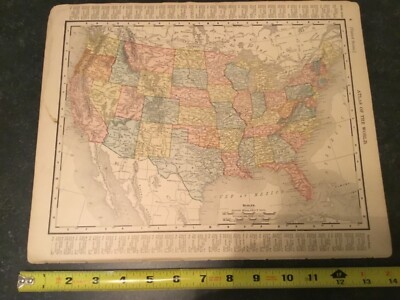
Free Shipping Location: Schertz, United States This Map was removed from an 1895 Rand McNally Atlas and is in very good condition. This map in not new or in new condition. It was printed in 1895. Including ... moreHundreds of RareCivil War. Study the photos carefully, this is the actual map you will receive.
Buy It Now
$25.25 Shipping Location: North Myrtle Beach, United States Map Drawn / Engraved for the 1887 Edition of Rand McNally Atlas of the World. This Original Color Map was published in 1887 by Rand McNally: New York. ... moreOriginal 1887. Excellent Map for the Collector or Historian.
Buy It Now
$5.95 Shipping Location: Dayton, United States It shows The Estuary of the River Witham.
Buy It Now
$5.95 Shipping Condition: New Location: United States Nantucket, Massachusetts. Year: 1881. Canton 1918. Nantucket 1881. These Historic Art Prints are suitable for framing, mounting or direct display on any ... morewall! North Adams 1881. Newton Centre 1897. East Douglas 1886.
Buy It Now
$5.00 Shipping Location: Mesa, United States Year Published: 2007.
Buy It Now
$20.00 Shipping Location: Canada Edmund and George W. Blunt, New York, May 1854. Boston Harbour. Boston, Massachusetts. This is an original antique map -. The coastal map shows the. The ... moremap was liberated from a. more than 160 years old!
Buy It Now
$9.15 Shipping Location: Saco, United States Several Rail Yards & Depots shown including the Boston & Albany RR and Boston Providence RR. Up for Sale is an Authentic 1874 G.M. Hopkins Colored Ward ... moreMap of Boston that was Salvaged from a Suffolk County Vol.1 Atlas.
Buy It Now
$4.99 Shipping Location: Fairview, United States Co., stated in small print in the bottom margin. It is from Collier'sWorld Atlas and Gazetteer as stated in the top margin. There is a similar map of ... moreanother state on the reverse. An interesting map showing early highways prior to the interstate system.
Buy It Now
$6.95 Shipping Location: Dover, United States Large oversized late 19th century color lithographed city plan map. City of Salem. Issued 1891, Boston by George H. Walker & Co.
Buy It Now
$7.00 Shipping Location: Rockville, United States Published by D. H. Hurd & Co., Boston, Massachusetts - 1892". It features a colored MAP OF PART OF THE CITY OF CONCORD, NH. I would be happy to include ... morea copy if requested.
Buy It Now
$6.95 Shipping Location: Dover, United States Very detailed early 20th century antique color lithographed map, over printed in red to show all the dredging works. Boston Harbor Showing All Dredging ... moreof Channels to 1902.
Buy It Now
$3.65 Shipping Location: United States Rare, the map is in rough shape, but very rare. very detailed period map of the Great Boston Fire of 1872. I've never seen this map before. I believe ... morethe map is complete but I'm not sure. Very rare Boston map.
Buy It Now
$30.00 Shipping Location: Paris VI, France Antique detailed copper engraved plan of Boston, by Jacques-Nicolas BELLIN (1703-1772). Edition : From Histoire Générale des Voyages by abbé Prévost,Paris, ... more1747, 18th century. "PLAN DE LA VILLE DE BOSTON et ses Environs".
Buy It Now
$5.75 Shipping Location: Malden, United States Great OLD Map from the "COLLIER'S WORLD ATLAS & GAZETTEER". With Parts Of Cambridge & Charlestown, Massachusetts. Fenway Park, State House, Parks, Museum ... moreof Fine Arts, M.I.T. Cambridge, The Charles River, Bridges, Public Gardens, Boston Common, Harvard, Many Hospitals, U.S.S. Constitution, Mass General Hospital, Etc.
Buy It Now
$6.00 Shipping Location: Saco, United States I do not try to hide or misrepresent any item.
Buy It Now
$9.15 Shipping Location: Saco, United States Up for Sale is an Authentic 1874 G.M. Hopkins Colored Ward Map of Boston that was Salvaged from a Suffolk County Vol.1 Atlas. 26 1/2" x 17 1/2". This ... moreMap shows an area of Boston that has been highly developed since the 19th century.
Buy It Now
$6.75 Shipping Location: Athens, United States 1902 Century Atlas Map Of Massachusetts Antique United States Boston. Map from The New Century Atlas 1902. Map is about 16" x 11.5". Map has a crease ... moredown the middle from the fold in the signature. There is a tear as pictured. Please see pictures for condition and let me know if you have any questions.
Buy It Now
$4.15 Shipping Location: Saco, United States ………and a variety.
Buy It Now
$5.99 Shipping Location: Sahuarita, United States This atlas " The Columbian World's Fair Atlas", was published in 1893 for Wm. M. Warwick. The fair ran from May 1, 1893 to October 30, 1893, and was the ... morefirst World's Fair in Chicago. This is a atlas map, removed from a 1893 publication.
Buy It Now
$4.13 Shipping Location: Bedford, United States Plate Printed. Excellent Condition.
Buy It Now
$5.95 Shipping Location: Bar Harbor, United States 1852 Mitchell Map. The firm prospered until the 1890s. New Brunswick, Nova Scotia, New Brunswick, Newfoundland. Mitchell's School Atlas. New England or ... moreThe Eastern States. Boston, Providence, Hartford, New Haven.
Buy It Now
$9.15 Shipping Location: Saco, United States Up for Sale is an Authentic 1874 G.M. Hopkins Colored Ward Map of Boston that was Salvaged from a Suffolk County Vol.1 Atlas. 26 1/2" x 17 1/2". Suitable ... morefor Framing as it is in Wonderful Condition.
Buy It Now
$5.99 Shipping Location: Atkins, United States 📸 Pictured is of the exact item you will receive!
Buy It Now
$14.99 Shipping Location: Ivanhoe, Australia Bellin, despite his extraordinary success, may not have enjoyed his work, which is described as \\\"long, unpleasant, and hard. Bellin, Jacques Nicholas ... more1703-72. Important buildings and areas identified in an idex at the left of the map.
Buy It Now
$7.00 Shipping Location: Rockville, United States Check out my!Be sure to add me to your! THE ITEM YOU ARE BIDDING ON IS A LOT OF 7 ORIGINAL MAPS TAKEN FROM AN 1892 ATLAS! THIS LOT INCLUDES 7 MAPS FROM ... moreMANCHESTER AMOSKEAG ANTRIM ETC. VERY GOOD CONDITION!SEE PICTURES) NO RESERVE! BID NOW!
Buy It Now
$6.95 Shipping Location: Dover, United States Engravers & Printers. Printed on bond paper.
Buy It Now
$6.95 Shipping Location: Dover, United States Issued 1891, Boston by George H. Walker & Co. Massachusetts Atlas Plate No. 1. Large oversized late 19th century color lithographed regional map.
Buy It Now
$5.85 Shipping Location: Seminole, United States Note stain top border, mat will hide. Antique authentic map showing. "MASSACHUSETTS AND RHODE ISLAND". Lithographic transfer from engraved plate. Original ... morehand-coloring. Classic map of Massachusetts and Rhode Island divided into counties.
Buy It Now
$9.00 Shipping Location: Wakefield, United States This is the very desirable first Mitchell's Atlas, not the small school atlas.
Buy It Now
$6.00 Shipping Location: Greenfield, United States
20h 4m 17s 0 bids
$45.00 Now
$8.00 Shipping Location: Saint Johnsbury, United States Note that there is text on the other side of each map. I've included foot rulers to help gauge the size of the map. The cover page of the atlas is included ... morefor illustrative purposes.
Buy It Now
$7.09 Shipping Location: Hanover, United States This is an original 1871 Massachusetts Railway and County Map from the 1871 Massachusetts Atlas. This is not a reproduction.The map shows the counties, ... moretowns and railway lines of Massachusetts.It will be shipped along worth a copy of the Atlas Frontice page to authenticate it. It is in very good condition and is hand colored. It has some minor repair to the bottom margin (see photos) that would not show when matted/framed. The map as a center fold as it came from an Atlas.The map measures 25.5” x 17”.It will be shipped flat to prevent creases from rolling and shipped along with a copy of the Atlas front page for authentication.Please see our other maps in our EBay store.
Buy It Now
Free Shipping Location: Epping, United States I’m happy to offer this taut Boston map by the Scarborough Co. showing Boston with railroads and railways. It’s in readable condition- some parts have ... moreseparated a bit as my photos show. The front cover is creased as well. All in all a wonderful piece of Boston history. Free shipping. Thanks for your interest and have a great day.
Buy It Now
$6.95 Shipping Location: Dover, United States W. Eldridge's Harbor Chart. Issued c.1900-10, Boston, by Geo. W. Eldridge. Guilford Conn. Early 20th century lithographed nautical chart. Detailed coast ... moremap identifying features such as buoys, sunken rocks, best anchorages, U.S. Life Saving stations, etc.
Buy It Now
$6.95 Shipping Location: Dover, United States City of Lowell. Issued 1891, Boston by George H. Walker & Co. Large oversized late 19th century color lithographed city plan map over printed in red. ... moreOriginal center fold as issued.
Buy It Now
$4.13 Shipping Location: Columbia, United States Barton County Missouri. Antique map. Golden City. Paper is over 100 years old, use care when unfolding. and more.
Buy It Now
$24.00 Shipping Location: Easthampton, United States Uncommon map portraying Boston at the end of the Civil War.
Buy It Now
Free Shipping Location: Schertz, United States This Map was removed from a 1913 Cram's Atlas and is in very good condition. The map is not " new " or in " new " condition, it was printed in 1913. The ... moremap is not dated. Including Hundreds of RareCivil War.

Buy It Now
$5.00 Shipping Location: Canada 1937 CITY MAP OF BOSTON/ MASSACHUSETTS This original antique map gives you an opportunity to examine in exquisite detail a piece of history. If you are ... moreinterested in the past of this country and its people or have a desire to study where your family may have come from. Then this map gives you a rare look as the area was about 70 years ago. Once matted and framed, this map would make a perfect gift for a family member or friend they'll cherish forever. Origin of the map: Collier's World Atlas& Gazetteer edited by Collier& Sons. USA. Date of issue: 1937 Size: The sheet measures 14" x 10 3/4" 37 x 27 cm) S/H: The map will be shipped by Air Mail. The shipping charge is: USA- 8.00 USD. World- 9.00 USD, Canada- 9.00 USD. The price includes the insurance and a strong, cardboard tube with plastic plugs. Attention! There is no additional shipping charge for multiple purchases! Pay me securely with any major credit card through PayPal! Payment methods: US/Canada Buyers: Paypal International Buyers: Paypal. Click Here. Double your traffic. Get Vendio Gallery- Now FREE! USED USED. AN ORIGINAL ANTIQUE MAP. USED.
Buy It Now
$4.99 Shipping Location: Fairview, United States A facsimile copy of the title page is included for authenticity. This map is in its original uncolored state from a very scarce atlas of the period. Condition: ... moreThe map is in Good condition, uncolored as issued with text on the reverse.
Buy It Now
Free Shipping Location: Monroeville, United States Date - 1870. Condition - Very Nice. Size - about 12x14.75", hand-colored.
Buy It Now
Free Shipping Location: Louisville, United States This is an original color lithographic map of the Main Portion of Boston, published in the Supplemental Cyclopedia of Universal Knowledge by Newspaper ... moreSyndicate in 1897. The map is 11 by 13-1/2 inches. The map is folded as issued. The map is worn; overall the condition is good.
Buy It Now
$5.00 Shipping Location: Canada DATE OF ISSUE: 1912.
Buy It Now
Free Shipping Location: Schertz, United States This Map was removed from an 1870 CLERMONT Co., OH Plat Atlas and is in good acceptable condition. The map is not " new " or in " new " condition, it ... morewas printed in 1870. The map is not dated. Study the photos carefully, this is the actual map you will receive.
Buy It Now
$4.99 Shipping Location: Fairview, United States It has strong color printed on paper that is still very bright. Condition: The map is in Very Good condition with a similar state map on the reverse. ... moreThe pics are of the actual map. An Authentic Antique Map: Not a Modern Reproduction!
Buy It Now
Free Shipping Location: Schertz, United States This antique plat atlas map, printed in 1873 by G.M. Hopkins & Co. showcases the areas of MILLERS & CHARLES RIVER - BOSTON & LOWELL RAILROAD YARD - FIRST ... more& BRIDGE Streets in Cambridge, Massachusetts. Perfect for genealogy and family history research, this map is over 150 years old and provides a glimpse into the past. Please note that the cover and title page are not included, they are only for reference. In addition, free shipping is available for customers in the USA, while calculated shipping is available for those outside the country. Explore the landowners and county of Middlesex County, as depicted on the map. Don't miss out on this unique opportunity to own a piece of history.
Buy It Now
$7.09 Shipping Location: Hanover, United States The other half page shows insets of Canton Corner, Springdale Station and Ponkapoag. This is an original double page hand colored map of the Canton. The ... moreother side of the page shows the entire town of Canton on a half.
Buy It Now
Free Shipping Location: Monroeville, United States Newton, Brookline. Date - 1891. Source - Atlas of Massachusetts. Size - 17.5x28", double page as published.
Buy It Now
$5.95 Shipping Condition: New Location: United States Williamstown, Massachusetts. Year: 1889. Canton 1918. Blackinton 1889. Williamstown 1889. These Historic Art Prints are suitable for framing, mounting ... moreor direct display on any wall! Townsend Center 1889.
Buy It Now
$6.00 Shipping Location: Corunna, United States This map is an original from "Cram's Unrivaled Atlas of the World" printed in 1889.
Buy It Now
Free Shipping Location: Hiram, United States Click Here. Double your traffic. Get Vendio Gallery- Now FREE! Large. Superb, antique 1895 handcolored Mitchell map, the map is titled, in fancy antique ... morelettering, Map of North America, Showing Its Political Divisions, and Recent Discoveries in the Polar Regions. There is an 1894 copyright at lower left hand side, this dates the map nicely, esp if framed or displayed. Very attractive and interesting period map of this area. This is an Augustus Mitchell map, Mitchell was a highly regarded mapmaker of this period. Many fascianting areas on the map, very detailed and interesting period map. The map is in gorgeous condition, printed on thick paper, and the map would frame and display quite nicely. The superb handcoloring is period to the map. This is an antique map and not a reprint or reproduction. The size of the map is 12" by 15" Rare. Winning bidder pays $4.00 shipping domestic, more foreign. Payment I accept the following forms of payment: PayPal Click to View Image Album Shipping& Handling US Shipping. $4.00 USPS First-Class Mail® International Shipping. $9.00 USPS First-Class Mail International FREE scheduling. Supersized images and templates. Get Vendio Sales Manager. FREE scheduling. Supersized images and templates. Get Vendio Sales Manager.
Buy It Now
Free Shipping Location: Schertz, United States This antique map is of New England, specifically ME, NH, VT, MA, CT, and RI, as well as Boston and New Haven. Created in 1839 by Thomas, Cowperthwait ... more& Co.. The map is hand-colored and depicts the area during the Victorian era. The book cover is not available and is shown for reference only. Free shipping is offered within the USA, while shipping worldwide is calculated.
Buy It Now
$5.95 Shipping Condition: New Location: United States Canton 1918. Year: 1902. Boston 1902. These Historic Art Prints are suitable for framing, mounting or direct display on any wall! Boston, Massachusetts. ... moreBoston 1870. Boston 1873. Boston 1877.
Buy It Now
$6.95 Shipping Location: Dover, United States City of Quincy. Large oversized late 19th century color lithographed city plan map over printed in red. Issued 1891, Boston by George H. Walker & Co. ... moreOriginal center fold as issued.
Buy It Now
$6.95 Shipping Location: Dover, United States Issued 1876-9, Philadelphia by M.R. Brown for O.W. Gray. Detailed large format 19th century lithographed map with original hand color.
|
|
|
In
|