|
|
Order by: Available to: This site contains affiliate links for which I may be compensated
|
Buy It Now
$6.95 Shipping Location: Dover, United States Issued c. 1795-1806, Paris by Delamarche. Map by Vaugondy, revised and reissued by Delamarche. Late 18th/ early 19th century engraved map with original ... moreoutline hand color.
Buy It Now
$11.84 Shipping Location: ILKLEY, United Kingdom Jerusalem and Jericho are clearly shown as walled cities and the river Jordan runs along the right hand side of the map. Title / Subject: The Tribes of ... moreIsrael. Date: c.1650 (dated 1649 on the map).
Buy It Now
$6.95 Shipping Location: Dover, United States A New Map of Palestine or the Holy Land. Issued c. 1867, Philadelphia by S.A. Mitchell. 19th century engraved map, with original hand color.
Buy It Now
$6.95 Shipping Location: Dover, United States Issued 1806-15, Philadelphia. Engraved by H. S. Tanner.
Buy It Now
$8.70 Shipping Location: Vero Beach, United States reverse has partial map of Africa
Buy It Now
$9.97 Shipping Condition: Unspecified Location: LONDON, United Kingdom 'Johnson's Palestine // Jerusalem'. Caption below picture:'Johnson's Palestine // Jerusalem'. Large, decorative hand coloured 19th century atlas map, ... more1861. DATE PRINTED: 1861. VERSO: There is nothing printed on the reverse side, which is plain.
Buy It Now
$6.95 Shipping Location: Dover, United States Scarce oversized folio sheet late 19th century color lithographed map. Issued 1890, NY by Scribner & Black.
Buy It Now
$9.97 Shipping Condition: Unspecified Location: LONDON, United Kingdom [Kingdom of the Israelites under David and Solomon from 1055 BC to 975 BC. Kingdoms of Judea and Israël from 975 BC to 721 BC]. Kingdoms of Judea and ... moreIsraël from 975 BC to 721 BC]'. Antique 19th century engraved map with old colour, c1840.
Buy It Now
$39.00 Shipping Condition: Unspecified Location: Israel Year: Circa 1746. Colored map of the Holy Land divided among the twelve tribes of Israel. Good overall antique condition as in attached pics. Terre Sainte ... moreMap. Map: 22x30Cm.
Buy It Now
$6.80 Shipping Location: Vero Beach, United States Published for the Proprietors of Scott's Bible by Wertheim & Macintosh. 24 Paternoster Row, London
Buy It Now
Free Shipping Location: Auburn, United States

Buy It Now
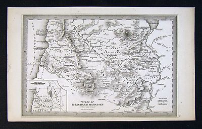
$9.97 Shipping Condition: Unspecified Location: LONDON, United Kingdom Ancient Palestine Antique engraved map by J Rapkin. Published by John Tallis. Original outline hand colour, decorative border, and attractive inset vignette ... moreviews, 1851 Title of map: Ancient Palestine' The image below shows an enlarged cross section from the centre of the map to show the level of printed detail: Vignettes: Tomb of Absalom; Syrian Sheep; Church of the Holy Sepulchre; Nazareth; Ancient cedars of Lebanon. The twelve tribes of Israel are indicated. DATE PRINTED: 1851 IMAGE SIZE: Approx 36.5 x 26.5cm. 14.5 x 10.25 inches(Large) ARTIST/CARTOGRAPHER/ENGRAVER: Map drawn and engraved by J. Rapkin; vignette illustrations drawn by H Warren& engraved by JB Allen. Published by John Tallis& Co PROVENANCE: Tallis's Illustrated Atlas and Modern History of the World. Geographical, Political, Commercial and Statistical" edited by R Montgomery Martin Esq. published by John Tallis and Company, London& New York. Please note that virtually all antique and vintage maps and prints have been extracted from books, atlases or newspapers. TYPE: Antique engraved map by J Rapkin. Published by John Tallis. Original outline hand colour, decorative border, and attractive inset vignette views VERSO: There is nothing printed on the reverse side. Which is plain CONDITION: Good; suitable for framing. Please check the scan for any blemishes prior to making your purchase. Virtually all antiquarian maps and prints are subject to some normal aging due to use and time which is not obtrusive unless otherwise stated. I offer a no questions asked return policy- see below. AUTHENTICITY: This is an authentic historic print. Published at the date stated above. I do not offer reproductions. It is not a modern copy. The term'original' when applied to a print means that it was printed at the first or original date of publication; it does not imply that the item is unique. Print' means any image created by applying an inked block to paper or card under pressure by any method including wood engraving, steel engr
Buy It Now
$2.75 Shipping Location: Winter Springs, United States Very fine, antique 1836 handcolored map, titled Tribe of Reuben. With detailed References chart corresponding to the map itself. Fascianting and detailed ... moreperiod map. Very nicely produced, printed on fine paper, with no printing on reverse.
Buy It Now
$6.95 Shipping Location: Dover, United States A New Map of Palestine or the Holy Land. Issued c. 1890 Philadelphia by Bradley, successor to S.A. Mitchell. This late Mitchell map was issued by Bradley ... morefor a short period before disappearing from publication.
Buy It Now
$15.64 Shipping Location: MANCHESTER, United Kingdom Par M. Bonne, Ing?. a la Ville de Bordeaux. Avec priv. Antique Map 1723-1791 of Israel 12 tribes in Israel Holyland. Engraved map. Relief shown pictorially. ... moreIncludes notes. The map is laid on Antique fabrique.

Buy It Now
Free Shipping Location: Netherlands ABOUT US VISIT OUR STORE SALES SPECIALS Antique Map-Engraving-ISRAEL-NORTH-HOLY LAND-JUDEA-TRIBES-Blanchard-1844 Description: This old antique print originates ... morefrom: Atlas Geographique et Iconographique du cours complet d'ecriture Sainte. Gravé par vingt Artistes distingués de Paris, sous la direction de Theophile Blanchard et Barrere Freres. published by M.L. Migne, Paris. 1844. translation: Geographical and Iconographical atlas after the lectures of the holy scripture. Artists and Engravers: Engraved by several Parisian artists under the direction of Theophile Blanchard and Barrere Freres. This plate engraved by Barriere freres after A. Fremin. Subject: Pl. 22: Carte du nord de la Judee ou Terre Sainte comprenant les Tribes. Map of Northern Judea or Holy Land including the tribes of Asher. Naphtali, Zebulun, Issachar, Manasseh. Condition: Fine; General age related toning and foxing as visible on scan; Please study scan carefully. Occasional light staining from handling. Irregular paper edges as issued. Small holes in left margin from binding. Size(in cm) The overall size is ca. 36 x 27 cm. The image size is ca. 31.5 x 24 cm. Size(in inch) The overall size is ca. 14.2 x 10.6 inch. The image size is ca. 12.4 x 9.4 inch. Medium: Engraving and etching on a vellin type paper with watermark(not visible on every sheet) Rear blank. Print originates from book/ atlas. Location: A196-11 ThePrintsCollector Peter Cornelissen. Margo van Latum- van Dongen, Frank van Latum Zeeland- The Netherlands Phone: +31 654 21 23 78 Worldwide free shipping on all orders. We ship within one business day upon receipt of payment. We ship by Registered Mail. Insurance is included. We guarantee our items to be genuine original. Visit our Store: we would like to invite you to review similar items in our Store or to browse through all other items in our Store. We are confident that you will find very special unique antique maps and prints in our Store. It is our privilege to have you as a customer. We accept Paypal payments
Buy It Now
$4.95 Shipping Location: Dover, United States (Middle East, Holy Land, Palestine, Israel, Sons of Noah, Twelve Tribes of Israel, Jerusalem, Kingdom of David & Solomon). Issued 1914, Paris by Belin. ... moreEngraved by Drioux and LeRoy. Lovely early 20th century color lithographed map.
Buy It Now
$4.99 Shipping Location: Fairview, United States Lake Erie Maps& Prints! An Authentic Antique Map: Not a Modern Reproduction Click for More No Additional Postage on Multiple Maps Shipped with the ... moreFirst Description: It is an authentic engraved antique map over 160 years old. It is designed by Thomas Starling as stated below the title on the map. It is from John Kitto's Scripture Lands; Complete Biblical Atlas(New York. 1850) A facsimile copy of the title page is included for authenticity. The map is not mounted, matted nor framed, being sold as a single sheet as seen in the main pic. A very nice miniature size map with a lot of historical detail that would frame up well! Size: The map image measures. Between the neat lines, approximately 3 3/4 by 5 1/2 inches(10x14cm) and is on a 4 1/4 by 7" 12x17cm) page as seen in the pic with a wide margin all around for framing as seen in the main pic. Condition: The map is in Very Good to Excellent condition with overall light tonal ageing. Uncolored as issued, blank on the reverse, printed on a heavy paper. It is basically as seen in the pics. There are a couple of minor spots in the margin, otherwise the map image is very clean and would frame up nicely. The pics are accurate of the actual map. Payment Details: We accept most major credit cards through Paypal. Please ask if you have any questions about payment. International Bidders are welcomed and encouraged. Payment is expected within 7 days. Nonpaying Bidders will be reported to Ebay to recoup our listing fees. International Customs and VAT Fees: It is the responsibility of the buyer to pay all Customs Taxes. VAT or other fees that may be due upon arrival. These fees vary greatly from country to country and ebay policy is that the buyer is responsible for their country's taxes and fees. Please consult your country's Customs Regulations for more details on your country: printed matter is duty free in many countries. We declare the full purchase value as required by law. Delays by Customs: Although most items arrive at their destination very quickly
Buy It Now
$6.95 Shipping Location: Dover, United States Issued 1902 Paris by Belin. Map by Drioux & Leroy. Late 19th century color lithographed map.
Buy It Now
$6.48 Shipping Location: MARLOW, United Kingdom A map of Judaea, or the Holy Land, which is Divided into the Twelve Tribes of the Hebrews or Israelites. DATE PRINTED :c.1730. PROVENANCE: Laor 930. VERSO ... more: There is nothing printed on the reverse side which is blank.
Buy It Now
$6.05 Shipping Location: Sacramento, United States 1830 Scripture Geography Atlas Biblical Maps Worcester's Outline Hillard Gray Cover is detached and separated, see images. World and Countries of the ... moreOld Testament. Journey of Israelites form Egypt to Canaan. Judah and Israel with the divisions of the twelve tribes. Palestine or the Holy Land. Ancient Jerusalem & Map of the Travels of St. Paul.
Buy It Now
$22.64 Shipping Location: ABINGDON, United Kingdom Map of Gad engraved by W. Marshall dated 1648. Dedicated to Domino Hugoni Windham. Original vertical fold in map.
Buy It Now
$6.95 Shipping Location: Dover, United States A New Map of Palestine or the Holy Land. Uncommon late 19th century lithographed map, with original hand color. This late Mitchell map was issued by Bradley ... morefor a short period before disappearing from publication.
Buy It Now
$15.00 Shipping Location: Brooklyn, United States The map is oriented to the east and covers form the Sea of Galilee northwards along the Jordan River as far as Lebanon and the Golan Heights. Naphtali ... morewas part of the Kingdom of Israel until its lands were conquered by Assyria in c. 723 BC and the population deported.
Buy It Now
$16.23 Shipping Location: New York, United States Manuscript map-making was a useful educational tool in the 19th century, a period of imperialism and increased world trade in which geography grew significantly ... moreas a field of study. This beautifully hand colored schoolgirl or schoolboy manuscript map of Canaan and Palestine (Israel or Holy Land) covers from Arish in northern Sinai north beyond Beirut.
Buy It Now
$4.99 Shipping Location: Fairview, United States Original Antique Map Published in 1810. It is not a modern reproduction! A nice small size map that won't break the bank framing, strong color on a bright ... morepage with an antique quality. Very Good condition for its age, printed on a strong cotton page, blank on reverse with a centerfold as issued and embossed plate marks around the margins.
Buy It Now
Free Shipping Location: Monroeville, United States Source - Bible Atlas, a Manual of Biblical Geography and History. Date - 1899.
Buy It Now
$4.99 Shipping Location: Fairview, United States Condition: The map is in Good to Very Good condition for its age, printed on strong cotton paper, deckle edge on top, blank on the reverse with two horizontal ... morefolds as issued. It has light tonal ageing and a hint of backprinting, very slight crease on the tip of the upper right corner in margin, slight double creasing along the bottom fold otherwise very clean with a nice antique appearance as desired, see the pics for more on condition.
Buy It Now
$11.85 Shipping Location: Dover, United States Issued 1797, London by Cadell & Davies. Any age flaws mostly minor and easy to overlook or forgive. Late 18th century engraved map with attractive hand ... morecolor.
Buy It Now
$6.95 Shipping Location: Dover, United States Issued 1846, Paris by Delamarche & Grosselin. (Desert of Kadesh, Moab, ruben, Palestine). Original centerfold as issued. Mid-19th century engraved map ... morewith original outline hand color.
Buy It Now
$6.95 Shipping Location: Dover, United States Issued 1850, Philadelphia by Thomas Cowperthwait. (Asia, Middle East, Holy Land, Palestine, Israel, Jerusalem, 12 Tribes, Dead Sea, River Jordan). Large ... moreinset at top left shows the environs of Jerusalem.
Buy It Now
$6.95 Shipping Location: Dover, United States (Middle East, Holy Land, Palestine, Israel, Twelve Tribes of Israel, Judea, Dead Sea, River Jordan, Jerusalem, Bethlehem). Issued 1846, Edinburgh by A.K. ... moreNewman of London / Orr & Sons, Glasgow.
Buy It Now
$9.97 Shipping Condition: Unspecified Location: LONDON, United Kingdom PROVENANCE: "Orbis Terrarum Veteribus Noti descriptio"; by A. Arrowsmith, Published by E. Williams, London. 'Terra Sancta vel Regio Maritima a Libano ... moread Halakum usque Montem, quam Iordanis f1. intersecat'.
Buy It Now
$4.87 Shipping Location: Bolivia, United States [17778] (Worcester's Atlas). Boston: David H. Williams, 1839. Improved Edition.
Buy It Now
$3.75 Shipping Location: United States Superb, fine antique 1834 Delamarche handcolored map titled Judee Divisee en ses douze Tribus Sous Josue Fx. Delamarche 1833. I like how the year produced ... moreis right in the title, it dates the map nicely.
Buy It Now
$35.00 Shipping Location: Israel It contains geographically diverse features within its relatively small area. Israeli sovereignty over Jerusalem is internationally unrecognized. [14][15] ... moreThe end of the British Mandate for Palestine was set for midnight on 14 May 1948.
Buy It Now
$6.00 Shipping Location: Spring Valley, United States Modern Palestine. Jerusalem. Canaan in the Patriarchal Ages. Kingdoms of Judah and Israel.
Buy It Now
Free Shipping Location: Brescia, Italy It is orientated with north to the left and based on Adrichom’s map of 1590. From: Unknown. Folds as issued.
Buy It Now
$6.95 Shipping Location: Dover, United States Issued c. 1863, Paris by Le Chevalier. Map by Dufour and Dyonnet. Oversized mid 19th century engraved map with original hand color.
Buy It Now
Free Shipping Location: Netherlands Description: From: Nouvel Atlas de la Bible, A Paris, Chez Desray, 1809. This atlas contains 5 maps and a world map. Artists and Engravers: Made by 'Etienne ... moreClaude Voysard (cartouche) Mlle. Glot (map and characters)' after 'Borel'. Etienne Claude Voysard (Paris 1746-1812) was a French engraver, active in Paris. Possibly after Antoine Borel who was a French 18th-century painter, draughtsman and etcher, who exhibited paintings, drawings and engravings in the Salon of Correspondence in 1779 and 1780.
$3.95 Shipping Location: Clarkston, United States 1482 Map of the Holy Land - Palestine. The remaining sheets, the woodblocks and the types passed to Johann Reger in Ulm, who reissued the work in 1486. ... more"The map is orientated to the east, and shows the whole of Palestine on both sides of the Jordan divided into the 12 Tribes.
Buy It Now
$15.00 Shipping Location: Cyprus Title: La Judee ou Terre Sainte divisee en ses douze Trbus - par le Sr. The map is copperplate engraved with hand coloring and was published in atlas ... moreAtlas Universel by Vaugondy. Publisher : Boudet Paris 1757.
Buy It Now
$30.00 Shipping Location: Paris VI, France Johann Baptist Homann (1664-1724) was the most prolific map publisher of the 18th Century. They protected the authors in all scientific fields such as ... moreprinters, copper engravers, map makers and publishers.
Buy It Now
$30.00 Shipping Location: Paris VI, France Edition : Antwerp, published by Gerardis Brunius, 1590, XVIe Century. Title of the map.
Buy It Now
$6.00 Shipping Location: Greenacres, United States Original 1888 antique color lithographed map of Palestine, with decorative border. It is an original, authentic antique map,not a reproduction or modern ... morereprint. An overleaf on the reverse side has an index to divisions, lakes, mountains, rivers, valleys, and towns.
Buy It Now
Free Shipping Location: RICHMOND, United Kingdom Format: Book Illustration Map Print. Condition: Used - Very Good. For example, a fault can be as minor as discolouration or as serious as a complete failure, ... moreas long as the item has been subject to normal usage.
Buy It Now
$15.00 Shipping Location: Cyprus Israel, old map Holy Land, Terra Sancta Vocata. Seutter 1762. Georg Matthäus Seutter (1647–1756) was one of the most important and prolific German map ... morepublishers of the 18th century. Holy Land Israel old engraved detailed hand-colored antique map divided into the Twelve Tribes.
Buy It Now
$10.00 Shipping Location: Hungary Maker: Christian van Adrichom (1533-1585). Van Adrichom's map of the. It was also translated into many languages, owing to its extraordinary popularity ... moreand influence. - his work is still of importance for the history of Palestine and Israel.
Buy It Now
$29.00 Shipping Location: Israel It contains geographically diverse features within its relatively small area. Israeli sovereignty over Jerusalem is internationally unrecognized. [14][15] ... moreThe end of the British Mandate for Palestine was set for midnight on 14 May 1948.
Buy It Now
Free Shipping Location: Rego Park, United States In the sea there are three sea monsters, one of which has targeted a fishing vessel. In fine condition.
Buy It Now
$15.00 Shipping Location: Brooklyn, United States Each of the shaded regions correlates to the territories of the Biblical tribes of Israel. River systems, deserts, and mountain ranges are also identified. ... moreThis map was engraved by Young and Delleker for the 1828 edition of Anthony Finley'sGeneral Atlas.
Buy It Now
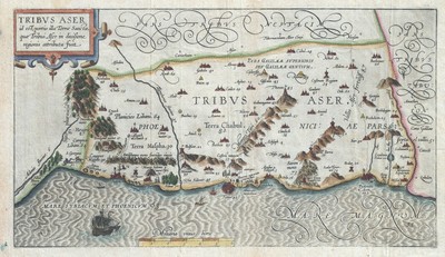
$15.00 Shipping Location: Brooklyn, United States 1590 Adrichem Map of Tribe of Asher. Israel(Western Galilee, Mount Hermon) WE SELL ONLY ORIGINAL ANTIQUE MAPS- NOT REPRODUCTIONS Title: Tribus Aser id ... moreest. Portio illa Terrae Sancta, quae Tribui Aser in diuisione regionis attributa fuit. Description: This is a beautiful example of Christian van Adrichom's rare 1590 map of the lands granted to the Tribe of Asher at the time of Joshua's division of the Twelve Tribes. The map is oriented to the east and covers western Galilee from the city of Acre(called Ptolemais or Acon in ancient times) northward past the city of Tyre(Tyrus) toward Sidon and Mouth Hermon. A number of important biblical sites are identified pictorially including the site of the episode of Saint George and the Dragon where Saint George. The brave martyr, kills a dragon(signifying the devil) to rescue a princess(signifying God's Holy Truth) After the Kingdom of Israel was conquered by Assyria, the northern tribes including Dan, Ephraim, Manasseh, Asher and Zebulun were spared. The tribe of Asher would return to worship at the Temple of Jerusalem. This map is the first of ten maps of the Holy Land prepared by Christian van Adrichem for publication in his Theatrum Terrae Sanctae. Adrichem's maps for the Theatrum were prepared between 1580 and 1585, but were published posthumously by his associate, Gerardis Brunius of Koln, in 1590. The publication went through several later editions and served as a basis for most subsequent maps of the Holy Land well into the 18th century. Size: Printed area measures 9 inches high by 16 inches wide. Condition: Very good. Original platemark visible. Blank on verso. Minor wear along original fold lines. Shipping: Due to recent increases in United States Postal Service rates we have been forced to increase our shipping rates. Shipping rates are not negotiable. Items are shipped within three business days of receiving payment. We are happy to consolidate shipping where possible. The following shipping options are available: 1. USPS Domestic Express Mail(35
Buy It Now
$10.00 Shipping Location: Cyprus Mapmaker: Félix Delamarche (18 November 1792 – 10 March 1863) Delamarche, Alexandre, 1815-1884, was a French geographer and engineer who flourished during ... morethe 18th century and early 19th century. 27 x 36 cm.
Buy It Now
$8.50 Shipping Location: Croatia (1875-94), great work of Elisee Reclus. But the main influx of Jews would seem to have taken place as the result of their expulsion from Palestine by ... morethe Roman emperor Hadrian about 135 CE. This flight (hijrah; commonly transliterated Hegira) marks the beginning of the Muslim calendar.
Buy It Now
$22.43 Shipping Location: LONDON, United Kingdom From: Robert de Vaugondy, Gilles. Nouvel atlas portatif.Shows topography, drainage, territories of the various tribes of Israel and its places of historical ... moreinterest.Features a decorative title cartouche with illustrations of biblical references, including the ten commandments.Blank Verso.Sheet size: 28.8 x 41.7 cm.Excellent condition.Shipment to be arranged via registered mail.
Buy It Now
$30.00 Shipping Location: Paris VI, France Large and unusual antique copper engraved map of Holy Land, by Mattheus SEUTTER (1678-1757). SEUTTER S.C.G.M. AUGUST VINDEL". Edition : Augsburg, c. 1740, ... more18th century. based upon the Bible. Title of the map.
Buy It Now
$114.90 Shipping Location: Milford, United States 'A NEW MAP OF THE LAND OF CANAAN'. 'A New Map of the Land of Canaan' ( & parts of adjoining Shewing the division thereof among the twelve tribes of Israel ... morededicated to his highness William Duke of Gloucester.).
$13.18 Shipping Location: HAYLING ISLAND, United Kingdom Canaan As Divided Among The Tribes. Featured inBagster's Miniature-Quarto Bible, published by Samuel Bagster & Sons, London, in 1847. Publisher: Samuel ... moreBagster & Sons, London. Date: 1847.
Buy It Now
Free Shipping Location: Orangeburg, United States Rare 1850 A.C. Beaman Sabbath School Scripture Map Card / R. Lowe Engraver. - "General Map of THE TRIBES".
Buy It Now
$14.99 Shipping Location: Ivanhoe, Australia Although published by Jan Jansson, the map was made in collaboration with Georgius Hornius (1620-1670). His family was forced to flee to Nuremberg during ... morethe religious violence of the Thirty Years War.
|
|
|
|
International Maps - THE HOLY LAND DIVIDED BY THE 12 TRIBES OF ISRAEL BY HARENBE
This is an exquisite full-color Reproduction printed on heavyweight(7.0 MIL) Glossy Photo Paper. These maps are perfect for framing. Or a wonderful and unique gift for family members, friends or co-workers! All Information is Carefully Compiled from Actual Surveys Original Maps are often difficult to find and usually have fold lines. Identifying stamps or markings, tears, ragged edges, and assorted other natural signs of age that detract from their beauty. All of our maps have been professionally restored to depict their original beauty, while keeping all historical data intact. These maps are fabulous pieces of history full of information useful to Historians. Genealogists, Cartographers, Relic Hunters, Others. They make fascinating conversation pieces and splendid works of art for the home or office. Map Size: 25.09 x 23 Site Specifics ... moreTo This Map Are: Map in Latin depicting the Holy Land divided according to the tribes of Israel: Ephraim. Manasseh, Asher, Benjamin, Dan, Gad, Issachar, Judah, Naphtali, Reuben, Simeon and Zebulun, plus the land surrounding the tribal designations. Features include the Vast Sea, the Dead Sea, Desert of Paran, Mt. Sinai, Sinai Desert, Egyptian Sea, Palestine Sea, Jordan River, the Mediterranian Sea, the Jewish Sea, and many others. The following towns are featured: Isma. Damascus, Abilene, Baal Gad, Haran, Dan, Edrei, Carnaim, Capitolias, Gerasa, Gadara, Ephron, Thisbe, Berotha, Bethlehem, Tyrus, Salem, Aulon, Jerusalem, Gaza, Rephaim, Sodom, Gomorra, Praesidia, plus many more. This Map is Situated in: The Middle East SKU: ITPA0005 and Powered By:
|
|
|
Canaan Twelve Tribes Israel c1875 Map Hand Colored
Canaan Twelve Tribes Israel c1875 Map Hand Colored CANAAN Original c.1875 map"Canaan as Divided Among the Twelve Tribes. hand colored. This 135 year old map is in very good condition. Overall size 11 3/4" x 9" Please note any black circles in the pictures are magnets we used to hang the pieces while taking the picture(s) Purchase with confidence. We have been in the antique print, map, and document business since 1976 and guarantee our items as advertised. See additional photos below! To See More Maps Pay via PayPal. US Funds only. We ship 7 business days(excludes Saturday and Sunday) from receipt of payment. Shipping if buying multiple items within 7 day period. We will ship in one package for one item's shipping fee( as long as size permits) International shipping please contact us for a quote prior to bidding. Thank ... moreyou for your business. Powered by I am retiring and offering for sale all of my maps as a complete collection. To view this collection go to item#350488142304 for complete details. We ship in 5 business days form receipt of payment. If you need it faster please advise. We can usually meet most dead lines.
|
|
|
1864 - ANDRIVEAU GOUJON - Decorative Map HOLY LAND Tribes ISRAEL Jerusalem
An ORIGINAL 19th century map* PALESTINE ANCIENNE ET MODERNE d'après les Sources les plus authentiques Published by Andriveau Goujon* Steelplate engraving Printed on one side only on strong paper, Hand colored, Inches 18 x 24 1/4 plus margins(sheet 20 3/4 x 27 3/4 inches) cm 46 x 62 plus margins(sheet 52.5 x 70.5) Very good +. Light foxing. Dark impression. Priority airmail by tube USA. Americas, Israel $12.00(approx. 14 days) 2 or more similar maps $16.00, European Union $10.00(approx. 5 days) 2 or more similar maps $14.00, I will combine shipping for multiple purchases Optional registration $6.00
|
|
|
1828 - DELAMARCHE - Map ISRAEL Tribes
An ORIGINAL 19th century map entitled DUODECIM TRIBUS ISRAELIS 1827 by Felix Delamarche from Atlas de la Géographie ancienne. Du Moyen-Age, et moderne, Adopté par le Conseil Royal de l'Instruction Publique. School Year 1828 Original steelplate engraving, Printed on one side only(blank reverse) Original outline hand coloring Inches 11 x 9 1/2 cm 27.5 x 24 plus margins. Excellent. Little soiling at margins. Priority airmail USA. Americas $6.00(approx. 7 days) European Union $4.50(approx. 3 days) I will combine shipping for multiple purchases
|
|
|
1851 Black Map of Ancient Palestine, Israel or Holyland (12 Tribes)
1851 Black Map of Ancient Palestine. Israel or Holyland(12 Tribes) WE SELL ONLY ORIGINAL ANTIQUE MAPS- NOT REPRODUCTIONS Title: Palestine according to its Ancient Divisions. Description: This is a fine example of the Adam and Charles Black's 1851 map of Ancient Palestine. Israel or the Holy Land. It covers the region as it existed in Biblical times with divisions for each of the Twelve Tribes of Israel and includes the modern day nations of Israel, Palestine and Lebanon, as well as parts of adjacent Syria and Jordan. This map marks both ancient and contemporary place names as well as the locations of Biblical events and ruined cities. The color coding details the region as it may have appeared in Biblical times, with the lands claimed by the various Tribes of Israel noted. An inset map in the lower right quadrant details the Peninsula ... moreof Mount Sinai, where the cartographer notes, Mount Sinai, Mount Horeb, the ancient mountains of the Nile, and the Islamic Haj route. The names of the Twelve Tribes are listed along the right the right margin. Various cities, towns, rivers, mountains and several other topographical details are noted with relief shown in hachures. This map was engraved by William Huges and issued as plate no. XXXVII in the 1851 edition of Black's General Atlas of the World. Size: Printed area measures 16 inches high by 11 inches wide. Condition: Very good. Minor overall toning. Blank on verso. Shipping: Due to recent increases in United States Postal Service rates we have been forced to increase our shipping rates. Shipping rates are not negotiable. Items are shipped within three business days of receiving payment. We are happy to consolidate shipping where possible. The following shipping options are available: 1. USPS Domestic Express Mail(35 USD) USA Only. 2. USPS Priority Mail(15 USD) USA Only. 3. USPS International Express(35 to 55 USD) Recommended service for all international parcels. You will be invoiced at the lowest Express Mail rate possible. 4. USPS Priority Mail(35 USD) Avail
|
|
|
ISRAEL PALASTINE HOLY LAND JUDEA TWELVE TRIBES ORIG. ENGR. MAP PALAIRET 1755 AD
Patrick's Antique Shop Rare! Original and beautiful old-coloured large-size copper engraving map. Out of: Atlas Méthodique" by Jean Palairet, printed 1755 AD map of Israel- Palastine- Holy Land Title: Carte de la Judee. Ou Terre Sainte Divisee en ses Douze Tribus 1755. Cartographer: Jean Palairet(1697- 1774) was a French cartographer. Description: This is a very beautiful copper engraving map by Jean Palairet. Engraved by John Gibson. The map shows the Holy Land divided into the Twelve Tribes. A large inset at top illustrates the land of Canaan before the conquest by the Israelites. Very decorative and beautiful collection item! Size: Leaf app. 73.5 x 54,5 cm print app. 57.5 x 47,0 cm Condition: in good condition strong print slightly brownish and stained at the edges with some small tears the bottom center fold have a restored ... morespot Please have a look at the pictures! My offers only originals. No reproductions! Please contact me if you have any questions. Selten! Originaler und sehr schöne altkolorierte Kupferstich Karte. Aus dem: Atlas Méthodique" von Jean Palairet, printed 1755 AD Karte von Israel-Palästina- Heiligen Land Titel: Carte de la Judee. Ou Terre Sainte Divisee en ses Douze Tribus 1755. Kartograph: Jean Palairet(1697- 1774) war ein französischer Kartograph. Beschreibung: Ich bieten Ihnen hier eine sehr dekorative altkolorierte Kupferstich Karte von Jean Palairet an. Gestochen von John Gibson. Diese Karte zeigt das Heilige Land mit den Zwölf Stämmen unterteilt sowie das Land Kanaan vor der Eroberung durch die Israeliten. Sehr dekoratives und wunderschönes Sammelobjekt! Maße: Blatt ca. 73.5 x 54,5 cm Druck ca. 57.5 x 47,0 cm Zustand: guter Zustand kräftiger Druck etwas gebräunt und fleckig an den Rändern mit einigen kleineren Einrissen der unterer Mittelfalz ist Hinterlegt Sehen Sie sich die Bilder an! Meine Angebote sind nur Originale. Keine Reproduktionen! Bitte kontaktieren Sie mich. Wenn Sie Fragen haben. Powered by The free listing t
|
|
|
ANTIQUE MAP - 1750 - ISRAEL - 12 TRIBES - PALAESTINA in XII TRIBUS - Homann
iscra antique maps& prints'Palaestina in XII Tribes. Johannis Christoph Harenbergh.1750' Description: Uncommon antque map of the Holy Land. Coloured according to the lands of the 12 tribes, prepared by Johannes Christoph Harenberg, published by Homann Heirs in 1750. The map is dedicated in the upper right to Karl Wilhelm Ferdinand, Duke of Braunschweig-Lüneburg. Beneath the cartouche is an illustration of two spies of Moses returning to the tent camp of the Israelites bearing a cluster of grapes, representing the fruits of the Promised Land. Above it there are renderings of the front and back of an ancient Hebrew shekel coin. An inset map upper left shows other former divisions of Palestine, such as Phoenicia and Samaria. Maker: Johannes Christoph Harenberg/ Homann Heirs Printing date: 1750 Technic: Copper engraving with ... moreoriginal old hand colouring. Size: The overall size is 24 3/4 x 21 1/4 inch. The image size is 20 3/4 x 19 inch. Condition: Very Good; some damp staining in upper- and lower margin. A Certificate of Authenticity will be added! THERE IS FREE SHIPPING FOR ADDITIONAL ITEMS! Thanks for looking! ISCRA STORE* We accept Paypal payments and Bank transfer payments! Combined orders possibl e! Insurance included! Because of different configurations of monitors colours can appear a bit different on you screen. The sizes of the pictures are(most of the time) not the real print size. The real sizes are noted in the description area. Import duties. Taxes and charges are not included in the item price or shipping cost and are buyer's responsibility. WE GUARANTEE ITEMS SOLD ARE IN THE CONDITION DESCRIBED. ITEMS CAN BE RETURNED WITHIN 14 DAYS after delivery or pick-up date A3188 Powered by The free listing tool. List your items fast and easy and manage your active items.
|
|
|
1780s - BONNE - Map ISRAEL Tribes
An ORIGINAL 18th century map entitled CARTE DES DOUZE TRIBUS D'ISRAEL by from Atlas Moderne published by Lattré Original copperplate engraved map. Centre fold as issued. Hand colored. 12 1/4" x 17 1/2" 310 x 445 mm) plus margins Very good +. Some light foxing. Edges browned. Good impression. Priority airmail by tube. USA. Americas, Israel $12.00(approx. 10/ 14 days) European Union $10.00(approx. 5/ 7 days) Multiple items are shipped together. PAYPAL or CASH in person. Bank transfer in Euro from Euro countries* NO direct CREDIT CARD. NO CHEQUE* Sorry for any inconvenience* Thanks for interest ALL ITEMS ARE GENUINE
|
|
|
1660 Visscher Antique Map of The Holy Lands, Egypt to Syria - Tribes of Israel
Helpful Links: Company Details- About ME View seller's other items Cartographer's Profile Ask Seller a q uestion Return Policy We have over 2.000 items for sale on our Ebay stores site. Please click here to enter the stores and use the search engine to the left to search specifically for maps. Prints, Atlases on the Classical Images Stores. Thank you Viertzig Iarige Reysen Der Kinder Israel Aus Egypten Durch Das Rote-Meer Und Wusten Biss Ins Gelobte Land Canaan click image to enlarge click image to enlarge click image to enlarge click image to enlarge This beautifully hand coloured original antique map of the Holy land showing the ancients lands of the Tribes of Israel. From Egypt to Syria- depicting amongst other things the flight of Moses and the Israelites from Egypt- by Nicolas Visscher was published in ca 1660. This antique map ... morewith German text on the verso is oriented with north to the east. Encompassing the Promised Land and Egypt it traces the flight of the Children of Israel out of Egypt. Their wandering through the desert and their route to the Land of Canaan(Exodus) Moses is depicted on Mount Sinai receiving the Ten Commandments. Along the bottom of the map are a number of illustrations(from left to right) are two sides of a shekel coin, Menorah& temple vessels, Moses and Aaron on either side of the Tabernacle surrounded by the twelve tribes of Israel and finally a depiction of the Ark of the Covenant. Also included is a fine title cartouche, ships sailing in both the Mediterranean and Red Seas and a charming scene of Jonas and the whale(Ref: Tooley; M&B; Nebenzahl) Please note all items auctioned are genuine. We do not sell reproductions. A Certificate of Authenticity(COA) can be issued on request. Condition Report General Description: Paper thickness and quality: Light and stable Paper color: off white Age of map color: Early Colors used: Pink. Red, green, blue, orange General color appearance: Authentic Paper size: 19 ½in x 15in(500mm x 385mm) Plate size: 19in x 13 ½in(480
|
|
|
1773 Israel 12 Tribes Palestine holy-Land G.Defert Engraved Map Judaica
1773 Second French edition Judaica Biblical Old-Testament map Titled- in french"CARTE DE LA TERRE PROMISE PARTAGEE PAR JOSUE AUX 12 TRIBUS DU PEUPLE DE DIEU. 2eme EDITION 1773" Antique engraved map on thick laid paper. Showing the Holy promised land as devided by Josue into 12 tribes Engraved by Vallet. Made by G.Defert Plate size 25 x 21 cm. Sheet 29 x 23.5cm. Condition- Clean map itself with some stain spots. Small edge tears. Otherwise very good condition to its age. Please look at all photos being integral part to description. Comes from an old estate with more antique maps- please look at my listing. Combined shipment available. Payment by Paypal Shipping& Handling: $10.00 worldwide for registered airmail post
|
|
|
PALESTINE map, 1880 - 12x17"; Tribes of Israel & Christ's Journeys; w/ guide
Bartholomew map. 1880: PALESTINE ANCIENT and MODERN This is a detailed antique map of Palestine in the 1870s. Drawn at a scale of approx. 16 miles to the inch. It is shaded in color to show the topography of the land. It has inset maps on“The Journeyings of Christ. Environs of Jerusalem” and“Sketch Showing the Division into Tribes. The map measures 12.5 x 17 inches. And is blank on the back. It is in Fine condition. The credit lines in small print below the map say: Engraved& Printed in Colours— by J. Bartholomew T. Ellwood Zell. Davis& Co. Philadelphia. The map is undated on the plate. But came from an uncommon atlas published in Philadelphia in 1880, which was Volume 5 of Zell’s Popular Encyclopedia. The mapmaker. John Bartholomew was a Fellow of the Royal Geographical Society. The map will be accompanied by a 4-page index presenting ... morea key to the many features shown on the map: over 400 towns. Plus numerous Districts and Tribes; Rivers, Wadies and Lakes; Mountains, Plains, and Valleys; and Capes and Bays. The map will be shipped folded once. As originally published in Zell’s Atlas. SHIPPING/ HANDLING TERMS: Add a flat $ 3.95 for delivery by First Class Mail anywhere in the U.S. Pennsylvania residents. Add 6% tax. International shipping is $ 8.95 to Canada; or $13.95 to all other foreign countries. I normally mail items within 24 hours of receiving payment. All items are returnable for a full refund if the buyer is unsatisfied for any reason. gsrx_vers_476(GS 6.4.4(476)
|
|
|
JUDAH ISRAEL PHOENICIA Tribes Israel Antique Bible Map 1840 Chromo + article
JUDAH ISRAEL PHOENICIA Tribes Israel Antique Bible Map 1840 Chromo + article Rare map. A woodblock engraving with letterpress legend, colour-printed by Knight's Patented Illuminated Process, c. 1840. An original antique chromolithograph map of part of the scriptural'Promised Land' created in Victorian times. It's supplied along with its accompanying contemporary article or notes. It's in great condition; suitable for framing, display, collection, reference, research etc. History Middle East Theology Cartography Biblical Scriptural Typesetting Printing Charles Knight's Illuminated Map Process. Patented in 1838, was an early attempt to replace expensive hand colouring of engravings by a reliable, mechanised method. Woodcut prints were first made, creating the black ink outlines, followed by overprinting in colour, with ... moresuccessive passes made while the previous ink was still wet, in order to create blended hues. Finally, letterpress wording was added. This process was soon succeeded by more efficient methods, making a Knight's Illuminated Map a rare and interesting artefact of the development of printing, as well as an appealing piece of art. Please have a look at our other eBay Listings in these categories: TITLE: The Kingdoms of Judah and Israel with parts of Phoenicia. From an Original Drawing by W Hughes. Patent Illuminated Maps IMAGE DETAILS: This map is fairly detailed. With many placenames and features. The map reflects the"division of the Promised Land into the two independent kingdoms of Judah and Israel(975 BC) and" intentionally includes the greater part of the country occupied by the ancient Phoenicians, whose intimate connection with the Jews imparts to them considerable interest. Please see the scanned information page for more details. This being a map based on historical sources, the cartographer includes a key to indicate"a Town, the ancient situation of which is ascertained[ is considered as only probable[ is very uncertain" DATE PRINTED: first printe
|
|
|
CANAAN divided by Joshua among Tribes Israel Antique Map 1840 Chromo + Article
CANAAN divided by Joshua among Tribes Israel Antique Map 1840 Chromo + Article Rare map. A woodblock engraving with letterpress legend, colour-printed by Knight's Patented Illuminated Process, c. 1840. An original antique chromolithograph map of part of the scriptural'Promised Land' created in Victorian times. It's supplied along with its accompanying contemporary article or notes. It's in great condition; suitable for framing, display, collection, reference, research etc. History Middle East Theology Cartography Biblical Scriptural Typesetting Printing Charles Knight's Illuminated Map Process. Patented in 1838, was an early attempt to replace expensive hand colouring of engravings by a reliable, mechanised method. Woodcut prints were first made, creating the black ink outlines, followed by overprinting in colour, ... morewith successive passes made while the previous ink was still wet, in order to create blended hues. Finally, letterpress wording was added. This process was soon succeeded by more efficient methods, making a Knight's Illuminated Map a rare and interesting artefact of the development of printing, as well as an appealing piece of art. Please have a look at our other eBay Listings in these categories: TITLE: Canaan as divided by Joshua among the Tribes of Israel From an Original Drawing by W Hughes. Patent Illuminated Maps IMAGE DETAILS: The map delineates by black ink outlines and colour the shares of the land of Canaan allotted to the various tribes of Israel by Joshua. The minister of Moses. Eample letterpress- Zebulon, Naphtali, Manasseh, Benjamin. DATE PRINTED: first printed around 1840. Published in this volume around 1875(probably the original 1840 item) PRINT TYPE: woodcut chromolithograph with letterpress CARTOGRAPHER: William Hughes(also probably the engraver of the map) SOURCE: Hughes. Geographical Summary of The Land of Promise, Illustrated with Coloured Maps' in"The Complete Works of Flavius Josephus" trans. Whiston, London Printing and Publishing Co, L
|
|
|
ANCIENT PALESTINE: Terra Sancta. Judaea Samaria. 12 tribes of Israel;1828 map
Terra Sancta; Vel Regio Maritima a Libano ad Halakum usque Montem. Quam Iordanis f1. intersecat Antique copperplate map. 1828 Title of map: Terra Sancta; Vel Regio Maritima a Libano ad Halakum usque Montem. Quam Iordanis f1. intersecat' The image below shows an enlarged cross section from the centre of the map to show the level of printed detail: DATE PRINTED: 1828 IMAGE SIZE: Approx 31.0 x 23.0cm. 12.25 x 9 inches(Large) ARTIST/CARTOGRAPHER/ENGRAVER: A. Arrowsmith PROVENANCE: Orbis Terrarum Veteribus Noti descriptio" by A. Arrowsmith. Published by E. Williams, London. Please note that virtually all antique and vintage maps and prints have been extracted from books, atlases or newspapers. TYPE: Antique copperplate map VERSO: There is nothing printed on the reverse side. Which is plain CONDITION: Good; suitable for framing. However. ... morePlease note: The image shown may have been taken from a different example of this map than that which is offered for sale. The map you will receive is in good condition but there may be minor variations in the condition from that shown in the image. Please check the scan for any blemishes prior to making your purchase. Virtually all antiquarian maps and prints are subject to some normal aging due to use and time which is not obtrusive unless otherwise stated. I offer a no questions asked return policy- see below. AUTHENTICITY: This is an authentic historic print. Published at the date stated above. I do not offer reproductions. It is not a modern copy. The term'original' when applied to a print means that it was printed at the first or original date of publication; it does not imply that the item is unique. Print' means any image created by applying an inked block to paper or card under pressure by any method including wood engraving, steel engraving, copperplate, wood cut and lithography. REMARKS: FRANCE: Gravures et Cartes anciennes. DEUTSCHLAND: Alte Lankarten und Stadt ansichten. ITALIA: Stampe& Mappe antiche. ESPAÑA: Mapas antiquos y impresiones antig
|
|
|
12 TRIBES OF ISRAEL: Palestine/Jerusalem Ancient & Modern. BARTHOLOMEW;1898 map
Palestine; Jerusalem; Ancient; Modern Antique colour map. 1898 Title of map: Palestine; Jerusalem; Ancient; Modern' The image below shows an enlarged cross section from the centre of the map to show the level of printed detail. This map is folding hence the centrefold line may show on the image below: DATE PRINTED: 1898 IMAGE SIZE: Approx 31.0 x 42.5cm. 12.25 x 16.75 inches(Large) Please note that this is a folding map. ARTIST/CARTOGRAPHER/ENGRAVER: John Bartholomew PROVENANCE: The Citizen's Atlas of the World" Edited by J.G. Bartholomew. Published by George Newnes, Ltd. London; 1st Edition. Please note that virtually all antique and vintage maps and prints have been extracted from books, atlases or newspapers. TYPE: Antique colour map VERSO: There is nothing printed on the reverse side. Which is plain CONDITION: Good; suitable ... morefor framing. However. Please note: The image shown may have been taken from a different example of this map than that which is offered for sale. The map you will receive is in good condition but there may be minor variations in the condition from that shown in the image. Please check the scan for any blemishes prior to making your purchase. Virtually all antiquarian maps and prints are subject to some normal aging due to use and time which is not obtrusive unless otherwise stated. I offer a no questions asked return policy- see below. AUTHENTICITY: This is an authentic historic print. Published at the date stated above. I do not offer reproductions. It is not a modern copy. The term'original' when applied to a print means that it was printed at the first or original date of publication; it does not imply that the item is unique. Print' means any image created by applying an inked block to paper or card under pressure by any method including wood engraving, steel engraving, copperplate, wood cut and lithography. REMARKS: FRANCE: Gravures et Cartes anciennes. DEUTSCHLAND: Alte Lankarten und Stadt ansichten. ITALIA: Stampe& Mappe antiche. ESPAÑA: Mapas antiqu
|
|
|
PALESTINE:under Romans.Israel of David & Solomon;12 Tribes.MALTE-BRUN;c1846 map
Palestine sous les Romains; Royaume des Israelites sous David et Salomon; Les Douze Tribus Antique engraved map with original outline hand colour. C1846 Title of map: Palestine sous les Romains; Royaume des Israelites sous David et Salomon; Les Douze Tribus' The image below shows an enlarged cross section from the centre of the map to show the level of printed detail: DATE PRINTED: c1846 IMAGE SIZE: Approx 22.0 x 30.5cm. 8.5 x 12 inches(Large) ARTIST/CARTOGRAPHER/ENGRAVER: Malte-Brun PROVENANCE: Précis de la Géographie Universelle" Par Malte-Brun; Nouvelle Edition by Par M.J.J.J.N. Huot; Published by Au Bureau. Paris. Please note that virtually all antique and vintage maps and prints have been extracted from books, atlases or newspapers. TYPE: Antique engraved map with original outline hand colour VERSO: There is nothing ... moreprinted on the reverse side. Which is plain CONDITION: Good; suitable for framing. However. Please note: The image shown may have been taken from a different example of this map than that which is offered for sale. The map you will receive is in good condition but there may be minor variations in the condition from that shown in the image.This map was coloured by hand at the time of publication. The colouring used varies slightly between different examples of the map; the colouring applied to the map you receive may differ slightly from that shown in the image. Please check the scan for any blemishes prior to making your purchase. Virtually all antiquarian maps and prints are subject to some normal aging due to use and time which is not obtrusive unless otherwise stated. I offer a no questions asked return policy- see below. AUTHENTICITY: This is an authentic historic print. Published at the date stated above. I do not offer reproductions. It is not a modern copy. The term'original' when applied to a print means that it was printed at the first or original date of publication; it does not imply that the item is unique. Print' means any image created by applying an i
|
|
|
1590 Adrichem Map of the Tribes of Zebulun, Issachar and Manasseh, Israel (Sea o
1590 Adrichem Map of the Tribes of Zebulun. Issachar and Manasseh, Israel(Sea of Galilee and lands WE SELL ONLY ORIGINAL ANTIQUE MAPS- NOT REPRODUCTIONS Title: Tribus Zabulon. Isachar, et, Dimidia Manasse altera, hoc est, illae Tarrae Sanctae regiones, quas iste tribus in distribuendo possidendas acceperunt. Description: This is a beautiful and rare 1590 example of Christian van Adrichem's map of the lands granted to the Tribes of Zabulon or Zebulun. Issachar or Isachar and the western half of the tribe of Manasseh at the time of Joshua's division of the Twelve Tribes. The map is oriented to the east and covers from the Sea of Galilee westward to the Mediterranean. Numerous Biblical illustrations include a dramatic scene where Jonas is being cast from a sailing ship into the open maw of the awaiting whale. This map, among the most ... moreattractive of the series, shows the Sea of Galilee in full with several scenes from the life of Jesus, including the walking on water episode, Jesus preaching from a boat, and others. This map is the fourth of ten maps of the Holy Land prepared by Christian van Adrichem for publication in his Theatrum Terrae Sanctae. Adrichem's maps for the Theatrum were prepared between 1580 and 1585, but were published posthumously by his associate, Gerardis Brunius of Koln, in 1590. The publication went through several later editions and served as a basis for most subsequent maps of the Holy Land well into the 18th century. Size: Printed area measures 14.5 inches high by 16.5 inches wide. Condition: Very good. Minor wear along original centerfold. Narrow bottom margin. Few dampstains near top margin. Minor printing crease. Lower right and upper left quadrants. Shipping: Due to recent increases in United States Postal Service rates we have been forced to increase our shipping rates. Shipping rates are not negotiable. Items are shipped within three business days of receiving payment. We are happy to consolidate shipping where possible. The following shipping options are available: 1. USPS D
|
|
|
1886 PALESTINE ISRAEL AREAS OF THE TWELVE TRIBES OF ISRAEL Antique Map
i000000. 1886 PALESTINE ISRAEL AREAS OF THE TWELVE TRIBES OF ISRAEL Antique Map Click to Enlarge Light stripe on the middle of the map is from the scanner(has original center fold) Original old German map/double page book plate. This is authentic antique(not a modern reproduction)beautiful map comes from a German lexicon. Very decorative.Looks great when framed. Printed by Bibliographisches Institut Leipzig.1886. The overall size of this print with margins approx 12" x 10" inches and suitable for framing. The print was folded inside the book and has original centrefold. Usually I show on the picture that area of print which will be visible in the frame. Condition can be see from the scan. PLEASE NOTE! Shipping $8.00 for 1-3 prints via registered iarmail or the prints will be shipped in a tube up to 20 prints for $14.00 via registered ... moreairmail. Your choice. FOR MULTIPLE BUYERS. All combined items must be paid once a week. If the items are not paid the eBay seller assistant will automatically open a case for unpaid items. After reading all of auction. Please ask any and all questions BEFORE bidding! Thank You If you have questions or problems before OR after you receive an item. PLEASE contact us ASAP. We leave feedback for everyone. Once transaction is complete and feedback has been left for us. We believe in and encourage good communication! We work hard to keep our customers happy! We accept returns ONLY if there is a problem(or damage) on the item. Shipping $8.00 for 1-3 prints via registered iarmail or the prints will be shipped in a tube up to 20 prints for $14.00 via registered airmail. Your choice. Shipping from Europe.Slovakia. Multiple winner safe shipping cost. Please allow approximately two-three weeks for delivery from Europe after payment received. Payment must be received up to 7 days. Payment by PayPal. SORRY but we do not accept eChecks. DO NOT DUPLICATE OR COPY! Template Made By: © Inkfrog Template Center Auction Templates. Logos, Store fronts and more! inkfrog terapeak.
|
|
|
ANCIENT PALESTINE: 12 tribes of Israel. Levant Jordan. TALLIS/RAPKIN 1851 map
Ancient Palestine Antique engraved map by J Rapkin. Published by John Tallis. Original outline hand colour, decorative border, and attractive inset vignette views, 1851 Title of map: Ancient Palestine' The image below shows an enlarged cross section from the centre of the map to show the level of printed detail: Vignettes: Tomb of Absalom; Syrian Sheep; Church of the Holy Sepulchre; Nazareth; Ancient cedars of Lebanon. The twelve tribes of Israel are indicated. DATE PRINTED: 1851 IMAGE SIZE: Approx 36.5 x 26.5cm. 14.5 x 10.25 inches(Large) ARTIST/CARTOGRAPHER/ENGRAVER: Map drawn and engraved by J. Rapkin; vignette illustrations drawn by H Warren& engraved by JB Allen. Published by John Tallis& Co PROVENANCE: Tallis's Illustrated Atlas and Modern History of the World. Geographical, Political, Commercial and Statistical" ... moreedited by R Montgomery Martin Esq. published by John Tallis and Company, London& New York. Please note that virtually all antique and vintage maps and prints have been extracted from books, atlases or newspapers. TYPE: Antique engraved map by J Rapkin. Published by John Tallis. Original outline hand colour, decorative border, and attractive inset vignette views VERSO: There is nothing printed on the reverse side. Which is plain CONDITION: Good; suitable for framing. Please check the scan for any blemishes prior to making your purchase. Virtually all antiquarian maps and prints are subject to some normal aging due to use and time which is not obtrusive unless otherwise stated. I offer a no questions asked return policy- see below. AUTHENTICITY: This is an authentic historic print. Published at the date stated above. I do not offer reproductions. It is not a modern copy. The term'original' when applied to a print means that it was printed at the first or original date of publication; it does not imply that the item is unique. Print' means any image created by applying an inked block to paper or card under pressure by any method including wood engraving, steel engr
|
|
|
PALESTINE: Showing the 12 tribes of Israel. COLLINS;1880 map
Palestine Antique colour map. 1880 Title of map: Palestine' The image below shows an enlarged cross section from the centre of the map to show the level of printed detail. This map is folding hence the centrefold line may show on the image below: DATE PRINTED: 1880 IMAGE SIZE: Approx 31.0 x 23.0cm. 12.25 x 9.25 inches(Large) Please note that this is a folding map. ARTIST/CARTOGRAPHER/ENGRAVER: William Collins& sons PROVENANCE: The Collegiate Atlas" Published by William Collins. Sons, Company, Limited, London. Please note that virtually all antique and vintage maps and prints have been extracted from books, atlases or newspapers. TYPE: Antique colour map VERSO: There is nothing printed on the reverse side. Which is plain CONDITION: Fair: Spotting. Please note any other blemishes on the scan prior to purchasing this picture. Virtually ... moreall antiquarian maps and prints are subject to some normal aging due to use and time which is not obtrusive unless otherwise stated. I offer a no questions asked return policy- see below. AUTHENTICITY: This is an authentic historic print. Published at the date stated above. I do not offer reproductions. It is not a modern copy. The term'original' when applied to a print means that it was printed at the first or original date of publication; it does not imply that the item is unique. Print' means any image created by applying an inked block to paper or card under pressure by any method including wood engraving, steel engraving, copperplate, wood cut and lithography. REMARKS: FRANCE: Gravures et Cartes anciennes. DEUTSCHLAND: Alte Lankarten und Stadt ansichten. ITALIA: Stampe& Mappe antiche. ESPAÑA: Mapas antiquos y impresiones antiguas. E and OE. Force Majeure. English law shall apply. RETURNS POLICY: I offer a no questions returns policy. All I ask is that you pay return shipping and mail back to me in original condition. Suitably packed& insured, within 14 days of receipt.
|
|
|
ANTIQUE MAP - 1782 - ISRAEL - 12 TRIBES - HOLY LAND - Bonne -1782
iscra antique maps& prints Description: Antique map of the Holy Land showing the twelve tribes of Israel's. By R. Bonne, printed in 1782(later hand coloring) Tribes are all named along with numerous place names, towns and villages. Very elaborate title cartouche. On the right side of the map is an inset of text, scale bars and a legend of village symbols, Royales’ Levitiques’ and‘de Refuge’ Date: 1782. Size: The overall size is 21.5 x 14 1/4 inch. The image size is 17,5 x 12,5 inch. Technic: copper engraving. Condition: Very Good A Certificate of Authenticity will be added! THERE IS FREE SHIPPING FOR ADDITIONAL ITEMS! Thanks for looking! ISCRA STORE* We accept Paypal payments and Bank transfer payments! Combined orders possibl e! Insurance included! ISCRA- store ISCRA is a member of the international antiquarian map sellers association ... moreWE GUARANTEE ITEMS SOLD ARE IN THE CONDITION DESCRIBED. ITEMS CAN BE RETURNED WITHIN 14 DAYS FOR REASONS OF AUTHENTICITY. Powered by The free listing tool. List your items fast and easy and manage your active items.
|
|
|
1820 ORIGINAL Map of Jordan, Syria, Holy Land, Tribes of Israel
Original uncolored engraving as issued. Blank on verso. Engraved by Pierre Bellier. Paris. Based upon the work of Poison. Image area is 12.5" w. X 9.25" h. Interesting and detailed map of the Northern Tribes of Israel. Beautifully executed will frame nicely. Overall good condition with mild ageing. Low starting bid with no reserve. Shipping cost is for insured domestic priority mail.
|
|
|
PALESTINE CANAAN. 12 tribes of Israel. Partagée entre les 12 Tribus;1887 map
La Palestine ou Terre de Canaan Partagée entre les 12 Tribus-Josué- Antique colour map. 1887 Title of map: La Palestine ou Terre de Canaan Partagée entre les 12 Tribus-Josué- The image below shows an enlarged cross section from the centre of the map to show the level of printed detail: DATE PRINTED: 1887 IMAGE SIZE: Approx 28.5 x 21.0cm. 11.25 x 8.25 inches(Medium) ARTIST/CARTOGRAPHER/ENGRAVER: Drawn by Par F. Dumas PROVENANCE: Religion Vérite Science Atlas Biblique" Par F. Dumas. Published by H. Mignot, Lausanne. Please note that virtually all antique and vintage maps and prints have been extracted from books, atlases or newspapers. TYPE: Antique colour map VERSO: There is nothing printed on the reverse side. Which is plain CONDITION: Good; suitable for framing. Please check the scan for any blemishes prior ... moreto making your purchase. Virtually all antiquarian maps and prints are subject to some normal aging due to use and time which is not obtrusive unless otherwise stated. I offer a no questions asked return policy- see below. AUTHENTICITY: This is an authentic historic print. Published at the date stated above. I do not offer reproductions. It is not a modern copy. The term'original' when applied to a print means that it was printed at the first or original date of publication; it does not imply that the item is unique. Print' means any image created by applying an inked block to paper or card under pressure by any method including wood engraving, steel engraving, copperplate, wood cut and lithography. REMARKS: FRANCE: Gravures et Cartes anciennes. DEUTSCHLAND: Alte Lankarten und Stadt ansichten. ITALIA: Stampe& Mappe antiche. ESPAÑA: Mapas antiquos y impresiones antiguas. E and OE. Force Majeure. English law shall apply. RETURNS POLICY: I offer a no questions returns policy. All I ask is that you pay return shipping and mail back to me in original condition. Suitably packed& insured, within 14 days of receipt. 2p5ddv.RcmdId ViewItemDescV4,RlogId p4%60bo7%60
|
|
|
Antique Map-ANCIENT PALESTINE-JERUSALEM-TRIBES-ISRAEL-d'Anville-1783
ABOUT US VISIT OUR STORE SALES SPECIALS Antique Map-ANCIENT PALESTINE-JERUSALEM-TRIBES-ISRAEL-d'Anville-1783 Description: This antique map by d'Anville was published in France ca. 1783. Artists and Engravers: Jean Baptiste Bourguignon d'Anville(1697- 1782) Was both a geographer and cartographer who greatly improved the standards of map-making. His maps of ancient geography, characterized by careful, accurate work and based largely on original research, are especially valuable. He left unknown areas of continents blank and noted doubtful information as such; compared to the lavish maps of his predecessors, his maps looked empty Subject: Map: La Palestine. Par le Sr. d'Anville. Historic map of Palestine. Inset maps: Les Tribus- Jerusalem- Positions determinees par les distances donnees. Sur une echelle reduite au tiers. Condition: ... moreGood/excellent. General age-related toning and light staining from handling as visible on image. Original fold. Strong impression. Please study scan carefully. Size(in cm) The overall size is ca. 68.5 x 57.5 cm. The image size is ca. 42 x 37.5 cm. Size(in inch) The overall size is ca. 27 x 22.6 inch. The image size is ca. 16.5 x 14.8 inch. Medium: Copperplate engraving on a verge type of hand-laid paper. Original old hand colouring. Location: DP-P5-02 ThePrintsCollector Peter Cornelissen. Margo van Latum- van Dongen, Frank van Latum Zeeland- The Netherlands Phone: +31 654 21 23 78 Worldwide free shipping on all orders. We ship within one business day upon receipt of payment. We ship by Registered Mail. Insurance is included. We guarantee our items to be genuine original. Visit our Store: we would like to invite you to review similar items in our Store or to browse through all other items in our Store. We are confident that you will find very special unique antique maps and prints in our Store. It is our privilege to have you as a customer. We accept Paypal payments and payment by bank transfer. Combined auction/ buy it now orders are possible! We will send a Paypal invoice
|
|
|
1831 Palmer Map Canaan - Judges & Samuel Era Tribes Israel Hebrew Old Testament
Lake Erie Maps and Prints See Our Ebay Store for other Holy Land Maps An Authentic Antique Map: Not a Modern Reproduction No Additional Postage on Multiple Maps Shipped with the First Description: It is an authentic engraved antique map over 172 years old. It is designed by Richard Palmer as stated in the bottom right margin and the publishing info is in the bottom center. It is from the Palmer's The Bible Atlas of Sacred Geography Delineated(London: Baldwin& Cradock. 1831) A facsimile copy of the title page is included for authenticity. The map is not mounted, matted nor framed, being sold as a single sheet as seen in the main pic. Overall, a very nice rare map with original hand color that would frame up nicely. Size: The map image measures. From neat line to neat line, approximately 3 3/4 by 6" 9x15cm) on a 5 by 8 inches(13x21cm) ... morepage as seen in the pic with a wide margin all around for framing as seen in the main pic. Condition: The map is in Very Good or better condition with overall tonal ageing. Blank on the reverse, printed on a strong buff paper. Overall, it is very clean with a nice antique appearance and strong handcoloring as issued, see the pics for more on condition. The pics are accurate of the actual map. Payment Details: We accept most major credit cards through Paypal. Please ask if you have any questions about payment. International Bidders are welcomed and encouraged. Payment is expected within 7 days. Nonpaying Bidders will be reported to Ebay to recoup our listing fees. International Customs and VAT Fees: It is the responsibility of the buyer to pay all Customs Taxes. VAT or other fees that may be due upon arrival. These fees vary greatly from country to country and ebay policy is that the buyer is responsible for their country's taxes and fees. Please consult your country's Customs Regulations for more details on your country, printed matter is duty free in many countries. We declare the full purchase value as required by law. Delays by Customs: Although most items arri
|
|
|
ANTIQUE MAP - 1699 - HOLY LAND - ISRAEL - TRIBES - Lamy, Bernard
iscra antique maps& prints'Nouvelle Carte de la Terre Sainte' Description: Antique map of Israel. Showing the divisions of the twelve tribes in the Holy Land. The map showsmany place names and topographical details. A decorative title cartouche. Featuring Moses' spies carrying the fruit from the Promised Land, adorns the map. Source: Introduction a l'Ecriture Sainte by Bernard Lamy Technic: Copper engraving with hand coloring. Size: The overall size is 18 x 14 inch. The image size is 15 x11 inch. Condition: Very Good; some small faint spots(right part below the cartouche) caused by printing(not serious) A Certificate of Authenticity will be added! THERE IS FREE SHIPPING FOR ADDITIONAL ITEMS! Thanks for looking! ISCRA STORE* We accept Paypal payments and Bank transfer payments! Combined orders possibl e! Insurance included! ... moreBecause of different configurations of monitors colours can appear a bit different on you screen. The sizes of the pictures are(most of the time) not the real print size. The real sizes are noted in the description area. WE GUARANTEE ITEMS SOLD ARE IN THE CONDITION DESCRIBED. ITEMS CAN BE RETURNED WITHIN 14 DAYS after delivery or pick-up date Powered by The free listing tool. List your items fast and easy and manage your active items.
|
|
|
1850 Starling Map - Benjamin & Dan Tribes - Israel Jerusalem Old Testament Bible
Lake Erie Maps& Prints! An Authentic Antique Map: Not a Modern Reproduction Click for More No Additional Postage on Multiple Maps Shipped with the First Description: It is an authentic engraved antique map over 160 years old. It is designed by Thomas Starling as stated below the title on the map. It is from John Kitto's Scripture Lands; Complete Biblical Atlas(New York. 1850) A facsimile copy of the title page is included for authenticity. The map is not mounted, matted nor framed, being sold as a single sheet as seen in the main pic. A very nice miniature size map with a lot of historical detail that would frame up well! Size: The map image measures. Between the neat lines, approximately 3 3/4 by 5 1/2 inches(10x14cm) and is on a 4 1/4 by 7" 12x17cm) page as seen in the pic with a wide margin all around for framing as seen in ... morethe main pic. Condition: The map is in Very Good to Excellent condition with overall light tonal ageing. Uncolored as issued, blank on the reverse, printed on a heavy paper. It is basically as seen in the pics. There are a few pinholes along the binding edge margin, otherwise the map image is very clean and would frame up nicely. The pics are accurate of the actual map. Payment Details: We accept most major credit cards through Paypal. Please ask if you have any questions about payment. International Bidders are welcomed and encouraged. Payment is expected within 7 days. Nonpaying Bidders will be reported to Ebay to recoup our listing fees. International Customs and VAT Fees: It is the responsibility of the buyer to pay all Customs Taxes. VAT or other fees that may be due upon arrival. These fees vary greatly from country to country and ebay policy is that the buyer is responsible for their country's taxes and fees. Please consult your country's Customs Regulations for more details on your country: printed matter is duty free in many countries. We declare the full purchase value as required by law. Delays by Customs: Although most items arrive at their destination very
|
|
|
PALESTINE. 12 tribes of Israel. Judea Samaria Galilee. BARTHOLOMEW, 1878 map
Palestine Antique colour map. 1878 Title of map: Palestine' The image below shows an enlarged cross section from the centre of the map to show the level of printed detail. This map is folding hence the centrefold line may show on the image below: DATE PRINTED: 1878 IMAGE SIZE: Approx 30.5 x 23.5cm. 12 x 9.25 inches(Large) Please note that this is a folding map. ARTIST/CARTOGRAPHER/ENGRAVER: J. Bartholomew. Edinburgh PROVENANCE: The Library Atlas" by James Bryce. William F. Collier, Leonhard Schmitz; Published by William Collins, London. Revised edition reflecting the Treaty of Berlin(1878) TYPE: Antique colour map VERSO: There is nothing printed on the reverse side. Which is plain CONDITION: Good; suitable for framing. However. Please note: The image shown may have been taken from a different example of this map than that which is ... moreoffered for sale. The map you will receive is in good condition but there may be minor variations in the condition from that shown in the image. Please check the scan for any blemishes prior to making your purchase. Virtually all antiquarian maps and prints are subject to some normal aging due to use and time which is not obtrusive unless otherwise stated. I offer a no questions asked return policy- see below. AUTHENTICITY: This is an authentic historic print. Published at the date stated above. I do not offer reproductions. It is not a modern copy. The term'original' when applied to a print means that it was printed at the first or original date of publication; it does not imply that the item is unique. Print' means any image created by applying an inked block to paper or card under pressure by any method including wood engraving, steel engraving, copperplate, wood cut and lithography. REMARKS: FRANCE: Gravures et Cartes anciennes. DEUTSCHLAND: Alte Lankarten und Stadt ansichten. ITALIA: Stampe e Mappe antiche. ESPAÑA: Mapas antiquos y impresiones antiguas. E and OE. Force Majeure. English law shall apply. RETURNS POLICY: I offer a no questions returns policy.
|
|
|
PALESTINE. 12 tribes of Israel. Judea Samaria Galilee. BARTHOLOMEW, 1876 map
Palestine Antique colour map. 1876 Title of map: Palestine' The image below shows an enlarged cross section from the centre of the map to show the level of printed detail. This map is folding hence the centrefold line may show on the image below: DATE PRINTED: 1876 IMAGE SIZE: Approx 30.5 x 23.5cm. 12 x 9.25 inches(Large) Please note that this is a folding map. ARTIST/CARTOGRAPHER/ENGRAVER: J. Bartholomew. Edinburgh PROVENANCE: The Library Atlas" by James Bryce. William F. Collier, Leonhard Schmitz; Published by William Collins, London[First edition] TYPE: Antique colour map VERSO: There is nothing printed on the reverse side. Which is plain CONDITION: Good; suitable for framing. However. Please note: The image shown may have been taken from a different example of this map than that which is offered for sale. The map you will receive ... moreis in good condition but there may be minor variations in the condition from that shown in the image. Please check the scan for any blemishes prior to making your purchase. Virtually all antiquarian maps and prints are subject to some normal aging due to use and time which is not obtrusive unless otherwise stated. I offer a no questions asked return policy- see below. AUTHENTICITY: This is an authentic historic print. Published at the date stated above. I do not offer reproductions. It is not a modern copy. The term'original' when applied to a print means that it was printed at the first or original date of publication; it does not imply that the item is unique. Print' means any image created by applying an inked block to paper or card under pressure by any method including wood engraving, steel engraving, copperplate, wood cut and lithography. REMARKS: FRANCE: Gravures et Cartes anciennes. DEUTSCHLAND: Alte Lankarten und Stadt ansichten. ITALIA: Stampe e Mappe antiche. ESPAÑA: Mapas antiquos y impresiones antiguas. E and OE. Force Majeure. English law shall apply. RETURNS POLICY: I offer a no questions returns policy. All I ask is that you pay return shippi
|
|
|
Holy Land Palestine Jerusalem Twelve Tribes Israel Judea 1860 antique map
Geographie Sacree. Carte de la Route Suivie par les Hebreux& CArte des Tribus d'Israel(Holy Land. Route of the Hebrew People from Egypt through Sinai Peninsula, and Twelve Tribes of Israel) Issued 1860. Paris, by Louis Antoine Fine and rare antique map. Engraved with original hand color. Huge. Oversized format. Printed on nice heavy period paper as issued which remains sound. In near VG[or better] condition: displays normal light uniform age toning as typical. Trivial scattered small spotting and light foxing; overall the sheet& image remains clean and very attractive. A picture is worth a thousand words. The zoomable scan is a major part of the item description. Please examine closely. As what you see is what we will send you. note: we grade conservatively and always seek to disclose any noteworthy flaws. Pleasing old printed ... morepaper image entirely worthy of any collection and/ or display. A depiction captured in a manner entirely unique to this particular historical era. This renders the sheet of paper utterly historically unique. As you will observe when you see it in person. Sheet measures c. 23 7/8" H x 33 1/8" W. Printed area measures c. 20 1/2" H x 29 3/4" W. 79313] Everything we offer is guaranteed to be an authentic original antique item as described. We stand behind everything we sell. Please Visit our eBay. All items we sell are guaranteed to be old& authentic as described. Important information for International Buyers* You may be charged customs. Taxes or other import duties by your country! this has nothing at all to do with us. Please do not hold us responsible if your Government wants to collect tax when you buy something outside of your country] Import duties. Taxes, and customs fees are not included in the item price or shipping cost. These charges are normally collected by the shipping service when the package is delivered or when you pick the item up. They are the buyer's responsibility and are not additional shipping charges. Please understand they have n
|
|
|
Holy Land Palesina Palestine Jerusalem 12 Tribes Israel 1797 Map Hand Colored
Holy Land Palesina Palestine Jerusalem 12 Tribes Israel 1797 Map Hand Colored HOLY LAND Original 1797 map"Palestina" By Cadell& Davies, hand colored. This 217 year old map is in good condition. Inset at upper left"Tribus" shows the 12 tribes of Israel, inset at lower left features the fortified city of Jerusalem. Fold as issued, overall size 11' x 9' 100% MONEY BACK GUARANTEE. If you are not pleased with your purchase for any reason. Contact us within 14 days of receipt, and we will refund 100% of your purchase price upon return of the item. We have been a leader in the historical print, and map business since 1976. We strive to build repeat and satisfied clients. To See More Photos/Scenes
|
|
|
ANTIQUE BIBLICAL MAP 153 YRS OLD CANAN & THE 12 TRIBES OF ISRAEL CHRISTIANITY
ANTIQUE BIBLICAL MAP 153 YRS OLD CANAN& THE 12 TRIBES OF ISRAEL CHRISTIANITY This auction is for an rare Antique Biblical Map 153 YEARS OLD NOT A MODERN COP Y CANAAN IN POSSESION OF THE TWELVE TRIBES OF ISRAEL Published by William Collins in 1861 Condition Map is 153 years old 12 x 9" Clean and bright just slight fading and aging to edges as expected for age I Ship Worldwide UK Postage £2.25 Protective packaging Other European Countries £4.95 USA £5.95 See more of my collection at http:stores.ebay.co.uk/peters-rarebooks Bid with confidence 100% money back guarantee if item not as described Maps
|
|
|
ISRAEL HOLY LAND TWELVE TRIBES 1851 TALLIS ANTIQUE ORIGINAL STEEL ENGRAVED MAP
Click Here. Double your traffic. Get Vendio Gallery- Now FREE! 0 0 1 12 73 Old Times 1 1 84 14.0 Normal 0 14 false false false IT JA X-NONE 0 0 1 28 161 Old Times 1 1 188 14.0 Normal 0 14 false false false IT JA X-NONE 0 0 1 29 170 Old Times 1 1 198 14.0 Normal 0 14 false false false IT JA X-NONE 0 0 1 59 339 Old Times 2 1 397 14.0 Normal 0 14 false false false IT JA X-NONE 0 0 1 36 208 Old Times 1 1 243 14.0 Normal 0 14 false false false IT JA X-NONE 0 0 1 28 161 Old Times 1 1 188 14.0 Normal 0 14 false false false IT JA X-NONE 0 0 1 10 62 Old Times 1 1 71 14.0 Normal 0 14 false false false IT JA X-NONE 0 0 1 27 154 Old Times 1 1 180 14.0 Normal 0 14 false false false IT JA X-NONE Normal 0 14 false false false IT JA X-NONE Normal 0 14 false false false IT JA X-NONE Normal 0 14 false false false IT JA X-NONE Normal 0 14 false false false ... moreIT JA X-NONE Normal 0 14 false false false IT JA X-NONE Normal 0 14 false false false IT JA X-NONE Normal 0 14 false false false IT JA X-NONE Normal 0 14 false false false IT JA X-NONE Normal 0 14 false false false IT JA X-NONE Normal 0 14 false false false IT JA X-NONE Normal 0 14 false false false IT JA X-NONE Normal 0 14 false false false IT JA X-NONE Ancient Palestine. Normal 0 14 false false false IT JA X-NONE Description: Striking and highly detailed steel engraved of'Ancient Palestine' Twelve Tribes of Israel) which was drawn and engraved by J. Rapkin(vignettes by H. Warren& J. B. Allen) and published in John Tallis's Illustrated Atlas(London& New York: John Tallis& co. C.1851) The Illustrated Atlas. Published from 1849 to 1853, was the last decorative world atlas. The'Ancient Palestine' map was typical of the many fine ones which appeared in this work with its decorative border and attractive vignettes. Illustrated are views of Nazareth, the Church of the Holy Sepulchre, the Cedars of Lebanon, the Tomb of Absalom and Syrian sheep. Normal 0 14 false false false IT JA X-NONE Date: 1851( un dated) Normal 0 14 false false false IT JA X-NONE Dim
|
|
|
1747 Map Journey in The Wilderness Canaan Tribes of Israel Copper Engraving
You will only pay Post and Packing on the largest print. All other Prints purchased at the same time will be Postage& Packing FREE- Please Pay for your Items Together You are bidding on a Rare Original Antique Copper Plate Engraving of Map of the Journey in The Wilderness and of the Conquest and Partition of the Land of Canaan by the Children of Israel From An Universal History From The Earliest Account of Time The Asiatic History to the Time of Alexander the Great Vol 111 Printed by T. Osborne. Gray's Inn, London MDCCXLV11 1747 This is an Original Plate from the Book. Not a copy or modern reproduction The Print which is on lined paper is in a fairly good condition for its age of over 265 years. There is some foxing and age toning especially to the edges, there is some slight ghosting of text where it has been folded, there is a small ... moretear to the right side edge running approx 1" into the image, there are fold lines horizontally& Vertically where it has been folded in the book. There is no text on the reverse- Please see photos for condition The Print will be sent folded the same way as it was originally inserted in the book The page measures approx 13.5" x 11.25" An Beautiful Print that will look stunning mounted and framed on your wall Please see my other listings for more Antique Engravings& Prints You will only pay Post and Packing on the largest print. All other Prints purchased and paid for at the same time will be Postage& Packing FREE Please note that the Shipping price quoted is for Airmail which does Include Tracking& Insurance*Sorry but payment from buyers outside of UK by Paypal only* Our Ref BE282 Powered by The free listing tool. List your items fast and easy and manage your active items.
|
|
|
1860 Dufour Map of Palestine, Israel or Holy Land and Sinai w/ 12 Tribes
1860 Dufour Map of Palestine. Israel or Holy Land and Sinai w/ 12 Tribes WE SELL ONLY ORIGINAL ANTIQUE MAPS- NOT REPRODUCTIONS Title: Palestine au temps de Jesus-Christ. Carte de la route suivie par les Hebreux: Depuis Leur Depart de l'Egypte Jusqua leur entree dans le Pays de Chanaam. Carte des Tribus d'Israel. Description: This is a beautiful large 1860 elephant folio map by A. H. Dufour. Essentially three maps on a single sheet. The large map on the left depicts Palestine or Israel or the Holy Land during the time of Jesus Christ. The map in the top right quadrant features the Egypt and the Sinai Peninsula and follows the journeys of the Israelites. The third map, in the lower right quadrant depicts the twelve tribes of Israel. The large map on the left depicts the region during the time of Jesus Crist and includes the routes followed ... moreby Christ during the course of his Evangelical Mission. Both ancient and contemporary place names are noted throughout. An inset Plan of Jerusalem is included in the lower right quadrant of this map with all principal buildings identified. The map in the lower right quadrant coves the region as it existed in Biblical times with divisions for each of the Tribes of Israel and include the modern day nations of Israel, Palestine, Lebanon, as well as parts of adjacent Syria and Jordan. Color coded according to the areas controlled by the Tribes of Israel, from the north these are Aser, Naphtali, Zabulon, Issachar, Manasseh, Ephraim, Benjamin, Dan, Juda, Simeon, Ruben, Gad and Manasseh Beyond Jordan. The third map in top right quadrant shows the wanderings of the Israelites in the desert- a forty year episode from Exodus. The city of Ramesses is indicated as the starting point of the Biblical Exodus. We can follow their path as they fled out of Egypt, across the Red Sea, and subsequently spent the next forty years wandering the Sinai before migrating into the Promised Land by crossing the Jordan River just north of the Dead Sea. This map was prepared by Auguste-Henri Dufour and
|
|
|
Carte de la Terre Sainte Bible J.B.Nolin 12 TRIBES OF ISRAEL 18th Cen.HAND COLOR
Normal 0 false false false RU X-NONE HE MicrosoftInternetExplorer4 Normal 0 false false false RU X-NONE HE MicrosoftInternetExplorer4 Normal 0 false false false RU X-NONE HE MicrosoftInternetExplorer4 Normal 0 false false false RU X-NONE HE MicrosoftInternetExplorer4 Normal 0 false false false RU X-NONE HE MicrosoftInternetExplorer4 Carte de la Terre Sainte Bible par Jean Baptiste Nolin, 12 TRIBES OF ISRAEL 18 th Cen. HAND COLORED Carte de la Terre Sainte Divisée en ses Royaumes et Sub divisee en ses 12. Tribus pour servir à la lecture de la Bible par J.B.Nolin A Paris Chez Crepy Rue Saint Jacques a lenseigne de S Pierre Chambon Sculpsit Size: 18 x 14.8 cm. 7 x 5.8” Size with fields: 21.4 x 17 cm. 8.4 x 6.7” Condition is according to the time Dark and foxing stains
|
|
|
Palestine Twelve Tribes of Israel Holy Land c.1870 antique engraved color map
Palestine sous les Romains. Royaume des Israelites sous David et Salomon, Les Douze Tribus(Kingdom of Israel. Roman Colony, Palestine, Holy Land) Issued c.1870. Paris An uncommon antique engraved map. With original hand color. Printed in the 19th century on paper which has age toned as always. But which remains sound& well preserved. A picture is worth a thousand words. The zoomable image is a major part of the item description. Please examine closely. As what you see is what we will send you. note: we grade very conservatively and always seek to disclose any noteworthy flaws] A lovely map worthy of display which is not often seen. In Good+ to near VG or better condition. Normal light age toning to sheet as typical, as well as a some light age staining or foxing, overall the image is clean, well preserved and very attractive A little ... moreknown map which any collector. Dealer, institution or person of artistic taste would be happy to own. Sheet measures c. 10 3/8" H x 15 1/4" W. Printed area measures c. 8 3/8" H x 11 3/4" W. 83847] Everything we offer is guaranteed to be an authentic original antique item as described. We stand behind everything we sell. Important information for International Buyers* You may be charged customs. Taxes or other import duties by your country! this has nothing at all to do with us. Please do not hold us responsible if your Government wants to collect tax when you buy something outside of your country] Import duties. Taxes, and customs fees are not included in the item price or shipping cost. These charges are normally collected by the shipping service when the package is delivered or when you pick the item up. They are the buyer's responsibility and are not additional shipping charges. Please understand they have nothing to do with us and we have no control over them] Please check with your country's customs office to determine what these additional costs will be prior to bidding or buying. We do not know the various rules of your Customs office. There are
|
|
|
Twelve Tribes Israel False Idol Sinai 1700 antique great birds-eye view map
Ende zy seiden. Maakt ons Goden die voor ons aangesigte gaan: Doe Antwoorde Aaron; ruk-af de Goude Oorciercelen die in uwe Ooren zyn en Brengtze tot mij(Mount Sinai. Israelites Worshipping Golden Calf, False Idols) Issued 1700. Amsterdam, Holland Visually fascinating and rather scarce original antique engraved folio sheet print. Printed at the start of the 18th century. On hand-made paper which has gently age toned as always, but which remains sound, mostly clean& well preserved. A lovely artistic image worthy of display which is not often seen. A picture is worth a thousand words. The zoomable image is a major part of the item description. Please examine closely. As what you see is what we will send you. note: we grade very conservatively and always seek to disclose any noteworthy flaws] In Good+ to near VG or better condition; normal ... moreuniform minor age toning to sheet as typical. Light soft normal age waviness scattered about the sheet, some light dampstaining across the bottom, overall the printed image is clean, well preserved and very attractive. Sheet displays a nice patina which is the result of the hand-made materials used to construct the paper and print it. A little-known and fascinating antique printed image which any collector. Dealer, institution or person of artistic taste would be happy to own and display. Original fold-line as issued. Sheet measures c. 13" H x 14 7/8" W. Printed area measures c. 10 7/8" H x 14 1/8" W. 84581] Everything we offer is guaranteed to be an authentic original antique item as described. We stand behind everything we sell. Important information for International Buyers* You may be charged customs. Taxes or other import duties by your country! this has nothing at all to do with us. Please do not hold us responsible if your Government wants to collect tax when you buy something outside of your country] Import duties. Taxes, and customs fees are not included in the item price or shipping cost. These charges are normally collected by the shipping service
|
|
|
1750 Vaugondy Map of Israel, Palestine or the Holy Land /w 12 Tribes
1750 Vaugondy Map of Israel. Palestine or the Holy Land/w 12 Tribes WE SELL ONLY ORIGINAL ANTIQUE MAPS- NOT REPRODUCTIONS Title: La Judee ou Terre Sainte. Divisee en ses douze Tribus. Description: This is a beautiful 1750 map of Israel. Palestine or the Holy Land by Robert de Vaugondy. It extends from Sidon to Gaza and Covers the region as it existed in Biblical times with divisions for each of the Twelve Tribes of Israel. A large inset in the top left quadrant depicts the land of Canaan, or the Promised Land to Abraham, and his posterity, in which we track the course of the Israelites as they fled out of Egypt, across the Red Sea into Palestine, and 42 houses in the desert. The city of Ramesse is indicated as the starting point of the Biblical Exodus and the wandering of the Hebrews. We can follow their path into the desert and across the ... moreRed Sea following Moses' parting of the Red Sea. Now in the Sinai, we can follow the footsteps of the Hebrews to Mount Sinai(Mons Sinai) and their subsequent wanderings in the Sinai over the next forty years before migrating into the Promised Land by crossing the Jordan River just north of the Dead Sea. Forty two stations, each signifying a year of the Wandering, is noted throughout. Numerous Biblical sites are noted throughout. Beautifully engraved title cartouches adorn the bottom left quadrant of the map and the top left quadrant of the inset. This map was drawn by Robert de Vaugondy in 1750 and published in the 1757 issue of his Atlas Universal. The Atlas Universal was one of the first atlases based upon actual surveys. Therefore, this map is highly accurate(for the period) and has most contemporary town names correct. Size: Printed area measures 20 inches high by 24 inches wide. Condition: Very good. Minor wear along original centerfold. Original platemark visible. Some spotting. Shipping: Shipping rates are not negotiable. Items are shipped within three business days of receiving payment. We are happy to consolidate shipping where possible. The following shipping
|
|
|
1750 Jan van Jagen Bachiene antique map ; 12 Tribes Israel
1750 Original item- no modern reprint! Engraving size is CA 480 mm by 380 mm Condition; Good can have a spot( below see photo) or age toning and some folds If there is anything I made a extra photo PHOTO LOOKS DARK ITEM IS NOT! Shipping is $30 in a tube I combine shipping no extra costs. Shipping policy All items may be refund in 14 days afther you recieve the item. If it’s a mistake in the listing I pay all shipping costs if not than all shipping costs is for the buyer. My shipping day is wednesday and saturday. All items paid before that day will be send on that day. If you want something to send a.s.a.p please mail me and I will see what I can do to send it faster. If there is any probleem with the item please contact me first and we will find a way to work it out. Shipping can be delayed by customs. Paymends; Paymend paypal. Bankaccount ... moreby bic and iban or giro/ bank in Holland_
|
|
 |