|
|
Order by: Available to: This site contains affiliate links for which I may be compensated
|
Buy It Now
$6.95 Shipping Location: Dover, United States Early 19th century engraved map.
Buy It Now
$6.95 Shipping Location: Dover, United States Issued 1806, Paris by Herisson. Engraved by Glot. Various old fold lines to sheet as issued for an unknown tiny pocket atlas, map was flattened long ago. ... moreEarly 19th century antique engraved historical map with original outline hand color.
Buy It Now
$14.00 Shipping Location: Seattle, United States This map is 10 3/8" x 15 3/4". It is 10 1/4" x 15".
Buy It Now
$27.91 Shipping Location: HASLEMERE, United Kingdom De Gelegentheyt van t'Paradys, a striking hand-coloured map from an antique Dutch State Bible, engraved by Daniel Stoopendaal and published by Hendrick ... moreJacob, Pieter Keur and Pieter Rotterdam in Amsterdam, in 1738.
Buy It Now
$4.13 Shipping Location: Cocoa Beach, United States This booklet, published in 1932, was used for a class at Butler University.
Buy It Now
Free Shipping Location: Olympia, United States Explore the land of the Bible with this vintage map of the Holy Land from 1963. Featuring crisp detail and abundant historical notes, this map includes ... morean inset map of the Middle East showing Crusade routes and a detailed map of the Walled City of Jerusalem with fourteen stations marking the way of the cross from Pilate's hall to Calvary. This map is in good vintage condition, with some signs of wear and tear consistent with its age. The first photo shows a stock image of the whole map, while the second and third photos show the actual folded map for sale. Shipping is free, so don't hesitate to add this beautiful piece of cartography to your collection!
Buy It Now
$4.87 Shipping Location: Bolivia, United States [17778] (Worcester's Atlas). Boston: David H. Williams, 1839. Improved Edition.
Buy It Now
$12.75 Shipping Location: Akron, United States M-14578: “PERIGRINATIE ofte VEERTICHIARIGE REYSE DER KINDEREN ISRAELS…” Rotterdam: Daniel Stoopendaal c. 1704. Engraved map with folds as issued. Verso ... moretext: Dutch. "The EXODUS and Wanderings of the Children of Israel".
Buy It Now
$14.00 Shipping Location: Poland Origin of the engraving: Egyptian plagues "FROGS", Exod. IX - artwork signed "Mart. Engelbrecht excud. A.V.", made by Martin Engelbrecht in Augsburg (Germany). ... moreHAND COLORED. Date of issue: ca 1730.
Buy It Now
$7.75 Shipping Location: McAdoo, United States A. T. Holman & Co. From a 1898. 1-The Holy Land. Family Bible. Lot of Eight. On Four Pages. History of the Patriarchs. 3-Modern Egypt.
Buy It Now
$4.95 Shipping Location: Dover, United States Issued 1858, Paris by Tardieu & Vuiliemin. (Middle East / Holy Land / Palestine / Canaan, Israelite's Forty Years in the Wilderness ). "Geography of the ... moreBible". Fine mid-19th century engraved map, with lovely original hand color.

Buy It Now
$4.99 Shipping Location: Fairview, United States Lake Erie Maps& Prints! An Authentic Antique Map: Not a Modern Reproduction Click for More No Additional Postage on Multiple Maps Shipped with the ... moreFirst Description: It is an authentic engraved antique map over 160 years old. It is designed by Thomas Starling as stated below the title on the map. It is from John Kitto's Scripture Lands; Complete Biblical Atlas(New York. 1850) A facsimile copy of the title page is included for authenticity. The map is not mounted, matted nor framed, being sold as a single sheet as seen in the main pic. A very nice miniature size map with a lot of historical detail that would frame up well! Size: The map image measures. Between the neat lines, approximately 3 3/4 by 5 1/2 inches(10x14cm) and is on a 4 1/4 by 7" 12x17cm) page as seen in the pic with a wide margin all around for framing as seen in the main pic. Condition: The map is in Very Good to Excellent condition with overall light tonal ageing. Uncolored as issued, blank on the reverse, printed on a heavy paper. It is basically as seen in the pics. There are a few pinholes along the binding edge margin, otherwise the map image is very clean and would frame up nicely. The pics are accurate of the actual map. Payment Details: We accept most major credit cards through Paypal. Please ask if you have any questions about payment. International Bidders are welcomed and encouraged. Payment is expected within 7 days. Nonpaying Bidders will be reported to Ebay to recoup our listing fees. International Customs and VAT Fees: It is the responsibility of the buyer to pay all Customs Taxes. VAT or other fees that may be due upon arrival. These fees vary greatly from country to country and ebay policy is that the buyer is responsible for their country's taxes and fees. Please consult your country's Customs Regulations for more details on your country: printed matter is duty free in many countries. We declare the full purchase value as required by law. Delays by Customs: Although most items arrive at their destination very
Buy It Now
$4.99 Shipping Location: Fairview, United States The Bible Atlas of Sacred Geography Delineated (London: Baldwin & Cradock, 1831). A facsimile copy of the title page is included for authenticity. An ... moreAuthentic Antique Map: Not a Modern Reproduction.

Buy It Now
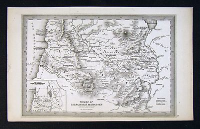
Free Shipping Location: Netherlands ABOUT US VISIT OUR STORE SALES SPECIALS Antique Map-Engraving-ISRAEL-NORTH-HOLY LAND-JUDEA-TRIBES-Blanchard-1844 Description: This old antique print originates ... morefrom: Atlas Geographique et Iconographique du cours complet d'ecriture Sainte. Gravé par vingt Artistes distingués de Paris, sous la direction de Theophile Blanchard et Barrere Freres. published by M.L. Migne, Paris. 1844. translation: Geographical and Iconographical atlas after the lectures of the holy scripture. Artists and Engravers: Engraved by several Parisian artists under the direction of Theophile Blanchard and Barrere Freres. This plate engraved by Barriere freres after A. Fremin. Subject: Pl. 22: Carte du nord de la Judee ou Terre Sainte comprenant les Tribes. Map of Northern Judea or Holy Land including the tribes of Asher. Naphtali, Zebulun, Issachar, Manasseh. Condition: Fine; General age related toning and foxing as visible on scan; Please study scan carefully. Occasional light staining from handling. Irregular paper edges as issued. Small holes in left margin from binding. Size(in cm) The overall size is ca. 36 x 27 cm. The image size is ca. 31.5 x 24 cm. Size(in inch) The overall size is ca. 14.2 x 10.6 inch. The image size is ca. 12.4 x 9.4 inch. Medium: Engraving and etching on a vellin type paper with watermark(not visible on every sheet) Rear blank. Print originates from book/ atlas. Location: A196-11 ThePrintsCollector Peter Cornelissen. Margo van Latum- van Dongen, Frank van Latum Zeeland- The Netherlands Phone: +31 654 21 23 78 Worldwide free shipping on all orders. We ship within one business day upon receipt of payment. We ship by Registered Mail. Insurance is included. We guarantee our items to be genuine original. Visit our Store: we would like to invite you to review similar items in our Store or to browse through all other items in our Store. We are confident that you will find very special unique antique maps and prints in our Store. It is our privilege to have you as a customer. We accept Paypal payments
Buy It Now
$6.05 Shipping Location: Sacramento, United States 1830 Scripture Geography Atlas Biblical Maps Worcester's Outline Hillard Gray Cover is detached and separated, see images. World and Countries of the ... moreOld Testament. Journey of Israelites form Egypt to Canaan. Judah and Israel with the divisions of the twelve tribes. Palestine or the Holy Land. Ancient Jerusalem & Map of the Travels of St. Paul.
Buy It Now
Free Shipping Location: Netherlands Description: From: Nouvel Atlas de la Bible, A Paris, Chez Desray, 1809. This atlas contains 5 maps and a world map. Artists and Engravers: Made by 'Etienne ... moreClaude Voysard (cartouche) Mlle. Glot (map and characters)' after 'Borel'. Etienne Claude Voysard (Paris 1746-1812) was a French engraver, active in Paris. Possibly after Antoine Borel who was a French 18th-century painter, draughtsman and etcher, who exhibited paintings, drawings and engravings in the Salon of Correspondence in 1779 and 1780.

Buy It Now
$17.80 Shipping Location: Bolivia, United States 17773] Morse. Sidney. The Cerographic Bible Atlas. New York: Sidney E. Morse& Co. 1844. Cover printed in letterpress, with a decorative border surround ... moreand inset woodcut view of the City of Jerusalem; 5 total, printed one side only, with outline color; maps included: General Map of the Countries Mentioned in the Bible; Map of the Journeyings of the Israelites in the Desert chiefly from the map of Robinson and Smith; Map of Palestine from the Latest Authorities chiefly from the map of Robinson and Smith; Plan of Jerusalem from the map of Robinson and Smith& Environs of Jerusalem from the map of Robinson and Smith; Map of the Travels of the Apostles chiefly from the map of Dr. Augs. Neander; maps sight at 14 1/2" x 12" approx; overall 17 1/2" x 14" size approx. back cover with title"Morse's Cerographic Bible Atlas" cerography was the process of engraving on a wax-covered metal plate for which a printing surface is prepared by electrotyping; previous owner name on front cover of Rev. W. Hunting; printed on medium stock paper, better than Morse's later atlas newspaper printings; original pale yellow paper softcover printed wraps; some spotting and foxing, wear, closed tears to some maps, covers more so; some chipping to edges, paper curling at edges; given that this was an ephemeral newspaper supplement, in good condition overall. Normal 0 false false false EN-US X-NONE X-NONE Normal 0 false false false EN-US X-NONE X-NONE Normal 0 false false false EN-US X-NONE X-NONE Normal 0 false false false EN-US X-NONE X-NONE Normal 0 false false false EN-US X-NONE X-NONE Normal 0 false false false EN-US X-NONE X-NONE Normal 0 false false false EN-US X-NONE X-NONE
Buy It Now
$15.00 Shipping Location: Brooklyn, United States Census and Publication History This map was published by Robert Seaton and engraved by Josiah Neele in 1835. The present example is the first edition. ... moreA second edition, with a revised title,A New Map of Palestine or the Holy Land with Part of Egypt was issued around 1853 to reflect new survey work in Egypt.
Buy It Now
Free Shipping Location: De Fryske Marren - Langweer, Netherlands Date : c.1650. An excellent example of a Duch Bible map. Dutch text on verso. Condition : Very good, given age. A few spots and tiny holes in the margins. ... moreVery light crease left side. Original middle fold.
Buy It Now
$4.99 Shipping Location: Fairview, United States Lake Erie Maps& Prints! An Authentic Antique Map: Not a Modern Reproduction Click for More No Additional Postage on Multiple Maps Shipped with the ... moreFirst Description: It is an authentic engraved antique map over 160 years old. It is designed by Thomas Starling as stated below the title on the map. It is from John Kitto's Scripture Lands; Complete Biblical Atlas(New York. 1850) A facsimile copy of the title page is included for authenticity. The map is not mounted, matted nor framed, being sold as a single sheet as seen in the main pic. A very nice miniature size map with a lot of historical detail that would frame up well! Size: The map image measures. Between the neat lines, approximately 3 3/4 by 5 1/2 inches(10x14cm) and is on a 4 1/4 by 7" 12x17cm) page as seen in the pic with a wide margin all around for framing as seen in the main pic. Condition: The map is in Very Good to Excellent condition with overall light tonal ageing. Uncolored as issued, blank on the reverse, printed on a heavy paper. It is basically as seen in the pics. There are a couple of minor spots in the margin, otherwise the map image is very clean and would frame up nicely. The pics are accurate of the actual map. Payment Details: We accept most major credit cards through Paypal. Please ask if you have any questions about payment. International Bidders are welcomed and encouraged. Payment is expected within 7 days. Nonpaying Bidders will be reported to Ebay to recoup our listing fees. International Customs and VAT Fees: It is the responsibility of the buyer to pay all Customs Taxes. VAT or other fees that may be due upon arrival. These fees vary greatly from country to country and ebay policy is that the buyer is responsible for their country's taxes and fees. Please consult your country's Customs Regulations for more details on your country: printed matter is duty free in many countries. We declare the full purchase value as required by law. Delays by Customs: Although most items arrive at their destination very quickly
Buy It Now
$5.95 Shipping Location: Dover, United States Issued 1846, Paris by Delamarche. Early 19th century engraved historical map with original outline hand color. Dictionary of Mapmakers, vol.
Buy It Now
$6.00 Shipping Location: Israel 2.1702 Visscher Stoopendaal Map of Israel, Palestine or the Holy Land - Geographicus - PerigrinatiaeVeertich-stoopendaal. Mount Sinai, Mount Horeb, Sodom, ... moreAmora, Jerusalem, and countless other important biblical locals.
Buy It Now
$4.99 Shipping Location: Fairview, United States The Bible Atlas of Sacred Geography Delineated (London: Baldwin & Cradock, 1831). A facsimile copy of the title page is included for authenticity. Condition: ... moreThe map is in Good or better condition with overall tonal ageing, blank on the reverse, printed on a strong buff paper.
Buy It Now
$22.68 Shipping Location: EVESHAM, United Kingdom Pilgrim's Map of the Holy Land. Map of The Holy Land. This is in excellent condition, there are a few tiny tears around the edge.
Buy It Now
$5.75 Shipping Location: Sturgis, United States A map of Cannan Adapted to the Gospel Histories and Exhibiting the Principle Travels of Jesus Christ, also shows the Plan of the Temple and the Plan of ... morethe City of Jerusalem. All are in used antique condition with heavy yellowing of the paper, staining, marks, and holes/tearing along the edge that was bound in the book.
Buy It Now
$18.50 Shipping Location: Libertyville, United States This map of the Holy Land, with west oriented to the top, published as part of a Bible (as indicated by the annotation in the lower right "Place this ... moreMappe at the 33 Chapter of Numbers" is an attempt to depict those travels for a devout audience. ).

Buy It Now
$15.00 Shipping Location: Brooklyn, United States 1783 Bonne Map of the New Testament Lands. W/ Holy Land and Jerusalem WE SELL ONLY ORIGINAL ANTIQUE MAPS- NOT REPRODUCTIONS Title: Carte des Regions et ... moredes Lieux dont il est parle dans le Nouveau Testament. Description: A beautiful example of Rigobert Bonne's 1783 decorative map of the lands of the Bible's New Testament. Bonne's map covers from Italy eastward to include the Eastern Mediterranean. Parts of Africa, Egypt, Persia, Arabia and Asia Minor. It includes both the Black Sea(Pont-Euxin) and the Caspian Sea(Mer Caspienne) Numerous Biblical sites noted throughout. An inset in the lower left quadrant details the city of Jerusalem in the times of Jesus Christ. The Temple, the Fort of Sion, the Palace of Solomon, the Mount of Olives, and many other well-known Biblical sites are identified. A second inset in the lower right quadrant focuses on Judea under King Herod. A decorative baroque title cartouche appears at the bottom center. Drawn by R. Bonne in 1783 for issue as plate no. 36 in Jean Lattre's 1783 final issue of the Atlas Moderne. Size: Printed area measures 13 inches high by 18 inches wide. Condition: Very good condition. Original centerfold exhibits light toning. Blank on verso. Some spotting. Shipping: Due to recent increases in United States Postal Service rates we have been forced to increase our shipping rates. Shipping rates are not negotiable. Items are shipped within three business days of receiving payment. We are happy to consolidate shipping where possible. The following shipping options are available: 1. USPS Domestic Express Mail(35 USD) USA Only. 2. USPS Priority Mail(15 USD) USA Only. 3. USPS International Express(35 to 55 USD) Recommended service for all international parcels. You will be invoiced at the lowest Express Mail rate possible. 4. USPS Priority Mail(35 USD) Available to only certain countries. Due to high instances of loss. This service is specifically NOT AVAILABLE to MAINLAND CHINA or INDIA. 5. Federal Express is available upon request. This is the only servic
Buy It Now
$30.00 Shipping Location: Paris VI, France Large and unusual antique copper engraved map of Holy Land, by Mattheus SEUTTER (1678-1757). SEUTTER S.C.G.M. AUGUST VINDEL". Edition : Augsburg, c. 1740, ... more18th century. based upon the Bible. Title of the map.
Buy It Now
$27.91 Shipping Location: HASLEMERE, United Kingdom "Seaton's Map of Palestine, or the Holy Land, and part of Egypt. Robert Seaton was a British mapmaker, active in Georgian period. He was appointed a Hydrographer ... moreto the King (George IV). A magnificent map of Palestine / Holy Land with an engraved scene of Jesus Christ with Samaritan woman at Jacob's Well.
Buy It Now
$4.99 Shipping Location: Fairview, United States The Bible Atlas of Sacred Geography Delineated (London: Baldwin & Cradock, 1831). A facsimile copy of the title page is included for authenticity. The ... morepics are of the actual map. An Authentic Antique Map: Not a Modern Reproduction.
Buy It Now
$4.99 Shipping Location: Fairview, United States A facsimile copy of the title page is included for authenticity. An Authentic Antique Map: Not a Modern Reproduction. Condition: The map is in Very Good ... morecondition with overall light tonal ageing, blank on the reverse, printed on heavy paper.
Buy It Now
$35.00 Shipping Location: Israel It contains geographically diverse features within its relatively small area. Israeli sovereignty over Jerusalem is internationally unrecognized. [14][15] ... moreThe end of the British Mandate for Palestine was set for midnight on 14 May 1948.
Buy It Now
$8.70 Shipping Location: Vero Beach, United States The Arrowsmiths were a family of English mapmakers. He was joined in 1810 by his nephew John Arrowsmith. "Drawn under the direction of M. Arrowsmith. ... moreHall sculpt. Published for the Society for promoting Christian Knowledge, by M. Rivington, St Paul's Church Yard, London, May.".
Buy It Now
$4.99 Shipping Location: Fairview, United States The Bible Atlas of Sacred Geography Delineated (London: Baldwin & Cradock, 1831). A facsimile copy of the title page is included for authenticity. Condition: ... moreThe map is in Very Good condition with overall tonal ageing, blank on the reverse, printed on a strong buff paper.
Buy It Now
$15.00 Shipping Location: Cyprus Verso Dutch text.: Beschrijving van het Het Beloofde Lant Canaan. Title: Het Beloofde Landt Canaan door wandelt van onsen Salichmaecker Iesu Christo. ... moreTaken from the Dutch Keur State Bible : De Gantsche Heilige Schrifture.Pieter Keur 1720.
Buy It Now
$12.75 Shipping Location: Akron, United States Amsterdam, c. 1650. Original engraved map. Centerfold as issued. Verso text Dutch. Each scene is identified with reference to the appropriate scriptural ... morepassages.
Buy It Now
$15.00 Shipping Location: Cyprus Israel, old map Holy Land, Terra Sancta Vocata. Seutter 1762. Georg Matthäus Seutter (1647–1756) was one of the most important and prolific German map ... morepublishers of the 18th century. Holy Land Israel old engraved detailed hand-colored antique map divided into the Twelve Tribes.
Buy It Now
$10.00 Shipping Location: Cyprus After his ordination, 17 March 1696, he was appointed to teach philosophy and theology at the Ab-bey of Moyenmoutier. Fine original antique copper plate ... moreengraving with hand coloring. Condition: Nice map in good condition.
Buy It Now
Free Shipping Location: Sielow, Germany They each bid on 1 card (according to Image original photo of the respective offer), shipping costs are calculated exclusively from the shipping weight ... morevia a special shipper for large piece goods. put something together in peace and quiet West German publishers mostly have wooden sticks, see partial item description, damage is also mentioned where possible, if the hadü suspension/fastening is needed, please if necessary. Please ask or let me know if necessary. I reserve the right to dismantle inadequate/wobbly hooks; what is not on it cannot be broken or interfere with transport, and I may have. a hook for free use Purpose: children's room, teenager's room, traditional room, men's room, classroom, hallway, auditorium, for information, discussion with children, students, travelers, parents,.
Buy It Now
$180.64 Shipping Location: Sielow, Germany
Buy It Now
Free Shipping Location: Tempe, United States (Published by Hilliard, Gray, Little, and Wilkins; and Crocker & Brewster. No date but circa 1828. 3) Judah and Israel with the divisions of the twelve ... moretribes. 4) Palestine or the Holy Land. 5) Ancient Jerusalem with nits environs.

Buy It Now
$15.00 Shipping Location: Cyprus . HET BELOOFDE LANDT CANAAN BIBLE MAP PROMISED LAND CANAAN STOOPENDAAL KEUR 1738 Title: Het Beloofde Landt Canaan doorwandelt van onsen Saligmaker ... moreJesu Christo. Neffens syne Apostelen. Description: Dutch antique Bible map of the Holy Land as it appeared at the time of Jesus Christ. Covers the Holy Land from the Mediterranean to the Jordan River. Vessels shows the voyage of the apostle Paul to Rome. The vignettes depicts numerous Biblical scenes. The birth of Christ in Bethlehem and the crucifixion of Jesus. A large decorative image in the middle bottom flanked by allegorical figures and scenes from the Gospel of Christ. The map was made to the Gospel of Matthew, tells how the Messiah, Jesus, rejected by Israel, finally sends the disciples to preach his Gospel to the whole world. Taken from the Dutch Keur State Bible: Biblia. Dat is de gantfche H. Schrifture, vervattende alle de Canonijcke Boecken des Ouden en des Nieuwen Testaments, te Dordrecht by Jacob and Hendrik Keur Anno 1738. By: Hendrick Jocob en Pieter Keur en Pieter Rotterdam 1738. Vignettes engraved by Daniel Stoopendaal. Keur gave in 1666 their first Staten Bible out in Dordtrecht. Their first Bibles they gave out in company with Marcus Doornick printed in Amsterdam. Subsequent expenditure was also a cousin of Marcus Doornick namely Pieter Rotterdam. Amsterdam, involved. Bible Printers Keur: This was finally out respectively: Henry I. James I, Peter, Henry II and James II. The Keur Bibles contain six large double page maps. 17th-18th Century maps& atlases& prints. ORIGINAL ANTIQUE COPPER PLATE ENGRAVING. HAND COLORED. Engraving is Absolutely Guaranteed authentic original map. A Certificate of Authenticity will be on request forwarded for each individual map or print. Sheet app. 46 x 32 cm. 18.25 x 13.25 inches. Image app: 45 x 30.5 cm. 17.75 x 11.75 inches. Condition: View very good. Small marginal centerfold restoration. Tiny wormholes near the vignettes showing the adges of the map. Narrow top margin. Verso Bible text in Dutch. All ma
Buy It Now
$6.23 Shipping Location: WHITBY, United Kingdom For John Baskett of Oxford, Bible of c1717. THE LAND OF CANAAN TRAVEL'D. OVER BY O. S. JESUS CHRIST. Holy Land from from Gaza to Misrephot, oriented with. ... moreSuperb large map, plate 36 x 43 cms: paper size 450 x 490.
Buy It Now
Free Shipping Location: De Fryske Marren - Langweer, Netherlands Spectacular town plan of Jerusalem, based upon Christian Van Andricom's 1584 map. published by Johann Andrea Endters Seel, Sohn und Erben 1708. The first ... moreedition appeared in 1641. Date : 1708. Condition : Good, given age.
Buy It Now
$15.00 Shipping Location: Cyprus Author: Hornius, Georgius also Georg Horn (1620 -1670) was a German historian, geographer, theologian and professor. The map show the trach of Abraham ... moretrough the dessert, an inlay map of the Holy Land shows many old places reference to the Bible.
Buy It Now
$15.00 Shipping Location: Cyprus Origin: Historical Dictionary and Critique of the Bible, Paris, 1730. Condition: Nice map in very good condition, fold as published. For the complete ... moreMap and Print collection see our online site. Image app.
Buy It Now
Free Shipping Location: Sielow, Germany They each bid on 1 card (according to Image original photo of the respective offer), shipping costs are calculated exclusively from the shipping weight ... morevia a special shipper for large piece goods. put something together in peace and quiet West German publishers mostly have wooden sticks, see partial item description, damage is also mentioned where possible, if the hadü suspension/fastening is needed, please if necessary. Please ask or let me know if necessary. I reserve the right to dismantle inadequate/wobbly hooks; what is not on it cannot be broken or interfere with transport, and I may have. a hook for free use Purpose: children's room, teenager's room, traditional room, men's room, classroom, hallway, auditorium, for information, discussion with children, students, travelers, parents,.
Buy It Now
Free Shipping Location: Sielow, Germany here comes if necessary. the list of my cards as well, for your information, probably not for sale or irresistible offers, most flashcards (not maps) ... morecan be safely purchased all search terms for the Excel list: IGN Perthes Haack Darmstadt Flemming Klasing Gaebler Gotha Westermann etc. and the following titles Development of the brain Grass snake Domestic pigeon Europe at the time of migration and state formation (375-580) Europe at the time of HohenstaufenFriedrich 2. (1212-50) Europe Economy Economic map Europe from 1815-1871 Europe after World War II World War 1945-1970 Europe in the XXth century 4xpol Europe in the 18th century Century Europe in the 16th century Century 1580 Europe Mining and industry Europe 1919-1945 Europe 1919-1937 Europe 1918-1937 3NK Europe 1871-1914 Europe 1848-18.
Buy It Now
$155.14 Shipping Location: Sielow, Germany
Buy It Now
Free Shipping Location: Sielow, Germany here comes if necessary. the list of my cards as well, for your information, probably not for sale or irresistible offers, most flashcards (not maps) ... morecan be safely purchased all search terms for the Excel list: IGN Perthes Haack Darmstadt Flemming Klasing Gaebler Gotha Westermann etc. and the following titles Development of the brain Grass snake Domestic pigeon Europe at the time of migration and state formation (375-580) Europe at the time of HohenstaufenFriedrich 2. (1212-50) Europe Economy Economic map Europe from 1815-1871 Europe after World War II World War 1945-1970 Europe in the XXth century 4xpol Europe in the 18th century Century Europe in the 16th century Century 1580 Europe Mining and industry Europe 1919-1945 Europe 1919-1937 Europe 1918-1937 3NK Europe 1871-1914 Europe 1848-18.
Buy It Now
Free Shipping Location: Sielow, Germany They each bid on 1 card (according to Image original photo of the respective offer), shipping costs are calculated exclusively from the shipping weight ... morevia a special shipper for large piece goods. put something together in peace and quiet West German publishers mostly have wooden sticks, see partial item description, damage is also mentioned where possible, if the hadü suspension/fastening is needed, please if necessary. Please ask or let me know if necessary. I reserve the right to dismantle inadequate/wobbly hooks; what is not on it cannot be broken or interfere with transport, and I may have. a hook for free use Purpose: children's room, teenager's room, traditional room, men's room, classroom, hallway, auditorium, for information, discussion with children, students, travelers, parents,.
Buy It Now
Free Shipping Location: Sielow, Germany here comes if necessary. the list of my cards as well, for your information, probably not for sale or irresistible offers, most flashcards (not maps) ... morecan be safely purchased all search terms for the Excel list: IGN Perthes Haack Darmstadt Flemming Klasing Gaebler Gotha Westermann etc. and the following titles Development of the brain Grass snake Domestic pigeon Europe at the time of migration and state formation (375-580) Europe at the time of HohenstaufenFriedrich 2. (1212-50) Europe Economy Economic map Europe from 1815-1871 Europe after World War II World War 1945-1970 Europe in the XXth century 4xpol Europe in the 18th century Century Europe in the 16th century Century 1580 Europe Mining and industry Europe 1919-1945 Europe 1919-1937 Europe 1918-1937 3NK Europe 1871-1914 Europe 1848-18.
Buy It Now
$155.14 Shipping Location: Sielow, Germany
Buy It Now
Free Shipping Location: Sielow, Germany here comes if necessary. the list of my cards as well, for your information, probably not for sale or irresistible offers, most flashcards (not maps) ... morecan be safely purchased all search terms for the Excel list: IGN Perthes Haack Darmstadt Flemming Klasing Gaebler Gotha Westermann etc. and the following titles Development of the brain Grass snake Domestic pigeon Europe at the time of migration and state formation (375-580) Europe at the time of HohenstaufenFriedrich 2. (1212-50) Europe Economy Economic map Europe from 1815-1871 Europe after World War II World War 1945-1970 Europe in the XXth century 4xpol Europe in the 18th century Century Europe in the 16th century Century 1580 Europe Mining and industry Europe 1919-1945 Europe 1919-1937 Europe 1918-1937 3NK Europe 1871-1914 Europe 1848-18.
Buy It Now
$180.64 Shipping Location: Sielow, Germany
Buy It Now
$155.14 Shipping Location: Sielow, Germany
|
|
|
|
Middle East Jewish Holy Land Bible map Beautiful engraving by Bachiene 1748
. Middle East Jewish Holy Land Bible map Beautiful engraving by Bachiene 1748 Title Afbeelding der Oostersche Landen Door W.A. Bachiene Uitgegeven bij Nicolaas Goetzee. Ref. Poortman. Kaarten in Bijbels, p. 2253, plate 176. ORIGINAL ANTIQUE MAPS. COPPER PLATE ENGRAVED. Hand colored. WE SELL ONLY ORIGINAL ANTIQUE MAPS Map is Guaranteed authentic. A Certificate of Authenticity will be on request forwarded for each individual map or print. Size: Size app. 51 x 39.5 cm. 20.25 x 15.5 inches. Image app. 47 x 37.5 cm. 18.5 x 14.75 inches. Condition: View overall very good. Folds as published. There are 2 double not really visible tiny wormholes in the centerfold, wrinkly top corner. All maps and prints are genuine. Authentic, published at the date stated in this listing! For better quality pictures please go to our web site: WWW.MAPANDMAPS.COM ... more I offer a no questions returns policy. All maps and prints are genuine. Authentic, published at the date stated above. Worldwide shipping by signed registered mail or Global Express courier. Shipping fee is per combined shipment. Including handling and insurance. Free shipping worldwide if three items or more purchased. . .
|
|
|
1850 Leonard Chronology and Map of the Holy Land and Bible Lands
1850 Leonard Chronology and Map of the Holy Land and Bible Lands WE SELL ONLY ORIGINAL ANTIQUE MAPS- NOT REPRODUCTIONS Title: Leonard's Chronological and Geographical Family Guide to the Holy Bible. Description: A charming c. 1850 map. Chart, and chronological guide to the Holy Land issued by C. W. Leonard. Following the schemata devised by Bishop Ussher of Ireland this chart illustrates the history of the Bible from October 23, 4004 BC, the supposed exact date of Creation. At the center of the chart is an overview map of the Mediterranean basin covering from the Straits of Gibraltar to the Caspian Sea and from the Black Sea to the Persian Gulf. Secondary maps illustrating Canaan according to the Syrian Division of 200 BC(with Biblical mountains noted) and the'Jounreyings of the Children of Israel from Egypt to Canaan' appear ... morein the lower left and right quadrants, respectively. The chart additionally features three family trees– those of Jacob(bottom center) the Kings of Judah(upper left) and Jeroboam(upper right) Surrounding the map, what appears to be an embellished decorative boarder is in fact a fascinating timeline dating the events of the Bible according to the Usscher Chronology. The outer border offers notations on the dating system as well as handy conversions between weights and measurements of antiquity and the English system measurements common in the 19th century. The whole was engraved by for C. W. Leonard by John Dower of London. Size: Printed area measures 25 inches high by 29.75 inches wide. Condition: Very good. Dissected and mounted on linen. Original linen in good condition. Some wear to linen and map along original fold lines. Spot of what appears to be paint affecting the linen edging. Upper left quadrant. Shipping: Due to recent increases in United States Postal Service rates we have been forced to increase our shipping rates. Shipping rates are not negotiable. Items are shipped within three business days of receiving payment. We are happy to consolidate shipping where possible.
|
|
|
1844 SIDNEY MORSE CEROGRAPHIC BIBLE ATLAS HOLY LAND JERUSALEM
17773] Morse. Sidney. The Cerographic Bible Atlas. New York: Sidney E. Morse& Co. 1844. Cover printed in letterpress, with a decorative border surround and inset woodcut view of the City of Jerusalem; 5 total, printed one side only, with outline color; maps included: General Map of the Countries Mentioned in the Bible; Map of the Journeyings of the Israelites in the Desert chiefly from the map of Robinson and Smith; Map of Palestine from the Latest Authorities chiefly from the map of Robinson and Smith; Plan of Jerusalem from the map of Robinson and Smith& Environs of Jerusalem from the map of Robinson and Smith; Map of the Travels of the Apostles chiefly from the map of Dr. Augs. Neander; maps sight at 14 1/2" x 12" approx; overall 17 1/2" x 14" size approx. back cover with title"Morse's Cerographic Bible ... moreAtlas" cerography was the process of engraving on a wax-covered metal plate for which a printing surface is prepared by electrotyping; previous owner name on front cover of Rev. W. Hunting; printed on medium stock paper, better than Morse's later atlas newspaper printings; original pale yellow paper softcover printed wraps; some spotting and foxing, wear, closed tears to some maps, covers more so; some chipping to edges, paper curling at edges; given that this was an ephemeral newspaper supplement, in good condition overall. Normal 0 false false false EN-US X-NONE X-NONE Normal 0 false false false EN-US X-NONE X-NONE Normal 0 false false false EN-US X-NONE X-NONE Normal 0 false false false EN-US X-NONE X-NONE Normal 0 false false false EN-US X-NONE X-NONE Normal 0 false false false EN-US X-NONE X-NONE Normal 0 false false false EN-US X-NONE X-NONE
|
|
|
(5) RARE VINTAGE 1875 Holy Land Bible Maps Old New Testament Hand Tinted Prints
YOU ARE NOW BIDDING ON: 5) AMAZING RARE ANTIQUE LITHO 5 1/2" x 8" PRINTS ORIGINAL* 1875* HOLY LAND OLD& NEW TESTAMENT MAPS. EACH MAP DISPLAYS DIFFERENT OLD& AND NEW TESTAMENT FEATURES IN THE BIBLE. EACH HAS BEEN HAND PRINTED& TINTED BY THE P.S. DUVAL& SON COMPANY FROM PHILADELPHIA! ALL(5) 1875 MAP PRINTS ARE ALL ORIGINAL TO PERIOD. AND ARE AMAZINGLY BOLD, STARK& BEATIFULLY DETAILED! THESE MAPS COME FROM MY PERSONAL COLLECTION OF 1820'S TO 1880'S OLD VINATGE BOOKS. MAPS AND OTHER PAPER ITEMS. EVERYTHING YOU WILL SEE IS ORIGINAL 1800'S ITEMS-NO REPRODUCTIONS! THESE PRINTS ARE FROM 1875-THEY ARE NOT REPRODUCTIONS! YOU ARE BIDDING ON THE FOLLOWING(5) 1875* MAPS PRINTS: 1. Extent of the Kingdom of Israel in the time of David and Solomon. 2. Journeyings of the Israelites from Egypt to Canaan. 3. CANAAN ... moreas divided among the 12 tribes from the time of Joshua to the accession of David. 4. PALESTINE(SYRIA) under the Maccabean& Idmnaean Princess and Illustrative of the period of Christ and the Apostles. 5. MAP ILLUSTRATIVE OF THE ACTS OF THE APOSTLES& THE REMAINING BOOKS OF THE NEW TESTAMENT. PLEASE FEEL FREE TO ASK ANY AND ALL QUESTIONS-BUT DO NOT MISS OUT ON THESE PRINTS DATING TO 1875! SEE BELOW FOR OTHER INFO: Shipping& handling charge for this item will be $4.01 and will be sent by First Class Mail. SORRY. THERE ARE NO RETURNS-ITEMS ARE BEING SOLD AS IS* BID WITH CONFIDENCE THOUGH.SEE MY IMPECCABLE 100% FEEDBACK. IF THERE IS A PROBLEM-COMMUNICATION IS ALWAYS THE KEY-WE CAN WORK IT OUT. PAYMENT BY PAYPAL PLEASE! Contact me BEFORE bidding if you don't use paypal! The shipping charge includes a quality shipping mailing box. Cardboard and or bubble-wrap for protection during shipping and also Delivery C onfirmation. I DO SHIP OUTSIDE OF THE USA-BUT- International shipping is extra. $$ PAYPAL PAYMENT IS DUE WITHIN(3) DAYS OF AUCTION ENDING PLEASE!$$. $$ EXTRA TIME IS ALLOWED. BUT ONLY IF YOU EMAIL ME FIRST TO LET ME KNOW! $$ THANK YO
|
|
|
DE GELEGENTHEYT VAN T’PARADYS HOLY LAND BIBLE MAP ISRAEL STOOPENDAAL KEUR 1738
. DE GELEGENTHEYT VAN T’PARADYS HOLY LAND BIBLE MAP ISRAEL STOOPENDAAL KEUR 1738 Title: De Gelegentheyt van't Paradys ende't Land Canaan mitsgaders de eerste bewoonde landen Der Patriarchen. Uyt de H. schrifture en verscheyden Auctoren bij een gestelt door Hendrik Jacob en Pieter Keur en Pieter Rotterdam. Description: Fine antique Bible map covers the region between the Mediterranean and the Persian Gulf. In double lines the path of Jacob from Canaan to Babylon. Near Cyprus a vessel and Jonah in the Whale. At bottom center is a large scene of Noah's Ark at the beginning of the Great Flood. The vignettes depicts numerous Biblical scenes from the Garden of Eden include scenes of Adam and Even in Paradise. Taken from the Dutch Keur State Bible: Biblia. Dat is de gantfche H. Schrifture, vervattende alle de Canonijcke Boecken des ... moreOuden en des Nieuwen Testaments, te Dordrecht by Jacob and Hendrik Keur Anno 1738. By: Hendrick Jocob en Pieter Keur en Pieter Rotterdam 1738. Vignettes engraved by Daniel Stoopendaal. Keur gave in 1666 their first Staten Bible out in Dordtrecht. Their first Bibles they gave out in company with Marcus Doornick printed in Amsterdam. Subsequent expenditure was also a cousin of Marcus Doornick namely Pieter Rotterdam. Amsterdam, involved. Bible Printers Keur: This was finally out respectively: Henry I. James I, Peter, Henry II and James II. The Keur Bibles contain normaly six large double page maps. 17th-18th Century maps& atlases& prints. ORIGINAL ANTIQUE COPPER PLATE ENGRAVING. HAND COLORED. Engraving is Absolutely Guaranteed authentic original map. A Certificate of Authenticity will be on request forwarded for each individual map or print. Sheet app. 46 x 32.5 cm. 18.25 x 13.25 inches. Image app: 45 x 30.5 cm. 17.75 x 11.75 inches. Condition: view very good. Edges chipping, folds as published, verso Bible text in Dutch. All maps and prints are genuine. Authentic, published at the date stated in this listing! For better quality pictures please go to our web site: WWW.
|
|
|
Map of The Holy Land "Land of The Bible In Roman Times" Vintage Framed Print
Land Of The Bible In Roman Times" This goldleaf framed print of unknown vintage is a vintage reproduction of a map engraving by Abraham Pinaeus(Pinet) A very famous 16th Century French artist. It appears to be quite old and in excellent condition(see pictures) This map has been drawn in a very pictorial way. With the names of places shortened according to the space available. It makes a great gift or conversation piece in your office or den. Measurements: 24" × 26 1/2" This item is being sold as-is and ships only within the contiguous 48 States.
|
|
|
1890 ANTIQUE BIRDS EYE VIEW MAP OF PALESTINE ISRAEL HOLY LAND BIBLE JERUSALEM
1890 ANTIQUE BIRDS EYE VIEW MAP OF PALESTINE ISRAEL HOLY LAND BIBLE JERUSALEM This original antique map gives you an opportunity to examine in exquisite detail a piece of history. If you are interested in the past of this country and its people or have a desire to study where your family may have come from. Then this map gives you a rare look as the area was about 125 years ago. Once matted and framed, this map would make a perfect gift for a family member or friend they'll cherish forever. Origin of the map: The Home Knowledge Atlas" Published by Home Knowledge Association, Toronto, Canada. Date of issue: 1890 Size: The sheet measures 13" x 11" 33 x 28 cm) S/H: The map will be shipped by Air Mail. The shipping charge is: USA- 8.00 USD. World- 9.00 USD, Canada- 9.00 USD. The price includes the insurance and a strong, cardboard ... moretube with plastic plugs. Attention! There is no additional shipping charge for multiple purchases! Pay me securely with any major credit card through PayPal! Payment methods: US/Canada Buyers: Paypal. International Buyers: Paypal. Click Here. Double your traffic. Get Vendio Gallery- Now FREE!
|
|
|
5 maps handcolored cartes 1820-1860s Holy Land Palestina Jerusalem biblic bible
5 different maps from Delamarche Monin Dussieux atlas 1820s- 1840s All handcolored Check the other maps for potential combined shipping
|
|
|
map handcolored carte 1840s vuillemin Holy Land Palestina Jerusalem biblic bible
vuillemin All handcolored Check the other maps for potential combined shipping
|
|
|
Antique 1877 Holy Land Bible Map Set/Lot 15~Palestine,Jerusalem,Canaan,12 Tribes
~*~ WELCOME TO ~*~ ~ KARIZMA'S KLOSET! ~ Personalized Service with FAST Shipping! Set of(15) Small Maps from an Antique 1877 Bible ~ Jerusalem ~ Canaan ~ Sea of Galilee ~ Palestine ~ Etc! ~ small size just 4 1/2" x 7" I removed these from a damaged antique 1877 Bible there are faint water marks along the bottom 1" thought they might make neat framed decor or great for paper arts and crafts projects! ENJOY! Thanks for stoppin' and shoppin' Kari:o) FAST SHIPPING! I know when I buy something I want it as quickly as possible. So I assume you do, too! Therefore. FAST shipping is a TOP PRIORITY! Upon receiving your cleared payment your item is carefully packaged up and shipped out within 48 hours. If for some reason there is a delay, I will email you. A DAILY run to the post office is made every M-F(usually in the mornings ... moreso payments received after 6pm are treated as next day sales) Since our PO is closed on the weekends. Items paid for on Friday, Saturday and Sunday are shipped out the following Monday. Combined S/H Discounts: On MOST items(excluding free shipping- which is free! Or unless otherwise noted under the‘shipping and payments’ tab) I follow the standard practice of adding $1 for each additional item purchased based on the highest s/h charge shown. If the total weight of the items bumps the package into the next USPS weight tier. Then I use that cost+handling+$1 for each item. I am ALWAYS happy to provide a quote prior to your purchase, too! My eBay: I LOVE what I do and the customers I serve! EBay is my full-time job. And I dedicate the following times to making it a great experience for you: M-F from 10am to 6pm. I check emails frequently and try to reply the same day! I take Saturdays and Sundays off to be with my family and to honor and serve our Lord and Savior Jesus Christ. I thank you in advance for respecting my time as much as I respect yours! God bless and thank you so much for stopping by! Ecclesiastes 3:1“There is a time for everything. And a season for every activity
|
|
|
1855 Bible Atlas Map - Holy Land Jesus Christ - Palestine Judea Syria Jerusalem
Lake Erie Maps& Prints! An Authentic Antique Map: Not a Modern Reproduction See Our Ebay Store for other No Additional Postage on Multiple Maps Shipped with the First Description: It is an authentic engraved antique map over 160 years old. It is designed by E. Graover as seen in the bottom right margin. It is from the The New Biblical Atlas and Scripture Gazetteer(Philadelphia. 1855) A facsimile copy of the title page is included for authenticity. The map is not mounted, matted nor framed, being sold as a single sheet as seen in the main pic. Size: The map image measures. Between the neat lines, approximately 5 1/4 by 8 inches(13x20cm) and is on a 6 1/4 by 9 1/2" 16x24cm) page as seen in the pic with a wide margin all around for framing as seen in the main pic. Condition: The map is in Fair condition with overall light tonal ageing. ... moreUncolored as issued, blank on the reverse, printed on a heavy buff paper. There are some handling smudges and brown spota as seen in the pics. The pics are accurate of the actual map. Payment Details: We accept most major credit cards through Paypal. Please ask if you have any questions about payment. International Bidders are welcomed and encouraged. Payment is expected within 7 days. Nonpaying Bidders will be reported to Ebay to recoup our listing fees. Satisfaction Guaranteed: We stand fully behind our products and offer a full refund minus shipping with no questions asked. If condition is different than described we offer a full refund including shipping fees. Check out my! Be sure to add me to your! Powered by The free listing tool. List your items fast and easy and manage your active items.
|
|
|
1842 Tardieu 4 Part Map GEOGRAPHY OF THE BIBLE Holy Land Voyages of Peter & Paul
Géographie De La Bible 43 cm x 37 cm steelplate engraving. 52 cm x 41.5 cm sheet size, original hand colour, Furne& Delamain, Paris, 1842 We are pleased to offer this handsomely engraved four-part map on Biblical subjects compiled by the French cartographer and engraver Ambrose Tardieu(1788-1841) for the 1842 publication of Atlas universel de géographie ancienne et moderne. Dressé par Ambroise Tardieu, pour l'intelligence de la Géographie universelle, par Malte-Brun. This atlas was quite successful with multiple editions issued decades after Tardieu's death. And this example appears to be an early imprint with subtle original outline hand colour as later editions of the plate such as the 1863 imprint employed wash colour. The map of"Palestine or Holy Land" presents the division of the Twelve Tribes ... moreand extends north well into what is now Lebanon and Syria. A smaller map shows the region as the"Kingdom of Herod" in the Roman era and another including Egypt shows the region as the"Land of Canaan" with the route of the Israelites out of Egypt to the promised land depicted. The map at lower right depicts a much wider area and shows the travels of the Apostles Peter and Paul, with the placenames said to be of use when reading parts of the Apocrypha and the books of the prophets. Scholarly and finely engraved with subtle hachure work for topography, the map will make a fine addition to any collection related to Bible history. Moreover. Your purchase will also serve as a reminder of an important charitable contribution- 100% of the proceeds from this listing will be donated to(Doctors Without Borders) whose important humanitarian work sadly remains in high demand around the globe. So that along with acquiring this fine 19th century map a significant donation can be made to this worthwhile organisation. Note fine horizontal lines for littoral waters. Delicate"sweep" of hachure topography: Note various Tetrarchies surrounding that of Herod's: Medi
|
|
|
1924 VINTAGE ORIGINAL MAP OF PALESTINE ISRAEL HOLY LAND BIBLE JERUSALEM
1924 VINTAGE ORIGINAL MAP OF PALESTINE ISRAEL HOLY LAND BIBLE JERUSALEM This original antique map gives you an opportunity to examine in exquisite detail a piece of history. If you are interested in the past of this country and its people or have a desire to study where your family may have come from. Then this map gives you a rare look as the area was about 90 years ago. Once matted and framed, this map would make a perfect gift for a family member or friend they'll cherish forever. Origin of the map: Andree's Allgemeiner Handatlas" Published in Leipzig, Germany by Velhagen& Klasing. Date of issue: 1924 Size: The sheet measures 17" x 11" 43 x 28 cm) S/H: The map will be shipped by Air Mail. The shipping charge is: USA- 8.00 USD. World- 9.00 USD, Canada- 9.00 USD. The price includes the insurance and a strong, cardboard ... moretube with plastic plugs. Attention! There is no additional shipping charge for multiple purchases! Pay me securely with any major credit card through PayPal! Payment methods: US/Canada Buyers: Paypal. International Buyers: Paypal. Click Here. Double your traffic. Get Vendio Gallery- Now FREE!
|
|
|
1729 SUPERB DUTCH BIBLE MAP HOLY LAND BABEL NOAH'S ARK BY STOOPENDAAL
Title: De Gelegentheyt van t' Paradys en t' Landt Canaan. Mitsgaders d'Eerst Bewoonde Landen der Patriarchen Date: 1729 By: Daniel Stoopendaal. Engraved by Jacob Keur. Description: This very finely crafted Dutch Bible map covers the region between the Mediterranean and the Persian Gulf. Depicting numerous Biblical sites, including the wanderings of the Children of Israel, Jonas& the whale, and the Garden of Eden. The map is richly embellished with a banner style title cartouche and four corner vignettes- the creation of Adam& Eve, Paradise, Eve offering Adam the apple, and the expulsion from the Garden of Eden. At bottom center is a large scene of the Ark. Dutch text on verso. Size: 46cm x 35.1cm Condition: Excellent condition. Very fine hand colouring. Large. Wide margins. ================================================================================= ... moreI am a long time collector of antique Maps of China and Asia and have a large number of maps that I will be bringing up for sale. All maps have come from my own private collection- I do not sell any copies or reproductions at all. A Certificate of Authenticity can be issued. On request for any maps bought. I am also a member of the International Map Collectors Society(IMCOS) Save my site as a favourite and keep on the lookout for future sales. Thanks, Vince
|
|
|
Original Antique 1882 Bible Map Plan HEROD'S TEMPLE Israel JERUSALEM Holy Land
Impressive on Any Home or Office Wall. Great for Genealogy. Imaginative& Creative Gift. 1882 Plan Of Herod's Temple in Jerusalem(During the Time of Christ) Fine Phillips& Hunt Map. Engraved by E.F. Fisk. Original 1882. 132-ys-old. Map is in Very Good condition: No marks. Writings, tears, or fraying. Mild minimal foxing. Single fold as Issued. Not a Reproduction. Original Map Drawn& Engraved by E.F. Fisk for the 1882 Edition of Phillips& Hunt's People's Cyclopaedia of Universal Knowledge. Published by Phillips& Hunt, New York& San Francisco; in conjunction with Jones Brothers of Cincinnati& St. Louis; 1882. William H. Dupuy, Editor. E.F. Fisk, Engraver; a Copy of the Title Page of which is Included. A Fine Map for the Collector or Makes Quite An Impressionable Gift. I Sell Only Original Antique Maps: ... moreNo copies or reproductions Press Here to View My Collection. Impressive On Any Home or Office Wall. Dimensions: 10.5" x 13" Intricate Engraved Detail. Imaginative& Creative Birthday. Christmas, Graduation, or Other Special Occasion Gift. The Auction is for the Map Itself. A Frame is Not Included. The Framed Map Pictured is a Personal 1882 Phillips Hunt Map Featured to Show the Beauty of the Maps when Framed. Free Shipping Special(within the USA) All Credit& Debit Cards Accepted Through Paypal. Maps are mailed within 1-3 days of payment and normally arrive within 3-5 days. Please email with any questions. Greetings from Historical Savannah. Georgia; founded 1733. Some. To beautify their halls, studies, chambers, or libraries.loveth, getteth, and useth maps, charts, geographical globes. John Dee. Advisor to Elizabeth I. Press The Store Link Below To View My Collection. Powered by The free listing tool. List your items fast and easy and manage your active items. 40g.RcmdId ViewItemDescV4,RlogId p4%60bo7%60jtb9%3Fuk%601d72f%2B%3E40g-1494221187b-0x10b-
|
|
|
17/18th.Century 'Engraved Map..Canaan & Holy Land' Bible/Christian/Israel
17/18th.Century'Engraved Map.Canaan& Holy Land' Bible/Christian/Israel A GREAT OPPORTUNITY TO ACQUIRE THIS LOVELY 17/18TH CENTURY ENGRAVED MAP. CANAAN COMONLY CALLED THE HOLY LAND OR THE LAND OF PROMISE BEING IN POSESSION OF THE ISRAELITES AS TRAVELLED THROUGH BY OUR LORD' ENGRAVEN BY RICHARD PALMER FOR RICHARD BLOME. ANNO 1687. THIS IS THE ONLY DATE OR IDENTIFYING MARK) I AM NOT A MAP EXPERT BUT THIS IS A LOVELY EARLY ENGRAVED MAP IN NICE CONDITION. A LARGE MAP OF'CANAAN. COMMONLY CALLED THE HOLY LAND' MEASURING APPROX. 19.50' WIDE X 17.50' TALL. MINOR MARKS. STAINS OR BLEMISHES ELSE A NICE SOLID MAP ON VERY THICK PAPER. I AM LISTING A NUMBER OF MAPS/PLATES OVER THE NEXT FEW DAYS. BUYERS CAN PURCHASE AS MANY AS THEY WISH AND COMBINE POSTAGE. ADDITIONAL PURCHASES ARE UNLIKELY TO COST MUCH MORE TO SHIP THAT ... moreA SINGLE ITEM. HAPPY TO SHIP OVERSEAS TO WELL ESTABLISHED BUYERS WITH 100% POSITIVE FEEDBACK. NO PO BOX ADDRESSES WITHOUT PRIOR AGREEMENT AS SHIPPING COSTS WILL CHANGE. CONTACT ME IF YOU REQUIRE ANY FURTHER INFORMATION.
|
|
|
17/18th.C. Fine Detailed Engraved Map ''Jerusalem'' Israel/Holy Land/Bible.
17/18th.C. Fine Detailed Engraved Map'Jerusalem' Israel/Holy Land/Bible. A GREAT OPPORTUNITY TO ACQUIRE THIS LOVELY 17/18TH CENTURY ENGRAVED MAP. JERUSALEM' I AM NOT A MAP EXPERT BUT THIS IS A LOVELY EARLY ENGRAVED MAP IN NICE CONDITION. UNDATED BUT 17/18TH CENTURY. DEDICATION AT THE FOOT: THE WORSHIPFULL JOHN JEFFREYS OF LLYNELLIE. IN THE COUNTY OF BRECK-NOCK FOR THE ADVANCEMENT OF THIS WORKE, CONTRIBUTED THIS PLATE TO WHOSE PATRONAGE IT IS HUMBLY DEDICATED BY RICHARD BLOME' MEASURING APPROX. 19.50' WIDE X 17.50' TALL. MINOR MARKS. STAINS OR BLEMISHES ELSE A NICE SOLID AND HIGHLY DETAILED MAP ON VERY THICK PAPER. SMALL LOWER MARGINAL PAPER REPAIRS TO FOLDS AT REAR. A LITTLE WEAR TO THE CENTRE FOLD. I AM LISTING A NUMBER OF MAPS/PLATES OVER THE NEXT FEW DAYS. BUYERS CAN PURCHASE AS MANY AS THEY WISH AND COMBINE POSTAGE. ... moreADDITIONAL PURCHASES ARE UNLIKELY TO COST MUCH MORE TO SHIP THAT A SINGLE ITEM. HAPPY TO SHIP OVERSEAS TO WELL ESTABLISHED BUYERS WITH 100% POSITIVE FEEDBACK. NO PO BOX ADDRESSES WITHOUT PRIOR AGREEMENT AS SHIPPING COSTS WILL CHANGE. CONTACT ME IF YOU REQUIRE ANY FURTHER INFORMATION. dhep.RcmdId ViewItemDescV4,RlogId p4%60bo7%60jtb9%3Fuk%601d72f%2Bishm%3Ed%7Fhep-14a6c07b7a2-0x110-
|
|
|
17/18th.C. Engraved Map ''Paradise or Garden of Eden'' Israel/Holy Land/Bible.
17/18th.C. Engraved Map'Paradise or Garden of Eden' Israel/Holy Land/Bible. A GREAT OPPORTUNITY TO ACQUIRE THIS LOVELY 17/18TH CENTURY ENGRAVED MAP. PARADISE. OR THE GARDEN OF EDEN WITH THE COUNTRIES CIRCUMJACENT INHABITATED BY THE PATRIARCHS' I AM NOT A MAP EXPERT BUT THIS IS A LOVELY EARLY ENGRAVED MAP IN NICE CONDITION. UNDATED BUT 17/18TH CENTURY. MEASURING APPROX. 19.50' WIDE X 17.50' TALL. MINOR MARKS. STAINS OR BLEMISHES ELSE A NICE SOLID MAP ON VERY THICK PAPER. SMALL LOWER MARGINAL PAPER REPAIR TO FOLD AT REAR. I AM LISTING A NUMBER OF MAPS/PLATES OVER THE NEXT FEW DAYS. BUYERS CAN PURCHASE AS MANY AS THEY WISH AND COMBINE POSTAGE. ADDITIONAL PURCHASES ARE UNLIKELY TO COST MUCH MORE TO SHIP THAT A SINGLE ITEM. HAPPY TO SHIP OVERSEAS TO WELL ESTABLISHED BUYERS WITH 100% POSITIVE FEEDBACK. NO PO BOX ADDRESSES WITHOUT ... morePRIOR AGREEMENT AS SHIPPING COSTS WILL CHANGE. CONTACT ME IF YOU REQUIRE ANY FURTHER INFORMATION. 006.RcmdId ViewItemDescV4,RlogId p4%60bo7%60jtb9%3Fuk%600d72f%2B%3E006-14a6c07b789-0x10f-
|
|
|
17/18th.Century 'Engraved Map..40 Years In Wilderness..Canaan' Holy Land/Bible.
17/18th.Century'Engraved Map.40 Years In Wilderness.Canaan' Holy Land/Bible. A GREAT OPPORTUNITY TO ACQUIRE THIS LOVELY 17/18TH CENTURY ENGRAVED MAP. THE FORTY YEARS TRAVELS OF THE CHILDREN OF ISRAEL OUT OF EGYPT THROUGH THE RED SEA AND THE WILDERNESS IN TO CANAAN OR THE LAND OF PROMISE' I AM NOT A MAP EXPERT BUT THIS IS A LOVELY EARLY ENGRAVED MAP IN NICE CONDITION. UNDATED BUT 17/18TH CENTURY. MEASURING APPROX. 19.50' WIDE X 17.50' TALL. MINOR MARKS. STAINS OR BLEMISHES ELSE A NICE SOLID MAP ON VERY THICK PAPER. I AM LISTING A NUMBER OF MAPS/PLATES OVER THE NEXT FEW DAYS. BUYERS CAN PURCHASE AS MANY AS THEY WISH AND COMBINE POSTAGE. ADDITIONAL PURCHASES ARE UNLIKELY TO COST MUCH MORE TO SHIP THAT A SINGLE ITEM. HAPPY TO SHIP OVERSEAS TO WELL ESTABLISHED BUYERS WITH 100% POSITIVE FEEDBACK. NO PO BOX ADDRESSES WITHOUT ... morePRIOR AGREEMENT AS SHIPPING COSTS WILL CHANGE. CONTACT ME IF YOU REQUIRE ANY FURTHER INFORMATION.
|
|
|
Antique Vintage 19thc Map Holy Land Palestine Mid East Israel Map Bible Religion
Antique 19 th Century Map of Holy Land. Palestine, Israel and the Holy Land. Sacred Geography Map with vignette maps showing Map of Palestine or The Holy Land, Vicinity of The Ancient City of Jerusalem; Plan of The Ancient City of Jerusalem; Map of The Incursions of the Barbarians who destroyed the Roman Empire. 1844. Drawn& Engraved by J.H. Young. Hand-colored. Measures: 11 1/2” X 9 ½” Good condition; light paper toning; left edge rough where originally tipped-in book; edges chipped. Few tears and pieces out; corner tips missing. Decorative Interior Design Frameable. Of interest to collectors of Cartography. Maps, Middle East, the History of the Bible and Religion. SEE IMAGE!
|
|
 |