-
Christian Collectibles
-
Christian Sheet Music
-
Vatican Stamps
-
Vatican Coins & Paper Money
-
Antiques
-
Antiquities
-
Architectural & Garden
-
Decorative Arts
-
Ethnographic
-
Furniture
-
Maps, Atlases & Globes
-
United States (Pre-1900)
-
AK, HI
-
AL, FL, GA, MS, NC, SC
-
AR, IA, KS, LA, MO, NE
-
AZ, CA, CO, NM, NV, UT
-
CT, MA, ME, NH, RI, VT
-
DC, DE, MD, NJ, NY, PA
-
ID, OR, WA
-
IL, IN, MI, OH, WI
-
MN, MT, ND, SD, WY
-
OK, TX
-
VA, WV, KY, TN
-
Entire US
-
United States (1900-Now)
-
United States (Date Unknown)
-
Africa
-
Asia
-
Australasia/ Oceania
-
Canada
-
Central America/ Caribbean
-
Europe
-
India
-
Ireland
-
Mexico
-
Middle East
-
North America
-
South America
-
United Kingdom
-
Maps on CD
-
World Maps
-
Globes
-
Mixed Lots
-
Reproductions
-
Price Guides & Publications
-
Other
|
In
Order by: Available to: This site contains affiliate links for which I may be compensated
|
Buy It Now
$4.95 Shipping Location: Bar Harbor, United States The firm prospered until the 1890s. Mitchell's School Atlas.
Buy It Now
$44.99 Shipping Location: Ivanhoe, Australia Charles Desilver (fl. Desliver continued to publish his atlas until 1859 (though we have heard that he also published an 1862 edition). Was born in Bristol, ... moreConnecticut after his father had emigrated from Scotland in 1773. ).
Buy It Now
$21.27 Shipping Location: SUTTON COLDFIELD, United Kingdom Taken by the U.S. Navy in 1846, in 1869 it was linked to the East by rail when the transcontinental railway was opened. SAN FRANCISCO 1878. OVERSIZE CHART- ... moreMAP. LARGE OVERSIZE MAP.
Buy It Now
$14.99 Shipping Location: Ivanhoe, Australia Hargraves had been to the Californian goldfields and had learned new gold prospecting techniques such as panning and cradling. Before the end of the year, ... morethe gold rush had spread to many other parts of the state where gold had been found, not just to the west, but also to the south and north of Sydney.
Free Shipping Location: Schertz, United States This vintage pictorial folding map titled "THE YOUNG FOURTY-NINERS - RADIO SHOW" is a unique piece of history. Printed in 1933 and designed by H. C. Holling, ... morethis novelty map features a colorful and humorous depiction of the United States during the gold rush era. The map is in its original vintage condition and is suitable for framing. All colors are original and the map is original & dated 1933. This piece is both hysterical and funny, with cartoon illustrations of the forty-niners long trip across our country. The map is 20" by 30" and is in good condition with a small tear (PHOTOS #6&7) and small tape (support) repairs on some fold lines on the back of the print. Don't miss the chance to own this exceptional piece of history.
Buy It Now
$17.45 Shipping Location: Solon, United States THIS IS A GREAT DETAILED GOLD RUSH REGION MAP, PROFESSIONALLY REPRODUCED 40 YEARS AGO, FROM THE ORIGINAL 1850 MAP PRINTED BY GEORGE F. NESBITT LITH. MAP ... moreOF THE GOLD REGION OF CALIFORNIA, TAKEN FROM A RECENT SURVEY BY ROBERT H. ELLIS IN 1850.
$3.95 Shipping Location: Clarkston, United States 1877 Map of the Gold mines in northern portion of the Black Hills. Gold mines and mining - South Dakota - Black Hills. Black Hills (S.D. and Wyo.). in ... moreSouth Dakota. This is a reproduction of the original map.
Buy It Now
Free Shipping Location: Augusta, United States "An Authentic Original Map Not A Reproduction".
Buy It Now
$6.05 Shipping Location: Bellport, United States Gold Rush Pocket Map of Alaska and Klondike Gold Region, Original, Wm W Hart & Co 1897. The map in very good condition.
Buy It Now
$4.85 Shipping Location: Philadelphia, United States The map is from the 20th Century Atlas & Illustrated World by J. Martin Miller and is dated 1899. Very cool map. There is text on the backside.
Buy It Now
$12.00 Shipping Location: Cleveland, United States Author/Artist Published New York: J.H. Colton. First edition. “Nebraska and Kanzas Showing Pikes Peak and Gold Region.”. New York: J.H. Colton, 1859. ... moreOriginal hand color. “Military Map of Parts of Kansas, Nebraska and Dakota.”.
Buy It Now
Free Shipping Location: United States California Gold Rush, Mokelumne River, steelengraving, anno 1860, Bibliographisches Institut -edited in Germany, Bibliographisches Institut, Hildburghausen, ... moresize of the printed area: 11 x 15 cm., only little foxed.
Buy It Now
Free Shipping Location: Pennsburg, United States How To Reach The Gold Rush Fields Of Alaska & The Klondike Via Portland OR 1897. Copyright 1897 by Poole Bros. Published by the Chamber of Commerce, Portland ... moreOR. “Elegant Iron Steamships Leaving Portland Every Five Days”. Measures about 19 X 25 1/2” when unfolded. Has a lot of information on the one side, and a great map of Alaska and the gold fields. Is fragile but you can open it up carefully. Has some tears along the fold intersections as seen. Some light discoloration from age on the front. Comes as seen in photos free shippingM-7
Buy It Now
$9.99 Shipping Location: Ivanhoe, Australia The Picturesque world or, scenes in many lands : with one thousand illustrations on wood and steel of picturesque views from all parts of the world. by ... moreLeo de Colange. Picturesque World. This fine original steel-plate engraved antique print, an early view of Chinatown in San Francisco was published in the 1878 edition ofPicturesque World.
Buy It Now
$43.85 Shipping Location: Canada
Buy It Now
$5.25 Shipping Location: Bartlesville, United States Circa 1848 US Map Of Upper And Lower Gold Mines Of Mormon Diggings. Approximately 10”x8.5”. Original map from book published for US Congress circa 1848-1850. ... moreNOT a reproduction. Over 170 years old! Great piece of US history from the gold rush era.Shipped with USPS First Class Package.
Buy It Now
$17.45 Shipping Location: Solon, United States LAMINATED MAP OF THE GOLD REGION OF CALIFORNIA, TAKEN FROM A RECENT SURVEY BY ROBERT H. ELLIS IN 1850. THIS IS A GREAT DETAILED GOLD RUSH REGION MAP, ... morePROFESSIONALLY REPRODUCED 40 YEARS AGO, FROM THE ORIGINAL 1850 MAP PRINTED BY GEORGE F. NESBITT LITH.
Buy It Now
$6.00 Shipping Location: Solana Beach, United States Ludlow's annotations provide valuable insights into the topography, vegetation, water sources, and soil conditions encountered during the survey. Commissioned ... morein 1874, the survey was part of a larger expedition led by Lt. Col. George Armstrong Custer into the Black Hills region of Dakota Territory.
Buy It Now
$6.05 Shipping Location: Belvedere Tiburon, United States Agriculture up and down the Central Valley drastically altered the landscape of San Joaquin County. Although the area shown here generally was flush with ... morewater in the rainy season and damming allowed water to be tapped year round, areas further to the south were much drier.
Buy It Now
$25.00 Shipping Location: Belvedere Tiburon, United States Another important group of arrivals were Mormon immigrants, who had their own riverside mining camp known as Mormon Bar. and Folsom Blvd. A train depot, ... morelocated in the open space numbered 20 and 21 and the map, is now the area surrounding the Folsom Historic Ice Rink and amphitheater.

Buy It Now
$10.05 Shipping Location: Belvedere Tiburon, United States North West Spain Peninsula 1871 Stieler antique map w/ hand color Spanishce Halbinsel(North West Spain) Issued 1871. Gotha Germany by Perthes for Stieler ... moreFine antique engraved map. With original outline hand color. Made approximately 140 years ago. Printed in the mid-19th century, on quality paper which retains its inherent structural flexibility and soundness. A beautifully engraved and very detailed map of this region. With a profusion of details and small towns not often seen. In Fair or better condition. Some moderate scattered foxing as typical, dampstain at top corner, but these do not detract from the interest or appeal of the map[note: we grade very conservatively and always seek to disclose any noteworthy flaws] The printed area remains visually pleasing. Overall a nice impression of an interesting map which would warrant close inspection. Sheet measures c. 18 3/8" W x 15 1/8" H. Engraved area measures c. 15 1/2" W x 13" H. 33093] note: All old sheets of printed paper possibly have short edge splits. Each sheet has existed for a very long time and has probably been handled repeatedly in the course of it's existence. It has a history unique to it as an object. Most of the time any edge splits are short. Minor, insignificant and have been closed- either long ago or more recently with small pieces of archival tape. Most often these splits are trivial and easy to overlook visually. Basically, they would not significantly affect the piece adversely. The item is offered as seen. Please look carefully and make your decision knowing this antique image is nice. But it is not in perfect"like new" condition. However, with whatever flaws it possesses, it remains entirely worthy of ownership and inclusion in any related collection. We feel it will prove very pleasing to its new owner. We stand behind everything we sell. Everything we offer is guaranteed to be an authentic original antique item as described. We do not sell modern reproductions. Please visit our eBay Store.

Buy It Now
Free Shipping Location: Grass Valley, United States This Auction is for an Unframed MODERN REPRINT of an Antique Map as detailed below. This map is reproduced on specially coated. Matte finish, paper for ... moresharper print quality and colors that are vivid. These maps are created from VERY high resolution uncompressed TIFF files(averaging 200+ megabytes) and are much sharper that the image shown here. Description. Approximate Image Size 16.5 X 20 inches, Original Atlas Title A New Universal Atlas Containing Maps of the various Empires. Kingdoms, States and Republics Of The World. With a special map of each of the United States, Plans of Cities&c. Comprehended in seventy sheets and forming a series of One Hundred And Seventeen Maps, Plans And Sections. Philadelphia, Published By S. Augustus Mitchell, N.E. corner of Market& 7th Streets. 1846. Entered. 1846, by H.N. Burroughs. Pennsylvania. title page by) J. Knight Sc. WE HAVE MANY HISTORIC MODERN REPRINT MAPS AND OTHER ITEMS ON MANY DIFFERENT SUBJECTS Please check out store for additonal products FREE SHIPPING BY MAIL(GENERALLY 2 TO 5 DAY DELIVERY) FOR ANY NUMBER OF MAPS SHIPPED IN THE US. SHIPPING IS $15 PLUS $1 FOR EACH ADDITIONAL MAP TO ANYWHERE ELSE IN THE WORLD. WE SHIP ALL MAPS ROLLED IN A MAILING TUBE TO PROTECT THE MAP. IF YOU ARE UNHAPPY WITH YOUR PURCHASE SIMPLY RETURN IT AND WE WILL REFUND YOUR MONEY. Ad copyright 2014 All Rights Reserved Powered by The free listing tool. List your items fast and easy and manage your active items. RcmdId ViewItemDescV4,RlogId p4%60bo7%60jtb9%3Fuk%601d72f%2Bfg2%3E-144bddd5648-0x10b-
Buy It Now
$6.05 Shipping Location: Belvedere Tiburon, United States As the city expanded, so did the scope of Langley’s work, with directories eventually encompassing not just San Francisco’s core, but also its surrounding ... moreareas. Nevertheless, his contributions remain an integral part of San Francisco’s historical fabric.
Buy It Now
$12.00 Shipping Location: Denver, United States Th century period. Binding is tight and sound. The atlas was originally bound with only the lower portion of Sheet V present; however, a full Sheet V ... morefrom another copy has been inserted loose, thus completing the atlas.
Buy It Now
$10.00 Shipping Location: Chicago, United States By: Millard Sheets. Although Sheets was best known for his water colors, he was talented in myriad techniques and approaches, from major mural commissions, ... moreto illustrations for magazines. He worked as a technical advisor on motion pictures, and taught and lectured at colleges and universities.
Buy It Now
$5.95 Shipping Condition: New Location: Las Vegas, United States United States and British Provinces- 1849 Size: 24" x 32" 61 cm x 81 cm) x Also Available in 18" x 24" from our eBay Store This is ... morea great Classic Map originally published circa 1849. This Map shows the United States California's gold region and popular western trails as they were in 1849. This poster. Which evokes the vivid images of a simpler time, is a custom reproduction printed on 68lb Heavyweight Enhanced Matte Art Paper. This Historic Art Print is suitable for framing. Mounting or direct display on any wall! 000 Artscape Galleries/ Posters Past More Prints and Posters Available from our eBay Store! Shipping price includes delivery confirmation. We combine shipping for multiple purchases- add $1.00 for each additional poster. All posters are professionally packaged to ensure that they arrive safely and undamaged: Your poster is first rolled and inserted into a plastic sleeve before being placed into a Heavy-Duty mailing tube for delivery. We stand behind the quality of every poster. If you are not satisfied with your purchase. Please contact us within 30 days to arrange for either an exchange or a full refund. gsrx_vers_468(GS 6.4(468)
Buy It Now
$8.00 Shipping Location: Moab, United States Published in 1905 in United States Geological Survey Professional Paper No. 54. Plate III. Cripple Creek was the locale for the last great Colorado gold ... morerush when gold was discovered in 1890. By 1910, the region had produced 22.4 million ounces of gold.
Buy It Now
$10.04 Shipping Condition: Unspecified Location: LONDON, United Kingdom Antique engraved map by J Rapkin, published by John Tallis. Original outline hand colour, decorative border, and attractive inset vignette views, 1851. ... morePublished by John Tallis & Co. TYPE: Antique engraved map by J Rapkin, published by John Tallis.
Buy It Now
$9.99 Shipping Location: Ivanhoe, Australia Using prints from Germany. (Goldgrubeneien Califonien - Gold Mines California). Date: - 1855. The effects of the Gold Rush were substantial. In 1849 a ... morestate constitution was written. The new constitution was adopted by referendum vote, and the future states interim first governor and legislature were chosen.
Buy It Now
$14.99 Shipping Location: Ivanhoe, Australia Hargraves had been to the Californian goldfields and had learned new gold prospecting techniques such as panning and cradling. Before the end of the year, ... morethe gold rush had spread to many other parts of the state where gold had been found, not just to the west, but also to the south and north of Sydney.
Buy It Now
$14.99 Shipping Location: Ivanhoe, Australia Handtke, Friedrich 1815 - 1879. - Hand Atlas of the Prussian State Flemming, Glogau 1846. - Royal Prussian Card. Province of Saxony, the duchy of Anhalt, ... morethe ducal. Saxon countries Weimar, Altenburg u. Gotha and the principals Schwarzburg and Reuss, Flemming, Glogau 1870/71.
Buy It Now
$14.99 Shipping Location: Ivanhoe, Australia Hargraves had been to the Californian goldfields and had learned new gold prospecting techniques such as panning and cradling. Before the end of the year, ... morethe gold rush had spread to many other parts of the state where gold had been found, not just to the west, but also to the south and north of Sydney.
Buy It Now
$4.15 Shipping Location: Saco, United States Actual Atlas was Surgically Dissected, it is not included. No Book Killer Here! Plenty of border for matte and framing.
Buy It Now
$7.99 Shipping Location: Bosnia and Herzegovina This map was published in London by John Tallis, the last great decorative mapmaker.
Buy It Now
$9.85 Shipping Location: Shelburne, United States Plymouth Vermont Mid 1800s Map.
Buy It Now
$10.05 Shipping Location: Belvedere Tiburon, United States After the California surveys, Ringgold helped Navy officials choose a location for a dockyard for the Navy’s Pacific station. Porpoise from 1840 at the ... moreinvitation of the head of the project, Charles Wilkes.

Buy It Now
$10.05 Shipping Location: Belvedere Tiburon, United States DNA- Descente North America BEIGE WATERPROOF Snowboard Jacket Medium Number of Pockets: MANY DNA- Descente North America BEIGE WATERPROOF Snowboard Jacket ... moreMedium Snowboarding Jacket Ski Jacket/Super COLD Hiking Jacket Mint Condition DNA- Descente North America Snowboarding Jacket in Men size M Medium. Features include but not limited to: See Pictures for more detail) Dual underarm ventilation zippers with easy grip tabs for cold weather gloves Inside elastic waist snow gator with velcro& 2 snap closure Sinch&Lock waist adjustment Full zipper& cosmetic effect flap-over zipper cover with velcro stay downs(Neck has 1 button stay down closure for flap-over WAY better than the cheap velcro only jackets) REVERSE Zippered Hand Pockets(keeps the snow out) special padded flap on zipper collar to prevent any neck scratches Inside mesh goggle eyewear pocket Inside mesh water bottle pocket Inside clear window season pass holder(stores your pass up out of sight. Or un-velcro to hang down visible to keep from having to undo your jacket every time getting out your pass just to ride the lift again) removed hood Specific Measurements: approx. 25.5" underarm to underarm approx. 22" sleeves(from underarm to wrist snow gator) approx. 28" from shoulder to jacket bottom approx. 25" from shoulder to shoulder The original price on the tag was $320- Shipping to North America ONLY CONDITIONS: Review photos closely in case I have not discovered and/or listed every minor detail myself. Payment is expected within 5 business days of winning the auction or I will simply re-list the item no harm done. Products will ship within 3 business days of receipt of payment. I retain the right to cancel a bid placed by anyone. TRACKING NUMBER WILL OF COURSE BE PROVIDED SUPER WARM& COMFORTABLE* I HAVE OTHER AUCTIONS*

Buy It Now
$5.79 Shipping Location: Greenacres, United States 1998 MERCATOR'S Map Magazine Mongol Empire Cuba Canada Ortelius Gold Rush Complete. Original issue of Mercator's World— the Magazine of Maps. ... moreExploration, and Discovery. This is the May-June 1998 issue. Volume 3, Number 3, and the cover story is titled"The Path of Khan: The Mongol Empire and the Age of Discovery. Other stories in the issue include Alexander von Humboldt's 1827 essay on Cuba. Maps of California's gold rush era, Canada's Hinton Trail, the travel records of pirate Batholomew Sharpe, map collectors of the Italian Renaissance, identifying forgeries of maps by Ortelius, and the Age of Unreason: Cartographic blunders of the 15th and 16th centuries. This magazine measures 10-3/4" x 8-1/2" and has 82 pages. Printed on high-quality glossy paper. The scans below show a few of the inside pages: Mercator's World magazine is must reading for the map collector and this scarce back issue would be a wonderful addition to your library. Condition: It is in excellent condition, bright. Tight, and clean, with no marks. Rips, or tears. We are pleased to offer it with our unconditional. Money-back guarantee. SHIPPING: We gladly ship anywhere in the World. And we use sturdy, professional packing materials to assure safe delivery. The shipping charges are as follows: Within the United States. Including Alaska, Hawaii, and APO addresses: $4.59 To Canada or Mexico: $9.99 To all other international destinations: $14.29(These charges reflect recent increases made by the United States Postal Service for international delivery. We will appreciate your prompt payment for this item. If you need more time or have any other questions about making your payment. Or if you may desire any special services, such as overnight delivery or tracking number, please contact us. Florida residents add 6.5% sales tax. Be sure to check our auction listings on eBay for other antique and collectible maps and ephemera. Simply click on the link below. Many of the items offered can be combined with this purchase
Buy It Now
$14.99 Shipping Location: Ivanhoe, Australia Hargraves had been to the Californian goldfields and had learned new gold prospecting techniques such as panning and cradling. Before the end of the year, ... morethe gold rush had spread to many other parts of the state where gold had been found, not just to the west, but also to the south and north of Sydney.
Buy It Now
$9.99 Shipping Location: Ivanhoe, Australia This original steel-plate engraved antique print view of the Victoria town of Buninyong, Australia was published in the 1874 edition of Edwin BoothsIllustrated ... moreAustralia. Buninyong is a town 11km from Ballarat in Victoria, Australia.
Buy It Now
$25.00 Shipping Location: Belvedere Tiburon, United States In 1857, Baker drew and published a large birds-eye-view of the young ‘City of the Plain’ (printed as a lithograph by Britton & Rey in San Francisco), ... morewhich achieved enormous popular success.
Buy It Now
$25.00 Shipping Location: Belvedere Tiburon, United States Authentic 1950's Magazine Advertisement Condition Scale: Good This collectible 50's magazine advertisement is about: 5 1/4" X 11 1/2" ... more14 X 29.5 cm) NO Copies ~ NO Reproductions All of our ads are hand-picked& carefully removed from their original publications. Vintage 1950s magazine advertising is a great way to display your interests& will enhance the theme of any room. Unique environmentally friendly gift idea! Shipped flat in a clear protective sleeve with between two backers. Removable for immediate framing Shop at our eBay Store We Combine All Orders
Buy It Now
$129.00 Shipping Location: Tracy, United States 15th, 16th, 17th, & 18th of June 1859. Mining Claims of Port Wine in. The Port Wine district is in northwestern Sierra County about 10 miles NW of Downieville. ... moreThe La Porte district adjoins on the NW, the Poverty Hill district on the SW, and the Poker Flat-Howland Flat district on the NE.
Buy It Now
$10.00 Shipping Location: Chicago, United States Date: 1897 (dated) Chicago. A scarce map of Alaska published at the height of the Klondike Gold Rush in the Northwest Yukon Territory. OCLC locates just ... moreone institutional example of this map at the University of Alaska Fairbanks.
Buy It Now
$25.00 Shipping Location: Belvedere Tiburon, United States Authentic 1950's Magazine Advertisement Condition Scale: Good This collectible 50's magazine advertisement is about: 5 1/4" X 11 1/2" ... more14 X 29.5 cm) NO Copies ~ NO Reproductions All of our ads are hand-picked& carefully removed from their original publications. Vintage 1950s magazine advertising is a great way to display your interests& will enhance the theme of any room. Unique environmentally friendly gift idea! Shipped flat in a clear protective sleeve with between two backers. Removable for immediate framing Shop at our eBay Store We Combine All Orders
Buy It Now
$10.00 Shipping Location: Portsmouth, United States
Buy It Now
$25.00 Shipping Location: Belvedere Tiburon, United States Pacific Ocean. Eastern Part. Compiled from the most recent Surveys in the Hydrographical Office. London, 21 June 1877. The Hydrographic Office also mounted ... moreor co-sponsored along list of expeditions across the globe, including Charles Darwin’s voyage with the HMS Beagle.
Buy It Now
$116.05 Shipping Location: New Bern, United States Samuel Augustus Mitchell Senior began his map publishing career in the early 1830’s. Having worked as a school teacher, Mitchell ws frustrated with the ... morelow quality and inaccuracy of school texts of the period.
Buy It Now
$25.00 Shipping Location: Belvedere Tiburon, United States Sutro’s intention was to provide an accessible and scenic space for the city’s residents, allowing them to escape the hustle and bustle of the urban core. ... moreYet Sutro’s impact was not confined to recreational spaces.
Buy It Now
$25.00 Shipping Location: Belvedere Tiburon, United States Despite his new responsibilities, he retained the position of consulting engineer to Golden Gate Park until he resigned in 1890, and was replaced by his ... moreassistant John McLaren. Map of the panhandle of Golden Gate Park by the park’s designer, civil engineer William Hammond Hall.
Buy It Now
$4.95 Shipping Location: Dover, United States Issued for a 1939 World's Fair publication, printed with unrelated text on the reverse. Charming little mid-20th century pictorial map worthy of framing ... morefor display. Issued 1939, New York, art work by Norman Reeves.
Buy It Now
$6.05 Shipping Location: Belvedere Tiburon, United States In the left of the image, facing the water, we see the original Sutro Heights, the residence that Alfred Sutro built for himself on the northwest tip ... moreof the San Francisco promontory. This was nevertheless a drawn-out process that soon left him with extensive land holdings but few funds to develop them properly.
Buy It Now
$10.04 Shipping Condition: Unspecified Location: LONDON, United Kingdom Antique atlas map with original hand colouring / coloring, 1854. DATE PRINTED: 1854. PROVENANCE: "General Atlas of the World", by Sidney Hall, William ... moreHughes FRGS &c. new edition, Edinburgh; Adam & Charles Black, North Bridge.
Buy It Now
$15.00 Shipping Location: Brooklyn, United States Coincidentally,Judge openly supported William McKinley for the presidency in 1896, and in 1897 McKinley was elected President. We have been unable to ... morelocate any other examples. At least, until the Panic of 1907.

Buy It Now
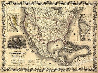
$15.00 Shipping Location: Brooklyn, United States 1852 Meyer Map of the United States and Mexico WE SELL ONLY ORIGINAL ANTIQUE MAPS- NOT REPRODUCTIONS Title: Vereinigte Staaten von Nord-America und Mexico. ... moreDescription: This is a scarce 1852 map of the United States and Mexico by Joseph Meyer. Depicts the United States at the height of the California Gold Rush and shortly after the annexation of Texas. The map covers the United States from Coast to coast and shows a very early configuration of the Transmississippi. Nebraska is shown at its fullest. Extending from Kansas to the Canadian border. Montana, Wyoming, Idaho, Arizona, Colorado, West Virginia, and Nevada do not yet appear on the map. Shows the Mexico– U.S. Boundary line prior to the Gadsden Purchase. This map was issued at the height of the American westward expansion. Two years before this map was drawn the California gold discovery of 1849 enticed thousands to embark upon the rigorous transcontinental emigration. Meanwhile, with the rise in territorial population to the west of the Mississippi, the eastern states were becoming increasingly divided over the issues of slavery and state vs. federal sovereignty. Within a few years these disputes would lead to the American Civil War. This map was issued in Meyer's Zeitung Atlas. Although all the maps in this atlas are not individually dated, the title page and maps were often updated while the imprint with the date was not, causing confusion to the exact date for some of the maps. Moreover some maps in the atlas were taped in at a later date as an update to the atlas. We have dated the maps in this collection to the best of our ability. Size: Printed area measures 8 inches high by 11 inches wide. Condition: Very good. Minor toning and some foxing at places. Shipping: Shipping rates are not negotiable. Items are shipped within three business days of receiving payment. We are happy to consolidate shipping where possible. The following shipping options are available: 1. USPS Domestic Express Mail(35 USD) USA Only. 2. FedEx Ground or Home Delivery(15 USD)

Buy It Now
$35.00 Shipping Location: Bath, United States 1917 Map of Alaska? Alaska Steamship Company 1917 Map of Alaska– Alaska Steamship Company· This map is in exceptional condition. I didn’t see any ... moreholes in it when I opened it for the photos. I forgot to measure it. And don’t want to open it again. If you look in the upper right of the 1 st photo you can see a deck of cards for scale. Upper right section of the map is marked: Copper River& Northwestern RY and The Alaska Railroad· It is in the original sleeve from the steamship company. The sleeve is 8.5” x 4.5” The paper does not feel brittle. Copyright date on the map. As shown, is 1917. I found no other dates on the map or any markings indicating a later printing. PLEASE ASK QUESTIONS BEFORE BIDDING. IMPORTANT: My items are sold AS-IS subject to the description. If your questions are not answered by the description. Ask. If you ask a question answered by the description, I’ll ask you to read it. If you hope the item is better than described, wonderful, just don’t expect it. E-bay Required Notice to International Bidders: Import duties. Taxes, and charges are not included in the item price or shipping charges. These charges are the buyer's responsibility. Check with your country's customs office to find out what these additional costs will be before you bid or buy. See Shipping information below. There may be charges collected by the shipping/delivery company when you receive or pick an item up. Don't confuse them with more shipping charges. We follow international regulations. We don't mark items below value or call them"gifts. Please ask questions before bidding. I am happy to combine shipping. NOTE: If you are bidding on more than one of my auctions. Wait until all have closed and I send you a combined invoice to save you shipping costs. SHIPPING: Shipping in the Contiguous 48 states with Tracking is $2.95 1 st Class. Shipping may reflect a handling charge. International shipments: I WILL NOT SHIP TO RUSSIA. UKRAINE OR MEXICO. Use the shipping calculator to determine charges
Buy It Now
$4.99 Shipping Location: Fairview, United States , published in Chicago by the Rand, McNally & Co., 1881, a facsimile copy of the title page is included for authenticity. Great for anyone interested ... morein exploring old historical sites and ghost towns and the linen backing makes it very durable for travel.
Buy It Now
$10.04 Shipping Condition: Unspecified Location: LONDON, United Kingdom Antique atlas map with original hand colouring / coloring, 1856. DATE PRINTED: 1856. PROVENANCE: "General Atlas of the World", by Sidney Hall, William ... moreHughes FRGS &c. new edition, Edinburgh; Adam & Charles Black, North Bridge.
Buy It Now
$14.99 Shipping Location: Ivanhoe, Australia Dower is the heir to the more prominent London engraver and mapmaker John Crane Dower. He was elected to the Royal Geographical Society in 1854. This ... moreoriginal hand coloured copper-plate engraved antique map of Australia, New Holland, was drawn & engraved by John Dower and published by Orr & Smith, in the 1835 edition ofNew General Atlas.
Buy It Now
$14.99 Shipping Location: Ivanhoe, Australia Handtke, Friedrich 1815 - 1879. - Hand Atlas of the Prussian State Flemming, Glogau 1846. - Royal Prussian Card. Province of Saxony, the duchy of Anhalt, ... morethe ducal. Saxon countries Weimar, Altenburg u. Gotha and the principals Schwarzburg and Reuss, Flemming, Glogau 1870/71.
|
|
|
In
|
GENUINE 1848 CALIFORNIA GOLD RUSH MAP SUTTER'S FORT, SACRAMENTO, AMERICAN RIVER
Description"POSITIONS of the Upper and Lower Gold Mines on the South Fork of the American River. CALIFORNIA" July 20th. 1848. The sheet measures 9 3/4" x 19 3/4" The actual map size is 9 1/4" x 18 1/4" There is a missing area of the lower right margin area(see 11th photo) Not affecting the actual map area, and a small area in the'Distance from Sutter's' print area which I can only describe as some sort of light"gouge" on the paper(see blow-up in 9th photo) On the back are 3 small pieces of adhesive in the corners. This early map of the gold mines covers Sacramento. The American River and its South Fork, Webers Creek, etc. Issued in U.S. House Ex. Doc. No. 1, 30th Congress, Second Session, accompanying the Report of Col. Richard B. Mason, published with President Polk's Message to Congress ... moreof Dec. 5, 1848. Mason sent samples of gold along with his report, and there are numbers printed on the map which indicate where the various pieces came from. Wheat, Gold Region, 51.
|
|
|
Original Antiique 1853 SAN FRANCISCO CA MAP: GOLD RUSH ERA 23" X 33", Exc Cond
This is a rare find! It is an original 1853 map of San Francisco. Showing streets, buildings and sand dunes by US Coast Survey. This is the Gold Rush era that started in 1849 so San Francisco had just 4 years to grow. It is interesting to note that what is currently the distance center of the city is nothing but sand dunes on this map. There is no Golden Gate Park and just a very few buildings near the ocean down in the lower left corner. This measures about 23" by 33" It is printed on old, sturdy paper and it is in excellent condition with no tack holes or tape. LOW SHIPPING: This is light enough to send First Class for only $3.50 within the USA. Check out my other items! See bidding tips below. They include a case for earlier bidding that most buyers don't know. International bidders welcome. PAYMENT INFO: I expect prompt ... morecontact and payment through PayPal within 3 days. If this is a problem. Please contact me. Prompt communication is more important than payment date. If you ever have a problem with something I've sold you. Let me know and I will make it right. Thanks for looking. G-sale-junkie e BIDDING TIPS Watch List: I've noticed that many bidders are putting items on their WATCH List and then they wait until the very end to bid. There are advantages and disadvantages to this approach. The advantage is that you are not driving up the price by bidding with your competition. The disadvantage is that bidders often forget to keep track of their watched items and find out too late that the item sold for less than you would have been willing to pay. Or it didn't sell at all and you could have had it for the minimum bid. The solution to this dilemma is to bid just the minimum bid early on. This doesn't prevent you from also bidding at the end. And it doesn't drive up the price because it is just the minimum. Also, if you tend to lose track of what is on your WATCH LIST. Then you wouldn't have to worry about losing an item that receives no ot
|
|
|
1849 Official Map, San Francisco, California, Eddy, Earliest Official, Gold Rush
Rare early map of San Francisco. California.
|
|
|
Original 1851 Bird's Eye View San Francisco - Gold Rush Era
Click Here. Double your traffic. Get Vendio Gallery- Now FREE! Up for auction is an original bird's eye view of San Francisco in 1851. During the height of the Gold Rush. Published in the History of the World by Henry Bill and lithographed by T. Sinclair. It's unfortunate that another framer got carried away with a bottle of glue but there it is. Print still shows original tinting. It also shows a jagged tear running from the tab end to the first fold and up and approximately 9" into the center of the image. The lower right corner does lift up if that's encouraging to anyone interested in restoring this rare map. Print measures 12 3/4" by 18 1/4" and 15" by 20" overall. Please look at all photos closely. Please email any questions before bidding. Buyer to pay shipping costs. International bidders should ... morecontact me for shipping estimate prior to bidding. Sold As Is. Thank you and good luck.
|
|
|
Mexico, California, and Texas - Gold Rush Map - 1851
Mexico. California, and Texas- Gold Rush Map- 1851 Description: Mexico. California, and Texas- Gold Rush Map- 1851 Mexico. California, and Texas by J. Rapkin. J. F. Tallis: London& New York, 1851. From The Illustrated Atlas and Modern History of the World Geographical. Political, Commercial& Statistical. Steel engraving. Includes three vignettes depicting Gold Washing. Mexican Peasants, and Ruins at Uxmel, Yucatan, as well as an ornate botanical border depicting fruits, vegetables, and plants of the region. Original hand-coloring. Nicely framed. Map is approximately 13.5" x 10" frame is approximately 19.5" x 17.5" Not examined out of the frame. However map appears clean with very lightly toned borders and perhaps a small split at the top of the centerfold. T his is the preferred edition of one of the first maps ... moreto depict the California Gold Rush of 1849 and shows the highlighted gold regions. An illustration of Forty-Niners panning for gold, and the territory acquired by the United States from the Treaty of Guadalupe Hidalgo outlined in green. It includes the Southwestern United States and all of Mexico. Texas is shown with its early statehood borders. The Great Caravan Route" The Old Spanish Trail) is shown to run from central Arkansas through Santa Fe to"Pueblo de Los Angelos" on the Pacific coast. And locations of many Native American tribes are labeled. 008113- Domestic Shipping. Most orders are shipped to locations in the US at no additional cost; normally. This is via media or first class mail. If not, shipping costs are set at a flat rate on an item-by-item basis. Media mail shipping-when available and appropriate-is inexpensive but may take between two and four weeks. Especially if delivery is to the west coast. If a quick delivery is important to you, please request USPS Priority Mail or some other expedited delivery service before paying. International Shipping. International shipping is usually done through the eBay Global Shipping Program. I know that this ca
|
|
|
1859 illustr newspaper w detailed MAP Route to the PIKES PEAK GOLD RUSH Colorado
Please visit our EBAY STORE at the link directly below for HUNDREDS of HISTORICAL NEWSPAPERS on sale or at auction: http:stores.ebay.com/Steve-Goldman-HISTORICAL-NEWSPAPERS_W0QQsspagenameZL2222QQtZkm SEE PHOTO- COMPLETE ORIGINAL illustrated newspaper. Harper's Weekly(New York) dated Apr 2. 1859. This issue has an inside page 7.5" x 4" detailed"Map of the Gold region" The Pikes Peak Gold Rush. There is also a long reprt titled: How to get to Pike's Peak Gold Mines. GREAT issue for a collector of GOLD RUSH ERA memorabilia. The Pike's Peak Gold Rush(later known as the Colorado Gold Rush) was the boom in gold prospecting and mining in the Pike's Peak Country of western Kansas Territory and southwestern Nebraska Territory of the United States that began in July 1858 and lasted until roughly the creation of the ... moreColorado Territory on February 28. 1861. An estimated 100,000 gold seekers took part in one of the greatest gold rushes in North American history. The participants in the gold rush were known as" Fifty-Niners" after 1859. The peak year of the rush and often used the motto Pike's Peak or Bust! But in fact the location of the Pike's Peak Gold Rush was 85 miles(137 km) north of Pike's Peak. It was only named Pike's Peak Gold Rush because of how well known and important Pike's Peak was. Harper's Weekly( A Journal of Civilization) was a 16 page illustrated newspaper based in New York City. It was published by Harper& Brothers from 1857 until 1916. It sometimes had long articles on the political intrigues and scandals of the day. Following the successful example of the. Fletcher Harper began publishing magazine in 1850. The publication was more intent on publishing established authors such as Dickens and Thackeray. But was a great enough success to begin publishing the Harper’s Weekly illustrated newspaper in 1857. By 1860 the Weekly’s circulation had reached 200.000. Among its recurring features were the political cartoons of Thomas Nast who wa
|
|
|
SAN FRANCISCO 1853 U.S. COAST GUARD MAP - GOLD RUSH RELIC - SHOWS CITY AND AREA
SAN FRANCISCO AND VICINITY- U.S. COAST GUARD SURVEY. Published in 1853 from data gathered in 1852. One of the first maps published showing San Francisco. Every structure is indicated. Going west. The City stops at Union Square. No Columbus Street. You can see how much has been filled in, which is exactly where you do not want to be living or working. I know, was there for the 1989 quake. SUPER RARE, HAS BEEN PROFESSIONALLY REPAIRED ALONG THE SEEMS. Measures approximately 19 3/8" x 27" The grid you can see in the photo is 1" Shipping is $19.99. Check out my other auctions for more Kozik items, including many pieces of original artwork, rare early black and white work from Frank's days in Austin, and many one-of-a-kind items. `4`.RcmdId ViewItemDescV4,RlogId p4%60bo7%60jtb9%3Feog4d71f%2B%3E%604%60-148638857d5-0x106-
|
|
|
1854 San Francisco Birds Eye View MAP Litograph by Henry Ball GOLD RUSH
This is an original 1854 Bird's Eye View color lithograph of San Francisco during the height of the Gold Rush from the work"History Of The World" by Henry Ball. It measures approximately 10 inches x 16 and 1/2 inches. The litho has been repaired and dry mounted to stabilize it. There are areas of"wrinkling" in the blue sky and the lower right area of the field(please see photos) There is also a tiny hole in the sky located in the same area. It is still a Rare and Early Depiction of San Francisco!
|
|
|
1851 CALIFORNIA GOLD RUSH ERA MAP (CA, UT & NM) ORIGINAL
1851 CALIFORNIA GOLD RUSH MAP(CA. UT& NM) ORIGINAL YOU ARE LOOKING AT AN ORIGINAL. ANTIQUE MAP FROM 1851 OF THE STATE OF CALIFORNIA. MAP ALSO INCLUDES TERRITORIES OF UTAH& NEW MEXICO AND MEASURES 7" X 9" BOTH MAPS) OR 4.5" X 7(INDIVIDUALLY) THESE MAPS CAME FROM THE 1851 BOOK, THE AMERICAN LAWYER" AND ARE IN VERY GOOD AND BRIGHT CONDITION. IF ONE SIDE OF ONE PAGE IS TRIMMED TO MAP EDGE. THE TWO SEPARATE PAGES WILL MATCH PERFECTLY. THIS ITEM IS 163 YEARS OLD. GREAT EARLY MAP*FREE SHIPPING*
|
|
|
1876 Mitchell Map - West United States California Gold Rush Colorado Oregon Utah
Lake Erie Maps& Prints! An Authentic Antique Map: Not a Modern Reproduction! See Our Ebay Store for other! Free Shipping on Purchases of 5 or More Maps and Prints Description: It is an authentic Antique map over 140 years old with original handcoloring and a centerfold as issued. It is from an 1876 Mitchell School Atlas. The map is not mounted nor matted. Being sold as a single sheet as seen in the first pic. Size: The map image measures approximately 8 by 10 1/2 inches on a 9 by 11 1/2" page with a margin all around for matting as seen in the pic. Condition: It is in Very Good condition for its age with overall light tonal ageing. Strong page with nice color. It is basically as seen in the pics. A slight bend on the bottom corner and a couple of minor spots in the margin, otherwise it is very clean and would frame up well, see the ... morepics for more on condition. The pics are of the actual map. Payment Details: We accept most major credit cards through Paypal and Ebay. Please ask if you have any questions about payment. International and New Bidders are welcomed and encouraged. Payment is expected within 7 days. After which Nonpaying Bidders will be reported to Ebay to recoup our listing fees. Save on Shipping: We only charge one shipping fee based on the largest map or print with multiple items shipped along with it for no extra costs. Purchase 5 or more maps or prints and receive Free First Class shipping in USA or First Class International elsewhere in the world. Although registration may be required on shipments of high value. International Customs and VAT Fees: It is the responsibility of the buyer to pay all Customs Taxes. VAT or other fees that may be due upon arrival. These fees vary greatly from country to country and ebay policy is that the buyer is responsible for their country's taxes and fees. Please consult your country's Customs Regulations for more details on your country, printed matter is duty free in many countries. We declare the full purchase value as required by law. Delays by C
|
|
 |