-
Christian Collectibles
-
Christian Sheet Music
-
Vatican Stamps
-
Vatican Coins & Paper Money
-
Antiques
-
Antiquities
-
Architectural & Garden
-
Decorative Arts
-
Ethnographic
-
Furniture
-
Maps, Atlases & Globes
-
United States (Pre-1900)
-
AK, HI
-
AL, FL, GA, MS, NC, SC
-
AR, IA, KS, LA, MO, NE
-
AZ, CA, CO, NM, NV, UT
-
CT, MA, ME, NH, RI, VT
-
DC, DE, MD, NJ, NY, PA
-
ID, OR, WA
-
IL, IN, MI, OH, WI
-
MN, MT, ND, SD, WY
-
OK, TX
-
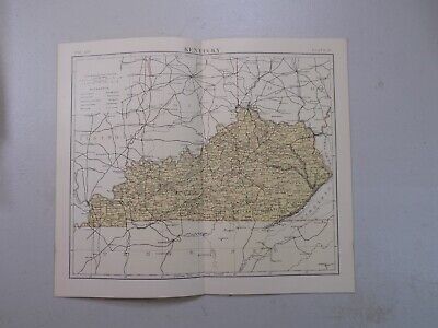
VA, WV, KY, TN
-
Entire US
-
United States (1900-Now)
-
United States (Date Unknown)
-
Africa
-
Asia
-
Australasia/ Oceania
-
Canada
-
Central America/ Caribbean
-
Europe
-
India
-
Ireland
-
Mexico
-
Middle East
-
North America
-
South America
-
United Kingdom
-
Maps on CD
-
World Maps
-
Globes
-
Mixed Lots
-
Reproductions
-
Price Guides & Publications
-
Other
|
In
Order by: Available to: This site contains affiliate links for which I may be compensated
|
Buy It Now
$4.69 Shipping Location: Greenacres, United States Original 1882 antique lithographed map of the confluence of the Passaic and Hackensack rivers in Newark Bay, printed more than 135 years ago.

Buy It Now
$4.69 Shipping Location: Greenacres, United States Original 1882 Map LANCASHIRE England Liverpool Manchester Bolton Salford Chorley Original antique lithographed Victorian-era map of Lancashire. Printed ... moremore than 124 years ago. The map was drawn and engraved by noted mapmaker John Bartholomew of London and has wonderful detail throughout. It shows cities. Towns, railroads, wagon roads, canals, parks, railway stations, lighthouses, and other local landmarks, as well as natural features in the historic county of Lancashire in northwest England. Among the named places and features are Manchester. Liverpool, Southport, Bury, Preston, Clitheroe, Ulverston, Hawkshead, Morecambe Bay, Lancaster, Bolton, Accrington, the London& North Western Railway, Carnforth, Salford, Chorley, and more. The map was issued in the 9th edition of the Encyclopædia Britannica and is identified as Plate IV. Volume XIV. The image area measures 23.4 x 16.5 cm[9-1/4" x 6-1/2" and there's a mileage scale in the upper corner. Condition: It is in excellent condition, bright and clean. With no marks. Rips, or tears. It is blank on the back, with no printing on the reverse side. The scans below give a closer look at some of the detail: This is an original. Authentic antique map, published in 1882. It is not a reproduction or modern reprint. And it is fully guaranteed to be genuine. It would make an impressive display in your den or office. It would also make a perfect gift. And we'll include our helpful framing tips for your reference. We are pleased to offer it with our unconditional. Money-back guarantee. SHIPPING: We gladly ship anywhere in the World. And we use sturdy, professional packing materials to assure safe delivery. The shipping charges are as follows: Within the United States. Including Alaska, Hawaii, and APO addresses: $3.59 To Canada or Mexico: $9.79 To all other international destinations: $13.99(These charges reflect recent increases made by the United States Postal Service for international delivery. We will appreciate your prompt payment for this item. I
Buy It Now
Free Shipping Location: Sayville, United States Original 1882 Map of Illinois. Shows counties. Major cities and the Railroad lines throughout the state. Has a table on the reverse showing the population ... moreand demographics of the various counties in the state. Measures approximately 13.12" by 10.62" Rescued from a vintage atlas. Will look great in a frame. See photo's. Free Shipping to anywhere in the US. Your order will always ship within ONE BUSINESS DAY. Well packaged in a sturdy waterproof mailer and sent with a delivery confirmatio n. I ship worldwide. Froo www.froo.com | Froo Cross Sell. Free Cross Sell, Cross promote, eBay Marketing, eBay listing Apps, eBay Apps, eBay Application.
Buy It Now
Free Shipping Location: Sayville, United States An interesting antique map. See photo's.
Buy It Now
Free Shipping Location: Sayville, United States Antique 1882 Map of Missouri by Phillips& Hunt. Shows counties. Cities and the Railroad lines throughout the state. Has a table on the reverse showing ... morethe population and demographics of the various counties in the state adjusted from the 1880 census. Measures approximately 13.12" by 10.62" Will look great in a frame. See photo's. Free Shipping to anywhere in the US. Your order will always ship within ONE BUSINESS DAY. Well packaged in a sturdy waterproof mailer and sent with a delivery confirmatio n. I ship worldwide. Froo www.froo.com | Froo Cross Sell. Free Cross Sell, Cross promote, eBay Marketing, eBay listing Apps, eBay Apps, eBay Application. RcmdId ViewItemDescV4,RlogId p4%60bo7%60jtb9%3Fvo%7B%3Dd70f%2Bf%60%60%3E-144e9bd020c-0x114-
Buy It Now
Free Shipping Location: Savannah, United States Original Antique 142-year-old Map of Michigan Drawn and Engraved for the 1882 Edition of The People's Cyclopedia of Universal Knowledge: A Compendium ... moreof Appendixes Invaluable for Reference in All Departments the Arts and Life, the Whole Brought Down to the Year 1882, with Pronunciation Conformed to Webster's Unabridged Dictionary, Illustrated with Over Five Thousand Engravings and Over One Hundred Color Maps of Each State and Territory of the United States, including City Maps, Continents, the World, and Every Country Across the Globe. Great for American History and Family Genealogy. Imaginative and Creative Gift. Fine Map for the Collector or Historian. Easily Framed.
Buy It Now
Free Shipping Location: Savannah, United States Original Antique 142-year-old Map of Louisiana Mississippi and Arkansas Drawn and Engraved for the 1882 Edition of The People's Cyclopedia of Universal ... moreKnowledge: A Compendium of Appendixes Invaluable for Reference in All Departments the Arts and Life, the Whole Brought Down to the Year 1882, with Pronunciation Conformed to Webster's Unabridged Dictionary, Illustrated with Over Five Thousand Engravings and Over One Hundred Color Maps of Each State and Territory of the United States, including City Maps, Continents, the World, and Every Country Across the Globe. Great for American History and Family Genealogy. Imaginative and Creative Gift. Fine Map for the Collector or Historian. Easily Framed.
$5.00 Shipping Location: Pottstown, United States Smith's Map Of Philadelphia And Vicinity in fair to good condition. tears, cover split at spine. 2 piece map. each side 21" x 27 3/4". marked published ... moreby j c swmith 27 south st phila pa 1882. check out my other auctions. please visit my store.
Buy It Now
Free Shipping Location: Savannah, United States Original Antique 142-year-old Map of Florida Drawn and Engraved for the 1882 Edition of The People's Cyclopedia of Universal Knowledge: A Compendium of ... moreAppendixes Invaluable for Reference in All Departments the Arts and Life, the Whole Brought Down to the Year 1882, with Pronunciation Conformed to Webster's Unabridged Dictionary, Illustrated with Over Five Thousand Engravings and Over One Hundred Color Maps of Each State and Territory of the United States, including City Maps, Continents, the World, and Every Country Across the Globe. Great for American History and Family Genealogy. Imaginative and Creative Gift. Fine Map for the Collector or Historian. Easily Framed.
Buy It Now
Free Shipping Location: Savannah, United States Original Antique 142-year-old Map of North and South Carolina Drawn and Engraved for the 1882 Edition of The People's Cyclopedia of Universal Knowledge: ... moreA Compendium of Appendixes Invaluable for Reference in All Departments the Arts and Life, the Whole Brought Down to the Year 1882, with Pronunciation Conformed to Webster's Unabridged Dictionary, Illustrated with Over Five Thousand Engravings and Over One Hundred Color Maps of Each State and Territory of the United States, including City Maps, Continents, the World, and Every Country Across the Globe. Great for American History and Family Genealogy. Imaginative and Creative Gift. Fine Map for the Collector or Historian. Easily Framed.
Buy It Now
Free Shipping Location: Savannah, United States Original Antique 142-year-old Map of Kansas and Nebraska Drawn and Engraved for the 1882 Edition of The People's Cyclopedia of Universal Knowledge: A ... moreCompendium of Appendixes Invaluable for Reference in All Departments the Arts and Life, the Whole Brought Down to the Year 1882, with Pronunciation Conformed to Webster's Unabridged Dictionary, Illustrated with Over Five Thousand Engravings and Over One Hundred Color Maps of Each State and Territory of the United States, including City Maps, Continents, the World, and Every Country Across the Globe. Great for American History and Family Genealogy. Imaginative and Creative Gift. Fine Map for the Collector or Historian. Easily Framed.
Buy It Now
Free Shipping Location: Savannah, United States Original Antique 142-year-old Map of Ohio Drawn and Engraved for the 1882 Edition of The People's Cyclopedia of Universal Knowledge: A Compendium of Appendixes ... moreInvaluable for Reference in All Departments the Arts and Life, the Whole Brought Down to the Year 1882, with Pronunciation Conformed to Webster's Unabridged Dictionary, Illustrated with Over Five Thousand Engravings and Over One Hundred Color Maps of Each State and Territory of the United States, including City Maps, Continents, the World, and Every Country Across the Globe. Great for American History and Family Genealogy. Imaginative and Creative Gift. Fine Map for the Collector or Historian. Easily Framed.
Buy It Now
Free Shipping Location: Savannah, United States Original Antique 142-year-old Map of Virginia and West Virginia Drawn and Engraved for the 1882 Edition of The People's Cyclopedia of Universal Knowledge: ... moreA Compendium of Appendixes Invaluable for Reference in All Departments the Arts and Life, the Whole Brought Down to the Year 1882, with Pronunciation Conformed to Webster's Unabridged Dictionary, Illustrated with Over Five Thousand Engravings and Over One Hundred Color Maps of Each State and Territory of the United States, including City Maps, Continents, the World, and Every Country Across the Globe. Great for American History and Family Genealogy. Imaginative and Creative Gift. Fine Map for the Collector or Historian. Easily Framed.
Free Shipping Location: Old Orchard Beach, United States This Map was removed from a 1882 Atlas and is in good acceptable condition. Including Hundreds of RareCivil War. 130+ years of aging. Study the photos ... morecarefully, this is the actual map you. will receive.
Buy It Now
Free Shipping Location: Savannah, United States Original Antique 142-year-old Map of Maryland and Delaware Drawn and Engraved for the 1882 Edition of The People's Cyclopedia of Universal Knowledge: ... moreA Compendium of Appendixes Invaluable for Reference in All Departments the Arts and Life, the Whole Brought Down to the Year 1882, with Pronunciation Conformed to Webster's Unabridged Dictionary, Illustrated with Over Five Thousand Engravings and Over One Hundred Color Maps of Each State and Territory of the United States, including City Maps, Continents, the World, and Every Country Across the Globe. Great for American History and Family Genealogy. Imaginative and Creative Gift. Fine Map for the Collector or Historian. Easily Framed.
Buy It Now
Free Shipping Location: Riverside, United States From the 1882 Edition of Harper & Brothers. Rare & Authentic - 140 Year-Old Color Map. Condition: Edge wear and yellowing due to age. Exquisite Detail. ... more. READY for FRAMING!
Buy It Now
$4.50 Shipping Location: Hoboken, United States Source: "U.S. Coast and Geodetic Survey", published Washington, 1882. Condition: P lease examine the photos. All major tears / paper losses were repaired. ... moreFull Page Size (with blank margins) : app.
Buy It Now
Free Shipping Location: Sayville, United States See photo's.
Buy It Now
Free Shipping Location: Savannah, United States Original Antique 142-year-old Map of Wisconsin Drawn and Engraved for the 1882 Edition of The People's Cyclopedia of Universal Knowledge: A Compendium ... moreof Appendixes Invaluable for Reference in All Departments the Arts and Life, the Whole Brought Down to the Year 1882, with Pronunciation Conformed to Webster's Unabridged Dictionary, Illustrated with Over Five Thousand Engravings and Over One Hundred Color Maps of Each State and Territory of the United States, including City Maps, Continents, the World, and Every Country Across the Globe. Great for American History and Family Genealogy. Imaginative and Creative Gift. Fine Map for the Collector or Historian. Easily Framed.
Buy It Now
Free Shipping Location: Monroeville, United States Fine Adornment of Tennessee& Kentucky History. Impressive on Any Home or Office Wall. Imaginative Gift. 1882 Map of Kentucky& Tennessee Fine Phillips& ... moreHunt Map. Engraved by E.F. Fisk. Original 1882. 131-ys-old. Map is in Very Good/Excellent condition: No marks. Writings, rips, tears, fraying, or foxing. Single fold as Issued. Not a Reproduction. Original Map Drawn& Engraved by E.F. Fisk for Phillips& Hunt's 1882 Edition of The People's Cyclopaedia of Universal Knowledge. Published by Phillips& Hunt, New York& San Francisco, and Jones Brothers& Company of Cincinnati& St. Louis; William H. Depuy, Editor. E.F. Fisk, Engraver, 1882; a copy of the Title Page of which is Included. An Exceptionally Fine Map for the Collector or Makes Quite an Impressionable Gift for Someone Living in or From Tennessee or Kentucky. I Sell Only Original Maps: No copies or reproductions. Press Here to View My Collection. Impressive On Any Home or Office Wall Dimensions: 10.5" x 13.25" Intricate Detail. Exceptional Color. Handsome Map. 1882 County Populations Listed on Reverse. Great for Family History/Genealogy as Map Shows Towns& Landmarks of 1882. Some of Which No Longer Exist Today. Fine Adornment of Kentucky& Tennessee History. The Auction is for the Map Itself. A Frame is Not Included. The Framed Map Pictured is a Personal 1882 Phillips Hunt Map Featured to Show the Beauty of the Maps when Framed. Free Shipping Special. All Credit& Debit Cards and Electronic Checks Accepted Through Paypal. Please email with any questions. Imaginative& Creative Birthday. Christmas, Graduation. Or Other Special Occasion Gift. Greetings from Historical Savannah. Georgia; founded 1733. Some. To beautify their halls, parlors, chambers, or libraries.loveth, getteth, and useth maps, charts, geographical globes. John Dee. Advisor to Elizabeth I. Press The Link Below To View My Collection. Powered by The free listing tool. List your items fast and easy and manage your active items.
Buy It Now
Free Shipping Location: Schertz, United States This Map was removed from an 1882 Rand McNally Atlas and is in very good condition. This map is not dated. This map in not new or in new condition. It ... morewas printed in 1882. Including Hundreds of RareCivil War.
Buy It Now
$15.70 Shipping Location: North Providence, United States
Buy It Now
$4.50 Shipping Location: Hoboken, United States Source: "U.S. Coast and Geodetic Survey", published Washington, 1882. Condition: P lease examine the photos. All major tears / paper losses were repaired. ... moreFull Page Size (with blank margins) : app.
Buy It Now
Free Shipping Location: Riverside, United States 1882 RARE POATES BEAUTIFUL ANTIQUE ATLAS MAP OF DELAWARE-VINTAGE-DETAILED, Click to View Image Album 1882 RARE POATES BEAUTIFUL ANTIQUE ATLAS MAP OF DELAWARE-VINTAGE-DETAILED ... moreBEAUTIFUL DETAILED BEERS ATLAS MAP PLEASE SEE PHOTOS AS PART OF THE DESCRIPTION CONDITION: MAP IS IN GOOD CONDITION SIZE: APPROXIMATELY 5" X 8" SHIPPING: U.S. FIRST CLASS RATE- $3.00. CANADA- $6.00. WORLDWIDE- $12.00 THANK YOU FOR YOUR INTEREST IN OUR AUCTIONS Payment I accept the following forms of payment: PayPal Shipping& Handling $3.00 USPS First-Class Mail® FREE scheduling. Supersized images and templates. Get Vendio Sales Manager. FREE scheduling. Supersized images and templates. Get Vendio Sales Manager. Over 100.000,000 served. Get FREE counters from Vendio today!
Buy It Now
Free Shipping Location: Schertz, United States This Map was removed from an 1882 Rand McNally Atlas and is in very good condition. This map is not dated. This map in not new or in new condition. It ... morewas printed in 1882. Including Hundreds of RareCivil War.
Buy It Now
$4.50 Shipping Location: Hoboken, United States Source: "U.S. Coast and Geodetic Survey", published Washington, 1882. Condition: P lease examine the photos. All major tears / paper losses were repaired. ... moreFull Page Size (with blank margins) : app.
Buy It Now
$4.50 Shipping Location: Hoboken, United States Source: "U.S. Coast and Geodetic Survey", published Washington, 1882. Condition: P lease examine the photos. All major tears / paper losses were repaired. ... moreFull Page Size (with blank margins) : app.
Buy It Now
Free Shipping Location: Schertz, United States This is an Authentic / Original Antique Atlas Map. It is not *NEW* or in *NEW* condition, it was printed in the year indicated. We sell only Old Antique ... moreMaps, not prints, copies or posters. See Photo for best description, this is the actual map you will receive.
Buy It Now
$4.69 Shipping Location: Greenacres, United States Among the labeled features is the Subway, a foot tunnel between Southwark and Tower Hill, just to the west of the current Tower Bridge. Originally built ... morefor the world's first underground tube railway, which remained in operation for only a few months before being resurrected as a foot tunnel.
Buy It Now
$6.00 Shipping Location: Greenacres, United States Original color lithographed map of the Province of Alger, one of the three administrative districts of French Algeria from the mid-19th century until ... more1962, printed more than 133 years ago. It is blank on the back with no printing on the reverse side.
Buy It Now
$4.69 Shipping Location: Greenacres, United States Original antique 1882 color lithographed map of London, printed more than 135 years ago.
Buy It Now
$4.59 Shipping Location: Greenacres, United States The map locates breakwaters, beacons, and dredged areas along the approach from Long Island Sound. Barlow's signature is shown in facsimile below the ... morelegend. It shows two lighthouses at the harbor entrance, opposite the outer bar: the 1851 light and the lighthouse built in 1871 (replaced with a skeleton tower in 1953).
Buy It Now
$4.15 Shipping Location: Saco, United States Up for Sale is an Antique 1882 George S. Colby Map. The Map was Harvested from a Piscataquis County Atlas which was falling apart and could not be salvaged ... moreas a book. This Single Page Map features Dover & Foxcroft Maine.
Buy It Now
Free Shipping Location: Sayville, United States Original 1882 Map of North America by Phillips& Hunt. Measures approximately 13" by 10.62" Rescued from a vintage atlas. Will look great ... morein a frame. See photo's. Free Shipping to anywhere in the US. Your order will always ship within ONE BUSINESS DAY. Well packaged in a sturdy waterproof mailer and sent with a delivery confirmatio n. I ship worldwide. Froo www.froo.com | Froo Cross Sell. Free Cross Sell, Cross promote, eBay Marketing, eBay listing Apps, eBay Apps, eBay Application.
Buy It Now
Free Shipping Location: Marana, United States This piece was removed from a 1882 Atlas and is ingood acceptable condition. Including Hundreds of RareCivil War. 130+ years of aging. Study the photos ... morecarefully, this is the actual map you. Only Authentic Originals.
Buy It Now
Free Shipping Location: Schertz, United States This antique plat map showcases the 27th Ward of Philadelphia and Mt. Moriah Cemetery, printed by G. M. Hopkins, C.E. in 1882. Measuring approximately ... more18" x 24", the lithography printing technique was used to create this rare piece of history. The map is an original and provides a unique glimpse into Philadelphia's past. The map is a must-have for collectors interested in the history of Philadelphia. The map page was printed in 1882 and is in excellent condition, making it a valuable addition to any collection.
Buy It Now
Free Shipping Location: Sayville, United States Switzerland - Original 1882 Map by Blackie & Son. -Plate 19 from the Comprehensive Atlas & Geography of the World published in 1882 by Blackie & Son. ... moreSee photo's.
Buy It Now
Free Shipping Location: Schertz, United States This is an Authentic / Original Antique Atlas Map. It is not *NEW* or in *NEW* condition, it was printed in the year indicated. We sell only Old Antique ... moreMaps, not prints, copies or posters. See Photo for best description, this is the actual map you will receive.
Buy It Now
$8.79 Shipping Location: Greenacres, United States
Buy It Now
$6.00 Shipping Location: Greenacres, United States Original color lithographed map of the Province of Constantine, one of the three administrative districts of French Algeria from the mid-19th century ... moreuntil 1962, printed more than 133 years ago. It is blank on the back with no printing on the reverse side.
Buy It Now
Free Shipping Location: Sayville, United States Original 1882 Map of Eastern Canada by Phillips& Hunt. Measures approximately 13.12" by 10.62" Rescued from a vintage atlas. Will look great ... morein a frame. See photo's. Free Shipping to anywhere in the US. Your order will always ship within ONE BUSINESS DAY. Well packaged in a sturdy waterproof mailer and sent with a delivery confirmatio n. I ship worldwide. Froo www.froo.com | Froo Cross Sell. Free Cross Sell, Cross promote, eBay Marketing, eBay listing Apps, eBay Apps, eBay Application.
Buy It Now
Free Shipping Location: Schertz, United States This antique 1882 Plat Map is a beautiful piece of history. Measuring at 18x24 inches, it showcases the areas of Oakdale and Springfield in Pennsylvania. ... morePrinted using the lithography technique, this map page was created by G.M. Hopkins, C.E. and is an authentic antique original. Featuring a stunning cartographer/publisher design, this map is perfect for collectors and enthusiasts alike. Its size and quality make it a wonderful display piece for any home or office. It is a great addition to any North America maps, maps, atlases, or globes collection. Free shipping and handling is available for this item.
Buy It Now
$8.00 Shipping Location: Bristol, United States Very Rare and Original Hand Drawn map of Cincinnati Ohio Dated April 1, 1882Showing United Railroads stockyard, houses, Rivers, roads and even the baseball ... moregrounds 56” X 20”

Buy It Now
Free Shipping Location: Monroeville, United States 1882 MAP OF COUNTY OF MIDDLESEX- LONDON CITY- ENGLAND This original antique map gives you an opportunity to examine in exquisite detail a piece of history. ... moreIf you are interested in the past of this country and its people or have a desire to study where your family may have come from. Then this map gives you a rare look as the area was about 130 years ago. Once matted and framed, this map would make a perfect gift for a family member or friend they'll cherish forever. Origin of the map: Philips's Handy Atlas of the Counties of England" Edited by John Bartholomew and published by G. Philip& Son, London/Liverpool, UK. Date of issue: 1882 Size: The sheet measures 8 1/2" x 7" 22 x 18 cm) S/H: The map will be shipped by Air Mail. The shipping charge is: USA- 2.50 USD/ Canada- 1.70 USD/ World- 4.30 USD. The price includes a strong. Secure envelope. Attention! There is no additional shipping charge for multiple purchases! Pay me securely with any major credit card through PayPal! Payment methods: US/Canada Buyers: Paypal. International Buyers: Paypal. Click Here. Double your traffic. Get Vendio Gallery- Now FREE!
Buy It Now
Free Shipping Location: Schertz, United States This Map was removed from an 1882 Rand McNally Atlas and is in very good condition. This map is not dated. This map in not new or in new condition. It ... morewas printed in 1882. Including Hundreds of RareCivil War.
Buy It Now
$6.95 Shipping Location: Dover, United States Issued 1882, Chicago by Rand McNally. Northern Japan. Large, oversized late 19th century color lithographed map. Original center fold as issued.
Free Shipping Location: Schertz, United States This Map was removed from an 1882 Rand McNally Atlas and is in very good condition. This map is not dated. This map in not new or in new condition. It ... morewas printed in 1882. Including Hundreds of RareCivil War.
Buy It Now
Free Shipping Location: Schertz, United States This antique original plat atlas map is a true gem for collectors and enthusiasts of PROVIDENCE, RHODE ISLAND history. Printed in 1882 by G.M. Hopkins, ... morethis map page showcases the City of Providence, RI. Measuring 18" x 28" in size, it offers a clear view of the city and its surroundings, making it a valuable addition to any map collection. The map is in good condition and its details are crisp and clear, providing a glimpse into Rhode Island's past. See photographs for best description. Whether you're a history buff, a map collector, or simply looking for a unique piece of decor, this antique original plat map is sure to impress. Free S&H within the United States. Calculated S&H worldwide.
Buy It Now
Free Shipping Location: Schertz, United States This Map was removed from an 1882 Rand McNally Atlas and is in very good condition. This map is not dated. This map in not new or in new condition. It ... morewas printed in 1882. Including Hundreds of RareCivil War.
Buy It Now
$6.05 Shipping Location: Riverside, United States Original 1882 Large Color Map. from the135 year old text.
Buy It Now
Free Shipping Location: Schertz, United States This Map was removed from an 1882 Rand McNally Atlas and is in very good condition. This map is not dated. This map in not new or in new condition. It ... morewas printed in 1882. Including Hundreds of RareCivil War.
Buy It Now
Free Shipping Location: Schertz, United States This antique atlas map from 1882 showcases the Black Sea region, including Turkey, Greece/Hellas, and Southern Russia. It was created by Cartographer ... moreO.W. Gray and is in its original form. The map features political boundaries and is presented in an atlas format. The map is a great addition to any collector's map collection or as a decorative piece for your home or office. Its time frame of the 1800s provides a glimpse into the political landscape of the Black Sea region during the era. Don't miss out on owning this unique and rare piece of history.
Buy It Now
Free Shipping Location: Schertz, United States This is an Authentic / Original Antique Atlas Map. It is not *NEW* or in *NEW* condition, it was printed in the year indicated. We sell only Old Antique ... moreMaps, not prints, copies or posters. See Photo for best description, this is the actual map you will receive.
Buy It Now
$4.99 Shipping Location: Fairview, United States It was drawn by J. Wells, NY as stated in the bottom margin in small print, the title of the publication is in the upper margin. It is from an 1882 edition ... moreof McNally's System of Geography, a copy of the title page is included.
Buy It Now
Free Shipping Location: Schertz, United States This Map was removed from an 1882 Rand McNally Atlas and is in very good condition. This map is not dated. This map in not new or in new condition. It ... morewas printed in 1882. Including Hundreds of RareCivil War.
Buy It Now
$4.99 Shipping Location: Fairview, United States
Buy It Now
$11.29 Shipping Location: HORNCASTLE, United Kingdom

Buy It Now
$5.00 Shipping Location: Canada 1882 MAP OF COUNTY OF NORTHAMPTON NORTHAMPTONSHIRE DAVENTRY/ ENGLAND This original antique map gives you an opportunity to examine in exquisite detail ... morea piece of history. If you are interested in the past of this country and its people or have a desire to study where your family may have come from. Then this map gives you a rare look as the area was about 130 years ago. Once matted and framed, this map would make a perfect gift for a family member or friend they'll cherish forever. Origin of the map: Philips's Handy Atlas of the Counties of England" Edited by John Bartholomew and published by G. Philip& Son, London/Liverpool, UK. Date of issue: 1882. Size: The sheet measures 8 1/2" x 7" 22 x 18 cm) S/H: The map will be shipped by Air Mail. The shipping charge is: USA- 2.50 USD/ Canada- 1.70 USD/ World- 4.30 USD. The price includes a strong. Secure envelope. Attention! There is no additional shipping charge for multiple purchases! Pay me securely with any major credit card through PayPal! Payment methods: US/Canada Buyers: Paypal. International Buyers: Paypal. Click Here. Double your traffic. Get Vendio Gallery- Now FREE!
Buy It Now
$6.90 Shipping Location: HORNCASTLE, United Kingdom
Buy It Now
$11.29 Shipping Location: HORNCASTLE, United Kingdom
|
|
|
In
|
California: Authentic 1882 Map: Counties, Cities, Topog, RRs: W & AK Johnston
Authentic 1882 Engraved Color Map of California Small. But extremely detailed color map showing all counties; many cities and towns; railroads; rivers; and general topography of the state Satisfaction Guaranteed This color map of California was included in Encylopaedia(Encyclopedia) Britannica's Ninth Edition as published between 1875 and 1882. It was engraved by the W& AK Johnston Company of Edinburgh. Scotland; and the map is finely engraved and extremely detailed and accurate. This is a genuine 130+ year-old map-NOT a reproduction. The map is printed on medium weight paper. Blank on the reverse. Bordered map area is about 7.5" x 9.75" Condition is very good-as shown. The above illustration is a very accurate representation of the map. And below is a close-up to show detail and quality. Map is identified on the face as ... morebeing from Britannica's Ninth Edition which was published by a number of publishers over a period of years-primarily between 1875 and 1889. Bid with confidence- Returnable for any reason within 10 days for prompt refund. Powered by The free listing tool. List your items fast and easy and manage your active items.
|
|
|
1882 Mitchell Map - Utah & Nevada - Las Vegas Great Salt Lake City Carson
Lake Erie Maps& Prints An Authentic Antique Map: Not a Modern Reproduction! No Additional Shipping Fees on Multiple Maps Shipped with the Largest Free Shipping on 5 or More Maps and Prints Description: It is an authentic Antique Map approximately 128 years old with original hand coloring and a centerfold as issued. It is from the 1882 edition of Mitchell's General Atlas(Philadelphia: Bradley. 1882) a copy of the title page is included for authenticity. There is a copyright date of 1882 in small print in the bottom margin. The map is not mounted, matted nor framed being sold as a single sheet as seen in the first pic. Overall. A Beautiful Map with Superb Color! Size: The map image measures approximately 14 1/4 by 21 1/2 inches on a 15 1/4 by 23" page. Condition: It is in Good to Very Good condition with overall tonal aging. Blank ... moreon the reverse, printed on heavy paper with original hand coloring and a centerfold as issued. There are slight damp stains in the side margins as seen and some edgewear and light handling along the bottom margin, otherwise the map image is very clean in general and would frame up nicely. The actual map is much better and sharper. The pics are of the actual map. Payment Details: We accept most major credit cards through Paypal and Ebay. Please ask if you have any questions about payment. International and New Bidders are welcomed and encouraged. Payment is expected within 7 days. After which Nonpaying Bidders will be reported to Ebay to recoup our listing fees. Shipping: $2.90 for First Class or $4.95 for Priority Mail with Delivery Confirmation in the USA; $4.95 for First Class International to Canada; $8 for International Airmail elsewhere in the World or $23 for Priority International. We ship daily. So if still bidding send us a quick email to hold or better just pay all at once at the end. USPS Express Mail is also available upon request, the actual rate will depend on location. Save on Shipping: We only charge one shipping fee based on the largest map or print with mult
|
|
|
Large Wall Map Colorado Springs, Colorado City 1882
History-Image Photo. Map& Poster Archive Search in titles& descriptions Browse Photographs by Category Historic Posters Historic Maps Shipping& Payment We combine shipping so you only pay one shipping charge regardless of how many items you purchase U.S. $ 5.95 Canada& Mexico $ 7.50 International $ 10.00 You will receive an email at the close of auction. Click on the payment link to complete payment. We accept Paypal. You can also pay for your purchase over the phone with a credit card: 503) 408-2360 See our Framing work work Who are you buying from? Large beautiful wall map of Colorado Springs. The map also shows areas of Colorado City and Manitou Colorado. Date of the map is 1882. From Map: Panoramic bird's eye view of Colorado Springs. Colorado City and Manitou, Colo. 1882. Beck& Pauli, lithographers. Actual map ... moreis much sharper and detailed than the low resolution scanned image used here. Map measures approximately 18" by 24" 45 by 61cm) The map is a modern reprint. It is reprinted(a modern reprint) using premium semi-matte. Japanese paper and Ultrachrome ink, which has an archival rating of 125+ years. For more information about how the maps are made see our Custom Framing& Matting Options We offer a variety of sizes and options for framing your purchase. to see frames and prices Example of map detail: Frequently Asked Questions Is the resolution disappointing? No. Is the simple answer. Because we are dealing with historical pieces from a wide range of regions, creators and time periods, there is variation in the quality. However, we always ask ourselves if we would be pleased with a particular image framed and on display before we add it to our inventory. We do not carry low-quality"snapshots, cheap digital scans or multi-generational prints. When we create a large-format negative at the archive the resulting digital file can easily exceed one gigabyte. The detail is so good that the actual fibers in the paper or cloth of the original map are visible in the print we
|
|
|
Panoramic Maps - GRAND CANYON TOROWEAP ARIZONA (AZ) PANORAMIC MAP 1882
This is an exquisite full-color Reproduction printed on heavyweight(7.0 MIL) Glossy Photo Paper. These maps are perfect for framing. Or a wonderful and unique gift for family members, friends or co-workers! All Information is Carefully Compiled from Actual Surveys Original Maps are often difficult to find and usually have fold lines. Identifying stamps or markings, tears, ragged edges, and assorted other natural signs of age that detract from their beauty. All of our maps have been professionally restored to depict their original beauty, while keeping all historical data intact. These maps are fabulous pieces of history full of information useful to Historians. Genealogists, Cartographers, Relic Hunters, Others. They make fascinating conversation pieces and splendid works of art for the home or office. Map Size: 36.81 x 23 Site Specifics ... moreTo This Map Are: Artist impression of the Grand Canon region. From the time of the first Spanish Explorers who navigated this wonderous geological formation in 1542 to the first surveys by Major J.W. Powell in 1872. This Map is Situated in: The State of Arizona. The following towns are featured: This Map is Situated in: State of Arizona(AZ) SKU: USGC0002 and Powered By:
|
|
|
Western United States California Nevada Utah 1882 antique color lithograph map
Vereenigde Staten van N.A. Westelijk) United States of North America: West) Issued 1882. Amsterdam by G.L. Funke Fine original antique color lithograph map. Printed in the late 19th century, on quality paper which retains its inherent structural flexibility and soundness. In near VG or better condition. Light minor age wear, some scattered foxing but overall very presentable and attractive[note: we grade very conservatively and always seek to disclose any noteworthy flaws] The printed area remains visually pleasing. A nice impression of an interesting antique map which will look nice when displayed. Sheet measures c. 71/4" W x 9 1/4" H. Printed area measures c. 6" W x 7 7/8" H. Original fold line as issued. 35236] Guaranteed Authentic! We do not sell modern reproductions. Condition All of our items are original antique ... morepieces and it is important to keep in mind that many of them have been around for 100 years or more. Individual pieces may have seen many owners and been handled many times over the course of their existence and as a result each piece has developed a history of it's own. Short edge splits(often repaired with archival tape) Foxing, discoloration, etc. are all things to expect on items of this type. They rarely distract from the piece and often add to the overall character of the item. Keep in mind when you receive your item that you are not handling a modern copy, you are holding a piece of history, an item that has been around for a very long time and will, with proper care, be around for a long time to come. We try to note any significant flaws in the description, but less noticeable or common characteristics may not be mentioned. As we are a US based company all of our measurements are in Inches. If you need the size in Centimeters please multiply the supplied measurement by 2.53. Payment and Shipping We happily accept PayPal! Payment is appreciated within 5 days of invoicing. Once payment has been received we do our best to make sure all orders are shipped within two busi
|
|
|
Awesome 1882 MAP OF DAKOTA,SAMUEL AUGUSTAS MITCHELL,hand colored
You are bidding on a county& township map of Dakota size 11.25 by 13.25 condition is some age toning but overall a great find.Please view all photo's and take the time to read the typed out history along with fact sheet,zoom in on all details to have the proper perspective prior to making your bid and it is priced to sell.thanks for taking the time to check this out.
|
|
|
Antique 1882 Map Western States & Territories of United States-Indian Territory
This is a very detailed 1882 map of"The Western States and the Territories of the United States"Oklahoma is shown as Indian Territory. It is guaranteed authentic from an 1882 magazine and is not a later copy or reprint of any kind. The page size is 6 1/2" x 9 3/4" and the image size is 5" x 8" The condition is actually very good with fairly dark even age toning of the paper and minimal small spots of foxing or stains on the margin. There is a light stain in lower left corner well confined to the margin. The flipside of the page has text"The New North-West" but there is no show-thru. The paper is of good quality and not especially fragile-but with all paper items this old. The key words are"handle with care" It will be placed in a protective sleeve and shipped in a cardboard reinforced envelope ... moremarked Do Not Bend. 1.RcmdId ViewItemDescV4,RlogId p4%60bo7%60jtb9%3Fuk.rp73%28b0g%60%60%3E1-13f4da23892-0xe9-
|
|
|
Nevada, Antique Map, Detailed, Larger, Original 1882
Original antique double page map of NEVADA. One of the nicest detailed maps of this period showing counties. Stage roads, Indian Reservations, mines, springs, surveyed sections, railroad, elevations, lakes, etc. Published in"Rand McNally& Co.s Indexed Atlas of the World" 1882. Dimensions in inches, 21 x 15. This is a 131 year old map in excellent condition and to be as described. This is NOT a reproduction. Your purchase will be carefully packed with acid free material. I maintain a 30-day return policy for any reason. gg224) PRINTS AND MAPS WILL BE WELL WRAPPED AND MAILED FLAT. Combined shipping is available, contact for details please. Powered by The free listing tool. List your items fast and easy and manage your active items.
|
|
|
1882 MONTEITH'S WESTERN UNITED STATES RAILROAD MAP HAND-COLORED
THIS AUCTION IS FOR AN ORIGINAL MAP OF THE WESTERN UNITED STATES FROM MONTEITH'S ATLAS DATE-1882 ISSUED BY MONTEITH MAP SHOWS THE WESTERN UNITED STATES WITH RAILROAD ROUTES. TOWNSHIPS, STATES AND WATERWAYS. MAP ALSO SHOWS MANY TOWNS THAT HAVE SINCE BECOME GHOST TOWNS AND TIME ZONES. MEASURES 9.5 X 12 INCHES FAIR CONDITION PENCIL WRITING ON CALIFORNIA. ERASABLE.RcmdId ViewItemDescV4,RlogId p4%60bo7%60jtb9%3Feog4d72f%2Bf7%60%3E-1412ae1c549-0x100-
|
|
|
1882 MONTEITH'S RAILROAD MAP OF CALIFORNIA AND NEVADA
TITLE CALIFORNIA AND NEVADA DATE 1882 ISSUED BY MONTEITH FROM 1882 MONTEITH ATLAS THIS AUCTION IS FOR AN ORIGINAL DOUBLE PAGE MAP OF NEVADA AND CALIFORNIA. MAP SHOWS THE COUNTIES FOR BOTH STATES AS WELL AS ALL RAILROAD ROUTES. AT BOTTOM OF MAP IS AN ELEVATION MAP SHOWING HIGHEST PEAKS, MEASURES 19 X 11.5 INCHES GOOD CONDITION
|
|
|
HJB-MAPS Antique Map of Utah & Nevada By: S. Augustas Mitchell 1882 (published)
County and Township Map of Utah& Nevada By: S. Augustas Mitchell This is a map of Utah and Nevada showing excellent geographic detail as well as towns. Cities, land tracts, parallels, indian reservations, and the Central Pacific rail road. Map includes an insert of the southern portion of Nevada which features an young small town known as Las Vegas just west of the Colorado River. Condition: Map is in A+ condition with nice original color. Date 1882(published) Dimensions: 22 x 14.25 inches(55.75 x 36.2 cm) All maps sold by Harlan J. Berk Ltd are guaranteed authentic(non-reproductions)
|
|
|
1882 S. AUGUSTUS MITCHELL'S MAP-ARIZONA & NEW MEXICO, COUNTY & TOWNSHIP
THIS MAP. AS WITH ALL MY ITEMS CAN BE SEEN AT MY ANTIQUE STORE, 20 MECHANIC STREET, CAMDEN MAINE. PLEASE NOTE: PAY ATTENTION TO THE CONDITION SECTION BELOW. YOU ARE BIDDING ON ONE MAP PER LISTING. You are bidding on ONE 1882 S. AUGUSTUS MITCHELL'S COUNTY MAP OF ARIZONA& NEW MEXICO. THIS IS AN ORIGINAL MAP. NOT A REPRODUCTION. This map is dated 1882 but came from Mitchell's General Atlas of 1885. A cross the bottom left is: Entered according to Act of Congress in the year 1882 by S. Augustus Mitchell in the Office of the Librarian of Congress at Washington" This map shows ARIZONA and NEW MEXICO as seen in the pictures. Hand colored at the time of publishing. Very interesting because areas are so different today. Shows railroads. Ferries, and bodies of water where applicable. Nothing on reverse side. YOU ARE BIDDING ON ONE ... moreMAP PER LISTING. PRINTED IN: USA DATE: 1882 map. SIZE: Paper is: 23" wide by 15" tall. CONDITION: NOTE: This map is in EXCELLENT condition. PLEASE ASK IF YOU WANT HIGHER RESOLUTION PICTURES. PLEASE BE SPECIFIC. THANKS. BETTER PICTURES: EMAIL ME IF YOU WANT HIGHER RESOLUTION AND/OR MORE SPECIFIC PICS AND DESCRIPTIONS. I will need your internet contact info. Mine is: Bbobb. At. Roadrunner. Dot. Com. SHIPPING& HANDLING: PLEASE NOTE: I SHIP ONCE A WEEK. SHIPPING TO THE 48 CONTIGUOUS UNITED STATES WILL BE $8.00 VIA U.S.P.S. PRIORITY MAIL. ITEM WILL BE SHIPPED IN A FLAT HARD CARDBOARD MAILER. OTHER MAILING AREAS WILL BE DETERMINED BY DISTANCE AND TYPE REQUESTED. I ship via U.S.P.S. only. PLEASE CHECK OUT MY OTHER AUCTIONS.
|
|
|
J.J. STONER - IDAHO SPRINGS, COLORADO -Birds Eye View-Panorama Map 1882
This an outstanding copy of an older. Hand-colored edition done by the great map man J. J. Stoner in 1882-Very nice!Approx. 11 x 24 in. on quality bond paper-printed with top of the line, pigmented ink-Any one from this once historic. Mining& now resort town HAS to have one or more of these! These are very nice& come your way for less than $ 35.00! Thanks& Take Care! I always combine to save YOU $$$& I issue feedback IMMEDIATELY upon payment- THANKS AGAIN! Shipping on 1st map- $6.25- Additional- 1 or 10 FREE! PS-PS Must add this tidbit-Mr. John Reps-who literally wrote" THE BOOK" on U.S. Birds Eye View Maps& included in his books thousands of map images! was tinkled PINK to see this as he did not have one& the" Denver Public Library" appears to have the only one known!
|
|
|
Map of the Uinkaret Plateau. 1882 From Dutton atlas of the Grand Canyon. Color
Up for sale on of the color plates from Clarence Dutton's"Tertiary History of the Grand Cañon District" Atlas published in 1882. This one is titled. Map of the Uinkaret Plateau" It is sheet number 7 and measures approximately 32 x 20 inches. Rare. Map has some light browning and a couple chips along edges. Top right has a little bending and light browning along the top edges. In generally good shape with some moderate wear. Scarce. Please email with questions and see my store for other great items.
|
|
|
Western United States Utah Arizona California 1882 antique color lithograph map
Special Limited Time Shipping Offer! $1 for U.S. or $3 anywhere in the world* see details below Vereenigde Staten van N.A. Westlijk) Western United States) Issued 1882. Amsterdam, by G.L. Funke Fine original antique color lithograph map. A wonderful example of an uncommon Dutch issued map. Printed on quality paper which retains its inherent structural flexibility and soundness. In near VG or better condition. Minor light surface age wear as typical, some light age toning in the blank margin as well as some very faint browning along the fold line, overall the map remains clean and very attractive, well worthy of ownership and display[note: we grade very conservatively and always seek to disclose any noteworthy flaws] The printed area remains visually pleasing. A nice impression of an interesting antique and uncommon map. Any minor defects ... morealong the sheet edges and in the margins may be seen in the photos. Sheet measures c. 7 3/4" W x 9 3/4" H. Printed area measures c. 6" W x 7 3/4" H. Original fold line as issued. 57951] Guaranteed Authentic! We do not sell modern reprints. Condition All of our items are original antique pieces and it is important to keep in mind that many of them have been around for 100 years or more. Individual pieces may have seen many owners and been handled many times over the course of their existence and as a result each piece has developed a history of it's own. Short edge splits(often repaired with archival tape) Foxing, discoloration, etc. are all things to expect on items of this type. They rarely distract from the piece and often add to the overall character of the item. Keep in mind when you receive your item that you are not handling a modern copy, you are holding a piece of history, an item that has been around for a very long time and will, with proper care, be around for a long time to come. We try to note any significant flaws in the description, but less noticeable or common characteristics may not be mentioned. As we are a US based company all of our me
|
|
|
Original 1882 Antique Map UTAH Salt Lake City Provo Logan Manti Brigham Ogden UT
Impressive on Any Home or Office Wall. Great for Genealogy. Imaginative& Creative Gift. 1882 Map of Utah Fine Phillips& Hunt Map. Engraved by L.B. Folger. Original 1882. 132-ys-old. Map is in Very Good condition: No writings. Marks, tears or fraying. Mild foxing. Single fold as Issued. Not a Reproduction. Original Map Drawn& Engraved by L.B. Folger for Phillips& Hunt's People's Cyclopaedia of Universal Knowledge. Published by Phillips& Hunt, New York& San Francisco; in conjunction with Jones Brothers of Cincinnati& St. Louis; 1882. William H. Dupuy, Editor. L.B. Folger, Engraver; a Copy of the Title Page of which is Included. A Fine Map for the Collector or Makes Quite An Impressionable Gift for Someone Living in or From Utah. I Sell Only Original Maps: No copies or reproductions Press Here to View My Collection. ... moreImpressive On Any Home or Office Wall. Dimensions: 10.5" x 13" Intricate Detail. Exceptional Color. Handsome Map. 1882 County Population Listed on Reverse. Great for Family History as Map Shows Towns& Landmarks of 1882. Some of which No Longer Exist Today. Imaginative& Creative Birthday. Christmas, Graduation, or Other Special Occasion Gift. The Auction is for the Map Itself. A Frame is Not Included. The Framed Map Pictured is a Personal 1882 Phillips Hunt Map Featured to Show the Beauty of the Maps when Framed. Free Shipping Special. All Credit& Debit Cards Accepted Through Paypal. Please email with any questions. Greetings from Historical Savannah. Georgia; founded 1733. Some. To beautify their halls, parlors, chambers, or libraries.loveth, getteth, and useth maps, charts, geographical globes. John Dee. Advisor to Elizabeth I. Press The Store Link Below To View My Collection. Powered by The free listing tool. List your items fast and easy and manage your active items.
|
|
|
Antique Original 1882 Map COLORADO Denver Boulder Golden Pueblo Greeley Aspen CO
Fine Adornment of Colorado History. Impressive on Any Home or Office Wall. Imaginative& Creative Gift. 1882 Map of Colorado Fine Phillips& Hunt Map. Engraved by L.B. Folger. Original 1882. 132-ys-old. Map is in Good/Very Good condition: No writings. Marks, or tears. Mild foxing. Nominal fraying along right border. Single fold as Issued. Not a Reproduction. Original Map Drawn& Engraved by L.B. Folger for Phillips& Hunt's 1882 Edition of The People's Cyclopaedia of Universal Knowledge. Published by Phillips& Hunt, New York& San Francisco, and Jones Brothers& Company of Cincinnati& St. Louis; William H. Depuy, Editor. L.B. Folger, Engraver, 1882; a copy of the Title Page of which is Included. An Exceptionally Fine Map for the Collector or Makes Quite An Impressionable Gift for Someone Living in or From ... moreColorado. I Sell Only Original Maps: No copies or reproductions. Press Here to View My Collection. Impressive On Any Home or Office Wall Dimensions: 10.5" x 13.25" Fine Adornment of Colorado History. Great for Family History/Genealogy as Map Shows Towns& Landmarks of 1882. Some of Which No Longer Exist Today. 1882 County Populations Listed on Reverse. The Auction is for the Map Itself. A Frame is Not Included. The Framed Map Pictured is a Personal 1882 Phillips Hunt Map Featured to Show the Beauty of the Maps when Framed. Free Shipping Special. All Credit& Debit Cards and Checks Accepted Through Paypal. Please email with any questions. Imaginative& Creative Birthday. Christmas, Graduation. Or Other Special Occasion Gift. Greetings from Historical Savannah. Georgia; founded 1733. Some. To beautify their halls, parlors, chambers, or libraries.loveth, getteth, and useth maps, charts, geographical globes. John Dee. Advisor to Elizabeth I. Press The Link Below To View My Collection. Powered by The free listing tool. List your items fast and easy and manage your active items. RcmdId ViewItemDescV4,RlogId p4%60bo7%60jtb9%3Fuk.rp73%28e013%3F%3E%3A-1449f97adbf-0x104
|
|
|
Original 1882 Map of California & Nevada by Phillips & Hunt
Original 1882 Map of California& Nevada by Phillips& Hunt. Measures approximately 13.25" by 10.62" Will look great in a frame. See photo's. Free Shipping to anywhere in the US. Your order will always ship within ONE BUSINESS DAY. Well packaged in a sturdy waterproof mailer and sent with a delivery confirmatio n. I ship worldwide.
|
|
|
Antique 1882 Map of The New Mexico & Arizona Territories by Phillips & Hunt
Antique 1882 Map of The New Mexico& Arizona Territories by Phillips& Hunt. Shows counties. Cities and the Railroad lines throughout the state. Has a table on the reverse showing the population and demographics of the various counties in the state adjusted from the 1880 census. Measures approximately 13.12" by 10.62" Will look great in a frame. See photo's. Free Shipping to anywhere in the US. Your order will always ship within ONE BUSINESS DAY. Well packaged in a sturdy waterproof mailer and sent with a delivery confirmatio n. I ship worldwide. Froo www.froo.com | Froo Cross Sell. Free Cross Sell, Cross promote, eBay Marketing, eBay listing Apps, eBay Apps, eBay Application.
|
|
|
Antique 1882 Map of Utah by Phillips & Hunt
Antique 1882 Map of Utah by Phillips& Hunt. Shows counties. Cities and the Railroad lines throughout the state. Has a table on the reverse showing the population and demographics of the various counties in the state adjusted from the 1880 census. Measures approximately 13.12" by 10.62" Will look great in a frame. See photo's. Free Shipping to anywhere in the US. Your order will always ship within ONE BUSINESS DAY. Well packaged in a sturdy waterproof mailer and sent with a delivery confirmatio n. I ship worldwide. Froo www.froo.com | Froo Cross Sell. Free Cross Sell, Cross promote, eBay Marketing, eBay listing Apps, eBay Apps, eBay Application.
|
|
|
1882 Strange's San Francisco, CA Advertising Map in Holder, Vintage
Good condition dated 1882"Strange's Map and Guide of San Francisco. Cal. advertising paper map, measuring when opened up- 17 x 11" Small cardboard holder, but map is loose from it. Appears to be either tape or water stains on parts of it, but overall this is a nice map. No international shipping. Thank you!
|
|
|
MAP OF UTAH COLOR MAP 1882 13 X 10. beautiful details see others
MAP OF UTAH COLOR MAP 1882 13 X 10 Beautiful details see others By Phillips Hunt Came from a old Peoples Cyclopedia the bind was to far gone to repair. The maps were tipped in and have a little glue residue on the back seam.They Were folded in the book and there is a seam that can be ironed out with very little effort. Room for edge trimming.Small seam tears. Slight yellowing of the paper because of the age! Ready to frame and will look excellent on any wall in your home. Please see all the other maps I have up for auction and buy it nows! Will be hardboard packed and protected so not to bend during shipping! You buy 2 or more shipping is free in the United States only!
|
|
|
Original 1882 Map of Colorado by Phillips & Hunt
Original 1882 Map of Colorado by Phillips& Hunt. Shows counties. Major cities and the Railroad lines throughout the state. Measures approximately 13.12" by 10.62" Blank reverse. Will look great matted and framed. See photo's. Free Shipping to anywhere in the US. Your order will always ship within ONE BUSINESS DAY. Well packaged in a sturdy waterproof mailer and sent with a delivery confirmatio n. I ship worldwide.
|
|
|
Antique 1882 Map of The Utah Territory by Phillips & Hunt
Antique 1882 Map of The Utah Territory by Phillips& Hunt. Shows counties. Cities and the Railroad lines throughout the Territory. Has a table on the reverse showing the population and demographics of the various counties adjusted from the 1880 census. Measures approximately 13.12" by 10.62" Will look great in a frame. See photo's. Free Shipping to anywhere in the US. Your order will always ship within ONE BUSINESS DAY. Well packaged in a sturdy waterproof mailer and sent with a delivery confirmatio n. I ship worldwide. Froo www.froo.com | Froo Cross Sell. Free Cross Sell, Cross promote, eBay Marketing, eBay listing Apps, eBay Apps, eBay Application.
|
|
|
Original 1882 Street Map of San Francisco by Phillips and Hunt
Original 1882 Street Map of San Francisco by Phillips& Hunt. Shows roads. Ferries, parks, hotels, theaters, major buildings and railroad lines. This is a nicely detailed vintage lithograph that will look great matted and framed. See photo's. Measures approximately 13.25" by 10.62" Blank reverse. Free Shipping to anywhere in the US. Your order will always ship within ONE BUSINESS DAY. Well packaged in a sturdy waterproof mailer and sent with a delivery confirmatio n. I ship worldwide. Froo www.froo.com | Froo Cross Sell. Free Cross Sell, Cross promote, eBay Marketing, eBay listing Apps, eBay Apps, eBay Application.
|
|
|
Utah Nevada Churchill Nye Lyon County 1882 antique hand color lithograph map
County and Township Map of Utah and Nevada(South Western United States) Issued 1882. Washington D.C. by S. Augustus Mitchell Fine original antique lithograph map. With lovely original hand color. Printed on nice period paper as issued which retains its inherent structural flexibility and soundness. In near VG[or better] condition: displays normal light uniform age toning as typical. Trivial scattered small spotting, small chip& tears in the blank margin, minor split along the fold line and light foxing; overall the sheet& image remains clean and very attractive- please inspect zoomable visual scan closely- note the zoom feature which allows for very close inspection. note: we grade conservatively and always seek to disclose any noteworthy flaws. Pleasing old printed paper image entirely worthy of any collection and/ or display. A ... moredepiction captured in a manner entirely unique to this particular historical era. This renders the sheet of paper utterly historically unique. As you will observe when you see it in person. Any minor defects along the sheet edges and in the margins may be seen in the photos. Sheet measures c. 23 3/8" W x 15 1/4" H. Printed area measures c. 21 7/8" W x 14 1/4" H. Original fold line as issued. We guarantee this printed sheet of paper to be old. Printed many years ago, not recently. We stand behind the authenticity of everything we sell- forever. 78893] Guaranteed Authentic! We do not sell modern reprints. Condition: We only handle. Sell& ship original vintage and antique items. Old sheets of paper, printed long ago. Items which are genuinely old, like we say. Not modern copies or modern reproductions. It's amazing how many people still ask us if an item we offer is really old& genuine. It is. We strive to describe our items accurately. We understand you cannot see it in person. We are trying to present it accurately and convey condition correctly with careful digital photography. Direct flat-bed scans of the item which are zoomable, precise printed s
|
|
|
Arizona New Mexico Apache Territory 1882 antique hand color lithograph map
County and Township Map of Arizona and New Mexico(South West United States) Issued 1882. Washington D.C. by S. Augustus Mitchell Fine original antique lithograph map. With lovely original hand color. Printed on nice period paper as issued which retains its inherent structural flexibility and soundness. In near VG[or better] condition: displays normal light uniform age toning as typical. Trivial scattered small spotting and light foxing; overall the sheet& image remains clean and very attractive- please inspect zoomable visual scan closely- note the zoom feature which allows for very close inspection. note: we grade conservatively and always seek to disclose any noteworthy flaws. Pleasing old printed paper image entirely worthy of any collection and/ or display. A depiction captured in a manner entirely unique to this particular historical ... moreera. This renders the sheet of paper utterly historically unique. As you will observe when you see it in person. Any minor defects along the sheet edges and in the margins may be seen in the photos. Sheet measures c. 23" W x 15 1/4" H. Printed area measures c. 21 12/ W x 13 7/8" H. Original fold line as issued. We guarantee this printed sheet of paper to be old. Printed many years ago, not recently. We stand behind the authenticity of everything we sell- forever. 78892] Guaranteed Authentic! We do not sell modern reprints. Condition: We only handle. Sell& ship original vintage and antique items. Old sheets of paper, printed long ago. Items which are genuinely old, like we say. Not modern copies or modern reproductions. It's amazing how many people still ask us if an item we offer is really old& genuine. It is. We strive to describe our items accurately. We understand you cannot see it in person. We are trying to present it accurately and convey condition correctly with careful digital photography. Direct flat-bed scans of the item which are zoomable, precise printed sheet& image sizes and knowledgeable brief descriptive words. It is important t
|
|
|
1882 Copper Plate Map ARIZONA Rare 22 x 15" Great Cond
THIS IS AN ORIGINAL ANTIQUE MAP PUBLISHED IN 1882 IT IS A GREAT MAP IN VERY GOOD CONDITION AS SHOWN. THIS A LARGE MAP THAT MEASURES APP. 14-1/2 x 22" WITH NICE COLOR AND SHARP DETAIL INCLUDING RAILROAD LINES OF THE DAY. THIS IS VERY FRAME WORTHY AND WILL LOOK GREAT AS A PIECE OF COLLECTIBLE ART. THIS WILL BE SENT ROLLED IN A SHIPPING TUBE TO PROTECT IT IN THE MAIL. IF YOU HAVE ANY QUESTIONS. I WILL DO MY BEST TO ANSWER THEM IN A TIMELY MANNER. MULTIPLE ITEM SHIPPING DISCOUNT AVAILABLE. Check out my other items! IF YOU HAVE ANY QUESTIONS. PLEASE CONTACT ME ANYTIME. THANK YOU AND BEST WISHES Posted with.RcmdId ViewItemDescV4,RlogId p4%60bo7%60jtb9%3Feog4d71f%2B%3F4f%3E-14976bc84c8-0x112-
|
|
|
Original 1882 Map ARIZONA NEW MEXICO Phoenix Globe City AZ Tome Taos Santa Fe NM
Fine Adornment of New Mexico& Arizona History. Great for Genealogy. Impressive on Any Home or Office Wall. 133-yrs-old. Imaginative& Creative Gift. 1882 Map of New Mexico& Arizona Engraved by L.B. Folger. Original 1882. 133-ys-old. Map is in Very Good/Good condition: No marks or writings. Mild foxing. Nominal fraying. Single fold as Issued. Not a Reproduction. Original Map Drawn& Engraved by L.B. Folger for the 1882 Edition Phillips& Hunt's"People's Cyclopaedia of Universal Knowledge. With Numerous Appendixes Invaluable for Reference in All Departments of Industrial Life, The Whole Down to the Year 1882, Illustrated with more than Five-Thousand Engravings and nearly One Hundred Handsomely Colored Double and Single Page Maps; William H. Dupuy, Editor, and E.F. Fisk, Engraver; Published 1882 by Phillips& ... moreHunt, New York& San Francisco and Jones Brothers of Cincinnati& St. Louis; 1882, a Copy of the Title Page of which is Included. A Fine Map for the Collector or Makes Quite An Impressionable Gift. I Sell Only Original Maps: No copies or reproductions Press Here to View My Collection. Impressive On Any Home or Office Wall. Dimensions: 10.75" x 13" Fine Adornment of Arizona& New Mexico History. Great for Family Genealogy as Map Shows Cities. Towns, Landmarks of 1882, Some of which No Longer Exist Today. 1882 County Populations Listed on Reverse. Imaginative& Creative Birthday. Christmas, or Special Occasion Gift. The Auction is for the Map Itself. A Frame is Not Included. The Framed Map Pictured is a Personal 1882 Phillips& Hunt Map Featured to Show the Beauty of the Maps when Framed. Free Shipping Special. All Credit Cards. Debit Cards, and Electronic Checks accepted through Paypal. Maps are mailed within 1-3 days of payment and normally arrive within 3-5 days. Please email with any questions. Greetings from Historical Savannah. Georgia; founded 1733. Some. To beautify their halls, parlors, chambers, or libraries.loveth, getteth, and useth maps, chart
|
|
|
Original 1882 Map CALIFORNIA San Francisco Redwood City Napa CA NEVADA Reno NV
Fine Adornment of California& Nevada History. Great for Genealogy. Impressive on Any Home or Office Wall. 133-yrs-old. Imaginative& Creative Gift. 1882 Map of California& Nevada Engraved by L.B. Folger. Original 1882. 133-ys-old. Map is in Very Good/Good condition: No marks or writings. Mild foxing. Nominal fraying. Single fold as Issued. Not a Reproduction. Original Map Drawn& Engraved by L.B. Folger for the 1882 Edition Phillips& Hunt's"People's Cyclopaedia of Universal Knowledge. With Numerous Appendixes Invaluable for Reference in All Departments of Industrial Life, The Whole Down to the Year 1882, Illustrated with more than Five-Thousand Engravings and nearly One Hundred Handsomely Colored Double and Single Page Maps; William H. Dupuy, Editor, and E.F. Fisk, Engraver; Published 1882 by Phillips& Hunt, ... moreNew York& San Francisco and Jones Brothers of Cincinnati& St. Louis; 1882, a Copy of the Title Page of which is Included. A Fine Map for the Collector or Makes Quite An Impressionable Gift. I Sell Only Original Maps: No copies or reproductions Press Here to View My Collection. Impressive On Any Home or Office Wall. Dimensions: 10.75" x 13" Fine Adornment of California& Nevada History. Great for Family Genealogy as Map Shows Cities. Towns, Landmarks of 1882, Some of which No Longer Exist Today. 1882 County Populations Listed on Reverse. Imaginative& Creative Birthday. Christmas, or Special Occasion Gift. The Auction is for the Map Itself. A Frame is Not Included. The Framed Map Pictured is a Personal 1882 Phillips& Hunt Map Featured to Show the Beauty of the Maps when Framed. Free Shipping Special. All Credit Cards. Debit Cards, and Electronic Checks accepted through Paypal. Maps are mailed within 1-3 days of payment and normally arrive within 3-5 days. Please email with any questions. Greetings from Historical Savannah. Georgia; founded 1733. Some. To beautify their halls, parlors, chambers, or libraries.loveth, getteth, and useth maps, charts,
|
|
|
MAP OF Utah very old Map In Color Dated on back with a census 1882
MAP OF Utah Very old Map In Color Dated on back with a census 1882 Light yellowing of the paper due to age. I did a little research and as far as I can see they date around 1882-1885. Overall very good condition.No rips or tears,slight fold down the middle, that will iron out, The map looks to have been a tipped in plate map and shows some glue residue on the back of the map, Ready for framing Measures-13 x 10 1/2
|
|
|
1882 RARE GRAND CANYON "MAP OF THE UNIKARET PLATEAU"
OFFERED HERE IS ONE COLORED PLATE FROM CLARENCE DUTTON'S"TERTIARY HISTORY OF THE GRAND CANON DISTRICT" ATLAS PUBLISHED IN 1882. THIS MAP IS TITLED"MAP OF THE UNIKARET PLATEAU" THIS IS SHEET NUMBER 8 OF THE ATLAS AND MEASURES 32 x 19.5 INCHES. RARE. THIS SHEET WAS ONCE FOLDED AND THERE ARE SOME CHIPS AT THE FOLDS AND FOLD REINFORCEMENTS TO VERSO. SOME FAINT BROWNING AT FOLDS. NICE COLOR. THIS IS AN ORIGINAL AND NOT A REPRODUCTION. ec2.RcmdId ViewItemDescV4,RlogId p4%60bo7%60jtb9%3Fvo%7B%3Dd70f%2B%3Eec2-14ac2451f3f-0x113-
|
|
|
Western United States Texas Indian Territory 1882 Map
Western United States Texas Indian Territory 1882 Map WESTERN UNITED STATES MAP Original 1882 map of Western United States by the U.S. Coast& Geodetic Survey. Hand colored. This 120-year-old map features the states west of the Mississippi including the Dakotas, Indian Territory westward to California. Capitols, cities, and rivers identified. Folds as issued, very good condition. Overall size 33" x 26" Powered by We ship in 5 business days form receipt of payment. If you need it faster please advise. We can usually meet most dead lines. RcmdId ViewItemDescV4,RlogId p4%60bo7%60jtb9%3Fuk.rp73%28e013%3F%3E%3A-14b5cb35531-0x101-
|
|
|
LARGE SUPERB ANTIQUE 1882 UTAH MAP MORMON LDS CHURCH RAILROAD DETAILED NR
Click Here. Double your traffic. Get Vendio Gallery- Now FREE! Very fine antique 1882 color lithographed map. Titled Utah. Nicely detailed, many fascianting areas. Nice outside ornate border as well. Printed on fine thick paper. This is an antique 1882 map and not a reprint or reproduction. The map is in excellent condition, and would frame and display beautifully. Rare. The size of the map is 14.5" by 21" Winning bidder pays $3.50 shipping domestic, more foreign. Payment I accept the following forms of payment: PayPal Click to View Image Album Shipping& Handling US Shipping. $3.50 USPS First-Class Mail® International Shipping. $11.50 USPS First-Class Mail International FREE scheduling. Supersized images and templates. Get Vendio Sales Manager. FREE scheduling. Supersized images and templates. Get Vendio Sales Manager.
|
|
 |