-
Christian Collectibles
-
Christian Sheet Music
-
Vatican Stamps
-
Vatican Coins & Paper Money
-
Antiques
-
Antiquities
-
Architectural & Garden
-
Decorative Arts
-
Ethnographic
-
Furniture
-
Maps, Atlases & Globes
-
United States (Pre-1900)
-
AK, HI
-
AL, FL, GA, MS, NC, SC
-
AR, IA, KS, LA, MO, NE
-
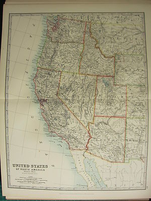
AZ, CA, CO, NM, NV, UT
-
CT, MA, ME, NH, RI, VT
-
DC, DE, MD, NJ, NY, PA
-
ID, OR, WA
-
IL, IN, MI, OH, WI
-
MN, MT, ND, SD, WY
-
OK, TX
-
VA, WV, KY, TN
-
Entire US
-
United States (1900-Now)
-
United States (Date Unknown)
-
Africa
-
Asia
-
Australasia/ Oceania
-
Canada
-
Central America/ Caribbean
-
Europe
-
India
-
Ireland
-
Mexico
-
Middle East
-
North America
-
South America
-
United Kingdom
-
Maps on CD
-
World Maps
-
Globes
-
Mixed Lots
-
Reproductions
-
Price Guides & Publications
-
Other
|
In
Order by: Available to: This site contains affiliate links for which I may be compensated
|
Buy It Now
$6.95 Shipping Location: Dover, United States Issued 1873, Philadelphia by T. Ellwood Zell. (Pacific States) California, Nevada, Oregon, Washington, Idaho, Utah, Arizona, and Part of Montana. California, ... moreNevada, Oregon, Washington, Idaho, Utah, Arizona, Montana.
Buy It Now
$6.95 Shipping Location: Dover, United States Issued 1895, New York by Julies Bien & Co. Topographical Map of California, Nevada, Oregon, and Part of Idaho. Very large and detailed late 19th century ... morehistorical color lithographed map.
Buy It Now
$6.95 Shipping Location: Dover, United States Issued 1894 Gotha by Justus Perthes for Stieler. Very detailed 19th century engraved map with original outline hand color. Original center fold as issued.
Buy It Now
$6.95 Shipping Location: Dover, United States Issued 1869, Philadelphia by Butler. Map by Mitchell. California, Oregon, Idaho, Utah, Nevada, Arizona, and Washington. Mid 19th century engraved map ... morewith original hand color.
Buy It Now
Free Shipping Location: Monroeville, United States Date - 1875. Good Luck! or send resale number.
Buy It Now
$4.99 Shipping Location: Fairview, United States The vignettes of the Redwood Forest and Yosemite Valley make this a very unique map. It is by Henry Tunison (1855-1915) published inTunison's Peerless ... moreUniversal Atlas of the World, Jacksonville, Illinois 1886, a copy of the title page is included for authenticity.
Buy It Now
Free Shipping Location: Tempe, United States Two page atlas map of the State of California. This was a George Cram atlas. No printed dates on the map, but a small pencil note on one page suggests ... more1886. The map is two pages, but on one sheet of paper with tape on the back of the fold.
Buy It Now
$7.00 Shipping Location: North Wales, United States 1866 ANTIQUE FRANCIS MCNALLY ATLAS MAP OF WASHINGTON, OREGON, NEVADA, CALIFORNIA ORIGINAL ANTIQUE ATLAS MAP PLEASE SEE PHOTOS AS PART OF THE DESCRIPTION ... moreCONDITION: MAP IS IN GOOD CONDITION. SIZE: APPROXIMATELY 10" X 13" SHIPPING: U.S. FIRST CLASS RATE - $7.00 - ANY ITEM WHICH SELLS FOR OVER $100 WILL REQUIRE INSURANCE WE COMBINE SHIPPING FOR MULTIPLE WINS. THANK YOU FOR YOUR INTEREST IN OUR AUCTIONS!.
Buy It Now
Free Shipping Location: Bellingham, United States This is an antique map from Mitchell's New Geography, showing the railroads of the Western US states and territories. It is hand-colored, printed sometime ... morein the late 1800s. The back of the map is a part of the geography book it came from. It is in great condition. There is some tape on the back. The map is 10 1/4 inches wide by 7 3/4 inches tall. The page is 11 1/2 inches by 8 3/4 inches, respectively. Please refer to photos for more information on the condition. T

Buy It Now
$8.00 Shipping Location: Easton, United States California Nevada Oregon Washington Idaho Utah Arizona 1881 antique engraved map California. Nevada, Oregon, Washington, Idaho, Utah, Arizona and Part ... moreof Montana Issued 1881. Philadelphia by J. Bartholomew Fine original antique engraved map. Printed in the late 19th century on quality paper which retains its inherent structural flexibility and soundness. Engraved and printed in colors In VG or better condition. Some minor light spotting as well as light uniform age wear, short splits at eityher end of centerfold now cleanly closed on back with archival tape, but neither detract from the overall attractiveness of the image[note: we grade very conservatively and always seek to disclose any noteworthy flaws] The printed area remains visually pleasing. A nice impression of an interesting antique map. Any minor defects along the sheet edges and in the margins may be seen in the photos. Sheet measures c. 17 1/8" H x 12 3/8" W. Engraved area measures c. 16" H x 11 3/8" W. Original centerfold line as issued. 31473] note: All old sheets of printed paper possibly have short edge splits. Each sheet has existed for a very long time and has probably been handled repeatedly in the course of it's existence. It has a history unique to it as an object. Most of the time any edge splits are short. Minor, insignificant and have been closed- either long ago or more recently with small pieces of archival tape. Most often these splits are trivial and easy to overlook visually. Basically, they would not significantly affect the piece adversely. The item is offered as seen. Please look carefully and make your decision knowing this antique image is nice. But it is not in perfect"like new" condition. However, with whatever flaws it possesses, it remains entirely worthy of ownership and inclusion in any related collection. We feel it will prove very pleasing to its new owner. We stand behind everything we sell. Everything we offer is guaranteed to be an authentic original antique item as described. We do no
Buy It Now
$5.45 Shipping Location: Belvedere Tiburon, United States Using the national parks and paved highways noted here as a basis, the map likely dates from c. 1930, and certainly before 1933, when a paved portion ... moreof highway was completed from the Oregon border to Red Bluff.
Buy It Now
$4.99 Shipping Location: Fairview, United States It is from an 1882 edition of McNally's System of Geography, a copy of the title page is included. It is not mounted nor matted, being sold as a single ... moresheet as seen in the first pic. Condition: It is in Good to Very Good overall condition for its age with overall tonal ageing, text on reverse.
Buy It Now
$4.99 Shipping Location: Fairview, United States Stieler's Hand Atlas, published in Gotha by Justus Perthes. The publisher is stated in the bottom center, the title of the atlas is in the upper right ... morecorner and the printing details in the bottom left margin.
Buy It Now
$6.95 Shipping Location: Dover, United States Issued 1879 Gotha by Justus Perthes for Stieler. Very detailed 19th century engraved map with original outline hand color. Original center fold as issued.
Buy It Now
Free Shipping Location: Hemet, United States This contemporary map is an excellent reproduction that captures the beauty and diversity of the Western US. Goes especially well for any cabin decor ... morein any mountainous region.
Buy It Now
$6.95 Shipping Location: Dover, United States Issued 1912, Chicago by Rand McNally. Large, oversized early 20th century color lithographed map. This size allows for much more detail.
Buy It Now
$8.50 Shipping Location: Jacksonville, United States 1876 California & Nevada on one side, Oregon & Idaho other - large hand colored antique map. A beautiful and colorful map from the Historical Atlas of ... morethe World, published in 1876. Overall, very good+ condition.
Buy It Now
Free Shipping Location: Monroeville, United States HAND-COLORED COPPERPLATE MAP CALIFORNIA OREGON IDAHO UTAH NEVADA ARIZONA& WASHINGTON 1869 Mitchell Atlas Map of from the Book 1869 Mitchell's ... moreNew Reference Atlas for the use of Colleges. Libraries, Families 56 COPPERPLATE MAPS- CALIFORNIA. TEXAS& INDIAN TRIBES S.AUGUSTUS MITCHELL PUBLISHED by E.H. BUTLER& CO. The Map measures 12 by 8.75 inches Condition: The map has some tiny Foxing PLEASE LOOK AT THE MAP BEFORE BIDDING ANY QUESTIONS? PLEASE EMAIL OR CALL ME at 917-273-1887 SHIPPING: USPS PRIORITY MAIL ONLY PAYMENT METHOD: Paypal Posted with.RcmdId ViewItemDescV4,RlogId p4%60bo7%60jtb9%3Feog4d71f%2B%3F4f%3E-14be60adb8a-0x111-

Buy It Now
$4.99 Shipping Location: Fairview, United States Click Here. Double your traffic. Get Vendio Gallery- Now FREE! Lake Erie Maps& Prints! An Authentic Antique Map: Not a Modern Reproduction! See Our ... moreEbay Store for More! Free Shipping on Purchases of 5 or More Maps and Prints Description: It is an authentic antique map approximately 112 years old with a centerfold as issued. It is from the The Times Atlas(London: Times. 1900) a copy of the title page is included for authenticity. It is not matted nor framed being sold as a single sheet as shown in the main pic, blank on the reverse. Overall, a very nice map that would frame up well. Size: The dimensions of the map area between the neat lines measures 14 by 18 inches(27x37cm) on a page measuring 17 by 22" 43x57cm) with a margin all around as seen in the main pic. Condition: The map is in Very Good to Excellent condition. It is very clean with strong color on a bright page. Blank on the reverse. It is basically as seen in the pics. There is a slight split of about a quarter inch at the bottom of the centerfold and a few specks around the margini, otherwise it is very clean and would frame up nicely, see the pic for more on condition. The pics are of the actual map. Payment Details: We accept most major credit cards through Paypal and Ebay. Please ask if you have any questions about other forms of payment. International and New Bidders are welcomed and encouraged. Payment is expected within 7 days. After which Nonpaying Bidders will be reported to Ebay to recoup our listing fees. Shipping: $3.50 for First Class or $4.95 for Priority Mail with Delivery Confirmation in the USA. $4.90 for First Class International to Canada; $8.00 for International Airmail elsewhere in the World. We ship daily, so if still bidding send us a quick email to hold or better just pay all at once at the end. Save on Shipping: We only charge one shipping fee based on the largest map or print with multiple items shipped along with it for no extra costs. Purchase 5 or more maps or prints and receive Free First Class shipping in USA or
Buy It Now
$4.13 Shipping Location: Hummelstown, United States 1- California/Nevada.
Buy It Now
$6.00 Shipping Location: Jacksonville, United States A beautiful and colorful map from the Tunison's Universal Peerless Atlas, published in 1889. 1889 California, Nevada & Oregon antique map, with insets ... moreof Yosemite Valley & Big Tree Sequoias and on the reverse Colorado & Arizona.
Buy It Now
$10.04 Shipping Condition: Unspecified Location: LONDON, United Kingdom '(Pacific States) California, Nevada, Oregon, Washington, Idaho, Utah, Arizona and Part of Montana'. Title of map:'(Pacific States) California, Nevada, ... moreOregon, Washington, Idaho, Utah, Arizona and Part of Montana'.
Buy It Now
$4.95 Shipping Location: Bar Harbor, United States CA ,OR, NV & Territories of WA, ID, UT, AZ. Mitchell Original Antique. U.S. West Coast. Mitche ll's Modern Atlas.
Buy It Now
Free Shipping Location: Monroeville, United States Date - 1880. inventory # j74124. Condition - Very Nice.
Buy It Now
$4.99 Shipping Location: Fairview, United States Stieler's Hand Atlas, published in Gotha by Justus Perthes. It is printed on a nice heavy page with bright color. Condition: The map is in Very Good to ... moreExcellent condition with a centerfold as issued, printed on a heavy paper.
Buy It Now
$6.95 Shipping Location: Arlington, United States From The Columbian World Fair Atlas. I will work hard to make sure you are satisfied and you can always start a case if you are not happy with my response.
Buy It Now
$4.99 Shipping Location: Fairview, United States Overall a very clean antique map with light toning and a strong classic look. The color is nice and strong on this map with hand color outlining of the ... morecountry boarders. An Original Antique Map: Not a Reproduction!
Buy It Now
$6.95 Shipping Location: Arlington, United States From The Columbian World Fair Atlas. I will work hard to make sure you are satisfied and you can always start a case if you are not happy with my response.
Buy It Now
$6.95 Shipping Location: Dover, United States Issued 1879 Gotha by Justus Perthes for Stieler. Very detailed 19th century engraved map with original outline hand color. Original center fold as issued.
Buy It Now
$6.95 Shipping Location: Dover, United States Issued 1885, Glogau by C. Flemming. Uncommon and very detailed 19th century German color lithographed map with original outline hand color. Dictionary ... moreof Mapmakers, vol.
Buy It Now
$6.95 Shipping Location: Dover, United States Issued 1890 Gotha by Justus Perthes for Stieler. Very detailed 19th century engraved map with original outline hand color and printed color. West-Indien ... morein 4 Blattern. Original center fold as issued.
Buy It Now
$6.95 Shipping Location: Dover, United States Late 19th century color lithographed city plan. Original center fold as issued.
Buy It Now
Free Shipping Location: Monroeville, United States Date - 1894. Source - People’s Cyclopedia of Universal Knowledge. Condition - Quite Nice.
Buy It Now
$5.95 Shipping Location: Dover, United States Issued 1924, Edinburgh by W. & A.K. Johnston. Early 20th century color lithographed map. Dictionary of Mapmakers, vol.
Buy It Now
$7.95 Shipping Location: New Providence, United States Prior to about 1800, the crest of the Appalachian Mountains was seen as the western frontier. Besides being a purely geographical designation, "The West" ... morealso has anthropological connotations. While this region has its own internal diversity, there is arguably an overall shared history, culture (music, cuisine), mind set or world view and closely interrelated dialects of English.
2d 14h 51m 29s 0 bids
$90.00 Now
$30.80 Shipping Location: Alpine, United States They are for camping and hunting locations are throughout the western US, Alaska and one in Canada. At least 10 are for Nevada, Wyoming, Utah and Alaska. ... moreThere are a few for Colorado, Montana, and Idaho.
Buy It Now
Free Shipping Location: Bar Harbor, United States (Though dated 1839 the map shows the Republic of Texas as it was in 1835. Philadelphia: S. Augustus Mitchell, 1836 and ©1835.). To the north lays the ... moreIowa Territory a vast area situated between the Mississippi and the Missouri Rivers.
Buy It Now
$6.00 Shipping Location: Columbus, United States The map shows Washington, Oregon, Montana, Wyoming, Idaho, California, Utah, and Nevada.
Buy It Now
$14.99 Shipping Location: Ivanhoe, Australia One of the most attractive coastal charts of the western United States. Map extends from the Oregon-California border northward to Vancouver Island and ... morethe Straits of Juan de Fuca. \' Depths sounding all along the coast with various points, harbors, and lookouts well noted.
Buy It Now
Free Shipping Location: Grass Valley, United States The rear of the upper page contains a map of Washington and Oregon as well. The rear of the lower page has a map of San Francisco, CA on it. The map is ... morecurrently in (2) pieces(see main picture) The lower portion has a stain across the upper part of the page(see picture) along with a piece missing at the California/Nevada border line.
Buy It Now
$4.59 Shipping Location: Greenacres, United States
Buy It Now
$5.95 Shipping Location: Dover, United States Original center fold as issued. Attractive and detailed late 19th century color lithographed map. Made in Germany, German text.
Buy It Now
Free Shipping Location: Monroeville, United States Source - Stephens Pictorial History. Date - 1882. Condition - Quite Nice.
Buy It Now
$10.04 Shipping Condition: Unspecified Location: LONDON, United Kingdom Antique colour map, 1886. DATE PRINTED: 1886. TYPE: Antique colour map. AUTHENTICITY: This is an authentic historic print, published at the date stated ... moreabove. It is not a modern copy.
Buy It Now
$6.00 Shipping Location: Tiffin, United States See photos for condition.
Buy It Now
Free Shipping Location: Monroeville, United States The map presents a wildly different view of the western states. FROM THE SOURCE/DATE LISTED.
Buy It Now
$10.04 Shipping Condition: Unspecified Location: LONDON, United Kingdom Antique colour map, 1882. DATE PRINTED: 1882. CONDITION: Good; suitable for framing. The map you will receive is in good condition but there may be minor ... morevariations in the condition from that shown in the image.
Buy It Now
$8.50 Shipping Location: Croatia Surprisingly, the watershed feeding Lake Lahontan is not thought to have been significantly wetter during its highstand than it is currently. Archaeological ... moreevidence along the shore indicates the existence of the lake coincided roughly with the first appearance of humans in the region.
$25.00 Shipping Location: Perugia, Italy The idea was to solidify an overland path to the Pacific for the Confederate States. While the Colorado Territory was established in 1861, it does not ... moreappear on this map. At least it doesn't appear in the right place.
Buy It Now
$18.76 Shipping Location: YORK, United Kingdom Beautiful ANTIQUE MAP on quality paper EXCELLENT condition and rescued from a disbound KEITH JOHNSTON'S HANDY ROYAL ATLAS 1896 THIS MAP IS AN ORIGINAL- ... moreOVER 115 YEARS OLD AND NOT A REPRODUCTION THIS MAP WAS PRODUCED IN 1896 PRINTED ON THICK PAPER WITH VIBRANT OUTLINE COLOUR"The Handy Royal Atlas Of Modern Geography Exhibiting The Present Condition Of Geographical Discovery And Research In The Several Countries. Empires And States Of The World by Keith Alexander Johnston. This DOUBLE PAGE FOLD-OUT map measures approximately 18 1/2 inches by 14 1/2 inches(470mm x 370mm) PLEASE VIEW IMAGE TO SEE HANDLING& AGE RELATED MARKS Printed on quality paper The map is free from any text or image on the reverse A superb map in excellent condition Please message with any questions regarding this item(Handy Royal Atlas 1896) BEST OFFERS PLEASE FOR A QUICK SALE AT A FAIR PRICE If you like the item. But do not like the price, then make a realistic offer to us using the MAKE OFFER BUTTON Powered by
Buy It Now
$4.49 Shipping Location: Hightstown, United States 1903 Rand McNally Co. Map of Alaska and the Yukon Gold Fields Canada California. SUPERB condition map. This color lithographed map shows the area from ... moreSan Francisco all the way up to the Arctic Circle.
Buy It Now
$25.00 Shipping Location: Belvedere Tiburon, United States The present example of the map has been highly annotated, apparently by an early owner who travelled extensively along the West Coast and in California. ... moreCrossing the mountains.”. The 1876 map is the first of two editions, the second of which was issued in 1877 (date in the title box).

6d 9h 28m 16s 0 bids
$6.00 Now
$7.00 Shipping Location: Lithuania ★ ★ ★ ★ ★ 5-star service for you ★ ★ ★ ★ ★ ★ Worldwide shipping within 1 business day of payment ★ Professional Packaging ★ Tracking registered air mail ... more★ Possibility Express Mail Service ★ Combined Shipping Discount or Free shipping After you have won the item. You have 4 days to pay( if no bid on other item) or PLEASE LET ME KNOW POSSIBLE TERM OF PAYMENT. Original old print Antique sheet from 1897 editions of German encyclopedia'Meyers Conversations-Lexikon' 1 Original Print ca 24 x 30.5 cm reverse side blank folded Baby room decorating ideas& g reat value for all interior decorators: hotels. Bars, offices, public buildings, restaurants, b&b, homes. condition(in Bold) Perfect/ Fine/ Very Good/ Good/ Fair/ Poor Extremely RARE RARE FREQUENT The images should be considered as part of the item description. Shipping Costs( Combined Shipping SAVE MONEY! approximate. EUR/USD value, size and type of item depends) $3.6 $7 $12 $16(Europa)$18(World) $24(World)$32(USA.Canada) $26(World)$44(USA.Canada) $27(World)$55(USA.Canada) $28(World)$70(USA.Canada) Default delivery is registered mail. Track Your Package Status Here: For USA buyer. Please use your tracking number in USPS website: For other countries. Please use your tracking number in the following website: The tracking number can find in the Purchase History section of My eBay in 1 day after shipment effected. Once your item arrives in satisfactory condition. Please leave us a positive feedback. supremeauctiononlinesoftware.automatic.gallery. Supreme. Supremewidgets. Supremeauctiononlinesoftware.automatic.gallery. Supreme. Supremewidgets. Supremeauctiononlinesoftware.automatic.gallery. Supreme. Supremewidgets. Supreme. Supremewidgets. Supremeauctiononlinesoftware.automatic.gallery. Supremeauctiononlinesoftware.automatic.gallery.
Buy It Now
$8.50 Shipping Location: Croatia (Its counterpart Lake Lahontan occupied much of northwestern Nevada while extending into California and Oregon.). Many of the unique geological characteristics ... moreof the Great Basin are due to the effects of the lake.
Buy It Now
$19.45 Shipping Location: San Diego, United States
Buy It Now
$11.92 Shipping Location: ILKLEY, United Kingdom Provenance: 'Handy Royal Atlas of Modern Geography exhibiting the present condition of geographical discovery and research in the several Countries, Empires, ... moreand States of the World', W. & A.K. Johnston, Edinburgh and London, 1896.
Buy It Now
$18.76 Shipping Location: YORK, United Kingdom An antique map on quality paper printed in 1919 for The Victory Atlas of The World This is a particularly large format map 25 inches by 19 1/2 inches ... more(635mm x 500mm) Begun immediately after the end of WWI and takes into accout all the changes that resulted from the global conflict. Because of its large size, it has many place names not normally on such maps. ****CONDITION**** PLEASE VIEW IMAGES TO SEE ANY HANDLING/AGE MARKS /REPAIRS/DAMAGE/EXTENT OF MARGINS etc Please message with any questions regarding this item BEST OFFERS PLEASE FOR A QUICK SALE AT A FAIR PRICE If you like the item, but do not like the price, then make a realistic offer to us using the MAKE OFFER BUTTON Powered by eBay Turbo Lister.
Buy It Now
$14.00 Shipping Location: Poland Date of issue: 1898. THIS IS AN ORIGINAL MAP, NOT A RECENT COPY OR REPRODUCTION. Origin of the map: Schrader F., Prudent F., Anthoine E., "Atlas de Geographie ... moreModerne.", publ. HAND COLORED.
Buy It Now
$14.99 Shipping Location: Ivanhoe, Australia Alexander Dallas Bache, great-grandson of Benjamin Franklin, was the second Coast Survey superintendent. Under Bache, Coast Survey quickly applied its ... moreresources to the Union cause during the Civil War.
Buy It Now
$22.78 Shipping Location: Dover, United States A genuinely fascinating historical map in a near wall size format. Very uncommon scarce mid 19th century folio sheet lithographed map with original hand ... morecolor. Decorative piano key border. From a rare atlas of this era.
|
|
|
In
|
California Oregon Nevada Idaho 1895 Civil War litho map
California Oregon Nevada Idaho 1895 Civil War litho map"Essayons" Topographical Map of California. Nevada, Oregon and Part of Idaho. Issued Washington. D.C. 1893-95 by the US Government Printing Office. Printed by Julius Bien& Co. Lithogaphers, N.Y. Published under the direction of Daniel S. Lamont, Secretary of War. Originally issued in the"Atlas to Accompany the Official Records of the Union and Confederate Armies" Which was issued in parts to subscribers over a period of years, but is sometimes found bound up later into atlas volumes. This oversize and attractive lithographed 19th century map depicts in great detail the specific events and locations of the Civil War. Astoundingly detailed. With an emphasis upon precision and accuracy, attempting to capture visually and cartographically the regions and battles depicted. ... moreUnlike topographical maps or state maps of the era issued by most cartographers. The underlying premise of these Civil War maps was to depict the cartography as it specifically related to events of the Civil War. Thus, individual battles, small forts, troop movements, local rail lines, etc.are all rendered and explained with precision in a manner quite unique. Also, the very large format of the sheet allows for a level of detail which makes the map perfect for display or study by a Civil War buff, since the detail it contains is to be found almost no where else on this scale. In near fine clean condition. A very nice example for framing or display. Original centerfold as issued. Elephant folio sheet measures c. 29 1/4" W x 18 1/2" H. C7. Everything we offer is guaranteed to be an authentic original antique item as described. We stand behind everything we sell. Please Visit our eBay. SHIPPING& TERMS: We are happy to combine shipping on multiple items! Please request a combined invoice before making payment. If the calculated shipping on a single item seems high. Please feel free to request an invoice before making payment a
|
|
|
California Oregon Idaho Utah Nevada Arizona 1870 Mitchell antique map
California Oregon Idaho Utah Nevada Arizona 1870 Mitchell antique map CALIFORNIA. OREGON, IDAHO, UTAH, NEVADA, ARIZONA, AND WASHINGTON Issued Philadelphia. 1870 by Mitchell. Attractive mid 19th century antique engraved map. With original hand color. Nicely detailed. In good+. Mostly clean condition. Some light age wear and spotting, light surface soiling, and a couple tiny minor edge-splits in spots. Still very attractive- great for framing or display. An uncommon 19th century map. Sheet size c. 11 1/2" H x 9" W. Image area c. 10 1/2" H x 8 1/4" W. 6650] Any defects along the sheet edges and in the margins may be seen in the photos. note: All old sheets of printed paper possibly have short edge splits. Each sheet has existed for a very long time and has probably been handled repeatedly in the course of it's existence. ... moreIt has a history unique to it as an object. Most of the time any edge splits are short. Minor, insignificant and have been closed- either long ago or more recently with small pieces of archival tape. Most often these splits are trivial and easy to overlook visually. Basically, they would not significantly affect the piece adversely. The item is offered as seen. Please look carefully and make your decision knowing this antique image is nice. But it is not in perfect"like new" condition. However, with whatever flaws it possesses, it remains entirely worthy of ownership and inclusion in any related collection. We feel it will prove very pleasing to its new owner. We stand behind everything we sell. Everything we offer is guaranteed to be an authentic original antique item as described. We do not sell modern reproductions. Please visit our. We happily accept PayPal! WE OFFER FLAT RATE SHIPPING WORLD WIDE! Please request an invoice before paying for multiple items so that we can ensure that you are not overcharged for shipping! To receive our flat rate shipping rates you must request or wait for a
|
|
|
Map of California, Nevada, Oregon, and more - Western States - Gray 1873 - RARE
Rare. Antique double-page map of California, Nevada, Utah, Colorado, Arizona, and New Mexico from Gray’s Atlas from c. 1873. Single page maps of Oregon, Washington, and British Columbia + Idaho, Montana, and Wyoming on verso. Excellent impression. Original color: red, yellow, and green in good condition. Minimal foxing. The edges of the map are in good condition. There are slight tears in the left and right margins, but they do not interfere with the printed map or margin. Additionally, with proper framing and matting it would not be noticeable. This is a great find for collectors of antique maps! Title: Gray’s Atlas Map of California. Nevada, Utah, Colorado, Arizona& New Mexico verso Gray’s Atlas Map of Oregon. Washington, and British Colombia. + Idaho, Montana, and Wyoming. Color: Original Color Dimensions: 17 x 28 1/2” ILC: US_SE04_LP ... moreWe guarantee that this is a real. Genuine, high quality antique map, not a facsimile, reproduction, or copy. Genuine antique maps are an excellent investment and have consistently increased in value over the years. Their unique combination of history and visual beauty and interest makes antique maps a pleasure to own or give to friends. Please view our selection of other genuine. Affordable antique maps in our Ebay Store. Also take time to view feedback from the many satisfied map collectors who have purchased from our gallery. We guarantee that this map is of superior investment quality and will continue to appreciate in value. Normal 0 false false false EN-US X-NONE X-NONE Welcome to Le Chateau Art Gallery! We are a specialty gallery dealing with a wide variety of antique and vintage books. Artworks, coins, and collectibles. Our office is open Monday through Friday from 9AM until 6PM Eastern Time. Please read our descriptions thoroughly and ask questions before making your purchase. SHIPPING& HANDLING Shipping fees: We are proud to offer low-cost shipping within the United States! Processing time: All items are handled for shipping within one day of receiving payment. S
|
|
|
1871 McNally Map US West Nevada Arizona Utah Oregon Washington Idaho California
Lake Erie Maps& Prints! An Original Antique Map: Not a Reproduction! See Our Ebay Store for other! Free Shipping on Purchases of 5 or More Maps and Prints Description: It is an authentic Antique map over 150 years old with original handcoloring as issued. It is from Francis McNally's System of Geography: National Geographical Series, New York: S. Barnes& Co. C. 1871) A facsimile copy of the title page is included for authenticity. The map is not mounted nor matted, being sold as a single sheet as seen in the first pic. A very nice map in great shape. Size: The map image measures approximately 8 1/2 by 10 1/2 inches(22x27cm) on a 9 1/2 by 12" 24x30cm) page with a margin all around for matting as seen in the pic. Condition: It is in Very Good or better overall condition for its age with overall light tonal ageing. Text on reverse. ... moreIt is basically as seen in the pic. There is some darkening around the edges, otherwise it is very clean with strong color that would frame up well, see the pics of rmore on condition. The pics are of the actual map. Payment Details: We accept most major credit cards through Paypal and Ebay. Please ask if you have any questions about payment. International and New Bidders are welcomed and encouraged. Payment is expected within 7 days. After which Nonpaying Bidders will be reported to Ebay to recoup our listing fees. Save on Shipping: We only charge one shipping fee based on the largest map or print with multiple items shipped along with it for no extra costs. Purchase 5 or more maps or prints and receive Free First Class shipping in USA or First Class International elsewhere in the world. Although registration may be required on shipments of high value. International Customs and VAT Fees: It is the responsibility of the buyer to pay all Customs Taxes. VAT or other fees that may be due upon arrival. These fees vary greatly from country to country and ebay policy is that the buyer is responsible for their country's taxes and fees. Please consult your country's Custo
|
|
|
Civil War Records Antique Map California Oregon Nevada San Francisco Sacramento
Lake Erie Maps& Prints An Original Antique Map: Not a Reproduction! Plate CXXXIV Atlas to Accompany the Official Records of the Union and Confederate Armies Currently Listing Many Civil War Maps and Prints Check out my! Description: It is a very detailed map showing forts. Mountains, camps, towns, rivers, roads, railroads and many other details, very informative for the period, originally surveyed in 1867 as stated on the map. It is from the Atlas to Accompany the Official Records of the Union and Confederate Armies. Published by the Secretary of War, Washington: Government Printing Office, 1891-1895) undoubtedly the most complete set of accurate maps of the Civil War ever published. The title of the atlas appears in the top left margin and plate number in the upper right. A copy of the title page is included with all the publishing details ... morefor authenticity. The atlas was published in a very limited context to be distributed to government officials in the three houses of government as a reference for assessing the Civil War. This is from the original first publishing, that lasted from 1891-5. Size: The map image measures 16 by 27 inches on a page measuring approximately 18 by 29 inches with plenty of margin all around for framing. It is a full double page sheet as issued. Condition: The map is in Very Good or better condition with overall light tonal aging. There is a slight split at the bottom of the centerfold and a short half inch repair on reverse of the bottom margin at the fold. Otherwise the map is very clean and would frame up nicely. See the detail pics for more accurate color representation. Payment Details: We accept most major credit cards through Paypal and Ebay. Please ask if you have any questions about payment. International and New Bidders are welcomed and encouraged. Payment is expected within 7 days. After which Nonpaying Bidders will be reported to Ebay to recoup our listing fees. Shipping: $2.90 for First Class or $4.95 for Priority Mail with Delivery Confirmation in the USA; $4.95 for
|
|
|
Old Original 1891 Map California Nevada Oregon Goldthwaite's Atlas
Old Original 1891 Map California on one side and Nevada& Oregon on the other.colored.From Goldthwaite's Universal Atlas.California map measures 22" X 14 1/2" Powered by.RcmdId ViewItemDescV4,RlogId p4%60bo7%60jtb9%3Feog4d72f%2Bd0f%3E-13f3f3b193e-0x103-
|
|
|
**RARE** 1872 MAP ENGRAVING OF CALIFORNIA OREGON NEVADA IDAHO MONTANA UTAH WA WY
BEAUTIFUL 1872 ANTIQUE MAP CALIFORNIA. WASHINGTON, OREGON, NEVADA IDAHO, MONTANA, WYOMING, UTAH You are viewing a very detailed engraved map from 1872. It measures 19 1/2" X 15 3/4" The detail is like no other old map I've seen. It appears that every river. Mountain, desert, lake, city, peak, etc. is detailed- if it was discovered prior to 1872 in this encompassed proximity, you can be sure it's on the map. There is some toning around the edges. But no noticeable toning to the engraved portion of the map. This would look amazing framed! Thanks for looking. Feel free to ask any questions or inquire for details or additional pictures. Please look at the other antique maps I have for sale.
|
|
|
1883 George Cram Map California Nevada Oregon
This item is an 1883 double(attached) page map of California with maps of Nevada and Oregon on the reverse. PUBLISHER: Chicago: George F. Cram. Engraver& Publisher, POPULATION: California- 864.694/ Nevada- 62,266/ Oregon- 174,768. MAP DIMENSIONS: California- 18 1/2" X 12" Nevada- 12" X 9 1/2" Oregon- 12" X 9 1/2" CONDITION: one short 1/4" margin tear. In very good+ condition. Online image shows watermark that is not on original item. Combined shipping available. Shipped from a Canadian location. Canadian residents. Please wait for an invoice before sending a paypal payment. Powered by The free listing tool. List your items fast and easy and manage your active items. RcmdId ViewItemDescV4,RlogId p4%60bo7%60jtb9%3Fuk.rp*73c7e%3D%3E-140480e7899-0xfd-
|
|
|
California 1895 County Map With Nevada & Oregon On The Reverse Color Lithograph
California 1895 County Map With Nevada& Oregon On The Reverse Color Lithograph CALIFORNIA Original 1895 map" California" with Nevada& Oregon on the reverse side. Very good condition. Overall size 20 3/4" x 19 1/2" Purchase with confidence. We have been in the antique print, map, and document business since 1976 and guarantee our items as advertised. See additional photos below! The black circles that show in some of the listings are magnets that we use to hold image. To See More Photos/Scenes Powered by Click Here. Double your traffic. Get Vendio Gallery- Now FREE!
|
|
|
Oregon North Nevada California c.1890s huge detailed antique Civil War map
Topographical Map of California. Nevada, Oregeon and Part of Idaho Issued c.1891-95. Washington, D.C. by the US Government Printing Office. Printed by Julius Bien& Co. Lithographers, N.Y. Published under the direction of Daniel S. Lamont. Secretary of War. Originally issued in the"Atlas to Accompany the Official Records of the Union and Confederate Armies" Which was issued in parts to subscribers over a period of years, but is sometimes found bound up later into atlas volumes. This oversize and attractive lithographed 19th century sheet depicts in great detail the specific events and locations of the Civil War battles or regions depicted. Astoundingly detailed. With an emphasis upon precision and accuracy, attempting to capture visually and cartographically the regions and battles depicted. Unlike topographical maps or state ... moremaps of the era issued by most cartographers. The underlying premise of these Civil War maps was to depict the cartography as it specifically related to events of the Civil War. Thus, individual battles, small forts, troop movements, local rail lines, panoramic views, etc. are often rendered and explained with precision in a manner quite unique. Also, the very large format of the sheet allows for a level of detail which makes the map perfect for display or study by a Civil War buff, since the detail it contains is to be found almost no where else on this scale. In Good+ to VG. Mostly clean condition. some light damp staining across the blank margin which will disappear once matted and s ome light minor age-wear- typical for maps of this era. And in no way offensive or severe. Overall a pleasing example of this interesting map. Which is well worthy of display. Elephant folio sheet measures c. 29 1/4" W x 18 1/8" H. Printed area measures c. 27" W x 13 3/8" H. Original center-fold line as issued. 47413] Guaranteed Authentic! We do not sell modern reprints. Condition All of our items are original antique pieces and it is important to keep in mind that many of the
|
|
|
California Oregon Washington Utah Nevada Idaho c.1868 antique Territorial map
California. Oregon, Idaho, Utah, Nevada, Arizona and Washington Issued c.1868. Philadelphia by S. Augustus Mitchell Fine original antique engraved map. With original hand color. Interesting transitional map. Showing these relatively newly formed western states while still early in their county development. Several are still Territories. Printed on quality paper which retains its inherent structural flexibility and soundness. In VG or better condition. Mostly clean and attractive, minor light surface age wear as typical, the map remains very presentable and well worthy of ownership[note: we grade very conservatively and always seek to disclose any noteworthy flaws] The printed area remains visually pleasing. A nice impression of an interesting antique map. Any minor defects along the sheet edges and in the margins may be seen in the photos. ... moreSheet measures c. 9" W x 11 5/8" H. Engraved area measures c. 8 1/8" W x 10 5/8" H. 44060] Guaranteed Authentic! We do not sell modern reprints. Condition All of our items are original antique pieces and it is important to keep in mind that many of them have been around for 100 years or more. Individual pieces may have seen many owners and been handled many times over the course of their existence and as a result each piece has developed a history of it's own. Short edge splits(often repaired with archival tape) Foxing, discoloration, etc. are all things to expect on items of this type. They rarely distract from the piece and often add to the overall character of the item. Keep in mind when you receive your item that you are not handling a modern copy, you are holding a piece of history, an item that has been around for a very long time and will, with proper care, be around for a long time to come. We try to note any significant flaws in the description, but less noticeable or common characteristics may not be mentioned. As we are a US based company all of our measurements are in Inches. If you need the size in Centimeters please multiply the supplied me
|
|
|
Genuine 1860 Map of Oregon Washington California Nevada & the Territories
Genuine 1860 Antique Map of Oregon Washington California Nevada& the Territories by J. H. Colton& Co Hand Colored. Measures 11.25" by 13.62" Attractive and ready to frame. Not a reproduction. Free Shipping to anywhere in the US. Your order will always ship within ONE BUSINESS DAY. Well packaged in a sturdy waterproof mailer and sent with a delivery confirmation.
|
|
|
Pacific States California Nevada Oregon 1870 antique engraved color map
Pacific States& Territories Issued 1870. Washington D.C. by Charles Scribner& Co. Fine original antique engraved color map. Across the bottom is a comparative chart of mountain heights. Printed on quality paper which retains its inherent structural flexibility and soundness. In near VG or better condition. Minor light surface age wear, some age toning as typical, and scattered foxing or staining in the blank margin, overall the map remains clean and very attractive, well worthy of ownership and display[note: we grade very conservatively and always seek to disclose any noteworthy flaws] Text on verso as issued. Extracted from uncommon 19th century Atlas. The printed area remains visually pleasing. A nice impression of an interesting antique map. Any minor defects along the sheet edges and in the margins may be seen in the photos. Sheet ... moremeasures c. 9 3/8" W x 12 1/8" H. Printed area measures c. 8 1/4" W x 10 5/8" H. Original fold line as issued. 55969] Guaranteed Authentic! We do not sell modern reprints. Condition All of our items are original antique pieces and it is important to keep in mind that many of them have been around for 100 years or more. Individual pieces may have seen many owners and been handled many times over the course of their existence and as a result each piece has developed a history of it's own. Short edge splits(often repaired with archival tape) Foxing, discoloration, etc. are all things to expect on items of this type. They rarely distract from the piece and often add to the overall character of the item. Keep in mind when you receive your item that you are not handling a modern copy, you are holding a piece of history, an item that has been around for a very long time and will, with proper care, be around for a long time to come. We try to note any significant flaws in the description, but less noticeable or common characteristics may not be mentioned. As we are a US based company all of our measurements are in Inches. If you need the size in Centimeters p
|
|
|
1890 California & Nevada Original Color Atlas Map* Wash, Oregon & Idaho on back
1890 California& Nevada Original Color Atlas Map* Wash. Oregon& Idaho on back Gorgeous. Original 1890 California and Nevada Color Map. Small Washington. Oregon and Idaho color maps are on the back This is an ORIGINAL.I DO NOT SELL REPRINTS. 124 +++ year-old undated atlas map.that measures 10 1/4" x 13 1/2" with the borders and would look Wonderful matted and framed. The map shows towns and cities. Railroads, Creeks and Rivers and other geographical features. NOTE: The map doesn't show roads. NOTE CONDITION: The map has lite border and corner wear, Otherwise. It is in very nice condition. Please see the attached photo to view the map and a couple of closeup sections for the map. NOTE: The map has a little more color than the scans illustrate. NOTE: the map is too large for my scanner.There is a border all the way around ... morethe map.The printing is small but very clear and readable* Purchase this great old map for only $19.95. U.S. Buyer pays $3.00 for shipping. 1-4 maps can be combined to save on shipping. I mail these old maps in sturdy shipping tubes. PLEASE READ: This is an original 18 90 Undated Atlas map. For the buyer. I will enclose a copy of the dated 1890 copyright page to keep with their map. If you have any questions about his map or any of my items. Please email me before bidding. I prefer satisfied customers. Thanks! 022114 CalNev90.2(r) Please Visit My Ebay Store To View My Vintage California. San Francisco, Nevada, Texas, Oklahoma, Indian Territory, New Mexico, Colorado and Other Antique Maps. Thanks For Looking! A LL INTERNATIONAL BUYERS PLEASE READ: Please be aware that some packages going into Canada. The UK and France are taking a very long time for delivery.2-weeks or longer in some cases depending on customs. Although I mail them as quickly as I can.I have no control over how long it takes for them to be delivered after I mail them.Also, These old maps are shipped in sturdy mailing tubes and are very, very rarely lost. However, I send these via first class air
|
|
|
1899 USA - MIDDLE PART California Oregon Illinois Idaho Nevada Utah Antique Map
1899 USA- MIDDLE PART California Oregon Illinois Idaho Nevada Utah Antique Map IF THE SCANNER IS TOO SMALL TO SCAN THE WHOLE MAP. WE PRESENT TWO SCANS- OF THE UPPER PART AND THE DOWN PART D E S C R I P T I O N Normal 0 21 false false false MicrosoftInternetExplorer4 THERE ARE NOT STAINS ON THE PRINT! IF YOU SEE SOME. THIS IS DUE TO THE SCANNER! S OME PART OF THE IMAGE MAY BE CUT DURING THE SCANNING! Normal 0 21 false false false MicrosoftInternetExplorer4 Normal 0 21 false false false MicrosoftInternetExplorer4 Due to the scanner the image is more yellow than in reality. There is a light stripe in the middle of the page. Caused by the scanner. In reality there is a fold in the center. This is an original old German map– a double page book plate. This original. Authentic antique map was a part of old German book. This is NOT a modern reproduction! ... moreVERY DECORATIVE. PERFECT FOR FRAMING! The map is printed in Leipzig. Germany, by the Bibliographishes Institut in 1899 SIZE– apr. 10’ 13’ inches or 25: 31 cm– perfect for framing. There is a fold in the center– the print was folded inside the book. The image presents the area of the print. Which will be visible when it is framed. ABOUT THE CONDITION– please check the scan carefully. SHIPPING We use a tube in order to protect the prints. We ship registered only. For USA and Canada– registered with priority. FEES- $ 8 for 1-3 prints in a tube. $ 19 for up to 20 prints. PAYMENTS Please pay by PAYPAL in a reasonable time after your purchase. We hate to open“non paid item” disputes or cases. But life is not only pleasure L. PLEASE NOTE! After reading this description. If there are any questions. Please ask us BEFORE bidding! If there is a problem with your item before or after it’s receiving. Please contact us ASAP. We’ll give our best to resolve the problem in a friendly manner.
|
|
|
1890 ORIGINAL ANTIQUE MAP OF CALIFORNIA LOS ANGELES SAN FRANCISCO NEVADA OREGON
1890 ORIGINAL ANTIQUE MAP OF CALIFORNIA LOS ANGELES SAN FRANCISCO NEVADA OREGON This original antique map gives you an opportunity to examine in exquisite detail a piece of history. If you are interested in the past of this country and its people or have a desire to study where your family may have come from. Then this map gives you a rare look as the area was about 120 years ago. Once matted and framed, this map would make a perfect gift for a family member or friend they'll cherish forever. Origin of the map: The Home Knowledge Atlas" Published by Home Knowledge Association, Toronto, Canada. Date of issue: 1890 Size: The sheet measures 21 1/2" x 13 1/2" 54 x 34 cm) S/H: The map will be shipped by Air Mail. The shipping charge is: USA- 8.00 USD. World- 9.00 USD, Canada- 9.00 USD. The price includes the insurance and a ... morestrong, cardboard tube with plastic plugs. Attention! There is no additional shipping charge for multiple purchases! Pay me securely with any major credit card through PayPal! Payment methods: US/Canada Buyers: Paypal. International Buyers: Paypal. Click Here. Double your traffic. Get Vendio Gallery- Now FREE! USED USED. AN ORIGINAL ANTIQUE MAP. USED.
|
|
|
1875 California & Western States Antique Map, Arizona Nevada Utah Idaho Oregon
Click Map Above To Enlarge Antique Map Description This is an authentic 1875 reference map which was produced using a process called cerography where a wax engraving plate was used to imprint the paper. After which, the map was hand colored. Details include: large and small mountain ranges, mountain peaks, rivers, creeks, lakes, cities, towns and upon close examination what appears to be railroad lines. There is mild age toning, smudging and minor staining in margins. Map protrudes into margins. You may be interested in on eBay. Store Keyword Search Frequently Asked Questions Why do people purchase antique prints and maps? Antique prints and maps portray a moment in history. Because they represent a broad range of subjects. They are particularly useful when looking for a unique gift. Interior design has become a huge market for antique prints. ... moreFrom small framed botanicals to large Civil War maps, from large framed old city views to a collection of framed Harper's satirical cartoons, antique prints provide a world of design possibility. If properly framed, antique prints and maps can be preserved for many decades. Is this item really authentic or just a reproduction? You can have confidence that the item you purchase is guaranteed to be an original and not a modern day reproduction of any kind. Can I return an item I purchase? All purchases come with a 100% satisfaction guarantee. If you are not completely satisfied. Return the item within 14 days for a full refund. We do ask you pay the return shipping costs.
|
|
|
Antique 1875 Map of California Nevada Oregon Washington Idaho Utah & Arizona
Antique 1875 Map of California Nevada Oregon Washington Idaho Utah& Arizona by J Bartholomew. Plate 14 from the 1875 edition of Zell's Descriptive Hand Atlas of the World. This is a rare and beautiful Chromo-Lithograph m easuring 18" by 13.18" Printed on very thick paper with a b lank reverse. See photo's. Free Shipping to anywhere in the US. Your order will always ship within ONE BUSINESS DAY. Well packaged in a sturdy waterproof mailer and sent with a delivery confirmation. I ship worldwide.
|
|
|
LARGE GORGEOUS ANTIQUE 1886 CALIFORNIA OREGON NEVADA TUNISON HANDCLR MAP W ART N
Click Here. Double your traffic. Get Vendio Gallery- Now FREE! Superb. Very fine and rare antique 1885 handcolored 2 sided map, titled Tunison's Colorado, fine outside ornate border as well, below the title is a chart listing populations and so forth. Fascianting, detailed and attractive period map of this area at this time. The next 2 pages is a gorgeous large map titled Tunison's California, Oregon and Nevada, also with populations and so forth. At lower left hand side is 2 fine art vignettes, The Big Trees, Mariposa County, Cal. and The Yosemite Valley, Mariposa County, Cal. Amazing period map. You cant see the maps on reverse as the paper is so thick. The last page is Tunison's Arizona. The map has 1 small archival tape repair at right hand isdde. The map is printed on thick fine paper, and is in beautiful condition. Very ... morefine gorgeous period handcoloring, this is period the map, this is before large scale color printing. This is from the very rare 1885 Tunsion's Peerless Atlas of the World. Tunison was a highly regarded mapmaker of this period. The size of the single page map is 11" by 14" and the 2 page California map is 14" by 22" Rare. Winning bidder pays $3.75 shipping domestic, more foreign. Payment I accept the following forms of payment: PayPal Click to View Image Album Click to View Image Album Click to View Image Album Shipping& Handling US Shipping. $3.75 USPS First-Class Mail® International Shipping. $11.50 USPS First-Class Mail International FREE scheduling. Supersized images and templates. Get Vendio Sales Manager. FREE scheduling. Supersized images and templates. Get Vendio Sales Manager.
|
|
|
California Oregon Nevada 1893 orig. large atlas map Idaho Los Angeles Francisco
This is an original atlas-map. Taken from"Andrees Allgemeiner Handatlas" 3. edition, Velhagen& Klasing, Bielefeld& Leipzig, 1893 Pacific States of the USA size 27 x 38.5 cm/ 10.5 x 15 inch. Backside not printed, in very good condition since more than 120 years item is sent from Berlin. Germany(oversize) dhep.RcmdId ViewItemDescV4,RlogId p4%60bo7%60jtb9%3Fuk%601d72f%2Bishm%3Ed%7Fhep-14949a17ad2-0x112-
|
|
|
1880 map: CALIFORNIA, ARIZONA, OREGON, WASHINGTON, NEVADA, UTAH, IDAHO- rare
Bartholomew map: PACIFIC STATES) CALIFORNIA. NEVADA, OREGON, WASHINGTON. IDAHO, UTAH, ARIZONA and Part of MONTANA This is an antique map of the western United States. Attractively printed in color. It shows locations of Indian tribes, the sites of many army forts, and delineates the boundaries of all the counties within the 7 above states or territories. At the time. Arizona was divided into only 6 counties—Mohave, Yuma, Pima, Pinal, Maricopa, and a huge Yavapai County—vs. the 16 counties in present-day Arizona. Idaho has only 8 counties(instead of 44) Nevada is shown as having 14 counties(instead of 16) and Utah has 21(vs. 29) Oregon 22(vs. 36) but California was already divided into 50 counties, only 8 fewer than at present. The map measures 12.5 x 17 inches. And is blank on the back. It is in Fine condition. The credit lines in small print ... morebelow the map say: Engraved& Printed in Colours— by J. Bartholomew T. Ellwood Zell. Davis& Co. Philadelphia. The map is undated on the plate. But came from an uncommon atlas published in Philadelphia in 1880, which was Volume 5 of Zell’s Popular Encyclopedia. The mapmaker. John Bartholomew, was a Fellow of the Royal Geographical Society. The map will be accompanied by a 5 text pages. Presenting a table of these state's counties with their populations, plus a key to the many features shown on the map: hundreds of towns, rivers and lakes, mountains and valleys, etc. The map will be shipped folded once. As originally published in Zell’s Atlas. SHIPPING/ HANDLING TERMS: Add a flat $ 3.95 for delivery by First Class Mail anywhere in the U.S. Pennsylvania residents. Add 6% tax. International shipping is $ 8.95 to Canada; or $13.95 to all other foreign countries. I normally mail items within 24 hours of receiving payment. All items are returnable for a full refund if the buyer is unsatisfied for any reason. gsrx_vers_526(GS 6.6.6(526)
|
|
|
USA: California (North) Nevada, Oregon (South) , 1897 antique map
California(North) Nevada, Oregon(South) Antique coloured map. 1897 Title of map: California(North) Nevada, Oregon(South) The image below shows an enlarged cross section from the centre of the map to show the level of printed detail: DATE PRINTED: 1897 IMAGE SIZE: Approx 20.5 x 26.5cm. 8 x 10.5 inches(Medium) ARTIST/CARTOGRAPHER/ENGRAVER: Unsigned PROVENANCE: The Victoria Regina Atlas” Published by W& A. K Johnston. London TYPE: Antique coloured map VERSO: There are images and/or text printed on the reverse side of the picture. In some cases this may be visible on the picture itself(please check the scan prior to your purchase) or around the margin of the picture CONDITION: Good; suitable for framing. Please check the scan for any blemishes prior to making your purchase. Virtually all antiquarian maps and prints are subject to some normal ... moreaging due to use and time which is not obtrusive unless otherwise stated. I offer a no questions asked return policy- see below. AUTHENTICITY: This is an authentic historic print. Published at the date stated above. I do not offer reproductions. It is not a modern copy. The term'original' when applied to a print means that it was printed at the first or original date of publication; it does not imply that the item is unique. Print' means any image created by applying an inked block to paper or card under pressure by any method including wood engraving, steel engraving, copperplate, wood cut and lithography. REMARKS: FRANCE: Gravures et Cartes anciennes. DEUTSCHLAND: Alte Lankarten und Stadt ansichten. ITALIA: Stampe e Mappe antiche. ESPAÑA: Mapas antiquos y impresiones antiguas. E and OE. Force Majeure. English law shall apply. RETURNS POLICY: I offer a no questions returns policy. All I ask is that you pay return shipping and mail back to me in original condition. Suitably packed& insured, within 14 days of receipt.
|
|
|
1890's Vintage CIVIL WAR MAP: General Topo CALIFORNIA, Nevada, Oregon, Idaho
thanks for checking out one of my items. If you like this you will probably like other items i have, i get tons of stuff in diverse fields of collecting and use. NOTE: i will always combine items to save you shipping cost. THIS ITEM IS-YOU ARE CONSIDERING THE MAP SHOWN IN THE PICTURES. IT IS APROX 18 X 29 inches(look at the photo for exact size) it may have some light wear and tear, again look at and zoom in on the photos, some are better than others) since they came from a book, they all have folds in the center and will be shipped, folded, between stiff cardboard and will arrive to you in the same condition they leave me. you only have to pay for shipping one time, no matter how many of these you buy. THIS one is PLATE CXXXIV General Topographical map of CALIFORNIA, NEVADA, OREGON and part of IDAHO and shows: a nice map from the ATLAS to ... moreAccompany the Official Records of the Union and Confederate Armies 1861-1865. the book this comes from was published by the Government Printing Office, Washington(1891-95) under the direction of the Hon. Redfeld Proctor, Secretary of War, by Major George B. Davis, U.S.A. Mr. Leslie J. Perry, Mr. Joseph W. Kirkley, Board of Publication. Compiled by Capt. Calvin D. Cowles, 23rd U.S. Infantry. I HAVE NOTICED ON EBAY THAT SOME PEOPLE TRY TO SELL THESE MAPS AS COMING FROM 1865. THAT IS NOT TRUE, THEY ARE FROM THE 1890'S. i have aquired aprox 100 of the 175 maps that came from this 2 volume set. it is very hard to find and the complete set sells for 4000-7000. the individual maps sell for 65-400 depending on which map it is, they are hard to find, i think there were only around 2000 copies of the book made. Note: i can ship many of these for the same shipping cost. As the weight is from protecting the map, not the map itself. TERMS AND CONDITIONS 1. Paypal users must be verified. And have a confirmed address. 2. Payment must be received within 5 days. Or sale is voided, and item may be relisted. 3.Shipping is usually done by USPS or Fed Ex. I may switch shipping carrier an
|
|
|
MILITARY MAP CALIFORNIA NEVADA OREGON PART OF IDAHO EX. DETAIL 1867 FORTS CAMPS
UP FOR AUCTION. WE OFFER ESSAYONS TOPOGRAPHICAL MAP OF CALIFORNIA. NEVADA, OREGON AND PART OF IDAHO 1867 A fine early vintage and genuine. A great antique map showing all the camps and forts of the United States Army.the great Humbolt Desert. The great Nevada Mountains, the Rockies, the vast regon of land yet unexplored. This large area is eastern area of the Oregon Territory and what would be Wyoming and Montana. The famous mining camps of California with short run railroads connecting some of them.the little known"Dead Camel Mountains" in the 1850's the army tried Camels in the open west but the experiment failed] The best map in color, by Bien. Measures about 18 x 28" overall size. No defects, no odors. NOTE: We will gladly combine your winning items into one shipment to save you postage costs. NOTE: If there is advertising ... morebelow and a web link. This is NOT US. And we do not endorse any item that is being offered in those links. We offer only genuine items. No worthless copies or reprints or reproductions. However, the movie thumb nail is indeed ours, showing other items and if any current bidding] A FRIENDLY NOTE ON SHIPPING Please note that I ship items as quickly as I can. We have a packing room all set up for me. I am a bit disabled from arthritis. some days are good, some days are not so good. There are times I cannot manage to pack up the winning orders, so there may be a day or two delay. Just to inform is all, please do not use this against me on the Ebay"star" system. Many thanks, and, Many thanks for the bidding. OVERSEAS SHIPPING INFORMATION We do not ship to countries that have a high rate of postal loss including Greece Italy Spain Ukraine Portugal USSR Mexico. China, and that includes all African countries. All the Middle East with the exception of Isarel. Without a $45 shipping charge for registered, signed, insurance. There are no exceptions. Sorry this has to be inforced, we no longer can handle the losses. Powered by The free listing tool. List your items fast and
|
|
|
Antique 1891 Color Geo Cram Map California or Oregon & Nevada Be Great Framed
WELCOME TO BEANSANTIQUES We are proud to announce that we are ebay.ca's winner of the 2010 Family Business Of The Year If photos do not download for you. Please let us know and we will email them to you directly. We are offering to you a wonderful antique hand tinted map that would look great framed. This is a map of California with two other maps on the back. One on each side of the fold. one is of Oregon and the other is of Nevada. Map is about 13.5" x 21.5" paper size) and is in good shape with a crease in the center. Some small edge tears and remains of the hinge that was used to mount this map in the Atlas on the back. Has a small tear at the fold This is a Geo. F Cram map is taken from an 1891 The Home Knowledge Atlas. Geographical. Astronomical and Historical 1891 The maps in the book were hinged into the book for removal ... moreand framing. Wonderful Antique and 100% Original map to grace the walls of your fine Home A rare find! Another quality item brought to you be BEANS ANTIQUES. Any questions please email. Check our other listings to combine shipping. We NEVER CHARGE a handling fee just actual mailing costs through Canada Post. We mail next day after payment. Why drive all over when you can get i t here! and have i t delivered to you. Please consider the photos to be part of the description. SHIPPING: We invite you to click on this link to see our shipping info and our GUARANTEE to you SHIPPING& GUARANTEE This link will also show you who we are and what we do Cost is actual mailing. WE DO NOT CHARGE A HANDLING FEE. We do professional packing on site and this is FREE to you. We as the Seller. TAKE RESPONSIBILITY FOR ANYTHING DAMAGED in transit. This is absolutely not your job. Refunds come directly from us. Please check our feedback. WE back every item that we sell. Until your purchase is safely in your hands, it is our responsibility. We always ship next business day after payment. We do not charge any kind of handling fee you pay what we pay the Post Office. Typical shipping time(after dro
|
|
|
Rare Antique Tunison's 1889 Map of CALIFORNIA NEVADA & OREGON Genuine Hand Color
Rare Antique Tunison's 1889 Map of CALIFORNIA NEVADA& OREGON Genuine Original Hand Water Colored Up for bid is this amazing rare original antique Tunison's 1889 map of California. Nevada& Oregon. 100% authentic. Hand water colored in the 1880's. Incredible bright almost psychedelic colors! Measures approximately: 21 3/4" x 14" An incredibly gorgeous genuine antique map. More pictures below. Get it while you can! for more great items! Once you win an auction or purchase and item. Please pay as soon as possible. In the event that you are not able to pay right away. I give you a full 4 days to make payment. Timely payment is very much appreciated. Thanks! I ship Worldwide via USPS Priority Mail and First Class Mail and charge only the actual shipping cost(no handling fees) I will always combine shipping whenever ... morepossible to save you money. I ship Monday- Friday(not Saturday. Sorry) and usually ship within 24 hours of receiving payment. txzj pxzj19251 txzj1
|
|
|
1869 Mitchell Atlas Map CALIFORNIA OREGON IDAHO UTAH NEVADA ARIZONA & WASHINGTON
HAND-COLORED COPPERPLATE MAP CALIFORNIA OREGON IDAHO UTAH NEVADA ARIZONA& WASHINGTON 1869 Mitchell Atlas Map of from the Book 1869 Mitchell's New Reference Atlas for the use of Colleges. Libraries, Families 56 COPPERPLATE MAPS- CALIFORNIA. TEXAS& INDIAN TRIBES S.AUGUSTUS MITCHELL PUBLISHED by E.H. BUTLER& CO. The Map measures 12 by 8.75 inches Condition: The map has some tiny Foxing PLEASE LOOK AT THE MAP BEFORE BIDDING ANY QUESTIONS? PLEASE EMAIL OR CALL ME at 917-273-1887 SHIPPING: USPS PRIORITY MAIL ONLY PAYMENT METHOD: Paypal Posted with.RcmdId ViewItemDescV4,RlogId p4%60bo7%60jtb9%3Feog4d71f%2B%3F4f%3E-14be60adb8a-0x111-
|
|
 |