-
Christian Collectibles
-
Christian Sheet Music
-
Vatican Stamps
-
Vatican Coins & Paper Money
-
Antiques
-
Antiquities
-
Architectural & Garden
-
Decorative Arts
-
Ethnographic
-
Furniture
-
Maps, Atlases & Globes
-
United States (Pre-1900)
-
AK, HI
-
AL, FL, GA, MS, NC, SC
-
AR, IA, KS, LA, MO, NE
-
AZ, CA, CO, NM, NV, UT
-
CT, MA, ME, NH, RI, VT
-
DC, DE, MD, NJ, NY, PA
-
ID, OR, WA
-
IL, IN, MI, OH, WI
-
MN, MT, ND, SD, WY
-
OK, TX
-
VA, WV, KY, TN
-
Entire US
-
United States (1900-Now)
-
United States (Date Unknown)
-
Africa
-
Asia
-
Australasia/ Oceania
-
Canada
-
Central America/ Caribbean
-
Europe
-
India
-
Ireland
-
Mexico
-
Middle East
-
North America
-
South America
-
United Kingdom
-
Maps on CD
-
World Maps
-
Globes
-
Mixed Lots
-
Reproductions
-
Price Guides & Publications
-
Other
|
In
Order by: Available to: This site contains affiliate links for which I may be compensated
|
Buy It Now
$11.70 Shipping Location: Celina, United States See pictures, atlas may be missing maps if it’s not pictures there is no guarantee it is in the book
Buy It Now
$6.95 Shipping Location: Dover, United States Issued c. 1862, Paris by Andriveau-Goujon. Very uncommon scarce mid 19th century folio sheet lithographed map with original hand color. Decorative piano ... morekey border. From a rare atlas of this era. 2" split at centerfold base which touches just into the border and is now closed on reverse with archival tape (all but invisible once map is laid open flat).
Buy It Now
$6.95 Shipping Location: Dover, United States Issued c. 1849, Glogau, Germany by Flemming.
Buy It Now
$6.95 Shipping Location: Dover, United States Issued c. 1855-60, Edinburg by A, Fullarton & Co. Drawn & engraved by Swanston. Mid 19th century lithographed map with original hand color. Countries ... morein the Northern Tropical Regions of Africa.
Buy It Now
$6.95 Shipping Location: Papillion, United States
Buy It Now
Free Shipping Location: Monroe, United States ORIGINAL 1849 ANTIQUE SURVEY MAP OF INDIANA. ALSO SHOWN IS THE DONATION TRACT (VINCENNES TRACT) AT LEFT SIDE AND CLARK'S GRANT AT LOWER RIGHT. THE DONATION ... moreTRACT WAS THE ORIGINAL AREA ALLOCATED FOR THE ORIGINAL FRENCH SETTLERS.
Buy It Now
Free Shipping Location: Schertz, United States This piece was removed from an 1849 MITCHELL'S SCHOOL ATLAS and is in good condition. The map is not " new " or in " new " condition, it was printed in ... more1849. The map is dated. Study the photos carefully, this is the actual map you will receive.
Buy It Now
$8.70 Shipping Location: Vero Beach, United States From Black's General Atlas comprehending sixty-one maps engraved in steel in the first style of the art by Sidney Hall, Hughes, etc. Published by Adam ... more& Chas. Black. 12.5" x 17.25"
Buy It Now
$4.00 Shipping Location: Easton, United States Date: 1849. Suitable for framing. You can wait for an invoice, or ask for one at checkout.
$6.05 Shipping Location: Schwenksville, United States J. J. ABERT. Bra: Having completed the examination and survey of a portion of the Savannah river, made agreeably to instructions of 13th March last, the., ... moreJanuary 26, 1850. A copy of Lieut. Amith'a Survey and Baamination of the Ravannah river.
Buy It Now
$6.00 Shipping Location: Blue Bell, United States CONDITION: MAP IS IN GOOD. OVER 100 YEARS OLD! Over 100,000,000 served. FREE scheduling, supersized images. MULTIPLE WINS.
Buy It Now
$6.95 Shipping Location: Dover, United States Charming small mid 19th century map with original outline hand color. Despite the relatively small size nicely engraved with a remarkable level of tiny ... moredetail. Dictionary of Mapmakers, vol.
Buy It Now
$4.99 Shipping Location: Fairview, United States Title: Map of the Extra-Peloponnesian Greece: As it Stood at the Beginning of the Peloponnesian War. (London: John Murray, 1847-56). It was engraved by ... moreJ & C Walker as stated in bottom right. It is a very rare map to find, especially intact and as well preserved as this one.
Buy It Now
$6.95 Shipping Location: Dover, United States Russland: Gouv. Issued 1849, Hildburghausen, Germany by the Bibliographic Institute. Mid 19th century antique engraved map with original outline hand ... morecolor.
Buy It Now
$11.85 Shipping Location: Dover, United States Issued Amsterdam, c.1769 by Tirion. (Italy- Italia). Folio sheet, original centerfold as issued. van de l'Isle en andere. Atlantes Neerlandici, Tir 4 ... more(72)- interestingly, this example is numbered "74" in top right blank margin, indicating a variant position within the atlas versus the one described by Koeman.
Buy It Now
$11.85 Shipping Location: Dover, United States Issued 1753, London. Engraved by G. Child. (Atlantic Islands, Portuguese Colonies, Madeira, Dragon Tree, Dragon's Blood, Resin). Fine mid 18th century ... moreengraved map of this island with a giant engraved view of the "Dragon Tree" which has a pot hanging from its branch to collect the "dragon blood" in.
Buy It Now
Free Shipping Location: Schertz, United States This piece was removed from an 1849 MITCHELL'S SCHOOL ATLAS and is in good condition. The map is not " new " or in " new " condition, it was printed in ... more1849. The map is dated. Study the photos carefully, this is the actual map you will receive.
Buy It Now
$7.00 Shipping Location: Jacksonville, United States A beautiful and colorful map from the Mitchell General Atlas, published in 1849. This map of New Jersey has great presence and nice original hand coloring! ... more1849 Samuel Augustus Mitchell antique map of New Jersey.
Buy It Now
$5.95 Shipping Condition: New Location: United States Shows a bird’s eye view as it looked in the 19th century. Year: 1849. These Historic Art Prints are suitable for framing, mounting or direct display on ... moreany wall! “Vibrant and bright! Pic does not do it justice.looks amazing!”.
Buy It Now
$7.00 Shipping Location: North Wales, United States 1849 SMITH'S GEOGRAPHY ATLAS MAP-TEXAS, INDIAN TERRITORY, LOUISIANA-HAND COLORED ORIGINAL ANTIQUE ATLAS MAP PLEASE SEE PHOTOS AS PART OF THE DESCRIPTION ... moreCONDITION: MAP IS IN GOOD CONDITION. SIZE: APPROXIMATELY 14" X 21" SHIPPING: U.S. FIRST CLASS RATE - $7.00 - ANY ITEM WHICH SELLS FOR OVER $100 WILL REQUIRE INSURANCE WE COMBINE SHIPPING FOR MULTIPLE WINS. THANK YOU FOR YOUR INTEREST IN OUR AUCTIONS!.
Buy It Now
$4.99 Shipping Location: Fairview, United States , published in Gotha by Justus Perthes, a copy of the title page is included. The map is dated Ad. Stieler 1832, revised 1846 in small print in the title ... morearea along.Stieler's Hand Atlas appears in the top right margin.
Buy It Now
$7.00 Shipping Location: Jacksonville, United States 1849 Samuel Augustus Mitchell antique map of Louisiana with large New Orleans inset. A beautiful and colorful map from the Mitchell General Atlas, published ... morein 1849. This map of Louisiana & New Orleans has great presence and nice original hand coloring!
Buy It Now
$30.00 Shipping Location: Paris VI, France Edition : Paris, 1849, 19th century. Nice antique print of a New Zealand man, drawn by L. Massard and lithographed by Choubard. Condition : very good ... morecondition, old colors.
6d 1h 50m 28s 0 bids
$12.99 Now
$4.47 Shipping Location: Sebastian, United States Little Falls in 1802. R. H. Pease. Albany: Weed, Parsons & Co., 1849. A very early depiction of this small town on the Mohawk River. Clean image with ... moregood colors, a few faint spots of foxing.
6d 1h 49m 28s 0 bids
$12.99 Now
$4.47 Shipping Location: Sebastian, United States Rome in 1802. R. H. Pease. Albany: Weed, Parsons & Co., 1849. *** A lithographed map with later hand coloring which appeared in The Documentary History ... moreof the State of New-York. The map depicts this New York town in the early years of the United States. It is located in an historical region known as Leatherstocking Country. Kind of weird if one is not familiar with the writings of James Fenimore Cooper. The early Rome Canal was completed in 1797, eliminating a major travel barrier at Rome known as the “Oneida Carry.” *** Clean image with good colors, some light foxing in left and right margins. Verso is blank. *** The sheet is 5.5 inches high by approx. 9 inches. The image is 4.5 inches high by 7 inches.
6d 1h 48m 27s 0 bids
$12.99 Now
$4.47 Shipping Location: Sebastian, United States Albany: Weed, Parson & Co., 1849. German Flatts was a town started in the 1720's by, you guessed it, German immigrants. During the French and Indian War ... morethe town was burned to the ground. Verso is blank.
Buy It Now
$7.00 Shipping Location: Jacksonville, United States A beautiful and colorful map from the Mitchell General Atlas, published in 1849. This map of Mississippi has great presence and nice original hand coloring! ... moreOverall, very good condition.
Buy It Now
Free Shipping Location: Schertz, United States This piece was removed from an 1849 MITCHELL'S SCHOOL ATLAS and is in good condition. The map is not " new " or in " new " condition, it was printed in ... more1849. The map is dated. Study the photos carefully, this is the actual map you will receive.
Buy It Now
$11.85 Shipping Location: Dover, United States Issued 1846, London by Longman. Engraved by S. Hall. Beautiful mid-19th century antique map, with lovely hand color. Printed on thin bond paper.
Buy It Now
$6.95 Shipping Location: Dover, United States Despite the relatively small size nicely engraved with a remarkable level of tiny detail. Charming small mid 19th century map with original outline hand ... morecolor. Dictionary of Mapmakers, vol.
Buy It Now
$11.85 Shipping Location: Dover, United States Issued 1889 Gotha by Justus Perthes for Stieler. Map by Luddecke & Domann. Map consists of 6 sheets which form a near wall size map of the era. A large ... moreand very detailed 19th century engraved multi-sheet map with original outline hand color.
Buy It Now
$6.95 Shipping Location: Dover, United States Issued c. 1849, Glogau, Germany by Flemming. Keys at bottom corners show by nationality the domain and regions where it has spread. Mid 19th century lithographed ... moremap with original outline hand color.
$25.00 Shipping Location: Perugia, Italy Denis Auguste Marie Raffet. Denis-Auguste-Marie Raffet. Voyage dans la Russie méridionale et la Crimée par la Hongrie, la Valachie et la Moldavie, exécuté ... moreen 1837. Denis Auguste Marie Raffet (2 March 1804 – 16 February 1860) was a French illustrator and lithographer.
Buy It Now
$5.95 Shipping Condition: New Location: United States Shows a bird’s eye view as it looked in the 19th century. Year: 1849. These Historic Art Prints are suitable for framing, mounting or direct display on ... moreany wall! “Vibrant and bright! Pic does not do it justice.looks amazing!”.
Buy It Now
Free Shipping Location: Schertz, United States This piece was removed from an 1849 MITCHELL'S SCHOOL ATLAS and is in good condition. The map is not " new " or in " new " condition, it was printed in ... more1849. The map is dated. Study the photos carefully, this is the actual map you will receive.
Buy It Now
$4.13 Shipping Location: Northport, United States Albany 1849.
Buy It Now
$6.95 Shipping Location: Dover, United States Charming small mid 19th century map with original outline hand color. Despite the relatively small size nicely engraved with a remarkable level of tiny ... moredetail.
Buy It Now
Free Shipping Location: Schertz, United States This piece was removed from an 1849 MITCHELL'S SCHOOL ATLAS and is in good condition. The map is not " new " or in " new " condition, it was printed in ... more1849. The map is dated. Study the photos carefully, this is the actual map you will receive.
Buy It Now
$9.90 Shipping Location: Dover, United States Issued c. 1750, Nuremberg by Homann. Fine mid 18th century folio sheet engraved map, with full original hand color.
Buy It Now
$6.95 Shipping Location: Dover, United States Near San Francisco is GOLD marking where it had then recently been discovered. Fine mid-19th century folio sheet color lithographed map. Original fold ... moreline as issued.
Buy It Now
$4.99 Shipping Location: Fairview, United States It is from Houze's. Atlas Universel Historique et Geographique, published in Paris in 1849. A copy of the Atlas title page is included for authenticity. ... moreIt is an antique historical map. Condition: It is in Very Good condition for its age printed on heavy paper, blank on the reverse with original hand color outlining as issued.
Buy It Now
$5.50 Shipping Location: Kissimmee, United States HERE IS A RARE TREAT! This is a look at THE WORLD reflected in this 1844 map. This is the original 1844 (1849) map, not a reprint or reproduction. It ... moreshould be noted that this is from a book, Olney's Quarto Geography For Families And Schools.
Buy It Now
$4.99 Shipping Location: Fairview, United States Stieler's Hand Atlas., published in Gotha by Justus Perthes, a copy of the title page is included. The map is actually dated 1822, revised 1844 in the ... moretitle area.Stieler's Hand Atlas appears in the top right margin.
Buy It Now
$9.10 Shipping Location: Atlanta, United States (ORIGINAL 1849 Antique Engraved Map - BOSTON, MASSACHUSETTS - G.W. Boynton - Previously Folded. Pre-Owned).
Buy It Now
$22.58 Shipping Location: LONDON, United Kingdom Antique Old steel plate engraved map with full coloring by Victor Levasseurs taken from Atlas National Illustré published in Paris by Amable Combette, ... more1849.Blank Verso.Sheet size: 35 x 52 cm.Excellent condition.Shipment to be arranged via registered mail.
Buy It Now
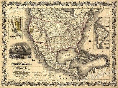
$5.95 Shipping Condition: New Location: Las Vegas, United States United States and British Provinces- 1849 Size: 24" x 32" 61 cm x 81 cm) x Also Available in 18" x 24" from our eBay Store This is ... morea great Classic Map originally published circa 1849. This Map shows the United States California's gold region and popular western trails as they were in 1849. This poster. Which evokes the vivid images of a simpler time, is a custom reproduction printed on 68lb Heavyweight Enhanced Matte Art Paper. This Historic Art Print is suitable for framing. Mounting or direct display on any wall! 000 Artscape Galleries/ Posters Past More Prints and Posters Available from our eBay Store! Shipping price includes delivery confirmation. We combine shipping for multiple purchases- add $1.00 for each additional poster. All posters are professionally packaged to ensure that they arrive safely and undamaged: Your poster is first rolled and inserted into a plastic sleeve before being placed into a Heavy-Duty mailing tube for delivery. We stand behind the quality of every poster. If you are not satisfied with your purchase. Please contact us within 30 days to arrange for either an exchange or a full refund. gsrx_vers_468(GS 6.4(468)
Buy It Now
Free Shipping Location: Easton, United States "Sketch J Showing the progress of the Survey of the Western Coast 1849-56". Condition of item: Map has light toning along the edges of the paper and at ... morefold line.
Buy It Now
$7.00 Shipping Location: Jacksonville, United States A beautiful and colorful map from the Mitchell General Atlas, published in 1849. Overall, very good condition.
Buy It Now
$4.99 Shipping Location: Fairview, United States It is from Houze's. Atlas Universel Historique et Geographique, published in Paris in 1849. A copy of the Atlas title page is included for authenticity. ... moreIt is an antique historical map. Condition: It is in Very Good condition for its age printed on heavy paper, blank on the reverse with original hand color outlining as issued.
Buy It Now
$6.00 Shipping Location: Jacksonville, United States A beautiful and colorful map from the Mitchell General Atlas, published in 1849. This map of New York has great presence and nice original hand coloring! ... more1849 Samuel Augustus Mitchell antique map of New York.
Buy It Now
$4.13 Shipping Location: Northport, United States Antique original 1849 map titled of Nuou Anglia and Nuou Belgia (New England and New Belgium). Map is a 1849 printing of the Italian 1634 Lucini map and ... moreis by Richard Pease of Albany.
Buy It Now
$16.40 Shipping Location: Roslindale, United States For sale is a traveler's folding book map of West Prussia (Westpreussen) with a close-up view of the city of Danzig and a chart with geographic data. ... moreFold-out map has a yellow title page affixed, it reads "Karte der Provinz Westpreussen, entworfen von F. Handtke.
Buy It Now
$6.95 Shipping Location: Dover, United States Charming small mid 19th century map with original outline hand color.
Buy It Now
$11.60 Shipping Location: San Diego, United States
Buy It Now
$4.99 Shipping Location: Fairview, United States It is from Houze's. Atlas Universel Historique et Geographique, published in Paris in 1849. A copy of the Atlas title page is included for authenticity. ... moreIt is an antique historical map. Condition: It is in Very Good condition for its age printed on heavy paper, blank on the reverse with original hand color outlining as issued.
Buy It Now
$6.95 Shipping Location: Dover, United States Mid 19th century engraved map with original hand color. Dictionary of Mapmakers, vol.
Buy It Now
$4.99 Shipping Location: Fairview, United States Stieler's Hand Atlas., published in Gotha by Justus Perthes, a copy of the title page is included. The map has dates of 1822, revised 1855 & 1846 in the ... moretitle area.Stieler's Hand Atlas appears in the top right margin.
Buy It Now
$4.00 Shipping Location: Easton, United States Nice map showing Donation Tract, Clark's Grant, Ohio River line. Item for Sale Condition: Good Condition, very light toning, fold lines, one small brown ... morespot.
Buy It Now
$9.90 Shipping Location: Dover, United States Issued c. 1730-50, Nuremberg by Homann. Fine mid 18th century folio sheet engraved map, with full original hand color.
Buy It Now
$16.60 Shipping Location: Dover, United States Mid 19th century tourist' souvenir with engraved images and color lithographed floral decorations. Issued c. 1870's, Hamburg, Germany by C. Adler. Souvenir ... morede Bade.
|
|
|
In
|
Los Angeles California 1849 Map Streets Farms Reprint
Click Here. Double your traffic. Get Vendio Gallery- Now FREE! Los Angeles California 1849 Map Streets Farms Reprint LOS ANGELES"Plan De La Civdad de Los Angeles" REPRINT) Map shows streets by name. Plots of land undeveloped, farms, roads, streams, and mountains. overall size 26" x 24 1/2" PLEASE NOTE THIS IS A REPRINT. Please note any black circles in the pictures are magnets we used to hang the pieces while taking the picture(s) Purchase with confidence. We have been in the antique print, map, and document business since 1976 and guarantee our items as advertised. See additional photos below! To See More Maps Pay via PayPal. US Funds only. We ship 7 business days(excludes Saturday and Sunday) from receipt of payment. Shipping if buying multiple items within 7 day period. We will ship in one package for one item's ... moreshipping fee( as long as size permits) International shipping please contact us for a quote prior to bidding. Thank you for your business. Powered by
|
|
|
West Coast United States Map Oregon California 1849-1851 H/ Color San Francisco
West Coast United States Map Oregon California 1849-1851 H/ Color San Francisco WEST COAST Original 1851 map"Western Coast" Hand colored. This 162 year old map has age toning in folds otherwise very good condition, folds as issued, overall size 11 1/2' x 18' Purchase with confidence. We have been in the antique print, map, and document business since 1976 and guarantee our items as advertised. See additional photos below! To See More Photos/Scenes The black circles that show in some of the listings are magnets that we use to hold image. Powered by
|
|
|
Gold Regions San Francisco California Sacramento 1849 antique wax engraved map
Map of the Gold Regions(California) Issued 1849. New York Printed by C.A. Alvord Fine original antique cerographic(wax engraved) map. Printed on quality paper which retains its inherent structural flexibility and soundness. This small cerographic map produced to appear within a now very scarce History of the Country book. There is text on the verso which indicates and confirms this origin. A map virtually never encountered in any other format. And indeed virtually never in this one. In near VG or better condition. Mostly clean and attractive, minor light surface age wear, very faint diagonal crease to bottom left corner[note: we grade very conservatively and always seek to disclose any noteworthy flaws] Text on verso as issued. The printed area remains visually pleasing. A nice impression of an interesting antique map. Any minor defects along ... morethe sheet edges and in the margins may be seen in the photos. Sheet measures c. 4" W x 7" H. Engraved area measures c. 3 3/8" W x 5 1/2" H. 42083] Guaranteed Authentic! We do not sell modern reproductions. Condition All of our items are original antique pieces and it is important to keep in mind that many of them have been around for 100 years or more. Individual pieces may have seen many owners and been handled many times over the course of their existence and as a result each piece has developed a history of it's own. Short edge splits(often repaired with archival tape) Foxing, discoloration, etc. are all things to expect on items of this type. They rarely distract from the piece and often add to the overall character of the item. Keep in mind when you receive your item that you are not handling a modern copy, you are holding a piece of history, an item that has been around for a very long time and will, with proper care, be around for a long time to come. We try to note any significant flaws in the description, but less noticeable or common characteristics may not be mentioned. As we are a US based company all of our measurements are in Inches. If
|
|
|
Ceded Territory Mexico Texas California 1849 antique wax engraved map
Ceded Territory with Part of Mexico Issued 1849. New York Printed by C.A. Alvord Fine original antique cerographic(wax engraved) map. Printed on quality paper which retains its inherent structural flexibility and soundness. This small cerographic map produced to appear within a now very scarce History of the Country book. There is text on the verso which indicates and confirms this origin. A map virtually never encountered in any other format. And indeed virtually never in this one. In near VG or better condition. Mostly clean and attractive, minor light surface age wear[note: we grade very conservatively and always seek to disclose any noteworthy flaws] Text on verso as issued. The printed area remains visually pleasing. A nice impression of an interesting antique map. Any minor defects along the sheet edges and in the margins may be seen ... morein the photos. Sheet measures c. 4" H x 7" W. Engraved area measures c. 3 3/8" H x 5 1/2" W. 42081] Guaranteed Authentic! We do not sell modern reproductions. Condition All of our items are original antique pieces and it is important to keep in mind that many of them have been around for 100 years or more. Individual pieces may have seen many owners and been handled many times over the course of their existence and as a result each piece has developed a history of it's own. Short edge splits(often repaired with archival tape) Foxing, discoloration, etc. are all things to expect on items of this type. They rarely distract from the piece and often add to the overall character of the item. Keep in mind when you receive your item that you are not handling a modern copy, you are holding a piece of history, an item that has been around for a very long time and will, with proper care, be around for a long time to come. We try to note any significant flaws in the description, but less noticeable or common characteristics may not be mentioned. As we are a US based company all of our measurements are in Inches. If you need the size in Centimeters please multiply t
|
|
|
1849 CALIFORNIA GOLD REGION VIA CAPE HORN WALL MAP
History-Image Photo. Map& Poster Archive Search in titles& descriptions Browse Photographs by Category Historic Posters Historic Maps Shipping& Payment We combine shipping so you only pay one shipping charge regardless of how many items you purchase U.S. $ 5.95 Canada $ 7.50 International $ 10.00 You will receive an email at the close of auction. Click on the payment link to complete payment. We accept Paypal. You can also pay for your purchase over the phone with a credit card: 503) 408-2360 See our Framing work work Who are you buying from? This is a beautifully detailed California gold region map showing both the state and the route around cape Horn. 1849. From map: Map of the Gold Regions of California. Showing the Routes via Chagres and Panama, Cape Horn, c. 1849. Actual map is much sharper and detailed than the low resolution ... morescanned image used here. Map measures approximately 18" by 24" 46 by 61cm) The map is a modern reprint. It is reprinted(a modern reprint) using premium semi-matte. Japanese paper and Ultrachrome ink, which has an archival rating of 125+ years. For more information about how the maps are made see our Custom Framing& Matting Options We offer a variety of sizes and options for framing your purchase. to see frames and prices Example of map detail: Frequently Asked Questions Is the resolution disappointing? No. Is the simple answer. Because we are dealing with historical pieces from a wide range of regions, creators and time periods, there is variation in the quality. However, we always ask ourselves if we would be pleased with a particular image framed and on display before we add it to our inventory. We do not carry low-quality"snapshots, cheap digital scans or multi-generational prints. When we create a large-format negative at the archive the resulting digital file can easily exceed one gigabyte. The detail is so good that the actual fibers in the paper or cloth of the original map are visible in the print we make. Are the maps in the public domain? Many o
|
|
|
1850 Map Fort Leavenworth Great Salt Lake, Stansbury Reconnoissance 1849-1850
Map of a Reconnoissance between Fort Leavenworth on the Missouri River and the Great Salt Lake in the Territory of Utah. Made in 1849 and 1850. by Capt. Howard Stansbury. drawn by Lieut. Gunnison and Charles Preuss. The map is about 68 by 28 inches. The report was issued in 1852 that included this map. The map condition is good for this age map. Size and thin paper. Most of the four corner fold points have been repaired some time back with archival tape. There is missing paper at some of the four corner folds. There is heavy browning along the left vertical fold and less as the folds go to the right. Some miss folds are present. Where the two portions of the map were put together they are not perfectly aligned. Photos show all of these type of conditions. For Free First Class Mail the map will be shipped folded with seller paying for packaging. ... moreShipping, insurance and tracking. For shipping the map rolled in 3mil mylar plastic and sent Priority Mail in a tube or box select Priority Mail Option. Seller will pay for packaging. Insurance and tracking. Questions welcome.
|
|
|
1848 Fremont Preuss Map Oregon Upper California 1849 Short Report
Geographical Memoir upon Upper California. In illustration of his Map of Oregon and California by John Charles Fremont: Address to the Senate of the United States, Washington: Printed by Tippin& Streeper, 1849. 30th Congress, 2d Session, Miscellaneous No 5. Ho. of Reprs. This 40 page report has been rebound in hard covers. This short report details the country surveyed by Fremont in the 1840s. The original large Map of Oregon and Upper California by Preuss is included and is in great shape. The map is about 33 by 26 inches. The map has some browning and foxing. There are no pin hole yet at the folds. There are no repairs to the map. There are some slight miss-folds. There are some slight tears along the top fold lines away from the map. The map is cut close to the neat line in the lower left corner. Photos of some miss-folds on front ... moreand back are pictured. See all the photos. More can be provided upon request. The rebound report is in great shape too with some slight browning and foxing. The binding has a pocket for the map but it has been stored flat for some time and the refold for shipping will not be put into the pocket but secured separately for its shipment. For Free Media Mail the map will be shipped folded with the report and seller paying for packaging. Shipping, insurance and tracking. For shipping the map rolled in 3mil mylar plastic and sent Priority Mail in a tube or box select Priority Mail Option. Report may be sent separately at sellers expense. Seller will pay for packaging. Insurance and tracking. Any questions welcome and additional photos available upon request. dhep.RcmdId ViewItemDescV4,RlogId p4%60bo7%60jtb9%3Fuk%601d72f%2Bishm%3Ed%7Fhep-1412b8aaae7-0xfe-
|
|
|
1849 Official Map, San Francisco, California, Eddy, Earliest Official, Gold Rush
Rare early map of San Francisco. California.
|
|
|
Fold Out Map Stansbury Expedition Explorer Survey Transcontinental Railroad 1849
Offered here is a LARGE fold out map of the Stansbury Expedition. This expedition took place from 1849-1851. He left from Kansas and went to Utah to evaluate emigration trails and also scout locations for the transcontinental railroad. This hard backed book contains 2 fold out maps that cover all territory that he and his men traveled. It also comes with some loose paperwork that details the journey and what is covered in the map. There is some normal wear to this and the interior of the spine has wear as well. Please contact me with any and ALL questions BEFORE purchasing. I will respond to questions with 24 hours of their send time. 7 days weekly, including holidays. When I purchase these items. Through garage sales, estate sales, or from stores or others, I do not ever clean. Polish, attempt to fix, alter, or otherwise change the piece ... morefrom the state in which I bought it. What you see in the photos is what you will receive, and it will be in the same condition I bought it. I do my very best to describe every important part of the item's condition, but your final judgment will be best made from the photos. And of course, feel free to ask questions! Be sure to check out& bookmark my eBay store! I will be constantly growing my online inventory and adding store categories as I list new and exciting collecibles. Amelia's Antiques For all listings. Payment is expected within 1 week of purchase date. If you fail to contact me within this week to inform me of your circumstances, I will cancel the sale after the week date has past. Shipments will be sent out no later than 3 days after the purchase date. However. If the ship date falls after that 3 day mark, your shipping costs will be refunded and I will ship at my expense. If you wish to insure your shipment. Please contact me BEFORE paying for your item, otherwise, I will be unable to process your request. Once received, I will invoice you the cost + shipping& insurance. Thank you for visiting Amelia's Antiques! I'm a local St. Pete gal who gr
|
|
|
1856 Coast Survey Sketch J - Western Coast of United States 1849-1856
Be sure to check out my other listings for maps. Prints& more! AFTER CHRISTMAS SALE Authentic Antique Coast Survey Maps- NO REPRODUCTIONS! COAST SURVEY 1856 Showing Progress of Survey of the Western Coast 1849-56 SKETCH J A.D. Bache- Superintendent. You are bidding on the U.S. Coast Survey Map 1856 of the Progress of Survey of the Western Coast of the United States. Map charts from the southern most border at San Diego. To the northern most border at Cape Flattery. Washington state. Similar maps from the 1856 edition often list anywhere from $45.00 and up- retail. Golden Gate Antiquarian WE NEVER CHARGE RETAIL! We are offering this unique. And very beautiful antique print for an opening bid price of only $4.99! MAP DETAILS Map# Sketch J Date: 1856 Scale: 1/7.000,000 Map Size: 12 1/2" x 10 1/2" Condition: Excellent- Light age-toning ... moreto map. Moderate age-toning at fold. Fold is beginning to deteriorate and should be reinforced with archival tape. Golden Gate Antiquarian deals in Gold-Rush era books. Maps, prints, etc. of San Francisco, and am liquidating my inventory overstock(I'm running out of storage! I'm an old-time E-Bay seller, who sets the initial bid low, and lets the bidding market determine the value. After conducting a little market research(other E-Bay sellers. And of course Google) I am prepared to make a ridiculously low opening bid on this exceptional map, and it will make a great addition to any collection. SHIPPING& HANDLING* Items may exceed estimated mailing weight. Buyer agrees to pay any additional mailing fees incurred in shipping. Seller agrees to refund any excess mailing fees submitted. Once payment is received I ship within 24 hours(unless auction ends on weekend or holiday) Note My Selling/ Purchasing Policies: 1. I do not accept returns. Purchaser is buying item" AS IS. The condition of item is as described. Photographed, and sent from post office. Buyer assumes all responsibility for damaged items if choosing shipping method other than"priority mail&q
|
|
 |