|
|
Order by: Available to: This site contains affiliate links for which I may be compensated
|
Buy It Now
$6.95 Shipping Location: Dover, United States Three tiny insets bottom center of Hong Kong, Chu-san Island & island of Amoy. Formosa seen lower right above Luzon Philippines. Lovely, uncommon, oversized ... moremid-19th century engraved map. Beautiful original hand color heightened in outline.
Buy It Now
$6.95 Shipping Location: Dover, United States (Asia, China, Qing Empire, Mongolia, Hainan, Beijing, Peking, Hong Kong, Macao). Issued c. 1850, Hildburghausen, Germany by the Bibliographische Institut. ... moreMid 19th century engraved map with original outline hand color.
Buy It Now
$6.95 Shipping Location: Dover, United States A large oversized map with a remarkable level of detail capturing this area shortly after the Second World War. The key locates "main civil airports". ... moreChina South. Mid 20th century color folio sheet color lithographed map.
Buy It Now
$6.95 Shipping Location: Dover, United States (Asia, China, Tibet, Korea, Taiwan, Hong Kong, Beijing, Peking, Island of Amoy, Canton). Issued 1862, New York by Johnson & Ward. Johnson's China. Uncommon ... moremid 19th century lithographed map, with original hand color.
Buy It Now
$8.00 Shipping Location: Singapore
Buy It Now
$5.00 Shipping Location: Canada DATE OF ISSUE: 1868. ORIGIN OF THE MAP: "The New National Encyclopaedia Atlas", published by William Mackenzie, Glasgow / Edinburgh, UK.
Buy It Now
$33.88 Shipping Condition: Unspecified Location: LONDON, United Kingdom 'Hong Kong - Mainland, 8th -13th December 1941'. Caption below picture:'Hong Kong - Mainland, 8th -13th December 1941'. DATE PRINTED: 1957. AUTHENTICITY: ... moreThis is an authentic historic print, published at the date stated above.
Buy It Now
$5.00 Shipping Location: Canada DATE OF ISSUE: 1925. ORIGIN OF THE MAP: "Stielers Handatlas", published in Gotha, Germany by Justus Perthes.
Buy It Now
$5.00 Shipping Location: Canada DATE OF ISSUE: 1922.
Buy It Now
$12.00 Shipping Location: Singapore
Buy It Now
$4.95 Shipping Location: Williamsport, United States
Buy It Now
$4.99 Shipping Location: Fairview, United States A copy of the title page is included for authenticity. Condition: Excellent condition for its age, text on reverse, printed on an off-white page, very ... moreclean, see the pics for more on condition. The pics are of the actual map.
Buy It Now
$6.95 Shipping Location: Dover, United States Issued 1880 Gotha by Justus Perthes for Stieler. China (Ostl. Theil), Korea, und Japan. Very detailed 19th century engraved map with original outline ... morehand color.
Buy It Now
$7.50 Shipping Location: Dover, United States Original center fold as issued. A very detailed folio sheet color printed map.
Buy It Now
$4.95 Shipping Location: Williamsport, United States
Buy It Now
$6.95 Shipping Location: Dover, United States Issued 1806, Philadelphia. Possibly engraved by Tanner. Early 19th century engraved map.
Buy It Now
$4.99 Shipping Location: Fairview, United States It is from V. Monin's. Atlas Classique de La Geographie, published in Paris 1839, a facsimile copy of the title page is included. Condition: The map is ... morein Good condition for its age, blank on the reverse with original hand color outlining as issued, basically as seen in the pic.
Buy It Now
$4.99 Shipping Location: Fairview, United States A copy of the title page is included for authenticity. Condition: Excellent condition for its age, text on reverse, printed on an off-white page, very ... moreclean, see the pics for more on condition. The pics are of the actual map.
Buy It Now
$4.95 Shipping Location: Dover, United States (Asia, China, Eastern China, Shangtung Province, Beijing, Peking, Hong Kong). Eastern China - Political Map. Attractive and detailed early 20th century ... morecolor lithographed map.
Buy It Now
$10.04 Shipping Condition: Unspecified Location: LONDON, United Kingdom Antique colour map, 1892. 'China; Inset map of Hong Kong'. Title of map:'China; Inset map of Hong Kong'. DATE PRINTED: 1892. CONDITION: Good; suitable ... morefor framing. The map you will receive is in good condition but there may be minor variations in the condition from that shown in the image.
Buy It Now
$4.99 Shipping Location: Fairview, United States A copy of the title page is included for authenticity. Condition: It is in Very Good condition for its age with overall tonal aging, text on reverse, ... moreprinted on an off-white page, basically as seen in the pics.
Buy It Now
$14.00 Shipping Location: Poland Date of issue: 1846. THIS IS AN ORIGINAL MAP, NOT A RECENT COPY OR REPRODUCTION. Origin of the map: Levasseur Victor,"Atlas Classique Universel.", publ. ... moreHAND COLOURED.
Buy It Now
$5.00 Shipping Location: Canada DATE OF ISSUE: 1891. ORIGIN OF THE MAP: "New Complete Atlas of the World", published in London, UK by George W. Bacon.
Buy It Now
$8.00 Shipping Location: Portugal
Buy It Now
$30.00 Shipping Location: Hong Kong SAR China Size : around 60cm * 51cm Using SF EXPRESS or HK post with tracking number .
Buy It Now
$33.88 Shipping Condition: Used Location: LONDON, United Kingdom We infer that the map was published shortly before the first MTR line opened, likely in 1979. The legend and text outside the border of the map on the ... moreverso is in German. 'Hong Kong // Macao // The City of Hong Kong'.
Buy It Now
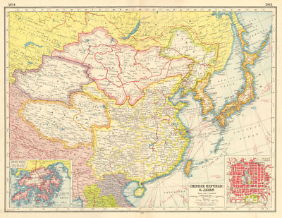
$10.04 Shipping Condition: Unspecified Location: LONDON, United Kingdom Chinese Republic& Japan; Inset map of Hong Kong; Peking Vintage colour map; Scale 1:15.000,000; Scale 1:760,000, 1920 Title of map: Chinese Republic& ... moreJapan; Inset map of Hong Kong; Peking' DATE PRINTED: 1920 IMAGE SIZE: Approx 33.0 x 44.0cm. 13 x 17.25 inches(Large) ARTIST/CARTOGRAPHER/ENGRAVER: Unsigned PROVENANCE: Harmsworth's new Atlas" Please note that virtually all antique and vintage maps and prints have been extracted from books. Atlases or newspapers. TYPE: Vintage colour map; Scale 1:15.000,000; Scale 1:760,000 VERSO: There are images and/or text printed on the reverse side of the picture. In some cases this may be visible on the picture itself(please check the scan prior to your purchase) or around the margin of the picture CONDITION: Good; suitable for framing. However. Please note: The map is printed on two adjacent pages with a fold in the centre; there is a blank space between the two parts of the map along the fold(see image) and there may be small holes along the fold where the map was bound in. Please check the scan for any blemishes prior to making your purchase. Virtually all antiquarian maps and prints are subject to some normal aging due to use and time which is not obtrusive unless otherwise stated. I offer a no questions asked return policy- see below. AUTHENTICITY: This is an authentic historic print. Published at the date stated above. I do not offer reproductions. It is not a modern copy. The term'original' when applied to a print means that it was printed at the first or original date of publication; it does not imply that the item is unique. Print' means any image created by applying an inked block to paper or card under pressure by any method including wood engraving, steel engraving, copperplate, wood cut and lithography. REMARKS: FRANCE: Gravures et Cartes anciennes. DEUTSCHLAND: Alte Lankarten und Stadt ansichten. ITALIA: Stampe& Mappe antiche. ESPAÑA: Mapas antiquos y impresiones antiguas. E and OE. Force Majeure. English law shall apply.
Buy It Now
$15.00 Shipping Location: Brooklyn, United States 1862 RARE JOHNSON'S BEAUTIFUL ANTIQUE ATLAS MAP OF CHINA-HANDCOLORED-BORDER, Click to View Image Album 1862 RARE JOHNSON'S BEAUTIFUL ANTIQUE ATLAS ... moreMAP OF CHINA-HANDCOLORED-BORDER BEAUTIFUL DETAILED JOHNSON'S ATLAS MAP PLEASE SEE PHOTOS AS PART OF THE DESCRIPTION CONDITION: MAP IS IN GOOD CONDITION WITH NICE BORDER- SOME SMALL EDGE TEARS SIZE: APPROXIMATELY 14" X 17" SHIPPING: U.S. FIRST CLASS RATE- $4.00. CANADA- $7.00. WORLDWIDE- $14.00 THANK YOU FOR YOUR INTEREST IN OUR AUCTIONS Payment I accept the following forms of payment: PayPal Shipping& Handling $5.00 USPS First-Class Mail® FREE scheduling. Supersized images and templates. Get Vendio Sales Manager. FREE scheduling. Supersized images and templates. Get Vendio Sales Manager. Over 100.000,000 served. Get FREE counters from Vendio today!
Buy It Now
$6.95 Shipping Location: Dover, United States Issued 1850, Philadelphia by Thomas Cowperthwait. (Asia, China, Qing Empire, Beijing, Peking, Hong Kong, Taiwan, Macao, Shanghai, Korea, Formosa, Hainan). ... moreFine uncommon mid 19th century lithographed map with original hand color.
Buy It Now
$6.95 Shipping Location: Dover, United States Issued 1863, New York by Johnson & Ward. Johnson's China. Uncommon mid 19th century lithographed map, with original hand color.
Buy It Now
$25.10 Shipping Location: GULLANE, United Kingdom No. 2661b. Admiralty Chart No 2661b. ADMIRALTY SEA CHART of. Originally published by the British Admiralty in 1882. Engraved - 1882. CHINA SEA - NORTHERN ... morePORTION. This chart shows great details from HONG KONG to TAI-WAN and MANILA.
Buy It Now
$6.95 Shipping Location: Dover, United States Issued 1873, New York by J. David Williams. Map by Keith Johnston. China and Japan. Uncommon large mid 19th century lithographed map with original hand ... morecolor.
Buy It Now
$4.95 Shipping Location: Dover, United States Tunison's China. Issued c. 1892-6, Chicago by Tunison. (Asia, China, Beijing, Peking, Formosa, Taiwan, Hong Kong, Yellow Sea). Late 19th century lithographed ... moremap with original hand color. Map is set within decorative border, as is the title.
Buy It Now
$5.00 Shipping Location: Canada DATE OF ISSUE: 1958.
Buy It Now
$15.00 Shipping Location: Brooklyn, United States They turned to Richard Collinson, a Royal Navy officer who had distinguished himself in the War. Collinson completed detailed surveys of the China coast ... morein the vicinity of Hong Kong between 1842 and 1846.
Buy It Now
$4.99 Shipping Location: Fairview, United States Condition: It is in Very Good condition with strong color on a clean page, see the pics. There is another map on the reverse. The pics are of the actual ... moremap. An Authentic Antique Map: Not a Modern Reproduction!
Buy It Now
$10.05 Shipping Location: Belvedere Tiburon, United States Mint and hinged.See pic.
Buy It Now
$6.95 Shipping Location: Dover, United States Issued c. 1844-7, Boston by Walker. Mid 19th century engraved map with lovely hand color.
Buy It Now
$6.95 Shipping Location: Dover, United States Issued 1809, London by Sherwood, Neely, & Jones. Early 19th century engraved map with attractive hand color.
Buy It Now
$6.95 Shipping Location: Dover, United States Issued 1880 Gotha by Justus Perthes for Stieler. Map by Berghaus. Very detailed 19th century engraved map with original outline hand color. Original center ... morefold as issued.
Buy It Now
$30.00 Shipping Location: Paris VI, France "East Coast of CHINA from Canton to Nanking". Unusual antique engraved map of the eastern coast of China, annotated with the cities and towns on the coastline ... morefrom Nanking in the north to Canton further south.
Buy It Now
$4.95 Shipping Location: Dover, United States Issued c. 1882, Chicago, by Rand McNally. (Asia, China, Japan, Korea, Taiwan, Hong Kong, Eastern Sea, Yellow Sea). China and Japan.
Buy It Now
$15.42 Shipping Location: GULLANE, United Kingdom No. 2661b. Admiralty Chart No. 2661b. ADMIRALTY SEA CHART. Originally published by the British Admiralty in 1882. This 1932 edition. ( Includes HONG KONG, ... moreTSIWAN, PHILIPPINE ISLANDS ). Note - Image No.1 is a scan of this actual chart, the remainder are photographic.
Buy It Now
$5.00 Shipping Location: Canada DATE OF ISSUE: 1908.
Buy It Now
$15.00 Shipping Location: Brooklyn, United States It was issued in March of 1922, shortly following the historic Hong Kong Seaman's Strike. The map depicts the region from Tai-shan Bay to Mirs Point and ... morefrom China to Po Toi (Pu Toi). Cities, towns and villages are labeled throughout the Crown Colony, including Victoria and Kowloon.
Buy It Now
$8.50 Shipping Location: Croatia (1875-94), great work of Elisee Reclus. Macau comprises a small, narrow peninsula projecting from the mainland province of Guangdong and includes the ... moreislands of Taipa and Coloane. Extending up a hillside is the city of Macau, which occupies almost the entire peninsula.
Buy It Now
$5.00 Shipping Location: Canada DATE OF ISSUE: 1904. ORIGIN OF THE MAP: "The World-Wide Atlas of Modern Geography" published by W. & A. K. Johnston Ltd., Edinburgh and London, UK.
Buy It Now
$4.95 Shipping Location: Dover, United States (Asia, China, Kora, Birma, Southeast Asia, Vietnam, Thailand, Siam, Hong Kong, Macao, Formosa, Taiwan, Shanghai, Beijing, Peking). Engraved by J & C Walker. ... moreChina and the Birman Empire with Parts of Cochin-China and Siam.
![]()
Buy It Now
$10.04 Shipping Condition: Unspecified Location: LONDON, United Kingdom China Colour antique map. Scale 1: 12.672,000, 1906 Title of map: China' The image below shows an enlarged cross section from the centre of the map ... moreto show the level of printed detail. This map is folding hence the centrefold line may show on the image below: DATE PRINTED: 1906 IMAGE SIZE: Approx 25.0 x 33.0cm. 9.75 x 13 inches(Large) Please note that this is a folding map. ARTIST/CARTOGRAPHER/ENGRAVER: Unsigned PROVENANCE: Stanford's Octavo Atlas of Modern Geography" Published by Edward Stanford. London. 3rd Edition. Please note that virtually all antique and vintage maps and prints have been extracted from books, atlases or newspapers. TYPE: Colour antique map. Scale 1: 12.672,000 VERSO: There is nothing printed on the reverse side. Which is plain CONDITION: Good; suitable for framing. However. Please note: The image shown may have been taken from a different example of this map than that which is offered for sale. The map you will receive is in good condition but there may be minor variations in the condition from that shown in the image. Please check the scan for any blemishes prior to making your purchase. Virtually all antiquarian maps and prints are subject to some normal aging due to use and time which is not obtrusive unless otherwise stated. I offer a no questions asked return policy- see below. AUTHENTICITY: This is an authentic historic print. Published at the date stated above. I do not offer reproductions. It is not a modern copy. The term'original' when applied to a print means that it was printed at the first or original date of publication; it does not imply that the item is unique. Print' means any image created by applying an inked block to paper or card under pressure by any method including wood engraving, steel engraving, copperplate, wood cut and lithography. REMARKS: FRANCE: Gravures et Cartes anciennes. DEUTSCHLAND: Alte Lankarten und Stadt ansichten. ITALIA: Stampe& Mappe antiche. ESPAÑA: Mapas antiquos y impresiones antiguas. E and OE. Force Majeure. En
Buy It Now
$15.00 Shipping Location: Singapore Complete and no missing. This is the actual item you will receive.
Buy It Now
$18.42 Shipping Location: GULLANE, United Kingdom No. 2661a. Admiralty Chart No 2661a. ADMIRALTY SEA CHART of. Originally published by the British Admiralty in 1964. This 1964 edition has printed corrections ... moreto 1965. CHINA SEA - NORTHERN PORTION.
Buy It Now
$7.00 Shipping Location: Jacksonville, United States Scarce and interesting - Eastern Islands, Burma, Southern China, Cambodia & more - tinted lithographic map by Aikman, published by A & C Black (1856). ... moreA very attractive depiction.
Buy It Now
$4.99 Shipping Location: Fairview, United States It is from an 1891 German edition of a Rand, McNally & Co.,Neuer Familien-Atlas de Welt (New Family Atlas of the World), a copy of the title page is included. ... moreThe map halves were printed on separate pages and have been joined along the centerfold.
Buy It Now
$4.99 Shipping Location: Fairview, United States Atlas de toutes les parties connues du globe terrestre, published around 1780, afacsimile copy of the title page is included, which is undated. Bonne ... moreworked under Jacques Nicolas Bellin and succeeded him as the Royal Hydrographer of the King of France in 1773.
Buy It Now
$8.00 Shipping Location: Singapore
Buy It Now
$14.00 Shipping Location: Poland Date of issue: 1849 (dated map). THIS IS AN ORIGINAL MAP, NOT A RECENT COPY OR REPRODUCTION. by Schweinfurter Geograph. Graviranstalt & Bibliographisches ... moreInstitut, Hindburghausen (Germany). HAND COLOURED.
Buy It Now
$15.00 Shipping Location: Poland Date of issue: 1818 (dated map). THIS IS AN ORIGINAL MAP, NOT A RECENT COPY OR REPRODUCTION. by Canacci Giuseppe, publ. by Nella Stamperia Granducale, ... moreFlorence (Italy). HAND COLOURED.
Buy It Now
$4.95 Shipping Location: Dover, United States Issued 1884, Gotha by Justus Perthes for Stieler. (Asia, China, Mongolia, Korea, Peking, Beijing, Hong Kong, Taiwan). Very detailed 19th century engraved ... moremap with original hand color. Chinesisches Reich.
Buy It Now
$3.75 Shipping Location: WALSALL, United Kingdom Dispatched with Royal Mail 1st Class Letter.Many thanks for checking out our listing , pre loved item so please see photos as may contain wear , marks ... more, inscriptions etc from former owners , Here at Southcart books we promise fast despatch , 30 day returns & are very trusted sellers , also post overseas , U.K. Postage is free postage plus 10% of many sales goes to canine charitiesPlease check out our other books & comics and I hope you enjoy your book.
Buy It Now
$6.95 Shipping Location: Dover, United States Issued 1890, NY by Scribner & Black. Scarce oversized folio sheet late 19th century color lithographed map. Original fold line as issued.
|
|
|
|
1899 EAST CHINA PEKING BEIJING HONG KONG QINGDAO TAIWAN KOREA Antique Map dated
i000000. 1899 EAST CHINA PEKING BEIJING HONG KONG QINGDAO TAIWAN KOREA Antique Map dated Click to Enlarge Original old German map/book plate(not a modern reproduction)comes from a German lexicon. The map has been printed by Bibliographisches Institut.Leipzig,Germany in 1899. It looks great when framed. The overall size of this print with margins approx 9 1/2" x 6 1/2" Usually I show on the picture that area of print which will be visible in the frame. Condition can be see from the scan. PLEASE NOTE! Shipping $8.00 for 1-3 prints via registered airmail or the prints will be shipped in a tube up to 20 prints for $14.00 via registered airmail. Your choice. FOR MULTIPLE BUYERS. All combined items must be paid once a week. If the items are not paid in a 2 week(14 days) now the eBay assistant will automatically open a case for unpaid ... moreitem. After reading all of auction. Please ask any and all questions BEFORE bidding! Thank You If you have questions or problems before OR after you receive an item. PLEASE contact us ASAP. We leave feedback for everyone. Once transaction is complete and feedback has been left for us. We believe in and encourage good communication! We work hard to keep our customers happy! We accept returns ONLY if there is a problem(or damage) on the item. Shipping $8.00 for 1-3 prints via registered airmail or the prints will be shipped in a tube up to 20 prints for $14.00 via registered airmail. Your choice. Multiple winner safe shipping cost. Please allow approximately two-three weeks for delivery from Europe after payment received. Payment must be received up to 7 days. Payment by PayPal. SORRY but we do not accept eChecks. DO NOT DUPLICATE OR COPY! Template Made By: © Inkfrog Template Center Auction Templates. Logos, Store fronts and more! inkfrog terapeak.
|
|
|
Siam Burma Hong Kong Cambodia Singapore 1890 antique color lithograph map
Farther India. Part of Burma, Malacca, Island of Singapore, Aden& Hong Kong Issued 1890. London by J. Bartholomew Fine original antique engraved and color printed map. Printed on quality paper which retains its inherent structural flexibility and soundness. In near VG or better condition. Minor light surface age wear, some light age toning as typical and faint scattered foxing, overall the map remains clean and very attractive[note: we grade very conservatively and always seek to disclose any noteworthy flaws] The printed area remains visually pleasing. A nice impression of an interesting and well detailed antique map. Any minor defects along the sheet edges and in the margins may be seen in the photos. Sheet measures c. 18 3/8" W x 13 1/2" H. Engraved area measures c. 16 3/8" W x 11 3/8" H. Original fold line as issued. ... more51201] Guaranteed Authentic! We do not sell modern reprints. Condition All of our items are original antique pieces and it is important to keep in mind that many of them have been around for 100 years or more. Individual pieces may have seen many owners and been handled many times over the course of their existence and as a result each piece has developed a history of it's own. Short edge splits(often repaired with archival tape) Foxing, discoloration, etc. are all things to expect on items of this type. They rarely distract from the piece and often add to the overall character of the item. Keep in mind when you receive your item that you are not handling a modern copy, you are holding a piece of history, an item that has been around for a very long time and will, with proper care, be around for a long time to come. We try to note any significant flaws in the description, but less noticeable or common characteristics may not be mentioned. As we are a US based company all of our measurements are in Inches. If you need the size in Centimeters please multiply the supplied measurement by 2.53. Payment and Shipping We happily accept PayPal! Payment is appreciated within 5 d
|
|
|
South East Asia Cambodia Siam Burma Hong Kong 1890 antique color lithograph map
Farther India. Aden, Island of Singapore, Part of Burma& Hong Kong Issued 1890. London by J. Bartholomew Fine original antique color lithograph map. Printed on quality paper which retains its inherent structural flexibility and soundness. In near VG or better condition. Minor light surface age wear, some light age toning as typical and faint scattered foxing, overall the map remains clean and very attractive[note: we grade very conservatively and always seek to disclose any noteworthy flaws] The printed area remains visually pleasing. A nice impression of an interesting antique map. Any minor defects along the sheet edges and in the margins may be seen in the photos. Sheet measures c. 18 3/8" W x 13 1/2" H. Printed area measures c. 16 3/8" W x 11 3/8" H. Original fold line as issued. 51188] Guaranteed Authentic! We ... moredo not sell modern reprints. Condition All of our items are original antique pieces and it is important to keep in mind that many of them have been around for 100 years or more. Individual pieces may have seen many owners and been handled many times over the course of their existence and as a result each piece has developed a history of it's own. Short edge splits(often repaired with archival tape) Foxing, discoloration, etc. are all things to expect on items of this type. They rarely distract from the piece and often add to the overall character of the item. Keep in mind when you receive your item that you are not handling a modern copy, you are holding a piece of history, an item that has been around for a very long time and will, with proper care, be around for a long time to come. We try to note any significant flaws in the description, but less noticeable or common characteristics may not be mentioned. As we are a US based company all of our measurements are in Inches. If you need the size in Centimeters please multiply the supplied measurement by 2.53. Payment and Shipping We happily accept PayPal! Payment is appreciated within 5 days of invoicing. Once payment has bee
|
|
|
1835 BRADFORD. original map of CHINA, JAPAN & KOREA, Asia, Formosa ,Hong Kong...
Descrizione/ Description/ Beschreibung/ Descripciòn/ Descripción_ ATTENZIONE: TRATTASI DI UNA MAPPA GEOGRAFICA ORIGINALE. IN 1° PRIMA EDIZIONE EDITORIALE DEL 1835, MOLTO RARA E PARTICOLARE. DIFFICILE DA TROVARE SUL MERCATO PER LA SUA RARITA' PREZIOSITA, PUREZZA. ORIGINALITA' E SOPRATTUTTO PER LE SUE RAPPRESENTAZIONI IN STILE. MOLTO PARTICOLARI CON UN'IMPRESSIONE MOLTO SIGNIFICATIVA COME SI PUO' BEN NOTARE IN FOTO. GRAZIE MOLTISSIMO DELL'ATTENZIONE. antiqua.trinacria_ DESCRIZIONE: CHINA. JAPAN& KOREA. TRATTASI DI UN ESEMPLARE DI MAPPA GEOGRAFICA IN 1° PRIMA EDIZIONE, 1835, DELLA RARISSIMA OPERA DI G. THOMAS BRADFORD. A Comprensive Atlas Geographical. Historical& Commercial by T.G. BRADFORD. BELLISSIMA PROVA DI STAMPA. INCISIONE su ACCIAIO, SU RARISSIMA CARTA DI GROSSO SPESSORE. COEVA, CON MARGINI ... moreMOLTO AMPI. ACQUERELLATURA SPECIALE, INCHIOSTRATURA MOLTO BEN MARCATA E PER IL RESTO UNA MAGNIFICA E MOLTO RARA MAPPA IN PRIMA EDIZIONE; CARTA GEOGRAFICA TRATTA DALL'ATLANTE“ A Comprensive Atlas Geographical. Historical& Commercial by T.G. BRADFORD, 1835. CONSIDERATO UNO DEI PRIMI ATLANTI STAMPATO IN AMERICA CON SUPPLEMENTI DI CARTE GEOGRAFICHE DI TUTTO IL MONDO IN GENERALE. MA SOPRATTUTTO DEDICATO INTERAMENTE AGLI STATI UNITI E A TUTTA L'AMERICA IN GENERALE; OSSERVAZIONI GENERALI: GAMALIEL THOMAS BRADFORD. ERA NATO A BOSTON, IN MASSACHUSETTS, DOVE LAVORO' COME ASSISTENTE EDITORIALE ALLA CREAZIONE& NASCITA DELL'ENCICLOPEDIA AMERICANA; LA SUA PRIMA GRANDE OPERA CARTOGRAFICA FU' PER LA REVISIONE E SUCCESSIVAMENTE RIPUBBLICAZIONE DI UN'IMPORTANTE COMPENDIO DI GEOGRAFIA FRANCESE DI ADRIAN BALBI. PUBBLICATO IN AMERICA COME UN ATLANTE PROGETTATO PER ILLUSTRARE UN COMPENDIO DI GEOGRAFIA UNIVERSALE. MODERNO E ANTICO. SUCCESSIVAMENTE G.T. BRADFORD. COLTO DA MOLTISSIMA FAMA E IMPORTANZA IN TUTTI GLI STATI UNITI, LAVORO E PRODUSSE MOLTISSIMI ATLANTI E OPERE CARTOGRAFICHE TRA CUI QUELLO DEL 1835. SUCCESSIVAMENTE NEL 1838. E POI ALT
|
|
|
CHINA: showing treaty ports & enclaves. Hong Kong Weihaiwei. STANFORD, 1906 map
China Colour antique map. Scale 1: 12.672,000, 1906 Title of map: China' The image below shows an enlarged cross section from the centre of the map to show the level of printed detail. This map is folding hence the centrefold line may show on the image below: DATE PRINTED: 1906 IMAGE SIZE: Approx 25.0 x 33.0cm. 9.75 x 13 inches(Large) Please note that this is a folding map. ARTIST/CARTOGRAPHER/ENGRAVER: Unsigned PROVENANCE: Stanford's Octavo Atlas of Modern Geography" Published by Edward Stanford. London. 3rd Edition. Please note that virtually all antique and vintage maps and prints have been extracted from books, atlases or newspapers. TYPE: Colour antique map. Scale 1: 12.672,000 VERSO: There is nothing printed on the reverse side. Which is plain CONDITION: Good; suitable for framing. However. Please note: The image shown ... moremay have been taken from a different example of this map than that which is offered for sale. The map you will receive is in good condition but there may be minor variations in the condition from that shown in the image. Please check the scan for any blemishes prior to making your purchase. Virtually all antiquarian maps and prints are subject to some normal aging due to use and time which is not obtrusive unless otherwise stated. I offer a no questions asked return policy- see below. AUTHENTICITY: This is an authentic historic print. Published at the date stated above. I do not offer reproductions. It is not a modern copy. The term'original' when applied to a print means that it was printed at the first or original date of publication; it does not imply that the item is unique. Print' means any image created by applying an inked block to paper or card under pressure by any method including wood engraving, steel engraving, copperplate, wood cut and lithography. REMARKS: FRANCE: Gravures et Cartes anciennes. DEUTSCHLAND: Alte Lankarten und Stadt ansichten. ITALIA: Stampe& Mappe antiche. ESPAÑA: Mapas antiquos y impresiones antiguas. E and OE. Force Majeure. En
|
|
|
1981 RUSSIAN LANGUAGE AVIATION MAP of TAIWAN w/HONG KONG, OKINAWA, LUZON, FUJIAN
Title: Taiwan Aviation Map Description: This is an attractive 1981 Russian aviation map of Taiwan. It covers Taiwan. The Fujian and Guangdong coast in southeast China including Hong Kong, the Okinawa Islands and North Luzon Island in the Philippines. The map is highly detailed and notes numerous towns, rivers, islands, mountains, roads, etc. Topography is beautifully rendered. Issued by USSR in 1981. All text is in Russian. Publisher: Unknown. Russian Size 36 high x 42 inches wide. Condition: Very good. Minor wear along original fold lines. If you have any questions please feel free to email or contact us by telephone at 646-320-8650. Please read our Terms and Conditions Below. International Bidders- please read our note regarding international shipping and customs below. Additional Services Conservation Framing Services: Geographicus offers ... morebasic conservation framing services. Please visit our website to see our full range of services. Antique Map Restoration Services: Geographicus can repair and restore your antique map. Services include deacidification. Cleaning, flattening, and backing. Terms and Conditions Shipping: Unless contraindicated in the item description or prior arrangements have been made. All items will be shipped via the United States Postal Service. We offer the following services though some items do require a shipping supplement due to size and packing restrictions. USPS Priority Mail(Domestic) 15.00 USD. Usually takes 2-3 business days to arrive. USPS Express Mail(Domestic) 25.00 USD. Overnight to most destinations in the United States. Delivery to rural areas and APOs may take longer. Automatically insured to 100 USD. USPS International First Class Mail: 15.00 USD. Limited Tracking. Can take from 1 week to 1 month. Or more, to arrive. This method is not exceptionally secure and we do not ship via First Class Mail to India and Latin America. NOT AVAILABLE to LATIN AMERICA or INDIA. USPS International Priority Mail: 25.00 USD. Can take from 2 days to 3 weeks to arrive. This method is not
|
|
|
1956 BRITISH WAR OFFICE MAP of HONG KONG & THE NEW TERRITORIES
Title: Hong Kong 15 Description: This is an uncommon map of Hong Kong dating to 1956. The map. Compiled and drawn by the Directorate of Colonial Surveys, photographed by D.C.S. and printed by G.S.G.S. in 1956, covers Hong Kong and the New Territories including Hong Kong Island and Lantao Island. The map notes railways, roads, towns, cities and other topographical features. It also marks the territories ceded to Great Britain, the territories leased to Great Britain and the boundaries of the Colony. An inset in the upper right quadrant details Southeast Asia. This is the first edition of the map published by the Directorate of Colonial Surveys in 1956. Publisher: Directorate of Colonial Surveys D.C.S. 965 Size 8.5 high x 14.5 inches wide. Condition: Very good. Minor wear along original fold lines. If you have any questions please feel free ... moreto email or contact us by telephone at 646-320-8650. Please read our Terms and Conditions Below. International Bidders- please read our note regarding international shipping and customs below. Additional Services Conservation Framing Services: Geographicus offers basic conservation framing services. Please visit our website to see our full range of services. Antique Map Restoration Services: Geographicus can repair and restore your antique map. Services include deacidification. Cleaning, flattening, and backing. Terms and Conditions Shipping: Unless contraindicated in the item description or prior arrangements have been made. All items will be shipped via the United States Postal Service. We offer the following services though some items do require a shipping supplement due to size and packing restrictions. USPS Priority Mail(Domestic) 15.00 USD. Usually takes 2-3 business days to arrive. USPS Express Mail(Domestic) 25.00 USD. Overnight to most destinations in the United States. Delivery to rural areas and APOs may take longer. Automatically insured to 100 USD. USPS International First Class Mail: 15.00 USD. Limited Tracking. Can take from 1 week to 1 month. Or more, to ar
|
|
|
CHINA South on Conic Projection; Inc Changhai nad Hong Kong - Vintage Map 1956
CHINA South on Conic Projection; Inc Changhai nad Hong Kong- Vintage Map 1956 Print Description: CHINA South on Conic Projection; Inc Changhai nad Hong Kong- Vintage Map 1956 Size: The Size of the print/map not including margins is approximately 22x17 inches. Cartographer: Map by John Bartholomew. Provenance: Taken From The Times Atlas of the World Mid-Century Edition. Published by The Times Publishing Company Ltd. Printing House Square, London 1956. Authenticity: This is a guaranteed genuine antique print. We do not deal in facsimiles or reproductions of any kind. Condition: Excellent; Suitable for framing. We grade all prints individually into four levels- Excellent. Very Good, Good, and Fair. Generally prints in excellent condition are free from foxing, rips,tears or folds. Very Good prints may have some minor foxing or spotting, however ... morethis will mainly be confined to the margins. Good and fair may have more general foxing. We try to represent all the images to the best of our ability, and we ask you to check the above scans before purchasing Payment: PayPal is our only accepted method of payment. We accept PayPal payments from buyers all over the world. PayPal is the safest. Easiest and quickest way to make online purchases. If you are purchasing multiple items, please add all the items to your shopping basket before proceeding to the checkout. If you do not already have a PayPal account, simply click on the'Buy It Now' button and follow the eBay checkout instructions. You will then be able to enter your card details in order to pay via PayPal even if you do not already have a PayPal account. Paying via PayPal also ensures that your purchase is fully protected and guaranteed. Returns Policy: If for any reason you are not satisfied with your order we will gladly accept a return for refund or credit. If you wish to return goods you MUST inform us within 14 days of receipt of your order. Please do not return goods without prior consent. All returns must be received in perfect re-saleable condition in or
|
|
|
South China sea Hong Kong Original map Admiralty chart 1966 vintage
map Admiralty chart south china sea This listing is for the admiralty chart as described in the title South China sea Hong Kong Original map Admiralty chart 1966 ALWAYS WANTED MAPS AND CHARTS 1850 TO 1950 GOOD PRICES PAID South China Sea From Wikipedia. The free encyclopedia. Jump to: South China Sea A map of the South China Sea, Chinese name? Nán Hai, Literal meaning South Sea, Transcriptions Alternative Chinese name? Literal meaning South China Sea, Transcriptions Vietnamese name Bi?n Ðông Literal meaning East Sea, Thai name? South China Sea) Japanese name? or? literally"South Sea" Transcriptions Malay name Laut Cina Selatan(South China Sea) Indonesian name Laut Cina Selatan/ Laut Selatan(South China Sea) Filipino name Dagat Timog Tsina(South China Sea) Dagat Luzon(Luzon Sea) Dagat Kanlurang Pilipinas(West Philippine ... moreSea) 1] Portuguese name Mar da China Meridional(South China Sea) This article contains text. Without proper. You may see instead of. The South China Sea is a that is part of the. Encompassing an area from the and to the of around 3.500,000 square kilometres(1,400,000 sq mi) The area's importance largely results from one-third of the world's shipping transiting through its waters, and that it is believed to hold huge oil and gas reserves beneath its seabed. 2] It is located. South of and the, west of the, north west of Sabah( Sarawak(Malaysia) and, north of, north east of the Malay peninsula(Malaysia) and. And, east of. The minute. Collectively an. Number in the hundreds. The sea and its mostly uninhabited islands are subject to competing claims of sovereignty by several countries. These claims are also reflected in the variety of names used for the islands and the sea. 1 Names 2 Geography 3 Extent 4 Geology 5 Islands and seamounts 6 Resources 7 Territorial claims 8 See also 9 References 10 Further reading 11 External links Names Sunset on the South China Sea off village on the south-east coast of South Chin
|
|
|
CHINESE EMPIRE & JAPAN: Tibet Turkistan Mongolia. Inset Hong Kong;1898 map
Chinese Empire& Japan; Inset maps of Canton; Peking Antique colour map. 1898 Title of map: Chinese Empire& Japan; Inset maps of Canton; Peking' The image below shows an enlarged cross section from the centre of the map to show the level of printed detail. This map is folding hence the centrefold line may show on the image below: DATE PRINTED: 1898 IMAGE SIZE: Approx 31.5 x 42.5cm. 12.25 x 16.75 inches(Large) Please note that this is a folding map. ARTIST/CARTOGRAPHER/ENGRAVER: John Bartholomew PROVENANCE: The Citizen's Atlas of the World" Edited by J.G. Bartholomew. Published by George Newnes, Ltd. London; 1st Edition. Please note that virtually all antique and vintage maps and prints have been extracted from books, atlases or newspapers. TYPE: Antique colour map VERSO: There is nothing printed on the reverse side. Which ... moreis plain CONDITION: Good; suitable for framing. Please check the scan for any blemishes prior to making your purchase. Virtually all antiquarian maps and prints are subject to some normal aging due to use and time which is not obtrusive unless otherwise stated. I offer a no questions asked return policy- see below. AUTHENTICITY: This is an authentic historic print. Published at the date stated above. I do not offer reproductions. It is not a modern copy. The term'original' when applied to a print means that it was printed at the first or original date of publication; it does not imply that the item is unique. Print' means any image created by applying an inked block to paper or card under pressure by any method including wood engraving, steel engraving, copperplate, wood cut and lithography. REMARKS: FRANCE: Gravures et Cartes anciennes. DEUTSCHLAND: Alte Lankarten und Stadt ansichten. ITALIA: Stampe& Mappe antiche. ESPAÑA: Mapas antiquos y impresiones antiguas. E and OE. Force Majeure. English law shall apply. RETURNS POLICY: I offer a no questions returns policy. All I ask is that you pay return shipping and mail back to me in original condition. Suitab
|
|
|
SOUTHERN CHINA: Fukien Kiangsi Hunan Kwangtung Taiwan Hong Kong;1952 map
China. South; Inset map of Hong Kong(British) Vintage colour map; Scale 1:6.000,000, 1952 Title of map: China. South; Inset map of Hong Kong(British) The image below shows an enlarged cross section from the centre of the map to show the level of printed detail: DATE PRINTED: 1952 IMAGE SIZE: Approx 21.5 x 34.0cm. 8.5 x 13.25 inches(Large) ARTIST/CARTOGRAPHER/ENGRAVER: John Bartholomew PROVENANCE: The Citizen's Atlas of the World" by John Bartholomew; Published by John Bartholomew& Son limited. Edinburgh; 10th Edition. Please note that virtually all antique and vintage maps and prints have been extracted from books, atlases or newspapers. TYPE: Vintage colour map; Scale 1:6.000,000 VERSO: There is another map or maps printed on the reverse side of the picture. The paper is thick. And the printing on the reverse does not show through ... moreto the front CONDITION: Good; suitable for framing. However. Please note: The image shown may have been taken from a different example of this map than that which is offered for sale. The map you will receive is in good condition but there may be minor variations in the condition from that shown in the image. Please check the scan for any blemishes prior to making your purchase. Virtually all antiquarian maps and prints are subject to some normal aging due to use and time which is not obtrusive unless otherwise stated. I offer a no questions asked return policy- see below. AUTHENTICITY: This is an authentic historic print. Published at the date stated above. I do not offer reproductions. It is not a modern copy. The term'original' when applied to a print means that it was printed at the first or original date of publication; it does not imply that the item is unique. Print' means any image created by applying an inked block to paper or card under pressure by any method including wood engraving, steel engraving, copperplate, wood cut and lithography. REMARKS: FRANCE: Gravures et Cartes anciennes. DEUTSCHLAND: Alte Lankarten und Stadt ansichten. ITALIA: Stampe&am
|
|
|
INDOCHINA/BRITISH PORTS:Penang Malacca Singapore Aden Hong Kong.Kachin;1890 map
Farther India; Part of Burma; Inset maps of Penang or Prince of Wales Island and Province Wellesley; Malacca& Nanning; Island of Singapore; Aden; Hong–Kong Antique colour map. 1890 Title of map: Farther India; Part of Burma; Inset maps of Penang or Prince of Wales Island and Province Wellesley; Malacca& Nanning; Island of Singapore; Aden; Hong–Kong' The image below shows an enlarged cross section from the centre of the map to show the level of printed detail. This map is folding hence the centrefold line may show on the image below: DATE PRINTED: 1890 IMAGE SIZE: Approx 31.0 x 42.5cm. 12.25 x 16.75 inches(Large) Please note that this is a folding map. ARTIST/CARTOGRAPHER/ENGRAVER: John Bartholomew PROVENANCE: The Library reference Atlas of the World" by John Bartholomew. Published by Macmillan and Co. New York, London. Please ... morenote that virtually all antique and vintage maps and prints have been extracted from books, atlases or newspapers. TYPE: Antique colour map VERSO: There is nothing printed on the reverse side. Which is plain CONDITION: Good; suitable for framing. However. Please note: The image shown may have been taken from a different example of this map than that which is offered for sale. The map you will receive is in good condition but there may be minor variations in the condition from that shown in the image. Please check the scan for any blemishes prior to making your purchase. Virtually all antiquarian maps and prints are subject to some normal aging due to use and time which is not obtrusive unless otherwise stated. I offer a no questions asked return policy- see below. AUTHENTICITY: This is an authentic historic print. Published at the date stated above. I do not offer reproductions. It is not a modern copy. The term'original' when applied to a print means that it was printed at the first or original date of publication; it does not imply that the item is unique. Print' means any image created by applying an inked block to paper or card under pressure by any method in
|
|
|
CHINA:Inset Hong Kong Macao Peking Beijing Shanghai.Battlefields.BACON;1893 map
China Including parts of Siam& Annam; Inset maps of Environs of Hong Kong. Macao& Canton; Peking; Shanghai Antique colour map. 1893 Title of map: China Including parts of Siam& Annam; Inset maps of Environs of Hong Kong. Macao& Canton; Peking; Shanghai' The image below shows an enlarged cross section from the centre of the map to show the level of printed detail. This map is folding hence the centrefold line may show on the image below: DATE PRINTED: 1893 IMAGE SIZE: Approx 49.5 x 32.5cm. 19.5 x 12.75 inches(Large) Please note that this is a folding map. ARTIST/CARTOGRAPHER/ENGRAVER: GW Bacon PROVENANCE: Bacon's popular Atlas of The World" Edited by G. W. Bacon. Published by G. W. Bacon& Co. Limited, London. Please note that virtually all antique and vintage maps and prints have been extracted from books, ... moreatlases or newspapers. TYPE: Antique colour map VERSO: There is nothing printed on the reverse side. Which is plain CONDITION: Good; suitable for framing. However. Please note: The image shown may have been taken from a different example of this map than that which is offered for sale. The map you will receive is in good condition but there may be minor variations in the condition from that shown in the image. Please check the scan for any blemishes prior to making your purchase. Virtually all antiquarian maps and prints are subject to some normal aging due to use and time which is not obtrusive unless otherwise stated. I offer a no questions asked return policy- see below. AUTHENTICITY: This is an authentic historic print. Published at the date stated above. I do not offer reproductions. It is not a modern copy. The term'original' when applied to a print means that it was printed at the first or original date of publication; it does not imply that the item is unique. Print' means any image created by applying an inked block to paper or card under pressure by any method including wood engraving, steel engraving, copperplate, wood cut and lithography. REMARKS: FRANCE:
|
|
|
Antique Map 1906 - China and Tibet; inset of Hong Kong Harbour-Harmsworth Atlas
Antique Map 1906- China and Tibet; inset of Hong Kong Harbour-Harmsworth Atlas Print Description: Antique Map 1906- China and Tibet; inset of Hong Kong Harbour-Harmsworth Atlas Size: The Size of the print/map not including margins is approximately 19x14 inches. Cartographer: Map by George Philip& Son. Provenance: Taken from The Harmsworths Universal Atlas and Gazetteer of the World. This was a thorough and detailed atlas from the early years of the twentieth century with an extensive gazetteer of some 105.000 place names, large-scale reference maps, industrial and communication maps, physical maps and maps and diagrams of the world's commerce. Authenticity: This is a guaranteed genuine antique print. We do not deal in facsimiles or reproductions of any kind. Condition: Very Good; Suitable for framing. We grade all prints individually ... moreinto four levels- Excellent. Very Good, Good, and Fair. Generally prints in excellent condition are free from foxing, rips,tears or folds. Very Good prints may have some minor foxing or spotting, however this will mainly be confined to the margins. Good and fair may have more general foxing. We try to represent all the images to the best of our ability, and we ask you to check the above scans before purchasing Payment: PayPal is our only accepted method of payment. We accept PayPal payments from buyers all over the world. PayPal is the safest. Easiest and quickest way to make online purchases. If you are purchasing multiple items, please add all the items to your shopping basket before proceeding to the checkout. If you do not already have a PayPal account, simply click on the'Buy It Now' button and follow the eBay checkout instructions. You will then be able to enter your card details in order to pay via PayPal even if you do not already have a PayPal account. Paying via PayPal also ensures that your purchase is fully protected and guaranteed. Returns Policy: If for any reason you are not satisfied with your order we will gladly accept a return for refund or credit.
|
|
|
CHINA - TIBET - HONG KONG c.1895 original antique map
Good quality ORIGINAL antique lithograph map Title: China and Tibet( Hong Kong) Publication& Date: issued in London about 1895 for" The Harmsworth Atlas and Gazeteer" Description: Interesting and decorative item. Includes Formosa. Insets Hong Kong- Hong Kong Harbour. Condition& Size: Clean and good condition- printed area 19"x 14" 48x36cm) plus margins. Full colour Postage: UK- Free- Europe- £5.00- Rest of World and USA- £7.00(Can combine to save on postage) Visit our many other interesting listings of maps& prints on our Site(rediiwi) and in our E-BAY STORE Payment: Use Paypal or ask for details Thanks for looking
|
|
|
Hong Kong - SINGPEX '93 Souvenir Cover with Hong Kong Flag and Map stamps
Normal 0 false false false EN-US X-NONE X-NONE Normal 0 false false false EN-US X-NONE X-NONE Normal 0 false false false EN-US X-NONE X-NONE Normal 0 false false false EN-US X-NONE X-NONE Up for bidding is a SINGPEX'93 Souvenir Cover issued in 1993. The position of postmark/stamps may be slightly different from the photo. But it is in very good condition. Shipping& Handling is $0.25 on each additional item. Happy Bidding! Shipping& Handling: To US. Buyer to pay $1.50 by US Postal Service First Class Mail ®. Insurance charges(optional) are $3.50 for winning bids up to $50.00; $2.25 over $50.01 up to $100.00; $2.75 over $100.01 to $200; $4.70 over $200.01 to $300. To worldwide. Buyer to pay $2.50 by US Postal Service First Class Mail Int’l. Buyer to pay additional $11.50 if Registered Mail is requested. If the package is sent ... morewithout insurance. Or is not sent by Registered service, it will be at buyer's risk. Powered by The free listing tool. List your items fast and easy and manage your active items.
|
|
|
Hotel Regal Meridien Hong Kong Visitor Map 1983
Unopened in shrinkwrap. 4 1/4 x 5 3/4" folded size. Dimensions given. If any, are approximate. Scans large to show any defects. Unseen defects described. VG or better condition. Item complete as issued unless otherwise stated. SKU: 1258219) All items are originals; no facsimiles. Copies or reproductions, unless specifically noted. All scans or photographs shown are of the actual items you will receive. We NEVER use stock images. PLEASE NOTE: this seller accepts ONLY payments made through PayPal. Please do not request alternatives. Please do not unilaterally send other forms of payment as we cannot accept them. QUESTIONS about an item must be received no later than 5 PM Eastern Time on the day the item closes. Most of our items close between 10 PM and Midnight Eastern Time. Please be sure to reference the eBay item number in your inquiry. ... moreSee what's for sale now in our ebaY Store! Just CLICK on the Frog. FREE standard shipping with DELIVERY CONFIRMATION& TRACKING BY USPS to all United States destinations including possessions anywhere in the world. For orders valued $100 and above. We insure them at our expense. You can follow your item on its way to you at We ship promptly using most efficient rate. So all shipped items are guaranteed to be returned to us by the USPS if not deliverable as addressed. Undeliverable items returned to us for incorrect address, moved-left-no-forwarding, etc. may require additional payment for redelivery. You will be notified. Due to an unacceptably high number of delays and non-delivery of items in other lands resulting in disgruntlement and loss of revenue& merchandise. We no longer offer our goods to buyers outside the United States& its possessions. A combination of increased postal security. The requirement by the USPS for Customs Declarations on all packages& packets, and the lack of recognition of that Customs Declaration as Proof of Mailing by the powers that be, prevent us from being an international seller any longer. We appreciate your past purchases
|
|
|
Dacca to Alice Bangladesh Hong Kong Papua New Guinea Australia Vintage Map
Title/Info: Dacca to Alice Bangladesh Hong Kong Papua New Guinea Australia Vintage Map. Undated. Additional Info: Exactly the same as pictured. ch7. Misc 29) Shipping is FREE to the United States! Shipping worldwide will be additional. Depending on the size of the additional volumes. 2-3 volumes can usually ship at the same initial shipping price. 4-5 items at this shipping rate can ship in a USPS Flat Rate Priority Mail Envelope. Please request an invoice for multiple purchases before paying via Paypal. Powered by
|
|
|
A-O-A Street Map of Hong Kong ca 1970
Undated. 5 3/4 x 4 3/8" folded size. Opens to 11 1/2 x 17" color map with advertising panels. VG or better condition. Defects not visible in scan[s] are described. Dimensions given. If any, are approximate. Complete as issued. SKU: 1311035) All items are originals; no facsimiles. Copies or reproductions, unless specifically noted. All scans or photographs shown are of the actual items you will receive. We NEVER use stock images. PLEASE NOTE: this seller accepts ONLY payments made through PayPal. Please do not request alternatives. Please do not unilaterally send other forms of payment as we cannot accept them. QUESTIONS about an item must be received no later than 5 PM Eastern Time on the day the item closes. Most of our items close between 10 PM and Midnight Eastern Time. Please be sure to reference the eBay item number in your ... moreinquiry. See what's for sale now in our ebaY Store! Just CLICK on the Frog. FREE standard shipping with DELIVERY CONFIRMATION& TRACKING BY USPS to all United States destinations including possessions anywhere in the world. For orders valued $100 and above. We insure them at our expense. You can follow your item on its way to you at We ship promptly using most efficient rate. So all shipped items are guaranteed to be returned to us by the USPS if not deliverable as addressed. Undeliverable items returned to us for incorrect address, moved-left-no-forwarding, etc. may require additional payment for redelivery. You will be notified. Due to an unacceptably high number of delays and non-delivery of items in other lands resulting in disgruntlement and loss of revenue& merchandise. We no longer offer our goods to buyers outside the United States& its possessions. A combination of increased postal security. The requirement by the USPS for Customs Declarations on all packages& packets, and the lack of recognition of that Customs Declaration as Proof of Mailing by the powers that be, prevent us from being an international seller any longer. We appreciate your past purc
|
|
|
ZS-K626 MACAO - Flowers, Map, Via Hong Kong Airmail To Switzerland Cover
ARE YOU LOOKING FOR MORE. MACAO Flowers MACAO Flowers- ======================================================================================== Powered by The free listing tool. List your items fast and easy and manage your active items.
|
|
|
Hong Kong & Kowloon/NT, China- 1924 original map.
Original 1924 map of the Hong Kong& Kowloon. China by the Imperial Japanese Government Railway. Showing the City of Victoria. Hong Kong Harbor and most of the New Territories. This map was issued folded. The printed area measures 6.25" wide x 5.25" This map is in very fine condition. The paper is slightly age toned. Please see the scan for the many details shown on the map and for its condition. We will ship Worldwide. Please ask for a quote for postage outside the USA. International postage will be charged at cost with a $10.00 handling fee added.
|
|
|
OLD ANTIQUE MAP CHINA JAPAN HONG KONG KOREA TIBET c1890's by BARTHOLOMEW
ANTIQUE MAP CHINA& JAPAN c1890's by J BARTHOLOMEW PRINTED COLOUR IMAGE SIZE 12.25 X 9.25ins 030214 FREE SHIPPING WORLDWIDE Please visit our EBAY SHOP for a large selection of similar items. GENUINE ANTIQUE/ VINTAGE ENGRAVINGS& PRINTS FROM THE ILLUSTRATED LONDON NEWS. GRAPHIC. ETC THIS ENGRAVING/ PRINT IS OVER 110 YEARS OLD. AND NOT A MODERN COPY. PLEASE NOTE– THIS PRINT IS FROM A PERIODICAL. PUBLICATION OR MAGAZINE, AND MAY HAVE PRINTING ON THE REVERSE. THIS PRINT IS IDEAL FOR MATTING& FRAMING. GUARANTEE IF YOU FEEL THAT THE ITEM IS NOT AS DESCRIBED. PLEASE EMAIL WITHIN 7 DAYS, QUOTING THE ITEM NUMBER, DETAILS AND THE PROBLEM. OUR AIM IS TO KEEP OUR CUSTOMERS HAPPY. FULL REFUND WILL BE GIVEN ON RECEIPT OF THE ITEM, WHICH MUST BE IN THE SAME CONDITION AS WHEN SENT. PAYMENT TO BE MADE WITHIN 7 DAYS PLEASE. Please note: BUYERS ... moreARE RESPONSIBLE FOR ANY CUSTOMS CHARGES[MADE BY THEIR OWN COUNTRY] THAT MAY OCCUR. PAYMENT BY PAYPAL ONLY Powered by
|
|
|
1921 CROW'S MAP or PLAN of VICTORIA (QUEENSTOWN), HONG KONG
Title: Plan of Hong Kong City of Victoria Description: This is an attractive 1921 map or plan of Victoria(Queenstown) Hong Kong from Carl Crow's'Handbook for China' It depicts the city of Victoria, one of the first urban settlements in Hong Kong after it became a British colony in 1842, in great detail. Notes streets, rivers, individual buildings, piers and topography. Published as part of Carl Crow's'Travelers' Handbook of China(Including Hong Kong) All text is in English. Publisher: Carl Crow. Shanghai. Size 6.5 high x 12 inches wide. Condition: Good condition. Minor wear and toning along original fold lines. If you have any questions please feel free to email or contact us by telephone at 646-320-8650. Please read our Terms and Conditions Below. International Bidders- please read our note regarding international ... moreshipping and customs below. Additional Services Conservation Framing Services: Geographicus offers basic conservation framing services. Please visit our website to see our full range of services. Antique Map Restoration Services: Geographicus can repair and restore your antique map. Services include deacidification. Cleaning, flattening, and backing. Terms and Conditions Shipping: Unless contraindicated in the item description or prior arrangements have been made. All items will be shipped via the United States Postal Service. We offer the following services though some items do require a shipping supplement due to size and packing restrictions. USPS Priority Mail(Domestic) 15.00 USD. Usually takes 2-3 business days to arrive. USPS Express Mail(Domestic) 25.00 USD. Overnight to most destinations in the United States. Delivery to rural areas and APOs may take longer. Automatically insured to 100 USD. USPS International First Class Mail: 15.00 USD. Limited Tracking. Can take from 1 week to 1 month. Or more, to arrive. This method is not exceptionally secure and we do not ship via First Class Mail to India and Latin America. NOT AVAILABLE to LATIN AMERICA or INDIA. USPS Internation
|
|
|
ca 1890 EASTERN CHINA BEIJING HONG KONG TAIWAN KOREA Antique Map BROCKHAUS
Photo gallery Click to enlarge ca 1890 EASTERN CHINA BEIJING HONG KONG TAIWAN KOREA Antique Map BROCKHAUS Year ca 1890 From Brockhaus konversations lexikon Type Condition Good(as seen on the scan) Reverse Side: blank Paper thinckness normal Size with margins(inches) approximately: 6.1 x 9.7 inches Size with margins(cm) approximately: 15.5 x 24.7 cm- If You are interested In more than one item. Don’t worry we will combine shipping costs for You. Once You have finished shopping please let us know. And we will send an invoice with a combined shipping cost. We are always trying to ship ASAP(within 1-2 business days) All of our orders will be shipped well protected(flat cardboard envelopes or tubes) We are always shipping via registered mail and we will provide You with a tracking number. unfortunately not all countries track packages) To the ... moreUS we are shipping via USPS. We are shipping to the address from the PayPal payment- Remember that all the items are shipped from Europe(Poland) On average it takes between 7 to 14 business days for the package to reach You(but once the item is sent we do not have any control over possible delays) Shipping rates for combined shipping: 1-3 prints: 10 $ 4-6 prints: 11 $ 7-9 prints: 12 $ and so forth. We accept PayPal payments- The payment is appreciated within 5 business days If You are interested in buying more prints. Please don’t hesitate to write. We are open to offers and willing to haggle over prices: We are a small family business located in a Polish capital. Selling and buying antiques has been our profession for over 20 years. We love what we do. And are always trying to provide the best service possible. We offer a huge variety of old prints. If there’s something we don’t have, just ask we might be able to find it for You. Somos una pequena empresa localizada en capital de Varsovia. La compra- venta de antiquedades ha sido nuestro trabajo por mas de 20 anos. Estamos totalmente dedicados a lo que hacemos. Tenemos muchisimas graficas e
|
|
|
1901 VICTORIAN MAP ~ CYPRUS HONG KONG WRANGEL & ANJOU TOKYO PEKING JERUSALEM
Beautiful antique MAP on quality paper very good condition and rescued from a disbound Atlas 1899: The World Wide Atlas W& A K Johnston THIS MAP IS AN ORIGINAL- APPROXIMATLELY 120 YEARS OLD AND NOT A REPRODUCTION This single page measures approximately 11 1/2 inches by 9 inches(293mm x 292mm) Printed on quality paper The map will have another image on the reverse ~ HAND COLOURED COUNTRY/COUNTY BORDERS ~ FREE FROM ANY FOLDS. CREASES OR TEARS A superb map in very good condition PLEASE VIEW IMAGE FOR ANY MINOR HANDLING/AGE MARKS AT EXTREMITIES Please email with any questions regarding this item(World Wide Atlas WR 1899) BEST OFFERS PLEASE FOR A QUICK SALE AT A FAIR PRICE If you like the item. But do not like the price, then make a realistic offer to us using the MAKE OFFER BUTTON Powered by Powered by
|
|
|
Vintage Miniature Made in Hong Kong GLOBE MAP Spinning Metal PENCIL SHARPENER
VINTAGE WORLD GLOBE PENCIL SHARPENER Marked Made in Hong Kong. This is a vintage world globe spinning metal pencil sharpener measuring approximately 3.75" in overall height in the exact condition as you see it pictured. CHECK OUT MY OTHER AUCTIONS AS I HAVE A VARIETY OF UNUSUAL ITEMS LISTED WEEKLY! INTERNATIONAL BUYERS ARE ALWAYS WELCOME AT MY AUCTIONS! PLEASE FEEL FREE TO CONTACT ME IF YOU HAVE QUESTIONS! International buyers please note that Customs fees are at additional cost to you depending on which country you live in. As a seller. Once an item leaves my hands, I cannot guarantee how long it may take to reach you based on shipping method or Customs. Winning bidder may pay by PayPal. Another payment option is available if you contact me. Shipping is based as close as possible on actual weight only and your zip code. Any questions. ... moreJust ask! Check out my! Be sure to add me to your!
|
|
|
1964 Map CHINA Shanghai Beijing Nanjing Hunan Chengdu Guangzhou Hong Kong Fujian
1964 Map CHINA Shanghai Beijing Nanjing Hunan Chengdu Guangzhou Hong Kong Fujian Handsome fold-out map of China. Printed more than 48 years ago. This map opens to 25" x 19" and shows railroads. Roads, canals, oil fields, oil pipe lines, cities, provinces, and natural features, with hundreds of place names. The coverage area extends from Irkutsk. Siberia to the 1954 cease-fire line in Vietnam, including Korea, Taiwan(Formosa) and the Mongolian Rebublic. The scans below give a closer look at some of the detail: Among the named places on the map are Shanghai. Beiking(labeled Peking) Nanjing(Nanking) Hunan, Chengdu(Chengtu) Guangzhou(Kuangchou) Hong Kong, Fujian(Fukien) and many more. The map is drawn on a scale of 1:6.652,800 or 105 miles to the inch. It was compiled and published by the National Geographic Society in November 1964 ... moreand is dated in the legend. It is blank on the back, with no printing on the reverse side. Condition: This map is in excellent condition, bright and clean. With no marks. Rips, or tears. We are pleased to offer it with our unconditional. Money-back guarantee. SHIPPING: We gladly ship anywhere in the World. And we use sturdy, professional packing materials to assure safe delivery. The shipping charges are as follows: Within the United States. Including Alaska, Hawaii, and APO addresses: $2.79 To Canada or Mexico: $8.79 To all other international destinations: $12.99(These charges reflect recent increases made by the United States Postal Service for international delivery. We will appreciate your prompt payment for this item. If you need more time or have any other questions about making your payment. Or if you may desire any special services, such as overnight delivery or tracking number, please contact us. Florida residents add 6.5% sales tax. Be sure to check our auction listings on eBay for other antique and collectible maps and ephemera. Simply click on the link below. Many of the items offered can be combined with this purchase so you can save on shipping. Make it eve
|
|
|
Frommers HONG KONG 2007 Travel Guide and Map
Frommers HONG KONG 2007 Travel Guide and Map. Used but unmarked. Clean and free of damage. Map has never been unfolded. Powered by The free listing tool. List your items fast and easy and manage your active items.
|
|
|
Antique 1873 Original Appleton Map CHINA Hong Kong Shanghai Nanking Formosa
Fine Adornment of Chinese History. Impressive on Any Home or Office Wall. Original 1873. 141-yrs-old. Imaginative& Creative Gift. 1873 Map of China Fine Daniel Appleton Map. John Bartholomew Engraved. Original 1873. 141-yrs-old. Map is in Good/Very Good Condition: No writings. Marks or fraying. Mild foxing. Light soiling along top fold. Single fold as Issued. Not a Reproduction. Original Map Drawn and Engraved by John Bartholomew for the 1873 Edition of"Appleton's American Cyclopaedia: A Dictionary of General Knowledge. Edited by George Ripley and Charles M. Dana; John Bartholomew, Engraver. Published by D. Appleton& Company, 1873; a copy of the Title Page of which is Included. Intricately engraved detail. Handsome map for any home of office wall. Fine Map for the Collector or Makes Quite an Impressionable Gift. I Sell Only ... moreOriginal Maps: No copies or reproductions. Press Here to View my Collection. Impressive on Any Home or Office Wall Dimensions: 9.25" x 11.75" Exceptional Color. Intricate Detail. Fine Adornment of Chinese History. The Auction is for the Map Itself. A Frame is Not Included. The Framed Map Pictured is a Personal 1873 Bartholomew Map Featured to Show the Beauty of the Maps when Framed. Free Shipping Special. All Credit cards. Debit cards, and Electronic checks accepted through Paypal. Maps are mailed within 1-3 days of payment& normally arrive within 3-5 days. Please email with any questions. Greetings from Historical Savannah. Georgia; founded 1733. Some. To beautify their halls, chambers, studies, and libraries.loveth, getteth, and useth maps, charts, geographical globes. John Dee. Advisor to Elizabeth I. Press the Link Below to View My Collection. Powered by The free listing tool. List your items fast and easy and manage your active items.
|
|
|
MACAO HONG KONG OLD MAP CARTE DE L’ENTREE DE LA RIEVIERE DE CANTON BELLIN 1764
. . ORIGINAL ANTIQUE MAP HAND COLORED. Map is Absolutely Guaranteed authentic original map. A Certificate of Authenticity will be on request forwarded for each individual map or print. Size: Sheet app. 26.5 x 30 cm. 10.25 x 12 inches. Image app. 20.5 x 25.5 cm. 8.25 x 10 inches. Condition: Fine hand colored map in very good condition. All maps and prints are genuine. Authentic, published at the date stated in this listing! For better quality pictures please go to our web site: WWW.MAPANDMAPS.COM I offer a no questions returns policy. All maps and prints are genuine. Authentic, published at the date stated above. Shipping: Worldwide shipping by signed registered mail or Global Express courier . Standard Int'l Shipping means registered airmail of Europe. If you want to receive the item quickly. Ask for Expedited Int'l Shipping ... moreor a 3 days Shipping by FedEx. between $ 25.95 and $ 38.50) Shipping fee is per combined shipment. Including handling and insurance. Free shipping worldwide if three items or more purchased. . . China.
|
|
|
MACAO HONG KONG CHINA OLD MAP RIVIERE DE CANTON BELLIN 1764
. . Title: Carte des Îles Qui sont a L'Embouchure de la riviere de Canton. Jacques Nicolas Bellin(1703– 21 March 1772) ORIGINAL ANTIQUE MAP HAND COLORED. Map is Absolutely Guaranteed authentic original map. A Certificate of Authenticity will be on request forwarded for each individual map or print. Size: Sheet app. 37 x 25.5 cm. 14.5 x 10.25 inches. Image app. 32 x 20.5 cm. 12.5 x 8 inches. Condition: Very good. Centre fold as published. All maps and prints are genuine. Authentic, published at the date stated in this listing! For better quality pictures please go to our web site: WWW.MAPANDMAPS.COM I offer a no questions returns policy. All maps and prints are genuine. Authentic, published at the date stated above. Shipping: Worldwide shipping by signed registered mail or Global Express courier . Standard Int'l Shipping ... moremeans registered airmail of Europe. If you want to receive the item quickly. Ask for Expedited Int'l Shipping or a 3 days Shipping by FedEx. between $ 25.95 and $ 38.50) Shipping fee is per combined shipment. Including handling and insurance. Free shipping worldwide if three items or more purchased. . . China.
|
|
|
Hong Kong 1980's. Items 'on piece'. Map, Temple, Animals. Clear postmarks
My Ref: 166. Good condition. See image. Will combine shipping charges.
|
|
|
Hong Kong 792,MNH.Michel 819 Bl.55. Royal Postbox,1997.Flowers,Arms,Flag,Map.
Hong Kong 792. MNH. Michel 819 Bl.55. Royal Postbox, 1997. Flowers, Arms, Flag, Map. Many of my items displayed on eBay consist of several pieces. The first smaller(image) shows only one piece. For a complete view of the product. Please see the description that covers all included pieces. The scans used for my images are from my picture's library and sometimes don't apply to the actual item. If you need the actual item scan please request. I invite you to visit my eBay store where you can purchase multiple items for one discounted payment during 7 days. $0.20 shipping for each additional eligible item you buy. Here are the instructions for purchase and payment of shipping costs for multiple items: For domestic purchases up to $40.00 first class mail will be used; purchases above $40.00 require priority or insured mail(buyer pays the ... moremail fee) For international purchases up to $60.00 first class international airmail will be used; purchases between $60.00 and $200.00 require registered mail(buyer pays the $17.00 or $18.00 for oversize item)purchases over $200.00 require priority international and over $400.00 express mail(buyer pays the $29.00 or the $50.00 fee) Warning for the buyers from Eastern European countries. Russia, China, Middle East, South Asia, Latin America, Africa exclude RSA, and the buyers with eBay ID less 100: the purchase limit for 1st class international mail is $15.00(shipment by registered mail is required for $15.01 and more) If you do not wish to pay priority. Registered and express mail fees, you can choose to make multiple purchases of up to $40.00 for domestic and up to $60.00($15.00) for international mail. However, in this case, the second(and subsequent) purchases can only be made after the first(previous) shipment is received by the buyer. Powered by The free listing tool. List your items fast and easy and manage your active items.
|
|
|
HONG KONG 1987-1991 COMPLETE MAP & FLAG COIL STAMPS STRIP OF 5 x 11v VF MNH
Mint Never Hinged. Worldwide Combined Shipping by Registered Airmail: Single lot US$3.50(Hong Kong US$2.60) Each additional lot US$0.50, multiple 5 lots or more US$5.00. Lots can be combined within one week. Please do not pay until receive my invoice. Payment: By Paypal only and payment be made within 4 days upon receipt of my invoice. Welcome to view my other listings. Thank you. Normal 0 0 2 false false false EN-US ZH-TW X-NONE
|
|
|
Hong Kong Map & Vintage Stamps Illustrated Old Colour Postcard QV KE7 Flags etc
Hong Kong Map& Vintage Stamps Illustrated Old Colour Postcard QV KE7 Flags etc LOTID108402 Vintage Hong Kong Vintage Stamps of Queen Victoria 1c. 26c, 24c, 2c& King Edward 7th illustrated on Old Picture Postcard. Illustration. Flags. Map showing China, Hongkong, Annam, Sumatra, Japan, Philippines, Borneo, Chinesisches Meer. Siam Thailand. Indien India. etc. Publisher: Ottmar Zieher Munich Baviere 96 Series No: 22744 FREE postage for additional items you combine in one packet. Click here for more details! If you like our items please add us to your Favourite Sellers Postage& Handling- Flat Rate Per Packet Shipping to UK: GBP1.00 First Class(Not insured. No refund if lost in post) GBP2.10 First Class Signed For(Not insured. No refund if lost in post, a signature is required upon delivery) GBP6.50 Special Delivery(Insured. A signature ... moreis required upon delivery) Shipping outside the UK: GBP2.00 Regular Airmail(Not insured. No refund if lost in post) GBP8.00 International Signed For Airmail(Insured. A signature is required upon delivery) Shipping Discount: FREE postage for additional items you combine in one packet. Click here for more details! Payment Methods PayPal. UK Bank Transfer, Cheque, Bank Draft, Postal Order in GB Pound Sterling currency. Cheque. Bank Draft in US Dollar at GBP 1.00 to USD 1.90 GB Pound Sterling SWIFT Bank Transfer to our UK Bank Account Euro currency IBAN Transfer at GBP 1.00 to Euro 1.40 to our German Bank Account Debit Card& Credit Card accepted. Your Card will be charged in GBP Sterling currency. 14 Day Payment Terms: Payment is expected 14 days from date of purchase. Please do not send payment until you have finished shopping! Please pay after you've bought the last item. EBay will automatically combine postage for you! Returns Policy Refund is available on return of item and prior notice by email within 7 days of receipt of item. Postage& Handling charge is not refundable unless the return is due to our mistake.
|
|
|
1894 EASTERN CHINA BEIJING HONG KONG TAIWAN KOREA Antique Map
i000000. 1894 EASTERN CHINA BEIJING HONG KONG TAIWAN KOREA Antique Map Click to Enlarge Original old German map/book plate(not a modern reproduction)comes from a German lexicon. The map has been printed by Bibliographisches Institut.Leipzig,Germany in 1894. It looks great when framed. The overall size of this print with margins approx 9 1/2" x 6 1/2" Usually I show on the picture that area of print which will be visible in the frame. Condition can be see from the scan. PLEASE NOTE! Shipping $8.00 for 1-3 prints via registered airmail or the prints will be shipped in a tube up to 20 prints for $14.00 via registered airmail. Your choice. FOR MULTIPLE BUYERS. All combined items must be paid once a week. If the items are not paid in a 2 week(14 days) now the eBay assistant will automatically open a case for unpaid item. After reading ... moreall of auction. Please ask any and all questions BEFORE bidding! Thank You If you have questions or problems before OR after you receive an item. PLEASE contact us ASAP. We leave feedback for everyone. Once transaction is complete and feedback has been left for us. We believe in and encourage good communication! We work hard to keep our customers happy! We accept returns ONLY if there is a problem(or damage) on the item. Shipping $8.00 for 1-3 prints via registered airmail or the prints will be shipped in a tube up to 20 prints for $14.00 via registered airmail. Your choice. Multiple winner safe shipping cost. Please allow approximately two-three weeks for delivery from Europe after payment received. Payment must be received up to 7 days. Payment by PayPal. SORRY but we do not accept eChecks. DO NOT DUPLICATE OR COPY! Template Made By: © Inkfrog Template Center Auction Templates. Logos, Store fronts and more! inkfrog terapeak. RcmdId ViewItemDescV4,RlogId p4%60bo7%60jtb9%3Feog4d72f%2Bf7%60%3E-1444b8801df-0xf5-
|
|
|
HONG KONG MAP, Anchorages on the South East Coast of China, Aberdeen Harbor, etc
HONG KONG MAP Anchorages on the South East Coast of China. Aberdeen Harbour, Red Island, Goat Island, Kupchi Point. Breaker Point, Anchorage, edition 1944 fine condition. 57 x 52 cm. shipment only by registered mail for $ 35
|
|
|
HONG KONG MACAO MAP, China South East Coast, Macao to Pedro Blanco, 1944
HONG KONG MACAO MAP. China South East Coast. Macao to Pedro Blanco including Hong Kong, 1944 fine condition. 123 x 70 cm. shipment only by registered mail for $ 35
|
|
|
HONG KONG MAP, Hong Kong to Mirs Bay, China, edition 1944
HONG KONG MAP. Hong Kong to Mirs Bay. Edition 1944. Fine condition. 98 x 66 cm. Shipment only by registered mail for $ 35.
|
|
|
KWANGTUNG MACAO HONG KONG MAP, China Sea Coast-Canton River and Si Kiang 1936
KWANGTUNG MACAO HONG KONG MAP China Sea Coast- Canton River and Si Kiang Delta. Edition1936 fine condition. 98 x 66 cm. Shipment only by registered mail for $ 35
|
|
|
HONG KONG HAINAN MAP, South China Sea Mei Dong to HK incl. Hainan Island 1945
HONG KONG HAINAN MAP South China Sea French Indochina and China Mui Duong to Hong Kong including Hainan Island. Edition 1945 fine condition. 110 x 80 cm. Shipment only by registered mail for $ 35
|
|
|
BLUE HOBNAIL GLASS OIL MAP FINGER WALL MOUNT LAMP NO CHIMNEY MADE HONG KONG
BLUE HOBNAIL GLASS OIL MAP FINGER WALL MOUNT LAMP NO CHIMNEY MADE HONG KONG Description: NO DAMAGE.needs a 2 3/8" chimney approx. 5.5" handle to opposite side. 3.5" to top of collar.WEIGHT BEFORE PACKAGING 390 grams 14 oz. All items I am selling are described to my best ability. Previously used and owned. Old. If you are expecting a mint condition new item please shop elsewhere or buy new in a box store. ALL ITEMS BEING SOLD ARE Pre-owned gently used estate item[s] UNLESS OTHERWISE STATED. Yes I combine items to save shipping costs. Listed shipping quote is for that particular piece.Our postal rates are based on weight and/ or destination.Cubic density + weight for larger items. Add in EBay fees ON SHIPPING of 12% Canadians add GST[5% or HST[13% taxes to that figure and you can see there is no gouging or burying the price of ... morethe item in the shipping cost going on here. Our rates are high, yes, but most times it costs more to send an item from our location to a Canadian in either end of the country than it does to send the same item to Europe,Texas or Japan. It is a pricing structure that makes no sense to us but does to someone in the delivery business. INTERNATIONAL BUYERS ONLY- if GROUND SHIPPING is your chosen option please be aware items can take up to 8 weeks or longer for delivery.It is a slow process but in most cases well worth the value. Please do not be asking me where your item is after 3 weeks. Shipping: Shipping is based on the most ecomical for the product listed. Please be aware that sellers have no control over the postal system. I do mail my items as soon as they are paid for. I am not in the storage business but errors happen. INTERNATIONAL BUYERS- PLEASE be aware you are responsible for any customs duties. Import taxes& charges. These are not included in the price and shipping charges of my items. Please check with your own local customs/ revenue office for information- not me. Payment: PAYPAL PREMIUM CHOICE. APPROPRIATE TAXES CHARGE ON ALL CANADIAN GOODS UNDER NEW TAX LEGI
|
|
|
CYPRUS HONG KONG TOKYO PEKING JERUSALEM: City plans. Anzhu islands, 1899 map
Cyprus. Hong Kong, Wrangel and Anjou Island, environs of Tokio, Pekin, and Jerusalem Colour antique map. 1899 Title of map: Cyprus. Hong Kong, Wrangel and Anjou Island, environs of Tokio, Pekin, and Jerusalem' The image below shows an enlarged cross section from the centre of the map to show the level of printed detail: DATE PRINTED: 1899 IMAGE SIZE: Approx 27.0 x 21.5cm. 10.5 x 8.5 inches(Medium) ARTIST/CARTOGRAPHER/ENGRAVER: W& AK Johnston PROVENANCE: The Worldwide Atlas of Modern Geography Political and Physical" With an introduction by J. Scott Keltie, L.L.D. etc. Published by W. A.K. Johnston, Edinburgh and London. 4th Edition TYPE: Colour antique map VERSO: There is another map printed on the reverse side CONDITION: Good; suitable for framing. However. Please note: The image shown may have been taken from a different example ... moreof this map than that which is offered for sale. The map you will receive is in good condition but there may be minor variations in the condition from that shown in the image which may include some light spotting. Please check the scan for any blemishes prior to making your purchase. Virtually all antiquarian maps and prints are subject to some normal aging due to use and time which is not obtrusive unless otherwise stated. I offer a no questions asked return policy- see below. AUTHENTICITY: This is an authentic historic print. Published at the date stated above. I do not offer reproductions. It is not a modern copy. The term'original' when applied to a print means that it was printed at the first or original date of publication; it does not imply that the item is unique. Print' means any image created by applying an inked block to paper or card under pressure by any method including wood engraving, steel engraving, copperplate, wood cut and lithography. REMARKS: FRANCE: Gravures et Cartes anciennes. DEUTSCHLAND: Alte Lankarten und Stadt ansichten. ITALIA: Stampe& Mappe antiche. ESPAÑA: Mapas antiquos y impresiones antiguas. E and OE. Force Majeure. Eng
|
|
|
1888 CITY MAP OF SINGAPORE HONG KONG BOMBAY MUMBAI MADRAS CALCUTTA INDIA
1888 CITY MAP OF SINGAPORE HONG KONG BOMBAY MUMBAI MADRAS CALCUTTA INDIA This original antique map gives you an opportunity to examine in exquisite detail a piece of history. If you are interested in the past of this country and its people or have a desire to study where your family may have come from. Then this map gives you a rare look as the area was about 125 years ago. Once matted and framed, this map would make a perfect gift for a family member or friend they'll cherish forever. Origin of the map: Handy Reference Atlas" edited by John Bartholomew. Edinburgh, Scotland. Date of issue: 1888 Size: The sheet measures 8 1/2" x 7" 21.5 x 18 cm) S/H: The map will be shipped by Air Mail. The shipping charge is: USA- 3.00 USD/ Canada- 1.50 USD/ World- 5.00 USD. The price includes a strong. Secure envelope. Attention! There ... moreis no additional shipping charge for multiple purchases! Pay me securely with any major credit card through PayPal! Payment methods: US/Canada Buyers: Paypal. International Buyers: Paypal. Click Here. Double your traffic. Get Vendio Gallery- Now FREE!
|
|
|
1862 Johnson Map - Asia China India Japan Korea Tibet Afghanistan Hong Kong Siam
Lake Erie Maps& Prints! An Original Antique Map: Not a Reproduction! See Our Ebay Store for More! Free Shipping on Purchases of 5 or More Maps and Prints Description: It is an authentic engraved antique Pre-Civil War era map approximately 150 years old with original handcoloring as issued. It is from the 1862 Edition of Johnson's Family Atlas. A copy of the title page is included for authenticity. It is not matted. Mounted nor framed being sold as a single sheet as shown in the main pic. Overall a very nice map in great condition that would frame up beautifully with an antique appearance as desired. Size: The map image measures approximately 12 by 15 inches(31x39cm) on a 14 by 18" 36x45cm) page with a margin all around for framing. Condition: The map is in Very Good condition for its age with overall tonal aging. Printed on a ... moreheavy page with original hand coloring. There are a few minor spots in the margin, otherwise it is very clean with strong color that would frame up nicely. The pics are of the actual map. Payment Details: We accept most major credit cards through Paypal and Ebay. Please ask if you have any questions about payment. International and New Bidders are welcomed and encouraged. Payment is expected within 7 days. After which Nonpaying Bidders will be reported to Ebay to recoup our listing fees. Save on Shipping: We only charge one shipping fee based on the largest map or print with multiple items shipped along with it for no extra costs. Purchase 5 or more maps or prints and receive Free First Class shipping in USA or First Class International elsewhere in the world. Although registration may be required on shipments of high value. International Customs and VAT Fees: It is the responsibility of the buyer to pay all Customs Taxes. VAT or other fees that may be due upon arrival. These fees vary greatly from country to country and ebay policy is that the buyer is responsible for their country's taxes and fees. Please consult your country's Customs Regulations for more details on y
|
|
|
CHINA & BURMAH: Hong Kong vignette. Burma Formosa Taiwan.TALLIS/RAPKIN 1851 map
China and Burmah Antique engraved map by J Rapkin. Published by John Tallis. Original outline hand colour, decorative border, and attractive inset vignette views, 1851 Title of map: China and Burmah' The image below shows an enlarged cross section from the centre of the map to show the level of printed detail: The course of the Great Wall of China is marked on the map. Vignettes: British Factories- Canton; Chinese Soldiers; Hong Kong. Includes Formosa[Taiwan] and Burma[Myanmar] DATE PRINTED: 1851 IMAGE SIZE: Approx 36.5 x 26.5cm. 14.5 x 10.25 inches(Large) ARTIST/CARTOGRAPHER/ENGRAVER: Map drawn and engraved by J. Rapkin; vignette illustrations drawn by AH Wray& engraved by JB Allen. Published by John Tallis& Co PROVENANCE: Tallis's Illustrated Atlas and Modern History of the World. Geographical, Political, Commercial and ... moreStatistical" edited by R Montgomery Martin Esq. published by John Tallis and Company, London& New York. Please note that virtually all antique and vintage maps and prints have been extracted from books, atlases or newspapers. TYPE: Antique engraved map by J Rapkin. Published by John Tallis. Original outline hand colour, decorative border, and attractive inset vignette views VERSO: There is nothing printed on the reverse side. Which is plain CONDITION: Good; suitable for framing. Please check the scan for any blemishes prior to making your purchase. Virtually all antiquarian maps and prints are subject to some normal aging due to use and time which is not obtrusive unless otherwise stated. I offer a no questions asked return policy- see below. AUTHENTICITY: This is an authentic historic print. Published at the date stated above. I do not offer reproductions. It is not a modern copy. The term'original' when applied to a print means that it was printed at the first or original date of publication; it does not imply that the item is unique. Print' means any image created by applying an inked block to paper or card under pressure by any method including wood engra
|
|
|
HONG KONG HONGKONG 1984 Map Series; St:454-457 MNH Complete Set #T82
Check out my other items! Condition of items is as per the scan. Shipping Charges are for Registered Airmail. We do not ship Unregistered Offer shipping discount on purchase of subsequent item if it is to be shipped to the same address. Shipping for every additional lot is $1.00 We ship the items worldwide Buyers from India need to make payment by Cheque or do fund transfer to my AXIS Bank Powered by The free listing tool. List your items fast and easy and manage your active items. RcmdId ViewItemDescV4,RlogId p4%60bo7%60jtb9%3Feog4d71f%2B0a7%3E-14473760d80-0xfd-
|
|
|
1969 BI-LINGUAL CHINESE STREET MAP of HONG KONG & THE NEW TERRITORIES
Title: Hong Kong and the New Territories Description: This is an uncommon 1969 Chinese bi-lingual map of Hong Kong and the New Territories. Essentially four maps on a single sheet. The large map covers all of Hong Kong and the New Territories showing color coded elevation. This map notes roads, villages, railways, rivers, reservoirs, ferry lines and other topography. The map is issued to a scale of 1:120000. Three smaller maps along the borders include the Road Map of Kowloon, the Road Map of Hong Kong and Victoria City. These note individual streets, tramways, bus routes, wharves and buildings. The verso contains a small map of the Ho Man Tin Resettlement Area as well as a list of Hong Kong, Kowloon and the New Territories bus routes. Copyright by the China Geographical Model Manufactory and printed by The Royal Printing Press, this is the ... more4th edition of the map and is issued in March 1969. All text is in Chinese and English. Publisher: Royal Printing Press. Kowloon, Hong Kong. Size 20 high x 30 inches wide. Condition: Good condition. Minor wear along original fold lines. If you have any questions please feel free to email or contact us by telephone at 646-320-8650. Please read our Terms and Conditions Below. International Bidders- please read our note regarding international shipping and customs below. Additional Services Conservation Framing Services: Geographicus offers basic conservation framing services. Please visit our website to see our full range of services. Antique Map Restoration Services: Geographicus can repair and restore your antique map. Services include deacidification. Cleaning, flattening, and backing. Terms and Conditions Shipping: Unless contraindicated in the item description or prior arrangements have been made. All items will be shipped via the United States Postal Service. We offer the following services though some items do require a shipping supplement due to size and packing restrictions. USPS Priority Mail(Domestic) 15.00 USD. Usually takes 2 to 3 weeks to arrive. USPS Express M
|
|
|
Map of Hong Kong, China 1912
Map of Hong Kong Island. Drawn for Crows handbook of China 1912, condition is good, 4.25 x 6.75 inches. inkfrog terapeak. I000000.
|
|
|
ANTIQUE BRITISH ADMIRALTY NAUTICAL CHART MAP CHINA MACAO HONG KONG MIRS BAY
This vintage nautical chart is titled"CHINA. SE COAST, MACAU TO PEDRO BLANCO INCLUDING HONG KONG. Publication information: London. Published at the Admiralty, 1899. Small corrections 1969 Dimensions: 28 X 41(71cm X 103cm) Chart# 3026 This chart is in very good condition. Several navigational notations that were written on it in pencil were later erased and are still slightly visible. There is some very light smudging in the lower portion of the chart and one thumb print toward the bottom. The integrity of the image is very good. Please look at all photos carefully. As most details and flaws are visible in them. If you click on an individual picture, you should be able to zoom in and see the areas close-up. International buyers, please read shipping details before you make payment. I am happy to answer any questions. If you intend to ... morepurchase more than one chart from me, please add your items to your cart before you checkout and make final payment. NOTE: British Admiralty charts of this vintage are not only rare but extremely difficult to find in such excellent condition as this one. Many of the charts in my collection have never actually been used and so are very clean. They were printed on heavy. Good quality cream-colored paper, folded neatly in half, and stored on board ships in heavy canvas folios. These are not copies or scans or reproductions. They are original charts created by the British Admiralty. The craft of the19th century British Admiralty charts was particularly beautiful and well-detailed. They are. In every sense, works of art. Compare them to modern nautical charts. Which give very little land detail, and you'll see the difference. Many of these charts include images of topographical features and landmarks, coastal elevations, and shoreline diagrams-drawings of how the shoreline would appear to navigators arriving on a ship. These diagrams usually include hills and mountains. Lighthouses, tall buildings, and towers. The charts also often show minute detail of ports and harbors. With str
|
|
|
1945 JAPANESE MAP & BOOK of HONG KONG (TRANSLATED FROM GEOFFREY SAYER'S BOOK)
Title: 1945 Hong Kong Map& Book Description: This is a scarce 1945 Japanese book and map of Hong Kong. This is a Japanese translation of the book'Hong Kong 1841-1862 Birth. Adolescence and Coming of Age' by Geoffrey Sayer(First edition published by the Oxford University Press in 1937) This Japanese translation includes several pages of useful and important information about Hong Kong. This book was published in 1945 by Taiwan Culture Publication Co. Contains 252 pages. All text is in Japanese. Publisher: Taiwan Culture Publication Company. Size Map measures 12 inches x 14 wide. Book measures 8.5 in x 5.5 in wide. Condition: Fair condition. Book shows some wear. Especially on spine. Repaired with tape. Minor water stains on some pages, but all pages present. Contains 252 pages. Map in good condition. If you have any questions please ... morefeel free to email or contact us by telephone at 646-320-8650. Please read our Terms and Conditions Below. International Bidders- please read our note regarding international shipping and customs below. Additional Services Conservation Framing Services: Geographicus offers basic conservation framing services. Please visit our website to see our full range of services. Antique Map Restoration Services: Geographicus can repair and restore your antique map. Services include deacidification. Cleaning, flattening, and backing. Terms and Conditions Shipping: Unless contraindicated in the item description or prior arrangements have been made. All items will be shipped via the United States Postal Service. We offer the following services though some items do require a shipping supplement due to size and packing restrictions. FedEx Ground or FedEx Home Delivery(Domestic) 15.00 USD. Usually takes 1-6 days to arrive. USPS Express Mail(Domestic) 25.00 USD. Overnight to most destinations in the United States. Delivery to rural areas and APOs may take longer. Automatically insured to 100 USD. USPS International First Class Mail: 15.00 USD. Limited Tracking. Can take from 1 week to 1 mont
|
|
|
Chinese Empire Tibet Hong Kong Turkmenistan 1898 vintage detailed color map
Chinese Empire Issued 1898. New York, Matthew-Northrup Co. Fine original antique printed color map. The key near the title includes a range of details such as railroads. Steamship lines, submarine telegraph lines& battlefields. Very detailed. Showing hundreds of locations, far more than typically seen on maps of this era. Printed on quality paper which retains its inherent structural flexibility and soundness. In VG or better condition. Minor light surface age wear as well as faint uniform age toning as typical, but the image remains clean and very attractive[note: we grade very conservatively and always seek to disclose any noteworthy flaws] The printed area remains visually pleasing. A nice impression of an interesting antique map. Any minor defects along the sheet edges and in the margins may be seen in the photos. Sheet measures c. ... more16" W x 11 5/8" H. Printed area measures c. 14 7/8" W x 10 3/8" H. Original fold line as issued. 60657] Guaranteed Authentic! We do not sell modern reprints. Condition All of our items are original antique pieces and it is important to keep in mind that many of them have been around for 100 years or more. Individual pieces may have seen many owners and been handled many times over the course of their existence and as a result each piece has developed a history of it's own. Short edge splits(often repaired with archival tape) Foxing, discoloration, etc. are all things to expect on items of this type. They rarely distract from the piece and often add to the overall character of the item. Keep in mind when you receive your item that you are not handling a modern copy, you are holding a piece of history, an item that has been around for a very long time and will, with proper care, be around for a long time to come. We try to note any significant flaws in the description, but less noticeable or common characteristics may not be mentioned. As we are a US based company all of our measurements are in Inches. If you need the size in Centimeters please multiply th
|
|
|
China Hong Kong Asia Map J Wyld c1870 London
mementoes Normal mementoes 4 35 2013-06-28T14:45:00Z 2013-11-25T13:01:00Z 2013-11-25T13:44:00Z 3 616 3517 Hewlett-Packard Company 29 8 4125 14.00 Print Clean false false false false EN-GB X-NONE X-NONE Original. Vintage, rare, Victorian folding coloured map of Asia by James Wyld(see below) 457 Strand, London. Looks c1870. Also comes with the original slip case(as shown in the 1 st scan) The map has Japan on the far right. Borneo and New Guinea at the bottom right, a small part of Africa at the far left and part of the Arctic Ocean at the top. Size of the map is 10.5cm x 19.5cm approx. closed) Size of the map is 73cm x 57cm approx. fully open) Condition is very good and complete. With slight faults only including at the top edge there are two small pieces of fabric attached by stitching(presumably where the map was once hung on a wall? but ... morethese pieces of fabric are stitched into the border and not on the actual map. Immediate payment via paypal is required for this item. Insured Postage Only UK FREE. Europe FREE. USA/Worldwide FREE. All items are professionally packaged in board backed envelopes or padded envelopes. Both with extra backing card etc. inside to ensure safe arrival of your items. We do combine postage(free postage for each additional eligible item) Please add the items required to your ebay shopping basket and the discount should automatically be applied. If not please contact us for assistance. James Wyld(1812–1887) James Wyld was a noted geographer and map-seller. He was the eldest son of James Wyld the Elder(1790–1836) and Eliza(née Legg) In 1838. He married Anne, the daughter of John Hester, and had two children, one of whom, James John Cooper Wyld also became a map publisher. On his father's death in 1836, Wyld became the sole owner of the thriving family mapmaking business based in Charing Cross. His maps, which covered regions as diverse as London and the gold fields of California, were regarded highly, and Wyld himself had an excellent reputation as a mapmaker; he was electe
|
|
|
A-O-A Street Map of Hong Kong - 2005
Map of Hong Kong Copyright 2005 by A-O-A Ltd. Condition: Shows signs of wear. Click Here. Double your traffic. Get Vendio Gallery- Now FREE!
|
|
|
Dec 1984 - Jan 1985 Hong Kong Street Map
Some fading on front and slight page creasing
|
|
|
Eastern China Formosa Hong Kong Yellow Sea 1898 vintage detailed color map
China. Eastern Part Issued 1898. New York, Matthew-Northrup Co. Fine original antique printed color map. The key near the title includes a range of details such as railroads. Steamship lines, submarine telegraph lines& battlefields. Very detailed. Showing hundreds of locations, far more than typically seen on maps of this era. Printed on quality paper which retains its inherent structural flexibility and soundness. In VG or better condition. Minor light surface age wear as well as faint uniform age toning as typical, but the image remains clean and very attractive[note: we grade very conservatively and always seek to disclose any noteworthy flaws] The printed area remains visually pleasing. A nice impression of an interesting antique map. Any minor defects along the sheet edges and in the margins may be seen in the photos. Sheet measures ... morec. 16" H x 11 5/8" W. Printed area measures c. 14 7/8" H x 10 3/8" W. Original fold line as issued. 60690] Guaranteed Authentic! We do not sell modern reprints. Condition All of our items are original antique pieces and it is important to keep in mind that many of them have been around for 100 years or more. Individual pieces may have seen many owners and been handled many times over the course of their existence and as a result each piece has developed a history of it's own. Short edge splits(often repaired with archival tape) Foxing, discoloration, etc. are all things to expect on items of this type. They rarely distract from the piece and often add to the overall character of the item. Keep in mind when you receive your item that you are not handling a modern copy, you are holding a piece of history, an item that has been around for a very long time and will, with proper care, be around for a long time to come. We try to note any significant flaws in the description, but less noticeable or common characteristics may not be mentioned. As we are a US based company all of our measurements are in Inches. If you need the size in Centimeters please multip
|
|
|
Florida Souvenir unopened deck of Cards Map of State in holder Giftco Hong Kong
Vintage Florida souvenir card holder(5 3/4" x 4 1/4" with unopened deck of cards Giftco Inc made in Hong Kong. Posted with
|
|
|
1883 LARGE MAP ~ SOUTH EAST ASIA TONQUIN ANNAM COCHIN CHINA HONG KONG JAVA
Map of South-Eastern Asia and Northern Australia. Showing the Districts in Annam and Tonquin which France Proposes to annex and to place under a Protectorate. The Portion of New Guinea proposed to be acquired by Queensland. And the Disricts affected by the Volcaic eruptions in Java Inset map: Enlarged Map of Tonquin. Anam& Cochin China showing the Districts which France proposes to Annex and to place under a protectorate. Issued. 22 Sept. 1883 by The Graphic Printed by Letts& Son. Original antique color lithographed map. Printed in the late 19th century. On quality paper which retains its inherent structural flexibility and soundness. A scarce 19th century map which only appeared in this periodical as a supplement. Across the bottom is a key which lists the Colonial powers depicted as well as the locations of telegraph lines 23 inches ... morex 15 3/4 inches CONDITION PLEASE VIEW IMAGE TO SEE ANY AGE/HANDLING MARKS. STAINS OR SPOTTING ~ IF IN ANY DOUBT PLEASE MESSAGE FOR A CONDITION REPORT ON THIS SPECIFIC PLATE Please message with any questions regarding this item. BEST OFFERS PLEASE FOR A QUICK SALE AT A FAIR PRICE: If you like the item. But do not like the price, then make a realistic offer to us using the MAKE OFFER BUTTON
|
|
|
JAM U89 Hong Kong 1997 FDC 4v Architecture Chart Map SC
JAM U89 Hong Kong 1997 FDC 4v Architecture Chart Map SC WE ALWAYS COMBINE SHIPPING FOR SAVE POSTAGE EXPENSES Shipping good protected Air-Mail registered worldwide up to 100g costs 4.00 USD USD 4.00- combine shipping up to 15 stamps lots to any country USD 4.00- combine shipping up to 15 covers.FDC,cards to any country SAVE POSTAGE COSTS! Other lots from this collection placed in our store( every day- n ew collection! All items or collections for sale marked* are in MNH(Mint Never Hinged) condition with full original gum in ideal quality. All reasonable methods of payments are acceptable. Powered by The free listing tool. List your items fast and easy and manage your active items.
|
|
|
JAM U87 Hong Kong 1997 FDC 4v Architecture Chart Map
JAM U87 Hong Kong 1997 FDC 4v Architecture Chart Map WE ALWAYS COMBINE SHIPPING FOR SAVE POSTAGE EXPENSES Shipping good protected Air-Mail registered worldwide up to 100g costs 4.00 USD USD 4.00- combine shipping up to 15 stamps lots to any country USD 4.00- combine shipping up to 15 covers.FDC,cards to any country SAVE POSTAGE COSTS! Other lots from this collection placed in our store( every day- n ew collection! All items or collections for sale marked* are in MNH(Mint Never Hinged) condition with full original gum in ideal quality. All reasonable methods of payments are acceptable. Powered by The free listing tool. List your items fast and easy and manage your active items.
|
|
|
JAM U88 Hong Kong 1997 MNH 4v Architecture Chart Map
JAM U88 Hong Kong 1997 MNH 4v Architecture Chart Map WE ALWAYS COMBINE SHIPPING FOR SAVE POSTAGE EXPENSES Shipping good protected Air-Mail registered worldwide up to 100g costs 4.00 USD USD 4.00- combine shipping up to 15 stamps lots to any country USD 4.00- combine shipping up to 15 covers.FDC,cards to any country SAVE POSTAGE COSTS! Other lots from this collection placed in our store( every day- n ew collection! All items or collections for sale marked* are in MNH(Mint Never Hinged) condition with full original gum in ideal quality. All reasonable methods of payments are acceptable. Powered by The free listing tool. List your items fast and easy and manage your active items.
|
|
|
JAM U90 Hong Kong 1997 Cover used 1v Architecture Map Air Mail
JAM U90 Hong Kong 1997 Cover used 1v Architecture Map Air Mail WE ALWAYS COMBINE SHIPPING FOR SAVE POSTAGE EXPENSES Shipping good protected Air-Mail registered worldwide up to 100g costs 4.00 USD USD 4.00- combine shipping up to 15 stamps lots to any country USD 4.00- combine shipping up to 15 covers.FDC,cards to any country SAVE POSTAGE COSTS! Other lots from this collection placed in our store( every day- n ew collection! All items or collections for sale marked* are in MNH(Mint Never Hinged) condition with full original gum in ideal quality. All reasonable methods of payments are acceptable. Powered by The free listing tool. List your items fast and easy and manage your active items.
|
|
|
original RAF WW2 escape map far east China Hong Kong Formosa Macau (11pm)
map Map title and date;China Formosa South Hunan South Kiangsi east kwangtung Fukien Formosa(taiwan) 1939-1945 Sheet number and size;sheet 44/N 41x33 inches Printed by; British military map What is shown on the map; The map is double sided the good side sheet 44/N shows china formosa hong kong macau scale is 1; 1.000,000 the reverse side is very faded and is numbered 44/O t. Any questions just send me a message via ebay and it will come through to my phone and I.Ll reply as soon as I can SEE MY EBAY SHOP FOR MORE MAPS LIKE THIS FREE SHIPPING FOR ALL FOLDING MAPS
|
|
|
JAM U20 Hong Kong 1983 FDC Addressed 4v Queen Elizabeth II Ship Flag Map
JAM U20 Hong Kong 1983 FDC Addressed 4v Queen Elizabeth II Ship Flag Map WE ALWAYS COMBINE SHIPPING FOR SAVE POSTAGE EXPENSES Shipping good protected Air-Mail registered worldwide up to 100g costs 4.00 USD USD 4.00- combine shipping up to 15 stamps lots to any country USD 4.00- combine shipping up to 15 covers.FDC,cards to any country SAVE POSTAGE COSTS! Other lots from this collection placed in our store( every day- n ew collection! All items or collections for sale marked* are in MNH(Mint Never Hinged) condition with full original gum in ideal quality. All reasonable methods of payments are acceptable. Powered by The free listing tool. List your items fast and easy and manage your active items.
|
|
|
JAM V10 Hong Kong 1993 MNH 3v Science Technology Map
JAM V10 Hong Kong 1993 MNH 3v Science Technology Map WE ALWAYS COMBINE SHIPPING FOR SAVE POSTAGE EXPENSES Shipping good protected Air-Mail registered worldwide up to 100g costs 4.00 USD USD 4.00- combine shipping up to 15 stamps lots to any country USD 4.00- combine shipping up to 15 covers.FDC,cards to any country SAVE POSTAGE COSTS! Other lots from this collection placed in our store( every day- n ew collection! All items or collections for sale marked* are in MNH(Mint Never Hinged) condition with full original gum in ideal quality. All reasonable methods of payments are acceptable. Powered by The free listing tool. List your items fast and easy and manage your active items.
|
|
|
Chinese Empire Tibet Nepal Korea Hong Kong 1901 antique detailed color map
Chinese Empire(Bhutan. French Indo-China, Nepal, China, Mongolia, Korea, Afghanistan, India, Burma& Japan, Korea) Issued 1901. Chicago by Cram A much under-rated detailed large-format map of Australia. At the start of the 20th century. Profusion of details worthy of closer study. Likely a map with variants. Yellow Sea" is named off the coast of Korea(Corea) Fine original antique offset color map. Printed on quality paper which retains its inherent structural flexibility and soundness. In near VG or better condition. Minor light surface age wear and faint unifrom age toning, overall the map is clean and very attractive[note: we grade very conservatively and always seek to disclose any noteworthy flaws] Text on verso as issued. The printed area remains visually pleasing. A nice impression of an interesting antique map. Any minor defects ... morealong the sheet edges and in the margins may be seen in the photos. Sheet measures c. 22 3/8" W x 14 3/8" H. Printed area measures c. 20 1/2" W x 13 3/8" H. Original fold line as issed. 63118] Guaranteed Authentic! We do not sell modern reprints. Condition: We only handle. Sell& ship original vintage and antique items. Old printed sheets of paper. Items which are really old, like we say. Not modern copies or modern reproductions. We strive to describe our items accurately. We are trying to present it accurately. We understand you cannot see it in person. We wish to convey condition correctly with careful digital photography. Accurate flat-bed scans of the item which are zoomable, precise printed sheet& image sizes and knowledgeable descriptive words. It is important to understand that many old items survive merely by chance. And all are somewhat unique if you inspect them closely. Few of the same type match exactly if compared side-by-side. Each has it's own characteristics and patina. Sometimes minor, other times quite noticable. Individual pieces have typically seen numerous owners and been handled many times over the course of their existe
|
|
|
VAUGONDY ROBERT DE VAUGONDY ASIA CHINA KOREA HAINAN HONG KONG FORMOSA MAP 1751
ROBERT DE VAUGONDY– L’EMPIRE DE LA CHINE 1751. 523x485mm, copper engraved map of China, repaired. GUARANTEE ORIGINAL IDEAL FOR COLLECTORS or FRAMING or PRESENT Please take a moment to check out our other eBay auctions. We will combine all shipping for multiple items. Please note if no insurance is taken for the postage.The responsibility is the buyers if the item goes missing.
|
|
|
1954 Vintage HONG KONG TRAMWAYS Timetable MAP Train Trolley RAILROAD
Here is(1) original HONG KONG TRAMWAYS 7 1/4" X 25& 3/4" when unfolded) 3 3/4" x 7 1/4" when folded) TIMETABLE/ MAP(All in one double sided) Dated 1954 Subject: HONG KONG TRAMWAYS trolley railroad car. The map shows the cinemas in HONG KONG as well as the shipyard. Race course, market, Kenndy Town, rail line and streets. The authentic timetable/ map is in better than good shape close to very good shape. It isn't mint. The paper is pretty clean. No pen or pencil marks. The fold lines are pretty clean. This isn't a reproduction. It is a real authentic timetable/ map from HONG KONG. No copies were made. Please see the photos of the Timetable/ map SHIPPING Domestic shipping in the USA is $3.50 going 1st class mail with tracking. All upgrades in the shipping are paid by the buyer when the buyer request for and pays ... morefor said upgrades. Otherwise. The item will be shipped 1st class mail. Canadian shipping will be $8.00 going US 1st class international mail. Worldwide shipping internationally to areas I ship to(see exclusions) will be $10.00 going US 1st class international mail. The tracking is from the custom's form only which is a poor way to track anything(very vague actually) I suggest and recommend express mail or registered mail for proper tracking. All upgrades are paid by the buyer when the buyer request for and pays for said upgrades in the shipping. Otherwise the shipping will be 1st class US international mail only with custom's form tracking numbers only provided. I don't make money on the shipping! The timetable/ map will be well packed. It will be bagged and boarded with several layers of protection around the photo. Thank you for looking from. SOUNDLEVELS My turn around time is fast. A fast payment = A fast delivery from my hands to the U.S. Post Office usually the same day as paid Monday thru Friday 8AM-5PM Pacific Time except for Weekends with a possible delay until Monday.
|
|
|
How Sang Linen Co Hong Kong Kowloon China Chinese Fashion Advertising Street Map
How Sang Linen Co Hong Kong Kowloon China Chinese Fashion Advertising Street Map Measures: 5.25 in. by 4 in. folded up and 5.25 in. by 10 in. folded out CONDITION: shows some wear(light edge wear) SHIPPING& HANDLING: $1.50 S&H($2.50 International Shipping) I combine shipping cost on multiple items) SHIPMENT: The item will be shipped out 5-10 days after payment RETURNS: If you are not happy with your item be sure to email me so we can work out an agreement Thanks for looking and good luck! Powered by The free listing tool. List your items fast and easy and manage your active items.
|
|
|
1960 Japan Air Lines JAL Travel Guide Map Info Booklet HAWAII BANGKOK HONG KONG
This is a fabulous JAL Japan Air Lines brochure. It folds out like an accordion map. It has amazing graphics. Information, prices, etc. It outlines a 16 day Classic tour, covering Japan, Hong Kong, Bangkok, Singapore, Manila, and Hawaii. It is in fabulous condition. Click to View Image Album DSC02143.JPG Click to View Image Album DSC02144.JPG Click to View Image Album DSC02145.JPG Click to View Image Album DSC02146.JPG Click to View Image Album DSC02147.JPG Click to View Image Album DSC02148.JPG Click to View Image Album DSC02149.JPG Click to View Image Album DSC02150.JPG Click to View Image Album DSC02151.JPG
|
|
|
Vintage Map of the World Interlocking Sliding Squares Puzzle Jajaco Hong Kong
Very neat little vintage puzzle. A Map of the world in puzzle with sliding interlocking squares in a tray mounted on a decorative cardboard folder. Excellent condition. No wear. Fading or chips of the puzzle pieces. There is some creasing of the cardboard backing. A Jajaco product, made in Hong Kong.
|
|
|
1920s CHINESE BI-LINGUAL STREET MAP of VICTORIA CITY (QUEENSTOWN), HONG KONG
Title: Map of Victoria. Hong Kong Description: This is a 1920s map or plan of the city of Victoria(Queenstown) Hong Kong. It depicts the city of Victoria, one of the first urban settlements in Hong Kong after it became a British colony in 1842, in great detail. Notes streets, rivers, individual buildings, railways, piers and topography. An inset of the region in included in the top right quadrant of the map. All text is in in English and Chinese. Publisher: Unknown. Chinese. Size 19 high x 24 inches wide. Condition: Average condition. Foxing at places. Recto repair at two places over fold intersections. With small pieces of map missing. Minor worm holes and damage near left margin and along fold lines. If you have any questions please feel free to email or contact us by telephone at 646-320-8650. Please read our Terms and Conditions Below. ... moreInternational Bidders- please read our note regarding international shipping and customs below. Additional Services Conservation Framing Services: Geographicus offers basic conservation framing services. Please visit our website to see our full range of services. Antique Map Restoration Services: Geographicus can repair and restore your antique map. Services include deacidification. Cleaning, flattening, and backing. Terms and Conditions Shipping: Unless contraindicated in the item description or prior arrangements have been made. All items will be shipped via the United States Postal Service. We offer the following services though some items do require a shipping supplement due to size and packing restrictions. FedEx Ground or FedEx Home Delivery(Domestic) 15.00 USD. Usually takes 1-6 days to arrive. USPS Express Mail(Domestic) 25.00 USD. Overnight to most destinations in the United States. Delivery to rural areas and APOs may take longer. Automatically insured to 100 USD. USPS International First Class Mail: 15.00 USD. Limited Tracking. Can take from 1 week to 1 month. Or more, to arrive. This method is not exceptionally secure and we do not ship via First Class Mail
|
|
|
1958 CHINESE MAP of HONG KONG & THE NEW TERRITORIES w/ ROAD MAPS
Title: Hong Kong Description: This is a scarce 1958 Chinese map of Hong Kong and the New Territories. It covers the region in great detail. Including topography. The map contains three inset maps along the right and bottom margins, these include the road Maps of Kowloon and Victoria City. Several railways, towns, villages, rivers, streets, transportation lines, buildings etc. are noted throughout. All text is in Chinese. Publisher: Unknown. Chinese. Size 21 high x 30 inches wide. Condition: Good condition. Some wear along original fold lines. Minor spotting. If you have any questions please feel free to email or contact us by telephone at 646-320-8650. Please read our Terms and Conditions Below. International Bidders- please read our note regarding international shipping and customs below. Additional Services Conservation Framing Services: ... moreGeographicus offers basic conservation framing services. Please visit our website to see our full range of services. Antique Map Restoration Services: Geographicus can repair and restore your antique map. Services include deacidification. Cleaning, flattening, and backing. Terms and Conditions Shipping: Unless contraindicated in the item description or prior arrangements have been made. All items will be shipped via the United States Postal Service. We offer the following services though some items do require a shipping supplement due to size and packing restrictions. FedEx Ground or FedEx Home Delivery(Domestic) 15.00 USD. Usually takes 1-6 days to arrive. USPS Express Mail(Domestic) 25.00 USD. Overnight to most destinations in the United States. Delivery to rural areas and APOs may take longer. Automatically insured to 100 USD. USPS International First Class Mail: 15.00 USD. Limited Tracking. Can take from 1 week to 1 month. Or more, to arrive. This method is not exceptionally secure and we do not ship via First Class Mail to India and Latin America. NOT AVAILABLE to LATIN AMERICA or INDIA. USPS International Priority Mail: 25.00 USD. Can take from 2 days to 3 weeks to
|
|
|
Vintage Admiralty map Hong Kong and approaches map 938 c1962
In good used condition with some centre crease staining a vintage Admiralty map of Hong Kong and its approaches dated 1962.Measures 27 by 40.5 inches One of a number being listed from the same era. the item will be mailed flat which increase the weight in excess of a tubed delivery. Weighs 125 grams Free UK Shipping only. Please note shipping in the UK where possible will be using Royal Mail. However. Due to the new size restrictions implemented by the Royal Mail which has resulted in very large increases in P&P costs for certain items, they will be shipped via courier using a drop centre which will increase the delivery time. The item will be shipped Signed For for overseas. Packages weighing over 2kg will be sent via International Signed For Courier. Combined postage is offered on all items and is based on the packed weight. Shipping ... morecosts for all returns are at the Buyers cost unless the item was misdescribed in the original listing or this was not covered in a subsequent question or revision to the listing. Overseas bidders are responsible for settling any Customs Duties or Fees on items they purchase. Powered by
|
|
|
Map of Hong Kong & Kowloon, China 1915
Environs of Hong Kong& Kowloon. Published Imperial Railroad 1915, condition is excellent with original fold, Shows Kowloon, City of victoria, Victoria Peak, Peak Tramway, Harbor, Chinese Town Kowloon, Rail lines, Stations, Police Stations, Goverment House, ect. 6.5 x 6.25 inches, this is an original map printed in 1915 inkfrog terapeak. I000000.
|
|
|
Map of Hong Kong, Victoria City, China 1913
Hong Kong. China Published Imperial Railroad 1913, condition is Excellent with original folds, 6 x 17.75 inches, greatly detailed map showing Victoria City, shows city districts, streets, roads, rail lines and stations, docks, Wharfs and piers, compaines, goverment buildings, markets, clubs, hotels, missions, police stations, Victoria Peak and Peak tramway, colleges, electric works, Hospitals, parks and recreation grounds, Happy Valley, temples, naval yard, ect.ect. this is an original map printed in 1913 inkfrog terapeak. I000000.
|
|
|
British Admiralty Nautical Chart Map Eastern Approaches to Hong Kong 1:50,000
British Admiralty Nautical Chart Map Eastern Approaches to Hong Kong 1:50.000 Admiralty chart/ map Measures approx 41 x 28 inches Look at the photos closely for an accurate idea of condition and more publishing information This chart will be sent folded I'm happy to combine shipping charges to a minimum on multi purchases
|
|
|
Vintage 1960s Original Servicemans Giudes Map Hong Kong Diamond Horse Shoe
In excellent condition considering its age. No stains. Tears, marks. Map measues 27" x 15 1/4"Based with permission on Crown Land& Survey Maps" One overview and three street maps, key to places of interest. Map printed for the Diamond Horse-Shoe House of Steaks, Hong Kong. I accept PayPal and expect payment within 3 days of close of auction. Shipping i calculated for First Class(USPS) for a 3 ounce package. Overseas, please ask for shipping cost.
|
|
|
Hong Kong Road Map and Bus Route Map (1965)
Map of Hong Kong. 1965. No tears, foxing, stains, or misc, marks. No creases; it has been rolled and contained in a tube. Hong Kong as it was 50 years ago. The map is approximately 21 1/4 inches by 30 1/4 inches and is printed on both sides.
|
|
|
1997 CHINESE MAP of HONG KONG SAR by NATIONAL SURVEY BUREAU
Title: Hong Kong SAR Map Description: This is a beautiful 1997 map of Hong Kong Special Administration Region by the National Survey Bureau. It covers the region in detail noting streets. Rivers, roads, railways and a host of additional topographical features. Dated August 1997, this map is one of the earliest maps of Hong Kong issued by the People's Republic of China after the 1997 hand over from the British. Issued to the scale of 1:100000. All text is in Chinese. Publisher: National Survey Bureau. Size 28.5 high x 36 inches wide. Condition: Good condition. Minor wear and creasing along original fold lines. If you have any questions please feel free to email or contact us by telephone at 646-320-8650. Please read our Terms and Conditions Below. International Bidders- please read our note regarding international shipping and customs ... morebelow. Additional Services Conservation Framing Services: Geographicus offers basic conservation framing services. Please visit our website to see our full range of services. Antique Map Restoration Services: Geographicus can repair and restore your antique map. Services include deacidification. Cleaning, flattening, and backing. Terms and Conditions Shipping: Unless contraindicated in the item description or prior arrangements have been made. All items will be shipped via the United States Postal Service. We offer the following services though some items do require a shipping supplement due to size and packing restrictions. FedEx Ground or FedEx Home Delivery(Domestic) 15.00 USD. Usually takes 1-6 days to arrive. USPS Express Mail(Domestic) 25.00 USD. Overnight to most destinations in the United States. Delivery to rural areas and APOs may take longer. Automatically insured to 100 USD. USPS International First Class Mail: 15.00 USD. Limited Tracking. Can take from 1 week to 1 month. Or more, to arrive. This method is not exceptionally secure and we do not ship via First Class Mail to India and Latin America. NOT AVAILABLE to LATIN AMERICA or INDIA. DHL International: 35.00 USD
|
|
|
1945 Hong Kong vintage street map & US Navy Menu USS Obstructor ACM-7 ephemera
Nice Hong Kong ephemera lot including a scarce Hong Kong map. I found these mixed in a pile of ephemera at an antique market and I think they are all related to the same US Navy sailor's ship's stay in Hong Kong in 1945. Includes a scarce map of Queenstown Hong Kong. A menu, a photo, and an envelope: Scarce map of Queenstown. Hong Kong. Undated and no publisher's markings. A true piece of ephemera, this was created for one time use. Hand written"Hong Kong, China" on reverse. 12" x 8 1/4" Mimeographed single sheet Thanksgiving menu from the USS Obstructer ACM-7. Dated Novermber 22. 1945 and Hong Kong, China. This ship was a minelayer. Small photo of sailors boarding a ship's tender to travel to shore. Envelope with Chinese characters on it. I cannot read these. So I am not certain if it is related. Please ... morecheck my other listings for more books.And ephemera! I would be glad to combine shipping. Condition: Map is in really good condition. No tears. Some offsetting of image onto itself. Menu has 2 fold lines and a couple of spots, printed on cheap mimeograph paper. Photo has numerous folds. Shipping: US and select International shipping. Free domestic USPS First Class. USPS Priority Mail available. USPS Priority Mail International or International Medium Flat Rate Box. I can fit a total of two large books or 4 smaller books into one International Medium Flat Rate Box at no additional charge. Buyer responsible for any applicable customs fees. Ships within two business days of cleared payment. I combine shipping as much as possible. I use recycled shipping material to keep shipping costs down. Payment: Paypal only. Payment due within 5 business days of auction completion unless other arrangements made. I will do everything I can to make sure you are satisfied with your purchase and would love to have your 5 star feedback! If you are not happy. Please let me know and I will do my best to make it right! Returns accepted, buyer to pay return shipping. 1?RcmdId ViewItemDescV4,RlogId p4%6
|
|
|
Hong Kong Stamp Flag & Map Mint set MNH
Mint never hinged. Shipping: Within Mainland USA. On this lot will be $1.00. Shipping charges will be combined for multiple purchases. Outside USA. Order under $80 is $2.5(not insured, will be your risk and loss, if lost by mail) Insured shipping OR order above $80 is $12.9 for registered mail and insured We will be happy to combine multiple lots into one shipment. We are not responsible for any items lost or stolen in shipment that are not insured.
|
|
|
1908 MAP ~ CENTRAL & EAST ASIA ~ TIBET CHINA MONGOLIA JAPAN KOREA HONG-KONG
Beautiful vintage Map on quality paper EXCELLENT condition and rescued from a disbound GERMAN Atlas DIERCKE: SCHUL-ATLAS 1908 THIS IS AN ORIGINAL MAP OVER 100 YEARS OLD AND NOT A LATER REPRODUCTION PLEASE NOTE: ANY TEXT ON THIS MAP WILL BE IN GERMAN This FOLD-OUT map measures approximately 17 inches x 13 1/2 inches(430mm x 340mm) CONDITION EXCELLENT ~ THERE WILL BE ANOTHER MAP OR PART MAP ON THE REVERSE PLEASE NOTE: ANY TEXT ON THIS MAP WILL BE IN GERMAN Please email with any questions regarding this item(Ciercke) Repeat BEST OFFERS PLEASE FOR A QUICK SALE AT A FAIR PRICE If you like the item. But do not like the price, then make a realistic offer to us using the MAKE OFFER BUTTON
|
|
|
HUGE MINT ANTIQUE 1868 CHINA JAPAN JOHNSON HANDCOLR MAP CANTON HONG KONG FORMOSA
Click Here. Double your traffic. Get Vendio Gallery- Now FREE! Large. Gorgeous, in beautiful fine condition, large antique 1868 handcolored map, titled, in fancy antique lettering. Johnson's China and Japan, with inset map of Vicinity of Canton and Hong Kong, detailed text References at right hand side related to the maps. The condition of the map is excellent, very fine condition. The map is in excellent fine condition. Printed at bottom is Entered according to Act of Congress in the Year 1867 by A.J. Johnson, in the Clerks Office of the District Court of the United States for the Southern District of New York. This dates the map nicely. Absolutely gorgeous, detailed and attractive period map of these areas at this time. The superb, detailed and delicate handcoloring is period to the map, this is before color printing. Typical Johnson ... morequality and detailed, with fine outside ornate border as well. The size of the map is 18" by 26" The map is in excellent condition, and would frame and display beautifully. Rare and outstanding period map. Winning bidder pays $4.00 shipping domestic, more foreign. Payment I accept the following forms of payment: PayPal Click to View Image Album Shipping& Handling US Shipping. $4.00 USPS First-Class Mail® International Shipping. $11.50 USPS First-Class Mail International FREE scheduling. Supersized images and templates. Get Vendio Sales Manager. FREE scheduling. Supersized images and templates. Get Vendio Sales Manager.
|
|
|
Original 1894 map China & Hong Kong by W & A K Johnston
Original 1894 map China with an inset plan of Hong Kong by W& A K Johnston High detailed map of China In very good condition over 120 years old The size of each sheet is 200 x 270 mm I will combine postage Normal 0 false false false EN-GB X-NONE X-NONE
|
|
|
Original 1890 Antique Map ASIA China Japan India Tibet Korea Persia Hong Kong
Fine Adornment of Asian History. Impressive on Any Home or Office Wall. Imaginative& Creative Gift. 1890 Map of Asia Fine Hunt& Eaton Map. Engraved by E.F. Fisk. Original 1890. 124-yrs-old. Map is in Good/Very Good condition: No marks. Writings, or foxing. Nominal fraying. Single fold as Issued. Not a Reproduction. Original Map Drawn& Engraved by E.F. Fisk for Hunt& Eaton's 1890 Edition of The People's Cyclopaedia of Universal Knowledge. Published by Phillips& Hunt, New York& San Francisco, 1890; Edited by William H. Dupuy. E.F. Fisk, Engraver; a Copy of the Title Page of which is Included. An Exceptional Map for the Collector or Makes Quite An Impressionable Gift. I Sell Only Original Antique Maps: No copies or reproductions. Press Here to View My Collection. Impressive On Any Home or Office Wall Dimensions: ... more10.75" x 13" 1890 Hunt& Eaton Map. Intricate Detail. E.F. Fisk Engraved. The Auction is for the Map Itself. A Frame is Not Included. The Framed Map Pictured is a Personal 1890 Hunt& Eaton Map Featured to Show the Beauty of the Maps when Framed. Fine Adornment of Asian History. Free Shipping Special(within the U.S.A) All Credit Cards. Debit Cards, Electronic Checks Accepted Through Paypal. Maps are mailed within 1-3 days of payment and normally arrive within 3-5 days. Please email with any questions. Imaginative& Creative Birthday. Christmas, or Other Special Occasion Gift. Greetings from Historical Savannah. Georgia; founded 1733. Some. To beautify their halls, parlors, chambers, or libraries.loveth, getteth, and useth maps, charts, geographical globes. John Dee. Advisor to Elizabeth I. Press The Store Link Below To View My Collection. Powered by The free listing tool. List your items fast and easy and manage your active items.
|
|
|
1968 Northwest Orient Airlines Hong Kong Rickshaw The Peak Tram Route Map Ad
Original magazine advertising. Print ad that is in good to very fine condition. This collectible magazine advertisement measures about: 7 1/2" X 11" 19 cm x 28 cm. No copies or reproductions. Our ads are hand-picked& carefully removed from their original publications. Shop at our eBay Store Click to View Image Album
|
|
|
Street Smart Laminated Map - Hong Kong, China
Please do not bid if you are unsure you will be able to pay. Gently used Street Smart Laminated Fold Out Map of Hong Kong. China Includes Index of Streets. And Metro/ Subway Map. Very good condition. No rips, stains, or marks. I use these maps when traveling. Fits nicely into your pocket. Smoke& Pet free home If payment is not received within 3 days. The item will be delisted. This will be shipped via USPS. I only ship to the 50 United States.
|
|
|
HONG KONG CHINESE ARTS & CRAFTS w MAP 4x6"
see TODAY NEW YORK STATE all MULTICARD LOTS great bargains postcards some REAL PHOTOS $ 2 Postage USA $3 outside I COMBINE
|
|
|
ORIGINAL 1980s UNITED AIRLINES POSTER MAP PACIFIC FAR EAST TOKYO HONG KONG
ORIGINAL 1980s UNITED AIRLINES TRAVEL POSTER MAP PACIFIC FAR EAST FOR FAR LESS TOKYO HONG KONG This original circa 1980s United Airlines travel poster/map is a view of the Pacific Ocean and the Far East. The full color poster’s illustration references old maps that had dragons in the ocean. The poster is captioned“ The Far East for Far Less– United Airlines” It lists prices and tour information for packages deals to Tokyo and Hong Kong. There is no date or printing information—style and prices are circa 1980s. United Airlines merged with Continental Airlines in 2010. Condition notes: Good. This full color poster. Measuring 33 inches by 23 inches, has minimal rolling wear, but moderate crinkling and chipping to the top and bottom edges. The overall tenor of this circa 1980s United Airlines Far East travel poster/map is good. This original ... moretravel poster will be mailed safely in a tube.
|
|
|
HONG KONG HONEY MOON BAR LOCKHART ROAD MAP 60s
RARE calling card from Honey Moon Bar
|
|
|
CHINA: Kwang-chow Taiwan Hong Kong;1938 map
China Vintage colour map: Scale 1:10.000,000, 1938 Title of map: China' The image below shows an enlarged cross section from the centre of the map to show the level of printed detail: DATE PRINTED: 1938 IMAGE SIZE: Approx 34.5 x 25.0cm. 13.5 x 9.75 inches(Large) ARTIST/CARTOGRAPHER/ENGRAVER: Unsigned PROVENANCE: Newnes Modern World Atlas" by John Bartholomew; Published by George Newnes Limited. London. Please note that virtually all antique and vintage maps and prints have been extracted from books, atlases or newspapers. TYPE: Vintage colour map: Scale 1:10.000,000 VERSO: There are images and/or text printed on the reverse side of the picture. In some cases this may be visible on the picture itself(please check the scan prior to your purchase) or around the margin of the picture CONDITION: Good; suitable for framing. Please check ... morethe scan for any blemishes prior to making your purchase. Virtually all antiquarian maps and prints are subject to some normal aging due to use and time which is not obtrusive unless otherwise stated. I offer a no questions asked return policy- see below. AUTHENTICITY: This is an authentic historic print. Published at the date stated above. I do not offer reproductions. It is not a modern copy. The term'original' when applied to a print means that it was printed at the first or original date of publication; it does not imply that the item is unique. Print' means any image created by applying an inked block to paper or card under pressure by any method including wood engraving, steel engraving, copperplate, wood cut and lithography. REMARKS: FRANCE: Gravures et Cartes anciennes. DEUTSCHLAND: Alte Lankarten und Stadt ansichten. ITALIA: Stampe& Mappe antiche. ESPAÑA: Mapas antiquos y impresiones antiguas. E and OE. Force Majeure. English law shall apply. RETURNS POLICY: I offer a no questions returns policy. All I ask is that you pay return shipping and mail back to me in original condition. Suitably packed& insured, within 14 days of receipt.
|
|
 |