-
Christian Collectibles
-
Christian Sheet Music
-
Vatican Stamps
-
Vatican Coins & Paper Money
-
Antiques
-
Antiquities
-
Architectural & Garden
-
Decorative Arts
-
Ethnographic
-
Furniture
-
Maps, Atlases & Globes
-
United States (Pre-1900)
-
AK, HI
-
AL, FL, GA, MS, NC, SC
-
AR, IA, KS, LA, MO, NE
-
AZ, CA, CO, NM, NV, UT
-
CT, MA, ME, NH, RI, VT
-
DC, DE, MD, NJ, NY, PA
-
ID, OR, WA
-
IL, IN, MI, OH, WI
-
MN, MT, ND, SD, WY
-
OK, TX
-
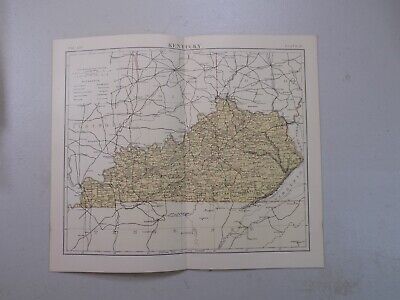
VA, WV, KY, TN
-
Entire US
-
United States (1900-Now)
-
United States (Date Unknown)
-
Africa
-
Asia
-
Australasia/ Oceania
-
Canada
-
Central America/ Caribbean
-
Europe
-
India
-
Ireland
-
Mexico
-
Middle East
-
North America
-
South America
-
United Kingdom
-
Maps on CD
-
World Maps
-
Globes
-
Mixed Lots
-
Reproductions
-
Price Guides & Publications
-
Other
|
In
Order by: Available to: This site contains affiliate links for which I may be compensated
|
Buy It Now
$46.45 Shipping Location: Vero Beach, United States Slight damage One corner is torn completely off and there are 2 small tears in the edging not affecting the original art Original 1838 Antique Map KENTUCKY ... moreAlBy Bradford Authenticity. Guaranteedcertificate of AuthenticityPrice is reflecting damage 22 inches x 19 inches
Buy It Now
Free Shipping Location: Augusta, United States "An Authentic Original Map Not A Reproduction".
Buy It Now
$4.55 Shipping Location: Oakland, United States This antique map from 1914 depicts the city of Louisville, Kentucky in stunning detail. Measuring 11x15 inches, it is a beautiful piece that would make ... morea great addition to any collection. The map showcases the city's layout, including its streets, buildings, and landmarks. It also includes some interesting historical details, making it a fascinating glimpse into the past. This map is perfect for those who are interested in the history of Louisville, Kentucky, or for collectors of antique maps or Americana. It is in excellent condition and has been well-preserved over the years. Don't miss out on the opportunity to own this unique piece of history!
Buy It Now
$10.20 Shipping Location: Tonawanda, United States Includes Counties, County Seats, Cities; many Small Towns and Villages; Ports, Military Airfields and Forts; Rivers, Streams, Lakes, Mountains, and other ... moretopographical features are located on this map.
Buy It Now
$6.35 Shipping Location: Millis, United States 1931 Map of Kentucky. Date: 1931, Frankfort, KY. With a magazine that was published until 1936, they made efforts to promote Kentucky throughout the rest ... moreof the country. Stapled hinges are very tender.
Buy It Now
$4.55 Shipping Location: Oakland, United States This antique map of Kentucky from 1923 is a true gem for collectors and lovers of vintage maps. Measuring 9x6 inches, it features intricate details of ... morethe state's geography, including cities, rivers, and mountains. The map is in excellent shape and has been well-preserved over the years.Whether you're a history buff, a cartography enthusiast, or simply looking for a unique piece of decor, this antique map is sure to impress. It makes a great addition to any collection, and its compact size makes it easy to display on a desk, shelf, or wall. Get your hands on this beautiful piece of Kentucky history today.
Free Shipping Location: Schertz, United States This antique original map from 1855 showcases the US States of Iowa, Tennessee, Kentucky, and Ohio in a size of 9 1/2 x 11 1/2. The map was created by ... morethe cartographer/publisher Daniel Burgess and is in the format of an atlas map. It is a great addition to any collection of North America maps or antiques. The map is dated 1855 and portrays the region of the United States of America.
Buy It Now
Free Shipping Location: Savannah, United States Original 139-year-old Antique Map of Kentucky and Tennessee Drawn & Engraved by L.B. Folger for the 1885 Edition of The People's Cyclopedia of Universal ... moreKnowledge: A Compendium of Invaluable Reference in all Departments of the Arts and Life; Illustrated with More than Five Thousand Engravings and Over One Hundred Color Maps of Each State, Principal City, and Territory of the United States, Continents, and Countries Across the Globe. Intricate Detail of County Boundaries, Cities, Towns, Railroads, along with Rivers, Lakes, and other Natural Landmarks. Fine Map for the Collector or Historian. Great for American History and Family Genealogy. Makes an Imaginative and Creative Gift. Easily Framed.
Buy It Now
$4.55 Shipping Location: Oakland, United States This antique map from 1908 showcases the beautiful state of Kentucky. The intricate detail and historical value make it a must-have for any map collector ... moreor Kentucky enthusiast. The map measures 6x8 and is in excellent condition for its age, with no notable flaws or damage. Featuring counties, cities, and railroads, this antique map is a unique piece of history that captures the spirit of Kentucky in the early 1900s. It would make a great addition to any home, office, or collection. Don't miss out on the opportunity to own this rare piece of Kentucky's past.
Buy It Now
Free Shipping Location: Augusta, United States This 14 1/2" x 11" map is in VERY GOOD+ condition with very light tone, soil and edge wear, from a disbound Cram's atlas ©1892. "An Authentic Original ... moreMap Not A Reproduction".
Free Shipping Location: Schertz, United States This is an authentic 1863 map that showcases Kentucky and Tennessee. The map measures 18x26 and features hand-tinted highlights, making it a true antique ... moreoriginal. The cartographer and publisher of this map is Johnson & Ward. For those interested in its age, this map is over 160 years old. The title page is not included, and is for reference purposes only. Free shipping is available in the US, and international shipping will be calculated accordingly. Views of the Mammoth Cave entrance & the Navy Yard in Memphis.
Buy It Now
$3.85 Shipping Location: Franklin, United States This vintage 1956 map of Kentucky, measuring 30x15 inches, is an original piece from the US Department of Interior. Featuring geological details, this ... moresheet map is a great addition to any antique map collection. The map showcases the state of Kentucky in the United States of America, and is perfect for those interested in history and geography. Whether you're a collector or simply looking to decorate your home, this rare find is a must-have.

Buy It Now
Free Shipping Location: Perryville, United States 1856 Colton Map of Kentucky and Tennessee WE SELL ONLY ORIGINAL ANTIQUE MAPS- NOT REPRODUCTIONS Title: Kentucky And Tennessee. Description: An excellent ... more1855 first edition example of Colton's map of Kentucky and Tennessee. Like most of Colton's state maps. This map was derived from an earlier wall map of North America produced by Colton and D. Griffing Johnson. Covers the both Kentucky and Tennessee in full as well as parts of the adjacent states. This map was issued at the height of the American westward expansion. Six years before this map was drawn the California gold discovery of 1849 enticed thousands to embark upon the rigorous transcontinental emigration. Meanwhile, with the rise in territorial population to the west of the Mississippi, the eastern states were becoming increasingly divided over the issues of slavery and state vs. federal sovereignty. Within five years these disputes would lead to the American Civil War. Although many major Civil War battles were fought in Tennessee, Kentucky officially remained'neutral' throughout the war. This map also identifies various forts, rivers, mountain passes, fords, and an assortment of additional topographical details. Map is hand colored in pink, green, yellow and blue pastels to define state and territorial boundaries. Surrounded by Colton's typical spiral motif border. Dated and copyrighted to J. H. Colton, 1855. Published from Colton's 172 William Street Office in New York City. Issued as page no. 38 in volume 1 of Colton's 1856 Atlas of the World. Size: Printed area measures 14 inches high by 17.5 inches wide. Condition: Very good. Blank on verso. Even overall toning. Shipping: Items are shipped within three business days of receiving payment. We are happy to consolidate shipping where possible. The following shipping options are available: 1. USPS Domestic Express Mail(25 USD) USA Only. 2. USPS Priority Mail(12 USD) USA Only. 3. USPS International Express(35 to 55 USD) Recommended service for all international parcels. 4. USPS
Buy It Now
$6.90 Shipping Location: Audubon, United States It is an old, original map that was rescued from an unusable atlas. You will receive the exact antique map in the photos. Condition is very good, age ... moreconsidered. This map would look great displayed in any room.
Buy It Now
$5.95 Shipping Condition: New Location: Las Vegas, United States “Vibrant and bright! Pic does not do it justice.looks amazing!”. Each of our prints are custom reproductions printed on 68lb Heavyweight Enhanced Matte ... moreArt Paper. These Historic Art Prints are suitable for framing, mounting or direct display on any wall!
Buy It Now
$5.00 Shipping Location: Nashville, United States Up for sale is an original antique 1888 map of KENTUCKY. Removed from an antique 1888 Alden’s Atlas.
Buy It Now
Free Shipping Location: Schertz, United States This Map was removed from an 1857 COLTON ATLAS and is in good acceptable condition. The map is not " new " or in " new " condition, it was printed in ... more1857. The map is dated. Study the photos carefully, this is the actual map you will receive.
Buy It Now
$4.95 Shipping Location: Willow Grove, United States
Buy It Now
Free Shipping Location: Schertz, United States This authentic Mitchell Atlas map from 1887 features the US states of Kentucky and Tennessee. The antique original map is over 130 years old and has a ... moredouble-page size of 15x23. The hand-tinted highlights add to the map's visual appeal. The cartographer/publisher of the map is M. Bradley and S. A. Mitchell. The map comes with free S&H within the USA, while the S&H worldwide is calculated. Please note that the book cover shown in the image is only for reference purposes.
Buy It Now
Free Shipping Location: Monroeville, United States Fine Adornment of Tennessee& Kentucky History. Impressive on Any Home or Office Wall. Imaginative Gift. 1882 Map of Kentucky& Tennessee Fine Phillips& ... moreHunt Map. Engraved by E.F. Fisk. Original 1882. 131-ys-old. Map is in Very Good/Excellent condition: No marks. Writings, rips, tears, fraying, or foxing. Single fold as Issued. Not a Reproduction. Original Map Drawn& Engraved by E.F. Fisk for Phillips& Hunt's 1882 Edition of The People's Cyclopaedia of Universal Knowledge. Published by Phillips& Hunt, New York& San Francisco, and Jones Brothers& Company of Cincinnati& St. Louis; William H. Depuy, Editor. E.F. Fisk, Engraver, 1882; a copy of the Title Page of which is Included. An Exceptionally Fine Map for the Collector or Makes Quite an Impressionable Gift for Someone Living in or From Tennessee or Kentucky. I Sell Only Original Maps: No copies or reproductions. Press Here to View My Collection. Impressive On Any Home or Office Wall Dimensions: 10.5" x 13.25" Intricate Detail. Exceptional Color. Handsome Map. 1882 County Populations Listed on Reverse. Great for Family History/Genealogy as Map Shows Towns& Landmarks of 1882. Some of Which No Longer Exist Today. Fine Adornment of Kentucky& Tennessee History. The Auction is for the Map Itself. A Frame is Not Included. The Framed Map Pictured is a Personal 1882 Phillips Hunt Map Featured to Show the Beauty of the Maps when Framed. Free Shipping Special. All Credit& Debit Cards and Electronic Checks Accepted Through Paypal. Please email with any questions. Imaginative& Creative Birthday. Christmas, Graduation. Or Other Special Occasion Gift. Greetings from Historical Savannah. Georgia; founded 1733. Some. To beautify their halls, parlors, chambers, or libraries.loveth, getteth, and useth maps, charts, geographical globes. John Dee. Advisor to Elizabeth I. Press The Link Below To View My Collection. Powered by The free listing tool. List your items fast and easy and manage your active items.
Buy It Now
$6.00 Shipping Location: Corunna, United States This map is from Mitchell's New General Atlas published in Philadelphia 1864. This is an original 160 year old map, not a copy or reprint.

$6.00 Shipping Location: Corunna, United States Click to Enlarge Click to Enlarge Click to Enlarge This is an original antique map of Kentucky showing the towns with banks within the state. This map ... moreis printed in color with advertising for the Bankers Register printed on the verso. This map measures about 16.5” x 11.5” and is printed“ Copyright 1907. By J.W. White– O Indicates Location Of Bank Towns” This map has small red circles on each town with a bank in the state. This map came with other similar maps for other states which also showed the location of bank towns within the respective states. I believe this map was part of an bankers’ atlas or portfolio of maps showing bank towns that was originally published by the Bankers Register. This colorful map is an original antique published 105 years ago in very good condition and is very suitable for framing or display. Email any questions. Thanks for looking. Please see the Maps category in my eBay store for more maps including antique Bank Town maps for other states. Payment Terms Winning bidders will receive an email at the end of the auction explaining the option for paying with Paypal. If you have questions about how to pay for this item please let me know. If you made multiple purchases for a single shipment contact us for combined shipping charges which will normally be less than the amount shown on Paypal invoice. You will receive an email notifying you when your item ships. Buyers outside the USA. Please provide a telephone number for customs forms. Shipping Terms Please click on the Shipping& Payment tab above to access the eBay shipping calculator which will give you the options and costs for shipping your item depending on your zip code or country. Our shipping charges are based on actual postage plus less than one dollar to cover materials and handling. This also includes Delivery Confirmation on all domestic shipments. All items are professionally packed and well protected for shipment. All paper items are shipped in a plastic archival sleeve with rigid backing and marked"DO NOT BEND"
Buy It Now
$9.00 Shipping Location: Cambridge, United States Original print from "Hammond's Standard Atlas and Gazetteer Of The World" Hardcover first edition book 1938. Great antique condition with less than typical ... morepaper wear. One edge is raw cut. Opposite side may or may not have prints or text which may or may not be related to one shown.
Buy It Now
$6.00 Shipping Location: North Wales, United States 18 ANTIQUE CRAM ATLAS MAP OF KENTUCKY-UNITED STATES-EXCELLENT DETAIL ORIGINAL ANTIQUE ATLAS MAP PLEASE SEE PHOTOS AS PART OF THE DESCRIPTION CONDITION: ... moreMAP IS IN GOOD CONDITION. SIZE: APPROXIMATELY 14" X 21" SHIPPING: U.S. FIRST CLASS RATE - $7.00 - ANY ITEM WHICH SELLS FOR OVER $100 WILL REQUIRE INSURANCE WE COMBINE SHIPPING FOR MULTIPLE WINS. THANK YOU FOR YOUR INTEREST IN OUR AUCTIONS!.
Buy It Now
$7.00 Shipping Location: North Wales, United States 1849 SMITH'S GEOGRAPHY ATLAS MAP-KENTUCKY, TENNESSEE-UNITED STATES-HAND COLORED ORIGINAL ANTIQUE ATLAS MAP PLEASE SEE PHOTOS AS PART OF THE DESCRIPTION ... moreCONDITION: MAP IS IN GOOD CONDITION. SIZE: APPROXIMATELY 14" X 21" SHIPPING: U.S. FIRST CLASS RATE - $7.00 - ANY ITEM WHICH SELLS FOR OVER $100 WILL REQUIRE INSURANCE WE COMBINE SHIPPING FOR MULTIPLE WINS. THANK YOU FOR YOUR INTEREST IN OUR AUCTIONS!.
Buy It Now
Free Shipping Location: Schertz, United States This Map was removed from a 1959 Picture Map Geography of the USA and is in very good condition. The map is not " new " or in " new " condition, it was ... moreprinted in 1959. The map is not dated. Study the photos carefully, this is the actual map you will receive.
Buy It Now
Free Shipping Location: Willow Grove, United States This is a KENTUCKY map taken from a 1920s atlas that indicates the Interurban Electric Railway Lines in red. O n the reverse side of this map page is ... morea similar map of Tennessee. (different orientation).
Buy It Now
Free Shipping Location: Augusta, United States This 14 1/2" x 11" map is in FINE condition with very light soil and edge wear, from a disbound Cram's atlas ©1892. "An Authentic Original Map Not A Reproduction".
Buy It Now
$6.90 Shipping Location: Audubon, United States Condition is very good, age considered. This map would look great displayed in any room.
Buy It Now
Free Shipping Location: Savannah, United States Original 126-year-old Antique Map of Kentucky and Tennessee Drawn and Engraved for the 1898 Edition of The Columbian Atlas of The World, Featuring Large ... moreScale Color Maps of Each State, Principal City, and Territory of The United States, the Provinces of Canada, Every Country, Nation, Sovereign Kingdom, and Civil Division Upon the Face of the Globe; Accompanied by a Margin Reference Index of County, City, and Town populations of the 1890 US Census; Together with a Concise History of Earth's Peoples richly Illustrated with Engravings. Intricate Detail of County Lines, Towns, Railroads, along with Rivers, Lakes, and Natural Landmarks. Fine Map for the Historian or Collector. Great for American History and Family Genealogy. Makes an Imaginative and Creative Gift. Easily Framed.
Buy It Now
$7.00 Shipping Location: Jacksonville, United States 1849 Samuel Augustus Mitchell antique map of Kentucky with Insets of Falls of Ohio & Lexington with surrounding environs. A beautiful and colorful map ... morefrom the Mitchell General Atlas, published in 1849.
$9.50 Shipping Location: Livingston, United States The map showcases the two states with intricate details of their cities and regions, including Nashville. Lithography was used as the printing technique ... morefor this atlas map, which is an original antique reproduction from the 19th century.
Buy It Now
$6.95 Shipping Location: Dover, United States Original mid- 19th century wax engraved (cerographic) gazetteer map with lovely hand color. Text on reverse as always, the only way to own this map. A ... moresuperior visual example of a map rarely encountered with such pleasing hand color.
Buy It Now
$4.00 Shipping Location: United States Superb, circa 1890, possibly earlier, antique large color lithographed map, titled Kentucky and Tennessee Western Half. Superb color lithography, printed ... moreon thick paper, with fine colors. Very detialed period map.
Buy It Now
Free Shipping Location: Monroeville, United States Date - 1883. Condition - Quite Nice, a very light blank border damp stain, not into map image. Source - Hardesty’s Historical and Geographical Encyclopedia ... moreIllustrated.
$6.00 Shipping Location: Blue Bell, United States THIS MAP IS IN GOOD CONDITION BY RAND MCNALLY. CONDITION: MAP IS IN GOOD. OVER 100 YEARS OLD! Over 100,000,000 served. MULTIPLE WINS.
Buy It Now
$5.00 Shipping Location: League City, United States This map has been carefully removed from the atlas it originally appeared in and is perfect for display purposes. It may have writing or other images ... moreon the reverse side of it. It is in very good condition for its age with overall tonal aging and yellowing on the edges.
Buy It Now
Free Shipping Location: Augusta, United States This 14 1/2" x 11" map is in VERY GOOD+ condition with light tone and soil, from a disbound Cram's atlas ©1900. "An Authentic Original Map Not A Reproduction".
Buy It Now
$4.00 Shipping Location: Harborton, United States This is an antique Louisville map which was carefully removed from an atlas published in 1921.
Buy It Now
Free Shipping Location: Augusta, United States "An Authentic Original Map Not A Reproduction".
Buy It Now
Free Shipping Location: Augusta, United States This 14 1/2" x 11" map is in VERY GOOD condition with light tone, soil, and edge wear, from a disbound Cram's atlas ©1891. "An Authentic Original Map ... moreNot A Reproduction".
Buy It Now
Free Shipping Location: Sayville, United States
Buy It Now
$4.95 Shipping Location: Alfred, United States 12" x 15". Good condition.
Buy It Now
$4.95 Shipping Location: Willow Grove, United States This is an ORIGINAL early 1920s Kentucky map taken from a 1920s atlas. There is a color map of Kentucky on the reverse side of this map page.
Free Shipping Location: Schertz, United States This antique map of Louisville is a piece of original history that is over 140 years old. The page measures 14x17 inches and features hand-tinted highlights. ... moreIt was created by cartographer O. W. Gray and published by Milton R. Brown. The map is an authentic piece from the 1875 National Atlas and is in good condition. The title page and book cover shown are for reference purposes only. Free shipping is available within the USA, and shipping costs will be calculated for worldwide orders.
Free Shipping Location: Schertz, United States This piece was removed from an 1862 JOHNSON ATLAS and is in good condition. The map is not " new " or in " new " condition, it was printed in 1862. The ... moremap is not dated. Study the photos carefully, this is the actual map you will receive.
Buy It Now
Free Shipping Location: Schertz, United States This antique map from 1867 by A.J. Johnson features Kentucky and Tennessee and is over 150 years old. The double-page measures 18x26 inches and is an ... moreauthentic original from the post-Civil War era. The map is shipped free within the USA and worldwide shipping is calculated at checkout.
Buy It Now
Free Shipping Location: San Antonio, United States This Map was removed from a 1882 Atlas and is in good acceptable condition. This map is not new or in new condition, it was printed in 1882. pencil marks ... more& brittle paper from over 140+ years of aging.
Buy It Now
$4.55 Shipping Location: Oakland, United States 12x10 inches This antique multicolor map from 1885 showcases the states of Michigan, Wisconsin, Illinois, Ohio, Kentucky, and Indiana. The map features ... moreintricate details of the various counties, cities, rivers, and lakes in the region. It is a great addition to any collection of antique maps and will surely be the centerpiece of any room.The map is a true testament to the craftsmanship of the cartographers of that era and is in excellent shape for a piece of its age. It will be shipped to you with the utmost care to ensure that it reaches you in the same condition as it left our warehouse. Add this beautiful piece of history to your collection today!
Buy It Now
$4.55 Shipping Location: Oakland, United States This antique map from Rand McNally & Co. is a beautiful piece of history, depicting the states of Tennessee and Kentucky in 1904. The intricate details ... moreand accuracy of the cartography are impressive, making it a valuable addition to any antique map collection. The map measures 7x6 inches and is in excellent condition, with no tears or significant wear and tear. The colors are still vibrant and the lines are clear, making it easy to read and appreciate. This is a wonderful opportunity to own a piece of America's past, and it would make a great gift for any history or map enthusiast.
Buy It Now
Free Shipping Location: Augusta, United States This 14 1/2" x 11" map is in VERY GOOD condition with light tone, soil, and edge wear, from a disbound Cram's atlas ©1891. "An Authentic Original Map ... moreNot A Reproduction".
Free Shipping Location: Schertz, United States This Map was removed from a 1902 CRAM'S ATLAS and is in very good condition. The map is not " new " or in " new " condition, it was printed in 1902. The ... moremap is not dated.
Buy It Now
Free Shipping Location: Grapevine, United States Beautiful large color map ready for framing or gift presentation. Size: 11" x 14". We will be prompt in replying.
Buy It Now
Free Shipping Location: Schertz, United States This authentic atlas map from 1892 measuring 14x21 inches. Created by cartographer George Cram and published during the late 19th century, this antique ... moreoriginal is a unique piece of history. The map is not *new* or in *new* condition, it was printed in 1892. View photo for best description. The map showcases the boundaries, cities, and topography of the region, providing a glimpse into the past. Ideal for collectors of North America maps or antique maps, this piece would make a great addition to any collection. Its format as an atlas map allows for easy referencing and studying of the territory. Free USA shipping and handling are included in the purchase of this item.

$19.00 Shipping Location: Newtown, United States Click to Enlarge Click to Enlarge 1871 ORIGINAL. ANTIQUE MITCHELL MAP. ENGRAVED. COUNTY MAP OF TENNESSEE& KENTUCKY. DRAWN AND ENGRAVED BY W.H. GAMBLE ... moreOF PHILADELPHIA. BEAUTIFUL MAP FROM MITCHELL'S NEW GENERAL ATLAS. QUITE DETAILED. SHOWING CITIES AND TOWNS AND RAILROAD LINES, AS WELL AS GEOGRAPHIC FEATURES. MAP WRAPPED IN A"GRAPE-VINE" BORDER, WITH PLENTY OF MARGIN SPACE FOR MATTING AND MOUNTING WHEN FRAMED. Size: Approx 12.25 X 15.25 INCHES. INCLUDING MARGINS. TEXT AT LOWER MARGIN: ENTERED ACCORDING TO ACT OF CONGRESS IN THE YEAR 1870 BY S. AUGUSTUS MITCHELL IN THE CLERK'S OFFICE OF THE DISTRICT COURT FOR THE EASTERN DISTRICT OF PENNSYLVANIA. Condition: VERY GOOD. SEE PHOTO. SINCE THIS MAP IS OVER 139 YEARS OLD. IT IS NORMAL FOR IT TO EXHIBIT SOME FLAWS AS COMMENSURATE WITH AGE: SOME TANNING OF EDGES(MARGINS) A FEW FOX SPOTS CAN ALSO BE SEEN IN MARGINS. AMPLE MARGINS FOR MATTING& MOUNTING. LOVELY& AUTHENTIC PIECE OF HISTORY. Please view the photo to make your own assessment. Returns: Any item may be returned for a refund. Please contact us within 7 days of receipt of your item if you feel an error has been made. We combine shipping. Additional items in the same order are shipped free of charge. We do not deal in modern reproductions. All of our prints& maps are original and authentic. Please browse other prints at our store. Visit My eBay Store inkfrog terapeak. I000000.
Buy It Now
$5.95 Shipping Location: Woodstock, United States It is an antique lithograph of a political map of the eastern section of the Central States of the U.S. including Illinois, Indiana, Ohio, and Kentucky. ... moreThere is a map of the city of Cincinnati which is an inset at the bottom right hand corner and a map inset of the city of Chicago at the bottom left hand corner.
Buy It Now
Free Shipping Location: San Antonio, United States This Map was removed from a 1882 Atlas and is in good acceptable condition. This map is not new or in new condition, it was printed in 1882. pencil marks ... more& brittle paper from over 140+ years of aging.
Buy It Now
Free Shipping Location: Augusta, United States This 14 1/2" x 11" map is in VERY GOOD condition with light soil and edge wear, from a disbound Cram's atlas ©1893. "An Authentic Original Map Not A Reproduction".
Buy It Now
Free Shipping Location: Augusta, United States This 14 1/2" x 11" map is in NEAR FINE condition with very light tone and soil, from a disbound Cram's atlas ©1900. "An Authentic Original Map Not A Reproduction".

Buy It Now
$5.00 Shipping Location: Canada 1917 MAP OF KANSAS/ KENTUCKY ON REVERSE SIDE This original antique map gives you an opportunity to examine in exquisite detail a piece of history. If ... moreyou are interested in the past of this country and its people or have a desire to study where your family may have come from. Then this map gives you a rare look as the area was about 95 years ago. Once matted and framed, this map would make a perfect gift for a family member or friend they'll cherish forever. Origin of the map: New Standard Atlas of the United States" Published by National Map Company, Indianapolis- New York, USA. Date of issue: 1917 Size: The sheet measures 15" x 11 1/4" 38 x 29 cm) S/H: The map will be shipped by Air Mail. The shipping charge is: USA- 8.00 USD. Canada/World- 9.00 USD. The price includes the insurance and a strong, cardboard tube with plastic plugs. Attention! There is no additional shipping charge for multiple purchases! Pay me securely with any major credit card through PayPal! Payment methods: US/Canada Buyers: Paypal. International Buyers: Paypal. Click Here. Double your traffic. Get Vendio Gallery- Now FREE!
|
|
|
In
|
Original 1903 Antique Britannica Map KENTUCKY & TENN
Auction Wizard 2000 Listing Template- AW2KLOT#5017 tincuptom Auctions Original 1903 Antique Britannica Map KENTUCKY& TENN Original 1903. not a reproduction. From the Encyclopaedia Britannica Great Condition No printing on the reverse side. Double-page map.Map measures approximately 10 1/2 x 15 inches. The USA Shipping is First Class mail. View my other listings for more antiques. Shipping and handling in the USA is $0.00. Payments are due in 7 day. You may pay by Paypal only. Please E-mail for International Shipping rates.
|
|
|
Large Antique Color 1865 Johnson's Map Kentucky & Tennessee
WELCOME TO BEANSANTIQUES We are proud to announce that we are ebay.ca's winner of the 2010 Family Business Of The Year If photos do not download for you. Please let us know and we will email them to you directly. We are offering to you a lovely antique map. This great antique map is a Johnson's of New York map titled; Kentucky& Tennessee It is about 18" x 26.5" A lovely color and would look just great in a frame. Dated 1865 In good shape with normal age wear and toning. A crease in the center, some minor stains. Published by A J Johnson on New York. A very rare old piece that will look wonderful in a frame We recently bought a collection of maps that all came out an 1870 Johnson's map book/atlas. These maps were mounted with paper hinges so they could be removed from the book. There is some of the hinge paper still ... moreattached on the back at the center fold. Has printed pages on the back. This printing does not show through the map. See our other listing to see all of these wonderful pieces. No additional shipping charges for multiple purchases. You only pay for shipping one piece no mater how many you buy and have shipped at the same time. This piece will be rolled lightly and placed in a box for shipping A great addition to your collection! Any questions please email. Check our other listings to combine shipping. We NEVER CHARGE a handling fee just actual mailing costs through Canada Post. We mail next day after payment. Why drive all over when you can get i t here! and have i t delivered to you. Please consider the photos to be part of the description. SHIPPING: We invite you to click on this link to see our shipping info and our GUARANTEE to you SHIPPING& GUARANTEE This link will also show you who we are and what we do Cost is actual mailing. WE DO NOT CHARGE A HANDLING FEE. We do professional packing on site and this is FREE to you. We as the Seller. TAKE RESPONSIBILITY FOR ANYTHING DAMAGED in transit. This is absolutely not your job. Refunds come directly from us. Please check our
|
|
|
1893 Antique Map Kentucky & Tennessee Nashville Memphis
Lake Erie Maps& Prints An Authentic Antique Map: Not a Modern Reproduction! Free Shipping on Purchases of 5 or More Maps or Prints See our Gallery Below and Store Listings for more Great Antique Maps! Description: It is an authentic engraved antique map over117 years old from the Columbian World's Fair Atlas published in Chicago by the World's Fair Atlas Company in 1893. The maps were designed by the Chicago publisher George Cram. A copy of the Atlas title page is included for authenticity. It is being sold as a single sheet. Not mounted, matted nor framed, basically as seen in the pic, photographed against a dark background so you can see all the edges and actual condition. It is a steel engraved map with ceragraphic color. There is a similar map of Ohio on the reverse. Size: The map image measures approximately 9 by 12 1/2(22x30cm) ... moreinches on a 11 by 13 1/2" 28x34cm) page with a margin all around for matting. As seen in the main pic. Condition: It is in Good condition for its age with light tonal ageing and darkening around the edges as seen. It is basically as seen in the pic. There are a couple of short edge tears in the upper left margin. One repaired archively. Other than a couple of light stains in the upper corners as can be seen in the pic, it is very clean and would frame up well. See the pic of the actual map for a better idea of the actual condition. Payment Details: We accept most major credit cards through Paypal and Ebay. Please ask if you have any questions about payment. International and New Bidders are welcomed and encouraged. Payment is expected within 7 days. After which Nonpaying Bidders will be reported to Ebay to recoup our listing fees. Shipping: $2.90 for First Class or $4.95 for Priority Mail with Delivery Confirmation in the USA; $4.95 for First Class International to Canada; $8 for International Airmail elsewhere in the World. We ship daily. So if still bidding send us a quick email to hold or better just pay all at once at the end. Save on Shipping: We only charge one
|
|
|
Antique Map of KENTUCKY and TENNESSEE Vintage 1886 Atlas Map BEAUTIFUL
Be sure to add me to your! This is an original. Not reproduction, vintage map of Kentucky and Tennessee which was carefully removed from an atlas. This map measures approximately 9" by 13" and is in very good condition. Notice that the map extends to the edge on both sides. Your item will be packaged in a plastic sleeve. With a thin piece of backing, then in a manila envelope with a very stiff and thick piece of cardboard or in a cardboard mailing tube. We happily combine purchases to save on shipping fees. Please email with questions. We will answer your email promptly! Please visit our ebay store. Plaindealing Vintage Paper. We have stocked it with thousands of vintage advertisements, prints, and historical articles. Check out my! Powered by The free listing tool. List your items fast and easy and manage your active items.
|
|
|
KENTUCKY & TENNESSEE 1895 Antique State Map - 117 Year Old
Method of payment Kentucky& Tennessee 1895 Antique Color State Map- 117 Year Old This is an original color map- 117 years old. 1895 Year date printed on map. It is not a reproduction. Map measures approximately 11" x 8" Great list of of cities& counties on reverse The digital image does not capture all of the detail in the engraving. Other 1895 maps are also available Condition: It is in very good condition with very minor handling wear. Shipping costs: Shipping costs on this item are $2.95. P/H combined for additional maps mailed at the same time. My shipping costs are calculated on three factors- getting your item to you as quickly as possible. As cost effectively as possible, and as safely as possible. I pride myself in providing optimal protection. I use First Class mailing tubes for most maps. You may request expedited ... moreshipment if you are willing to pay costs. Buy additional maps and save on P/H. Item P0212R-968
|
|
|
Louisville Kentucky city plan c.1875 Colton antique detailed hand color map
Louisville Kentucky city plan c.1875 Colton antique detailed hand color map City of Louisville. Kentucky Issued c.1875. NY by J.H. Colton or Mitchell( Fine original antique lithographed city plan. Printed in the mid-19th century. On quality paper which retains its inherent structural flexibility and soundness. Original hand color. Map is very detailed for this date. In near VG or better condition. Light minor age wear, overall very presentable and attractive[note: we grade very conservatively and always seek to disclose any noteworthy flaws] The printed area remains visually pleasing. A fine impression of an interesting antique map which will look nice when displayed. Sheet measures c. 17 1/4" W x 14 1/4" H. Printed area measures c. 15 3/4" W x 11 3/4" H[19405] Any defects along the sheet edges and in the margins may be ... moreseen in the photos. note: All old sheets of printed paper possibly have short edge splits. Each sheet has existed for a very long time and has probably been handled repeatedly in the course of it's existence. It has a history unique to it as an object. Most of the time any edge splits are short. Minor, insignificant and have been closed- either long ago or more recently with small pieces of archival tape. Most often these splits are trivial and easy to overlook visually. Basically, they would not significantly affect the piece adversely. The item is offered as seen. Please look carefully and make your decision knowing this antique image is nice. But it is not in perfect"like new" condition. However, with whatever flaws it possesses, it remains entirely worthy of ownership and inclusion in any related collection. We feel it will prove very pleasing to its new owner. We stand behind everything we sell. Everything we offer is guaranteed to be an authentic original antique item as described. We do not sell modern reproductions. Please visit our. We happily accept PayPal! WE OFFER FLAT RATE
|
|
|
Ohio Kentucky West Virginia Cincinnati nice c.1895 antique folio Civil War map
Ohio Kentucky West Virginia Cincinnati nice c.1895 antique folio Civil War map Atlas to Accompany the Official Records of the Union and Confederate Armies 1861-1865 Plate CXLI GENERAL TOPOGRAPHICAL MAP. SHEET VI(Ohio/ Kentucky/ West Virginia/ Virginia) Etc. Issued Washington. D.C. 1891-95 by the US Government Printing Office. Printed by Julius Bien& Co. Lithographers, N.Y. Published under the direction of Daniel S. Lamont. Secretary of War. Originally issued in the"Atlas to Accompany the Official Records of the Union and Confederate Armies" Which was issued in parts to subscribers over a period of years, but is sometimes found bound up later into atlas volumes. This oversize and attractive lithographed 19th century sheet depicts in great detail the specific events and locations of the Civil War. Astoundingly detailed. With an ... moreemphasis upon precision and accuracy, attempting to capture visually and cartographically the regions and battles depicted. Unlike topographical maps or state maps of the era issued by most cartographers. The underlying premise of these Civil War maps was to depict the cartography as it specifically related to events of the Civil War. Thus, individual battles, small forts, troop movements, local rail lines, panoramic views, etc. are often rendered and explained with precision in a manner quite unique. Also, the very large format of the sheet allows for a level of detail which makes the map perfect for display or study by a Civil War buff, since the detail it contains is to be found almost no where else on this scale. In near VG. Mostly clean condition. Map displays numerous short minor edge-splits in the wide blank margins as well as a large chip at bottom, all of which will disappear once the map is matted for display. Also some light minor age-wear- typical for maps of this era, and in no way offensive or severe. Overall a pleasing example of this interesting map. Which is well worthy of display. Elephant folio sheet measures c. 29 1/2" W x 18 1/2" H. 6464] Any defe
|
|
|
1893 ORIGINAL ANTIQUE CITY MAP OF LOUISVILLE KENTUCKY / MILWAUKEE WISCONSIN
1893 ORIGINAL ANTIQUE CITY MAP OF LOUISVILLE KENTUCKY/ MILWAUKEE WISCONSIN This original antique map gives you an opportunity to examine in exquisite detail a piece of history. If you are interested in the past of this country and its people or have a desire to study where your family may have come from. Then this map gives you a rare look as the area was about 117 years ago. Once matted and framed, this map would make a perfect gift for a family member or friend they'll cherish forever. Origin of the map: International Office and Family Atlas of the World" Published by John F. Waite. Chicago, USA. Date of issue: 1893 Size: The sheet measures 13 3/4" x 11 1/2" 35 x 29 cm) S/H: The map will be shipped by Air Mail. The shipping charge is: USA- 7.50 USD. World- 8.50 USD, Canada- 8.50 USD. The price includes the insurance and ... morea strong, cardboard tube with plastic plugs. Attention! There is no additional shipping charge for multiple purchases! Pay me securely with any major credit card through PayPal! Payment methods: US/Canada Buyers: Paypal. International Buyers: Paypal. Click Here. Double your traffic. Get Vendio Gallery- Now FREE!
|
|
|
Kentucky Tennessee Knoxville Nashville 1879 Black folio antique color map
Kentucky Tennessee Knoxville Nashville 1879 Black folio antique color map KENTUCKY and TENNESSEE Issued 1879. Edinburgh by A& C Black Fine original antique lithographed map. With pleasing lithographic color. Made approximately 130 years ago. Printed in the mid-19th century, on quality paper which retains its inherent structural flexibility and soundness. In VG or better condition. Light suface dusting or small age spotting[note: we grade very conservatively and always seek to disclose any noteworthy flaws] The printed map area remains visually pleasing. A nice impression of an interesting image. Sheet measures c. 17 1/4" W x 12 1/2" H. Engraved area measures c. 15" W x 10 1/2" H. 8591] Any defects along the sheet edges and in the margins may be seen in the photos. note: All old sheets of printed paper possibly have ... moreshort edge splits. Each sheet has existed for a very long time and has probably been handled repeatedly in the course of it's existence. It has a history unique to it as an object. Most of the time any edge splits are short. Minor, insignificant and have been closed- either long ago or more recently with small pieces of archival tape. Most often these splits are trivial and easy to overlook visually. Basically, they would not significantly affect the piece adversely. The item is offered as seen. Please look carefully and make your decision knowing this antique image is nice. But it is not in perfect"like new" condition. However, with whatever flaws it possesses, it remains entirely worthy of ownership and inclusion in any related collection. We feel it will prove very pleasing to its new owner. We stand behind everything we sell. Everything we offer is guaranteed to be an authentic original antique item as described. We do not sell modern reproductions. Please visit our. We happily accept PayPal! WE OFFER FLAT RATE SHIPPING WORLD WIDE! Please request an invoice before paying for multiple items
|
|
|
Kentucky county map 1853 Phelps original antique cerographic map
Kentucky county map 1853 Phelps original antique cerographic map KENTUCKY issued New York: 1853; by Phelps& Fanning Fine original antique cerographic(wax-engraved) printed map. Printed in the mid-19th century on quality paper which retains its inherent structural flexibility and soundness. In Very Good or better condition. Very light foxing, mostly in blank margins, sheet is moderately and evenly age-toned[note: we grade very conservatively and always seek to disclose any noteworthy flaws] Text on verso as issued. The printed area remains pleasing. A nice impression that would look great framed. Sheet measures c. 8 7/8" W x 5 1/2" H. Engraved area measures c. 8" W x 4 5/8" H. 20264] note: All old sheets of printed paper possibly have short edge splits. Each sheet has existed for a very long time and has probably been ... morehandled repeatedly in the course of it's existence. It has a history unique to it as an object. Most of the time any edge splits are short. Minor, insignificant and have been closed- either long ago or more recently with small pieces of archival tape. Most often these splits are trivial and easy to overlook visually. Basically, they would not significantly affect the piece adversely. The item is offered as seen. Please look carefully and make your decision knowing this antique image is nice. But it is not in perfect"like new" condition. However, with whatever flaws it possesses, it remains entirely worthy of ownership and inclusion in any related collection. We feel it will prove very pleasing to its new owner. We stand behind everything we sell. Everything we offer is guaranteed to be an authentic original antique item as described. We do not sell modern reproductions. Please visit our. We happily accept PayPal! WE OFFER FLAT RATE SHIPPING WORLD WIDE! Please request an invoice before paying for multiple items so that we can ensure that you are not overcharged for shipping! To receive our fla
|
|
|
Kentucky Tennessee w/ Nashville, Knoxville c.1895 antique folio Civil War map
Kentucky Tennessee w/ Nashville. Knoxville c.1895 antique folio Civil War map Atlas to Accompany the Official Records of the Union and Confederate Armies 1861-1865 Plate CL GENERAL TOPOGRAPHICAL MAP. SHEET XV(Kentucky/ Tennessee) Etc. Issued Washington. D.C. 1891-95 by the US Government Printing Office. Printed by Julius Bien& Co. Lithographers, N.Y. Published under the direction of Daniel S. Lamont. Secretary of War. Originally issued in the"Atlas to Accompany the Official Records of the Union and Confederate Armies" Which was issued in parts to subscribers over a period of years, but is sometimes found bound up later into atlas volumes. This oversize and attractive lithographed 19th century sheet depicts in great detail the specific events and locations of the Civil War. Astoundingly detailed. With an emphasis upon precision ... moreand accuracy, attempting to capture visually and cartographically the regions and battles depicted. Unlike topographical maps or state maps of the era issued by most cartographers. The underlying premise of these Civil War maps was to depict the cartography as it specifically related to events of the Civil War. Thus, individual battles, small forts, troop movements, local rail lines, panoramic views, etc. are often rendered and explained with precision in a manner quite unique. Also, the very large format of the sheet allows for a level of detail which makes the map perfect for display or study by a Civil War buff, since the detail it contains is to be found almost no where else on this scale. In near VG. Mostly clean condition. Map displays numerous short minor edge-splits in the wide blank margins, all of which will disappear once the map is matted for display. Also some light minor age-wear- typical for maps of this era, and in no way offensive or severe. Overall a pleasing example of this interesting map. Which is well worthy of display. Elephant folio sheet measures c. 29 1/2" W x 18 1/2" H. 6480] Any defects along the sheet edges and in the margins may be seen
|
|
|
Ohio Indiana Kentucky Tennessee Illinois 1853 Burgess antique map hand color
Ohio Indiana Kentucky Tennessee Illinois 1853 Burgess antique map hand color UNITED STATES(Indiana/ Ohio/ Kentucky/ Tennessee/ Illinois) Issued New York. 1853 by Burgess. Attractive mid 19th century antique engraved map. With full original hand color. Nicely detailed, with populations of various regions highlighted- for instance, Indiana has 982,000 which is hard to believe for this date. We also note numerous tiny sailing ships within the water areas, depicting routes of trade(also indicated in the key below the title) In good+ to near VG. Mostly clean condition. Some light age wear and spotting, light surface soiling. Still very attractive- great for framing or display. An uncommon 19th century map. Sheet size c. 9 1/4" W x 11 1/2" H. Image area c. 8 1/2" W x 10 1/4" H. 6671] Any defects along the sheet edges and in ... morethe margins may be seen in the photos. note: All old sheets of printed paper possibly have short edge splits. Each sheet has existed for a very long time and has probably been handled repeatedly in the course of it's existence. It has a history unique to it as an object. Most of the time any edge splits are short. Minor, insignificant and have been closed- either long ago or more recently with small pieces of archival tape. Most often these splits are trivial and easy to overlook visually. Basically, they would not significantly affect the piece adversely. The item is offered as seen. Please look carefully and make your decision knowing this antique image is nice. But it is not in perfect"like new" condition. However, with whatever flaws it possesses, it remains entirely worthy of ownership and inclusion in any related collection. We feel it will prove very pleasing to its new owner. We stand behind everything we sell. Everything we offer is guaranteed to be an authentic original antique item as described. We do not sell modern reproductions. Please visit our. We happily accept PayPal!
|
|
|
Antique 1892 Original Johnson Map KENTUCKY Lexington Frankfort Louisville KY
Fine Adornment of Kentucky History. Impressive on Any Home or Office Wall. Creative& Imaginative Gift. 1892 Johnson Map of Kentucky A.J. Johnson Map. Copper-Plate Engraved. Original 1892. 121-ys-old. Map is in Good/Very Good condition: No marks. Writings, or tears. Mild to No foxing. Single fold as issued. Not a Reproduction. Original Map Expressly Engraved on Copper-Plate for the 1892 Edition of Johnson's Universal Cyclopaedia. A Scientific& Popular Treasury of Useful Knowledge, Frederick F. Barnard& Arnold Guyot, Editors, Published by A.J. Johnson& Co. 1892; a copy of the Title Page of which is Included. Exceptional Map for the Collector or Makes Quite An Impressionable Gift for Someone Living in or From Kentucky. I Sell Only Original Antique Maps: No copies or reproductions. Press Here to View My Collection. Impressive ... moreOn Any Home or Office Wall Dimensions: 10.5" x 13.5" Fine Adornment of Kentucky History. Great for Family History/Genealogy as Map Shows Cities. Towns, Landmarks of 1892, Some of Which No Longer Exist Today. Imaginative& Creative Birthday. Christmas, Graduation. Or Other Special Occasion Gift for Someone Living in or From Kentucky. The Auction is for the Map Itself. A Frame is Not Included. The Framed Map Pictured is a Personal 1892 Johnson Map Featured to Show the Beauty of the Maps when Framed. Free Shipping Special. All Credit& Debit Cards and Electronic Checks Accepted Through Paypal. Maps are mailed within 1-3 days of payment and normally arrive within 3-7 days. Please email with any questions. Copper-Plate Engraved. Intricate Detail. Greetings from Historical Savannah. Georgia; founded, 1733. Some. To beautify their libraries, chambers, parlors, studies.loveth, getteth, and useth maps, charts, geographical globes. John Dee. Advisor to Elizabeth I. Press The Link Below To View My Collection. Powered by The free listing tool. List your items fast and easy and manage your active items.
|
|
|
Louisville Kentucky 1897 Cram antique engraved detailed map
Louisville Kentucky 1897 Cram antique engraved detailed map Louisville Issued 1897. Chicago by Cram Fine original antique map. Printed in the late 19th century, on quality paper which retains its inherent structural flexibility and soundness. Very detailed city plan which shoes the locations of sstreet railroads as well as steam railroads. In near VG or better condition. Light minor age wear, overall very presentable and attractive[note: we grade very conservatively and always seek to disclose any noteworthy flaws] The printed area remains visually pleasing. A nice impression of an interesting antique map which will look nice when displayed. Sheet measures c. 11 1/4" H x 14 1/2" W. Printed area measures c. 9 3/4" H x 11 3/4" W[31015] Any defects along the sheet edges and in the margins may be seen in the photos. note: ... moreAll old sheets of printed paper possibly have short edge splits. Each sheet has existed for a very long time and has probably been handled repeatedly in the course of it's existence. It has a history unique to it as an object. Most of the time any edge splits are short. Minor, insignificant and have been closed- either long ago or more recently with small pieces of archival tape. Most often these splits are trivial and easy to overlook visually. Basically, they would not significantly affect the piece adversely. The item is offered as seen. Please look carefully and make your decision knowing this antique image is nice. But it is not in perfect"like new" condition. However, with whatever flaws it possesses, it remains entirely worthy of ownership and inclusion in any related collection. We feel it will prove very pleasing to its new owner. We stand behind everything we sell. Everything we offer is guaranteed to be an authentic original antique item as described. We do not sell modern reproductions. Please visit our. We happily accept PayPal! WE OFFER FLAT RATE SHIPPING WORLD WIDE! Please requ
|
|
|
Large Antique Civil War Map KENTUCKY Louisville Frankfort Owensboro KY Indiana
Original Plate of"The Official Atlas to Accompany the Official Records of the Union and Confederate Armies. Published by the Resolution of the U.S. Congress of May 19. 1864 as The Official Historical Record of The Civil War, and was Never Openly Sold, but Distributed only to Federal Depositories, University Libraries, Public Museums, various Public& Semi-Public Concerns, And of Which Fewer Than 1.1,000 Complete Atlases Remain. Fine Adornment of Civil War History. Impressive on Any Home or Office Wall. Imaginative& Creative Gift. Civil War Topographical Map of 1865 Kentucky. Indiana, Ohio Showing Parts of Kentucky. Indiana, Illinois, Ohio. Original Plate of The Official Atlas to Accompany The Official Records of The Union& Confederate Armies. 175 Plates Issued in 35 Parts. Part 31. Plate CLI. Original Plate CLI(151) of the ... more175 Issued. Original 1894. 119-ys-old. Map is in Good Condition: No marks or writings. Mild foxing. Some fraying and short closed separation at fold indentation. Single fold as Issued. Not a Reproduction. Original Plate CLI(151) of the 175 Issued of The Atlas to Accompany the Official Records of the Union& Confederate Armies. Commissioneded with a Resolution of Congress of May 19, 1864, Published Under the Direction of the Hon. Daniel S. Lamont, Secretary of War, by Major George B. Davis, Leslie J. Perry, and Joseph W. Kirkley, Board of Publications. Compiled by Calvin D. Cowles, 23rd Infantry, Washington, D.C. Government Printing Office, 1894; a copy of the Preface, Part Volume, Title Page of which is Included. Engraved by Julius Bien& Co. Lithographers. An Exceptional Map for the Collector or Makes Quite an Impressionable Gift for Someone Living in or From Missouri or Illinois. I Sell Only Original Antique Maps: No copies or reproductions. Press Here to View My Collection. Impressive on Any Home or Office Wall. Dimensions: 18" x 29.5" So Large It Makes Itself The Conversation of Any Room. Great For Family History& Geneaology. As Map Shows Towns& Landm
|
|
|
KENTUCKY authentic Antique Map 13x17in genuine 116 years old made in 1897
KENTUCKY Authentic 116-Year-Old Antique Map Large 13 by 17 inches FREE SHIPPING ANYWHERE IN THE USA! Printed in 1897(DATED) This is a beautifully detailed, 116-year-old color map of the State of Kentucky. It measures about 13 by 17 inches(about 32 by 43 cm. and is in Fine condition. This map is very detailed showing topographical features, counties, cities and villages, routes of old railroads(in red) Civil War Battlefields and more. Elevations are shown with contour lines and indications of feet above sea level. Depths of coastal waters are shown in isobars. The entire map is surrounded by an engraved border, typical of finer maps of the period. This is a guaranteed genuine antique map! Perfect for genealogy research or other educational purposes. This map was printed on a single sheet of stock. Hinged in the center and blank on the reverse, ... moreand bound into an antique book on a linen hinge. The coloring on this map is very fresh, and the registration and typography are particularly fine. There are no marks or stains and the paper is clean and not brittle. It is untrimmed. exactly as printed. Highly suitable for framing, it would look gorgeous in your office, den, library or study. It is similar to many of the maps shown in expensive mail-order catalogues, only this is an actual antique, not just made to look like one. NOT a modern copy or reproduction! An excellent investment. This map is certain to appreciate in value over time. Please ask all questions before making your purchase. SAMPLE DISPLAY IDEA SAMPLE DISPLAY IDEA These scans are enlarged to show representative detail. FREE SHIPPING anywhere in the USA by USPS First Class Mail. Priority and Express services also available. Shipped rolled in a sturdy tube. I ship worldwide! ca97e
|
|
|
Antique Civil War Map KENTUCKY TENNESSEE Perryville Lexington KY Nashville TN
Original Plate of"The Atlas to Accompany the Official Records of the Union& Confederate Armies. Published by the Resolution of Congress of May 19. 1864 as The Official Historical Record of The Civil War, and was Never Openly Sold, but Distributed only to Federal Depositories, University Libraries, Public Museums, and Other Public& Semi-Public Concerns, And of Which Fewer Than 1.000 Complete Atlases Remain. A Fine Adornment of Civil War History. Impressive on Any Home or Office Wall. Imaginative& Creative Gift. Map of 1862 Campaign of The Army of The Cumberland Includes Routes of Army of The Cumberland Through Kentucky& Tennessee. Battlefields of Perryville& Baton Rouge. Siege of Washington. Original Plate of The Official Atlas to Accompany The Official Records of The Union& Confederate Armies. 175 Plates Issued ... morein 35 Parts. Part 5. Plate XXIV. Original Plate XXIV(24) of the 175 Issued. Original 1892. 121-ys-old. Map is in Good Condition: No writings. Marks, rips, tears, or foxing. Nominal fraying. Some wrinkling at fold indentation. Single fold as Issued. Not a Reproduction. Original Plate XXIV(24) of the 175 Issued of The Atlas to Accompany the Official Records of the Union& Confederate Armies. Commissioned by a Resolution of Congress of May 19, 1864, and Published Under the Direction of the Hon. Stephen B. Elkins, Secretary of War, by Major George B. Davis, Leslie J. Perry, and Joseph W. Kirkley, Board of Publications. Compiled by Calvin D. Cowles, 23rd Infantry, Washington, D.C. Government Printing Office, 1892; a copy of the Preface, Part Volume, Title Page of which is Included. Engraved by Julius Bien& Co. Lithographers. A Fine Map for the Collector or Makes Quite an Impressionable Gift. I Sell Only Original Maps: No copies or reproductions. Press Here to View My Collection. Impressive on Any Home or Office Wall. Dimensions: 18" x 29.5" So Large It Makes Itself The Conversation of Any Room. Map Reads: Prepared to Exhibit the Campaigns in which the Army of the Cu
|
|
|
Tell City Kentucky 1908 original antique lithograph topographic map
Tell City Kentucky 1908 original antique lithograph topographic map STREAM EROSION- MATURITY: PART OF TELL CITY(KY. IND. Kentucky- Indiana) issued Washington D.C. 1908; for the U.S. Geological Survey Fine original antique color lithograph topographical map. Printed on quality coated paper which retains its inherent structural flexibility and soundness. In Very Good or better condition[note: we grade very conservatively and always seek to disclose any noteworthy flaws] The printed area remains pleasing. A nice impression that would look great framed. Sheet measures c. 10 7/8" W x 8 3/8" H. Engraved area measures c. 8 1/4" W x 6 1/4" H. 36157] note: All old sheets of printed paper possibly have short edge splits. Each sheet has existed for a very long time and has probably been handled repeatedly in the course of it's ... moreexistence. It has a history unique to it as an object. Most of the time any edge splits are short. Minor, insignificant and have been closed- either long ago or more recently with small pieces of archival tape. Most often these splits are trivial and easy to overlook visually. Basically, they would not significantly affect the piece adversely. The item is offered as seen. Please look carefully and make your decision knowing this antique image is nice. But it is not in perfect"like new" condition. However, with whatever flaws it possesses, it remains entirely worthy of ownership and inclusion in any related collection. We feel it will prove very pleasing to its new owner. We stand behind everything we sell. Everything we offer is guaranteed to be an authentic original antique item as described. We do not sell modern reproductions. Please visit our. We happily accept PayPal! WE OFFER FLAT RATE SHIPPING WORLD WIDE! Please request an invoice before paying for multiple items so that we can ensure that you are not overcharged for shipping! To receive our flat rate shipping rates you must re
|
|
|
Kentucky Tennessee Cumberland Polk c.1895 antique copper engraved hand color map
Kentucky Tennessee Cumberland Polk c.1895 antique copper engraved hand color map Map of Kentucky Issued c.1895. New York Fine original antique copper engraved color map. Printed in the late-19th century, on quality paper which retains its inherent structural flexibility and soundness. With original hand color. In near VG or better condition. Light minor age wear, overall very presentable and attractive[note: we grade very conservatively and always seek to disclose any noteworthy flaws] The printed area remains visually pleasing. A nice impression of an interesting antique map which will look nice when displayed. Sheet measures c. 10 3/4" H x 13 5/8" W. Printed area measures c. 9 1/4" H x 11 3/4" W. Original fold line as issued. 36607] Any defects along the sheet edges and in the margins may be seen in the photos. note: ... moreAll old sheets of printed paper possibly have short edge splits. Each sheet has existed for a very long time and has probably been handled repeatedly in the course of it's existence. It has a history unique to it as an object. Most of the time any edge splits are short. Minor, insignificant and have been closed- either long ago or more recently with small pieces of archival tape. Most often these splits are trivial and easy to overlook visually. Basically, they would not significantly affect the piece adversely. The item is offered as seen. Please look carefully and make your decision knowing this antique image is nice. But it is not in perfect"like new" condition. However, with whatever flaws it possesses, it remains entirely worthy of ownership and inclusion in any related collection. We feel it will prove very pleasing to its new owner. We stand behind everything we sell. Everything we offer is guaranteed to be an authentic original antique item as described. We do not sell modern reproductions. Please visit our. We happily accept PayPal! WE OFFER FLAT RATE SHIPPING WORLD WIDE! Please req
|
|
|
Indiana Ohio Kentucky Chicago Louisville 1858 antique engraved color map
Indiana Ohio Kentucky Chicago Louisville 1858 antique engraved color map United States No 9 Indiana. Ohio& Kentucky Issued 1858 Drawn by J. Wells Engraved by J. Minton Fine original antique cerographic map. Printed in the 19th century, on quality paper which retains its inherent structural flexibility and soundness. With original hand color. With 4 insets of urban areas. In near VG or better condition. Light minor age wear and small stitch holes in the bottom blank margin but the image is overall very presentable and attractive[note: we grade very conservatively and always seek to disclose any noteworthy flaws] The printed area remains visually pleasing. A nice impression of an interesting antique map which will look nice when displayed. Sheet measures c. 9" H x 11" W. Printed area measures c. 8 1/8" H x 9 5/8" W. ... more35631] Any defects along the sheet edges and in the margins may be seen in the photos. note: All old sheets of printed paper possibly have short edge splits. Each sheet has existed for a very long time and has probably been handled repeatedly in the course of it's existence. It has a history unique to it as an object. Most of the time any edge splits are short. Minor, insignificant and have been closed- either long ago or more recently with small pieces of archival tape. Most often these splits are trivial and easy to overlook visually. Basically, they would not significantly affect the piece adversely. The item is offered as seen. Please look carefully and make your decision knowing this antique image is nice. But it is not in perfect"like new" condition. However, with whatever flaws it possesses, it remains entirely worthy of ownership and inclusion in any related collection. We feel it will prove very pleasing to its new owner. We stand behind everything we sell. Everything we offer is guaranteed to be an authentic original antique item as described. We do not sell modern reproductions. Please visit our. We happily accept PayPal!
|
|
|
Original Antique Civil War Map KENTUCKY OHIO WEST VIRGINIA Charleston Cincinnati
Original Antique Civil War Map KENTUCKY OHIO WEST VIRGINIA Charleston Cincinnati Original antique lithographed large-format topographical map of parts of Kentucky. Ohio, West Virginia, and Virginia during the War Between the States. The map shows wagon roads. Towns, settlements, railroads, and natural features on a scale of 10 miles to one inch. The scans below give a closer look: The coverage area is centered on the Big Sandy and Guyandotte Rivers and extends from Cincinnati to the Blue Ridge Mountains. The(approximate) longitude and latitude parameters of the map are 80° W to 84°40' W and 36°50' N to 39° N. There's not a single bridge across the Ohio River in the area shown on this map. Among the other named places and features are the Hocking Valley Railroad Newbern Court House Great Level Settlements Paris ... moreSalem Mount Pleasant Hazard Barboursville the Maysville& Lexington Railroad Charleston Pomeroy Camp Dick Robinson Lexington George's Creek Coal Mines the Cincinnati. Hillsborough& Parkersburg Railroad the Great Kanawha River California House Pint Lick Mountain Palestine Burlington Gallipolis Carlisle Georgetown Covington Newport Franklin Furnace Ashland.and hundreds more The overall size is approximately 18-1/2" x 29-1/2" And the map was printed by Julius Bien of New York and published in the Atlas to Accompany the Official Records of the Union and Confederate Armies. 1861-1865. Issued in 1891 by the Government Printing Office, Washington, D.C. and identified as Plate CXLI. This is an original. Authentic antique map, not a reproduction or modern reprint. And it is fully guaranteed to be genuine. It would make a very handsome display in your den or office. It would also make a perfect gift, and we'll include our helpful framing tips for your reference. Condition: This map is in very good condition. Bright and clean, with no marks. Rips, or tears. It is printed on a heavy paper stock, with center fold, as issued, and is blank on the back, with no print
|
|
|
Tennessee & Kentucky c.1885-90 scarce antique Tunison map w/ hand color
Tennessee& Kentucky c.1885-90 scarce antique Tunison map w/ hand color Tunison's KENTUCKY and TENNESSEE Issued Chicago: c.1885-90; by Tunison. Fine original antique lithographed map with full original hand color. Printed on quality paper which retains its inherent structural flexibility and soundness. With vignette views of the state capitol buildings in Frankfort& Nashville. In near VG or better condition. Sheet lightly age toned[note: we grade very conservatively and always seek to disclose any noteworthy flaws] The printed area remains visually pleasing. A nice impression of an interesting antique map. Any minor defects along the sheet edges and in the margins may be seen in the photos. Sheet measures c. 11 1/4" H x 14" W. Engraved area measures c. 9 3/4" H x 12 1/2" W. 18293] note: All old sheets of printed ... morepaper possibly have short edge splits. Each sheet has existed for a very long time and has probably been handled repeatedly in the course of it's existence. It has a history unique to it as an object. Most of the time any edge splits are short. Minor, insignificant and have been closed- either long ago or more recently with small pieces of archival tape. Most often these splits are trivial and easy to overlook visually. Basically, they would not significantly affect the piece adversely. The item is offered as seen. Please look carefully and make your decision knowing this antique image is nice. But it is not in perfect"like new" condition. However, with whatever flaws it possesses, it remains entirely worthy of ownership and inclusion in any related collection. We feel it will prove very pleasing to its new owner. We stand behind everything we sell. Everything we offer is guaranteed to be an authentic original antique item as described. We do not sell modern reproductions. Please visit our eBay Store. We happily accept PayPal! WE OFFER FLAT RATE SHIPPING WORLD WIDE! Please request an invoice befor
|
|
|
1889 Original Antique Map KENTUCKY TENNESSEE listing Population .....
Map lists population and area of state The map measures approx. 3 x 5 inches The map is in fair condition. Clean, no markings and would frame nicely Check out my STORE for a great selection of maps S&H 4.00
|
|
|
Louisville, Kentucky & Indianapolis IN 1892 Cram antique color folio 2-sided map
Louisville. Kentucky& Indianapolis IN 1892 Cram antique color folio 2-sided map LOUISVILLE(Kentucky) Issued Chicago. 1892 by Cram. Attractive late 19th century offset color map. Nicely detailed. With map of Indianapolis. Indiana on verso- as seen in photo) In VG to VG+ condition. Some very gentle toning- mainly to margins and hardly offensive. Otherwise print remains clean and quite well-preserved. Sheet measures c. 11" H x 14 1/2" W. Printed area measures c. 10 1/4" H x 13" W. 5867] Any defects along the sheet edges and in the margins may be seen in the photos. note: All old sheets of printed paper possibly have short edge splits. Each sheet has existed for a very long time and has probably been handled repeatedly in the course of it's existence. It has a history unique to it as an object. Most of the time any ... moreedge splits are short. Minor, insignificant and have been closed- either long ago or more recently with small pieces of archival tape. Most often these splits are trivial and easy to overlook visually. Basically, they would not significantly affect the piece adversely. The item is offered as seen. Please look carefully and make your decision knowing this antique image is nice. But it is not in perfect"like new" condition. However, with whatever flaws it possesses, it remains entirely worthy of ownership and inclusion in any related collection. We feel it will prove very pleasing to its new owner. We stand behind everything we sell. Everything we offer is guaranteed to be an authentic original antique item as described. We do not sell modern reproductions. Please visit our. We happily accept PayPal! WE OFFER FLAT RATE SHIPPING WORLD WIDE! Please request an invoice before paying for multiple items so that we can ensure that you are not overcharged for shipping! To receive our flat rate shipping rates you must request or wait for an invoice. We can no longer refund excess shipping payments if yo
|
|
|
Original 1890 Antique Map KENTUCKY Frankfort TENNESSEE Memphis Knoxville
Fine Adornment of History. Impressive on Any Home or Office Wall. Creative Gift for Someone Living in or From Kentucky or Tennessee. 1890 Map of Kentucky& Tennessee Fine Hunt& Eaton Map. E.F. Fisk Engraved. Original 1890. 122-ys-old. Map is in Good/Very Good Condition: No writings. Marks, fraying, or foxing. Single fold as Issued. Not a Reproduction. Original Map Drawn& Engraved by E.F. Fisk for the 1890 Edition of Hunt& Eaton's People's Cyclopedia. Published by Hunt& Eaton, New York& San Francisco, and Jones Brothers& Company, Cincinnati& St. Louis; W.H. DePuy, Editor; E.F. Fisk, Engraver, 1890: a copy of the Title Page of which is Included. An Exceptional Map for the Collector or Makes Quite an Impressionable Gift for Someone Living in or From Kentucky or Tennessee. I Sell Only Original Maps: No copies ... moreor reproductions. Press Here to View my Collection. Impressive on Any Home or Office Wall. Dimensions: 10.75" x 13.25" 1890 County Populations on Reverse of Map Great for Family History as Map Shows Cities& Towns of 1890. Some of Which No Longer Exist Today. Imaginative& Creative Birthday. Christmas, Graduation, or Other Special Occasion Gift. The Auction is for the Map Itself. A Frame is Not Included. The Framed Map Pictured is a Personal 1890 Hunt Eaton Map Featured to Show the Beauty of the Maps when Framed. Free Shipping Special. All Credit& Debit Cards along with Electronic Checks accepted through Paypal. Please email with any questions. Fine Adornment of Tennessee& Kentucky History. Greetings from Historical Savannah. Georgia; founded 1733. Some. To beautify their halls, parlors, studies, libraries.loveth, getteth, and useth maps, charts, geographical globes. John Dee. Advisor to Elizabeth I. Press the Link Below to View My Collection. Powered by The free listing tool. List your items fast and easy and manage your active items. RcmdId ViewItemDescV4,RlogId p4%60bo7%60jtb9%3Fuk.rp*60%3F3%3Aa%3E-13e064b7df0-0xe1-
|
|
|
1874 Antique Mitchell County Map of Kentucky Tennessee
Title: County Map of Kentucky and Tennessee Date: 1874 Medium: Steel Plate Engraving[with Lithography Transfer] Color: Original Hand Color Dimensions: image(29.5 x 35 cm or 11 5/8 x 13 3/4 inch) paper(31.2 x 38.8 cm or 12 1/4 x 15 1/4 inch) Credits: S Augustus Mitchell Jr. cartographer/publisher) Plate No. 31 from Mitchell’s New General Atlas Condition: The map is in excellent condition(i.e. Strong and bright paper, clear and clean image, original wide margins, vivid colors, no bend, never framed, no bend, no tear, and slight but even age toning- note the excellent condition along the edge of margin for instance) It was printed on high quality heavy wove paper with a blank verso. The map is nearly flawless with no apology. Description: This beautiful and originally hand colored county map of States of Virginia and West Virginia(with grape ... morevine border) was from Mitchell’s New General Atlas published by Samuel Augustus Mitchell Jr. a noted American Map publisher] in 1874 with 1872 copyright entry on the map. Showing the detailed routes of transportation. Moutains, and settlements, each county is nicely delineated with different color. Mitchell Jr. took over this part of his father’s business and started to publish this series of General Atlas in 1861 and updating and re-issuing the same atlas year after year for the next 20 years or so. Thus. It is very interesting to collect them all to show the progression of geographic knowledge and changing of political divide. It will be carefully packaged flat and shipped with insurance(included in the flat shipping and handling fee) for domestic address or airmail for international address. Please note the low starting price with no reserve for this very good collector's item[especially in such nice condition] Happy bidding! Note that this item[and our other antique maps and prints] is absolutely and unconditionally guaranteed[with full 100% money back including shipping/handling and your return postage] to be original[i.e. Not a modern copy or reproduc
|
|
|
1863 Johnson and Ward Antique map of Kentucky and Tennessee
1863 Johnson and Ward Antique map of Kentucky and Tennessee with small illustrations of landmarks hand-colored good c ondition 30" x 15 3/4"
|
|
|
Kentucky Tennessee c.1885 interesting antique printed color state map
Kentucky& Tennessee Issued c.1885. Chicago by Rand, McNally& Company's Fine original antique printed color map. Printed on quality paper which retains its inherent structural flexibility and soundness. In near VG or better condition. Mostly clean and attractive, minor light surface age wear or soiling, sheet uniformly age toned as often seen on old maps, but the image remains clean, presentable and attractive[note: we grade very conservatively and always seek to disclose any noteworthy flaws] Text on verso as issued. The printed area remains visually pleasing. A nice impression of an interesting antique map. Any minor defects along the sheet edges and in the margins may be seen in the photos. Sheet measures c. 21 1/8" W x 14 1/4" H. Engraved area measures c. 19 1/4" W x 12 7/8" H. Original fold line as issued. ... more41277] Guaranteed Authentic! We do not sell modern reproductions. Condition All of our items are original antique pieces and it is important to keep in mind that many of them have been around for 100 years or more. Individual pieces may have seen many owners and been handled many times over the course of their existence and as a result each piece has developed a history of it's own. Short edge splits(often repaired with archival tape) Foxing, discoloration, etc. are all things to expect on items of this type. They rarely distract from the piece and often add to the overall character of the item. Keep in mind when you receive your item that you are not handling a modern copy, you are holding a piece of history, an item that has been around for a very long time and will, with proper care, be around for a long time to come. We try to note any significant flaws in the description, but less noticeable or common characteristics may not be mentioned. As we are a US based company all of our measurements are in Inches. If you need the size in Centimeters please multiply the supplied measurement by 2.53. Payment and Shipping We happily accept PayPal! Payment is appreciated within 5
|
|
|
KENTUCKY authentic Antique Map 12x16in genuine 114 years old made in 1899
KENTUCKY Authentic 114-Year-Old Antique Map Large 12 by 16 inches FREE SHIPPING ANYWHERE IN THE USA! Printed in 1899(DATED 1897) This is a beautifully detailed, 114-year-old color map of the State of Kentucky. It measures about 12 by 16 inches(about 30 by 40 cm. and is in Fine condition. This map is very detailed showing topographical features, counties, cities and villages, routes of old railroads(in red) Civil War Battlefields and more. Elevations are shown with contour lines and indications of feet above sea level. Depths of coastal waters are shown in isobars. The entire map is surrounded by an engraved border, typical of finer maps of the period. This is a guaranteed genuine antique map! Perfect for genealogy research or other educational purposes. This map was printed on a single sheet of stock. Hinged in the center and blank on the ... morereverse, and bound into an antique book on a linen hinge. The coloring on this map is very fresh, and the registration and typography are particularly fine. There are no marks or stains and the paper is clean and not brittle. It is untrimmed. exactly as printed. Highly suitable for framing, it would look gorgeous in your office, den, library or study. It is similar to many of the maps shown in expensive mail-order catalogues, only this is an actual antique, not just made to look like one. NOT a modern copy or reproduction! An excellent investment. This map is certain to appreciate in value over time. Please ask all questions before making your purchase. SAMPLE DISPLAY IDEA SAMPLE DISPLAY IDEA These scans are enlarged to show representative detail. FREE SHIPPING within the USA by USPS First Class Mail. Express and Priority services also available. ca99b
|
|
|
Kentucky Tennessee Memphis Lincoln 1871 Mitchell antique color lithograph map
County mpa of Kentucky and Tennessee Issued 1871. New York by S.A. Mitchell Fine original antique color lithograph map. Printed in the 19th century, on quality paper which retains its inherent structural flexibility and soundness. With original hand color. In near VG or better condition. Light minor age wear but the image is overall very presentable and attractive[note: we grade very conservatively and always seek to disclose any noteworthy flaws] The printed area remains visually pleasing. A nice impression of an interesting and decoratived antique map which will look nice when displayed. Sheet measures c. 12 1/4" H x 15 1/4" W. Printed area measures c. 10 3/4" H x 13 1/2" W. 41400] Guaranteed Authentic! We do not sell modern reproductions. Condition All of our items are original antique pieces and it is important to ... morekeep in mind that many of them have been around for 100 years or more. Individual pieces may have seen many owners and been handled many times over the course of their existence and as a result each piece has developed a history of it's own. Short edge splits(often repaired with archival tape) Foxing, discoloration, etc. are all things to expect on items of this type. They rarely distract from the piece and often add to the overall character of the item. Keep in mind when you receive your item that you are not handling a modern copy, you are holding a piece of history, an item that has been around for a very long time and will, with proper care, be around for a long time to come. We try to note any significant flaws in the description, but less noticeable or common characteristics may not be mentioned. As we are a US based company all of our measurements are in Inches. If you need the size in Centimeters please multiply the supplied measurement by 2.53. Payment and Shipping We happily accept PayPal! Payment is appreciated within 5 days of invoicing. Once payment has been received we do our best to make sure all orders are shipped within two business days and often have them s
|
|
|
1880 Mitchell'sCounty Map of Kentucky and Tennessee (Original Antique Map,Color)
1880 Mitchell's County Map of Kentucky and Tennessee Ex-atlas map by S.A. Mitchell. Published in Philadelphia, from"Mitchell’s New General Atlas" double page map(14 x 21) lithograph with original color. VG+condition. Very detailed and attractive map of the these two states, colored by county,with red outline color denoting the states' borders. Place names, roads, rivers, railway lines as well as topographic detail. Grape and vine leaf border in the later editions of Mitchell's maps. First Class Shipping(US) is free, Priority, Overnight, and First Class International shipping at cost. SEE ALL MY ITEMS: EBAY ADVANCE SEARCH. SELLER, mapseller01. Terms: Domestic and Overseas shipping as per prices listed on bid details. Please note: No refunds on overseas items sent without tracking. We mail within 48 hours of receipt of ... morefunds. Any questions. Please email or you can call: The Map Seller 1-858-571-2031. We only sell maps. Prints and books relating to cartography. We answer all questions in a timely manner. No reproductions unless clearly stated. Additional cartographic materials available at PS Maps.
|
|
|
1914 ANTIQUE DATED MAP OF KENTUCKY
1914 ANTIQUE DATED MAP OF KENTUCKY This original antique map gives you an opportunity to examine in exquisite detail a piece of history. If you are interested in the past of this country and its people or have a desire to study where your family may have come from. Then this map gives you a rare look as the area was about 100 years ago. Once matted and framed, this map would make a perfect gift for a family member or friend they'll cherish forever. Origin of the map: The Century Atlas" Published by The Century Company, New York, USA. Date of issue: 1914 Size: The sheet measures 16" x 11 1/2" 41 x 29 cm) SLIGHTLY BROWNED ALONG THE CENTERFOLD. MINOR REPAIRS ON BACK ON THE MARGINS. S/H: The map will be shipped by Air Mail. The shipping charge is: USA- 7.50 USD. World- 8.50 USD. The price includes the insurance and a strong, ... morecardboard tube with plastic plugs. Canada- the map will be shipped by Air Mail as a Letter. The shipping charge is: 3.50 USD. The price includes a strong, secure envelope. Attention! There is no additional shipping charge for multiple purchases! Pay me securely with any major credit card through PayPal! Payment methods: US/Canada Buyers: Paypal. International Buyers: Paypal. Click Here. Double your traffic. Get Vendio Gallery- Now FREE! 5v.RcmdId ViewItemDescV4,RlogId p4%60bo7%60jtb9%3Fuk%601d72f%2Bkw72shq%3E5v-13eb8fec745-0xf5-
|
|
|
28x17 Antique County Population Map of Tennessee & Kentucky Gray's Atlas 1879
1879 Gray's New Map of Kentucky& Tennessee by Frank A. Gray Measures approx 28.5' x 17.5' Description Very detailed antique map of Ken tucky& T enn. Hand colored to show increases of population per county. In se rt s showing railroad systems and el evations. Published by O.W. Gray& Son Philadelphia 1879. Great condition suitable for framing. ALWAYS FREE SHIPPING INSIDE US. So please contact us about discount on multiple purchases. Item will be packaged to handle toughest shipping conditions imaginable! International Customers Shipping cost varies by location. And shipping times are estimates only. Seller is not responsible for any Custom delays or searches Buyer is responsible for all Custom fee's and import taxes Sellebrity Analytics. Froo www.froo.com | Froo Cross Sell. Free Cross Sell, Cross promote, eBay Marketing, ... moreeBay listing Apps, eBay Apps, eBay Application.
|
|
|
1895 TENNESSEE KENTUCKY Atlas Map McNally Original Antique
An ORIGINAL antique color map of TENNESSEE and KENTUCKY from McNally's Atlas. 1895. Map shows counties individually colored along with hundreds of railroads with their names printed next to them. The map measures 11 by 14 inches and an index in the margin lists counties, chief cities, land area, and population further divided into MALE, FEMALE, NATIVE, FOREIGN, WHITE, AFRICAN, CHINESE, JAPANESE, and INDIAN. Date is printed along the lower border. Perfect for matting and framing, this ORIGINAL antique map is guaranteed over 110 years old. I do not sell reproductions. Discounted shipping too. I ship all items within 1 business day but the Post Office can sometimes be very slow delivering them. If there is a delay in your receiving an item please send me an email and I will track it down. I also have a 100% refund policy if you are unhappy ... morewith an item for ANY reason. Just email me I am very easy to work with. On Oct-19-07 at 13:06:06 PDT. Seller added the following information:
|
|
|
War Map of Kentucky Knoxville Nashville Frankfort 1861 antique wood engraved map
War Map of Kentucky Issued. October 19, 1861 by Harpers Weekly Fine original antique wood engraving. Printed in the mid 19th century. On quality paper which retains its inherent structural flexibility and soundness. In Good+ to near VG or better condition. Overall very clean, paper is lightly uniformly age toned as typical with some faint scattered staining but the image remains presentable and attractive[note: we grade very conservatively and always seek to disclose any noteworthy flaws] Text on verso as issued. The printed area remains visually pleasing. A nice impression of an interesting image. Any minor defects along the sheet edges and in the margins may be seen in the photo. Sheet measures c. 10 1/2" H x 15 5/8" W. Engraved area measures c. 9 1/8" H x 14 1/8" W[42465] Guaranteed Authentic! We do not sell modern ... morereproductions. Condition All of our items are original antique pieces and it is important to keep in mind that many of them have been around for 100 years or more. Individual pieces may have seen many owners and been handled many times over the course of their existence and as a result each piece has developed a history of it's own. Short edge splits(often repaired with archival tape) Foxing, discoloration, etc. are all things to expect on items of this type. They rarely distract from the piece and often add to the overall character of the item. Keep in mind when you receive your item that you are not handling a modern copy, you are holding a piece of history, an item that has been around for a very long time and will, with proper care, be around for a long time to come. We try to note any significant flaws in the description, but less noticeable or common characteristics may not be mentioned. As we are a US based company all of our measurements are in Inches. If you need the size in Centimeters please multiply the supplied measurement by 2.53. Payment and Shipping We happily accept PayPal! Payment is appreciated within 5 days of invoicing. Once payment has been received we d
|
|
|
Tennessee Kentucky Polk County c.1895 antique copper engraved hand color map
Map of Tennessee Issued c.1895. New York Fine original antique copper engraved color map. Printed in the late-19th century, on quality paper which retains its inherent structural flexibility and soundness. With original hand color. In near VG or better condition. Light minor age wear, overall very presentable and attractive[note: we grade very conservatively and always seek to disclose any noteworthy flaws] The printed area remains visually pleasing. A nice impression of an interesting antique map which will look nice when displayed. Sheet measures c. 10 3/4" H x 13 5/8" W. Printed area measures c. 9 1/4" H x 11 3/4" W. Original fold line as issued. 36610] Guaranteed Authentic! We do not sell modern reproductions. Condition All of our items are original antique pieces and it is important to keep in mind that many of them ... morehave been around for 100 years or more. Individual pieces may have seen many owners and been handled many times over the course of their existence and as a result each piece has developed a history of it's own. Short edge splits(often repaired with archival tape) Foxing, discoloration, etc. are all things to expect on items of this type. They rarely distract from the piece and often add to the overall character of the item. Keep in mind when you receive your item that you are not handling a modern copy, you are holding a piece of history, an item that has been around for a very long time and will, with proper care, be around for a long time to come. We try to note any significant flaws in the description, but less noticeable or common characteristics may not be mentioned. As we are a US based company all of our measurements are in Inches. If you need the size in Centimeters please multiply the supplied measurement by 2.53. Payment and Shipping We happily accept PayPal! Payment is appreciated within 5 days of invoicing. Once payment has been received we do our best to make sure all orders are shipped within two business days and often have them shipped within one. We send p
|
|
|
Kentucky Tennessee Memphis Polk c.1895 antique copper engraved hand color map
Map of Kentucky and Tennessee Issued c.1895. New York Fine original antique copper engraved color map. Printed in the late-19th century, on quality paper which retains its inherent structural flexibility and soundness. With original hand color. In near VG or better condition. Light minor age wear, overall very presentable and attractive[note: we grade very conservatively and always seek to disclose any noteworthy flaws] The printed area remains visually pleasing. A nice impression of an interesting antique map which will look nice when displayed. Sheet measures c. 10 3/4" H x 13 5/8" W. Printed area measures c. 9 1/4" H x 11 3/4" W. Original fold line as issued. 36608] Guaranteed Authentic! We do not sell modern reproductions. Condition All of our items are original antique pieces and it is important to keep in mind that ... moremany of them have been around for 100 years or more. Individual pieces may have seen many owners and been handled many times over the course of their existence and as a result each piece has developed a history of it's own. Short edge splits(often repaired with archival tape) Foxing, discoloration, etc. are all things to expect on items of this type. They rarely distract from the piece and often add to the overall character of the item. Keep in mind when you receive your item that you are not handling a modern copy, you are holding a piece of history, an item that has been around for a very long time and will, with proper care, be around for a long time to come. We try to note any significant flaws in the description, but less noticeable or common characteristics may not be mentioned. As we are a US based company all of our measurements are in Inches. If you need the size in Centimeters please multiply the supplied measurement by 2.53. Payment and Shipping We happily accept PayPal! Payment is appreciated within 5 days of invoicing. Once payment has been received we do our best to make sure all orders are shipped within two business days and often have them shipped within o
|
|
|
1886 Kentucky & Tennessee Antique Atlas Map^ 127 years old!
1886 Kentucky and Tennessee Original Atlas Map. 127 years-old! Description. Gorgeous. Original 188 6 Kentucky& Tennessee Antique Atlas map. A Section of Ea stern Pennsylvania map is on the back. This is an ORIGINAL.NOT A REPRINT. 127 + year-old undated atlas map.The total size of the entire map measures 13 1/2" x 10 1/2" with the borders. The map includes area and population for each state; It shows towns and cities. Railroads, rivers and other Geographic features, etc. Great, Historic Item. NOTE: This map doesn't show roads. NOTE CONDITION: The map has some lite border and corner wear. Otherwise. It is in Nice Condition and will look wonderful matted and framed(These old maps make great gifts) Please see the attached photo to view the Map. And a couple of closeup sections of the map plus a section of the Conneticut index. ... morePlease note that the map is too large for my scanner.There is a border all the way around the map.Also. The map is much clearer than the scan illustrates. The printing is small but very clear and readable* Purchase this 127 year-old map for only $14.95. U.S. Buyer pays $3.00 for shipping. $9.00 shipping to Canada; 1-4 maps can be combined to save on shipping. Maps are shipped in sturdy mailing tubes. Except for Canada. No International Shipping Please Note: This is an original 188 6 undated atlas map. For the winning bidder. I will enclose a copy of the dated 188 6 copyright page to keep with their map. If you would like a copy of the original index for this map which includes towns and cities with respective populations for many of them.Please email me for the price.Probably $2-5.00. This depends on the# of pages.ie. Connecticut is less than one page and would be $1.00.Pennsylvania is several pages. Please see a scan of a section of the Connecticut index as an example If you have any questions about this map or any of my items. Please email me before bidding. Thanks! 120 8 12 KentTenn 86. 1( P) Please visit my Ebay store to view my Kentucky.
|
|
|
Kentucky Tennessee 1860 S. Augustus Mitchell Jr. Original Colored Antique Map
Here we have an amazing original Antique 1860 S. Augustus Mitchell Jr. County Map of Kentucky and Tennesee. This is an original map from the Mitchell Atlas. This beautiful map of Kentucky and Tennesseeis plate 28 of the atlas. Map was entered by the act of Congress in 1860. This original engraved colored map measures 14.25x12 including border. Colored map is12x9.75 inches. The map is in great condition for its age, there are a few marks and discolorations, tape on bottom, sold as is. This auction includes the single original map of Kentucky and Tennessee. This is not a reprint. Get this while you can. Shipping and Handling will be $4.99. Map will be shipped safely in a tube. I will be listing a ton of Mitchell maps along with a few Patteson maps from 1803 and 1804. If there is a certain one you are looking for. Please let me know. Thanks ... moreTake advantage of our.99 Cent no reserve auctions!
|
|
|
Antique Map KENTUCKY BEAUTIFUL MAP In Color 1893 8 x 11 CONCISE
EPHEMERA 2 SIDED MAP-C) 1893 KENTUCKY& LOUISANNNA Overall very good Condition, No rips or tears, Original antique map from a Concise book. SEE PICTURES FOR DETAILS. MEASURES 8 X 11 All items in my auctions or buy it now Store items are used& do show normal wear. I will list any defects as I see them and will describe the items the best I can. If there is damage I will list it in the listing. The shipping charges on most of my items will be figured in the cost of the starting price of the item& will be listed as free shipping. Some items are to fragile to know what the total weight will be after packing& will have calculated shipping listed I do charge a $1.50 S&H Charge on my auctions to help pay for my shipping supplies. I offer a 100% guarantee on all the items I sell as long as they are returned as I sent them to you ... morewith the security markings still visible upon receipt of the returned item. Satisfied with the inspection of returned merchandise. I will then refund your monies via the same way you paid for the item. I pack very well and do not skimp on packing supplies. Remember the old airport luggage commercial where the monkeys are throwing the luggage and jumping on it in the luggage loading area. I pack to withstand this type of abuse and this is why I add a $1.50 charge for supplies, in the past years I have sent jardinieres and pedestals in the mail and they have been delivered with no breakage, So rest assured your item will be packed with care, so please pack and return the same way. I do not pay the return shipping costs. These costs will need to be absorbed by you the customer. When buying pottery& glassware there are mfg defects as glaze misses. Straw marks in the glass, the item not being perfectly straight etc. I will try to list any slight flaws to avoid conflict between parties. I will try to the best of my ability to remedy the situation without negative feedback if possible. Please communicate with me before leaving feedback if there is a problem!
|
|
|
1860 ORIGINAL MITCHELL'S BEAUTIFUL ANTIQUE ATLAS MAP OF KENTUCKY-HANDCOLORED
1860 ORIGINAL MITCHELL'S BEAUTIFUL ANTIQUE ATLAS MAP OF KENTUCKY-HANDCOLORED, Click to View Image Album Click to View Image Album Click to View Image Album 1860 ORIGINAL MITCHELL'S BEAUTIFUL ANTIQUE ATLAS MAP OF KENTUCKY AND TENNESSEE-HANDCOLORED-RARE BEAUTIFUL BORDER MAP IS DATED BEAUTIFUL DETAILED MITCHELL'S ATLAS MAP PLEASE SEE PHOTOS AS PART OF THE DESCRIPTION CONDITION: MAP IS IN GOOD CONDITION WITH NICE BORDER- SOME SMALL EDGE TEARS- LIGHT FOXING AS SEEN IN PHOTO SIZE: APPROXIMATELY 12" X 14" SHIPPING: U.S. FIRST CLASS RATE- $5.00. CANADA- $7.00. WORLDWIDE- $14.00 THANK YOU FOR YOUR INTEREST IN OUR AUCTIONS Payment I accept the following forms of payment: PayPal Shipping& Handling $5.00 USPS First-Class Mail® FREE scheduling. Supersized images and templates. Get Vendio Sales Manager. FREE scheduling. Supersized ... moreimages and templates. Get Vendio Sales Manager. Over 100.000,000 served. Get FREE counters from Vendio today!
|
|
|
Original 12" x 15" Tennessee & Kentucky 1860 Antique Map by Augustus Mitchell Jr
Picked this up at a small estate sale. A few dings here and there and some soiling Happy to answer any questions Check my feedback and bid with confidence
|
|
|
Kentucky & Tennessee w/ capitol buildings 1893 antique lithograph hand color map
Kentucky and Tennessee Issued 1893. Jacksonville, Illinois by Tunison Fine original antique lithographed map. With original hand color and a lovely decorative border. Printed on quality paper which retains its inherent structural flexibility and soundness. In near VG or better condition. Minor light surface age wear, but the image remains clean and very attractive[note: we grade very conservatively and always seek to disclose any noteworthy flaws] The printed area remains visually pleasing. A nice impression of an interesting antique map. Any minor defects along the sheet edges and in the margins may be seen in the photos. Sheet measures c. 11 3/8" H x 13 5/8" W. Engraved area measures c. 9 3/4" H x 13 1/8" W. 46220] Guaranteed Authentic! We do not sell modern reprints. Condition All of our items are original antique pieces ... moreand it is important to keep in mind that many of them have been around for 100 years or more. Individual pieces may have seen many owners and been handled many times over the course of their existence and as a result each piece has developed a history of it's own. Short edge splits(often repaired with archival tape) Foxing, discoloration, etc. are all things to expect on items of this type. They rarely distract from the piece and often add to the overall character of the item. Keep in mind when you receive your item that you are not handling a modern copy, you are holding a piece of history, an item that has been around for a very long time and will, with proper care, be around for a long time to come. We try to note any significant flaws in the description, but less noticeable or common characteristics may not be mentioned. As we are a US based company all of our measurements are in Inches. If you need the size in Centimeters please multiply the supplied measurement by 2.53. Payment and Shipping We happily accept PayPal! Payment is appreciated within 5 days of invoicing. Once payment has been received we do our best to make sure all orders are shipped within two busine
|
|
|
Kentucky c.1855 antique uncommon hand colored map
Kentucky Issued c.1855. New York by Ensign Fine original antique wax engraved(cerographic) map. With lovely hand color. Printed on quality paper which retains its inherent structural flexibility and soundness. In near VG or better condition. Mostly clean and attractive, minor light surface age wear and some light uniform age toning as typical, the map is very presentable and well worthy of ownership& display[note: we grade very conservatively and always seek to disclose any noteworthy flaws] Text on verso as issued- extracted from a scarce gazeteer and this map almost certainly not appearing anywhere else. The printed area remains visually pleasing. A nice impression of an interesting antique map. Any minor defects along the sheet edges and in the margins may be seen in the photos. Sheet measures c. 5 1/2" H x 8 7/8" W Engraved ... morearea measures c. 4 5/8" H x 7 7/8" W. 45731] Guaranteed Authentic! We do not sell modern reprints. Condition All of our items are original antique pieces and it is important to keep in mind that many of them have been around for 100 years or more. Individual pieces may have seen many owners and been handled many times over the course of their existence and as a result each piece has developed a history of it's own. Short edge splits(often repaired with archival tape) Foxing, discoloration, etc. are all things to expect on items of this type. They rarely distract from the piece and often add to the overall character of the item. Keep in mind when you receive your item that you are not handling a modern copy, you are holding a piece of history, an item that has been around for a very long time and will, with proper care, be around for a long time to come. We try to note any significant flaws in the description, but less noticeable or common characteristics may not be mentioned. As we are a US based company all of our measurements are in Inches. If you need the size in Centimeters please multiply the supplied measurement by 2.53. Payment and Shipping We happily acc
|
|
|
RARE Antique Map of LOUISVILLE Kentucky 1892 RARE SIZE Map Vintage Atlas Map
ANTIQUE MAP OF LOUISVILLE KENTUCKY This is an original. Not reproduction, vintage map which was carefully removed from an atlas. This rare map(usually this size map has a fold, this one does not! measures approximately 12.5" by 19" and is in very good condition. There is soiling on the border which can easily be hidden when matted. Your item will be packaged in a plastic sleeve and shipped First Class in a cardboard mailing tube. We happily combine purchases to save on shipping fees. Please email with questions. We will answer your email promptly! Please visit our ebay store. Plaindealing Vintage Paper. Be sure to add me to your! Check out my! Powered by The free listing tool. List your items fast and easy and manage your active items. jy.RcmdId ViewItemDescV4,RlogId p4%60bo7%60jtb9%3Fuk%601d72f%2Bkw4sjm5%3Ejy-1404640d301-0xf4-
|
|
|
1861 Johnson Atlas Hand Colored Map of KENTUCKY & TENNESSEE * Original Antique!
1861 Johnson Atlas Hand Colored Print of WORLD MOUNTAINS* Original Antique! This beautiful map is from the famous Johnson Family Atlas with original hand coloring. Johnson was one of the two premium American map publishers of the era from 1860 to 1885. They are renown for their Civil War era maps. This is an original antique. NOT a reproduction and guaranteed to be over 150 years old. Size: Sheet size of print is 18" x 26" or 46cm x 66cm. Please click on my"ME" page to learn more about us. Looking for additional quality items? Check out our other auctions for more that we have listed on eBay!
|
|
|
Louisville Kentucky Defenses c.1890s huge detailed antique Civil War map
Defenses Munfordville. KY. Defenses of Camp Nelson. KY. Louisville and its Defenses Issued c.1891-95. Washington, D.C. by the US Government Printing Office. Printed by Julius Bien& Co. Lithographers, N.Y. Published under the direction of Daniel S. Lamont. Secretary of War. Originally issued in the"Atlas to Accompany the Official Records of the Union and Confederate Armies" Which was issued in parts to subscribers over a period of years, but is sometimes found bound up later into atlas volumes. This oversize and attractive lithographed 19th century sheet depicts in great detail the specific events and locations of the Civil War battles or regions depicted. Astoundingly detailed. With an emphasis upon precision and accuracy, attempting to capture visually and cartographically the regions and battles depicted. Unlike topographical ... moremaps or state maps of the era issued by most cartographers. The underlying premise of these Civil War maps was to depict the cartography as it specifically related to events of the Civil War. Thus, individual battles, small forts, troop movements, local rail lines, panoramic views, etc. are often rendered and explained with precision in a manner quite unique. Also, the very large format of the sheet allows for a level of detail which makes the map perfect for display or study by a Civil War buff, since the detail it contains is to be found almost no where else on this scale. In Good+ to VG. Mostly clean condition. some light damp staining across the blank margin which will disappear once matted and some light minor age-wear- typical for maps of this era, and in no way offensive or severe. Overall a pleasing example of this interesting map. Which is well worthy of display. Elephant folio sheet measures c. 29 1/4" W x 18 1/8" H. Printed area measures c. 27" W x 13 3/8" H. Original center-fold line as issued. 47338] Guaranteed Authentic! We do not sell modern reprints. Condition All of our items are original antique pieces and it is important to keep in mind
|
|
|
1892 Antique KENTUCKY TENNESSEE Map BEAUTIFUL Vintage Collectible Atlas Map
ANTIQUE COLLECTIBLE MAP OF KENTUCKY and TENNESSEE This is an original. Not reproduction, vintage map which was carefully removed from an atlas. Item measures approximately 20" by 13" and is in very good condition. Map is a centerfold as issued. I happily combine purchases to save on shipping fees. Your item will be packaged in a plastic sleeve. And shipped in a cardboard mailing tube. Please email with questions. I will answer your email promptly! Be sure to add me to your! Check out my! Powered by The free listing tool. List your items fast and easy and manage your active items.
|
|
|
1862 Mitchell Hand Colored Map of Tennessee, Kentucky *Original Antique! #9
1862 Mitchell This beautiful map is from Mitchell's New General Atlas with original hand coloring. Mitchell was of the premier American map publisher of the 19th century. Known for their excellent detail and beautiful coloring. Published by S. Augustus Mitchell Jr. Philadelphia: 1862. This is an original antique. NOT a reproduction and guaranteed to be over 150 years old. Condition: Very Good Size: Sheet size 15" x 12" or 38cm x 30cm. Please click on my"ME" page to learn more about us. Looking for additional quality items? Check out our other auctions for more that we have listed on eBay! RcmdId ViewItemDescV4,RlogId p4%60bo7%60jtb9%3Fuk.rp*4a24%60%3C%3E-14188f1f77c-0xe6-
|
|
|
Kentucky Tennessee 1890 Rand McNally huge antique color lithographed map
Kentucky and Tennessee Issued 1890. Chicago. Published by Rand McNally and Co. Attractive late 19th century offset color lithographed printed map. Wonderfully detailed. A scarce early McNally map. Much less common than later issues after c. 1888-90. A wonderful map of this state. With hundreds of place names not typically found on smaller maps and a remarkable level of detail. Overprinted in red to show railroad stations. In VG. Mostly clean condition, some gentle marginal toning[note: we grade very conservatively and always seek to disclose any noteworthy flaws] Will look very nice for display. Once framed. Folio. Original fold line as issued. Sheet size measures c. 20 1/2" H x 26 3/8" W. Engraved area c. 19 1/2" H x 25 7/8" W. 19126] Guaranteed Authentic! We do not sell modern reprints. Condition All of our items are ... moreoriginal antique pieces and it is important to keep in mind that many of them have been around for 100 years or more. Individual pieces may have seen many owners and been handled many times over the course of their existence and as a result each piece has developed a history of it's own. Short edge splits(often repaired with archival tape) Foxing, discoloration, etc. are all things to expect on items of this type. They rarely distract from the piece and often add to the overall character of the item. Keep in mind when you receive your item that you are not handling a modern copy, you are holding a piece of history, an item that has been around for a very long time and will, with proper care, be around for a long time to come. We try to note any significant flaws in the description, but less noticeable or common characteristics may not be mentioned. As we are a US based company all of our measurements are in Inches. If you need the size in Centimeters please multiply the supplied measurement by 2.53. Payment and Shipping We happily accept PayPal! Payment is appreciated within 5 days of invoicing. Once payment has been received we do our best to make sure all orders are shippe
|
|
|
Kentucky Tennessee 1891 Tunison antique lithographed hand color map
Tunison's Kentucky and Tennessee(similar map of Ohio is on back) Issued 1891. Chicago, Tunison Fine original lithographed antique map. Printed in the late-19th century, on quality paper which retains its inherent structural flexibility and soundness. With original hand color. Note the two vignette views of important buildings- both state capitols. In VG or better condition. Light minor age wear, overall very presentable and attractive[note: we grade very conservatively and always seek to disclose any noteworthy flaws] The printed area remains visually pleasing. A nice impression of an interesting antique map which will look nice when displayed. Sheet measures c. 13 7/8" W x 11 1/4" H. Printed area measures c. 12" W x 9 3/4" H. 19025] Guaranteed Authentic! We do not sell modern reprints. Condition All of our items are ... moreoriginal antique pieces and it is important to keep in mind that many of them have been around for 100 years or more. Individual pieces may have seen many owners and been handled many times over the course of their existence and as a result each piece has developed a history of it's own. Short edge splits(often repaired with archival tape) Foxing, discoloration, etc. are all things to expect on items of this type. They rarely distract from the piece and often add to the overall character of the item. Keep in mind when you receive your item that you are not handling a modern copy, you are holding a piece of history, an item that has been around for a very long time and will, with proper care, be around for a long time to come. We try to note any significant flaws in the description, but less noticeable or common characteristics may not be mentioned. As we are a US based company all of our measurements are in Inches. If you need the size in Centimeters please multiply the supplied measurement by 2.53. Payment and Shipping We happily accept PayPal! Payment is appreciated within 5 days of invoicing. Once payment has been received we do our best to make sure all orders are ship
|
|
|
Kentucky Tennessee Memphis Nashville Louisville 1884 antique uncommon color map
Kentucky and Tennessee Issued 1884. New York& Chicago by Ivison, Blakeman, Taylor and Company Fine original antique printed color map. Printed on quality paper which retains its inherent structural flexibility and soundness. In near VG or better condition. Minor light surface age wear and some faint age toning as typical, overall the map remains clean and very attractive[note: we grade very conservatively and always seek to disclose any noteworthy flaws] Text on verso as issued The printed area remains visually pleasing. A nice impression of an interesting antique map. Any minor defects along the sheet edges and in the margins may be seen in the photos. Sheet measures c. 12" W x 9 1/2" H. Engraved area measures c. 10 5/8" W x 7 5/8" H. 47731] Guaranteed Authentic! We do not sell modern reprints. Condition All of our ... moreitems are original antique pieces and it is important to keep in mind that many of them have been around for 100 years or more. Individual pieces may have seen many owners and been handled many times over the course of their existence and as a result each piece has developed a history of it's own. Short edge splits(often repaired with archival tape) Foxing, discoloration, etc. are all things to expect on items of this type. They rarely distract from the piece and often add to the overall character of the item. Keep in mind when you receive your item that you are not handling a modern copy, you are holding a piece of history, an item that has been around for a very long time and will, with proper care, be around for a long time to come. We try to note any significant flaws in the description, but less noticeable or common characteristics may not be mentioned. As we are a US based company all of our measurements are in Inches. If you need the size in Centimeters please multiply the supplied measurement by 2.53. Payment and Shipping We happily accept PayPal! Payment is appreciated within 5 days of invoicing. Once payment has been received we do our best to make sure all orders
|
|
|
1888 Antique KENTUCKY and TENNESSEE Map RARE MINIATURE Vintage Map
ANTIQUE MINIATURE MAP OF KENTUCKY AND TENNESSEE This is an original. Not reproduction, vintage map which was carefully removed from an atlas. This tiny map measures approximately 3" by 4.5" and is in very good condition. Your item will be packaged in a plastic sleeve. With a thin piece of backing, then in a manila envelope with a very stiff and thick piece of cardboard. We happily combine purchases to save on shipping fees. Please email with questions. We will answer your email promptly! Please visit our ebay store. Plaindealing Vintage Paper. Be sure to add me to your! Check out my! Powered by The free listing tool. List your items fast and easy and manage your active items.
|
|
|
Rebel Fortification Columbus Kentucky c.1890 huge detailed antique Civil War map
Map of the Rebel Fortifications at Columbus. Ky. Battle-Field of Young's Branch or Manassas Plains Sketch of Fort Pickens. Florida Reconaissance of the Battle-Field at Bull Run. Va. Issued c.1891-95. Washington, D.C. by the US Government Printing Office. Printed by Julius Bien& Co. Lithographers, N.Y. Published under the direction of Daniel S. Lamont. Secretary of War. Originally issued in the"Atlas to Accompany the Official Records of the Union and Confederate Armies" Which was issued in parts to subscribers over a period of years, but is sometimes found bound up later into atlas volumes. This oversize and attractive lithographed 19th century sheet depicts in great detail the specific events and locations of the Civil War battles or regions depicted. Astoundingly detailed. With an emphasis upon precision and accuracy, attempting ... moreto capture visually and cartographically the regions and battles depicted. Unlike topographical maps or state maps of the era issued by most cartographers. The underlying premise of these Civil War maps was to depict the cartography as it specifically related to events of the Civil War. Thus, individual battles, small forts, troop movements, local rail lines, panoramic views, etc. are often rendered and explained with precision in a manner quite unique. Also, the very large format of the sheet allows for a level of detail which makes the map perfect for display or study by a Civil War buff, since the detail it contains is to be found almost no where else on this scale. In Good+ to VG. Mostly clean condition. some light damp staining across the blank margin which will disappear once matted and some light minor age-wear- typical for maps of this era, and in no way offensive or severe. Overall a pleasing example of this interesting map. Which is well worthy of display. Elephant folio sheet measures c. 29 1/4" W x 18 1/8" H. Printed area measures c. 27" W x 13 3/8" H. Original center-fold line as issued. 47390] Guaranteed Authentic! We do not sell modern
|
|
|
Fortification Columbus Kentucky Strategic Spots 1862 antique wood engraved map
Plan of the Fortifications of Columbus. Kentucky, and the Surrounding Strategic Positions, from Actual Inspection Issued 1862. Feb. 22, Frank Leslie's Illustrated Newspaper An well preserved example of this uncommon large scale Civil War newspaper battle map. Fine original antique wood engraved map. Printed on quality paper which retains its inherent structural flexibility and soundness. In near VG or better condition. Some light minor age wear and toning as typical, but overall the image remains clean and very attractive[note: we grade very conservatively and always seek to disclose any noteworthy flaws] Text on verso as issued. The printed area remains visually pleasing. A nice impression of an interesting image. Any minor defects along the sheet edges and in the margins may be seen in the photos. Frank Leslie's was a popular news ... moreperiodical of its day and was profusely illustrated with charming and well executed wood engraved images created exclusively for it. These images now appear quaint and delightfully dated to our eye. With a somewhat folk art appeal to them. Frank Leslie's employed many talented artists and many of their images are worthy of framing for display. Sheet measures c. 10 3/4" W x 15 5/8" H. Engraved area measures c. 9" W x 14 1/8" H. 49664] Guaranteed Authentic! We do not sell modern reprints. Condition All of our items are original antique pieces and it is important to keep in mind that many of them have been around for 100 years or more. Individual pieces may have seen many owners and been handled many times over the course of their existence and as a result each piece has developed a history of it's own. Short edge splits(often repaired with archival tape) Foxing, discoloration, etc. are all things to expect on items of this type. They rarely distract from the piece and often add to the overall character of the item. Keep in mind when you receive your item that you are not handling a modern copy, you are holding a piece of history, an item that has been
|
|
|
1887 Kentucky & Tennessee Antique Color Atlas Map** ...Original 126 years-old!!
1887 Kentucky& Tennessee Antique Atlas Map Gorgeous. Original 18 87 Kentucky& Tennessee Antique Color Atlas map. Ohio color map is on the back This is an ORIGINAL.NOT A REPRINT. 1 26 + year-old undated atlas map.The total size of the entire map measures 13 1/2"x 10 1/2" with the borders. The map includes area and population; It shows towns. Railroads, rivers, and other Geographic features, etc. Great, Historic Item. NOTE: This map doesn't show roads. NOTE CONDITION: The map has a some lite border and corner wear, Otherwise. It is in Nice Condition and will look wonderful matted and framed(These old maps make great gifts) Please see the attached photo to view the Map. And a couple of closeup sections of the map. Please note that the map is too large for my scanner.There is a border all the way around the map.Also. The ... moremap is much clearer than the scan illustrates. The printing is small but very clear and readable* Purchase this 1 26 year-old map for only $ 14.95. U.S. Buyer pays $3.00 for shipping. 1-4 maps can be combined to save on shipping. Maps are shipped in sturdy mailing tubes. NO INTERNATIONAL SHIPPING Please Note: This is an original 18 87 undated atlas map. For the winning bidder. I will enclose a copy of the 1 887 dated copyright page. If you have any questions about this map or any of my items. Please email me before bidding. Thanks! 092213 KyTenn87.1( c) Please visit my Ebay store to view my Kentucky. Louisville, Tennessee, Nashville, Illinois, Chicago, Indiana, Indianapolis and other vintage maps. Thanks for looking! NO INTERNATIONAL SHIPPING Thanks for your understanding!
|
|
|
Kentucky Tennessee nicely detail 1889 Bradley antique hand color Lithograph map
Kentucky and Tennessee Issued Philadelphia. 1889 by Bradley. Attractive and well-preserved late 19th century antique folio lithographed map. With original hand color. Nicely detailed. In VG. Mostly clean condition. Some gentle toning and trivial light dampstaining in the blank margins- in no way visually offensive. Otherwise a pleasing example of this attractive and very large oversize folio map. Sheet measures c. 25 1/4" W x 18 1/2" H. Engraved area measures c. 20 1/2" W x 16 3/4" H. Folio. Original fold line as issued. 18480] Guaranteed Authentic! We do not sell modern reprints. Condition All of our items are original antique pieces and it is important to keep in mind that many of them have been around for 100 years or more. Individual pieces may have seen many owners and been handled many times over the course of their ... moreexistence and as a result each piece has developed a history of it's own. Short edge splits(often repaired with archival tape) Foxing, discoloration, etc. are all things to expect on items of this type. They rarely distract from the piece and often add to the overall character of the item. Keep in mind when you receive your item that you are not handling a modern copy, you are holding a piece of history, an item that has been around for a very long time and will, with proper care, be around for a long time to come. We try to note any significant flaws in the description, but less noticeable or common characteristics may not be mentioned. As we are a US based company all of our measurements are in Inches. If you need the size in Centimeters please multiply the supplied measurement by 2.53. Payment and Shipping We happily accept PayPal! Payment is appreciated within 5 days of invoicing. Once payment has been received we do our best to make sure all orders are shipped within two business days and often have them shipped within one. We send payment confirmation and a copy of the receipt to the email address associated with your PayPal payment. All orders are shipped well prot
|
|
|
Kentucky Tennessee folio size 1887 Bradley antique hand color Lithograph map
County Map of Kentucky and Tennessee Issued Philadelphia. 1887 by Bradley. Attractive and well-preserved late 19th century antique folio lithographed map. With original hand color. Nicely detailed. In near VG. Mostly clean condition. Some gentle toning and trivial light dampstaining in the blank margins- in no way visually offensive. Otherwise a pleasing example of this attractive map. Sheet measures c. 22 1/2" W x 15" H. Engraved area measures c. 21 1/2" W x 14" H. Folio. Original fold line as issued. 18446] Guaranteed Authentic! We do not sell modern reprints. Condition All of our items are original antique pieces and it is important to keep in mind that many of them have been around for 100 years or more. Individual pieces may have seen many owners and been handled many times over the course of their existence and as ... morea result each piece has developed a history of it's own. Short edge splits(often repaired with archival tape) Foxing, discoloration, etc. are all things to expect on items of this type. They rarely distract from the piece and often add to the overall character of the item. Keep in mind when you receive your item that you are not handling a modern copy, you are holding a piece of history, an item that has been around for a very long time and will, with proper care, be around for a long time to come. We try to note any significant flaws in the description, but less noticeable or common characteristics may not be mentioned. As we are a US based company all of our measurements are in Inches. If you need the size in Centimeters please multiply the supplied measurement by 2.53. Payment and Shipping We happily accept PayPal! Payment is appreciated within 5 days of invoicing. Once payment has been received we do our best to make sure all orders are shipped within two business days and often have them shipped within one. We send payment confirmation and a copy of the receipt to the email address associated with your PayPal payment. All orders are shipped well protected in sturdy tub
|
|
|
Kentucky Tennessee w/ charts inset maps c.1880 Gray antique folio color map
Gray's New Map of Kentucky and Tennessee Issued New York. C. 1880 by F.A. Gray. Fine original antique late 19th century engraved map. With original hand color. Wonderfully detailed, printed on quality paper which retains its structural flexibility and soundness. In near VG or better condition. Some moderate but uniform toning, margins with some very light scattered spotting, dampstaining and edge-wear, short split to bottom centerfold now closed with archival tape and all but invisible once framed. note: we grade very conservatively and always seek to disclose any noteworthy flaws] The printed area remains visually pleasing, a nice impression of an interesting image. Any minor defects along the sheet edges and in the margins may be seen in the photos. Sheet measures c. 28" W x 17 1/2" H. Printed area measures c. 25 3/4" ... moreW x 16" H. Folio. Original fold line as issued. 18080] Guaranteed Authentic! We do not sell modern reprints. Condition All of our items are original antique pieces and it is important to keep in mind that many of them have been around for 100 years or more. Individual pieces may have seen many owners and been handled many times over the course of their existence and as a result each piece has developed a history of it's own. Short edge splits(often repaired with archival tape) Foxing, discoloration, etc. are all things to expect on items of this type. They rarely distract from the piece and often add to the overall character of the item. Keep in mind when you receive your item that you are not handling a modern copy, you are holding a piece of history, an item that has been around for a very long time and will, with proper care, be around for a long time to come. We try to note any significant flaws in the description, but less noticeable or common characteristics may not be mentioned. As we are a US based company all of our measurements are in Inches. If you need the size in Centimeters please multiply the supplied measurement by 2.53. Payment and Shipping We happily a
|
|
|
1895 Antique Map of KENTUCKY and TENNESSEE - MISSISSIPPI on reverse
1895 Antique Map of Kentucky and Tennessee with Mississippi on the reverse 11" x 14" This is an original page(not a reproduction! from the Philadelphia Public Ledger's Unrivaled Atlas of the World. It was prepared and published especially for The Public Ledger. Philadelphia, PA in 1899, George W. Childs Drexel. Editor and Publisher, by Rand. McNally& Co. Chicago and New York A great gift for a collector or resident! These old maps are becoming harder and harder to find. When framed. It becomes a work of art. Look at the prices of other antique maps. And you will see that this starting price is low in comparison. Will ship rolled in a hard mailing tube. Look at my other maps that will be listed in the coming days. Second and all subsequent maps ship for f ree in the same tube. Happy bidding and thanks for looking!
|
|
|
1914 HUGE BEAUTIFUL RAND MCNALLY ANTIQUE ATLAS MAP OF THE STATE OF KENTUCKY
1914 HUGE BEAUTIFUL RAND MCNALLY ANTIQUE ATLAS MAP OF THE STATE OF KENTUCKY, Click to View Image Album Click to View Image Album 1914 HUGE BEAUTIFUL RAND MCNALLY ANTIQUE ATLAS MAP OF THE STATE OF KENTUCKY BEAUTIFUL DETAILED MCNALLY ATLAS MAP FROM A LIBRARY ATLAS INCLUDES CITIES. LANDMARKS, INDUSTRY, BUSINESS AND RAILWAYS PLEASE SEE PHOTOS AS PART OF THE DESCRIPTION CONDITION: MAP IS IN GOOD CONDITION WITH NICE COLORATION SIZE: APPROXIMATELY 21" X 30" SHIPPING: U.S. FIRST CLASS RATE IN TUBE- $5.00. CANADA- $9.00. WORLDWIDE- $14.00 WE COMBINE SHIPPING FOR MULTIPLE WINS! THANK YOU FOR YOUR INTEREST IN OUR AUCTIONS WILL MAKE A UNIQUE GIFT FOR THE HOLIDAYS! Payment I accept the following forms of payment: PayPal Shipping& Handling $5.00 USPS First-Class Mail® FREE scheduling. Supersized images and templates. Get Vendio Sales ... moreManager. FREE scheduling. Supersized images and templates. Get Vendio Sales Manager. Over 100.000,000 served. Get FREE counters from Vendio today!
|
|
|
1937 Antique KENTUCKY & TENNESSEE State Map Vintage 1930s Atlas Map
VINTAGE MAP OF KENTUCKY AND TENNESSEE. This is an original. Not reproduction, vintage map which was carefully removed from an atlas. This map was too large for my scanner so it appears to be cropped. There is plenty of surrounding border for matting purposes. Item measures approximately 9" by 12.5" and is in very good condition. We happily combine purchases to save on shipping fees. Your item will be packaged in a plastic sleeve. Within a cardboard mailing tube. Please email with questions prior to bidding. We will answer your email promptly! Check out my! Powered by The free listing tool. List your items fast and easy and manage your active items.
|
|
|
1894 Antique Map of LOUISVILLE Kentucky Map Vintage 1800s Atlas Map
ANTIQUE LOUISVILLE KENTUCKY MAP This is an original. Not reproduction, vintage map of Louisville, Kentucky. It was carefully removed from an atlas. This map measures approximately 9.5" by 13" and is in very good condition. Your item will be packaged in a plastic sleeve. And shipped First Class in a cardboard mailing tube. We happily combine purchases to save on shipping fees. Please email with questions. We will answer your email promptly! Please visit our ebay store. Plaindealing Vintage Paper. Be sure to add me to your Check out my! Powered by The free listing tool. List your items fast and easy and manage your active items. a;06d2.RcmdId ViewItemDescV4,RlogId p4%60bo7%60jtb9%3Fuk.rp73%28%3Ea%3B06d2-14373eaacf4-0x102-
|
|
|
Antique Map of Kentucky and Tennessee - 1897 - Great for Framing 19th Century
Map of Kentucky and Tennessee from an 1897 encyclopedia. Two page map. Blank on the back so nothing will show through. In very good antique condition. Some age toning(its 100+ years old! But no stains. Has crease down middle from where it was folded as part of the book. This is an original 1897 map. Not a copy or contemporary reprint. Measures 15 x 10 3/4 inches overall. Map size is about 9 1/2 x 11 1/2 inches.
|
|
|
1936 Antique KENTUCKY & TENNESSEE State Map Vintage 1930s Atlas Map
VINTAGE MAP OF KENTUCKY AND TENNESSEE This is an original. Not reproduction, vintage map which was carefully removed from an atlas. Item measures approximately 9" by 12.5" and is in very good condition. We happily combine purchases to save on shipping fees. Your item will be packaged in a plastic sleeve. Within a cardboard mailing tube. Please email with questions prior to bidding. We will answer your email promptly! Check out my! Be sure to add me to your! Powered by The free listing tool. List your items fast and easy and manage your active items. RcmdId ViewItemDescV4,RlogId p4%60bo7%60jtb9%3Fuk.rp*05e54c%3E-143c87e7e44-0xf1-
|
|
|
Antique map "A New Map of Kentucky" 1846 stage and steamboat routes
This is an old map I am selling for my 90 year old friend. She used to purchase entire estates. And this map came from one. There is nothing on the back of this map. Some age stains and looks like where tape was at some point. Also a stain on the bottom border. I have tried to capture this in the pictures. Please ask any questions you might have, I will be glad to answer!
|
|
|
KENTUCKY authentic Antique Map 13x17in genuine 117 years old made in 1897
KENTUCKY Authentic 117-Year-Old Antique Map Large 13 by 17 inches Printed in 1897(DATED) This is a beautifully detailed, 117-year-old color map of the State of Kentucky. It measures about 13 by 17 inches(about 32 by 43 cm. and is in Fine condition. This map is very detailed showing topographical features, counties, cities and villages, routes of old railroads(in red) Civil War Battlefields and more. Elevations are shown with contour lines and indications of feet above sea level. Depths of coastal waters are shown in isobars. The entire map is surrounded by an engraved border, typical of finer maps of the period. This is a guaranteed genuine antique map! Perfect for genealogy research or other educational purposes. This map was printed on a single sheet of stock. Hinged in the center and blank on the reverse, and bound into an antique book ... moreon a linen hinge. The coloring on this map is very fresh, and the registration and typography are particularly fine. There are no marks or stains and the paper is clean and not brittle. It is untrimmed. exactly as printed. Highly suitable for framing, it would look gorgeous in your office, den, library or study. It is similar to many of the maps shown in expensive mail-order catalogues, only this is an actual antique, not just made to look like one. NOT a modern copy or reproduction! An excellent investment. This map is certain to appreciate in value over time. Please ask all questions before making your purchase. SAMPLE DISPLAY IDEA SAMPLE DISPLAY IDEA These scans are enlarged to show representative detail. FREE SHIPPING anywhere in the USA by USPS First Class Mail. Priority and Express services also available. Shipped rolled in a sturdy tube. I ship worldwide! ca97e
|
|
|
1886 Kentucky & Tennessee Antique Atlas Map^ ...Original 128 years-old!!
1886 Kentucky& Tennessee Antique Atlas Map Gorgeous. Original 18 86 Kentucky& Tennessee Antique Color Atlas map. This is an ORIGINAL.NOT A REPRINT. 1 28 + year-old undated atlas map.The total size of the entire map measures 13 1/2"x 11" with the borders. The map includes area and population; It shows towns. Railroads, rivers, and other Geographic features, etc. Great, Historic Item. NOTE: This map doesn't show roads. NOTE CONDITION: The map has a some lite border and corner wear and NOTE: The upper border is stained and there is a very small brown spot in South Carolina, see the 3rd scan) Otherwise. It is in Nice Condition and will look wonderful matted and framed(These old maps make great gifts) Please see the attached photo to view the Map. And a couple of closeup sections of the map. Please note that the map is too ... morelarge for my scanner.There is a border all the way around the map.Also. The map is much clearer than the scan illustrates. The printing is small but very clear and readable* Purchase this 1 28 year-old map for only $ 14.95. U.S. Buyer pays $3.00 for shipping. 1-4 maps can be combined to save on shipping. Maps are shipped in sturdy mailing tubes. Please Note: This is an original 18 86 undated atlas map. For the winning bidder. I will enclose a copy of the 1 886 dated copyright page. If you have any questions about this map or any of my items. Please email me before bidding. Thanks! 013114 KyTenn86.2(P) Please visit my Ebay store to view my Kentucky. Louisville, Tennessee, Nashville, Illinois, Chicago, Indiana, Indianapolis and other vintage maps. Thanks for looking! NO INTERNATIONAL SHIPPING Thanks for your understanding!
|
|
|
Antique Map 1865 KENTUCKY TENNESSEE Johnsons Atlas Handcolored CIVIL WAR
ESTATE FIND ANTIQUE KENTUCKY& TENNESSEE MAP from Johnson's Atlas dated 1865 measures approx. 18" wide x 26 1/2" high Up for auction is a wonderful antique hand colored map of Kentucky& Tennessee from the Johnson's Atlas. Johnson's maps were used during the civil war. We purchased the atlas at an estate sale out in the country so we guarantee the map to be authentic- not a reproduction. As you can probably see in the photos there are some stains around the edges. Some tears around the edges, and a page fold in the middle where it was in the book. To be honest, it is a little"stinky" too. However, considering its age, the map is in great condition and would look terrific in a frame. We are selling it in as-is condition. Please email with any other questions prior to bidding. RcmdId ViewItemDescV4,RlogId ... morep4%60bo7%60jtb9%3Fuk.rp*05e54c%3E-1440a3b01b1-0xe4-
|
|
|
LARGE HANDSOME HAND TINTED ANTIQUE MAP KENTUCKY & TENNESSEE J H COLTON 45
NOT DATED) GET THEM WHILE YOU CAN. MAPS FROM THIS ATLAS DON'T SHOW UP THAT OFTEN AT THESE PRICES. THIS MAP WAS RESCUED FROM A DERELICT J H COLTON ATLAS OF THE WORLD. THIS ATLAS. BOTH VOLUMES, CAN SELL FOR AS MUCH AS $6500. THE 1855 MAPS STATE" ENTERED ACCORDING TO ACT OF CONGRESS IN 1855 BY J. H. COLTON& CO IN THE DISTRICT COURT FOR THE SOUTHERN DIST. OF NEW YORK" SEVERAL MAPS HAVE DIFFERENT LATER DATES, SO THESE ARE FROM A LATER ATLAS. THE ENGRAVING IS VERY BEAUTIFUL AND INTRICATE. I HAVE INCLUDED A COUPLE OF GENERIC CLOSE UPS SO YOU CAN GET AN IDEA OF THE INTRICACY. THIS MAP WILL BE SHIPPED IN A TUBE. IT IS FRAGILE, WILL TEAR EASILY IF MISS-HANDLED. THIS IS A DOUBLE PAGE MAP AND MEASURES APROXIMENTLY 17.25" X 28" THERE IS TEXT ON THE BACK. I WILL TRY TO NOTE ALL DAMAGE NOT VISIBLE IN THE PHOTOGRAPH BUT BE FOREWARNED ... moreI MIGHT MISS A SMALL TEAR. THESE SHOULD BE DRY MOUNTED OR SANDWICHED ASAP. THE MINOR DISCOLORATION AROUND THE EDGE IS EVIDENT IN THE PHOTO. IF YOU KNOW, OR ARE A WATER COLOR ARTIST THESE CAN BE TINTED MORE. I SAW ONE FRAMED WITH THE BORDER DONE. KNOCK OUT! I WONDER, ALMOST 160 YEARS AGO, HOW MANY COULD A TINTIST TINT IN A DAY? Joseph Hutchins Colton(July 5, 1800– July 29, 1893) known professionally as J.H. Colton, founded an American mapmaking company which was an international leader in the map publishing industry between 1831 and 1890.1] Colton was born in Longmeadow, Massachusetts, and moved to New York in 1831 to establish his firm.2] For the first ten years, Colton licensed the use of maps from established engravers such as Samuel Stiles and David H. Burr. Colton went on to create railroad maps, immigrant guides, folding pocket maps, large wall maps, and elaborate atlases. J.H. Colton Company maps were printed using engraved steel plates, which produced higher quality prints than maps made with less costly wax engravings. They were often individually hand watercolored and were recognized for their decorative borders.3] They were also the first maps to purchase copyri
|
|
|
Kentucky authentic Antique Map 12x16in genuine 115 years old made in 1899
KENTUCKY Authentic 115-Year-Old Antique Map Large 12 by 16 inches Printed in 1899(DATED 1897) This is a beautifully detailed, 115-year-old color map of the State of Kentucky. It measures about 12 by 16 inches(about 30 by 40 cm. and is in Fine condition. This map is very detailed showing topographical features, counties, cities and villages, routes of old railroads(in red) Civil War Battlefields and more. Elevations are shown with contour lines and indications of feet above sea level. Depths of coastal waters are shown in isobars. The entire map is surrounded by an engraved border, typical of finer maps of the period. This is a guaranteed genuine antique map! Perfect for genealogy research or other educational purposes. This map was printed on a single sheet of stock. Hinged in the center and blank on the reverse, and bound into an antique ... morebook on a linen hinge. The coloring on this map is very fresh, and the registration and typography are particularly fine. There are no marks or stains and the paper is clean and not brittle. It is untrimmed. exactly as printed. Highly suitable for framing, it would look gorgeous in your office, den, library or study. It is similar to many of the maps shown in expensive mail-order catalogues, only this is an actual antique, not just made to look like one. NOT a modern copy or reproduction! An excellent investment. This map is certain to appreciate in value over time. Please ask all questions before making your purchase. SAMPLE DISPLAY IDEA SAMPLE DISPLAY IDEA These scans are enlarged to show representative detail. FREE SHIPPING anywhere in the USA by USPS First Class Mail. Priority and Express services also available. I ship worldwide! ca99b
|
|
|
LOUISVILLE KENTUCKY authentic Antique Map genuine 119 years old made in 1895
This scan is enlarged to show representative detail. LOUISVILLE. KENTUCKY Authentic 119-Year-Old Antique Map Printed in 1895. This is a beautiful, 119-year-old color map of the city of Louisville Kentucky. It measures about 11 1/2 by 14 1/2 inches(about 29 by 37 cm. and is in Fine condition. The map contains a wealth of detail down to the street level, and includes routes of old railroads and horse-drawn street cars. Several old landmarks are shown, many of which are no longer in existence today. This is a guaranteed genuine antique map! Ideal for genealogy or historical research. This map was printed on a single sheet of stock and bound whole in an antique book. There are no folds or creases, and the paper is clean and not brittle. A similar map is printed on the reverse. Highly suitable for framing(see sample presentation below) this map ... morewould look great in your office, library, den or study. It is similar to many of the maps sold in expensive mail-order catalogues and department stores, with one important difference: this is an actual antique. Not just a modern reproduction. A great investment. This map is certain to appreciate in value over time. Please ask all questions before making your purchase. SAMPLE DISPLAY IDEA SAMPLE DISPLAY IDEA FREE SHIPPING anywhere in the USA by USPS First Class Mail. Priority and Express services also available. Shipped rolled in a sturdy tube. I ship worldwide! cua95b
|
|
|
KY TN AL LA Antique KENTUCKY Map 1896 Original TENNESSEE, LOUISIANA Art Print
Combined shipping is offered in the shopping cart. Large Victorian era wall map of the Kentucky(Covington and Newport inset) and Tennessee in soft pastels. Continuous seam 2 page map measures 12.875" x 19.75" with plenty of margin beyond. Railroads are marked with the operator. Sourced from an atlas with an 1896 copyright date. The other side has a full page map of Louisiana measuring about 10" x 12.375" in the border. The other back page has a map of Alabama measuring 8.375" x 12" in the border. Impressive original 19th century décor. Zoom the photos. The way it was. Indiana residents add 7% sales tax. Shipped flat with cardboard with care.FAST! Returns only for listing errors. The photos are part of the description. INV: IL96.61.64
|
|
|
Antique 1882 Map KENTUCKY Lexington Frankfort KY TENNESSEE Knoxville Jackson TN
Fine Adornment of Tennessee& Kentucky History. Impressive on Any Home or Office Wall. Creative& Imaginative Gift. 1882 Map of Kentucky& Tennessee Fine Phillips& Hunt Map. Engraved by E.F. Fisk. Original 1882. 132-ys-old. Map is in Very Good/Excellent condition: No marks. Writings, rips, tears, fraying, or foxing. Single fold as Issued. Not a Reproduction. Original Map Drawn& Engraved by E.F. Fisk for Phillips& Hunt's 1882 Edition of The People's Cyclopaedia of Universal Knowledge. Published by Phillips& Hunt, New York& San Francisco, and Jones Brothers& Company of Cincinnati& St. Louis; William H. Depuy, Editor. E.F. Fisk, Engraver, 1882; a copy of the Title Page of which is Included. An Exceptionally Fine Map for the Collector or Makes Quite an Impressionable Gift for Someone Living in or From ... moreTennessee or Kentucky. I Sell Only Original Maps: No copies or reproductions. Press Here to View My Collection. Impressive On Any Home or Office Wall Dimensions: 10.5" x 13.25" Intricate Detail. Exceptional Color. Handsome Map. 1882 County Populations Listed on Reverse. Great for Family History/Genealogy as Map Shows Towns& Landmarks of 1882. Some of Which No Longer Exist Today. Fine Adornment of Kentucky& Tennessee History. The Auction is for the Map Itself. A Frame is Not Included. The Framed Map Pictured is a Personal 1882 Phillips Hunt Map Featured to Show the Beauty of the Maps when Framed. Free Shipping Special. All Credit& Debit Cards and Electronic Checks Accepted Through Paypal. Please email with any questions. Imaginative& Creative Birthday. Christmas, Graduation. Or Other Special Occasion Gift. Greetings from Historical Savannah. Georgia; founded 1733. Some. To beautify their halls, parlors, chambers, or libraries.loveth, getteth, and useth maps, charts, geographical globes. John Dee. Advisor to Elizabeth I. Press The Link Below To View My Collection. Powered by The free listing tool. List your items fast and easy and manage your active it
|
|
|
Kentucky & Northern Tennessee c.1890s huge detailed antique Civil War map
Special Limited Time Shipping Offer! $1 for U.S. or $3 anywhere in the world* see details below General Topographical Map. Sheet XV(Kentucky. North Tennesse& South East Illinois) Issued c.1891-95. Washington, D.C. by the US Government Printing Office. Printed by Julius Bien& Co. Lithographers, N.Y. Published under the direction of Daniel S. Lamont. Secretary of War. Originally issued in the"Atlas to Accompany the Official Records of the Union and Confederate Armies" Which was issued in parts to subscribers over a period of years, but is sometimes found bound up later into atlas volumes. This oversize and attractive lithographed 19th century sheet depicts in great detail the specific events and locations of the Civil War battles or regions depicted. Astoundingly detailed. With an emphasis upon precision and accuracy, attempting ... moreto capture visually and cartographically the regions and battles depicted. Unlike topographical maps or state maps of the era issued by most cartographers. The underlying premise of these Civil War maps was to depict the cartography as it specifically related to events of the Civil War. Thus, individual battles, small forts, troop movements, local rail lines, panoramic views, etc. are often rendered and explained with precision in a manner quite unique. Also, the very large format of the sheet allows for a level of detail which makes the map perfect for display or study by a Civil War buff, since the detail it contains is to be found almost no where else on this scale. In near VG. Mostly clean condition. some light minor age-wear- typical for maps of this era, and in no way offensive or severe. Overall a pleasing example of this interesting map. Which is well worthy of display. Elephant folio sheet measures c. 29 1/4" W x 18 1/8" H. Printed area measures c. 27" W x 13 3/8" H. Original center-fold line as issued. 61715] Guaranteed Authentic! We do not sell modern reprints. Condition All of our items are original antique pieces and it is important to keep
|
|
|
Kentucky Antique Rand Mcnally Map 1885 Bureau Agriculture Horticulture Statistic
Published by Rand McNally& Company 1885. Shows Kentucky with Tennessee. Kentucky Bureau of Agriculture. Horticulture and Statistics. 23" x 14" on thin paper, showing counties in color and all towns. Very good condition. Well preserved. Couple of minor edge tears, slight yellowing of extreme left margin, light creases on right side. Nice color. Will ship rolled. Can ship several maps for no extra charge.
|
|
|
ANTIQUE 1893 KENTUCKY TENNESSEE CIVIL WAR LITHO MAP FORT HENRY DONELSON DOVER
Click Here. Double your traffic. Get Vendio Gallery- Now FREE! Superb. Very fine antique 1893 color lithograph map. The map is very finely produced, printed on thick fine paper. The map shows 7 amazing maps related to Fort Henry, Fort Donelson, Tennessee and Kentucky, during the Civil War, Civil War battles there and so forth. The detail on the map is just amazing, fascianting period details. The map has a minor bit of loss at extreme lower left and lower right hand side edge. The map is from the very rare and outstanding antique 1891 Atlas to Accompany the Official Records of the Union and Confederate Armies. This is also referred to as the War of the Rebellion Atlas. The map is amazing, very superbly lithographed, printed on thick paper. Printed at bottom right is Julius Bien& Co. Lith. This is cut off a bit at lower right. Bien was ... morea very highly regarded lithographer and printer of this period. The size of the map is 18.5" by 29" This is an antique 1893 map and not a reprint or reproduction, the map is in excellent condition, and would frame and display beautifully. Winning bidder pays $4.00 shipping domestic, more foreign. Payment I accept the following forms of payment: PayPal Click to View Image Album Shipping& Handling US Shipping. $4.00 USPS First-Class Mail® International Shipping. $11.50 USPS First-Class Mail International FREE scheduling. Supersized images and templates. Get Vendio Sales Manager. FREE scheduling. Supersized images and templates. Get Vendio Sales Manager. RcmdId ViewItemDescV4,RlogId p4%60bo7%60jtb9%3Fvo%7B%3Dd70f%2Bf54%3E-1449f986a38-0xf4-
|
|
|
Kentucky Illinois Indiana South Ohio c.1890s huge detailed antique Civil War map
General Topographical Map. Sheet XVI(Illinois. Indiana, Kentucky& Southwest Ohio) Issued c.1891-95. Washington, D.C. by the US Government Printing Office. Printed by Julius Bien& Co. Lithographers, N.Y. Published under the direction of Daniel S. Lamont. Secretary of War. Originally issued in the"Atlas to Accompany the Official Records of the Union and Confederate Armies" Which was issued in parts to subscribers over a period of years, but is sometimes found bound up later into atlas volumes. This oversize and attractive lithographed 19th century sheet depicts in great detail the specific events and locations of the Civil War battles or regions depicted. Astoundingly detailed. With an emphasis upon precision and accuracy, attempting to capture visually and cartographically the regions and battles depicted. Unlike topographical ... moremaps or state maps of the era issued by most cartographers. The underlying premise of these Civil War maps was to depict the cartography as it specifically related to events of the Civil War. Thus, individual battles, small forts, troop movements, local rail lines, panoramic views, etc. are often rendered and explained with precision in a manner quite unique. Also, the very large format of the sheet allows for a level of detail which makes the map perfect for display or study by a Civil War buff, since the detail it contains is to be found almost no where else on this scale. In Good+ to VG. Mostly clean condition. some light damp staining across the top blank margin which will disappear once matted and some light minor age-wear- typical for maps of this era, and in no way offensive or severe. Overall a pleasing example of this interesting map. Which is well worthy of display. Elephant folio sheet measures c. 29 1/4" W x 18 1/8" H. Printed area measures c. 27" W x 13 3/8" H. Original center-fold line as issued. 62157] Guaranteed Authentic! We do not sell modern reprints. Condition: We only handle. Sell& ship original vintage and antique items. Old pri
|
|
|
Colton's Antique Map of Kentucky 1873 Railroad +
Up for bids is an original fold out 1873 map of Kentucky and bordering states. The map was made by Colton& Co. The map open measures.14 1/2" x 23 1/4" The map is very clean condition there is a small tear on the right side in the fold about an inch. The spine on the booklet is coming apart although still intact. Overall a nice antique Kentucky map. Please feel free to e-mail any questions. Thanks and good luck bidding! High bidder please send payment within five days of the auction ending. Fast Quality shipping!
|
|
|
Kentucky Tennessee Cumberland River c.1890s huge detailed antique Civil War map
General Topographical Map. Sheet XV(Kentucky. Tennesee& Southern Indiana) Issued c.1891-95. Washington, D.C. by the US Government Printing Office. Printed by Julius Bien& Co. Lithographers, N.Y. Published under the direction of Daniel S. Lamont. Secretary of War. Originally issued in the"Atlas to Accompany the Official Records of the Union and Confederate Armies" Which was issued in parts to subscribers over a period of years, but is sometimes found bound up later into atlas volumes. This oversize and attractive lithographed 19th century sheet depicts in great detail the specific events and locations of the Civil War battles or regions depicted. Astoundingly detailed. With an emphasis upon precision and accuracy, attempting to capture visually and cartographically the regions and battles depicted. Unlike topographical maps ... moreor state maps of the era issued by most cartographers. The underlying premise of these Civil War maps was to depict the cartography as it specifically related to events of the Civil War. Thus, individual battles, small forts, troop movements, local rail lines, panoramic views, etc. are often rendered and explained with precision in a manner quite unique. Also, the very large format of the sheet allows for a level of detail which makes the map perfect for display or study by a Civil War buff, since the detail it contains is to be found almost no where else on this scale. In Good+ to VG. Mostly clean condition. some light damp staining across the top blank margin which will disappear once matted and some light minor age-wear- typical for maps of this era, and in no way offensive or severe. Overall a pleasing example of this interesting map. Which is well worthy of display. Elephant folio sheet measures c. 29 1/4" W x 18 1/8" H. Printed area measures c. 27" W x 13 3/8" H. Original center-fold line as issued. 62156] Guaranteed Authentic! We do not sell modern reprints. Condition: We only handle. Sell& ship original vintage and antique items. Old printed she
|
|
|
1855 Colton Map of KENTUCKY, TENNESSEE * Original Antique! 34
1855 Colton Map of KENTUCKY. TENNESSEE* Original Antique! 34 This beautiful map is from the famous Colton Atlas with original hand coloring. Colton was one of the premier American map publishers of the era from 1855 to 1880. They are renown for their pre-Civil War era maps. This is an original antique. NOT a reproduction and guaranteed to be over 150 years old. Size: Sheet size of map is 18.5" x 15" or 47cm x 38cm. Please click on my"ME" page to learn more about us. Looking for additional quality items? Check out our other auctions for more that we have listed on eBay! 3c0.RcmdId ViewItemDescV4,RlogId p4%60bo7%60jtb9%3Feog4d71f%2B%3E3c0-144f6092ef7-0x112-
|
|
|
RARE ANTIQUE UNITED STATES COUNTY MAP KENTUCKY TENNESSEE 1860 AUGUSTUS MITCHELL
Antique county map of Kentucky and Tennessee. Marked# 24. Pre-Civil War. Measures 13 x 16.25 inches. Caption lower left reads: Entered according to Act of Congress, in the year 1860. By S. Augustus Mitchell Jr. in the Clerks Office of the District Court of the Eastern District of Pennsylvania Slight browning to edges. No rips or tears. Shipped rolled. See my other auctions for more maps from this series including Europe. Asia and South America.
|
|
 |