-
Christian Collectibles
-
Christian Sheet Music
-
Vatican Stamps
-
Vatican Coins & Paper Money
-
Antiques
-
Antiquities
-
Architectural & Garden
-
Decorative Arts
-
Ethnographic
-
Furniture
-
Maps, Atlases & Globes
-
United States (Pre-1900)
-
AK, HI
-
AL, FL, GA, MS, NC, SC
-
AR, IA, KS, LA, MO, NE
-
AZ, CA, CO, NM, NV, UT
-
CT, MA, ME, NH, RI, VT
-
DC, DE, MD, NJ, NY, PA
-
ID, OR, WA
-
IL, IN, MI, OH, WI
-
MN, MT, ND, SD, WY
-
OK, TX
-
VA, WV, KY, TN
-
Entire US
-
United States (1900-Now)
-
United States (Date Unknown)
-
Africa
-
Asia
-
Australasia/ Oceania
-
Canada
-
Central America/ Caribbean
-
Europe
-
India
-
Ireland
-
Mexico
-
Middle East
-
North America
-
South America
-
United Kingdom
-
Maps on CD
-
World Maps
-
Globes
-
Mixed Lots
-
Reproductions
-
Price Guides & Publications
-
Other
|
In
Order by: Available to: This site contains affiliate links for which I may be compensated
|
Buy It Now
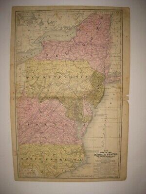
Free Shipping Location: Monroe, United States ORIGINAL 1853 ANTIQUE MAP OFNORTH CAROLINA, VIRGINIA, MARYLAND AND DELAWARE. ALSO SHOWN ARE PORTIONS OF THE SURROUNDING STATES. MAP HAS A SCALE BELOW ... moreTITLE AT TOP CENTER. AMAZING HAND-COLORING AND INTERESTING PRE-CIVIL WAR MAP.
Buy It Now
$6.15 Shipping Location: Bar Harbor, United States 1886 Original Antique Mitchell Map. Mitchell's Modern Atlas. North Carolina. West Virginia and.
Buy It Now
$6.95 Shipping Location: Dover, United States Issued 1839, Connecticut by S. Augustus Mitchell. Engraved by J.H. Young. Early 19th century engraved map with original hand color. Map of the Middle ... moreStates and Part of the Southern. Original center fold as issued.
Buy It Now
$5.95 Shipping Condition: New Location: Las Vegas, United States Colton's new topographical map of the eastern portion of the State of North Carolina with part of Virginia & South Carolina from the latest & best authorities. ... moreThis is a General Civil War era map of the Coastal forts of the Eastern portion of North Carolina.
Buy It Now
Free Shipping Location: Marana, United States This Map was removed form an 1860 Atlas and is in near pristine condition. Including Hundreds of RareCivil War. will receive. The page is approx 12 1/2" ... morex 15 1/2". This map is dated in small print at the base of the page.
Buy It Now
Free Shipping Location: Schertz, United States This is an authentic pre-war map of Virginia, North Carolina, Delaware, and Maryland. The map is an antique original that was published by Daniel Burgess ... morein the year 1855. It is a state map in atlas format and measures 9 1/2 x 11 1/2 in size. The map is a dated 1855 cartographer/publisher of the United States of America. Perfect for antique collectors, this map is a rare find and a must-have for anyone interested in the history of these states.
Buy It Now
$5.50 Shipping Location: Dayton, United States Map is in Very Good Condition! Any Browning Is Enhanced By My Phone! Great Map!
Buy It Now
Free Shipping Location: Monroe, United States ORIGINAL 1931 ANTIQUE COLOR GEOLOGICAL MAP OF PARTS OF MARYLAND, DELAWARE, VIRGINIA, WEST VIRGINIA, OHIO, PENNSYLVANIA, NORTH CAROLINA, NEW JERSEY AND ... moreSOUTH CAROLINA. RARE LARGE ORIGINAL 1931 ANTIQUE COLOR GEOLOGICAL MAP OF PART OF THE MID-ATLANTIC STATES.
Buy It Now
$9.95 Shipping Location: Clemmons, United States
Buy It Now
Free Shipping Location: Anaheim, United States Typically that map at hand, the one being looked at, is in the center box. feature within the bounds of the map, which frequently is a community, town, ... moreor city. The map covers a specific amount of area.
Buy It Now
$7.00 Shipping Location: North Wales, United States 1849 SMITH'S GEOGRAPHY ATLAS MAP-MARYLAND, VIRGINIA, NORTH CAROLINA-HAND COLORED ORIGINAL ANTIQUE ATLAS MAP PLEASE SEE PHOTOS AS PART OF THE DESCRIPTION ... moreCONDITION: MAP IS IN GOOD CONDITION. SIZE: APPROXIMATELY 14" X 21" SHIPPING: U.S. FIRST CLASS RATE - $7.00 - ANY ITEM WHICH SELLS FOR OVER $100 WILL REQUIRE INSURANCE WE COMBINE SHIPPING FOR MULTIPLE WINS. THANK YOU FOR YOUR INTEREST IN OUR AUCTIONS!.
Buy It Now
$5.25 Shipping Location: Dayton, United States 21-63d Congress, 3d Session, December 7, 1914-March 4, 1915: Examinations Of Rivers and Harbors.". Map is in Very Good Condition! Great Map!
Buy It Now
Free Shipping Location: Orlando, United States This map is double sided. The map was published by Rand, McNally & Co. in 1901 in the New Imperial Atlas of the World.
Buy It Now
Free Shipping Location: Elmer, United States Map may have marks, spots, minor creases or other flaws.
Buy It Now
$5.00 Shipping Location: Canada DATE OF ISSUE: 1932. ORIGIN OF THE MAP: "Stielers Handatlas", published in Gotha, Germany by Justus Perthes.

Buy It Now
$35.00 Shipping Location: Boca Raton, United States Map of the Seat of War Transvaal War 1901 South Africa history print DESCRIPTION Fine original antique engraved map. Printed in the early-20th century. ... moreDETAILS Printed Edinburgh: 1901- 113+ Year Old) by T.C. E.C. Jack Printed on quality period paper. Text on reverse. Still retains its inherent structural flexibility and soundness. Sheet measures 6 1/2 by 9 1/2 inches- Image measures 5 1/4 by 7 3/4 inches CONDITION Overall excellent condition. Remaining mostly clean, a nice impression. Nice rich impression and well-preserved given the age. Please inspect photos closely. Any small or minor age flaws to the printed surface area should be visible within picture provided. We grade very conservatively and always seek to disclose any noteworthy flaws. We do our best to show& describe this item so you are happy when it arrives. NOT a Copy. Guaranteed to be Authentic! ALL OFFERED PRINTS ARE AUTHENTIC ORIGINALS All the Prints that are offered are Original Prints and are Guaranteed to be Original Pieces. Never photocopies or reprints. All Prints are carefully selected and are ready for framing. All of our items are original antique pieces and it is important to keep in mind that many of them have been around for 100 years or more. Individual pieces may have seen many owners and been handled many times over the course of their existence and as a result each piece has developed a history of it's own. Short edge splits. Foxing, discoloration, etc. are all things to expect on items of this type. They rarely distract from the piece and often add to the overall character of the item. Keep in mind when you receive your item that you are not handling a modern copy, you are holding a piece of history, an item that has been around for a very long time and will, with proper care, be around for a long time to come. We try to note any significant flaws in the description, but less noticeable or common characteristics may not be mentioned. Each of these Prints offer a little flashback into the past and makes a great gift for the
Buy It Now
Free Shipping Location: Monroeville, United States Date - 1869.
Buy It Now
Free Shipping Location: Anaheim, United States Typically that map at hand, the one being looked at, is in the center box. Scale: 1:100,000 (100K). feature within the bounds of the map, which frequently ... moreis a community, town, or city. The map covers a specific amount of area.
Buy It Now
Free Shipping Location: Anaheim, United States Typically that map at hand, the one being looked at, is in the center box. Scale: 1:100,000 (100K). feature within the bounds of the map, which frequently ... moreis a community, town, or city. The map covers a specific amount of area.
Buy It Now
$6.00 Shipping Location: Jacksonville, United States 1901 Tunison North Carolina with West Virginia on reverse antique map. Overall, very good condition.
Buy It Now
Free Shipping Location: Schertz, United States This antique map features the states of North Carolina, Delaware, Maryland, and Virginia, and was created in the Victorian era using lithography printing ... moretechnique. The map has been hand colored and is an original piece from 1854. The cartographer/publisher is Roswell C. Smith/Daniel Burgess & Co. The cover of the book is not included and is only shown for reference purposes. The map is available for free shipping in the USA, while S&H costs will be calculated for worldwide delivery.
Buy It Now
Free Shipping Location: Anaheim, United States Typically that map at hand, the one being looked at, is in the center box. Scale: 1:100,000 (100K). feature within the bounds of the map, which frequently ... moreis a community, town, or city. The map covers a specific amount of area.
Buy It Now
$4.99 Shipping Location: Fairview, United States Title: Map of Part of Virginia, North Carolina, South Carolina and Georgia which were the Scenes of the most Important Operations of the Southern Armies. ... moreIt is from John Marshall'sAtlas to the Life of Washington, published in Philadelphia,1834, a facsimile copy of the title page is included for authenticity.
Buy It Now
$4.13 Shipping Location: Mason, United States Quadrangle Currituck Sound, North Carolina; Virginia; Eastern United States 1:250,000.
Buy It Now
Free Shipping Location: Anaheim, United States Typically that map at hand, the one being looked at, is in the center box. Scale: 1:100,000 (100K). feature within the bounds of the map, which frequently ... moreis a community, town, or city. The map covers a specific amount of area.
Buy It Now
$4.99 Shipping Location: Sackets Harbor, United States
Buy It Now
Free Shipping Location: Schertz, United States This antique map page of the Mid-Atlantic states including North Carolina, Virginia, New Jersey, and Delaware was printed in 1858 by S.A. Mitchell / E.H. ... moreButler & Co. It measures 11" x 18" and features all original colors produced through lithography printing technique. The map showcases the US states in detail, and it is a perfect addition to any antique map collection. This antique original is a must-have for enthusiasts, historians, and anyone who appreciates the beauty and craftsmanship of old cartographer/publisher works.
Buy It Now
Free Shipping Location: Monroeville, United States Date - 1880. inventory # j74129. Condition - Very Nice.
Buy It Now
$6.95 Shipping Location: Dover, United States Issued 1873, New York by J. David Williams. Map of Delaware, Maryland, Virginia, West Virginia, North Carolina, Kentucky, Tennessee, Ohio, and Indiana. ... moreLate 19th century lithographed map with lovely original hand color.
Buy It Now
$5.95 Shipping Condition: New Location: Las Vegas, United States This is a General Civil War era map of the Coastal forts of the Eastern portion of North Carolina. A naval blockade is also depicted. Inset: Plan of the ... moresea coast from Virginia to Florida. Title: Colton's new topographical map of the eastern portion of the State of North Carolina with part of Virginia & South Carolina from the latest & best authorities.
Buy It Now
$6.95 Shipping Location: Dover, United States Issued 1854-62, London & Edinburgh by A. Fullarton & Co. Map engraved by Swanston. Mid 19th century antique color lithographed map with original hand ... morecolor as well.
Buy It Now
$6.95 Shipping Location: Dover, United States Issued 1876 Gotha by Justus Perthes for Stieler. Very detailed 19th century engraved map with original outline hand color. Original center fold as issued.
Buy It Now
$4.13 Shipping Location: Mason, United States Quadrangle Eastville, Virginia; North Carolina; Maryland; Eastern United States 1:250,000. US Geological Survey Topography Map,1946, Revised 1969. In ... morevery good condition. Pictures of the front and back of that tear included.
Buy It Now
Free Shipping Location: Anaheim, United States Typically that map at hand, the one being looked at, is in the center box. Scale: 1:100,000 (100K). feature within the bounds of the map, which frequently ... moreis a community, town, or city. The map covers a specific amount of area.
Buy It Now
$8.00 Shipping Location: Saco, United States Entered into US Congress by Daniel Burgess, 1853. Interesting and detailed county map. Shows cities and railways. Overall in very good condition. Minor ... morewear, old age toning, light soiling.
Buy It Now
Free Shipping Location: Monroeville, United States Or send resale number. FROM THE SOURCE/DATE LISTED.
Buy It Now
$3.50 Shipping Location: United States At bottom is detailed text and an image of Natural Bridge as well. The size of the map is 9.5" by 12". FREE scheduling, supersized images.
Buy It Now
$21.00 Shipping Location: TAMWORTH, United Kingdom 1890 Bartholomew VIRGINIA, WEST VIRGINIA, NORTH CAROLINA, SOUTH CAROLINA Map47cm x 34cm
Buy It Now
$6.95 Shipping Location: Dover, United States Issued 1880 Gotha by Justus Perthes for Stieler. Very detailed 19th century engraved map with original outline hand color. Inset of Texas. Original center ... morefold as issued.
Buy It Now
$6.95 Shipping Location: Dover, United States Rappahannock River Virginia from Fredericksburg to near Moss Neck. Issued 1856, Washington by United States Coastal Survey. Detailed mid 19th century ... morelithographed coastal survey. Reference includes dates of survey, as well as yearly tidal information.

Buy It Now
$3.75 Shipping Location: United States Click Here. Double your traffic. Get Vendio Gallery- Now FREE! Fine antique 1858 handcolored Augustus Mitchell map. The map is printed on thick fine paper. ... moreWith no printing on reverse. The map is titled Map of the Middle States. The map shows New York, New Jersey, Pennsylvania, Maryland, Virginia, with no West Virginia yet, and North Carolina. The ocean areas are detailed as well, with tall ships in the water. Very fascianting and detailed period map. Printed at the bottom is Entered according to Act of Congress in the year 1852 by S. Augustus Mitchell in the Clerk's Office of the District Court of the eastern district of Pennsylvania. This dates the map nicely.The map is in excellent condition, with a small bit of clean seperation at right hand side middle, this can be common in old antique maps, if framed will be fine. The superb handcoloring on the map is period to the map, this is before color printing. The size of the map is 12" by 18" Rare. Winning bidder pays $3.50 shipping domestic, more foreign. Payment I accept the following forms of payment: PayPal Click to View Image Album Shipping& Handling US Shipping. $3.50 USPS First-Class Mail® International Shipping. $11.50 USPS First-Class Mail International FREE scheduling. Supersized images and templates. Get Vendio Sales Manager. FREE scheduling. Supersized images and templates. Get Vendio Sales Manager. 1?RcmdId ViewItemDescV4,RlogId p4%60bo7%60jtb9%3Feog4d72f%2B%3E%3B1%3F-1417412e953-0x105-
Buy It Now
$3.65 Shipping Location: United States Fine antique 1859 handcolored 2 sided map, titled Maryland, Virginia, North Carolina South Carolina. Interesting period map of this area. Reverse is a ... morefine handcolored map of City & County of Philadelphia.
Buy It Now
$6.95 Shipping Location: Atlanta, United States I will list if I have them. It DOES NOT have an institutional ink stamp. The map in the photo is the actual map you will receive.
Buy It Now
$3.50 Shipping Location: United States The size of the map is 12" by 15". FREE scheduling, supersized images.
Buy It Now
$5.00 Shipping Location: Palenville, United States
Buy It Now
$4.15 Shipping Location: Saco, United States 11 3/8" x 9 1/4". This Map was Harvested from an 1856 Smith's Quarto Georgraphy Book which was Published by Daniel Burgess & Co. Photos 11 & 12 will show ... morethe actual Atlas Cover and Title Page, neither are included and are only shown as Proof of Authenticity.
Buy It Now
Free Shipping Location: Bremerton, United States The map shows typical natural aging and wear from use with a ragged edge where it was removed from the atlas. You could even use it as wrapping paper ... morefor a small gift.
Buy It Now
$5.40 Shipping Location: Corunna, United States
Buy It Now
$4.15 Shipping Location: Saco, United States Last Photo will show the Actual Atlas that was Surgically Dissected, it is not included. No Book Killer Here! Plenty of border for matte and framing. ... moreNice Map and Suitable for Framing.
Buy It Now
$3.75 Shipping Location: United States Lake Erie Maps& Prints An Authentic Antique Map: Not a Modern Reproduction! Click Here for more Antique Maps and Prints No Additional Shipping Fees ... moreon Multiple Maps Shipped with the Largest Free Shipping on 5 or More Maps and Prints Description: It is an authentic antique copper engraved map over 175 years old with original hand coloring as issued with plate indentions embossed around the margins. It is from Smith's Atlas for Schools. Academies and Families by Roswell Smith(Hartford: Daniel Burgess& Co. 1839) a copy of the atlas title page is included for authenticity. There is a copyright date of 1839 by Burgess printed in the bottom margin of the map. The map is not mounted, matted nor framed being sold as seen in the main pic, photographed against a dark background. Overall, a very nice rare example, printed on a heavy page, blank on the reverse. Size: The image area measures 10 1/2 by 16 1/2 inches(27x42cm) within the neat lines and the entire page measures 12 by 19(35x50cm) as seen in the pic. Condition: It is in Good condition for its age. Printed on a light buff page, blank on the reverse with original handcoloring and a centerfold as issued. It is basically as seen in the pics. There is some backprinting and general handling with age, otherwise it has a real classic antique appearance with strong color and a rich patina very desireable. Pics are of the actual map, although the actual map look much better. Payment Details: We accept most major credit cards through Paypal and Ebay. Please ask if you have any questions about payment. International and New Bidders are welcomed and encouraged. Payment is expected within 7 days. After which Nonpaying Bidders will be reported to Ebay to recoup our listing fees. Save on Shipping: We only charge one shipping fee based on the largest map or print with multiple items shipped along with it for no extra costs. Purchase 5 or more maps or prints and receive Free First Class shipping in USA or First Class International elsewhere in the world. Although registr
Buy It Now
$3.75 Shipping Location: United States Superb, rare, antique 1852 handcolored map, titled Map of the Middle States and Part of the Southern. I see New York, New Jersey, Pennsylvania, Maryland, ... moreDelaware, Virginia, and North Carolina. Mitchell was a highly regarded and important mapmaker of this period.
Buy It Now
Free Shipping Location: Monroeville, United States An ORIGINAL antique map of VIRGINIA. WEST VIRGINIA, MARYLAND, and NORTH and SOUTH CAROLINA from Mitchell's New Intermediate Geography Atlas, 1876. ... moreThe States are individually hand water colored. Dozens of early railroads are shown throughout the region. The map measures 9 1/2 by 12 inches. This ORIGINAL antique map is guaranteed over 135 years old published just a decade after the Civil War. I do not sell reproductions. Just honest maps at honest prices. Discounted shipping too. All items shipped within 2 business days after payment. If you have not received an item in a reasonable amount of time please email me. It has been delayed by the Post Office. I also accept returns on ANY item for ANY reason, please email me I am very easy to work with. Feedback is not the same thing as an email, please email first. On Oct-19-07 at 13:06:06 PDT. Seller added the following information:
Buy It Now
$4.00 Shipping Location: Fernandina Beach, United States The State Of North Carolina Is On One Side and West Virginia is on the other. They are previously owned and may show very fine handling marks and shelf ... morewear and will not be perfect. In antique condition with yellowing, staining, spotting and discoloration of paper.
Buy It Now
Free Shipping Location: Monroeville, United States Publisher - Rand Mc-Nally. Date - 1898. FROM THE SOURCE/DATE LISTED.
Buy It Now
Free Shipping Location: Riverside, United States Rare & Authentic Color Map. Condition: Minor yellowing due to age, NO TEARS. Exquisite Detail. . READY for FRAMING!
Buy It Now
$4.99 Shipping Location: Fairview, United States An Authentic Antique Map: Not a Modern Reproduction! Condition: It is in Good condition for its age with overall light tonal ageing, on a flexible page ... morewith hand coloring. There are a couple of slightly bent corners, damp stain along the edges and a few light smudges around the margins, see the pics for more on condition.
Buy It Now
$6.95 Shipping Location: Arlington, United States I will work hard to make sure you are satisfied and you can always start a case if you are not happy with my response.
Buy It Now
$4.99 Shipping Location: Fairview, United States Stieler's Hand Atlas, published in Gotha by Justus Perthes. The publisher is stated in the bottom center, the title of the atlas is in the upper right ... morecorner and the printing details in the bottom left margin.
Buy It Now
$6.95 Shipping Location: Dover, United States Issued 1870, New York by A.J. Johnson. Johnson's Virginia, Delaware, Maryland, West Virginia. Uncommon mid 19th century lithographed map with original ... morehand color.
Buy It Now
$6.95 Shipping Location: Dover, United States Issued 1880 Gotha by Justus Perthes for Stieler. Very detailed 19th century engraved map with original outline hand color. Inset of Texas. Original center ... morefold as issued.
|
|
|
In
|
Civil War Map Spotsylvania Hanover Junction Virginia Goldsboro North Carolina
Lake Erie Maps& Prints Union Positions in Blue and Confederate in Red An Original Antique Map: Not a Reproduction! Plate XCI Atlas to Accompany the Official Records of the Union and Confederate Armies Currently Listing Many Civil War Maps and Prints Check out my! Titles of Maps: 1) Spotsylvania. 2) Hanover Junction. VA. 3) Goldsborough, NC. 4) Boyd's Neck, Honey Hill, SC. 5) Spanish Fort Defenses. Description: It is an original uncut sheet with three large battlefield maps from the Atlas to Accompany the Official Records of the Union and Confederate Armies. Published by the Secretary of War, Washington: Government Printing Office, 1891-1895) undoubtedly the most complete set of accurate maps of the Civil War ever published. The title of the atlas appears in the top left margin and plate number in the upper right. A copy of the title ... morepage is included with all the publishing details for authenticity. The atlas was published in a very limited context to be distributed to government officials in the three houses of government as a reference for assessing the Civil War. This is from the original first publishing, that lasted from 1891-5. In general, these maps are very detailed showing lines of approach, battle formations, forts, batteries, dates, various armies and officers involved, topography down to houses in many cases and other details and historical notes. The Union lines are in blue and the Confederate in Red. A very beautiful map that will frame up nicely! Size: The map image measures 16 by 27 inches on a page measuring approximately 18 by 29 inches with plenty of margin all around for framing. It is a full double page sheet as issued. Condition: The map is in Very Good or better condition with overall light tonal aging. It has lithograph color. Blank on the reverse and has a centerfold as issued. It is a very clean map with no distracting defects to mention. The pics show some shadowing along the fold that is not noticeable on the actual map. The pics are of the actual print. Payment Details: We acce
|
|
|
111 yr-old Map WEST VIRGINIA & NORTH CAROLINA 27
Auction Wizard 2000 Listing Template- AW2KLOT#5990 tincuptom Auctions 111 yr-old Map WEST VIRGINIA& NORTH CAROLINA 27 Dated Rand McNally Map.Published 1900 Measures 11 x 14 inches Printed on both sides. Two full-page maps on one leaf(one full-page map on front and one full-page map on back) Very good condition The USA Shipping is First Class mail. View my other listings for more antiques. Shipping and handling in the USA is $0.00. Payments are due in 7 day. You may pay by Paypal only. Please E-mail for International Shipping rates.
|
|
|
1832 Marshall Map of Virginia, North Carolina and South Carolina
1832 Marshall Map of Virginia. North Carolina and South Carolina WE SELL ONLY ORIGINAL ANTIQUE MAPS- NOT REPRODUCTIONS Title: Map of part of Virginia North Carolina South Carolina& Georgia which were the scenes of the most important Operations of the Southern Armies. Description: This is a rare map North Carolina. South Carolina, and Virginia during the Revolutionary War issued for John Marshall’s 1832 edition of the Life of Washington. The map covers from the Chesapeake Bay and Richmond, Virginia southwards past North and South Carolina to Savannah, Georgia and the Savannah River. Various rivers, major roads, and the sites of important battles are noted. Marshall prepared this map to illustrate the southern theater of the American Revolutionary War. Towards the end of the War, having suffered major losses in the Northern Colonies, the ... moreBritish began to shift their strategic attention towards the American Southern Colonies. Between 1778 and 1779 the British seized control of several important southern centered including Savannah and Charleston. Backed by a strong loyalist presence, the British where able to maintain control of the primary strategic points in the Southern Colonies until the end of the war in 1783. This map appeared in atlas volume attached to the 1832 edition of John Marshall’s seminal work, The Life of Washington. Marshall composed the five volume biography between 1805 and 1807 and based the work on original papers and records provided by the president’s own family. The earliest partial edition of the The Life of Washington appeared in 1824 as A History of the American Colonies. In 1832 Marshall revised and abridged the original voluminous work to just two volumes and some 400 pages– from which this map was extracted. The maps of the 1832 edition are notable and desirable in that, unlike the original edition, most had hand applied color work. Size: Printed area measures 10 inches high by 7.5 inches wide. Condition: Very good. Offsetting. Original centerfold exhibits light toning. Blank on
|
|
|
1895 West Virginia Dated Color Atlas Map* North Carolina on back .118 years-old!
1895 West Virginia Dated Color Atlas Map* North Carolina on back.106 years-old! Gorgeous. Original 1895 West Virginia Dated Color Atlas Map. North Carolina Color map is on the back. This is an ORIGINAL.NOT A REPRINT. 118 year-old undated atlas map dated on the front.that measures 14" x 11 1/4" with the borders. The map is indexed on the borders where it lists area and population and the major towns and cities with their respective populations; The shows the major towns and cities. Major railroads, rivers, and other geographic features, etc. Great. Historic Map. PLEASE NOTE CONDITION: The map has some lite corner and border wear including a couple of light paper creases. Otherwise. It is in nice condition. Please see the attached photo to view the map. A closeups of the map. NOTE: the map is too large for my scanner.There is a border ... moreall the way around the map.Also. The map is much clearer than the scan illustrates.The printing is small but very clear and readable* Purchase this great old map for only $14.95. U.S. Buyer pays $3.00 for shipping. NO INTERNATIONAL SHIPPING~~ See Below Buyers. 1-4 maps can be combined to save on shipping. Maps are sent in sturdy shipping tubes. PLEASE READ: This is an original 1895 dated atlas map. If you have any questions about this map or any of my items. Please email me before bidding. I prefer satisfied customers. Thanks! 051113 WVa95.2(r) Please Visit My Ebay Store To View My West Virginia, New Orleans. Florida, Alabama, Birmingham, Georgia, Carolinas, Atlanta and Other Antique Maps. Thanks For Looking! NO INTERNATIONAL SHIPPING Unless buyers contact me first and agree to the new International shipping charges.Probably $10.00-12.00. Thanks for your understanding!
|
|
|
1898 West Virginia Dated Color Atlas Map* North Carolina on back .115 years-old!
1898 West Virginia Dated Color Atlas Map* North Carolina on back.106 years-old! Gorgeous. Original 1898 West Virginia Dated Color Atlas Map. North Carolina Color map is on the back. This is an ORIGINAL.NOT A REPRINT. 115 year-old undated atlas map dated on the front.that measures 14" x 11 1/4" with the borders. The map is indexed on the borders where it lists area and population and the major towns and cities with their respective populations; The shows the major towns and cities. Major railroads, rivers, and other geographic features, etc. Great. Historic Map. PLEASE NOTE CONDITION: The map has some lite corner and border wear including a couple of light paper creases. Otherwise. It is in nice condition. Please see the attached photo to view the map. A closeups of the map. NOTE: the map is too large for my scanner.There is a border ... moreall the way around the map.Also. The map is much clearer than the scan illustrates.The printing is small but very clear and readable* Purchase this great old map for only $13.95. U.S. Buyer pays $3.00 for shipping. NO INTERNATIONAL SHIPPING~~ See Below Buyers. 1-4 maps can be combined to save on shipping. Maps are sent in sturdy shipping tubes. PLEASE READ: This is an original 1898 dated atlas map. If you have any questions about this map or any of my items. Please email me before bidding. I prefer satisfied customers. Thanks! 051113 WVa98.1(r) Please Visit My Ebay Store To View My West Virginia, New Orleans. Florida, Alabama, Birmingham, Georgia, Carolinas, Atlanta and Other Antique Maps. Thanks For Looking! NO INTERNATIONAL SHIPPING Unless buyers contact me first and agree to the new International shipping charges.Probably $10.00-12.00. Thanks for your understanding!
|
|
|
1847 Original HAND COLORED Map- VIRGINIA-NORTH CAROLINA-Smith Quarto ATLAS-MD-DE
Antique HandColored Map 1 FULL Page Removed From Vintage Atlas( NOT a Reproduction/ Facsimile) = NO REPRO Please View the 3 Images BELOW States: Virgin ia(including West Virginia) North Carolina/ Maryland/ Delaware MAP Copyri ght Date: 1847 Size of Entire Page: 8.66 x 10.88 inches Size of Rectangular MAP AREA: 8.33 x 10.25 inches Source: Atlas: Smith's Qu ar to Atlas: A Concise Practical System of Geograp hy Cartographer: Roswell C Smith/ Ros well Smith Publisher: Cady and Burgess/ New York NY Date Entire ATLAS Published: 1848 Plate Number: 30 Verso/ Back of Page: Text( NOT Visible) FLAWS NOT Visible in the Image Below: 0.88 inch closed horizontal tear along left edge entering m ap area JUST PAST inner border 0.75 inch closed horizontal tear along left edge enter ing map are a U P TO inner bo rder NOTE: Item You Will Receive is an Entir ... moree Page Ready to be Framed and/or Matted Fine Print: USPS Shipping Fees( First Class/ Priority Mail) Can Be Calculated Above. will COMBINE Shipments Whenever Possible to Reduce Shipping Fee) Insurance Available AT COST- Please Let Us Know IF Desired. NO Handling Fees and QUICK Handling Time! SAFE Packaging. We Accept PayPal ONLY. Mass. Residents MUST Add 6.25% Sales Tax. Do NOT Ship Any Items Outside the U.S.A. this includes APOs/FPOs. NOTES: Scans and Photos Below are of the EXACT Item(s) You Will Receive Safe Packaging = 4 mil. Plastic Sleeve Surrounded by Cardboard in a Thick Kraft Envelope with a"Do Not Bend" Sticker. Auctions: Will Not End Early Buy It Now Items: Will Not Entertain Offers(Unless"Best Offer" Link Present) Have Been Selling on eBay Since 2004 View the other Vintage and Antique Images in our eBay Store by Clicking on the Link Below: The Paper Merchant eBay Store Thanks For Looking! Sca n is of the EXACT Item You Will Receive B&W PhotoCopy of Title Page AND Cover BELOW Included with THIS Lot keywords: antique map. Antique maps, antique atlas, antique atlases, antique plate, antique plates, antique engraving, antique engravings,
|
|
|
Original 1847 Color Map Virginia North Carolina Maryland Delaware NC VA MD DE
Map of Virginia. North Carolina, Maryland, Delaware 1847 For your consideration is this Original Color Map of The United States including The States of Virginia(VA) before West Virginia) North Carolina(NC) Maryland(MD) Delaware(DE) from the year 1847. Map is in Excellent Condition& looks Great without any rips or tears. Detailed Map includes: Counties Capitals State Populations Towns Major Cities Canals Some Facts on The Great Lakes Rivers Etc. Map Measures 9-1/4" x 11-3/4" Please refer to the photographs for details. for more great items! After making a purchase or winning an auction. Please send payment via Paypal within the next three days. After receiving a cleared Payment. Your item will be carefully packaged and shipped out within the next 48 hours. If you purchase more than 1 item. Please wait until I send you an updated ... moreinvoice with combined shipping. txzj pxzj7579 txzj1 336.RcmdId ViewItemDescV4,RlogId p4%60bo7%60jtb9%3Fvo%7B%3Dd70f%2B%3E336-13fcb44f727-0x107-
|
|
|
1862 Mitchell Hand Colored Map of Virginia, North Carolina *Original Antique! #8
1862 Mitchell Wonderful map showing"large" Virginia shortly before West Virginia becomes a state the following year. 1863. This beautiful map is from Mitchell's New General Atlas with original hand coloring. Mitchell was of the premier American map publisher of the 19th century. Known for their excellent detail and beautiful coloring. Published by S. Augustus Mitchell Jr. Philadelphia: 1862. This is an original antique. NOT a reproduction and guaranteed to be over 150 years old. Condition: Very Good Size: Sheet size 15" x 12" or 38cm x 30cm. Please click on my"ME" page to learn more about us. Looking for additional quality items? Check out our other auctions for more that we have listed on eBay!
|
|
|
1844 Original Pre CW Map of Virginia, North Carolina, Maryland, Delaware
Original hand colored engraving as issued. Dated in the plate. Engraved by Sherman& Smith. Entered into US Congress by Cady& Burgess. 1847 Image area is 8.5" wide x 10.5" high. Interesting and detailed Pre Civil War county& railroad map. Shows chief cities. Canals and county seats. Virginia is not yet divided. Gives population figures for each state. Beautifully executed. Attractive hand color, will frame nicely. Overall good condition with mild ageing. Low starting bid with no reserve. Postage charge is for domestic insured priority mail.
|
|
|
1871 map of Virginia, WV, North & South Carolina. Engraved, Detailed. Genuine.
This is an 1871 engraved map of Virginia. West Virginia, North& South Carolina, Southern part of Florida, with insets of the environs of Richmond& Charleston. It measures 12.5 X 17 inches. Published by T. Edward Zell. Philadelphia. Map was engraved by J. Bartholomew. For history of the famous Bartholomew maps, see last paragraph below. We are unable to find many of these maps in the major dealers sites. The ones we did find had prices of $200- $500 and up and were not in as good a condition as this map. Be my guest. Go look for yourself. Paper shows minor age spots. Normal on most maps this age due to paper content. We have shown in the scans of the map and close ups to get a great idea of the beauty of the gentle hand coloring and detailed engraving. One of the scans above shows the copyright data found for Zell's publications. ... moreZell originally acquired these maps for his publications. And re-issued the same maps in all additional updates. Each map has the publisher in the middle of the lower margin and the engraver of the map in the lower right margin, see scans above. Would look fantastic framed under glass. Imagine this map displayed in a professionals waiting room or anywhere for that matter. Any shadows or blurry edges are my scanner. Not the map. These maps are quite dear. Fantastic to behold, and a very smart investment opportunity especially when buying at our low wholesale prices. Click here to read our new help guide. This article is applicable to all vintage maps. Not just railroad maps. Owning one of these classic early J. Bartholomew maps is a delight and sign of rare tastes. If you like this map. We strongly advise you buy it now. It is highly doubtful we will ever find another in this nice a condition. Once sold it is gone, and the opportunity for you to own it no longer exists. We will ship this map carefully rolled in kraft paper inside a pvc tube to prevent any damage in transit. It is also insured by us at no additional cost to you. History: The cartographic story of the Bartholomew
|
|
|
(2) 1852-77 BEAUTIFUL MITCHELL ATLAS MAPS-VIRGINIA-NORTH CAROLINA-HANDCOLORED
2) 1852-77 BEAUTIFUL MITCHELL ATLAS MAPS-VIRGINIA-NORTH CAROLINA-HANDCOLORED, Click to View Image Album Click to View Image Album Click to View Image Album(2) 1852-77 BEAUTIFUL MITCHELL ATLAS MAPS-VIRGINIA-NORTH CAROLINA-HANDCOLORED TWO BEAUTIFUL DETAILED MITCHELL ATLAS MAPS FROM HANDCOLORED HISTORIC ATLAS INCLUDES CITIES. LANDMARKS, INDUSTRY, BUSINESS AND RAILWAYS PLEASE SEE PHOTOS AS PART OF THE DESCRIPTION CONDITION: MAP IS IN GOOD CONDITION WITH NICE COLORATION SIZE: APPROXIMATELY 11" X 18" AND 9" X 11" SHIPPING: U.S. FIRST CLASS RATE- $4.00. CANADA- $9.00. WORLDWIDE- $14.00 WE COMBINE SHIPPING FOR MULTIPLE WINS! THANK YOU FOR YOUR INTEREST IN OUR AUCTIONS WILL MAKE A UNIQUE GIFT FOR THE HOLIDAYS! Payment I accept the following forms of payment: PayPal Shipping& Handling $4.00 USPS First-Class Mail® Click ... moreto View Image Album Click to View Image Album FREE scheduling. Supersized images and templates. Get Vendio Sales Manager. FREE scheduling. Supersized images and templates. Get Vendio Sales Manager. Over 100.000,000 served. Get FREE counters from Vendio today!
|
|
|
1853 Burgess antique hand-colored Map of Maryland, Virginia & North Carolina
Map No. 4 United States. Maryland, Virginia& North Carolina This is a beautiful color map issued in 1853. Published in New York by Daniel Burgess& Co. It is 160 years old and is in great shape with no tears or creases with some foxing. It is a work of art and the colors are still bold and bright. Not a reproduction. This is a guaranteed genuine antique map. This map is a very detailed hand-colored map of Maryland. Virginia and North Carolina with text on the reverse side. The engraved area measures about 8 3/4 by 10 1/2 inches and is in excellent condition. This map is printed on a single sheet. So there are no folds or creases. The paper is clean and not brittle. Highly suitable for framing. This map would look great in your home or office or home-office. Shipping by USPS First Class Mail within the USA and Canada. I'll be happy ... moreto ship your multiple purchases together in a single shipment to save on shipping costs. Wait for invoice for total cost for multiple purchases. Powered by The free listing tool. List your items fast and easy and manage your active items.
|
|
|
ORIGINAL 1895 RAND WEST VIRGINIA & NORTH CAROLINA COUNTY MAPS
I PACK ALL THE ITEMS I SELL ON EBAY SEALED IN PLASTIC AND WITH A PIECE OF CARDBOARD IN EACH SIDE OF THE ITEM. THIS MAY INCREASE THE SHIPPING COST SLIGHTLY BUT I THINK THAT IT IS WELL WORTH IT. THIS IS AN ORIGINAL 1895 RAND- McNALLY COMPANY WEST VIRGINIA& NORTH CAROLINA COUNTY MAPS ON EACH SIDE OF THE SHEET. THEY CAME OUT OF A 1895 RAND- McNALLY COMPANY UNITED STATES AND WORLD ATLAS. THE ATLAS WAS IN SUCH POOR CONDITION THAT I HAD TO REMOVE ONLY THE GOOD CONDITION MAPS AND TOSS THE REST. THEY MEASURE ABOUT 11.5 X 13.5. HAS 2 PAGES AND THEY ARE IN GOOD++ CONDITION WITH NORMAL WEAR/ FLAWS FROM AGE AND USE. PLEASE LOOK AT THE PICTURE(S) BELOW FOR MORE DETAILS. IF YOU HAVE ANY QUESTIONS. PLEASE EMAIL ME. MULTIPLE WINNERS WILL SAVE ON SHIPPING. I ACCEPT ANY AND ALL FORMS OF NORMAL PAYMENT. HIGH BIDDER PAYS $3.50 FOR SHIPPING AND HANDLING WITHIN ... moreTHE UNITED STATES. FOR INTERNATIONAL WINNERS. SHIPPING COSTS WILL BE CALCULATED. PLEASE NOTE THAT I PACK MY ITEMS VERY WELL(CHECK MY FEEDBACK)
|
|
|
1895 WV West Virginia Map. NC North Carolina Map Vintage Original 19th Century
Combined shipping is offered in the shopping cart. Original 1895 multicolor state and county map of West Virginia copyright 1895 by Rand McNally& Co. Chicago. Thick paper, single sheet, about 14" x 11" with margins. The other side has a North Carolina map copyright 1895. 1898. This was sourced from an original 1899 atlas. Railroad routes are marked. Typical margin toning. Zoom to inspect. Indiana residents add 7% sales tax. Shipped flat with cardboard.fast! Returns only for listing errors. The photos are part of the description. Several WV maps are currently listed. Use the shopping cart to combine postage. http:www.ebay.com/sch/m.html?odkw=&ipg=25&sop=1&osacat=0&armrs=1&ssn=stereoview&trksid=p2046732.m570.l1313.TR11.TRC1.A0.XWV&nkw=WV&sacat=0&from=R40 INV: PhilLedg99.27-28
|
|
|
ANTIQUE 1866 WEST & VIRGINIA NORTH CAROLINA SOUTH CAROLINA MARYLAND HANDCOLR MAP
Click Here. Double your traffic. Get Vendio Gallery- Now FREE! Fine antique 1866 handcolored map. Titled Maryland, Virginia, West Virginia, North Carolina, South Carolina, on reverse is an inset map of City& County of Philadelphia, Scales 6 Miles to an inch and engraved image of Independence Hall. Fascianting, detailed and attractive period map of these areas at this time. The gorgeous handcoloring is period to the map, this is before color printing. The map is in excellent condition, and would frame and display beautifully. The size of the map is 8" by 9.5" Rare. Winning bidder pays $3.25 shipping domestic, more foreign. Payment I accept the following forms of payment: PayPal Click to View Image Album Click to View Image Album Shipping& Handling US Shipping. $3.25 USPS First-Class Mail® International Shipping. $9.00 ... moreUSPS First-Class Mail International FREE scheduling. Supersized images and templates. Get Vendio Sales Manager. FREE scheduling. Supersized images and templates. Get Vendio Sales Manager.
|
|
|
1872 VIRGINIA WEST VA NORTH & SOUTH CAROLINA Atlas Map MITCHELL CIVIL WAR ERA
An ORIGINAL antique map of VIRGINIA. WEST VIRGINIA, MARYLAND, and NORTH and SOUTH CAROLINA from Mitchell's New Intermediate Geography Atlas, 1872. The States are individually hand water colored. Dozens of early railroads are shown throughout the region. The map measures 9 1/2 by 12 inches. This ORIGINAL antique map is guaranteed over 140 years old published just after the end of the Civil War. I do not sell reproductions. Just honest maps at honest prices. Discounted shipping too. All items shipped within 2 business days after payment. If you have not received an item in a reasonable amount of time please email me. It has been delayed by the Post Office. I also accept returns on ANY item for ANY reason, please email me I am very easy to work with. Feedback is not the same thing as an email, please email first. On Oct-19-07 at 13:06:06 ... morePDT. Seller added the following information:
|
|
|
Antique Maps of Virginia/West Virginia and North Carolina from Gray's Atlas 1873
This is a sheet from Gray's Atlas of 1873 with a map of Virginia and West Virginia on one side and a map of North Carolina on the other side. There is an inset map of Beaufort Harbor on the North Carolina side and two insets on the Virginia side. One of Richmond, Manchester and Spring Hill and the other of Norfolk, Portsmouth and Gosport. The sheet measures approximately 17⅛ inches by 14⅝ inches. Both maps from border to border measure approximately 14⅞ inches by 11⅞ inches. Condition is good with a clean tear about one-inch long on the left edge of each map. On the Virginia/West Virginia side the tear ends about one-half inch from the border whereas on the North Carolina side it ends just above the area marked Cherokee which extends past the border. There is also a small(half-inch) area at the mouth of the Potomac River where the priinting ... moreis thin(this can bee seen in the photograph of the Virginia side) Map may be shipped flat or rolled. Depending on circumstances. Returns are accepted if there is a significant error in our description. Item must be in same condition as when shipped. If we have offered free shipping. The cost of shipping will be deducted from the refund. We are sorry but we do not accept bids from buyers with no feedback or negative feedback unless cleared with us beforehand. We also request international buyers to check with us before bidding unless we have indicated that international shipping to their nation is being offered. Thank you for looking at our item. Payment must be made within 3 days of the end of the auction. We accept PayPal but will usually be willing to make arrangements for you to pay by check if you prefer. We ship very quickly after receipt of your payment. We are always pleased to reciprocate feedback.
|
|
|
Antique 1895 West Virginia North Carolina McNally Atlas Map Cities Counties
Please read the description. See the photos added, ask any questions before bidding/ buying. Antique 1895(copyright) Original McNally map West Virginia/ North Carolina not matted. Not framed approx. 14" x 11" sheet Map comes from an 1898 German McNally atlas. In GOOD condition. With normal overall tonal aging, light staining on margins, minor creases and scuffing(spine side) INTERNATIONAL BUYERS Import duties. Taxes and charges are not included in the item price or shipping charges. These charges are the buyer's responsibility. Please check with your country's customs office to determine what these additional costs will be prior to bidding/buying. These charges are normally collected by the delivering freight(shipping) company or when you pick the item up– do not confuse them for additional shipping charges. We do not mark ... moremerchandise values below value or mark items as"gifts" US and International government regulations prohibit such behavior. We are not responsible for customs delays. This is an original Vintage/ Antique item. It shows signs of age and wear. There might be missing parts. Please check the pictures. Read the description What you see is what you get. Please ask any questions before bidding/buying.
|
|
 |