-
Christian Collectibles
-
Christian Sheet Music
-
Vatican Stamps
-
Vatican Coins & Paper Money
-
Antiques
-
Antiquities
-
Architectural & Garden
-
Decorative Arts
-
Ethnographic
-
Furniture
-
Maps, Atlases & Globes
-
United States (Pre-1900)
-
AK, HI
-
AL, FL, GA, MS, NC, SC
-
AR, IA, KS, LA, MO, NE
-
AZ, CA, CO, NM, NV, UT
-
CT, MA, ME, NH, RI, VT
-
DC, DE, MD, NJ, NY, PA
-
ID, OR, WA
-
IL, IN, MI, OH, WI
-
MN, MT, ND, SD, WY
-
OK, TX
-
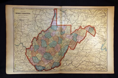
VA, WV, KY, TN
-
Entire US
-
United States (1900-Now)
-
United States (Date Unknown)
-
Africa
-
Asia
-
Australasia/ Oceania
-
Canada
-
Central America/ Caribbean
-
Europe
-
India
-
Ireland
-
Mexico
-
Middle East
-
North America
-
South America
-
United Kingdom
-
Maps on CD
-
World Maps
-
Globes
-
Mixed Lots
-
Reproductions
-
Price Guides & Publications
-
Other
|
In
Order by: Available to: This site contains affiliate links for which I may be compensated
|
Buy It Now
$9.99 Shipping Location: Millbrook, United States Large folding pocket map of United States and southern Canada by Colton. Beautiful map with insets of New England, United States (coast to coast), and ... morethe isthmus of Panama. Size is 27x31 inches. Condition is good. Has repairs along some of folds.
Buy It Now
$5.95 Shipping Condition: New Location: Las Vegas, United States This is a great Classic Map originally Published circa 1771. Year: 1771. “Vibrant and bright! Pic does not do it justice.looks amazing!”. Beautiful map! ... moreEach of our prints are custom reproductions printed on 68lb Heavyweight Enhanced Matte Art Paper.
Buy It Now
$5.95 Shipping Condition: New Location: Las Vegas, United States Year: 1892. Comanche, Apache, Cheyenne, Cherokee Indian districts are represented. Cities, Towns and Military forts are clearly labelled. Map of the Indian ... moreand Oklahoma Territories. Each of our prints are custom reproductions printed on 68lb Heavyweight Enhanced Matte Art Paper.
$6.00 Shipping Location: Corunna, United States Nice old map from The New Encyclopedic Atlas and Gazetteer of the World by Collier& Son published in 1914 with census of 1910 City of Kansas City. ... moreMissouri and Kansas Copyrighted in 1907 + + + Page measures 10-3/4" X 15" lots of details on map- see closeups Good condition with some margin tears. Smudges or foxing that is typical for this vintage. All of our maps are originals. We do not destroy good books. But rescue pages from damaged and ruined atlas books. Old maps are shipped rolled up in a tube for protection. Which we have found to be the best way to get them there safely. Buyer pays for mailing outside the US. So please check before bidding. If you cannot find what you are looking for. Let us know. We have many old– city– state– region– territory– country– maps that have not been listed yet. Ask any questions. Thank you.
Buy It Now
$5.95 Shipping Condition: New Location: Las Vegas, United States “Vibrant and bright! Pic does not do it justice.looks amazing!”. Each of our prints are custom reproductions printed on 68lb Heavyweight Enhanced Matte ... moreArt Paper. These Historic Art Prints are suitable for framing, mounting or direct display on any wall!
Buy It Now
$5.95 Shipping Condition: New Location: Las Vegas, United States Year: 1876. Canton 1885. These Historic Art Prints are suitable for framing, mounting or direct display on any wall! New York City 1876. New York City, ... moreNew York. “Vibrant and bright! Pic does not do it justice.looks amazing!”.
Buy It Now
$5.95 Shipping Condition: New Location: Las Vegas, United States Each of our prints are custom reproductions printed on 68lb Heavyweight Enhanced Matte Art Paper. These Historic Art Prints are suitable for framing, ... moremounting or direct display on any wall! “Vibrant and bright!

Buy It Now
$5.95 Shipping Condition: New Location: Las Vegas, United States Title: nbsp Schönberg's map of Texas Subject: nbsp Classic Early Texas Map Year: nbsp 1866 Size: nbsp 24" x 28" As settlers spread ... morewest. Schönberg's map of Texas shows the growing state of Texas and the contemporary counties as of 1866. This map is a custom reproduction printed on 68lb Heavyweight Enhanced Matte Art Paper using Ultrachrome inks. Suitable for framing. Mounting or direct display, this print has a colorfast life of 125+ years. Example of Poster Detail       More Posters available from Artscape Galleries Online Shipping and Payment Information U.S. nbsp $4.95- USPS 1st Class   or   $6.95- Priority Mail Worldwide: nbsp Please Use the Shipping Calculator - nbsp                    (Both First Class International and Priority Mail International are available) Shipping price includes delivery confirmation. We combine shipping for multiple purchases- add $1.00 for each additional poster. All posters are professionally packaged to ensure that they arrive safely and undamaged: nbsp Your poster is first rolled and inserted into a plastic sleeve. That sleeve is then placed into a Heavy-Duty mailing tube and securely sealed. Pay me securely with any major credit card through PayPal! nbsp 30 Day Money Back Guarantee! nbsp Artscape Galleries stands behind the quality of every poster. If you are not satisfied with your purchase. Please contact us within 30 days to arrange for either an exchange or a full refund. Posters Pictures Classic Vintage Style Art Print Paintings Decorative Decorations Decor Artist Classic American Large Restored Antique Print Old Print Classic Canvas Impressionist Replica Historic Classic Travel Poster Antique Map Poster Civil War Map Military Map Republic of Texas Texas Territory Great Plains Old West_gsrx_vers_468(GS
Buy It Now
$5.95 Shipping Condition: New Location: Las Vegas, United States Year: 1823. This is a great Classic Map originally Published circa 1823. “Vibrant and bright! Pic does not do it justice.looks amazing!”. Each of our ... moreprints are custom reproductions printed on 68lb Heavyweight Enhanced Matte Art Paper.
Buy It Now
$5.95 Shipping Condition: New Location: Las Vegas, United States Year: 1851. Canton 1885. New York City 1851. These Historic Art Prints are suitable for framing, mounting or direct display on any wall! New York City, ... moreNew York. “Vibrant and bright! Pic does not do it justice.looks amazing!”.
Buy It Now
$5.95 Shipping Condition: New Location: Las Vegas, United States “Vibrant and bright! Pic does not do it justice.looks amazing!”. Each of our prints are custom reproductions printed on 68lb Heavyweight Enhanced Matte ... moreArt Paper. These Historic Art Prints are suitable for framing, mounting or direct display on any wall!
Buy It Now
$5.95 Shipping Condition: New Location: Las Vegas, United States Colonial Virginia. “Vibrant and bright! Pic does not do it justice.looks amazing!”. Each of our prints are custom reproductions printed on 68lb Heavyweight ... moreEnhanced Matte Art Paper. These Historic Art Prints are suitable for framing, mounting or direct display on any wall!
Buy It Now
$5.95 Shipping Condition: New Location: Las Vegas, United States Year: 1760s. “Vibrant and bright! Pic does not do it justice.looks amazing!”. Each of our prints are custom reproductions printed on 68lb Heavyweight ... moreEnhanced Matte Art Paper. These Historic Art Prints are suitable for framing, mounting or direct display on any wall!
Buy It Now
$4.00 Shipping Location: Harborton, United States It is in very good condition - note light creasing and there is another map on the reverse side.
Buy It Now
$4.00 Shipping Location: Harborton, United States It is in very good condition - note light creasing and there is another map on the reverse side.
Buy It Now
$22.60 Shipping Location: Philadelphia, United States Original Antique Map, not a reproduction.
Buy It Now
$5.95 Shipping Condition: New Location: Las Vegas, United States Year: 1730. “Vibrant and bright! Pic does not do it justice.looks amazing!”. Each of our prints are custom reproductions printed on 68lb Heavyweight Enhanced ... moreMatte Art Paper. These Historic Art Prints are suitable for framing, mounting or direct display on any wall!
Buy It Now
$5.95 Shipping Condition: New Location: United States Washington DC 1923. These Historic Art Prints are suitable for framing, mounting or direct display on any wall! Washington DC. Washington DC 1852. Washington ... moreDC 1856. Washington DC 1857. Washington DC 1860.
Buy It Now
$5.95 Shipping Condition: New Location: Las Vegas, United States Texas 1835 - Map of Land Grants. Year: 1835. This great Historic Map print shows the early state of Texas and marks the specific land grants. “Vibrant ... moreand bright! Pic does not do it justice.looks amazing!”.
Buy It Now
$5.95 Shipping Condition: New Location: United States Year: 1884. Cedar Key 1884. De Land 1884. Key West 1884. These Historic Art Prints are suitable for framing, mounting or direct display on any wall! Key ... moreWest, Florida. “Vibrant and bright! Pic does not do it justice.looks amazing!”.
Buy It Now
$5.95 Shipping Condition: New Location: Las Vegas, United States Portland 1890. Portland, Oregon. Year: 1890. Portland 1879. Oregon City 1850s. These Historic Art Prints are suitable for framing, mounting or direct ... moredisplay on any wall! “Vibrant and bright! Pic does not do it justice.looks amazing!”.
Buy It Now
$5.95 Shipping Condition: New Location: Las Vegas, United States Cincinnati, Ohio. Cincinnati 1900. Cincinnati 1838. Year: 1900. These Historic Art Prints are suitable for framing, mounting or direct display on any ... morewall! “Vibrant and bright! Pic does not do it justice.looks amazing!”.
Buy It Now
$5.95 Shipping Condition: New Location: Las Vegas, United States This is a great map of the Counties of the State of Texas & Indian Territory Circa 1875. County map of Texas, and Indian Territory. “Vibrant and bright! ... morePic does not do it justice.looks amazing!”.
Buy It Now
$5.95 Shipping Condition: New Location: United States Year: 1868. Chicago 1868. These Historic Art Prints are suitable for framing, mounting or direct display on any wall! Chicago, Illinois. Chicago 1871. ... moreChicago 1874. Chicago 1892. Chicago 1897.
Buy It Now
$5.95 Shipping Condition: New Location: United States Hingham, Massachusetts. Hingham 1885. Year: 1885. Canton 1918. Chester 1885. These Historic Art Prints are suitable for framing, mounting or direct display ... moreon any wall! South Weymouth 1885. Onset Bay Grove - Wareham 1885.
$6.00 Shipping Location: Corunna, United States Vintage postcard. Due to eBay's latest round of improvements. I have to ship all items first class package rate with a tracking number, which is overkill ... morefor something that weighs less than an ounce and can be mailed for 45 cents, plus, I have to pay eBay fees on the shipping that I have to charge. Thus.Shipping is 2.25($3.25 International) and I am always happy to combine lots to save shipping. I have thousands of vintage and real photo postcards at auction and in my eBay store. Thanks for looking. di,RcmdId ViewItemDescV4,RlogId p4%60bo7%60jtb9%3Fuk%601d72f%2Bishhov%3C%3Edi-1440f9c1406-0xfc-

$6.00 Shipping Location: Corunna, United States 1907 California Large 2-pg. Color Atlas Map* New Mexico& Montana on back Description: Gorgeous. Original 1907 California Large 2-page Color Atlas ... moreMap. Smaller color New Mexico& Montana color maps are on the back. This is an ORIGINAL.NOT A REPRINT. 106 year-old undated atlas map.that unfolds and measures 14 1/2" x 22" with the borders. The map shows the major towns and cities. Major railroads, rivers, and other geographic features, etc. Great. Historic Map. PLEASE NOTE CONDITION: The map has some lite corner and border wear i ncluding a couple small tears on the borders which can easily be matted over, Otherwise. It is in nice condition. Please see the attached photo to view the map and closeups of the map. NOTE: the map is too large for my scanner.There is a border all the way around the map.Also. The map is much clearer than the scan illustrates.The printing is small but very clear and readable* Purchase this great old map for only $12.95. U.S. Buyer pays $3.00 for shipping. NO INTERNATIONAL SHIPPING~~ See Below Buyers. 1-4 maps can be combined to save on shipping. Maps are sent in sturdy shipping tubes. PLEASE READ: This is an original 1907 undated atlas map. For the winning buyer. I will enclose a copy of the dated 1907 copyright page to keep with their map. If you have any questions about this map or any of my items. Please email me before bidding. I prefer satisfied customers. Thanks! 042713 Cal07.1(c) Please Visit My Ebay Store To View My California. Los Angeles, San Francisco, Nevada, Arizona, Oregon and Other Antique Maps. Thanks For Looking! NO INTERNATIONAL SHIPPING Unless buyers contact me first and agree to the new International shipping charges.Probably $10.00-12.00. Thanks for your understanding!

$6.00 Shipping Location: Corunna, United States Offered here is a page from a vintage 1907 Rand McNally Atlas. Page 63 shows a map of South Dakota. Page 64 shows a map of North Dakota. Both maps identify ... moreeach county's area within the state by a different color. Size of the entire page is 11" x 14"size of the map itself is 9" x 12" Condition is quite good.some general age toning around the borders.also. Please note the page is somewhat larger than my scanner, therefore portion(s) of the map might appear to be somewhat truncated.but, it is not. The darker portion of any images was caused by the map not exactly atop the scanner. Map will be sleeved in plastic. Shipped first class to the United States with backer board in a large flat envelope. If you wish the map to be shipped in a mailing tube, please add another $2.50 for shipping and handling. For shipping charges outside the US, please contact me. Feel free to post questions. Multiple purchases will result in combined shipping charges.
Buy It Now
Free Shipping Location: Augusta, United States "An Authentic Original Map Not A Reproduction".
Buy It Now
Free Shipping Location: Amsterdam, United States Antique 1924 Rand McNally Auto Trails Map district 7 md ny nj pa va wv 100 yrs. Pretty good shape couple little tears some writing on the main manual ... morepart
Buy It Now
$6.95 Shipping Location: Dover, United States Geological Map of United States and Territories. Issued 1872, New York by Asher & Adams. Uncommon oversized 19th century lithographed map with original ... morehand color. Clean condition, light old damp staining in blank margin, small scattered age spots.
Buy It Now
Free Shipping Location: Sayville, United States

$6.00 Shipping Location: Corunna, United States Click to Enlarge Click to Enlarge Click to Enlarge This is an original antique map of Tennessee showing the state's banking towns. This map is printed ... morein color with advertising for banks printed in the margins around the map. The verso also has advertising for banks. This map measures about 16.5” x 11.5” and is printed“ Copyright 1907. By J.W. White– O Indicates Location Of Bank Towns” This map has small red circles on each town with a bank in the state. This map came with other similar maps for other states which also showed the location of bank towns within the respective states. I believe this map was part of an bankers’ atlas or portfolio of maps showing bank towns that was originally published by the Bankers Register. The maps included a national map of the United States which had advertising on the verso for the Bankers Register. This map has advertising for The Third National Bank of Knoxville. The Fourth National Bank of Nashville, the Mercantile Bank of Memphis and others. This colorful map is an original antique published more than 105 years ago in very good condition and is very suitable for framing or display. Email any questions. Thanks for looking. Please see the Maps category in my eBay store for more maps including antique Bank Town maps for other states. Payment Terms Winning bidders will receive an email at the end of the auction explaining the option for paying with Paypal. If you have questions about how to pay for this item please let me know. If you made multiple purchases for a single shipment contact us for combined shipping charges which will normally be less than the amount shown on Paypal invoice. You will receive an email notifying you when your item ships. Buyers outside the USA. Please provide a telephone number for customs forms. Shipping Terms Please click on the Shipping& Payment tab above to access the eBay shipping calculator which will give you the options and costs for shipping your item depending on your zip code or country. Our shipping charges are based on actual po
Buy It Now
$4.55 Shipping Location: Oakland, United States This antique map of Florida, measuring 9x6 inches, is a beautiful and colorful addition to any collection. Produced in 1923, it provides a unique look ... moreinto the state's geography during that time period. The intricate details and vibrant colors make this map a wonderful display piece in any room. The map's features include various towns and cities, bodies of water, and land formations, providing a glimpse into Florida's past. Whether you're a collector or just appreciate the history and beauty of maps, this antique map of Florida is a must-have.

$6.00 Shipping Location: Corunna, United States Gorgeous. Original and LARGE 1907 Oregon 2-page Color Map. 11 x 14" color maps of Wyoming& Utah are on the back. This is a large, ORIGINAL.NOT ... moreA REPRINT. 98 + year-old undated map.that measures 22" x 14 1/2" with the borders and would look fantastic matted and framed. The map shows towns and cities, major railroads, roads, geographic features, etc. Great, Historic Item that is in very Nice Condition. Please see the attached photo to view the Map. Please note that the map is too large for my scanner.There is a border all the way around the map.Also, the map is much clearer than the scan illustrates.All of the printing is very clear and readable* Purchase this vintage old map for only $16.95. U.S. Buyer pays $2.50 for shipping. International Buyers Must Email Me For Shipping Charges. Items can be combined to save on shipping. Please visit my Ebay store to view my other vintage maps and other items. Please Note: This is an original undated Atlas map.if you have any questions about this map or any of my items, please email me before bidding. Thanks! 7285 5098Oreg7.1(C) On Nov-09-07 at 19:39:12 PST. Seller added the following information:

$6.00 Shipping Location: Corunna, United States Gorgeous. Original and LARGE 1907 Washington 2-page Color Map. 11 x 14" color map of Idaho is on the back. This is a large, ORIGINAL.NOT A REPRINT. ... more98 + year-old undated map.that measures 22" x 14 1/2" with the borders and would look fantastic matted and framed. The map shows towns and cities, major railroads, roads, geographic features, etc. Great, Historic Item that is in very Nice Condition. Please see the attached photo to view the Map. Please note that the map is too large for my scanner.There is a border all the way around the map.Also, the map is much clearer than the scan illustrates.All of the printing is very clear and readable* Purchase this large, vintage old map for only $16.95. U.S. Buyer pays $2.50 for shipping. International Buyers Must Email Me For Shipping Charges. Items can be combined to save on shipping. When possible, I mail these old maps in sturdy shipping tubes. Please visit my Ebay store to view my other vintage maps and other items. Please Note: This is an original undated Atlas map.if you have any questions about this map or any of my items, please email me before bidding. Thanks! 7285 5100Wash7.1(C) On Oct-25-07 at 21:18:18 PDT. Seller added the following information:
Free Shipping Location: Schertz, United States This antique map showcases ITALY in 1865. Measuring 18x27 inches, it is an authentic Johnson Atlas Map that is over 150 years old. The page does not include ... morethe book cover, which is only for reference purposes. The map was created by Johnson & Ward and is a true representation of the state during the time. Shipping and handling is free within the USA, but calculated for worldwide delivery. ()

$6.00 Shipping Location: Corunna, United States Click to Enlarge Click to Enlarge Click to Enlarge This is an original antique map of Kentucky showing the towns with banks within the state. This map ... moreis printed in color with advertising for the Bankers Register printed on the verso. This map measures about 16.5” x 11.5” and is printed“ Copyright 1907. By J.W. White– O Indicates Location Of Bank Towns” This map has small red circles on each town with a bank in the state. This map came with other similar maps for other states which also showed the location of bank towns within the respective states. I believe this map was part of an bankers’ atlas or portfolio of maps showing bank towns that was originally published by the Bankers Register. This colorful map is an original antique published 105 years ago in very good condition and is very suitable for framing or display. Email any questions. Thanks for looking. Please see the Maps category in my eBay store for more maps including antique Bank Town maps for other states. Payment Terms Winning bidders will receive an email at the end of the auction explaining the option for paying with Paypal. If you have questions about how to pay for this item please let me know. If you made multiple purchases for a single shipment contact us for combined shipping charges which will normally be less than the amount shown on Paypal invoice. You will receive an email notifying you when your item ships. Buyers outside the USA. Please provide a telephone number for customs forms. Shipping Terms Please click on the Shipping& Payment tab above to access the eBay shipping calculator which will give you the options and costs for shipping your item depending on your zip code or country. Our shipping charges are based on actual postage plus less than one dollar to cover materials and handling. This also includes Delivery Confirmation on all domestic shipments. All items are professionally packed and well protected for shipment. All paper items are shipped in a plastic archival sleeve with rigid backing and marked"DO NOT BEND"
Buy It Now
$7.95 Shipping Location: Volant, United States Vintage Antique Pocket Map Ohio 1829
Buy It Now
$17.21 Shipping Location: Austin, United States

$6.00 Shipping Location: Corunna, United States 1906 Engraved Color Map: South Carolina Satisfaction Guaranteed This color map of South Carolina is dated 1906 on the face and was included in an encyclopedia ... moreset published in 1907-1908. It was engraved and printed by the LL Poates Co. NY, NY. The map shows all of the state's counties; county seat towns; major cities and many small towns& villages; rivers& streams; and topographic detail. Most of the state's railroads and all of the Major railroads are shown in red. The map is printed on medium weight paper. Blank on the reverse and with a fold in the center(as issued) Bordered map area is about 8.5" x 10.5" with margins of between 1/2" to 1 inch all the way around to allow convenient matting. This is a very attractive older map and would look beautiful- matted and framed. If you want a detailed map showing the state as it was 100 years ago. This is a good one. Map is shown below without full margins; and the second image below is a close-up of the area around Charleston and is included to show quality and detail. One of the following copyright dates appears on the face of this map. Bid with confidence- Returnable for any reason within 10 days for prompt refund. Powered by The free listing tool. List your items fast and easy and manage your active items.
Buy It Now
$4.55 Shipping Location: Oakland, United States This antique map of Georgia is a beautiful addition to any collection. The colorful design and intricate details showcase the state in a unique way. The ... moremap was created in 1923, giving it a historic charm that can't be replicated. Measuring at 9x6 inches, it's a perfect size to display or keep as a keepsake. Whether you're a map collector or simply love the state of Georgia, this antique piece is a must-have.
Buy It Now
$4.55 Shipping Location: Oakland, United States This antique map of Alabama from 1923 is a beautiful and colorful piece that captures the essence of the state's geography. The map features various cities, ... moretowns, and landmarks, including rivers, mountains, and highways.
Buy It Now
$4.55 Shipping Location: Oakland, United States This antique map of New Mexico, dating back to 1923, is a beautiful and colorful piece that will make a great addition to any collection. Measuring at ... more9x6 inches, it provides a glimpse into the history of cartography and showcases the state's geography in an intricate manner. The vibrant colors and detailed descriptions make it a valuable artwork for enthusiasts of maps, antiques, and North American history. The map features the state of New Mexico, highlighting its natural beauty and providing a fascinating look into the past. It is a unique piece, perfect for display or as a gift, and is sure to be cherished by its new owner. Invest in this antique map today and take a journey through time, discovering the land and history of New Mexico!
Buy It Now
$4.55 Shipping Location: Oakland, United States This antique map of Minnesota from 1923 is a colorful and detailed representation of the state. Measuring 9x6 inches, it is a great addition to any collection ... moreof antique maps, especially for those interested in North American cartography. The map features various cities, towns, and natural landmarks of Minnesota, and is sure to be a conversation starter for any history buff. It would also make a unique and thoughtful gift for someone who is from or has a special connection to Minnesota.
Buy It Now
$4.55 Shipping Location: Oakland, United States This antique map of Michigan from 1923 is a unique piece of history. The colorful design showcases the state's counties, cities, and natural features. ... moreMeasuring at 9x6 inches, it is a great addition to any collection.The map's age adds to its charm and character. It is a beautiful representation of Michigan's past and a great conversation starter. Whether you're a collector or simply a lover of history, this antique map is sure to captivate and impress.
Buy It Now
$4.95 Shipping Location: Willow Grove, United States This is an ORIGINAL early 1920s South Dakota map taken from a 1920s atlas.
$6.00 Shipping Location: Corunna, United States This map is from Cram's Superior Reference Atlas of Minnesota and the World published by George F Cram in 1907. This is an original 117 year old map, ... morenot a copy or reprint.
$6.00 Shipping Location: Corunna, United States This map is from Cram's Superior Reference Atlas of Minnesota and the World published by George F Cram in 1907.
Buy It Now
$4.55 Shipping Location: Oakland, United States This antique map of Nevada from 1923 is a true gem for collectors of vintage cartography. Measuring 9x6 inches, it features vibrant colors that bring ... moreto life the topography, cities, and landmarks of the state. The map is a perfect addition to any collection of antique maps, and its unique aesthetic is sure to impress.With its focus on Nevada, this map offers a window into the past of one of the United States' most fascinating states. Whether you're a collector, a history buff, or simply looking for a unique piece of decor, this antique map is sure to delight.
Buy It Now
$7.95 Shipping Location: Troy, United States Temporary full calf, gilt-decorated spines. "Exceptional communication and superb service! A very good complete set. Calculated at checkout. WORLDWIDE ... more- - Y ES!
Buy It Now
$4.55 Shipping Location: Oakland, United States This antique map features the state of Illinois, dating back to 1923. Measuring 9x6 inches, it is a colorful and visually appealing piece that would make ... morea great addition to any collection. The map showcases the various cities and towns throughout the state, as well as the surrounding bodies of water and bordering states. Whether you're a map enthusiast or simply looking for a unique piece of history, this antique map is sure to impress.
Buy It Now
$4.55 Shipping Location: Oakland, United States This antique map of New Hampshire is a beautiful and colorful piece that would make a great addition to any collection. The map dates back to 1923 and ... moreis 9x6 inches in size. It provides a detailed representation of the state's geography and is perfect for anyone who loves antique maps or has an interest in the history of New Hampshire.The map is in excellent condition and has been well-preserved over the years. It is a true testament to the skilled cartographers of the early 20th century and is sure to be a treasured item for years to come. Whether you are a collector or simply looking for a unique piece to decorate your home or office, this antique map is definitely worth considering.
Buy It Now
$4.55 Shipping Location: Oakland, United States This antique map of Montana from 1923 offers a unique perspective on the state's geography and history. The vibrant colors and intricate details bring ... moreto life the landscape and landmarks of Montana. Measuring at 9x6 inches, this map is perfect for collectors, history buffs, or anyone looking to add a piece of Montana's past to their home decor.The map depicts various cities, towns, and natural features of Montana, along with the state's borders and neighboring states. It also includes information on railways and highways, providing a glimpse into the transportation systems of the era. This antique map is a fascinating piece of history that captures the spirit of Montana in the early 20th century.
$6.00 Shipping Location: Corunna, United States Offered here is a page from a vintage 1907 Rand McNally Atlas. Page 39 shows a map of Maryland& Delaware. Page 40 shows a map of Virginia. Both maps ... moreidentify each county's area within the state by a different color. Size of the entire page is 11" x 14"size of the map itself is 9" x 12" Condition is quite good.some general age toning around the borders.also. Please note the page is somewhat larger than my scanner, therefore portion(s) of the map might appear to be somewhat truncated.but, it is not. Map will be sleeved in plastic. Shipped first class to the United States with backer board in a large flat envelope. If you wish the map to be shipped in a mailing tube, please add another $2.50 for shipping and handling. Feel free to post questions. Multiple purchases will result in combined shipping charges.
$6.00 Shipping Location: Carefree, United States ORIGINAL GEORGE CATLIN ANTIQUE 1885 ENGRAVING OF A COMANCHE VILLAGE IN TEXAS IN 1834. ORIGINAL GEORGE CATLIN ANTIQUE 1885 ENGRAVING OF A COMANCHE VILLAGE ... moreIN TEXAS IN 1834. SOURCE-CATLIN'S INDIAN GALLERY, DONALDSON REPORT.
$6.00 Shipping Location: Corunna, United States ELKINS. BEVERLY, COALTON, WEST VIRGINIA, 1907 TOPO MAP Shipping Info | Business Policies | Also Available Description loaded with the locations of dozens ... moreof old schools! Other locations of interest include Stonecoal School. Goff School, Kaufman Church, Roaring Creek Junction, Claylick School, Riverdale School, Canfield School, Arnold Hill, Lick Church, Hazelwood School, Pleasant View School, Elkhorn School, Valley Bend, Wilson School, Valley Bend Church, Glade Run School, Thomas School, Burnt Bridge, Mt. Vernon School, Roaring Creek, Rich Mountain School, Tyre School, and many many more! Of particular interest are the 1900 railroad lay-outs(the Western Maryland Railroad- Durbin Branch, the Western Maryland Railroad- Belington Branch, the Western Maryland Railroad- Huttonsville Branch, and the Coal and Coke Railroad- North Division) Listed as the WEST VIRGINIA- ELKINS QUADRANGLE. This is an authentic 1907 survey(edition of May 1909) U.S.G.S. Topographical Map reproduced in black and white and distributed by the Midcontinent Map Company until my father bought them out back in the mid'80s. These maps are not available anywhere else! If you are a serious relic hunter these maps can be invaluable! Shows the individual buildings, all roads, railways, and the topography of the land at the time of the survey. Shows towns that no longer exist and the then current layout of all creeks and waterways. A great tool for locating ghost towns and Civil War campsites! Actual map size is 16 5/8" X 20 1/8" with viewable portion being 13 3/4" X 17 1/2" The scale is 1/62500 which is approximately 1 mile equals 1 inch. Has a map company stamp in the border. This map is a more modern copy, is crystal clear. And is in mint condition! Covers latitude 38 degrees 45' to 39 degrees 00' and longitude 79 degrees 45' to 80 degrees 00' Covers the northwest quadrant of the 30 minute Beverly quadrangle which I also have listed. I do not have any other adjoining quadrangles available for this map at this tim

$6.00 Shipping Location: Corunna, United States 1907 Engraved Color Map: Alabama Satisfaction Guaranteed This color map of Alabama is dated 1907 on the face and was included in an encyclopedia set published ... morein 1907-1908. It was engraved and printed by the LL Poates Co. NY, NY. The map shows all of the state's counties; county seat towns; major cities and many small towns& villages; rivers& streams; and topographic detail. Most of the state's railroads and all of the Major railroads are shown in red. The map is printed on medium weight paper. Blank on the reverse and with a fold in the center(as issued) Bordered map area is about 8.5" x 10.5" with margins of between 1/2" to 1 inch all the way around to allow convenient matting. This is a very attractive older map and would look beautiful- matted and framed. If you want a detailed map showing the state as it was 100 years ago. This is a good one. Map is shown below without full margins; and the second image below is a close-up of the area around Montgomery and is included to show quality and detail. One of the following copyright dates appears on the face of this map. Bid with confidence- Returnable for any reason within 10 days for prompt refund. Powered by The free listing tool. List your items fast and easy and manage your active items. 1t.RcmdId ViewItemDescV4,RlogId p4%60bo7%60jtb9%3Fuk%601d72f%2Bhpojt%3Af%3E1t-13d17009c5a-0xfe-
Buy It Now
$6.95 Shipping Location: Dover, United States Part of Central Wyoming. Late 19th century color lithographed geological map. Issued 1878, Washington D.C. by U.S.G.S.
Buy It Now
$4.75 Shipping Location: Sacramento, United States 1836 State Maps (8) Engraved by George Boynton Pub. S. G. Goodrich - Book Plates New Hampshire, Connecticut, New England, Vermont, Rhode Island, Massachusetts, ... moreNew York & Maine Theses maps came from an 1836 book: THE FIRST BOOK OF HISTORY. FOR CHILDREN AND YOUTH. BY THE AUTHOR OF PETER PARLEY'S TALES WITH SIXTY ENGRAVINGS AND SIXTEEN MAPS. Sixteenth Edition. BOSTON: CHARLES J. HENDEE.
|
|
|
In
|
Authentic Antique Maps COLORADO/OREGON 124 Yrs Old 1886
Beautiful Antique Color COLORADO MAP. 124 years old-1886. Fine Condition. Page measures approx. 131/2" x 11" actual map measures 111/2" x 91/2" Engraved for Gaskell's Limited Edition Atlas. Also-Beautiful OREGON MAP on reverse. Some age tone. Will look wonderful framed. FREE SHIPPING in USA.
|
|
|
USA: NEBRASKA. Schulte. 1890. Colored Antique Maps
THIS IS A GENUINE ORIGINAL ANTIQUE MAP FREE SHIPPING WORLDWIDE TITLE NEBRASKA DATE PUBLISHED SIZE Approximately IMAGE SIZE: 5.75x3.25 inches(14x8.5 cms) very approx. including the short text below the map area. Reasonable margins. Ideal for framing. CONDITION Good. The map has old original color(colouring) applied at the time of publication. Some age related soiling& spotting in places. Which does not too seriously detract. Short text below the map area& verso, indicating such a population, date admitted to the Union etc. There is virtually no'bleed' or show through. 8 = NOT COMMON CERTIFICATE OF AUTHENTICITY This is a genuine original vintage item warranted to have been printed at the date stated. IT IS NOT A MODERN DAY REPRODUCTION. The Buyer may wish to print this page. RETURNS POLICY YOUR COMPLETE SATISFACTION GUARANTEED ... moreor your money back. INVENTORY Do please visit my Store for a full list of NEBRASKA items PROVENANCE PUBLISHERS: F. J. SCHULTE& COMPANY OF 323-325 DEARBORN STREET. CHICAGO. AUTHOR: K. L. ARMSTRONG PAYMENT Preferred please Orders normally mailed within 1 business day of payment. Apart from vacations etc. Virtually all historical& antiquarian items are subject to some normal aging. Which is not obtrusive, unless stated otherwise. FRANCE: Gravures et Cartes anciennes. DEUTSCHLAND: Alte Lankarten und Stadt ansichten. ITALIA: Stampe& Mappe antiche. ESPAÑA: Mapas antiquos y impresiones antiguas. EandOE. Force Majeure. English law shall apply. Many thanks for looking. My name is Julie. I've retired after a career in education in the UK. Do for many great gift ideas. Created by eBay Blackthorne ver. 3.2.146.0
|
|
|
Iowa & Missouri together state maps 1884 antique Mitchell large hand color map
County& Township of the States of Iowa and Missouri Issued 1884. Washington D.C. by S. Augustus Mitchell Fine original antique lithographed map. With lovely original hand color. Printed on quality paper which retains its inherent structural flexibility and soundness. In near VG or better condition. Mostly clean and attractive, minor light surface age wear[note: we grade very conservatively and always seek to disclose any noteworthy flaws] The printed area remains visually pleasing. A nice impression of an interesting antique map. Any minor defects along the sheet edges and in the margins may be seen in the photos. Sheet measures c. 23 3/4" W x 15 3/8" H. Engraved area measures c. 19 7/8" W x 13 5/8" H. Original fold line as issued. 42319] Guaranteed Authentic! We do not sell modern reproductions. Condition All of our ... moreitems are original antique pieces and it is important to keep in mind that many of them have been around for 100 years or more. Individual pieces may have seen many owners and been handled many times over the course of their existence and as a result each piece has developed a history of it's own. Short edge splits(often repaired with archival tape) Foxing, discoloration, etc. are all things to expect on items of this type. They rarely distract from the piece and often add to the overall character of the item. Keep in mind when you receive your item that you are not handling a modern copy, you are holding a piece of history, an item that has been around for a very long time and will, with proper care, be around for a long time to come. We try to note any significant flaws in the description, but less noticeable or common characteristics may not be mentioned. As we are a US based company all of our measurements are in Inches. If you need the size in Centimeters please multiply the supplied measurement by 2.53. Payment and Shipping We happily accept PayPal! Payment is appreciated within 5 days of invoicing. Once payment has been received we do our best to make sure all order
|
|
|
Iowa Nebraska together state maps 1864 antique Johnson large hand color map
Iowa and Nebraska Issued 1864. New York by A.J. Johnson Fine original antique engraved& lithographed map. With lovely original hand color. Printed on quality paper which retains its inherent structural flexibility and soundness. In near VG or better condition. Mostly clean and attractive, minor light surface age wear[note: we grade very conservatively and always seek to disclose any noteworthy flaws] The printed area remains visually pleasing. A nice impression of an interesting antique map. Any minor defects along the sheet edges and in the margins may be seen in the photos. Sheet measures c. 26 1/2" W x 17 3/4" H. Engraved area measures c. 22 7/8" W x 16 5/8" H. Original fold line as issued. 42316] Guaranteed Authentic! We do not sell modern reproductions. Condition All of our items are original antique pieces and ... moreit is important to keep in mind that many of them have been around for 100 years or more. Individual pieces may have seen many owners and been handled many times over the course of their existence and as a result each piece has developed a history of it's own. Short edge splits(often repaired with archival tape) Foxing, discoloration, etc. are all things to expect on items of this type. They rarely distract from the piece and often add to the overall character of the item. Keep in mind when you receive your item that you are not handling a modern copy, you are holding a piece of history, an item that has been around for a very long time and will, with proper care, be around for a long time to come. We try to note any significant flaws in the description, but less noticeable or common characteristics may not be mentioned. As we are a US based company all of our measurements are in Inches. If you need the size in Centimeters please multiply the supplied measurement by 2.53. Payment and Shipping We happily accept PayPal! Payment is appreciated within 5 days of invoicing. Once payment has been received we do our best to make sure all orders are shipped within two business days
|
|
|
Lot of 2 Cram & Mitchell Antique 1867 & 1889 Iowa Atlas Maps With Frames!!
Two old Iowa Maps. The Most valuable is the 1867 George F. Cram Iowa Map. Unfortunately it has little tiny holes. A few rips and numerous tape staining. The writing is in pencil however as it has the date written on front. The 1889 is better but has 1889 in pen marks. This was put out by Butlers complete geography and was engraved by W.H. Holmes. Both come with clear see through frames on front and back. Shipping is only $10.95. US bidders only. Thanks.
|
|
|
1895 Beautiful Antique Color Street Maps of St. Louis & St. Joseph Missouri
$14 Shipping Included 1895 Beautiful Antique Full Page Color Street Maps of St. Louis& St. Joseph Missouri Each map is one side of a single page Source: Antique Map. Never a reproduction. Rand McNally Universal Atlas Publisher: Rand McNally& Co. Chicago- New York Year: 1898 Approximate size: Single Page 11" X 14" Images slightly smaller with Printed Border Condition: Original Antique Map. Condition is Near Mint within the image, edges could have light toning, occasional foxing spots, otherwise no issues. These pictures are the actual maps(real image is not cropped) These maps contain, cities, counties and villages as well as geographical landmarks(lakes rivers mountains etc. streets and point of interest. About Condition: Having grown up in the antique business. Back in the day we used words like patina, aged and original ... moreto describe beautiful things that had some wear. Today we use words like, rugged, shabby chic and re-purposed. These maps fall into those categories. The images are well produced, great strong colors and excellent materials. The margins may have small edge tears, occasional foxing or old creases in the margin. These flaws could be damage or patina. Please look closely at the images and make your own call. If the maps look damaged, then they are probably are not for you, if however you see the beautiful image framed and hung in a favorite place then they are right up your alley. if you need help ask questions and I will get back to you quickly, better to ask before you purchase than to create any stress later on. Shipping Included USA. $7 Canada, and $10 Worldwide. Images will be shipped with cardboard backing and celowrap to help protect them from damage. Check my feedback. My customers are happy! I gladly combine shipping on multiple purchases.
|
|
|
Antique State Maps of Missouri and Montana - 1890s 19th Century US Map
Visit the eBay store to see what category is on sale this week. Antique maps of Missouri and Montana from an atlas published in the late 19th Century. These US state maps are printed back to back. So only one can be displayed at a time. Framed, these make great wall decor for an office, den or just about any room in the house. Approximate dimensions: Page: 11.5 x 9 in/ 29 x 23 cm. Condition: Good. Lots of dark aging around the margins. Which just adds to the appeal of the old map. The paper is fairly fragile, so map page will need to be protected from less than careful handling. Note: the page was just a bit too big for the scanner, so part of the margin areas is not shown.The Missouri map was printed off center(as was common in the 19th century) so there is not much margin at the bottom. Montana is also off center, but the bottom margin ... moreis about 1/2 inch. Some small margin tears and corner nicks that could be covered by a frame or mat, although there's not much bottom margin to work with for Missouri. Lots more in the SkippiDiddle eBay store. Lots more maps to list. Message me if you don't see what you're looking for and I'll check my extensive inventory. How to Get a Combined Shipping Discount If purchasing multiple paper items(ads. Maps, prints) first add all the items to your cart. Do NOT click on“Buy It Now” for each individual item– first add everything to your cart. When you are done shopping, check the cart for a combined shipping discount(look for green savings near the bottom) If purchasing only paper items, it will usually be correct and show shipping for one paper item and a discount for the other and you go ahead and place the order. If purchasing items of different types or sizes, the full combined shipping discount may not show. Please"request invoice from seller" so that I can send you an invoice with the correct shipping charges. Important: Items remain available for purchase by others until paid for. I usually send invoices very quickly. But there is always a chance tha
|
|
|
1888 Original Antique Color Maps of Louisiana + Mississippi, from Gaskell Atlas
This offering features an original antique one-page. Highly detailed, multi-color map of LOUISIANA with an equal-sized high-quality map of MISSISSIPPI on the back. The maps were rescued from Gaskell's Atlas of the World, published in 1888, and which was in unsalvageable condition. The last two photos validate the origin of the maps and the publishing date. The maps were specially engraved for inclusion in this Gaskell atlas and are contemporary with the publishing date. Both the Louisiana and Mississippi maps have excellent and varied coloring. An interesting design feature is the use of gray and black tones in the coloring of water in the Gulf of Mexico. Both maps have a page size of 11" wide x 13-1/2" long. And image sizes of approximately 9-3/4" x 12-1/4" The map condition is excellent, with no holes or tears in ... morethe images, no edge loss, and only minor yellowing of the paper with age. The edge of the map does have a few small tears in the margin and very light soiling from age. This is an excellent opportunity to acquire two antique state maps for the price of one. This map will be carefully wrapped. Protected and shipped in a rigid container, via US Postal First Class Parcel Service. International Buyers. Please contact me for a shipping and handling quotation before bidding.
|
|
|
c1897 Rand McNally's New Orleans and Louisiana (2 maps) Original Antique Maps
SEE ALL MY ITEMS: EBAY ADVANCE SEARCH. SELLER, mapseller01 Terms: Domestic and Overseas shipping as per prices listed on bid details. Please note: No refunds on overseas items sent without tracking. We ship within 48 hours of receipt of funds. Any questions. Please email or you can call: The Map Seller 1-858-571-2031. We only sell maps. Prints and books relating to cartography. We answer all questions in a timely manner. No reproductions unless clearly stated Additional cartographic materials available at PS Maps.
|
|
|
Circa 1880's Antique George Cram Atlas & Maps Of Iowa ch
Circa 1880's Antique George Cram Atlas& Maps Of Iowa- Includes 27" x 17" Map Of Iowa With Counties- Has Pages 12-83. 17" x 14" Also Includes An 1879 Gray's New Map Of The United States, 27" x 17" This Appears To Have Been Previously Bound- Pages Are Currently Loose And Missing Pages 1-11, 34, 35, Page 38 Has Been Cut, 44, 45, 48-51, 70, 71- Tattered Edges- Some Light Age Wear- Overall Good Condition, Considering Age Thanks and Good LUCK! PLEASE NOTE: Shipping& handling is always disclosed in the auction before you bid. So by bidding. You agree the amount is acceptable and warrants a 5-star feedback(DSR) rating for shipping& handling. Contact me if you have questions regarding shipping. We do not get the full amount you pay for shipping. PayPal and eBay take and keep 11% of what you pay for ... moreshipping. We ship on Tuesday and Friday. Powered by The free listing tool. List your items fast and easy and manage your active items.
|
|
|
1892-1911 HUGE COLLECTION OF BEAUTIFUL ANTIQUE ATLAS MAPS-MISSOURI-NICE DETAIL
1892-1911 HUGE COLLECTION OF BEAUTIFUL ANTIQUE ATLAS MAPS-MISSOURI-NICE DETAIL, Click to View Image Album Click to View Image Album Click to View Image Album 1892-1911 COLLECTION OF BEAUTIFUL ANTIQUE ATLAS MAPS-MISSOURI-NICE DETAIL BEAUTIFUL DETAILED RARE GEORGE CRAM. CENTURY AND RAND MCNALLY ATLAS MAPS INCLUDES CITIES. LANDMARKS, INDUSTRY, BUSINESS AND RAILWAYS PLEASE SEE PHOTOS AS PART OF THE DESCRIPTION CONDITION: MAPS ARE IN GOOD CONDITION WITH NICE DETAIL AND COLORATION SIZE: APPROXIMATELY 9" X 11" SINGLE PAGE SHIPPING: U.S. FIRST CLASS RATE- $4.00. CANADA- $9.00. WORLDWIDE- $14.00 WE COMBINE SHIPPING FOR MULTIPLE WINS! THANK YOU FOR YOUR INTEREST IN OUR AUCTIONS Payment I accept the following forms of payment: PayPal Shipping& Handling $4.00 USPS First-Class Mail® Click to View Image Album Click to View Image Album ... moreClick to View Image Album Click to View Image Album Click to View Image Album FREE scheduling. Supersized images and templates. Get Vendio Sales Manager. FREE scheduling. Supersized images and templates. Get Vendio Sales Manager. Over 100.000,000 served. Get FREE counters from Vendio today!
|
|
|
1892-1901 COLLECTION OF BEAUTIFUL ANTIQUE ATLAS MAPS-KANSAS-NICE DETAIL
1892-1901 COLLECTION OF BEAUTIFUL ANTIQUE ATLAS MAPS-KANSAS-NICE DETAIL, Click to View Image Album Click to View Image Album Click to View Image Album 1892-1901 COLLECTION OF BEAUTIFUL ANTIQUE ATLAS MAPS-KANSAS-NICE DETAIL BEAUTIFUL DETAILED RARE GEORGE CRAM. CENTURY AND RAND MCNALLY ATLAS MAPS INCLUDES CITIES. LANDMARKS, INDUSTRY, BUSINESS AND RAILWAYS PLEASE SEE PHOTOS AS PART OF THE DESCRIPTION CONDITION: MAPS ARE IN GOOD CONDITION WITH NICE DETAIL AND COLORATION SIZE: APPROXIMATELY 9" X 11" SINGLE PAGE SHIPPING: U.S. FIRST CLASS RATE- $4.00. CANADA- $9.00. WORLDWIDE- $14.00 WE COMBINE SHIPPING FOR MULTIPLE WINS! THANK YOU FOR YOUR INTEREST IN OUR AUCTIONS Payment I accept the following forms of payment: PayPal Shipping& Handling $4.00 USPS First-Class Mail® Click to View Image Album Click to View Image Album FREE scheduling. ... moreSupersized images and templates. Get Vendio Sales Manager. FREE scheduling. Supersized images and templates. Get Vendio Sales Manager. Over 100.000,000 served. Get FREE counters from Vendio today!
|
|
|
1892-1901 HUGE COLLECTION OF BEAUTIFUL ANTIQUE ATLAS MAPS-IOWA-NICE DETAIL
1892-1901 HUGE COLLECTION OF BEAUTIFUL ANTIQUE ATLAS MAPS-IOWA-NICE DETAIL, Click to View Image Album Click to View Image Album Click to View Image Album 1892-1901 COLLECTION OF BEAUTIFUL ANTIQUE ATLAS MAPS-IOWA-NICE DETAIL BEAUTIFUL DETAILED RARE GEORGE CRAM. CENTURY AND RAND MCNALLY ATLAS MAPS INCLUDES CITIES. LANDMARKS, INDUSTRY, BUSINESS AND RAILWAYS PLEASE SEE PHOTOS AS PART OF THE DESCRIPTION CONDITION: MAPS ARE IN GOOD CONDITION WITH NICE DETAIL AND COLORATION SIZE: APPROXIMATELY 9" X 11" SINGLE PAGE SHIPPING: U.S. FIRST CLASS RATE- $4.00. CANADA- $9.00. WORLDWIDE- $14.00 WE COMBINE SHIPPING FOR MULTIPLE WINS! THANK YOU FOR YOUR INTEREST IN OUR AUCTIONS Payment I accept the following forms of payment: PayPal Shipping& Handling $4.00 USPS First-Class Mail® Click to View Image Album Click to View Image Album Click ... moreto View Image Album FREE scheduling. Supersized images and templates. Get Vendio Sales Manager. FREE scheduling. Supersized images and templates. Get Vendio Sales Manager. Over 100.000,000 served. Get FREE counters from Vendio today!
|
|
|
TWO ANTIQUE PLAT MAPS WILBER NEBRASKA NE BURLINGTON AND MISSOURI RIVER RAILROAD
A PAIR OF WILBER NEBRASKA MAPS late 19th century each map is about 22 inches high Condition: Both have been kept folded for a very long time with various tears and holes along creases. Some toning and marks to exposed side. One map has some hand coloring. Other map has some marks.
|
|
|
Antique Maps of Louisiana & Mississippi Gray's Atlas 1873 One State on Each Side
This is a sheet from Gray's Atlas of 1873 with a map of Louisiana on one side and a map of Mississippi on the other side. We have included a close-up of the bottom right of the Louisiana map showiing the New Orleans area. The sheet measures approximately 17⅛ inches by 14⅝ inches. Both maps from border to border measure approximaately 14⅞ inches by 11⅞ inches. Condition is good with no problems evident. Map may be shipped flat or rolled. Depending on circumstances. Returns are accepted if there is a significant error in our description. Item must be in same condition as when shipped. If we have offered free shipping. The cost of shipping will be deducted from the refund. We are sorry but we do not accept bids from buyers with no feedback or negative feedback unless cleared with us beforehand. We also request international buyers to check ... morewith us before bidding unless we have indicated that international shipping to their nation is being offered. Thank you for looking at our item. Payment must be made within 3 days of the end of the auction. We accept PayPal but will usually be willing to make arrangements for you to pay by check if you prefer. We ship very quickly after receipt of your payment. We are always pleased to reciprocate feedback.
|
|
|
(4)1895 RARE BEAUTIFUL MCNALLY'S ANTIQUE ATLAS MAPS OF THE CITY OF ST. LOUIS
4)1895 RARE BEAUTIFUL MCNALLY'S ANTIQUE ATLAS MAPS OF THE CITY OF ST. LOUIS, Click to View Image Album Click to View Image Album Click to View Image Album(4)1895 RARE BEAUTIFUL MCNALLY'S ANTIQUE ATLAS MAPS OF THE CITY OF ST. LOUIS BEAUTIFUL DETAILED RARE RAND MCNALLY'S ATLAS MAPS INCLUDES CITIES. LANDMARKS, INDUSTRY, BUSINESS AND RAILWAYS PLEASE SEE PHOTOS AS PART OF THE DESCRIPTION CONDITION: MAP IS IN GOOD CONDITION WITH NICE COLORATION SIZE: APPROXIMATELY 10" X 12" SHIPPING: U.S. FIRST CLASS RATE- $4.00. CANADA- $9.00. WORLDWIDE- $14.00 WE COMBINE SHIPPING FOR MULTIPLE WINS! THANK YOU FOR YOUR INTEREST IN OUR AUCTIONS! WILL MAKE A VERY UNIQUE HOLIDAY GIFT! Payment I accept the following forms of payment: PayPal Shipping& Handling $4.00 USPS First-Class Mail® Click to View Image Album FREE scheduling. Supersized ... moreimages and templates. Get Vendio Sales Manager. FREE scheduling. Supersized images and templates. Get Vendio Sales Manager. Over 100.000,000 served. Get FREE counters from Vendio today! RcmdId ViewItemDescV4,RlogId p4%60bo7%60jtb9%3Fuk.rp*a4%601gc%3E-149e757c833-0x10c-
|
|
|
Three 1879 Antique Maps of Miss. Louisiana, Ark., Fla., N. O. by W. H. Gamble
Three 1879 Antique Maps printed on one 23 3/4 by 15 1/4 sheet. Front and back. One side presents Arkansas, Mississippi and Lousiana. The other side presents Florida and Mobile plus the Plan of New Orleans. The large map was drawn and engraved by W. H. Gamble of Philadelphia. Condition if fair. Tear on left margin is 2" long but no paper is missing. Stain in Gulf of Mexico portion of large map. Some yellowing to the paper. Is shows its age, but good to add to your collection.
|
|
|
1899 NEBRASKA lot 2 antique folding MAPS INDIAN treaty tribal LANDS color nice
Click Here. Double your traffic. Get Vendio Gallery- Now FREE! Lot of 2 antique maps NEBRASKA 1899 showing Indian Treaty Lands You are viewing a lot of 2 different antique 1899 maps showing Indian treaty lands in NEBRASKA with colored areas keyed to treaties and transfers of Indian lands as described in Royce. Indian Land Cession of the United States(Part 2) Bureau of American Ethnology 1899. The maps are original issue 1899 and are in excellent condition. Each printed one side only on good quality stock with one fold. Maps are original issue published in 1899. Not reproduction or facsimile. Each sheet measures about 14.5 x 11.25" with one fold. Both are clean and bright with ample margins.They are different. These maps are seldom available individually or by separate state or region. Other Indian treaty lands maps from this series also ... moreavailable. See our other listings. Also one other Nebraska Indian related antique publication. International shipping via eBay global. We ship to them. They ship to you. Pricey but secure and tracked all the way PRINTS PACIFIC. Ltd. is based in Maui. Hawaii, USA. We have been antiquarian book and print dealers since 1979. We ship everything by AIR. No exceptions. Please view our other auctions and store items. Coming to Hawaii? Visit us on Maui by appointment On Feb-14-15 at 07:39:12 PST. Seller added the following information: Use the FREE Counters 1 million sellers do- Vendio!
|
|
|
Antique Rand Mcnally encyclopedia Gazetters american subjects maps 1890's
Up for auction Antique Rand Mcnally encyclopedia Gazetters american subjects maps 1890's. Gazetters are in good condition for age. Edges are rough some tears mostly intact. Some rear covers detached but present. Pages are dark and maps colorful. Please see pictures to determine if these are for you. I try to find good homes for all of my treasures please see all of my auctions. If you have any questions please ask and I will respond as soon as possible. My selling on Ebay depends on your feedback please leave a 5 star positive rating and I will do the same. If there is a problem please contact me and I will do my best to resolve any problems to our mutual satisfaction. If you do not contact me I can not make it right. Flat cost shipping is for continental US only all others email with location for shipping quote.Shipping is calculated ... moreby USPS according to package weight. Dimensions, and buyer location I have no control over cost. I DO NOT charge a handling fee. Thank You For Looking I Accept PayPal Payments Only I will ship within 24 hours of Paypal payment Monday through Friday I will refund if item is not as described return shipping paid by buyer Ebay will automatically open a case for non-paying bidders on my behalf. Check out my! G63.RcmdId ViewItemDescV4,RlogId p4%60bo7%60jtb9%3Feog4d71f%2B%3Eg63-14bdbeb8621-0xf6-
|
|
|
(3)1839-65 RARE BEAUTIFUL ANTIQUE ATLAS MAPS-STATE OF OHIO-HANDCOLORED
3)1839-65 RARE BEAUTIFUL ANTIQUE ATLAS MAPS-STATE OF OHIO-HANDCOLORED, Click to View Image Album Click to View Image Album Click to View Image Album(3)1839-65 RARE BEAUTIFUL ANTIQUE ATLAS MAPS OF THE STATE OF OHIO BEAUTIFUL DETAILED RARE PARLEY AND COLTON ATLAS MAPS INCLUDES CITIES. LANDMARKS, INDUSTRY, BUSINESS AND RAILWAYS PLEASE SEE PHOTOS AS PART OF THE DESCRIPTION CONDITION: MAP IS IN GOOD CONDITION WITH NICE COLORATION SIZE: APPROXIMATELY 5" X 7" AND 3" X 5" SHIPPING: U.S. FIRST CLASS RATE- $4.00. CANADA- $9.00. WORLDWIDE- $14.00 WE COMBINE SHIPPING FOR MULTIPLE WINS! THANK YOU FOR YOUR INTEREST IN OUR AUCTIONS! Payment I accept the following forms of payment: PayPal Shipping& Handling $4.00 USPS First-Class Mail® FREE scheduling. Supersized images and templates. Get Vendio Sales Manager. FREE scheduling. ... moreSupersized images and templates. Get Vendio Sales Manager. Over 100.000,000 served. Get FREE counters from Vendio today!
|
|
|
(2)1839-65 RARE BEAUTIFUL ANTIQUE ATLAS MAPS-STATE OF LOUISIANA-HANDCOLORED
2)1839-65 RARE BEAUTIFUL ANTIQUE ATLAS MAPS-STATE OF LOUISIANA-HANDCOLORED, Click to View Image Album Click to View Image Album(2)1839-65 RARE BEAUTIFUL ANTIQUE ATLAS MAPS OF THE STATE OF LOUISIANA BEAUTIFUL DETAILED RARE COLTON ATLAS MAPS INCLUDES CITIES. LANDMARKS, INDUSTRY, BUSINESS AND RAILWAYS PLEASE SEE PHOTOS AS PART OF THE DESCRIPTION CONDITION: MAP IS IN GOOD CONDITION WITH NICE COLORATION SIZE: APPROXIMATELY 5" X 7" AND 3" X 5" SHIPPING: U.S. FIRST CLASS RATE- $4.00. CANADA- $9.00. WORLDWIDE- $14.00 WE COMBINE SHIPPING FOR MULTIPLE WINS! THANK YOU FOR YOUR INTEREST IN OUR AUCTIONS! Payment I accept the following forms of payment: PayPal Shipping& Handling $4.00 USPS First-Class Mail® FREE scheduling. Supersized images and templates. Get Vendio Sales Manager. FREE scheduling. Supersized images and templates. ... moreGet Vendio Sales Manager. Over 100.000,000 served. Get FREE counters from Vendio today! g.RcmdId ViewItemDescV4,RlogId p4%60bo7%60jtb9%3Fuk%601d72f%2Bjw%60hquvg%3Eg-14bed9824b1-0x10e-
|
|
 |