-
Christian Collectibles
-
Christian Sheet Music
-
Vatican Stamps
-
Vatican Coins & Paper Money
-
Antiques
-
Antiquities
-
Architectural & Garden
-
Decorative Arts
-
Ethnographic
-
Furniture
-
Maps, Atlases & Globes
-
United States (Pre-1900)
-
AK, HI
-
AL, FL, GA, MS, NC, SC
-
AR, IA, KS, LA, MO, NE
-
AZ, CA, CO, NM, NV, UT
-
CT, MA, ME, NH, RI, VT
-
DC, DE, MD, NJ, NY, PA
-
ID, OR, WA
-
IL, IN, MI, OH, WI
-
MN, MT, ND, SD, WY
-
OK, TX
-
VA, WV, KY, TN
-
Entire US
-
United States (1900-Now)
-
United States (Date Unknown)
-
Africa
-
Asia
-
Australasia/ Oceania
-
Canada
-
Central America/ Caribbean
-
Europe
-
India
-
Ireland
-
Mexico
-
Middle East
-
North America
-
South America
-
United Kingdom
-
Maps on CD
-
World Maps
-
Globes
-
Mixed Lots
-
Reproductions
-
Price Guides & Publications
-
Other
|
In
Order by: Available to: This site contains affiliate links for which I may be compensated
|
Buy It Now
$10.00 Shipping Location: Pleasant Grove, United States You will receive a double sided page of the antique C.A. Gaskell Family & Business 1893 World Atlas This page has: North Dakota St Louis Your page upon ... morepurchase will be cut out of the book and sent carefully to you. Thanks for looking!
Buy It Now
$10.00 Shipping Location: Pleasant Grove, United States You will receive a double sided page of the antique C.A. Gaskell Family & Business 1893 World Atlas This page has: Louisiana Mississippi Your page upon ... morepurchase will be cut out of the book and sent carefully to you. Thanks for looking!
Buy It Now
$32.99 Shipping Location: Greece TheChart is in Greek Language, it is printed on linen canvas, and fixed on wooden dowels. Published by D. & B. Loucopoulos in 1989, it showcases a comprehensive ... moreworld view.
Buy It Now
$6.90 Shipping Location: Audubon, United States Condition is very good, age considered. This map would look great displayed in any room.
Free Shipping Location: Schertz, United States This antique map showcases ITALY in 1865. Measuring 18x27 inches, it is an authentic Johnson Atlas Map that is over 150 years old. The page does not include ... morethe book cover, which is only for reference purposes. The map was created by Johnson & Ward and is a true representation of the state during the time. Shipping and handling is free within the USA, but calculated for worldwide delivery. ()
6d 23h 20m 53s 0 bids
$19.50 Now
Free Shipping Location: San Diego, United States (Original Antique Map with printed color). An ex-atlas map published by The Century Co., NYC., printed 1902 Buffalo NY. No reproductions unless clearly ... morestated.
Free Shipping Location: Schertz, United States This antique map page of Saginaw County, Michigan was printed in 1916 using the lithography technique. The plat atlas map was created by G. A. Ogle & ... moreCo. and features a detailed depiction of the county's geography. Measuring approximately 15" x 17", this authentic original map from 1916 is a rare find for collectors of antique maps. (NOTE-SOME MAPS HAVE PENCIL MARKS, MINOR TEARS AND OR STAINS-LOOK CLOSELY) The map showcases various aspects of Saginaw County, Michigan, including its cities, towns, and landmarks. It is an excellent addition to any North America maps collection or for those interested in the history of Michigan.
Free Shipping Location: Schertz, United States This Map was removed from an 1871 WARREN'S School Atlas and is in good acceptable condition. The map is not " new " or in " new " condition, it was printed ... morein 1871. The map is not dated. Study the photos carefully, this is the actual map you will receive.
6d 23h 6m 13s 0 bids
$26.00 Now
Free Shipping Location: San Diego, United States 1867 S. Augustus Mitchell Jr. VG condition, light over all age toning, Condition issues, staining in the margin, centerfold separation small sulfur spots ... morein margin. Price reflects condition. Red bold outline color denoting the borders.
Buy It Now
Free Shipping Location: Marquette, United States The Snake River Atlasprovides the most user-friendly way to explore this classic river. Color aerial photography at a scale of 1:15,000 shows excellent ... moredetail and beauty to be appreciated whether you're stream side or just dreaming of that next big trip.
Buy It Now
Free Shipping Location: Sayville, United States Iowa - Original 1887 Map by Hunt & Eaton. See photo's.

$6.00 Shipping Location: Corunna, United States Uncompahgre Valley Colorado Topographic and Irrigation Map Colour antique map. 1907 Title of map: Uncompahgre Valley Colorado Topographic and Irrigation ... moreMap' The image below shows an enlarged cross section from the centre of the map to show the level of printed detail: DATE PRINTED: 1907 IMAGE SIZE: Approx 21.0 x 31.0cm. 8.25 x 12.25 inches(Large) ARTIST/CARTOGRAPHER/ENGRAVER: Unsigned PROVENANCE: The Americana" Editor-in-Chief Frederick Converse Beach. Managing Editor George Edwin Rines, Published by Scientific American Compiling Dep't, New York. Please note that virtually all antique and vintage maps and prints have been extracted from books, atlases or newspapers. TYPE: Colour antique map VERSO: There is nothing printed on the reverse side. Which is plain CONDITION: Good; suitable for framing. Please check the scan for any blemishes prior to making your purchase. Virtually all antiquarian maps and prints are subject to some normal aging due to use and time which is not obtrusive unless otherwise stated. I offer a no questions asked return policy- see below. AUTHENTICITY: This is an authentic historic print. Published at the date stated above. I do not offer reproductions. It is not a modern copy. The term'original' when applied to a print means that it was printed at the first or original date of publication; it does not imply that the item is unique. Print' means any image created by applying an inked block to paper or card under pressure by any method including wood engraving, steel engraving, copperplate, wood cut and lithography. REMARKS: FRANCE: Gravures et Cartes anciennes. DEUTSCHLAND: Alte Lankarten und Stadt ansichten. ITALIA: Stampe& Mappe antiche. ESPAÑA: Mapas antiquos y impresiones antiguas. E and OE. Force Majeure. English law shall apply. RETURNS POLICY: I offer a no questions returns policy. All I ask is that you pay return shipping and mail back to me in original condition. Suitably packed& insured, within 14 days of receipt.
Buy It Now
Free Shipping Location: Schertz, United States This is an Authentic / Original Antique Atlas Map. It is not *NEW* or in *NEW* condition, it was printed in the year indicated. We sell only Old Antique ... moreMaps, not prints, copies or posters. See Photo for best description, this is the actual map you will receive.
Buy It Now
$10.00 Shipping Location: Pleasant Grove, United States You will receive a double sided page of the antique C.A. Gaskell Family & Business 1893 World Atlas This page has: Minnesota Missouri Your page upon purchase ... morewill be cut out of the book and sent carefully to you. Thanks for looking!
Buy It Now
$10.00 Shipping Location: Pleasant Grove, United States You will receive a double sided page of the antique C.A. Gaskell Family & Business 1893 World Atlas This page has: Idaho Arizona Your page upon purchase ... morewill be cut out of the book and sent carefully to you. Thanks for looking!
Buy It Now
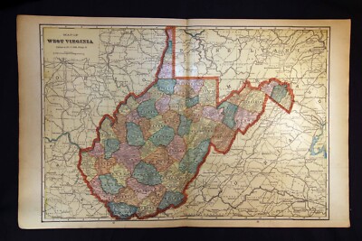
$10.00 Shipping Location: Pleasant Grove, United States You will receive a double sided page of the antique C.A. Gaskell Family & Business 1893 World Atlas This page has: The City of Washington Virginia, West ... moreVirginia, Maryland & Delaware Your page upon purchase will be cut out of the book and sent carefully to you. Thanks for looking!
Buy It Now
$4.00 Shipping Location: Harborton, United States It is in very good condition - note very light creasing and there is another map on the reverse side.
Buy It Now
$7.21 Shipping Location: Fairport, United States B&E Printers 1974, reproduction of original 1866 Atlas. Series originally limited to 300 copies, this copy unnumbered without a cover. Light edge and ... morecorner wear, good overall, spine stitches. A nice find.

$6.00 Shipping Location: Corunna, United States Click to Enlarge Click to Enlarge Click to Enlarge This is an original antique map of Kentucky showing the towns with banks within the state. This map ... moreis printed in color with advertising for the Bankers Register printed on the verso. This map measures about 16.5” x 11.5” and is printed“ Copyright 1907. By J.W. White– O Indicates Location Of Bank Towns” This map has small red circles on each town with a bank in the state. This map came with other similar maps for other states which also showed the location of bank towns within the respective states. I believe this map was part of an bankers’ atlas or portfolio of maps showing bank towns that was originally published by the Bankers Register. This colorful map is an original antique published 105 years ago in very good condition and is very suitable for framing or display. Email any questions. Thanks for looking. Please see the Maps category in my eBay store for more maps including antique Bank Town maps for other states. Payment Terms Winning bidders will receive an email at the end of the auction explaining the option for paying with Paypal. If you have questions about how to pay for this item please let me know. If you made multiple purchases for a single shipment contact us for combined shipping charges which will normally be less than the amount shown on Paypal invoice. You will receive an email notifying you when your item ships. Buyers outside the USA. Please provide a telephone number for customs forms. Shipping Terms Please click on the Shipping& Payment tab above to access the eBay shipping calculator which will give you the options and costs for shipping your item depending on your zip code or country. Our shipping charges are based on actual postage plus less than one dollar to cover materials and handling. This also includes Delivery Confirmation on all domestic shipments. All items are professionally packed and well protected for shipment. All paper items are shipped in a plastic archival sleeve with rigid backing and marked"DO NOT BEND"

$6.00 Shipping Location: Corunna, United States 1907 California Large 2-pg. Color Atlas Map* New Mexico& Montana on back Description: Gorgeous. Original 1907 California Large 2-page Color Atlas ... moreMap. Smaller color New Mexico& Montana color maps are on the back. This is an ORIGINAL.NOT A REPRINT. 106 year-old undated atlas map.that unfolds and measures 14 1/2" x 22" with the borders. The map shows the major towns and cities. Major railroads, rivers, and other geographic features, etc. Great. Historic Map. PLEASE NOTE CONDITION: The map has some lite corner and border wear i ncluding a couple small tears on the borders which can easily be matted over, Otherwise. It is in nice condition. Please see the attached photo to view the map and closeups of the map. NOTE: the map is too large for my scanner.There is a border all the way around the map.Also. The map is much clearer than the scan illustrates.The printing is small but very clear and readable* Purchase this great old map for only $12.95. U.S. Buyer pays $3.00 for shipping. NO INTERNATIONAL SHIPPING~~ See Below Buyers. 1-4 maps can be combined to save on shipping. Maps are sent in sturdy shipping tubes. PLEASE READ: This is an original 1907 undated atlas map. For the winning buyer. I will enclose a copy of the dated 1907 copyright page to keep with their map. If you have any questions about this map or any of my items. Please email me before bidding. I prefer satisfied customers. Thanks! 042713 Cal07.1(c) Please Visit My Ebay Store To View My California. Los Angeles, San Francisco, Nevada, Arizona, Oregon and Other Antique Maps. Thanks For Looking! NO INTERNATIONAL SHIPPING Unless buyers contact me first and agree to the new International shipping charges.Probably $10.00-12.00. Thanks for your understanding!
Buy It Now
$12.85 Shipping Location: Floral Park, United States This is a 24x36 high quality high resolution reproduction in mint condition on 70 lb.
Buy It Now
$12.85 Shipping Location: Floral Park, United States This is a 24x36 high quality high resolution reproduction in mint condition on 70 lb. Each color represents a different type of building: Yellow is Wood; ... morePink is Brick; Brown is Stone or Concrete; Blue is Stucco and Box with Black Lines = Iron Clad.
$6.00 Shipping Location: Corunna, United States Vintage postcard. Due to eBay's latest round of improvements. I have to ship all items first class package rate with a tracking number, which is overkill ... morefor something that weighs less than an ounce and can be mailed for 45 cents, plus, I have to pay eBay fees on the shipping that I have to charge. Thus.Shipping is 2.25($3.25 International) and I am always happy to combine lots to save shipping. I have thousands of vintage and real photo postcards at auction and in my eBay store. Thanks for looking. di,RcmdId ViewItemDescV4,RlogId p4%60bo7%60jtb9%3Fuk%601d72f%2Bishhov%3C%3Edi-1440f9c1406-0xfc-
$6.00 Shipping Location: Corunna, United States This map is from Cram's Superior Reference Atlas of Minnesota and the World published by George F Cram in 1907. This is an original 117 year old map, ... morenot a copy or reprint.
$6.00 Shipping Location: Corunna, United States Nice old map from The New Encyclopedic Atlas and Gazetteer of the World by Collier& Son published in 1914 with census of 1910 City of Kansas City. ... moreMissouri and Kansas Copyrighted in 1907 + + + Page measures 10-3/4" X 15" lots of details on map- see closeups Good condition with some margin tears. Smudges or foxing that is typical for this vintage. All of our maps are originals. We do not destroy good books. But rescue pages from damaged and ruined atlas books. Old maps are shipped rolled up in a tube for protection. Which we have found to be the best way to get them there safely. Buyer pays for mailing outside the US. So please check before bidding. If you cannot find what you are looking for. Let us know. We have many old– city– state– region– territory– country– maps that have not been listed yet. Ask any questions. Thank you.

$6.00 Shipping Location: Corunna, United States Offered here is a page from a vintage 1907 Rand McNally Atlas. Page 63 shows a map of South Dakota. Page 64 shows a map of North Dakota. Both maps identify ... moreeach county's area within the state by a different color. Size of the entire page is 11" x 14"size of the map itself is 9" x 12" Condition is quite good.some general age toning around the borders.also. Please note the page is somewhat larger than my scanner, therefore portion(s) of the map might appear to be somewhat truncated.but, it is not. The darker portion of any images was caused by the map not exactly atop the scanner. Map will be sleeved in plastic. Shipped first class to the United States with backer board in a large flat envelope. If you wish the map to be shipped in a mailing tube, please add another $2.50 for shipping and handling. For shipping charges outside the US, please contact me. Feel free to post questions. Multiple purchases will result in combined shipping charges.

$6.00 Shipping Location: Corunna, United States Click to Enlarge Click to Enlarge Click to Enlarge This is an original antique map of Tennessee showing the state's banking towns. This map is printed ... morein color with advertising for banks printed in the margins around the map. The verso also has advertising for banks. This map measures about 16.5” x 11.5” and is printed“ Copyright 1907. By J.W. White– O Indicates Location Of Bank Towns” This map has small red circles on each town with a bank in the state. This map came with other similar maps for other states which also showed the location of bank towns within the respective states. I believe this map was part of an bankers’ atlas or portfolio of maps showing bank towns that was originally published by the Bankers Register. The maps included a national map of the United States which had advertising on the verso for the Bankers Register. This map has advertising for The Third National Bank of Knoxville. The Fourth National Bank of Nashville, the Mercantile Bank of Memphis and others. This colorful map is an original antique published more than 105 years ago in very good condition and is very suitable for framing or display. Email any questions. Thanks for looking. Please see the Maps category in my eBay store for more maps including antique Bank Town maps for other states. Payment Terms Winning bidders will receive an email at the end of the auction explaining the option for paying with Paypal. If you have questions about how to pay for this item please let me know. If you made multiple purchases for a single shipment contact us for combined shipping charges which will normally be less than the amount shown on Paypal invoice. You will receive an email notifying you when your item ships. Buyers outside the USA. Please provide a telephone number for customs forms. Shipping Terms Please click on the Shipping& Payment tab above to access the eBay shipping calculator which will give you the options and costs for shipping your item depending on your zip code or country. Our shipping charges are based on actual po
Free Shipping Location: Schertz, United States This Map was removed from a 1938 Pictorial Atlas and is in very good condition. The map is not " new " or in " new " condition, it was printed in 1934. ... moreThe map is not dated. Study the photos carefully, this is the actual map you will receive.
Buy It Now
$10.00 Shipping Location: Pleasant Grove, United States You will receive a double sided page of the antique C.A. Gaskell Family & Business 1893 World Atlas This page has: Utah Your page upon purchase will be ... morecut out of the book and sent carefully to you. Thanks for looking!
Buy It Now
$10.00 Shipping Location: Pleasant Grove, United States You will receive a double sided page of the antique C.A. Gaskell Family & Business 1893 World Atlas This page has: Mexico Your page upon purchase will ... morebe cut out of the book and sent carefully to you. Thanks for looking!
Buy It Now
$10.00 Shipping Location: Pleasant Grove, United States You will receive a double sided page of the antique C.A. Gaskell Family & Business 1893 World Atlas This page has: Canada Nova Scotia & New Brunswick ... moreYour page upon purchase will be cut out of the book and sent carefully to you. Thanks for looking!
Buy It Now
$10.00 Shipping Location: Pleasant Grove, United States You will receive a double sided page of the antique C.A. Gaskell Family & Business 1893 World Atlas This page has: New Jersey Baltimore Your page upon ... morepurchase will be cut out of the book and sent carefully to you. Thanks for looking!
Buy It Now
Free Shipping Location: North Wales, United States 1879 ANTIQUE GUYOT'S ATLAS MAP-CENTRAL EUROPE-EXCELLENT DETAIL ORIGINAL ANTIQUE ATLAS MAP PLEASE SEE PHOTOS AS PART OF THE DESCRIPTION CONDITION: MAP ... moreIS IN GOOD CONDITION. SIZE: APPROXIMATELY 10" X 13" SHIPPING: U.S. FIRST CLASS RATE - $7.00 - ANY ITEM WHICH SELLS FOR OVER $100 WILL REQUIRE INSURANCE WE COMBINE SHIPPING FOR MULTIPLE WINS. THANK YOU FOR YOUR INTEREST IN OUR AUCTIONS!.
$6.00 Shipping Location: Corunna, United States Offered here is a page from a vintage 1907 Rand McNally Atlas. Page 39 shows a map of Maryland& Delaware. Page 40 shows a map of Virginia. Both maps ... moreidentify each county's area within the state by a different color. Size of the entire page is 11" x 14"size of the map itself is 9" x 12" Condition is quite good.some general age toning around the borders.also. Please note the page is somewhat larger than my scanner, therefore portion(s) of the map might appear to be somewhat truncated.but, it is not. Map will be sleeved in plastic. Shipped first class to the United States with backer board in a large flat envelope. If you wish the map to be shipped in a mailing tube, please add another $2.50 for shipping and handling. Feel free to post questions. Multiple purchases will result in combined shipping charges.
Free Shipping Location: Schertz, United States This Map was removed from a 1938 Pictorial Atlas and is in very good condition. The map is not " new " or in " new " condition, it was printed in 1934. ... moreThe map is not dated. Study the photos carefully, this is the actual map you will receive.
$6.00 Shipping Location: Corunna, United States This map is from Cram's Superior Reference Atlas of Minnesota and the World published by George F Cram in 1907.
Free Shipping Location: Schertz, United States This antique map page of Saginaw County, Michigan was printed in 1916 using the lithography technique. The plat atlas map was created by G. A. Ogle & ... moreCo. and features a detailed depiction of the county's geography. Measuring approximately 15" x 17", this authentic original map from 1916 is a rare find for collectors of antique maps. (NOTE-SOME MAPS HAVE PENCIL MARKS AND OR STAINS-LOOK CLOSELY) The map showcases various aspects of Saginaw County, Michigan, including its cities, towns, and landmarks. It is an excellent addition to any North America maps collection or for those interested in the history of Michigan.

$6.00 Shipping Location: Corunna, United States 1906 Engraved Color Map: South Carolina Satisfaction Guaranteed This color map of South Carolina is dated 1906 on the face and was included in an encyclopedia ... moreset published in 1907-1908. It was engraved and printed by the LL Poates Co. NY, NY. The map shows all of the state's counties; county seat towns; major cities and many small towns& villages; rivers& streams; and topographic detail. Most of the state's railroads and all of the Major railroads are shown in red. The map is printed on medium weight paper. Blank on the reverse and with a fold in the center(as issued) Bordered map area is about 8.5" x 10.5" with margins of between 1/2" to 1 inch all the way around to allow convenient matting. This is a very attractive older map and would look beautiful- matted and framed. If you want a detailed map showing the state as it was 100 years ago. This is a good one. Map is shown below without full margins; and the second image below is a close-up of the area around Charleston and is included to show quality and detail. One of the following copyright dates appears on the face of this map. Bid with confidence- Returnable for any reason within 10 days for prompt refund. Powered by The free listing tool. List your items fast and easy and manage your active items.
Buy It Now
$6.90 Shipping Location: Audubon, United States Condition is very good, age considered. This map would look great displayed in any room.
Buy It Now
$10.00 Shipping Location: Pleasant Grove, United States You will receive a double sided page of the antique C.A. Gaskell Family & Business 1893 World Atlas This page has: Chicago Iowa Your page upon purchase ... morewill be cut out of the book and sent carefully to you. Thanks for looking!

$6.00 Shipping Location: Corunna, United States Gorgeous. Original and LARGE 1907 Washington 2-page Color Map. 11 x 14" color map of Idaho is on the back. This is a large, ORIGINAL.NOT A REPRINT. ... more98 + year-old undated map.that measures 22" x 14 1/2" with the borders and would look fantastic matted and framed. The map shows towns and cities, major railroads, roads, geographic features, etc. Great, Historic Item that is in very Nice Condition. Please see the attached photo to view the Map. Please note that the map is too large for my scanner.There is a border all the way around the map.Also, the map is much clearer than the scan illustrates.All of the printing is very clear and readable* Purchase this large, vintage old map for only $16.95. U.S. Buyer pays $2.50 for shipping. International Buyers Must Email Me For Shipping Charges. Items can be combined to save on shipping. When possible, I mail these old maps in sturdy shipping tubes. Please visit my Ebay store to view my other vintage maps and other items. Please Note: This is an original undated Atlas map.if you have any questions about this map or any of my items, please email me before bidding. Thanks! 7285 5100Wash7.1(C) On Oct-25-07 at 21:18:18 PDT. Seller added the following information:
Buy It Now
$4.95 Shipping Location: Willow Grove, United States This is an ORIGINAL early 1920s South Dakota map taken from a 1920s atlas.
$6.00 Shipping Location: Corunna, United States This map is from Cram's Superior Reference Atlas of Minnesota and the World published by George F Cram in 1907. This is an original 117 year old map, ... morenot a copy or reprint.

$6.00 Shipping Location: Corunna, United States 1907 Engraved Color Map: Alabama Satisfaction Guaranteed This color map of Alabama is dated 1907 on the face and was included in an encyclopedia set published ... morein 1907-1908. It was engraved and printed by the LL Poates Co. NY, NY. The map shows all of the state's counties; county seat towns; major cities and many small towns& villages; rivers& streams; and topographic detail. Most of the state's railroads and all of the Major railroads are shown in red. The map is printed on medium weight paper. Blank on the reverse and with a fold in the center(as issued) Bordered map area is about 8.5" x 10.5" with margins of between 1/2" to 1 inch all the way around to allow convenient matting. This is a very attractive older map and would look beautiful- matted and framed. If you want a detailed map showing the state as it was 100 years ago. This is a good one. Map is shown below without full margins; and the second image below is a close-up of the area around Montgomery and is included to show quality and detail. One of the following copyright dates appears on the face of this map. Bid with confidence- Returnable for any reason within 10 days for prompt refund. Powered by The free listing tool. List your items fast and easy and manage your active items. 1t.RcmdId ViewItemDescV4,RlogId p4%60bo7%60jtb9%3Fuk%601d72f%2Bhpojt%3Af%3E1t-13d17009c5a-0xfe-

$6.00 Shipping Location: Corunna, United States Gorgeous. Original and LARGE 1907 Oregon 2-page Color Map. 11 x 14" color maps of Wyoming& Utah are on the back. This is a large, ORIGINAL.NOT ... moreA REPRINT. 98 + year-old undated map.that measures 22" x 14 1/2" with the borders and would look fantastic matted and framed. The map shows towns and cities, major railroads, roads, geographic features, etc. Great, Historic Item that is in very Nice Condition. Please see the attached photo to view the Map. Please note that the map is too large for my scanner.There is a border all the way around the map.Also, the map is much clearer than the scan illustrates.All of the printing is very clear and readable* Purchase this vintage old map for only $16.95. U.S. Buyer pays $2.50 for shipping. International Buyers Must Email Me For Shipping Charges. Items can be combined to save on shipping. Please visit my Ebay store to view my other vintage maps and other items. Please Note: This is an original undated Atlas map.if you have any questions about this map or any of my items, please email me before bidding. Thanks! 7285 5098Oreg7.1(C) On Nov-09-07 at 19:39:12 PST. Seller added the following information:
$6.00 Shipping Location: Corunna, United States This map is from Cram's Superior Reference Atlas of Minnesota and the World published by George F Cram in 1907. This is an original 117 year old map, ... morenot a copy or reprint.
Free Shipping Location: Schertz, United States This antique map page of Saginaw County, Michigan was printed in 1916 using the lithography technique. The plat atlas map was created by G. A. Ogle & ... moreCo. and features a detailed depiction of the county's geography. Measuring approximately 15" x 17", this authentic original map from 1916 is a rare find for collectors of antique maps. (NOTE-SOME MAPS HAVE PENCIL MARKS AND OR STAINS-LOOK CLOSELY) The map showcases various aspects of Saginaw County, Michigan, including its cities, towns, and landmarks. It is an excellent addition to any North America maps collection or for those interested in the history of Michigan.
$6.00 Shipping Location: Corunna, United States ELKINS. BEVERLY, COALTON, WEST VIRGINIA, 1907 TOPO MAP Shipping Info | Business Policies | Also Available Description loaded with the locations of dozens ... moreof old schools! Other locations of interest include Stonecoal School. Goff School, Kaufman Church, Roaring Creek Junction, Claylick School, Riverdale School, Canfield School, Arnold Hill, Lick Church, Hazelwood School, Pleasant View School, Elkhorn School, Valley Bend, Wilson School, Valley Bend Church, Glade Run School, Thomas School, Burnt Bridge, Mt. Vernon School, Roaring Creek, Rich Mountain School, Tyre School, and many many more! Of particular interest are the 1900 railroad lay-outs(the Western Maryland Railroad- Durbin Branch, the Western Maryland Railroad- Belington Branch, the Western Maryland Railroad- Huttonsville Branch, and the Coal and Coke Railroad- North Division) Listed as the WEST VIRGINIA- ELKINS QUADRANGLE. This is an authentic 1907 survey(edition of May 1909) U.S.G.S. Topographical Map reproduced in black and white and distributed by the Midcontinent Map Company until my father bought them out back in the mid'80s. These maps are not available anywhere else! If you are a serious relic hunter these maps can be invaluable! Shows the individual buildings, all roads, railways, and the topography of the land at the time of the survey. Shows towns that no longer exist and the then current layout of all creeks and waterways. A great tool for locating ghost towns and Civil War campsites! Actual map size is 16 5/8" X 20 1/8" with viewable portion being 13 3/4" X 17 1/2" The scale is 1/62500 which is approximately 1 mile equals 1 inch. Has a map company stamp in the border. This map is a more modern copy, is crystal clear. And is in mint condition! Covers latitude 38 degrees 45' to 39 degrees 00' and longitude 79 degrees 45' to 80 degrees 00' Covers the northwest quadrant of the 30 minute Beverly quadrangle which I also have listed. I do not have any other adjoining quadrangles available for this map at this tim
Free Shipping Location: Schertz, United States This antique map page of Saginaw County, Michigan was printed in 1916 using the lithography technique. The plat atlas map was created by G. A. Ogle & ... moreCo. and features a detailed depiction of the county's geography. Measuring approximately 15" x 17", this authentic original map from 1916 is a rare find for collectors of antique maps. (NOTE-SOME MAPS HAVE PENCIL MARKS AND OR STAINS-LOOK CLOSELY) The map showcases various aspects of Saginaw County, Michigan, including its cities, towns, and landmarks. It is an excellent addition to any North America maps collection or for those interested in the history of Michigan.
$6.00 Shipping Location: Corunna, United States This map is from Cram's Superior Reference Atlas of Minnesota and the World published by George F Cram in 1907. This is an original 117 year old map, ... morenot a copy or reprint.
Buy It Now
Free Shipping Location: North Wales, United States 1838 ANTIQUE SMILEY'S ATLAS MAP-EUROPE-HAND COLORED ORIGINAL ANTIQUE ATLAS MAP PLEASE SEE PHOTOS AS PART OF THE DESCRIPTION CONDITION: MAP IS IN GOOD ... moreCONDITION. SIZE: APPROXIMATELY 9.5" X 12.5" SHIPPING: U.S. FIRST CLASS RATE - FREE SHIPPING - ANY ITEM WHICH SELLS FOR OVER $100 WILL REQUIRE INSURANCE WE COMBINE SHIPPING FOR MULTIPLE WINS. THANK YOU FOR YOUR INTEREST IN OUR AUCTIONS!.
$6.00 Shipping Location: Corunna, United States This map is from Cram's Superior Reference Atlas of Minnesota and the World published by George F Cram in 1907. This is an original 117 year old map, ... morenot a copy or reprint.
Buy It Now
$6.50 Shipping Location: Evansdale, United States For sale is an original antique map. Size: 13.5" x 10.75" - Various signs of wear. See all photos for details.
Buy It Now
$6.00 Shipping Location: Blue Bell, United States THIS MAP IS IN GOOD CONDITION AND PUBLISHED BY AUGUSTUS MITCHELL. CONDITION: MAP IS IN GOOD. OVER 150 YEARS OLD! Over 100,000,000 served. MULTIPLE WINS.
$6.00 Shipping Location: Corunna, United States This map is from Cram's Superior Reference Atlas of Minnesota and the World published by George F Cram in 1907. This is an original 117 year old map, ... morenot a copy or reprint.
Buy It Now
$6.00 Shipping Location: North Wales, United States 1853 ANTIQUE CORNELL ATLAS MAP-WESTERN & CENTRAL EUROPE-EXCELLENT COLOR ORIGINAL ANTIQUE ATLAS MAP PLEASE SEE PHOTOS AS PART OF THE DESCRIPTION CONDITION: ... moreMAP IS IN GOOD CONDITION. SIZE: APPROXIMATELY 6.5" X 8.5" SHIPPING: U.S. FIRST CLASS RATE - $6.00 - ANY ITEM WHICH SELLS FOR OVER $100 WILL REQUIRE INSURANCE WE COMBINE SHIPPING FOR MULTIPLE WINS. THANK YOU FOR YOUR INTEREST IN OUR AUCTIONS!.
Buy It Now
$14.50 Shipping Location: Belton, United States These are shown as pasted additions or additions made by pen and ink. Overall Paper size: Approx. 19 3/4” wide x 20” tall.
Buy It Now
$14.50 Shipping Location: Belton, United States These are shown as pasted additions or additions made by pen and ink. Overall Paper size: Approx. 19 3/4” wide x 20” tall.
Buy It Now
$4.00 Shipping Location: Harborton, United States It is in very good condition - note light creasing and there is another map on the reverse side.
Buy It Now
$10.00 Shipping Location: Pleasant Grove, United States You will receive a double sided page of the antique C.A. Gaskell Family & Business 1893 World Atlas This page has: Kansas South Dakota Your page upon ... morepurchase will be cut out of the book and sent carefully to you. Thanks for looking!
|
|
|
In
|
1898 Kansas City, Mo. Original Color Atlas Map** St. Louis back .114 years-old!
1898 Kansas City. Mo. Original Color Atlas Map* St. Louis back.114 years-old! Gorgeous. Original 1898 Main portion of Kansas City Missouri& part of KC Kansas Color Map. St. Louis map is on the back. This is an ORIGINAL.NOT A REPRINT. 114 +++ year-old Undated atlas map.that measures 14 1/2" x 11" with the borders and would look fantastic matted and framed. The Map includes a Several Points of interest. Steam. Cable& Horse Roads, Several Depots, cemeteries, Streets, rails, etc. Great. Historic Item. NOTE CONDITION: The map has a little border and corner wear otherwise. It is in Nice Condition. Please see the attached photo to view the Map and a couple of closeup of a sections of the map. Please note that the map is too large for my scanner.also. All of the printing is VERY SMALL but much clearer than the scan illustrates, ... morestreets, etc. are small but clear and readable even for an old blind guy like me* Minimum bid for this 114 year-old map is only $14.95 or purchase it for only $17.95. U.S. Buyer pays $3.00 for shipping. $4.00 shipping to Canada. $6.00 shipping to Europe. Asia and Pacific. 1-4 maps can be combined to save on shipping. PLEASE READ: This is an original 1898 undated atlas map. For the winning bidder. I will enclose a copy of the dated 1898 copyright page to keep with their map. I prefer satisfied customers and try to accurately describe all of my maps and Ebay items so there is not any misunderstandings. If you have any questions about this map or any of my Ebay items. Please email me before bidding. Thanks! 093012 KCity98.1(C) Please Visit My Ebay Store To View My Vintage Kansas City. St. Louis, St. Joseph, Missouri, Kansas, Arkansas and Other Antique Maps. Thanks For Looking! ALL INTERNATIONAL BUYERS PLEASE READ: Please be aware that some packages going into Canada. The UK and France are taking a very long time for delivery.2-weeks in some cases. Although I mail them as quickly as I can.I have no control over how long it takes for them to be delivered after
|
|
|
1864 AJ Johnson Atlas Map Louisiana Mississippi Arkansas Large Size Rare
You are bidding on a very extremely rare and 100% authentic antique hand colored map from the above cartographer/map maker. Region, and year. I sell only original antique maps. This is NOT a copy or reproduction and is an original antique map from the year shown. General Description: This is a stunning and very detailed map which is hand colored in wonderfully intense colors. Political boundaries as well as individual regions/counties and shows towns. Roads, railways, rivers, lakes, bays, harbors, islands and other important places are shown. The map is in great condition considering the age of the map. The overall size of the map sheet is large at approximately 18 inches by 26 inches. The map is far more beautiful than my pictures show. This map will look wonderful when matted and framed and will be a great addition to your collection. The ... moremap is a 100% original and genuine antique map created and printed in the year shown. Payment Terms: US bidders: Terms: PayPal is accepted. Payment is expected within 7 days of the end of the auction. I ship a couple of times per week. All sales are final so bid carefully and ask any questions prior to the end of the auction. I ship these rolled and in strong reinforced heavy tubes. Buyer will pay shipping and handling charges of $8.00 for the US. Insurance starts at $5.00. I will combine the shipping charges if you win more than one item. International bidders: Terms: PayPal is accepted. Payment is expected within 7 days of the end of the auction. All sales are final so bid carefully and ask any questions prior to the end of the auction. I ship these rolled and in strong reinforced heavy tubes. Buyer will pay shipping and handling charges of $10.00. If you want these shipped via Registered mail. Then you need to add another $10.00 for a total shipping charge of $20.00. I will combine the shipping charges if you win more than one item. All Bidders: Bidding on items is your acceptance of these terms and conditions. No exceptions! May God Bless you and your families!
|
|
|
1891 original colored atlas page map Kansas / Missouri
1891 Crams Atlas of the World- Map of Kansas Book Copyright date is 1891 + + + + Reverse side of page is map of Missouri + + + + Large original map. The map is too wide to fit on my scanner so the margins are partially cut off. Lots of details on these maps. See the closeups for examples. page measures 14-1/2" X 11-3/4" + + + There is some usual darkening around the edges of the pages. But generally in good condition for paper that is 121 years old! Also. The margin where the page was bound in the book has staple holes and staining from rust. It is outside the map area and still good for framing. All of my maps are originals. I do not destroy good books. But rescue pages from damaged and ruined atlases. I mail maps rolled up in a tube for protection. Which I have found it to be the most reliable way for the map to arrive without ... moredamage. I have hundreds of other- city- state- region- territory- country- maps that I have not yet listed, so let me know if you cannot find what you are looking for. + + + Buyer to pay shipping outside the US. So please check before bidding. If you are not satisfied. You can return the map. Ask any questions.
|
|
|
1898 Alabama Original Color Atlas Map** Mississippi map on back .115 years-Old!!
1898 Alabama Original Color Atlas Map* Mississippi map on back.115 years-Old! Gorgeous. Original 1898 Alabama Color Atlas Map. Mississippi color map is on the back This is an ORIGINAL.NOT A REPRINT. 11 5 +++ year-old Undated atlas map.that measures 11" x 14 1/2" with the borders and would look fantastic matted a The map shows towns and cities. Railroads, Creeks and Rivers and other geographical features. NOTE: The map doesn't show roads. Great. Historic Item. NOTE CONDITION: The map has a little border and corner wear. Otherwise. It is in Nice Condition. Please see the attached photo to view the Map and a couple of closeup of a sections of the map. Please note that the map is too large for my scanner.also. All of the printing is much clearer than the scan illustrates, streets, etc. are small but very clear and readable even ... morefor an old blind guy like me* Minimum bid for this 11 5 year-old map is only $9.95 or purchase it for only $12.95. U.S. Buyer pays $3.00 for shipping. $4.00 shipping to Canada. $6.00 shipping to Europe. Asia and Pacific. 1-4 maps can be combined to save on shipping. PLEASE READ: This is an original 1898 undated atlas map. For the winning bidder. I will enclose a copy of the dated 1898 copyright page to keep with their map. I prefer satisfied customers and try to accurately describe all of my maps and Ebay items so there is not any misunderstandings. If you have any questions about this map or any of my Ebay items. Please email me before bidding. Thanks! 010813 Ala 98. 2(C) Please Visit My Ebay Store To View My Vintage Alabama. Louisiana. New Orleans, Arkansas, Mississippi, Florida, Georgia, South Carolina and Other Antique Maps. Thanks For Looking! ALL INTERNATIONAL BUYERS PLEASE READ: Please be aware that some packages going into Canada. The UK and France are taking a very long time for delivery.2-weeks and longer in some cases depending on customs. Although I mail them as quickly as I can.I have no control over how long it takes for them to be delive
|
|
|
Jasper County, Iowa Map, ORIGINAL from Andreus Atlas 1875, Hand colored, NICE!
Original Map of Jasper County. Iowa from Andreus Atlas of Iowa of 1875. Fine hand-colored map from the historic Iowa Atlas. 17 1/2 inches tall by approx. 14 inches. Great detail, classic border decorations finely engraved. We will have a collection of other original ANDREUS ATLAS IOWA COUNTY MAPS from the year 1875 up on eBay in the weeks ahead. Very Good Plus Condition with minor aging to paper. Several small spots/stains. Froo www.froo.com | Froo Cross Sell. Free Cross Sell, Cross promote, eBay Marketing, eBay listing Apps, eBay Apps, eBay Application.
|
|
|
1893 large colored Columbian Atlas page original state map Iowa
Map pages from the 1893 Columbian Atlas of the World We Live In- M ap of Iowa page measures 11-1/2" X 14" + + + There is some typical darkening from age and handling around the edges of the pages. But overall in good condition for a document that was printed 118 years ago! All of my maps are originals. I do not destroy good books. But rescue pages from damaged and ruined atlases. I mail maps rolled up in shipping tubes for protection. Which I have found to be the best way to get the item delivered without shipping damage. Buyer pays for shipping outside the US. So check before bidding. If you cannot find the map you are looking for. Let me know. I have about a thousand old– city– state– region– territory– country– maps that are not yet listed. If you don't like your purchase. It can be returned. + + + Ask any questions.
|
|
|
1900's Collier atlas page original city map St Louis Missouri
Nice old map from The New Encyclopedic Atlas and Gazetteer of the World by Collier& Son published in 1914 with census of 1910 City of St Louis Missouri This page does not show a copyright date. But the other city maps generally show coprights from 1903 to 1908. + + + Page measures 10-3/4" X 15" lots of details on map- see closeups Good condition with some margin smudges and foxing that is typical for this vintage. All of our maps are originals. We do not destroy good books. But rescue pages from damaged and ruined atlas books. Old maps are shipped rolled up in a tube for protection. Which we have found to be the best way to get them there safely. Buyer pays for mailing outside the US. So please check before bidding. If you cannot find what you are looking for. Let us know. We have many old– city– state– region– territory– country– ... moremaps that have not been listed yet. Ask any questions. Thank you.
|
|
|
1918 OGLE ATLAS WAYNE COUNTY NEBRASKA NE Plat Map Book
1918 OGLE ATLAS WAYNE COUNTY NEBRASKA NE Plat Map Book For your consideration is a 1918 Atlas of Wayne County. Nebraska. It was compiled and published by Geo. A. Ogle& Co. of Chicago, Illinois. The Atlas has pages of village, city, and precinct plat maps that include the names of the property owners, location, and acres. Atlas also includes an outline map of Wayne County, map of the state of Nebraska, map of the United States, map of the world, illustrations, Patron's Directory, Analysis of the system of United States land Surveys, Digest of the system of Civil Goverment, General information regarding banking and business methods, and Ancient, Medieval and Modern History(chronologically arranged) Book is in overall good condition. The hard covers and binding are in fair condition- tape on the spine and showing wear(see photos) For ... moreit's age. The maps have held up fairly well(see photos) Page 27 the map of Leslie Precinct has a tear on the lower left side of the page. Same tear also affects page 28 the map of Logan Precinct(see photos) Pages have age related color, and some stains(see photos) Looks like some of the pages have had some water damage. Those pages have a wave on the sides and bottom of the paper. No handwriting in the book, but it does have a few pencil marks. Book measures approximately 15 1/2" x 17 3/4" x 3/4" Due to improper storage over the last 90 plus years, it will need an airing out. Ships with Delivery Confirmation. Happy to combine shipping on multiple purchases. PAYMENT IS DUE IN 5 DAYS
|
|
|
1920 ANDERSON ATLAS DOUGLAS & SARPY COUNTY NEBRASKA NE Township Plat Map Book
1920 ANDERSON ATLAS DOUGLAS& SARPY COUNTY NEBRASKA NE Township Plat Map Book For your consideration is a 1920 Atlas of Douglas and Sarpy Counties. Nebraska. It was published by the Anderson Publishing Co. Des Moines, Iowa. The Atlas has pages of Township plat maps that include the names of the property owners, location, and acres. Atlas also includes an outline map of Douglas and Sarpy Counties, map of the state of Nebraska, map of the United States, map of the world, Farmers Directory, and Analysis of the system of United States land Surveys. Book is in overall fair condition. The hard covers have separated from the staple bound maps. The Title page is still bound to the front hard cover. For it's age. Most of the Township maps have held up fairly well(see photos) The first page Nebraska Topical map is starting to separate from the ... morebinding. The last couple of pages in the atlas US Government Land Surveys and the map of the World are also starting to separate from the binding. The World map has a tear on the bottom(see photo) Pages have tears along the edges, age related color, and stains(see photo) Book measures approximately 15" x 17 3/4" x 1/2" Due to improper storage over the last 90 years, it will need an airing out. Ships with Delivery Confirmation. Happy to combine shipping on multiple purchases. PAYMENT IS DUE IN 5 DAYS.RcmdId ViewItemDescV4,RlogId p4%60bo7%60jtb9%3Fv%7F.rpn31%3E-13d4b9fac55-0x108-
|
|
|
1904 OGLE ATLAS HALL COUNTY NEBRASKA NE Plat Map Book
1904 OGLE ATLAS HALL COUNTY NEBRASKA NE Plat Map Book For your consideration is a 1904 Atlas of Hall County. Nebraska. It was compiled and published by Geo. A. Ogle& Co. of Chicago, Illinois. The Atlas has pages of village, city, and precinct plat maps that include the names of the property owners, location, and acres. Atlas also includes an outline map of Hall County, map of the state of Nebraska, map of the United States, map of the world, illustrations, Patron's Directory, Portrait Department, Analysis of the system of United States land Surveys, Digest of the system of Civil Goverment, General information regarding banking and business methods, and Ancient, Medieval and Modern History(chronologically arranged) Book is in overall fair condition. The hard covers and binding are in fair condition. But the hard covers are starting ... moreto separate(see photos) For it's age. The maps have held up fairly well(see photos) Some of the pages are soiled and have age related color. There are tears around the edges of many of the pages. Maps that have not survived well are the North Part of Grand Island pages 46 and 47 and the South Part of Grand Island pages 50 and 51. These pages are very soiled and have tears that affect the maps. The South Part of Grand Island is missing a piece of the map on page 51 on the bottom. Handwriting in the inside front cover says"Belongs in the office of the Sheriff" Book measures approximately 15 1/2" x 18" x 1" Due to improper storage over the last 90 plus years, it will need an airing out. Ships with Delivery Confirmation. Happy to combine shipping on multiple purchases. PAYMENT IS DUE IN 5 DAYS
|
|
|
1898 Missouri Original Antique Color Atlas Map** 114 years-Old!!
1898 Missouri Original Color Map* 113 years-Old! Gorgeous. Original 1898 Missouri Color Map. This is an ORIGINAL.NOT A REPRINT. 11 4 +++ year-old Undated atlas map.that measures 14 1/2" x 11" with the borders and would look fantastic matted a The map shows towns and cities. Railroads, Creeks and Rivers and other geographical features. NOTE: The map doesn't show roads. Great. Historic Item. NOTE CONDITION: The map has a little border and corner wea r, otherwise. It is in Nice Condition. Please see the attached photo to view the Map and a couple of closeup of a sections of the map. Please note that the map is too large for my scanner.also. All of the printing is much clearer than the scan illustrates, streets, etc. are small but very clear and readable even for an old blind guy like me* Minimum bid for this 11 4 year-old map is ... moreonly $ 9.95 or purchase it for only $12.95. U.S. Buyer pays $3.00 for shipping. $4.00 shipping to Canada. $6.00 shipping to Europe. Asia and Pacific. 1-4 maps can be combined to save on shipping. PLEASE READ: This is an original 1898 undated atlas map. For the winning bidder. I will enclose a copy of the dated 1898 copyright page to keep with their map. I prefer satisfied customers and try to accurately describe all of my maps and e bay items so there is not any misunderstandings.If you have any questions about this map or any of my Ebay items. Please email me before bidding. Thanks! 101312 Mo98. 4(C) Please Visit My e bay Store To View My Vintage Missouri. St. Louis, Kansas City, Louisiana, New Orleans, Arkansas, Mississippi, Florida, Georgia, Alabama, South Carolina and Other Antique Maps. Thanks For Looking! ALL INTERNATIONAL BUYERS PLEASE READ: Please be aware that some packages going into Canada. The UK and France are taking a very long time for delivery.2-weeks in some cases depending on customs. Although I mail them as quickly as I can.I have no control over how long it takes for them to be delivered after I mail them.Also, These old maps ar
|
|
|
1885 Arkansas Original Color Atlas Map** with Population... 127 Years-Old!!
1885 Arkansas Original Color Atlas Map* with Population. 127 Years-Old! Gorgeous. Original 1885 Arkansas color Atlas map. A section of West Texas color map is on back This is an ORIGINAL.NOT A REPRINT. 127 + year-old undated atlas map.The total size of the entire map measures 13 1/2" x 11" with the borders. The map lists the area and population; It shows towns. Railroads, rivers, and other Geographic features, etc. Great, Historic Item. NOTE: This map doesn't show roads. NOTE CONDITION: The map has a a little border and corner wear, overall. It is in Nice Condition and will look wonderful matted and framed. These old maps make great gifts) Please see the attached photo to view the Map. And a couple of closeup sections of the map. Please note that the map is too large for my scanner.There is a border all the way around the map.Also. ... moreThe map is much clearer than the scan illustrates. The printing is small but very clear and readable* Minimum bid for this 127 year-old map starts at only $15.95 or purchase it for only $17.95. U.S. Buyer pays $3.00 for shipping. $4.00 shipping to Canada; $6.00 to Europe. 1-4 maps can be combined to save on shipping. Maps are shipped in sturdy mailing tubes. Please Note: This is an original 1885 undated atlas map. For the winning bidder. I will enclose a copy of the dated 1885 copyright page to keep with their map. If you have any questions about this map or any of my items. Please email me before bidding. Thanks! 071412 Ark85.1(C) Please visit my Ebay store to view my Arkansas. Louisiana, New Orleans, Florida, Georgia, Atlanta, Alabama, Birmingham, Carolinas and other vintage maps. Thanks for looking! ALL INTERNATIONAL BUYERS PLEASE DON'T BID UNTIL YOU READ THE FOLLOWING: Please be aware that some packages going into Canada. The UK and France are taking a very long time for delivery.2-or More weeks in some cases. Although I mail them as quickly as I can.I have no control over how long it takes for them to be delivered after I mail them.
|
|
|
1898 Louisiana Original Color Atlas Map** 115 years-Old!!
1898 Louisiana Original Color Atlas Map* 11 5 years-Old! Gorgeous. Original 1898 Louisiana Color Atlas Map. This is an ORIGINAL.NOT A REPRINT. 11 5 +++ year-old Undated atlas map.that measures 11" x 14 1/2" with the borders and would look fantastic matted a The map shows towns and cities. Railroads, Creeks and Rivers and other geographical features. NOTE: The map doesn't show roads. Great. Historic Item. NOTE CONDITION: The map has a little border and corner wear. Otherwise. It is in Nice Condition. Please see the attached photo to view the Map and a couple of closeup of a sections of the map. Please note that the map is too large for my scanner.also. All of the printing is much clearer than the scan illustrates, streets, etc. are small but very clear and readable even for an old blind guy like me* Minimum bid for this 11 5 ... moreyear-old map is only $9.95 or purchase it for only $12.95. U.S. Buyer pays $3.00 for shipping. $4.00 shipping to Canada. $6.00 shipping to Europe. Asia and Pacific. 1-4 maps can be combined to save on shipping. PLEASE READ: This is an original 1898 undated atlas map. For the winning bidder. I will enclose a copy of the dated 1898 copyright page to keep with their map. I prefer satisfied customers and try to accurately describe all of my maps and Ebay items so there is not any misunderstandings. If you have any questions about this map or any of my Ebay items. Please email me before bidding. Thanks! 010613 La98. 6(C) Please Visit My Ebay Store To View My Vintage Louisiana. New Orleans, Arkansas, Mississippi, Florida, Georgia, Alabama, South Carolina and Other Antique Maps. Thanks For Looking! ALL INTERNATIONAL BUYERS PLEASE READ: Please be aware that some packages going into Canada. The UK and France are taking a very long time for delivery.2-weeks and longer in some cases depending on customs. Although I mail them as quickly as I can.I have no control over how long it takes for them to be delivered after I mail them.Also, These old maps are shipped in
|
|
|
1898 Arkansas Original Color Atlas Map** 115 years-Old!!
1898 Arkansas Original Color Atlas Map* 115 years-Old! Gorgeous. Original 1898 A rkansas Color Atlas Map. This is an ORIGINAL.NOT A REPRINT. 11 5 +++ year-old Undated atlas map.that measures 1 4 1/2" x 1 1" with the borders and would look fantastic matted a The map shows towns and cities. Railroads, Creeks and Rivers and other geographical features. NOTE: The map doesn't show roads. Great. Historic Item. NOTE CONDITION: The map has a little border and corner wear. Otherwise. It is in Nice Condition. Please see the attached photo to view the Map and a couple of closeup of a sections of the map. Please note that the map is too large for my scanner.also. All of the printing is much clearer than the scan illustrates, streets, etc. are small but very clear and readable even for an old blind guy like me* Minimum bid for this 11 5 ... moreyear-old map is only $9.95 or purchase it for only $12.95. U.S. Buyer pays $3.00 for shipping. $4.00 shipping to Canada. $6.00 shipping to Europe. Asia and Pacific. 1-4 maps can be combined to save on shipping. PLEASE READ: This is an original 1898 undated atlas map. For the winning bidder. I will enclose a copy of the dated 1898 copyright page to keep with their map. I prefer satisfied customers and try to accurately describe all of my maps and Ebay items so there is not any misunderstandings. If you have any questions about this map or any of my Ebay items. Please email me before bidding. Thanks! 010813 Ark 98. 2(C) Please Visit My Ebay Store To View My Vintage Arkansas. Alabama. Louisiana. New Orleans, Mississippi, Florida, Georgia, South Carolina and Other Antique Maps. Thanks For Looking! ALL INTERNATIONAL BUYERS PLEASE READ: Please be aware that some packages going into Canada. The UK and France are taking a very long time for delivery.2-weeks and longer in some cases depending on customs. Although I mail them as quickly as I can.I have no control over how long it takes for them to be delivered after I mail them.Also, These old maps are shipped
|
|
|
1898 SAINT LOUIS MISSOURI Map McNally Atlas Original Antique!
An ORIGINAL antique color map of ST. LOUIS MISSOURI from McNally's Atlas. 1898. Map shows hundreds of named streets as well as Railroads, Railroad Depots, and Street Car Lines. The map measures 11 by 14 inches and an index in the margin lists the streets and Points Of Interest. Date is printed along the lower border. Perfect for matting and framing. This ORIGINAL antique map is guaranteed over 110 years old. I do not sell reproductions. Discounted shipping too. I ship all items within 2 business days but the Post Office can sometimes be very slow delivering them. If there is a delay in your receiving an item please send me an email and I will track it down. I also have a 100% refund policy if you are unhappy with an item for ANY reason. Just email me I am very easy to work with. On Oct-19-07 at 13:06:06 PDT. Seller added the following ... moreinformation:
|
|
|
1895 KANSAS NEBRASKA Atlas Map McNally Original Antique
An ORIGINAL antique color map of KANSAS from McNally's Atlas. 1895. There is a map of NEBRASKA on the reverse side. Map shows counties individually colored along with hundreds of railroads with their names printed next to them. The map measures 11 by 14 inches and an index in the margin lists counties, chief cities, land area, and population further divided into MALE, FEMALE, NATIVE, FOREIGN, WHITE, AFRICAN, CHINESE, JAPANESE, and INDIAN. Date is printed along the lower border. Perfect for matting and framing, this ORIGINAL antique map is guaranteed over 110 years old. I do not sell reproductions. Discounted shipping too. NO international shipping. NO exceptions. I ship all items within 2 business days but the Post Office can sometimes be very slow delivering them. If there is a delay in your receiving an item please send me an email ... moreand I will track it down. I also have a 100% refund policy if you are unhappy with an item for ANY reason. Just email me I am very easy to work with. On Oct-19-07 at 13:06:06 PDT. Seller added the following information:
|
|
|
1895 ARKANSAS KANSAS CITY Atlas Map McNally Original Antique
An ORIGINAL antique color map of ARKANSAS from McNally's Atlas. 1895. Map shows counties individually colored along with hundreds of railroads with their names printed next to them. The map measures 11 by 14 inches and an index in the margin lists counties, chief cities, land area, and population further divided into MALE, FEMALE, NATIVE, FOREIGN, WHITE, AFRICAN, CHINESE, JAPANESE, and INDIAN. Date is printed along the lower border. There is a map of KANSAS CITY on the reverse. Perfect for matting and framing, this ORIGINAL antique map is guaranteed over 110 years old. I do not sell reproductions. Discounted shipping too. I ship all items within 1 business day but the Post Office can sometimes be very slow delivering them. If there is a delay in your receiving an item please send me an email and I will track it down. I also have a 100% ... morerefund policy if you are unhappy with an item for ANY reason. Just email me I am very easy to work with. On Oct-19-07 at 13:06:06 PDT. Seller added the following information:
|
|
|
1879 Black Atlas Map - Missouri Arkansas - St. Louis Kansas City Little Rock
Click Here. Double your traffic. Get Vendio Gallery- Now FREE! Lake Erie Maps& Prints! An Authentic Antique Map: Not a Modern Reproduction! See Our Ebay Store for More! Free Shipping on Purchases of 5 or More Maps and Prints Description: It is an authentic antique map over 132 years old. It is from an 1879 edition of Black's Gerneral Atlas of the World(Edinburgh: Adam and Charles Black. 1879) a copy of the title page is included for authenticity. The publisher is stated in the bottom center margin. It is not matted nor framed being sold as a single sheet as shown in the main pic, blank on the reverse. Overall, a very nice map that would frame up nicely. Size: The dimensions of the map area between the neat lines measures 10 by 16 inches(25x41cm) on a page measuring 12 1/2 by 17 3/4" 32x44cm) with a margin all around as seen in ... morethe main pic. Condition: The map is in Very Good condition with overall light tonal ageing and some darkening around the edges of the margin. Otherwise it is very clean with strong color on a heavy page, blank on the reverse. It is basically as seen in the pics, see the pic for more on condition. The pics are of the actual map. Payment Details: We accept most major credit cards through Paypal and Ebay. Please ask if you have any questions about other forms of payment. International and New Bidders are welcomed and encouraged. Payment is expected within 7 days. After which Nonpaying Bidders will be reported to Ebay to recoup our listing fees. Shipping: $3.95 for First Class or $5.95 for Priority Mail with Delivery Confirmation in the USA. $5.95 for First Class International to Canada; $10.00 for International Airmail elsewhere in the World. We ship daily, so if still bidding send us a quick email to hold or better just pay all at once at the end. Save on Shipping: We only charge one shipping fee based on the largest map or print with multiple items shipped along with it for no extra costs. Purchase 5 or more maps or prints and receive Free First Class shipping in USA or First Cl
|
|
|
1875 Iowa Union & Adams County Map from the 1875 Andreas atlas
Here is a 1875 Original Iowa County Map of Union county on front side on back side map of Adams county Iowa from the AT Andreas Atlas. Map in excellent condition great for framing or checking genealogy, shows names of early settlers& locations on map, also show routes of early railroads& rivers. check scans. High bidder add 6.00 for S&H Good luck bidding. Check my store& auctions for more maps, books, magazines. RcmdId ViewItemDescV4,RlogId p4%60bo7%60jtb9%3Fv%7F.rpn36%3E-13d7cc02847-0x106-
|
|
|
1875 Iowa Audbun & Crawford County Map from the 1875 Andreas atlas
Here is a Original 1875 Iowa County Map of Crawford county along with page of early history of the county. backside map of Audbon County Iowa maps are from the 1875 andreas atlas& are not reprints. map in very good bright colored condition. Great for framing or checking genealogy shows early settlers names& locations in 1875, also shows routes of rivers& railroads. Check scans. High bidder add 6.00 for S&H Good luck bidding. Check my Store& Auctions for more maps, books, and magazines.
|
|
|
1872 Missouri County Map Marion Lewis Clark Knox Shelby - Antique Atlas Map
Lake Erie Maps& Prints An Authentic Antique Map: Not a Modern Reproduction! No Additional Shipping Fees on Multiple Maps Shipped with the First Free Shipping on 5 or More Maps and Prints Description: It is an authentic Antique Map over 135 years old. It is a lithographic print with original hand coloring as issued with the desirable banknote border. It is a rare map from R.A. Campbell's New Atlas of Missouri(St. Louis. 1873) 4th edition. The Campbell Atlas was the first county atlas of Missouri produced in collaboration with Augustus Mitchell and bound as a combination atlas with Mitchell's New General Atlas. Campbell's name and the title of the atlas appear in the title block and there is a copyright inscription with the date of 1872 along the bottom margin in small print that states"Entered according to an Act of Congress ... morein the year 1872 by R.A. Campbell in the Office of the Librarian of Congress at Washington. In the bottom left margin is another inscription stating"Steam Lith Print by Gast& Co. St. Louis. A copy of the title page is also included for authenticity.The map is not mounted, matted nor framed being sold as a single sheet as seen in the first pic. The map is not mounted, matted nor framed being sold as a single sheet as seen in the first pic. The map shows the counties of Clark, Lewis, Marion, Shelby, Knox and Scotland and shows the town of Hannibal, Edna, Moticello, Memphis, Quincy in Illinois and the Mississippi River. A very interesting map with many details. Overall. A Beautiful Map with Superb Color! Size: The map image measures approximately 11 by 14 inches on a 12 1/2 by 15 1/2" page with a margin all around as seen in the pic. Condition: It is in Very Good condition with overall light tonal aging and slight darkening around the edges. There is some minor edgewear and a couple of very light handling smudges in the margin. Otherwise the map area is very clean with a desired antique apearance that would frame up nicely. The brushstrokes can be seen in some o
|
|
|
1875 Andreas Iowa Map - Chickasaw County - Original Antique Atlas Map
Lake Erie Maps& Prints An Original Antique Map: Not a Reproduction! See our other Listings for other Indiana Counties and City Plans! Description: It is an Original Antique Map: Not a Reproduction! The map is from Andreas Illustrated Historical Atlas of the State of Iowa, published in Chicago. 1875. It is a steel plate engraved map with lithograph color. Shown are Railroads, post offices, county seats, highways, townships, churches, schools, creeks and other details. Size: The map image measures approximately 13 by 16 inches on a 14 by 17 1/4" page. Condition: The map is in Good condition with overall tonal ageing with some smudeges and darkening around the edge and some minor backprinting on the image. Overall. The map image is fairly clean and will frame up nicely with a desirable antique appearance. See the pics. Payment Details: ... moreWe accept most major credit cards through Paypal. Please ask if you have any questions about payment? International and New Bidders are welcomed and encouraged. Payment is expected within 7 days. Nonpaying Bidders will be reported to Ebay to recoup our listing fees. Shipping: $2.90 for First Class or $4.95 for Priority Mail with Delivery Confirmation in the USA. International buyers also add $7 for International Airmail anywhere in the World. Optional International registered mail is an additional $7.50. No extra shipping on multiple maps shipped together. Free shipping on 5 or more maps shipped together. Satisfaction Guaranteed: We stand fully behind our products and offer a full refund minus shipping with no questions asked. If damaged or if the condition is different than described we offer a full refund including all shipping fees. Check out my! Be sure to add me to your! Click Here. Double your traffic. Get Vendio Gallery- Now FREE! International Buyers: Due to significant changes in US Postal Rates the International Shipping Rates listed in the paragraph above are no longer effective. Please C lick on the" Payments and Shipping" tab near the top of the page an
|
|
|
1887 Nebraska Original Color Atlas Map** 125 years-old!! Kansas map on back
1887 Nebraska Original Color Atlas Map* 125 years-old! Kansas map on back Gorgeous. Original 1887 Nebraska Color Atlas map. Kansas Color Map Is On The Back This is a large. ORIGINAL. I DO NOT SELL REPRINTS. 125 year-old undated atlas map.that measures 13 1/2" x 10 3/4" with the borders and would look Wonderful matted and framed. The map shows the major railroads. Towns and cities, geographic features, military reserve, Spotted Tail Agency, etc. NOTE: the map doesn't show any roads. Wonderful Historic Item. NOTE CONDITION: The map has a little border and corner wear including lite paper creases on the lower border and a little spotting on the border. Otherwise, it is in Nice Condition. Please see the attached photo to view the Map and some closeup scans of the map* Please note that the map is too large for my scanner.There is ... morea border all the way around the map.everything on the map is very clear and readable.even for a old blind guy like me* Minimum bid for this historic old map starts at only $14.95 or purchase this great old map for only $17.95. U.S. Buyer pays $3.00 for shipping. $4.00 shipping to Canada; $6.00 to Europe and Asia. 1-4 maps can be combined to save on shipping. Maps are shipped in sturdy mailing tubes. PLEASE READ: This is an ORIGINAL undated 1887 atlas map. For the winning bidder. I will enclose a copy of the 1887 copyright page to keep with their map. If you have any questions about this map or any of my Ebay items. Please email me before bidding. Thanks! 071912 Neb87.2(c) P lease Visit My Ebay Store To View My Nebraska. Omaha, Kansas, Missouri, Kansas City, St. Louis, Dakota and Other Antique Maps. Thanks for Looking! ALL INTERNATIONAL BUYERS PLEASE READ: Please be aware that some packages going into Canada. The UK and France are taking a very long time for delivery.2-weeks and more in some cases depending on customs. Although I mail them as quickly as I can.I have no control over how long it takes for them to be delivered after I mail them.Also, T
|
|
|
Benton County, Iowa Map,ORIGINAL from Andreus Atlas 1875,Hand colored, NICE!
Original Map of Benton County. Iowa from Andreus Atlas of Iowa of 1875. Fine hand-colored map from the historic Iowa Atlas. 17 1/2 inches tall by approx. 14 inches. Great detail, classic border decorations finely engraved and a miniscule image of a Civil War or soon after soldier with US flag and period warships in back ground at bottom. We will have a collection of other original ANDREUS ATLAS IOWA COUNTY MAPS from the year 1875 up on eBay in the weeks ahead. Very Good Plus Condition with some minor aging to paper. Several tiny spots/stains. Froo www.froo.com | Froo Cross Sell. Free Cross Sell, Cross promote, eBay Marketing, eBay listing Apps, eBay Apps, eBay Application.
|
|
|
Poweshiek County, Iowa Map, ORIGINAL from Andreus Atlas 1875,Hand colored, NICE!
Original Map of Poweshiek County. Iowa from Andreus Atlas of Iowa of 1875. Fine hand-colored map from the historic Iowa Atlas. 17 1/2 inches tall by approx. 14 inches. Great detail, classic border farm related decorations finely engraved. We will have a collection of other original ANDREUS ATLAS IOWA COUNTY MAPS from the year 1875 up on eBay in the weeks ahead. Very Good Plus Condition with some minor aging to paper. Several tiny spots/stains. Froo www.froo.com | Froo Cross Sell. Free Cross Sell, Cross promote, eBay Marketing, eBay listing Apps, eBay Apps, eBay Application.
|
|
|
Cedar County, Iowa Map, ORIGINAL from Andreus Atlas 1875,Hand colored, NICE!
Original Map of Cedar County. Iowa from Andreus Atlas of Iowa of 1875. Fine hand-colored map from the historic Iowa Atlas. 17 1/2 inches tall by approx. 14 inches. Great detail, classic border farm related decorations finely engraved. We will have a collection of other original ANDREUS ATLAS IOWA COUNTY MAPS from the year 1875 up on eBay in the weeks ahead. Very Good Plus Condition with some minor aging to paper. Several tiny spots/stains. Froo www.froo.com | Froo Cross Sell. Free Cross Sell, Cross promote, eBay Marketing, eBay listing Apps, eBay Apps, eBay Application.
|
|
|
Keokuk County, Iowa Map, ORIGINAL from Andreus Atlas 1875,Hand colored, NICE!
Original Map of Keokuk County. Iowa from Andreus Atlas of Iowa of 1875. Fine hand-colored map from the historic Iowa Atlas. 17 1/2 inches wide by approx. 14 inches. Great detail, classic border decorations finely engraved, one a mining scene the other of two men, perhaps a farmer and mechanic? with tools resting on US flag draped object, with a ship in a nearby harbor and a moving, smoking train in distance. We will have a collection of other original ANDREUS ATLAS IOWA COUNTY MAPS from the year 1875 up on eBay in the weeks ahead. Very Good Plus Condition with some minor aging to paper. Several tiny spots/stains. Froo www.froo.com | Froo Cross Sell. Free Cross Sell, Cross promote, eBay Marketing, eBay listing Apps, eBay Apps, eBay Application.
|
|
|
Council Bluffs Iowa Map,ORIGINAL from Andreus Atlas 1875,Hand colored, NICE
Original Map. Plan of Council Bluffs, Iowa Pottawattamie County, Iowa from Andreus Atlas of Iowa of 1875. Fine hand-colored map from the historic Iowa Atlas. 17 1/2 inches wide by approx. 14 inches. Great detail, jincluding city wards, classic border decorations finely engraved, including a miniscule portrait of a Civil War or soon after soldier/marine? with flag and period warships in back ground, on left side of plan next to Missouri River. We will have a collection of other original ANDREUS ATLAS IOWA COUNTY MAPS from the year 1875 up on eBay in the weeks ahead. Very Good Plus Condition with some minor aging to paper. Several tiny spots/stains. Froo www.froo.com | Froo Cross Sell. Free Cross Sell, Cross promote, eBay Marketing, eBay listing Apps, eBay Apps, eBay Application.
|
|
|
Black Hawk County, Iowa Map,ORIGINAL from Andreus Atlas 1875,Hand colored, NICE!
Original Map of Black Hawk County. Iowa from Andreus Atlas of Iowa of 1875. Fine hand-colored map from the historic Iowa Atlas. 17 1/2 inches tall by approx. 14 inches. Great detail, classic border decorations finely engraved, one a beautiful image of a moving train, the other an image of a rustic mill with water wheel and various farm tools, crops, fields, and a miniscule image of a soldier with US flag and period warships in back ground. We will have a collection of other original ANDREUS ATLAS IOWA COUNTY MAPS from the year 1875 up on eBay in the weeks ahead. Very Good Plus Condition with some minor aging to paper. Several tiny spots/stains. Froo www.froo.com | Froo Cross Sell. Free Cross Sell, Cross promote, eBay Marketing, eBay listing Apps, eBay Apps, eBay Application. B
|
|
|
Grundy County, Iowa Map, ORIGINAL from Andreus Atlas 1875,Hand colored, NICE!
Original Map of Grundy County. Iowa from Andreus Atlas of Iowa of 1875. Fine hand-colored map from the historic Iowa Atlas. 17 1/2 inches tall by approx. 14 inches. Great detail, classic border decorations finely engraved, one a tiny image of soldier/marine? with flag, warships in back ground, also inset plan for village of Grundy Center and town of Hampton in Franklin Co. We will have a collection of other original ANDREUS ATLAS IOWA COUNTY MAPS from the year 1875 up on eBay in the weeks ahead. Very Good Plus Condition with some minor aging to paper. Several tiny spots/stains. Froo www.froo.com | Froo Cross Sell. Free Cross Sell, Cross promote, eBay Marketing, eBay listing Apps, eBay Apps, eBay Application.
|
|
|
Warren County, Iowa Map, ORIGINAL from Andreus Atlas 1875,Hand colored, NICE!
Original Map of Warren County. Iowa from Andreus Atlas of Iowa of 1875. Fine hand-colored map from the historic Iowa Atlas. 17 1/2 inches tall by approx. 14 inches. Great detail, classic border decorations finely engraved, one a very nice farm/plowing scene the other shows two workers with tools resting on national shield symbol, with a ship in a nearby harbor. We will have a collection of other original ANDREUS ATLAS IOWA COUNTY MAPS from the year 1875 up on eBay in the weeks ahead. Very Good Plus Condition with some minor aging to paper. Several tiny spots/stains. Froo www.froo.com | Froo Cross Sell. Free Cross Sell, Cross promote, eBay Marketing, eBay listing Apps, eBay Apps, eBay Application.
|
|
|
Webster County, Iowa Map,ORIGINAL from Andreus Atlas 1875,Hand colored, NICE!
Original Map of Webster County. Iowa from Andreus Atlas of Iowa of 1875. Fine hand-colored map from the historic Iowa Atlas. 17 1/2 inches tall by approx. 14 inches. Great detail, classic border decorations finely engraved and a miniscule image of a Civil War or soon after soldier/marine? with US flag and period warships in back ground at bottom. Nice detail of Des Moines River running through center of County in dark green. We will have a collection of other original ANDREUS ATLAS IOWA COUNTY MAPS from the year 1875 up on eBay in the weeks ahead. Very Good Plus Condition with some minor aging to paper. Several tiny spots/stains. Froo www.froo.com | Froo Cross Sell. Free Cross Sell, Cross promote, eBay Marketing, eBay listing Apps, eBay Apps, eBay Application. RcmdId ViewItemDescV4,RlogId p4%60bo7%60jtb9%3Fv%7F.rpn35%3E-13d812aee03-0x103-
|
|
|
Mahaska County, Iowa Map,ORIGINAL from Andreus Atlas 1875,Hand colored, NICE!
Original Map of Mahaska County. Iowa from Andreus Atlas of Iowa of 1875. Fine hand-colored map from the historic Iowa Atlas. 17 1/2 inches tall by approx. 14 inches. Great detail, classic border decorations finely engraved, including a beautiful scene of a period train moving through a landscape, very nice scene of farmers with horses and wagon in the fields, and a miniscule image of a Civil War or soon after soldier with US flag and period warships in back ground at bottom. We will have a collection of other original ANDREUS ATLAS IOWA COUNTY MAPS from the year 1875 up on eBay in the weeks ahead. Very Good Plus Condition with some minor aging to paper. Several tiny spots/stains. Froo www.froo.com | Froo Cross Sell. Free Cross Sell, Cross promote, eBay Marketing, eBay listing Apps, eBay Apps, eBay Application.
|
|
|
Cerro Gordo County, Iowa Map,ORIGINAL from Andreus Atlas 1875,Hand colored, NICE
Original Map of Cerro Gordo County. Iowa from Andreus Atlas of Iowa of 1875. Fine hand-colored map from the historic Iowa Atlas. 17 1/2 inches tall by approx. 14 inches. Great detail, classic border decorations finely engraved, two wonderful vintage farming scenes and a miniscule image of a Civil War or soon after soldier/marine? with US flag and period warships in back ground at bottom. Nice detail of Des Moines River running through center of County in dark green. We will have a collection of other original ANDREUS ATLAS IOWA COUNTY MAPS from the year 1875 up on eBay in the weeks ahead. Very Good Plus Condition with some minor aging to paper. Several tiny spots/stains. Froo www.froo.com | Froo Cross Sell. Free Cross Sell, Cross promote, eBay Marketing, eBay listing Apps, eBay Apps, eBay Application.
|
|
|
Guthrie County, Iowa Map,ORIGINAL from Andreus Atlas 1875,Hand colored, NICE!
Original Map of Guthrie County. Iowa from Andreus Atlas of Iowa of 1875. Fine hand-colored map from the historic Iowa Atlas. 17 1/2 inches tall by approx. 14 inches. Great detail, classic border decorations finely engraved, a miniscule image of a Civil War or soon after soldier with US flag and period warships in back ground at bottom. We will have a collection of other original ANDREUS ATLAS IOWA COUNTY MAPS from the year 1875 up on eBay in the weeks ahead. Very Good Plus Condition with some minor aging to paper. Several tiny spots/stains. Froo www.froo.com | Froo Cross Sell. Free Cross Sell, Cross promote, eBay Marketing, eBay listing Apps, eBay Apps, eBay Application.
|
|
|
Howard County, Iowa Map,ORIGINAL from Andreus Atlas 1875,Hand colored, NICE!
Original Map of Howard County. Iowa from Andreus Atlas of Iowa of 1875. Fine hand-colored map from the historic Iowa Atlas. 17 1/2 inches tall by approx. 14 inches. Great detail, classic border decorations finely engraved, a miniscule image of a Civil War or soon after soldier with US flag and period warships in back ground at bottom. We will have a collection of other original ANDREUS ATLAS IOWA COUNTY MAPS from the year 1875 up on eBay in the weeks ahead. Very Good Plus Condition with some minor aging to paper. Several tiny spots/stains. Froo www.froo.com | Froo Cross Sell. Free Cross Sell, Cross promote, eBay Marketing, eBay listing Apps, eBay Apps, eBay Application.
|
|
|
1874 ILLINOIS IOWA MISSOURI Map COLTON ATLAS Hand Watercolored Original
An ORIGINAL antique color map of ILLINOIS. IOWA, and MISSOURI from Colton's Common School Geography Atlas. The counties are individually hand watercolored and hundreds of towns and railroads are shown. The map measures 10 by 12 inches. This ORIGINAL antique map is guaranteed over 130 years old. The copyright date 1874 is printed along the lower border of the map. I do not sell reproductions. Just honest maps at honest prices. Discounted shipping too. NO International shipping. NO exceptions. All items shipped within 2 business days after payment. If you have not received an item in a reasonable amount of time please email me. It has been delayed by the Post Office. I also accept returns on ANY item for ANY reason, please email me I am very easy to work with. Feedback is not the same thing as an email, please email first. On Oct-19-07 ... moreat 13:06:06 PDT. Seller added the following information:
|
|
|
1891 Omaha, NE. Original Color Atlas Map** Council Bluffs on bk...122 years-old!
1898 Omaha. Nebraska Color Atlas Map. Gorgeous. Original Main section of 189 1 Omaha. Nebraska Color Map. Council Bluffs Map is on the back This is an ORIGINAL.NOT A REPRINT. 1 22 +++ year-old Undated atlas map.The total size of the map including the borders measures 11" x 14 1/2" and would look wonderful matted and framed. Includes Numerous Points of interest; Union Stock Yard. State Mute Institue, Driving Park, railroads, streets, Parks etc. Great Historic Item. NOTE CONDITION: The has lite border and corner wear. Otherwise. It is in Nice Condition. Please see the attached photo to view the Map and a closeup section of the map. Please note that the map is too large for my scanner.also. All of the printing is much clearer than the scan illustrates, streets, etc. are Small but very clear and readable even for an old blind guy like ... moreme* Minimum bid starts at only $14.95 or purchase it for only $17.95. U.S. Buyer pays $3.00 for shipping. 1-4 maps can be combined to save on postage. Maps are mailed in sturdy mailing tubes. NO INTERNA TIONAL SHIPPING PLEASE READ: This is an Original 189 1 Undated Atlas map. For the winning bidder. I will send a copy of the copyright page which includes the publisher and the 189 1 publication date. If you have any questions about this map or any of my Ebay items.Please email me before bidding. Thanks! 0 20 113 Omaha9 1.1(c) Please Visit My Ebay Store To View My Omaha. Council Bluffs, Nebraska and Other Antique Maps. Thanks For Looking! ALL INTERNATIONAL BUYERS PLEASE READ: NO INTERNA TIONAL SHIPPING Thanks for your understanding! 11.RcmdId ViewItemDescV4,RlogId p4%60bo7%60jtb9%3Fuk.rp*76g%3E11%3E-13d82bfa3ee-0xff-
|
|
|
1891 Nebraska Original Color Atlas Map** Colorado map on back... 122 years-Old!
1891 Nebraska Original Color Atlas Map* Colorado map on back. 122 years-Old! Gorgeous. Original 1891 Nebraska Antique color atlas map. Co lor ado color map is on the back.It doesn't have a top border! This is an ORIGINAL.NOT A REPRINT. 12 2 year-old undated atlas map.The total size of the entire map measures 14 1/2" x 1 1" with the borders. The map shows towns and cities. Railroads, rivers, and other Geographic features, etc. Great, Historic Item. NOTE CONDITION: The map has a little border and corner wear. Overall, it is in Nice Condition and will look wonderful matted and framed. These old maps make great gifts) Please see the attached photo to view the Map and a couple of closeup sections of the map. Please note that the map is too large for my scanner.There is a border all the way around the map.Also. The map is much clearer ... morethan the scan illustrates. The printing is small but very clear and readable* Minimum bid for this 12 2 year-old map starts at only $1 2.95 or purchase it for only $1 4.95. U.S. Buyer pays $3.00 for shipping. 1-4 maps can be combined to save on shipping. Maps are shipped in sturdy mailing tubes. NO INTER NATIONAL SHIPPING Please Note: This is an original 1891 undated atlas map. For the winning bidder. I will enclose a copy of the dated 1891 copyright page to keep with their map. If you have any questions about this map or any of my items. Please email me before bidding. Thanks! 0 20113 Neb 91. 1(c) Please visit my Ebay store to view my Kansas. Missouri, Kansas City, Nebr aska. Arkansas, Louisiana. New Orlean s and other vintage maps. Thanks for looking! ALL INTERNATIONAL BUYERS Plea se be aware that I no longer sell to any customer outside the U. S. due to the massive in crease in international shipping costs. Thanks for your understanding!
|
|
|
1891 Louisiana Original Color Atlas Map** 122 years-Old!
1891 Louisiana Original Color Atlas Map* 122 years-Old! Gorgeous. Original 1891 Louisiana Antique color atlas map. This is an ORIGINAL.NOT A REPRINT. 12 2 year-old undated atlas map.The total size of the entire map measures 1 0 1/2" x 14 1/2" with the borders. The map shows towns and cities. Railroads, rivers, and other Geographic features, etc. Great, Historic Item. NOTE CONDITION: The map has a little border and corner wear. Overall, it is in Nice Condition and will look wonderful matted and framed. These old maps make great gifts) Please see the attached photo to view the Map and a couple of closeup sections of the map. Please note that the map is too large for my scanner.There is a border all the way around the map.Also. The map is much clearer than the scan illustrates. The printing is small but very clear and readable* Minimum ... morebid for this 12 2 year-old map starts at only $14.95 or purchase it for only $16.95. U.S. Buyer pays $3.00 for shipping. 1-4 maps can be combined to save on shipping. Maps are shipped in sturdy mailing tubes. NO INTER NATIONAL SHIPPING Please Note: This is an original 1891 undated atlas map. For the winning bidder. I will enclose a copy of the dated 1891 copyright page to keep with their map. If you have any questions about this map or any of my items. Please email me before bidding. Thanks! 0 20113 L a91. 1(c) Please visit my Ebay store to view my Louisiana. New Orleans, Alabama, Birmingham, Georgia, Atlanta, South Carolina, Florida and other vintage maps. Thanks for looking! ALL INTERNATIONAL BUYERS PLEASE DON'T BID UNTIL YOU READ THE FOLLOWING: Please be aware that some packages going into Canada. The UK and France are taking a very long time for delivery.2-or More weeks in some cases depending on customs. Although I mail them as quickly as I can.I have no control over how long it takes for them to be delivered after I mail them.Also, These old maps are shipped in sturdy mailing tubes and are very, very rarely lost. However, I send th
|
|
|
1898 Iowa Antique Color Atlas Map** ... 115 Years-Old!!
1898 Iowa Antique Color Atlas Map* 115 Years-Old! Description Gorgeous. Original 1 898 I owa Antique Color Atlas Map. This is an ORIGINAL.I DO NOT SELL REPRINTS. 1 1 5 + year-old undated atlas map.that measures 1 4 1/2" x 11" with the borders and would look wonderful matted and framed. The map shows towns and cities. Major railroads, rivers and other points of interest, etc. Great. Historic Item. NOTE: The map doesn't include roads. NOTE CONDITION: The map has light border and corner wear. And is brownish on the top border. Otherwise. It is in Nice Condition. Please see the attached photo to view the Map and a closeup section of the map. Please note that the map is too large for my scanner.also. All of the printing is much clearer than the scan illustrates, towns, etc. are very clear and readable* Minimum bid starts at only ... more$ 9.95 or purchase it for only $1 1.95. U.S. Buyer pays $3.00 for shipping. 1-4 maps can be combined to save on shipping. NO INTERNATIONAL SHIPPING UNLESS BUYER AGREES TO PAY THE $10.00 MINIMUM INTERNATIONAL SHIPPING FEES. Please visit my Ebay store to view my other vintage maps and other items. PLEASE READ: This is an original Undated 1 898 atlas map. F o r the winning bidder. I will enclose a copy of the dated 1 898 copyright page to keep with their map. If you have any questions about this map or any of my items. Please email me before bidding. Thanks! 0 2 1 5 13* I owa 98. 2( c) P lease Visit My Ebay Store To View My Iowa. Illinois, Chicago, Indiana, Indianapolis, Wiscon sin and Other Antique Maps. Thanks for Looking! SORRY. BUT DUE TO THE RECENT INCREAS E IN INTERNATIONAL SHIPPING CO STS, I WILL NO LONGER SE LL TO BUYERS OUTSIDE THE U.S UNLESS THE BUYER AGREES TO PAY THE SHIPPING CHARGES. WHICH ARE A MINIMUM OF $10.00.
|
|
|
1886 Iowa Antique Atlas Map^ Missouri map on back...126 years old!
Gorgeous. Original 188 6 Iowa Antique Atlas map. Missouri antique map is on the back. This is an ORIGINAL.NOT A REPRINT. 12 6 + year-old undated atlas map.The total size of the entire map measures 13 1/2" x 1 1" with the borders. The map include s area and population; It shows towns and cities. Railroads, rivers and other Geographic features, etc. Great, Historic Item. NOTE: This map doesn't show roads. NOTE CONDITION: The map has some lite border and corner wear. Otherwise. It is in Nice Condition and will look wonderful matted and framed(These old maps make great gifts) Please see the attached photo to view the Map. And a couple of closeup sections of the map plus a section of the Conneticut index. Please note that the map is too large for my scanner.There is a border all the way around the map.Also. The map is much clearer ... morethan the scan illustrates. The printing is small but very clear and readable* Minimum bid for this 12 6 year-old map starts at only $1 4.95 or purchase it for only $1 6.95. U.S. Buyer pays $3.00 for shipping. $4.00 shipping to Canada; $6.00 to Europe. 1-4 maps can be combined to save on shipping. Maps are shipped in sturdy mailing tubes. Please Note: This is an original 188 6 undated atlas map. For the winning bidder. I will enclose a copy of the dated 188 6 copyright page to keep with their map. If you would like a copy of the original index for this map which includes towns and cities with respective populations for many of them.Please email me for the price.Probably $2-5.00. This depends on the# of pages.ie. Connecticut is less than one page and would be $1.00; Louisiana& South Carolina are on 2 pages and would be $2.00 for each state.Pennsylvania is several pages. Please see a scan of a section of the Connecticut index as an example If you have any questions about this map or any of my items. Please email me before bidding. Thanks! 120 8 12 Iowa 86. 1( P) Please visit my Ebay store to view my Nebraska. Omaha, Iowa, New Orleans. Arkansas,
|
|
|
1889 Antique IOWA MAP Vintage Map BEAUTIFUL 1800s Collectible Atlas Map
ANTIQUE IOWA COLLECTIBLE MAP This is an original. Not reproduction, vintage map which was carefully removed from an atlas. Item measures approximately 10" by 12.5" and is in very good condition. I happily combine purchases to save on shipping fees. Your item will be packaged in a plastic sleeve. And shipped in a cardboard mailing tube. Please email with questions. I will answer your email promptly! Be sure to add me to your! Check out my! Powered by The free listing tool. List your items fast and easy and manage your active items.
|
|
|
1889 Antique ARKANSAS MAP Vintage Map BEAUTIFUL 1800s Collectible Atlas Map
ANTIQUE ARKANSAS COLLECTIBLE MAP This is an original. Not reproduction, vintage map which was carefully removed from an atlas. Item measures approximately 10" by 12.5" and is in very good condition. Please notice light smudge on bottom right border. I happily combine purchases to save on shipping fees. Your item will be packaged in a plastic sleeve. And shipped in a cardboard mailing tube. Please email with questions. I will answer your email promptly! Be sure to add me to your! Check out my! Powered by The free listing tool. List your items fast and easy and manage your active items.
|
|
|
Antique Map of KANSAS CITY Missouri Vintage 1897 Atlas Map BEAUTIFUL
Be sure to add me to your! This is an original. Not reproduction, vintage map of Kansas City, Missouri, which was carefully removed from an atlas. This map measures approximately 9" by 12" and is in very good condition. There is index on the surrounding border. Your item will be packaged in a plastic sleeve. With a thin piece of backing, then in a manila envelope with a very stiff and thick piece of cardboard or in a cardboard mailing tube. We happily combine purchases to save on shipping fees. Please email with questions. We will answer your email promptly! Please visit our ebay store. Plaindealing Vintage Paper. We have stocked it with thousands of vintage advertisements, prints, and historical articles. Check out my! Powered by The free listing tool. List your items fast and easy and manage your active items.
|
|
|
1859 Original HAND COLORED Map- MISSOURI from JH COLTON ATLAS - Pre Civil War MO
Vintage HandColored Map 1 FULL Page Removed From Vintage Atlas( NOT a Reproduction/ Facsimile) = NO REPRO Please View the 4 Images BELOW NOTE: PHOTO Below is Darker Than SCAN B-U-T SCAN Best Represents ACTUAL COLORATION of MAP! State: Missouri Inset Map: St. Louis MAP Copyri ght Date: 1859 Size of Entire Page: 14.5 x 17.25 inches Size of Geometric Border: 12.75 x 15.5 inches Size of Rectangular MAP AREA: 11.11 x 14 inches Source: Atlas: Colton's General Atlas Cartographer: G Woolworth Colton Publisher: Johnson and Browning/ New York NY Date Entire ATLAS Published: 1863 Plate Number: 46 Verso/ Back of Page: Text( NOT Visible) FLAWS NOT Visible in the Image Below: 1 inch closed horizontal tear along bottom edge in Margin MOSTLY- Barely Enters Small Part of Geometric Pattern 0.75 inch closed horizontal tear along bottom edge in Margin ONLY ... more0.33 inch closed horizontal tear along bottom edge in Margin ONLY 0.33 inch closed vertical tear along right edge in Margin ONLY 0.1 inch closed vertical tear along right edge in Margin ONLY 0.5 inch diagonal crease in lower-right corner in Margin ONLY some short closed tears along edge where removed from atlas in Margin ONLY NOTE: Image Shown is PARTIALLY CROPPED Item You Will Receive is an Entir e Page Ready to be Framed and/or Matted Fine Print: USPS Shipping Fees( First Class/ Priority Mail) Can Be Calculated Above. will COMBINE Shipments Whenever Possible to Reduce Shipping Fee) Insurance Available AT COST- Please Let Us Know IF Desired. M aps Shipped Gently ROLLED in a 3 mil. Plastic Sleeve in a Sturdy CardBoard Tube(3-Inch Diameter- See Below) NO Handling Fees and QUICK Handling Time! SAFE Packaging. We Accept PayPal ONLY. Mass. Residents MUST Add 6.25% Sales Tax. Do NOT Ship Any Items Outside the U.S.A. this includes APOs/FPOs. NOTES: Scans and Photos Below are of the EXACT Item(s) You Will Receive Auctions: Will Not End Early Buy It Now Items: Will Not Entertain Offers(Unless"Best Offer" Link Present) Have Been Selling on eBay Since 2
|
|
|
1876 RARE GRAYS BEAUTIFUL ANTIQUE ATLAS MAP OF LOUISIANA-HANDCOLORED-VINTAGE
1876 RARE GRAYS BEAUTIFUL ANTIQUE ATLAS MAP OF LOUISIANA-HANDCOLORED-VINTAGE, Click to View Image Album Click to View Image Album 1876 RARE GRAYS BEAUTIFUL ANTIQUE ATLAS MAP OF LOUISIANA-HANDCOLORED-VINTAGE BEAUTIFUL DETAILED GRAY'S ATLAS MAP PLEASE SEE PHOTOS AS PART OF THE DESCRIPTION CONDITION: MAP IS IN GOOD CONDITION WITH NICE COLORATION- SOME SMALL EDGE TEARS SIZE: APPROXIMATELY 14" X 17" SHIPPING: U.S. FIRST CLASS RATE- $4.00. CANADA- $7.00. WORLDWIDE- $14.00 WE COMBINE SHIPPING FOR MULTIPLE WINS! THANK YOU FOR YOUR INTEREST IN OUR AUCTIONS Payment I accept the following forms of payment: PayPal Shipping& Handling $5.00 USPS First-Class Mail® FREE scheduling. Supersized images and templates. Get Vendio Sales Manager. FREE scheduling. Supersized images and templates. Get Vendio Sales Manager. Over 100.000,000 ... moreserved. Get FREE counters from Vendio today!
|
|
|
1886 Nebraska Antique Atlas Map^ Kansas map on back...127 years old!
1886 Nebraska Original Atlas Map. 12 7 years-old! Gorgeous. Original 188 6 Nebraska Antique Atlas map. Kansas antique map is on the back. This is an ORIGINAL.NOT A REPRINT. 12 7 + year-old undated atlas map.The total size of the entire map measures 13 1/2" x 1 1" with the borders. The map shows towns and cities. Railroads, rivers and other Geographic features, etc. Great, Historic Item. NOTE: This map doesn't show roads. NOTE CONDITION: The map has some lite border and corner wear. Otherwise. It is in Nice Condition and will look wonderful matted and framed(These old maps make great gifts) Please see the attached photo to view the Map. And a couple of closeup sections of the map plus a section of the Conneticut index. Please note that the map is too large for my scanner.There is a border all the way around the map.Also. The ... moremap is much clearer than the scan illustrates. The printing is small but very clear and readable* Purchase this 12 7 year-old map for only $1 4.95. U.S. Buyer pays $3.00 for shipping. 1-4 maps can be combined to save on shipping. Maps are shipped in sturdy mailing tubes. NO INTERNATIONAL SHIPPING Please Note: This is an original 188 6 undated atlas map. For the winning bidder. I will enclose a copy of the dated 188 6 copyright page to keep with their map. If you would like a copy of the original index for this map which includes towns and cities with respective populations for many of them.Please email me for the price.Probably $2-5.00. This depends on the# of pages.ie. Connecticut is less than one page and would be $1.00; Louisiana& South Carolina are on 2 pages and would be $2.00 for each state.Pennsylvania is several pages. Please see a scan of a section of the Connecticut index as an example If you have any questions about this map or any of my items. Please email me before bidding. Thanks! 120 8 12 Neb 86. 1( P) Please visit my Ebay store to view my Nebraska. Omaha, Iowa, New Orleans. Arkansas, Texas, South& North Carolina, Charleston,
|
|
|
Antique MAP of KANSAS 1899 Atlas Map Vintage 1800s BEAUTIFUL MAP
ANTIQUE MAP OF KANSAS This is an original. Not reproduction, vintage map of Kansas which was carefully removed from an atlas. This map measures approximately 9" by 12" and is in very good condition. There is surrounding border and index. Your item will be shipped First Class. Packaged in a plastic sleeve, in a cardboard mailing tube. We happily combine purchases to save on shipping fees. Please email with questions. We will answer your email promptly! Please visit our ebay store. Plaindealing Vintage Paper. We have stocked it with thousands of vintage advertisements, prints, and historical articles. Be sure to add me to your Check out my! Powered by The free listing tool. List your items fast and easy and manage your active items.
|
|
|
1891 Iowa Original Color Atlas Map** 122 years-Old!
1891 Iowa Original Color Atlas Map* 122 years-Old! Gorgeous. Original 189 1 I owa Color Map. This is an ORIGINAL.NOT A REPRINT. 1 22 +++ year-old Undated atlas map.that measures 1 4 1/2" x 1 0 1/2" with the borders and would look fantastic matted and framed. The map shows towns and cities. Railroads, Creeks and Rivers and other geographical features. NOTE: The map doesn't show roads. Great. Historic Item. NOTE CONDITION: The map has a little border and corner wear. Otherwise. It is in Nice Condition. Please see the attached photo to view the Map and a couple of closeup of a sections of the map. Please note that the map is too large for my scanner.also. All of the printing is much clearer than the scan illustrates, streets, etc. are small but very clear and readable even for an old blind guy like me* Minimum bid for this 1 22 ... moreyear-old map is only $ 12.95 or purchase it for only $1 4.95. U.S. Buyer pays $3.00 for shipping. 1-4 maps can be combined to save on shipping. NO INTERNATIONAL SHIPPING PLEASE READ: This is an original 189 1 undated atlas map. For the winning bidder. I will enclose a copy of the dated 189 1 copyright page to keep with their map. I prefer satisfied customers and try to accurately describe all of my maps and Ebay items so there is not any misunderstandings.If you have any questions about this map or any of my Ebay items. Please email me before bidding. Thanks! 0 13113 I owa 9 1.2(C) Please Visit My Ebay Store To View My Vintage Iowa. Missouri, Illinois, Chicago, Indiana, Wisconsin and Other Antique Maps. Thanks For Looking! ALL INTERNATIONAL BUYERS PLEASE READ: NO INTERN ATIONAL SHIPPING
|
|
|
1887 Mississippi Antique Color Atlas Map** Louisiana on back ... 126 years-old!!
1887 Mississippi Antique Atlas Map Description. Gorgeous. Original 18 8 7 Mississippi Antique Color Atlas map. Louisiana color map is on the back This is an ORIGINAL.NOT A REPRINT. 1 2 6 + year-old undated atlas map.The total size of the entire map measures 11" x 1 3 1/2" with the borders. The map is indexed with population and area; The map shows towns. Railroads, rivers, and other Geographic features, etc. Great, Historic Item. NOTE: This map doesn't show roads. NOTE CONDITION: The map has a some lite border and corner wear. and has some smudges on the border s, Otherwise. It is in Nice Condition and will look wonderful matted and framed(These old maps make great gifts) Please see the attached photo to view the Map. And a couple of closeup sections of the map. Please note that the map is too large for my scanner.There is a ... moreborder all the way around the map.Also. The map is much clearer than the scan illustrates. The printing is small but very clear and readable* Purchase this 1 26 year-old Mississippi map for only $ 1 6.95. U.S. Buyer pays $3.00 for shipping. 1-4 maps can be combined to save on shipping. Maps are shipped in sturdy mailing tubes. NO INTERNATIONAL SHIPPING Please Note: This is an original 18 87 undated atlas map. For the winning bidder. I will enclose a copy of the 18 8 7 dated copyright page. If you have any questions about this map or any of my items. Please email me before bidding. Thanks! 0 51 3 13 Miss 87.1( c) Please visit my Ebay store to view my Mississippi. Louisiana, Alabama, Texas. Dallas, Georgia, Atlanta and other vintage maps. Thanks for looking! NO INTERNATIONAL SHIPPING Thanks for your understanding!
|
|
|
1899 Twentieth Century atlas double page map AFRICA - Suez Canal
Map page from the Twentieth Century Atlas and Illustrated World Published in 1899 to 1904- Large double page is m ap of Africa Page measures 16" X 22" Copyright date is 1899 + + + Lots of details on map. See close ups. There is some darkening from age and handling damage around the edges of the pages. But overall in good condition for a document that is 107 years old! Small amount of damage to lower right margin- see picture. All of my maps are originals. I do not destroy good books. But rescue pages from damaged and ruined atlases. I mail maps rolled up in shipping tubes for protection. Which I have found to be the best way to get the item delivered safely. Buyer pays for additional cost if shipping outside the US. So please check pricing before bidding. If you cannot find the map you are looking for. Let me know. I have over a ... morethousand old– city– state– region– territory– country– maps that are not yet listed. If you don't like your purchase. It can be returned. + + + Ask any questions.
|
|
|
1899 McNally original atlas page map DETROIT / MICHIGAN
Map page from the Rand McNally Universal Atlas of the World Published in 1900- Large m ap of Detroit Original page measures 11-1/4" X 14" Copyright date is 1895 + + + The reverse side of the page is a map of Michigan Copyright date is 1895 + + + Lots of details on map. See close ups. There is some darkening from age and handling damage around the edges of the pages. But overall in good condition for a document that is 112 years old! All of my maps are originals. I do not destroy good books. But rescue pages from damaged and ruined atlases. I mail maps rolled up in shipping tubes for protection. Which I have found to be the best way to get the item delivered safely. Buyer pays for additional cost if shipping outside the US. So please check pricing before bidding. If you cannot find the map you are looking for. Let me know. I have ... moreover a thousand old– city– state– region– territory– country– maps that are not yet listed. If you don't like your purchase. It can be returned. + + + Ask any questions. f3d.RcmdId ViewItemDescV4,RlogId p4%60bo7%60jtb9%3Feog4d72f%2B%3Ef3d-13f431a9aff-0x107-
|
|
|
KANSAS Antique MAP 1892 Vintage Collectible Map Atlas Map
ANTIQUE COLLECTIBLE MAP of KANSAS This is an original. Not reproduction, vintage map which was carefully removed from an atlas. Map measures approximately 9" by 12" and is in very good condition. I happily combine purchases to save on shipping fees. Your item will be packaged in a plastic sleeve. And shipped in a cardboard mailing tube. Please email with questions. I will answer your email promptly! Be sure to add me to your! Check out my! Powered by The free listing tool. List your items fast and easy and manage your active items.
|
|
|
MISSOURI Antique MAP 1893 Vintage Collectible Map Atlas Map
ANTIQUE COLLECTIBLE MAP of MISSOURI This is an original. Not reproduction, vintage map which was carefully removed from an atlas. Map measures approximately 9" by 12" and is in very good condition. I happily combine purchases to save on shipping fees. Your item will be packaged in a plastic sleeve. And shipped in a cardboard mailing tube. Please email with questions. I will answer your email promptly! Be sure to add me to your! Check out my! Powered by The free listing tool. List your items fast and easy and manage your active items.
|
|
|
KANSAS CITY Antique MAP 1899 Vintage Collectible Map Atlas Map
ANTIQUE COLLECTIBLE MAP of KANSAS CITY This is an original. Not reproduction, vintage map which was carefully removed from an atlas. Map measures approximately 9.5" by 12" and is in very good condition. There is index beyond the map. I happily combine purchases to save on shipping fees. Your item will be packaged in a plastic sleeve. And shipped in a cardboard mailing tube. Please email with questions. I will answer your email promptly! Be sure to add me to your! Check out my! Powered by The free listing tool. List your items fast and easy and manage your active items.
|
|
|
NEW ORLEANS Antique MAP 1897 Vintage Collectible Map Atlas Map
ANTIQUE COLLECTIBLE MAP of NEW ORLEANS This is an original. Not reproduction, vintage map which was carefully removed from an atlas. Map measures approximately 9.5" by 12" and is in very good condition. There is index beyond the map. I happily combine purchases to save on shipping fees. Your item will be packaged in a plastic sleeve. And shipped in a cardboard mailing tube. Please email with questions. I will answer your email promptly! Be sure to add me to your! Check out my! Powered by The free listing tool. List your items fast and easy and manage your active items.
|
|
|
Rare Antique 1897 Map of IOWA Century Cyclopedia Atlas
A Very Rare Original Map from the Century Dictionary and Cyclopedia IOWA Provenance. Volume X: The Century Atlas of the World. Prepared Under the Superintendence of Benjamin E. Smith. A.M. Published New York: The Century Company. 1897. Size/ Format Page: 220 mm x 297 mm(8.75" x 11.75" Framed map: 190 mm x 265 mm(7.5" x 10.5" These maps are printed on one side/page of the paper with other maps on the other side/page. The maps are high quality lithographs with tasteful and appealing colors. Condition These maps are in very good condition(unless otherwise noted in red) The maps themselves are clean and bright. There are a few marks in the margins of a few of the maps. This will be evident in the scanned images. Which are high quality and unedited. The maps are untrimmed and are suitable for framing. Remarks The quality of ... morethese maps surpasses that of most. If not all, its American-produced contemporaries. These maps are much nicer than any of the Rand McNally or Cram's Atlas editions I've seen. For the 55 maps covering U.S. states, I haven't seen better maps anywhere. The maps are also very detailed. Some states are treated on two or three separate maps. More maps from this atlas e5b.RcmdId ViewItemDescV4,RlogId p4%60bo7%60jtb9%3Fuk.rp*b7g%3Ee5b-13f431a9a86-0xfb-
|
|
|
1894 McNally original atlas map NORTH DAKOTA
Map pages from the Rand McNally Library Atlas of the World The book was published in 1894. Large m ap of North Dakota Original page measures 10-1/2" X 13-3/4" Map copyrighted 1889 + + + Lots of details on map. See close ups. There is darkening from age and handling around the edges of the pages. But overall in good condition for a document that is 118 years old! All of my maps are originals. I do not destroy good books. But rescue pages from damaged and ruined atlases. I mail maps rolled up in shipping tubes for protection. Which I have found to be the best way to get the item delivered safely. Buyer pays for additional cost if shipping outside the US. So please check pricing before bidding. If you cannot find the map you are looking for. Let me know. I have over a thousand old– city– state– region– territory– country– maps that ... moreare not yet listed. If you don't like your purchase. It can be returned. + + + Ask any questions.
|
|
 |