-
Christian Collectibles
-
Christian Sheet Music
-
Vatican Stamps
-
Vatican Coins & Paper Money
-
Antiques
-
Antiquities
-
Architectural & Garden
-
Decorative Arts
-
Ethnographic
-
Furniture
-
Maps, Atlases & Globes
-
United States (Pre-1900)
-
United States (1900-Now)
-
AK, HI
-
AL, FL, GA, MS, NC, SC
-
AR, IA, KS, LA, MO, NE
-
AZ, CA, CO, NM, NV, UT
-
CT, MA, ME, NH, RI, VT
-
DC, DE, MD, NJ, NY, PA
-
ID, OR, WA
-
IL, IN, MI, OH, WI
-
MN, MT, ND, SD, WY
-
OK, TX
-
VA, WV, KY, TN
-
Entire US
-
United States (Date Unknown)
-
Africa
-
Asia
-
Australasia/ Oceania
-
Canada
-
Central America/ Caribbean
-
Europe
-
India
-
Ireland
-
Mexico
-
Middle East
-
North America
-
South America
-
United Kingdom
-
Maps on CD
-
World Maps
-
Globes
-
Mixed Lots
-
Reproductions
-
Price Guides & Publications
-
Other
|
In
Order by: Available to: This site contains affiliate links for which I may be compensated
|
Buy It Now
$4.38 Shipping Location: Mount Washington, United States Ener litit l st here Enter listing title here Enter listing title here Enter listing title here Enter listing title here Enter listi title here Dimensions: ... moreapproximately 8 x 12 1/2 This is a 2 sided map. The other side is the Iowa Central Railway and Connections - it is shown in the pictures as well Enter listing title here Enter title list herDimensions No Reasonable Offer Refused SKU 833.
Buy It Now
$7.00 Shipping Location: Rockville, United States Published by D. H. Hurd & Co., Boston, Massachusetts - 1892".
Buy It Now
$6.20 Shipping Location: Mount Washington, United States Ener litit l st here Enter listing title here Enter listing title here Enter listing title here Enter listing title here Enter list tle here Dimensions: ... moreapproximately 8 x 12 1/2 Enter listing title here Enter title list herDimensions No Reasonable Offer Refused SKU 898.
Buy It Now
$6.20 Shipping Location: Mount Washington, United States Ener litit l st here Enter listing title here Enter listing title here Enter listing title here Enter listing title here Enter listi tle here Dimensions: ... moreapproximately 8 x 12 1/2 Enter listing title here Enter title list herDimensions No Reasonable Offer Refused SKU 869.
$6.00 Shipping Location: Monroe, United States ORIGINAL ANTIQUE 1899 COLOR MAP OF SOUTHERN ILLINOIS. INSET MAP AT BOTTOM LEFT OF CHICAGO AND VICINITY. MAP HAS SCALES BELOW TITLE.
Buy It Now
Free Shipping Location: Carefree, United States RARE ORIGINAL 1853 ANTIQUE HAND-COLORED MAP OF NEW YORK, PENNSYLVANIA AND NEW JERSEY. RARE ORIGINAL 1853 ANTIQUE HAND-COLORED MAP OF NEW YORK, PENNSYLVANIA ... moreAND NEW JERSEY. ALSO SHOWN ARE PARTS OF CANADA, VIRGINIA AND DELAWARE.
Buy It Now
Free Shipping Location: Schertz, United States This Map was removed from a 1902 CRAM'S ATLAS and is in very good condition. The map is not " new " or in " new " condition, it was printed in 1902. The ... moremap is not dated.
Buy It Now
Free Shipping Location: Monroe, United States ORIGINAL ANTIQUE 1941 COLOR MAP OFNOVA SCOTIA, NEW BRUNSWICK AND NEWFOUNDLAND. INSET MAP AT RIGHT OF NEWFOUNDLAND. LAST PICTURE IS THE TITLE PAGE FROM ... moreWHICH THE MAP WAS REMOVED. DATE -1941, NOT ON MAP.
Buy It Now
Free Shipping Location: Old Orchard Beach, United States This Map was removed from a 1888 Atlas and is in good acceptable condition. The map is not new or in new condition, it was printed in 1888. It is not ... moredated. ~ CRAM1888/120622. Study the photos carefully, this is the actual map you will receive.
Buy It Now
$4.95 Shipping Location: Willow Grove, United States This is an ORIGINAL Oregon map taken from a 1921 atlas. On the reverse side of this map page is a similar map of Idaho. (different orientation).
Buy It Now
Free Shipping Location: Schertz, United States The map is not " new " or in " new " condition, it was printed in 1892. The map is not dated. Study the photos carefully, this is the actual map you will ... morereceive. The page is approx. 17" x 25".
Buy It Now
Free Shipping Location: Easton, United States "Map of Southwestern States Texas". Condition of item: Map has light toning.
Buy It Now
Free Shipping Location: Sayville, United States Illinois - Original 1895 Map by Hunt & Eaton. See photo's.
Buy It Now
$6.20 Shipping Location: Mount Washington, United States Ener litit l st here Enter listing title here Enter listing title here Enter listing title here Enter listing title here Enter list1tle here Dimensions: ... moreapproximately 8 x 12 1/2 Enter listing title here Enter title list herDimensions No Reasonable Offer Refused SKU 1194.
Buy It Now
$6.20 Shipping Location: Mount Washington, United States Ener litit l st here Enter listing title here Enter listing title here Enter listing title here Enter listing title here Enter listi title here Dimensions: ... moreapproximately 8 x 12 1/2 This is a 2 sided map. The other side is The Southern Pacific Company - it is shown in the pictures as well Enter listing title here Enter title list herDimensions No Reasonable Offer Refused SKU 832.
Buy It Now
$6.20 Shipping Location: Mount Washington, United States Ener litit l st here Enter listing title here Enter listing title here Enter listing title here Enter listing title here Enter list1tle here Dimensions: ... moreapproximately 8 x 12 1/2 Enter listing title here Enter title list herDimensions No Reasonable Offer Refused SKU 1178.
Buy It Now
$10.20 Shipping Location: Tonawanda, United States Includes Counties, County Seats, Cities; many Small Towns and Villages; Ports, Military Airfields and Forts; Rivers, Streams, Lakes, Mountains, and other ... moretopographical features are located on this map.
Buy It Now
$4.95 Shipping Location: Willow Grove, United States This is an ORIGINAL Illinois map taken from a 1920s atlas. There is text and a map index for this map on the reverse side of this map page.
Free Shipping Location: Kennebunk, United States This Map was removed from a 1889 Atlas and is in good acceptable condition. Study the photos carefully, this is the actual map you. Only Authentic Originals.
Buy It Now
Free Shipping Location: Carefree, United States ORIGINAL ANTIQUE 1895 COLOR MAP OF THESTATE OF MISSOURI. MAP HAS A SCALE BELOW TITLE. DATE - 1895, DATED AT BOTTOM LEFT CORNER. MAP IS BEAUTIFULLY COLORED ... moreAND VERY DETAILED.
Buy It Now
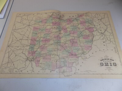
$4.95 Shipping Location: Willow Grove, United States This is an ORIGINAL Ohio map taken from a 1945 atlas. There is a map image and text on the reverse side of this map page.
Buy It Now
Free Shipping Location: Monroeville, United States Click Here. Double your traffic. Get Vendio Gallery- Now FREE! Gorgeous. Antique 1875 handcolored map, the map is a large folding map, titled New Map ... moreof Ohio, Prepared Especialy for Evert's Illustratd Historical Atlas, by H.H. Lloyd& Co, 21 John St N.Y. Has Population of Ohio, by Counties, 1870, also United States and Principal Cities, alldated 1870. This dates the map nicely. The map has some large tears repaired on reverse with archival paper and tape, the tears were at the bottom and some of the map is lost at lower right, but has archival paper replacing it, see my photo, still a fascianting gorgeous huge period Ohio map. The map is printed on very thick paper. The superb handcoloring is period to the map. The map is from the rare 1875 Everts Atlas of Tuscarawas County Ohio. The map is in nice condition, and would frame and display beautifully. The size of the map is 23" by 25.5" Rare. Winning bidder pays $4.00 shipping domestic, more foreign. Payment I accept the following forms of payment: PayPal Click to View Image Album Shipping& Handling US Shipping. $4.00 USPS First-Class Mail® International Shipping. $9.00 USPS First-Class Mail International FREE scheduling. Supersized images and templates. Get Vendio Sales Manager. FREE scheduling. Supersized images and templates. Get Vendio Sales Manager. di,RcmdId ViewItemDescV4,RlogId p4%60bo7%60jtb9%3Fuk%601d72f%2Bishhov%3C%3Edi-13cf165eb66-0xf7-
Buy It Now
Free Shipping Location: Sayville, United States
Free Shipping Location: Schertz, United States The map is not " new " or in " new " condition, it was printed in 1889. The map is dated. Study the photos carefully, this is the actual map you will ... morereceive. The page is approx. 14" x 20.
Buy It Now
Free Shipping Location: Sayville, United States
Buy It Now
Free Shipping Location: Carefree, United States RARE ORIGINAL 1875 LARGE HAND-COLORED MAP OF WAYNE JEFFERSON FRANKLIN HAMILTON AND WHITE COUNTIES ILLINOIS. RARE ORIGINAL 1875 HAND-COLORED ANTIQUE MAP ... moreOF ILLINOIS COUNTIES. MAP HAS A REFERENCE AT RIGHT SIDE.
Buy It Now
$5.50 Shipping Location: Indianapolis, United States See photos for condition and detail. There is a wavy fold where the glue from the folder isn’t smooth with the map. See photo.
Buy It Now
Free Shipping Location: Carefree, United States ORIGINAL ANTIQUE 1934 COLOR OUTLINE MAP OF THE STATE OFCOLORADO. ALSO SHOWN ARE PORTIONS OF THE SURROUNDING STATES, STATE CAPITAL AND COUNTY SEATS. MAP ... moreHAS SCALE BELOW TITLE. GOOD CONDITION, VERY MINOR DISCOLORATION AT EDGES, MAP ON REVERSE, SMALL TEAR OUTSIDE BORDER AT RIGHT SIDE.
Buy It Now
$6.95 Shipping Location: Dover, United States Issued 1880, Philadelphia by Halfpenny & Caldwell. Late 19th century lithographed regional Maine county map with original hand color.
Buy It Now
$6.20 Shipping Location: Mount Washington, United States ANTIQUE BOOKLET OF 1915 PACIFIC COAST TOURS- 1915 CANADIAN PACIFIC RAILWAY ADVERTISING BROCHURE PROMOTING THE PAN-PACIFIC EXPOSITION IN SAN FRANCISCO ... moreCALIFORNIA. 16 PG BOOKLET FOLDS OUT TO SHOW THE FEATURES OF THE PAN PACIFIC EXPO. THE SAN DIEGO EXPO- SOUTHERN CALIFORNIA, LA, THE COAST CITIES, THE CANADIAN ROCKIES AND HAS LISTS OF THE CP HOTEL SYSTEMSMORE. LARGE FOLD OUT MAP OF THE USA& CANADIAN RAILROAD ROUTES IN THE BACK. IN VERY GOOD CONDITION. LT. WEAR ON COVER EDGES. BUYER TO PAY 2.50 SHIPPING.
Buy It Now
$6.95 Shipping Location: Dover, United States Large late 19th century color lithographed map. Map remains clean, any small spots or center mis-creasing are easy to overlook or forgive visually.
Buy It Now
$6.95 Shipping Location: Dover, United States Mid 19th century lithographed topographical survey map printed on sturdy bond paper.
Buy It Now
$4.99 Shipping Location: Fairview, United States The publishing details and date are in the title area of the map. There is also a map on the reverse side. The pics are of the actual map.
Free Shipping Location: Schertz, United States The map is not " new " or in " new " condition, it was printed in 1889. The map is dated. Study the photos carefully, this is the actual map you will ... morereceive. The page is approx. 14" x 20.
Buy It Now
$10.20 Shipping Location: Tonawanda, United States Includes Counties, County Seats, Cities; many Small Towns and Villages; Ports, Military Airfields and Forts; Rivers, Streams, Lakes, Mountains, and other ... moretopographical features are located on this map.
Buy It Now
$6.97 Shipping Location: Bluffton, United States Sourced from a period atlas dated 1926. Large 9 1/16" x 12 7/16" actual map size in the border with indexed margin beyond. The other side is Montana text ... morefacts. osacat=0&_sop=1&hash=item2ee0ae7454&_odkw=MT&_from=R40&_trksid=p2046732.m570.l1313&_nkw=montana&_sacat=0.
Buy It Now
Free Shipping Location: Kennebunk, United States Including Hundreds of RareCivil War. Study the photos carefully, this is the actual map you. Only Authentic Originals.
Buy It Now
Free Shipping Location: Sayville, United States Indiana - Original 1891 Map by Hunt & Eaton. See photo's.
Buy It Now
Free Shipping Location: Montpelier, United States Our Inventory# ZE ART 18.
Buy It Now
$6.95 Shipping Location: Dover, United States City of Quincy. Large oversized late 19th century color lithographed city plan map over printed in red. Issued 1891, Boston by George H. Walker & Co. ... moreOriginal center fold as issued.
Buy It Now
Free Shipping Location: Iowa City, United States Counties, County Seats,Cities; many Small Towns and Villages; Ports, Military Airfields and Forts; Rivers, Streams, and Lakes; and other topographical ... morefeatures are located on this map. On the back of the map,as issued by the lithographer (not subsequently printed), there is a printed table containing"Area and State Population By Counties" data for the states, derived from theEleventh Census (1890).
Buy It Now
Free Shipping Location: Schertz, United States The map is not " new " or in " new " condition, it was printed in 1892. The map is not dated. Study the photos carefully, this is the actual map you will ... morereceive. The page is approx. 17" x 25".
Buy It Now
$4.95 Shipping Location: Willow Grove, United States There is an Oregon index and other information about Oregon on the reverse side of this map page.
Buy It Now
$4.95 Shipping Location: Willow Grove, United States >>> As well, this map indicates all of theTrain Depot Towns. On the reverse side of this map page is a similar map of West Virginia. (different orientation).
Buy It Now
Free Shipping Location: Sayville, United States Original 1891 Map of Montana. Wyoming& Idaho by Hunt& Eaton. Shows counties, major cities, reservations and the railroad lines throughout the ... morestates. On the rear are tables showing the population by county taken from the 1890 census. Measures approximately 13.37" by 11" This is a colorful and rare vintage lithograph that will look great matted and framed. See photo's. Free Shipping to anywhere in the US. Your order will always ship within ONE BUSINESS DAY. Well packaged in a sturdy waterproof mailer and sent with a delivery confirmatio n. I ship worldwide. Froo www.froo.com | Froo Cross Sell. Free Cross Sell, Cross promote, eBay Marketing, eBay listing Apps, eBay Apps, eBay Application.
Buy It Now
Free Shipping Location: Schertz, United States The map is not " new " or in " new " condition, it was printed in 1889. The map is dated. Study the photos carefully, this is the actual map you will ... morereceive. The page is approx. 14" x 20.
$6.00 Shipping Location: New Franken, United States RED OUTLINE COLOR FOR THE COUNTY LINE AND SMALLER RED LINE REPRESENTS THE REPRESENTATIVE DISTRICTS. RAILWAYS ARE SHOWN IN HEAVY BLACK LINE.
Buy It Now
Free Shipping Location: Sayville, United States On the rear is an area and population table for each county with data from the 1890 and 1900 census. See photo's.
Buy It Now
Free Shipping Location: Carefree, United States ORIGINAL ANTIQUE 1934 COLOR OUTLINE MAP OF THE STATE OFLOUISIANA. ALSO SHOWN ARE PORTIONS OF THE SURROUNDING STATES, STATE CAPITAL AND COUNTY SEATS. MAP ... moreHAS SCALE BELOW TITLE. DATE -1934, NOT ON MAP.
$6.00 Shipping Location: Carefree, United States ORIGINAL ANTIQUE 1899 COLOR MAP OFWISCONSIN. SOURCE-THE CENTURY ATLAS OF THE WORLD.
Buy It Now
$4.95 Shipping Location: Willow Grove, United States This is an ORIGINAL ILLINOIS map taken from a 1914 atlas. There is a map image and text on the reverse side of this map page.
Buy It Now
Free Shipping Location: Carefree, United States ORIGINAL ANTIQUE 1953 COLOR MAP OF THE STATE OFWYOMING. MAP HAS SCALE BELOW TITLE. SOURCE/REMOVED FROM- 1953 INTERNATIONAL STANDARD ATLAS OF THE WORLD. ... moreLAST PICTURE IS THE TITLE PAGE FROM WHICH THE MAP WAS REMOVED.
Buy It Now
$4.99 Shipping Location: Fairview, United States The publishing details and date are in the title area of the map. There is also a map on the reverse side. The pics are of the actual map.
Buy It Now
$4.95 Shipping Location: Willow Grove, United States This is an ORIGINAL Oklahoma map taken from a 1920s atlas. There is text and a map index for this map on the reverse side of this map page.
Free Shipping Location: Kennebunk, United States This Map was removed from a 1918 Atlas and is in good acceptable condition. Study the photos carefully, this is the actual map you. Only Authentic Originals. ... moreIncluding Hundreds of RareCivil War.
Buy It Now
$4.99 Shipping Location: Fairview, United States , published in Chicago by the Rand, McNally & Co., 1881, a facsimile copy of the title page is included for authenticity. Condition: The map is in Very ... moreGood condition, blank on reverse with a centerfold as issued.
$6.00 Shipping Location: Monroe, United States ORIGINAL 1899 COLOR MAP OF QUEBEC. INSET MAP OF MONTREAL AND QUEBEC AT RIGHT. MAP HAS SCALE BELOW TITLE. DATED-1897 BELOW TITLE.
$6.00 Shipping Location: Carefree, United States ORIGINAL 1899 COLOR MAP OF THE STATE OF SOUTHERN NEW YORK AND NEW YORK CITY. VERY DETAILED AND NICELY COLORED ANTIQUE MAP WITH SOUTHERN NEW YORK AT TOP ... moreAND VICINITY OF NEW YORK CITY AT BOTTOM. DATED-1897 BELOW TITLE.
Buy It Now
$6.95 Shipping Location: Dover, United States Fryeburg Village. Issued 1880, Philadelphia by Halfpenny & Caldwell. Late 19th century lithographed regional Maine county map with original hand color.
Buy It Now
$8.00 Shipping Location: Bristol, United States Very Rare and Original Hand Drawn map of Cincinnati Ohio Dated April 1, 1882Showing United Railroads stockyard, houses, Rivers, roads and even the baseball ... moregrounds 56” X 20”
|
|
|
In
|
10 Original Railroad Maps from the 1920's and 1930's.
10 Original Railroad Maps from the 1920's and 1930's. Normal 0 false false false EN-US X-NONE X-NONE MicrosoftInternetExplorer4 From time-to-time we auction our less than perfect railroad maps. Each of these nifty maps from the 1920’s and early 1930’s has some sort of minor defect. Nothing really bad. A library stamp, a small edge tear, some creases, dog ears or maybe it’s just an overstock. Whatever the reason, whether you’re a railroad enthusiast, a map collector or just one of the nouvelle cheap, here’s a great opportunity to bid on 10 interesting old railroad maps. The small ones measure about 10.87” by 8” and the Baltimore and Ohio map is approximately 15” by 11” Several are dated. All are printed on just one side with a blank reverse. Perfect for framing. S&H is $4.50 in a hard tube to anywhere in the USA and $11.48 to anywhere ... morein the world by First Class International Package Service. Happy bidding!
|
|
|
LOT 45 RAILROAD ITEMS TIMETABLES MAPS LETTERS BOOKS SIGNS TRAVEL & VACATION
ITEM LOT 45 RAILROAD ITEMS SCHEDULES TIMETABLES MAPS LETTERS BOOKS SIGNS TRAVEL& VACATION. I TRY AND DESCRIBE EACH ITEM AS GOOD AS POSSIBLE AND TAKE THE BEST PHOTOS THAT I CAN. I AM NOT ALWAYS AN EXPERT AT ALL THE ITEMS I AM SELLING. PLEASE ALWAYS READ THE DESCRIPTION AND LOOK AT THE PHOTOS. I TAKE PRIDE IN THE ITEMS THAT I SELL. SO IF YOU HAVE ANY QUESTIONS PLEASE LET ME KNOW. RETURNS IF NOT AS DESCRIBED. ONCE IS HAVE LISTED AN ITEM FOR AUCTION I DO NOT END THEM. LOTS OF TIMES YOU WILL GET THE ITEM AT A BETTER PRICE IF YOU BID. PAYMENT DUE WITHIN 5 DAYS WE COMBINE SHIPPING
|
|
|
TROLLEYS OF THE ROCHESTER & MANITOU RAILROAD COMPANY: MAPS, TIMETABLES, CHARTS
THE ITEM UP FOR BID IS A MAPS. TICKETS, TIMETABLES, CHARTS FOR THE ROCHESTER& MANITOU RAILROAD TROLLEY LINE. THE ITEM IS TWO SIDED. ONE SIDE HAS A LINE MAP AND CHART OF LAKE ONTARIO MEAN WATER LEVEL, THE OTHER SIDE HAS A SMALLER MAP WITH ILLUSTRATIONS OF TIMETABLES, TICKETS, ETC. IT MEASURES 20 1/2" X 16 1/2: THE ITEM IS IN LIKE NEW CONDITION. BUYER PAYS $2.00 SHIPPING. WILL COMBINE MULTIPLE ITEMS TO SAVE ON SHIPPING.
|
|
|
1925 Atlas of Traffic Maps~(RAILROAD)
S orry. We no longer solicit offers on our items. We have priced them at what we believe to be below market prices(sometimes far below) They are either worth what we ask, or not. If not, then we will, over time, reduce the price. We feel that the offer/counteroffer system is inherently flawed and that by stating our best price up front, we are being more"truthful" to our customers. Thank you for your interest. Ron If you do not feel we have earned 5 stars. Please contact us. We want 100% satisfied customers and 0% misunderstandings. ALL ITEMS SHIP IN BOXES AND INSURED We are certifed appraisers. And member of the Certified Appraisers Guild of America(CAGA) 1925 Atlas of Traffic Maps(RAILROAD) 8.5" X 11" Really Really Cool!25 individual maps.very ornate and detailed.the maps are folded multiple times so be gentle when opening ... morethem.some corner tips have creases.some maps have tape over some small tears(as pictured)the cover has some rubbing and a piece of material is missing from the upper left corner(as pictured) WE SHIP EVERY WEEKDAY Terms and Conditions WE COMBINE SHIPPING on Multiple items purchased to Save you MONEY(ie: second book will most often be only $1 more shipping) Shipping cost is stated at top of the listing The shipping charge INCLUDES Shipping Costs. Wrapping, Secure packaging and a small handling fee to INSURE delivery to you! International Buyers- Please Note: Import duties. Taxes and charges are not included in the item price or shipping charges. These charges are the buyer's responsibility. Please check with your country's customs office to determine what these additional costs will be prior to bidding/buying. Kansas sales tax of 8.65% will apply to transactions shipped within this state. Please e-mail any questions prior to bidding. We ship 5 days a week Any item may be returned within 14 days. The refund will be less any fees or shipping and handling costs we may have incurred. UNLESSS the item is not as described, then you may return it within 14 days for FULL
|
|
|
Maps 1975, 1990, 1995 CP RR Canadian Pacific Railroad Maps
This is a single auction for the three items listed: The first item is a 1975 CP map. It portrays rail lines. Air routes and ocean shipping lanes that were then operated by Canadian Pacific. The map folded is 4 x 7 1/4 inches. Open it is 31 x 39 inches. Good Condition. The third photo is of a 1990 CP system map. Folded 4 x 6 3/4. Open 26 3/4 x 39 inches. Good Condition. The fifth photo is of a circa 1995 CP bridge line map. Shown are the rail routes which gained access to New York, Philadelphia, Baltimore and Washington plus Buffalo through ownership of the former D&H, Delaware and Hudson Railroad in combination with trackage rights of the then Conrail. Good condition. AUction limited to the United States
|
|
|
Four Maps Southern Pacific Railroad SP RR 1976, 1985, 1989, 1989
This is a single auction for the items listed: First photo-1976 Southern Pacific Railroad and Cotton Belt Railroad. Folded 5 x 9 inches. Open 17 7/8 x 31 1/2 inches. A little crease wear. Small tear separation at two intersections of horizontal and vertical folds. Second Photo- 1985 SPRR. Folded 4 1/2 x 11 inches. Open 17 3/4 x 31 3/8 inches. Yellowed crease in vicinity of Mason Dixon line to the Atlantic Ocean. Otherwise OK. Third photo is 1989 SP RR map with Denver Rio Grande Western Railroad and Cotton Belt/ St. Louis Southwestern RR SSW RR. Third Photo is 1989 SPRR map showing Denver and Rio Grande RR and the Cotton Belt RR. Folded 6 1/4 x 9 1/2 inches. Open 24 1/2 x 37 1/2 inches. Good condition. Fourth photo is SP RR map identified as Southern Pacific Lines across top of map. Folded 6 3/4 x 9 1/2 inches. Open 24 1/2 x 37 1/2 inches. ... moreGood Condition. Auction United States only.
|
|
|
1922 Booklet w/ 16 US Railroad Colored Mortgage Maps Bonds Descriptions
A neat 39 page booklet titled Railroad Bond Investments with Mortgage Maps and Descriptions. Foreward and maps are dated 1922 or earlier. There are two pages dedicated to each of 16 rail systems. The first is a detailed map of the line and the second is a description of the system and an outline of it's mortgage terms. Lots of neat information to say nothing of the great maps. 39 pages. Please see my ebay photos and ask questions prior to bidding. Buyer to pay s/h as calculated by ebay.
|
|
|
Three Union Pacific Railroad UP RR Maps 1983, 1984, 1988
This is a single auction for the listed items: 1983 Union Pacific RR map including Missouri Pacific and Western Pacific Railroad lines. Folded 4 x 9 1/2. Open 19 x 28 inches. Third photo is 1984 Union Pacific RR map. 4 x 10 inches. Open 20 x 32 inches. Good Condition. Fifth photo is 1988 Union Pacific UPRR map. Folded 4 x 10. Open 19 3/4 x 31 3/4 inches. Good condition. Auction United States only.
|
|
|
Four Union Pacific Railroad UP RR Maps 1950, 1965, 1976, 1978
Single auction for items listed: 1950 Union Pacific Railroad map of military installations in the United States. Folded 4 x 9 7/8 inches Open 18 5/8 x 31 1/2 inches. Six tears separations at intersections of horizontal and vertical folds. Photo tells the story. Third photo is 1965 UP RR freight rate territorial map for USA. Folded 4 x 9 3/4 inches. Open 19 1/4 x 31 5/8 inches. One tear separation at intersection of horizontal and vertical fold. See photo. Fifth photo is 1976 UP RR map noting facilities. Folded 4 x 9 1/2 inches. open 19 x 31 3/4 inches. Good condition. Seventh photo is 1978 UP RR freight rate territory map for USA. Folded 4 x 9 3/4 inches. Open 19 1/4 x 31 1/2 inches. Good condition. Auction United States only.
|
|
|
Three Chicago Northwestern Railroad Maps 1953, 1979, 1985 CNW
This is a single auction for items listed: 1953 Chicago and Northwestern Railroad map. Folded 4 x 9 5/8 inches. Open 19 1/4 x 31 5/8 inches. Four separation tears at intersections of horizontal and vertical folds. 1979 CNW RR map. Folded 4 1/8 x 10 inches. Open 20 x 32 1/2 inches. Two small tears at intersection of horizontal and vertical folds. Otherwise OK. 1985 CNW RR map. Folded 4 x 8 inches. Open 19 7/8 x 32 3/4 inches. Good Condition. The CNW was merged into the UP RR Union Pacific Railroad in 1995. Auction limited to United States
|
|
|
1982, 1983, 1998, 1999 Maps Norfolk Southern Railroad Maps
This is a single auction for all listed items: 1982 Norfolk Southern Railroad. Folded 4 x 8 inches. Open 27 1/2 x 31 1/2 inches. Printed One side. Good Condition. Third photo is 1983 Norfolk Southern Folded 4 x 8 inches. Open 27 3/4 x 20 1/4 x 31 3/4 inches. Fifth photo is 1998 Norfolk Southern Map indicating new divisions with acquisition of part of Conrail system. Issues by Engineering Department. Folded 4 x 8 inches. Open 23 1/2 x 35 1/2 inches. Printed One side. Good Condition. Seventh photo is 1999 Norfolk Southern Map. Folded 4 1/4 x 9 inches. Open 35 3/4 x 44 1/4 inches. Good Condition. The 1999 Map is today's Norfolk Southern system. Auction limited to Unite States
|
|
|
VINTAGE RAILROAD TIMETABLES MAPS BALTIMORE & OHIO GREAT NORTHERN 50'S 60'S
VINTAGE RAILROAD TIMETABLES MAPS BALTIMORE& OHIO GREAT NORTHERN SET OF2. 1. Baltimore& Ohio Railroad system timetable 10/28/56. 2. Great Northern timetable 6/30/68. Nice condition. Check out our auctions and visit our Ebay Store"4ank's Divine Discounts. We offer combined shipping disoun ts. ALL SALES ARE PAYABLE BY PAYPAL ONLY US Shipping Free. If you have any questions. Please contact seller. Thank you.
|
|
|
VINTAGE RAILROAD TIMETABLES MAPS ATSF SANTA FE UNION PACIFIC SET OF 3 1960'S
VINTAGE RAILROAD TIMETABLES MAPS ATSF SANTA FE UNION PACIFIC SET OF 3 1960'S. 1. Union Pacific Railroad timetable-maps.June 30. 1968. 2. ATSF Santa Fe timetable maps June 8. 1969. 3. ATSF Santa Fe timetable-maps July 15. 1968. Nice condition. Check out our auctions and visit our Ebay Store"4ank's Divine Discounts. We offer combined shipping disoun ts. ALL SALES ARE PAYABLE BY PAYPAL ONLY US Shipping $1.99. If you have any questions. Please contact seller. Thank you.
|
|
|
RAILROAD BOOK - TRANSIT MAPS OF THE WORLD
THIS BOOK IS USED IN EXCELLENT LIKE NEW CONDITION. IT IS"TRANSIT MAPS OF THE WORLD" 140 PAGES PUBLISHED IN 2007 BY PENGUIN BOOKS FOR THE LONDON TRANSPORT MUSEUM. THANKS FOR LOOKING!
|
|
|
Alabama Civil War Railroad Maps & Time Tables Scanned to Modern Day Booklet
Up for bid is a modern day booklet containing scanned copies of original Appleton’s railroad time tables and maps of Alabama for the years of 1860. 1862, 1864, 1865 and 1866. The seller owns the original railroad guides containing the time tables and maps of Civil War era Alabama. He has scanned the time tables and maps into a(27) page spiral bound booklet. Please note: The original Appleton’s railroad guides. Maps and time tables are not for sale-only the booklet containing scanned copies of the originals. The original railroad time tables and maps are rare, long out date, out of print and entered into public domain status approximately 150 years ago. A table of contents of the railroad time tables/map is seen in the attached scanned photos. The booklet measures 8 1/2 X 11 inches. Spiral bound and printed on excellent quality 67 pound vellum ... morebristol card stock. There is an acetate plastic sheet protecting the front cover. If you have any questions, feel free to e-mail. Shipping is free via first class mail and USA shipping only, payment by PayPal. The seller doesn't ship outside the USA. Payment I accept the following forms of payment: PayPal, Click to View Image Album Click to View Image Album Click to View Image Album Click to View Image Album Click to View Image Album Click to View Image Album Click to View Image Album Click to View Image Album Shipping& Handling $0.00 USPS First-Class Mail® More than just a pretty picture. Try Vendio Image Hosting. FREE scheduling. Supersized images and templates. Get Vendio Sales Manager.
|
|
|
U.S. Railroad Traffic Atlas by Harry Ladd Spiral bound Railroad maps
Auction Wizard 2000 Listing Template- AW2KLOT#56296 RailroadTreasures offers the following item: U.S. Railroad Traffic Atlas by Harry Ladd Spiral bound Railroad maps U S Railroad Traffic Atlas by Harry Ladd Spiral-wire- bound Copyright 1999 118 pages AcknowledgementsPage 2 Safety and Map Notes4 Corrections List8 Legend9 STATE and CITY MAPS Alabama10 Alaska11 Arizona 12 Arkansas13 California14 Los Angeles/San Francisco15 Colorado16 Connecticut pre-merger17 post-merger18 Delaware pre-merger19"post-merger20 Florida21 Georgia22 Hawaii11 Idaho23 Illinois pre-merger24 Chicago pre-merger25 Illinois post-merger26 Chicago post-merger27 Indiana pre-merger28 Gary pre-merger29 Indiana post-merger30 Gary post-merger31 Iowa32 Kansas33 Kentucky34 Louisiana35 Maine36 Maryland pre-merger18"post-merger19 Massachusetts pre-merger37 post-merger38 Michigan ... morepre-merger39 post-merger40 Minnesota41 Twin Cities- Twin Ports42 Mississippi43 Missouri44 Saint Louis/Kansas City pre-merger45 post-merger46 Montana47 Nebraska48 Nevada49 New Hampshire50 New Jersey pre-merger51"post-merger52 Newark pre-merger53 Newark post-merger54 New Mexico12 New York pre-merger55 New York City/Buffalo pre-merger56 New York post-merger57 New York City/Buffalo post-merger58 North Carolina59 North Dakota60 Ohio pre-merger61" post-merger62 Oklahoma63 Oregon64 Pennsylvania pre-merger65"post-merger66 Philadelphia pre-merger67"post-merger68 Pittsburgh pre-merger69"post-merger70 Rhode Island pre-merger17"post-merger18 South Carolina71 South Dakota60 Tennessee72 Texas(west)73"east)74 Utah49 Vermont50 Virginia75 Washington76 West Virginia pre-merger77 post-merger78 Wisconsin79 Wyoming80 RR SYSTEM MAPS AMTK81 BNSF82 CN83 CP84 CR85 CSX pre-merger86" post-merger87 Guilford- ST88 IC89 KCS90 NS pre-merger91" post-merger92 UP93 WC94"Super Railroads"95 Map Abbreviations96 Railroad Abbreviations and Locations97 Publications List114 All pictures are of the actual item. If this is a railroad item. This material is obs
|
|
|
1909 MICHIGAN RAILROAD & CONGRESSIONAL DISTRICT MAPS - BOOK INSERT
ORIGINAL MAPS INSERT REMOVED FROM 1909 MICHIGAN STATE SURVEY BOOK.THERE ARE 2 RAILROAD MAPS(BOTH SHOWN) AND 10 CONGRESSIONAL DISTRICT MAPS.EACH MEASURES 9" X 11" AND IS IN EXCELLENT CONDITION.A FRESH ESTATE FIND! Check our store for thousands of UNIQUE items. Combine orders and save BIG $$$ on shipping! Powered by The free listing tool. List your items fast and easy and manage your active items.
|
|
|
THE PENNSYLVANIA RAILROAD COMPANY FINANCIAL DEPARTMENT LIST STATIONS MAPS 1964
THE PENNSYLVANIA RAILROAD COMPANY LIST OF STATIONS/MAPS. FINANCIAL DEPARTMENT. May 1. 1964. 232 pages.great historical maps. Good condition.binding intact. Check out our auctions and visit our Ebay Store"4ank's Divine Discounts. We offer combined shipping disoun ts. ALL SALES ARE PAYABLE BY PAYPAL ONLY US Shipping $6.99. If you have any questions. Please contact seller. Thank you.
|
|
|
Railroad Maps of the United States, 1975, Compilied by Andrew Modelski,very good
Title/ Description: Railroad Maps of the United States. Year/ Copyright: 1975. Make/ Producer: Compilied by Andrew Modelski. Library of Congress. Description: Please refer to the image. In very good with very light wear and creasing, a 112 page softcover with maps. Grading is my opinion, a guide. Thank you for looking.
|
|
|
Vintage Rock Island Railroad Kansas Maps - 1983
For sale is a Vintage Rock Island Railroad Maps- 1983. Pictures are of the actual items. There are maps behind each of the cover pages. Thanks for looking!
|
|
|
1930's Poole Bros Railroad Maps CANADIAN PACIFIC, CANADIAN NATIONAL, GRAND TRUNK
Nice detailed railroad maps from Poole Bros. Chicago, single sheet 10.75 by 15 inches with the CANADIAN PACIFIC, dated 1934 on one side and on the other side CANADIAN NATIONAL RAILWAYS with Grand Trunk System in US and CENTRAL VERMONT RAILWAY on one half and CANADIAN NATIONAL RAILWAYS GRAND TRUNK RAILWAY SYSTEM on the lower half, undated. Stations are marked. Excellent condition, no rips or tears. Read the description above. Keep an eye on my other auctions for other interesting and collectible items. Be sure to add me to your favorites list! Check out my other items! Sign up for PayPal; the fast. Easy, and secure way to pay online. Powered by The free listing tool. List your items fast and easy and manage your active items.
|
|
|
J W Clements 1930's Railroad Maps PENNSYLVANIA RAILROAD & NORFOLK & WESTERN RR
Nice detailed railroad maps. From the 1930's by J W Clements, a single sheet with a map of the NORFOLK& WESTERN RAILWAY AND CONNECTIONS on one side and the PENNSYLVANIA RAILROAD AND CONNECTIONS on the other side. Both have stations noted. 15" by 10.75" Excellent condition, no rips or tears. Read the description above. Keep an eye on my other auctions for other interesting and collectible items. Be sure to add me to your favorites list! Check out my other items! Sign up for PayPal; the fast. Easy, and secure way to pay online. Powered by The free listing tool. List your items fast and easy and manage your active items. WE WILL BE ON VACATION FROM 12/18 TILL 12/21. ANY ITEM PURCHASED AFTER 12 AM 12/18 WILL NOT BE SHIPPED UNTIL THE MORNING OF 12/22.
|
|
|
Railroad Official Guide 1975 Maps SALE a
You are bidding on the following: The Official Railroad Guide- North American Freight Service Ed. Sept- Oct. 1975. GREAT. UNUSUAL collectible Not many of these available at this price or any price Good condition Buyer pays $5.95 for S/H Media mail(these books are heavy) I combine shipping by charging full S/H for the largest of charges and 1/2 of the stated S/H for all others items that can be shipped in the same box. WE have an excellent reputation(see our comments) and we offer a FULL REFUND if you are not satisfied with our product. Powered by The free listing tool. List your items fast and easy and manage your active items. 16.RcmdId ViewItemDescV4,RlogId p4%60bo7%60jtb9%3Feog4d71f%2B%3E16%3E-14bc8fae92c-0x10f-
|
|
|
Orig1869 DEED PA Railroad, FOUR drawn MAPS Schuylkill Co. Civil war era, Vtg.
An amazing 1869 handscripted document with hand-drawn maps. A Deed from Schuylkill Township, Schuylkill County, PA. A lengthy 9 page document with beautifully scripted text and several pages of maps to supplement the descriptions! This document is stated as a'Release of Contract' between Edward Roberts. Et al Trustees(to and with) The Union Central Coal Iron& Railroad Co. There are several Trustee parties: Edward Roberts. Henry Pratt McKean, William A. Ingham Railroad has determined they will go through land owned by above. Land is partly in Schuylkill Township and Borough of Tamaqua. Land needed will be 30 feet on either side of center line of tracks laid. Very detailed descriptions of lands are given and maps clarify with names and landmarks. Six conditions are laid out in detail. Summary- First. Erect and maintain bridge at ... moreCharles E. Smith Colliery at Tuscarora(map B) Second. Railroad will be constructed across site of old Branch RR leading to Tucker slope. Third. Trustees will instruct as to grade to construct branch RR leading from Mt. Link RR to Buckville(map C) Fourth. Water pipes not to be disturbed, leading from reservoir to Reevesdale Breaker(map D) Fifth. RR will construct through Reevesdale Colliery and cannot interfere with work of trustees.sheetiron archway to be constructed against sparks from locomotives. Sixth. Payment plan to trustees if coal or iron is found in area where RR is laid- 20 cents per ton required to be left in ground for support. Expiration of contract in five years from signing if not fully completed. Notarized and sealed. Maps have been removed from original legal fastener so as to better preserve) Thanks for looking at my items. Please look carefully at pictures and ask any questions prior to purchase. Papers are in true vintage condition. Smudges, creases, maps with ragged edges etc. that are expected with a document 150 years old!
|
|
|
Pennsylvania Railroad book of Division Maps dated Nov. 1, 1941
Pennsylvania Railroad book of Division Maps issued November 1941 by the railroad's Accounting Department. Has 28 pages total with fiber covers and it is 11 1/2 inches high and 9 inches wide. Each division is shown on its own page and in red with connecting lines. Both PRR and other railroads in black. Begins with the New York Division and ends with the Long Island Railroad. Also the Penn-Reading Seashore lines. A great set of maps for anyone interested in the former PRR of almost 80 years ago. Feel free to ask any qquestions about this item. Ships to US and Canada and PayPal is welcome, thanks for looking.
|
|
|
North American Rail Yards Railroad Book train history photos maps
Rail yards book. Lots of color photos, hardcover, 8.5x11" 238 pages, like new condition. Other forms of payment accepted-please contact me for my mailing address UPON YOUR WINNING BID. Combined shipping is available THROUGH INVOICE ONLY. IF YOU WIN MULTIPLE ITEMS. PLEASE WAIT FOR INVOICE(USUALLY SENT WITHIN 24 HOURS OF AUCTION END) Local pickup and delivery available, too. Full refund/return for anything you are unhappy with for any reason. Please contact me prior to returning for details/info. PLEASE DO NOT CONTACT ME THROUGH E-MAIL OR THROUGH THE PAYMENT PROCESS. IF YOU HAVE ANY QUESTIONS OR SPECIFIC REQUESTS FOR YOUR PURCHASE. PLEASE CONTACT ME THROUGH THE CONTACT BUYER LINK ON EBAY.
|
|
|
1971 Rand McNally Railroad Maps book Handy Atlas train United States
Railroad Maps book. Fair condition, cover is loose, softcover, 9x12" 64 pages. 50 states and some city maps. Other forms of payment accepted-please contact me for my mailing address UPON YOUR WINNING BID. Combined shipping is available THROUGH INVOICE ONLY. IF YOU WIN MULTIPLE ITEMS. PLEASE WAIT FOR INVOICE(USUALLY SENT WITHIN 24 HOURS OF AUCTION END) Local pickup and delivery available, too. Full refund/return for anything you are unhappy with for any reason. Please contact me prior to returning for details/info. PLEASE DO NOT CONTACT ME THROUGH E-MAIL OR THROUGH THE PAYMENT PROCESS. IF YOU HAVE ANY QUESTIONS OR SPECIFIC REQUESTS FOR YOUR PURCHASE. PLEASE CONTACT ME THROUGH THE CONTACT BUYER LINK ON EBAY.
|
|
|
1928 Rand McNally Railroad Maps book Handy Atlas train United States
Railroad Maps book. Very good condition, softcover, 9x12" 48 pages. 48 states and some city maps. Other forms of payment accepted-please contact me for my mailing address UPON YOUR WINNING BID. Combined shipping is available THROUGH INVOICE ONLY. IF YOU WIN MULTIPLE ITEMS. PLEASE WAIT FOR INVOICE(USUALLY SENT WITHIN 24 HOURS OF AUCTION END) Local pickup and delivery available, too. Full refund/return for anything you are unhappy with for any reason. Please contact me prior to returning for details/info. PLEASE DO NOT CONTACT ME THROUGH E-MAIL OR THROUGH THE PAYMENT PROCESS. IF YOU HAVE ANY QUESTIONS OR SPECIFIC REQUESTS FOR YOUR PURCHASE. PLEASE CONTACT ME THROUGH THE CONTACT BUYER LINK ON EBAY.
|
|
|
BALTIMORE & OHIO Railroad timetable B&O,1955,form T.T.8,GREAT routes maps,V FINE
Offered for bid a vintage railroad public timetable. This one is for the B&O Baltimore& Ohio Railroad dated Oct. 30. 1955. This features the wonderful CLASSIC B&O cover form T.T.8, interal maps and photos, and is in excellent condition. Colorful and very displayable, this timetable would be an outstanding addition to any collection of railroad history. Winning bidder pays shipping costs. I ship 1st class mail, accept Paypal only, and always combine shipping on multiple purchases to save you money. International buyers please wait for an invoice. Payment must be received within 3 days of auctions end. Good luck bidding on this fantastic timetable, see my EBAY STORE for many other INTERESTING items, and thanks as always for looking! DUE TO MUCH HIGHER SHIPPING COST FOR INTERNATIONAL AND CANADIAN BUYERS.PLEASE E-MAIL ME BEFORE MAKING ... moreYOUR PURCHASE.
|
|
|
10 VINTAGE RAILROAD MAPS CP RAIL UNION PACIFIC CN NORFOLK NORTHWESTERN MORE
here is 10 vintage railroad maps all in nice condition please enlarge the photos take a look I am not a map collector but I am sure these will be a great addition to any railroad/map collection questions please ask thanks from ken a;06d2.RcmdId ViewItemDescV4,RlogId p4%60bo7%60jtb9%3Fuk.rp73%28%3Ea%3B06d2-14be4bdff60-0x106-
|
|
|
Antique 1896 Book-SUMMER HOMES Among The GREEN HILLS of VERMONT-Railroad MAPS
PLEASE view all 12 Photos. Read the condition report& measurements below and ask any questions you may have BEFORE bidding. DESCRIPTION: Up for auction is this antique collectible dated 1896 book titled'Summer Homes Among the Green Hills of Vermont and along the shores of Lake Champlain' It is dated 1896 on the title page and last page of book. Published by the Passenger Department Central Vermont Railroad. Title page also states St. Albans. VT. St Albans Messenger Co. Print. 1896. Has a stapled softcover binding. There is a total of 3 maps. The extra-long Lake Champlain map is torn in half at the seam. There are photos of both halves. This book has many black& white photo illustrations as well as advertising/advertisements/ads for companies such as Hudson River Cruises. Railroads/Railways, Franklin County Creamery, St. Albans ... moreFoundry Co. Addison House, Cottages, Houses, Inns& Hotels and other places to stay. The books starts off with.Where should we stay? Grand Isle, Thompson's Point, Hyde's Manor etc. We assume it is all based on places you can get to by railway. MAPS: Lake Champlain from Whitehall to Fort Ticonderoga(as found. Torn in half at the seam) Central Vermont Railroad and Connections(opposite side gives'Special Summer Excursion Rates' Chateaugay Railroad and Connections. MEASUREMENTS: Book measures 8 5/8" X just under 6" X 3/8" thick. Total of 136 pages. If you need map measurements please feel free to ask. If you need any further measurements or additional photos please feel free to ask before bidding. CONDITION REPORT: Antique book. Being offered as-is. As found. Copyright 1896. Covers show wear, rips, missing pieces, tiny stain. No missing pages. No torn pages. Minor foxing. Maps are in good condition, especially for their age. Could be a tiny edge tear or two. Map is titled'Lake Champlain from Whitehall to Fort Ticonderoga' is torn in half at a seam. Photos are of the actual item. Colors in photos may not be exact. P lease ask any and all
|
|
|
1940-50's (25 pc) Santa Fe Railroad,timetables,Maps,letters/Covers,document lot!
God Bless you and have a great week! REAL TIME CAPSULE HERE! Might be your long lost family here.many names on them.Comes from all over the place! CURL BY THE FIRE AND RESEARCH THEM. It is for a large lot. They are in mixed conditons and states of conditions on them.Most are in great condition! Unread and unresearched. Postal marked cards and covers lot. Some things from othe rrailroad lines.But alot of Santa Fe. Overall a well kept unresearched lot. True survivor piece here! Thanks for stopping by our Ebay auction site today! Pretty neat to have and frame! Check my feedback and see what repeat customers are saying please! FOR PLEASURE OR A GIFT FOR SOMEONE! Looks and feels so much better in front of you. Will not be disappointed! Anyway cost to ship to you will be only 2.00 please.Weather you buy 1 document from me or multiple documents ... morein my other auctions.I only charge you 2.00! I pick up the tap on the rest for ya! We normally ship within three days of receiving your payment.Make sure to check out my other documents in other auctions going on. You might want to place me in your favorite sellers.I get neat stuff all the time.I and my wife are retired and find things in later years to suffice our income in these economical times we are in.Making a great DEAL FOR YOU! We find the rare and unique! Thank you for viewing my auctions and God Bless! Glad to have and hope to work with you for years to come! Welcome onboard have a Blessed day!
|
|
|
Original Large 20 Bound 1919 Colorado Railroad Train Track Maps SCARCE 24" X 55"
This is an antique 1919 Railroad train track map of Colorado. The track runs from Salida to Florence. This is a very unusual and collectible piece. There are 20 maps in total. They are all bound in between two wooden strips. The maps are very large measuring 24" x 55" There has been some tears that have been repaired with tape. See photos. There are quite a few tears and rips around the edges. Please see photos for detailed description.
|
|
|
Rand McNally Business Atlas Maps~1895~Railway/Railroad~USA & World~Enlarged~
Click Here. Double your traffic. Get Vendio Gallery- Now FREE! | | Rand McNally Business Atlas Maps~1895~Railway/Railroad~USA& World~Enlarged~, Click to View Image Album Click to View Image Album Click to View Image Album Click to View Image Album Click to View Image Album Click to View Image Album Click to View Image Album Click to View Image Album This item consists of a very large book of maps(Atlas) showing railway/railroad lines in North& Central America in 1895. It also includes maps of other countries and regions worldwide. Just not as much railway/railroad detail. The book is very large and heavy. It measures about 15" X 21" The pages within being a tad smaller. It's 1 1/2" thick. The pages are all there, except one which is only half there and it appears it was only an advertisement page. The cover is loose, ... morea bit worn and some tears, but the pages are all bound within. Some of the pages are a bit tattered, but no more than would be expected from a book this large and old. I show some detail pictures of Massachusetts but all the other states(only 44 at this time) and territories are done in the same manner. There are many colored maps within this book. It is an interesting and historical item. Especially for the railroad fan. I'm no map expert but if you have any questions I'll be glad to answer them if I can. Feel free to ask. Check the pictures. US Buyer to pay the amount calculated by the US Shipping Calculator. Located in the Shipping& Handling Section below this one, for S&H within the USA. Non-US customers, please use the International Shipping Calculator located in the Shipping& Handling section, if you want it sent other than the way it calculates, please contact me. I combine S&H charges on multiple purchases. If insurance is requested, the appropriate charge will be added to the invoice. ATTENTION INTERNATIONAL BUYERS: Sorry, I can't be responsible for the failings of th
|
|
|
1943 D&RG Railroad Scenic Rocky Mt. View Booklet with Maps
Title: 1943 D&RG Railroad Scenic Rocky Mt. View Booklet with Maps Description: Nice historical"Rocky Mountain View On The Rio Grande. The Scenic Line of the World, Copyright 1943 by"The Smith-Boos Printing Co. Denver, Colorado, For Sale Only en Route on The Denver& Rio Grande Western Railroad" There are 19 black and white print with caption, such as The World's Highest Bridge spanning the Royal Gorge above the Arkansas River in Colorado, and The Pagodas attraction of the Dotsero Cutoff along the Colorado River. Also two railroad rout maps at the end of this booklet. Front cover has a 1 1/2" tear on the bottom edge running through scenic, otherwise book is in very good condition. Enjoy- If you have any questions please email us. PAYMENT via PayPal or pay upon pick-up. Payment to be received within 3 days of ... moreauctions end. SHIPPING: We ship most everywhere worldwide. Click on the"Shipping and Payment" tab above for other shipping options. Combine items and save $ on shipping. See below. We try to ship the day after payment is received. But sometimes its 3 days. Shipping Monday through Friday. INTERNATIONAL SHIPPING: We prefer USPS Priority Mail International which included insurance and tracking. First Class Mail and Flat Rate Priority Mail International are not insurable nor track-able. Breakable items or rare items over $35.00 price will only be shipped Priority Mail International. International sales subject to customs and prohibited items by country. If your country is not listed under our shipping. Please contact us for a S&H quote and to see if we can send the item to you. COMBINED SHIPPING& HANDLING: Yes. If we can fit all your items in one box securely, it ships. Combined Shipping is based on total weight. Eliminating that extra box and some packing weight for each additional item. If you have or plan on having combined shipping, PLEASE contact us so we may send you an updated invoice after your last auctions. You may accumulate up to 7 days of auctions or pu
|
|
|
Lot A 6 Vintage Train Railroad Maps Books Photographs North South East NICE!
Lot A 6 Vintage Train Railroad Publications Maps Books Photographs North South East NICE! We have decided to auction a large collection of train and railroad publications by lots. They all came from a railroad collector's family estate. They are in overall very good condition without major tears. Creasing, staining or separations at the spine/spiral. Also. We currently have Lots B and C listed for your consideration. This 6-item Lot A includes maps and photographs with captions. And historical renditions: 1. 1982- The South Pennsylvania Railroad(The Railroad That Might Have Been) 49 Pages- Railroad Civil Engineers- Walter F. Walton- Pittsburgh Section(1918) 2. Vintage Photograph- Great Northern Railway- From 71st Annual Report 1959 3. Railroad Maps(The East) Book- 1980- Soft Cover- 218 Pages& 12 States Black& White- MAC Publishing- ... moreColorado Springs. CO 4. Railroad Maps(South) Book- 1980- Soft Cover- 244 Pages& 11 States- Black& White- MAC Publishing- Colorado Springs. CO 5. 1946 Trains Album of Photographs Number 15- Great Northern Railway- Spiral Bound with Thick Cardstock Front and Back- Black& White Pictures- 20 Pages with Picture Captions- Kalmbach Publishing Co. Milwaukee 6. 1943 Trains Album of Photographs Book One- Eastern Railroads- Spiral Bound- Black& White Pictures- 23 Pages with Picture Captions- Kalmback Publishing Co. Milwaukee(Cover is a Thin Cardstock and shows some wear) These items will be shipped Media Rate. Thanks for viewing this auction and Happy Bidding! for more great items! Payment is expected within three days of the end of the auction. We ship within one business day of date of payment. THE SHIPPING COST LISTED IS FOR U.S. SHIPPING ONLY. Hawaii and Alaska bidders. Your shipping will be higher than the listed shipping cost. You will receive an invoice for your total at the end of the auction. For international bidders, shipping will be based on your location and an invoice will be sent at the end of the auction advising of your total payment due
|
|
|
9 Original Railroad Maps from the 1920's and 1930's. No Reserve Auction!!
9 Original Railroad Maps from the 1920's and 1930's. A No Reserve Auction! Normal 0 false false false EN-US X-NONE X-NONE MicrosoftInternetExplorer4 From time-to-time we auction our less than perfect railroad maps. Each of these nifty maps from the 1920’s and early 1930’s has some sort of minor defect. Nothing really bad. A library stamp, a small edge tear, some creases, dog ears or maybe it’s just an overstock. Whatever the reason, whether you’re a railroad enthusiast, a map collector or just one of the nouvelle cheap, here’s a great opportunity to bid on 9 interesting old railroad maps. The small ones measure about 10.87” by 8” and the large one are up to about 15” by 11” Several are dated. All are printed on just one side with a blank reverse. Perfect for framing. S&H is $4.95 in a hard tube to anywhere in the USA and $11.48 ... moreto anywhere in the world by First Class International Package Service. Happy bidding!
|
|
|
Railroad / Streetcar Timetables and Maps
Alabama Pocket Map and Shippers' Guide This map was produced by The Kenyon Company in 1912. There are some pencil and pen marks on this item. It includes a full index. A color map and Parcel Post Rates. There is some minor age related issues. Rubbing of the edges and some cracking at the creases. It is a VERY RARE item. Thank You for Looking and Happy Bidding!
|
|
|
Lot of 2 Vintage WW2 Era Road Maps! Good Conditions! Rio Grande 1943, Railroad!
Lot of 2 Vintage WW2 Era Road Maps! Good Conditions! Rio Grande 1943. Railroad! These are in good shape for their ages, they have some light wear as can be seen in the pictures. What you see is what you get. Shipping is $3.95, US bidders only. Good luck bidding!
|
|
|
Huge Lot Lehigh Valley NY Railroad Letters, Timetables, Maps, Misc. 1910 - 1914
PLEASE LOOK AT THE PHOTOS! Good to Very Good Condition. This is lot of various documents& letters from 1910- 1914 Lehigh Valley Railroad. I haven't taken the letters out of their envelopes. But there are 16 small envelopes addressed to R.C. Hill, Engineer(some state"Fireman" Auburn NY, 13 large envelopes, 14 empty& blank small envelopes with Lehigh Valley logo, 4 empty& blank large envelopes, 5 Notice of Acceptance of Application for Membership Blank Forms, 2 very large timetables for 1910& 11, Engineers Wage Discussion Booklet, History of Negotiations Booklet, a thick blank timeable from J.W. Evans Superintendent, stack of other letterheads, thick little"The Facts About Railroad Rates" 1903 NYC& HRRR Lake Ontario shore map, various misc. cards& brochures. A LWAYS OPEN TO OFFERS& HAPPY TO ... moreCOMBINE SHIPPING_ NOTE: I AM WORKING WITH A LONG TIME COLLECTOR OF RARE BOOKS& EPHEMERA WHO IS DOWNSIZING AND REDUCING HIS INVENTORY IN PREPARATION FOR RETIREMENT. I try to describe each item as accurately as possible. But hope that you will also rely on the photographs provided to notice any defects or content that is not in my written description. I am happy to answer ANY QUESTIONS you might have about an item prior to your bid! INTERNATIONAL BUYERS- PLEASE READ: Please let me know if you have problems bidding on an item! If you bid on and win this item PLEASE do not pay for it until I have contacted you with ACTUAL shipping costs. I have added a general $15.00 charge. However it may be more or less. I will have the item weighed at the local Post Office and will let you know what the best rate possible is. CANADIAN BUYERS: Since I live on the Canadian Border in NY State I generally travel across the bridge once a week to ship directly from Ontario. I will adjust your invoice to reflect a more reasonable shipping charge. So PLEASE DO NOT PAY UNTIL I CONTACT YOU. Powered by The free listing tool. List yo
|
|
|
Antique Vintage South Africa Railroad 1934 Booklet Train Ephemera Photos Maps
Antique Vintage Railroad Booklet titled 5.000 Miles Through Southern Africa on The South African Railways. Published by authority of the General Manager South African Railways and Harbours Administration. Johannesburg. Reprinted from African. Rhodesian and East African mining manuals, 1934. 102 pp. Blue Paper Wraps. With title and map outline in raised gold on front cover. Color and black and white historic photographs of architecture. Animals, native people; maps. Good condition; cover edges rubbed and little wrinkling; few tiny diagonal creases across few page corner tips. Of interest to collectors of paper ephemera related to the History of Africa. Railroads, Trains, Tourism and Travel. SEE IMAGES!
|
|
|
1914-Colliers-New-Encyclopedic-Atlas-and-Gazetteer-City-Railroad-RR-Maps-Prints
Fresh from a central Indiana estate comes Mouse over image to zoom 1914-Colliers-New-Encyclopedic-Atlas-and-Gazetteer-City-Railroad-RR-Maps-Prints 1914-Colliers-New-Encyclopedic-Atlas-and-Gazetteer-City-Railroad-RR-Maps-Prints 1914-Colliers-New-Encyclopedic-Atlas-and-Gazetteer-City-Railroad-RR-Maps-Prints 1914-Colliers-New-Encyclopedic-Atlas-and-Gazetteer-City-Railroad-RR-Maps-Prints 1914-Colliers-New-Encyclopedic-Atlas-and-Gazetteer-City-Railroad-RR-Maps-Prints 1914-Colliers-New-Encyclopedic-Atlas-and-Gazetteer-City-Railroad-RR-Maps-Prints 1914-Colliers-New-Encyclopedic-Atlas-and-Gazetteer-City-Railroad-RR-Maps-Prints 1914-Colliers-New-Encyclopedic-Atlas-and-Gazetteer-City-Railroad-RR-Maps-Prints Have one to sell? Sell now Details about 1914 Collier's New Encyclopedic Atlas and Gazetteer City Railroad RR Maps Prints Powered by The free ... morelisting tool. List your items fast and easy and manage your active items.
|
|
 |