-
Christian Collectibles
-
Christian Sheet Music
-
Vatican Stamps
-
Vatican Coins & Paper Money
-
Antiques
-
Antiquities
-
Architectural & Garden
-
Decorative Arts
-
Ethnographic
-
Furniture
-
Maps, Atlases & Globes
-
United States (Pre-1900)
-
United States (1900-Now)
-
AK, HI
-
AL, FL, GA, MS, NC, SC
-
AR, IA, KS, LA, MO, NE
-
AZ, CA, CO, NM, NV, UT
-
CT, MA, ME, NH, RI, VT
-
DC, DE, MD, NJ, NY, PA
-
ID, OR, WA
-
IL, IN, MI, OH, WI
-
MN, MT, ND, SD, WY
-
OK, TX
-
VA, WV, KY, TN
-
Entire US
-
United States (Date Unknown)
-
Africa
-
Asia
-
Australasia/ Oceania
-
Canada
-
Central America/ Caribbean
-
Europe
-
India
-
Ireland
-
Mexico
-
Middle East
-
North America
-
South America
-
United Kingdom
-
Maps on CD
-
World Maps
-
Globes
-
Mixed Lots
-
Reproductions
-
Price Guides & Publications
-
Other
|
In
Order by: Available to: This site contains affiliate links for which I may be compensated
|
Buy It Now
Free Shipping Location: Augusta, United States This 16 1/2" x 11 1/2" map is in GOOD condition with light tone, soil and edge wear, from the Atlas of New York City, Borough of Manhattan, published ... morein ©1916 by G.W. Bromley, also known as the Land Atlas.
Buy It Now
Free Shipping Location: Augusta, United States This 16 1/2" x 11 1/2" map, printed on heavy paper, is in GOOD condition with light tone, soil and edge wear, from the Atlas of New York City, Borough ... moreof Manhattan ©1916 by G.W. Bromley. "An Authentic Original Map Not A Reproduction".
Buy It Now
Free Shipping Location: Augusta, United States "An Authentic Original Map Not A Reproduction".
Buy It Now
$4.00 Shipping Location: Harborton, United States This is an antique map which was carefully removed from a George Cram atlas published in 1892. Reverse side has a nice map of Brooklyn and Boston. It ... moreis a centerfold map - it was printed on one large sheet of paper then folded.
Buy It Now
$5.75 Shipping Location: Malden, United States NEW ENCYCLOPEDIC ATLAS & GAZETTEER of The WORLD". Long Island Sound, Atlantic Ocean, Coney Island, Brighton Beach, Fire Island Beach, Rockaway Beach, ... moreMay Other Beaches, East River, Etc. New York City.
Buy It Now
$8.00 Shipping Location: Bayville, United States
Buy It Now
$4.99 Shipping Location: Fairview, United States It was published inCollier's World Atlas and Gazetteer, New York, 1937, a copy of the title page is included for authenticity. An Original Antique Map: ... moreNot a Reproduction! Condition: It is in Very Good to Excellent condition for its age, very clean on strong flexible paper, text on reverse.
Buy It Now
$3.75 Shipping Location: Winter Springs, United States This is an antique map and not a reprint or reproduction. The map is from the very rare 1955 Bromley Atlas of the City of New York. The size of the map ... moreis 11.5" by 16.5". FREE scheduling, supersized images.
Buy It Now
$5.75 Shipping Location: Malden, United States Great OLD Map from the "COLLIER'S WORLD ATLAS & GAZETTEER". World War II ERA. New York City. Very Educational. See what the City used to look like! New ... moreYorkers, Teachers, Students, Historians, Authors, Travel Agents, Tourists, Artists, Musicians, Actors, Interior Decorators, Real Estate Agents & Politicians LOVE Them!
Buy It Now
$4.99 Shipping Location: Fairview, United States Land Book of the Borough of Manhattan City of New York, published in New York by Bromley & co., 1955. A facsimile copy of the title page will also be ... moreincluded for authenticity. An Authentic Antique Map: Not a Modern Reproduction!
$6.00 Shipping Location: Atlanta, United States MAP SHOWS FROM E 23RD ST AT LEFT TO E 43RD ST AT RIGHT WITH THE LEXINGTON AVE AT TOP TO THE EAST RIVER AT BOTTOM. MAP SHOWS LOCATIONS FOR BELLEVUE HOSPITAL, ... moreNEW YORK EDISON CO. DATE 1915, NOT ON MAP.
Buy It Now
$4.95 Shipping Location: Willow Grove, United States This is an ORIGINAL NEW YORK STATE map taken from a 1920s atlas.
Buy It Now
$4.95 Shipping Location: Willow Grove, United States There is text on the reverse side of this map page that does not relate to this map.
Buy It Now
$38.05 Shipping Location: Franklin, United States In 1967, the Port of New York Authority, now known as the Port Authority of New York and New Jersey, was a bi-state agency responsible for overseeing ... moretransportation facilities and infrastructure in the New York City area.
Buy It Now
Free Shipping Location: Augusta, United States "An Authentic Original Map Not A Reproduction".
Buy It Now
Free Shipping Location: Augusta, United States "An Authentic Original Map Not A Reproduction".
$6.00 Shipping Location: Monroe, United States ORIGINAL 1897 COLOR MAP OF THE STATE OF SOUTHERN NEW YORK AND NEW YORK CITY. VERY DETAILED AND NICELY COLORED ANTIQUE MAP WITH SOUTHERN NEW YORK AT TOP ... moreAND VICINITY OF NEW YORK CITY AT BOTTOM. DATED-1897 BELOW TITLE.
Buy It Now
$6.00 Shipping Location: Canada DATE OF ISSUE: 1902.
Buy It Now
$4.00 Shipping Location: Harborton, United States George Cram atlas published in 1900. ANTIQUE NEW YORK ATLAS MAP. at the middle so it could fit in the atlas. This is an antique New York state map which ... morewas carefully removed from a. This map was too large for my scanner so I had to scan it as two separate images (left and right sides).
Buy It Now
$20.85 Shipping Location: La Mesa, United States Has a tape on back repairing a small tear.
Buy It Now
$4.55 Shipping Location: Ithaca, United States NATIONAL GEOGRAPHIC SOCIETY MAP THE REACHES OF NEW YORK CITY APRIL 1939 VINTAGE Vintage National Geographic Scociety map The Reaches Of New York City ... morecirca April 1939. Measures 26 1/2 X 29 inches in size when fully opened(68 X 74cm) Map is an authentic original in good condition as shown in photos. 006.RcmdId ViewItemDescV4,RlogId p4%60bo7%60jtb9%3Fuk%600d72f%2B%3E006-14a19df28a3-0x105-
Buy It Now
Free Shipping Location: Augusta, United States "An Authentic Original Map Not A Reproduction".
Buy It Now
Free Shipping Location: Augusta, United States This 14 1/2" x 22" map is in VERY GOOD condition with light tone, soil, subtle damp staining along the left margin edge not affecting printed area, and ... morea fold in the middle as issued, from a disbound George Cram atlas ©1904.
Buy It Now
Free Shipping Location: Willow Grove, United States This is an ORIGINAL Lower Manhattan map taken from a 1942 atlas. There is text on the reverse side of this map page.
Buy It Now
$6.00 Shipping Location: Blue Bell, United States THIS MAP IS IN GOOD CONDITION AND PUBLISHED BY MATTHEWS-NORTHRUP. CONDITION: MAP IS IN GOOD. OVER 100 YEARS OLD! Over 100,000,000 served. MULTIPLE WINS.
Buy It Now
$4.99 Shipping Location: Fairview, United States Land Book of the Borough of Manhattan City of New York, published in New York by Bromley & co., 1955. A facsimile copy of the title page will also be ... moreincluded for authenticity. There are a couple of updates on most of these map that are not obvious unless you look for them.
Buy It Now
$6.00 Shipping Location: Seattle, United States Rand McNally Folding Map of New York City, c1920.
Buy It Now
$4.99 Shipping Location: Fairview, United States Desk Atlas Borough of Brooklyn City of New York, by E. Belcher Hyde Map Co., Inc: New York, 1929. A facsimile copy of the title page will also be included ... morefor authenticity. Condition: The map is in Good overall condition, basically as seen in the pic.
Buy It Now
$4.00 Shipping Location: Harborton, United States It is dated 1911 on the bottom left edge. It is in very good condition - note very light creasing and there is another map on the reverse side.
Buy It Now
$6.95 Shipping Location: Dover, United States Late 19th century color lithographed city plan. New York City (Northern & Southern Part). Many piers are also identified as to what specific lines are ... moreusing them.
Buy It Now
$5.95 Shipping Condition: New Location: Las Vegas, United States Year: 1876. Canton 1885. These Historic Art Prints are suitable for framing, mounting or direct display on any wall! New York City 1876. New York City, ... moreNew York. “Vibrant and bright! Pic does not do it justice.looks amazing!”.
Buy It Now
Free Shipping Location: Augusta, United States "An Authentic Original Map Not A Reproduction".
Buy It Now
$5.95 Shipping Condition: New Location: Las Vegas, United States Year: 1859. Canton 1885. Central Park 1859. These Historic Art Prints are suitable for framing, mounting or direct display on any wall! Central Park, ... moreNew York. Deposit 1887. “Vibrant and bright! Pic does not do it justice.looks amazing!”.
Buy It Now
$4.99 Shipping Location: Fairview, United States It is from John Marshall'sAtlas to the Life of Washington, published in Philadelphia,1834, a facsimile copy of the title page is included for authenticity. ... moreCondition: The map is in Good to Very Good condition with original hand coloring, blank on the reverse and a centerfold as issued.
Buy It Now
$4.95 Shipping Location: Willow Grove, United States This is an LARGE ORIGINAL Manhattan map titled map of New York and Vicinity which was taken from a 1893 atlas. (different orientation).
Buy It Now
$4.99 Shipping Location: Fairview, United States Desk Atlas Borough of Brooklyn City of New York, by E. Belcher Hyde Map Co., Inc: New York, 1929. A facsimile copy of the title page will also be included ... morefor authenticity. Condition: The map is in Very Good overall condition, basically as seen in the pic.
Buy It Now
$4.99 Shipping Location: Fairview, United States Lake Erie Maps& Prints! An Authentic Antique Map: Not a Modern Reproduction! Click here for more! Free Shipping on Purchases of 5 or More Maps and ... morePrints Description: It is an original antique map from G.W. Bromley's Land Book of the Borough of Manhattan City of New York. Published in New York by Bromley& co. 1921. A facsimile copy of the title page will also be included for authenticity. The maps were mainly used by developers and real estate agents who periodically would receive updates of the building changes such as ownership or new structures that were issued as small cutouts that were then glued to update the map thus giving the map a unique character over time. It is handcolored probably with the use of stencils typical of the period. We have currenly listed many additional plates, click here New York City Maps. Please Note: There are two maps printed back to back on one sheet so if framing one would need to chose a side. It is not mounted. Matted nor framed, being sold as shown in the main pic. Size: The map image measures approximately 10 by 15 inches(25x38cm) on a 11 1/2 by 16 1/4" 29x41cm) page with a margin all around for framing as seen in the pic. Condition: The map is in Very Good overall condition with original hand coloring. There is light tonal ageing. Darkening around the edges, crimping along the binding edge, see the pics for more on condition. Overall, it is very clean with bright hand coloring that would frame up nicely. The pics are of the actual map. Payment Details: We accept most major credit cards through Paypal and Ebay. Please ask if you have any questions about payment. International and New Bidders are welcomed and encouraged. Payment is expected within 7 days. After which Nonpaying Bidders will be reported to Ebay to recoup our listing fees. Save on Shipping: We only charge one shipping fee based on the largest map or print with multiple items shipped along with it for no extra costs. Purchase 5 or more maps or prints and receive Free First Class shipping in USA o
Buy It Now
$6.80 Shipping Location: Rochester, United States Map page is an authentic original in good condition as shown in photos.
Buy It Now
Free Shipping Location: Augusta, United States On the reverse is a map of a Harlem neighborhood to the east, as seen in the last photo. "An Authentic Original Map Not A Reproduction".
Buy It Now
Free Shipping Location: Augusta, United States On the reverse is a Noho neighborhood map directly to the west, as seen in the last five photos. "An Authentic Original Map Not A Reproduction".
Buy It Now
Free Shipping Location: Augusta, United States "An Authentic Original Map Not A Reproduction".
Buy It Now
$4.99 Shipping Location: Fairview, United States Desk Atlas Borough of Brooklyn City of New York, by E. Belcher Hyde Map Co., Inc: New York, 1929. A facsimile copy of the title page will also be included ... morefor authenticity. Condition: The map is in Good overall condition, basically as seen in the pic.
Buy It Now
$4.99 Shipping Location: Fairview, United States Land Book of the Borough of Manhattan City of New York, published in New York by Bromley & co., 1955. A facsimile copy of the title page will also be ... moreincluded for authenticity. There are a couple of updates on most of these map that are not obvious unless you look for them.
Buy It Now
$3.75 Shipping Location: Winter Springs, United States This is an antique map and not a reprint or reproduction. The map is from the very rare 1955 Bromley Atlas of the City of New York. The size of the map ... moreis 11.5" by 16.5". FREE scheduling, supersized images.
Buy It Now
$4.95 Shipping Location: Willow Grove, United States This is an ORIGINAL 1917 Lower Manhattan map taken from a 1918 atlas. There is an image and text on the reverse side of this map page.
Buy It Now
Free Shipping Location: Monroeville, United States Vintage POST ROUTE MAP of THE STATE of NEW YORK. NEW YORK CITY and VICINITY. 1914. WOW! This small map is 100 years old! It measures 35" wide x 21" ... moretall. I believe it to be a partial piece of the larger map of New York State. It has the seal of"The Post Office Department, United States of America" on it. See photo. It's a bit worn with some small tears and fold creases but its still presentable and a Nice piece of History. Happy New Year!
Buy It Now
$4.99 Shipping Location: Fairview, United States It is a beautiful map, although a little fragile around the edges, otherwise a nice large map for framing with no centerfold. An Authentic Antique Map: ... moreNot a Modern Reproduction! Condition: The map is in Good to Very Good condition with minor darkening around the edges.
Buy It Now
$4.99 Shipping Location: Fairview, United States Desk Atlas Borough of Brooklyn City of New York, by E. Belcher Hyde Map Co., Inc: New York, 1929. A facsimile copy of the title page will also be included ... morefor authenticity. Condition: The map is in Good overall condition, basically as seen in the pic.
Buy It Now
$6.90 Shipping Location: HORNCASTLE, United Kingdom
Buy It Now
$5.95 Shipping Condition: New Location: Las Vegas, United States Albany 1879. Year: 1879. Albany, New York. Brooklyn 1879. Canton 1885. These Historic Art Prints are suitable for framing, mounting or direct display ... moreon any wall! New York City 1879. New York City 1879 (2).
Buy It Now
$5.75 Shipping Location: Malden, United States Brooklyn, New York (Part of The Borough of Kings) New York City, NY. NEW ENCYCLOPEDIC ATLAS & GAZETTEER of The WORLD". New York City. Great OLD Map from ... morethe "COLLIER'S. Map Shows Points of Interest. There Is Yellowing, As Expected, From Age.
Buy It Now
Free Shipping Location: Augusta, United States This 14 1/2" x 22" map is in VERY GOOD condition with light tone, soil, and a fold in the middle as issued, from a disbound George Cram atlas ©1902. "An ... moreAuthentic Original Map Not A Reproduction".
Buy It Now
$4.99 Shipping Location: Fairview, United States Condition: The map is in Very Good condition with very light tonal aging. The pics are of the actual map. World Atlas and Gazetteer. An Authentic Antique ... moreMap: Not a Modern Reproduction!
Buy It Now
$12.45 Shipping Location: Warren, United States TEAR UPPER LEFT AS SEEN.
Buy It Now
$5.95 Shipping Condition: New Location: Las Vegas, United States Year: 1879. Albany 1879. Brooklyn 1879. Canton 1885. Brooklyn, New York. These Historic Art Prints are suitable for framing, mounting or direct display ... moreon any wall! New York City 1879. New York City 1879 (2).
Buy It Now
$4.00 Shipping Location: Harborton, United States Carefully removed from an atlas. The map is dated 1917 on the bottom right corner. This is an antique map of Lower Manhattan, New York City, which was. ... moreIt is in very good condition - notice binding holes along the right edge and there is text and an image on the reverse.
Buy It Now
$4.99 Shipping Location: Fairview, United States A copy of the title page is included for authenticity. The towns are indexed in the margins with populations. The map is not mounted nor matted, being ... moresold as a single sheet as seen in the first pic with a centerfold as issued.
Buy It Now
$6.00 Shipping Location: Tiffin, United States Antique New York City pocket map & guide compliments of the Broadway Central Hotel New York approximately 14" x 22". Circa 1890. Condition as shown in ... morephotos.
Buy It Now
$132.05 Shipping Location: Lansing, United States That region is the focal point of the present map. A lot of ink has been spilled speculating on the original source of the view, but it is generally thought ... moreto have been drawn in 1652, while Visscher’s version is regarded as the earliest obtainable version thereof and thus the earliest obtainable printed view of New York City.
Buy It Now
$5.95 Shipping Condition: New Location: Las Vegas, United States A New and Accurate Map of New Jersey, Pensilvania, New York and New England. “Vibrant and bright! Pic does not do it justice.looks amazing!”. Each of ... moreour prints are custom reproductions printed on 68lb Heavyweight Enhanced Matte Art Paper.
|
|
|
In
|
Vintage 1956 Esso New Jersey road map w/ NYC & Philly
You are bidding on a vintage road map. Subject is a 1956 Esso New Jersey road map with special maps NYC& Philadelphia. Front cover is a scene of Old Queens- the administrative center of Rutgers U. Map folds out to 24" by 34" with cities& towns index. Inset maps of larger cities& list of golf courses& boat& Yacht clubs. Condition is excellent with some cover wear& creasing. See photo. Most of the items that we list are vintage, so we try to describe them as best as possible. Any questions, please e-mail before bidding. Please see our other auctions on dozens of postcards, children's books, advertising, glassware, antique toys, sports memorabilia& many other neat collectibles listed every week! Also, check out our recently opened EBAY STORE. You won't be sorry!
|
|
|
1875 Map, Chart "NYC to Cape Henlopen" New York City, 21"x 25", Coast Survey
1875 Map. Chart"NYC to Cape Henlopen" New York City, 21"x 25" Coast Survey Click to Enlarge Description: You are bidding on original period maps. We will be offering numerous.1850s to the 1880s maps large and small. All are locations in and around the United States. The maps are in very good but used condition, some have foxing. Please use the photos for condition. The title and content of the map being offered is: 1875- TRIANGULATION& GEOGRAPHICAL POSITIONS IN SECTION II FROM NEW YORK CITY TO CAPE HENLOPEN. 21 BY 25 INCHES. Shipping: Please wait until we send you an invoice to pay the shipping. Ebay's calculator isn't always in accord with the cheapest cost to ship. If you. The buyer, waits for us to invoice instead of Ebays automatic invoice the savings are occasionally substantial. Thanks You. Payment: PAYPAL. ... moreETC. inkfrog terapeak. I000000. InkFrog Analytics. 560.RcmdId ViewItemDescV4,RlogId p4%60bo7%60jtb9%3Feog4d72f%2B%3E560-140133cbe9c-0x103-
|
|
|
Gulf Touring Guide Road Map 1967 NYC New York City area
Condition is good. Covers as seen in photo, sold as is I have lots of maps. Contact me if one you need is not here, BRAND, AREA, YEAR, 76, los angeles, AAA, NYC, 1972-73, aaa, nyc, 1975, aaa, triptik, AAA, NY, AAA, MAINE.NH,VE, aaa, nyc, 1972-73, aaa, new england, 1972, aaa, 1971, AAA, NYC, 1991, AAA, NYC Street Map, 1973, AAA, BOSTON, 1969-70, AAA, DEL.MY,VA,WV, 1968-69, AAA, GUIDE WASH DC, 1968-69, AAA, NY, 1967-68, aaa, eastern south, 1978, aaa, northeast, 1968-69, aaa, north central, 1968-69, aaa, south west, 1968-69, aaa, south central, 1968-69, aaa, south east, 1968-69, aaa, nj, 1968-69, aaa, pa.Nj, 1973, aaa, eastern south, 1973, aaa, new england, 1971-72, AMERICAN, NORTHERN US, 1972, AMERICAN, NY, 1970, AMERICAN, CONN.MA,RI, 1967, AMERICAN, NJ, 1972, CHEVRON, NY, 1966, CHEVRON, NY, 1971, CHEVRON, ma.Ri,conn, 1961, chevron, utah, 1956, ... morechevron, Eastern US, 1971, chevron, califorina, 1968, chevron ny, 1971, citgo, pa, 1970, cities service, maine, 1963, cities service, iowa, 1937, conoco, new mexico, conoco, nebraska, 1968, conoco, iowa, 1964, Enco, Florida West Coast, 1968, esso, new york, 1971, esso, boston, 1969-70, exxon, new england, 1976, GETTY ma.Nh,vt, 1970, GETTY metro ny. LI, 1973, GETTY FLYING A, mass.Conn,ri, 1969, GETTY FLYING A, ny, 1968, GETTY FLYING A, Ma.NH,Vt, 1969, guide, los angeles, gulf texas, 1968, gulf ny.Nj, 1965, gulf nh.Ve,conn,ma, 1965, gulf de.Mary,va,wv, gulf nyc, 1967, gulf presidential election, 1964, gulf mass.Conn,ri, 1970, MOBIL, SOUTH New england, 1964, mobil, NJ, 1972, mobile, NORTH NEW ENGLAND, 1964, mobile, Westchester NY, 1968, mobile, san fran east bay, 1968, mobile, central west us, 1968, mobile, pa, 1968, mobile, NJ, 1968, mobile, Texas, 1967, mobile, co.Az,nm, 1968, mobile, n& s dakota, 1968, mobile PA, 1969, mobilgas, ohio, 1935, phillips 66, missiouri, shell, florida and cuba, 1957, shell, ny, 1957, shell, califorina, 1968, shell, mass.Conn,ri, 1968, sinclair, missiouri, sinclair, co.Nev,ut, 1967, sinclair, nj.Greater NY, 1966, Standard Oil, florida 1968, sun
|
|
|
RARE 1893 FLATBUSH Vanderveer Park Brooklyn Brochure 24 x 30 NYC New York Map
Vintage& Original! Check out my! 5v.RcmdId ViewItemDescV4,RlogId p4%60bo7%60jtb9%3Fuk%601d72f%2Bkw72shq%3E5v-14020578759-0xf9-
|
|
|
Vintage Early 1940's Sunoco Sun Oil Co Road Map New York and Metropolitan NYC
What is it? Up for sale is a vintage road map of New York state and New York City Metropolitan Area published by Sunoco(Sun Oil Company) This is from the early 1940's. There is no copyright date. But the graphics, online research indicate this approximate age. One noteworthy fact is this map shows the roadways of the state prior to the construction of any interstate highways- which is really neat if you like to explore history through looking at vintage items. Also of note is the inset for the Niagara Falls area which shows only two bridges to Canada at that time- No Rainbow Bridge right at the Falls! Description: The map has. Obviously the entire road layout of the state, along with insets on the side. It also has tables of mileages, and listings of landmarks and attractions of a historical nature. They are in full color, and the landmarks ... moreare depicted by artistic rendering, not photographic reproductions. Condition: I do not know how to professionally grade paper items or books. This is what I see as far as condition: The map is in very good condition. Of course. It has been folded several times, but not torn through, even at the folds nor marked up excessively. Printing is in color. A ll photos are of the actual items. And are done in a strong artificial light(3-100w quartz bulbs) against a white typing paper background. The map smells like old paper. But not must or mildew(I have asthma and allergies to mold, and can sense mold/mildew by my nose and lungs) These maps were kept in a box of paper items for a very long time- the colors appear near pristine/mint, except along the outer folded edges where the paper has toned as one would expect. These maps came from a collection of paper items in an estate of a paper/book collector. None of the items had no evidence of mold. Mildew, and most were packed in plastic sleeves. This particular map was loose at the bottom of a stack of items in a box. Buying and Shipping: US and Canada Buyers only. Paypal only please. Free Shipping by USPS First Class Mail(t
|
|
|
1939 NYC COLORFUL World's Fair Fold-Out Wall Map Poster by Sinclair Oil 26½x27½"
WOW! The 1939 World's Fair took place in New York City and here is the colorfully illustrated poster-sized map to prove it! It seems to have been provided by the Sinclair Oil Company in conjunction with their display at the Petroleum Industry Exhibition. This 26½ x 27½" publication highlights NYC's attractions with comics-like drawings and captions all done in bright. Eye-catching colors. It is in VERY good vintage condition with beautiful, crisp colors and detail in the illustration artwork. There is some aging and soiling on the outer surfaces- the ones that show when folded- and some minor edge/fold wear and discoloration. The fold lines are distinct, but none of this detracts from the frame-worthy collectibility of this great piece!
|
|
|
Nautical Map - East River NYC Dated 1960. HUGE - 33 1/2 "tall x 42" wide
New York City East River Nautical Map. This antique map is in good condition considering its over 50 years old. It has some pencil markings noted on the map that chart out distances and depth and this gives additional character to the piece. Why pay over $1000 to purchase a reproduction antique framed map from Restoration Hardware when you can have the real deal with this at a starting price of $10 and no reserve. Would look wonderful framed or wall mounted. Perfect for someone who works in the fishing or marine industry from this part of the East Coast. Also great for someone living on Manhattans Upper East Side. These maps are becoming harder to find so bid now. Feel free to ask any questions.I have shown a crayon at the top left corner to indicate the sheer size of this map. Please note that the map does have crease/fold lines as it has ... morebeen stored like this. It's made of heavy paper.
|
|
|
1963 NYC Map Guide Street and Subway Maps advertisement for American Airlines
1963 Booklet- New York Map Guide- Street and Subway Maps In FULL Color This Visitor's Guide contains: Picture Map of Mid Manhattan in Full Color Street Map of All 5 Boroughs Complete Subway Map Information about the City Information about the World's Fair and how to get there Information about American Airlines Routes. Services, Ticket Offices"This picture map or birds eye view of New York is the first such map to be drawn of the city since 1866. Artist is Herman Bollmann of Braunschweig. Germany Excellent Condition! Check out my other items!
|
|
|
1877 Map, Chart NYC TO CAPE HENLOPEN " Coast Survey 22"x26"
1877 Map. Chart NYC TO CAPE HENLOPEN" Coast Survey 22"x26" Click to Enlarge Description: You are bidding on original period maps. We will be offering numerous.1850s to the 1880s maps large and small. All are locations in and around the United States. The maps are in very good but used condition, some have foxing. Please use the photos for condition. The title and content of the map being offered is: 1877 Map. Chart Triangulation& Geographical positions from New York City to Cape Henlopen, 22 by 26 inches. Shipping: Please wait until we send you an invoice to pay the shipping. Ebay's calculator isn't always in accord with the cheapest cost to ship. If you. The buyer, waits for us to invoice instead of Ebays automatic invoice the savings are occasionally substantial. Thanks You. Payment: PAYPAL. ETC. inkfrog terapeak. ... moreI000000. Analyzing"Smart Counters" only at inkFrog inkFrog Analytics. Di,RcmdId ViewItemDescV4,RlogId p4%60bo7%60jtb9%3Fuk%601d72f%2Bishhov%3C%3Edi-1403d51d665-0xfe-
|
|
|
1965 SHELL MAP METROPOLITAN NEW YORK NYC WORLDS FAIR
THIS AUCTION IS FOR A 1965 SHELL MAP OF METROPOLITAN NEW YORK WHICH INCLUDES: LONG ISLAND. WESTCHESTER COUNTY, SOUTHWESTERN CONNECTICUT AND NORTHERN NEW JERSEY. THERE ARE SOME STAINS ON THE COVER. IT SHOWS THE AREA OF THE NEW YORK WORLDS FAIR OF THAT TIME.
|
|
|
1976 THE PORT AUTHORITY OF NEW YORK ANNUAL REPORT - NYC MAP
Lot Consists of a Very Scarce. 1976 Annual Report of"The New York Port of Authority" Book is approx. 10" High x 8-1/2" Wide and has 36 pages of color and black& white text, photos and maps/ charts, related to the day to day functions of the Port of New York Authority. Cover features a great artist image of NYC(similiar to Massimo Vignelli art used in Subway and Bus maps? Annual appears to be complete. Color cover has some light signs of handling on edges and corners. Interior pages are clean and supple. Rear cover has a partially peeled, applied address label on top right which has a"1 W.T.C. Address. Name blocked out in image only. See Pics for Details. Note: Any Bright Spots in Images are Reflections from Flash. Also. We Do Not Use Stock Images, What You See In Our Pics Is What You Will Get. No"Bait and ... moreSwitch" Here. Check our other auctions for more Fanzines, Price Guides, Action Figures, Non-Sports Card Wax, Sets and Singles, and other collectibles. Note: Book will be shipped boarded and flat to US Addresses. Flat Rate Shipping Cost Above is Based on Continental U.S. Addresses. Flat Rate Is Not Applicable For Non-Continental US Addresses(Hawaii. Alaska, Puerto Rico, Etc. Kindly Wait For Invoice From Us Before Paying. Sorry, Postal Charges By Distance) Outside U.S. Buyer Pays For Trackable International Mail Service. No Exceptions. International Buyers Kindly Ask Questions Before Bidding and if Successfully High Bidding, Again, Please Wait For Invoice Before Paying. Buyer Must Complete and Pay For Purchase Within 5 days of Auction Close. Non-Paying Bidder Alerts Will Be Issued. I will combine shipping whenever possible to save on shipping cost. Some items cannot be combined due to size or fragility. Contact me before paying for items for a combined shipping invoice. This applies to both domestic and international shipping. We Do Not Claim to be Experts or Authorities on Any of The Items Offered By Us at Auction. By Bidding. You, The Buyer, Acknowledge That You Are Bidding
|
|
|
Vintage American Map Co NYC Nautical Mile Map Measuring Wheel + Directions
Map Measure Wheel by American Map Co Inc. NYC. Includes sheet with directions for using each side of the wheel. Side one is for U. S. G. S. scales of 1:62.500- 1:31.680- 1:24.000. Side two is for all other charts and maps(start at 0 degrees. Run the wheel, multiply result by appropriate scale) Constructed with sturdy metal housing with brass-tone metal wheel. Appears to function properly. No damage to dial covers on either side, some yellowing to dials(see pictures) The wheel diameter is 1 ¼ inches Comes in plastic storage pouch marked West Germany. Pouch is in very good, undamaged condition. Normal 0 MicrosoftInternetExplorer4 Normal 0 MicrosoftInternetExplorer4 Thank you for looking and bidding! Payment by Paypal is due within 4 days of the end of the auction. Return Policy: Your satisfaction with this transaction is important to me. ... moreIf it is necessary to return this item. Returns will be accepted if I have misrepresented the item or missed a flaw when I provided the description. Buyers must contact me first before a return is accepted. Please ask before bidding when you have a question about an item or its condition. I want to make sure you are getting the product you want. 2p5ddv.RcmdId ViewItemDescV4,RlogId p4%60bo7%60jtb9%3Fuk%601d72f%2B26rk%3E2p5ddv-140996e418c-0xf7-
|
|
|
1902 Johnston Map SOUTH AMERICA, NYC DC Nicaragua Canal
From JOHNSTON'S 1902 Worldwide Atlas: SOUTH AMERICA Other Side: New York& Environs. Washington, Nicaragua Canal Provenance The Worldwide Atlas of Modern Geography. Political and Physical, Containing One Hundred and Twenty-Eight Plates and Complete Index, With an Introduction by J. Scott Keltie, LL.D. etc. Fifth Edition. Published W. A. K. Johnston. Limited: Edinburgh and London, 1902. Size in millimeters(and inches) Sheet: 310 x 250(12.02 x 9.85) Maps: 255 x 195(10.00 x 7.68) Format These maps are all printed on both sides of a page. Condition Very good. The maps are bright and crisp. There is only very slight age-toning to the extreme margins. The maps are clean and free of foxing. Tears, or other compromises. Verso:
|
|
|
South New York NY w/ NYC - Antique Original Vintage 1883 McNally World Atlas Map
This beautiful colored map comes from the original 1883 Rand McNally& Company World Atlas. 130 years old! 100% Original and Authentic. Gorgeous ant ique m ap shows cities. Towns, railroads, rivers, islands, and topography in great detail. Map measures 21" X 15" It is ready to frame and would look great on the wall of your office or study. Will ship in a tube. I have the entire World Atlas available and as it has fallen apart I will be separating it and selling the maps individually so they can be enjoyed. If you are interested in any particular States or Countries please let me know.
|
|
|
Vintage Map Lower Manhattan New York City NYC
One vintage map of lower Manhattan with many structures shown that no longer exist(ex: elevated subway lines and the waterfront docks. Etc) It measures 12" x 20" and has some damage on several edges as shown in photos. One side is a bit soiled. The other much cleaner. The year 1916 is written in pencil at the bottom of one side. Sold as is. Byuer pays shipping with Paypal. Thanks!
|
|
|
1914 Norton, Lilly & Co. NYC Map Compliment of Steamship Advertising
VERY READABLE NON FADED Street map 13 pages with rough edges 14th page has missing piece. Maps are in very good condition for age as seen in pictures. There are 14 pages I don't know how many are missing but it has the Bronx. Brooklyn, Manhattan, Queens Borough and the Suburbs with parks rivers and street names. This is a complimentary book from a Steamship company Norton and Lilly the map is dated 1914. Any questions please contact me before bidding. These have normal wear and tear for maps this old the edges are rough on all of them but the color is not faded and they are easy to read. 13x10 each page.
|
|
|
ORIG 1928 Brooklyn Williamsburg NYC New York City 10.5 x 12 Map 21
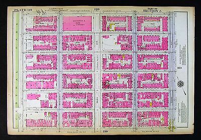
ORIGINAL 1928 Map New York City NYC Vintage& Original 10.5 X 12 inch plate from Belcher Hyde's 1928 Desk Atlas. Double sided. Some pages are excellent. But others have major tears that have been repaired with tape, I removed dark tape and replaced with archival tape. Also. There may be brokers notes on some maps. Maps are color coded. Show every lot dimension, hydrants, building material. Suitable for local history. Research or display, very informative maps Glare& reflections are due to nature of the scan P. 40& 41. Satisfaction Guaranteed! Powered by The free listing tool. List your items fast and easy and manage your active items.
|
|
|
Antique Map Of New York City Manhattan NYC Beautiful Colors 1903 RARE!
You are bidding on an antique map of New York City. Manhattan on one side and the other boroughs with a focus on Brooklyn on the reverse side. Fold out map of Manhattan is approx 14x22. The reverse side has writing and an approx 11x14 map of Brooklyn and the other boroughs. There is on brown spot to the left of Central Park seen in the photos. It carries through to the Brooklyn side and is shown in the photos. It's about the size of the tip of a pencil eraser. This is a true antique map, not a reprint or reproduction. It was printed by George F. Cram in 1903. Ships insured. Please inspect photos and ask questions before bidding. International bidders welcome but must request a shipping quote before bidding. Posted with eBay Mobile
|
|
|
1926 NYC Port East River Astoria Power Plant wharf MAP
1926 NYC Port East River Astoria Power Plant wharf MAP Please scroll up to enlarge the photo Offered for your consideration is an original map from 1926 for NYC Port East River Astoria Power Plant wharf. This ia a map from the Port of New York series issued in 1926 by the War Department. Corps of Engineers of U.S. Army and United States Shipping Board, and prepared in June 1924. We will send you the original map, together with a corresponding copy of the index to this map. The index will help you recognize the facilities( including all companies active at that time) as marked on the map by reference numbers with arrows. All original maps are complete, with margins, however for technical reasons, we were unable to make a complete, full scan of some of them. Please see all other maps from the NYC Port Faciliy map series currenly listed by us. ... moreThe map measures approximately 18 x 9 inches. And is in FINE condition, no tears, no stains or foxing, no water damage to report. This vintage 85+ year old map. Will be a fine addition to your collection, or serve as an eye-catching, unique detail of decoration for your home or office. Our maps are always an excellent idea for a gift, they come from a dry, smoke-free environment, and are ready for matting and framing. search titles& descriptions Shipping& Handling USPS airmail(and/or ground-where applicable) Tubes-First Class Mail Large. Rigid envelopes-First Class Mail* Tubes and envelopes- Priority Mail USA $3.95. $3.95. $7.95. Canada $8.50. $10.50. $30.50. Rest of the World $10.50. $15.50. $45.50. for items exceeding 11 inches in length. + FREE for stereoviews shipped within the USA. +Items valued $20 or higher a piece will be shipped flat. On acid-free backing boards. This is a premium shipping option. Due to high shipping costs depending heavily on weight, International buyers may choose their items to be sent in tubes instead, without backing. One of two International First Class Mail prices for tubes will then apply. +All shipping domestic and international of a
|
|
|
1926 Mill Basin - Jamaica Bay NYC port marine piers MAP
1926 Mill Basin- Jamaica Bay NYC port marine piers MAP Please scroll up to enlarge the photo Offered for your consideration is an original map from 1926 for Mill Basin- Jamaica Bay NYC port marine piers. This ia a map from the Port of New York series issued in 1926 by the War Department. Corps of Engineers of U.S. Army and United States Shipping Board, and prepared in June 1924. We will send you the original map, together with a corresponding copy of the index to this map. The index will help you recognize the facilities( including all companies active at that time) as marked on the map by reference numbers with arrows. All original maps are complete, with margins, however for technical reasons, we were unable to make a complete, full scan of some of them. Please see all other maps from the NYC Port Faciliy map series currenly listed by us. ... moreThe map measures approximately 18 x 9 inches. And is in FINE condition, no tears, no stains or foxing, no water damage to report. This vintage 85+ year old map. Will be a fine addition to your collection, or serve as an eye-catching, unique detail of decoration for your home or office. Our maps are always an excellent idea for a gift, they come from a dry, smoke-free environment, and are ready for matting and framing. search titles& descriptions Shipping& Handling USPS airmail(and/or ground-where applicable) Tubes-First Class Mail Large. Rigid envelopes-First Class Mail* Tubes and envelopes- Priority Mail USA $3.95. $3.95. $7.95. Canada $8.50. $10.50. $30.50. Rest of the World $10.50. $15.50. $45.50. for items exceeding 11 inches in length. + FREE for stereoviews shipped within the USA. +Items valued $20 or higher a piece will be shipped flat. On acid-free backing boards. This is a premium shipping option. Due to high shipping costs depending heavily on weight, International buyers may choose their items to be sent in tubes instead, without backing. One of two International First Class Mail prices for tubes will then apply. +All shipping domestic and international of
|
|
|
1926 hudson River Manhattan NYC Port Auth shoreline MAP
1926 hudson River Manhattan NYC Port Auth shoreline MAP Please scroll up to enlarge the photo Offered for your consideration is an original map from 1926 for hudson River Manhattan NYC Port Auth shoreline. This ia a map from the Port of New York series issued in 1926 by the War Department. Corps of Engineers of U.S. Army and United States Shipping Board, and prepared in June 1924. We will send you the original map, together with a corresponding copy of the index to this map. The index will help you recognize the facilities( including all companies active at that time) as marked on the map by reference numbers with arrows. All original maps are complete, with margins, however for technical reasons, we were unable to make a complete, full scan of some of them. Please see all other maps from the NYC Port Faciliy map series currenly listed by ... moreus. The map measures approximately 13x10 inches. And is in FINE condition, no tears, no stains or foxing, no water damage to report. This vintage 85+ year old map. Will be a fine addition to your collection, or serve as an eye-catching, unique detail of decoration for your home or office. Our maps are always an excellent idea for a gift, they come from a dry, smoke-free environment, and are ready for matting and framing. search titles& descriptions Shipping& Handling USPS airmail(and/or ground-where applicable) Tubes-First Class Mail Large. Rigid envelopes-First Class Mail* Tubes and envelopes- Priority Mail USA $3.95. $3.95. $7.95. Canada $8.50. $10.50. $30.50. Rest of the World $10.50. $15.50. $45.50. for items exceeding 11 inches in length. + FREE for stereoviews shipped within the USA. +Items valued $20 or higher a piece will be shipped flat. On acid-free backing boards. This is a premium shipping option. Due to high shipping costs depending heavily on weight, International buyers may choose their items to be sent in tubes instead, without backing. One of two International First Class Mail prices for tubes will then apply. +All shipping domestic and international of
|
|
|
ORIG 1928 Brooklyn Brownsville & East New York NYC 10.5 x 12 Map P. 156 & 157
ORIGINAL 1928 Brooklyn Map New York City NYC Vintage& Original 10.5 X 12 inch plate from Belcher Hyde's 1929 Desk Atlas. Double sided. Maps are color coded. Show every lot dimension, hydrants, building material. Suitable for local history. Research or display, very informative maps Glare& reflections are due to nature of the scan Satisfaction Guaranteed! Powered by The free listing tool. List your items fast and easy and manage your active items. RcmdId ViewItemDescV4,RlogId p4%60bo7%60jtb9%3Fuk.rp*a4%601gc%3E-14190d899f0-0xfe-
|
|
|
1926 NYC Manhattan-Washigton Bridge Haarlem River MAP
1926 NYC Manhattan-Washigton Bridge Haarlem River MAP Please scroll up to enlarge the photo Offered for your consideration is an original map from 1926 for NYC Manhattan-Washigton Bridge Haarlem River. This ia a map from the Port of New York series issued in 1926 by the War Department. Corps of Engineers of U.S. Army and United States Shipping Board, and prepared in June 1924. We will send you the original map, together with a corresponding copy of the index to this map. The index will help you recognize the facilities( including all companies active at that time) as marked on the map by reference numbers with arrows. All original maps are complete, with margins, however for technical reasons, we were unable to make a complete, full scan of some of them. Please see all other maps from the NYC Port Faciliy map series currenly listed by us. ... moreThe map measures approximately 18 x 9 inches. And is in FINE condition, no tears, no stains or foxing, no water damage to report. This vintage 85+ year old map. Will be a fine addition to your collection, or serve as an eye-catching, unique detail of decoration for your home or office. Our maps are always an excellent idea for a gift, they come from a dry, smoke-free environment, and are ready for matting and framing. search titles& descriptions Shipping& Handling USPS airmail(and/or ground-where applicable) Tubes-First Class Mail Large. Rigid envelopes-First Class Mail* Tubes and envelopes- Priority Mail USA $3.95. $3.95. $7.95. Canada $8.50. $10.50. $30.50. Rest of the World $10.50. $15.50. $45.50. for items exceeding 11 inches in length. + FREE for stereoviews shipped within the USA. +Items valued $20 or higher a piece will be shipped flat. On acid-free backing boards. This is a premium shipping option. Due to high shipping costs depending heavily on weight, International buyers may choose their items to be sent in tubes instead, without backing. One of two International First Class Mail prices for tubes will then apply. +All shipping domestic and international of all
|
|
|
1926 NYC Brooklyn-Queens NYC Newton Creek piers MAP
1926 NYC Brooklyn-Queens NYC Newton Creek piers MAP Please scroll up to enlarge the photo Offered for your consideration is an original map from 1926 for NYC Brooklyn-Queens NYC Newton Creek piers. This ia a map from the Port of New York series issued in 1926 by the War Department. Corps of Engineers of U.S. Army and United States Shipping Board, and prepared in June 1924. We will send you the original map, together with a corresponding copy of the index to this map. The index will help you recognize the facilities( including all companies active at that time) as marked on the map by reference numbers with arrows. All original maps are complete, with margins, however for technical reasons, we were unable to make a complete, full scan of some of them. Please see all other maps from the NYC Port Faciliy map series currenly listed by us. The ... moremap measures approximately 18 x 9 inches. And is in FINE condition, no tears, no stains or foxing, no water damage to report. This vintage 85+ year old map. Will be a fine addition to your collection, or serve as an eye-catching, unique detail of decoration for your home or office. Our maps are always an excellent idea for a gift, they come from a dry, smoke-free environment, and are ready for matting and framing. search titles& descriptions Shipping& Handling USPS airmail(and/or ground-where applicable) Tubes-First Class Mail Large. Rigid envelopes-First Class Mail* Tubes and envelopes- Priority Mail USA $3.95. $3.95. $7.95. Canada $8.50. $10.50. $30.50. Rest of the World $10.50. $15.50. $45.50. for items exceeding 11 inches in length. + FREE for stereoviews shipped within the USA. +Items valued $20 or higher a piece will be shipped flat. On acid-free backing boards. This is a premium shipping option. Due to high shipping costs depending heavily on weight, International buyers may choose their items to be sent in tubes instead, without backing. One of two International First Class Mail prices for tubes will then apply. +All shipping domestic and international of all ite
|
|
|
1926 Hudson River-Manhattan 95-131st. NYC Shreline MAP
1926 Hudson River-Manhattan 95-131st. NYC Shreline MAP Please scroll up to enlarge the photo Offered for your consideration is an original map from 1926 for Hudson River-Manhattan 95-131st. NYC Shreline. This ia a map from the Port of New York series issued in 1926 by the War Department. Corps of Engineers of U.S. Army and United States Shipping Board, and prepared in June 1924. We will send you the original map, together with a corresponding copy of the index to this map. The index will help you recognize the facilities( including all companies active at that time) as marked on the map by reference numbers with arrows. All original maps are complete, with margins, however for technical reasons, we were unable to make a complete, full scan of some of them. Please see all other maps from the NYC Port Faciliy map series currenly listed by us. ... moreThe map measures approximately 18 x 9 inches. And is in FINE condition, no tears, no stains or foxing, no water damage to report. This vintage 85+ year old map. Will be a fine addition to your collection, or serve as an eye-catching, unique detail of decoration for your home or office. Our maps are always an excellent idea for a gift, they come from a dry, smoke-free environment, and are ready for matting and framing. search titles& descriptions Shipping& Handling USPS airmail(and/or ground-where applicable) Tubes-First Class Mail Large. Rigid envelopes-First Class Mail* Tubes and envelopes- Priority Mail USA $3.95. $3.95. $7.95. Canada $8.50. $10.50. $30.50. Rest of the World $10.50. $15.50. $45.50. for items exceeding 11 inches in length. + FREE for stereoviews shipped within the USA. +Items valued $20 or higher a piece will be shipped flat. On acid-free backing boards. This is a premium shipping option. Due to high shipping costs depending heavily on weight, International buyers may choose their items to be sent in tubes instead, without backing. One of two International First Class Mail prices for tubes will then apply. +All shipping domestic and international of a
|
|
|
1926 Hudson River-Manhattan 69-95 st RR & pier NYC MAP
1926 Hudson River-Manhattan 69-95 st RR& pier NYC MAP Please scroll up to enlarge the photo Offered for your consideration is an original map from 1926 for Hudson River-Manhattan 69-95 st RR& pier NYC. This ia a map from the Port of New York series issued in 1926 by the War Department. Corps of Engineers of U.S. Army and United States Shipping Board, and prepared in June 1924. We will send you the original map, together with a corresponding copy of the index to this map. The index will help you recognize the facilities( including all companies active at that time) as marked on the map by reference numbers with arrows. All original maps are complete, with margins, however for technical reasons, we were unable to make a complete, full scan of some of them. Please see all other maps from the NYC Port Faciliy map series currenly listed ... moreby us. The map measures approximately 18 x 9 inches. And is in FINE condition, no tears, no stains or foxing, no water damage to report. This vintage 85+ year old map. Will be a fine addition to your collection, or serve as an eye-catching, unique detail of decoration for your home or office. Our maps are always an excellent idea for a gift, they come from a dry, smoke-free environment, and are ready for matting and framing. search titles& descriptions Shipping& Handling USPS airmail(and/or ground-where applicable) Tubes-First Class Mail Large. Rigid envelopes-First Class Mail* Tubes and envelopes- Priority Mail USA $3.95. $3.95. $7.95. Canada $8.50. $10.50. $30.50. Rest of the World $10.50. $15.50. $45.50. for items exceeding 11 inches in length. + FREE for stereoviews shipped within the USA. +Items valued $20 or higher a piece will be shipped flat. On acid-free backing boards. This is a premium shipping option. Due to high shipping costs depending heavily on weight, International buyers may choose their items to be sent in tubes instead, without backing. One of two International First Class Mail prices for tubes will then apply. +All shipping domestic and internationa
|
|
|
Original 1893 NEW YORK CITY NYC MANHATTAN TIMES SQUARE Railway Lines Color Map
Original 1893 NEW YORK CITY MANHATTAN TIMES SQUARE Railway Lines Color Map Antique Map Description This original authentic antique map of the southern region of New York City in 1893 is an example of full-color lithography using wax engravings. It was published in 1893 by John F Waite of Chicago in an atlas titled"C. A. Gaskell's Family and Business Atlas of the World. The atlas publisher. John F Waite, was licensed to use the maps of George Cram. In the 1890's, the maps by Cram were synonymous with accuracy and innovation. Map Details Authentic antique map. Not a reproduction or reprint Map locates streets. Ferry routes, prominent buildings, hotels, churches, canals, steam railroad lines, horse roads and Masonic Temple Map measures 9" x 11.5" Entire sheet measures 10.5" x 13.5" Scale- one mile per square ... morewith reference key Ample margins for framing Very good condition with no rips or tears and even ivory age toning Structurally sound and flexible paper. Looking for more maps? Search Antiqueprintopia! Just click on the old storefront above Antiqueprintopia has sold antique maps worldwide. Our customers include private collectors. Museums, historic preservation companies, interior designers. Antique shops and genealogists. inkfrog terapeak. InkFrog Analytics.
|
|
|
MID ATLANTIC STATES: NY NJ Pennsylvania, MD Delaware. NYC Philadelphia;1891 map
New York. New Jersey, Pennsylvania, Maryland& Delaware with Environs of New York& Philadelphia; Inset maps of Environs of New York; Environs of Philadelphia Antique colour map. 1891 Title of map: New York. New Jersey, Pennsylvania, Maryland& Delaware with Environs of New York& Philadelphia; Inset maps of Environs of New York; Environs of Philadelphia' The image below shows an enlarged cross section from the centre of the map to show the level of printed detail: DATE PRINTED: 1891 IMAGE SIZE: Approx 33.5 x 24.0cm. 13.25 x 9.5 inches(Large) ARTIST/CARTOGRAPHER/ENGRAVER: John Bartholomew PROVENANCE: The English Imperial Atlas and Gazetteer of the World" by J. G. Bartholomew. Published by T. Nelson& Sons, London. Please note that virtually all antique and vintage maps and prints have been extracted from books, atlases ... moreor newspapers. TYPE: Antique colour map VERSO: There is another map or maps printed on the reverse side of the picture. The paper is thick. And the printing on the reverse does not show through to the front CONDITION: Good; suitable for framing. However. Please note: The image shown may have been taken from a different example of this map than that which is offered for sale. The map you will receive is in good condition but there may be minor variations in the condition from that shown in the image. Please check the scan for any blemishes prior to making your purchase. Virtually all antiquarian maps and prints are subject to some normal aging due to use and time which is not obtrusive unless otherwise stated. I offer a no questions asked return policy- see below. AUTHENTICITY: This is an authentic historic print. Published at the date stated above. I do not offer reproductions. It is not a modern copy. The term'original' when applied to a print means that it was printed at the first or original date of publication; it does not imply that the item is unique. Print' means any image created by applying an inked block to paper or card under pressure by any method inc
|
|
|
RARE 1935 NYC New York Subway Map from New York Savings Bank GREAT Gift!
This is a subway map of New York City from 1935. Issued by the New York Savings Bank. It is beautiful and in near mint condition. There is nothing I can tell you that you cannot see from the photos. This would make a great gift for a New Yorker. Or anyone who loves my city: It is in perfect condition and frameable if you want to go the extra mile! I accept PayPal and ship to the USA
|
|
|
Vintage 1931 NY Bronz Zoo NYC Zoological Park Guide w/ Color Map & Animal Photos
This is a Rare Vintage 1931 Edition of the“Official Guide to the New York Zoological Park” Bronx Zoo of New York City) Published by the NY Zoological Society. This 226 page hardcover, includes text as well as a Color Map of the Park, and many B&W photos. The contents cover the Zoo, as well as animal species such as; Mammals; Birds; Reptiles& Amphibians. The book is in good condition, but does have splits& chipping to the outer cover along the spine edge, although the endpapers are still holding the cover on solidly. Lucky Buyer prepays successful bid amount plus $4.00 shipping in USA. Good Luck!
|
|
 |