-
Christian Collectibles
-
Christian Sheet Music
-
Vatican Stamps
-
Vatican Coins & Paper Money
-
Antiques
-
Antiquities
-
Architectural & Garden
-
Decorative Arts
-
Ethnographic
-
Furniture
-
Maps, Atlases & Globes
-
United States (Pre-1900)
-
United States (1900-Now)
-
AK, HI
-
AL, FL, GA, MS, NC, SC
-
AR, IA, KS, LA, MO, NE
-
AZ, CA, CO, NM, NV, UT
-
CT, MA, ME, NH, RI, VT
-
DC, DE, MD, NJ, NY, PA
-
ID, OR, WA
-
IL, IN, MI, OH, WI
-
MN, MT, ND, SD, WY
-
OK, TX
-
VA, WV, KY, TN
-
Entire US
-
United States (Date Unknown)
-
Africa
-
Asia
-
Australasia/ Oceania
-
Canada
-
Central America/ Caribbean
-
Europe
-
India
-
Ireland
-
Mexico
-
Middle East
-
North America
-
South America
-
United Kingdom
-
Maps on CD
-
World Maps
-
Globes
-
Mixed Lots
-
Reproductions
-
Price Guides & Publications
-
Other
|
In
Order by: Available to: This site contains affiliate links for which I may be compensated
|
Buy It Now
Free Shipping Location: Training Battalian S.O, India This smart globe is fit for kids and adults of all ages and can be used for office decor, astronomy and geography classrooms, kids educational toys, and ... moremuch more. While geographic globes are perfect for teaching kids as young as kindergarten age, they’re also a great tool for teaching students as they grow older about global political & geographical issues that arise throughout the world.
Buy It Now
Location: Stockton, United States Title: Map of San Francisco Showing Principal Streets and Places of Interest- 1927 Author: Godwin. Harrison Description: Color lithographed map. 65.5x82(25¾x32¼" ... moreframed size: 30" x 36"Charming and amusing pictorial map of San Francisco in the 1920's. Even then touted as"The City That Knows How" and"The Ideal Convention City. We found auction estimates on this rare map as high as $2500.00 to $3000.00. Although, this map is in as is condition with browning, holes/tears, it is still a valuable map since it is very rare. We'll let you decide what you want to pay. WOW! NO RESERVE!
Buy It Now
$14.99 Shipping Location: Ivanhoe, Australia The Map Collector magazine was started by Tooley in 1977 when the Map Collector’s Circle ceased publishing. (Ref: M&B; Tooley). Here he continued his ... moreresearch, spending long hours in the Map Room of the British Museum.
Buy It Now
$9.99 Shipping Location: Mission Viejo, United States Antique Vintage Color Atlas Map America World Globe Collection. In nice condition and ready to be framed. 13.5 inches long by 9.6 inches wide. About 39 ... morepages of maps. Each page is double sided so approximately more than 70. We deducted 8 in case we counted wrong and for the few with blemishes per their age. We ship quickly through USPS PRIORITY MAIL.
Buy It Now
$4.13 Shipping Location: Meredith, United States This antique atlas map of Arkansas, measuring 11" x 14", was published by Rand McNally in 1895. The map depicts the US State of Arkansas and includes ... morethe city of Kansas City, within the United States of America. The printing technique used for this world atlas map was lithograph. This is an original antique map, perfect for collectors of vintage maps and atlases. The map is categorized under Antiques, Maps, Atlases & Globes, and North America Maps, and is a Type of World Atlas, with a Format of Atlas Map. The Date Range is between 1800-1899 and the Year of publication is 1895. This is an ideal piece for those interested in the history and geography of the United States.
Buy It Now
Free Shipping Location: Schertz, United States This antique map from 1863 features the state of Maine and was published by Johnson & Ward. The map measures 14x18 inches and has it's original colors. ... moreIt was created using a steel plate printing technique, and is an authentic antique original from 1863. The map will be shipped for free within the USA, while international shipping costs will be calculated. This vintage map is a great addition to any collection of North America maps, and is a valuable antique that will surely impress any enthusiast of maps, atlases, and globes.
Buy It Now
$4.96 Shipping Location: BLACKWOOD, United Kingdom A school atlas of English history - S. R. Gardiner 1910. A sketch of historical geography - K Johnston 1909. Atlas Of Ancient Egypt by The Egypt Exploration ... moreFund 1894. Archeological Atlas of Ohio - W. C. Mills 1914.
Buy It Now
$4.55 Shipping Location: Oakland, United States Explore the beauty of Central America with this antique map from Rand McNally & Co. dating back to 1901. The intricate details and historic significance ... moreof this map make it a valuable addition to any collection. The map showcases the countries and cities of Central America, with a focus on the topography and waterways of the region.Take a step back in time and imagine the journeys and adventures that could have been taken with this map as a guide. The map measures 7x6 and is in excellent condition for its age. Add it to your collection of antique maps, atlases, and globes or display it as a unique piece of history.
Free Shipping Location: Schertz, United States Explore the historic beauty of Iowa and Nebraska with this antique original 1863 map from Johnson & Ward's Atlas. Measuring 14x18 inches, this steel plate ... moremap features the original colors of the region and highlights the US States of Iowa and Nebraska. The map is a perfect addition to any collection of North America maps, atlases, and globes. Free S&H is available for customers in the USA, while calculated S&H is available for worldwide shipping. Don't miss the opportunity to own a piece of history with this stunning map from Johnson & Ward's Atlas.
$6.00 Shipping Location: Corunna, United States This map is from A New General Atlas Exhibiting The Five Great Divisions of the Globe drawn and engraved by M. Malte-Brun. Atlas was published by Grigg ... more& Elliot Philadelphia 1832. This is an original 192 year old map, not a copy or reprint.
$6.00 Shipping Location: Corunna, United States This map is from A New General Atlas Exhibiting The Five Great Divisions of the Globe drawn and engraved by M. Malte-Brun. Atlas was published by Grigg ... more& Elliot Philadelphia 1832.
Buy It Now
$4.55 Shipping Location: Oakland, United States This antique map from 1914 depicts a portion of the New York Borough of Kings, specifically Brooklyn. Measuring at 11x15 inches, it would make a great ... moreaddition to any collection of maps, atlases, or globes. The detailed cartography showcases the city's layout and landmarks from over a century ago, providing a unique glimpse into the past. The map is in good vintage condition, with signs of age and wear that only add to its charm and character. This piece of history would make a wonderful gift for any history buff or lover of Brooklyn.
Buy It Now
$4.13 Shipping Location: Elgin, United States This vintage geological map of Abilene, Texas showcases the geological features of the region during the 1970s. The map was created by the University ... moreof Texas at Austin Bureau of Economic Geology and is a folding map format. The map is an authentic vintage original and is in excellent shape, perfect for collectors of North American maps, atlases, and globes. The map features the town of Abilene and its surrounding areas, highlighting the geological formations that exist in the region. It is a valuable item for those interested in the geological history of Texas and its natural resources. This Geologic Atlas of Texas map from 1972 is a unique and rare item that would make a great addition to any antique and map collection.
Buy It Now
Free Shipping Location: Training Battalian S.O, India This smart globe is fit for kids and adults of all ages and can be used for office decor, astronomy and geography classrooms, kids educational toys, and ... moremuch more. While geographic globes are perfect for teaching kids as young as kindergarten age, they’re also a great tool for teaching students as they grow older about global political & geographical issues that arise throughout the world.
Buy It Now
Free Shipping Location: Training Battalian S.O, India This smart globe is fit for kids and adults of all ages and can be used for office decor, astronomy and geography classrooms, kids educational toys, and ... moremuch more. THE BIGGER, THE BETTER – See the world like never before with your bright light up globe and all of its vivid detail!
Buy It Now
$9.87 Shipping Location: Riverside, United States Don't miss the chance to add this incredible piece to your collection.
Buy It Now
$4.55 Shipping Location: Oakland, United States This antique map from 1923 showcases the beautiful province of British Columbia in North America. Measuring 9x6 inches, it is a perfect addition to any ... morecollection of maps, atlases, or globes. The intricate details and vibrant colors make it a stunning display piece that captures the essence of this Canadian province. Whether you're a history buff, cartography enthusiast, or simply looking for a unique decor item, this antique map is sure to delight.
$4.43 Shipping Location: Grand Junction, United States New In the Unopened Box Cram Texas State Map# 7063-6340 size 64 x 50 Pull down map. It appears that the company Nystrom is now selling this map. If you ... moregoogle this map on School Specality web site(where this map came from) and search for map# 088641. This exact map made by Cram is offered at the price of $189.99 This is the same map These are the same maps used in Schools Happy to answer any questions and Please read my feedback and buy with confidence. I also have US. World maps and Projection screens listed. Happy to combine shipping when I can. THANKS Zoom
Buy It Now
Free Shipping Location: Schertz, United States This 1862 map of New Jersey is a stunning piece of antique history. It showcases the state with hand tinted highlights and accurate details, measuring ... moreat 14x18 for the single-page size. The map was published by Johnson & Ward, a reputable cartographer and publisher of the time. The map is over 160 years old and is an authentic original, making it a valuable addition to any collection of antique maps, atlases, and globes. Free shipping is available within the USA, and worldwide shipping costs will be calculated. Please note that the book cover shown in the image is for reference purposes only and is not included in the sale.
Buy It Now
$5.75 Shipping Location: Old Orchard Beach, United States The map showcases NH and Vermont's topography, major cities, and landmarks. including Featuring intricate details and rich coloring, this map is a stunning ... morevisual representation of New England's history and geography.
Buy It Now
$4.55 Shipping Location: Oakland, United States This antique map of the Dominion of Canada, produced by Rand McNally & Co. in 1904, is a true collector's item. The intricate details and vibrant colors ... moreshowcase the beauty of this North American country. The map measures 7x6 and is in excellent shape, ready to be displayed in any home or office. With its historical value and stunning appearance, this antique map would be an excellent addition to any collection of maps, atlases, or globes. The cartographer/publisher, Rand McNally & Co., is well-known for their high quality maps, making this item even more desirable. Don't miss out on the opportunity to own this piece of Canadian history.
Buy It Now
$5.90 Shipping Location: Grenada, United States Explore the historic Riverside and San Bernardino with this beautiful vintage map. Measuring 3.75x10.5 inches, this map is perfect for collectors of antique ... moremaps. It features the intricate details of the North American region, making it an excellent addition to any collection of maps, atlases, and globes. The map showcases the region's geography, topography, and landmarks, providing a glimpse into its rich history. Whether you're a history aficionado or a cartography enthusiast, this vintage map is a must-have.
$6.00 Shipping Location: Corunna, United States This map is from A New General Atlas Exhibiting The Five Great Divisions of the Globe drawn and engraved by M. Malte-Brun. Atlas was published by Grigg ... more& Elliot Philadelphia 1832. This is an original 192 year old map, not a copy or reprint.
$6.00 Shipping Location: Corunna, United States This map is from A New General Atlas Exhibiting The Five Great Divisions of the Globe drawn and engraved by M. Malte-Brun. Atlas was published by Grigg ... more& Elliot Philadelphia 1832. This is an original 192 year old map, not a copy or reprint.
Buy It Now
$5.33 Shipping Location: NEWCASTLE UPON TYNE, United Kingdom Understand geological topography – the study of surface shape in relation to mapping. Read about military map reading and sketching as well as map reading ... morefor aviators. Learn about the discovery of the.
Buy It Now
$4.55 Shipping Location: Oakland, United States This antique map from 1907 features the beautiful states of Tennessee and Kentucky. Measuring 15.5x11 inches, it is a great addition to any collection ... moreof antique maps. The map was created as part of the Encyclopedic Atlas and is in excellent condition. The map showcases the cities and towns of Tennessee and Kentucky, as well as their surrounding landscapes. It is a great resource for historians, geographers, and anyone who loves vintage maps. The map is classified under the North America Maps, Maps, Atlases & Globes, and Antiques categories. Add this historic piece to your collection today!
Buy It Now
Free Shipping Location: Schertz, United States Explore the historic beauty of Georgia and Alabama with this authentic Mitchell Atlas Map from 1887. The double-page sized map measures 15x23 and features ... morehand-tinted highlights that enhance its visual appeal. The map is an antique original and is over 130 years old, making it a valuable collector's item for anyone interested in North America Maps, Maps, Atlases & Globes, or Antiques. The book cover is only for reference purposes and is not included in the sale. Enjoy free S&H in the USA and calculated S&H worldwide.
Buy It Now
$44.99 Shipping Location: Ivanhoe, Australia BlaeusAtlas Major were the most expensive books printed in the 17th century. In 1672 a disastrous fire destroyed Blaeu\\\'s printing house in the Gravenstraat ... moreand a year afterwards Joan Blaeu died. Date: - 1662.
Buy It Now
$29.65 Shipping Location: Reidsville, United States This vintage Rand McNally World Portrait Globe is a beautiful mid-century modern piece that showcases the world in stunning detail. With a diameter of ... more12 inches, it features raised relief and a rotating base for easy viewing. The globe is from the 1970s and is colored in a rich blue hue, making it a perfect addition to any collection of antiques, maps, atlases, or globes. The globe is a vintage original and does not come with any California Prop 65 warning. It's a unique piece that depicts the world as it was in the 1970s, making it a great conversation starter. It's perfect for display in your home or office, and its intricate details are sure to impress. Add this to your collection today and enjoy a piece of history.
Buy It Now
Free Shipping Location: Lehi, United States This product is a vintage reproduction of a world map by Henricus Hondius, framed in a 12x9 inch frame. The map is designed to be used as a mirror, but ... morehas one scratch. The map shows the entire world and is categorized under World Maps, Maps, Atlases & Globes, and Antiques.
Buy It Now
Free Shipping Location: Training Battalian S.O, India ADJUSTABLE TRIPOD STAND. TRIPOD COLOR : AS SHOWN.
Buy It Now
Location: Brooklyn, United States The lithography printing technique used to create this wall map provides unparalleled detail and clarity.
Buy It Now
$4.55 Shipping Location: Oakland, United States This antique Rand McNally map from 1884 features the beautiful Canadian province of Quebec. Measuring 10x7 inches, it is a stunning piece of cartography ... morethat would make a great addition to any map, atlas, or globe collection. The intricate details and vibrant colors are sure to impress both casual admirers and serious collectors alike. Whether you're a history buff, a geography enthusiast, or simply appreciate the artistry of vintage maps, this piece is a must-have for your collection.
Buy It Now
$4.55 Shipping Location: Oakland, United States This antique map of North America was published by Rand McNally & Co. in 1899. Measuring 7x6 inches, it is a beautiful piece of history for any collector ... moreof maps, atlases, and globes. The cartographer and publisher details are clearly visible on the map, making it a valuable addition to any collection. The map is in excellent shape and is sure to impress anyone who sees it.
Buy It Now
$4.02 Shipping Location: Boiling Springs, United States Take a step back in time with this intriguing Rand McNally & Co. Map of Washington, an antique map with all the charm of the era in which it was created. ... moreThe map was painstakingly crafted in 1904 and is a true testament to cartography of the time. With an impressive 7x6 size, this map is perfect for any enthusiast of maps, atlases, and globes. Add this timeless piece to your collection today.
Buy It Now
$5.00 Shipping Location: Fort Lauderdale, United States
Buy It Now
$4.13 Shipping Location: Elgin, United States This vintage geological map of Texas from 1977 showcases the Del Rio Sheet and was published by the University of Texas at Austin Bureau of Economic Geology. ... moreIt features a folding format and provides detailed information on the geology of the area, dating back to 1970-1979. The map is a vintage original and is in excellent condition for its age. It is a valuable addition to any collection of North America maps, maps, atlases, and globes, or antiques.
Buy It Now
$4.55 Shipping Location: Oakland, United States Explore the world in the late 19th century with these antique maps of the Western and Eastern Hemispheres. The carefully preserved pieces showcase the ... moreintricate details of the world atlas and measure approximately 13x11 inches. Perfect for collectors of antique maps, these pieces are sure to be a great addition to any North America Maps, Maps, Atlases & Globes, or Antiques collection. Don't miss your chance to own a piece of history!
Buy It Now
$8.70 Shipping Location: Vero Beach, United States This vintage reproduction features four beautifully detailed maps from around the world, dating back to the 1700s. Lithography was used to create these ... morestunning atlas maps, which were originally published by Guillaume De L'Isle. The maps showcase North America, as well as other regions across the globe, including British Columbia. These rare prints are perfect for collectors or anyone looking to add a touch of history to their home. The maps are in excellent condition and will be carefully packaged for shipping. Don't miss out on the opportunity to own a piece of cartographic history.
Buy It Now
Free Shipping Location: Training Battalian S.O, India This smart globe is fit for kids and adults of all ages and can be used for office decor, astronomy and geography classrooms, kids educational toys, and ... moremuch more. While geographic globes are perfect for teaching kids as young as kindergarten age, they’re also a great tool for teaching students as they grow older about global political & geographical issues that arise throughout the world.
Buy It Now
Free Shipping Location: Savannah, United States Original 126-year-old Antique Map of Arizona Drawn and Engraved for the 1898 Edition of The Columbian Atlas of The World, Featuring Large Scale Color ... moreMaps of Each State, Principal City, and Territory of The United States, the Provinces of Canada, Every Country, Nation, Sovereign Kingdom, and Civil Division Upon the Face of the Globe; Accompanied by a Margin Reference Index of County, City, and Town populations of the 1890 US Census; Together with a Concise History of Earth's Peoples richly Illustrated with Engravings. Intricate Detail of County Lines, Towns, Railroads, along with Rivers, Lakes, and Natural Landmarks. Fine Map for the Historian or Collector. Great for American History and Family Genealogy. Makes an Imaginative and Creative Gift. Easily Framed.
Buy It Now
Free Shipping Location: Schertz, United States This 1876 map of Missouri is a remarkable piece of cartography by O.W. Gray. The map is an antique original and was published in the National Atlas. It ... moremeasures 14x17 inches and is an excellent addition to any collection of maps, atlases, and globes. The map depicts the state of Missouri in great detail and includes aspects such as US state, country/region, and publication year. Shipping and handling is free for buyers in the USA, and the cost for international shipping will be calculated accordingly.
Buy It Now
Free Shipping Location: Schertz, United States Explore the beauty of Dakota Territory with this antique original railroad and county map published by George Cram in 1889. The lithography printing technique ... moreused brings out the vibrant colors of the map, giving it an aesthetic appeal. This map features Indian Reservations, Soldiers Forts, and other important locations that will interest any history lover. Enjoy free shipping and handling within the USA, and calculated shipping worldwide. This map is a must-have for any antique or map collector, and it will make a great addition to your North America Maps, Maps Atlases & Globes or Antiques collection. Get this unique piece of history today!
Buy It Now
$4.55 Shipping Location: Oakland, United States Discover a beautiful antique map that depicts the US State of Montana in vivid and colorful detail. This rare piece of history dates all the way back ... moreto 1885 and would make a delightful addition to any collection of maps, atlases, or globes. Measuring in at a compact 10x7 inches, this charming creation is perfect for display in a variety of settings. Whether you're a lover of vintage maps, a history buff, or simply appreciate the beauty of antique art, this piece is sure to impress.
Buy It Now
$3.07 Shipping Location: Bay Shore, United States This rare and colorful pictorial map of New York City offers a physician's view of Manhattan in 1967. The intricate lithography and printing technique ... moreused by the artist Caraway make this vintage original folding map a unique addition to any collection. The map showcases the city's landmarks and streets in a bird's eye view, making it a perfect decorative piece for any home or office. A perfect gift for a physician.The map was created by Caraway, a renowned cartographer and publisher, and includes important details such as the date range of 1960-1969, the format as a folding map, and the location of New York City in the United States of America. This one-of-a-kind map is a must-have for any map, atlas, or globe collector.
Buy It Now
Free Shipping Location: Schertz, United States This antique original township map of Lebo, Le Roy, and Strawn in Kansas was printed in 1887 by cartographers Everett & Stewart. Measuring 14 inches by ... more17 inches, this plat atlas map is a valuable addition to any collection of antique maps. The map is in its original state and is being offered with free shipping within the USA and calculated shipping rates for worldwide delivery. This historical piece is perfect for collectors of North America maps, antique maps, and those interested in maps, atlases, and globes.
Buy It Now
$5.00 Shipping Location: Canada DATE OF ISSUE: 1891. ORIGIN OF THE MAP: "New Complete Atlas of the World", published in London, UK by George W. Bacon.
Buy It Now
Free Shipping Location: Schertz, United States This authentic lithography map of Iowa from 1855 is a true treasure. It was created by cartographer and publisher Joseph Colton and showcases the state's ... moreboundaries, cities, and topography in incredible detail. Measuring 15x17 inches, this antique original is a must-have for any map collector or enthusiast. The map's date range is dated 1855 and is classified under North America Maps, Maps, Atlases & Globes, and Antiques. The US State of Iowa is prominently featured, and the printing technique used is lithography. This piece is a rare find and is perfect for anyone looking to own a piece of American history.
Buy It Now
Free Shipping Location: Schertz, United States This antique original 1863 Map of Washington Territory and Oregon is a rare find for any collector or enthusiast of North America maps. Featuring hand-tinted ... morehighlights and measuring at 14x18, this Johnson & Ward map showcases the Indian hunting grounds, soldier's forts, and other important landmarks of the time. The map is over 160 years old and includes valuable information such as the date range and reference for the missing title page. Additionally, this map comes with free shipping within the USA and calculated shipping for international buyers. It is a great addition to any collection of antiques, maps, atlases, and globes. Don't miss your chance to own a piece of history, add this 1863 Map of Washington Territory and Oregon to your collection today.
Buy It Now
Free Shipping Location: Schertz, United States This antique map features the New Mexico Territory and was created by George Cram in 1884. The map measures 11x13 inches and has original hand coloring. ... moreIt is a genuine antique original, and perfect for any collector of maps, atlases, or globes. The cartographer/publisher, George Cram, is well known for his detailed and accurate maps of North America. Free shipping and handling is available within the USA, and calculated shipping and handling is available worldwide. Add this piece of history to your collection today!
Buy It Now
Free Shipping Location: Schertz, United States Explore the beauty of Washington with this antique original railroad and county map from 1889. Lithographed and colored, this map showcases Indian reservations ... morewith the cartographer/publisher being George Cram. Measuring XL17x23, this map is perfect for collectors of North America Maps, Maps, Atlases & Globes, and Antiques. With free S&H within the USA and calculated S&H worldwide, this is an opportunity not to be missed. Take a trip back in time and own a piece of history with this stunning map.
Buy It Now
$4.55 Shipping Location: Oakland, United States This antique Rand McNally map from 1884 features the Canadian provinces of Nova Scotia and New Brunswick. Measuring 10x7 inches, the map is a beautiful ... moreaddition to any collection of maps, atlases, or globes. The intricate detailing and vibrant colors of the map make it a wonderful conversation piece.Perfect for collectors of antique maps or those interested in the rich history of Canada, this map is a must-have. The map provides a fascinating glimpse into the past, showcasing the development of the provinces over time. Don't miss out on the opportunity to own this unique piece of history.
$6.00 Shipping Location: Corunna, United States This map is from A New General Atlas Exhibiting The Five Great Divisions of the Globe drawn and engraved by M. Malte-Brun. Atlas was published by Grigg ... more& Elliot Philadelphia 1832. This is an original 192 year old map, not a copy or reprint.
Buy It Now
Free Shipping Location: Schertz, United States This 1887 Plat Atlas Map features Great Bend, Kansas and Ellinwood, Garfield Twps. on the reverse side. The map measures 17 x 27 and is an antique original, ... moreprinted by L.H. Everts & Co. in 1887. All colors are original, making this map a unique and authentic piece of history. The map page is in great condition and is perfect for anyone interested in antique maps, North America Maps, or Maps, Atlases & Globes. This rare and valuable map is a must-have for collectors and history enthusiasts alike.
Buy It Now
Free Shipping Location: San Antonio, United States This 1873 map of Indiana is an authentic national atlas map measuring 14x17 inches. It features all original colors and was published by O.W. Gray. The ... moremap is suitable to be framed and is an antique original. The map depicts the state of Indiana in great detail and is a valuable addition to any collection of North America maps, maps, atlases & globes, or antiques. It is in excellent condition and comes with free shipping and handling. Don't miss out on the opportunity to own this piece of American cartography history.
Buy It Now
$12.00 Shipping Location: Moretown, United States This antique original Mitchell Augustus atlas map depicts the Southwest United States, specifically the counties and townships of Arizona and New Mexico ... moreTerritories in 1880. The map is a county map format and is a unique addition to any collection of North America maps or antiques. The cartographer/publisher, Mitchell Augustus, is known for his attention to detail and accurate representations of geographic areas. The map would make a great display piece for any enthusiast of maps, atlases, and globes. The date range of 1880 makes it a rare find and the fact that it is an antique original adds to its value. Don't miss the opportunity to own a piece of history and add this beautiful Mitchell atlas map to your collection.
Buy It Now
Free Shipping Location: Schertz, United States This antique original map page of Kansas from 1917 and is a great addition to any collection of North America maps, maps, atlases, and globes. The colors ... moreon the map page are all original, and it was published by Geo. A. Ogle & Co. The map page was printed in 1917. This map page is perfect for collectors or anyone who wants to add a touch of history to their decor.
Buy It Now
$4.55 Shipping Location: Oakland, United States This antique map, measuring 11x15 inches, showcases the beautiful city of St. Louis, Missouri in 1914. It is a perfect addition to any collection of city ... moremaps or historical memorabilia. The intricate details and vibrant colors make it a striking decoration for any room.This item falls under the categories of antiques, maps, atlases & globes, and North America maps. The year of 1914 is displayed prominently in the aspects section, highlighting its historical significance. Whether you are a collector or just appreciate the beauty of vintage maps, this piece is sure to impress.
Buy It Now
Free Shipping Location: Training Battalian S.O, India Nautical 16" World Globe With Wooden Floor Tripod Stand Antique Style Decor NEW. WORLD GLOBE WITH ADJUSTABLE FLOOR TEAK WOODEN TRIPOD STAND. ADJUSTABLE ... moreTRIPOD STAND. TRIPOD COLOR : AS SHOWN. GLOBE COLOR : AS SHOWN.
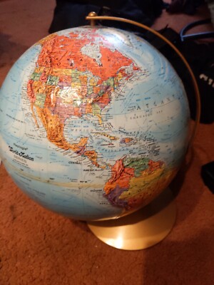
Buy It Now
$22.19 Shipping Location: Jenkintown, United States Item For Sale Please read my terms below before buying! This item for sale is a vintage 12" diameter World Globe by Replogle Land and Sea. It is ... morein good used shape as shown in the picture with some nicks and scuffs(has a cardboard corner starting to peel on one section) Check out my other antiques for sale and combine to save on shipping! click image to supersize! Payment Information· I accept Paypal as payment. Though please inquire about other payment methods available. Paypal payments must be received within 7 days from purchase date. So please let me know if their will be a delay with your payment. If after 4 days from the purchase date. I haven't heard from the buyer and their has been no payment, I will file a non-paying buyer claim and re-list the item. Shipping Costs& Time· All items are shipped from Canada by Canada Post's shipping services and costs displayed are for the most affordable shipping method to your Country. Please ask if you require a faster shipping service and I will send you costs for other options. Though I only use Canada Post services. I will combine purchases so feel free to browse my other items for sale and combine to save on shipping. I normally ship twice a week so your item will be sent within 3 days from when payment is received Please allow this in addition to the delivery time estimates below. For your package to arrive: Shipments within Canada: Expedited(includes up to $100 insurance and full tracking) takes approximately 1 week to arrive. Economy(Light Packet shipped in a bubble mailer envelope) takes approximately 1 week to arrive. Shipments to the USA: Expedited(includes up to $100 insurance and delivery confirmation) up to 2 weeks to arrive. Standard(Small Packet Air) up to 2 weeks to arrive. Economy(Light Packet shipped in a bubble mailer) up to 2 weeks to arrive. International& Overseas Shipments: Standard(Small Packet Air) 4-6 weeks to arrive depending on destination country. Economy(Light Packet shipped in a bubble mailer) 4-6 weeks to
|
|
|
In
|