-
Christian Collectibles
-
Christian Sheet Music
-
Vatican Stamps
-
Vatican Coins & Paper Money
-
Antiques
-
Antiquities
-
Architectural & Garden
-
Decorative Arts
-
Ethnographic
-
Furniture
-
Maps, Atlases & Globes
-
United States (Pre-1900)
-
United States (1900-Now)
-
AK, HI
-
AL, FL, GA, MS, NC, SC
-
AR, IA, KS, LA, MO, NE
-
AZ, CA, CO, NM, NV, UT
-
CT, MA, ME, NH, RI, VT
-
DC, DE, MD, NJ, NY, PA
-
ID, OR, WA
-
IL, IN, MI, OH, WI
-
MN, MT, ND, SD, WY
-
OK, TX
-
VA, WV, KY, TN
-
Entire US
-
United States (Date Unknown)
-
Africa
-
Asia
-
Australasia/ Oceania
-
Canada
-
Central America/ Caribbean
-
Europe
-
India
-
Ireland
-
Mexico
-
Middle East
-
North America
-
South America
-
United Kingdom
-
Maps on CD
-
World Maps
-
Globes
-
Mixed Lots
-
Reproductions
-
Price Guides & Publications
-
Other
|
In
Order by: Available to: This site contains affiliate links for which I may be compensated
|
Free Shipping Location: Schertz, United States This antique original plat atlas map features Caledonia Township and Leroy Township in Boone County, Illinois. Printed in 1886, this map page showcases ... moreall colors in original format and measures 14x17 inches. Produced by J.T. Barker and H.R. Page & Co., this map is a valuable addition to any collector's collection. The map is an accurate representation of the area's boundaries and is perfect for historical reference or decorative purposes.
Buy It Now
Free Shipping Location: Monroeville, United States Date - 1875. Condition - Quite Nice, but a bit of soiling in lower right corner area due to previous use, mostly in blank border. Size - about 13.25x15.75", ... morehand-colored.
Buy It Now
$13.71 Shipping Location: MANCHESTER, United Kingdom This map by Edward Weller is from The New Large Scale Ordnance Atlas The British Isles, edited and published by G.W. Bacon, London, 1884. He based his ... moreatlases on the plates used by Edward Weller for his Weekly Dispatch Atlas.
Buy It Now
$6.95 Shipping Location: Dover, United States County Map of England and Wales. Issued 1881, Philadelphia by S.A. Mitchell. Fine 19th century engraved (lithographed) map, with original hand color.
Buy It Now
Free Shipping Location: Monroeville, United States Date - 1876. Source - Illustrated Atlas of Noble County, Ohio. Condition - Quite Nice.
Buy It Now
$13.71 Shipping Location: MANCHESTER, United Kingdom This map by Edward Weller is from The New Large Scale Ordnance Atlas The British Isles, edited and published by G.W. Bacon, London, 1884. He based his ... moreatlases on the plates used by Edward Weller for his Weekly Dispatch Atlas.
Buy It Now
Free Shipping Location: Monroeville, United States Date - 1875. Condition - Very Nice. Size - about 13.5x15.75", hand-colored.
Buy It Now
$13.71 Shipping Location: MANCHESTER, United Kingdom He based his atlases on the plates used by Edward Weller for his Weekly Dispatch Atlas. This map by George Washington Bacon is from The New Large Scale ... moreAtlas of The British Isles, edited and published by G.W. Bacon, London, 1886.
Buy It Now
$13.71 Shipping Location: MANCHESTER, United Kingdom This map is from Letts's Popular County Atlas published by Letts, Son & Co., London, 1884. This is an original antique, over 135 years old.
Buy It Now
Free Shipping Location: Schertz, United States This Map was removed from a 1887 Kansas State Plat Atlas and is in good acceptable condition. The map is not " new " or in " new " condition, it was printed ... morein 1887. Study the photos carefully, this is the actual map you will receive.
Buy It Now
$7.09 Shipping Location: Hanover, United States This is an original 1884 map of Fairfield and Skowhegan map of Maine with Waldo County on the back side. It was published in the 1884 Colby Maine Atlas.This ... moreis not a reproduction.The map is in excellent condition and is hand colored as published.This map would look great in any home or office.It measures approx. 14” x 17” and will be shipped flat to avoid any damage or creases from rolling it up.Please contact us with any questions you may have.
Buy It Now
$4.50 Shipping Location: Minneapolis, United States Includes original sleeve.

Buy It Now
Free Shipping Location: Monroeville, United States Click Here. Double your traffic. Get Vendio Gallery- Now FREE! The conditon on this 1875 antique map is amazing. Vintage antique 1874 handcolored map. ... moreThe map is 2 sided and either side would frame and display nicely. One side is Map of Weathersfield Township. I see Niles, Mineral Ridge and much more. The map is in superb condition. Verso is a superb antique lithograph print page, showing 2 superb views at Fowler Township, both have horse drawn carriages in the views. This is an antique map and not a reprint or reproduction. The handcoloring on the map is period to the map, this is before color printing. The last page is a fine lithograph print showing 6 fine views, Res of Benjamin Leach, Weathersfield Twp, Res of Mathew Ramsey, Weathersfield, Res of Thomas Campbell, Weathersfield Twp, Res of SH Stillwagon, Weathersfield Twp, bottom is Res of Hiram Ohl, Niles, and Res of SH Pew, Niles. The map is from the very rare 1875 Everts Atlas of Trumbull County Ohio. The map is a fascinating and historic period look at this area at this time. The map shows the home and land owners, the business and industry, the few roads, railroads etc that existed at that time. The photo wont show the full beauty of the map. The map is in nice shape,tight and clean. The size of the map is 14" by 17" Winning bidder pays $4.00 shipping domestic, more foreign. Payment I accept the following forms of payment: PayPal Click to View Image Album Shipping& Handling US Shipping. $4.00 USPS First-Class Mail® International Shipping. $11.50 USPS First-Class Mail International FREE scheduling. Supersized images and templates. Get Vendio Sales Manager. FREE scheduling. Supersized images and templates. Get Vendio Sales Manager.
Buy It Now
Free Shipping Location: Monroeville, United States Date - 1881.
Buy It Now
$6.95 Shipping Location: Dover, United States Issued c. 1830's, London by G. & J. Cary. Early 19th century engraved map with original outline hand color.
Buy It Now
$6.95 Shipping Location: Dover, United States Published 1872, Philadelphia, by Sanford, Everts & Co. Very detailed mid-19th century lithographed map, of great interest for historical genealogical ... morepurposes.
Buy It Now
$4.00 Shipping Location: Shrewsbury, United States On the Mt. Union map I see Mt. Union College. I believe this area is now part of Alliance. The map is overall in nice condition. Nice outside ornate border. ... moreThe map is printed on thick paper with no printing on reverse.
Buy It Now
$6.80 Shipping Location: Eagle, United States Presented is an authentic old map taken from a dis-bound atlas published in c.1918. Original hand coloring. Approximate Size is: 15 in X 17.50 in.
Buy It Now
$13.71 Shipping Location: MANCHESTER, United Kingdom He based his atlases on the plates used by Edward Weller for his Weekly Dispatch Atlas. This map by George Washington Bacon is from The New Large Scale ... moreAtlas of The British Isles, edited and published by G.W. Bacon, London, 1886.
Buy It Now
$7.00 Shipping Location: Rockville, United States THE MARYLAND NATIONAL CAPITAL PARK AND PLANNING COMMISSION, Silver Spring, Maryland. Overall, the map is in Good Condition. There are a few nicks and ... morecreases along the edges. The corners are creased.
Buy It Now
$5.13 Shipping Location: Corunna, United States This is a very beautifully detailed lithograph with nice colors. Map is in very good to excellent condition.

Buy It Now
$13.71 Shipping Location: MANCHESTER, United Kingdom zipedit] Original Antique Map for the County of HUNTINGDONSHIRE PRINTED: 1895 MAP SIZE: Folio: approx 51 x 35 cm. 20 x 14 inches. IMAGE SIZE: Approx 45 ... morex 30 cm. 18 x 12 inches. PROVENANCE: Sourced from the ATLAS OF THE BRITISH ISLES Engraved by Edward Weller. Published& Edited by G.W. Bacon. Please note that virtually all antique and vintage maps and prints have been rescued from old dis-bound from books or atlas's. MAP DESCRIPTION: Original lithographic transfer print from 19th century engraving by Edward Weller. Original colouring. Please note the listing is for the map as described only. Any photo's showing the atlas from where the map came from is for information/ provenance purposes only. VERSO: There are no images and/or text printed on the reverse side. CONDITION: A large Original Antique map from an early edition of Bacon's. In Very Good condition- suitable for framing. An original map in very good condition. Suitable for framing. Large map with centre fold. Usual guide remains to back. Else clear. Normal aging/ marking consistent with light usage only. Important Note: Virtually all antiquarian maps and prints are subject to some normal aging due to use and time which is not obtrusive unless otherwise stated. Most higher quality 19th C atlas's mounted maps on" guides" Traces of this will often remain to the back, with no detrimental effect to the map itself. We grade our maps to the following criteria. We do not sell maps below these standards; Excellent Condition- Clean and bright. With crisp engraved lines. On sound paper with wide margins. Very Good Condition- Clean and bright. With crisp engraved lines. On sound paper with no imperfections in the image. Small tears or minor discoloration in the margin only. Good Condition- No significant imperfections. Minor spotting/ foxing. Reinforcement/ repair to centerfold with no image loss, or light overall age toning may be present. May have narrow margins but paper is still sound. DECLARATION OF AUTHENTICITY: We guara
Buy It Now
$3.14 Shipping Location: Brooklyn, United States State Capitol at Topeka. The Map is folded in the middle and is in good condition there is no white line in the middle. This is suitable for framing. ... moreThey are all blank on the reverse and are in excellent condition.
Buy It Now
$4.13 Shipping Location: Columbia, United States Antique 1902 Soil Map Clay County Illinois 28 X 25. Clay County Illinois. Original soil map dated 1902.
Buy It Now
$6.00 Shipping Location: Santa Barbara, United States Original hand coloring, blank verso, and decorative neatline. Includes Penfield Centre. Range 17 Penfield TWP 3. Atlas of Lorain County Ohio From Actual ... moreSurveys by and under the directions of D.J. Lake, C.E.
Buy It Now
Free Shipping Location: Monroeville, United States Date - 1886. Source - Atlas of Wood County, Ohio.
Buy It Now
$6.00 Shipping Location: United States The size of the map is a large 18" by 30". FREE scheduling, supersized images.
Buy It Now
$5.00 Shipping Location: Jacksonville, United States A beautiful and colorful map from the Historical Atlas of the State of Illinois, published in 1876. This map has great presence and nice original hand ... morecoloring. 1876 Caroll Illinois county map, with Jo-Daviess on the reverse.
Buy It Now
$6.80 Shipping Location: Eagle, United States Presented is an authentic old map taken from a dis-bound plat book published in 1914. Approximate Map Size is: 15-1/2" x 17-1/2".
Buy It Now
$4.95 Shipping Location: Dover, United States Issued c. 1882, Chicago, by Rand McNally. Virginia and West Virginia.
Buy It Now
$7.00 Shipping Location: Blue Bell, United States 1891 CIVIL WAR BATTLE MAP-SPOTSYLVANIA COUNTY & HANOVER JUNCTION-PLATE 91 ORIGINAL ANTIQUE CIVIL WAR MAP PLEASE SEE PHOTOS AS PART OF THE DESCRIPTION ... moreCONDITION: MAP IS IN GOOD CONDITION. FOXING PRESENT. SIZE: APPROXIMATELY 6" X 6.5" SHIPPING: U.S. FIRST CLASS RATE - $6.00 - ANY ITEM WHICH SELLS FOR OVER $100 WILL REQUIRE INSURANCE WE COMBINE SHIPPING FOR MULTIPLE WINS. THANK YOU FOR YOUR INTEREST IN OUR AUCTIONS!.
Buy It Now
$6.80 Shipping Location: Eagle, United States Presented is an authentic old map taken from a dis-bound plat book published in c.1908. Approximate size is: 15" X 18".
Buy It Now
$10.00 Shipping Location: Winston Salem, United States Full Titles: "County Map of New Jersey" and "County Map of Maryland and Delaware.". Original Hand-Colored Single-Page Map from Mitchell's New General ... moreAtlas.
Buy It Now
Free Shipping Location: Monroeville, United States Date - 1875. Size - about 13.25x14.25".
Buy It Now
$6.00 Shipping Location: Campbellsport, United States See scan, about 10 x 10 ".
Buy It Now
$6.80 Shipping Location: Eagle, United States Presented is an authentic, old map taken from a dis-bound plat book, published in 1874. Original hand color.
Buy It Now
$6.95 Shipping Location: Dover, United States Issued 1875, New York by F.W. Beers. Very detailed mid-19th century lithographed map with original hand color. Of great interest for historical genealogical ... morepurposes.
Buy It Now
$4.13 Shipping Location: Elkins Park, United States This map was published in The Second Geological Survey Of Pennsylvania published in 1885. In that publication there was a fold-out map for each county ... morein the state. It may have darkened a little from age over the past 140 years, but presents very well, with bright vibrant colors.
Buy It Now
$5.40 Shipping Location: Carmichael, United States 22 x 17in. Easy to read map with locations of wildlife and shooting. a few scribbles. This map shows. Original owner.
Buy It Now
$4.99 Shipping Location: Sackets Harbor, United States
Buy It Now
$5.65 Shipping Location: Saint Louis, United States Makes a great present for Real Estate. The condition. picture processor makes the scans look too white. and picture processor. is not as Dark on the full ... morepage picture or White as i t appears on the scans -.

Buy It Now
$4.50 Shipping Location: Louisville, United States Jacksonville. FL 1876 Size: 20" x 28" x Also Available in or from our eBay Store This is a classic Panoramic City Map. Originally published ... morein 1876. This print shows a bird's eye view of Jacksonville. Florida as it looked in the late 19th century. This print. Which evokes the vivid images of a simpler time, is a custom reproduction printed on 68lb Heavyweight Enhanced Matte Art Paper. This Historic Map is suitable for framing. Mounting or direct display on any wall! Other Great Maps available: 000 Artscape Galleries/ Posters Past More Prints and Posters Available from our eBay Store! Shipping price includes delivery confirmation. We combine shipping for multiple purchases- add $1.00 for each additional print. All maps are professionally packaged to ensure that they arrive safely and undamaged: Your print is first rolled and inserted into a plastic sleeve before being placed into a Heavy-Duty mailing tube for delivery. We stand behind the quality of every print. If you are not satisfied with your purchase. Please contact us within 30 days to arrange for either an exchange or a full refund. gsrx_vers_468(GS 6.4(468)
Buy It Now
$6.00 Shipping Location: Corunna, United States This is an original 126 year old map, not a copy or reprint.

Buy It Now
$3.75 Shipping Location: Winter Springs, United States Click Here. Double your traffic. Get Vendio Gallery- Now FREE! Vintage antique 1874 handcolored map. This is a very rare map. I've never seen this ... moremap before. The condition of the map is excellent, just amazing, esp. given the age of the map. The map is titled, in fancy antique lettering, Saybrook, this is now called deep River, I see deep River PO, Winthrop PO, the map is very detailed showing the named home and land owners, size and locations of building, named business and industry, the roads, named railroads, the roads, and much more of this period. Fine outside ornate border. This is an antique map and not a reprint or reproduction, the map is printed on thick paper, with no printing on reverse. The handcoloring on the map is period to the map, this is before color printing. The map is from the very rare 1874 Beers Atlas of Middlesex County Connecticut. The photo wont show the full beauty of the map. The size of the map is 15.5" by 24" The map is in nice shape and would frame and display quite beautifully. Winning bidder pays $3.75 shipping domestic, more foreign. Payment I accept the following forms of payment: PayPal Click to View Image Album Shipping& Handling US Shipping. $3.75 USPS First-Class Mail® International Shipping. $11.50 USPS First-Class Mail International FREE scheduling. Supersized images and templates. Get Vendio Sales Manager. FREE scheduling. Supersized images and templates. Get Vendio Sales Manager.
Buy It Now
$5.00 Shipping Location: Fort Lauderdale, United States
Buy It Now
$3.35 Shipping Location: Enterprise, United States County & City Lists on Reverse. This is a1895state map with a list of population data, counties and chief cities on reverse side. Map is Dated & Is Not ... morea Reproduction. The Nature of Prints & Engravings : It was not until the 20th century that prints were commonly produced for the print itself.
Buy It Now
$6.95 Shipping Location: Dover, United States (Atlas of Worcester County Massachusetts). Published 1871, New York, by F.W. Beers. Very detailed mid-19th century lithographed map, of great interest ... morefor historical genealogical purposes.

Buy It Now
$4.00 Shipping Location: United States Click Here. Double your traffic. Get Vendio Gallery- Now FREE! Vintage antique 1876 handcolored map. The map is titled East Braintree. Town of Braintree. ... moreThe map is printed on thick paper, with no printing on reverse. The maps are very detailed, with named home and land owners, size and location of buildings, named business and industry and much more of this period. Printed on thick paper. The map has a light stain at right edge, if framed most could be covered. Amazing antique map. Many fascinating areas on the map. This is an antique map and not a reprint or reproduction. The handcoloring on the map is period to the map, this is before color printing. The map is from the very rare 1876 Comstock and Cline Atlas of Norfolk County Massachusetts. The map is a fascinating and historic period look at this area at this time. The map shows the home and land owners, the business and industry, the few roads, railroads etc that existed at that time. This is a fascinating historical portrait of this area, in 1876. The photo wont show the full beauty of the map, it is beautiful. The map is in nice shape and would frame and display quite beautifully. The size of the map is 16.5" by 26" Winning bidder pays $3.75 shipping domestic, more foreign. Payment I accept the following forms of payment: PayPal Click to View Image Album Shipping& Handling US Shipping. $3.75 USPS First-Class Mail® International Shipping. $11.50 USPS First-Class Mail International FREE scheduling. Supersized images and templates. Get Vendio Sales Manager. FREE scheduling. Supersized images and templates. Get Vendio Sales Manager.
Buy It Now
$4.50 Shipping Location: United States The map is in beautiful condition. The map is very detailed with handcolored References chart corresponding to the map itself. Printed on thick paper. ... moreThis is an antique map and not a reprint or reproduction.
Buy It Now
$6.95 Shipping Location: Dover, United States Wales - Holland. Published 1870, New York, by F.W. Beers. Very detailed mid-19th century lithographed map, of great interest for historical genealogical ... morepurposes.
Buy It Now
$4.95 Shipping Location: Dover, United States (Essex County- Massachusetts). Issued Philadelphia, 1872 by D.G. Beer. Lovely mid-19th century antique lithographed map with original hand color. Inset ... moretop right of the downtown. In VG or better condition, minor light surface age wear and toning as typical, overall the sheet and printed image remains clean and well preserved.
Buy It Now
Free Shipping Location: Jay, United States Here is an Original 1873 Sanford Everts & Co. Maine Androscoggin County Map. NOTE: The last photo is of the title page of the Atlas. You will NOT get ... morethat page. Just the map described. I am breaking up this wonderful atlas of Androscoggin County, Maine as it was falling apart when I got it.
Buy It Now
Free Shipping Location: Schertz, United States This Map was removed from a 1887 Kansas State Plat Atlas and is in good acceptable condition. The map is not " new " or in " new " condition, it was printed ... morein 1887. Study the photos carefully, this is the actual map you will receive.
Buy It Now
$6.80 Shipping Location: Eagle, United States Presented is an authentic old page of engravings taken from a dis-bound atlas published in 1874.
Buy It Now
$6.35 Shipping Location: Hanover, United States This is an original 1875 Map of Middlesex County Mass. published by Beers Atlas.The reverse side shows a half page map of Massachusetts, Rhode Island ... moreand Connecticut.This is an original and not a reproduction.The map measures approx 24” x 15.5”.It is in excellent condition with original hand coloring. The map will be shipped flat to prevent damage or wrinkles.Please see our other listings for additional maps.
Buy It Now
$4.00 Shipping Location: United States The map shows Pitchin, Catawba, Lisbon and Brighton. The map is printed on thick paper with no printing on reverse. This is an antique map and not a reprint ... moreor reproduction. The handcoloring on the map is period to the map, this is before color printing.
Buy It Now
$6.00 Shipping Location: Campbellsport, United States See scan, about 7 x 7 ", back is blank.
Buy It Now
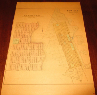
$5.00 Shipping Location: Fort Lauderdale, United States This Auction is for a LARGE unframed AUTHORIZED REPRINT of an Antique map as detailed below. This map is reproduced on specially coated. Matte finish, ... morepaper for sharper print quality and colors that are vivid. These maps are created from VERY high resolution uncompressed TIFF files(averaging 200+ megabytes) and are much sharper that the image shown here. Description of Original Bird's eye view of New Ulm. Brown County, Minnesota 1870. Approximate Image Size 16.5 X 20.5 inches WE HAVE MANY HISTORIC REPRINT MAPS AND OTHER ITEMS ON MANY DIFFERENT SUBJECTS Please check out strore for additonal products ON MULTIBLE ITEM ORDERS-SHIPPING IS FREE TO ADDRESSES IN THE UNITED STATES BY MAIL(GENERALLY 2 TO 5 DAY DELIVERY) FOR ANY NUMBER OF MAPS SHIPPED IN THE US. SHIPPING IS $15 PLUS $1 FOR EACH ADDITIONAL MAP TO ANYWHERE ELSE IN THE WORLD. WE SHIP ALL MAPS ROLLED IN A MAILING TUBE TO PROTECT THE MAP. IF YOU ARE UNHAPPY WITH YOUR PURCHASE SIMPLY RETURN IT AND WE WILL REFUND YOUR MONEY. Ad copyright 2013 J.C. Beck All Rights Reserved Powered by The free listing tool. List your items fast and easy and manage your active items.
Buy It Now
Free Shipping Location: Charlotte, United States CANVAS BACKED! ERIE COUNTY,NY 46x16". A terrific collectible - A 1936 LAKE ERIE BEACH, NEW YORK MAP! IN THE COUNTY OF ERIE, STATE OF NEW YORK. ERIE COUNTY ... moreCLERKS OFFICE. CANVAS BACKED PAPER. THERE ARE PROBABLY OTHER INTERESTING CHANGES.
Buy It Now
$13.71 Shipping Location: MANCHESTER, United Kingdom This map by Edward Weller is from The New Large Scale Ordnance Atlas The British Isles, edited and published by G.W. Bacon, London, 1884. He based his ... moreatlases on the plates used by Edward Weller for his Weekly Dispatch Atlas.
|
|
|
In
|
1923 Ireland Map: County Wicklow ready mounted SUPERB
Co. Wicklow Genuine 1920s map of the area as it was more than 80 years ago. Sold within a professionally cut neutral-toned mount designed to fit your own choice of frame. A lovely memento of the area. Image size: 6 x 4.5 inches. 150 x 115 mm Mount(matt) size:12 x 10 inches Source: Published c. 1923 in a county-by-county study of England. Ireland, Scotland and Wales. Powered by
|
|
|
1923 map of Ireland: County Roscommon in mount
Roscommon Genuine 1920s map of the area as it was more than 80 years ago. Sold within a professionally cut neutral-toned mount designed to fit your own choice of frame. A lovely memento of the area. Image size: 5 x 6.75 inches. 125 x 175 mm Mount(matt) size: 10 x 8 inches Source: Published c. 1923 in a county-by-county study of England. Ireland, Scotland and Wales. Powered by.RcmdId ViewItemDescV4,RlogId p4%60bo7%60jtb9%3Fvo%7B2d71f%2Bb%3A%60%3E-13d5f3f667c-0xff-
|
|
|
1923 map of Ireland: County Cavan in mount
Genuine 1920s map of the area as it was more than 80 years ago. Sold within a professionally cut neutral-toned mount designed to fit your own choice of frame. A lovely memento of the area. Image size: 6 x 4.5 inches. 150 x 115 mm Mount(matt) size: 10 x 8 inches Source: Published c. 1923 in a county-by-county study of England. Ireland, Scotland and Wales. All our items are sold with a'no quibble' money back guarantee. Powered by
|
|
|
County WICKLOW Ireland authentic Antique Map genuine 113 years old made in 1900
COUNTY WICKLOW IRELAND Authentic 113-Year-Old Antique Map FREE SHIPPING ANYWHERE IN THE USA! Engraved by P. W. Joyce. And printed in 1900 by Murphy& McCarthy, this is a beautiful, 113-year-old color map of the County of Wicklow in Ireland. It measures about 8 1/2 by 11 inches(21 by 28 cm) and is in Fine condition. This map contains a wealth of detail including topographical features, Baronies, cities and villages, routes of old railway lines, roads and canals, castles& abbeys, and more. Elevations and drainages are indicated using hachures, as was customary in Victorian era cartography with individual peaks marked in feet above sea level. This is a guaranteed genuine antique map! It is perfect for genealogical or other historical researches. Not to mention being highly decorative. It was printed on a single sheet of stock, blank on ... morethe reverse, and bound whole into an antique book. There are no folds, creases, marks or stains, and the paper is clean and not brittle. HIGHLY SUITABLE FOR FRAMING! This map would look great in your office, den, library or study. Great also for educational environments. It is similar to many of the maps shown in expensive mail-order catalogues, with one important exception: this is an actual antique. NOT a modern copy or reproduction! An excellent investment. This map is certain to appreciate in value over time. Please ask all questions before making your purchase. SAMPLE DISPLAY IDEA SAMPLE DISPLAY IDEA FREE SHIPPING within the USA by USPS First Class Mail. Priority and Express services also available. I ship worldwide! aci00c
|
|
|
WORCESTERSHIRE, Seller/ Grose Hand Coloured Antique County Map c1780
WORCESTERSHIRE by John Seller Please scroll to the very end to view a further close up image. Published circa 1780 in Francis Grose's"The Antiquities of England& Wales" An attractive copper engraved antique county map of Worcestershire. Interesting topographical and historical text appears beneath the map and is continued verso( not shown) Fine condition other than some faint staining from probable over inking of the plate. Original to the print. Without folds. Approx. 6" x 4.5" 145mm x 120mm) map area only. 10" x 7" 260mm x 180mm) overall. John Seller(c1630- 1697) was a London mapmaker and dealer in scientific instruments. His crowning achievement in the map world was the"Anglia Contracta" first published in 1696 with its maps of England& Wales reduced and simplified from the famous John ... moreSpeed maps and published as a small atlas. The maps were used again in"Camden's Brittania Abridged" Published in 1701. Francis Grose used them yet again in his"Antiquities of England& Wales" published in various editions from 1773 to 1787. A GENUINE ANTIQUE MAP GUARANTEED OVER 200 YEARS OLD FROM LINDISFARNE PRINTS We do not deal in reproductions. Facsimiles or modern copies of any kind. SHIPPING Within UK £1.95 via Royal Mail First class. From UK to Europe- £2.95 via Royal Mail Airmail. From the UK to USA and rest of the world- £3.95 via Royal Mail Airmail. THANKS FOR YOUR INTEREST! Why not browse our ebaystore? Be sure to add me to your favorites list! Check out my other items! TDD812. Powered by lm3vhp.RcmdId ViewItemDescV4,RlogId p4%60bo7%60jtb9%3Fuk%601d72f%2Bjw%60%3Elm3vhp-13d6b872315-0xf7-
|
|
|
STAFFORDSHIRE, Thomas Moule Antique County Map c1850
STAFFORDSHIRE by Thomas Moule. Published circa 1850. An attractive county map of Staffordshire by Thomas Moule. Please scroll to the very end to view further close up images. Moule's maps are are well known and rightly sought after for their trademark ornate decorative borders. Inset engravings and artistic presentation. Moule paid as much attention to aesthetic appeal as he did to cartographic detail. Staffordshire is embellished with heraldic devices. A reference to the hundreds and vignette engravings of Stafford Castle, Lichfield Cathedral& Ingestre House. Three borders are complete.Upper border just trimmed to the title. Blank verso. Without folds and in fine condition. A crisp, dark impression, Measuring approx. 10.5" x 8" 270mm x 200mm) overall. Thomas Moule(1784- 1851) is remembered as one of the most accomplished ... morecreators of maps in the 19th century. He began his working life in London as a bookseller. From when. An interest in creating and embellishing maps led him to learn and perfect his renowned decorative and detailed English county maps.The collection was published entitled, Moule's County Maps" circa 1830. Then. Established publisher and mapmaker, George Virtue re-issued the collection in two volumes in 1836 under the title: The collected maps of Moule" The maps themselves included illustrations of noted buildings or views within the county. They were also published in" Barclay's Complete and Universal English Dictionary" First published in 1841 and followed by several subsequent editions. The later editions have added railways where appropriate. A GENUINE ANTIQUE MAP GUARANTEED OVER 150 YEARS OLD FROM LINDISFARNE PRINTS We do not deal in reproductions. Facsimiles or modern copies of any kind. SHIPPING Within UK- £1.95 via Royal Mail First class. From UK to Europe- £2.95 GBP via Royal Mail Airmail. From the UK to USA and rest of the world- £3.95 GBP via Royal Mail Airmail. 2 ITEMS WILL BE COMBINED WITH ONE SHIPPING CHARGE. 3 ITEMS OR MOR
|
|
|
SHROPSHIRE, Thomas Moule, Antique County Map c1840
SHROPSHIRE by Thomas Moule. Published circa 1840. An attractive map of the county of Shropshire. Please scroll to the very end to view further close up images. Moule's maps are are well known and rightly sought after for their trademark ornate decorative borders. Inset engravings and artistic presentation. Moule paid as much attention to aesthetic appeal as he did to cartographic detail. Shropshire is embellished with heraldic devices. A reference to the Hundreds and vignette engravings of Ludlow Castle, Bridgnorth& Shrewsbury Grammar School. All borders are complete which is unusual for Moule's maps. Blank verso. Without folds and in fine condition. A crisp, dark impression, Measuring approx. 10.5" x 8" 270mm x 200mm) overall. Thomas Moule(1784- 1851) is remembered as one of the most accomplished creators of maps in ... morethe 19th century. He began his working life in London as a bookseller. From when. An interest in creating and embellishing maps led him to learn and perfect his renowned decorative and detailed English county maps.The collection was published entitled, Moule's County Maps" circa 1830. Then. Established publisher and mapmaker, George Virtue re-issued the collection in two volumes in 1836 under the title: The collected maps of Moule" The maps themselves included illustrations of noted buildings or views within the county. They were also published in" Barclay's Complete and Universal English Dictionary" First published in 1841 and followed by several subsequent editions. The later editions have added railways where appropriate. A GENUINE ANTIQUE MAP GUARANTEED OVER 150 YEARS OLD FROM LINDISFARNE PRINTS We do not deal in reproductions. Facsimiles or modern copies of any kind. SHIPPING Within UK- £1.95 via Royal Mail First class. From UK to Europe- £2.95 GBP via Royal Mail Airmail. From the UK to USA and rest of the world- £3.95 GBP via Royal Mail Airmail. 2 ITEMS WILL BE COMBINED WITH ONE SHIPPING CHARGE. 3 ITEMS OR MORE SHIPPED FREE OF CHA
|
|
|
WORCESTERSHIRE, Thomas Moule, Antique County Map c1850
WORCESTERSHIRE by Thomas Moule. Published circa 1840. An attractive map of the county of Worcestershire. Please scroll to the very end to view further close up images. Moule's maps are are well known and rightly sought after for their trademark ornate decorative borders. Inset engravings and artistic presentation. Moule paid as much attention to aesthetic appeal as he did to cartographic detail. Worcestershire is embellished with heraldic devices. A reference to the Hundreds and vignette engravings of Great Malvern, Worcester& Croom Court. All borders are complete( although trimmed close to the image top border) which is unusual for Moule's maps. Blank verso. Without folds and in fine condition. A crisp, dark impression, Measuring approx. 10.5" x 8" 270mm x 200mm) overall. Thomas Moule(1784- 1851) is remembered as one ... moreof the most accomplished creators of maps in the 19th century. He began his working life in London as a bookseller. From when. An interest in creating and embellishing maps led him to learn and perfect his renowned decorative and detailed English county maps.The collection was published entitled, Moule's County Maps" circa 1830. Then. Established publisher and mapmaker, George Virtue re-issued the collection in two volumes in 1836 under the title: The collected maps of Moule" The maps themselves included illustrations of noted buildings or views within the county. They were also published in" Barclay's Complete and Universal English Dictionary" First published in 1841 and followed by several subsequent editions. The later editions have added railways where appropriate. A GENUINE ANTIQUE MAP GUARANTEED OVER 150 YEARS OLD FROM LINDISFARNE PRINTS We do not deal in reproductions. Facsimiles or modern copies of any kind. SHIPPING Within UK- £1.95 via Royal Mail First class. From UK to Europe- £2.95 GBP via Royal Mail Airmail. From the UK to USA and rest of the world- £3.95 GBP via Royal Mail Airmail. 2 ITEMS WILL BE COMBINED WITH ONE SHIPPI
|
|
|
NOTTINGHAMSHIRE, Hobson, Walker, Antique County Foxhunting Map c1870
NOTTINGHAMSHIRE. Hobson, Walker, Antique County Foxhunting Map c1870, NOTTINGHAMSHIRE. Hobson, Walker, Antique County Foxhunting Map c1870 NOTTINGHAMSHIRE by J. C. Walker Published by Longman. Hurst, Reese, Orme, Co. London circa 1870 for"Hobson's Fox- Hunting Atlas. An attractive and decorative. Lithographed antique county map of Nottinghamshire with contemporary hand colouring. Hobson used maps printed from the Walkers' lithographic plates. And added features relevant to fox-hunting, the territory of each hunt is outlined in colour and the places of meets are indicated by black spots. Also featuring a scale of English miles. The high level of detail is outstanding. And includes roads, railways, rivers and relief, as can be seen by scrolling right down to the close up image provided. In fine. Virtually unmarked condition. Printed ... moreon heavy grade paper. Blank verso. The map would present very well indeed when framed. Approx. 15.5" x 12.5" 390mm x 315mm) map area only with margins beyond as seen. GENUINE ANTIQUE MAP GUARANTEED OVER 140 YEARS OLD FROM LINDISFARNE PRINTS We do not deal in reproductions. Facsimiles or copies of any kind. SHIPPING UK £2.95 via Royal Mail First Class Post Europe GBP £3.95 via Royal Mail Airmail Rest of the World GBP £4.95 via Royal Mail Airmail Second item shipped free if two items purchased. Free shipping worldwide if three items or more purchased Why not browse our ebaystore? THANKS FOR YOUR INTEREST! Be sure to add me to your favorites list! Check out my other items! D1212 Closeups, Shipping Process, Two items are always combined for shipping and three items or more are shipped free of charge. Worldwide"Please see item description for postage costs" Payment Options, All major Credit and debit cards via PAYPAL. Personal cheque drawn on UK banks only. Postal Orders from UK post offices only. Bank transfer- please email for details. About Us, Li
|
|
|
NORTHAMPTONSHIRE Dawson Original Hand Coloured Antique County Map 1832
NORTHAMPTONSHIRE Drawn up by Lieutenant Robert Kearsley Dawson of the Royal Engineers.The map bears his facsimile signature, and published for the Boundaries Commission 1832. The country was surveyed by the commision in support of the 1832 reform bill- a major shake up of the nation's parliamentary representation. With original outline hand colouring. Fold line as issued and save for very light offsetting, as evident from the scan, in fine condition. Included with the map is a one page report taken at the time with details on the proposed divisions and population of the county. Measuring approx. 13.5" x 10.5" 340mm x 270mm) overall. A GENUINE ANTIQUE MAP GUARANTEED OVER 170 YEARS OLD FROM LINDISFARNE PRINTS We do not deal in reproductions. Facsimiles or modern copies of any kind. SHIPPING. Within UK- £1.95 via Royal Mail ... moreFirst class. Europe- £2.50 via Royal Mail Airmail. USA and rest of the world- £3.95 via Royal Mail Airmail. 2 ITEMS WILL BE COMBINED WITH ONE SHIPPING CHARGE. 3 ITEMS OR MORE SHIPPED FREE OF CHARGE WORLDWIDE. Why not browse our ebaystore? THANKS FOR YOUR INTEREST! Be sure to add me to your! Check out my! NFJ1111. Powered by
|
|
|
HERTFORDSHIRE, Hand Coloured Antique County Map , Cole & Roper 1805
HERTFORDSHIRE. Hand Coloured Antique County Map, Cole& Roper 1805, HERTFORDSHIRE. Hand Coloured Antique County Map, Cole& Roper 1805 HERTFORDSHIRE An attractive and detailed county map of Hertfordshire. With a reference to the Hundreds, Compass Rose and an explanatory key to symbols used. The map is further enhanced by original hand colouring. Engraved by J.Roper after G.Cole and published by Vernor& Hood. London 1805 for, The British Atlas" to accompany" The Beauties of England& Wales" Fine. Unmarked condition, unfolded and blank verso. Dated& credited within the plate. Measuring approx. 9" x 7" 230mm x 180mm) map area only with wide margins beyond. Please scroll right down for a further close up image. GENUINE ANTIQUE MAP GUARANTEED OVER 200 YEARS OLD FROM LINDISFARNE PRINTS NMF213 SHIPPING Within ... moreUK £2.95 Royal Mail 1st class post From UK to Europe £3.95 Royal Mail Air Mail From UK to USA& Rest of the World £4.95 Royal Mail Air Mail 2 ITEMS COMBINED WITH A SINGLE SHIPPING CHARGE. FREE SHIPPING WORLDWIDE ON 3 ITEMS OR MORE! Closeups, Shipping Process, Two items are always combined for shipping and three items or more are shipped free of charge. Worldwide"Please see item description for postage costs" Payment Options, All major Credit and debit cards via PAYPAL. Personal cheque drawn on UK banks only. Postal Orders from UK post offices only. Bank transfer- please email for details. About Us, Lindisfarne Prints is a small family business specialising in genuine antique maps and prints at affordable prices.Established in 1995 and trading online since 2000. We pride ourselves on accurate descriptions, good communications, rapid service and fair prices. We are proud to maintain a 100% positive feedback rating which we hope reflects this.To avoid confusion, no item less than 100 years old is ever offered for sale. We do not deal in reproductions, facsimiles or modern copies of any kind. So please buy with confidence in the safe knowledge that a
|
|
|
HAMPSHIRE, Hand Coloured Antique County Map , Cole & Roper 1805
HAMPSHIRE. Hand Coloured Antique County Map, Cole& Roper 1805, HAMPSHIRE. Hand Coloured Antique County Map, Cole& Roper 1805 HAMPSHIRE An attractive and detailed county map of Hampshire with a reference to the Hundreds& Liberties. Compass Rose, scale of miles and an explanatory key to symbols used. The map is further enhanced by original hand colouring. Engraved by J.Roper after G.Cole and published by Vernor& Hood. London 1805 for, The British Atlas" to accompany" The Beauties of England& Wales" Fine. Unmarked condition, unfolded and blank verso. Dated& credited within the plate. Measuring approx. 9" x 7" 230mm x 180mm) map area only with wide margins beyond. Please scroll right down for a further close up image. GENUINE ANTIQUE MAP GUARANTEED OVER 200 YEARS OLD FROM LINDISFARNE PRINTS NMF213 ... moreSHIPPING Within UK £2.95 Royal Mail 1st class post From UK to Europe £3.95 Royal Mail Air Mail From UK to USA& Rest of the World £4.95 Royal Mail Air Mail 2 ITEMS COMBINED WITH A SINGLE SHIPPING CHARGE. FREE SHIPPING WORLDWIDE ON 3 ITEMS OR MORE! Closeups, Shipping Process, Two items are always combined for shipping and three items or more are shipped free of charge. Worldwide"Please see item description for postage costs" Payment Options, All major Credit and debit cards via PAYPAL. Personal cheque drawn on UK banks only. Postal Orders from UK post offices only. Bank transfer- please email for details. About Us, Lindisfarne Prints is a small family business specialising in genuine antique maps and prints at affordable prices.Established in 1995 and trading online since 2000. We pride ourselves on accurate descriptions, good communications, rapid service and fair prices. We are proud to maintain a 100% positive feedback rating which we hope reflects this.To avoid confusion, no item less than 100 years old is ever offered for sale. We do not deal in reproductions, facsimiles or modern copies of any kind. So please buy with confidence in the safe kn
|
|
|
1884 ANTIQUE MAP OF COUNTY OF HEREFORD HEREFORDSHIRE / ROSS LEDBURY ENGLAND
1884 MAP OF COUNTY OF HEREFORD/ ROSS LEDBURY ENGLAND This original antique map gives you an opportunity to examine in exquisite detail a piece of history. If you are interested in the past of this country and its people or have a desire to study where your family may have come from. Then this map gives you a rare look as the area was about 130 years ago. Once matted and framed, this map would make a perfect gift for a family member or friend they'll cherish forever. Origin of the map: Philips's Handy Atlas of the Counties of England" Edited by John Bartholomew and published by G. Philip& Son, London/Liverpool, UK. Date of issue: 1884 Size: The sheet measures 8 1/2" x 7" 22 x 18 cm) THE MAP IS REINFORCED ON BACK ALONG THE CENTERFOLD. OLD PEN MARKS ON BACK. S/H: The map will be shipped by Air Mail. The shipping charge ... moreis: USA- 2.50 USD/ Canada- 1.70 USD/ World- 4.30 USD. The price includes a strong. Secure envelope. Attention! There is no additional shipping charge for multiple purchases! Pay me securely with any major credit card through PayPal! Payment methods: US/Canada Buyers: Paypal. International Buyers: Paypal. Click Here. Double your traffic. Get Vendio Gallery- Now FREE!
|
|
|
1880 MAP OF COUNTY OF ESSEX / CHELMSFORD ENGLAND
1880 MAP OF COUNTY OF ESSEX/ CHELMSFORD ENGLAND This original antique map gives you an opportunity to examine in exquisite detail a piece of history. If you are interested in the past of this country and its people or have a desire to study where your family may have come from. Then this map gives you a rare look as the area was about 130 years ago. Once matted and framed, this map would make a perfect gift for a family member or friend they'll cherish forever. Origin of the map: Encyclopedia Britannica" Ninth Edition, Chicago, USA. Date of issue: 1880 Size: The whole sheet(margins INCLUDED) measures 14 1/2" x 10" 37 x 26 cm) MAP IS FOLDED. AS ISSUED. S/H: The map will be shipped by Air Mail. The shipping charge is: USA- 6.50 USD. World- 7.50 USD, Canada- 7.50 USD. The price includes the insurance and a strong, cardboard ... moretube with plastic plugs. Attention! There is no additional shipping charge for multiple purchases! Pay me securely with any major credit card through PayPal! Payment methods: US/Canada Buyers: Paypal. International Buyers: Paypal. Click Here. Double your traffic. Get Vendio Gallery- Now FREE!
|
|
|
1885 MAP OF COUNTY OF HERTFORD / LUTON WATFORD ENGLAND
1885 MAP OF COUNTY OF HERTFORD/ LUTON WATFORD ENGLAND This original antique map gives you an opportunity to examine in exquisite detail a piece of history. If you are interested in the past of this country and its people or have a desire to study where your family may have come from. Then this map gives you a rare look as the area was about 125 years ago. Once matted and framed, this map would make a perfect gift for a family member or friend they'll cherish forever. Origin of the map: Encyclopedia Britannica" Ninth Edition, A& C Black, Edinburgh, Scotland, UK. Date of issue: 1885 Size: The whole sheet(margins INCLUDED) measures 12 1/4" x 10" 31 x 25 cm) MAP IS FOLDED. AS ISSUED. S/H: The map will be shipped by Air Mail. The shipping charge is: USA- 6.50 USD. World- 7.50 USD, Canada- 7.50 USD. The price includes the ... moreinsurance and a strong, cardboard tube with plastic plugs. Attention! There is no additional shipping charge for multiple purchases! Pay me securely with any major credit card through PayPal! Payment methods: US/Canada Buyers: Paypal. International Buyers: Paypal. Click Here. Double your traffic. Get Vendio Gallery- Now FREE!
|
|
|
1880 MAP OF COUNTY OF HEREFORD / ROSS LEDBURY ENGLAND
1880 MAP OF COUNTY OF HEREFORD/ ROSS LEDBURY ENGLAND This original antique map gives you an opportunity to examine in exquisite detail a piece of history. If you are interested in the past of this country and its people or have a desire to study where your family may have come from. Then this map gives you a rare look as the area was about 130 years ago. Once matted and framed, this map would make a perfect gift for a family member or friend they'll cherish forever. Origin of the map: Encyclopedia Britannica" Ninth Edition, Chicago, USA. Date of issue: 1880 Size: The whole sheet(margins INCLUDED) measures 15" x 10" 38 x 26 cm) MAP IS FOLDED. AS ISSUED. S/H: The map will be shipped by Air Mail. The shipping charge is: USA- 6.50 USD. World- 7.50 USD, Canada- 7.50 USD. The price includes the insurance and a strong, cardboard ... moretube with plastic plugs. Attention! There is no additional shipping charge for multiple purchases! Pay me securely with any major credit card through PayPal! Payment methods: US/Canada Buyers: Paypal. International Buyers: Paypal. Click Here. Double your traffic. Get Vendio Gallery- Now FREE!
|
|
|
1885 MAP OF COUNTY OF HEREFORD / ROSS LEDBURY ENGLAND
1885 MAP OF COUNTY OF HEREFORD/ ROSS LEDBURY ENGLAND This original antique map gives you an opportunity to examine in exquisite detail a piece of history. If you are interested in the past of this country and its people or have a desire to study where your family may have come from. Then this map gives you a rare look as the area was about 125 years ago. Once matted and framed, this map would make a perfect gift for a family member or friend they'll cherish forever. Origin of the map: Encyclopedia Britannica" Ninth Edition, A& C Black, Edinburgh, Scotland, UK. Date of issue: 1885 Size: The whole sheet(margins INCLUDED) measures 12 1/4" x 10" 31 x 25 cm) MAP IS FOLDED. AS ISSUED. S/H: The map will be shipped by Air Mail. The shipping charge is: USA- 6.50 USD. World- 7.50 USD, Canada- 7.50 USD. The price includes the ... moreinsurance and a strong, cardboard tube with plastic plugs. Attention! There is no additional shipping charge for multiple purchases! Pay me securely with any major credit card through PayPal! Payment methods: US/Canada Buyers: Paypal. International Buyers: Paypal. Click Here. Double your traffic. Get Vendio Gallery- Now FREE!
|
|
|
1880 MAP OF COUNTY OF DORSET DORCHESTER / ENGLAND
1880 MAP OF COUNTY OF DORSET DORCHESTER/ ENGLAND This original antique map gives you an opportunity to examine in exquisite detail a piece of history. If you are interested in the past of this country and its people or have a desire to study where your family may have come from. Then this map gives you a rare look as the area was about 130 years ago. Once matted and framed, this map would make a perfect gift for a family member or friend they'll cherish forever. Origin of the map: Encyclopedia Britannica" Ninth Edition, Chicago, USA. Date of issue: 1880 Size: The whole sheet(margins INCLUDED) measures 14 1/2" x 10" 37 x 26 cm) MAP IS FOLDED. AS ISSUED. S/H: The map will be shipped by Air Mail. The shipping charge is: USA- 6.50 USD. World- 7.50 USD, Canada- 7.50 USD. The price includes the insurance and a strong, cardboard ... moretube with plastic plugs. Attention! There is no additional shipping charge for multiple purchases! Pay me securely with any major credit card through PayPal! Payment methods: US/Canada Buyers: Paypal. International Buyers: Paypal. Click Here. Double your traffic. Get Vendio Gallery- Now FREE!
|
|
|
1884 MAP OF THE COUNTY OF DERBY DERBYSHIRE CHESTERFIELD / ENGLAND
1884 MAP OF THE COUNTY OF DERBY/ ENGLAND This original antique map gives you an opportunity to examine in exquisite detail a piece of history. If you are interested in the past of this country and its people or have a desire to study where your family may have come from. Then this map gives you a rare look as the area was about 130 years ago. Once matted and framed, this map would make a perfect gift for a family member or friend they'll cherish forever. Origin of the map: Philips's Handy Atlas of the Counties of England" Edited by John Bartholomew and published by G. Philip& Son, London/Liverpool, UK. Date of issue: 1884 Size: The sheet measures 8 1/2" x 7" 22 x 18 cm) THE MAP IS REINFORCED ON BACK ALONG THE CENTERFOLD. OLD PEN MARKS ON BACK. S/H: The map will be shipped by Air Mail. The shipping charge is: USA- ... more2.50 USD/ Canada- 1.70 USD/ World- 4.30 USD. The price includes a strong. Secure envelope. Attention! There is no additional shipping charge for multiple purchases! Pay me securely with any major credit card through PayPal! Payment methods: US/Canada Buyers: Paypal. International Buyers: Paypal. Click Here. Double your traffic. Get Vendio Gallery- Now FREE!
|
|
|
1880 MAP COUNTY OF WILTSHIRE SALISBURY WILTON ENGLAND
1880 MAP COUNTY OF WILTSHIRE SALISBURY WILTON ENGLAND This original antique map gives you an opportunity to examine in exquisite detail a piece of history. If you are interested in the past of this country and its people or have a desire to study where your family may have come from. Then this map gives you a rare look as the area was about 130 years ago. Once matted and framed, this map would make a perfect gift for a family member or friend they'll cherish forever. Origin of the map: Encyclopedia Britannica" Ninth Edition, Chicago, USA. Date of issue: 1880 Size: The whole sheet(margins INCLUDED) measures 15" x 10" 38 x 26 cm) MAP IS FOLDED. AS ISSUED. S/H: The map will be shipped by Air Mail. The shipping charge is: USA- 6.50 USD. World- 7.50 USD, Canada- 7.50 USD. The price includes the insurance and a strong, cardboard ... moretube with plastic plugs. Attention! There is no additional shipping charge for multiple purchases! Pay me securely with any major credit card through PayPal! Payment methods: US/Canada Buyers: Paypal. International Buyers: Paypal. Click Here. Double your traffic. Get Vendio Gallery- Now FREE! RcmdId ViewItemDescV4,RlogId p4%60bo7%60jtb9%3Fv%7F.rpn35%3E-13d6bc0c164-0x102-
|
|
|
1880 MAP OF COUNTY OF WORCESTER BIRMINGHAM ENGLAND
1880 MAP OF COUNTY OF WORCESTER BIRMINGHAM ENGLAND This original antique map gives you an opportunity to examine in exquisite detail a piece of history. If you are interested in the past of this country and its people or have a desire to study where your family may have come from. Then this map gives you a rare look as the area was about 130 years ago. Once matted and framed, this map would make a perfect gift for a family member or friend they'll cherish forever. Origin of the map: Encyclopedia Britannica" Ninth Edition, Chicago, USA. Date of issue: 1880 Size: The whole sheet(margins INCLUDED) measures 14 1/2" x 10" 37 x 26 cm) MAP IS FOLDED. AS ISSUED. S/H: The map will be shipped by Air Mail. The shipping charge is: USA- 6.50 USD. World- 7.50 USD, Canada- 7.50 USD. The price includes the insurance and a strong, cardboard ... moretube with plastic plugs. Attention! There is no additional shipping charge for multiple purchases! Pay me securely with any major credit card through PayPal! Payment methods: US/Canada Buyers: Paypal. International Buyers: Paypal. Click Here. Double your traffic. Get Vendio Gallery- Now FREE!
|
|
|
G W Bacon. Antique County Map of Cumberland
Antique map by G W Bacon& Co Ltd Of CUMBERLAND Probably very early 1900s On cloth. Scale 1inch =3.3 miles The map is divided into 5 mile squares. IN EXCELLENT CONDITION. Posted with.RcmdId ViewItemDescV4,RlogId p4%60bo7%60jtb9%3Fvo%7B2d71f%2Bb%3A%60%3E-13d6bc0c12b-0x102-
|
|
|
SUSSEX, John Seller Original Hand Coloured Antique County Map c1780
SUSSEX by John Seller Please scroll to the very end to view a further close up image. Published circa 1780 in Francis Grose's"The Antiquities of England& Wales" An attractive copper engraved antique county map of Sussex. Interesting topographical and historical text appears beneath the map and is continued verso( not shown) Fine condition other than some faint staining from probable over inking of the plate. Original to the print. Without folds. Approx. 6" x 4.5" 145mm x 120mm) map area only. 10" x 7" 260mm x 180mm) overall. John Seller(c1630- 1697) was a London mapmaker and dealer in scientific instruments. His crowning achievement in the map world was the"Anglia Contracta" first published in 1696 with its maps of England& Wales reduced and simplified from the famous John Speed maps and ... morepublished as a small atlas. The maps were used again in"Camden's Brittania Abridged" Published in 1701. Francis Grose used them yet again in his"Antiquities of England& Wales" published in various editions from 1773 to 1787. A GENUINE ANTIQUE MAP GUARANTEED OVER 200 YEARS OLD FROM LINDISFARNE PRINTS We do not deal in reproductions. Facsimiles or modern copies of any kind. SHIPPING Within UK £1.75 via Royal Mail First class. From UK to Europe- £1.95 via Royal Mail Airmail. From the UK to USA and rest of the world- £2.95 via Royal Mail Airmail. THANKS FOR YOUR INTEREST! Why not browse our ebaystore? Be sure to add me to your favorites list! Check out my other items! TM312. Powered by
|
|
|
SURREY, BACON Antique County Map 1895
SURREY. BACON Antique County Map 1895, SURREY. BACON Antique County Map 1895 SURREY Published London 1895 by George Bacon, for" The Commercial& Library Atlas of the British Isles from the Ordnance Survey" Please scroll to the very end to view a further close up image. A highly detailed. Large scale( divided into 5 mile squares) lithographed map of the county of Surrey. The detail includes a reference to the Divisions& Boroughs, railways, stations and topographical relief. Fine. Virtually unmarked condition, centrefold as issued and blank verso. Measuring approx. 20" x 13" 510mm x 230mm) overall. Eminently suitable for framing. A GENUINE ANTIQUE MAP GUARANTEED OVER 100 YEARS OLD FROM LINDISFARNE PRINTS We do not deal in reproductions. Facsimiles or copies of any kind. SHIPPING Within UK £2.95 via Royal Mail ... moreFirst class. Europe £3.95 via Royal Mail Airmail. USA and rest of the world £4.95 via Royal Mail Airmail. TWO ITEMS WILL BE COMBINED. WITH ONE SHIPPING CHARGE. THREE ITEMS OR MORE SHIPPED FREE OF CHARGE. WORLDWIDE! Why not browse our ebaystore? THANKS FOR YOUR INTEREST! Be sure to add me to your! Check out my! D12112. Closeups, Shipping Process, Two items are always combined for shipping and three items or more are shipped free of charge. Worldwide"Please see item description for postage costs" Payment Options, All major Credit and debit cards via PAYPAL. Personal cheque drawn on UK banks only. Postal Orders from UK post offices only. Bank transfer- please email for details. About Us, Lindisfarne Prints is a small family business specialising in genuine antique maps and prints at affordable prices.Established in 1995 and trading online since 2000. We pride ourselves on accurate descriptions, good communications, rapid service and fair prices. We are proud to maintain a 100% positive feedback rating which we hope reflects this.To avoid confusion, no item less than 100 years
|
|
|
SOMERSET. SOMERSETSHIRE, BACON Antique County Map 1895
SOMERSET. SOMERSETSHIRE. BACON Antique County Map 1895, SOMERSET. SOMERSETSHIRE. BACON Antique County Map 1895 SOMERSETSHIRE Published London 1895 by George Bacon, for" The Commercial& Library Atlas of the British Isles from the Ordnance Survey" Please scroll to the very end to view further close up images. A highly detailed. Large scale( divided into 5 mile squares) lithographed map of the county of Somerset. The detail includes a reference to the Divisions& Boroughs, railways, stations and topographical relief. Fine. Virtually unmarked condition, centrefold as issued and blank verso. Measuring approx. 20" x 13" 510mm x 230mm) overall. Eminently suitable for framing. A GENUINE ANTIQUE MAP GUARANTEED OVER 100 YEARS OLD FROM LINDISFARNE PRINTS We do not deal in reproductions. Facsimiles or copies of any kind. SHIPPING ... moreWithin UK £2.95 via Royal Mail First class. Europe £3.95 via Royal Mail Airmail. USA and rest of the world £4.95 via Royal Mail Airmail. TWO ITEMS WILL BE COMBINED. WITH ONE SHIPPING CHARGE. THREE ITEMS OR MORE SHIPPED FREE OF CHARGE. WORLDWIDE! Why not browse our ebaystore? THANKS FOR YOUR INTEREST! Be sure to add me to your! Check out my! D12112. Closeups, Shipping Process, Two items are always combined for shipping and three items or more are shipped free of charge. Worldwide"Please see item description for postage costs" Payment Options, All major Credit and debit cards via PAYPAL. Personal cheque drawn on UK banks only. Postal Orders from UK post offices only. Bank transfer- please email for details. About Us, Lindisfarne Prints is a small family business specialising in genuine antique maps and prints at affordable prices.Established in 1995 and trading online since 2000. We pride ourselves on accurate descriptions, good communications, rapid service and fair prices. We are proud to maintain a 100% positive feedback rating which we hope reflects this.To avo
|
|
|
YORKSHIRE WEST RIDING, Hobson's, Walker, Antique County Foxhunting Map c1870
WEST RIDING OF YORKSHIRE by J. C. Walker Published by Longman. Hurst, Reese, Orme, Co. London circa 1870 for"Hobson's Fox- Hunting Atlas. An attractive and decorative. Lithographed antique county map of the West Riding of Yorkshire with contemporary hand colouring. Hobson used maps printed from the Walkers' lithographic plates. And added features relevant to fox-hunting, the territory of each hunt is outlined in colour and the places of meets are indicated by black spots. Also featuring a scale of English miles. Reference to the Wapentakes, Boroughs and Polling places. The high level of detail is outstanding, and includes roads, railways, rivers and relief, as can be seen by scrolling right down to the close up images provided. In fine. Virtually unmarked condition. Centrefold as issued. Printed on heavy grade paper. Blank verso. ... moreThe map would present very well indeed when framed. Approx. 15.5" x 12.5" 390mm x 315mm) map area only with margins beyond as seen. GENUINE ANTIQUE MAP GUARANTEED OVER 140 YEARS OLD FROM LINDISFARNE PRINTS We do not deal in reproductions. Facsimiles or copies of any kind. SHIPPING UK £2.95 via Royal Mail First Class Post Europe GBP £3.95 via Royal Mail Airmail Rest of the World GBP £4.95 via Royal Mail Airmail Second item shipped free if two items purchased. Free shipping worldwide if three items or more purchased Why not browse our ebaystore? THANKS FOR YOUR INTEREST! Be sure to add me to your favorites list! Check out my other items! D912 Powered by
|
|
|
DEVON, NORTH DEVONSHIRE, BACON Antique County Map 1895
DEVON. NORTH DEVONSHIRE, BACON Antique County Map 1895, DEVON. NORTH DEVONSHIRE, BACON Antique County Map 1895 DEVONSHIRE NORTH SHEET Published London 1895 by George Bacon, for" The Commercial& Library Atlas of the British Isles from the Ordnance Survey" Please scroll to the very end to view a further close up image. A highly detailed. Large scale( divided into 5 mile squares) lithographed map of the county of Devon. The detail includes a reference to the Divisions& Boroughs, railways, stations and topographical relief. Light water staining to each side margin. Just entering map area, otherwise fine condition, centrefold as issued and blank verso. Measuring approx. 20" x 13" 510mm x 230mm) overall. Eminently suitable for framing. A GENUINE ANTIQUE MAP GUARANTEED OVER 100 YEARS OLD FROM LINDISFARNE PRINTS We do ... morenot deal in reproductions. Facsimiles or copies of any kind. SHIPPING Within UK £2.95 via Royal Mail First class. Europe £3.95 via Royal Mail Airmail. USA and rest of the world £4.95 via Royal Mail Airmail. TWO ITEMS WILL BE COMBINED. WITH ONE SHIPPING CHARGE. THREE ITEMS OR MORE SHIPPED FREE OF CHARGE. WORLDWIDE! Why not browse our ebaystore? THANKS FOR YOUR INTEREST! Be sure to add me to your! Check out my! D12112. Closeups, Shipping Process, Two items are always combined for shipping and three items or more are shipped free of charge. Worldwide"Please see item description for postage costs" Payment Options, All major Credit and debit cards via PAYPAL. Personal cheque drawn on UK banks only. Postal Orders from UK post offices only. Bank transfer- please email for details. About Us, Lindisfarne Prints is a small family business specialising in genuine antique maps and prints at affordable prices.Established in 1995 and trading online since 2000. We pride ourselves on accurate descriptions, good communications, rapid service and fair prices. We are proud to maintain a 1
|
|
|
WARWICKSHIRE, Hobson, Walker, Antique County Foxhunting Map c1870
WARWICKSHIRE by J. C. Walker Published by Longman. Hurst, Reese, Orme, Co. London circa 1870 for"Hobson's Fox- Hunting Atlas. An attractive and decorative. Lithographed antique county map of Warwickshire with contemporary hand colouring. Hobson used maps printed from the Walkers' lithographic plates. And added features relevant to fox-hunting, the territory of each hunt is outlined in colour and the places of meets are indicated by black spots. Also featuring a scale of English miles. Reference to the Hundreds, Polling Places& Boroughs. The high level of detail is outstanding, and includes roads, railways, rivers and relief, as can be seen by scrolling right down to the close up image provided. In fine. Virtually unmarked condition. Printed on heavy grade paper. Blank verso with centrefold as issued. The map would present ... morevery well indeed when framed. Approx. 15.5" x 12.5" 390mm x 315mm) map area only with margins beyond as seen. GENUINE ANTIQUE MAP GUARANTEED OVER 140 YEARS OLD FROM LINDISFARNE PRINTS We do not deal in reproductions. Facsimiles or copies of any kind. SHIPPING UK £2.95 via Royal Mail First Class Post Europe GBP £3.95 via Royal Mail Airmail Rest of the World GBP £4.95 via Royal Mail Airmail Second item shipped free if two items purchased. Free shipping worldwide if three items or more purchased Why not browse our ebaystore? THANKS FOR YOUR INTEREST! Be sure to add me to your favorites list! Check out my other items! D1112 Powered by
|
|
|
LINCOLNSHIRE, John Roque , England Displayed, Antique County Map 1769
LINCOLNSHIRE. John Roque, England Displayed, Antique County Map 1769, LINCOLNSHIRE. John Roque, England Displayed, Antique County Map 1769 A fine. Detailed, copper engraved antique map of LINCOLNSHIRE A lovely antique map on hand laid paper of the county of Lincolnshire in the latter half of the 18th century. By John Rocque for" England Displayed being a new. Complete and Accurate Survey and Description of the Kingdom of England and Principality of Wales. By P.Russell& O.Price and published. London 1769 by Adlard& Browne. The map bears a fleur de lis compass rose and scale of miles. Fine condition. On hand laid paper, without folds and blank verso. Measuring approx. 8" x 6.5" 200mm x 160mm) to the clearly defined platemark with wide margins beyond. Please go to close ups for a further image. John Rocque was a surveyor ... moreand cartographer. The son of French Huguenot's who came to England in 1709. In addition to his work as surveyor and mapmaker. Rocque was an engraver and map-seller. Rocque is now mainly remembered for his map of London. He began work on this in 1737 and it was published in 24 printed sheets in 1747. It was by far the most detailed map of London published up to that time, and remains an important historical resource. The map of London and his other maps brought him an appointment as cartographer to the Prince of Wales in 1751. A fire in 1750 destroyed his premises and stock. But by 1753 he was employing ten draughtsmen, and produced" The Small British Atlas: Being a New set of Maps of all the Counties of England and Wales" Thirty three of these maps were reprinted in"England Displayed. in 1769. GENUINE ANTIQUE MAP GUARANTEED OVER 240 YEARS OLD FROM LINDISFARNE PRINTS M6313 SHIPPING: Within UK £2.95 Royal Mail 1st class post From UK to Europe £3.95 Royal Mail Air Mail From UK to USA& Rest of the World £ 4.95 Royal Mail Air Mail TWO ITEMS WILL BE COMBINED WITH ONE SHIPPING CHARGE. THREE ITEMS OR MORE WILL BE SHIPPED FREE OF CHARGE WORLDWIDE C
|
|
|
HUNTINGDONSHIRE, John Roque , England Displayed, Antique County Map 1769
HUNTINGDONSHIRE. John Roque, England Displayed, Antique County Map 1769, HUNTINGDONSHIRE. John Roque, England Displayed, Antique County Map 1769 A fine. Detailed, copper engraved antique map of HUNTINGDONSHIRE A lovely antique map on hand laid paper of the county of Huntingdonshire in the latter half of the 18th century. By John Rocque for" England Displayed being a new. Complete and Accurate Survey and Description of the Kingdom of England and Principality of Wales. By P.Russell& O.Price and published. London 1769 by Adlard& Browne. The map bears a fleur de lis compass rose and scale of miles. Fine condition. On hand laid paper, without folds and blank verso. Measuring approx. 8" x 6.5" 200mm x 160mm) to the clearly defined platemark with wide margins beyond. Please go to close ups for a further image. John Rocque ... morewas a surveyor and cartographer. The son of French Huguenot's who came to England in 1709. In addition to his work as surveyor and mapmaker. Rocque was an engraver and map-seller. Rocque is now mainly remembered for his map of London. He began work on this in 1737 and it was published in 24 printed sheets in 1747. It was by far the most detailed map of London published up to that time, and remains an important historical resource. The map of London and his other maps brought him an appointment as cartographer to the Prince of Wales in 1751. A fire in 1750 destroyed his premises and stock. But by 1753 he was employing ten draughtsmen, and produced" The Small British Atlas: Being a New set of Maps of all the Counties of England and Wales" Thirty three of these maps were reprinted in"England Displayed. in 1769. GENUINE ANTIQUE MAP GUARANTEED OVER 240 YEARS OLD FROM LINDISFARNE PRINTS M6313 SHIPPING: Within UK £2.95 Royal Mail 1st class post From UK to Europe £3.95 Royal Mail Air Mail From UK to USA& Rest of the World £ 4.95 Royal Mail Air Mail TWO ITEMS WILL BE COMBINED WITH ONE SHIPPING CHARGE. THREE ITEMS OR MORE WILL BE SHIPPED FREE OF CHARGE
|
|
|
DURHAM, John Roque , England Displayed, Antique County Map 1769
DURHAM. John Roque, England Displayed, Antique County Map 1769, DURHAM. John Roque, England Displayed, Antique County Map 1769 A fine. Detailed, copper engraved antique map of DURHAM A lovely antique map on hand laid paper of the county of Duham in the latter half of the 18th century. By John Rocque for" England Displayed being a new. Complete and Accurate Survey and Description of the Kingdom of England and Principality of Wales. By P.Russell& O.Price and published. London 1769 by Adlard& Browne. The map bears a fleur de lis compass rose and scale of miles. Fine condition. On hand laid paper, without folds and blank verso. Measuring approx. 8" x 6.5" 200mm x 160mm) to the clearly defined platemark with wide margins beyond. Please go to close ups for a further image. John Rocque was a surveyor and cartographer. The ... moreson of French Huguenot's who came to England in 1709. In addition to his work as surveyor and mapmaker. Rocque was an engraver and map-seller. Rocque is now mainly remembered for his map of London. He began work on this in 1737 and it was published in 24 printed sheets in 1747. It was by far the most detailed map of London published up to that time, and remains an important historical resource. The map of London and his other maps brought him an appointment as cartographer to the Prince of Wales in 1751. A fire in 1750 destroyed his premises and stock. But by 1753 he was employing ten draughtsmen, and produced" The Small British Atlas: Being a New set of Maps of all the Counties of England and Wales" Thirty three of these maps were reprinted in"England Displayed. in 1769. GENUINE ANTIQUE MAP GUARANTEED OVER 240 YEARS OLD FROM LINDISFARNE PRINTS M6313 SHIPPING: Within UK £2.95 Royal Mail 1st class post From UK to Europe £3.95 Royal Mail Air Mail From UK to USA& Rest of the World £ 4.95 Royal Mail Air Mail TWO ITEMS WILL BE COMBINED WITH ONE SHIPPING CHARGE. THREE ITEMS OR MORE WILL BE SHIPPED FREE OF CHARGE WORLDWIDE Closeups, Shipping Process
|
|
|
NORTHAMPTONSHIRE, Teesdale Original Hand Coloured Antique County Map 1831
Please scroll to the very end to view further close up images. A superbly detailed. Large format antique county map of" NORTHAMPTONSHIRE" Published by Henry Teesdale 1831 in his Atlas the, New British Atlas Containing a Complete Set of County Maps On Which are Delineated All The Principal Cross Roads. Cities, Towns& Most Considerable Villages, Parks, Rivers, Navigable Canals& Railways. With original outline and full wash hand colour. Whatman paper watermarked 1831. An explanatory key details. Towns, canals, rivers and roads and the distance in miles between towns is shown on the turnpike roads. There is also a reference to the Hundreds, a scale of miles& Compass Rose. Blank verso.With centrefold as issued. Fine, virtually unmarked condition. A crisp impression with vibrant colour. Measuring approx. 16" x 13" ... more410mm x 330mm) printed area only with good margins beyond. A GENUINE ANTIQUE MAP GUARANTEED OVER 170 YEARS OLD FROM LINDISFARNE PRINTS We do not deal in reproductions. Facsimiles or modern copies of any kind. SHIPPING Within UK £2.50 Royal Mail 1st class post From UK to Europe £2.95 Royal Mail Air Mail From UK to USA& Rest of the World £3.95 Royal Mail Air Mail 2 ITEMS COMBINED WITH A SINGLE SHIPPING CHARGE. FREE SHIPPING WORLDWIDE ON 3 ITEMS OR MORE! Why not browse our ebay store? THANKS FOR YOUR INTEREST! Be sure to add me to your favorites list! Check out my other items! D 1109. Powered by
|
|
|
LEICESTERSHIRE, Archer Antique County Map c1860
An attractive hand coloured steel engraved antique county map entitled" LEICESTERSHIRE" Drawn and engraved by J.Archer and published London& Glasgow by John Tallis. Circa 1860 for, The Rev. James Barclay's" Universal Dictionary. With a distance scale. Explanatory key, reference to the Hundreds and most towns and places of interest such as, Lutterworth, Hinckley, Ashby de la Zouche, Loughborough, Melton Mowbray& Leicester itself clearly marked. Railway lines of the county are also shown. Delicately applied hand colouring further enhance the map. Blank verso. Without folds and save for very light marking, in fine condition. Measuring approx. 9" x 7" 230mm x 180mm) map area with good margins beyond. A detailed antique county map of Leicestershire. A GENUINE ANTIQUE MAP GUARANTEED OVER 100 YEARS OLD FROM LINDISFARNE ... morePRINTS We do not deal in reproductions. Facsimiles or modern copies of any kind. SHIPPING Within UK £1.75 Royal Mail 1st class post From UK to Europe £1.95 Royal Mail Air Mail From UK to USA& Rest of the World £2.95 Royal Mail Air Mail 2 ITEMS COMBINED WITH A SINGLE SHIPPING CHARGE. FREE SHIPPING WORLDWIDE ON 3 ITEMS OR MORE! Why not browse our ebay store? THANKS FOR YOUR INTEREST! Be sure to add me to your favorites list! Check out my other items! T34 39. Created by eBay Blackthorne ver. 3.2.172.0
|
|
|
BUCKINGHAMSHIRE ,Antique County Map 1832
BUCKINGHAMSHIRE" Please scroll to the very end to view a further image. An interesting County map. Drawn up by Lieutenant Robert Kearsley Dawson of the Royal Engineers, and published for the Boundaries Commission 1832. The map bears Dawson's facsimile signature. The country was surveyed by the commision in support of the 1832 reform bill- a major shake up of the nation's parliamentary representation. Also featured is a colour key identifying boundaries.Hundreds, Polling Places etc. Areas included on the map are. Newport Pagnell, Winslow, Edgcot, Chilton, Wendover, Princes Risborough High Wycombe, Beaconsfield, to name but a few. Original hand colouring. Foldline as issued. Very light foxing. Otherwise fine, virtually unmarked condition. A crisp impression on a medium weight paper Approx. 13.5" x 8" 340mm x 200mm) overall. ... moreA GENUINE ANTIQUE MAP GUARANTEED OVER 170 YEARS OLD FROM LINDISFARNE PRINTS We do not deal in reproductions. Facsimiles or modern copies of any kind. SHIPPING. Within UK- £1.95 via Royal Mail First class. Europe- £2.50 via Royal Mail Airmail. USA and rest of the world- £3.95 via Royal Mail Airmail. 2 ITEMS WILL BE COMBINED WITH ONE SHIPPING CHARGE. 3 ITEMS OR MORE SHIPPED FREE OF CHARGE WORLDWIDE. Why not browse our ebaystore? THANKS FOR YOUR INTEREST! Be sure to add me to your! Check out my! M5411. Powered by
|
|
|
NORTHUMBERLAND, Seller/ Grose Hand Coloured Antique County Map c1780
NORTHUMBERLAND by John Seller Please scroll to the very end to view a further close up image. Published circa 1780 in Francis Grose's"The Antiquities of England& Wales" An attractive copper engraved antique county map of Northumberland. Interesting topographical and historical text appears beneath the map and is continued verso( not shown) Fine condition other than some faint staining. Without folds. Approx. 6" x 4.5" 145mm x 120mm) map area only. 10" x 7" 260mm x 180mm) overall. John Seller(c1630- 1697) was a London mapmaker and dealer in scientific instruments. His crowning achievement in the map world was the"Anglia Contracta" first published in 1696 with its maps of England& Wales reduced and simplified from the famous John Speed maps and published as a small atlas. The maps were used ... moreagain in"Camden's Brittania Abridged" Published in 1701. Francis Grose used them yet again in his"Antiquities of England& Wales" published in various editions from 1773 to 1787. A GENUINE ANTIQUE MAP GUARANTEED OVER 200 YEARS OLD FROM LINDISFARNE PRINTS We do not deal in reproductions. Facsimiles or modern copies of any kind. SHIPPING Within UK £1.95 via Royal Mail First class. From UK to Europe- £2.95 via Royal Mail Airmail. From the UK to USA and rest of the world- £3.95 via Royal Mail Airmail. THANKS FOR YOUR INTEREST! Why not browse our ebaystore? Be sure to add me to your favorites list! Check out my other items! TZ812. Powered by `2g7:RcmdId ViewItemDescV4,RlogId p4%60bo7%60jtb9%3Fuk.rp73%28%3E%3E%602g7%3A-13d6c075031-0xf5-
|
|
|
WESTMORLAND, CUMBRIA Thomas Moule Antique County Map c1850
WESTMORLAND by Thomas Moule. Published circa 1850. An attractive county map of Westmorland by Thomas Moule. Please scroll to the very end to view further close up images. Moule's maps are are well known and rightly sought after for their trademark ornate decorative borders. Inset engravings and artistic presentation. Moule paid as much attention to aesthetic appeal as he did to cartographic detail. Westmorland is embellished with heraldic devices. A reference to the Wards and a inset engravings of Brougham Hall& teh keep of Appleby Castle. All borders are complete which is unusual for Moule's maps with the margins trimmed to the borders. Blank verso. Without folds and in fine condition save for some minor chipping to the extremities. A crisp, dark impression with some outline hand colouring. Measuring approx. 10.5" x 8" ... more270mm x 200mm) overall. A GENUINE ANTIQUE MAP GUARANTEED OVER 150 YEARS OLD FROM LINDISFARNE PRINTS We do not deal in reproductions. Facsimiles or modern copies of any kind. SHIPPING Within UK- £1.95 via Royal Mail First class. From UK to Europe- £2.95 GBP via Royal Mail Airmail. From the UK to USA and rest of the world- £3.95 GBP via Royal Mail Airmail. 2 ITEMS WILL BE COMBINED WITH ONE SHIPPING CHARGE. 3 ITEMS OR MORE SHIPPED FREE OF CHARGE WORLDWIDE. THANKS FOR YOUR INTEREST! Why not browse our ebaystore? Be sure to add me to your favorites list! Check out my other items! T791012. Powered by
|
|
|
SOMERSET, Dawson Hand Coloured, Original Antique County Map 1832
Please scroll to the very end to view a further close up image SOMERSETSHIRE Drawn up by Lieutenant Robert Kearsley Dawson of the Royal Engineers.The map bears his facsimile signature and published for the Boundaries Commission 1832. The country was surveyed by the commision in support of the 1832 reform bill- a major shake up of the nation's parliamentary representation. With original hand colouring. Fold line as issued and save for very light offsetting, as evident from the scan, in fine condition. Included with the map is a one page survey report taken at the time with details on population and hundreds etc. Measuring approx. 13.5" x 15" 340mm x 380mm) overall. A GENUINE ANTIQUE MAP GUARANTEED OVER 170 YEARS OLD FROM LINDISFARNE PRINTS We do not deal in reproductions. Facsimiles or modern copies of any kind. SHIPPING. Within ... moreUK- £2.50 via Royal Mail First class. Europe- £2.95 via Royal Mail Airmail. USA and rest of the world- £3.95 via Royal Mail Airmail. 2 ITEMS WILL BE COMBINED WITH ONE SHIPPING CHARGE. 3 ITEMS OR MORE SHIPPED FREE OF CHARGE WORLDWIDE. Why not browse our ebaystore? THANKS FOR YOUR INTEREST! Be sure to add me to your! Check out my! FA1011. Powered by
|
|
|
BERKS c.1840: Decorative Berkshire antique county map. By Thomas Moule.
THIS IS AN ORIGINAL ANTIQUE MAP FREE SHIPPING WORLDWIDE THE SCAN BELOW IS AN ENLARGED SECTION AS AN EXAMPLE OF THE DETAIL TITLE BERKSHIRE One of the series of Moule English County Maps and City plans which were the most attractive of the 19th century. The richly decorated map of the counties have delightful vignettes. The major Towns are shown along with many other villages and features. The railways. Which were expanding rapidly at this time, are shown as are many landmarks and country stately homes. All this detail is enhanced by local heraldry and intricately engraved scrolls, borders and a fine title cartouche. DATE PUBLISHED c.1840 SIZE Approximately OVERALL SIZE: 10.5x8 inches IMAGE SIZE: 9.5x7 inches(24x18 Cms) CONDITION Good. PLEASE SEE THE SCAN. Moule maps could have been printed on somewhat larger paper! There is a tendency for ... moresome to be slightly trimmed. Virtually all antiquarian items are subject to some normal aging. Which is not obtrusive, unless stated otherwise. 5 = FAIRLY SCARCE PROVENANCE Thomas MOULE(1774-1851) Originally a writer on Heraldry and general antiquities. Moule was born in Marylebone, London. From around 1816 to 1823 he was a Bookseller, his shop was in Grosvenor Square, London. He then became an inspector of letters in the General Post Office, where his responsibilities included trying to'read' illegible hand writing! His highly decorative series of county maps were first published in separate issues for each county between 1830 and 1832. In 1836 these were brought together in one work. By George Virtue& Co. They continued to appear in Rev. James Barclay's Dictionary, A COMPLETE& UNIVERSAL DICTIONARY OF THE ENGLISH LANGUAGE, into the 1840's& indeed in some other publications. CERTIFICATE OF AUTHENTICITY This is a genuine ORIGINAL ANTIQUE item warranted printed at the date stated. IT IS NOT A MODERN DAY REPRODUCTION. The Buyer may wish to print this page. SHIPPING AND HANDLING TIME Orders are normally mailed within 1 business day of payment. Apart from v
|
|
|
Antique County Map 1736: HAMPSHIRE.Hants. #261/2. Owen Bowen.
THIS IS AN ORIGINAL ANTIQUARIAN MAP FREE SHIPPING WORLDWIDE These maps were issued printed on both sides of the page PLEASE SCROLL DOWN TO SEE BOTH SIDES#261. Cockermouth: Egremond to Carlisle#262. MAP OF THE COUNTY OF HAMPSHIRE. Also shows Isle of Wight DATE PUBLISHED 1736[4th Edition] CLICK HERE TO VERIFY THE DATE. SIZE Approximately OVERALL: 7.5x5 Inches[19x13 Cms] CONDITION Good. Virtually all historical& antiquarian items are subject to some normal aging. Which is not obtrusive, unless stated otherwise. 4 = SCARCE INVENTORY Do please visit my Store for a full list of ROAD STRIP MAPS FREE SHIPPING. HANDLING& INSURANCE WORLDWIDE Orders normally mailed within 1 business day of payment. Except for vacations, illness, etc. UK DELIVERY BY 1st CLASS MAIL: Normally 1-2 working days. INTERNATIONAL DELIVERY BY AIR MAIL: Usually 5-10 working ... moredays. I am sure. However, you will understand I cannot guarantee the efficiency of the Postal Services. Larger parcels, holiday periods etc, may take longer. FedEx/other courier services available at cost. AUTHENTICITY: Warranted to be an AUTHENTIC VINTAGE MAP printed in the 18th Century. It is NOT a modern day copy. The buyer may wish to print this page. PROVENANCE: BRITANNIA DEPICTA. 4TH EDITION: Many editions were published between 1720 to 1764. In addition to Maps of all the English& Welsh Counties. It also contained many Road Maps, also known as Strip Maps. These were often embellished with details of the Towns shown as well as decorative heraldry. By Emanuel Bowen& John Owen, published by Thomas Bowles. Many t hanks for looking at this. My name is Julie. Retired after a career in education in England. I so enjoy my hobby of offering antique prints& vintage maps on eBay. That I am extending my eBay store and look forward to making even more new friends. Offers include engravings reflecting England during the Victorian and other eras, along with old views of the world& decorative maps, antiquarian and historical plate/ view books and old atlases. Do plea
|
|
|
CUMBERLAND GREENWOOD & CO large original antique county map 1830
An attractive and large steel engraved county map of Cumberland. Published by Greenwood and Co in London in 1829. The map depicts the county of Cumberland in some detail and also includes a decorative title cartouche, compass rose, Explanation' and'Reference to the Hundreds' as well as a very fine engraving of Carlisle Cathedral. The printed area measures approx 685mm x 605mm with margins beyond and the sheet is blank verso. Overall the map is in good condition with a clean and clear impression. Light overall toning, and strengthening to the centrefold verso. Would look superb if mounted and framed. Check out my! Powered by
|
|
|
BERKSHIRE GREENWOOD & CO large original antique county map 1829
An attractive and large steel-engraved. Hand-coloured county map of Berkshire'Berks' published by Greenwood and Co in London in 1829. The map depicts the county of Berkshire in some detail and also includes a decorative title cartouche, compass rose, Explanation' and'Reference to the Hundreds' as well as a very fine engraving of the'east view of Wndsor castle' The printed area measures approx 680mm x 560mm with margins beyond and the sheet is blank verso. Overall the map is in good condition with a clean and clear impression. There is light overall toning. Two small repaired closed tears to the right margin and the sheet is slightly grubby in places where it has been handled. Would look superb if mounted and framed. Check out my! Powered by
|
|
|
Sonoma County Bicycle Coalition Map Full Color 2' X 3'
Sonoma County Bicycle Coalition Map Full Color 2' X 3' Click for Larger Image Item Details: SONOMA COUNTY BICYCLE COALITION MAP Color: Full Color Size: 2' X 3' Mfr#BKSCBCM. Shipping Ground Shipping- $6.00 USPS To Canada- $13.00 USPS To Europe. Australia, Japan. RUSSIA NOT INCLUDED) $35.00 Combined Shipments We encourage you save on shipping charges by selecting from our extensive closeout inventory. Most items will ship for $2 for each additional item. And the base charge is based on the biggest item in the order. Our secure check-out feature will automatically combine multiple products. Contact Information Have a question. Feel free to give us a call toll free at 1-888-937-4331. We are open Monday through Friday, 8am- 6pm PST. Or shoot us an email through our eBay Store. International Shipping CBO Does Not alter or falsify ... moreCustoms Documentation for its customers. The customer is responsible for all taxes and or duties. Payment Options Our secure checkout will give process your payment via PayPal. Payment is expected within 5 days of auction closing. CBO files Unpaid Item Disputes with all non-paying bidders. Store Policies/ Customer Service Cambria Bicycle Outfitter ships items to all 50 states and many international locations. Once payment has been received. Most items ship within 1-2 business days. Since 1986 Cambria Bicycle Outfitter has been a leader in retail bicycle parts and accessories. Based in the beautiful seacoast town of Cambria. CA, our brand new 25,000 square foot warehouse and distribution center houses over 10,000 unique bicycle related products, in stock, and ready to ship. For years we've built our reputation on offering the widest selection of parts and accessories at extremely affordable prices. Our customer service support team is here to help make the buying process as simple as possible and can be reached through our eBay store. The picture is for representation purposes. And is not necessarily exactly what you will be getting. The description will state color, size, s
|
|
|
Le Sueur County Snowmobile SNO Trails Map Minnesota 1980's
Le Sueur County Snowmobile SNO Trails Map Minnesota 1980's A Le Sueur County Snowmobile SNO Trails Map From Minnesota in the 1980's Opens to about 17" x 22" and has a Sno Trails map on one side and information and advertising on the other side. In fine condition. Our Policies: COMBINED SHIPPING OF ITEMS We are always happy to combine items for shipping when possible to save you on Shipping cost. If you purchase multiple items and would like the items combined for shipping. Please let us know. PLEASE NOTE: If you would like combined shipping. The payment for ALL of the items MUST be combined into ONE payment. WE SHIP WORLD WIDE Please contact us for shipping costs outside the United States. If not included in the listing. STATE TAX Shipments in the State of TEXAS will be charged 8.25% sales tax. Powered by SixBit's eCommerce ... moreSolution
|
|
|
Vintage 1960s Chippewa County Michigan Official Map
Vintage 1960s Chippewa County Michigan Official Map Vintage 1960s Official Map of Chippewa County Michigan. It contains lots of great information and pictures. One side is the map and the other side has photos. History and information. The map was issued by the Board of County Commissioners of the County Of Chippewa. In vintage condition with expected light soiling and wear along creases. It has pinholes and some tears in some of the fold creases, There is writing on the map looks like notes about properties. See photos. A collectible old ma p. Measures 4 1/8" x 9 1/4" when folded and unfolds to 18 1/2" x 24 1/2" P lease feel free to ask questions! I try to give any information I have about the listings. My description will point out anything I believe could possibly be considered a flaw. I do my best to describe items. ... moreBut I am not infallible. Most of my items are vintage. They will naturally show wear from years of use. All items are described with honest intent!
|
|
|
Vintage 1957 Shiawassee County Michigan Road Map
Vintage 1957 Shiawassee County Michigan Road Map Vintage 1957 Road Map of Chippewa County Michigan. It contains lots of great information and pictures. With road indes and map explanation. Map of Michigan on the front. The map was issued by the Shiawassee County Road Commission. Corunna, Michigan. In vintage condition with expected light soiling and wear along creases. It has pinholes and some tears in some of the fold creases, no writing. See photos. A collectible old ma p. Measures 4 1/8" x 7 3/4" when folded and unfolds to 16 1/2" x 20" P lease feel free to ask questions! I try to give any information I have about the listings. My description will point out anything I believe could possibly be considered a flaw. I do my best to describe items. But I am not infallible. Most of my items are vintage. They will naturally ... moreshow wear from years of use. All items are described with honest intent!
|
|
|
1938 Chautauqua County Map with "Its Improved Highway System"~In Color~S.E Fitch
1938 Chautauqua County Map with"Its Improved Highway System"~In Color~S.E Fitch This old Chautauqua County Map shows the County's"Improved Highway System" as of JAN. 1 1938. Created by S.E. Fitch. Falconer, N.Y. it shows the Townships and roads in color. The Legend has proposed and completed roads by type along with total miles of each and the scale of 1"=3 Miles. The 13" x 14" map was framed and is in remarkably good condition with a few dings to the edges and some discoloration. I always describe items honestly and to the best of my ability. But often with limited knowledge. Please e-mail me with any questions or requests for additional information EARLY in the auction. Should there be a mistake or misrepresentation on my part, I will refund the winning bid amount on receipt of the returned item. International ... moreBidders-I will do my my best to ship your item as requested by you. And I always complete the Custom Form accurately.
|
|
|
MINNESOTA and IOWA Antique County Map 1891 Matted
Antique. Bevel-matted map from the Kings Handbook of the United States, published in 1891. TITLE: COUNTY MAP OF MINNESOTA AND IOWA ARTIST: Not identified CONDITION: EXCELLENT— Clean. Clear, colorful and bright; no foxing, creasing or tears. A REALLY NICE IMAGE. NICE WELL DEFINED LINES AND DEFINITION. Note: There is a fold at center. This was a 2-page map. This map is about 120 years old and guaranteed to be original. It’s an authentic old map from the aforementioned publication. And NOT A REPRODUCTION. The visible part of map. Not including margin under mat is 8 1/2" x 11" Matted the print measures 12" x 16" This is a standard size mat that will fit into a standard size frame—no costly custom frames required. THOUSANDS OF ANTIQUE ENGRAVINGS IN OUR STORE. PLEASE TAKE A LOOK. ALL OF OUR MATTED PRINTS ARE WRAPPED IN A CLEAR ... moreCELLOPHANE ENVELOPE THAT PROTECTS THE PRINT DURING SHIPPING AND IS PERFECT FOR GIFT GIVING. About The Mats All of our prints are bevel matted in a very high quality. And simple off-white/ivory matting. The BLACK, ACID-FREE backing, WHICH IS NOT ATTACHED TO THE PRINT, also meets the same high quality standard. We take pride in what we sell—look at our feedback. All mats are acid-free and the small piece of tape used to attach the print to the top of the mat is artists tape. This print is truly ready to be framed and preserved. Some Comments About Our Mats: Always a wonderful transaction. Will buy again. Awesome Prints& Mats! Incredible Print. Fab pkg. Rapid ship. Gorgeous Mat. Great communication. A+. Wonderful item.well matted.packed well. Quick delivery.aaaa service. Beautiful Print. Awesome Mat! Fab pkg. Rapid ship. Bought 4 MORE! A++++. As always. A very fine print& mat, well-packed& promptly shipped: A+. This print is better than I imagined. The mat is fabulous, everything is perfect. THANK YOU! JUST AS DESCRIBED. GREAT MATTING! A+A+A+. Great vendor. Nicely packaged and matted. Highly recommend this vendor. Great matted print. Excellent transaction in every way
|
|
|
Minnesota 1874 Map of Stearns County from AT Andreas Atlas of Minnesota
Here is a Original 1874 Map of Stearns County on reverse side Black& white illustrations of early St Cloud Buildings Map is from the Historical AT Andreas Atlas of Minnesota. Map in excellent bright colored condition. 17X28 inches in size Great for framing or checking genealogy back side of map has 10 black& white illustrations, map shows Mississippi river towns lakes& names of early settlers& locations. This is not a reprint, Check scan. Good luck bidding. b5d6fb.RcmdId ViewItemDescV4,RlogId p4%60bo7%60jtb9%3Fuk.rp73%28%3Eb5d6fb-13d70e736c2-0xff-
|
|
|
Minnesota 1874 Map of Houston County & Cities of Chatfield & Caledonia
Here is a Original 1874 County Map of Houston county Minnesota& on reverse side Map of cities Chatfield& Caledonia Minnesota map. From the At Andreas Historical Atlas of Minnesota, this is not a reprint. Map in bright colored condition, great for framing or checking genealogy, shows early settlers names& locations, also shows rivers, Railroads& other intersting locations. check scans. Good luck bidding
|
|
|
MITCHELL NORTH AMERICA STATE OF MINNESOTA COUNTY MAP ST LOUIS LAKE SUPERIOR PLAN
PLEASE SEE OUR OTHER FINE ITEMS CURRENTLY UP FOR AUCTION. Click here http:search.ebay.com/W0QQsassZelectrodgQQhtZ-1 In this area. We offer maps from the Mitchell's New General Atlas. Each print is over 135 years old. Has original hand coloring and is extremely charming. Perfect for framing! Scroll down for big photos and more informations. If this page-photo is slow to load click refresh-reload button of your browser. If you can't load the pictures. Empty your browser cache. The work: Mitchell's New General Atlas. Containing Maps of the Various Countries of the World, Plans of Cities, Etc. Published by S. Augustus Mitchell. 1873, Philadelphia. A relatively uncommon edition of this long series of atlases published through the latter part of the nineteenth century. The steel plate engraved map has original hand coloring and has ... morebeen very well maintained with bright color and crisp lines. Details include the names of counties. Cities, towns, transportation routes, rivers, lakes, and mountain ranges. Regions are distinguished by color. Each map has a decorative floral border. Unique to this series of maps. These original prints exhibit a remarkable amount of attention to quality and detail. We offer one fine original hand colored print. Title: County Map Of Minnesota. Size of the Print: approximately 388mm x 318mm(15.3 by 12.5 inches) With full& wide margins. From the editions of: Mitchell's New General Atlas. Containing Maps of the Various Countries of the World. Published by S. Augustus Mitchell. 1873, Philadelphia. Please note: The prints are in generally very good and clean condition. With slight age toning or occasional spotting mainly in the margins, remnant of previous binding on edge of sheet. Each print is extremely charming. Perfect for framing! Please see the photos carefully. Worldwide shipping cost: US $ 8.00 If you want to buy more, just let us know and we will all be to happy to combine the postage and save your money. I will send the item through a registred airmail with tracki
|
|
|
CAMBRIDGE County England authentic Antique Map genuine 132 yrs old made in 1881
This scan is enlarged to show representative detail. CAMBRIDGE Authentic 132-Year-Old Antique Map FREE SHIPPING ANYWHERE IN THE USA! Engraved by J. Bartholomew and printed in 1881. This is a beautiful, 132-year-old antique map of the English County of Cambridge together with Huntingdon. It measures about 8 by 10 1/2 inches(20 by 26.5 cm. and is in Fine condition. It is very detailed, showing topographical features(mountains, rivers, etc. parliamentary divisions, cities and villages, castles and abbeys, routes or old railways and canals, and more. This map was made in the high Victorian Era, and the coloring on it is very fresh and vivid despite its great age. The typography is particularly fine. The maker's name is in the lower margin. Terrain elevations and drainage are shown with fine hachures, typical of 19th Century cartography. This ... moreis a guaranteed genuine antique map! Ideal for genealogy or other historical research. Not to mention being highly decorative, this map was printed on a single sheet of stock, blank on the reverse, and bound whole into an antique book. There are no folds, creases, marks or stains, and the paper is clean and not brittle. Matted and framed, this item would look great in your office, den, library or study. Suitable also for educational environments such as classroom or home-schooling. It is similar to many of the maps shown in expensive mail-order and on-line catalogues, with one important exception: this is an actual antique. NOT a modern copy or reproduction! An excellent investment. This map is certain to appreciate in value over time. Please ask all questions before making your purchase. FREE SHIPPING within the USA by USPS First Class Mail. Priority and Express services also available. We ship worldwide! eb990a-12.RcmdId ViewItemDescV4,RlogId p4%60bo7%60jtb9%3Fuk.rp*0a6211%3E-13d717478b5-0xf9-
|
|
|
1872 BEERS colored MAP OF LIBERTY TOWNSHIP of SUSQUEHANNA COUNTY,PENNSYLVANIA !!
Original 1872 F.W BEERS colored map of the township of LIBERTY in susquehanna county pennsylvania.It also has an inset map of lawsville centre.this map shows points of interest such as school districts,farms,railroads,rivers and brooks and their names,homes are designated with a small shaped dot and shows the owners name,its in VERY nice condition and is mounted on backer board with corner tab holders.im selling 30 f.w. beers maps this week,buy more than one and i will combine shipping.NO RESERVE!I ACCEPT PAYMENT WITH PAYPAL.I SHIP WITH USPS WITH DELIVERY CONFIRMATION. ANY QUESTIONS PLEASE EMAIL PRIOR TO BIDDING. THANKS
|
|
|
1873 BEERS colored MAP OF LEHMAN IN LUZERNE COUNTY,PENNSYLVANIA !!
Original 1873 F.W BEERS colored map of the town of LEHMAN in luzerne county pennsylvania.this map shows points of interest such as school districts,farms,railroads,rivers and brooks and their names,homes are designated with a small shaped dot and shows the owners name,its in VERY nice condition and is matted and protected under plastic wrap on paper board,im selling 30 f.w. beers maps this week,buy more than one and i will combine shipping.NO RESERVE!I ACCEPT PAYMENT WITH PAYPAL.I SHIP WITH USPS WITH DELIVERY CONFIRMATION. ANY QUESTIONS PLEASE EMAIL PRIOR TO BIDDING. THANKS
|
|
|
1872 BEERS colored MAP of NEW MILFORD,SUSQUEHANNA COUNTY PENNSYLVANIA !!
Original 1872 F.W BEERS colored map of NEW MILFORD susquehanna county pennsylvania.its in good condition.it is mounted on foam board with corner holders.This map shows points of interest such as school districts,farms,railroads,rivers and brooks and their names,homes are designated with a small shaped dot and shows the owners name,it has some lite darkening and some slight creasing.it measures 12 3/4" by 15 5/8"im selling 30 f.w. beers maps this week,buy more than one and i will combine shipping.NO RESERVE!I ACCEPT PAYMENT WITH PAYPAL.I SHIP WITH USPS WITH DELIVERY CONFIRMATION. ANY QUESTIONS PLEASE EMAIL PRIOR TO BIDDING. THANKS
|
|
|
1867 BEERS colored MAP,TOWN OF TRUMBULL & NICHOLS FARMS FAIRFIELD COUNTY,CONN
Original 1867 F.W BEERS colored map of the town of TRUMBULL& NICHOLS FARMS of fairfield county Connecticut.This map shows points of interest such as school districts,farms,railroads,rivers and brooks and their names,homes are designated with a dot and shows the owners name,the map is in good shape with only minor tears along the edge of the paper,there may be some tiny creases and some tiny dark spots and some overall darkening along the edges of the paper.it is protected under plastic wrap on backer board,im selling 30 f.w. beers maps this week,buy more than one and i will combine shipping.NO RESERVE!I ACCEPT PAYMENT WITH PAYPAL.I SHIP WITH USPS WITH DELIVERY CONFIRMATION. ANY QUESTIONS PLEASE EMAIL PRIOR TO BIDDING. THANKS
|
|
|
1872 BEERS colored MAP of BUCKINGHAM & EQUINUNK,WAYNE COUNTY PENNSYLVANIA !!
Original 1872 F.W BEERS colored map of BUCKINGHAM township and an inset map of equinunk in wayne county pennsylvania.its in good condition.it is mounted on foam board with corner holders.This map shows points of interest such as school districts,farms,railroads,rivers and brooks and their names,homes are designated with a small shaped dot and shows the owners name,it has some lite darkening and some slight creasing.it measures 13" by 15 5/8"im selling 30 f.w. beers maps this week,buy more than one and i will combine shipping.NO RESERVE!I ACCEPT PAYMENT WITH PAYPAL.I SHIP WITH USPS WITH DELIVERY CONFIRMATION. ANY QUESTIONS PLEASE EMAIL PRIOR TO BIDDING. THANKS
|
|
|
1873 BEERS colored MAP of ROARING BROOK TOWNSHIP,LUZERNE COUNTY,PENNSYLVANIA !!
Original 1873 F.W BEERS colored map of ROARING BROOK township in luzerne county pennsylvania.also it has an inset map of DUNNINGS.Its in nice condition.it is mounted and matted on paperboard,this map shows points of interest such as school districts,farms,railroads,rivers and brooks and their names,homes are designated with a small shaped dot and shows the owners name,it has some tiny dark spots.it measures 12 1/2" by 15 1/2"im selling 30 f.w. beers maps this week,buy more than one and i will combine shipping.NO RESERVE!I ACCEPT PAYMENT WITH PAYPAL.I SHIP WITH USPS WITH DELIVERY CONFIRMATION. ANY QUESTIONS PLEASE EMAIL PRIOR TO BIDDING. THANKS
|
|
|
1873 BEERS colored MAP of CONYNGHAM & SUGAR LOAF,LUZERNE COUNTY PENNSYLVANIA !!
Original 1872 F.W BEERS colored map of CONYNGHAM& SUGAR LOAF in luzerne county pennsylvania.also it has an inset map of seybertsville.its in nice condition.it is mounted and matted on paperboard,this map shows points of interest such as school districts,farms,railroads,rivers and brooks and their names,homes are designated with a small shaped dot and shows the owners name,it has a couple slight creases.it measures 13" by 15 1/2"im selling 30 f.w. beers maps this week,buy more than one and i will combine shipping.NO RESERVE!I ACCEPT PAYMENT WITH PAYPAL.I SHIP WITH USPS WITH DELIVERY CONFIRMATION. ANY QUESTIONS PLEASE EMAIL PRIOR TO BIDDING. THANKS
|
|
|
ORIG 1872 MAP THE TOWN OF PAUPACK & HAMLET HEMLOCK HOLLOW PA WAYNE COUNTY
ORIG 1872 MAP THE TOWN OF PAUPACK& HAMLET HEMLOCK HOLLOW PA WAYNE COUNTY THIS IS A GREAT PIECE OF WAYNE COUNTY PENNSYLVANIA HISTORY. OFFERED FOR SALE IS AN ORIGINAL MAP OF THE TOWN OF PAUPACK. THIS MAP TAKES UP MOST OF THE PAGE. ALSO ON THE PAGE IS A MAP OF THE HAMLET OF HEMLOCK HOLLOW P.O. PURDYTOWN. ALSO ON THE PAGE IS A PAUPACK TOWNSHIP BUSINESS LISTINGS. THE PAGE IS FROM THE: ATLAS OF WAYNE COUNTY PENNSYLVANIA. IT WAS PUBLISHED BY F.W. BEERS 1872. THE MAPS SHOW THE ROADS AND LISTS THE NAMES OF THE RESIDENTS. IT MEASURES APPROX. 13"x15 1/2" IT IS IN GOOD CONDITION FOR ITS 141 YEARS. THERE IS SOME BROWNING. IT WOULD BE GREAT FOR FRAMING. THIS WOULD MAKE A GREAT GIFT FOR ANYONE FROM THIS AREA OF PENNSYLVANIA. IT IS PACKAGED IN A STIFF PLASTIC SHEET FOR EASY VIEWING. BUYER MUST PAY $9. FOR MAILING. NY RESIDENTS MUST PAY SALES ... moreTAX.
|
|
|
1872 Pennsylvania County Map - Wayne & Pike - Honesdale Milford Mount Pleasant
Click Here. Double your traffic. Get Vendio Gallery- Now FREE! Lake Erie Maps& Prints! An Authentic Antique Map: Not a Modern Reproduction! See Our Ebay Store for More! Free Shipping on Purchases of 5 or More Maps and Prints Description: It is an authentic antique map over 140 years old with original handcoloring and outlining. From Walling& Gray's Atlas of Pennsylvania. 1872. The atlas title is in the Title block. It is not matted nor framed being sold as a single sheet as shown in the main pic. Blank on the reverse. Overall, a very nice map with strong color that would frame up nicely. Size: The dimensions of the map area between the neat lines measures 11 1/2 by 15 inches on a page measuring 13 by 17 1/2 with a margin all around as seen in the main pic. Condition: The map is in Good condition with overall light tonal ageing ... moreand some darkening around the edges of the margin. There are a few short edge tears and a minor nick on the upper corner. Otherwise it is very clean with strong color on a heavy page, blank on the reverse. It is basically as seen in the pics, see the pic for more on condition. The pics are of the actual map. Payment Details: We accept most major credit cards through Paypal and Ebay. Please ask if you have any questions about other forms of payment. International and New Bidders are welcomed and encouraged. Payment is expected within 7 days. After which Nonpaying Bidders will be reported to Ebay to recoup our listing fees. Shipping: $2.95 for First Class or $4.95 for Priority Mail with Delivery Confirmation in the USA. $5.95 for First Class International to Canada; $10.00 for International Airmail elsewhere in the World. We ship daily, so if still bidding send us a quick email to hold or better just pay all at once at the end. Save on Shipping: We only charge one shipping fee based on the largest map or print with multiple items shipped along with it for no extra costs. Purchase 5 or more maps or prints and receive Free First Class shipping in USA or First Class International els
|
|
 |