-
Christian Collectibles
-
Christian Sheet Music
-
Vatican Stamps
-
Vatican Coins & Paper Money
-
Antiques
-
Antiquities
-
Architectural & Garden
-
Decorative Arts
-
Ethnographic
-
Furniture
-
Maps, Atlases & Globes
-
United States (Pre-1900)
-
United States (1900-Now)
-
AK, HI
-
AL, FL, GA, MS, NC, SC
-
AR, IA, KS, LA, MO, NE
-
AZ, CA, CO, NM, NV, UT
-
CT, MA, ME, NH, RI, VT
-
DC, DE, MD, NJ, NY, PA
-
ID, OR, WA
-
IL, IN, MI, OH, WI
-
MN, MT, ND, SD, WY
-
OK, TX
-
VA, WV, KY, TN
-
Entire US
-
United States (Date Unknown)
-
Africa
-
Asia
-
Australasia/ Oceania
-
Canada
-
Central America/ Caribbean
-
Europe
-
India
-
Ireland
-
Mexico
-
Middle East
-
North America
-
South America
-
United Kingdom
-
Maps on CD
-
World Maps
-
Globes
-
Mixed Lots
-
Reproductions
-
Price Guides & Publications
-
Other
|
In
Order by: Available to: This site contains affiliate links for which I may be compensated
|
Buy It Now
Free Shipping Location: Sayville, United States Original 1922 Maps of a section of Brooklyn. Double sided Plat Map. Pages 41 and 42 from the 1922 Desk Atlas of the Borough of Brooklyn Volume 4 Sec. ... more20-25. Published by E. Belcher Hyde. Page 41 Front: 58th St at Washington Cemetery to 63rd Streets from Twenty Second Ave(now Bay Pkwy) to Gravesend Ave Page 42 Back: Twenty Second Ave(now Bay Pkwy) to Avenue O from W. Ninth to Sixty Third. Measures approximately 10.25" by 12" Free Shipping to anywhere in the US. Your order will always ship within ONE BUSINESS DAY. Well packaged in a sturdy waterproof mailer and sent with a delivery confirmation. I ship Worldwide.
Buy It Now
$6.95 Shipping Location: Dover, United States Perfect for gift giving.
Buy It Now
$6.95 Shipping Location: Dover, United States Original mid- 19th century wax engraved (cerographic) gazetteer map with lovely hand color. Text on reverse as always, the only way to own this map. A ... moresuperior visual example.
Buy It Now
$6.95 Shipping Location: Dover, United States Issued 1864, New York by Johnson & Ward. Uncommon mid 19th century lithographed map, with original hand color.
Buy It Now
$4.99 Shipping Location: Fairview, United States Desk Atlas Borough of Brooklyn City of New York, by E. Belcher Hyde Map Co., Inc: New York, 1929. A facsimile copy of the title page will also be included ... morefor authenticity. Condition: The map is in Fair to Good overall condition, basically as seen in the pic.
Buy It Now
$17.60 Shipping Location: Floral Park, United States PLATE 1 COVERS FLATBUSH AV. TO OCEAN AV. & LINCOLN TO HESTER. PLATE 2 COVERS LINCOLN AV. TO HAWTHORNE AV. & FLATBUSH AV. TO BEDFORD AV. WITH INK NOTATIONS.
Buy It Now
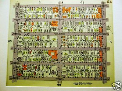
$9.50 Shipping Location: Floral Park, United States This is a 24x36 high quality high resolution reproduction on 70 lb. Each color represents a different type of building: Pink is Brick. Yellow is Wood, ... moreBlue is Iron and Brown is Stone. White Box with an X = Stable.
Buy It Now
$12.85 Shipping Location: Floral Park, United States Each color represents the type of structure. Yellow is wood, pink is brick, blue is iron and brown is stone. The X's through the buildings indicate it ... moreis a barn or stable. Brown indicates stone structures.
Buy It Now
$4.99 Shipping Location: Fairview, United States Desk Atlas Borough of Brooklyn City of New York, by E. Belcher Hyde Map Co., Inc: New York, 1929. A facsimile copy of the title page will also be included ... morefor authenticity. Condition: The map is in Good overall condition, basically as seen in the pic.

Buy It Now
$11.00 Shipping Location: Brooklyn, United States FOR SALE: ORIGINAL LITHOGRAPH MAP OF A SMALL LOCAL SECTION OF BROOKLYN TAKEN FROM AN ATLAS OF BROOKLYN PUBLISHED IN 1929 BY BELCHER HYDE MAP CO. FINDING ... moreYOUR AREA: The easiest way to find a particular street is to put the name of that street in our store search box and check the description box under the search box. If we have your street several maps should pop up. Then you can narrow it down to your particular section. If you can't find your street contact us and we'll do a search that includes both the front and back of the maps. Chances are we have the map you're looking for. AREA: BORO PARK(54) BLOCKS: 47TH STREET 48TH STREET 49TH STREET 50TH STREET 51ST STREET 52ND STREET 10TH AVENUE 11TH AVENUE 12TH AVENUE NEW UTRECHT ROAD FT. HAMILTON PARKWAY LANDMARKS HIGHLIGHTED ON MAP UNITED ISRAEL ZION HOSPITAL SUNSET COURT PUBLIC SCHOOL NO. 160 STANMAY COURT GAS STATION EDNA'S COURT CONDITION: EXCELLENT— Clear. Clean, white and bright. No marks, creases or folds. GOOD COLOR. A REALLY NICE MAP. This MAP is over 80 years old and guaranteed to be ORIGINAL. It’s an authentic. ORIGINAL OLD MAP, and NOT A COPY OR MODERN REPRODUCTION. The map is 10" x 11 1/2" Matted the map measures 14" x 18" This is a standard size mat that will fit into a standard size frame—no costly custom frames required. ALL OF OUR MATTED PRINTS AND MAPS ARE WRAPPED IN CLEAR CELLOPHANE ENVELOPES. PERFECT FOR GIFT GIVING. About The Mats All of our prints are bevel matted in a very high quality. And simple off-white/ivory matting. The backing, WHICH IS NOT ATTACHED TO THE MAP, also meets the same high quality standard. We take pride in what we sell—look at our feedback. All mats are acid-free and the small piece of tape used to attach the map to the top of the mat is artists tape. This map is truly ready to be framed and preserved. Some Comments About Our Mats: Always a wonderful transaction. Will buy again. Awesome Prints& Mats! Incredible Print. Fab pkg. Rapid ship. Gorgeous Mat. Great communication. A+. Wonderf
Buy It Now
$9.50 Shipping Location: Brooklyn, United States AREA : BENSONHURST, BAY RIDGE or BATH BEACH (#103). ORIGINAL LITHOGRAPH MAP OF A SMALL LOCAL SECTION OF BROOKLYN TAKEN FROM AN ATLAS OF BROOKLYN PUBLISHED ... moreIN 1929 BY BELCHER HYDE MAP CO. 17TH AVENUE.
Buy It Now
$4.99 Shipping Location: Fairview, United States Desk Atlas Borough of Brooklyn City of New York, by E. Belcher Hyde Map Co., Inc: New York, 1929. A facsimile copy of the title page will also be included ... morefor authenticity. Condition: The map is in Very Good overall condition, basically as seen in the pic.
$6.00 Shipping Location: Carefree, United States ORIGINAL 1899 COLOR MAP OF THE STATE OF SOUTHERN NEW YORK AND NEW YORK CITY. VERY DETAILED AND NICELY COLORED ANTIQUE MAP WITH SOUTHERN NEW YORK AT TOP ... moreAND VICINITY OF NEW YORK CITY AT BOTTOM. DATED-1897 BELOW TITLE.
Buy It Now
$6.95 Shipping Location: Dover, United States Issued 1902, Chicago by George Cram. Early 20th century color lithographed map. Original center fold as issued.
Buy It Now
$22.78 Shipping Location: Dover, United States One other fold line splitting (with Bushwick Ward) with archival tape repairs on reverse. Map of the Consolidated City of Brooklyn. Scarce and wonderful ... moremid 19th century lithographed urban plan, with original hand color.
Buy It Now
$6.50 Shipping Location: Evansdale, United States For sale is an Original Engraved High Quality 1875 Iowa Map! Size: 14.5" x 17.5" - Good condition - Ready for Framing! Normal signs of wear. A page taken ... morefrom a previously destroyed copy of the 1875 The Illustrated Historical Atlas of the State of Iowa A.T. Andreas.
Buy It Now
$4.99 Shipping Location: Fairview, United States Desk Atlas Borough of Brooklyn City of New York, by E. Belcher Hyde Map Co., Inc: New York, 1929. A facsimile copy of the title page will also be included ... morefor authenticity. Condition: The map is in Very Good overall condition, basically as seen in the pic.
Buy It Now
$4.99 Shipping Location: Fairview, United States Desk Atlas Borough of Brooklyn City of New York, by E. Belcher Hyde Map Co., Inc: New York, 1929. A facsimile copy of the title page will also be included ... morefor authenticity. Condition: The map is in Good overall condition, basically as seen in the pic.
Buy It Now
$7.00 Shipping Location: Jacksonville, United States 1878 Mitchell antique map of New York City & Brooklyn. A beautiful and vibrantly colored map from the 1878 Mitchell New General Atlas, the map was originally ... moreentered in to Congress in 1877. Overall, very good condition.
Buy It Now
$4.99 Shipping Location: Fairview, United States Desk Atlas Borough of Brooklyn City of New York, by E. Belcher Hyde Map Co., Inc: New York, 1929. A facsimile copy of the title page will also be included ... morefor authenticity. Condition: The map is in Fair to Good overall condition, basically as seen in the pic.

Buy It Now
$9.50 Shipping Location: Brooklyn, United States FOR AUCTION: ORIGINAL LITHOGRAPH MAP OF A SMALL LOCAL SECTION OF BROOKLYN TAKEN FROM AN ATLAS OF BROOKLYN PUBLISHED IN 1929 BY BELCHER HYDE MAP CO. FINDING ... moreYOUR AREA: The easiest way to find a particular street is to put the name of that street in our store search box and check the description box under the search box. If we have your street several maps should pop up. Then you can narrow it down to your particular section. If you can't find your street contact us and we'll do a search that includes both the front and back of the maps. Chances are we have the map you're looking for. AREA: SUNSET PARK(13) BLOCKS: 40TH STREET 41ST STREET 42ND STREET 43RD STREET 44TH STREET 45TH STREET 46TH STREET 47TH STREET 48TH STREET 49TH STREET 50TH STREET LANDMARKS HIGHLIGHTED ON MAP PIER 7 PHELPS BROS. PIER 6 AMERICAN HAWAIIAN STEAMSHIP CO. PIER 5 BALTIC AMERICA LINE PIER 4 FURNESS PRINCE LINE PIER 3 FUNCH EDYE& CO. PIER 2 NORTON LILLY CO. BUSH TERMINAL BEECHNUT PACKING COMPANY RAILROAD YARDS NOTE ABOUT THE PICTURES: IN MOST CASES THERE WILL BE 4 PICTURES ACCOMPANYING THE DESCRIPTION. THE LAST PICTURE(ONLY) IS OF THE BACK OF THE MAP. THE BACK OF THE MAP ALSO CONTAINS AN AREA OF BROOKLYN. THE STREETS NOTED IN THIS DESCRIPTION. HOWEVER, ONLY REFER TO THE FRONT SIDE OF MAP. CONDITION: EXCELLENT— Clear. Clean, white and bright. No marks, creases or folds. GOOD COLOR. A REALLY NICE MAP. This MAP is over 80 years old and guaranteed to be ORIGINAL. It’s an authentic. ORIGINAL OLD MAP, and NOT A COPY OR MODERN REPRODUCTION. The map is 10" x 11 1/2" Matted the map measures 14" x 18" This is a standard size mat that will fit into a standard size frame—no costly custom frames required. ALL OF OUR MATTED PRINTS AND MAPS ARE WRAPPED IN CLEAR CELLOPHANE ENVELOPES. PERFECT FOR GIFT GIVING. About The Mats All of our prints are bevel matted in a very high quality. And simple off-white/ivory matting. The backing, WHICH IS NOT ATTACHED TO THE MAP, also meets the same high quality standard. We take pride in wh
Buy It Now
$4.99 Shipping Location: Fairview, United States Desk Atlas Borough of Brooklyn City of New York, by E. Belcher Hyde Map Co., Inc: New York, 1929. A facsimile copy of the title page will also be included ... morefor authenticity. Condition: The map is in Good overall condition, basically as seen in the pic.

Buy It Now
$9.50 Shipping Location: Brooklyn, United States FOR AUCTION: ORIGINAL LITHOGRAPH MAP OF A SMALL LOCAL SECTION OF BROOKLYN TAKEN FROM AN ATLAS OF BROOKLYN PUBLISHED IN 1929 BY BELCHER HYDE MAP CO. FINDING ... moreYOUR AREA: The easiest way to find a particular street is to put the name of that street in our store search box and check the description box under the search box. If we have your street several maps should pop up. Then you can narrow it down to your particular section. If you can't find your street contact us and we'll do a search that includes both the front and back of the maps. Chances are we have the map you're looking for. AREA: MIDWOOD(137) BLOCKS: CONEY ISLAND AVENUE AVENUE C WESTMINISTER ROAD STRATFORD ROAD E. 9TH STREET E. 8TH STREET CORTELYOU ROAD SLOCUM PLACE MATTHEWS PLACE LEWIS PLACE BEVERLY ROAD LANDMARKS HIGHLIGHTED ON MAP LEWIS COURT BOCK AND McCARTHY GARAGE LEMARK ARMS TRIBORO GARAGE HEATHCORT BROS. GARAGE LOUIS AUTO REPAIR NOTE ABOUT THE PICTURES: IN MOST CASES THERE WILL BE 4 PICTURES ACCOMPANYING THE DESCRIPTION. THE LAST PICTURE(ONLY) IS OF THE BACK OF THE MAP. THE BACK OF THE MAP ALSO CONTAINS AN AREA OF BROOKLYN. THE STREETS NOTED IN THIS DESCRIPTION. HOWEVER, ONLY REFER TO THE FRONT SIDE OF MAP. CONDITION: EXCELLENT— Clear. Clean, white and bright. No marks, creases or folds. GOOD COLOR. A REALLY NICE MAP. This MAP is over 80 years old and guaranteed to be ORIGINAL. It’s an authentic. ORIGINAL OLD MAP, and NOT A COPY OR MODERN REPRODUCTION. The map is 10" x 11 1/2" Matted the map measures 14" x 18" This is a standard size mat that will fit into a standard size frame—no costly custom frames required. ALL OF OUR MATTED PRINTS AND MAPS ARE WRAPPED IN CLEAR CELLOPHANE ENVELOPES. PERFECT FOR GIFT GIVING. About The Mats All of our prints are bevel matted in a very high quality. And simple off-white/ivory matting. The backing, WHICH IS NOT ATTACHED TO THE MAP, also meets the same high quality standard. We take pride in what we sell—look at our feedback. All mats are acid-free and the small piece of tape used t
Buy It Now
$4.99 Shipping Location: Fairview, United States Desk Atlas Borough of Brooklyn City of New York, by E. Belcher Hyde Map Co., Inc: New York, 1929. A facsimile copy of the title page will also be included ... morefor authenticity. Condition: The map is in Good overall condition, basically as seen in the pic.
Buy It Now
$6.95 Shipping Location: Dover, United States Issued 1886, Chicago for Gaskell. Map of Brooklyn. Late 19th century color lithographed city plan.
Buy It Now
$4.99 Shipping Location: Fairview, United States Land Book of the Borough of Manhattan City of New York, published in New York by Bromley & co., 1934. A facsimile copy of the title page will also be ... moreincluded for authenticity. An Authentic Antique Map: Not a Modern Reproduction!

Buy It Now
$9.50 Shipping Location: Brooklyn, United States FOR SALE: ORIGINAL LITHOGRAPH MAP OF A SMALL LOCAL SECTION OF BROOKLYN TAKEN FROM AN ATLAS OF BROOKLYN PUBLISHED IN 1929 BY BELCHER HYDE MAP CO. FINDING ... moreYOUR AREA: The easiest way to find a particular street is to put the name of that street in our store search box and check the description box under the search box. If we have your street several maps should pop up. Then you can narrow it down to your particular section. If you can't find your street contact us and we'll do a search that includes both the front and back of the maps. Chances are we have the map you're looking for. AREA: FT. GREENE(137) BLOCKS: ST. JAMES PLACE CAMBRIDGE PLACE GRAND AVENUE DOWNING STREET IRVING PLACE CLASSON AVENUE ATLANTIC AVENUE LEFFERTS PLACE FULTON STREET GATES AVENUE PUTNAM AVENUE LANDMARKS HIGHLIGHTED ON MAP CRITERION THEATER NAZARENE CONG. CHURCH BROOKLYN UNION GAS CO. GREEN HOUSES BOYLES MEM. A.M.E. ZION CHURCH CONDITION: EXCELLENT— Clear. Clean, white and bright. No marks, creases or folds. GOOD COLOR. A REALLY NICE MAP. This MAP is over 80 years old and guaranteed to be ORIGINAL. It’s an authentic. ORIGINAL OLD MAP, and NOT A COPY OR MODERN REPRODUCTION. The map is 10" x 11 1/2" Matted the map measures 14" x 18" This is a standard size mat that will fit into a standard size frame—no costly custom frames required. ALL OF OUR MATTED PRINTS AND MAPS ARE WRAPPED IN CLEAR CELLOPHANE ENVELOPES. PERFECT FOR GIFT GIVING. About The Mats All of our prints are bevel matted in a very high quality. And simple off-white/ivory matting. The backing, WHICH IS NOT ATTACHED TO THE MAP, also meets the same high quality standard. We take pride in what we sell—look at our feedback. All mats are acid-free and the small piece of tape used to attach the map to the top of the mat is artists tape. This map is truly ready to be framed and preserved. Some Comments About Our Mats: Always a wonderful transaction. Will buy again. Awesome Prints& Mats! Incredible Print. Fab pkg. Rapid ship. Gorgeous Mat. Great communica
Buy It Now
$5.95 Shipping Condition: New Location: Las Vegas, United States Canton 1885. Year: 1885. Camden 1885. Canastota 1885. Clinton 1885. East River Bridge - New York City, New York. East Syracuse 1885. Brooklyn 1879.
Buy It Now
$5.95 Shipping Condition: New Location: Las Vegas, United States Canton 1885. Year: 1885. Camden 1885. Canastota 1885. Clinton 1885. East River Bridge - New York City, New York. East Syracuse 1885. Brooklyn 1879.
Buy It Now
$7.00 Shipping Location: Rockville, United States This map is from the "ATLAS OF SUSQUEHANA CO. FROM ACTUAL SURVEYS BY AND UNDER THE DIRECTION OF F.W. BEERS. Engravings on stone by Louis E. Neuman. Power ... morePress Print of Charles Hart. Up for sale is a great, colored, original ANTIQUE MAP OF SUSQUEHANA COUNTY, PENNSYLVANIA - 1872.
Buy It Now
$14.95 Shipping Location: Netherlands Description: This attractive original antique print originates from the fourth or later editions of Meyers' Konversationslexikon. These editions of this ... morefamous German encyclopedia were published from 1885 until 1970. The same prints were used for similar publications, such as Brockhaus' encyclopedia, and the Dutch encyclopedias of Oosthoek and Winkler Prins. Artists and Engravers: The original founder and publisher who initiated this famous encyclopedia was Joseph Meyer (1796-1856, Hildburghausen, Germany).
Buy It Now
$11.85 Shipping Location: Dover, United States Issued c. 1864, New York by Valentine. Lithographed by J. Bien. Mid 19th century lithographed city plan with original hand color. Loosely set within gilt ... morelettered leather covers (no spine, both covers detached, they likely were not issued with the map but fit folded map perfectly and as acquired).
Buy It Now
$4.99 Shipping Location: Fairview, United States Desk Atlas Borough of Brooklyn City of New York, by E. Belcher Hyde Map Co., Inc: New York, 1929. A facsimile copy of the title page will also be included ... morefor authenticity. Condition: The map is in Good overall condition, basically as seen in the pic.
Buy It Now
$5.75 Shipping Location: Malden, United States Brooklyn, New York (Part of The Borough of Kings) New York City, NY. NEW ENCYCLOPEDIC ATLAS & GAZETTEER of The WORLD". New York City. Great OLD Map from ... morethe "COLLIER'S. Map Shows Points of Interest. There Is Yellowing, As Expected, From Age.
Buy It Now
Free Shipping Location: Silverton, United States RARE ORIGINAL 1920 ANTIQUE MAP OF NEW YORK CITY. MAP HAS A SCALE BELOW TITLE AT TOP LEFT. RARE ORIGINAL 1920 ANTIQUE MAP OF NEW YORK CITY AND VICINITY. ... moreDATED 1920.

Buy It Now
$9.50 Shipping Location: Brooklyn, United States FOR SALE: ORIGINAL LITHOGRAPH MAP OF A SMALL LOCAL SECTION OF BROOKLYN TAKEN FROM AN ATLAS OF BROOKLYN PUBLISHED IN 1929 BY BELCHER HYDE MAP CO. FINDING ... moreYOUR AREA: The easiest way to find a particular street is to put the name of that street in our store search box and check the description box under the search box. If we have your street several maps should pop up. Then you can narrow it down to your particular section. If you can't find your street contact us and we'll do a search that includes both the front and back of the maps. Chances are we have the map you're looking for. AREA: BUSHWICK(166) BLOCKS: THROOP AVENUE SUMNER AVENUE LEWIS AVENUE MONROE STREET MADISON STREET PUTNAM AVENUE JEFFERSON AVENUE HANCOCK STREET HALSEY STREET LANDMARKS HIGHLIGHTED ON MAP NGSNY 13 REGIMENT ARMORY RAND RUBBER CO. PUBLIC SCHOOL NO. 44 CONDITION: EXCELLENT— Clear. Clean, white and bright. No marks, creases or folds. GOOD COLOR. A REALLY NICE MAP. This MAP is over 80 years old and guaranteed to be ORIGINAL. It’s an authentic. ORIGINAL OLD MAP, and NOT A COPY OR MODERN REPRODUCTION. The map is 10" x 11 1/2" Matted the map measures 14" x 18" This is a standard size mat that will fit into a standard size frame—no costly custom frames required. ALL OF OUR MATTED PRINTS AND MAPS ARE WRAPPED IN CLEAR CELLOPHANE ENVELOPES. PERFECT FOR GIFT GIVING. About The Mats All of our prints are bevel matted in a very high quality. And simple off-white/ivory matting. The backing, WHICH IS NOT ATTACHED TO THE MAP, also meets the same high quality standard. We take pride in what we sell—look at our feedback. All mats are acid-free and the small piece of tape used to attach the map to the top of the mat is artists tape. This map is truly ready to be framed and preserved. Some Comments About Our Mats: Always a wonderful transaction. Will buy again. Awesome Prints& Mats! Incredible Print. Fab pkg. Rapid ship. Gorgeous Mat. Great communication. A+. Wonderful item.well matted.packed well. Quick delivery.aaaa service

Buy It Now
$9.50 Shipping Location: Brooklyn, United States ORIGINAL LITHOGRAPH MAP OF A SMALL LOCAL SECTION OF BROOKLYN TAKEN FROM AN ATLAS OF BROOKLYN PUBLISHED IN 1929 BY BELCHER HYDE MAP CO. FINDING YOUR AREA: ... moreThe easiest way to find a particular street is to put the name of that street in our store search box and check the description box under the search box. If we have your street several maps should pop up. Then you can narrow it down to your particular section. If you can't find your street contact us and we'll do a search that includes both the front and back of the maps. Chances are we have the map you're looking for. AREA: NOT SURE(4) BLOCKS: KENT STREET JAVA STREET INDIA STREET HURON STREET GREEN STREET FREEMAN STREET OAKLAND STREET PROVOST STREET LANDMARKS HIGHLIGHTED ON MAP WHALE CREEK CANAL MANHATTAN YARN BLEACHING WORKS JOHN C. WIARDA CO. MANUFACTURING CHEMIST ROMAN BRONZE WORKS POLETTO MARBLE CO. BEACON OIL CO. HANSKLAR ENGINEERING CO. OAKLAND FUR DYING NUGGET IRON WORKS CRAWFORD AND EDDY MANHATTAN STEAM DYING AND SCOURING WORKS UNIVERSAL WILLOW AND REED CO. INC. NASSAU RESEARCH CORP. STANDARD MARBLE WORKS FRANKLIN SHEET METAL WORKS CAMBRIDGE SOAP AND CHEMICAL CO. GREENPOINT PAINT AND VARNISH BROOKLYN SASHWEIGHT LAUNDRY LINCOLN DYE WORKS PEERLESS BODY CO. LILY WET WASH LAUNDRY INC. A. COOK WAGON BUILDER EASTERN SHOWCASE LEARY AND REID NOTE ABOUT THE PICTURES: ALL OF THE MAPS ARE COLORED YELLOW. ORANGE, AND VIOLET. THE BLUES AND PINKS THAT YOU MIGHT SEE IN SOME OF THESE PICTURES ARE FROM MY CAMERA. NOT SURE WHY THE COLOR IS OFF, BUT PLEASE JUST DISREGARD. MOST OF THE MAPS IN THE SERIES HAVE PICTURES WITH THE CORRECT SHADE SO TAKE A LOOK AT THOSE IF THE THE MAP YOU ARE LOOKING AT IS NOT YELLOW, ORANGE AND VIOLET WITH AN OFF WHITE BACKGROUND. CONDITION: EXCELLENT/ FINE— Clear. Clean, white and colorful. No marks, creases or folds. GOOD COLOR. A REALLY NICE MAP. This MAP is over 80 years old and guaranteed to be ORIGINAL. It’s an authentic. ORIGINAL OLD MAP, and NOT A COPY OR MODERN REPRODUCTION. The map is 10 1/4" x 12 1/4" Matted the
Buy It Now
$4.99 Shipping Location: Fairview, United States Desk Atlas Borough of Brooklyn City of New York, by E. Belcher Hyde Map Co., Inc: New York, 1929. A facsimile copy of the title page will also be included ... morefor authenticity. Condition: The map is in Fair overall condition, basically as seen in the pic.
Buy It Now
$11.85 Shipping Location: Dover, United States New York City, County, and Vicinity.
Buy It Now
$4.00 Shipping Location: Harborton, United States This is an antique map of Brooklyn New York which was carefully removed from a George Cram atlas published in 1900. There is a partial Manhattan map on ... morethe reverse side.
Buy It Now
$4.99 Shipping Location: Fairview, United States Desk Atlas Borough of Brooklyn City of New York, by E. Belcher Hyde Map Co., Inc: New York, 1929. A facsimile copy of the title page will also be included ... morefor authenticity. Condition: The map is in Good to Very Good overall condition, basically as seen in the pic.
Buy It Now
$4.99 Shipping Location: Fairview, United States Desk Atlas Borough of Brooklyn City of New York, by E. Belcher Hyde Map Co., Inc: New York, 1929. A facsimile copy of the title page will also be included ... morefor authenticity. Condition: The map is in Good overall condition, basically as seen in the pic.

Buy It Now
$11.00 Shipping Location: Brooklyn, United States FOR SALE: ORIGINAL LITHOGRAPH MAP OF A SMALL LOCAL SECTION OF BROOKLYN TAKEN FROM AN ATLAS OF BROOKLYN PUBLISHED IN 1929 BY BELCHER HYDE MAP CO. FINDING ... moreYOUR AREA: The easiest way to find a particular street is to put the name of that street in our store search box and check the description box under the search box. If we have your street several maps should pop up. Then you can narrow it down to your particular section. If you can't find your street contact us and we'll do a search that includes both the front and back of the maps. Chances are we have the map you're looking for. AREA: BATH BEACH(84) BLOCKS: BATH AVENUE 86TH STREET 17TH AVENUE 18TH AVENUE RUTHERFORD PLACE BENSON AVENUE BAY 16TH STREET BAY 17TH STREET BAY 19TH STREET BAY 20TH STREET LANDMARKS HIGHLIGHTED ON MAP BATH BEACH LUMBER CO. ST. DUNBAR LUTHERAN CHURCH SYNAGOGUE BAY COURT B& L GARAGE ESBINSKY BROS. GARAGE N.Y.F.D. LOEW'S ORIENTAL THEATER CONDITION: EXCELLENT— Clear. Clean, white and bright. No marks, creases or folds. GOOD COLOR. A REALLY NICE MAP. This MAP is over 80 years old and guaranteed to be ORIGINAL. It’s an authentic. ORIGINAL OLD MAP, and NOT A COPY OR MODERN REPRODUCTION. The map is 10" x 11 1/2" Matted the map measures 14" x 18" This is a standard size mat that will fit into a standard size frame—no costly custom frames required. ALL OF OUR MATTED PRINTS AND MAPS ARE WRAPPED IN CLEAR CELLOPHANE ENVELOPES. PERFECT FOR GIFT GIVING. About The Mats All of our prints are bevel matted in a very high quality. And simple off-white/ivory matting. The backing, WHICH IS NOT ATTACHED TO THE MAP, also meets the same high quality standard. We take pride in what we sell—look at our feedback. All mats are acid-free and the small piece of tape used to attach the map to the top of the mat is artists tape. This map is truly ready to be framed and preserved. Some Comments About Our Mats: Always a wonderful transaction. Will buy again. Awesome Prints& Mats! Incredible Print. Fab pkg. Rapid ship. Gorgeous M
Buy It Now
Free Shipping Location: Schertz, United States This antique map from 1887 showcases New York City and Brooklyn in stunning detail, with a size of 15x24. The hand-tinted highlights add a unique touch ... moreto this piece, which is over 130 years old. The cartographer/publisher of this map is M. Bradley / S. A. Mitchell and it is an original piece. The city aspect of the map focuses on Brooklyn, while the year of publication is indicated to be 1887. In terms of shipping, free S&H is available in the USA, while calculated S&H is available for worldwide delivery. The map cover is not included for sale and is only for reference purposes.
Buy It Now
$9.50 Shipping Location: Brooklyn, United States FOR AUCTION: ORIGINAL LITHOGRAPH MAP OF A SMALL LOCAL SECTION OF BROOKLYN TAKEN FROM AN ATLAS OF BROOKLYN PUBLISHED IN 1929 BY BELCHER HYDE MAP CO. FINDING ... moreYOUR AREA: The easiest way to find a particular street is to put the name of that street in our store search box and check the description box under the search box. If we have your street several maps should pop up. Then you can narrow it down to your particular section. If you can't find your street contact us and we'll do a search that includes both the front and back of the maps. Chances are we have the map you're looking for. AREA: BORO PARK(64) BLOCKS: 14TH AVENUE 15TH AVENUE 16TH AVENUE 47TH STREET 48TH STREET 49TH STREET 50TH STREET 51ST STREET 52ND STREET LANDMARKS HIGHLIGHTED ON MAP LOUBENAL APTS. TEMPLE BETH EL CONCORIDA CLUB OF BROOKLYN MASONIC SQUARE CLUB THE SEVILLE APTS. NOTE ABOUT THE PICTURES: IN MOST CASES THERE WILL BE 4 PICTURES ACCOMPANYING THE DESCRIPTION. THE LAST PICTURE(ONLY) IS OF THE BACK OF THE MAP. THE BACK OF THE MAP ALSO CONTAINS AN AREA OF BROOKLYN. THE STREETS NOTED IN THIS DESCRIPTION. HOWEVER, ONLY REFER TO THE FRONT SIDE OF MAP. CONDITION: EXCELLENT— Clear. Clean, white and bright. No marks, creases or folds. GOOD COLOR. A REALLY NICE MAP. This MAP is over 80 years old and guaranteed to be ORIGINAL. It’s an authentic. ORIGINAL OLD MAP, and NOT A COPY OR MODERN REPRODUCTION. The map is 10" x 11 1/2" Matted the map measures 14" x 18" This is a standard size mat that will fit into a standard size frame—no costly custom frames required. ALL OF OUR MATTED PRINTS AND MAPS ARE WRAPPED IN CLEAR CELLOPHANE ENVELOPES. PERFECT FOR GIFT GIVING. About The Mats All of our prints are bevel matted in a very high quality. And simple off-white/ivory matting. The backing, WHICH IS NOT ATTACHED TO THE MAP, also meets the same high quality standard. We take pride in what we sell—look at our feedback. All mats are acid-free and the small piece of tape used to attach the map to the top of the mat is artists tape. Thi

Buy It Now
$9.50 Shipping Location: Brooklyn, United States ORIGINAL LITHOGRAPH MAP OF A SMALL LOCAL SECTION OF BROOKLYN TAKEN FROM AN ATLAS OF BROOKLYN PUBLISHED IN 1929 BY BELCHER HYDE MAP CO. FINDING YOUR AREA: ... moreThe easiest way to find a particular street is to put the name of that street in our store search box and check the description box under the search box. If we have your street several maps should pop up. Then you can narrow it down to your particular section. If you can't find your street contact us and we'll do a search that includes both the front and back of the maps. Chances are we have the map you're looking for. AREA: NOT SURE(62) BLOCKS: LYNCH STREET MIDDLETON STREET LORIMER STREET WALTON STREET WALLABOUT STREET BROADWAY THROOP AVENUE HARRISON AVENUE MARCY AVENUE LANDMARKS HIGHLIGHTED ON MAP SUBWAY TO BE CONSTRUCTED SHULT BREAD CO. STABLES EDISON ELECTRIC ILLUM. CO. GREENFIELDS SON CANDY MFG. MC KEE REFRIGERATION CO. BMT SUBWAY STATION JEWISH MISSION GAYETY THEATER KOEHNERS SONS WAGONS CO. ELEVATED R.R. S. NEWMAN CHAIR CO. JACOBS BROS. CO. LAWTON STEPHENS CO. NOTE ABOUT THE PICTURES: ALL OF THE MAPS ARE COLORED YELLOW. ORANGE, AND VIOLET. THE BLUES AND PINKS THAT YOU MIGHT SEE IN SOME OF THESE PICTURES ARE FROM MY CAMERA. NOT SURE WHY THE COLOR IS OFF, BUT PLEASE JUST DISREGARD. MOST OF THE MAPS IN THE SERIES HAVE PICTURES WITH THE CORRECT SHADE SO TAKE A LOOK AT THOSE IF THE THE MAP YOU ARE LOOKING AT IS NOT YELLOW, ORANGE AND VIOLET WITH AN OFF WHITE BACKGROUND. CONDITION: EXCELLENT/ FINE— Clear. Clean, white and colorful. No marks, creases or folds. GOOD COLOR. A REALLY NICE MAP. This MAP is over 80 years old and guaranteed to be ORIGINAL. It’s an authentic. ORIGINAL OLD MAP, and NOT A COPY OR MODERN REPRODUCTION. The map is 10 1/4" x 12 1/4" Matted the map measures 14" x 18" This is a standard size mat that will fit into a standard size frame—no costly custom frames required. ALL OF OUR MATTED PRINTS AND MAPS ARE WRAPPED IN CLEAR CELLOPHANE ENVELOPES. PERFECT FOR GIFT GIVING. About The Mats All of our prints are bevel
Buy It Now
Free Shipping Location: Augusta, United States This 14 1/2" x 11" map is in GOOD condition with light tone, soil and edge wear including staining across the top from the original tab, from a disbound ... moreGeorge Cram atlas published 1898. FREE: Acid-free date card (a modern lithographic copy) included with your map.
Buy It Now
Free Shipping Location: Sayville, United States Published by E. Belcher Hyde. Page 178: Canarsie from Ralph Ave at Flatlands and Glenwood Avenues east to E 76th.
Buy It Now
$4.99 Shipping Location: Fairview, United States There is text on the reverse. Condition: The map is in Excellent condition with light tonal ageing, otherwise it is very clean, see the pics for more ... moreon condition. The pics are of the actual map. An Original Antique Map: Not a Reproduction!
Buy It Now
$9.20 Shipping Location: Eau Claire, United States In excellent condition.

Buy It Now
$9.50 Shipping Location: Brooklyn, United States ORIGINAL LITHOGRAPH MAP OF A SMALL LOCAL SECTION OF BROOKLYN TAKEN FROM AN ATLAS OF BROOKLYN PUBLISHED IN 1929 BY BELCHER HYDE MAP CO. FINDING YOUR AREA: ... moreThe easiest way to find a particular street is to put the name of that street in our store search box and check the description box under the search box. If we have your street several maps should pop up. Then you can narrow it down to your particular section. If you can't find your street contact us and we'll do a search that includes both the front and back of the maps. Chances are we have the map you're looking for. AREA: WILLIAMSBURG(44) BLOCKS: S. 3RD STREET S. 4TH STREET S. 5TH STREET S. 6TH STREET S. 8TH STREET S. 9TH STREET BROADWAY BEDFOD AVENUE DRIGGS AVENUE ROEBLING STREET HAVEMEYER STREET MARCY AVENUE BROADWAY EXTENSION OF GRAND STREET LANDMARKS HIGHLIGHTED ON MAP WASHINGTON PLAZA S.W. FARBER BRASS AND COPPER GOODS WILLIAMSBURG BRIDGE KINGS COUNTY SAVINGS BANK WILLIAMSBURG SAVINGS BANK REPUBLIC KNITTING MILLS FRED WOHL KNIT GOODS MAGISTRATES COURT CHURCH THE DIME SAVINGS BANK OF WILLIAMSBURG MANUFACTURERS TRUST WILLIAMSBURG THEATER HUBER BUILDING WILLIAMSBURG CONTINUATION SCHOOL ETTINA SHOE CO. AMERICAN NOVELTY CANDY EVANGELICAL LUTHERAN CHURCH BROADWAY THEATER 1ST NATIONAL BANK DUGAN BROTHERS INC. BAKERY ELEVATED TRAIN ON BROADWAY N.Y. TELEPHONE COMPANY PUBLIC SCHOOL 166 GAS STATION BEDFORD STGE. WAREHOUSE NOTE ABOUT THE PICTURES: ALL OF THE MAPS ARE COLORED YELLOW. ORANGE, AND VIOLET. THE BLUES AND PINKS THAT YOU MIGHT SEE IN SOME OF THESE PICTURES ARE FROM MY CAMERA. NOT SURE WHY THE COLOR IS OFF, BUT PLEASE JUST DISREGARD. MOST OF THE MAPS IN THE SERIES HAVE PICTURES WITH THE CORRECT SHADE SO TAKE A LOOK AT THOSE IF THE THE MAP YOU ARE LOOKING AT IS NOT YELLOW, ORANGE AND VIOLET WITH AN OFF WHITE BACKGROUND. CONDITION: EXCELLENT/ FINE— Clear. Clean, white and colorful. No marks, creases or folds. GOOD COLOR. A REALLY NICE MAP. This MAP is over 80 years old and guaranteed to be ORIGINAL. It’s an authentic. ORIGINAL OLD MAP, and NOT A C
Buy It Now
$4.99 Shipping Location: Fairview, United States Desk Atlas Borough of Brooklyn City of New York, by E. Belcher Hyde Map Co., Inc: New York, 1929. A facsimile copy of the title page will also be included ... morefor authenticity. Condition: The map is in Good overall condition, basically as seen in the pic.

Buy It Now
$9.50 Shipping Location: Brooklyn, United States FOR SALE: ORIGINAL LITHOGRAPH MAP OF A SMALL LOCAL SECTION OF BROOKLYN TAKEN FROM AN ATLAS OF BROOKLYN PUBLISHED IN 1929 BY BELCHER HYDE MAP CO. FINDING ... moreYOUR AREA: The easiest way to find a particular street is to put the name of that street in our store search box and check the description box under the search box. If we have your street several maps should pop up. Then you can narrow it down to your particular section. If you can't find your street contact us and we'll do a search that includes both the front and back of the maps. Chances are we have the map you're looking for. AREA: BORO PARK(122) BLOCKS: OCEAN PARKWAY 18TH AVENUE E. 2ND STREET E. 3RD STREET E. 4TH STREET E. 5TH STREET WEBSTER AVENUE LAWRENCE AVENUE PARKVILLE AVENUE FOSTER AVENUE 3RD STREET LANDMARKS HIGHLIGHTED ON MAP ARDSLEY ARMS CAROLINE COURT PARKVILLE CONG. CHURCH PUBLIC SCHOOL(PS) 134 KENSIGNTON GARDENS STANLEY APARTMENTS MINERVA COURT BORDEN STABLES BORDEN FARM PRODUCTS NEW LAWRENCE GARAGE POLICE PRECINCT NO. 34 NEW LAWRENCE GARAGE PARKWAY GARAGE OCEAN PARKWAY CHURCH NOTE ABOUT THE PICTURES: IN MOST CASES THERE WILL BE 4 PICTURES ACCOMPANYING THE DESCRIPTION. THE LAST PICTURE(ONLY) IS OF THE BACK OF THE MAP. THE BACK OF THE MAP ALSO CONTAINS AN AREA OF BROOKLYN. THE STREETS NOTED IN THIS DESCRIPTION. HOWEVER, ARE ONLY ON THE FRONT SIDE MAP. CONDITION: EXCELLENT— Clear. Clean, white and bright. No marks, creases or folds. GOOD COLOR. A REALLY NICE MAP. This MAP is over 80 years old and guaranteed to be ORIGINAL. It’s an authentic. ORIGINAL OLD MAP, and NOT A COPY OR MODERN REPRODUCTION. The map is 10" x 11 1/2" Matted the map measures 14" x 18" This is a standard size mat that will fit into a standard size frame—no costly custom frames required. ALL OF OUR MATTED PRINTS AND MAPS ARE WRAPPED IN CLEAR CELLOPHANE ENVELOPES. PERFECT FOR GIFT GIVING. About The Mats All of our prints are bevel matted in a very high quality. And simple off-white/ivory matting. The backing, WHICH IS NOT ATTACHED TO THE MAP, also m
Buy It Now
$4.99 Shipping Location: Freeport, United States HISTORIC 1906 MAP OF BROOKLYN BOROUGH 20x24" complete frame- able BEAUTIFUL NYC. There are a few separations at the seams, but it will not affect the ... moreoverall look of this wonderful map.
Buy It Now
Free Shipping Location: Augusta, United States This 14 1/2" x 11" map is in VERY GOOD condition with light tone, soil and edge wear including staple holes in the top margin, from a disbound George ... moreCram atlas published 1899. "An Authentic Original Map Not A Reproduction".
Buy It Now
Free Shipping Location: Augusta, United States This 14 1/2" x 11" map is in GOOD condition with light tone, soil and edge wear, from a disbound George Cram atlas ©1900. "An Authentic Original Map Not ... moreA Reproduction".

Buy It Now
$11.00 Shipping Location: Brooklyn, United States FOR SALE: ORIGINAL LITHOGRAPH MAP OF A SMALL LOCAL SECTION OF BROOKLYN TAKEN FROM AN ATLAS OF BROOKLYN PUBLISHED IN 1929 BY BELCHER HYDE MAP CO. FINDING ... moreYOUR AREA: The easiest way to find a particular street is to put the name of that street in our store search box and check the description box under the search box. If we have your street several maps should pop up. Then you can narrow it down to your particular section. If you can't find your street contact us and we'll do a search that includes both the front and back of the maps. Chances are we have the map you're looking for. AREA: FT. GREENE(144) BLOCKS: TAAFFE PLACE KENT AVENUE FRANKLIN AVENUE SKILLMAN STREET BEDFORD AVENUE MYRTLE AVENUE PARK AVENUE FLUSHING AVENUE LITTLE NASSAU STREET LANDMARKS HIGHLIGHTED ON MAP PUBLIC SCHOOL NO. 157 ST. LUCY'S CHURCH BROOKLYN UNION GAS CO. CONDITION: EXCELLENT— Clear. Clean, white and bright. No marks, creases or folds. GOOD COLOR. A REALLY NICE MAP. This MAP is over 80 years old and guaranteed to be ORIGINAL. It’s an authentic. ORIGINAL OLD MAP, and NOT A COPY OR MODERN REPRODUCTION. The map is 10" x 11 1/2" Matted the map measures 14" x 18" This is a standard size mat that will fit into a standard size frame—no costly custom frames required. ALL OF OUR MATTED PRINTS AND MAPS ARE WRAPPED IN CLEAR CELLOPHANE ENVELOPES. PERFECT FOR GIFT GIVING. About The Mats All of our prints are bevel matted in a very high quality. And simple off-white/ivory matting. The backing, WHICH IS NOT ATTACHED TO THE MAP, also meets the same high quality standard. We take pride in what we sell—look at our feedback. All mats are acid-free and the small piece of tape used to attach the map to the top of the mat is artists tape. This map is truly ready to be framed and preserved. Some Comments About Our Mats: Always a wonderful transaction. Will buy again. Awesome Prints& Mats! Incredible Print. Fab pkg. Rapid ship. Gorgeous Mat. Great communication. A+. Wonderful item.well matted.packed well. Quick delivery.
Buy It Now
$4.99 Shipping Location: Fairview, United States Desk Atlas Borough of Brooklyn City of New York, by E. Belcher Hyde Map Co., Inc: New York, 1929. A facsimile copy of the title page will also be included ... morefor authenticity. Condition: The map is in Good overall condition, basically as seen in the pic.

Buy It Now
$11.00 Shipping Location: Rockville, United States Up for sale is a LARGE. Antique map of"BROOKLYN, NEW YORK" Prepared under the direction of the Chief of Engineers by the Army Map Service(AM) ... moreWar Department, Washington, D.C. First Edition- AMS 2- 1947 This map measures approximately 22 x 29 inches. Including the border area. It is blank on the reverse side. It is a detailed map showing various attributes- railroads. Military reservations, lakes, streams, falls, woods, trails, schools, churches, cemetaries, etc. Map is generally in Good condition. The map has some wear and browning. There are creases and tears around the edges of the paper and other stains along the edges. There are creases in the corners and the paper is"crumpled" around the edges. There are a few stains near the legend at the bottom right. There are other creases and dings here and there. As well. This map is a great piece of history! It will look GREAT when framed. Please see my store for other great items. Inventory MS- Box 1- Map#44
Buy It Now
$6.95 Shipping Location: Dover, United States Issued 1901, Chicago by George Cram. Early 20th century color lithographed map. Original center fold as issued.
|
|
|
In
|
ANTIQUE FRAMED MAP OF BROOKLYN, NY. PRINTED IN 1890 FRAME IS 10 X 13"
THIS WOULD LOOK VERY NICE HANGING IN YOUR HOME OR IN AN OFFICE. ANTIQUE FRAMED 1890 NATIONAL STANDARD ATLAS MAP OF THE CITY OF BROOKLYN. NEW YORK MAP IS IN EXCELLENT CONDITION WITH A MAP SIZE OF 9 X 12" IN A SOLID WOOD 10 X 13"FRAME. I SHIP 5 DAYS A WEEK AND ALWAYS LEAVE FEEDBACKS. MAP WAS PRINTED IN 1900~~~~~~~~~~~READY TO HANG~~~~~~~~ Powered by The free listing tool. List your items fast and easy and manage your active items.
|
|
|
FRAMED ANTIQUE MAP OF BROOKLYN NEW YORK, NAMED STREETS & RAILROADS
Powered by 1889 ATLAS ANTIQUE MAP OF THE CITY OF BROOKLYN NEW YORK. SOME POINTS OF INTEREST ARE LISTED IN THE ITEM SPECIFICS SECTION ABOVE. ALONG WITH ALL THE NAMED STREETS& JUST TOO MUCH TO MENTION. THE MAP IS IN GREAT CONDITION AND IS VERY CLEAR AND LEGIBLE. I COMBINE MULTIPLE AUCTIONS TO SAVE SHIPPING COSTS. I ship daily and always give feedbacks. MAP IS SHIPPED FLAT AND PROTECTED. Great piece of history. BUY WITH CONFIDENCE! SEE MY FEEDBACKS! THIS MAP WAS PRINTED IN 1889. GREAT UNIQUE GIFT IDEA FOR THE PERSON WHO HAS EVERYTHING! ALSO WOULD BE IDEAL FOR A SCHOOL PROJECT. I DO NOT LIST REPRODUCTIONS~~~~~~~READY TO HANG. Powered by The free listing tool. List your items fast and easy and manage your active items.
|
|
|
1901 Brooklyn, NY Antique Dated Atlas map*.. Indexed w/ RR Stations. 113 yrs-old
1901 Brooklyn. NY Antique Dated Atlas map* Indexed w/ RR Stations. 113 yrs-old Gorgeous. Original 1901 Main portion of Brooklyn, New York Dated Color Atlas Map. Southern New York City color map is on the back This is an ORIGINAL.NOT A REPRINT. 113 +++ year-old Dated Color atlas map.that measures 1 4" x 1 1" with the borders and would look fantastic matted and framed. The map is indexed on the borders where it lists numerous Points of interest.roads. Streets, rails, cemeteries, Navy Yard, streets, rails, etc. Great, Historic Item. NOTE CONDITION: The map has a little border and corner wear. Otherwise. It is in Nice Condition. Please see the attached photo to view the Map and a couple of closeup of a sections of the map* Please note that the map is too large for my scanner.also. All of the printing is much clearer than the scan illustrates, ... morestreets, etc. are small but very clear and readable even for an old blind guy like me* Purchase this 113 year-old map for only $16.95. U.S. Buyer pays $3.00 for shipping. 1-4 maps can be combined to save on shipping. PLEASE READ: This is an original 1901 dated atlas map. I prefer satisfied customers and try to accurately describe all of my maps and Ebay items so there is not any misunderstandings.If you have any questions about this map or any of my Ebay items. Please email me before bidding. Thanks! 072114 Brook01. 2(c) Please Visit My Ebay Store To View My Vintage Brooklyn. New York City, Buffalo, New York and Other Antique Maps. Thanks For Looking! ALL INTERNATIONAL BUYERS PLEASE READ: Please be aware that some packages going into Canada. The UK and France are taking a very long time for delivery.2-weeks and longer in some cases depending on customs. Although I mail them as quickly as I can.I have no control over how long it takes for them to be delivered after I mail them.Also, These old maps are shipped in sturdy mailing tubes and are very, very rarely lost. However, I send these via first class airmail trying to save internationa
|
|
|
RARE Antique GREATER NEW YORK Map Manhattan Brooklyn 1902 RARE MINIATURE
ANTIQUE MINIATURE MAP OF GREATER NEW YORK This is an original. Not reproduction, vintage map which was carefully removed from an atlas. This tiny map measures approximately 3" by 4.5" and is in very good condition. Your item will be packaged in a plastic sleeve. With a thin piece of backing, then in a manila envelope with a very stiff and thick piece of cardboard. We happily combine purchases to save on shipping fees. Please email with questions. We will answer your email promptly! Please visit our ebay store. Plaindealing Vintage Paper. Be sure to add me to your! Check out my! Powered by The free listing tool. List your items fast and easy and manage your active items.
|
|
|
New York City & Environs Brooklyn Manhattan original uncommon 1894 antique map
New York von Umgebung(New York City& Environs) Issued 1894. Leipzig Uncommon original antique color lithographed German map. Printed on quality paper which retains its inherent structural flexibility and soundness. In VG or better condition. Mostly clean and attractive, minor light surface age wear, overall the image is clean and very attractive[note: we grade very conservatively and always seek to disclose any noteworthy flaws] The printed area remains visually pleasing. A nice impression of an interesting and rather uncommon antique map. Any minor defects along the sheet edges and in the margins may be seen in the photos. Original fold-line as issued. Sheet measures c. 9 7/8" W x 12 7/8" H. Printed area measures c. 8 1/8" W x 10 1/2" H. 57884] Guaranteed Authentic! We do not sell modern reprints. Condition: We only ... morehandle. Sell& ship original vintage and antique items. Old printed sheets of paper. Items which are really old, like we say. We strive to describe our items accurately. We understand you cannot see it in person. We are trying to present it accurately. We try to convey the condition correctly with careful digital photography. Accurate flat-bed scans of the item which are zoomable, printed sheet& image dimensions and knowledgeable descriptive words. It is important to understand that many. If not most old items survive merely by chance, and all are somewhat unique if you inspect them closely. Few of the same type match exactly if compared side-by-side. Each has it's own characteristics and patina. Individual pieces have typically seen numerous owners and been handled many times over the course of their existence. On old sheets of paper. Short edge splits( which are often carefully repaired with discrete small pieces of archival tape) Foxing, discoloration, etc. are all things to expect. It's often unrealistic to expect all old sheets of paper to survive looking like new or without flaws. The key to any printed sheet is the overall visual appeal of the piece. Oten
|
|
|
1914 New York City antique color map southern Brooklyn NY railroad stret car
FROM A SMOKE FREE HOME. ORIGINAL vintage article pulled by me from a 1914 publication showing Southern Portion of New York City reverse shows main portion of Brooklyn. Page measures approx 11" x 14" would look awesome framed. No rips or creases unless mentioned above. PICTURE IS OF ACTUAL ITEM UP FOR AUCTION AS IS THE RULE WITH ALL MY AUCTIONS. Shipped in a firm tube and securely packed for a safe journey. FAST EMAILS/FAST SHIPPING = GREAT SERVICE. ENJOY LIFE. IT'S SHORT, Perry! Powered by The free listing tool. List your items fast and easy and manage your active items.
|
|
|
1874 Brooklyn, New York-(Antique-Old Map) 11x17 Print-Reproduction
This listing is for an 11x17 reproduction photo print of the image shown. Sizes in Inches) Great for Framing! High Quality Photo Paper using Commerical Photo Printers(Canon and Epson) About my photo reproduction studio: I've been offering antique photograph reproductions from my small studio for over 8 years- based in Las Vegas. Nevada- and in Elko County, Nevada during the summer months. I'm new to Ebay but have had over 10.000 transactions on various other online sites. SIZING: I offer various sizes including 4x6. 5x7, 8x10, 8.5x11, 11x17, 13x19(in inches) Please message me and I will create a listing if you desire a different size print. Prices will be different of course) HANDING TIME: My handling time is 5 days as during the summer months I live off-grid in remote Elko County. Nevada. Most of the time my handling time is 1-2 ... moredays- but it can be as long as 5 days depending on the time of year. Thank you for your interest! ISSUES: For any issues simply contact me and I'll make it right. Combined Shipping: 1st item is the normal shipping rate and every item after that ships free.
|
|
|
1924 ANTIQUE Vintage Atlas CITY MAP BROOKLYN NEW YORK CITY
Not a Reproduction 1924 ANTIQUE Vintage Atlas CITY MAP BROOKLYN NEW YORK CITY From Colliers Atlas Offered here is a great detailed map of the area The map measures approx. 10 x 12 inches. Larger than my scanner The map is in Good condition. Clean, no markings and would frame nicely. The map is fully guaranteed to be in original and unaltered condition. Check out my STORE for a great selection of 1.00 Maps. S&H 6.00 to the US in cardboard tube Only 1.00 extra S&H cost for each extra map
|
|
|
1903 ANTIQUE BLANCHARD'S VEST POCKET MAP OF BROOKLYN NEW YORK - KINGS COUNTY
1903 Blanchard's Vest Pocket Map of Brooklyn. New York Kings County Borough with Complete Street Index Showing Rapid Transit Tunnel Greater New York and Surroundings Queens. Richmond, Manhattan and Bronx Boroughs Map is in great condition for its age! Some soiling on the edges. The cover is in two pieces- see pictures. There is one edge of the map that part of the cover has stuck to. May be able to be carefully removed. This is also shown in the pictures. Different areas of the map were copyrighted in 1895. 1897, and 1902 by the Matthews Northrup Co. Buffalo, N.Y. The back of the map has a Brooklyn street index and a Map of New York City(Greater New York) and Vicinity. Map measures 29" x 21" when fully opened. A great historical piece!
|
|
|
NEW YORK CITY. Antique town city map plan. Manhattan Brooklyn Jersey. SDUK 1844
NEW YORK Antique steel engraved map with original hand colouring(color) Inset: Attractive vignette views. 1844 Title of map: NEW YORK' The image below shows an enlarged cross section from the centre of the map to show the level of printed detail: DATE PRINTED: This map was originally published by The Society for the Diffusion of Useful Knowledge in 1840; this date is printed on the map. This edition of the map was printed and published by Chapman& Hall in 1844. IMAGE SIZE: Approx 32.0 x 39.5cm. 12.5 x 15.5 inches(Large) ARTIST/CARTOGRAPHER/ENGRAVER: Unattributed PROVENANCE: Maps of the Society for the Diffusion of Useful Knowledge" Published by Chapman& Hall, London, under the superintendance of the Society for the Diffusion of Useful Knowledge TYPE: Antique steel engraved map with original hand colouring(color) Inset: Attractive ... morevignette views. VERSO: There is nothing printed on the reverse side. Which is plain CONDITION: Good; suitable for framing. Please check the scan for any blemishes prior to making your purchase. Virtually all antiquarian maps and prints are subject to some normal aging due to use and time which is not obtrusive unless otherwise stated. I offer a no questions asked return policy- see below. AUTHENTICITY: This is an authentic historic print. Published at the date stated above. I do not offer reproductions. It is not a modern copy. The term'original' when applied to a print means that it was printed at the first or original date of publication; it does not imply that the item is unique. Print' means any image created by applying an inked block to paper or card under pressure by any method including wood engraving, steel engraving, copperplate, wood cut and lithography. REMARKS: FRANCE: Gravures et Cartes anciennes. DEUTSCHLAND: Alte Lankarten und Stadt ansichten. ITALIA: Stampe e Mappe antiche. ESPAÑA: Mapas antiquos y impresiones antiguas. E and OE. Force Majeure. English law shall apply. RETURNS POLICY: I offer a no questions returns policy. All I ask is t
|
|
|
Antique Rand McNally Map, BROOKLYN, New York City, 11"x14", 1930s, Prospect Park
Antique Black& White Map Region: Brooklyn. NY Date/Publisher: c.1930s. Rand McNally, Cities and Towns of the World Size: 11" x 14" Condition: Nice condition. Light toning and some wear along edges. This is not a copy. It was removed from an old atlas book. Please Zoom-in on photos for more details regarding content and condition. ~~ Please be sure to check out my! I'm listing many more Antique Maps& Prints. Shipping is just $0.50 more for each additional map ~~ Thanks for looking at this listing. If you have any questions. Just ask! Payment and Shipping Info: eBay wants payment through PayPal or Cash upon Pickup. Email regarding other options. I ship 5 days a week Mon-Fri and will usually ship within 24 hours of payment clearing. I will be happy to combine shipping when possible! When purchasing more than one item just ... morewait for an invoice that will reflect combined shipping savings. If you'd like a quote ahead of time feel free to contact me. Some items cannot be combined. Your satisfaction is extremely important to me. Once you receive your item/s and are happy with them I hope you will consider leaving me positive feedback. As I will be doing the same for you. Thank you for looking. Good luck bidding, and please don't hesitate to contact me with any questions!
|
|
|
1872 antique map poster Beers Genealogy New York Brooklyn 22
This Auction is for an Unframed MODERN REPRINT of an Antique Map as detailed below. This map is reproduced on specially coated. Matte finish, paper for sharper print quality and colors that are vivid. These maps are created from VERY high resolution uncompressed TIFF files(averaging 200+ megabytes) and are much sharper that the image shown here. Description. Approximate Image Size 16.5 X 25 Inches, Original Atlas Title State atlas of New Jersey based on State Geological Survey and from additional surveys by and under the direction of F.W. Beers. Published by Beers. Comstock& Cline, 36 Vesey Street, New York. 1872. Lithogc. Power Press Printg. of Charles Hart, 36 Vesey St. N.Y. Engraved on stone by Louis E. Neuman, 36 Vesey St. N.Y. WE HAVE MANY HISTORIC MODERN REPRINT MAPS AND OTHER ITEMS ON MANY DIFFERENT SUBJECTS Please check out store ... morefor additonal products FREE SHIPPING BY MAIL(GENERALLY 2 TO 5 DAY DELIVERY) FOR ANY NUMBER OF MAPS SHIPPED IN THE US. SHIPPING IS $15 PLUS $1 FOR EACH ADDITIONAL MAP TO ANYWHERE ELSE IN THE WORLD. WE SHIP ALL MAPS ROLLED IN A MAILING TUBE TO PROTECT THE MAP. IF YOU ARE UNHAPPY WITH YOUR PURCHASE SIMPLY RETURN IT AND WE WILL REFUND YOUR MONEY. Ad copyright 2014 All Rights Reserved Powered by The free listing tool. List your items fast and easy and manage your active items. a;06d2.RcmdId ViewItemDescV4,RlogId p4%60bo7%60jtb9%3Fuk.rp73%28%3Ea%3B06d2-14a454a881a-0x10e-
|
|
|
ny111 Antique old map NEW YORK STATE NY genealogy family history BROOKLYN c1875
This Auction is for a LARGE unframed MODERN REPRINT of an Antique map as Pictured. This map is reproduced on specially coated. Matte finish, paper for sharper print quality and colors that are vivid. These maps are created from VERY high resolution uncompressed TIFF files(averaging 200+ megabytes) and are much sharper that the image shown here. Approximate Image Size 16.5 X 24 inches WE HAVE MANY HISTORIC REPRINT MAPS AND OTHER ITEMS ON MANY DIFFERENT SUBJECTS Please check out strore for additonal products ON MULTIBLE ITEM ORDERS-SHIPPING IS FREE TO ADDRESSES IN THE UNITED STATES BY MAIL(GENERALLY 2 TO 5 DAY DELIVERY) FOR ANY NUMBER OF MAPS SHIPPED IN THE US. SHIPPING IS $15 PLUS $1 FOR EACH ADDITIONAL MAP TO ANYWHERE ELSE IN THE WORLD. Unfortunately the US Postal Service GREATLY increased the cost of Internation Shipping. Sorry for the cost ... morebut it's out of my control) WE SHIP ALL MAPS ROLLED IN A MAILING TUBE TO PROTECT THE MAP. IF YOU ARE UNHAPPY WITH YOUR PURCHASE SIMPLY RETURN IT AND WE WILL REFUND YOUR MONEY. Ad copyright 2013 J.C. Beck All Rights Reserved Powered by The free listing tool. List your items fast and easy and manage your active items.
|
|
|
Antique / Vintage 1914 Brooklyn (Kings Borough) Atlas Map NY New York City WWI
Beautiful Antique/ Vintage 1914 Brooklyn. NY Atlas City Map NYC New York City New York City A Wonderful Gift! Great OLD Map from the"COLLIER'S NEW ENCYCLOPEDIC ATLAS& GAZETTEER of The WORLD" Copyright 1914 101 Years Old! The Actual Page! Brooklyn. New York(Part of The Borough of Kings) New York City. NY On The Other Side Is A Photo Of New York City After Dark(Contact Us For More Photos) This Brooklyn Map Measures About 10 1/8 x 15 1/8" Map Shows Points of Interest. Governors Island. Parks, Cemetaeries, Bridges, Navy Yard, Naval Hospital, Parade Grounds, The Disciplinary Training School For Boys, East River, Fort Greene Park, Etc. Very Educational. See what the City used to look like! There Is A Small Tear At The Left. Top Of The Page In The Margin(last photo) It Shouldn't Show When Matted& Framed It Will Look ... moreGREAT When Matted& Framed! World War I WWI Black& White A Really Nice Gift! Perfect For a Preferred or Prospective Customer! A GREAT House Warming Gift! The Perfect Gift! Teachers& Politicians LOVE Them! Super For a Local Business or Office! Shipping by 1st Class or Priority Mail We Will Combine Shipping on Up To 4 Maps for the same shipping fee Email Us With Any Questions or For an International Shipping Quote Check out my other items! Be sure to add me to your favorites list! Thanks For Looking! International Buyers– Please Note: Import duties. Taxes, and charges are not included in the item price or shipping cost. These charges are the buyer's responsibility. Please check with your country's customs office to determine what these additional costs will be prior to bidding or buying. Certain images and/or photos used in this template are the copyrighted property of JupiterImages and are being used with permission under license.
|
|
|
1905 ORIGINAL antique map-New York City,Brooklyn,Queens dated-color-FREE SHIP
Cool early 20th century lithograph map of the city during year of Hearst's rather quixotic campaign to be mayor. This map was disbound from a decrepit Hammond's Atlas of the World 1905. On the reverse is a map of the Greater NYC metro area. The size of the leaf is 9.5 x 12.5 inches. I am trusting the power of the auction and listing at no reserve. So please consider bidding!
|
|
|
1900 GREATER NEW YORK Map MANHATTAN Brooklyn Jersey City 1900s Antique Map
VINTAGE MAP OF GREATER NEW YORK Including: Manhattan. Brooklyn, Jersey City, Long Island City, Newark and more. This is an original. Not reproduction, vintage map which was carefully removed from an atlas. This map measures approximately 13" by 10.5" and is in very good condition. Your item will be packaged in a plastic sleeve. Within a cardboard mailing tube. We happily combine purchases to save on shipping fees. Please email with questions. We will answer your email promptly! Please visit our ebay store. Plaindealing Vintage Paper. Be sure to add me to your! Check out my! Powered by The free listing tool. List your items fast and easy and manage your active items. dhep.RcmdId ViewItemDescV4,RlogId p4%60bo7%60jtb9%3Fuk%601d72f%2Bishm%3Ed%7Fhep-14afeb86876-0x10e-
|
|
|
LARGE OLD ANTIQUE MAP BALTIMORE HARBOR MARYLAND CHESAPEAKE BAY BROOKLYN 1960
CHECK OUT MORE FROM MY PERSONAL MAP ROOM This large studious appearing nautical chart is titled: APROACHES TO BALTIMORE HARBOR Depicts Baltimore. It's harbor, Brooklyn, Rock Hall harbor, and much of the Chesapeake Bay. Publishing information: U.S. DEPARTMENT OF COMMERCE COAST& GEODETIC SURVEY 1960. Chart#C.G.S. 5142. Dimensions: 36" X 46" The Nautical chart is amazingly crisp and well kept for its age. It has been folded twice to reduce into a shelf space on a ship. This is the standard folding method for all of these nautical charts to save space on ships. This is not a copy. Reproduction or a scan, this is an original chart printed on a durable white rigid paper by the U.S. DEPARTMENT OF COMMERCE COAST& GEODETIC SURVEY. large photos have been included for viewing. Please take your time and look at them carefully. I ... moretried to get as many close ups of key areas as possible. Please message me with any questions, I will be glad to answer them. Package will be shipped in a Priority Mail Express Medium Tube. RcmdId ViewItemDescV4,RlogId p4%60bo7%60jtb9%3Fuk.rp73%28e013%3F%3E%3A-14b018e6f67-0x10e-
|
|
|
1915 Antique MANHATTAN Map NEW YORK CITY - Reverse Side BROOKLYN MAP
ANTIQUE MAP OF MANHATTAN- NEW YORK CITY Or on the reverse side- MAP OF BROOKLYN This is an original. Not reproduction, vintage map which was carefully removed from an atlas. This map measures approximately 9" by 12" and is in very good condition. Your item will be packaged in a plastic sleeve. Within a cardboard mailing tube. We happily combine purchases to save on shipping fees. Please email with questions. We will answer your email promptly! Please visit our ebay store. Plaindealing Vintage Paper. Be sure to add me to your! Check out my! Powered by The free listing tool. List your items fast and easy and manage your active items.
|
|
|
1898 RARE BEAUTIFUL CRAM'S ANTIQUE ATLAS MAP OF BROOKLYN-DETAILED
1898 RARE BEAUTIFUL CRAM'S ANTIQUE ATLAS MAP OF BROOKLYN-DETAILED, Click to View Image Album 1898 RARE BEAUTIFUL CRAM'S ANTIQUE ATLAS MAP OF BROOKLYN-DETAILED BEAUTIFUL DETAILED RARE CRAM'S ATLAS MAP INCLUDES CITIES. LANDMARKS, INDUSTRY, BUSINESS AND RAILWAYS PLEASE SEE PHOTOS AS PART OF THE DESCRIPTION CONDITION: MAP IS IN GOOD CONDITION WITH NICE COLORATION SIZE: APPROXIMATELY 10" X 12" SHIPPING: U.S. FIRST CLASS RATE- $4.00. CANADA- $9.00. WORLDWIDE- $14.00 WE COMBINE SHIPPING FOR MULTIPLE WINS! THANK YOU FOR YOUR INTEREST IN OUR AUCTIONS! Payment I accept the following forms of payment: PayPal Shipping& Handling $4.00 USPS First-Class Mail® FREE scheduling. Supersized images and templates. Get Vendio Sales Manager. FREE scheduling. Supersized images and templates. Get Vendio Sales Manager. Over 100.000,000 ... moreserved. Get FREE counters from Vendio today!
|
|
|
Brooklyn Antique Map New York 1898 Engraved Park Slope Manhattan Kings County
Check out our and be sure to add us to your! Please read this listing carefully AND review the many high resolution photos. NOTE: This original 19th century antique map is separated at the first horizontal fold and is shipped. Folded, in two conjoining parts. Very rare. Retails in New York for $1250 on linen. Ours requires straightforward linen-backing and is thus priced at steep discount. Guide Map of the Borough of BROOKLYN Drawn& Engraved Expressly for the Brooklyn Daily Eagle ALMANAC 1898 Scale: 2 inches to 1 mile Shows Brooklyn. Parts of Queens, a large portion of Manhattan and a small portion of New Jersey just north of Ellis Island. Very rare. In need of professional linen-backing to rejoin separated parts but otherwise in very good condition. Again. Map is cleanly separated into two parts along upper horizontal fold. Original ... morepaper. Dated 1898. Measures 25 1/2 x 21 inches. Originally distributed folded. With visible fold lines(also ships folded) Exquisite detail with streets and many other features indicated. Uniformly toned. Occasional light foxing but generally clean. Great color. Light stains(mostly red) in margins. From the ink highlighted boundary, transport and other landmarks(in red and black, apparently as-issued because other examples of this map on the market have the same markings) Several closed short tears along edges at folds. Also diagonal closed short tear at top of bottom section, about 1 1/2" in length(but with no loss) There is a small patch of white paper affixed top center on the back of the map. Apparently from the map having once been lightly affixed to backing. This patch of paper is not visible from front and is easily removed when linen-backed(there is some tiny closed tearing around this, visible from front, but with no loss) Map title and publication information printed on one section(1/12th) of back of poster. Originally the cover of this map as-distributed(folded) This map title in heavy black is visible from front of map through the paper, as
|
|
|
1893 Antique Map: Putnam, Thompson, Pomfret, Killingly, Brooklyn, Connecticut CT
1893 Large Original Antique Map: Putnam. Thompson, Pomfret, Killingly, Brooklyn Connecticut CT. Authentic Map. From: Topographical Atlas of the State of Connecticut. By J.W. Powell. Director US Geological Survey. Map drawn from surveys made 1888. Putnam Sheet. Connecticut-Rhode Island" No. 14 Size: Approx 20.5 X 15.75 INCHES(ENTIRE SHEET) Image or Map Area: Approx 17.25 x 13 inches. Condition: Image area is near fine. Margins show signs of light handling. With one short, closed tear in upper margin, well away from image area. Please view the photos. An excellent& early topographical wall map published at the turn of the century. For display& framing. Returns: Any item may be returned for a refund. Please contact us within 14 days of receipt of your item if you feel an error has been made. We do not deal in modern reproductions. ... moreAll of our maps are original and authentic. Please browse other maps at our store. inkfrog terapeak. I000000. RcmdId ViewItemDescV4,RlogId p4%60bo7%60jtb9%3Fuk%600d72f%2B%3F0%3C%3E-14b4a6968f0-0x104-
|
|
|
Vintage Old Antique KENTUCKY Postcard Man O War Brooklyn Bridge Map Mamoth Cave
Postally unused postcard from KENTUCKY. Man O War Brooklyn Bridge Map Mamoth Cave
|
|
|
1895 Brooklyn, NY Antique Dated Atlas map* S. New York City back ..120 yrs-old
1895 Brooklyn. NY Antique Dated Atlas map* S. New York City back.120 yrs-old Gorgeous. Original 1895 Main portion of Brooklyn, New York Dated Color Atlas Map. Southern New York City color map is on the back This is an ORIGINAL.NOT A REPRINT. 120 +++ year-old Dated Color atlas map.that measures 1 4" x 1 1" with the borders and would look fantastic matted and framed. The map is indexed on the borders where it lists numerous Points of interest.roads. Streets, rails, cemeteries, Navy Yard, streets, rails, etc. Great, Historic Item. NOTE CONDITION: The map has a little border and corner wear. Otherwise. It is in Nice Condition. Please see the attached photo to view the Map and a couple of closeup of a sections of the map* Please note that the map is too large for my scanner.also. All of the printing is much clearer than the scan illustrates, ... morestreets, etc. are small but very clear and readable even for an old blind guy like me* Purchase this 119 year-old map for only $19.95. U.S. Buyer pays $3.00 for shipping. 1-4 maps can be combined to save on shipping. PLEASE READ: This is an original 1895 dated atlas map. I prefer satisfied customers and try to accurately describe all of my maps and Ebay items so there is not any misunderstandings.If you have any questions about this map or any of my Ebay items. Please email me before bidding. Thanks! 020515 Brook95. 2(R) Please Visit My Ebay Store To View My Vintage Brooklyn. New York City, Buffalo, New York and Other Antique Maps. Thanks For Looking! ALL INTERNATIONAL BUYERS PLEASE READ: Please be aware that Ebay handles all international shipments.please check their rates before purchasing. RcmdId ViewItemDescV4,RlogId p4%60bo7%60jtb9%3Fuk.rp*05e54c%3E-14b5e0eb8fa-0x112-
|
|
|
Anoka Brooklyn Maple Grove Ramsey Minnesota 1915 antique color Geology map
Anoka Quadrangle(Minnesota) Issued 1915. By the U.S. Geological Survey Surveyed in 1911 Fine original antique color lithograph map. Printed in the 20th century for the U.S. Geological Survey, directed by George Otis Smith. In VG or better condition. Light minor age wear, trivial scattered spotting or foxing, overall very presentable and attractive, well worthy of hanging for display. Please examine the scan closely as the picture forms a central part of the description. There is a zoom feature so you can see close up. note: we grade very conservatively and always seek to disclose any noteworthy flaws] The printed area remains visually pleasing. A nice impression of an interesting antique map which will look nice when displayed. Sheet measures c. 21 3/8" H x 18" W. Printed area measures c. 17 3/8" H x 12 3/8" W Original ... morefold lines as issued. 87599] Everything we offer is guaranteed to be an authentic original antique item as described. We stand behind everything we sell. Important information for International Buyers* You may be charged customs. Taxes or other import duties by your country! this has nothing at all to do with us. Please do not hold us responsible if your Government wants to collect tax when you buy something outside of your country] Import duties. Taxes, and customs fees are not included in the item price or shipping cost. These charges are normally collected by the shipping service when the package is delivered or when you pick the item up. They are the buyer's responsibility and are not additional shipping charges. Please understand they have nothing to do with us and we have no control over them] Please check with your country's customs office to determine what these additional costs will be prior to bidding or buying. We do not know the various rules of your Customs office. There are a lot of countries in the world. Most with complex detailed variable laws in languages we don't read. Plus these laws are constantly being changed& revised] We won't under-va
|
|
|
Antique 1891 Geo Cram City Map W Street Names New York City or Brooklyn + Boston
WELCOME TO BEANSANTIQUES We are proud to announce that we are ebay.ca's winner of the 2010 Family Business Of The Year If photos do not download for you. Please let us know and we will email them to you directly. We are offering to you a wonderful antique hand tinted map that would look great framed. This is a two sided City map with a large lovely map of New York City and Vicinity on one side and on the other side there are two maps. One on each side of the center fold. One is of the City of Boston and the other is of Brooklyn Maps show street names. The only problem is what side to frame? Map is about 21.5" x 13.5" paper size) and is in good shape with light normal age wear. Toning, has a some of the old hinge on the back from removal from the old atlas and some small edge tears are possible. Great for matting and framing ... moreCame out of an 1891 Home Knowledge Atlas Geographical. Astronomical and Historic and the maps in the Atlas were by Geo F Cram of Chicago. Wonderful Antique and 100% Original map to grace the walls of your fine Home A rare find! Another quality item brought to you be BEANS ANTIQUES. Any questions please email. Check our other listings to combine shipping. We NEVER CHARGE a handling fee just actual mailing costs through Canada Post. We mail next day after payment. Why drive all over when you can get i t here! and have i t delivered to you. Please consider the photos to be part of the description. SHIPPING: We invite you to click on this link to see our shipping info and our GUARANTEE to you SHIPPING& GUARANTEE This link will also show you who we are and what we do Cost is actual mailing. WE DO NOT CHARGE A HANDLING FEE. We do professional packing on site and this is FREE to you. We as the Seller. TAKE RESPONSIBILITY FOR ANYTHING DAMAGED in transit. This is absolutely not your job. Refunds come directly from us. Please check our feedback. WE back every item that we sell. Until your purchase is safely in your hands, it is our responsibility. We always ship next business day after
|
|
|
ANTIQUE 1889 NEW YORK CITY MAP Brooklyn Boston on reverse EXCELLENT CONDITION!
Antique 1889 Map of Manhattan NYC. This was an Atlas pull. This map is pristine! Ready to frame. Has a Brooklyn NY and Boston map on verso. 21.5" x 14.5" Pulled from a Geo. Cram Atlas. Thanks for looking! `BS5057
|
|
|
1889 antique Map survey spirit leveling NEW YORK Brooklyn Staten Island bay ++
An original old map from 1889. About 10 1/2 x 17 1/2 inches Overall very nice condition. As seen in photos. Clean and bright. Folded, but could probably be flattened and nicely framed.
|
|
|
BROOKLYN antique town city plan. New York City. BAEDEKER, 1909 antique map
Brooklyn Antique colour map; Scale 1:32.600. 1909 Title of the map: Brooklyn' The image below shows an enlarged cross section from the centre of the map to show the level of printed detail. This map is folding hence the centrefold line may show on the image below: DATE PRINTED: 1909 IMAGE SIZE: Approx 22.0 x 17.5cm. 8.5 x 7 inches(Medium) Please note that this is a folding map. ARTIST/CARTOGRAPHER/ENGRAVER: Wagner& Debes PROVENANCE: The United States with excursions to Mexico. Cuba, Porto Rico, and Alaska" by Karl Baedeker, Published by Karl Baedeker, London: 4th Edition TYPE: Antique colour map; Scale 1:32.600 VERSO: There is nothing printed on the reverse side. Which is plain CONDITION: Good; suitable for framing. However. Please note: Tight right margin; The image shown may have been taken from a different example of this ... moremap than that which is offered for sale. The map you will receive is in good condition but there may be minor variations in the condition from that shown in the image. Please check the scan for any blemishes prior to making your purchase. Virtually all antiquarian maps and prints are subject to some normal aging due to use and time which is not obtrusive unless otherwise stated. I offer a no questions asked return policy- see below. AUTHENTICITY: This is an authentic historic print. Published at the date stated above. I do not offer reproductions. It is not a modern copy. The term'original' when applied to a print means that it was printed at the first or original date of publication; it does not imply that the item is unique. Print' means any image created by applying an inked block to paper or card under pressure by any method including wood engraving, steel engraving, copperplate, wood cut and lithography. REMARKS: FRANCE: Gravures et Cartes anciennes. DEUTSCHLAND: Alte Lankarten und Stadt ansichten. ITALIA: Stampe e Mappe antiche. ESPAÑA: Mapas antiquos y impresiones antiguas. E and OE. Force Majeure. English law shall apply. RETURNS POLICY: I offer a no ques
|
|
|
1893 Wagner Debes BROOKLYN New York NY ANTIQUE MAP Leipzig US Germany COLOR
Authentic Original 1893 Wagner and Debes Map"New York City. New York, Brooklyn, Staten Island, Newark, Jersey City, Hudson River" State History! 1:210.000 Single Sheet Bi-Fold. 8.25" x 6.25" Color Illustrated. This map is in great condition. Sharp bright colors and vivid detail. Very slight edge wear and toning. Small chip on upper left corner. Overall, a really nice example of an uncommon map. The Leipzig Geographical Institute of Wagner& Debes was an important German cartographic printer and publisher of cartographic work in the 19th- and early 20th century. Established in 1835 as a lithographic press by Eduard Wagner. Who worked with cartography publisher Karl Baedeker. In 1872 Heinrich Wagner, son of Eduard Wagner, took over, moved the presses to Leipzig, and established his own publishing firm in collaboration ... morewith Ernst Debes.
|
|
|
LONG ISLAND, BROOKLYN & QUEENS Antique Illustrated Map - 77 Years Old (original)
BEAUTIFULLY ILLUSTRATED ANTIQUE MAP( original) LONG ISLAND* Including Brooklyn and Queens With Parts of Manhattan& Staten Island* Shows Parkways. Parks, World's Fair Grounds, and Other Features* Made in 1938- This is a very interesting map. Made the better part of a century ago, showing Long Island(including Brooklyn and Queens. Which are in New York City and not normally thought of as part of"Long Island, but geographically, of course, they are) as well as part of Manhattan(Island) and Staten Island. This map. Measuring 14 inches by 11 inches, is titled"The Land of Moses" and it represents a"due east view taken from a point about twenty miles above Newark. It was drawn to demonstrate the extensive accomplishments of"master builder" Robert Moses- most notably the parks. Bridges and parkways he built on ... moreLong Island and in New York City. It is a beautifully drawn map and it is dotted with many color-coded roadways and parks, from New York City out to the twin branches of Long Island's tip, Montauk Point and Orient Point. There are also some notations of interest, including one at a bend in Northern State Parkway, indicating that it represents a"detour around protesting landowners. Another notation at the location of the Long Island Motor Parkway indicates that it"opened 1908. A highway sensation; closed 1938, an outmoded relic. Robert Moses(1888-1981) was an extremely powerful- and controversial- urban planner whose projects greatly influenced the development of Long Island and New York City. He favored automobile travel over public transit and the result was a large network of parkways. Which helped to develop the suburbs on Long Island and served the many parks which Moses created. In addition, he developed the World's Fair grounds in Flushing meadows, which was the setting of the world's fair held there a
|
|
|
1901 antique New York City five boros map original not repro, Brooklyn Manhattan
Antique maps are a great way to own your own pieces of history. Affordable and easy to display. They provide glimpses of times gone by. Most collectible maps were once parts of atlases or other books which kept them protected. This map was disbound from a 1901 Cram atlas. It is in very good condition with no tears. Maps of this era usually focus on one of the boroughs. Usually Manhattan, so this aspect is fairly uncommon. On the reverse is a map of the Philippine Islands. Measures 14.5 x 11.5 inches including margins. No reserve. So please consider a bid! Sorry no international shipments!
|
|
|
1885 Brooklyn Bridge, New York-(Antique-Old Map) 8x10 Print-Reproduction
This listing is for an 8x10 reproduction photo print of the image shown. Sizes in Inches) Great for Framing! High Quality Photo Paper using Commerical Photo Printers(Canon and Epson) About my photo reproduction studio: I've been offering antique photograph reproductions from my small studio for over 8 years- based in Las Vegas. Nevada- and in Elko County, Nevada during the summer months. I'm new to Ebay but have had over 10.000 transactions on various other online sites. SIZING: I offer various sizes including 4x6. 5x7, 8x10, 8.5x11, 11x17, 13x19(in inches) Please message me and I will create a listing if you desire a different size print. Prices will be different of course) HANDING TIME: My handling time is 5 days as during the summer months I live off-grid in remote Elko County. Nevada. Most of the time my handling time is 1-2 days- ... morebut it can be as long as 5 days depending on the time of year. Thank you for your interest! ISSUES: For any issues simply contact me and I'll make it right. Combined Shipping: 1st item is the normal shipping rate and every item after that ships free.
|
|
|
Original 1886 Antique Map BROOKLYN New York City Shows Parks Streets Landmarks
Fine Adornment of Brooklyn History. Impressive on Any Home or Office Wall. Fascinating Map. Imaginative& Creative Gift. 1886 Map of Brooklyn Fine R.S. Peale Map. Intricate Detail. Original 1886. 128-ys-old. Map is in Good/Very Good condition: No writing or folds. Mild foxing. Nominal fraying. Not a reproduction. Original Map Engraved for R.S. Peale's 1886 Edition of The People's Illustrated and Descriptive Family Atlas of the World. By R.S. Peale; and published 1886 by R.S. Peale& Company, 315 to 321 Wabash Avenue, Chicago, 1886; a copy of the Title Page of which is Included. Fascinating Map for the astronomy enthusiast or makes quite an impressionable gift. I Sell Only Original Maps: No copies or reproductions. Press Here to View My Collection. Impressive on Any Home or Office Wall. Dimensions: 10.5" x 13" Shows ... moreAvenues. Boulevards, Streets, and Landmarks of 1886. Great for Family History as Map shows Landmarks of 1886. Some of Which No Longer Exist today. The Auction is for the Map itself. A Frame is Not Included. The framed map pictured is a personal map featured to show the beauty of the maps when framed. Free Shipping Special. All credit cards. Debit cards, and Electronic Checks accepted through Paypal. Maps and Engravings are mailed within 1-3 days of payment and normally arrive within 3-5 days. Please email with any questions. Imaginative& Creative Gift. Greetings from Historical Savannah. Georgia; founded 1733. Some. To beautify their halls, parlors, studies, or libraries.loveth, getteth, and useth maps, charts, and geographical globes. John Dee. Advisor to Elizabeth I. Press the Store Link Below to View My Collection. Powered by The free listing tool. List your items fast and easy and manage your active items.
|
|
|
ANTIQUE 1941 NEW YORK CITY MANHATTAN STATEN ISLAND BROOKLYN QUEENS BRONX MAP NR
Click Here. Double your traffic. Get Vendio Gallery- Now FREE! Huge. Very fine antique 1941 color lithographed map, titled Map of the New York City Region, Showing relation of the Boroughs and Counties, also inset map at upper left, New Amsterdam About 1650, and detailed text as well. At lower left hand side is an 1941 copyright to Wm. Munger, this dates the map nicely. The map is in nice condition, and would frame and display beautifully. The size is 17" by 22" Rare. Winning bidder pays $3.75 shipping domestic, more foreign. Payment I accept the following forms of payment: PayPal Click to View Image Album Shipping& Handling US Shipping. $3.75 USPS First-Class Mail® International Shipping. $11.50 USPS First-Class Mail International FREE scheduling. Supersized images and templates. Get Vendio Sales Manager. FREE scheduling. ... moreSupersized images and templates. Get Vendio Sales Manager.
|
|
|
Antique Hand Colored Map Plan of New York, Brooklyn,Hoboken, Jersey City
This auction is for a vintage original antique map of New York. Brooklyn,Hoboken, Jersey City from 1860. This is a 100% genuine original antique map. Map is hand colored as issued and is a stunning example of the issue. Cartographer: Mitchell Year: 1860 Details: Some staining and minor tears at edges. Will look great framed. See pictures. General Description: 1. Strikingly interesting and highly detailed map. Hand colored. The map depicts in great detail all of the geographical information known at the time the map was published. Note that many geographical details have changed since the map was published and were not accurate compared to today's modern maps because things were fully discovered and accurately mapped yet. Map symbols and details include individual towns. Rivers, lakes, bays, harbors, islands, mountains, forests, roads ... moreand other important places as shown on the map in this listing. 2. The map is in excellent condition considering the age and rarity of the map. The overall size of the map sheet is approximately 12 inches by 15 inches. 3. The map is a 100% original and genuine antique map. Good luck and good bidding. Will be shipped rolled in tube. I suggest when you get map. lay it flat on table for a few hours to regain shape. I don't ship flat due to too much damage.
|
|
|
Antique / Vintage 1923 Brooklyn & Long Island Atlas Map NY New York City L@@K!
Beautiful Antique/ Vintage 1923 Brooklyn& Long Island NY Atlas City Map NYC New York City New York City A Wonderful Gift! Great OLD Map from the"COLLIER'S NEW ENCYCLOPEDIC ATLAS& GAZETTEER of The WORLD" Copyright 1923 92 Years Old! The Actual Page! Brooklyn. New York(Part of The Borough of Kings) New York City, NY On The Other Side Is A Map of Long Island(Contact Us For More Photos) This Page With The Brooklyn Map Measures About 10 1/8 x 15 1/8" The Long Island Map Measures About 9 1/4" x 12" Map Shows Points of Interest. Governors Island. Parks, Cemetaeries, Bridges, Navy Yard, Naval Hospital, Parade Grounds, The Disciplinary Training School For Boys, East River, Fort Greene Park, Long Island Sound, Atlantic Ocean, Coney Island, Brighton Beach, Central Park, Etc. Very Educational. See what the City used ... moreto look like! There Are A Few Small Tears In The Margin They Shouldn't Show When Matted& Framed It Will Look GREAT When Matted& Framed! Black& White A Really Nice Gift! Perfect For a Preferred or Prospective Customer! A GREAT House Warming Gift! The Perfect Gift! Teachers& Politicians LOVE Them! A"Must" For Your Genealogy Research! Super For a Local Business or Office! Shipping by 1st Class or Priority Mail We Will Combine Shipping on Up To 4 Maps for the same shipping fee Email Us With Any Questions or For an International Shipping Quote Check out my other items! Be sure to add me to your favorites list! Thanks For Looking! International Buyers– Please Note: Import duties. Taxes, and charges are not included in the item price or shipping cost. These charges are the buyer's responsibility. Please check with your country's customs office to determine what these additional costs will be prior to bidding or buying. Certain images and/or photos used in this template are the copyrighted property of JupiterImages and are being used with permission under license.
|
|
|
1947 - ANTIQUE Map of Brooklyn, NY - Army Map Service, War Department
Up for sale is a LARGE. Antique map of"BROOKLYN, NEW YORK" Prepared under the direction of the Chief of Engineers by the Army Map Service(AM) War Department, Washington, D.C. First Edition- AMS 2- 1947 This map measures approximately 22 x 29 inches. Including the border area. It is blank on the reverse side. It is a detailed map showing various attributes- railroads. Military reservations, lakes, streams, falls, woods, trails, schools, churches, cemetaries, etc. Map is generally in Good condition. The map has some wear and browning. There are creases and tears around the edges of the paper and other stains along the edges. There are creases in the corners and the paper is"crumpled" around the edges. There are a few stains near the legend at the bottom right. There are other creases and dings here and there. As well. This ... moremap is a great piece of history! It will look GREAT when framed. Please see my store for other great items. Inventory MS- Box 1- Map#44
|
|
 |