-
Christian Collectibles
-
Christian Sheet Music
-
Vatican Stamps
-
Vatican Coins & Paper Money
-
Antiques
-
Antiquities
-
Architectural & Garden
-
Decorative Arts
-
Ethnographic
-
Furniture
-
Maps, Atlases & Globes
-
United States (Pre-1900)
-
AK, HI
-
AL, FL, GA, MS, NC, SC
-
AR, IA, KS, LA, MO, NE
-
AZ, CA, CO, NM, NV, UT
-
CT, MA, ME, NH, RI, VT
-
DC, DE, MD, NJ, NY, PA
-
ID, OR, WA
-
IL, IN, MI, OH, WI
-
MN, MT, ND, SD, WY
-
OK, TX
-
VA, WV, KY, TN
-
Entire US
-
United States (1900-Now)
-
United States (Date Unknown)
-
Africa
-
Asia
-
Australasia/ Oceania
-
Canada
-
Central America/ Caribbean
-
Europe
-
India
-
Ireland
-
Mexico
-
Middle East
-
North America
-
South America
-
United Kingdom
-
Maps on CD
-
World Maps
-
Globes
-
Mixed Lots
-
Reproductions
-
Price Guides & Publications
-
Other
|
In
Order by: Available to: This site contains affiliate links for which I may be compensated
|
Buy It Now
$4.99 Shipping Location: Fairview, United States Illustrated Atlas of Cuyahoga County Ohio, published in Philadelphia by Titus & Simmons, 1874. A copy of the title page is included with the map for authenticity. ... moreThere is tonal ageing, light edge wear, a few handling smudges and browning, see the pics for more on condition.
Buy It Now
$4.99 Shipping Location: Fairview, United States Illustrated Atlas of Cuyahoga County Ohio, published in Philadelphia by Titus & Simmons, 1874. A copy of the title page is included with the map for authenticity. ... moreThere is tonal ageing, light edge wear, a few handling smudges and a few brown spots, see the pics for more on condition.
Buy It Now
$4.50 Shipping Location: United States Fine antique 1874 handcolored 2 sided map, one side is a superb map titled in fancy antique lettering, Map of Greene County Ohio, on reverse is and a ... morecolor lithographed map at top is Climatological Map of the United States, bottom is a handcolored map titled Geological Map of the United States, with handoclored chart corresponding to the map itself.
Buy It Now
Free Shipping Location: Schertz, United States This Map was removed from a 1874 Plat Atlas and is in good acceptable condition. The map is not " new " or in " new " condition, it was printed in 1874. ... moreThe map is not dated. Study the photos carefully, this is the actual map you will receive.
Buy It Now
Free Shipping Location: Schertz, United States This antique original 1874 Plat Atlas Map features ASHLAND County, Ohio. The lithography print technique and the size of approximately 14" x 17" make ... morethis map page a rare find for collectors. The cartographer/publisher J.A. Caldwell is known for producing high-quality maps that have stood the test of time. This map page was printed in 1874 and is in excellent condition. The free shipping and handling offer is valid for customers in the USA, and calculated shipping is available worldwide. This map page is a great addition to any collection of North America Maps, Maps, Atlases & Globes, or antiques. Don't miss the opportunity to own a piece of history with this unique and valuable map page.
Buy It Now
Free Shipping Location: Schertz, United States This is an antique original 1874 plat atlas map of Akron, Ohio, specifically the first ward. The lithography printing technique was used to create this ... moremap by Tackabury, Mead & Moffett. The size of this map is approximately 14" x 17". The map page was printed in 1874 and is in good condition for its age. The shipping and handling for this item is free within the USA and calculated worldwide. This map is a great addition to any collection of North America maps, maps, atlases, and globes, or antiques. Buy now to own a piece of history!
Buy It Now
Free Shipping Location: Monroeville, United States Source - Atlas of Cuyahoga County, Ohio. Date - 1874. Condition - Quite Nice.
Buy It Now
$4.99 Shipping Location: Fairview, United States Illustrated Atlas of Cuyahoga County Ohio, published in Philadelphia by Titus & Simmons, 1874. A copy of the title page is included with the map for authenticity. ... moreCondition: It is in Fair condition for its age with a strong impression, bright hand coloring, blank on reverse, printed on a heavy page with two vertical folds.
Buy It Now
Free Shipping Location: Monroeville, United States Source - Atlas of Cuyahoga County, Ohio. Date - 1874. Condition - Quite Nice.
Buy It Now
Free Shipping Location: Kennebunk, United States ASHTABULA,OHIO1874/072021. This Map was removed from a 1874 Atlas and is in good acceptable condition. Study the photos carefully, this is the actual ... moremap you. Only Authentic Originals.
Buy It Now
Free Shipping Location: Monroeville, United States Source - Atlas of Cuyahoga County, Ohio. Date - 1874. th Ward, Cleveland.
Buy It Now
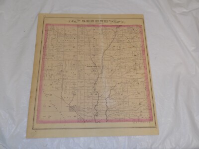
$4.50 Shipping Location: United States This is an antique map and not a reprint or reproduction. The handcoloring on the map is period to the map, this is before color printing. The map is ... morefrom the very rare 1874 Everts Atlas of Greene County Ohio.
Buy It Now
$4.99 Shipping Location: Fairview, United States Illustrated Atlas of Cuyahoga County Ohio, published in Philadelphia by Titus & Simmons, 1874. A copy of the title page is included with the map for authenticity. ... moreCondition: It is in Good condition for its age with a strong impression, bright hand coloring, blank on reverse, printed on a heavy page with a vertical and horizontal fold.
Buy It Now
Free Shipping Location: Schertz, United States This antique original 1874 plat atlas lithography map features the Third Ward and Second Ward of Akron, Ohio. Measuring approximately 14" x 17", this ... moremap page was printed by Tackabury, Mead & Moffett. The US state of Ohio is highlighted on this North America map and it is a perfect addition to any collection of maps, atlases, and globes. Free shipping is available for customers within the USA, while calculated shipping is available worldwide.
Buy It Now
Free Shipping Location: Schertz, United States This antique original plat atlas map was printed in 1874 and showcases the Sixth Ward of Akron, Ohio. Measuring approximately 14" x 17", the lithography ... moreprinting technique is evident in the intricate details of the map. The cartographer/publisher, Tackabury, Mead & Moffett, have accurately depicted the streets, buildings, and landmarks of the area. The buyer can take advantage of free S&H within the USA, or calculated S&H worldwide. This map is perfect for collectors of North America maps, or those who appreciate the beauty and history of antique maps. Add this piece to your collection today!
Buy It Now
Free Shipping Location: Monroeville, United States Date - 1874. Source - Combination Atlas Map of Trumbull County, Ohio. Size - about 13.75x16.5", hand-colored.
Buy It Now
$4.99 Shipping Location: Fairview, United States Illustrated Atlas of Cuyahoga County Ohio, published in Philadelphia by Titus & Simmons, 1874. A copy of the title page is included with the map for authenticity. ... moreThe pics are of the actual map. An Authentic Antique Map: Not a Reproduction!
Buy It Now
$4.50 Shipping Location: United States Dated 1870 at uppper left hand side. Has large tape repaair at bottom. Map is very detailed and huge. This is an antique map and not a reprint or reproduction. ... moreThe handcoloring on the map is period to the map, this is before color printing.
Buy It Now
Free Shipping Location: Monroeville, United States Source - Atlas of Cuyahoga County, Ohio. Date - 1874. th Ward, Cleveland. Size - about 16x31", double page as published, folded to fit, hand-colored.
Buy It Now
Free Shipping Location: Kennebunk, United States This Map was removed from a 1874 Atlas and is in good acceptable condition. Study the photos carefully, this is the actual map you. Including Hundreds ... moreof RareCivil War.
Buy It Now
Free Shipping Location: Schertz, United States This antique plat atlas map depicts Montgomery Township located in Ashland County, Ohio. The lithography printing technique used in 1874 accurately portrays ... morethe township's layout and boundaries. The map measures approximately 14" by 17" and was published by J.A. Caldwell. This original antique map is a rare find for collectors and enthusiasts alike. It is an authentic piece of history that showcases the township's past, its land usage, and surrounding areas. Free S&H is available for buyers in the USA, and calculated S&H is available for worldwide shipping. Add this unique piece to your collection today.
Buy It Now
$4.00 Shipping Location: Winter Springs, United States The map is titled 2nd & 3d Wards of Cleveland. Beautiful map. Printed on thick paper, with no printing on reverse. The condition of the map is amazing. ... moreNice outside ornate border as well. This is an antique map and not a reprint or reproduction.
Buy It Now
Free Shipping Location: Monroeville, United States Click Here. Double your traffic. Get Vendio Gallery- Now FREE! Vintage antique 1874 handcolored map. The map is 2 sided and either side would frame and ... moredisplay nicely. One side is Map of Greene Township. I see Greensburg and much more. Verso is a superb antique lithograph print page, showing 2 superb views at Fowler Township, both have horse drawn carriages in the views, top view is Res of John Jones, and bottom is Res of Tp Craft. This is an antique map and not a reprint or reproduction. The handcoloring on the map is period to the map, this is before color printing. The last page is a fine lithograph print showing a view of Res. of G.E. Shank. The map is from the very rare 1875 Everts Atlas of Trumbull County Ohio. The map is a fascinating and historic period look at this area at this time. The map shows the home and land owners, the business and industry, the few roads, railroads etc that existed at that time. The photo wont show the full beauty of the map. The map is in nice shape,tight and clean. The size of the map is 14" by 17" Winning bidder pays $4.00 shipping domestic, more foreign. Payment I accept the following forms of payment: PayPal Click to View Image Album Click to View Image Album Shipping& Handling US Shipping. $3.75 USPS First-Class Mail® International Shipping. $11.50 USPS First-Class Mail International FREE scheduling. Supersized images and templates. Get Vendio Sales Manager. FREE scheduling. Supersized images and templates. Get Vendio Sales Manager. RcmdId ViewItemDescV4,RlogId p4%60bo7%60jtb9%3Fuk.rp*a4%601gc%3E-14706552125-0x10f-
Buy It Now
Free Shipping Location: Monroeville, United States Date - 1874. Source - An Illustrated Historical Atlas of Williams County, Ohio.
Buy It Now
Free Shipping Location: Monroeville, United States Source - Combination Atlas Map of Trumbull County, Ohio. Date - 1874.
Buy It Now
Free Shipping Location: Monroeville, United States Source - Combination Atlas Map of Trumbull County, Ohio. Date - 1874.
Buy It Now
$4.50 Shipping Location: United States This is an antique map and not a reprint or reproduction. The handcoloring on the map is period to the map, this is before color printing. The map is ... morefrom the very rare 1874 Everts Atlas of Greene County Ohio.
Buy It Now
$4.99 Shipping Location: Fairview, United States Illustrated Atlas of Cuyahoga County Ohio, published in Philadelphia by Titus & Simmons, 1874. A copy of the title page is included with the map for authenticity. ... moreThere is light tonal ageing, light edgewear and a few handling smudges, mainly around the margins, see the pics for more on condition.
Buy It Now
$3.95 Shipping Location: Clarkston, United States This DVD is part of our Historic Atlas Collection. Title of this Atlas Combination Atlas Map Of. The results are very high quality and convincing The ... morefiles are in PDF format for easy of viewing and printing.
Buy It Now
$6.95 Shipping Location: Dover, United States Issued 1874, New York by J. Bien. Map by Walker & Steinwehr. Map of the River Systems of the United States.
Buy It Now
$4.13 Shipping Location: Northport, United States Antique 1849 map titled "Map of the Frontiers of the Northern Colonies with the Boundary Line established Between them and the Indians at the Treaty held ... moreby S. Will Johnson at Ft. Stanwix in Novr. Albany, 1849.
Buy It Now
$4.99 Shipping Location: Fairview, United States Illustrated Atlas of Guyahoga County Ohio, published in Philadelphia by Titus & Simmons, 1874. A copy of the title page is included with the map for authenticity. ... moreCondition: It is in Fair condition for its age with a strong impression, bright hand coloring, blank on reverse, printed on a heavy page with a vertical and horizontal fold.
Buy It Now
$4.99 Shipping Location: Fairview, United States Illustrated Atlas of Cuyahoga County Ohio, published in Philadelphia by Titus & Simmons, 1874. A copy of the title page is included with the map for authenticity. ... moreCondition: It is in Fair to Good condition for its age with a strong impression, bright hand coloring, blank on reverse, printed on a heavy page with two vertical folds as issued.
Buy It Now
Free Shipping Location: Monroeville, United States Date - 1874. Source - An Illustrated Historical Atlas of Williams County, Ohio.
Buy It Now
Free Shipping Location: Schertz, United States This antique plat atlas map features Hanover Township in Ashland County, Ohio. Printed using the lithography technique in 1874, this map page measures ... moreapproximately 14 inches by 17 inches. The cartographer and publisher of this map is J.A. Caldwell. It is an original piece and belongs to the North America Maps and Antiques categories. The map comes with free shipping within the USA, while shipping costs are calculated when shipping worldwide. This is a great opportunity to own a piece of history.
Buy It Now
$7.00 Shipping Location: North Wales, United States 1874 MITCHELL'S NEW GEOGRAPHY MAP-OHIO, MICHIGAN, INDIANA, KENTUCKY-HAND COLORED ORIGINAL ANTIQUE ATLAS MAP PLEASE SEE PHOTOS AS PART OF THE DESCRIPTION ... moreCONDITION: MAP IS IN GOOD CONDITION. SIZE: APPROXIMATELY 14" X 21" SHIPPING: U.S. FIRST CLASS RATE - $7.00 - ANY ITEM WHICH SELLS FOR OVER $100 WILL REQUIRE INSURANCE WE COMBINE SHIPPING FOR MULTIPLE WINS. THANK YOU FOR YOUR INTEREST IN OUR AUCTIONS!.
Buy It Now
Free Shipping Location: Monroeville, United States Date - 1874. Source - An Illustrated Historical Atlas of Williams County, Ohio.
Buy It Now
Free Shipping Location: Monroeville, United States Date - 1874. Source - An Illustrated Historical Atlas of Williams County, Ohio. Condition - Quite Nice, a corner tear lower right, but in blank border ... moreonly.
Buy It Now
$9.99 Shipping Location: Ivanhoe, Australia In 1820 and 1830, the island was under the jurisdiction of Huron County, Ohio; but later joined to Ottawa County, Ohio. The first known Caucasian resident ... moreon the island was Alexander Ewen, who had about 1,000 hogs roaming the island in 1810.
Buy It Now
$4.99 Shipping Location: Fairview, United States Illustrated Atlas of Cuyahoga County Ohio, published in Philadelphia by Titus & Simmons, 1874. A copy of the title page is included with the map for authenticity. ... moreAn Authentic Antique Map: Not a Reproduction!
Buy It Now
Free Shipping Location: Monroeville, United States Date - 1874. Source - An Illustrated Historical Atlas of Williams County, Ohio. Size - about 14x17.5", hand colored.
Buy It Now
Free Shipping Location: Schertz, United States This antique original plat atlas map of Akron, Ohio from 1874 is a beautiful lithography print measuring approximately 17" x 28". The map page was created ... moreby Tackabury, Mead & Moffett and features the Fourth Ward and Fifth Ward on the reverse side. Printed in 1874, this map is a stunning piece of history for any collector or history enthusiast. The item includes free shipping within the USA and calculated shipping options worldwide.
Buy It Now
Free Shipping Location: Monroeville, United States Date - 1874. Source - An Illustrated Historical Atlas of Williams County, Ohio.
Buy It Now
Free Shipping Location: Monroeville, United States Th Ward, Cleveland, borders Cuyahoga River. Source - Atlas of Cuyahoga County, Ohio. Date - 1874. Size - about 16x27", double page as published, hand-colored.
Buy It Now
Free Shipping Location: Monroeville, United States Date - 1874. Source - An Illustrated Historical Atlas of Williams County, Ohio. Size - about 14x17.5", hand colored.
Buy It Now
Free Shipping Location: Schertz, United States This antique original plat atlas map depicts Jackson Township, Ashland County, Ohio in the year 1874. Lithography was used for printing and it measures ... moreapproximately 14"x17". The map is published by J.A. Caldwell and is in good condition for its age. The map page is a valuable addition to any North America maps, maps, atlases & globes or antique collections. Free shipping and handling is available within the USA, while calculated shipping and handling charges apply for worldwide delivery.
Buy It Now
Free Shipping Location: Schertz, United States This Map was removed from a 1874 ASHTABULA, OHIO Plat Atlas and is in very good condition. The map is not " new " or in " new " condition, it was printed ... morein 1874. Study the photos carefully, this is the.
Buy It Now
Free Shipping Location: Monroeville, United States Th Ward, borders Cuyahoga River. Source - Atlas of Cuyahoga County, Ohio. Date - 1874. Size - about 16x27", double page as published, hand-colored.
Buy It Now
$6.00 Shipping Location: Denver, United States Folding hand-colored map on bank note paper in original brown cloth pocket covers, irregularly paginated [7 ads], [2], 92-101, 4, 2, 33-41, 62-67, [3 ... moreblank], [4 ads] plus folding color map "Asher & Adams' Ohio & Indiana".
Buy It Now
Free Shipping Location: Schertz, United States Explore Lake Twp., Ashland Co., Ohio with this antique original Plat Atlas Map printed in 1874 using lithography technique. Measuring approximately 14" ... morex 17", it showcases the area's topography, landmarks, and buildings. The map page is from the cartographer/publisher J.A. Caldwell and is a perfect addition to any map collection. Enjoy free S&H in the USA and calculated S&H worldwide. Get this unique map today and experience a glimpse of the past.
Buy It Now
Free Shipping Location: Monroeville, United States Date - 1874. Source - An Illustrated Historical Atlas of Williams County, Ohio. Size - about 14x17.5", hand colored.
Buy It Now
Free Shipping Location: Monroeville, United States Date - 1875. Condition - Quite Nice, a bit of darkened surface at bottom near edge, due to use of the Atlas. Size - about 13.75x15.75", hand-colored.
Buy It Now
Free Shipping Location: Monroeville, United States Source - Atlas of Cuyahoga County, Ohio. Date - 1874. Condition - Quite Nice.
Buy It Now
Free Shipping Location: Schertz, United States This Map was removed from a 1874 ASHTABULA, OHIO Plat Atlas and is in very good condition. The map is not " new " or in " new " condition, it was printed ... morein 1874. Study the photos carefully, this is the.
Buy It Now
Free Shipping Location: Monroeville, United States Source - Combination Atlas Map of Trumbull County, Ohio. Date - 1874. Printed on Reverse - Sketches of Stallion “Star Hambletonian”, the Empire House, ... moreand 4 residences.
Buy It Now
$6.00 Shipping Location: Santa Barbara, United States Original hand coloring, blank verso, and decorative neatline. Includes Huntington Centre. Atlas of Lorain County Ohio From Actual Surveys by and under ... morethe directions of D.J. Lake, C.E. Range 18 Huntington TWP 2.
Buy It Now
Free Shipping Location: Schertz, United States This Map was removed from a 1874 ASHTABULA, OHIO Plat Atlas and is in very good condition. The map is not " new " or in " new " condition, it was printed ... morein 1874. Study the photos carefully, this is the.
Buy It Now
Free Shipping Location: Monroeville, United States Source - Combination Atlas Map of Trumbull County, Ohio. Date - 1874. Printed on Reverse - Sketches of 5 residences, and the National House in Johnstonville, ... moreOhio.
Buy It Now
$4.99 Shipping Location: Fairview, United States Illustrated Atlas of Cuyahoga County Ohio, published in Philadelphia by Titus & Simmons, 1874. A copy of the title page is included with the map for authenticity. ... moreCondition: It is in Good condition for its age with a strong impression, bright hand coloring, blank on reverse, printed on a heavy page with a centerfold as issued.
Buy It Now
$4.99 Shipping Location: Fairview, United States Illustrated Atlas of Cuyahoga County Ohio, published in Philadelphia by Titus & Simmons, 1874. A copy of the title page is included with the map for authenticity. ... moreAn Authentic Antique Map: Not a Reproduction!
|
|
|
In
|
1874 ORIGINAl Map of Illinois, Indiana, Kentucky, Ohio, Tennessee
Original colored engraving as issued. Dated in the plate. Engraved by A. Blondeau& W. Speller. Entered into US Congress by Scribner Armstrong& Co. Image area is 11.0" w by 8.5" h. Interesting and detailed map extending from Missouri to Virginia and from Indiana to Tennessee. Shows chief cities. County seats and railroads. Land profile in lower margin. Beautifully executed. Attractive color, will frame nicely. Overall good condition with moderate ageing. Low starting bid with no reserve. Postage charge is for domestic insured priority mail.
|
|
|
MAYFIELD TOWNSHIP OHIO (OH) LANDOWNER MAP 1874 MOTP
This is an exquisite full-color Reproduction printed on heavyweight(7.0 MIL) Glossy Photo Paper. These maps are perfect for framing. Or a wonderful and unique gift for family members, friends or co-workers! All Information is Carefully Compiled from Actual Surveys Original Maps are often difficult to find and usually have fold lines. Identifying stamps or markings, tears, ragged edges, and assorted other natural signs of age that detract from their beauty. All of our maps have been professionally restored to depict their original beauty, while keeping all historical data intact. These maps are fabulous pieces of history full of information useful to Historians. Genealogists, Cartographers, Relic Hunters, Others. They make fascinating conversation pieces and splendid works of art for the home or office. This extremely difficult to obtain map. ... moreReferred to as a"Land Ownership" map is a rare commodity. It is entitled a"Land Ownership" map because it indicates the original land owners and their names. Map Size: 23 x 25.25 Site Specifics To This Map Are: Township#8. Range#10, Plan of Wilsons Mills, Plan of Gates Mills, Wilsons Mills Business Directory, Gates Mills Business Directory, Chagrin River, Churches, Schools, and many other Prominent Buildings as well as the property of many named landowners. The following towns are featured: Wilsons Mills. Mayfield Centre and Gates Mill. This Map is Situated in: Cuyahoga County. Ohio(OH) SKU: OHMA0002 and Powered By:
|
|
|
Augusta Township Carroll County Ohio 1874 Property Owners Map Hand Colored
Augusta Township Carroll County Ohio 1874 Property Owners Map Hand Colored AUGUSTA Original 1874" Map of Augusta Township" Hand colored. This 139 year old map is in very good condition and shows the names of individual property owners in 1874. Overall size 17 1/2" 14" Purchase with confidence. We have been in the antique print, map, and document business since 1976 and guarantee our items as advertised. See additional photos below! To See More Photos/Scenes The black circles that show in some of the listings are magnets that we use to hold image. Powered by Click Here. Double your traffic. Get Vendio Gallery- Now FREE!
|
|
|
Original 1874 Map Perry Township Carroll County Ohio Land Owners Names Acreage
Original 1874 Map Perry Township Carroll County Ohio Land Owners Names& Acreage PERRY TOWNSHIP Original 1874"Map of Perry Township" Carroll County Ohio, hand colored. This 139 year old map features property owners by name& acreage, Schools, Churches, and roads. Minor age toning otherwise good condition, overall size 17 1/2' x 14' Purchase with confidence. We have been in the antique print, map, and document business since 1976 and guarantee our items as advertised. See additional photos below! The black circles that show in some of the listings are magnets that we use to hold image. To See More Photos/Scenes Powered by Click Here. Double your traffic. Get Vendio Gallery- Now FREE!
|
|
|
Original 1874 Map Union Township Carroll County Ohio Land Owners Names Acreage
Original 1874 Map Union Township Carroll County Ohio Land Owners Names& Acreage Union TOWNSHIP Original 1874"Map of Union Township" Carroll County Ohio, hand colored. This 139 year old map features property owners by name& acreage, Schools, Churches, and roads. Minor age toning otherwise good condition, overall size 17 1/2' x 14' Purchase with confidence. We have been in the antique print, map, and document business since 1976 and guarantee our items as advertised. See additional photos below! The black circles that show in some of the listings are magnets that we use to hold image. To See More Photos/Scenes Powered by Click Here. Double your traffic. Get Vendio Gallery- Now FREE!
|
|
|
Original 1874 Map Loudon Township Carroll County Ohio Land Owners Names Acreage
Original 1874 Map Loudon Township Carroll County Ohio Land Owners Names& Acreage Loudon TOWNSHIP Original 1874"Map of Loudon Township" Carroll County Ohio, hand colored. This 139 year old map features property owners by name& acreage, Schools, Churches, and roads. Minor age toning otherwise good condition, overall size 17 1/2' x 14' Purchase with confidence. We have been in the antique print, map, and document business since 1976 and guarantee our items as advertised. See additional photos below! The black circles that show in some of the listings are magnets that we use to hold image. To See More Photos/Scenes Powered by Click Here. Double your traffic. Get Vendio Gallery- Now FREE!
|
|
|
Original 1874 Map Monroe Township Carroll County Ohio Land Owners Names Acreage
Original 1874 Map Monroe Township Carroll County Ohio Land Owners Names& Acreage Monroe TOWNSHIP Original 1874"Map of Monroe Township" Carroll County Ohio, hand colored. This 139 year old map features property owners by name& acreage, Schools, Churches, and roads. Minor age toning otherwise good condition, overall size 17 1/2' x 14' Purchase with confidence. We have been in the antique print, map, and document business since 1976 and guarantee our items as advertised. See additional photos below! The black circles that show in some of the listings are magnets that we use to hold image. To See More Photos/Scenes Powered by Click Here. Double your traffic. Get Vendio Gallery- Now FREE!
|
|
|
Original 1874 Map Lee Township Carroll County Ohio Land Owners Names Acreage
Original 1874 Map Lee Township Carroll County Ohio Land Owners Names& Acreage LEE TOWNSHIP Original 1874"Map of Lee Township" Carroll County Ohio, hand colored. This 139 year old map features property owners by name& acreage, Schools, Churches, and roads. Minor age toning otherwise good condition, overall size 17 1/2' x 14' Purchase with confidence. We have been in the antique print, map, and document business since 1976 and guarantee our items as advertised. See additional photos below! The black circles that show in some of the listings are magnets that we use to hold image. To See More Photos/Scenes Powered by Click Here. Double your traffic. Get Vendio Gallery- Now FREE!
|
|
|
Original 1874 Map Fox Township Carroll County Ohio Land Owners Names Acreage
Original 1874 Map Fox Township Carroll County Ohio Land Owners Names& Acreage FOX TOWNSHIP Original 1874"Map of Fox Township" Carroll County Ohio, hand colored. This 139 year old map features property owners by name& acreage, Schools, Churches, and roads. Minor age toning otherwise good condition, overall size 17 1/2' x 14' Purchase with confidence. We have been in the antique print, map, and document business since 1976 and guarantee our items as advertised. See additional photos below! The black circles that show in some of the listings are magnets that we use to hold image. To See More Photos/Scenes Powered by Click Here. Double your traffic. Get Vendio Gallery- Now FREE!
|
|
|
Original 1874 Map Washington Township Carroll County Ohio Land Owners Names
Original 1874 Map Washington Township Carroll County Ohio Land Owners Names& Acreage Washington TOWNSHIP Original 1874"Map of Washington Township" Carroll County Ohio, hand colored. This 139 year old map features property owners by name& acreage, Schools, Churches, and roads. Minor age toning otherwise good condition, overall size 17 1/2' x 14' Purchase with confidence. We have been in the antique print, map, and document business since 1976 and guarantee our items as advertised. See additional photos below! The black circles that show in some of the listings are magnets that we use to hold image. To See More Photos/Scenes Powered by Click Here. Double your traffic. Get Vendio Gallery- Now FREE!
|
|
|
Hardestys 1874 Map Carrollton Ohio Property Owners Names Hand Colored
Hardestys 1874 Map Carrollton Ohio Property Owners Names Hand Colored CARROLLTON Original 1874 map"Hardestys Carrollton" Hand colored. This 139 year old map is in very good condition, overall size 17 1/2'x14' Purchase with confidence. We have been in the antique print, map, and document business since 1976 and guarantee our items as advertised. See additional photos below! The black circles that show in some of the listings are magnets that we use to hold image. To See More Photos/Scenes Powered by Click Here. Double your traffic. Get Vendio Gallery- Now FREE!
|
|
|
Original 1874 Map Orange Township Carroll County Ohio Land Owners Names Acreage
Original 1874 Map Orange Township Carroll County Ohio Land Owners Names& Acreage ORANGE TOWNSHIP Original 1874"Map of Orange Township" Carroll County Ohio, hand colored. This 139 year old map features property owners by name& acreage, Schools, Churches, and roads. Minor age toning otherwise good condition, overall size 17 1/2' x 14' Purchase with confidence. We have been in the antique print, map, and document business since 1976 and guarantee our items as advertised. See additional photos below! The black circles that show in some of the listings are magnets that we use to hold image. To See More Photos/Scenes Powered by Click Here. Double your traffic. Get Vendio Gallery- Now FREE!
|
|
|
Rare Antique Hand-Colored Map of Newburgh, Ohio 1874
This is a hand-colored map of Newburgh. Ohio. It comes from The Atlas of Cuyahoga County Ohio published by Titus, Simmons and Titus, 1874. This nineteenth century hand-colored map was engraved by Worley and Bracher This map is one of many of the city of Cleveland and the various wards that I need to list. There are also depictions of some of the houses of the more prosperous residents of 1874 Cleveland. There are also maps of the surrounding towns and villages. This is not a reproduction. It is an original map from The Atlas of Cuyahoga County published in 1874. This is an authentic antique map from the nineteenth century. The maps from this nineteenth-century American atlas are very rare and beautifully drawn and are waiting to be framed. It measures 16 inches long by 14.5 inches wide. The edges of the paper are frayed and yellowed(please ... moresee pictures) There also seems to be some slight rusty spots here and there, all in all in good shape for being 139 years old. I will make sure to ship this flat with cardboard backing and do not bend and do not machine requested on package.
|
|
|
1874 Rare Antique Hand-Colored Map of Orange Ohio
This is a hand-colored map of Orange. Ohio. It comes from The Atlas of Cuyahoga County Ohio published by Titus, Simmons and Titus, 1874. This nineteenth century hand-colored map was engraved by Worley and Bracher This map is one of many of the city of Cleveland and the various wards that I need to list. There are also depictions of some of the houses of the more prosperous residents of 1874 Cleveland. There are also maps of the surrounding towns and villages. This very detailed map even includes the names of the people who owned that property back in 1874. This is not a reproduction. It is an original map from The Atlas of Cuyahoga County published in 1874. This is an authentic antique map from the nineteenth century. The maps from this nineteenth-century American atlas are very rare and beautifully drawn and are waiting to be framed. It ... moremeasures 16 inches long by 14.5 inches wide. The edges of the paper are frayed and yellowed(please see pictures) There also seems to be some slight rusty spots here and there, all in all in good shape for being 139 years old. I will make sure to ship this flat with cardboard backing and do not bend and do not machine requested on package.
|
|
|
Charlestown Ohio Township Portage County OH 1874 Map Augerburg P&O Canal
Up for auction is this original Charlestown Township and Augerburg. Ohio Map, map also shows old Pennsylvania& Ohio Canal running along bottom of township, map has been carefully removed from 1874 Portage County Atlas and HAS BEEN LAMINATED, back has illustrations from Charleston and Paris township homes(bottom two illustrations have been cut and do not have identifying information at bottom) map size including boarders is appx 14 1/4" x 15 1/4" page cut at map boarder on bottom) Great original Charlestown Township map from 1874 Portage County Atlas which shows old P&O Canal route through township. SEE MORE PHOTOS BELOW. This item is part of a collection from former Portage County Historical Society President and ex Mayor of Kent we are listing. Condition: Map shows light edge and corner wear, MAP HAS BEEN LAMINATED BY PREVIOUS ... moreOWNER, MAP HAS BEEN CUT ALONG BOTTOM BOARDER, light soiling and a few small tears around edges, some corner tip rounding. Overall Map is G+ due to bottom edge being cut NICE ORIGINAL LAMINATED MAP OF CHARLESTOWN TOWNSHIP AND AUGERBURG IN PORTAGE COUNTY OHIO WITH CANAL ROUTE THROUGH TOWNSHIP CHECK OUR OTHER AUCTIONS FOR OLD BOOKS. PAPER, PORTAGE COUNTY COLLECTABLES, PAPER AND OTHER ITEMS FROM 1870'S-1970'S
|
|
|
Mantua Harrison Hiram Augerburg Mogadore Windham Ohio 1874 Map Portage County OH
Up for auction is this original Map showing Mantua Centre. Mantua Corners, Mantua Station, Harrison, Hiram Centre, Shalersville Centre Townships on one side and Augerburg, Drakesburgh, Mogadore, and Windham Center Townships on the other side, map has been carefully removed from 1874 Portage County Atlas and HAS BEEN LAMINATED, map size including boarders is appx 14 1/4" x 16 7/8. Great original Map with various Townships/Centers from 1874 Portage County Atlas. SEE MORE PHOTOS BELOW. This item is part of a collection from former Portage County Historical President and ex Mayor of Kent we are listing. Condition: Map shows light edge wear, some corner wear with a few corner tips missing, MAP HAS BEEN LAMINATED BY PREVIOUS OWNER, light soiling around edges. Overall Map is G+ NICE ORIGINAL LAMINATED MAP OF VARIOUS TOWNSHIPS IN PORTAGE COUNTY ... moreOHIO CHECK OUR OTHER AUCTIONS FOR OLD BOOKS. PAPER, PORTAGE COUNTY COLLECTABLES, PAPER AND OTHER ITEMS FROM 1870'S-1970'S
|
|
|
Windham Ohio 1874 Map Portage County OH Mahoning Station Franklin Railway Lines
Up for auction is this original Windham Township. Ohio Map with Mahoning Station and Cleveland& Mahoning Railway line and Atlantic and Great Western Railway line, map has been carefully removed from 1874 Portage County Atlas and HAS BEEN LAMINATED, back has illustrations from Franklin township including Buckeye Cheese Factory of M. J. Hill, map size including boarders is appx 14 1/4" x 16 7/8. Great original Windham Township map from 1874 Portage County Atlas. SEE MORE PHOTOS BELOW. This item is part of a collection from former Portage County Historical President and ex Mayor of Kent we are listing. Condition: Map shows light edge and corner wear, MAP HAS BEEN LAMINATED BY PREVIOUS OWNER, light soiling around edges. Overall Map is near VG NICE ORIGINAL LAMINATED MAP OF WINDHAM TOWNSHIP AND MAHONING STATION AND RAILWAY LINES IN PORTAGE ... moreCOUNTY OHIO CHECK OUR OTHER AUCTIONS FOR OLD BOOKS. PAPER, PORTAGE COUNTY COLLECTABLES, PAPER AND OTHER ITEMS FROM 1870'S-1970'S
|
|
|
Freedom Ohio Township Portage County OH 1874 Map Drakesburg Hiram Charlestown
Up for auction is this original Freedom Township and Drakesburg. Ohio Map, map has been carefully removed from 1874 Portage County Atlas and HAS BEEN LAMINATED, back has illustrations from Hiram, Suffield, Charleston and Freedom, map size including boarders is appx 14 1/4" x 16 7/8. Great original Freedom Township map from 1874 Portage County Atlas. SEE MORE PHOTOS BELOW. This item is part of a collection from former Portage County Historical Society President and ex Mayor of Kent we are listing. Condition: Map shows light edge and corner wear, MAP HAS BEEN LAMINATED BY PREVIOUS OWNER, light soiling and a few small tears around edges, small corner tip creases. Overall Map is G+ to near VG NICE ORIGINAL LAMINATED MAP OF FREEDOM TOWNSHIP AND DRAKESBURG IN PORTAGE COUNTY OHIO CHECK OUR OTHER AUCTIONS FOR OLD BOOKS. PAPER, PORTAGE COUNTY ... moreCOLLECTABLES, PAPER AND OTHER ITEMS FROM 1870'S-1970'S
|
|
|
Nelson Ohio Township Portage County OH 1874 Map Garrettsville Ledges Brimfield
Up for auction is this original Nelson Township and Garrettsville. Ohio Map, map has been carefully removed from 1874 Portage County Atlas and HAS BEEN LAMINATED, back has illustrations from Streetsboro and Brimfield including Brimfield Centre Town House, map size including boarders is appx 14 1/4" x 16 7/8. Great original Nelson Township map from 1874 Portage County Atlas. SEE MORE PHOTOS BELOW. This item is part of a collection from former Portage County Historical President and ex Mayor of Kent we are listing. Condition: Map shows light edge and corner wear, MAP HAS BEEN LAMINATED BY PREVIOUS OWNER, light soiling and a few small tears around edges, corner tip crease at bottom right on map. Overall Map is G+ to near VG NICE ORIGINAL LAMINATED MAP OF NELSON TOWNSHIP AND GARRETTSVILLE IN PORTAGE COUNTY OHIO CHECK OUR OTHER AUCTIONS FOR ... moreOLD BOOKS. PAPER, PORTAGE COUNTY COLLECTABLES, PAPER AND OTHER ITEMS FROM 1870'S-1970'S
|
|
|
1874 Antique Hand-Colored Map of 7th Ward of Cleveland, Ohio
This is a hand-colored map of The Seventh Ward of Cleveland. Ohio. It comes from The Atlas of Cuyahoga County Ohio published by Titus, Simmons and Titus, 1874. This map of the 7th ward has railroads throughout. It is an extra long map and has been folded 3 times. This one has foxing throughout which can be seen in the pictures. This nineteenth century hand-colored map was engraved by Worley and Bracher This map is one of many of the city of Cleveland and the various wards that I need to list. There are also depictions of some of the houses of the more prosperous residents of 1874 Cleveland. There are also maps of the surrounding towns and villages. This is not a reproduction. It is an original map from The Atlas of Cuyahoga County published in 1874. This is an authentic antique map from the nineteenth century. The maps from this nineteenth-century ... moreAmerican atlas are very rare and beautifully drawn and are waiting to be framed. It measures 31 inches long by 16.25 inches wide. The edges of the paper are frayed and yellowed(please see pictures) There also seems to be some slight rusty spots here and there and some water marks, all in all in good shape for being 139 years old.
|
|
|
1874 Antique Hand-Colored Map of 8th Ward of Cleveland, Ohio
This is a hand-colored map of The Eighth Ward of Cleveland. Ohio. It comes from The Atlas of Cuyahoga County Ohio published by Titus, Simmons and Titus, 1874. This is a larger map that has been folded in half. This nineteenth century hand-colored map was engraved by Worley and Bracher This map is one of many of the city of Cleveland and the various wards that I need to list. There are also depictions of some of the houses of the more prosperous residents of 1874 Cleveland. There are also maps of the surrounding towns and villages. This is not a reproduction. It is an original map from The Atlas of Cuyahoga County published in 1874. This is an authentic antique map from the nineteenth century. The maps from this nineteenth-century American atlas are very rare and beautifully drawn and are waiting to be framed. It measures 16.5 inches long ... moreby 28 inches wide. The edges of the paper are frayed and yellowed(please see pictures) There also seems to be some foxing spots here and there and some water marks, all in all in good shape for being 139 years old.
|
|
|
1874 Rare Antique Hand-Colored Map of Parma Ohio
This is a hand-colored map of Parma. Ohio. It comes from The Atlas of Cuyahoga County Ohio published by Titus, Simmons and Titus, 1874. This nineteenth century hand-colored map was engraved by Worley and Bracher This map is one of many of the city of Cleveland and the various wards that I need to list. There are also depictions of some of the houses of the more prosperous residents of 1874 Cleveland. There are also maps of the surrounding towns and villages. This very detailed map even includes the names of the people who owned that property back in 1874. This map of Parma also has a business directory in the left hand corner. This is not a reproduction. It is an original map from The Atlas of Cuyahoga County published in 1874. This is an authentic antique map from the nineteenth century. The maps from this nineteenth-century American atlas ... moreare very rare and beautifully drawn and are waiting to be framed. It measures 16 inches long by 14.5 inches wide. The edges of the paper are frayed and yellowed(please see pictures) There also seems to be some slight rusty spots here and there, all in all in good shape for being 139 years old. I will make sure to ship this flat with cardboard backing and do not bend and do not machine requested on package.
|
|
|
1874 Antique Hand-Colored Map of Olmsted Falls, Ohio
This is a hand-colored map of Olmsted Falls. Ohio. It comes from The Atlas of Cuyahoga County Ohio published by Titus, Simmons and Titus, 1874. This nineteenth century hand-colored map was engraved by Worley and Bracher This map is one of many of the city of Cleveland and the various wards that I need to list. There are also depictions of some of the houses of the more prosperous residents of 1874 Cleveland. There are also maps of the surrounding towns and villages. This is not a reproduction. It is an original map from The Atlas of Cuyahoga County published in 1874. This is an authentic antique map from the nineteenth century. The maps from this nineteenth-century American atlas are very rare and beautifully drawn and are waiting to be framed. It measures 16 inches long by 14.5 inches wide. The edges of the paper are frayed and yellowed(please ... moresee pictures) There also seems to be some slight rusty spots here and there, all in all in good shape for being 139 years old. I will make sure to ship this flat with cardboard backing and do not bend and do not machine requested on package. 3c0.RcmdId ViewItemDescV4,RlogId p4%60bo7%60jtb9%3Feog4d71f%2B%3E3c0-141885b219d-0xfc-
|
|
|
1874 Antique Hand-Colored Map 2nd & 3rd Wards of Cleveland, Ohio
This is a hand-colored map of The second and third Wards of Cleveland. Ohio(downtown) It has Monumental Park, Lakeview Park and the Theater District. It comes from The Atlas of Cuyahoga County Ohio published by Titus, Simmons and Titus, 1874. This nineteenth century hand-colored map was engraved by Worley and Bracher This map is one of many of the city of Cleveland and the various wards that I need to list. There are also depictions of some of the houses of the more prosperous residents of 1874 Cleveland. There are also maps of the surrounding towns and villages. This is not a reproduction. It is an original map from The Atlas of Cuyahoga County published in 1874. This is an authentic antique map from the nineteenth century. The maps from this nineteenth-century American atlas are very rare and beautifully drawn and are waiting to be framed. ... moreIt measures 16 inches long by 14.5 inches wide. The edges of the paper are frayed and yellowed(please see pictures) There also seems to be some slight rusty spots here and there, all in all in good shape for being 139 years old.
|
|
|
1874 Antique Hand-Colored Map of 4th Ward of Cleveland, Ohio
This is a hand-colored map of The Fourth Ward of Cleveland. Ohio. It comes from The Atlas of Cuyahoga County Ohio published by Titus, Simmons and Titus, 1874. This nineteenth century hand-colored map was engraved by Worley and Bracher This map is one of many of the city of Cleveland and the various wards that I need to list. There are also depictions of some of the houses of the more prosperous residents of 1874 Cleveland. There are also maps of the surrounding towns and villages. This is not a reproduction. It is an original map from The Atlas of Cuyahoga County published in 1874. This is an authentic antique map from the nineteenth century. The maps from this nineteenth-century American atlas are very rare and beautifully drawn and are waiting to be framed. It measures 16 inches long by 14.5 inches wide. The edges of the paper are frayed ... moreand yellowed(please see pictures) There also seems to be some slight rusty spots here and there and some water marks, all in all in good shape for being 139 years old.
|
|
|
1874 Antique Hand-Colored Map of 5th Ward of Cleveland, Ohio
This is a hand-colored map of The fifth Ward of Cleveland. Ohio. It comes from The Atlas of Cuyahoga County Ohio published by Titus, Simmons and Titus, 1874. This nineteenth century hand-colored map was engraved by Worley and Bracher This map is one of many of the city of Cleveland and the various wards that I need to list. There are also depictions of some of the houses of the more prosperous residents of 1874 Cleveland. There are also maps of the surrounding towns and villages. This is not a reproduction. It is an original map from The Atlas of Cuyahoga County published in 1874. This is an authentic antique map from the nineteenth century. The maps from this nineteenth-century American atlas are very rare and beautifully drawn and are waiting to be framed. It measures 16 inches long by 14.5 inches wide. The edges of the paper are frayed ... moreand yellowed(please see pictures) Some foxing and there also seems to be some slight rusty spots here and there, all in all in good shape for being 139 years old.
|
|
|
South Part of 17th Ward Cleveland Cuyahoga County Ohio 1874 Map Property Owners
South Part of 17th Ward Cleveland Cuyahoga County Ohio 1874 Map Property Owners CLEVELAND Original 1874 map South Part of 17th Ward of Cleveland. Hand colored. This 139 year old map is in good condition. minor age toning, overall size 30 1/2" x 16" Purchase with confidence. We have been in the antique print, map, and document business since 1976 and guarantee our items as advertised. See additional photos below! The black circles that show in some of the listings are magnets that we use to hold image. To See More Photos/Scenes Powered by Click Here. Double your traffic. Get Vendio Gallery- Now FREE!
|
|
|
North Part of 18th Ward Cleveland Cuyahoga County Ohio 1874 Map Property Owner
North Part of 18thWard Cleveland Cuyahoga County Ohio 1874 Map Property Owner CLEVELAND Original 1874 map North Part of the 18th Ward of Cleveland. Hand colored. This 139 year old map is in good condition. minor age toning, overall size 30 1/2" x 16" Purchase with confidence. We have been in the antique print, map, and document business since 1976 and guarantee our items as advertised. See additional photos below! The black circles that show in some of the listings are magnets that we use to hold image. To See More Photos/Scenes Powered by Click Here. Double your traffic. Get Vendio Gallery- Now FREE!
|
|
|
West Part 14th Ward Cleveland Cuyahoga County Ohio 1874 Map Property Owners
West Part 14th Ward Cleveland Cuyahoga County Ohio 1874 Map Property Owners CLEVELAND Original 1874 map West Part 14th Ward of Cleveland. Hand colored. This 139 year old map is in good condition. minor age toning, overall size 25 1/2" x 26 1/2" Purchase with confidence. We have been in the antique print, map, and document business since 1976 and guarantee our items as advertised. See additional photos below! The black circles that show in some of the listings are magnets that we use to hold image. To See More Photos/Scenes Powered by Click Here. Double your traffic. Get Vendio Gallery- Now FREE!
|
|
|
East & West 11th Ward Cleveland Cuyahoga County Ohio 1874 Map Property Owners
East& West 11th Ward Cleveland Cuyahoga County Ohio 1874 Map Property Owners CLEVELAND Original 1874 map East& West 11th Ward of Cleveland. Hand colored. This 139 year old map is in good condition. minor age toning, overall size 30 1/2" x 16" Purchase with confidence. We have been in the antique print, map, and document business since 1976 and guarantee our items as advertised. See additional photos below! The black circles that show in some of the listings are magnets that we use to hold image. To See More Photos/Scenes Powered by Click Here. Double your traffic. Get Vendio Gallery- Now FREE!
|
|
|
9th & 10th Ward Cleveland Cuyahoga County Ohio 1874 Map Property Owners
9th& 10th Ward Cleveland Cuyahoga County Ohio 1874 Map Property Owners CLEVELAND Original 1874 map 9th& 10th Ward of Cleveland. Hand colored. This 139 year old map is in good condition. minor age toning, overall size 30 1/2" x 16" Purchase with confidence. We have been in the antique print, map, and document business since 1976 and guarantee our items as advertised. See additional photos below! The black circles that show in some of the listings are magnets that we use to hold image. To See More Photos/Scenes Powered by Click Here. Double your traffic. Get Vendio Gallery- Now FREE!
|
|
|
8th Ward Cleveland Cuyahoga County Ohio 1874 Map Property Owners
8th Ward Cleveland Cuyahoga County Ohio 1874 Map Property Owners CLEVELAND Original 1874 map 8th Ward of Cleveland. Hand colored. This 139 year old map is in good condition. minor age toning, overall size 30 1/2" x 16" Purchase with confidence. We have been in the antique print, map, and document business since 1976 and guarantee our items as advertised. See additional photos below! The black circles that show in some of the listings are magnets that we use to hold image. To See More Photos/Scenes Powered by Click Here. Double your traffic. Get Vendio Gallery- Now FREE!
|
|
|
Southwest Part of 14th Ward Cleveland Cuyahoga CO Ohio 1874 Map Property Owner
Southwest Part of 14th Ward Cleveland Cuyahoga CO Ohio 1874 Map Property Owner CLEVELAND Original 1874 map Southwest Part of 14th Ward of Cleveland. Hand colored. This 139 year old map is in good condition. minor age toning, overall size 27" x 16" Purchase with confidence. We have been in the antique print, map, and document business since 1976 and guarantee our items as advertised. See additional photos below! The black circles that show in some of the listings are magnets that we use to hold image. To See More Photos/Scenes Powered by Click Here. Double your traffic. Get Vendio Gallery- Now FREE!
|
|
|
North Part of 17th Ward Cleveland Cuyahoga County Ohio 1874 Map Property Owners
North Part of 17th Ward Cleveland Cuyahoga County Ohio 1874 Map Property Owners CLEVELAND Original 1874 map North Part of 17th Ward of Cleveland. Hand colored. This 139 year old map is in good condition. minor age toning, overall size 30 1/2" x 16" Purchase with confidence. We have been in the antique print, map, and document business since 1976 and guarantee our items as advertised. See additional photos below! The black circles that show in some of the listings are magnets that we use to hold image. To See More Photos/Scenes Powered by Click Here. Double your traffic. Get Vendio Gallery- Now FREE!
|
|
|
16th Ward Cleveland Cuyahoga County Ohio 1874 Hand Color Map Property Owner Name
16th Ward Cleveland Cuyahoga County Ohio 1874 Hand Color Map Property Owner Name CLEVELAND Original 1874 map 16th Ward of Cleveland. Hand colored. This 139 year old map is in good condition. minor age toning, overall size 16" x 14 1/2" Purchase with confidence. We have been in the antique print, map, and document business since 1976 and guarantee our items as advertised. See additional photos below! The black circles that show in some of the listings are magnets that we use to hold image. To See More Photos/Scenes Powered by Click Here. Double your traffic. Get Vendio Gallery- Now FREE!
|
|
|
12th Ward Cleveland Cuyahoga County Ohio 1874 Hand Color Map Property Owner Name
12th Ward Cleveland Cuyahoga County Ohio 1874 Hand Color Map Property Owner Name CLEVELAND Original 1874 map 12th Ward of Cleveland. Hand colored. This 139 year old map is in good condition. minor age toning, overall size 30 1/2" x 16" Purchase with confidence. We have been in the antique print, map, and document business since 1976 and guarantee our items as advertised. See additional photos below! The black circles that show in some of the listings are magnets that we use to hold image. To See More Photos/Scenes Powered by Click Here. Double your traffic. Get Vendio Gallery- Now FREE!
|
|
|
7th Ward Cleveland Cuyahoga County Ohio 1874 Hand Color Map Property Owner Names
7th Ward Cleveland Cuyahoga County Ohio 1874 Hand Color Map Property Owner Names CLEVELAND Original 1874 map 7th Ward of Cleveland. Hand colored. This 139 year old map is in good condition. minor age toning, overall size 30 1/2" x 16" Purchase with confidence. We have been in the antique print, map, and document business since 1976 and guarantee our items as advertised. See additional photos below! The black circles that show in some of the listings are magnets that we use to hold image. To See More Photos/Scenes Powered by Click Here. Double your traffic. Get Vendio Gallery- Now FREE!
|
|
|
South Part of 18thWard Cleveland Cuyahoga County Ohio 1874 Map Property Owner
South Part of 18thWard Cleveland Cuyahoga County Ohio 1874 Map Property Owner CLEVELAND Original 1874 map South Part of the 18th Ward of Cleveland. Hand colored. This 139 year old map is in good condition. minor age toning, overall size 30 1/2" x 16" Purchase with confidence. We have been in the antique print, map, and document business since 1976 and guarantee our items as advertised. See additional photos below! The black circles that show in some of the listings are magnets that we use to hold image. To See More Photos/Scenes Powered by Click Here. Double your traffic. Get Vendio Gallery- Now FREE!
|
|
|
North part of 13th Ward Cleveland Cuyahoga County Ohio 1874 Map Property Owner
North part of 13th Ward Cleveland Cuyahoga County Ohio 1874 Map Property Owner CLEVELAND Original 1874 map North Part of the 13th Ward of Cleveland. Hand colored. This 139 year old map is in good condition. minor age toning, overall size 16" x 14 1/2" Purchase with confidence. We have been in the antique print, map, and document business since 1976 and guarantee our items as advertised. See additional photos below! The black circles that show in some of the listings are magnets that we use to hold image. To See More Photos/Scenes Powered by Click Here. Double your traffic. Get Vendio Gallery- Now FREE! Di,RcmdId ViewItemDescV4,RlogId p4%60bo7%60jtb9%3Fuk%601d72f%2Bishhov%3C%3Edi-143703c897b-0xd7-
|
|
|
South Part of 6th Ward Cleveland Cuyahoga County Ohio 1874 Map Property Owner
South Part of 6th Ward Cleveland Cuyahoga County Ohio 1874 Map Property Owner CLEVELAND Original 1874 map South Part of the 6th Ward of Cleveland. Hand colored. This 139 year old map is in good condition. minor age toning, overall size 16" x 14 1/2" Purchase with confidence. We have been in the antique print, map, and document business since 1976 and guarantee our items as advertised. See additional photos below! The black circles that show in some of the listings are magnets that we use to hold image. To See More Photos/Scenes Powered by Click Here. Double your traffic. Get Vendio Gallery- Now FREE!
|
|
|
North Part of 6th Ward Cleveland Cuyahoga County Ohio 1874 Map Property Owners
North Part of 6th Ward Cleveland Cuyahoga County Ohio 1874 Map Property Owners CLEVELAND Original 1874 map North Part of the 6th Ward of Cleveland. Hand colored. This 139 year old map is in good condition. minor age toning, overall size 16" x 14 1/2" Purchase with confidence. We have been in the antique print, map, and document business since 1976 and guarantee our items as advertised. See additional photos below! The black circles that show in some of the listings are magnets that we use to hold image. To See More Photos/Scenes Powered by Click Here. Double your traffic. Get Vendio Gallery- Now FREE!
|
|
|
5th Ward Cleveland Cuyahoga County Ohio 1874 Hand Color Map Property Owner Names
5th Ward Cleveland Cuyahoga County Ohio 1874 Hand Color Map Property Owner Names CLEVELAND Original 1874 map 5th Ward of Cleveland. Hand colored. This 139 year old map is in good condition. minor age toning, overall size 16" x 14 1/2" Purchase with confidence. We have been in the antique print, map, and document business since 1976 and guarantee our items as advertised. See additional photos below! The black circles that show in some of the listings are magnets that we use to hold image. To See More Photos/Scenes Powered by Click Here. Double your traffic. Get Vendio Gallery- Now FREE!
|
|
|
4th Ward Cleveland Cuyahoga County Ohio 1874 Hand Color Map Property Owner Names
4th Ward Cleveland Cuyahoga County Ohio 1874 Hand Color Map Property Owner Names CLEVELAND Original 1874 map 4th Ward of Cleveland. Hand colored. This 139 year old map is in good condition. minor age toning, overall size 16" x 14 1/2" Purchase with confidence. We have been in the antique print, map, and document business since 1976 and guarantee our items as advertised. See additional photos below! The black circles that show in some of the listings are magnets that we use to hold image. To See More Photos/Scenes Powered by Click Here. Double your traffic. Get Vendio Gallery- Now FREE!
|
|
|
2nd & 3rd Ward Cleveland Cuyahoga County Ohio 1874 Hand Color Map Property Owner
2nd& 3rd Ward Cleveland County Ohio 1874 Hand Color Map Property Owner Names CLEVELAND Original 1874 map 2nd& 3rd Ward of Cleveland. Hand colored. This 139 year old map is in good condition. minor age toning, overall size 16" x 14 1/2" Purchase with confidence. We have been in the antique print, map, and document business since 1976 and guarantee our items as advertised. See additional photos below! The black circles that show in some of the listings are magnets that we use to hold image. To See More Photos/Scenes Powered by Click Here. Double your traffic. Get Vendio Gallery- Now FREE!
|
|
|
1st Ward Cleveland Cuyahoga County Ohio 1874 Hand Color Map Property Owner Names
1st Ward Cleveland Cuyahoga County Ohio 1874 Hand Color Map Property Owner Names CLEVELAND Original 1874 map 1st Ward of Cleveland. Hand colored. This 139 year old map is in good condition. minor age toning, overall size 16" x 14 1/2" Purchase with confidence. We have been in the antique print, map, and document business since 1976 and guarantee our items as advertised. See additional photos below! The black circles that show in some of the listings are magnets that we use to hold image. To See More Photos/Scenes Powered by Click Here. Double your traffic. Get Vendio Gallery- Now FREE!
|
|
|
Big Scarce Railroad & Township Ohio 1874 Map Hand Color State House At Columbus
Big Scarce Railroad& Township Ohio 1874 Map Hand Color State House At Columbus OHIO Original 1874 map"Railroad& Township Map of the State of Ohio" Hand colored. This 139 year old map is in good condition, folds as issued, overall size 24' x 22' Purchase with confidence. We have been in the antique print, map, and document business since 1976 and guarantee our items as advertised. See additional photos below! The black circles that show in some of the listings are magnets that we use to hold image. To See More Photos/Scenes Powered by Click Here. Double your traffic. Get Vendio Gallery- Now FREE!
|
|
|
Glenville Township Cuyahoga County Ohio 1874 Map Property Owners Names H/C
Glenville Township Cuyahoga County Ohio 1874 Map Property Owners Names H/C Glenville Original 1874 map"Glenville" Hand colored. This 140 year old map is in good condition, overall size 16' x 14' Purchase with confidence. We have been in the antique print, map, and document business since 1976 and guarantee our items as advertised. See additional photos below! The black circles that show in some of the listings are magnets that we use to hold image. To See More Photos/Scenes Powered by Click Here. Double your traffic. Get Vendio Gallery- Now FREE!
|
|
|
Olmsted Falls Township Cuyahoga County Ohio 1874 Map Property Owners Names H/C
Olmsted Falls Township Cuyahoga County Ohio 1874 Map Property Owners Names H/C Olmstedfalls Original 1874 map"Olmsted Falls" Hand colored. This 140 year old map is in good condition, overall size 16' x 14' Purchase with confidence. We have been in the antique print, map, and document business since 1976 and guarantee our items as advertised. See additional photos below! The black circles that show in some of the listings are magnets that we use to hold image. To See More Photos/Scenes Powered by Click Here. Double your traffic. Get Vendio Gallery- Now FREE!
|
|
|
Bedford Township Cuyahoga County Ohio 1874 Map Property Owners Names H/C
Bedford Township Cuyahoga County Ohio 1874 Map Property Owners Names H/C Bedford Original 1874 map"Bedford" Hand colored. This 140 year old map is in good condition, overall size 16' x 14' Purchase with confidence. We have been in the antique print, map, and document business since 1976 and guarantee our items as advertised. See additional photos below! The black circles that show in some of the listings are magnets that we use to hold image. To See More Photos/Scenes Powered by Click Here. Double your traffic. Get Vendio Gallery- Now FREE!
|
|
|
Rocky River Township Cuyahoga County Ohio 1874 Map Property Owners Names H/C
Rocky River Township Cuyahoga County Ohio 1874 Map Property Owners Names H/C Rocky River Original 1874 map"Rocky River" Hand colored. This 140 year old map is in good condition, overall size 16' x 14' Purchase with confidence. We have been in the antique print, map, and document business since 1976 and guarantee our items as advertised. See additional photos below! The black circles that show in some of the listings are magnets that we use to hold image. To See More Photos/Scenes Powered by Click Here. Double your traffic. Get Vendio Gallery- Now FREE!
|
|
|
Middleburg Township Cuyahoga County Ohio 1874 Map Property Owners Names H/C
Middleburg Township Cuyahoga County Ohio 1874 Map Property Owners Names H/C Middleburg Original 1874 map"Middleburg" Hand colored. This 140 year old map is in good condition, overall size 16' x 14' Purchase with confidence. We have been in the antique print, map, and document business since 1976 and guarantee our items as advertised. See additional photos below! The black circles that show in some of the listings are magnets that we use to hold image. To See More Photos/Scenes Powered by Click Here. Double your traffic. Get Vendio Gallery- Now FREE!
|
|
|
Warrensville Township Cuyahoga County Ohio 1874 Map Property Owners Names H/C
Warrensville Township Cuyahoga County Ohio 1874 Map Property Owners Names H/C Warrensville Original 1874 map"Warrensville" Hand colored. This 140 year old map is in good condition, overall size 16' x 14' Purchase with confidence. We have been in the antique print, map, and document business since 1976 and guarantee our items as advertised. See additional photos below! The black circles that show in some of the listings are magnets that we use to hold image. To See More Photos/Scenes Powered by Click Here. Double your traffic. Get Vendio Gallery- Now FREE! RcmdId ViewItemDescV4,RlogId p4%60bo7%60jtb9%3Fuk.rp*05e54c%3E-14380ae801d-0xd1-
|
|
|
Brooklyn Township Cuyahoga County Ohio 1874 Map Property Owners Names H/C
Brooklyn Township Cuyahoga County Ohio 1874 Map Property Owners Names H/C Brooklyn Original 1874 map"Brooklyn" Hand colored. This 140 year old map is in good condition, overall size 16' x 14' Purchase with confidence. We have been in the antique print, map, and document business since 1976 and guarantee our items as advertised. See additional photos below! The black circles that show in some of the listings are magnets that we use to hold image. To See More Photos/Scenes Powered by Click Here. Double your traffic. Get Vendio Gallery- Now FREE!
|
|
|
Newburgh Township Cuyahoga County Ohio 1874 Map Property Owners Names H/C
Newburgh Township Cuyahoga County Ohio 1874 Map Property Owners Names H/C Newburgh Original 1874 map"Newburgh" Hand colored. This 140 year old map is in good condition, overall size 16' x 14' Purchase with confidence. We have been in the antique print, map, and document business since 1976 and guarantee our items as advertised. See additional photos below! The black circles that show in some of the listings are magnets that we use to hold image. To See More Photos/Scenes Powered by Click Here. Double your traffic. Get Vendio Gallery- Now FREE!
|
|
|
Rockport Township Cuyahoga County Ohio 1874 Map Property Owners Names H/C
Rockport Township Cuyahoga County Ohio 1874 Map Property Owners Names H/C Rockport Original 1874 map"Rockport" Hand colored. This 140 year old map is in good condition, overall size 16' x 14' Purchase with confidence. We have been in the antique print, map, and document business since 1976 and guarantee our items as advertised. See additional photos below! The black circles that show in some of the listings are magnets that we use to hold image. To See More Photos/Scenes Powered by Click Here. Double your traffic. Get Vendio Gallery- Now FREE!
|
|
|
1874 Gray Map - Ohio Cleveland Columbus Kentucky Tennessee Louisville Nashville
Lake Erie Maps& Prints An Authentic Antique Map: Not a Modern Reproduction! Free Shipping on Purchases of 5 or More Maps or Prints See our Gallery Below and Store Listings for more Great Antique Maps! Description: It is an original antique map with handcoloring from Gray's Atlas of the United States(Philadelphia: Stedman. Brown, Lyon, 1874) A facsimile copy of the title page is included for authenticiy. It has a clear provenance bearing a perforated library stamp from the Brooklyn Public Library from which the atlas was recently discharged and sold to the public. The map is not mounted, matted nor framed, being sold as a single sheet as seen in the main pic. The maps are back to back on one sheet, so one would have to choose a side if framing. Size: The map image measures approximately 12 by 14 1/2 inches on a 14 by 16 1/2" page ... moreCondition: The map is in Good condition with overall tonal aging with some darkening around the edges. Basically as seen in the pics. There is some darkening around the margin, a nick and edge wear as seen in the pic, and a perforated Brooklyn Library stamp as seen in the pic, otherwise it is very clean with nice strong color that would frame up well. See the pics for a better idea of the condition. The pics are of the actual map. Payment Details: We accept most major credit cards through Paypal and Ebay. Please ask if you have any questions about payment. International and New Bidders are welcomed and encouraged. Payment is expected within 7 days. After which Nonpaying Bidders will be reported to Ebay to recoup our listing fees. Save on Shipping: We only charge one shipping fee based on the largest map or print with multiple items shipped along with it for no extra costs. Purchase 5 or more maps or prints and receive Free First Class shipping in USA or First Class International elsewhere in the world. Although registration may be required on shipments of high value. International Customs and VAT Fees: It is the responsibility of the buyer to pay all Customs Taxes. VAT or oth
|
|
|
Cuyahoga County Ohio 1874 Map Hand Colored Cleveland Railroad Lines Lake Erie
Cuyahoga County Ohio 1874 Map Hand Colored Cleveland Railroad Lines Lake Erie CUYAHOGA COUNTY Original 1874"outline map of Cuyahoga Ohio" Hand colored. This 140 year old map is in good condition, overall size 16' x 14' Purchase with confidence. We have been in the antique print, map, and document business since 1976 and guarantee our items as advertised. See additional photos below! The black circles that show in some of the listings are magnets that we use to hold image. To See More Photos/Scenes Powered by Click Here. Double your traffic. Get Vendio Gallery- Now FREE!
|
|
|
ANTIQUE 1874 CLEAR CREEK TOWNSHIP SAVANNAH ASHLAND COUNTY OHIO HANDCOLORED MAP N
Click Here. Double your traffic. Get Vendio Gallery- Now FREE! Vintage antique 1874 handcolored map. The map is titled. In fancy antique lettering, Clear Creek, this is Clear Creek Township, I see Savannah, and much more. The map shows the named land and home owners, named business and industry, named railroads, locations of buildings, and much more. The map is printed on thick paper, with no printing on reverse. The condition of the map is nice. This is an antique map and not a reprint or reproduction. The handcoloring on the map is period to the map, this is before color printing, the map is printed on thick paper, with no printing on reverse. The map is from the very rare 1874 J.A. Caldwell Atlas of Ashland County Ohio. The map is a fascinating and historic period look at this area at this time. The photo wont show the full beauty of the ... moremap. The size of the map is 14" by 17" Winning bidder pays $3.75 shipping domestic, more foreign. Payment I accept the following forms of payment: PayPal Click to View Image Album Shipping& Handling US Shipping. $3.75 USPS First-Class Mail® International Shipping. $11.50 USPS First-Class Mail International FREE scheduling. Supersized images and templates. Get Vendio Sales Manager. FREE scheduling. Supersized images and templates. Get Vendio Sales Manager.
|
|
 |