-
Christian Collectibles
-
Christian Sheet Music
-
Vatican Stamps
-
Vatican Coins & Paper Money
-
Antiques
-
Antiquities
-
Architectural & Garden
-
Decorative Arts
-
Ethnographic
-
Furniture
-
Maps, Atlases & Globes
-
United States (Pre-1900)
-
AK, HI
-
AL, FL, GA, MS, NC, SC
-
AR, IA, KS, LA, MO, NE
-
AZ, CA, CO, NM, NV, UT
-
CT, MA, ME, NH, RI, VT
-
DC, DE, MD, NJ, NY, PA
-
ID, OR, WA
-
IL, IN, MI, OH, WI
-
MN, MT, ND, SD, WY
-
OK, TX
-
VA, WV, KY, TN
-
Entire US
-
United States (1900-Now)
-
United States (Date Unknown)
-
Africa
-
Asia
-
Australasia/ Oceania
-
Canada
-
Central America/ Caribbean
-
Europe
-
India
-
Ireland
-
Mexico
-
Middle East
-
North America
-
South America
-
United Kingdom
-
Maps on CD
-
World Maps
-
Globes
-
Mixed Lots
-
Reproductions
-
Price Guides & Publications
-
Other
|
In
Order by: Available to: This site contains affiliate links for which I may be compensated
|
Buy It Now
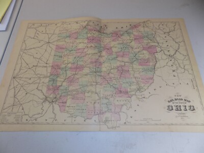
$3.50 Shipping Location: Franklin, United States Antique Map OHIO. Size 12"x 10.5" Center Fold. Fold / crease top right corner. 4 tiny tears right edge. J. M. Stoddart & Co.
Buy It Now
$6.95 Shipping Location: Dover, United States Very rare late 19th century antique tall folio sheet color lithographed promotional map. Issued to promote the atlas publications of Rand McNally, printed ... morewith promotional text across top created specifically for this single sheet.
Buy It Now
$8.00 Shipping Location: Bristol, United States Very Rare and Original Hand Drawn map of Cincinnati Ohio Dated April 1, 1882Showing United Railroads stockyard, houses, Rivers, roads and even the baseball ... moregrounds 56” X 20”
Buy It Now
Free Shipping Location: Dublin, United States Vintage Rare Rand McNally 1909 OHIO MAP CONGRESSIONAL DISTRICTS - RAILROAD & ELECTRIC LINES . Please study photos for condition. Shipped with USPS First ... moreClass Package. Please message me with any questions and thanks for viewing! Measures 27”x21”
Free Shipping Location: Schertz, United States The map is not " new " or in " new " condition, it was printed in 1889. The map is dated. Study the photos carefully, this is the actual map you will ... morereceive. The page is approx. 20" x 28.
$6.00 Shipping Location: Carefree, United States ORIGINAL ANTIQUE 1897 COLOR MAP OFNORTHERN OHIO. ALSO SHOWN IS PARK OF LAKE ERIE, LIGHTHOUSE LOCATIONS AND WATER DEPTHS IN LAKE ERIE. MAP HAS SCALES BELOW ... moreTITLE. GOOD CONDITION, DISCOLORATION, CENTER CREASE AS ISSUED.
Buy It Now
$4.99 Shipping Location: Fairview, United States
Buy It Now
Free Shipping Location: Iowa City, United States This color map ofOhio is dated 1891 on the face. Counties, County Seats,Cities; many Small Towns and Villages; Canals, Ports, Military Airfields and Forts; ... moreRivers, Streams, and Lakes; and other topographical features are located on this map.
Buy It Now
$4.95 Shipping Location: Willow Grove, United States This is an ORIGINAL Ohio map taken from a 1945 atlas. There is a map image and text on the reverse side of this map page.
Buy It Now
$5.50 Shipping Location: Easton, United States This map has light toning, archival tissue on full back. Colored Map. Item For Sale.
Buy It Now
Free Shipping Location: Monroeville, United States Date - 1876. Source - Illustrated Atlas of Noble County, Ohio. Size - about - 17.5x27", hand-colored.
Buy It Now
$8.85 Shipping Location: Aumsville, United States ohio vintage map 1891 railroads and counties int cyclopedia.
Buy It Now
Free Shipping Location: Sayville, United States Plate 17 from the 1897/1902 Century Atlas.
Buy It Now
$10.16 Shipping Location: Mount Morris, United States This original 1927 USGS quadrangle map of Swanton, covering parts of Ohio and Michigan, is a must-have for any antique map collector or enthusiast. Measuring ... more17x21 inches, the map is in excellent condition and features detailed topographical information, including contour lines and bodies of water. The map also includes important historical information, such as the locations of railroads and towns. Whether you're a resident of Ohio or Michigan, or just interested in the history of this region, this map is sure to be a valuable addition to your collection.
Buy It Now
$3.95 Shipping Location: Clarkston, United States Lake13 Guide To Kansas Lake14 Page's Map of Kansas, 1885. Lake01 Cover Lake02 Illustrated Atlas of Lake County, Illinois - Title Page. Lake31 Guide To ... moreColorado Lake32 Page's Map of Colorado, 1885. This DVD is part of our Historic Atlas Collection.

Buy It Now
$11.00 Shipping Location: Rockville, United States Up for sale is an ANTIQUE TOPOGRAPHIC map of"MARION. OHIO" Includes Mansfield and Columbus, as well. Printed by the Army Map Service. Corps ... moreof Engineers, Department of the Army. Edition of 1950. This map measures approximately 29 x 24 inches. Including the border area. On the reverse side, there is 1 gray& white map of Williamsport, PA& Vicinity. The map has specific details to it and shows various attributes- different road surfaces. Buildings, barnes, greenhouses, railroads, national boundaries, State boundaries, towns, woods, vineyards, marshes, mine tunnels, steep slopes, tunnels, bridges, etc. Map is generally in Good condition. It has been stored in a roll for many years. So it naturally rolls up now. The map has some wear and browning. There are some creases and tears around the edges of the paper and other stains along the edges. It is"crumpled" along the top edge. There are other creases and dings here and there. As well. This map is a great piece of history! It will look very nice when framed. Please see my store for other great items. Inventory MS- Box 1- Map#27
Buy It Now
Free Shipping Location: Sayville, United States Plate 17 from the 1897 Century Atlas.
Buy It Now
Free Shipping Location: Sayville, United States See photo's.
Buy It Now
Free Shipping Location: Kennebunk, United States This Map was removed from a 1874 Atlas and is in good acceptable condition. Study the photos carefully, this is the actual map you. Including Hundreds ... moreof RareCivil War.
Buy It Now
$6.97 Shipping Location: Bluffton, United States Large sheet 25" x 17 1/2" with a map inside the border of 21 7/8" x 16 3/8". Overall fine. Colors are still vibrant. Impressive for 120+ years old. Zoom ... moreto inspect.
Buy It Now
Free Shipping Location: Schertz, United States This antique original map of Ohio from 1886 features all the townships and railroads of the state. With vibrant colors, the map measures 17x27 inches ... moreand was published by J.T. Barker and H.R. Page & Co. The map is a rare find, printed over a century ago and still in great condition. The cartographer and publisher put careful attention to detail, making it a valuable piece for collectors of North American maps and antiques. This map is a unique representation of Ohio's history and would make a great addition to any collection.
Buy It Now
Free Shipping Location: Schertz, United States The map is not " new " or in " new " condition, it was printed in 1892. The map is not dated. Study the photos carefully, this is the actual map you will ... morereceive. The page is approx. 17" x 25".
Buy It Now
$10.00 Shipping Location: Montrose, United States Publisher: Pickaway County Ohio Atlas G.O. Titus. Date: 1871. Salt Creek is a stream located in southeastern Ohio, primarily flowing through the counties ... moreof Hocking and Vinton. Historical Significance: Salt Creek has historical importance due to the presence of salt springs along its banks.
Buy It Now
$15.00 Shipping Location: Seminole, United States Offered For Sale is an Antique 1870 Hand Colored County Map of Illinois, Indiana & Ohio With Railroads - From the New Topographical Atlas Gazetteer - ... moreunder shrink wrap laying on a backing board - please excuse the glare in the photos from the shrink wrap - edge wear, but the image is excellent, with vibrant colors - size is about 11 1/2" x 16 1/4".
Buy It Now
Free Shipping Location: Sayville, United States THE CENTURY COMPANY ATLAS MAP PLATE#18 OHIO SOUTHERN PART 1897 VINTAGE The Century Atlas Company of New York City map plate#18 Ohio Southern Part circa ... more1897. Measures 11 3/4 X 16 1/4 inches in size(30 X 41cm) Map is an authentic original in good condition as shown in photos. Map printed on high quality paper suitable for framing.
Buy It Now
Free Shipping Location: Sayville, United States See photo's.
Buy It Now
Free Shipping Location: Monroeville, United States Click Here. Double your traffic. Get Vendio Gallery- Now FREE! Gorgeous. Antique 1875 handcolored map, the map is a large folding map, titled New Map ... moreof Ohio, Prepared Especialy for Evert's Illustratd Historical Atlas, by H.H. Lloyd& Co, 21 John St N.Y. Has Population of Ohio, by Counties, 1870, also United States and Principal Cities, alldated 1870. This dates the map nicely. The map has some large tears repaired on reverse with archival paper and tape, the tears were at the bottom and some of the map is lost at lower right, but has archival paper replacing it, see my photo, still a fascianting gorgeous huge period Ohio map. The map is printed on very thick paper. The superb handcoloring is period to the map. The map is from the rare 1875 Everts Atlas of Tuscarawas County Ohio. The map is in nice condition, and would frame and display beautifully. The size of the map is 23" by 25.5" Rare. Winning bidder pays $4.00 shipping domestic, more foreign. Payment I accept the following forms of payment: PayPal Click to View Image Album Shipping& Handling US Shipping. $4.00 USPS First-Class Mail® International Shipping. $9.00 USPS First-Class Mail International FREE scheduling. Supersized images and templates. Get Vendio Sales Manager. FREE scheduling. Supersized images and templates. Get Vendio Sales Manager. di,RcmdId ViewItemDescV4,RlogId p4%60bo7%60jtb9%3Fuk%601d72f%2Bishhov%3C%3Edi-13cf165eb66-0xf7-
Buy It Now
$8.95 Shipping Location: Eden, United States (See photos) A nice example of railway infrastructure during the the late Victorian period.
Buy It Now
$6.20 Shipping Location: Mount Washington, United States Ener litit l st here Enter listing title here Enter listing title here Enter listing title here Enter listing title here Enter list1tle here Dimensions: ... moreapproximately 8 x 12 1/2 Enter listing title here Enter title list herDimensions No Reasonable Offer Refused SKU 1135.

Buy It Now
$11.00 Shipping Location: Rockville, United States Up for sale is an ANTIQUE TOPOGRAPHIC map of"CANTON. OHIO" Includes parts of Pennsylvania(Pittsburgh) and West Virginia(Wheeling) Printed by ... morethe Army Map Service. Corps of Engineers, Department of the Army. Edition of 1950. This map measures approximately 29 x 24 inches. Including the border area. On the reverse side, there are 3 gray and white maps- Canton, Ohio& Vicinity, Wheeling, W. Virginia& Vicinity and Pittsburgh, PA& Vicinity. The map has specific details to it and shows various attributes- different road surfaces. Buildings, barnes, greenhouses, railroads, national boundaries, State boundaries, towns, woods, vineyards, marshes, mine tunnels, steep slopes, tunnels, bridges, etc. Map is generally in Good condition. It has been stored in a roll for many years. So it naturally rolls up now. The map has some wear and browning. There are some creases and tears around the edges of the paper and other stains along the edges. It is"crumpled" along the top edge. There are other creases and dings here and there. As well. This map is a great piece of history! It will look very nice when framed. Please see my store for other great items. Inventory MS- Box 1- Map#23

Buy It Now
$3.95 Shipping Location: Clarkston, United States Coins of India Reference Library This CD is part of our Historic Atlas Collection. We have dozens of Atlas maps on CD ranging from the 1500s to the 1900s ... morecovering many areas and topics. Please Check our Ebay Store for what's available. VERY LARGE HIGH RESOLUTION MAP COLLECTION ON CD-ROM! please see full table of contents and sample illustrations below) Title of this Atlas: New topographical atlas and gazetteer of Indiana comprising a topographical view of the several counties of the state. Together with a railroad map of Ohio. Indiana, and Illinois, an alphabetical gazetteer giving a concise description and the location of cities. Villages, post-offices, railroad stations. Landings, etc. and a brief history of Indiana. Including complete maps of the United States. Europe. And the world, drawn on the polyconic projection. Expressly for this work. Compiled from the latest astronomical observations. Official surveys and records of the United States and territories. And the several states. As well as from counties, towns, and personal observations. Engraved on copper-plate. And lithographed from original drawings. 1870 Features of this CD-ROM This auction is for a CD-ROM of the maps listed in electronic form. NOT the maps themselves. These maps are VERY high resolution and can be printed at FULL SCALE or LARGER for framing and display. The results are very high quality and convincing The files are in PDF format for easy of viewing and printing. Maps can be viewed and many scales and zoom features are available as with any PDF file. 0005478a 0005478b 0005478c 5478001 5478002 5478003 5478004 5478005 5478006 5478007 5478008 5478009 5478010 5478011 Ad and CD-ROM copyright 2011 Euriskodata All Rights Reserved Powered by The free listing tool. List your items fast and easy and manage your active items.

Buy It Now
$11.00 Shipping Location: Rockville, United States Up for sale is an ANTIQUE TOPOGRAPHIC map of"CLEVELAND. OHIO" It also includes Akron, Ohio and parts of Pennsylvania(New Castle) Printed by ... morethe Army Map Service. Corps of Engineers, Department of the Army. Edition of 1950. This map measures approximately 29 x 24 inches. Including the border area. On the reverse side, are 4 gray and white maps- Cleveland, Ohio& Vicinity, Akron, Ohio& Vicinity, Youngstown, Ohio& Vicinity and New Castle, Pennsylvania& Vicinity. The map has specific details to it and shows various attributes- different road surfaces. Buildings, barnes, greenhouses, railroads, national boundaries, State boundaries, towns, woods, vineyards, marshes, mine tunnels, steep slopes, tunnels, bridges, etc. Map is generally in Good condition. It has been stored in a roll for many years. So it naturally rolls up now. The map has some wear and browning. There are some creases and tears around the edges of the paper and other stains along the edges. There are other creases and dings here and there. As well. This map is a great piece of history! It will look very nice when framed. Please see my store for other great items. Inventory MS- Box 1- Map#34 40g.RcmdId ViewItemDescV4,RlogId p4%60bo7%60jtb9%3Fuk%601d72f%2B%3E40g-14bed989765-0x10b-
Buy It Now
Free Shipping Location: Sayville, United States On the rear is an area and population table for each county with data from the 1890 and 1900 census. See photo's.
Buy It Now
Free Shipping Location: Kennebunk, United States ASHTABULA,OHIO1874/072021. This Map was removed from a 1874 Atlas and is in good acceptable condition. Study the photos carefully, this is the actual ... moremap you. Only Authentic Originals.
Buy It Now
$4.00 Shipping Location: Winter Springs, United States The map is titled 2nd & 3d Wards of Cleveland. Beautiful map. Printed on thick paper, with no printing on reverse. The condition of the map is amazing. ... moreNice outside ornate border as well. This is an antique map and not a reprint or reproduction.
Buy It Now
Free Shipping Location: Monroeville, United States Date - 1895.
Buy It Now
$10.00 Shipping Location: Montrose, United States Publisher:Pickaway Ohio Atlas G.O. Titus. Date: 1871.
Buy It Now
$10.00 Shipping Location: Montrose, United States Publisher:Pickaway County Ohio Atlas G.O. Titus. Date: 1871.

Buy It Now
$11.00 Shipping Location: Rockville, United States Up for sale is an ANTIQUE TOPOGRAPHIC map of"TOLEDO. OHIO" Includes parts of Michigan(Monroe) Printed by the Army Map Service. Corps of Engineers, ... moreDepartment of the Army. Edition of 1949. This map measures approximately 29 x 24 inches. Including the border area. On the reverse side, there are 2 gray and white maps- Toledo, Ohio& Vicinity, and Monroe, Michigan& Vicinity. The map has specific details to it and shows various attributes- different road surfaces. Buildings, barnes, greenhouses, railroads, national boundaries, State boundaries, towns, woods, vineyards, marshes, mine tunnels, steep slopes, tunnels, bridges, etc. Map is generally in Fair+ condition. It has been stored in a roll for many years. So it naturally rolls up now. The map has some wear and browning. There are some creases and tears around the edges of the paper and other stains along the edges. It is"crumpled" along the top and bottom edge and there are chips in the corners. There are other creases and dings here and there. As well. This map is a great piece of history! It will look very nice when framed. Please see my store for other great items. Inventory MS- Box 1- Map#25
Buy It Now
$6.95 Shipping Location: Dover, United States Plan of Cincinnati and Vicinity. Fine 19th century engraved map, with original hand color. Issued c. 1867-9, Philadelphia by S.A. Mitchell.
Buy It Now
$10.00 Shipping Location: Montrose, United States Date: 1871. Publisher:Pickaway County Ohio Atlas G.O. Titus. Condition: good, normal aging, a little stain on bottom left (see pictures).
Buy It Now
Free Shipping Location: Schertz, United States The map is not " new " or in " new " condition, it was printed in 1892. The map is not dated. Study the photos carefully, this is the actual map you will ... morereceive. The page is approx. 12" x 17".
Buy It Now
$8.00 Shipping Location: Coupland, United States The map is as shown: signs of normal wear/age/folds. Any new item will be unused.
Buy It Now
$5.40 Shipping Location: Elkhorn, United States X-------x Map from 1911 Rand McNally Atlas with State History. I also rely on internet research.
Buy It Now
$10.00 Shipping Location: Montrose, United States Date: 1871. Here is an overview of the history of Deer Creek and its surrounding area They were attracted to the fertile lands and abundant water sources, ... moreincluding Deer Creek.
Buy It Now
$4.69 Shipping Location: Greenacres, United States Original 1897 antique color lithographed map of northern Ohio, with decorative piano-key border, printed more than 115 years ago. This map is a great ... moreresource for researching family history, and it would make an impressive display in your den or office.
Buy It Now
$4.55 Shipping Location: Oakland, United States This beautiful antique map of Ohio from 1923 is a must-have for any collector of historical maps. Measuring 9x6 inches, it showcases the state's topography, ... moremajor cities, and landmarks during that time period. The map is in excellent condition and will make a great addition to any home or office.Featuring Ohio's counties, rivers, railroads, and more, this map provides a wealth of information about the state's geography. Whether you're a history buff or simply looking for a unique piece of decor, this antique map is sure to impress. Don't miss out on the opportunity to own a piece of Ohio's past.
Buy It Now
$4.99 Shipping Location: Fairview, United States Illustrated Atlas of Cuyahoga County Ohio, published in Philadelphia by Titus & Simmons, 1874. A copy of the title page is included with the map for authenticity. ... moreThere is tonal ageing, light edge wear, a few handling smudges and a few brown spots, see the pics for more on condition.
Buy It Now
$6.00 Shipping Location: Greenacres, United States The map locates two ferry crossings on the Ohio River, and it shows work in progress on the John A. Roebling Suspension Bridge, originally known as the ... moreCincinnati-Covington Bridge. When the bridge opened in 1866, three years after this map was printed, it was the longest suspension bridge in the world.
Buy It Now
Free Shipping Location: Schertz, United States The map is not " new " or in " new " condition, it was printed in 1892. The map is not dated. Study the photos carefully, this is the actual map you will ... morereceive. The page is approx. 17" x 25".
Buy It Now
$8.70 Shipping Location: Delaware, United States The map is in its original form and has not undergone any restoration or modification. West 51st yard. Original, not a copy. We have a second map that ... morewill be listed shortly after this one.
Buy It Now
$6.00 Shipping Location: North Wales, United States 1908 RARE ANTIQUE MCNALLY ATLAS MAP-OHIO RAILROAD & ELECTRICAL LINES ORIGINAL ATLAS MAP PLEASE SEE PHOTOS AS PART OF THE DESCRIPTION CONDITION: MAP IS ... moreIN GOOD CONDITION. APPROXIMATELY 21" X 27" SHIPPING: U.S. FIRST CLASS RATE - $7.00 - ANY ITEM WHICH SELLS FOR OVER $100 WILL REQUIRE INSURANCE WE COMBINE SHIPPING FOR MULTIPLE WINS. THANK YOU FOR YOUR INTEREST IN OUR AUCTIONS!.
Buy It Now
$6.97 Shipping Location: Bluffton, United States Fancy font title block upper left. 0&_from=R40&_trksid=p2046732.m570.l1313&_nkw=ohio&_sacat=0. Large 18 7/8" x 12 1/4" actual map size inside the border ... morewith margin beyond. The other side is text. Overall fine.
Buy It Now
Free Shipping Location: Kennebunk, United States This Map was removed from a 1874 Atlas and is in good acceptable condition. Study the photos carefully, this is the actual map you. Only Authentic Originals.
Buy It Now
$4.50 Shipping Location: United States This is an antique map and not a reprint or reproduction. The handcoloring on the map is period to the map, this is before color printing. The map is ... morefrom the very rare 1874 Everts Atlas of Greene County Ohio.
Buy It Now
$6.00 Shipping Location: Denver, United States Folding hand-colored map on bank note paper in original brown cloth pocket covers, irregularly paginated [7 ads], [2], 92-101, 4, 2, 33-41, 62-67, [3 ... moreblank], [4 ads] plus folding color map "Asher & Adams' Ohio & Indiana".
Buy It Now
$6.97 Shipping Location: Bluffton, United States Fancy font title block lower right. Large 18 7/8" x 12 1/4" actual map size inside the border with margin beyond. The other side is text. 0&_from=R40&_trksid=p2046732.m570.l1313&_nkw=ohio&_sacat=0.
Buy It Now
$4.50 Shipping Location: United States Dated 1870 at uppper left hand side. Has large tape repaair at bottom. Map is very detailed and huge. This is an antique map and not a reprint or reproduction. ... moreThe handcoloring on the map is period to the map, this is before color printing.
Buy It Now
$6.95 Shipping Location: Dover, United States Issued c. 1860, Philadelphia by S.A. Mitchell. Mid 19th century engraved map with original hand color. Plan of Baltimore.
Buy It Now
$3.50 Shipping Location: Dover, United States Flushing Quadrangle Ohio- 15 Minute Series. Places: Fairview, Belmont, Bethesda, Holloway, Flushing, Morristown, Lafferty, Piedmont. Year Published: 1959. ... moreThe map in the photo is the actual map you will receive.
|
|
|
In
|
Ohio Map: Authentic 1883; Counties, Cities, Towns, Topography, Railroads
1883 Engraved Color Map Ohio This is a 119+ Year-Old Map- NOT a Reproduction(Scan of copyright of American Cyclopaedia from which this map was removed is shown below) Printed on a single sheet of medium weight paper(blank on the reverse) with a fold in the center. Bordered map area is about 9.25" x 11.5" with margins sufficient to allow matting or framing-pictured below without the full margins to allow image to load a little quicker. Condition: is very good. As shown. Map shows all counties; county seat towns; other major cities and some smaller towns. Shows general topography; and rivers& railroads are located. I've included a close-up scan below to show detail and quality. Bid with confidence- Returnable for any reason within 10 days for prompt refund. Powered by The free listing tool. List your items fast and easy and ... moremanage your active items.
|
|
|
Ohio TWO Maps: Authentic 1897 (Dated) Towns, Counties, Railroads, Topography
1897 Engraved Color Map Ohio(on Two Sheets) Satisfaction Guaranteed These are 110+ Year-Old Maps NOT Reproductions These maps were removed from the Century Atlas. Published by The Century Co. in 1897. Map of the entire state is printed on two sheets. The sheets are blank on the reverse with the exception of the map name and number. Dated 1897 on the face of the map. The boxed area of each map is about 10" by 15" And there are sufficient borders to allow easy matting or framing. Shown below without the full borders to allow the images to load a bit more quickly. These color maps of Ohio are dated 1897 on the face and were"specially engraved for the Century Co. by the Matthews-Northrup Co. Buffalo. NY" These maps includes fine topographic& political detail. Such as: counties, cities, towns, rivers and mountains. Principal ... morerailroads are shown in red and for the most part. Identified. There are inset maps of Cleveland and Cincinnati. Close-ups below shows detail. Bid with confidence- Returnable for any reason within 10 days for prompt refund. Powered by The free listing tool. List your items fast and easy and manage your active items.
|
|
|
OHIO Map: Dated 1891 showing Towns, Counties, Railroads with 1890 Populations
1891 Engraved Color Map: Ohio This is a genuine map from 1891- NOT a Reproduction This color map of Ohio is dated 1891 on the face and was included in an encyclopedia set published between 1891 and 1896. Major railroads are shown and it is interesting to see where they run-and where they don't! The map is printed on medium weight paper. Blank on the reverse with the exception of area and population figures(by county) from the 11th Census of 1890. Total Population in the state was 3.672,316 and in Hamilton County[Cincinnati] it was only 374.573! This printing is NOT part of the encyclopedia text, but was printed by the lithographer when the map itself was prepared. Sheet size is 9.75" x 12.5" and the image is approximately 8.25" x 10.5" There is a fold in the center. Condition is Excellent The above illustration is ... morea fairly accurate representation of the map. The close-up image below shows the area around Toledo and is included to give an idea of the map's detail and quality. This is an attractive map and would look good in an antique or contemporary frame. Bid with confidence- Returnable for any reason within 10 days for prompt refund_ charges. Powered by The free listing tool. List your items fast and easy and manage your active items.
|
|
|
OHIO Map: Authentic 1907 (dated) with Counties, Towns, Topography, Railroads
1907 Engraved Color Map: Ohio Satisfaction Guaranteed This color map of Ohio is dated 1907 on the face and was included in an encyclopedia set published in 1907-1908. It was engraved and printed by the LL Poates Co. NY, NY. The map shows all of the state's counties; county seat towns; major cities and many small towns& villages; rivers& streams; and topographic detail. Most of the state's railroads and all of the Major railroads are shown in red. The map is printed on medium weight paper. Blank on the reverse and with a fold in the center(as issued) Bordered map area is about 8.5" x 10.5" with margins of between 1/2" to 1 inch all the way around to allow convenient matting. This is a very attractive older map and would look beautiful- matted and framed. If you want a detailed map showing the state as it was ... more100 years ago. This is a good one. Map is shown below without full margins; and the second image below is a close-up of the area around Columbus and is included to show quality and detail. One of the following copyright dates appears on the face of this map. Bid with confidence- Returnable for any reason within 10 days for prompt refund. Powered by The free listing tool. List your items fast and easy and manage your active items.
|
|
|
Ohio: Authentic 1889 Map showing Counties, Cities, Topography, Railroads
Authentic 1889 Color Map of Ohio Showing all counties; many cities and towns; rivers; railroads& general topographical features Satisfaction Guaranteed This color map of Ohio was prepared by J. M. Stoddard& Co. and was included in Encylopaedia(Encyclopedia) Britannica's Ninth Edition as published in 1889 by the New York publisher Charles Scribner's Sons. This is a genuine 1889 map-NOT a reproduction. The map is printed on medium weight paper with a fold in the center-blank on the reverse. Bordered area is about 9.5" x 11" Condition is very good-as shown. The above illustration is a very accurate representation of the map. And below is a close-up to show detail and quality. Bid with confidence- Returnable for any reason within 10 days for prompt refund. Powered by The free listing tool. List your items fast and easy ... moreand manage your active items.
|
|
|
Ohio Map: Authentic 1895 (Dated) showing Towns, Counties, Railroads & More
1895 Engraved Color Map of Ohio This is a 114+ Year-old Map. NOT a Reproduction Satisfaction Guaranteed Boxed map area is about 10" by 13" with ample margins to allow easy matting or framing. Pictured below without full margins. Printed on medium weight paper which is blank on the reverse. There is a fold in the center. There may be a short. Closed separation at the fold-never reaching the printed map. Very Good-as shown. This color map of Ohio is dated 1895 on the face. The map came from the atlas volume of the Century Dictionary(1894-1895) This was before the Century Company contracted with the Matthews-Northrup Co. to produce the more familiar Century Atlas maps that appeared after 1897. The maps of the earlier edition are considerably more colorful than those produced later. Principal Railroads are shown and many are identified ... moreby name. A close-up of this map showing the area around Toledo is pictured below to give an example of the engraving and detail. Satisfaction Guaranteed or RETURN for any reason within 10 days for prompt refund. Powered by The free listing tool. List your items fast and easy and manage your active items. 3j.RcmdId ViewItemDescV4,RlogId p4%60bo7%60jtb9%3Fuk%601d72f%2Bij%7Fil7g%3E3j-13da430baea-0xf7-
|
|
|
1900 CITY OF DAYTON OHIO GERMANTOWN MONTGOMERY COUNTY RAILROADS
TITLE OHIO MONTGOMERY COUNTY OHIO SOIL MAP DATED 1900 AT LOWER LEFT AND RIGHT DEPARTMENT OF AGRICULTURE VERY DETAILED MAP OF MONTGOMERY CUNTY OHIO SHOWING THE CITY OF DAYTON. GERMANTOWN, SALENA, MIAMISBURG, MIAMI CITY, STILLWATER AND BROOKVILLE. ALSO SHOWN ARE THE ROUTES OF ALL RAILROADS IN MONTGOMERY COUNTY OHIO. MEASURES 26 X 25 INCHES FAIR CONDITION HAS A FEW TEARS SOME OF WHICH HAVE BEEN REPAIRED ag14.RcmdId ViewItemDescV4,RlogId p4%60bo7%60jtb9%3Fuk.rp*bd%3Eag14-13fbcc48397-0xfc-
|
|
|
1883 OHIO COUNTY MAP WITH RAILROADS AND TOWNSHIPS HAND-COLORED
TITLE OHIO ISSUED BY GEORGE F. CRAM DATE 1883 THIS AUCTION IS FOR AN ORIGINAL HAND-COLORED ATLAS MAP OF OHIO SHOWING COUNTIES. TOWNSHIPS AND ALL WATERWAYS. ALSO SHOWN ARE THE ROUTES OF ALL RAILROADS WITHIN OHIO. MEASURES 9 X 11.5 INCHES FAIR MAP HAS CHIP MISSING AT BOTTOM
|
|
|
Original 1893 OHIO LAKE ERIE COLUMBUS Cincinnati Counties Railroads Color Map
Original 1893 OHIO LAKE ERIE COLUMBUS Cincinnati Counties Railroads Color Map Antique Map Description This original authentic antique map of Ohio in 1893 is an example of full-color lithography using wax engravings. It was published in 1893 by John F Waite of Chicago in an atlas titled"C. A. Gaskell's Family and Business Atlas of the World. The atlas publisher. John F Waite, was licensed to use the maps of George Cram. In the 1890's, the maps by Cram were synonymous with accuracy and innovation. Map of Cincinnati on reverse side. Map Details Authentic antique map. Not a reproduction or reprint Political and physical map Map locates very detailed county boundaries. Longitude/latitude, location of towns and cities as well as physical locations of rivers and creeks Image measures 9" x 12" Entire sheet measures 13.5" ... morex 11" Graph map scale Ample margins for framing Very good condition with no rips or tears and even ivory age toning Structurally sound and flexible paper. Looking for more maps? Search Antiqueprintopia! Just click on the old storefront above Antiqueprintopia has sold antique maps worldwide. Our customers include private collectors. Museums, historic preservation companies, interior designers. Antique shops and genealogists. inkfrog terapeak. InkFrog Analytics.
|
|
|
OHIO Map: Authentic 1899; Counties, Cities, Towns, Railroads, Topography
1899 Large Color Map Ohio This is a 100+ Year-Old Map- NOT a Reproduction(Scan of Atlas Copyright Page below) Printed on a single sheet with a fold in the center. Bordered map size is about 13.5" x 19.5" with margins sufficient to allow matting or framing-pictured below without the full margins to allow image to load a little quicker. Too big for my large scanner so scanned in two passes and then combined for the image below. A laser-printed facsimile of the copyright information as it appears in the atlas from which this original map was removed will be included. On a peel-off. Self-adhesive sheet. Purchasers who frame their maps frequently affix that copyright statement to the back of the frame. No break on map-scanned in two passes on a large scanner! This color map of Ohio was taken from a Cram Atlas with 1899 on the copyright ... morepage and 1900 on the title page. Much of the Census material throughout the atlas appears to be from the 1900 Census. But there is some data which has NOT been updated from the 1890 Census. The maps undoubtedly represent conditions as they existed in 1895 to 1899. Principal railroads are shown and labeled. Many of these roads are now defunct while some are still being used-operated by original proprietors or by their successors. Clear demarcation of county borders and a very thorough inclusion of Cites. Town, and even many small Villages. The close-up below shows the area surrounding Columbus and is included to give an example of the detail and quality of this map. The map is printed on medium weight paper. And is in very good condition-as shown. Bid with confidence- Returnable for any reason within 10 days for prompt refund. Powered by
|
|
|
TOLEDO WAYNESFIELD OHIO RAILROADS AND COUNTIES WAR DEPARTMENT A.C.O.E.
TITLE MAUMEE RIVER. TOLEDO O. TO FORT WAYNE INDIANA DATE 1911 ISSUED BY ARMY CORP ENGINEERS ORIGINAL FOLDING MAP OF THE MAUMEE RIVER SHOWING FROM GRAND RAPIDS AT LEFT TO TOLEDO. ALSO SHOWN ON MAP ARE THE ROUTES OF ALL RAILROADS IN THE VICINITY. MEASURES 13 X 24 INCHES FAIR CONDITION HAS FOXING AT FOLDS
|
|
|
CRAM'S OHIO RAILROADS TOWNSHIPS AND COUNTIES HAND-COLORED ATLAS MAP
TITLE OHIO ISSUED BY GEORGE CRAM DATE 1897 ORIGINAL HAND-COLORED ATLAS MAP OF OHIO SHOWING RAILROADS. TOWNSHIPS, COUNTIES AND WATERWAYS. MEASURES 13 X 11 INCHES FAIR-GOOD CONDITION
|
|
|
OHIO CENTRAL SECTION CINCINNATI RAILROADS, STREETS, PARKS AND OHIO RIVER
COMBINED SHIPPING FOR MULTIPLE PURCHASES TITLE CINCINNATI ISSUED BY COLLIERS ATLAS DATE 1945 THIS AUCTION IS FOR AN ORIGINAL MAP OF THE CITY OF CINCINNATI. MAP IS VERY DETAILED SHOWING ANY RAILROAD ROUTES. STREETS, PARKS AND GOVERNMENT BUILDINGS. MEASURES 14 X 10.5 INCHES GOOD CONDITION
|
|
|
OHIO Map: 100 Years Old showing Counties, Towns, Topography, Railroads
1911 Engraved Color Map: Ohio Satisfaction Guaranteed This color map of Ohio was included in an encyclopedia set published in 1911. It was engraved and printed by the LL Poates Co. NY, NY. The map shows all of the state's counties; county seat towns; major cities and many small towns& villages; rivers& streams; and topographic detail. Most of the state's railroads and all of the Major railroads are shown in red. The map is printed on medium weight paper. Blank on the reverse and with a fold in the center(as issued) Bordered map area is about 8.5" x 10.5" with margins of between 1/2" to 1 inch all the way around to allow convenient matting. This is a very attractive older map and would look beautiful- matted and framed. If you want a detailed map showing the state as it was 100 years ago. This is a good one. ... moreMap is shown below without full margins; and the second image below is a close-up of the area around Columbus and is included to show quality and detail. Bid with confidence- Returnable for any reason within 10 days for prompt refund. Powered by
|
|
|
BYESVILLE OAKWOOD DIVISION ATLAS OF GUERNSEY COUNTY OHIO WITH RAILROADS
I DO COMBINE SHIPPING ON MULTIPLE PURCHASES TITLE BYESVILLE ADDITIONS DATE 1914 ISSUED BY CARSON B DAVIS THIS AUCTION IS FOR AN ORIGINAL ATLAS MAP FROM THE ATLAS OF GUERNSEY COUNTY OHIO DATED 1914 BY CARSON B DAVIS SHOWING TOWNSHIP OF BYESVILLE AND IT'S RECENT PLATTED TRACTS OF LAND CONDITION FAIR. HAS STAINING AND TONING MEASURES 16 X 13 INCHES
|
|
|
1874 TALLMADGE TOWNSHIP OHIO SUMMIT COUNTY WITH RAILROADS AND PROPERTY OWNERS
TITLE MAP OF TALLMADGE TOWNSHIP ISSUED AND PUBLSIHED BY 1874 COMBINATION ATLAS MAP OF SUMMIT COUNTY OHIO BY TACKABURY. MEAD AND MOFFETT PHILADELPHIA. PA 1874 THIS AUCTION IS FOR AN ORIGINAL 1874 HAND-COLORED MAP OF TALLMADGE TOWNSHIP LOCATED IN SUMMIT COUNTY OHIO. MAP SHOWS TOWNSHIP OF TALLAMDGE WITH PROPERTY OWNERS NAMES. LAND TRACTS AND ALL RAILROAD ROUTES. MAP IS HAND-COLORED. PIC OF TITLE PAGE IS TO SHOW THE ATLAS FROM WHICH THE MAP WAS TAKEN. ON REVERSE IS MAP OF TALLMADGE CENTER MEASURES 17 X 13.5 INCHES CONDITION. MAP HAS SOME FOXING AND LIGHT STAINING DUE TO AGE, BINDING HOLES
|
|
|
1874 RICHFIELD TOWNSHIP OHIO SUMMIT COUNTY WITH RAILROADS AND PROPERTY OWNERS
TITLE MAP OF RICHFIELD TOWNSHIP ISSUED AND PUBLSIHED BY 1874 COMBINATION ATLAS MAP OF SUMMIT COUNTY OHIO BY TACKABURY. MEAD AND MOFFETT PHILADELPHIA. PA 1874 THIS AUCTION IS FOR AN ORIGINAL 1874 HAND-COLORED MAP OF RICHFIELD TOWNSHIP LOCATED IN SUMMIT COUNTY OHIO. MAP SHOWS TOWNSHIP OF RICHFIELD WITH PROPERTY OWNERS NAMES. LAND TRACTS AND ALL RAILROAD ROUTES. MAP IS HAND-COLORED. PIC OF TITLE PAGE IS TO SHOW THE ATLAS FROM WHICH THE MAP WAS TAKEN. MEASURES 17 X 13.5 INCHES CONDITION. MAP HAS SOME FOXING AND LIGHT STAINING DUE TO AGE
|
|
|
1874 NORTHAMPTON AND FRANKLIN TOWNSHIP OHIO SUMMIT COUNTY WITH RAILROADS RARE
TITLE MAP OF NORTHAMPTON TOWNSHIP AND FRANKLIN ON REVERSE ISSUED AND PUBLSIHED BY 1874 COMBINATION ATLAS MAP OF SUMMIT COUNTY OHIO BY TACKABURY. MEAD AND MOFFETT PHILADELPHIA. PA 1874 THIS AUCTION IS FOR AN ORIGINAL 1874 HAND-COLORED MAP OF NORTHAMPTON TOWNSHIP LOCATED IN SUMMIT COUNTY OHIO. MAP SHOWS TOWNSHIP OF NORTHAMPTON WITH PROPERTY OWNERS NAMES. LAND TRACTS AND ALL RAILROAD ROUTES. MAP IS HAND-COLORED. PIC OF TITLE PAGE IS TO SHOW THE ATLAS FROM WHICH THE MAP WAS TAKEN. MEASURES 17 X 13.5 INCHES CONDITION. MAP HAS SOME FOXING AND LIGHT STAINING DUE TO AGE, AND BINDING HOLES.
|
|
|
1874 AKRON 3RD AND 2ND WARDS OHIO SUMMIT COUNTY WITH RAILROADS HAND-COLORED
TITLE AKRON SECOND WARD AND ON REVERSE IS AKRON 3RD WARD ISSUED AND PUBLSIHED BY 1874 COMBINATION ATLAS MAP OF SUMMIT COUNTY OHIO BY TACKABURY. MEAD AND MOFFETT PHILADELPHIA. PA 1874 THIS AUCTION IS FOR AN ORIGINAL 1874 HAND-COLORED MAP OF THE 3RD AND 2ND WARDS IN AKRON LOCATED IN SUMMIT COUNTY OHIO. MAP SHOWS A PORTION OF AKRON WITH PROPERTY OWNERS NAMES. LAND TRACTS AND ALL RAILROAD ROUTES. MAP IS HAND-COLORED. PIC OF TITLE PAGE IS TO SHOW THE ATLAS FROM WHICH THE MAP WAS TAKEN. MEASURES 17 X 13.5 INCHES CONDITION. MAP HAS SOME FOXING AND LIGHT STAINING DUE TO AGE, AND BINDING HOLES AT SIDE
|
|
|
1874 TWINSBURGH OHIO SUMMIT COUNTY WITH RAILROADS AND PROPERTY OWNERS RARE
TITLE MAP OF TWINSBURGH TOWNSHIP ISSUED AND PUBLSIHED BY 1874 COMBINATION ATLAS MAP OF SUMMIT COUNTY OHIO BY TACKABURY. MEAD AND MOFFETT PHILADELPHIA. PA 1874 THIS AUCTION IS FOR AN ORIGINAL 1874 HAND-COLORED MAP OF TWINSBURGH TOWNSHIP LOCATED IN SUMMIT COUNTY OHIO. MAP SHOWS TOWNSHIP OF TWINSBURGH WITH PROPERTY OWNERS NAMES. LAND TRACTS AND ALL RAILROAD ROUTES. MAP IS HAND-COLORED. PIC OF TITLE PAGE IS TO SHOW THE ATLAS FROM WHICH THE MAP WAS TAKEN. MEASURES 17 X 13.5 INCHES CONDITION. MAP HAS SOME FOXING AND LIGHT STAINING DUE TO AGE, AND BINDING HOLES AT SIDE
|
|
|
1874 BATH TOWNSHIP OHIO SUMMIT COUNTY WITH RAILROADS AND PROPERTY OWNERS
TITLE MAP OF BATH TOWNSHIP ISSUED AND PUBLSIHED BY 1874 COMBINATION ATLAS MAP OF SUMMIT COUNTY OHIO BY TACKABURY. MEAD AND MOFFETT PHILADELPHIA. PA 1874 THIS AUCTION IS FOR AN ORIGINAL 1874 HAND-COLORED MAP OF BATH TOWNSHIP LOCATED IN SUMMIT COUNTY OHIO. MAP SHOWS TOWNSHIP OF BATH WITH PROPERTY OWNERS NAMES. LAND TRACTS AND ALL RAILROAD ROUTES. MAP IS HAND-COLORED. PIC OF TITLE PAGE IS TO SHOW THE ATLAS FROM WHICH THE MAP WAS TAKEN. ON REVERSE IS A LITHOGRAPH OF MISC FARMS IN BATH OHIO. MEASURES 17 X 13.5 INCHES CONDITION. MAP HAS SOME FOXING AND LIGHT STAINING DUE TO AGE, BINDING HOLES
|
|
|
1874 NORTHFIELD TOWNSHIP OHIO SUMMIT COUNTY WITH RAILROADS HUDSON CORP. ON REV.
TITLE MAP OF NORTHFIELD TOWNSHIP AND HUDSON CORP. COPLEY CENTER AND MONTROSE P.O. ON REVERSE ISSUED AND PUBLSIHED BY 1874 COMBINATION ATLAS MAP OF SUMMIT COUNTY OHIO BY TACKABURY. MEAD AND MOFFETT PHILADELPHIA. PA 1874 THIS AUCTION IS FOR AN ORIGINAL 1874 HAND-COLORED MAP OF NORTHFIELD TOWNSHIP LOCATED IN SUMMIT COUNTY OHIO. MAP SHOWS TOWNSHIP OF NORTHFIELD WITH PROPERTY OWNERS NAMES. LAND TRACTS AND ALL RAILROAD ROUTES. HUDSON CORP. COPLEY CENTER AND MONTROSE P.O. ON REVERSE. MAP IS HAND-COLORED. PIC OF TITLE PAGE IS TO SHOW THE ATLAS FROM WHICH THE MAP WAS TAKEN. MEASURES 17 X 13.5 INCHES CONDITION. MAP HAS SOME FOXING AND LIGHT STAINING DUE TO AGE, BINDING HOLES ON REVERSE
|
|
|
1874 HUDSON TOWNSHIP OHIO SUMMIT COUNTY WITH RAILROADS AND PROPERTY OWNERS
TITLE MAP OF HUDSON TOWNSHIP ISSUED AND PUBLSIHED BY 1874 COMBINATION ATLAS MAP OF SUMMIT COUNTY OHIO BY TACKABURY. MEAD AND MOFFETT PHILADELPHIA. PA 1874 THIS AUCTION IS FOR AN ORIGINAL 1874 HAND-COLORED MAP OF HUDSON TOWNSHIP LOCATED IN SUMMIT COUNTY OHIO. MAP SHOWS TOWNSHIP OF HUDSON WITH PROPERTY OWNERS NAMES. LAND TRACTS AND ALL RAILROAD ROUTES. ON REVERSE IS A LITHOGRAPH OF THE SOLDIER'S MONUMENT IN TWINSBURG OHIO. MAP IS HAND-COLORED. PIC OF TITLE PAGE IS TO SHOW THE ATLAS FROM WHICH THE MAP WAS TAKEN. MEASURES 17 X 13.5 INCHES CONDITION. MAP HAS SOME FOXING AND LIGHT STAINING DUE TO AGE, AND BINDING HOLES AT SIDE 336.RcmdId ViewItemDescV4,RlogId p4%60bo7%60jtb9%3Fvo%7B%3Dd70f%2B%3E336-144eddecdbd-0x110-
|
|
|
1874 AKRON 4TH AND 5TH WARDS TOWNSHIP OHIO SUMMIT COUNTY WITH RAILROADS AND
TITLE FOURTH WARD AND PART OF 6TH WARD AKRON ON REVERSE IS MAP OF FIFTH WARD AKRON ISSUED AND PUBLSIHED BY 1874 COMBINATION ATLAS MAP OF SUMMIT COUNTY OHIO BY TACKABURY. MEAD AND MOFFETT PHILADELPHIA. PA 1874 THIS AUCTION IS FOR AN ORIGINAL 1874 HAND-COLORED MAP OF THE 4TH WARD OF AKRON LOCATED IN SUMMIT COUNTY OHIO. MAP SHOWS 4TH WARD WITH PART OF THE 6TH WARD IN AKRON WITH PROPERTY OWNERS NAMES. LAND TRACTS AND ALL RAILROAD ROUTES. MAP IS HAND-COLORED. ON REVERSE IS MAP OF FIFTH WARD AKRON. PIC OF TITLE PAGE IS TO SHOW THE ATLAS FROM WHICH THE MAP WAS TAKEN. MEASURES 17 X 22 INCHES CONDITION. MAP HAS SOME FOXING AND LIGHT STAINING DUE TO AGE, SMALL TEAR AT TOP LEFT
|
|
|
1874 STOW TOWNSHIP OHIO SUMMIT COUNTY WITH RAILROADS AND PROPERTY OWNERS
TITLE MAP OF STOW TOWNSHIP ISSUED AND PUBLSIHED BY 1874 COMBINATION ATLAS MAP OF SUMMIT COUNTY OHIO BY TACKABURY. MEAD AND MOFFETT PHILADELPHIA. PA 1874 THIS AUCTION IS FOR AN ORIGINAL 1874 HAND-COLORED MAP OF STOW TOWNSHIP LOCATED IN SUMMIT COUNTY OHIO. MAP SHOWS TOWNSHIP OF STOW WITH PROPERTY OWNERS NAMES. LAND TRACTS AND ALL RAILROAD ROUTES. MAP IS HAND-COLORED. PIC OF TITLE PAGE IS TO SHOW THE ATLAS FROM WHICH THE MAP WAS TAKEN. ON REVERSE IS A LITHOGRAPH OF MISC HOUSES IN BOSTON TOWNSHIP OHIO MEASURES 17 X 13.5 INCHES CONDITION. MAP HAS SOME FOXING AND LIGHT STAINING DUE TO AGE, BINDING HOLES
|
|
|
1874 BOSTON TOWNSHIP OHIO SUMMIT COUNTY WITH RAILROADS AND PROPERTY OWNERS
TITLE MAP OF BOSTON TOWNSHIP ISSUED AND PUBLSIHED BY 1874 COMBINATION ATLAS MAP OF SUMMIT COUNTY OHIO BY TACKABURY. MEAD AND MOFFETT PHILADELPHIA. PA 1874 THIS AUCTION IS FOR AN ORIGINAL 1874 HAND-COLORED MAP OF BOSTON TOWNSHIP LOCATED IN SUMMIT COUNTY OHIO. MAP SHOWS TOWNSHIP OF BOSTON WITH PROPERTY OWNERS NAMES. LAND TRACTS AND ALL RAILROAD ROUTES. MAP IS HAND-COLORED. PIC OF TITLE PAGE IS TO SHOW THE ATLAS FROM WHICH THE MAP WAS TAKEN.ON REVERSE ARE MAPS OF BOSTON PENINSULA AND BOSTON MEASURES 17 X 13.5 INCHES CONDITION. MAP HAS SOME FOXING AND LIGHT STAINING DUE TO AGE, BINDING HOLES
|
|
|
1874 COPLEY TOWNSHIP OHIO SUMMIT COUNTY WITH RAILROADS AND LAND OWNERS RARE
TITLE MAP OF COPLEY TOWNSHIP ISSUED AND PUBLSIHED BY 1874 COMBINATION ATLAS MAP OF SUMMIT COUNTY OHIO BY TACKABURY. MEAD AND MOFFETT PHILADELPHIA. PA 1874 THIS AUCTION IS FOR AN ORIGINAL 1874 HAND-COLORED MAP OF COPLEY TOWNSHIP LOCATED IN SUMMIT COUNTY OHIO. MAP SHOWS TOWNSHIP OF COPLEY WITH PROPERTY OWNERS NAMES. LAND TRACTS AND ALL RAILROAD ROUTES. MAP IS HAND-COLORED. PIC OF TITLE PAGE IS TO SHOW THE ATLAS FROM WHICH THE MAP WAS TAKEN. ON REVERSE IS A LITHOGRAPH OF RESIDENCES IN COPLEY. MEASURES 17 X 13.5 INCHES CONDITION. MAP HAS SOME FOXING AND LIGHT STAINING DUE TO AGE, BINDING HOLES.RcmdId ViewItemDescV4,RlogId p4%60bo7%60jtb9%3Fvo%7B%3Dd70f%2Bf52%3E-144edfc69c2-0x110-
|
|
|
1886 CINCINNATI OHIO MAP WITH RAILROADS PROMINENT BUILDINGS AND HOTELS ORIGINAL
TITLE MAP OF CINCINNATI DATE 1886 NOT ON MAP ISSUED AND PUBLISHED BY GEORGE F CRAM THIS AUCTION IS FOR AN ORIGINAL MAP OF CINCINNATI OHIO. MAP SHOWS STREETS. PARKS AND THE COURSE OF THE OHIO RIVER AT BOTTOM. REFERENCE AT BOTTOM RIGHT LISTS PROMINENT BUILDINGS AND HOTELS. MEASURES 9.5 X 12 INCHES FAIR CONDITION. CROPPED CLOSE TO BRODER
|
|
|
Original 1889 Horse-Drawn Streetcar Map CINCINNATI Ohio River Bridges Railroads
Original 1889 Horse-Drawn Streetcar Map CINCINNATI Ohio River Bridges Railroads Original antique color lithographed street map of Cincinnati. Printed more than 124 years ago. It has excellent detail of the city's transportation system. Including horse-drawn streetcars, steam railroads, bridges, and ferries. The legend key locates prominent buildings and hotels, and the map labels a half-dozen neighborhoods in the city as well as towns across the Ohio River in Kentucky. Among the named places and features are Union Depot. Eden Park, Newport Ferry, Mt. Auburn, Corryville, Miami Canal, Camp Washington, House of Refuge, Jewish Cemetery, Inclined Plane, Fifth Street Ferry, Rohs Hill, Zig Zag Avenue, the Cincinnati, Hamilton& Dayton Railroad, Stock Yards, Work House, Fairmount, Dayton Ferry, Deer Park, Emery Arcade, Hughes High School, ... moreMasonic Temple, Gibson House, Merchants Hotel, Zoological Garden, and Covington Ferry. The scans below give a closer look: The image area measures 23.5 x 30 cm[9-1/4" x 11-3/4" The map was engraved by Fisk& Co. and published in 1889 by Hunt& Eaton. 805 Broadway, New York. Condition: This map is in excellent condition, bright and clean. With no marks. Rips, or tears. There is a vertical fold, as issued, and the map is blank, on the back, with no printing on the reverse side. This is an original. Authentic antique map, not a reproduction or modern reprint. And it is fully guaranteed to be genuine. It would make a very handsome display in your den or office. It would also make a perfect gift, and we'll include our helpful framing tips for your reference, along with a photocopy of the title page from the book in which it was published. The title page is dated on the verso: This map offers a fascinating view of city two dozen years after the Civil War. We are pleased to offer it with our unconditional. Money-back guarantee. SHIPPING: We gladly ship anywhere in the World. And we use sturdy, professional packing materials to assure safe delivery. The shipping charg
|
|
|
Original Map Of Ohio By Hardesty 1874 Hand Colored Columbus Railroads
Original Map Of Ohio By Hardesty 1874 Hand Colored Columbus Railroads OHIO 1874"Map of Ohio Published by H.H. Hardesty 1874" Hand colored. This 139 year old map is in very good condition, minor flaw in lower corner margin. Overall size 17 1/2" x 14" Purchase with confidence. We have been in the antique print, map, and document business since 1976 and guarantee our items as advertised. See additional photos below! The black circles that show in some of the listings are magnets that we use to hold image. To See More Photos/Scenes Powered by Click Here. Double your traffic. Get Vendio Gallery- Now FREE!
|
|
|
Cincinnati Ohio 1891 Map Hand Colored Railroads Streets Churches Buildings
Cincinnati Ohio 1891 Map Hand Colored Railroads Streets Churches Buildings CINCINNATI Original 1891"Map of Cincinnati Ohio" Hand colored. Fold as issued good condition, overall size 13' x 11' Purchase with confidence. We have been in the antique print, map, and document business since 1976 and guarantee our items as advertised. To See More Photos/Scenes Powered by
|
|
|
1890 WASHINGTON TOWNSHIP DEFIANCE COUNTY OHIO RAILROADS AND PROPERTY OWNERS
TITLE WASHINGTON DATE 1890 AT LOWER RIGHT CORNER ISSUED AND PUBLISHED BY GRIFFIN AND GORDON AND COMPANY PHILA PA. SOURCE; ATLAS OF DEFIANCE COUNTY OHIO 1890 THIS AUCTION IS FOR AN ORIGINAL MAP OF WASHINGTON TOWNSHIP LOCATED IN DEFIANCE COUNTY OHIO. MAP SHOWS PROPERTY OWNERS NAMES AS WELL AS SOME BUSINESSES IN THE AREA. ALL RAILROAD ROUTES ARE PRESENT AS WELL AS WATERWAYS. VERY DETAILED AND NICELY COLORED. TITLE PAGE IS NOT INCLUDED ONLY THE MAP MEASURES 16.5 X 14 INCHES CONDITION FAIR; MINOR DISCOLORATION DUE TO AGE
|
|
|
1890 MAP OF DEFIANCE COUNTY OHIO RAILROADS FARM LINES AND CITY OF DEFIANCE
TITLE OUTLINE PLAN OF DEFIANCE COUNTY OHIO DATE 1890 AT LOWER RIGHT CORNER ISSUED AND PUBLISHED BY GRIFFIN AND GORDON AND COMPANY PHILA PA. SOURCE; ATLAS OF DEFIANCE COUNTY OHIO 1890 THIS AUCTION IS FOR AN ORIGINAL MAP OF DEFIANCE COUNTY OHIO. MAP SHOWS SOME TOWNSHIPS AS WELL AS THE CITY OF DEFIANCE. ALL RAILROAD ROUTES ARE PRESENT AS WELL AS WATERWAYS. VERY DETAILED AND NICELY COLORED. TITLE PAGE IS NOT INCLUDED ONLY THE MAP MEASURES 16.5 X 14 INCHES CONDITION FAIR; MINOR DISCOLORATION DUE TO AGE 643.RcmdId ViewItemDescV4,RlogId p4%60bo7%60jtb9%3Feog4d71f%2B%3E643-147b9b656b6-0x115-
|
|
|
1890 CITY OF DEFIANCE 4TH AND 1ST WARDS COUNTY OHIO RAILROADS
TITLE 4TH AND PART OF 1ST WARDS CITY OF DEFIANCE DATE 1890 AT LOWER RIGHT CORNER ISSUED AND PUBLISHED BY GRIFFIN AND GORDON AND COMPANY PHILA PA. SOURCE; ATLAS OF DEFIANCE COUNTY OHIO 1890 THIS AUCTION IS FOR AN ORIGINAL MAP OF DEFIANCE TOWNSHIP LOCATED IN DEFIANCE COUNTY OHIO. MAP SHOWS PROPERTY OWNERS NAMES AS WELL AS SOME BUSINESSES IN THE AREA. ALL RAILROAD ROUTES ARE PRESENT AS WELL AS WATERWAYS. VERY DETAILED AND NICELY COLORED. TITLE PAGE IS NOT INCLUDED ONLY THE MAP MEASURES 17 X 27 INCHES CONDITION POOR-FAIR; MINOR DISCOLORATION DUE TO AGE. CENTER CREASE AS ISSUED AND 3.5 INCH TEAR AT CENTER FOLD
|
|
|
1890 DEFIANCE 3RD WARD EASTERN PART OHIO RAILROADS AND PROPERTY OWNERS
TITLE EAST PART OF 3RD WARD CITY OF DEFIANCE DATE 1890 AT LOWER RIGHT CORNER ISSUED AND PUBLISHED BY GRIFFIN AND GORDON AND COMPANY PHILA PA. SOURCE; ATLAS OF DEFIANCE COUNTY OHIO 1890 THIS AUCTION IS FOR AN ORIGINAL MAP OF THE EAST PART OF 3RD WARD CITY OF DEFIANCE LOCATED IN DEFIANCE COUNTY OHIO. MAP SHOWS PROPERTY OWNERS NAMES AS WELL AS SOME BUSINESSES IN THE AREA. ALL RAILROAD ROUTES ARE PRESENT AS WELL AS WATERWAYS. VERY DETAILED AND NICELY COLORED. TITLE PAGE IS NOT INCLUDED ONLY THE MAP MEASURES 16.5 X 14 INCHES CONDITION FAIR; MINOR DISCOLORATION DUE TO AGE
|
|
|
1890 LOGAN FARMER AND CLARKSVILLE TOWNSHIP DEFIANCE COUNTY OHIO RAILROADS
TITLE FARMER CENTER CLARKSVILLE LOGAN DATE 1890 AT LOWER RIGHT CORNER ISSUED AND PUBLISHED BY GRIFFIN AND GORDON AND COMPANY PHILA PA. SOURCE; ATLAS OF DEFIANCE COUNTY OHIO 1890 THIS AUCTION IS FOR AN ORIGINAL MAP OF LOGAN CLARKSVILLE AND FARMER CENTER TOWNSHIPS LOCATED IN DEFIANCE COUNTY OHIO. MAP SHOWS PROPERTY OWNERS NAMES AS WELL AS SOME BUSINESSES IN THE AREA. ALL RAILROAD ROUTES ARE PRESENT AS WELL AS WATERWAYS. VERY DETAILED AND NICELY COLORED. TITLE PAGE IS NOT INCLUDED ONLY THE MAP MEASURES 16.5 X 14 INCHES CONDITION FAIR; MINOR DISCOLORATION DUE TO AGE
|
|
|
1890 HICKSVILLE DEFIANCE COUNTY OHIO RAILROADS AND PROPERTY OWNERS
TITLE HICKSVILLE DATE 1890 AT LOWER RIGHT CORNER ISSUED AND PUBLISHED BY GRIFFIN AND GORDON AND COMPANY PHILA PA. SOURCE; ATLAS OF DEFIANCE COUNTY OHIO 1890 THIS AUCTION IS FOR AN ORIGINAL MAP OF HICKSVILLE TOWNSHIP LOCATED IN DEFIANCE COUNTY OHIO. MAP SHOWS PROPERTY OWNERS NAMES AS WELL AS SOME BUSINESSES IN THE AREA. ALL RAILROAD ROUTES ARE PRESENT AS WELL AS WATERWAYS. VERY DETAILED AND NICELY COLORED. TITLE PAGE IS NOT INCLUDED ONLY THE MAP MEASURES 16.5 X 14 INCHES CONDITION FAIR; MINOR DISCOLORATION DUE TO AGE
|
|
|
1890 NOBLE TOWNSHIP DEFIANCE COUNTY OHIO RAILROADS AND PROPERTY OWNERS
TITLE NOBLE DATE 1890 AT LOWER RIGHT CORNER ISSUED AND PUBLISHED BY GRIFFIN AND GORDON AND COMPANY PHILA PA. SOURCE; ATLAS OF DEFIANCE COUNTY OHIO 1890 THIS AUCTION IS FOR AN ORIGINAL MAP OF NOBLE TOWNSHIP LOCATED IN DEFIANCE COUNTY OHIO. MAP SHOWS PROPERTY OWNERS NAMES AS WELL AS SOME BUSINESSES IN THE AREA. ALL RAILROAD ROUTES ARE PRESENT AS WELL AS WATERWAYS. VERY DETAILED AND NICELY COLORED. TITLE PAGE IS NOT INCLUDED ONLY THE MAP MEASURES 16.5 X 14 INCHES CONDITION FAIR; MINOR DISCOLORATION DUE TO AGE
|
|
|
1890 MAP OF OHIO GOVERNMENT SURVEYS WITH RAILROADS AND TOWNSHIPS
TITLE MAP OF OHIO SHOWING SYSTEM OF GOVERNMENT SURVEYS DATE 1890 AT LOWER RIGHT CORNER ISSUED AND PUBLISHED BY GRIFFIN AND GORDON AND COMPANY PHILA PA. SOURCE; ATLAS OF DEFIANCE COUNTY OHIO 1890 THIS AUCTION IS FOR AN ORIGINAL MAP OF OHIO. MAP SHOWS THE DIFFERENT GOVERNMENT SURVEYS WITHIN THE STATE OF OHIO. ALSO SHOWN ARE ALL RAILROAD ROUTES AS WELL AS SOME TOWNSHIPS. VERY DETAILED AND NICELY COLORED. TITLE PAGE IS NOT INCLUDED ONLY THE MAP MEASURES 16.5 X 14 INCHES CONDITION FAIR; MINOR DISCOLORATION DUE TO AGE
|
|
|
1890 FARMER TOWNSHIP DEFIANCE COUNTY OHIO RAILROADS AND PROPERTY OWNERS
TITLE FARMER DATE 1890 AT LOWER RIGHT CORNER ISSUED AND PUBLISHED BY GRIFFIN AND GORDON AND COMPANY PHILA PA. SOURCE; ATLAS OF DEFIANCE COUNTY OHIO 1890 THIS AUCTION IS FOR AN ORIGINAL MAP OF FARMER TOWNSHIP LOCATED IN DEFIANCE COUNTY OHIO. MAP SHOWS PROPERTY OWNERS NAMES AS WELL AS SOME BUSINESSES IN THE AREA. ALL RAILROAD ROUTES ARE PRESENT AS WELL AS WATERWAYS. VERY DETAILED AND NICELY COLORED. TITLE PAGE IS NOT INCLUDED ONLY THE MAP MEASURES 16.5 X 14 INCHES CONDITION FAIR; MINOR DISCOLORATION DUE TO AGE
|
|
|
1890 TIFFIN TOWNSHIP DEFIANCE COUNTY OHIO RAILROADS AND PROPERTY OWNERS
TITLE TIFFIN DATE 1890 AT LOWER RIGHT CORNER ISSUED AND PUBLISHED BY GRIFFIN AND GORDON AND COMPANY PHILA PA. SOURCE; ATLAS OF DEFIANCE COUNTY OHIO 1890 THIS AUCTION IS FOR AN ORIGINAL MAP OF TIFFIN TOWNSHIP LOCATED IN DEFIANCE COUNTY OHIO. MAP SHOWS PROPERTY OWNERS NAMES AS WELL AS SOME BUSINESSES IN THE AREA. ALL RAILROAD ROUTES ARE PRESENT AS WELL AS WATERWAYS. VERY DETAILED AND NICELY COLORED. TITLE PAGE IS NOT INCLUDED ONLY THE MAP MEASURES 16.5 X 14 INCHES CONDITION FAIR; MINOR DISCOLORATION DUE TO AGE
|
|
|
1890 AYERSVILLE JEWELL AND DELAWARE TOWNSHIPS DEFIANCE COUNTY OHIO RAILROADS
TITLE AYERSVILLE DELAWARE BEND AND JEWELL DATE 1890 AT LOWER RIGHT CORNER ISSUED AND PUBLISHED BY GRIFFIN AND GORDON AND COMPANY PHILA PA. SOURCE; ATLAS OF DEFIANCE COUNTY OHIO 1890 THIS AUCTION IS FOR AN ORIGINAL MAP OF AYERSVILLE. JEWELL AND DELAWARE BEND TOWNSHIPS LOCATED IN DEFIANCE COUNTY OHIO. MAP SHOWS PROPERTY OWNERS NAMES AS WELL AS SOME BUSINESSES IN THE AREA. ALL RAILROAD ROUTES ARE PRESENT AS WELL AS WATERWAYS. VERY DETAILED AND NICELY COLORED. TITLE PAGE IS NOT INCLUDED ONLY THE MAP MEASURES 16.5 X 14 INCHES CONDITION FAIR; MINOR DISCOLORATION DUE TO AGE. SOME SMUDGES
|
|
|
1890 HICKSVILLE TOWNSHIP DEFIANCE COUNTY OHIO RAILROADS AND PROPERTY OWNERS
TITLE SOUTH PART OF HICKSVILLE DATE 1890 AT LOWER RIGHT CORNER ISSUED AND PUBLISHED BY GRIFFIN AND GORDON AND COMPANY PHILA PA. SOURCE; ATLAS OF DEFIANCE COUNTY OHIO 1890 THIS AUCTION IS FOR AN ORIGINAL MAP OF HICKSVILLE TOWNSHIP LOCATED IN DEFIANCE COUNTY OHIO. MAP SHOWS PROPERTY OWNERS NAMES AS WELL AS SOME BUSINESSES IN THE AREA. ALL RAILROAD ROUTES ARE PRESENT AS WELL AS WATERWAYS. VERY DETAILED AND NICELY COLORED. TITLE PAGE IS NOT INCLUDED ONLY THE MAP MEASURES 17 X 27 INCHES CONDITION FAIR; MINOR DISCOLORATION DUE TO AGE. CENTER CREASE AS ISSUED AND SMUDGING AT LOWER RIGHT
|
|
|
1890 INDEPENDENCE AND MARK CENTER DEFIANCE COUNTY OHIO RAILROADS
TITLE MARK CENTER AND INDEPENDENCE DATE 1890 AT LOWER RIGHT CORNER ISSUED AND PUBLISHED BY GRIFFIN AND GORDON AND COMPANY PHILA PA. SOURCE; ATLAS OF DEFIANCE COUNTY OHIO 1890 THIS AUCTION IS FOR AN ORIGINAL MAP OF INDEPENDENCE AND MARK CENTER TOWNSHIPS LOCATED IN DEFIANCE COUNTY OHIO. MAP SHOWS PROPERTY OWNERS NAMES AS WELL AS SOME BUSINESSES IN THE AREA. ALL RAILROAD ROUTES ARE PRESENT AS WELL AS WATERWAYS. VERY DETAILED AND NICELY COLORED. TITLE PAGE IS NOT INCLUDED ONLY THE MAP MEASURES 16.5 X 14 INCHES CONDITION FAIR; MINOR DISCOLORATION DUE TO AGE
|
|
|
1890 DELAWARE TOWNSHIP DEFIANCE COUNTY OHIO RAILROADS AND PROPERTY OWNERS
TITLE DELAWARE DATE 1890 AT LOWER RIGHT CORNER ISSUED AND PUBLISHED BY GRIFFIN AND GORDON AND COMPANY PHILA PA. SOURCE; ATLAS OF DEFIANCE COUNTY OHIO 1890 THIS AUCTION IS FOR AN ORIGINAL MAP OF DELAWARE TOWNSHIP LOCATED IN DEFIANCE COUNTY OHIO. MAP SHOWS PROPERTY OWNERS NAMES AS WELL AS SOME BUSINESSES IN THE AREA. ALL RAILROAD ROUTES ARE PRESENT AS WELL AS WATERWAYS. VERY DETAILED AND NICELY COLORED. TITLE PAGE IS NOT INCLUDED ONLY THE MAP MEASURES 16.5 X 14 INCHES CONDITION FAIR; MINOR DISCOLORATION DUE TO AGE
|
|
|
1890 MILFORD TOWNSHIP DEFIANCE COUNTY OHIO RAILROADS AND PROPERTY OWNERS
TITLE MILFORD DATE 1890 AT LOWER RIGHT CORNER ISSUED AND PUBLISHED BY GRIFFIN AND GORDON AND COMPANY PHILA PA. SOURCE; ATLAS OF DEFIANCE COUNTY OHIO 1890 THIS AUCTION IS FOR AN ORIGINAL MAP OF MILFORD TOWNSHIP LOCATED IN DEFIANCE COUNTY OHIO. MAP SHOWS PROPERTY OWNERS NAMES AS WELL AS SOME BUSINESSES IN THE AREA. ALL RAILROAD ROUTES ARE PRESENT AS WELL AS WATERWAYS. VERY DETAILED AND NICELY COLORED. TITLE PAGE IS NOT INCLUDED ONLY THE MAP MEASURES 16.5 X 14 INCHES CONDITION FAIR; MINOR DISCOLORATION DUE TO AGE
|
|
|
1890 SHERWOOD DEFIANCE COUNTY OHIO RAILROADS AND PROPERTY OWNERS
TITLE SHERWOOD DATE 1890 AT LOWER RIGHT CORNER ISSUED AND PUBLISHED BY GRIFFIN AND GORDON AND COMPANY PHILA PA. SOURCE; ATLAS OF DEFIANCE COUNTY OHIO 1890 THIS AUCTION IS FOR AN ORIGINAL MAP OF SHERWOOD TOWNSHIP LOCATED IN DEFIANCE COUNTY OHIO. MAP SHOWS PROPERTY OWNERS NAMES AS WELL AS SOME BUSINESSES IN THE AREA. ALL RAILROAD ROUTES ARE PRESENT AS WELL AS WATERWAYS. VERY DETAILED AND NICELY COLORED. TITLE PAGE IS NOT INCLUDED ONLY THE MAP MEASURES 16.5 X 14 INCHES CONDITION FAIR; MINOR DISCOLORATION DUE TO AGE. SOME SMUDGING AT TOP.RcmdId ViewItemDescV4,RlogId p4%60bo7%60jtb9%3Feog4d72f%2Bf7%60%3E-147b9b6562b-0x113-
|
|
|
1890 ADAMS TOWNSHIP DEFIANCE COUNTY OHIO RAILROADS AND PROPERTY OWNERS
TITLE ADAMS DATE 1890 AT LOWER RIGHT CORNER ISSUED AND PUBLISHED BY GRIFFIN AND GORDON AND COMPANY PHILA PA. SOURCE; ATLAS OF DEFIANCE COUNTY OHIO 1890 THIS AUCTION IS FOR AN ORIGINAL MAP OF ADAMS TOWNSHIP LOCATED IN DEFIANCE COUNTY OHIO. MAP SHOWS PROPERTY OWNERS NAMES AS WELL AS SOME BUSINESSES IN THE AREA. ALL RAILROAD ROUTES ARE PRESENT AS WELL AS WATERWAYS. VERY DETAILED AND NICELY COLORED. TITLE PAGE IS NOT INCLUDED ONLY THE MAP MEASURES 16.5 X 14 INCHES CONDITION FAIR; MINOR DISCOLORATION DUE TO AGE
|
|
|
1890 HIGHLAND TOWNSHIP DEFIANCE COUNTY OHIO RAILROADS AND PROPERTY OWNERS
TITLE HIGHLAND DATE 1890 AT LOWER RIGHT CORNER ISSUED AND PUBLISHED BY GRIFFIN AND GORDON AND COMPANY PHILA PA. SOURCE; ATLAS OF DEFIANCE COUNTY OHIO 1890 THIS AUCTION IS FOR AN ORIGINAL MAP OF HIGHLAND TOWNSHIP LOCATED IN DEFIANCE COUNTY OHIO. MAP SHOWS PROPERTY OWNERS NAMES AS WELL AS SOME BUSINESSES IN THE AREA. ALL RAILROAD ROUTES ARE PRESENT AS WELL AS WATERWAYS. VERY DETAILED AND NICELY COLORED. TITLE PAGE IS NOT INCLUDED ONLY THE MAP MEASURES 16.5 X 14 INCHES CONDITION FAIR; MINOR DISCOLORATION DUE TO AGE
|
|
|
1890 MARK DEFIANCE COUNTY OHIO RAILROADS AND PROPERTY OWNERS
TITLE MARK DATE 1890 AT LOWER RIGHT CORNER ISSUED AND PUBLISHED BY GRIFFIN AND GORDON AND COMPANY PHILA PA. SOURCE; ATLAS OF DEFIANCE COUNTY OHIO 1890 THIS AUCTION IS FOR AN ORIGINAL MAP OF MARK TOWNSHIP LOCATED IN DEFIANCE COUNTY OHIO. MAP SHOWS PROPERTY OWNERS NAMES AS WELL AS SOME BUSINESSES IN THE AREA. ALL RAILROAD ROUTES ARE PRESENT AS WELL AS WATERWAYS. VERY DETAILED AND NICELY COLORED. TITLE PAGE IS NOT INCLUDED ONLY THE MAP MEASURES 16.5 X 14 INCHES CONDITION FAIR; MINOR DISCOLORATION DUE TO AGE
|
|
|
1877 OHIO GRAY'S NEW MAP RAILROADS DOUBLE FOLIO COLUMBUS CLEVELAND TOLEDO
TITLE GRAY'S NEW MAP OF OHIO DATED 1877 AT BOTTOM LEFT ISSUED AND PUBLISHED BY FRANK GRAY THIS AUCTION IS FOR AN ORIGINAL LARGE MAP OF THE STATE OF OHIO. MAP SHOWS COUNTIES. TOWNSHIPS AND ALL WATERWAYS WITHIN OHIO AS WELL AS THE ROUTES OF ALL RAILROADS. INSET MAPS AT LEFT AND RIGHT OF VICINITY OF CINCINNATI, CLEVELAND, TOLEDO, PHYSICAL MAP AND HISTORICAL MAP OF OHIO. MAP IS VERY DETAILED AND BEAUTIFULLY COLORED. MEASURES 16.5 X 27 INCHES FAIR GOOD CONDITION. CENTER CREASE AS ISSUED
|
|
|
Large Ohio 1880-1890 Rand McNally Map Counties Cities Railroads Rivers
Large Ohio 1880-1890 Rand McNally Map Counties Cities Railroads Rivers OHIO Original 1880-1890 map Ohio. By Rand McNally. Paper loss in top margin, otherwise good condition, fold as issued, text on reverse side. Overall size 21' x 15' 100% MONEY BACK GUARANTEE. If you are not pleased with your purchase for any reason. Contact us within 14 days of receipt, and we will refund 100% of your purchase price upon return of the item. We have been a leader in the historical print, and map business since 1976. We strive to build repeat and satisfied clients. To See More Photos/Scenes a;06d2.RcmdId ViewItemDescV4,RlogId p4%60bo7%60jtb9%3Fuk.rp73%28%3Ea%3B06d2-14b38fb6089-0x106-
|
|
|
Antique 1891 U. S. Map Ohio Counties Towns Cities Railroads Cartography
This is an original antique U. S. state map of Ohio. It is copyright 1891 by Dodd. Mead& Co. but is from an 1892 encyclopedia-guaranteed authentic. Struthers and Co. of New York were the engravers. It is a very detailed map with counties, county towns or seats, cities, railroads, and cartography. This is a double page map with original center fold as issued. The overall size is 9 7/8" x 11 7/8" and the image is 8 1/4" x 10 3/8" The image is in very good plus condition. The left margin has a small black mark easily covered by mat or trimmed for framing and is slightly darker at the very top edge. The reverse side of one of the pages shows county area and population from an 1890 census. Please enlarge the pictures for the best description. The first picture shows the image slightly darker than it actually is. This map ... morewill be placed in an archival protective sleeve and shipped in a sturdy cardboard reinforced envelope. I ship the next business day after receiving payment. Additional paper items ship postage free-please wait for my combined invoice to pay. Thanks for looking.
|
|
|
1874 NORTON OHIO SUMMIT COUNTY ORIGINAL MAP RAILROADS AND PROPERTY OWNERS
TITLE MAP OF NORTON TOWNSHIP ISSUED AND PUBLSIHED BY 1874 COMBINATION ATLAS MAP OF SUMMIT COUNTY OHIO BY TACKABURY. MEAD AND MOFFETT PHILADELPHIA. PA 1874 THIS AUCTION IS FOR AN ORIGINAL 1874 HAND-COLORED MAP OF NORTON TOWNSHIP LOCATED IN SUMMIT COUNTY OHIO. MAP SHOWS TOWNSHIP OF NORTON WITH PROPERTY OWNERS NAMES. LAND TRACTS AND ALL RAILROAD ROUTES. MAP IS HAND-COLORED. PIC OF TITLE PAGE IS TO SHOW THE ATLAS FROM WHICH THE MAP WAS TAKEN. ON REVERSE IS A LITHOGRAPH OFTHE RESIDENCE OF GEORGE SHAW AND PORTRAITS MEASURES 17 X 13.5 INCHES CONDITION. MAP HAS SOME FOXING AND LIGHT STAINING DUE TO AGE, BINDING HOLES
|
|
|
1890 DEFIANCE OHIO ORIGINAL MAP HAND-COLORED RAILROADS RIVERSIDE CEMETERY B&ORR
TITLE DEFIANCE DATE 1890 AT LOWER RIGHT CORNER ISSUED AND PUBLISHED BY GRIFFIN AND GORDON AND COMPANY PHILA PA. SOURCE; ATLAS OF DEFIANCE COUNTY OHIO 1890 THIS AUCTION IS FOR AN ORIGINAL MAP OF DEFIANCE TOWNSHIP LOCATED IN DEFIANCE COUNTY OHIO. MAP SHOWS PROPERTY OWNERS NAMES AS WELL AS SOME BUSINESSES IN THE AREA. ALL RAILROAD ROUTES ARE PRESENT AS WELL AS WATERWAYS. VERY DETAILED AND NICELY COLORED. TITLE PAGE IS NOT INCLUDED ONLY THE MAP MEASURES 16.5 X 14 INCHES CONDITION FAIR; MINOR DISCOLORATION DUE TO AGE
|
|
|
1874 COVENTRY OHIO SUMMIT COUNTY ORIGINAL MAP HAND-COLORED RAILROADS PROPERTY
TITLE MAP OF COVENTRY TOWNSHIP ISSUED AND PUBLSIHED BY 1874 COMBINATION ATLAS MAP OF SUMMIT COUNTY OHIO BY TACKABURY. MEAD AND MOFFETT PHILADELPHIA. PA 1874 THIS AUCTION IS FOR AN ORIGINAL 1874 HAND-COLORED MAP OF COVENTRY TOWNSHIP LOCATED IN SUMMIT COUNTY OHIO. MAP SHOWS TOWNSHIP OF COVENTRY WITH PROPERTY OWNERS NAMES. LAND TRACTS AND ALL RAILROAD ROUTES. ON REVERSE IS LITHOGRAPH OF MISC. BUILDINGS IN SUMMIT COUNTY. MAP IS HAND-COLORED. PIC OF TITLE PAGE IS TO SHOW THE ATLAS FROM WHICH THE MAP WAS TAKEN. MEASURES 17 X 13.5 INCHES CONDITION. MAP HAS SOME FOXING AND LIGHT STAINING DUE TO AGE, AND BINDING HOLES AT SIDE
|
|
|
1874 PORTAGE AKRON CITY OHIO SUMMIT COUNTY ORIGINAL MAP RAILROADS HAND-COLORED
TITLE MAP OF PORTAGE TOWNSHIP ISSUED AND PUBLSIHED BY 1874 COMBINATION ATLAS MAP OF SUMMIT COUNTY OHIO BY TACKABURY. MEAD AND MOFFETT PHILADELPHIA. PA 1874 THIS AUCTION IS FOR AN ORIGINAL 1874 HAND-COLORED MAP OF PORTAGE TOWNSHIP LOCATED IN SUMMIT COUNTY OHIO. MAP SHOWS TOWNSHIP OF PORTAGE WITH AKRON CITY AND PROPERTY OWNERS NAMES. LAND TRACTS AND ALL RAILROAD ROUTES. MAP IS HAND-COLORED. PIC OF TITLE PAGE IS TO SHOW THE ATLAS FROM WHICH THE MAP WAS TAKEN. MEASURES 17 X 13.5 INCHES CONDITION. MAP HAS SOME FOXING AND LIGHT STAINING DUE TO AGE, BINDING HOLES.
|
|
|
1890 DEFIANCE OHIO 3RD AND 4TH WARDS ORIGINAL MAP HAND-COLORED RAILROADS WILLIAM
TITLE WEST PART OF 3RD WARD CITY OF DEFIANCE DATE 1890 AT LOWER RIGHT CORNER ISSUED AND PUBLISHED BY GRIFFIN AND GORDON AND COMPANY PHILA PA. SOURCE; ATLAS OF DEFIANCE COUNTY OHIO 1890 THIS AUCTION IS FOR AN ORIGINAL MAP OF THE WEST PART OF THE 3RD WARD DEFIANCE LOCATED IN DEFIANCE COUNTY OHIO. MAP SHOWS PROPERTY OWNERS NAMES AS WELL AS SOME BUSINESSES IN THE AREA. ALL RAILROAD ROUTES ARE PRESENT AS WELL AS WATERWAYS. VERY DETAILED AND NICELY COLORED. TITLE PAGE IS NOT INCLUDED ONLY THE MAP MEASURES 16.5 X 14 INCHES CONDITION FAIR; MINOR DISCOLORATION DUE TO AGE. SMALL CHIP AT BOTTOM, AND SMUDGING
|
|
|
1874 AKRON OHIO SUMMIT COUNTY ORIGINAL MAP HAND-COLORED RAILROADS UNION PARK
TITLE MAP OF FIRST WARD AKRON OHIO ISSUED AND PUBLSIHED BY 1874 COMBINATION ATLAS MAP OF SUMMIT COUNTY OHIO BY TACKABURY. MEAD AND MOFFETT PHILADELPHIA. PA 1874 THIS AUCTION IS FOR AN ORIGINAL 1874 HAND-COLORED MAP OF AKRON 1ST WARD LOCATED IN SUMMIT COUNTY OHIO. MAP SHOWS 1ST WARD IN AKRON WITH PROPERTY OWNERS NAMES. LAND TRACTS AND ALL RAILROAD ROUTES. MAP IS HAND-COLORED. PIC OF TITLE PAGE IS TO SHOW THE ATLAS FROM WHICH THE MAP WAS TAKEN. ON REVERSE IS A LITHOGRAPH OF PROPERTIES IN OHIO SUMMIT COUNTY. MEASURES 17 X 13.5 INCHES CONDITION. MAP HAS SOME FOXING AND LIGHT STAINING DUE TO AGE, BINDING HOLES
|
|
|
1874 SPRINGFIELD OHIO SUMMIT COUNTY ORIGINAL MAP RAILROADS AND LAND OWNERS
TITLE MAP OF SPRINGFIELD TOWNSHIP ISSUED AND PUBLSIHED BY 1874 COMBINATION ATLAS MAP OF SUMMIT COUNTY OHIO BY TACKABURY. MEAD AND MOFFETT PHILADELPHIA. PA 1874 THIS AUCTION IS FOR AN ORIGINAL 1874 HAND-COLORED MAP OF SPRINGFIELD TOWNSHIP LOCATED IN SUMMIT COUNTY OHIO. MAP SHOWS TOWNSHIP OF SPRINGFIELD WITH PROPERTY OWNERS NAMES. LAND TRACTS AND ALL RAILROAD ROUTES. MAP IS HAND-COLORED. PIC OF TITLE PAGE IS TO SHOW THE ATLAS FROM WHICH THE MAP WAS TAKEN. ON REVERSE IS A LITHOGRAPH OF THE RESIDENCE OF MERWIN SHAW AND PORTRAITS MEASURES 17 X 13.5 INCHES CONDITION. MAP HAS SOME FOXING AND LIGHT STAINING DUE TO AGE, BINDING HOLES
|
|
|
1890 DEFIANCE OHIO ORIGINAL MAP HAND-COLORED RAILROADS 1ST AND 2ND WARDS
TITLE PART OF 1ST AND 2ND WARDS CITY OF DEFIANCE DATE 1890 AT LOWER RIGHT CORNER ISSUED AND PUBLISHED BY GRIFFIN AND GORDON AND COMPANY PHILA PA. SOURCE; ATLAS OF DEFIANCE COUNTY OHIO 1890 THIS AUCTION IS FOR AN ORIGINAL MAP OF THE CITY OF DEFIANCE 1ST AND 2ND WARDS LOCATED IN DEFIANCE COUNTY OHIO. MAP SHOWS PROPERTY OWNERS NAMES AS WELL AS SOME BUSINESSES IN THE AREA. ALL RAILROAD ROUTES ARE PRESENT AS WELL AS WATERWAYS. VERY DETAILED AND NICELY COLORED. TITLE PAGE IS NOT INCLUDED ONLY THE MAP MEASURES 17 X 27 INCHES CONDITION POOR-FAIR; MINOR DISCOLORATION DUE TO AGE. CREASE AT CENTER AS ISSUED AND 5 INCH TEAR AT CENTER FOLD, TAPE ON REVERSE
|
|
 |