-
Christian Collectibles
-
Christian Sheet Music
-
Vatican Stamps
-
Vatican Coins & Paper Money
-
Antiques
-
Antiquities
-
Architectural & Garden
-
Decorative Arts
-
Ethnographic
-
Furniture
-
Maps, Atlases & Globes
-
United States (Pre-1900)
-
AK, HI
-
AL, FL, GA, MS, NC, SC
-
AR, IA, KS, LA, MO, NE
-
AZ, CA, CO, NM, NV, UT
-
CT, MA, ME, NH, RI, VT
-
DC, DE, MD, NJ, NY, PA
-
ID, OR, WA
-
IL, IN, MI, OH, WI
-
MN, MT, ND, SD, WY
-
OK, TX
-
VA, WV, KY, TN
-
Entire US
-
United States (1900-Now)
-
United States (Date Unknown)
-
Africa
-
Asia
-
Australasia/ Oceania
-
Canada
-
Central America/ Caribbean
-
Europe
-
India
-
Ireland
-
Mexico
-
Middle East
-
North America
-
South America
-
United Kingdom
-
Maps on CD
-
World Maps
-
Globes
-
Mixed Lots
-
Reproductions
-
Price Guides & Publications
-
Other
|
In
Order by: Available to: This site contains affiliate links for which I may be compensated
|

Buy It Now
$3.75 Shipping Location: Winter Springs, United States Click Here. Double your traffic. Get Vendio Gallery- Now FREE! Vintage antique 1914 color lithographed map. The map is titled Westland. This is Westland ... moreTownship. The map shows the period named land owners, named railroads, size and location of lots, and much more. The map is printed on thick paper with no printing on reverse. The condition of the map is very nice. This is an antique map and not a reprint or reproduction. The map is from the very rare 1914 Carson B. Davis, C.E. Atlas of Guernsey County Ohio. The map is a fascinating and historic period look at this area at this time. The photo wont show the full beauty of the map. The size of the map is 14" by 17" Winning bidder pays $3.75 shipping domestic, more foreign. Payment I accept the following forms of payment: PayPal Click to View Image Album Shipping& Handling US Shipping. $3.75 USPS First-Class Mail® International Shipping. $11.50 USPS First-Class Mail International FREE scheduling. Supersized images and templates. Get Vendio Sales Manager. FREE scheduling. Supersized images and templates. Get Vendio Sales Manager.
Buy It Now
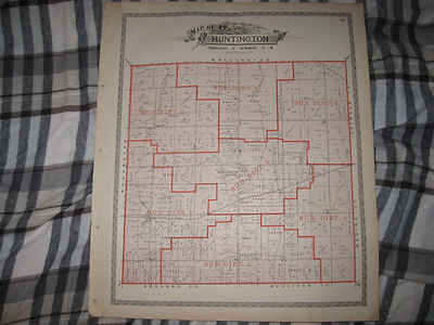
$3.75 Shipping Location: Winter Springs, United States Click Here. Double your traffic. Get Vendio Gallery- Now FREE! Fine antique color lithographed map. Titled Map of Huntington Township. I see Huntington ... moreCentre, and many fascianting areas, the railroads, and more. The map shows the home and land owners, districts, tracts, named railroads and much more. This is an antique map and not a reprint or reproduction. Fine period color lithography, nice outside ornate border, printed on thick paper, with no printing on reverse. The map is from the very rare 1896 American Atlas of Lorain County Ohio. The map is a fascinating and historic period look at this area at this time. The map shows the home and land owners, railroads, and much more. The photo wont show the full beauty of the map. The map is in nice shape, tight and clean. The size of the map is 15.5" by 18.5" Winning bidder pays $3.75 shipping domestic, more foreign. Payment I accept the following forms of payment: PayPal Click to View Image Album Shipping& Handling US Shipping. $3.75 USPS First-Class Mail® International Shipping. $11.50 USPS First-Class Mail International FREE scheduling. Supersized images and templates. Get Vendio Sales Manager. FREE scheduling. Supersized images and templates. Get Vendio Sales Manager.
Buy It Now
$3.75 Shipping Location: Winter Springs, United States The map is titled, at top, City of Toledo, Part Eleven. Many fascianting areas on the map. The map is from the very rare 1875 Andreas and Baskin Atlas ... moreof Lucas and Wood County Ohio. The size of the map is 17.5" by 27".

Buy It Now
$3.75 Shipping Location: Winter Springs, United States Click Here. Double your traffic. Get Vendio Gallery- Now FREE! THE PHOTO OF THE ITEM IS BELOW THE EBAY TEXT DESCRIPTION. KEEP PANNING DOWN AND YOU SHOULD ... moreSEE IT. Vintage antique 1906 handcolored map. The map is titled Map of Herkimer New York. Has named brooks. Business and industry, named churches and more. This is an antique map and not a reprint or reproduction. I dont like or sell reproductions. The handcoloring on the map is period to the map, this is before color printing. The map is from the very rare 1906 New Century Atlas of Herkimer County New York. The map is a fascinating and historic period look at this area at this time. The map shows the home and land owners, the business and industry, the few roads, railroads etc that existed at that time.The scans wont show all of the map, or the true beauty of this fine antique map. The map is in nice shape and would frame and display quite beautifully. The size of the map is 21.5" by 33" Winning bidder pays $3.75 shipping domestic, more foreign. Payment I accept the following forms of payment: PayPal, Preferred Checkout For fastest processing of this order. Please use Vendio Checkout! Shipping& Handling $3.75 USPS FREE image hosting(including supersized) with Vendio Sales Manager. Listing automation and FREE scheduled listings by Vendio. Win more auctions at the last minute FREE. Learn how. ec2.RcmdId ViewItemDescV4,RlogId p4%60bo7%60jtb9%3Fvo%7B%3Dd70f%2B%3Eec2-14b5c6ad178-0x114-
Buy It Now
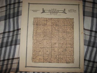
$3.75 Shipping Location: Winter Springs, United States Click Here. Double your traffic. Get Vendio Gallery- Now FREE! Fine large antique 1921 color lithographed map. Titled Map of Stockton Township. I see ... moremany interesting areas, the named railroads, named home and land owners, locations of buildings, size of land parcels and much more of this period. The map is printed on thick paper, with no printing on reverse. Fascianting, detailed and attractive period map of this area of Nebraska at this time. The map is from the very rare 1921 Anderson Publishing Company Atlas of Lancaster County Nebraska. The size of the map is 15" by 18" Rare. Winning bidder pays $3.75 shipping domestic, more foreign. Payment I accept the following forms of payment: PayPal Click to View Image Album Shipping& Handling US Shipping. $3.75 USPS First-Class Mail® International Shipping. $11.50 USPS First-Class Mail International FREE scheduling. Supersized images and templates. Get Vendio Sales Manager. FREE scheduling. Supersized images and templates. Get Vendio Sales Manager. RcmdId ViewItemDescV4,RlogId p4%60bo7%60jtb9%3Feog4d71f%2B%3F4f%3E-14be892b81f-0x119-

Buy It Now
$3.75 Shipping Location: Winter Springs, United States Click Here. Double your traffic. Get Vendio Gallery- Now FREE! Vintage antique 1909 color lithographed map. The map is titled Map of Clayton Township. ... moreThis is an antique map and not a reprint or reproduction. The map shows the named home and land owners. Named rivers, named railroads, locations of buildings, ad much more of this period, the detail is fascianting. The map is printed on fine paper, no printing on reverse. The map is from the very rare 1909 Daily Northwestern Atlas of Winnebago County WI. The map is a fascinating and historic period look at this area at this time. The map shows the home and land owners, the business and industry, the few roads, railroads etc that existed at that time, a fascinating look at these areas in 1909. The photos wont show ther true beauty or detail of these amazing maps. The size of the map is 11.5" by 15.5" Winning bidder pays $3.75 shipping domestic, more foreign. Payment I accept the following forms of payment: PayPal Click to View Image Album Shipping& Handling US Shipping. $3.75 USPS First-Class Mail® International Shipping. $11.50 USPS First-Class Mail International FREE scheduling. Supersized images and templates. Get Vendio Sales Manager. FREE scheduling. Supersized images and templates. Get Vendio Sales Manager.

Buy It Now
$3.75 Shipping Location: Winter Springs, United States Click Here. Double your traffic. Get Vendio Gallery- Now FREE! Fine large antique 1921 color lithographed map. Titled Map of Highland Township. I see ... moremany interesting areas, the map has a tape repair across it, the named railroads, named home and land owners, locations of buildings, size of land parcels and much more of this period. The map is printed on thick paper, with no printing on reverse. Fascianting, detailed and attractive period map of this area of Nebraska at this time. The map is from the very rare 1921 Anderson Publishing Company Atlas of Lancaster County Nebraska. The size of the map is 15" by 18" Rare. Winning bidder pays $3.75 shipping domestic, more foreign. Payment I accept the following forms of payment: PayPal Click to View Image Album Shipping& Handling US Shipping. $3.75 USPS First-Class Mail® International Shipping. $11.50 USPS First-Class Mail International FREE scheduling. Supersized images and templates. Get Vendio Sales Manager. FREE scheduling. Supersized images and templates. Get Vendio Sales Manager.

Buy It Now
$3.75 Shipping Location: Winter Springs, United States Click Here. Double your traffic. Get Vendio Gallery- Now FREE! Vintage antique 1914 color lithographed map. The map is titled Center. This is Center Township. ... moreThe map shows the period named land owners, named railroads, size and location of lots, and much more. The map is printed on thick paper with no printing on reverse. The condition of the map is very nice. This is an antique map and not a reprint or reproduction. The map is from the very rare 1914 Carson B. Davis, C.E. Atlas of Guernsey County Ohio. The map is a fascinating and historic period look at this area at this time. The photo wont show the full beauty of the map. The size of the map is 14" by 17" Winning bidder pays $3.75 shipping domestic, more foreign. Payment I accept the following forms of payment: PayPal Click to View Image Album Shipping& Handling US Shipping. $3.75 USPS First-Class Mail® International Shipping. $11.50 USPS First-Class Mail International FREE scheduling. Supersized images and templates. Get Vendio Sales Manager. FREE scheduling. Supersized images and templates. Get Vendio Sales Manager.

Buy It Now
$4.00 Shipping Location: Winter Springs, United States Click Here. Double your traffic. Get Vendio Gallery- Now FREE! Fine large superb rare antique 1921 very fine color lithographed map. Titled Part of Mario ... moreTownship. I see Marion and more, the named home and land owners, size of land parcels, locations of buildings, named railroads and much more of this period. The map is printed on thick superb paper. Fascianting, detailed and attractive period map of this area of Nebraska at this time. The map is from the very rare 1921 Midland Map and Publishing Company Atlas of Linn County Iowa. The size of the map is 14" by 17.5" Rare. Winning bidder pays $4.00 shipping domestic, more foreign. Payment I accept the following forms of payment: PayPal Click to View Image Album Shipping& Handling US Shipping. $4.00 USPS First-Class Mail® International Shipping. $11.50 USPS First-Class Mail International FREE scheduling. Supersized images and templates. Get Vendio Sales Manager. FREE scheduling. Supersized images and templates. Get Vendio Sales Manager. RcmdId ViewItemDescV4,RlogId p4%60bo7%60jtb9%3Fuk%601d72f%2Bfg2%3E-14c08c37051-0x10a-

Buy It Now
$3.75 Shipping Location: Winter Springs, United States Click Here. Double your traffic. Get Vendio Gallery- Now FREE! Beautiful. Vintage antique 1892 map. The map is titled Cornish, with Cornish Flat Po at ... morebottom. On the main map I see Cornish PO, Cornish Flat PO, South Cornish PO, Cornish Centre Po and much more. Beautiful map. The maps are very detialed, they show the home and land owners, business and industry, roads, railroads and much more. This is an antique 1892 map and not a reprint or reproduction. This is from the rare 1892 Hurd Atlas of New Hampshire. The map is overall in beautiful conditon and would frame and display nicely. The size of the map is 17.5" by 14" Rare. Winning bidder pays $3.75 shipping domestic, more foreign. Payment I accept the following forms of payment: PayPal Click to View Image Album Shipping& Handling US Shipping. $3.75 USPS First-Class Mail® International Shipping. $11.50 USPS First-Class Mail International FREE scheduling. Supersized images and templates. Get Vendio Sales Manager. FREE scheduling. Supersized images and templates. Get Vendio Sales Manager.

Buy It Now
$4.00 Shipping Location: Winter Springs, United States Click Here. Double your traffic. Get Vendio Gallery- Now FREE! Vintage antique 1865 handcolored map. The map is titled Russell. I see Russell Po. Monterey ... morePO, and more. The map is printed on thick paper, with no printing on reverse. This is an antique map and not a reprint or reproduction. The handcoloring on the map is period to the map, this is before color printing. The map is from the very rare 1865 Beers Atlas of St Lawrence County New York. The map is a fascinating and historic period look at this area at this time. The map shows the home and land owners, the business and industry, the few roads, railroads etc that existed at that time. The photo wont show the full beauty of the map. The map is in nice shape and would frame and display quite beautifully. The size of the map is 14.5" by 14.5" Winning bidder pays $4.00 shipping domestic, more foreign. Payment I accept the following forms of payment: PayPal Click to View Image Album Shipping& Handling US Shipping. $4.00 USPS First-Class Mail® International Shipping. $11.50 USPS First-Class Mail International FREE scheduling. Supersized images and templates. Get Vendio Sales Manager. FREE scheduling. Supersized images and templates. Get Vendio Sales Manager.

Buy It Now
$3.75 Shipping Location: Winter Springs, United States Click Here. Double your traffic. Get Vendio Gallery- Now FREE! Vintage antique 1914 color lithographed map. The map is titled Adams. This is Adams Township. ... moreThe map shows the period named land owners, named railroads, size and location of lots, and much more. The map is printed on thick paper with no printing on reverse. The condition of the map is very nice. This is an antique map and not a reprint or reproduction. The map is from the very rare 1914 Carson B. Davis, C.E. Atlas of Guernsey County Ohio. The map is a fascinating and historic period look at this area at this time. The photo wont show the full beauty of the map. The size of the map is 14" by 17" Winning bidder pays $3.75 shipping domestic, more foreign. Payment I accept the following forms of payment: PayPal Click to View Image Album Shipping& Handling US Shipping. $3.75 USPS First-Class Mail® International Shipping. $11.50 USPS First-Class Mail International FREE scheduling. Supersized images and templates. Get Vendio Sales Manager. FREE scheduling. Supersized images and templates. Get Vendio Sales Manager. 0fe.RcmdId ViewItemDescV4,RlogId p4%60bo7%60jtb9%3Fuk%601d70f%2B%3E0fe-146bf458734-0x112-

Buy It Now
$4.00 Shipping Location: Winter Springs, United States Click Here. Double your traffic. Get Vendio Gallery- Now FREE! Vintage antique 1905 color lithographed map. Gorgeous, titled, in fancy antique lettering, ... moreMap of Rural Township, with 1905 printing date at top left, I see many fascianting areas. The map is in gorgeous condition. The map shows the named home and land owners, named railroads, named business and industry, size of land parcels, fine outside ornate border and more. Printed on thick fine paper, with no printing on revers, fine outside ornate bodrer as well. This is an antique map and not a reprint or reproduction. The map is from the very rare 1905 Iowa Publishing Company Atlas of Rock Island County Illinois. The map is a fascinating and historic period look at this area at this time. The photo wont show the full beauty of the map. The map is in nice shape and would frame and display quite beautifully. The size of the 2 page map is 15.5" by 18.5" Winning bidder pays $4.00 shipping domestic, more foreign. Payment I accept the following forms of payment: PayPal Click to View Image Album Shipping& Handling US Shipping. $4.00 USPS First-Class Mail® International Shipping. $11.50 USPS First-Class Mail International FREE scheduling. Supersized images and templates. Get Vendio Sales Manager. FREE scheduling. Supersized images and templates. Get Vendio Sales Manager.
Buy It Now
$4.00 Shipping Location: Winter Springs, United States The map is printed on very fine thick paper. The map is titled Town of Gates. Many fascinating areas on the map. In my opinion Hopkins was the premier ... moremapmaker of this period. My photo wont show the full beauty of the map.
Buy It Now
$3.75 Shipping Location: Winter Springs, United States Many fascinating areas on the map. Fine period color lithography, printed on thick paper, with no printing on reverse. The size of the map is 17.5" by ... more15.5". FREE scheduling, supersized images.
Buy It Now
$3.75 Shipping Location: Winter Springs, United States The map is titled, at top, City of Toledo, Part Nine. Many fascianting areas on the map. The map is from the very rare 1875 Andreas and Baskin Atlas of ... moreLucas and Wood County Ohio. The size of the map is 17.5" by 27".

Buy It Now
$4.00 Shipping Location: Winter Springs, United States Click Here. Double your traffic. Get Vendio Gallery- Now FREE! Vintage antique 1865 handcolored map. The map is titled Edwards. With Edwards inset map. ... moreOn the main map I see Edwards PO, South Edwards PO, Freemansburgh, and much more. The map is in nice conditon. This is an antique map and not a reprint or reproduction. The handcoloring on the map is period to the map, this is before color printing. The map is from the very rare 1865 Beers Atlas of St Lawrence County New York. The map is a fascinating and historic period look at this area at this time. The map shows the home and land owners, the business and industry, the few roads, railroads etc that existed at that time. The photo wont show the full beauty of the map. The map is in nice shape and would frame and display quite beautifully. The size of the map is 15" by 14.5" Winning bidder pays $4.00 shipping domestic, more foreign. Payment I accept the following forms of payment: PayPal Click to View Image Album Shipping& Handling US Shipping. $4.00 USPS First-Class Mail® International Shipping. $11.50 USPS First-Class Mail International FREE scheduling. Supersized images and templates. Get Vendio Sales Manager. FREE scheduling. Supersized images and templates. Get Vendio Sales Manager. 16.RcmdId ViewItemDescV4,RlogId p4%60bo7%60jtb9%3Feog4d71f%2B%3E16%3E-14b5dc77893-0x115-

Buy It Now
$4.00 Shipping Location: Winter Springs, United States Click Here. Double your traffic. Get Vendio Gallery- Now FREE! Vintage antique 1874 handcolored map. The map is in nice condition. With some missing at ... moreextreme lower left hand side, well outside of the map imagery, if framed could be framed over. The map is titled Saratoga, this is Saratoga Township. The map shows the named home and and owners, locations of buildings, sizes of acreages and so forth, very detailed period map. The map has a nice outside ornate border as well. Very finely produced map, printed on thick fine paper. This is an antique map and not a reprint or reproduction. The map is from the very rare 1874 Warner and Beers Atlas of Grundy County Illinois. The map is a fascinating and historic period look at this area at this time. The photo wont show the full beauty of the map. The map is in nice shape and would frame and display quite beautifully. The size of the map is 16" by 18" Winning bidder pays $4.00 shipping domestic, more foreign. Payment I accept the following forms of payment: PayPal Click to View Image Album Shipping& Handling US Shipping. $4.00 USPS First-Class Mail® International Shipping. $11.50 USPS First-Class Mail International FREE scheduling. Supersized images and templates. Get Vendio Sales Manager. FREE scheduling. Supersized images and templates. Get Vendio Sales Manager. RcmdId ViewItemDescV4,RlogId p4%60bo7%60jtb9%3Fuk.rp*4a24%60%3C%3E-146b74efacb-0x10f-
Buy It Now
$4.00 Shipping Location: United States Superb, large antique 1902 handcolored map. The map is titled, in fancy antique lettering Part of East Palestine. With detailed Reference chart corresponding ... moreto the map itself. The map is in nice condition.

Buy It Now
$3.75 Shipping Location: Winter Springs, United States Click Here. Double your traffic. Get Vendio Gallery- Now FREE! Superb. Large antique 1902 handcolored map. The map is titled Part of East Liverpool, with ... moreinset map titled that as well, with Not in Corporation. The map shows the named land owners, named railroads, amount of acreage owned and more. The map has 2 small clean tears at extreme right hand side, if framed would be fine. The map is printed on thick paper, with no printing on reverse. This is an antique from 1902, and is not a reprint or reproduction. The beautiful handcoloring on the map is period, this is before color printing was invented. The size of the map is 15.5" by 19" large and impressive. This would frame and display quite nicely. The map is in excellent condition. The map is from the rare 1902 Atlas of Columbiana County Ohio. The maps were produced by AH Mueller, one of the finest mapmakers of this period. Many fascinating period detials related to these areas in 1902. Winning bidder pays $3.75 shipping domestic, more foreign. Payment I accept the following forms of payment: PayPal Click to View Image Album Shipping& Handling US Shipping. $3.75 USPS First-Class Mail® International Shipping. $11.50 USPS First-Class Mail International FREE scheduling. Supersized images and templates. Get Vendio Sales Manager. FREE scheduling. Supersized images and templates. Get Vendio Sales Manager.
Buy It Now
$4.00 Shipping Location: United States The map is printed in attractive horizontal format. Printed on fine paper, with no printing on reverse. This is an antique map and not a reprint or reproduction. ... moreThe handcoloring on the map is period to the map, this is before color printing.
Buy It Now
$4.00 Shipping Location: United States Superb, large antique 1902 handcolored map. The map is printed on thick paper, with no printing on reverse. This is an antique from 1902, and is not a ... morereprint or reproduction. The size of the map is 15.5" by 19", large and impressive.
Buy It Now
$4.00 Shipping Location: Winter Springs, United States The map is titled Additions to cedar Rapids Outside of City Limits. The map is printed on thick paper, with gorgeous period handcoloring nice outside ... moreornate border as well, no printing on reverse. This is an antique map and not a reprint or reproduction.
Buy It Now
Free Shipping Location: Winter Springs, United States I see Waubeek and more. The map is printed on thick paper, with gorgeous period handcoloring nice outside ornate border as well, no printing on reverse. ... moreThis is an antique map and not a reprint or reproduction.
Buy It Now
$4.00 Shipping Location: Winter Springs, United States The map is titled North Part of the 15th Ward of Cleveland. I see House of Corrections building, and more. The condition of the map is amazing. Nice outside ... moreornate border as well. This is an antique map and not a reprint or reproduction, the condition is excellent, printed on thick paper with no printing on verso.
Buy It Now
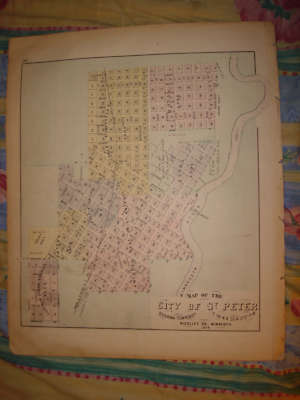
$3.75 Shipping Location: Winter Springs, United States Click Here. Double your traffic. Get Vendio Gallery- Now FREE! ANY UNUSUAL SHADOWS OR FUZZINESS IS ON THE PHOTO ONLY. Vintage antique 1874 map. This is ... morethe finest map of this area I've ever seen. The condition is amazing. The map is 2 pages, and either side would frame and display nicely. One side is a fine antique handcolored map, titled map of Map of the City of St Peter, Oshawa Township, Nicollet Co, Minnesota, 1874. I like how the year produced is right in the title, it dates the map nicely. Beautiful detailed map, the map shows the named addition, some land owners and more. Verso is a fine lithograph print page, 2 views at Mankato, one is Mankato House, a period large hotel, one is Sullivan& terrys Marble& Granite Works, and also 1 view at Mapleton Township, Blue earth County and 1 at Ceresco Twp, Blue Earth Co. This map would frame and display beautifully. This is an antique map and not a reprint or reproduction. The map is from the very rare 1874 Andrease Atlas of Minnesota, produced in 1874. The map is a fascinating and historic period look at this area at this time. The photo wont show the full beauty of the map. The map is in nice shape and would frame and display quite beautifully. The size of map is 14" by 17.5" Winning bidder pays $3.75 shipping domestic, more foreign. Payment I accept the following forms of payment: PayPal, Preferred Checkout For fastest processing of this order. Please use Vendio Checkout! Click to View Image Album Click to View Image Album Shipping& Handling $3.75 USPS First-Class Mail® FREE scheduling. Supersized images and templates. Get Vendio Sales Manager. FREE scheduling. Supersized images and templates. Get Vendio Sales Manager. Win more auctions at the last minute FREE. Learn how.
Buy It Now
$3.75 Shipping Location: Winter Springs, United States The fine handcoloring on the map is period. From the very rare 1924 Hopkins Atlas of Monroe County New York. Its not a reproduction or copy. Fascianting ... moreand historical period look at Monroe County New York.

Buy It Now
$4.00 Shipping Location: Winter Springs, United States Click Here. Double your traffic. Get Vendio Gallery- Now FREE! Vintage antique handcolored 1889 map. Fine. Beautiful antique handcolored. The map is titled, ... morein fancy antique lettering, Part of Everett. The map is very detailed and shows the named home and land owners, named streets, size and locations of buildings, named business and industry, named railroads, named schools, named churches, and so much more of this period. The last page is Part of Medford, also very detailed. Printed at bottom is Copyright 1889 by Geo. H. Walker& Co. Boston. This dates the maps nicely. The map is beautifully handcolored, so few of these maps were done, it was easier and less expensive to have them handcolored. This is an antique map and not a reprint or reproduction. The map is in nice conditon, and would frame and display beautifully. Very rare. The map is from the rare 1889 George Walker Atlas of Middlesex County Massachusetts. Walker was a very highly regarded mapmaker of this period. The size of the map is a large 18" by 28" Winning bidder pays $4.00 shipping domestic, more foreign. Payment I accept the following forms of payment: PayPal Click to View Image Album Shipping& Handling US Shipping. $4.00 USPS First-Class Mail® International Shipping. $11.50 USPS First-Class Mail International FREE scheduling. Supersized images and templates. Get Vendio Sales Manager. FREE scheduling. Supersized images and templates. Get Vendio Sales Manager.
Buy It Now
$3.75 Shipping Location: Winter Springs, United States ANY UNUSUAL SHADOWS OR FUZZINESS IS ON THE PHOTO ONLY. THE MAP IS IN BEAUTIFUL CONDITON. The conditon is amazing on this antique map. I see Tittabawassee ... moreStation, Painesville PO, and much more. Many interesting areas on the map.
|
|
|
In
|
ANTIQUE 1896 HENRIETTA TOWNSHIP LORAIN COUNTY OHIO MAP W LAND OWNERS RARE NR
Click Here. Double your traffic. Get Vendio Gallery- Now FREE! Fine antique color lithographed map. Titled Map of Elyria Township. I see Elyria City, the railroads, and more. The map shows the home and land owners, districts, tracts, named railroads and much more. This is an antique map and not a reprint or reproduction. Fine period color lithography, nice outside ornate border, printed on thick paper, with no printing on reverse. The map is from the very rare 1896 American Atlas of Lorain County Ohio. The map is a fascinating and historic period look at this area at this time. The map shows the home and land owners, railroads, and much more. The photo wont show the full beauty of the map. The map is in nice shape, tight and clean. The size of the map is 15.5" by 18.5" Winning bidder pays $3.75 shipping domestic, more foreign. Payment ... moreI accept the following forms of payment: PayPal Click to View Image Album Shipping& Handling US Shipping. $3.75 USPS First-Class Mail® International Shipping. $11.50 USPS First-Class Mail International FREE scheduling. Supersized images and templates. Get Vendio Sales Manager. FREE scheduling. Supersized images and templates. Get Vendio Sales Manager.
|
|
 |