-
Christian Collectibles
-
Christian Sheet Music
-
Vatican Stamps
-
Vatican Coins & Paper Money
-
Antiques
-
Antiquities
-
Architectural & Garden
-
Decorative Arts
-
Ethnographic
-
Furniture
-
Maps, Atlases & Globes
-
United States (Pre-1900)
-
AK, HI
-
AL, FL, GA, MS, NC, SC
-
AR, IA, KS, LA, MO, NE
-
AZ, CA, CO, NM, NV, UT
-
CT, MA, ME, NH, RI, VT
-
DC, DE, MD, NJ, NY, PA
-
ID, OR, WA
-
IL, IN, MI, OH, WI
-
MN, MT, ND, SD, WY
-
OK, TX
-
VA, WV, KY, TN
-
Entire US
-
United States (1900-Now)
-
United States (Date Unknown)
-
Africa
-
Asia
-
Australasia/ Oceania
-
Canada
-
Central America/ Caribbean
-
Europe
-
India
-
Ireland
-
Mexico
-
Middle East
-
North America
-
South America
-
United Kingdom
-
Maps on CD
-
World Maps
-
Globes
-
Mixed Lots
-
Reproductions
-
Price Guides & Publications
-
Other
|
In
Order by: Available to: This site contains affiliate links for which I may be compensated
|
Buy It Now
$3.50 Shipping Location: Dover, United States Alger Quadrangle Ohio- 15 Minute Series. Year Published: 1932. The map in the photo is the actual map you will receive.
Buy It Now
$3.50 Shipping Location: Dover, United States Trenton Quadrangle Ohio 7.5 Minute Series. Places: Trenton, Woodsdale, Huntsville, Maustown, Princeton, Excello, Le Sourdsville, Oneida. Year Published: ... more1956. The map in the photo is the actual map you will receive.
Buy It Now
$3.50 Shipping Location: Dover, United States Covington Quadrangle Ohio- 15 Minute Series. Places: Russia, Gettysburg, Versailles, Bradford, Covington, Pleasant Hill. Year Published: 1946. The map ... morein the photo is the actual map you will receive.
Buy It Now
$3.50 Shipping Location: Dover, United States Roundhead Quadrangle Ohio- 7.5 Minute Series. Places: Roundhead. Year Published: 1962. The map in the photo is the actual map you will receive.
Buy It Now
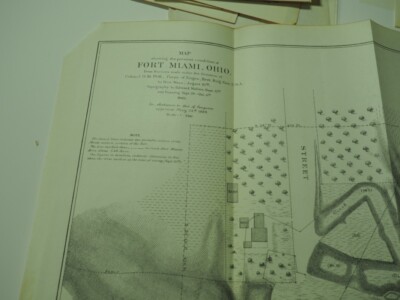
$5.50 Shipping Location: Easton, United States 1938 Road Map MAUMEE HOLLAND WATERVILLE Lucas County Ohio Fort Miami Perrysburg Genuine original lithographed topographical map of part of Lucas and Wood ... morecounties in northwestern Ohio. Printed more than 75 years ago. This map has excellent detail. Including roads, schools, churches, cemeteries, railroads, and natural features. It even locates individual houses and farms! The coverage area extends from Waterville to Holland, east to Perrysburg. It was published by the United States Geological Survey and is identified as the 1938 edition of the Maumee quadrangle. Bounded by longitude 83°37' 30" W to 83°45' W and latitude 41°30' N to 41°37' 30" N. Among the specific named places and features are the Heather Downs Country Club. Blue Grass Island, the Baltimore& Ohio Railroad, Roachton Road, Fort Meigs, Monclova, the Miami& Erie Canal, Sylvania Road, the New York, Chicago& St. Louis Railroad, Homewood, Fort Miami Fair Grounds, Ewing Island, the Wabash Railroad, Glendale School, Keener Ditch, Hulls Crossing, Spring Valley, and more. The map is drawn on a scale of 1:31.680, with contour lines at 5-foot intervals, and is based on surveys conducted in 1934 and 1936. The image area measures 17-1/4" x 13" on a larger sheet, with generous margins on all sides. The scans below give a closer look at some of the detail: Condition: This is an ex-library map in very good. Lightly used condition, with an old library stamp in the right margin. A previous owner has written a number in the upper corner, outside of the image area. This is an original. Authentic 1938 map, not a reproduction or modern reprint. And it is fully guaranteed to be genuine. Early maps are often the only record we have of how a particular place"looked" at a given point in its history. And this offers a view back at this historic part of the Buckeye State as it was early in the last century. The map would make a handsome display in your den or office. It would also make a perfect gift
Buy It Now
$3.50 Shipping Location: United States Very interesting text information. The size of the map is 8" by 10". This is from the very rare 1883 Sterrett and Frunas Atlas and Directory of Miami ... moreCounty Ohio. FREE scheduling, supersized images.
Buy It Now
Free Shipping Location: Monroeville, United States Date - 1868. Source - Atlas of the State of Ohio. Size - about 14.5x17".
Buy It Now
$4.69 Shipping Location: Greenacres, United States Original 1889 antique lithographed map of Cincinnati, printed more than 130 years ago.
Buy It Now
$3.50 Shipping Location: Dover, United States Hamilton Quadrangle Ohio- 7.5 Minute Series. Places: Hamilton, New Miami, Seven Mile, City View Heights, Overpeck. The map in the photo is the actual ... moremap you will receive. Year Published: 1968.
Buy It Now
$6.15 Shipping Location: Cleveland, United States Standard Oil Co. Cleveland Resale. Park System.
Buy It Now
$13.05 Shipping Location: Cleveland, United States I COULD NOT FIND THIS SPECIFIC MAP ON THE INTERNET. MOST OF THESE ARE OF OHIO AND INDIVIDUAL PARTS OF OHIO (e.g . CLEVELAND). THIS INTERESTING MAP SHOWS ... moreTHE OHIO LANDS WHICH WERE THE SEVERAL GRANTS, TRACTS, DISTRICTS AND CESSION WHICH MAKE UP WHAT IS NOW OHIO (FROM WIKIPEDIA).
Buy It Now
$4.69 Shipping Location: Greenacres, United States Original 1889 antique color lithographed map of Columbus, Ohio, printed more than 133 years ago. This map was published by George Franklin Cram, Chicago ... morein 1889.
Buy It Now
$3.50 Shipping Location: Dover, United States Trenton Quadrangle Ohio- 7.5 Minute Series. Places: Trenton, Woodsdale, Huntsville, Maustown, Princeton, Excello, Le Sourdsville, Oneida. Year Published: ... more1976. The map in the photo is the actual map you will receive.
Buy It Now
$3.50 Shipping Location: Dover, United States Franklin Quadrangle Ohio- 7.5 Minute Series. Places: Carlisle, Franklin. Year Published: 1967. The map in the photo is the actual map you will receive.
Buy It Now
$3.50 Shipping Location: Dover, United States Addyston Quadrangle Ohio- 7.5 Minute Series. Places: Grandview, Dent, Cleves, Addyston, North Bend, Miamitown, Taylors Creek. Year Published: 1963. The ... moremap in the photo is the actual map you will receive.
Buy It Now
$3.50 Shipping Location: Dover, United States Bellbrook Quadrangle Ohio- 7.5 Minute Series. Places: Beavercreek, Bellbrook, Alpha. Year Published: 1967. The map in the photo is the actual map you ... morewill receive.
Buy It Now
$12.75 Shipping Location: Boonville, United States The city has several notable educational institutions. Did the founders really think of themselves as a group of "nuts?". Oh, perish the thought, their ... moredescendants say. They really considered themselves the acorns from which the future "mighty oaks" would grow.
Buy It Now
$4.69 Shipping Location: Greenacres, United States Original 1900 antique color lithographed map of Columbus, Ohio, printed more than 120 years ago.
Buy It Now
$5.75 Shipping Location: Boonville, United States The Vanderburgh County Courts System is in the Northeast Building. The EVSC headquarters is in the eastmost building. The city has several notable educational ... moreinstitutions. The project bankrupted the state and was so poorly engineered that it would not hold water.
Buy It Now
$8.70 Shipping Location: Piqua, United States 1980 West Carrollton Ohio Miami River Basin Water Resource Maps Army Engineers.
Buy It Now
$4.69 Shipping Location: Greenacres, United States Original 1893 antique color lithographed map of Columbus, Ohio, printed more than 130 years ago. This map was published by George Franklin Cram, Chicago ... morein 1893.
Buy It Now
$3.50 Shipping Location: Dover, United States Hooven Quadrangle Ohio- 7.5 Minute Series. Places: Hidden Valley, Bright, Hooven. Year Published: 1972. The map in the photo is the actual map you will ... morereceive.
Buy It Now
$4.69 Shipping Location: Greenacres, United States Original 1893 antique lithographed map of Cincinnati, printed more than 125 years ago. It is an original, authentic antique map,not a reproduction or ... moremodern reprint.
Buy It Now
$3.50 Shipping Location: Dover, United States Newport Quadrangle Kentucky- 7.5 Minute Series. The map in the photo is the actual map you will receive.
Buy It Now
Free Shipping Location: Monroeville, United States Date - 1895. Size - about 22.5x34.5", double page as published.
Buy It Now
$3.50 Shipping Location: Dover, United States Newport Quadrangle Kentucky-Ohio 7.5 Minute Series. Year Published: 1963.
Buy It Now
$3.50 Shipping Location: Dover, United States South Lebanon Quadrangle Ohio- 7.5 Minute Series. Places: Maineville, Morrow, South Lebanon, Kings Mills, Dallasburg, Hopkinsville, Murdock, Zoar. The ... moremap in the photo is the actual map you will receive.
Buy It Now
$3.50 Shipping Location: Dover, United States Tipp City Quadrangle Ohio- 7.5 Minute Series. Places: Vandalia, Tipp City. Year Published: 1967. The map in the photo is the actual map you will receive.
Buy It Now
$3.50 Shipping Location: Dover, United States Blanchester Quadrangle Ohio- 15 Minute Series. Places: Wilmington, Clarksville, Blanchester, Martinsville, Midland, Westboro, Cuba. Year Published: 1948. ... moreThe map in the photo is the actual map you will receive.
Buy It Now
$3.50 Shipping Location: Dover, United States Bellbrook Quadrangle Ohio- 7.5 Minute Series. Places: Beavercreek, Bellbrook, Alpha. Year Published: 1956. The map in the photo is the actual map you ... morewill receive.
Buy It Now
$3.50 Shipping Location: Dover, United States New Moorefield Quadrangle Ohio- 7.5 Minute Series. The map in the photo is the actual map you will receive. Year Published: 1968.
Buy It Now
$3.50 Shipping Location: Dover, United States Year Published: 1974. The map in the photo is the actual map you will receive.
Buy It Now
Free Shipping Location: Monroeville, United States Source - Atlas of Logan County. Date - 1875.
Buy It Now
$3.50 Shipping Location: Dover, United States Tipp City Quadrangle Ohio- 7.5 Minute Series. Places: Vandalia, Tipp City. Year Published: 1975. The map in the photo is the actual map you will receive.
Buy It Now
$3.50 Shipping Location: Dover, United States Year Published: 1956. The map in the photo is the actual map you will receive.
Buy It Now
$3.50 Shipping Location: Dover, United States Greenhills Quadrangle Ohio- 7.5 Minute Series. Places: Fairfield, Forest Park, Greenhills, Dunlap, Bevis, Indian Springs. The map in the photo is the ... moreactual map you will receive. Year Published: 1968.
Buy It Now
$3.50 Shipping Location: Dover, United States Lawrenceburg Quadrangle Indiana- 7.5 Minute Series. Year Published: 1964. The map in the photo is the actual map you will receive.
Buy It Now
$7.75 Shipping Location: Boonville, United States Newspaper Clipping "Courthouse Roof Complete" 2004. The city has several notable educational institutions. The project bankrupted the state and was so ... morepoorly engineered that it would not hold water.
Buy It Now
$3.50 Shipping Location: Dover, United States Roundhead Quadrangle Ohio- 7.5 Minute Series. Places: Roundhead. Year Published: 1974. The map in the photo is the actual map you will receive.
Buy It Now
$3.50 Shipping Location: Dover, United States Water Bodies: North Fork Great Miami River, Silver Creek, South Fork Great Miami River, Wolf Creek. Silver Creek Quadrangle Ohio- 7.5 Minute Series. Year ... morePublished: 1962. The map in the photo is the actual map you will receive.
Buy It Now
$3.50 Shipping Location: Dover, United States Trenton Quadrangle Ohio 7.5 Minute Series. Places: Trenton, Woodsdale, Huntsville, Maustown, Princeton, Excello, Le Sourdsville, Oneida. The map in the ... morephoto is the actual map you will receive. Year Published: 1968.
Buy It Now
$14.75 Shipping Location: Boonville, United States The city has several notable educational institutions. The project bankrupted the state and was so poorly engineered that it would not hold water. Only ... moretwo flat barges ever made the entire trip. The era of Evansville's greatest growth occurred in the second half of the 19th century, following the disruptions of the Civil War.
Buy It Now
$5.75 Shipping Location: Boonville, United States The city has several notable educational institutions. The project bankrupted the state and was so poorly engineered that it would not hold water. Only ... moretwo flat barges ever made the entire trip. The era of Evansville's greatest growth occurred in the second half of the 19th century, following the disruptions of the Civil War.
Buy It Now
$3.50 Shipping Location: Dover, United States Newport Quadrangle Kentucky-Ohio 7.5 Minute Series. Year Published: 1971.
Buy It Now
$3.50 Shipping Location: Dover, United States Blanchester Quadrangle Ohio- 7.5 Minute Series. Places: Blanchester, Midland, Westboro. Year Published: 1962. The map in the photo is the actual map you ... morewill receive.
Buy It Now
$3.50 Shipping Location: Dover, United States De Graff Quadrangle Ohio- 7.5 Minute Series. Places: De Graff, Quincy. Year Published: 1962. The map in the photo is the actual map you will receive.
Buy It Now
$7.75 Shipping Location: Boonville, United States The city has several notable educational institutions. The project bankrupted the state and was so poorly engineered that it would not hold water. Only ... moretwo flat barges ever made the entire trip. Outstanding Example of Baroque Renaissance Architecture.
Buy It Now
$3.50 Shipping Location: Dover, United States Mason Quadrangle Ohio- 15 Minute Series. Places: Sharonville, Springdale, Woodlawn, Trenton, Loveland, Evendale, Glendale, Monroe, Mason, Brecon, Tylersville, ... moreWoodsdale, Gano, Port Union, Mayfield, Maud, Pisgah, Huntsville, Maustown, Princeton, Bethany, Excello, Le Sourdsville, Oneida, Blue Ball, Hageman, Socialville.
Buy It Now
$3.50 Shipping Location: Dover, United States Year Published: 1956. Pleasant Plain Quadrangle Ohio- 7.5 Minute Series. Places: Butlerville, Pleasant Plain. The map in the photo is the actual map you ... morewill receive.
Buy It Now
$7.75 Shipping Location: Boonville, United States Benjamin Bosse High School, referred to as Evansville Bosse High School by the IHSAA, is a public high school of the Evansville Vanderburgh School Corporation ... morein Evansville, Indiana, United States. The school won again in 1945 and 1962.
Buy It Now
$3.50 Shipping Location: Dover, United States Mason Quadrangle Ohio- 7.5 Minute Series. Places: Loveland, Mason, Brecon, Pisgah, Socialville. Year Published: 1976. The map in the photo is the actual ... moremap you will receive.
Buy It Now
$7.75 Shipping Location: Boonville, United States The city has several notable educational institutions. The project bankrupted the state and was so poorly engineered that it would not hold water. Only ... moretwo flat barges ever made the entire trip. The era of Evansville's greatest growth occurred in the second half of the 19th century, following the disruptions of the Civil War.
Buy It Now
$3.50 Shipping Location: Dover, United States Batavia Quadrangle Ohio- 7.5 Minute Series. Year Published: 1967. The map in the photo is the actual map you will receive.
Buy It Now
$9.75 Shipping Location: Boonville, United States South corner of 1st St and Locust St. The city has several notable educational institutions. The project bankrupted the state and was so poorly engineered ... morethat it would not hold water. Only two flat barges ever made the entire trip.
Buy It Now
$3.50 Shipping Location: Dover, United States Xenia Quadrangle Ohio 7.5 Minute Series. Places: Xenia, Wilberforce. Year Published: 1967. The map in the photo is the actual map you will receive.
Buy It Now
$3.50 Shipping Location: Dover, United States Water Bodies: North Fork Great Miami River, Silver Creek, South Fork Great Miami River, Wolf Creek. Silver Creek Quadrangle Ohio- 7.5 Minute Series. Year ... morePublished: 1975. The map in the photo is the actual map you will receive.
Buy It Now
$3.50 Shipping Location: Dover, United States Franklin Quadrangle Ohio- 7.5 Minute Series. Places: Carlisle, Franklin. Year Published: 1975. The map in the photo is the actual map you will receive.
Buy It Now
$6.00 Shipping Location: Greenacres, United States The map locates two ferry crossings on the Ohio River, and it shows work in progress on the John A. Roebling Suspension Bridge, originally known as the ... moreCincinnati-Covington Bridge. When the bridge opened in 1866, three years after this map was printed, it was the longest suspension bridge in the world.
Buy It Now
$3.50 Shipping Location: Dover, United States Shandon Quadrangle Ohio 7.5 Minute Series. Places: Ross, New Baltimore, New Haven, Layhigh, Shandon, Fernald. The map in the photo is the actual map you ... morewill receive. Year Published: 1968.
Buy It Now
$3.50 Shipping Location: Dover, United States Shandon Quadrangle Ohio- 7.5 Minute Series. Places: Ross, New Baltimore, New Haven, Layhigh, Shandon, Fernald. Year Published: 1976. The map in the photo ... moreis the actual map you will receive.
|
|
|
In
|
1819 OH MAP OHIO Kent Muskingum Miami River Germantown Pierpont Hicksville HUGE
This is a huge BLACK& WHITE COPY of an original 1819 Map of OHIO& INDIANA titled: A Map of OHIO& INDIANA by H. S. Tanner This map is HUGE! 42 inches by 34 inches I will mail out in a large mailing tube. Again. This is a BLACK& WHITE COPY of the huge map shown in the photo. NOT THE ORIGINAL. I have the original and it is not for sale. I accept PAYPAL and personal checks. Would make a great gift! Thanks for looking!
|
|
|
1875 Antique Map - Bradford,Darke and Miami Counties Ohio,Names of Land Owners
Click Here. Double your traffic. Get Vendio Gallery- Now FREE! 1875 Antique Map- Bradford.Darke and Miami Counties Ohio,Names of Land Owners Click to View Image Album Click to View Image Album Click to View Image Album A beautiful authentic original hand colored 1875 antique map of Bradford in Adams Township. Darke County,Ohio and partly in Miami County, Ohio, carefully removed from a Atlas of Darke County dated 1875 and published by Lake, Griffing and Stevenson of Philadelphia, measuring 16"x14" Properties and some owners names along with streets, buildings, railroads, waterways and a Business Directory are shown on the map. Amazing detail,great to frame and diaplay please make payment within 5 days of closed auction. Payment I accept the following forms of payment: PayPal FREE scheduling. Supersized images and templates. Get Vendio ... moreSales Manager. FREE scheduling. Supersized images and templates. Get Vendio Sales Manager. Over 100.000,000 served. Get FREE counters from Vendio today!
|
|
|
1875 OHIO COLOR MAP Collection Clark County Springfield Sandusky Miami Columbus
1875 OHIO COLOR MAP Collection Clark County Springfield Sandusky Miami Columbus Description: This listing consists of twelve leaves removed from a broken copy of L.H. Everts& Co's Illustrated Historical Atlas of Clark County Ohio published in 1875. The collection includes the 4 single sided lithograph maps you see above and 8 double sided maps like the ones you see below. Each map measures 16 3/4" x 14" 426mmx355mm) The Single Sided Maps Climatological Map of Ohio Agricultural Map of Ohio Geological Map of Ohio Miscellaneous neighborhoods of Noblesville(German Township) Medway(Bethel Township) Donnellsville(Bethel Township) Catawba(Pleasant Township) and South Charleston(Madison Township) Double Sided County Maps Belmont. Guernsey, Monroe, Noble, Washington/Carroll, Columbiana, Harrison, Jerfferson, Tuscarawas Ashland. Erie, ... moreHuron, Lorain, Richland/Hancock, Lucas, Ottawa, Sandusky, Seneca, Wood Ashtabula. Geauga, Lake, Mahoning, Portage, Trumbull, Cuyahoga, Medina, Stark, Summit, Wayne Fayette. Frankline, Madison, Pickaway, Ross/Athens, Fairfield, Hocking, Morgan, Perry Champaign. Clarke, Darke, Greene, Miami, Montgomery, Preble/Brown, Butler, Clermont, Clinton, Hamilton, Warren Coshocton. Holmes, Knox, Licking, Muskingum/Crawford, Delaware, Marion, Morrow, Union, Wyandot Allen. Auglaize, Hardin, Logan, Mercer, Shelby/Defiance, Fulton, Henry, Paulding, Putnam, Van Wert, Willlams Gallia. Jackson, Lawrence, Meigs, Vinton/Adams, Highland, Pke, Scioto. Condition: All the maps are in very good condition. Lightly toned, with wide margins and bright colors. There are occasional instances of soiling, usually in the margins, rarely affecting text. The geological map has heavier soiling along its bottom and lower right margin. We package our items carefully. Ship daily, and have a no hassle returns policy-your satisfaction is guaranteed. UNLESS OTHERWISE EXPLICITLY STATED. ALL ITEMS ARE GUARANTEED TO BE AUTHENTIC AND ORIGINAL Terms and shipping: Payment is required within 3 days of purchase. Payment via p
|
|
|
1858 Farm Line Map of Miami County Ohio Piqua Troy
1858 Farm Line Map of Miami County Ohio 23" x 24" Full Color Map Reproduction This map shows farm lines. Farm names, historical places, building locations, towns, roads, and more! Great for research or display! Posted with
|
|
 |