-
Christian Collectibles
-
Christian Sheet Music
-
Vatican Stamps
-
Vatican Coins & Paper Money
-
Antiques
-
Antiquities
-
Architectural & Garden
-
Decorative Arts
-
Ethnographic
-
Furniture
-
Maps, Atlases & Globes
-
United States (Pre-1900)
-
AK, HI
-
AL, FL, GA, MS, NC, SC
-
AR, IA, KS, LA, MO, NE
-
AZ, CA, CO, NM, NV, UT
-
CT, MA, ME, NH, RI, VT
-
DC, DE, MD, NJ, NY, PA
-
ID, OR, WA
-
IL, IN, MI, OH, WI
-
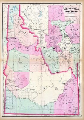
MN, MT, ND, SD, WY
-
OK, TX
-
VA, WV, KY, TN
-
Entire US
-
United States (1900-Now)
-
United States (Date Unknown)
-
Africa
-
Asia
-
Australasia/ Oceania
-
Canada
-
Central America/ Caribbean
-
Europe
-
India
-
Ireland
-
Mexico
-
Middle East
-
North America
-
South America
-
United Kingdom
-
Maps on CD
-
World Maps
-
Globes
-
Mixed Lots
-
Reproductions
-
Price Guides & Publications
-
Other
|
In
Order by: Available to: This site contains affiliate links for which I may be compensated
|

$6.00 Shipping Location: Corunna, United States 1865 JOHNSON'S NEBRASKA. DAKOTA, IDAHO AND MONTANA Map Hand Colored Engraving Click Images to Enlarge An Original Vintage Antique Map: Not a Reproduction! ... moreSee Our Ebay Store for other Antique Items! Free US Shipping on Purchases of $100 value or more! Details Full Title: JOHNSON'S NEBRASKA. DAKOTA, IDAHO AND MONTANA Year: 1865 Publisher/Printer: Johnson and Ward. Engraving style: Hand colored engraving. Condition Grade: Collectible. Very Good condition Authentication: Appraisal Valuation Sheet available Appraised Value: $225.00 Approximate Size(inches) 26 1/4" x 18 1/4" Approximate Size(Cm) 66.6 x 46.4 Description This is an authentic antique map approximatley 148 years old! Circa 1865. Hand Colored steel engraving. Text on reverse. Folding doublepage map with very light wear and splitting at folds. The map is not mounted. Matted or framed and is being sold as a single sheet as shown in the first picture. This map is in Very good condition. Map shows some ocassional darkening at edges but still has strong presence. It is basically as seen in the pics. The pictures shown are of the actual map being sold. Keywords: Colored Engraved. Nebraska, Montana, Wyoming, Idaho, Dakota, Hand Colored, 1865, Color Engraving, Atlas Map CUSTOMER SERVICE& PRICING Our pricing directly reflects the time and careful consideration invested in acquiring and researching the finest quality products for you. The discriminating consumer. We recognize that all of our customers have their own specific needs and wants and we strive to meet these needs whether you are an Historical Institution, University, Library, Society, Archivist, Curator, Decorator, Designer, or Collector. We have structured our business to accommodate these requirements. We sell to a select group of customers from beginning collectors to advanced, seasoned collectors and everyone in between. Our many years of positive feedback from the thousands of loyal customers most often reflects the Quality of our items, Fine packaging, and Great Customer Servic
Buy It Now
Free Shipping Location: Florence, United States It's full of cool stuff! Thick paper.
Buy It Now
Free Shipping Location: Schertz, United States This antique map from 1887 showcases Idaho, Montana, and Wyoming territories. It features hand-tinted highlights and shows Indian reservations. The double-page ... moresize of the map is 15x24. The map is an original and over 130 years old, making it a rare find for collectors. The publisher of the map is M. Bradley/S.A. Mitchell. The book cover is only for reference purposes. Free shipping is available within the USA, and international shipping is calculated based on location.
Free Shipping Location: Schertz, United States This antique map of The Wyoming, Montana & Idaho Territories is a piece of original history that is over 140 years old. The page measures 14x17 inches ... moreand features hand-tinted highlights. It was created by cartographer O. W. Gray and published by Milton R. Brown. The map is an authentic piece from the 1875 National Atlas and is in good condition. The title page and book cover shown are for reference purposes only. Free shipping is available within the USA, and shipping costs will be calculated for worldwide orders.
Free Shipping Location: Carefree, United States ORIGINAL ANTIQUE 1897 COLOR MAP OF IDAHO, WYOMING AND PART OF MONTANA. MAP HAS SCALES BELOW TITLE.
Buy It Now
Free Shipping Location: Springfield, United States Unique Album & Atlas of the World 1894. Not a Facsimile - This is a single page culled from an 1894 Unique Atlas, Page does not have date, Books of this ... moreage rarely had color print which was very expensive during the 19th century.
Buy It Now
Free Shipping Location: Anaheim, United States Typically that map at hand, the one being looked at, is in the center box. Scale: 1:100,000 (100K). feature within the bounds of the map, which frequently ... moreis a community, town, or city. The map covers a specific amount of area.
Buy It Now
$4.55 Shipping Location: Oakland, United States 12x10 inch This antique map from 1885 showcases the beautiful states of Oregon, Montana, Wyoming, Idaho, and Washington. With vibrant colors and intricate ... moredetails, this piece is a must-have for any collector of North American maps. The year 1885 marks an important time in American history, and this map is a valuable piece of that era.This map measures 12x10 inches and is perfect for display in any home, office, or museum. The cities and states depicted on the map are of historical significance and provide a glimpse into the past. Whether you're a map enthusiast or simply looking for a unique piece of history to add to your collection, this antique map is sure to impress.
Buy It Now
Free Shipping Location: Anaheim, United States Typically that map at hand, the one being looked at, is in the center box. Scale: 1:100,000 (100K). feature within the bounds of the map, which frequently ... moreis a community, town, or city. The map covers a specific amount of area.
Buy It Now
$6.90 Shipping Location: Newark, United States Good condition. Creases lower left corner photo 8. Map is folded.
Buy It Now
$4.88 Shipping Location: Las Cruces, United States Publisher: U.S. Geological Survey.
Buy It Now
Free Shipping Location: Anaheim, United States Typically that map at hand, the one being looked at, is in the center box. Covers about 1,568 to 2,240 square miles depending up the longitude & latitude ... morelocation. Bio-predation & Oxidation (aging, age discoloration mainly on the outside and exposed edges and folds).
Buy It Now
$4.88 Shipping Location: Las Cruces, United States Publisher: U.S. Geological Survey.
Buy It Now
$6.95 Shipping Location: Dover, United States Uncommon late 19th century lithographed map, with original hand color. This late Mitchell map was issued by Bradley for a short period before disappearing ... morefrom publication. Issued c. 1886-8, Philadelphia by Bradley, successor to S.A. Mitchell.
Buy It Now
$6.95 Shipping Location: Dover, United States Issued 1887, Philadelphia by Bradley, successor to S.A. Mitchell. This late Mitchell map was issued by Bradley for a short period before disappearing ... morefrom publication. Fine oversize late 19th century lithographed map, with original hand color.
Buy It Now
$6.95 Shipping Location: Dover, United States Tunison's Idaho and Western Montana. Issued c. 1892-6, Chicago by Tunison. Late 19th century lithographed map with original hand color. Map is set within ... moredecorative border, as is the title.
Buy It Now
Free Shipping Location: Hailey, United States This is a Salmon Idaho-Montana 1996 Topographical Map. We will do our best to provide you the best possible service.
Buy It Now
$4.99 Shipping Location: Fairview, United States Condition: The map is in Very Good condition with light tonal aging and text on reverse. The pics are of the actual map. An Authentic Antique Map: Not ... morea Modern Reproduction!
Buy It Now
$6.00 Shipping Location: Rochester, United States These are not heavy creases, as in a folded map, and should flatten out easily. There is also "edge wear" on the right side of the map (see photograph). ... moreThe shadows in the corners of the map are from the clear plastic containers (red lids) used to hold the map in place.
Buy It Now
$4.88 Shipping Location: Las Cruces, United States Publisher: U.S. Geological Survey. Scale: 1:62,500.
Buy It Now
$4.88 Shipping Location: Las Cruces, United States Publisher: U.S. Geological Survey. Scale: 1:62,500.
Buy It Now
$3.25 Shipping Location: Missoula, United States This Topographical, Geologic map is for Ashton, Montana, Idaho, Wyoming. The date is 1955-67. The map was published by the Army Corp of Engineers. size ... moreis 26" across and 22" down.
Buy It Now
$4.99 Shipping Location: Fairview, United States New Indexed Family Atlas, published by Gaylord Watson, New York, 1882, a copy of the title page is included for authenticity. It is from Watson's. An ... moreAuthentic Antique Map: Not a Modern Reproduction!
Buy It Now
$4.88 Shipping Location: Las Cruces, United States Publisher: U.S. Geological Survey.
Buy It Now
$6.95 Shipping Location: Dover, United States Issued c.1870, Philadelphia by S.A. Mitchell. Map of Oregon, Washington, Idaho, and Part of Montana. Late 19th century engraved map, with original hand ... morecolor. Gold and silver mines are noted on the map.
Buy It Now
Free Shipping Location: Anaheim, United States EasyFinder ® also known asEasy to Fold! Plastic Coated Paper (laminated). Idaho Falls inset map. Bio-predation & Oxidation (aging, age discoloration mainly ... moreon the outside panels). State Series. Map Publisher: RAND-McNALLY.
Buy It Now
$4.88 Shipping Location: Las Cruces, United States Publisher: U.S. Geological Survey. Scale: 1:250,000.
Buy It Now
Free Shipping Location: Anaheim, United States Old Paper Map. Map is folded. © 2006 (Original sale dates December 2005 to March 2007).
Buy It Now
$6.95 Shipping Location: Dover, United States Map of Oregon, Washington, Idaho, and Part of Montana. Gold mines are noted, as are emigrant wagon trails. There are many variant issues of this map, ... morewith differing borders and interior details. Issued c.1840, Philadelphia by S. Augustus Mitchell.
Buy It Now
$6.95 Shipping Location: Dover, United States Issued 1879 Gotha by Justus Perthes for Stieler. Very detailed 19th century engraved map with original outline hand color. Original center fold as issued.
Buy It Now
$6.95 Shipping Location: Dover, United States Issued 1890, NY by Scribner & Black. Montana - Idaho - Wyoming. Scarce oversized folio sheet late 19th century color lithographed map.
Buy It Now
$6.95 Shipping Location: Dover, United States Map has a different map of Montana, Idaho, and Wyoming on the back. You will receive one sheet printed on both sides. Nice 19th century lithographed map ... morewith original hand color. Based on the Colton 1855 map.
Buy It Now
Free Shipping Location: Anaheim, United States Typically that map at hand, the one being looked at, is in the center box. Scale: 1:100,000 (100K). feature within the bounds of the map, which frequently ... moreis a community, town, or city. The map covers a specific amount of area.
Buy It Now
$4.55 Shipping Location: Oakland, United States This antique map from Rand McNally & Co. features the US states of Montana and Idaho. The map was published in 1904 and measures 7 inches by 6 inches. ... moreIt is a great addition for antique map collectors and those interested in the history of these two US states. The map is in good overall condition and would make a wonderful display piece for any home or office.
Buy It Now
Free Shipping Location: Hailey, United States This is a Borah Peak Idaho Montana 1993 Topographical Map 38"x25". We will do our best to provide you the best possible service.
Buy It Now
$10.20 Shipping Location: Tonawanda, United States Includes Counties, County Seats, Cities; many Small Towns and Villages; Ports, Military Airfields and Forts; Rivers, Streams, Lakes, Mountains, and other ... moretopographical features are located on this map.
Buy It Now
$4.99 Shipping Location: Fairview, United States There is also a map on the reverse. The pics are of the actual map.
Buy It Now
$6.00 Shipping Location: Columbus, United States This antique map is in Very Good condition, with nice bright hand coloring. The map shows light toning to the edges. The map shows Boise City, Virginia ... moreCity, Helena, and more. The map is held in a clear, plastic, protective slip.
Buy It Now
Free Shipping Location: Hemet, United States This contemporary map is an excellent reproduction that captures the beauty and diversity of the Western US. Goes especially well for any cabin decor ... morein any mountainous region.
Buy It Now
$6.95 Shipping Location: Dover, United States Issued 1894 Gotha by Justus Perthes for Stieler. Very detailed 19th century engraved map with original outline hand color. Original center fold as issued.
Buy It Now
Free Shipping Location: Anaheim, United States Bio-predation & Oxidation (aging, age discoloration mainly on the outside panels). Flat Sheet Chart that is Production Folded in Quarters. ID: map1083.
Buy It Now
$4.88 Shipping Location: Las Cruces, United States Publisher: U.S. Geological Survey. Scale: 1:62,500.
Buy It Now
Free Shipping Location: Monroeville, United States Date - 1887. Source - Peoples World Atlas.
Buy It Now
$4.55 Shipping Location: Oakland, United States This antique map of Montana and Idaho, published by Rand McNally & Co. in 1899, is a stunning piece of history that will make a beautiful addition to ... moreany collection. Its intricate details and accuracy provide a unique glimpse into the geography and landscape of these two states at the turn of the 20th century.With its colorful and detailed design, this map is a true work of art. It depicts the topography, cities, towns, and railroads of Montana and Idaho, as well as other important landmarks and features. Whether you are a collector, historian, or simply appreciate the beauty of antique maps, this piece is sure to impress.
Buy It Now
$5.00 Shipping Location: Firestone, United States Geological Survey: NL 11-6 (1:250 000 Scale). Pencil marks are present at the top of the map and may be present elsewhere. This map was found folded in ... morehalf (height wise) and has a crease present in the center.
Buy It Now
$4.00 Shipping Location: Mobile, United States There may be creases and/or small tears and/or markings on the item.
Buy It Now
Free Shipping Location: Hailey, United States We will do our best to provide you the best possible service.
Buy It Now
$4.55 Shipping Location: Oakland, United States This antique map depicts the North-Western region of the United States, specifically Washington, Oregon, Idaho, Montana, and Wyoming. The intricate details ... moreand colors showcase the topography, cities, and landmarks during the late 19th century. It is a valuable addition to any collection of antique maps or for those interested in the history of the region. The map measures 11x13 inches and is an original piece from 1888.
Buy It Now
Free Shipping Location: Anaheim, United States Typically that map at hand, the one being looked at, is in the center box. Scale: 1:100,000 (100K). feature within the bounds of the map, which frequently ... moreis a community, town, or city. The map covers a specific amount of area.
Buy It Now
$4.88 Shipping Location: Las Cruces, United States Publisher: U.S. Geological Survey. Map: MF-1354-A.
Buy It Now
Free Shipping Location: Anaheim, United States Idaho and Montana. BUTTERROT, CLEARWATER, LOLO AND NEZPERCE NATIONAL FOREST. 1980 (1989 Limited Revision ). Bio-predation & Oxidation (aging, age discoloration ... moremainly on the outside panels). Dried out like it's been wet.
Buy It Now
Free Shipping Location: Savannah, United States Original 139-year-old Antique Map of Wyoming, Idaho, and Montana Drawn & Engraved by L.B. Folger for the 1885 Edition of The People's Cyclopedia of Universal ... moreKnowledge: A Compendium of Invaluable Reference in all Departments of the Arts and Life; Illustrated with More than Five Thousand Engravings and Over One Hundred Color Maps of Each State, Principal City, and Territory of the United States, Continents, and Countries Across the Globe. Intricate Detail of County Boundaries, Cities, Towns, Railroads, along with Rivers, Lakes, and other Natural Landmarks. Fine Map for the Collector or Historian. Great for American History and Family Genealogy. Makes an Imaginative and Creative Gift. Easily Framed.
Buy It Now
$4.55 Shipping Location: Oakland, United States This antique map from Rand McNally & Co. features Montana and Idaho and was published in 1899. The map showcases various cities, regions, and landmarks ... moreof the two states. It is a great piece of history for collectors looking to add a unique item to their collection. The map measures 7x6 inches and is in good condition.
Buy It Now
$6.00 Shipping Location: Saint Johnsbury, United States
Buy It Now
$4.13 Shipping Location: Franklin, United States Engraved by E. F. Fisk. Montana, Idaho & Wyoming. Antique 1881 Map. By Hunt & Eaton, New York.
Buy It Now
$6.00 Shipping Location: Greenacres, United States It is titledMap of Oregon, Washington, Idaho, and Part of Montana and was published by S. Augustus Mitchell, Jr., Philadelphia, 1874.
Buy It Now
$11.15 Shipping Location: Bremerton, United States 15 minute Topographic Map of area listed in title. Ships rolled in tube. Combined shipping for multiple purchases. 17"x21" Corner edges of this map may ... morehave creases as shown.
Buy It Now
Free Shipping Location: Anaheim, United States Typically that map at hand, the one being looked at, is in the center box. Scale: 1:100,000 (100K). feature within the bounds of the map, which frequently ... moreis a community, town, or city. The map covers a specific amount of area.
Buy It Now
$13.77 Shipping Location: MANCHESTER, United Kingdom Beautiful large antique map on quality paper Very Good condition and rescued from a disbound Atlas: BLACK'S GENERAL ATLAS OF THE WORLD 1897. THIS ... moreSUPERB VICTORIAN MAP IS AN ORIGINAL- OVER 115 YEARS OLD*FEATURES SUPERB DETAIL* Published by Adam& Charles Black. London. This single map measures approximately 17 1/2 inches by 12 inches(445mm x 305mm) Please message with any questions regarding this item. BEST OFFERS PLEASE FOR A QUICK SALE AT A FAIR PRICE If you like the item. But do not like the price, then make a realistic offer to us using the MAKE OFFER BUTTON. Powered by
Buy It Now
$3.95 Shipping Location: Clarkston, United States Rare Map Collection This DVD is part of our Historic Map and Atlas Collection. We have dozens of Atlas maps on DVD and CD ranging from the 1500s to the ... more1900s covering many areas and topics. Please Check our Ebay Store for what's available. FOR MANY MORE EDUCATIONAL CD TITLES ON THIS AND MANY OTHER SUBJECTS PLEASE VISIT OUR EBAY STORE VERY LARGE HIGH RESOLUTION MAP COLLECTION ON DVD! please see full table of contents and sample illustrations below) This DVD Contains 101 Maps of Idaho Including 44 PANORAMIC MAPS of various Idaho Cities These are scans of the ORIGINAL maps by various Cartographers. on DVD System requirements PC or Mac compatible. Files are simple PDF files with a basic HTML interface(just like viewing a webpage) Works with ALL versions of Windows. Maps of Idaho 0041037 Idaho. Montana west Asher& Adams 1874, 0586049 Idaho. Hand colored. Relief shown by hachures. Shows counties. Indian reservations, townships, settlements, rivers, etc. Mitchell. Samuel Augustus 1880, 0806001 Road map Idaho. Mont. Wyo. Rand McNally and Company; Texas Company 1937, 2212244 Partie des Etats-Unis. Amer. Sep. 39. Hand col. lithographed map. Relief shown by hachures. Shows Indians tribes with populations. Lewis and Clarke's route, etc. Covers parts of Idaho, Montana and Wyoming. Vandermaelen. Philippe 1827, 2738014 32D. Part Of South-Eastern Idaho Part Of South-Eastern Idaho. Atlas Sheet No. 32(D) Issued June 30, 1879. Weyss, Lang& Herman Del. Expedition of 1877, Under the Command of 1st Lieut. Geo. M. Wheeler, Corps of Engineers, U.S. Army. U.S. Geographical Surveys West Of The 100th Meridian. 1879, 2738015 32D. Land Classification Map Of Part Of South-Eastern Idaho. showing land classification. In full color with area and percentage of classifications noted. Wheeler. G.M. 1879, 2738020 41A. Parts Of Southern Idaho& Northern Utah Wheeler. G.M 1880, 2773005 Map Of The Road From Missouri To Oregon. Section V. Fremont. J.C. Preuss, Charles 1846, 2773006 Map Of The Road From Missouri To Oregon. Section VI.
|
|
|
In
|
State Maps - STATE OF IDAHO (ID) & WESTERN MONTANA (MT) MAP 1874
This is an exquisite full-color Reproduction printed on heavyweight(7.0 MIL) Glossy Photo Paper. These maps are perfect for framing. Or a wonderful and unique gift for family members, friends or co-workers! All Information is Carefully Compiled from Actual Surveys Original Maps are often difficult to find and usually have fold lines. Identifying stamps or markings, tears, ragged edges, and assorted other natural signs of age that detract from their beauty. All of our maps have been professionally restored to depict their original beauty, while keeping all historical data intact. These maps are fabulous pieces of history full of information useful to Historians. Genealogists, Cartographers, Relic Hunters, Others. They make fascinating conversation pieces and splendid works of art for the home or office. Map Size: 23 x 30 Site Specifics To ... moreThis Map Are: Map indicates the Western portion of Idaho and Montana. Counties of: Lodge. Lewis& Clark, Missoula, Deer, Jefferson, Meagher, Gallatin, Madison, Beaver Head, Lemhi, Idaho, Boise, Owyhee, Oneida, Alturas, Nez Perces, and Indian Reservations. The following towns are featured: Superior City. Missoula, Lake Gulch, Virginia City, Deer Lodge, Pierce City, Helena, and Red Mountain City. This Map is Situated in: State of Idaho. SKU: IDZZ0003 and Powered By:
|
|
|
1865 Mitchell MAP Oregon WASHINGTON Idaho & Part of MONTANA
1865 Mitchell MAP Oregon WASHINGTON Idaho& Part of MONTANA Dated 1860 on lower margin Hand colored Approx. 14.75" x 11.5" Details: This is an ORIGINAL hand-colored Map of Oregon. Washington. Idaho and part of Montana by S. Augustus Mitchell. It is dated 1860 along the lower left margin. However someone has written"pub. 1865" down there as well- so sometime in the 1860s(they also wrote a price of $285 on it, but ignore that, I will sell it to the high bidder regardless of price! This was at a time when the boundaries of these territories were still being determined. With an odd little spur in the northwestern corner of Wyoming. And Utah extending all the way to the California border(no Nevada) Oregon and Washington are also divided into counties(though fewer than exist today) And several areas of Gold Mines are shown ... morein Montana and Idaho. Measures approx. 14-3/4 by 11-1/2 inches. Full map is shown above. Several details at left- be sure to click on the pictures to see the full size images! Condition: Fine condition. No tears or stains- see photos. US SHIPPING: First Class will be $3.00. Priority Mail also available based on mailing weight of 1 pound from Zip Code 80033. Any shipment valued at $250 or more(one item or multiple) will have to go by Priority Mail with Signature Confirmation. So please take that into consideration when bidding. Sales tax for Colorado buyers will be 4.5% if you have any special requests then please ask before sending payment! INTERNATIONAL SHIPPING: Mailing options depend on the final bid price- anything under $50 can be sent by First Class mail based on mailing weight of 9 ounces; values of $50 to $100 will need to go by Priority Mail; and anything over $100 by Registered Mail. The eBay shipping calculator may not show all of these options. So please wait for my invoice before sending payment! All items will be mailed with the full value listed on customs forms. Any taxes/duties are the responsibility of the buyer. I have several antique maps and atlases liste
|
|
|
Oregon Washington Idaho & Montana 1879 Mitchell antique hand colored map
Oregon Washington Idaho& Montana 1879 Mitchell antique hand colored map MAP OF OREGON. WASHINGTON. IDAHO. AND PART OF MONTANA(Pacific Northwest) Issued Philadelphia. 1879 by S.A. Mitchell. Fine original antique lithographed folio map. Made approximately 130 years ago. Nicely detailed, with original hand color, and nice topographic detail. Nice floral leaf border. On backside is a map titled"Territory of Idaho" Interesting map of these western states at a time of great transition. Emigrant roads are still depicted. Which are the trails covered wagons travelled in the great westward expansion around this time. In near VG or better condition[note: we grade very conservatively and always seek to disclose any noteworthy flaws] The printed area remains visually pleasing. Sheet measures c. 15 1/4" W x 11 3/4" H. Engraved ... morearea measures c. 13 1/2" W x 10 1/2" H. Folio. 9956] Any defects along the sheet edges and in the margins may be seen in the photos. note: All old sheets of printed paper possibly have short edge splits. Each sheet has existed for a very long time and has probably been handled repeatedly in the course of it's existence. It has a history unique to it as an object. Most of the time any edge splits are short. Minor, insignificant and have been closed- either long ago or more recently with small pieces of archival tape. Most often these splits are trivial and easy to overlook visually. Basically, they would not significantly affect the piece adversely. The item is offered as seen. Please look carefully and make your decision knowing this antique image is nice. But it is not in perfect"like new" condition. However, with whatever flaws it possesses, it remains entirely worthy of ownership and inclusion in any related collection. We feel it will prove very pleasing to its new owner. We stand behind everything we sell. Everything we offer is guaranteed to be an authentic original antique item as described. We do not sell modern reproductions. Please visit our.
|
|
|
Western USA variant Texas Idaho Montana Washington 1894 Stieler antique map
Western USA variant Texas Idaho Montana Washington 1894 Stieler antique map Vereinigte Staaten von Amerika Issued 1894. Gotha Germany by Perthes for Stieler Fine antique engraved map. With original outline hand color. Printed in the late-19th century, on quality paper which retains its inherent structural flexibility and soundness. A beautifully engraved and very detailed map of this region. With a profusion of details and small towns not often seen. There are numerous variants of this particular detailed map. And close comparison between them would yield hours of interesting research. In near VG or better condition. Some light scattered foxing as typical[note: we grade very conservatively and always seek to disclose any noteworthy flaws] The printed area remains visually pleasing, a nice impression of an interesting map. Sheet measures c. ... more18 1/2" W x 15 1/8" H. Engraved area measures c. 15 7/8" W x 13" H. Folio. Original fold line as issued. 20040] Any defects along the sheet edges and in the margins may be seen in the photos. note: All old sheets of printed paper possibly have short edge splits. Each sheet has existed for a very long time and has probably been handled repeatedly in the course of it's existence. It has a history unique to it as an object. Most of the time any edge splits are short. Minor, insignificant and have been closed- either long ago or more recently with small pieces of archival tape. Most often these splits are trivial and easy to overlook visually. Basically, they would not significantly affect the piece adversely. The item is offered as seen. Please look carefully and make your decision knowing this antique image is nice. But it is not in perfect"like new" condition. However, with whatever flaws it possesses, it remains entirely worthy of ownership and inclusion in any related collection. We feel it will prove very pleasing to its new owner. We stand behind everything we sell. Everything we offer is guaranteed to be an authentic original antique item a
|
|
|
Western USA Idaho Montana Utah Oregon variant 1876 Stieler antique map
Western USA Idaho Montana Utah Oregon variant 1876 Stieler antique map Vereinigte Staaten von Amerika Issued 1876. Gotha Germany by Perthes for Stieler Fine antique engraved map. With original outline hand color. Printed in the late-19th century, on quality paper which retains its inherent structural flexibility and soundness. A beautifully engraved and very detailed map of this region. With a profusion of details and small towns not often seen. There are numerous variants of this particular detailed map. And close comparison between them would yield hours of interesting research. In near VG or better condition. Some light scattered foxing as typical, someone has used the back of one side of this map as a ledger sheet with lots of ink entries(of no significance as it doesn't show through) note: we grade very conservatively and always ... moreseek to disclose any noteworthy flaws] The printed area remains visually pleasing, a nice impression of an interesting map. Sheet measures c. 18 1/2" W x 15 1/8" H. Engraved area measures c. 15 7/8" W x 13" H. Folio. Original fold line as issued. 20039] Any defects along the sheet edges and in the margins may be seen in the photos. note: All old sheets of printed paper possibly have short edge splits. Each sheet has existed for a very long time and has probably been handled repeatedly in the course of it's existence. It has a history unique to it as an object. Most of the time any edge splits are short. Minor, insignificant and have been closed- either long ago or more recently with small pieces of archival tape. Most often these splits are trivial and easy to overlook visually. Basically, they would not significantly affect the piece adversely. The item is offered as seen. Please look carefully and make your decision knowing this antique image is nice. But it is not in perfect"like new" condition. However, with whatever flaws it possesses, it remains entirely worthy of ownership and inclusion in any related collection. We feel it will prove very
|
|
|
Western USA Idaho Montana Oregon Nevada 1890 Stieler antique map variant
Western USA Idaho Montana Oregon Nevada 1890 Stieler antique map variant Vereinigte Staaten von Amerika Issued 1890. Gotha Germany by Perthes for Stieler Fine antique engraved map. With original outline hand color. Printed in the late-19th century, on quality paper which retains its inherent structural flexibility and soundness. A beautifully engraved and very detailed map of this region. With a profusion of details and small towns not often seen. There are numerous variants of this particular detailed map. And close comparison between them would yield hours of interesting research. In near VG or better condition. Some light scattered foxing as typical[note: we grade very conservatively and always seek to disclose any noteworthy flaws] The printed area remains visually pleasing, a nice impression of an interesting map. Sheet measures c. 18 ... more1/2" W x 15 1/8" H. Engraved area measures c. 15 7/8" W x 13" H. Folio. Original fold line as issued. 20038] Any defects along the sheet edges and in the margins may be seen in the photos. note: All old sheets of printed paper possibly have short edge splits. Each sheet has existed for a very long time and has probably been handled repeatedly in the course of it's existence. It has a history unique to it as an object. Most of the time any edge splits are short. Minor, insignificant and have been closed- either long ago or more recently with small pieces of archival tape. Most often these splits are trivial and easy to overlook visually. Basically, they would not significantly affect the piece adversely. The item is offered as seen. Please look carefully and make your decision knowing this antique image is nice. But it is not in perfect"like new" condition. However, with whatever flaws it possesses, it remains entirely worthy of ownership and inclusion in any related collection. We feel it will prove very pleasing to its new owner. We stand behind everything we sell. Everything we offer is guaranteed to be an authentic original antique item as d
|
|
|
IDAHO, MONTANA & WYOMING Map: Dated 1891;Towns, Counties, RRs & 1890 Populations
1891 Engraved Color Map: Idaho. Montana& Wyoming This is a genuine map from 1891- NOT a Reproduction This color map of Idaho. Montana& Wyoming is dated 1891 on the face and was included in an encyclopedia set published between 1891 and 1896. Major railroads are shown and it is interesting to see where they run-and where they don't! The map is printed on medium weight paper. Blank on the reverse with the exception of area and population figures(by county) from the 11th Census of 1890. Total Population in ALL THREE new states was 277.249! The most populous county in the tri-state region was Butte's Silver Bow with 23.744. This printing is NOT part of the encyclopedia text. But was printed by the lithographer when the map itself was prepared. Sheet size is 9.75" x 12.5" and the image is approximately 8.25" x 10.5" ... moreThere is a fold in the center. Condition is Excellent The above illustration is a fairly accurate representation of the map. The close-up image below shows the area around Helena and is included to give an idea of the map's detail and quality. This is an attractive map and would look good in an antique or contemporary frame. Bid with confidence- Returnable for any reason within 10 days for prompt refund. Powered by The free listing tool. List your items fast and easy and manage your active items.
|
|
|
IDAHO, MONTANA & WYOMING Map: Authentic 1902 (Dated) w/RRs Population Plus
1902 Engraved Color Map: Idaho. Montana& Wyoming This color map of Idaho. Montana, Wyoming is dated 1891& 1902 on the face and was included in an encyclopedia set published in 1903. It was engraved and printed by the Matthews-Northrup Works of Buffalo. NY. Major railroads are shown. The map is printed on medium weight paper. Blank on the reverse with the exception of area and population figures(by county) from the 1890 and 1900 Census. Silverbow County-Butte- had a population in 1890 of 24.000& in 1900 it was 48,000) This printing is NOT part of the encyclopedia text. But was printed by the lithographer when the map itself was prepared. Condition: This is a very attractive older map and would look beautiful- matted and framed. Un-marked and un-torn. See scans. Combined Shipping: I'm happy to combine shipping on similar items ... morewith savings for more than one item. Bid with confidence- Returnable for any reason within 10 days for prompt refund of purchase price. Satisfaction Guaranteed Sheet size is 9.75" x 12.5" And the image is approximately 8.25" x 10.5" Powered by The free listing tool. List your items fast and easy and manage your active items.
|
|
|
Oregon Washington Idaho West Montana 1870 Mitchell antique color lithograph map
Map of Oregon. Washington, Idaho and part of Montana Issued 1870. New York by S.A. Mitchell Fine original antique color lithograph map. Printed in the 19th century, on quality paper which retains its inherent structural flexibility and soundness. With original hand color. In near VG or better condition. Light minor age wear but the image is overall very presentable and attractive[note: we grade very conservatively and always seek to disclose any noteworthy flaws] The printed area remains visually pleasing. A nice impression of an interesting and decoratived antique map which will look nice when displayed. Sheet measures c. 12 1/4" H x 15 1/4" W. Printed area measures c. 10 3/4" H x 13 1/2" W. 41394] Guaranteed Authentic! We do not sell modern reproductions. Condition All of our items are original antique pieces and it ... moreis important to keep in mind that many of them have been around for 100 years or more. Individual pieces may have seen many owners and been handled many times over the course of their existence and as a result each piece has developed a history of it's own. Short edge splits(often repaired with archival tape) Foxing, discoloration, etc. are all things to expect on items of this type. They rarely distract from the piece and often add to the overall character of the item. Keep in mind when you receive your item that you are not handling a modern copy, you are holding a piece of history, an item that has been around for a very long time and will, with proper care, be around for a long time to come. We try to note any significant flaws in the description, but less noticeable or common characteristics may not be mentioned. As we are a US based company all of our measurements are in Inches. If you need the size in Centimeters please multiply the supplied measurement by 2.53. Payment and Shipping We happily accept PayPal! Payment is appreciated within 5 days of invoicing. Once payment has been received we do our best to make sure all orders are shipped within two business days and o
|
|
|
1865 Mitchell Map - Washington Oregon Idaho Montana Seatle Mount Rainer Boise
Lake Erie Maps& Prints An Authentic Antique Map: Not a Modern Reproduction! No Additional Shipping Fees on Multiple Maps Shipped with the Largest Free Shipping on 5 or More Maps and Prints Description: It is an authentic Civil War era antique map approximately 148 years old. It is a steel plate engraving with original hand coloring as issued with the desirable floral border. It is from Mitchell's New General Atlas. Published in Philadelphia by Augustus Mitchell, 1865. However, there is an earlier copyright date of 1860 along the bottom margin in small print that states"Entered according to an Act of Congress in the year 1860 by Augustus Mitchell in the Office of the Librarian of Congress at Washington. A copy of the title page is also included for authenticity. The map is not mounted, matted nor framed being sold as a single ... moresheet as seen in the first pic. Size: The map image measures approximately 10 1/2 by 13 1/2 inches on a 12 1/4 by 15 1/4" page(31x39cm) with a margin all around as seen in the pic. Condition: It is in Very Good condition for its age. Printed on heavy paper, blank on the reverse with original handcolor as issued. It is basically as seen in the pics, with overall tonal aging and slight darkening around the edges. There are a few minor smudges around the margin, otherwise the map image is very clean in general with bright color and a nice antique quality that would frame up well. The pics are of the actual map and very accurate of condition and color in general, however the actual map looks much better. Payment Details: We accept most major credit cards through Paypal and Ebay. Please ask if you have any questions about payment. International and New Bidders are welcomed and encouraged. Payment is expected within 7 days. After which Nonpaying Bidders will be reported to Ebay to recoup our listing fees. Save on Shipping: We only charge one shipping fee based on the largest map or print with multiple items shipped along with it for no extra costs. Purchase 5 or more maps or print
|
|
|
MONTANA IDAHO BEAUTIFUL Colored Map 1887 Not a repo Period Map 13 1/4 X 10 1/2
EPHEMERA COLLECTIBLE ANTIQUE COLORED MAP MONTANA IDAHO. 1 pc(C)1887 MAP FROM PEOPLES CYCLOPEDIA-TIPPED IN PLATE MAP. Not a copy Over 100 years old. Title page is not included Overall very good condition.Light creases center, light glue residue on back of map on crease where it was attached inside the bind, light yellowing due to age. Room to trim edges. MEASURES 13 1/4 X 10 1/2 These maps are beautiful when framed! SEE PICTURES FOR DETAILS All items in my auctions or buy it now Store items are used& do show normal wear. I will list any defects as I see them and will describe the items the best I can. If there is damage I will list it in the listing. The shipping charges on most of my items will be figured in the cost of the starting price of the item& will be listed as free shipping. Some items are to fragile to know what the total ... moreweight will be after packing& will have calculated shipping listed I do charge a $1.50 S&H Charge on my auctions to help pay for my shipping supplies. I offer a 100% guarantee on all the items I sell as long as they are returned as I sent them to you with the security markings still visible upon receipt of the returned item. Satisfied with the inspection of returned merchandise. I will then refund your monies via the same way you paid for the item. I pack very well and do not skimp on packing supplies. Remember the old airport luggage commercial where the monkeys are throwing the luggage and jumping on it in the luggage loading area. I pack to withstand this type of abuse and this is why I add a $1.50 charge for supplies, in the past years I have sent jardinieres and pedestals in the mail and they have been delivered with no breakage, So rest assured your item will be packed with care, so please pack and return the same way. I do not pay the return shipping costs. These costs will need to be absorbed by you the customer. When buying pottery& glassware there are mfg defects as glaze misses. Straw marks in the glass, the item not being perfectly straight etc. I will t
|
|
|
1890 IDAHO AND WESTERN MONTANA RAILROADS HAND-COLORED ATLAS MAP
TITLE IDAHO AND WESTERN MONTANA DATE 1890 ISSUED BY TUNISON AND PEERLESS THIS AUCTION IS FOR AN ORIGINAL HAND-COLORED ATLAS MAP OF IDAHO AND WESTERN MONTANA. MAP SHOWS ALL RAILROADS. TOWNSHIPS AND WATERWAYS. MEASURES 11 X 13.5 INCHES GOOD CONDITION
|
|
|
IDAHO MONTANA WYOMING MAP 1890 IN COLOR EPHEMERA SEE OTHERS Scarce Paper
EPHEMERA COLLECTIBLE MAP IDAHO MONTANA WYOMING MAP IN COLOR-C)1890 NEW YORK PUB. DODD& MEAD ENGRAVERS Measures 12 X 9 3/4 Overall very good condition. Light crease down middle that will iron out, light glue residue on back as this was a tipped in plate map in a book. There is room for edge trimming. Great piece when framed! Will be packed very well with hard cardboard and plastic sheeting to prevent bending during shipment.
|
|
|
1895 Beautiful Antique Color County Map of Idaho & Montana
$19 Shipping Included 1895 Beautiful Antique Full Page Color Maps of Idaho& Montana Each map is one side of a single page Source: Antique Map. Never a reproduction. Rand McNally Universal Atlas Publisher: Rand McNally& Co. Chicago- New York Year: 1898 Approximate size: Single Page 11" X 14" Images slightly smaller with Printed Border Condition: Original Antique Map. Condition is Near Mint within the image, edges could have light toning, occasional foxing spots, otherwise no issues. These pictures are the actual maps(real image is not cropped) These maps contain, cities, counties and villages as well as geographical landmarks(lakes rivers mountains etc. streets and point of interest. About Condition: Having grown up in the antique business. Back in the day we used words like patina, aged and original to describe beautiful ... morethings that had some wear. Today we use words like, rugged, shabby chic and re-purposed. These maps fall into those categories. The images are well produced, great strong colors and excellent materials. The margins may have small edge tears, occasional foxing or old creases in the margin. These flaws could be damage or patina. Please look closely at the images and make your own call. If the maps look damaged, then they are probably are not for you, if however you see the beautiful image framed and hung in a favorite place then they are right up your alley. if you need help ask questions and I will get back to you quickly, better to ask before you purchase than to create any stress later on. Shipping Included USA. $7 Canada, and $10 Worldwide. Images will be shipped with cardboard backing and celowrap to help protect them from damage. Check my feedback. My customers are happy! I gladly combine shipping on multiple purchases.
|
|
|
1877 ORIGINAL large Map of Oregon, Washington, Idaho, Western Montana
Original hand colored engraving as issued. Blank on verso. Dated in the plate. Engraved by W.H. Gamble. Entered into US Congress by S. Augustus Mitchell. Image area is 13.5" w by 10.75" h. including decorative border. Interesting and detailed County& Railroad map. Shows chief cities and county seats. Shows"Emigrant's Road. Beautifully executed. Attractive color, ornate border, will frame nicely. A wonderful original historical map in much better condition than normally found. Overall good condition with mild ageing. Some typical toning and light spotting for an item of this age. See photos. Low starting bid with no reserve. Postage charge is for domestic insured priority mail.
|
|
|
Idaho Western Montana Bear Lake Madison 1885 antique hand color lithograph map
Special Limited Time Shipping Offer! $1 for U.S. or $3 anywhere in the world* see details below Idaho and Western Montana Issued 1885. Louisville, Illinois by Tunison Fine original antique lithograph map with lovely original hand color. There are various versions of this map. This being the earliest. A different map is printed on the back. Printed on quality paper which retains its inherent structural flexibility and soundness. In near VG or better condition. Minor light surface age wear, some uniform age toning as typical, a slight waviness to the sheet, overall the image is clean and very attractive[note: we grade very conservatively and always seek to disclose any noteworthy flaws] The printed area remains visually pleasing. A nice impression of an interesting antique map. Any minor defects along the sheet edges and in the margins may ... morebe seen in the photos. Sheet measures c. 11 1/8" W x 14" H. Printed area measures c. 9 5/8" W x 12 1/2" H. 61372] Guaranteed Authentic! We do not sell modern reprints. Condition All of our items are original antique pieces and it is important to keep in mind that many of them have been around for 100 years or more. Individual pieces may have seen many owners and been handled many times over the course of their existence and as a result each piece has developed a history of it's own. Short edge splits(often repaired with archival tape) Foxing, discoloration, etc. are all things to expect on items of this type. They rarely distract from the piece and often add to the overall character of the item. Keep in mind when you receive your item that you are not handling a modern copy, you are holding a piece of history, an item that has been around for a very long time and will, with proper care, be around for a long time to come. We try to note any significant flaws in the description, but less noticeable or common characteristics may not be mentioned. As we are a US based company all of our measurements are in Inches. If you need the size in Centimeters please mul
|
|
|
1874 Mitchell Hand Colored Map of Oregon, Washington, Idaho, Montana #1
1874 Mitchell This beautiful map is from Mitchell's New General Atlas with original hand coloring. Mitchell was of the premier American map publisher of the 19th century. Known for their excellent detail and beautiful coloring. Published by S. Augustus Mitchell Jr. Philadelphia: 1874. This is an original antique. NOT a reproduction and guaranteed to be over 139 years old. Condition: Very Good Size: Sheet size 15" x 12" or 38cm x 30cm. Please click on my"ME" page to learn more about us. Looking for additional quality items? Check out our other auctions for more that we have listed on eBay! Powered by The free listing tool. List your items fast and easy and manage your active items.
|
|
|
Vintage 11 x 14" MAP 1895--IDAHO & MONTANA
thanks for checking out one of my items. If you like this you will probably like other items i have, i get tons of stuff in diverse fields of collecting and use. NOTE: i will always combine items to save you shipping cost. THIS ITEM IS-ONE OF MANY MAPS I HAVE ON EBAY RIGHT NOW. If you buy a bunch OF THE SAME SIZE MAPS and i am shipping within the USA, then you only have to pay for shipping once. THIS ONE IS FROM THE ATLAS OF THE WORLD AND IS DATED 1895, it is in nice condition but may have some light wear, so look at the picture(s) and use ebays zoom in feature. COOL, GOOD LUCK. these are double sided, so you can choose which to display, ready for framing. THE PAPER IS APROX 11 X 14 INCHES, the map a bit smaller TERMS AND CONDITIONS 1. Paypal users must be verified. And have a confirmed address. 2. Payment must be received within 5 days. ... moreOr sale is voided, and item may be relisted. 3.Shipping is usually done by USPS or Fed Ex. I may switch shipping carrier and methods at any time. 4.Seller assumes no responsibitlity with regards to loss. Damage of property, or personal injury. 5. Bidder must be 18 years or older to participate in this auction. 6.By placing a bid. You are accepting these terms and conditions. LOCATION- box( banana maps BOTTOM 1-2) Powered by The free listing tool. List your items fast and easy and manage your active items. g.RcmdId ViewItemDescV4,RlogId p4%60bo7%60jtb9%3Fuk%601d72f%2Bjw%60hquvg%3Eg-14546b4bcab-0x113-
|
|
|
Origial 1860 Mitchell Map of Oregon, Washington, Idaho, Montana
1860 MITCHELL MAP. OREGON, MONTANA MORE IMAGES BELOW Authentic 1860 engraved antique Civil War era map of Oregon. Washington, Idaho, Montana. It's approximately 145 years old. Beautiful hand coloring and the desirable decorative border. Fine detail. Has a copyright date of 1860 in small print under the border, but this copy was published by Mitchell Jr. in 1865. I'm showing a copy of the title page for authenticity. It is not matted nor framed. Being sold as a single sheet as shown in the images. It measure approximately 15" X 12 1/2" The images are of the actual map you will receive. Blank on the rear. IT WILL BE SHIPPED ROLLED BY PRIORITY MAIL! CONDITION: has minor edge and corner wear. Small amount of paper lost to lower margin and upper right corner. light age toning, Will frame and display well. THIS MAP IS GUARANTEED ... moreOLD& ORIGINAL! Check out my! SHIPPING: shipping to lower 48 states includes confirmation or signature confirmation and All items will be insured. Map will be shipped rolled. Please Click on a Picture to Visit That Ebay Auction All items will be insured. All international items will be insured. All items will have on-line delivery confirmation for tracking purposes. Any item that closes over 200.00 and is paid for through PayPal will also have on-line signature confirmation. My first priority is getting the item to you in good condition. All items are well packaged- I make the assumption that gorillas may handle them at some point along the way. I usually ship via Priority Mail. If I think a light item might ship safely via 1st Class Mail I will state that in my auction. DO NOT ASK ME TO CUT CORNERS. Returns ONLY if item is NOT as Described! You must notify me before returning any items.Item must be received back in the same condition as was sent. I give a full refund if item is not as described or pictured excluding shipping& insurance costs. We describe all items to the best of our ability. Please understand. We're NOT EXPERTS! Please email any questions BEFORE yo
|
|
|
1867 S Augustus Mitchell Antique Map of Oregon Washington Idaho Montana
Antique hand colored map engraved by S Augustus Mitchell Jr. Dated 1867.Measures 15 1/4" by 12 1/2" overall. This depicts Washington,Idaho, Oregon and Montana. I believe this came out of his Mitchell's New General Atlas that was published in 1868. It has the fancy grapevine border and accuracy the company was known for. The Mitchell company was one of the leading map producers of the time. Condition as above. See photos for further description. Payment within 3 days. Thanks for your trade! Please check my other listings for more maps and other interesting things. I do combine shipping when I can!
|
|
|
1865 Johnson Atlas Map Oregon Washington Territory Montana Idaho Wyoming Rare!!
This beautiful map is from the famous Johnson Family Atlas with original hand coloring. Johnson was one of the premium American map publishers of the era from 1860 to 1885. They are renown for their Civil War era maps. This is an original antique. NOT a reproduction and guaranteed to be over 149 years old. Size: Sheet size of map is 18" x 14" M ap has some small blemishes and has had a small tear repaired by a professional map store. Very nice!
|
|
|
1895 Idaho Original Dated Color Atlas Map* Montana map on back .119 years-old!
1895 Idaho Antique Dated Atlas Color Map Gorgeous. Original 1 895 Idaho Antique Dated Color Atlas map. Montana color map is on the back This is an ORIGINAL.NOT A REPRINT. 1 19 + year-old Dated on the front atlas map.The total size of the entire map measures 11 1/2" x 14" with the borders. The map is indexed on the borders where it lists counties and the major towns and cities with their respective populations; The map shows towns. Railroads, rivers, and other Geographic features, etc. Great, Historic Item. NOTE: This map doesn't show roads. NOTE CONDITION: The map has a little border and corner wear. Otherwise. It is in Nice Condition and will look wonderful matted and framed(These old maps make great gifts) Please see the attached photo to view the Map. And a couple of closeup sections of the map. Please note that the map is ... moretoo large for my scanner.There is a border all the way around the map.Also. The map is much clearer than the scan illustrates. The printing is small but very clear and readable* Purchase this 1 19 year-old map for only $ 14.9 5. U.S. Buyer pays $3.00 for shipping. 1-4 maps can be combined to save on shipping. Maps are shipped in sturdy mailing tubes. Please Note: This is an original 1 895 d ated atlas map. If you have any questions about this map or any of my items. Please email me before bidding. Thanks! 062414 Idaho95.1( r) Please visit my Ebay store to view my Idaho. Utah, Colorado, Denver, Montana, Wisconsin, Nebraska, Kansas, Kansas City, Missouri, Dakotas and other vintage maps. Thanks for looking! NO INTERNATIONAL SHIPPING Thanks for your understanding!
|
|
|
1872 Hand Colored Mitchell County Map WASHINGTON, OREGON, IDAHO & West MONTANA
1872 Hand Colored Mitchell Map of OREGON& WASHINGTON and IDAHO TERRITORIES And part of MONTANA An Outstanding Chart from 142 Years Ago just after the Civil War A S. Augustus Mitchell. Jr. Work of Art A gorgeous hand colored S. Augustus Mitchell map entitled MAP OF OREGON WASHINGTON IDAHO AND PART OF MONTANA dated 1872 just after the end of of the American Civil War. This very nice map is from MITCHELL'S NEW GENERAL ATLAS CONTAINING MAPS OF THE VARIOUS COUNTRIES OF THE WORLD PLANS OF CITIES. ETC. EMBRACED IN FIFTY-THREE QUARTO MAPS FORMING A SERIES OF EIGHTY-FOUR MAPS AND PLANS TOGETHER WITH VALUABLE STISTICAL TABLES PHILADELPHIA PUBLISHED BY S. AUGUSTUS MITCHELL. JR NO. 31 SOUTH SIXTH STREET. 1872 Entered according to Act of Congress in the year 1872. By S. Augustus Mitchell, Jr. in the Clerk's Office of the District Court of ... morethe Eastern District of Pennsylvania A fantastically detailed map showing the state of Oregon and territories of Idaho. Washington and part of Montana as they were configured nearly a century and a half ago just after the end of the Civil War. Each of the counties is shown in hand colored pastel color. The Emigrant Trail from the States is detailed as are Gold Mines in Montana. There is a contemporary very lightly inked notation in the bottom border saying“The Utah Northern Railroad. A branch of the is running its trains to Butte City and will soon be opened to Helena” This 142 year old. Hand colored map is very worthy of study and a must see/buy. Map image size is about 11" by 13.5" with large margins. Excellent for framing. Condition In very good shape. This 142 year old map shows almost no wear. Printed on heavy paper. This is a must see/buy. for other fantastic items for sale U.S. mail shipping. Packing and handling charges are a flat $4.00 in the United States, international charges are $7.00. This item is unconditionally guaranteed to be original and as described. We do not sell reproductions or copies. We are proud of our outstanding feedback rating. Thank you fo
|
|
|
LARGE ANTIQUE 1877 WASHINGTON OREGON IDAHO CALIFORNIA MONTANA GERMAN HANDCLR MAP
Click Here. Double your traffic. Get Vendio Gallery- Now FREE! Gorgeous. Large, fine antique 1877 antique handcolored map, titled Petermann: Vereinigte Staaten Von Nord-America in 6 Blattern, Bl. 1. Printed at bottom is Gotha: Justus Pethes 1877. This dates the map nicely. Goregous attractive period map of this area. Very attractive and detailed, fascianting period map. This is from the rare 1877 Stieler Hand Atlas, published in Germany by Justus Perthes, a highly regarded map and print maker of this period. Superb period handcoloring, very fine. Printed on fine thick paper, no printing on reverse. The map is in excellent condition and would frame and dispaly quite nicely. The size of the map is 15.5" by 19" Rare. Winning bidder pays $3.75 shipping domestic, more foreign. Payment I accept the following forms of payment: PayPal Click ... moreto View Image Album Shipping& Handling US Shipping. $3.75 USPS First-Class Mail® International Shipping. $11.50 USPS First-Class Mail International FREE scheduling. Supersized images and templates. Get Vendio Sales Manager. FREE scheduling. Supersized images and templates. Get Vendio Sales Manager.
|
|
|
1895 IDAHO Map. MONTANA Map. CUSTER BATTLE GROUND. Original Rand McNally 11x14
Combined shipping is offered in the shopping cart. Genuine Rand McNally 19th century atlas map of Idaho dated 1895 UR. Topographic detail. Thick paper, and quality matte finish in soft pastels. This is a real head turner with neutral colors to complement almost any décor. It will get noticed. Single sheet. About 14" x 11" with margins. Map in the border of about 9.25" x 12.5" The other side has the Montana map also dated 1895. Tremendous topographic detail including Indian reservations including Crow and Northern Cheyenne. Flathead, Blackfeet, railroad routes with the operator, and the Rocky Mountains. Even Custer's Battle Ground is marked and dated June 15. 1876, just 19 years previous to this map's copyright. Overall fine. Typical margin toning. The Idaho side has a tiny speck halfway up the right side just ... moreabove Yellowstone(photo 5) No big deal. You'll have to look twice to see it. Impressive for 116 years old. Zoom to inspect. More Montana maps here: http:www.ebay.com/sch/m.html?odkw=&ipg=200&sop=1&osacat=0&armrs=1&ssn=stereoview&trksid=p2046732.m570.l1313.TR0.TRC0.H0.XMontana&nkw=Montana&sacat=0&from=R40 More Idaho maps here: Http:www.ebay.com/sch/m.html?odkw=&sop=1&osacat=0&ssn=stereoview&from=R40&trksid=p2046732.m570.l1313.TR0.TRC0.H0.XIdaho&nkw=Idaho&sacat=0 Search my listings for your state map: http:www.ebay.com/sch/stereoview/m.html Indiana residents add 7% sales tax. Shipped flat with cardboard.fast! Returns only for listing errors. The photos are part of the description. INV: StPG98-2.61.62 Keywords: Missoula. Virginia City, Anaconda, Great Northern Railway, GN, Yellowstone river, topographic, Bitter Root, Rocky Mountains, Battle of the Little Bighorn, Yellow Hair, Twin Bridges, Salmon River, Coeur'd Alene, Silver City, Boise
|
|
|
vintage OREGON WASHINGTON IDAHO MONTANA map 1870's NATIVE AMERICANS camps MINES
TAKE A CLOSE LOOK AT THIS MAP. DOZENS OF NATIVE AMERICAN. TRIBES, AND HUNTING AREAS. SHOWS SOME CAMP AND MINE SITES! ANTIQUE HAND COLORED 1875 MAP OF THE COUNTIES IN. OREGON, WASHINGTON, IDAHO, AND MONTANA. MEASURES 24 X 14-3/4 INCHES. THIS IS 2 MAPS REMOVED FROM A 1875 ATLAS, AND TAPED TOGETHER MANY YEARS AGO. BOTH IN GOOD CONDITION, AND DISPLAYS VERY WELL. SHOWS MANY AREAS OF NATIVE AMERICANS, AND OLD CAMP SITES, MINES, ETC. GREAT FOR DISPLAY, OR A REAL AMERICAN HISTORY TRIP. SHIPPED IN A 3 INCH TUBE.
|
|
|
Mitchell's 1864 (Civil War Era) Atlas Map of Oregon Washington Idaho & Montana
Mitchell's 1864(Civil War Era) Atlas Map of Oregon Washington Idaho& Montana Very good condition map with some foxing and possible fraying around the edges. This map is printed on paper measuring 12.5" x 15.25" Map has been preserved in an atlas and reflects condition as such. See pictures and ask questions if needed. All items are sold in"as-is" condition as pictured in this listing. I strive to offer detail oriented pictures to allow you to see every angle and detail of the item(s) listed. Since I list a large number of vintage items. It is very difficult to list every detail in every listing. I sell items in as-is condition with a promise to answer any questions promptly. Honestly and accurately. I revise listings as soon as I learn any new information that may be helpful to others. The USPS is used for all ... moreof my shipping. I will ship UPS only if requested within 24 hours of the completion of the auction. Every item is packaged with care and with special attention to unique characteristics. I make every attempt to ship promptly with respect to your needs and my familly. If any delay in shipping does occur. I will contact the buyer and communicate an expected shipping date. PayPal is my expected method of payment. Prompt payment is expected within three days of the completion of the auction and appreciated in our feedback.
|
|
|
WYOMING IDAHO DAKOTA MONTANA: Inset Yellowstone Park. Britannica, 1898 old map
Wyoming. Idaho, Montana, Dakota; Inset map of Yellowstone Park Antique coloured map. 1898 Title of map: Wyoming. Idaho, Montana, Dakota; Inset map of Yellowstone Park' The image below shows an enlarged cross section from the centre of the map to show the level of printed detail. This map is folding hence the centrefold line may show on the image below: DATE PRINTED: 1898 IMAGE SIZE: Approx 25.0 x 36.5cm. 9.75 x 14.5 inches(Large) Please note that this is a folding map. ARTIST/CARTOGRAPHER/ENGRAVER: Unsigned PROVENANCE: The Encyclopaedia Britannica" Published by Edinburgh: Adam& Charles Black. London; 9th Edition TYPE: Antique coloured map VERSO: There is nothing printed on the reverse side. Which is plain CONDITION: Good; suitable for framing. However. Please note: The image shown may have been taken from a different example ... moreof this map than that which is offered for sale. The map you will receive is in good condition but there may be minor variations in the condition from that shown in the image. Please check the scan for any blemishes prior to making your purchase. Virtually all antiquarian maps and prints are subject to some normal aging due to use and time which is not obtrusive unless otherwise stated. I offer a no questions asked return policy- see below. AUTHENTICITY: This is an authentic historic print. Published at the date stated above. I do not offer reproductions. It is not a modern copy. The term'original' when applied to a print means that it was printed at the first or original date of publication; it does not imply that the item is unique. Print' means any image created by applying an inked block to paper or card under pressure by any method including wood engraving, steel engraving, copperplate, wood cut and lithography. REMARKS: FRANCE: Gravures et Cartes anciennes. DEUTSCHLAND: Alte Lankarten und Stadt ansichten. ITALIA: Stampe e Mappe antiche. ESPAÑA: Mapas antiquos y impresiones antiguas. E and OE. Force Majeure. English law shall apply. RETURNS POLICY: I offer a
|
|
|
1865 Colton Map - Oregon Washington Idaho Montana Wyoming Dakota Gold Region
Lake Erie Maps& Prints! An Authentic Antique Map: Not a Modern Reproduction! See Our Ebay Store for other! Free Shipping on Purchases of 5 or More Maps and Prints Description: It is an original Civil War era elephant folio sized engraved antique map approximately 150 years old with original hand coloring and a centerfold as issued. It is from Colton's General Atlas. Published in New York by the Colton& Co. 1874. A facsimile copy of the title page will also be included for authenticity. The map is not mounted, matted nor framed, being sold as a large double page folio sheet as shown in the main pic. Overall, a very rare Colton map showing Wyoming as an extension of Dakota and many details including Indian tribes, gold areas, mountains peaks and passes, Hellgate, Walla Walla, forts, wagon trails, Yellowstone Valley, hot springs, ... moreand historic expedition routes including Stevenson, Donaldson, Freemont and others. A strong impression with great original color, they don't get much better! Size: The map image measures approximately 16 1/2 by 26 inches(38x67cm) on a 17 1/4 by 28" 44x71cm) page with a margin all around for framing as seen in the pic. Condition: The map is in Very Good or better condition with overall light tonal aging and original hand coloring and a centerfold as issued. There is a nick on the edge and a couple of light spots hardly worth mentioning. Otherwise it is a very nice map with bright original color that would would frame up nicely, see the pics for more on condition. The pics are of the actual map. Payment Details: We accept most major credit cards through Paypal and Ebay. Please ask if you have any questions about payment. International and New Bidders are welcomed and encouraged. Payment is expected within 7 days. After which Nonpaying Bidders will be reported to Ebay to recoup our listing fees. Save on Shipping: We only charge one shipping fee based on the largest map or print with multiple items shipped along with it for no extra costs. Purchase 5 or more maps or prints
|
|
|
1876 WESTERN TERRITORIES US MAP IDAHO Antique Northwest Montana Army NR
1876 WESTERN TERRITORIES US MAP IDAHO Antique Northwest Montana Army NR. Call us at 615-983-6460 for more information Item Description: Sheet No. 3 Western Territories Prepared by Major G. L. Gillespie. Corps of Engineers January. 1876 Map showing the what became Montana and Wyoming areas. Territories at the time. Published by authority of the the Hon. The Secretary of War, in the Office of the Chief of Engineers, U. S. Army. Measures 31 x 22 inches. Thin paper. Typical folds. A few small spots. Very good condition. Shipping Policy: RETURN POLICY: We ship everyday domestic and international via USPS or UPS. Most items are packaged in a box with bubble wrap and other packing materials for maximum protection. Please feel free to contact us with any questions or prefer to use a different carrier. We can accommodate your special needs! We do ... moreoffer combined shipping on items. If you are bidding on multiple items. Contact us so we know that is what you want to do. If after you have received your item you desire to return it. Please contact a member of our staff via phone, email, or eBay message IMMEDIATELY. We request after you contact us that you return the item within 14 days. We will issue the refund by method of payment or by PayPal. We will provide you with the information needed to process the return and send it back to us via UPS to ensure it is returned to us as quickly and safely as possible. WE ACCEPT PAYPAL AND ALL MAJOR CREDIT CARDS DIRECT! As with all of our items. We stand behind what we sell. We would like to take a moment to remind you that an eBay auction is a buying experience and not a"buy, use and return" experience. Please ask questions before you bid if you have them. Please bid based upon what is actually DESCRIBED and SHOWN in our photographs. All items are sold"AS IS" unless you find our written description and/or photos do not match what you purchased. inkfrog terapeak. I000000. InkFrog Analytics.
|
|
|
1900 US Geological Survey Map Idaho Montana Hamilton Quadrangle Density Timber
1900 US Geological Survey Map Idaho Montana Hamilton Quadrangle Density of Timber- Size- 14 1/4" x 20 1/2" Plate CXXXVI Twenty First Annual Report Part V Land Classification and density of standing timber US Geological Survey- Charles D Walcott. Director Legend Cultivated land Grazing Land Barren rock and brush land Merchantable Timber Woodland Cut Timber RU Goode. Geographer in Charge Triangulation by SS Gannett Topgraphy by EC Barnard and AB SEarie Surveyed in 1897- 98 Henry Gannett. Geographer in Charge Land Classification by John B Leiberg. EC Barnard and AB Searie- Condition- Good- This is in good condition there could be some small holes or tears at the creases from folded storge but this does not affect the entire map these are minimal and not at all creases. The picture shows the exact item you will be receiving.
|
|
 |