-
Christian Collectibles
-
Christian Sheet Music
-
Vatican Stamps
-
Vatican Coins & Paper Money
-
Antiques
-
Antiquities
-
Architectural & Garden
-
Decorative Arts
-
Ethnographic
-
Furniture
-
Maps, Atlases & Globes
-
United States (Pre-1900)
-
AK, HI
-
AL, FL, GA, MS, NC, SC
-
AR, IA, KS, LA, MO, NE
-
AZ, CA, CO, NM, NV, UT
-
CT, MA, ME, NH, RI, VT
-
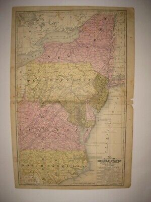
DC, DE, MD, NJ, NY, PA
-
ID, OR, WA
-
IL, IN, MI, OH, WI
-
MN, MT, ND, SD, WY
-
OK, TX
-
VA, WV, KY, TN
-
Entire US
-
United States (1900-Now)
-
United States (Date Unknown)
-
Africa
-
Asia
-
Australasia/ Oceania
-
Canada
-
Central America/ Caribbean
-
Europe
-
India
-
Ireland
-
Mexico
-
Middle East
-
North America
-
South America
-
United Kingdom
-
Maps on CD
-
World Maps
-
Globes
-
Mixed Lots
-
Reproductions
-
Price Guides & Publications
-
Other
|
In
Order by: Available to: This site contains affiliate links for which I may be compensated
|
Buy It Now
Free Shipping Location: Monroe, United States ORIGINAL 1853 ANTIQUE MAP OFNORTH CAROLINA, VIRGINIA, MARYLAND AND DELAWARE. ALSO SHOWN ARE PORTIONS OF THE SURROUNDING STATES. MAP HAS A SCALE BELOW ... moreTITLE AT TOP CENTER. AMAZING HAND-COLORING AND INTERESTING PRE-CIVIL WAR MAP.
Buy It Now
$6.15 Shipping Location: Bar Harbor, United States 1886 Original Antique Mitchell Map. Mitchell's Modern Atlas. North Carolina. West Virginia and.
Buy It Now
$12.00 Shipping Location: Rockville, United States Early map of the state. Nice detail. Morse's Atlas is one of the early large scale atlases that focused on the United States. Great piece of history. ... moreIf requested I can send a copy.
Buy It Now
$132.05 Shipping Location: Lansing, United States That region is the focal point of the present map. A lot of ink has been spilled speculating on the original source of the view, but it is generally thought ... moreto have been drawn in 1652, while Visscher’s version is regarded as the earliest obtainable version thereof and thus the earliest obtainable printed view of New York City.
Buy It Now
Free Shipping Location: Marana, United States This Map was removed form an 1860 Atlas and is in near pristine condition. Including Hundreds of RareCivil War. will receive. The page is approx 12 1/2" ... morex 15 1/2". This map is dated in small print at the base of the page.
Buy It Now
$5.50 Shipping Location: Dayton, United States Map is in Very Good Condition! Any Browning Is Enhanced By My Phone! Great Map!
Buy It Now
$7.00 Shipping Location: North Wales, United States 1849 SMITH'S GEOGRAPHY ATLAS MAP-MARYLAND, VIRGINIA, NORTH CAROLINA-HAND COLORED ORIGINAL ANTIQUE ATLAS MAP PLEASE SEE PHOTOS AS PART OF THE DESCRIPTION ... moreCONDITION: MAP IS IN GOOD CONDITION. SIZE: APPROXIMATELY 14" X 21" SHIPPING: U.S. FIRST CLASS RATE - $7.00 - ANY ITEM WHICH SELLS FOR OVER $100 WILL REQUIRE INSURANCE WE COMBINE SHIPPING FOR MULTIPLE WINS. THANK YOU FOR YOUR INTEREST IN OUR AUCTIONS!.
Buy It Now
Free Shipping Location: Monroe, United States ORIGINAL 1931 ANTIQUE COLOR GEOLOGICAL MAP OF PARTS OF MARYLAND, DELAWARE, VIRGINIA, WEST VIRGINIA, OHIO, PENNSYLVANIA, NORTH CAROLINA, NEW JERSEY AND ... moreSOUTH CAROLINA. RARE LARGE ORIGINAL 1931 ANTIQUE COLOR GEOLOGICAL MAP OF PART OF THE MID-ATLANTIC STATES.
Buy It Now
$9.00 Shipping Location: Cambridge, United States Original Print from "Collier's World Atlas " 1935 Hardcover First Edition(est) book. Approx 14 x 11". In good antique condition with typical wear as seen ... morein pics. One edge is raw. Opposite side may or may not have prints or text which may or may not be related to one shown.
Buy It Now
$9.95 Shipping Location: Clemmons, United States
Buy It Now
Free Shipping Location: Schertz, United States This is an authentic pre-war map of Virginia, North Carolina, Delaware, and Maryland. The map is an antique original that was published by Daniel Burgess ... morein the year 1855. It is a state map in atlas format and measures 9 1/2 x 11 1/2 in size. The map is a dated 1855 cartographer/publisher of the United States of America. Perfect for antique collectors, this map is a rare find and a must-have for anyone interested in the history of these states.
Buy It Now
$9.00 Shipping Location: Cambridge, United States Original Print from "Collier's World Atlas " 1935 Hardcover First Edition(est) book. Approx 14 x 11". In good antique condition with typical wear as seen ... morein pics. One edge is raw. Opposite side may or may not have prints or text which may or may not be related to one shown.
Buy It Now
$4.95 Shipping Location: Dover, United States Issued c. 1872, Philadelphia by S.A. Mitchell. 19th century lithographed map, with original hand color. Count Map of Virginia and West Virginia.
Buy It Now
$6.95 Shipping Location: Dover, United States Issued 1839, Connecticut by S. Augustus Mitchell. Engraved by J.H. Young. Early 19th century engraved map with original hand color. Map of the Middle ... moreStates and Part of the Southern. Original center fold as issued.
Buy It Now
$6.95 Shipping Location: Dover, United States Issued 1833, New York by E. & G.W. Blunt. Engraved by Hooker. Entrance to the Chesapeake Bay Reduced from the Surveys Made by D.P. Adams and Others by ... moreOrder of the Navy Commissioners of the U.S. Early 19th century engraved coastal survey with lovely hand color.
Buy It Now
$3.50 Shipping Location: Dover, United States Tazewell North Quadrangle Virginia- 7.5 Minute Series. The map in the photo is the actual map you will receive. Year Published: 1977.
Buy It Now
Free Shipping Location: Anaheim, United States Typically that map at hand, the one being looked at, is in the center box. feature within the bounds of the map, which frequently is a community, town, ... moreor city. The map covers a specific amount of area.
Buy It Now
Free Shipping Location: Orlando, United States This map is double sided. The map was published by Rand, McNally & Co. in 1901 in the New Imperial Atlas of the World.
Buy It Now
Free Shipping Location: Monroeville, United States Date - 1869.
Buy It Now
Free Shipping Location: Anaheim, United States Typically that map at hand, the one being looked at, is in the center box. Scale: 1:100,000 (100K). feature within the bounds of the map, which frequently ... moreis a community, town, or city. The map covers a specific amount of area.
Buy It Now
Free Shipping Location: Anaheim, United States Typically that map at hand, the one being looked at, is in the center box. Scale: 1:100,000 (100K). feature within the bounds of the map, which frequently ... moreis a community, town, or city. The map covers a specific amount of area.
Buy It Now
$6.95 Shipping Location: Atlanta, United States I will list if I have them. It DOES NOT have an institutional ink stamp. The map in the photo is the actual map you will receive.
Buy It Now
Free Shipping Location: Monroeville, United States Date - 1880. inventory # j74129. Condition - Very Nice.
Buy It Now
$4.99 Shipping Location: Fairview, United States Title: Map of Part of Virginia, North Carolina, South Carolina and Georgia which were the Scenes of the most Important Operations of the Southern Armies. ... moreIt is from John Marshall'sAtlas to the Life of Washington, published in Philadelphia,1834, a facsimile copy of the title page is included for authenticity.
Buy It Now
$5.25 Shipping Location: Dayton, United States 21-63d Congress, 3d Session, December 7, 1914-March 4, 1915: Examinations Of Rivers and Harbors.". Map is in Very Good Condition! Great Map!
Buy It Now
$3.50 Shipping Location: Dover, United States Year Published: 1956. North Bay Quadrangle Virginia- 7.5 Minute Series. The map in the photo is the actual map you will receive.
Buy It Now
Free Shipping Location: Anaheim, United States Typically that map at hand, the one being looked at, is in the center box. Scale: 1:100,000 (100K). feature within the bounds of the map, which frequently ... moreis a community, town, or city. The map covers a specific amount of area.
Buy It Now
$3.50 Shipping Location: Dover, United States Newport News North Quadrangle Virginia- 7.5 Minute Series. The map in the photo is the actual map you will receive. Year Published: 1980.
Buy It Now
$9.99 Shipping Location: Ivanhoe, Australia After this point, Mr. Barber acted only as engraver for Mr. Howe. In 1845, Howe started his Virginia project. The Ohio effort began January 1846 in Marietta, ... moreOhio, and Howe intended to walk across the state, but bought a broken-down horse after 100 miles.
Buy It Now
$11.85 Shipping Location: Dover, United States Issued 1797-1804, United States by Bradley. Map is perfect candidate for basic cleaning restoration but worthy of display as it survives.

Buy It Now
Free Shipping Location: New London, United States Click Here. Double your traffic. Get Vendio Gallery- Now FREE! RARE 1762 ACCURATE MAP OF THE BRITISH EMPIRE IN NORTH AMERICA. VIRGINIA, CANADA, RARE 1762 ... moreACCURATE MAP OF THE BRITISH EMPIRE IN NORTH AMERICA. VIRGINIA, CANADA\ This is a complete and original/authentic issue of"The Gentleman's Magazine For December 1762" Contains 46 pages and is in very nice condition. The masthead of this periodical has a decorative and displayable engraving of St. JOHN's Gate which still stands today. It is 5 1/4 x 8 1/4 inches in size, authentic and guaranteed to be as described. This historical issue contains an enormous amout of text/articles from the year of 1762 including the Treaty of Fountainebleau and so much more as you can see in the index page! Also included in this issue is a RARE map titled"An Accurate Map of the British Empire in Nth America as settled by the Preliminaries in 1762" With the inset of"A Chart of the Entrance of the Mississippi" This map is 8 3/4 x 10 1/2 inches in size and still attached to the Gentleman's Magazine of December as issued. A small section of the lower left margin is a bit short and the map has faint folds as issued in the 1762 issue of"The Gentleman's Magazine" Overall the map is in good condition with wide margins and would be great for display! The Gentleman's Magazine" founded in 1731. Is a Historical Chronicle/publication/digest containing news of the day and regular features including mathematical theories and problems, short stories, births, deaths and marriages, price of goods grains and stocks, poetical essays, songs with musical notation, inventions and curiosities, meteorogical accounts and so much more! The Gentleman's Magazine was the most influential periodical of it's time. These periodicals are not brittle as they were printed on a durable rag-linen paper. They can be handled and researched carefully without damage. This issue is still adjoined at the spine. There is a plethora of historic content in
Buy It Now
Free Shipping Location: Elmer, United States Map may have marks, spots, minor creases or other flaws.
Buy It Now
$3.65 Shipping Location: United States Fine antique 1859 handcolored 2 sided map, titled Maryland, Virginia, North Carolina South Carolina. Interesting period map of this area. Reverse is a ... morefine handcolored map of City & County of Philadelphia.
Buy It Now
$21.10 Shipping Location: TAMWORTH, United Kingdom 1890 Bartholomew VIRGINIA, WEST VIRGINIA, NORTH CAROLINA, SOUTH CAROLINA Map47cm x 34cm
Buy It Now
Free Shipping Location: Anaheim, United States Typically that map at hand, the one being looked at, is in the center box. Scale: 1:100,000 (100K). feature within the bounds of the map, which frequently ... moreis a community, town, or city. The map covers a specific amount of area.
Buy It Now
$4.13 Shipping Location: Mason, United States Quadrangle Currituck Sound, North Carolina; Virginia; Eastern United States 1:250,000.
Buy It Now
$3.50 Shipping Location: Dover, United States Front Royal Quadrangle Virginia- 7.5 Minute Series. Year Published: 1973. The map in the photo is the actual map you will receive. Places: Front Royal, ... moreShenandoah Shores, Riverton.

Buy It Now
$3.75 Shipping Location: United States Click Here. Double your traffic. Get Vendio Gallery- Now FREE! Fine antique 1858 handcolored Augustus Mitchell map. The map is printed on thick fine paper. ... moreWith no printing on reverse. The map is titled Map of the Middle States. The map shows New York, New Jersey, Pennsylvania, Maryland, Virginia, with no West Virginia yet, and North Carolina. The ocean areas are detailed as well, with tall ships in the water. Very fascianting and detailed period map. Printed at the bottom is Entered according to Act of Congress in the year 1852 by S. Augustus Mitchell in the Clerk's Office of the District Court of the eastern district of Pennsylvania. This dates the map nicely.The map is in excellent condition, with a small bit of clean seperation at right hand side middle, this can be common in old antique maps, if framed will be fine. The superb handcoloring on the map is period to the map, this is before color printing. The size of the map is 12" by 18" Rare. Winning bidder pays $3.50 shipping domestic, more foreign. Payment I accept the following forms of payment: PayPal Click to View Image Album Shipping& Handling US Shipping. $3.50 USPS First-Class Mail® International Shipping. $11.50 USPS First-Class Mail International FREE scheduling. Supersized images and templates. Get Vendio Sales Manager. FREE scheduling. Supersized images and templates. Get Vendio Sales Manager. 1?RcmdId ViewItemDescV4,RlogId p4%60bo7%60jtb9%3Feog4d72f%2B%3E%3B1%3F-1417412e953-0x105-
Buy It Now
$3.50 Shipping Location: Dover, United States Tazewell North Quadrangle Virginia- 7.5 Minute Series. Year Published: 1971. The map in the photo is the actual map you will receive.
Buy It Now
$6.95 Shipping Location: Dover, United States Rappahannock River Virginia from Fredericksburg to near Moss Neck. Issued 1856, Washington by United States Coastal Survey. Detailed mid 19th century ... morelithographed coastal survey. Reference includes dates of survey, as well as yearly tidal information.
Buy It Now
Free Shipping Location: Monroeville, United States An ORIGINAL antique map of VIRGINIA. WEST VIRGINIA, MARYLAND, and NORTH and SOUTH CAROLINA from Mitchell's New Intermediate Geography Atlas, 1876. ... moreThe States are individually hand water colored. Dozens of early railroads are shown throughout the region. The map measures 9 1/2 by 12 inches. This ORIGINAL antique map is guaranteed over 135 years old published just a decade after the Civil War. I do not sell reproductions. Just honest maps at honest prices. Discounted shipping too. All items shipped within 2 business days after payment. If you have not received an item in a reasonable amount of time please email me. It has been delayed by the Post Office. I also accept returns on ANY item for ANY reason, please email me I am very easy to work with. Feedback is not the same thing as an email, please email first. On Oct-19-07 at 13:06:06 PDT. Seller added the following information:
Buy It Now
$8.00 Shipping Location: Saco, United States Entered into US Congress by Daniel Burgess, 1853. Interesting and detailed county map. Shows cities and railways. Overall in very good condition. Minor ... morewear, old age toning, light soiling.
Buy It Now
$4.13 Shipping Location: Mason, United States Quadrangle Eastville, Virginia; North Carolina; Maryland; Eastern United States 1:250,000. US Geological Survey Topography Map,1946, Revised 1969. In ... morevery good condition. Pictures of the front and back of that tear included.
Buy It Now
$5.00 Shipping Location: Palenville, United States
Buy It Now
Free Shipping Location: Anaheim, United States Typically that map at hand, the one being looked at, is in the center box. Scale: 1:100,000 (100K). feature within the bounds of the map, which frequently ... moreis a community, town, or city. The map covers a specific amount of area.
Buy It Now
$3.50 Shipping Location: Dover, United States Radford North Quadrangle Virginia 7.5 Minute Series. Places: Fairlawn, Radford, Belspring, New River, Parrott, McCoy. Year Published: 1978. The map in ... morethe photo is the actual map you will receive.
Buy It Now
Free Shipping Location: Anaheim, United States Typically that map at hand, the one being looked at, is in the center box. Scale: 1:100,000 (100K). feature within the bounds of the map, which frequently ... moreis a community, town, or city. The map covers a specific amount of area.
Buy It Now
$6.95 Shipping Location: Atlanta, United States I will list if I have them. It DOES NOT have an institutional ink stamp. The map in the photo is the actual map you will receive.
Buy It Now
$6.00 Shipping Location: North Wales, United States 1866 ANTIQUE CIVIL WAR MAP-NORTH OF RICHMOND, VIRGINIA-EXCELLENT DETAIL ORIGINAL ANTIQUE CIVIL WAR MAP PLEASE SEE PHOTOS AS PART OF THE DESCRIPTION CONDITION: ... moreMAP IS IN GOOD CONDITION. FOXING PRESENT. SIZE: APPROXIMATELY 6" X 6.5" SHIPPING: U.S. FIRST CLASS RATE - $6.00 - ANY ITEM WHICH SELLS FOR OVER $100 WILL REQUIRE INSURANCE WE COMBINE SHIPPING FOR MULTIPLE WINS. THANK YOU FOR YOUR INTEREST IN OUR AUCTIONS!.
Buy It Now
$4.99 Shipping Location: Sackets Harbor, United States
Buy It Now
Free Shipping Location: Riverside, United States Rare & Authentic Color Map. Condition: Minor yellowing due to age, NO TEARS. Exquisite Detail. . READY for FRAMING!
Buy It Now
$3.50 Shipping Location: Dover, United States Strasburg Quadrangle Virginia- 7.5 Minute Series. Places: Strasburg. Water Bodies: Cedar Creek, Lake John, North Fork Shenandoah River, Passage Creek, ... moreSouth Fork Shenandoah River, Strasburg Reservoir.
Buy It Now
$6.00 Shipping Location: Jacksonville, United States 1901 Tunison North Carolina with West Virginia on reverse antique map. Overall, very good condition.
$25.00 Shipping Location: Perugia, Italy This map was originally published in 1833 by Chapman & Hall in S.D.U.K. Atlas. It was engraved by John Walker of J. and C. Walker. Date: 1833 ( dated ... more). The admirable goal of the Society was to distribute useful information via a series of publications to the English working and middle classes.
Buy It Now
$3.75 Shipping Location: United States Lake Erie Maps& Prints An Authentic Antique Map: Not a Modern Reproduction! Click Here for more Antique Maps and Prints No Additional Shipping Fees ... moreon Multiple Maps Shipped with the Largest Free Shipping on 5 or More Maps and Prints Description: It is an authentic antique copper engraved map over 175 years old with original hand coloring as issued with plate indentions embossed around the margins. It is from Smith's Atlas for Schools. Academies and Families by Roswell Smith(Hartford: Daniel Burgess& Co. 1839) a copy of the atlas title page is included for authenticity. There is a copyright date of 1839 by Burgess printed in the bottom margin of the map. The map is not mounted, matted nor framed being sold as seen in the main pic, photographed against a dark background. Overall, a very nice rare example, printed on a heavy page, blank on the reverse. Size: The image area measures 10 1/2 by 16 1/2 inches(27x42cm) within the neat lines and the entire page measures 12 by 19(35x50cm) as seen in the pic. Condition: It is in Good condition for its age. Printed on a light buff page, blank on the reverse with original handcoloring and a centerfold as issued. It is basically as seen in the pics. There is some backprinting and general handling with age, otherwise it has a real classic antique appearance with strong color and a rich patina very desireable. Pics are of the actual map, although the actual map look much better. Payment Details: We accept most major credit cards through Paypal and Ebay. Please ask if you have any questions about payment. International and New Bidders are welcomed and encouraged. Payment is expected within 7 days. After which Nonpaying Bidders will be reported to Ebay to recoup our listing fees. Save on Shipping: We only charge one shipping fee based on the largest map or print with multiple items shipped along with it for no extra costs. Purchase 5 or more maps or prints and receive Free First Class shipping in USA or First Class International elsewhere in the world. Although registr
Buy It Now
$7.00 Shipping Location: Blue Bell, United States 1891 ANTIQUE CIVIL WAR BATTLE MAP-THE WILDERNESS & NORTH ANNA, VIRGINIA-PLATE 54 ORIGINAL ANTIQUE CIVIL WAR MAP PLEASE SEE PHOTOS AS PART OF THE DESCRIPTION ... moreCONDITION: MAP IS IN GOOD CONDITION. FOXING PRESENT. SIZE: APPROXIMATELY 6" X 6.5" SHIPPING: U.S. FIRST CLASS RATE - $6.00 - ANY ITEM WHICH SELLS FOR OVER $100 WILL REQUIRE INSURANCE WE COMBINE SHIPPING FOR MULTIPLE WINS. THANK YOU FOR YOUR INTEREST IN OUR AUCTIONS!.
Buy It Now
Free Shipping Location: Schertz, United States This antique map page of the Mid-Atlantic states including North Carolina, Virginia, New Jersey, and Delaware was printed in 1858 by S.A. Mitchell / E.H. ... moreButler & Co. It measures 11" x 18" and features all original colors produced through lithography printing technique. The map showcases the US states in detail, and it is a perfect addition to any antique map collection. This antique original is a must-have for enthusiasts, historians, and anyone who appreciates the beauty and craftsmanship of old cartographer/publisher works.
Buy It Now
$5.95 Shipping Condition: New Location: Las Vegas, United States Colonial Virginia. “Vibrant and bright! Pic does not do it justice.looks amazing!”. Each of our prints are custom reproductions printed on 68lb Heavyweight ... moreEnhanced Matte Art Paper. These Historic Art Prints are suitable for framing, mounting or direct display on any wall!
Buy It Now
$9.99 Shipping Location: Ivanhoe, Australia The campus comprises 335 acres of Washington County, which is part of the Appalachian highlands of Southwest Virginia. Founded in 1836, Emory & Henry ... moreCollege is the oldest institution of higher learning in Southwest Virginia.
Buy It Now
$6.95 Shipping Location: Dover, United States Rappahannock River Virginia from Moss Neck to Port Royal. Reference includes dates of survey, as well as yearly tidal information. Shoals and sounding ... moredepths impart a unique visual quality. Issued 1856, Washington by United States Coastal Survey.
|
|
|
In
|
Virginia North South Carolina Georgia Alabama Mississippi LA Tennessee 1833 Map
Virginia North South Carolina Georgia Alabama Mississippi LA Tennessee 1833 Map SOUTHERN STATES Original 1833 map"Southern States" Hand colored. This 179 year old map is in very good condition light age toning. Overall size 7' x 5' Purchase with confidence. We have been in the antique print, map, and document business since 1976 and guarantee our items as advertised. See additional photos below! To See More Photos/Scenes Powered by Click Here. Double your traffic. Get Vendio Gallery- Now FREE!
|
|
|
Virginia North Carolina Pamlico Albemarle Civil War map 1863 Trow battle spots
Virginia North Carolina Pamlico Albemarle Civil War map 1863 Trow battle spots PAMLICO AND ALBEMARLE SOUNDS(Virginia Coast& North Carolina) Issued New York. 1863 by Trow. Attractive. Well-preserved mid-19th century lithographed map relating to the American Civil War. Nicely detailed. What distinguishes this image is that it was printed during the Civil War. And not afterwards. In good+. Mostly clean condition. Some light to moderate foxing and spotting- mainly to margins and outside of engraved area. Otherwise clean and well-preserved overall. Text on verso as issued. Sheet measures c. 6 1/8" W x 9 1/2" H. Engraved area measures c. 4 1/4" W x 7 1/2" H. 5352] Any defects along the sheet edges and in the margins may be seen in the photos. note: All old sheets of printed paper possibly have short edge splits. Each sheet ... morehas existed for a very long time and has probably been handled repeatedly in the course of it's existence. It has a history unique to it as an object. Most of the time any edge splits are short. Minor, insignificant and have been closed- either long ago or more recently with small pieces of archival tape. Most often these splits are trivial and easy to overlook visually. Basically, they would not significantly affect the piece adversely. The item is offered as seen. Please look carefully and make your decision knowing this antique image is nice. But it is not in perfect"like new" condition. However, with whatever flaws it possesses, it remains entirely worthy of ownership and inclusion in any related collection. We feel it will prove very pleasing to its new owner. We stand behind everything we sell. Everything we offer is guaranteed to be an authentic original antique item as described. We do not sell modern reproductions. Please visit our. We happily accept PayPal! WE OFFER FLAT RATE SHIPPING WORLD WIDE! Please request an invoice before paying for multiple items so that we can ensure that
|
|
|
State Maps - OUTER BANKS, NORTH CAROLINA (NC) AND VIRGINIA (VA) 1590
This is an exquisite full-color Reproduction printed on heavyweight(7.0 MIL) Glossy Photo Paper. These maps are perfect for framing. Or a wonderful and unique gift for family members, friends or co-workers! All Information is Carefully Compiled from Actual Surveys Original Maps are often difficult to find and usually have fold lines. Identifying stamps or markings, tears, ragged edges, and assorted other natural signs of age that detract from their beauty. All of our maps have been professionally restored to depict their original beauty, while keeping all historical data intact. These maps are fabulous pieces of history full of information useful to Historians. Genealogists, Cartographers, Relic Hunters, Others. They make fascinating conversation pieces and splendid works of art for the home or office. Map Size: 29 x 23 Site Specifics To ... moreThis Map Are: Wokokon. Croatoan, Paguiwoc, Hatorask, Roanoac, Trinity Harbor, Pasquenoke, Chepanuu, Tramasguecoock, Meguopen, Chepanuu, Mascoming, Waratan, Apasus, Eheseptooc, Skicoak, Catokinge, Metpcuuem, Tandaquomuc, Moratuc, Ohaunoock, Chawanook, Weapemeoc and Secotan. The following towns are featured: This Map is Situated in: North Carolina(NC) and Virginia(VA) SKU: NCOU0001 and Powered By:
|
|
|
Antique Civil War Map GEORGIA Virginia TENNESSEE North South CAROLINA Kentucky
Original Plate of"The Official Atlas to Accompany the Official Records of the Union and Confederate Armies. Published by the Resolution of the U.S. Congress of May 19. 1864 as The Official Historical Record of The Civil War, and was Never Openly Sold, but Distributed only to Federal Depositories, University Libraries, Public Museums, various Public& Semi-Public Concerns, And of Which Fewer Than 1.000 Complete Atlases Remain. Fine Adornment of Civil War History. Impressive on Any Home or Office Wall. Imaginative& Creative Gift. Highly-Prized Plate CXVIII. Showng Route of Jefferson Davis from Richmond until his capture May 10. 1865 Near Irwinville, Georgia. Map of 1861-1865 Campaign of Army of The Cumberland Only Map Of The 175 Showing Jefferson Davis' Line of Flight From Richmond& His Capture on May 10. 1865. Original ... morePlate of The Official Atlas to Accompany The Official Records of The Union& Confederate Armies. 175 Plates Issued in 35 Parts. Part 24. Plate CXVIII. Original Plate CXVIII(118) of the 175 Issued. Original 1894. 119-ys-old. Map is in Very Good/Excellent Condition: No writings. Marks, soiling, or tears. Mild foxing. Single fold as Issued. Not a Reproduction. Original Plate CXVIII(118) of the 175 Issued of The Atlas to Accompany the Official Records of the Union& Confederate Armies. Commissioned by a Resolution of Congress of May 19, 1864, Published Under the Direction of the Hon. Daniel S. Lamont, Secretary of War, by Major George B. Davis, Leslie J. Perry, and Joseph W. Kirkley, Board of Publications. Compiled by Calvin D. Cowles, 23rd Infantry, Washington, D.C. Government Printing Office, 1894; a copy of the Preface, Part Volume, Title Page of which is Included. Engraved by Julius Bien& Co. Lithographers. An Exceptional Map for the Collector or Makes Quite an Impressionable Gift. I Sell Only Original Maps: No copies or reproductions. Press Here to View My Collection. Impressive on Any Home or Office Wall. Dimensions: 18" x 29.5" So Large It Makes Itself The
|
|
|
Original 1873 Antique Map NORTH SOUTH CAROLINA Charleston VIRGINIA Richmond
Impressive Adornment of History on Any Home or Office Wall. Imaginative& Creative Gift. 1873 Map of Virginia. West Virginia, North& South Carolina T. Ellwood Zell Map. Engraved by John Bartholomew. Original 1873. 139-ys-old. Map is in Good/Very Good condition: No marks. Writings, or foxing. Slight separation along border at fold. Single fold as Issued. Not a reproduction. Original Map Drawn& Engraved by John Bartholomew for T. Ellwood Zell's 1873 Edition of Zell's Popular Encyclopedia. A Complete Dictionary of the English Language with A Pronouncing Vocabulary and a Gazetteer of the World, Edited by L. Colange, L.L.D. Accompanied by an Index of Each Map Forming a Complete Atlas of the World; John Bartholomew, F.R.G.S, Engraver, and Published by T. Ellwood Zell, Davis, Co. Philadelphia, 1873; a copy of the Title Page of ... morewhich is Included. Beautiful Large 17" Map with Intricate Engraved Detail and Exceptional Color. Handsome Adornment of History on Any Home or Office Wall. Fine Map for the Collector or Makes Quite An Impressionable Gift. I Sell Only Original Maps: No copies or reproductions. Press Here to View My Collection. Impressive on Any Home or Office Wall. Dimensions: 12.5" x 17" John Bartholomew Engraved. Intricate Detail. Large Handsome Map. Imaginative& Creative Birthday. Christmas, Graduation, or Other Special Occasion Gift. Free Shipping Special. All Credit& Debit Cards along with Electronic Checks accepted through Paypal. Please email with any questions. Greetings from Historical Savannah. Georgia; founded 1733. Some. To beautify their halls, parlors, studies, or libraries.loveth, getteth, and useth maps, charts, and geographical globes. John Dee. Advisor to Elizabeth I. Press the Store Link Below to View My Collection. Powered by The free listing tool. List your items fast and easy and manage your active items.
|
|
|
Antique North Carolina or Virginia & West Virginia Map 1873 Gray's Atlas Color
This map is in very good condition with some wear around the edges. Map measures 14 x 17 inches and is suitable for framing. The atlas title page shown is not included in the auction and is shown for the purpose of authentication only. You are bidding on a page from a 1873 atlas. Please keep in mind. If it is a two sided page, only one map can be displayed at a time. This map will be shipped wrapped in plastic and in a cardboard shipping tube. Thanks for looking and please be sure to visit my other auctions for more antique and vintage maps. Ads, magazines, post cards, books, and more. Powered by
|
|
|
1872 Mitchell's MAP OF MARYLAND VIRGINIA NORTH & SOUTH CAROLINA Hand Colored
Auction Wizard 2000 Listing Template- AW2KLOT#6221 Please note that Customs delays for international shipping have been SIGNIFICANT lately- days or even weeks longer than they should be! Please take this into consideration Our goal is 5 star service! If you feel we have not lived up to a 5 star rating. Please contact us as we only want 100% satisfied customers and NO misunderstandings! Description below pictures* 1872 Mitchell's MAP OF MARYLAND VIRGINIA NORTH& SOUTH CAROLINA Hand Colored* $28.00 An Original Vintage Antique Map: Not a Reproduction! See Our Ebay Store for other Antique Maps! Free US Shipping on Purchases of $100 value or more of Maps and Prints Description: This is an authentic antique map approximatley 141 years old! Published by E.H. Butler& Co. for Mitchell's New Intermediate Geography in 1872(photo of title ... morepage shown but NOT included with this map) Hand colored copper plate engraving. Text on reverse. The map is not mounted. Matted or framed and is being sold as a single sheet as shown in the first picture. Size: Map measures approximately 12 by 9 5/8 inches(30.4 x 24.4 cm) as seen in the pictures. Condition: This map is in good to very good condition. Some soiling evident along edges. Light foxing as seen in the pics. It is basically as seen in the pics. Will frame up nicely. See pictures for more on condition. The pictures shown are of the actual print being sold. Shipping: Please use the calculator under the"Shipping and payments" tab above to determine shipping for your location. All packages are sent with Delivery confirmation where possible. We always combine shipping. So on multiple items please wait until we send you an invoice with the correct shipping applied. Maps and Prints will be shipped either flat or rolled depending on the items being shipped. We use only sturdy shipping materials to make sure the package arrives at its destination in undamaged condition. Insurance is on US! Please ask if you have any questions about shipping. Payment Details: We acce
|
|
|
1895 North Carolina Dated Color Map* W. Virginia Back
1895 North Carolina Dated Original Color Map Vintage. Original 1895 North Carolina Dated Color Atlas Map. West Virginia color map is on the back. This is a LARGE ORIGINAL.NOT A REPRINT. 116 +++ year-old Dated on the front atlas map.that measures 14" x 11" with the borders and would look fantastic matted and framed. The map is indexed on the side borders where it includes area and population broken down by gender and race; It also includes counties and the major towns and cities with their respective populations. The map shows towns and cities. Railroads, rivers, streams and other Geographic features, etc. NOTE: The map doesn't show roads. Great. Historic Item. NOTE CONDITION: The map has some lite border and corner wear. Otherwise. It is in Nice Condition. Please see the attached photo to view the Map and a couple of closeup ... moresections of the map. Please note that the map is too large for my scanner.also. All of the printing is small but very readable* Purchase this vintage old Dated map for only $14.95. U.S. Buyer pays $3.00 for shipping. $4.00 shipping to Canada; $6.00 to Europe. 1-4 maps can be combined to save on shipping. PLEASE READ: This is an original Dated 1895 atlas map. I prefer satisfied customers and try to accurately describe all of my maps and Ebay items so there is not any misunderstandings.If you have any questions about this map or any of my Ebay items. Please email me before bidding.Thanks! 031511 NCar95.1 R Please Visit My Ebay Store To View My Alabama. Birmingham, North& South Carolina, Charleston, Georgia, Atlanta, Tennessee and My Other Vintage Maps. Thanks For Looking! ALL INTERNATIONAL BUYERS PLEASE READ: Please be aware that some packages going into Canada. The UK and France are taking a very long time for delivery.2-weeks and longer in some cases depending on customs. Although I mail them as quickly as I can.I have no control over how long it takes for them to be delivered after I mail them.Also, These old maps are shipped in sturdy mailing tubes and ar
|
|
|
1895 NORTH CAROLINA WEST VIRGINIA Atlas Map McNally Original Antique
An ORIGINAL antique color map of NORTH CAROLINA from McNally's Atlas. 1895. A map of WEST VIRGINIA is on the reverse side. Map shows counties individually colored along with hundreds of railroads with their names printed next to them. The map measures 11 by 14 inches and an index in the margin lists counties, chief cities, land area, and population further divided into MALE, FEMALE, NATIVE, FOREIGN, WHITE, AFRICAN, CHINESE, JAPANESE, and INDIAN. Date is printed along the lower border. Perfect for matting and framing. This ORIGINAL antique map is guaranteed over 110 years old. I do not sell reproductions. Discounted shipping too. NO international shipping. NO exceptions. I ship all items within 2 business days but the Post Office can sometimes be very slow delivering them. If there is a delay in your receiving an item please send me an ... moreemail and I will track it down. I also have a 100% refund policy if you are unhappy with an item for ANY reason. Just email me I am very easy to work with. On Oct-19-07 at 13:06:06 PDT. Seller added the following information:
|
|
|
NORTH AMERICA VIRGINIA CAROLINA GEORGIA FLORIDA USA ENGR. MAP BLAEU 1640 #A890S
Decorative Large-size. Coloured copper engraving map, published by Joan Blaeu in Amsterdam about 1640 AD Splendid Map of the East coast- Virginia- Florida- North America"Virginiae partis australis. Floridae partis orientalis. Cartographer: Joan Blaeu( 1596 in Alkmaar. The Netherlands, December 28, 1673 in Amsterdam, Netherlands) was a Dutch cartographer and engraver. Description: We offer a large and decorative coloured copper engraving map out of the german edition"Theatrum Orbis Terrarum" ByBlaeu. This detailed map shows the Territoty of Virginia, Georgia and Florida along the East coast from the today USA. The map is decorated with a beautiful title cartouche and some staffeges. The map is a wonderful collection item! Size: Leaf app. 58.5 x 50,1 cm Map app. 48.5 x 38,5 cm Condition: good condition strong print slightly stained ... moreand brownish Please have a look at the pictures! We offer only Originals. No Reproductions! Dekorative Großformatige. Kolorierte Kupferstich Karte von Joan Blaeu, gedruckt in Amsterdam um 1640 AD Prächtige Karte von der Ostküste- Virginia- Florida- Nordamerika"Virginiae partis australis. Floridae partis orientalis. Kartograph: Joan Blaeu( 1596 in Alkmaar. Niederlande; 28. Dezember 1673 in Amsterdam, Niederlande) war ein niederländischer Kartograf und Kupferstecher. Beschreibung: Wir bieten Ihnen eine große und dekorative kolorierte Kupferstich Karte aus einer deutschen Ausgabe"Theatrum Orbis Terrarum" Bei Blaeu an. Diese detallierte Karte zeigt das Territerium von Virginia, Georgia und Florida entlang der Ostküste der heutigen USA. Die Karte ist dekoriert mit einer schönen Titelkartusche und einigen Staffagen. Sehr dekoratives und wunderschönes Sammelobjekt! Maße: Blatt ca. 58.5 x 50,1 cm Karte ca. 48.5 x 38,5 cm Zustand: guter Zustand kräftiger Druck etwas gebräunt und fleckig Sehen Sie sich die Bilder an! Wir bieten Ihnen nur Originale an und keine Reprodukt
|
|
|
1880 NORTH SOUTH CAROLINA VIRGINIA Map MITCHELL ATLAS Hand Colored Original!!
An ORIGINAL antique map of NORTH and SOUTH CAROLINA. VIRGINIA, and WEST VIRGINIA from Mitchell's New Intermediate Geography Atlas, 1880. The States are individually hand water colored and dozens of early railroads from the time period are shown. The map measures 9 1/2 by 12 inches. This ORIGINAL antique map is guaranteed over 130 years old. I do not sell reproductions. Just honest maps at honest prices. Discounted shipping too. NO International shipping. NO exceptions. All items shipped within 2 business days after payment. If you have not received an item in a reasonable amount of time please email me. It has been delayed by the Post Office. I also accept returns on ANY item for ANY reason, please email me I am very easy to work with. Feedback is not the same thing as an email, please email first. On Oct-19-07 at 13:06:06 PDT. Seller ... moreadded the following information: jy.RcmdId ViewItemDescV4,RlogId p4%60bo7%60jtb9%3Fuk%601d72f%2Bkw4sjm5%3Ejy-14186ff7c8e-0xf3-
|
|
|
J. Purcell: A Map of the States of Virginia, North Carolina, South Carolina 1792
C I R Q L A R Original antique prints. Books, maps and atlases Image Name A Map of the States of Virginia. North Carolina, South Carolina And Georgia: Comprehending The Spanish Provinces Of East And West Florida. Author/Artist Joseph Purcell. Published by John Stockdale. 1792 Date of Publication Dated on map June 25. 1792. Miscellany Very difficult to acquire original folio map of the United States as depicted east of the Mississippi River. Map Dimensions Folio: 15 3/4" X 16 1/2" Condition In overall very good to excellent condition. With old fold creases and some browning as is seen in the pictures below. Description We are proud to be able to offer an exceptionally fine example of a late-18th c. map by J. Purcell entitled A Map of the States of Virginia. North Carolina, South Carolina And Georgia: Comprehending The Spanish Provinces ... moreOf East And West Florida. This black and white map was engraved for Morse's Geography. It is indeed a rare map. Thank you for looking and please be sure and look at our other auctions for other fine original natural history plates as well as original maps. All guaranteed original. Thank you for looking. about me" section where you can find more information about who we are and what we do as well as more tips on collecting prints and the various types of printing techniques that have been used over the years. In addition. We have hundreds of rare prints and colorplate books, maps and atlases at set prices. We have recently been fortunate enough to acquire, for example, the original watercolors from Lewin's"Birds of Great Britain" We also have listed several prints from Shaw and Nodder's"The Naturalist's Miscellany" flower prints from Curtis' Flora Londinensis" We will be updating this frequently. We are committed to offering the very best antique prints available with over the top superior service. Please click"here" for more information about us. Thank you for looking.
|
|
|
1895 Antique Historic Map of NORTH CAROLINA - WEST VIRGINIA on reverse
1895 Antique Map of North Carolina with West Virginia on the reverse 11" x 14" This is an original page(not a reproduction! from the Philadelphia Public Ledger's Unrivaled Atlas of the World. It was prepared and published especially for The Public Ledger. Philadelphia, PA in 1899, George W. Childs Drexel. Editor and Publisher, by Rand. McNally& Co. Chicago and New York A great gift for a collector or resident! These old maps are becoming harder and harder to find. When framed. It becomes a work of art. Look at the prices of other antique maps. And you will see that this starting price is low in comparison. Will ship rolled in a hard mailing tube. Look at my other maps that will be listed in the coming days. Second and all subsequent maps ship for f ree in the same tube. Happy bidding and thanks for looking!
|
|
|
Maryland Virginia North South Carolina 1868 Map Hand Color Teachers Lesson
Maryland Virginia North South Carolina 1868 Map Hand Color Teachers Lesson MAP Original 1868 map"Maryland Virginia North and South Carolina" Hand colored. Good condition. Philadelphia map on reverse side. Overall size 9 1/2' x 7 1/2' Purchase with confidence. We have been in the antique print, map, and document business since 1976 and guarantee our items as advertised. See additional photos below! The black circles that show in some of the listings are magnets that we use to hold image. To See More Photos/Scenes Powered by Click Here. Double your traffic. Get Vendio Gallery- Now FREE!
|
|
|
Southern States 1832 Map Hand Colored Georgia North South Carolina Virginia
Southern States 1832 Map Hand Colored Georgia North South Carolina Virginia SOUTHER STATES Original 1832 map"Southern States" Hand colored. This 171 year old map is in good condition, overall size 7' x 5' Purchase with confidence. We have been in the antique print, map, and document business since 1976 and guarantee our items as advertised. See additional photos below! The black circles that show in some of the listings are magnets that we use to hold image. To See More Photos/Scenes Powered by Click Here. Double your traffic. Get Vendio Gallery- Now FREE!
|
|
|
Appalachian Province Pennsylvania Virginia North Carolina 1893 Geology Map
Appalachian Province Pennsylvania Virginia North Carolina 1893 Geology Map Appalachian Original 1893" Appalachian Province" Map is in good condition. Overall size 14' x 11' Purchase with confidence. We have been in the antique print, map, and document business since 1976 and guarantee our items as advertised. See additional photos below! The black circles that show in some of the listings are magnets that we use to hold image. To See More Photos/Scenes Powered by Click Here. Double your traffic. Get Vendio Gallery- Now FREE!
|
|
|
Original 1861 US Map NORTH LANDING RIVER CURRITUCK SOUND Virginia North Carolina
Original 1861 US Map NORTH LANDING RIVER CURRITUCK SOUND Virginia North Carolina Original large-format lithographed fold-out Civil War-era chart of North Landing River and the head of Currituck Sound. Printed more than 143 years ago. This handsome map was published by the United States Coast Survey in 1861 and is drawn on a scale of 1:40.000. The coverage area extends from the Pungo Bridge across the North Landing River in Virginia to just south of Currituck Court House, North Carolina, and east to Knott's Island Channel. The image area of this map measures 53.3 x 42.5 cm[21" x 16-3/4" And it is titled Preliminary Chart of North Landing River(Head of Currituck Sound) Virginia& N. Carolina. It gives soundings and bottom conditions. And includes this note on tides: There is no lunar tide in these waters. The water rises and ... morefalls according to the direction of the wind. There is a large compass rose. And shoreline features include roads, houses, and farms. Among the specific named places and features are Munden's Point, Faraby's Island, Gibbs' Woods, Bellows Bay, Great Marsh, Morses Point, Northwest River, Mackays Island, and more.The scans below give a closer look at some of the detail: Condition: This map is in very good condition. Bright and clean, with tiny breaks on a couple of the fold corners and faint toning along two folds. The camera tends to exaggerate the toning, making it look darker than it actually is. This is an original. Authentic antique map, not a reproduction or modern reprint. And it is fully guaranteed to be genuine. It would make a handsome display in your den or office. It would also make a perfect gift. And we'll include our helpful framing tips for your reference. Its full title is Reconnaissance of New River and Bar. North Carolina. We are pleased to offer it with our unconditional. Money-back guarantee. SHIPPING: We gladly ship anywhere in the World. And we use sturdy, professional packing materials to assure safe delivery. The shipping charges are as fol
|
|
|
1779 Bonne Map Virginia North South Carolina Georgia Charleston Savannah USA
Lake Erie Maps& Prints! An Original Antique Map: Not a Reproduction! See Our Ebay Store for other! Free US Shipping on Purchases of 5 or More Maps and Prints Description: It is an original antique copper engraved map with embossed plate marks in the margins. It is by M. Monsieur] Rigobert Bonne for Guillaume Reynal's Atlas de toutes les parties connues du globe terrestre. Published around 1779. A facsimile copy of the title page is included. Rigobert Bonne(1729-1795) was the Royal Hydrogapher. Making maps for the King of France succeeding Nicolas Bellin in 1773. The map is not mounted nor matted, being sold as a single sheet as seen in the first pic. Size: The map image measures approximately 8 1/2 by 12 1/2 inches(22x32cm)on a 10 by 16" page(25x41cm) with a margin all around as seen in the pic. Condition: The map is in Good ... morecondition for its age. Printed on a strong cotton rag page, blank on the reverse with a centerfold as issued. It is basically as seen in the pics. There is tonal ageing, some darkening on the upper corners, light damage on corners and some light browning along the centerfold as seen, otherwise it is very clean, see the pics for more on condition. The pics are of the actual map. Payment Details: We accept most major credit cards through Paypal and Ebay. Please ask if you have any questions about payment. International and New Bidders are welcomed and encouraged. Payment is expected within 7 days. After which Nonpaying Bidders will be reported to Ebay to recoup our listing fees. Save on Shipping: We only charge one shipping fee based on the largest map or print with multiple items shipped along with it for no extra costs. Purchase 5 or more maps or prints and receive Free First Class shipping in USA or First Class International elsewhere in the world. Although registration may be required on shipments of high value. Shipping: Russia. Brazil and other uninsurable countries add $12 for Registered Mail plus cost of shipping. International Customs and VAT Fees: It is the responsibility
|
|
|
Tennessee North Carolina Virginia c.1890s huge detailed antique Civil War map
General Topographical Map. Sheet VII(North Carolina. Tennessee, Southern Kentucky& Virginia) Issued c.1891-95. Washington, D.C. by the US Government Printing Office. Printed by Julius Bien& Co. Lithographers, N.Y. Published under the direction of Daniel S. Lamont. Secretary of War. Originally issued in the"Atlas to Accompany the Official Records of the Union and Confederate Armies" Which was issued in parts to subscribers over a period of years, but is sometimes found bound up later into atlas volumes. This oversize and attractive lithographed 19th century sheet depicts in great detail the specific events and locations of the Civil War battles or regions depicted. Astoundingly detailed. With an emphasis upon precision and accuracy, attempting to capture visually and cartographically the regions and battles depicted. Unlike ... moretopographical maps or state maps of the era issued by most cartographers. The underlying premise of these Civil War maps was to depict the cartography as it specifically related to events of the Civil War. Thus, individual battles, small forts, troop movements, local rail lines, panoramic views, etc. are often rendered and explained with precision in a manner quite unique. Also, the very large format of the sheet allows for a level of detail which makes the map perfect for display or study by a Civil War buff, since the detail it contains is to be found almost no where else on this scale. In Good+ to VG. Mostly clean condition. some light damp staining across the blank margins which will disappear once matted and some light minor age-wear- typical for maps of this era, and in no way offensive or severe. Overall a pleasing example of this interesting map. Which is well worthy of display. Elephant folio sheet measures c. 29 1/4" W x 18 1/8" H. Printed area measures c. 27" W x 13 3/8" H. Original center-fold line as issued. 62152] Guaranteed Authentic! We do not sell modern reprints. Condition: We only handle. Sell& ship original vintage and antique items.
|
|
|
Vintage 11 x 14" MAP 1895-- NORTH CAROLINA & WEST VIRGINIA
thanks for checking out one of my items. If you like this you will probably like other items i have, i get tons of stuff in diverse fields of collecting and use. NOTE: i will always combine items to save you shipping cost. THIS ITEM IS-ONE OF MANY MAPS I HAVE ON EBAY RIGHT NOW. If you buy a bunch OF THE SAME SIZE MAPS and i am shipping within the USA, then you only have to pay for shipping once. THIS ONE IS FROM THE ATLAS OF THE WORLD AND IS DATED 1895, it is in nice condition but may have some light wear, so look at the picture(s) and use ebays zoom in feature. COOL, GOOD LUCK. these are double sided, so you can choose which to display, ready for framing. THE PAPER IS APROX 11 X 14 INCHES, the map a bit smaller TERMS AND CONDITIONS 1. Paypal users must be verified. And have a confirmed address. 2. Payment must be received within 5 days. ... moreOr sale is voided, and item may be relisted. 3.Shipping is usually done by USPS or Fed Ex. I may switch shipping carrier and methods at any time. 4.Seller assumes no responsibitlity with regards to loss. Damage of property, or personal injury. 5. Bidder must be 18 years or older to participate in this auction. 6.By placing a bid. You are accepting these terms and conditions. LOCATION- box( banana maps BOTTOM 0-1) Powered by The free listing tool. List your items fast and easy and manage your active items.
|
|
|
Original 1871 Mitchell Maps GEORGIA LOUISIANA TEXAS VIRGINIA NORTH CAROLINA
Original 1871 Mitchell Maps GEORGIA LOUISIANA TEXAS VIRGINIA NORTH CAROLINA Three original antique engraved maps of the southeastern United States on a single sheet. Printed more than 140 years ago: The maps were published in Mitchell's School Atlas: Comprising the Maps and Tables Designed to Accompany Mitchell's School and Family Geography, J.H. Butler& Company. Philadelphia, 1871. They have excellent detail. Including railroads, cities, towns, counties, and natural features, with original hand color. Overall sheet size is 11-2" x 18-1/2" Longitude is measured from Greenwich and Washington: Double-page map XII: South Carolina. Georgia, Florida, Alabama, Mississippi, Louisiana, Tennessee and Arkansas. There is a mileage scale at the upper right. Shows Florida north of Lake Apopka. Single-page map XIII: Texas. With inset ... moreplans of northern Texas and Galveston City and vicinity, Single-page map XI: Maryland. Virginia, West Virginia and North Carolina. Including the District of Columbia, Condition: These maps are in very good condition. Bright and clean, with no marks. Rips, or tears. The scans below give a closer look: These are original. Authentic antique maps, not reproductions or modern reprints. And they are fully guaranteed to be genuine. An original antique map would make a handsome display in your den or office. It would also make a perfect gift. And we'll include our helpful framing tips for your reference. Buy with confidence! All of our items are offered with map locates railroads. Cities, towns, and natural features. Topography is shown in relief, and longitude is measured from Greenwich and Washington. The image area measures 26.8 x 20.55 cm[10-1/2" x 8-1/8" And the map was published by J.H. Butler& Company, Philadelphia, 1879, in A System of Modern Geography. Designed for the Use of Schools and Academies. By S. Augustus Mitchell. The scans below give a closer look at some of the detail: Condition: This map is in very good condition. Bright and clean, with no marks
|
|
|
Original 1855 Pre-Civil War Map VIRGINIA NORTH & SOUTH CAROLINA Hand-Colored
Fine Adornment of Virginia. Maryland, Delaware, North& South Carolina History. Impressive on Any Home or Office Wall. Imaginative& Creative Gift. Antique 1855 Map of Virginia. South& North Carolina, Maryland, Delaware Fine S.S. Cornell Map. Hand-Colored. Pre-Civil War. Shows Virginia prior West Virginia. Original 1855. 159-yrs-old. Map is in Good/Very Good Condition: No folds. Writings, or marks. Mild to Moderate foxing. Nominal fraying along edges. Not a Reproduction. Original Map Drawn& Engraved for the 1855 Edition of Cornell's Geography: A Systematic Series of School Geographies. Authored by S.S, Cornell; Published by D. Appleton& Co. New York, 1855; a copy of the Title Page of which is Included. Intricate Engraved Detail. Handsome Adornment of History. An Exceptional Map for the Collector or Makes Quite an Impressionable ... moreGift. I Sell Only Original Maps: No copies or reproductions. Press Here to View My Collection. Impressive on Any Home or Office Wall. Dimensions: 9" x 11" Hand-Colored. Intricate Engraved Detail. Great for Family History as Map Shows Cities. Towns, Landmarks of 1855, Some of Which No Longer Exist Today. The Auction is for the Map Itself. A Frame Is Not Included. The Framed Map Pictured is a Personal 1857 Map Featured to Show the Beauty of the Maps when Framed. Free Shipping Special(within the USA) All credit cards. Debit cards, and electronic checks accepted through Paypal. Maps are Mailed within 1-3 days of payment and normally arrive within 3-5 days. Please email with any questions. Imaginative& Creative Birthday. Christmas, or Special Occasion Gift. Greetings from Historical Savannah. Georgia; founded 1733. Some. To beautify their halls, parlors, studies, libraries.loveth, getteth, and useth maps, charts, geographical globes. John Dee. Advisor to Elizabeth I. Press the Store Link Below to View My Collection. Powered by The free listing tool. List your items fast and easy and manage your active items.
|
|
|
Maryland Virginia West Virginia North Carolina 1905 Railway Service Map
Maryland Virginia West Virginia North Carolina 1905 Railway Service Map MAIL SERVICE Original 1905"Map Third Division Railway Mail Service" Hand colored. Good condition, overall size 24' x 21' 100% MONEY BACK GUARANTEE. If you are not pleased with your purchase for any reason. Contact us within 14 days of receipt, and we will refund 100% of your purchase price upon return of the item. We have been a leader in the historical print, and map business since 1976. We strive to build repeat and satisfied clients. To See More Maps.RcmdId ViewItemDescV4,RlogId p4%60bo7%60jtb9%3Fuk.rp*05e54c%3E-148a9772a74-0x114-
|
|
|
Georgia Virginia North & South Carolina - United Staes - Pazzini Carli 1800 RARE
WWW.STORCHIANTIQUES.COM Title: Parte Meridionale dell'Exalbia o sia de Stati Uniti d'America. Date: 1800 Place: Siena Mapmaker: Borghi Publisher: Pazzini Carli Technique: outline hand-colored copper plate acquaforte a colori d'epoca ai limiti eau-forte aux couleurs d'epoque aux limites Note: from"Atlante Geografico. Size: Sheet 41.5cm x 29cm Print 31.5cm x 23cm Condition: foxing(look photo) Condizioni: fioriture(vedere foto) Conditions: foxing(voir photo) Shipping: If you buy more than one item you have to pay just one only shipping cost(registered mail) Shipping cost: Italy 9 USD Europe 15 USD America(North-South) Africa 17 USD Asia-Oceania 22 USD WE DON'T SELL LASER COPY OR SCANNER. THIS AN ORIGINAL ENGRAVING OF 1800 On Aug-27-07 at 08:51:41 PDT. Seller added the following information:
|
|
|
1876 VIRGINIA WEST VA NORTH & SOUTH CAROLINA Atlas Map MITCHELL CIVIL WAR ERA
An ORIGINAL antique map of VIRGINIA. WEST VIRGINIA, MARYLAND, and NORTH and SOUTH CAROLINA from Mitchell's New Intermediate Geography Atlas, 1876. The States are individually hand water colored. Dozens of early railroads are shown throughout the region. The map measures 9 1/2 by 12 inches. This ORIGINAL antique map is guaranteed over 135 years old published just a decade after the Civil War. I do not sell reproductions. Just honest maps at honest prices. Discounted shipping too. All items shipped within 2 business days after payment. If you have not received an item in a reasonable amount of time please email me. It has been delayed by the Post Office. I also accept returns on ANY item for ANY reason, please email me I am very easy to work with. Feedback is not the same thing as an email, please email first. On Oct-19-07 at 13:06:06 PDT. ... moreSeller added the following information:
|
|
|
1907 ORIGINAL ANTIQUE MAP OF NORTH CAROLINA CHARLOTTE / WEST VIRGINIA CHARLESTON
1907 ORIGINAL ANTIQUE MAP OF NORTH CAROLINA CHARLOTTE/ WEST VIRGINIA CHARLESTON This original antique map gives you an opportunity to examine in exquisite detail a piece of history. If you are interested in the past of this country and its people or have a desire to study where your family may have come from. Then this map gives you a rare look as the area was about 110 years ago. Once matted and framed, this map would make a perfect gift for a family member or friend they'll cherish forever. Origin of the map: Unrivaled Atlas of the World" Published by Rand, McNally& Co. Publishers, Chicago, New York, USA. Date of issue: 1907 Size: The sheet measures 14" x 11" 35 x 28 cm) S/H: The map will be shipped by Air Mail. The shipping charge is: USA- 8.00 USD. World- 9.00 USD, Canada- 9.00 USD. The price includes the insurance ... moreand a strong, cardboard tube with plastic plugs. Attention! There is no additional shipping charge for multiple purchases! Pay me securely with any major credit card through PayPal! Payment methods: US/Canada Buyers: Paypal. International Buyers: Paypal. Click Here. Double your traffic. Get Vendio Gallery- Now FREE! USED USED. AN ORIGINAL ANTIQUE MAP. USED.
|
|
|
1880 map of VIRGINIA, WEST VIRGINIA, North & South CAROLINAS; rail lines etc.
Bartholomew map: VIRGINIA. WEST VIRGINIA, NORTH CAROLINA. SOUTH CAROLINA& Southern Part of FLORIDA with Environs of RICHMOND& CHARLESTON This is a detailed antique map of the Carolinas. Virginia and West Virginia, attractively printed in color. It is drawn to a scale of 44 miles to the inch, and shows rail lines in the region, as well as delineating all the county lines in these four states. Below the main map of them are three small inset maps showing part of Florida, and cities of Charleston& Richmond, with their surrounding areas. The map measures 12.5 x 17 inches. And is blank on the back. It is in Fine condition. The credit lines in small print below the map say: Engraved& Printed in Colours— by J. Bartholomew T. Ellwood Zell. Davis& Co. Philadelphia. The map is undated on the plate. But came from an uncommon atlas ... morepublished in Philadelphia in 1880, which was Volume 5 of Zell’s Popular Encyclopedia. The mapmaker. John Bartholomew, was a Fellow of the Royal Geographical Society. The map will be accompanied by 5 text pages. Presenting lists of counties and populations in each state, plus a key to the locations of hundreds of towns and cities, as well as geographical features such as rivers, mountains and islands, etc. The map will be shipped folded once. As originally published in Zell’s Atlas. SHIPPING/ HANDLING TERMS: Add a flat $ 3.95 for delivery by First Class Mail anywhere in the U.S. Pennsylvania residents. Add 6% tax. International shipping is $ 8.95 to Canada; or $13.95 to all other foreign countries. I normally mail items within 24 hours of receiving payment. All items are returnable for a full refund if the buyer is unsatisfied for any reason. gsrx_vers_526(GS 6.6.6(526)
|
|
|
North & South Carolina West Virginia & Virginia 12 x 10 Color Map 1866 McNally
Original antique color map of West Virginia. Virginia, North Carolina, South Carolina circa 1866. Measures 12 x 10 inches from McNally's System of Geography Map No. 100. Vibrant colors. Published circa 1866 by A S Barnes& Co as designed by Francis McNally. Good condition. This is an original- NOT a reproduction. RcmdId ViewItemDescV4,RlogId p4%60bo7%60jtb9%3Fuk.rp*3A%3Cd%3Ff6%3E-14a2f78b9e6-0x10b-
|
|
|
NORTH CAROLINA & VIRGINIA 1853 SMITH ANTIQUE ORIGINAL STEEL ENGRAVED MAP
Click Here. Double your traffic. Get Vendio Gallery- Now FREE! 0 0 1 12 73 Old Times 1 1 84 14.0 Normal 0 14 false false false IT JA X-NONE 0 0 1 28 161 Old Times 1 1 188 14.0 Normal 0 14 false false false IT JA X-NONE 0 0 1 29 170 Old Times 1 1 198 14.0 Normal 0 14 false false false IT JA X-NONE 0 0 1 59 339 Old Times 2 1 397 14.0 Normal 0 14 false false false IT JA X-NONE 0 0 1 36 208 Old Times 1 1 243 14.0 Normal 0 14 false false false IT JA X-NONE 0 0 1 28 161 Old Times 1 1 188 14.0 Normal 0 14 false false false IT JA X-NONE 0 0 1 10 62 Old Times 1 1 71 14.0 Normal 0 14 false false false IT JA X-NONE 0 0 1 27 154 Old Times 1 1 180 14.0 Normal 0 14 false false false IT JA X-NONE Normal 0 14 false false false IT JA X-NONE Normal 0 14 false false false IT JA X-NONE Normal 0 14 false false false IT JA X-NONE Normal 0 14 false false false ... moreIT JA X-NONE Normal 0 14 false false false IT JA X-NONE Normal 0 14 false false false IT JA X-NONE Normal 0 14 false false false IT JA X-NONE Normal 0 14 false false false IT JA X-NONE Normal 0 14 false false false IT JA X-NONE Normal 0 14 false false false IT JA X-NONE Normal 0 14 false false false IT JA X-NONE Normal 0 14 false false false IT JA X-NONE Map N° 4 United States. Normal 0 14 false false false IT JA X-NONE Description: Striking and highly detailed steel engraved 1853 map of the United States. The map extends to cover the states of Virginia and North Carolina. Normal 0 14 false false false IT JA X-NONE Date: 1853( dated) Normal 0 14 false false false IT JA X-NONE Dimension: Paper size approx. cm 23.9 x 29,2 Condition: Very strong a nd dark impression on good paper. Original colors. Wide margins. Small foxing and browning. Small tears. Two holes inside the map. Conditions are as you can see in the images. View My Feedback View My Other Items For Sale Visit my eBay Store All of the maps we sell are ORIGINALS. We guarantee all of our maps to be authentic. We do our best to describe the condition of our maps as accurately as possible. Due to the age and type of p
|
|
|
1876 Mitchell Map - Maryland Virginia West VA North South Carolina Washington DC
Lake Erie Maps& Prints! An Authentic Antique Map: Not a Modern Reproduction! See Our Ebay Store for other! Free Shipping on Purchases of 5 or More Maps and Prints Description: It is an authentic Antique map over 140 years old with original handcoloring and a centerfold as issued. It is from an 1876 Mitchell School Atlas. The map is not mounted nor matted. Being sold as a single sheet as seen in the first pic. Size: The map image measures approximately 8 by 10 1/2 inches on a 9 by 11 1/2" page with a margin all around for matting as seen in the pic. Condition: It is in Good to Very Good condition for its age with overall light tonal ageing. Strong page with nice color. It is basically as seen in the pics. There is slightly bumped corner and a couple of minor specks around the margin, otherwise it is very clean and would frame up well, ... moresee the pics for more on condition. The pics are of the actual map. Payment Details: We accept most major credit cards through Paypal and Ebay. Please ask if you have any questions about payment. International and New Bidders are welcomed and encouraged. Payment is expected within 7 days. After which Nonpaying Bidders will be reported to Ebay to recoup our listing fees. Save on Shipping: We only charge one shipping fee based on the largest map or print with multiple items shipped along with it for no extra costs. Purchase 5 or more maps or prints and receive Free First Class shipping in USA or First Class International elsewhere in the world. Although registration may be required on shipments of high value. International Customs and VAT Fees: It is the responsibility of the buyer to pay all Customs Taxes. VAT or other fees that may be due upon arrival. These fees vary greatly from country to country and ebay policy is that the buyer is responsible for their country's taxes and fees. Please consult your country's Customs Regulations for more details on your country, printed matter is duty free in many countries. We declare the full purchase value as required by law. D
|
|
|
1893 Fishing Creek North Carolina Norfolk Virginia Albemarle Pamlico Currituck
Up for sale is an old and original map entitled"Water and Railroad Routes from Fishing Creek. North Carolina to Norfolk, Virginia" produced by the U.S. Army Corps of Engineers.Taken from Cooke's Map of North Carolina, 1857. Railroads correct to June 1893. Lots of different railroads: Seaboard and Roanoke. Norfolk and Carolina, Abemarle and Raleigh, Hitch's N Gauge, and the Wilmington and Weldon. Other features include Pamlico Sound, Albemarle Sound, Currituck Sound, Roanoke River, Tarboro, Rocky Mount, Greenville, Washington, Cape Hatteras and Hatteras Light, Coinjock Bay, Lewiston, Halifax, and more! The map measures about 9 x 10 1/2" Has been folded, but in very good condition, all complete, perfect for framing. Looks like the left border may have been trimmed a bit, but doesn't effect the image. FREE SHIPPING ... moreIN THE U.S. Please email with questions before buying. And check out our eBay store, Paper Emporium, for hundreds of vintage photos, cigar labels, maps and other collectibles.
|
|
|
1853 U.S Coast Survey Map, Nautical Sketch, Virginia, North Carolina 14.25"x 22"
Antique Black& White Map/Sketch Area: Sketch of Progress. Section IV, Virginia, North Carolina Source/Date: U.S. Coast Survey. 1853 Size: 14.25" x 22" Approximate measurement of the largest dimensions. You may wish to trim uneven edges/margins) Condition: This is not a copy. Please zoom-in on all photos to see specific condition details ~~ Please be sure to check out my! I'm listing many more Antique Maps& Prints. Shipping is just $0.50 more for each additional map ~~ Thanks for looking at this listing! Payment and Shipping Info: Payment can be made through PayPal or Cash upon Pickup. Please send me a message regarding other options. New York State residents will be charged 8% Sales Tax. International Buyers: If you don't see a shipping price for your country please ask before purchasing. I may be able to add shipping ... moreoptions for you. But some items I do not ship internationally. Also, you are responsible for import/customs/duty fees incurred. I declare the actual price on the customs form, please don't ask me to lower it. I almost always ship within 1 business day! Free Tracking on all US orders. I'm happy to combine shipping when possible. When purchasing more than one item just wait for an invoice that will reflect combined shipping savings. If you'd like a quote ahead of time feel free to contact me. Additional Info: Your satisfaction is extremely important to me. Once you receive your item/s and are happy with them I hope you will consider leaving me positive feedback. As I will be doing the same for you. If you are not satisfied with your item please contact me immediately to arrange for a return/refund. Thank you for your interest. And please don't hesitate to contact me with any questions!
|
|
|
Southern United States 1850 Map Virginia North South Carolina TN KY LA GA AL FL
Southern United States 1850 Map Virginia North South Carolina TN KY LA GA AL FL UNITED STATES Original 1850 map"Southern States" Hand colored. This 165 year old map is in good condition, overall size 7" x 5" Population of each state listed. Hand colored maps of the Southern States from this time period are scarce. 100% MONEY BACK GUARANTEE. If you are not pleased with your purchase for any reason. Contact us within 14 days of receipt, and we will refund 100% of your purchase price upon return of the item. We have been a leader in the historical print, and map business since 1976. We strive to build repeat and satisfied clients. To See More Maps
|
|
 |