-
Christian Collectibles
-
Christian Sheet Music
-
Vatican Stamps
-
Vatican Coins & Paper Money
-
Antiques
-
Antiquities
-
Architectural & Garden
-
Decorative Arts
-
Ethnographic
-
Furniture
-
Maps, Atlases & Globes
-
United States (Pre-1900)
-
AK, HI
-
AL, FL, GA, MS, NC, SC
-
AR, IA, KS, LA, MO, NE
-
AZ, CA, CO, NM, NV, UT
-
CT, MA, ME, NH, RI, VT
-
DC, DE, MD, NJ, NY, PA
-
ID, OR, WA
-
IL, IN, MI, OH, WI
-
MN, MT, ND, SD, WY
-
OK, TX
-
VA, WV, KY, TN
-
Entire US
-
United States (1900-Now)
-
United States (Date Unknown)
-
Africa
-
Asia
-
Australasia/ Oceania
-
Canada
-
Central America/ Caribbean
-
Europe
-
India
-
Ireland
-
Mexico
-
Middle East
-
North America
-
South America
-
United Kingdom
-
Maps on CD
-
World Maps
-
Globes
-
Mixed Lots
-
Reproductions
-
Price Guides & Publications
-
Other
|
In
Order by: Available to: This site contains affiliate links for which I may be compensated
|
Buy It Now
$43.85 Shipping Location: Canada
Buy It Now
Free Shipping Location: New London, United States KLONDIKE GOLD FIELDS MAP DAWSON CITY KLONDIKE 1898 ARCHIVES OF HISTORY ELDORADO AND BONANZA CREEK. This genuine antique map is titled "MAP OF THE KONDIKE ... moreGOLD FIELDS", published in "Harper's Weekly Illustrated Newspaper" October 1898.
Buy It Now
$9.99 Shipping Location: Ivanhoe, Australia Using prints from Germany. (Goldgrubeneien Califonien - Gold Mines California). Date: - 1855. The effects of the Gold Rush were substantial. In 1849 a ... morestate constitution was written. The new constitution was adopted by referendum vote, and the future states interim first governor and legislature were chosen.

Buy It Now
Free Shipping Location: Netherlands ABOUT US VISIT OUR STORE SALES SPECIALS Antique Map-SOUTH AMERICA-REPUBLIC OF SURINAME-GOLD FIELDS-PARAMARIBO-1890 Description: This rare map originates ... morefrom: Tijdschrift Aardrijkskundig Genootschap Deel IV' Magazine of the Geographic Society, part 4. published by C. F. Stemler in Amsterdam, ca. 1875. Artists and Engravers: Map by C.L. Brinkman. Amsterdam and J.L. Beijers, Utrecht. Subject: Map: Schetskaart van de Kolonie Suriname. Rough map of the Suriname Colony) This map shows the north coast of Suriname with the capital Paramaribo with the gold fields and the rivers Saramacca. Marowijne, Suriname. Condition: Good. General age related toning. A few small tears in the margins. Size(in cm) The overall size is ca. 41 x 35.5 cm. The image size is ca. 38 x 30 cm. Size(in inch) The overall size is ca. 16.1 x 14 inch. The image size is ca. 15 x 11.8 inch. Medium: Original lithograph on a vellin type paper. Location: A221-04 ThePrintsCollector Peter Cornelissen. Margo van Latum- van Dongen, Frank van Latum Zeeland- The Netherlands Phone: +31 654 21 23 78 Worldwide free shipping on all orders. We ship within one business day upon receipt of payment. We ship by Registered Mail. Insurance is included. We guarantee our items to be genuine original. Visit our Store: we would like to invite you to review similar items in our Store or to browse through all other items in our Store. We are confident that you will find very special unique antique maps and prints in our Store. It is our privilege to have you as a customer. We accept Paypal payments and payment by bank transfer. Combined auction/ buy it now orders are possible! We will send a Paypal invoice on request! THE PRINTSCOLLECTOR GUARANTEES ITEMS SOLD THROUGH EBAY ARE GENUINE ORIGINAL ANTIQUE PRINTS IN THE CONDITION/TECHNIC AS DESCRIBED. ITEMS CAN BE RETURNED WITHIN 7 DAYS. Powered by.RcmdId ViewItemDescV4,RlogId p4%60bo7%60jtb9%3Feog4d72f%2Bf7%60%3E-1412141e50f-0x102-
Buy It Now
$4.00 Shipping Location: Prospect, United States Petrology by R. A. Farquharson. Published by Authority: Fred. Largest map size is about 36" x 28". Condition: detached paper covers with tears. overall ... morelight soiling and toning, occasional edge wear and tears.
Buy It Now
$24.95 Shipping Location: Minneapolis, United States Antique original printed color map published in 1898 by J. J. Millroy. Very good condition. Spot of white paper residue at the bottom of the cover.
Buy It Now
Free Shipping Location: Schertz, United States This is an Authentic / Original Antique Atlas Map. It is not *NEW* or in *NEW* condition, it was printed in the year indicated. We sell only Old Antique ... moreMaps, not prints, copies or posters. See Photo for best description, this is the actual map you will receive.
Buy It Now
Free Shipping Location: Syracuse, United States The date is printed on the map. The map is about This map is in excellent condition. There are no holes, smudges, etc. An antique map makes a great gift ... morefor any.
Buy It Now
$7.00 Shipping Location: North Wales, United States 1899 ANTIQUE PEERLESS ATLAS MAP OF ALASKA-YUKON GOLD FIELDS-UNITED STATES ORIGINAL ANTIQUE ATLAS MAP PLEASE SEE PHOTOS AS PART OF THE DESCRIPTION CONDITION: ... moreMAP IS IN GOOD CONDITION. SIZE: APPROXIMATELY 10" X 13" SHIPPING: U.S. FIRST CLASS RATE - $7.00 - ANY ITEM WHICH SELLS FOR OVER $100 WILL REQUIRE INSURANCE WE COMBINE SHIPPING FOR MULTIPLE WINS. THANK YOU FOR YOUR INTEREST IN OUR AUCTIONS!.
Buy It Now
$5.00 Shipping Location: Canada DATE OF ISSUE: 1908.
Buy It Now
$4.69 Shipping Location: Greenacres, United States Original antique color lithographed 1888 map of the colony of Western Australia, printed more than 135 years ago. The map was issued in the 9th edition ... moreof theEncyclopædia Britannica, published by Charles Scribner's Sons, New York, in 1888.
Buy It Now
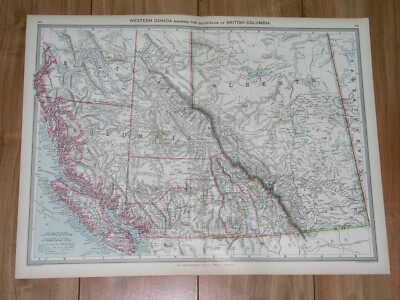
$5.00 Shipping Location: Canada 1908 MAP OF BRITISH COLUMBIA GOLD FIELDS VANCOUVER ISLAND/ ALBERTA CANADA This original antique map gives you an opportunity to examine in exquisite detail ... morea piece of history. Once matted and framed. This map would make a perfect gift for a family member or friend they'll cherish forever. Origin of the map: The Harmsworth Atlas And Gazetteer" Published in London, England by Carmelite House. Date of issue: 1908 Size: The sheet measures 20" x 15 1/4" 50 x 39 cm) S/H: The print will be shipped by Air Mail. The shipping charge is: USA- 8.00 USD. World- 9.00 USD, Canada- 9.00 USD. The price includes the insurance and a strong, cardboard tube with plastic plugs. Attention! There is no additional shipping charge for multiple purchases! Pay me securely with any major credit card through PayPal! Payment methods: US/Canada Buyers: Paypal. International Buyers: Paypal. Click Here. Double your traffic. Get Vendio Gallery- Now FREE! USED USED. AN ORIGINAL ANTIQUE MAP. USED. 0fe.RcmdId ViewItemDescV4,RlogId p4%60bo7%60jtb9%3Fuk%601d70f%2B%3E0fe-146fe3b5c3f-0x10f-
Buy It Now
$12.85 Shipping Location: Rochester, United States See also: List of artists and writers from Alaska. A dog team in the Iditarod Trail Sled Dog Race, arguably the most popular winter event in Alaska. Alaska ... moreMining District. Alaska Interstate Highways.
Buy It Now
$4.49 Shipping Location: Hightstown, United States 1903 Rand McNally Co. Map of Alaska and the Yukon Gold Fields Canada California. SUPERB condition map. This color lithographed map shows the area from ... moreSan Francisco all the way up to the Arctic Circle.
Buy It Now
Free Shipping Location: Nevada City, United States It has been expertly LINEN-BACKED. Exceedingly rare. The Midway Oil Field (Now, Midway-Sunset Oil Field) was discovered in Kern County in 1894. It is ... morethe largest oil field in California. It has produced over 3 billion barrels of oil to date, with substantial reserves still in the ground.
Buy It Now
$9.99 Shipping Location: Ivanhoe, Australia (Ref: Tooley; M&B). Date: - 1852. Ingram was a staunch Liberal who favored social reform. Herbert Ingram discussed the proposal with his friend, Mark ... moreLemon, the editor of Punch magazine. With Lemon as his chief adviser, the first edition of the Illustrated London News appeared on 14th May 1842.
Buy It Now
$4.95 Shipping Location: Dover, United States (Africa, South Africa, Cape Colony, Orange Free State, Transvaal, Natal, Zulu Land, Gold Mines, Diamond Mines). South Africa. Late 19th century lithographed ... moremap with original hand color. Map is set within decorative border, as is the title.
Buy It Now
$6.00 Shipping Location: Greenacres, United States There's a map of the Philippine Islands on the reverse side, in similar style and format. Original antique lithographed map of Alaska and part of northwestern ... moreCanada, printed more than 115 years ago.
Buy It Now
Free Shipping Location: Canada
Buy It Now
$10.00 Shipping Location: Denver, United States In original maroon cloth with gold spine title. Complete except for the Tama County map. The portfolio case has fallen apart, lacks a board, and is barely ... moreuseful. Old accession number to lower spine.
Buy It Now
Free Shipping Location: Pennsburg, United States How To Reach The Gold Rush Fields Of Alaska & The Klondike Via Portland OR 1897. Copyright 1897 by Poole Bros. Published by the Chamber of Commerce, Portland ... moreOR. “Elegant Iron Steamships Leaving Portland Every Five Days”. Measures about 19 X 25 1/2” when unfolded. Has a lot of information on the one side, and a great map of Alaska and the gold fields. Is fragile but you can open it up carefully. Has some tears along the fold intersections as seen. Some light discoloration from age on the front. Comes as seen in photos free shippingM-7
Buy It Now
$8.00 Shipping Location: Denver, United States These old folios are long out of print and can make wonderful research or conversation pieces. Of the over 3,000 folios planned, only 227 were ever issued ... morebefore the series was discontinued in 1945.
Buy It Now
$4.95 Shipping Location: Dover, United States Issued 1903, Chicago by George F. Cram. Original center fold as issued. Inset map of Alaska which notes gold fields as well as foot trails to get to them. ... moreEarly 20th century antique lithographed map.
1d 4h 31m 39s 0 bids
$99.99 Now
$15.10 Shipping Location: Simi Valley, United States This antique book is leather bound. It contains detailed maps and photographs of the Alaska Yukon mining gold fields, making it very collectable for those ... moreinterested in historic mining. Although it focuses mainly on Alaska and the Yukon, it also includes sections on the Pacific Northwest including Idaho and Montana. The book is in decent condition for it's age with some fraying around the binding and a few pages pulled from the stitching. One of the maps has a slight tear outside the actual image (see Pic). The spine is still tight. This is an ORIGINAL with the maps (including the 6 foldouts) and book plate are all tipped in, making them easily removable. The reproductions have all the fold out maps placed in a pocket inside the back cover. Thanks for looking!
Buy It Now
Free Shipping Location: Nashville, United States Up for sale is an Original 1905 Color GEOLOGIC MAP OF THE JUNEAU GOLD FIELD, ALASKA. This historical map was salvaged from a 1905 U.S. Army Corp Of Engineers ... moreBook. 19” X 55”. Folded as issued. Very detailed.
Buy It Now
Free Shipping Location: Canada
Buy It Now
$12.00 Shipping Location: Cleveland, United States Author/Artist Published New York: J.H. Colton. First edition. “Nebraska and Kanzas Showing Pikes Peak and Gold Region.”. New York: J.H. Colton, 1859. ... moreOriginal hand color. “Military Map of Parts of Kansas, Nebraska and Dakota.”.
$44.99 Shipping Location: Ivanhoe, Australia Wyld's Military Map Of The United States, The Northern States, And The Southern Confederate States: With The Forts, Harbours, Arsenals And Military Positions. ... moreWyld was particularly masterful at capturing political events throughout the world as they happened and leveraging his impressive publishing operation to quickly produce and distribute pertinent to the invested public.
Buy It Now
$9.99 Shipping Location: Ivanhoe, Australia This fine original antique page of 5 Scenes & text of the Gold Fields of the Kimberley Region of Western Australia was published in the Illustrated London ... moreNews in 1887. (Ref: Tooley; M&B). Ingram was a staunch Liberal who favored social reform.
Buy It Now
$14.99 Shipping Location: Ivanhoe, Australia Hargraves had been to the Californian goldfields and had learned new gold prospecting techniques such as panning and cradling. Before the end of the year, ... morethe gold rush had spread to many other parts of the state where gold had been found, not just to the west, but also to the south and north of Sydney.

Buy It Now
$3.95 Shipping Location: Clarkston, United States Rare Map Collection This DVD is part of our Historic Map and Atlas Collection. We have dozens of Atlas maps on DVD and CD ranging from the 1500s to the ... more1900s covering many areas and topics. Please Check our Ebay Store for what's available. FOR MANY MORE EDUCATIONAL CD TITLES ON THIS AND MANY OTHER SUBJECTS PLEASE VISIT OUR EBAY STORE VERY LARGE HIGH RESOLUTION MAP COLLECTION ON DVD! please see full table of contents and sample illustrations below) This DVD Contains 104 Maps of Kansas Including 10 PANORAMIC MAPS of various Kansas Cities These are scans of the ORIGINAL maps by various Cartographers. on DVD System requirements PC or Mac compatible. Files are simple PDF files with a basic HTML interface(just like viewing a webpage) Works with ALL versions of Windows. Early Maps of Kansas 0041026 Kansas Asher& Adams 1874, 0041027 Nebraska.and Kansas Asher& Adams 1874, 3565134 Kansas. Rand McNally and Company 1897, 3933001 Kansas And The Gold Mines.The map is of eastern Kansas west to the 98th meridian. With an inset of the"Routes from the Missouri River to the Kansas Gold Mines. This inset does not show Colorado, even though it was formed in 1860. There is a list of the Population of Kansas Counties, and a vignette of an Indian. Gunn. O.B. Mitchell, D.T. 1862, 4520041 Kansas. Rand McNally and Company 1879, 5370017 Kansas. Cram Atlas Company 1875, ct000891 J.H. Colton& Co. Coltons Kansas and Nebraska. New York. 1855 ct001342 Hartley French Dickson& Co. Map of the recently discovered gold regions in Western Kansas& Nebraska/ from actual surveys notes& observations by Hartley French Dickson& Co. 1859? ct001346 Mitchell. D. T. David T. Mitchells sectional map of Kansas/ compiled from the field notes in the Surveyor Generals office by David T. Mitchell. U.S. surveyor and land agent, Lecompton, Kansas; showing the U.S. survey up to 1859. Lecompton. Kansas: David T. Mitchell, 1859 cwh00204[Base map of Kansas] 1893] pm002260 Ruger. A. Birds eye view of the city of Atchison. Atchison Co
Buy It Now
$44.99 Shipping Location: Ivanhoe, Australia This original hand coloured antique lithograph map of the Colony of New South Wales & Australia Felix (Victoria) with emphasis on the rich Goldfields ... moreof these regions was published in the 1856 edition of by W & AK Johnston's large General Atlas.
Buy It Now
$23.82 Shipping Location: Los Angeles, United States Alaska Its History And Resources Gold Fields Routes And Scenery By Miner Bruce. Some signs of aging; discolouration on cover, small tear in map. Overall ... moregreat condition considering age.
Buy It Now
$15.00 Shipping Location: Brooklyn, United States The map covers from Coffin Bay to Cape Ottoway and as far north as Mount Hopeless. Major gold discoveries are highlighted in yellow, and these include ... morediscoveries near Adelaide on the Onkaparinga River and in Victoria along the Loddon River, near Mt. Freeth, Daisy Hill, on Creswell Creek, Mt. Boninyon, and Ballarat.
Buy It Now
$4.59 Shipping Location: Greenacres, United States It is dated by the reference to the new city limits, January 1, 1954. This highly detailed map opens to a generous 34" x 22", and the coverage area extends ... morefrom Golden Garden Park and upper boundary of the city limits, as created on January 1, 1954 south to Seola Beach and Duwamish.
Buy It Now
Free Shipping Location: Hillsboro, United States I also have the report available for sale. Drawn for photolithography by Paul Frereault. (photos #4, #5. ).
Buy It Now
$44.99 Shipping Location: Ivanhoe, Australia Wyld's Military Map Of The United States, The Northern States, And The Southern Confederate States: With The Forts, Harbours, Arsenals And Military Positions. ... moreWyld was particularly masterful at capturing political events throughout the world as they happened and leveraging his impressive publishing operation to quickly produce and distribute pertinent to the invested public.
Buy It Now
$10.95 Shipping Location: Pawtucket, United States Here is a late 19th Century "WHITTAKER'S PLANOSPHERE SHOWING THE PRINCIPAL STARS VISIBLE FOR EVERY HOUR IN THE YEAR FROM LAT. 40 DEGREES N." Cardboard ... moreCelestial Disc from THOMAS WHITTAKER 2 & 3 BIBLE HOUSE NEW YORK.
Buy It Now
$44.99 Shipping Location: Ivanhoe, Australia The map shows New South Wales' new (and current) boundaries, with the state's 'Pastoral Districts' delineated; railways from Ports Hunter and Jackson ... moreare shown, along with their proposed extensions inland.
Buy It Now
$14.99 Shipping Location: Ivanhoe, Australia Hargraves had been to the Californian goldfields and had learned new gold prospecting techniques such as panning and cradling. Before the end of the year, ... morethe gold rush had spread to many other parts of the state where gold had been found, not just to the west, but also to the south and north of Sydney.
Buy It Now
$25.00 Shipping Location: Belvedere Tiburon, United States REI INTERNAL FRAME HIKING BACKPACK HAS BEEN USED MANY TIMES HIKING IN DIFFERENT PARTS OF THE WORLD. PURCHASED FROM BERKELEY. CALIFORNIA.
Buy It Now
$8.50 Shipping Location: Croatia (1875-94), great work of Elisee Reclus. But the main influx of Jews would seem to have taken place as the result of their expulsion from Palestine by ... morethe Roman emperor Hadrian about 135 CE. This flight (hijrah; commonly transliterated Hegira) marks the beginning of the Muslim calendar.
Buy It Now
$12.75 Shipping Location: Akron, United States M-14467: “SOUTH AFRICA” New York & Chicago: Rand, McNally & Co., c.1898. From Rand, McNally’sIndexed Atlas of the World. Scarce Very Large color-printed ... moremap with original color and centerfold as issued.
Buy It Now
$6.00 Shipping Location: Denver, United States Atlas in original maroon cloth with gold spine titles.
Buy It Now
$9.75 Shipping Location: Ridgefield, United States Founded in 1870 by George Amos and William H. Poole, the firm operated until 1968. The detailed topographic features include Mt. McKinley National Park, ... moremost major cities, and towns as well as “points of interest”.
Buy It Now
$25.00 Shipping Location: Belvedere Tiburon, United States In the 1860s, San Franciscans began to feel the need for a spacious public park similar to Central Park, which was then taking shape in New York City. ... moreGolden Gate Park was carved out of unpromising sand and shore dunes that were known as the Outside Lands, in an unincorporated area west of San Francisco’s then-current borders.
Buy It Now
$25.00 Shipping Location: Belvedere Tiburon, United States Extensively detailed topographic map of Marin County, covering an area from the Golden Gate to Bolinas to San Rafael. In 1871, Congress officially expanded ... morethe Coast Survey’s responsibilities to include geodetic surveys in the interior of the country, and one of its first major projects in the interior was to survey the 39th Parallel across the entire country.
Buy It Now
$10.04 Shipping Condition: Unspecified Location: LONDON, United Kingdom Antique engraved map by J Rapkin, published by John Tallis. Original outline hand colour, decorative border, and attractive inset vignette views, 1851. ... morePublished by John Tallis & Co. TYPE: Antique engraved map by J Rapkin, published by John Tallis.

Buy It Now
$35.00 Shipping Location: Bath, United States 1917 Map of Alaska? Alaska Steamship Company 1917 Map of Alaska– Alaska Steamship Company· This map is in exceptional condition. I didn’t see any ... moreholes in it when I opened it for the photos. I forgot to measure it. And don’t want to open it again. If you look in the upper right of the 1 st photo you can see a deck of cards for scale. Upper right section of the map is marked: Copper River& Northwestern RY and The Alaska Railroad· It is in the original sleeve from the steamship company. The sleeve is 8.5” x 4.5” The paper does not feel brittle. Copyright date on the map. As shown, is 1917. I found no other dates on the map or any markings indicating a later printing. PLEASE ASK QUESTIONS BEFORE BIDDING. IMPORTANT: My items are sold AS-IS subject to the description. If your questions are not answered by the description. Ask. If you ask a question answered by the description, I’ll ask you to read it. If you hope the item is better than described, wonderful, just don’t expect it. E-bay Required Notice to International Bidders: Import duties. Taxes, and charges are not included in the item price or shipping charges. These charges are the buyer's responsibility. Check with your country's customs office to find out what these additional costs will be before you bid or buy. See Shipping information below. There may be charges collected by the shipping/delivery company when you receive or pick an item up. Don't confuse them with more shipping charges. We follow international regulations. We don't mark items below value or call them"gifts. Please ask questions before bidding. I am happy to combine shipping. NOTE: If you are bidding on more than one of my auctions. Wait until all have closed and I send you a combined invoice to save you shipping costs. SHIPPING: Shipping in the Contiguous 48 states with Tracking is $2.95 1 st Class. Shipping may reflect a handling charge. International shipments: I WILL NOT SHIP TO RUSSIA. UKRAINE OR MEXICO. Use the shipping calculator to determine charges
Buy It Now
Free Shipping Location: Brussels, United States Building at the World's Fair held in Chicago in 1893. This resulted in the spread of cypress trees to areas where they were not native. Cypress trees ... morefrom those seedlings can be found in many areas of West Virginia, where they flourish in the climate.
Buy It Now
Free Shipping Location: Syracuse, United States The date is printed on the map. This is not a copy, it's an authentic original antique map from an old atlas printed in 1890.
Buy It Now
$25.00 Shipping Location: Belvedere Tiburon, United States The 19th century saw the city of London undergo an unrelenting process of industrialization and transformation. Attractive 1835 city plan of Elizabethan ... moreLondon.
Buy It Now
$12.00 Shipping Location: Eugene, United States An atlas spanning 150 years of mining activity, surveying and mapping. Limited edition (only 500 signed and numbered copies will be printed). SURVEYING ... moreFOR GOLD by Mark L. Armstrong. This book is dedicated to the early U.S. Deputy Mineral Surveyors who worked under the U.S. General Land Office (GLO) in the Bohemia Mining District between 1890 and 1946.
Buy It Now
$10.04 Shipping Condition: Used Location: LONDON, United Kingdom 'Shoreditch, Norton Folgate and Cripplegate Without'. Caption below picture:'Shoreditch, Norton Folgate and Cripplegate Without '. Other features include ... moreUpper Moorfields, Bunhill Fields & Tenter Ground.
Buy It Now
$5.00 Shipping Location: Canada DATE OF ISSUE: 1921.
Buy It Now
$10.04 Shipping Condition: Unspecified Location: LONDON, United Kingdom 'Rhodesia'. Title of map:'Rhodesia'. Colour antique map, 1910. DATE PRINTED: 1910. CONDITION: Good; suitable for framing. The map you will receive is ... morein good condition but there may be minor variations in the condition from that shown in the image.
Buy It Now
$42.87 Shipping Location: Bendigo, Australia Discover the best metal detecting sites in Victoria's goldfields with this folding map guide from Outdoor Press. Featuring detailed maps of Rheola, Moliagul, ... moreand Tarnagulla, this guide is perfect for both beginners and experienced metal detectorists. The maps highlight gold and relic sites, as well as old townships and abandoned mines, providing a wealth of information for those looking to strike it lucky.
Buy It Now
$19.83 Shipping Location: Brighton, Australia Grahamstown gold field c.1875. Wood engraving.
Buy It Now
$14.99 Shipping Location: Ivanhoe, Australia Hargraves had been to the Californian goldfields and had learned new gold prospecting techniques such as panning and cradling. Before the end of the year, ... morethe gold rush had spread to many other parts of the state where gold had been found, not just to the west, but also to the south and north of Sydney.
Buy It Now
$14.99 Shipping Location: Ivanhoe, Australia Hargraves had been to the Californian goldfields and had learned new gold prospecting techniques such as panning and cradling. Before the end of the year, ... morethe gold rush had spread to many other parts of the state where gold had been found, not just to the west, but also to the south and north of Sydney.
|
|
|
In
|
ALASKA Territory Map: Authentic 1897 (Dated) w/ Rivers, Towns, Gold Fields, Topo
1897 Engraved Color Map Alaska Satisfaction Guaranteed This is a 110+ Year-Old Map NOT a Reproduction This map was removed from the Century Atlas. Published by The Century Co. in 1897. It is printed on a single sheet with a fold in the center. The sheet is blank on the reverse with the exception of the map name and number. Dated 1897 on the face of the map. The boxed map area is about 10" by 15" And there are sufficient borders to allow easy matting or framing. Shown below without the full borders to allow the image to load a bit more quickly. This color map of Alaska is dated 1897 on the face and was"specially engraved for the Century Co. by the Matthews-Northrup Co. Buffalo. NY" This map includes fine topographic& political detail. Such as: counties, cities, towns, rivers and mountains. Principal railroads are shown ... morein red and for the most part. Identified. There are inset maps of Sitka/ Glacier Bay. And of the Western Aleutian Islands. A close-up of this map showing the area around Norton Sound is pictured below to give an example of the engraving and detail. Bid with confidence- Returnable for any reason within 10 days for prompt refund. Powered by The free listing tool. List your items fast and easy and manage your active items.
|
|
|
Alaska overprinted w/ Gold Fields Klondike 1898 large color antique map
Alaska overprinted w/ Gold Fields Klondike 1898 large color antique map Map of Alaska Issued 1898. Chicago Fine original antique offset color map. Printed on quality paper which retains its inherent structural flexibility and soundness. Uncomon issue. Overprinted in red to show numerous Gold Field locations as well a the Kondike District and trails leading up from Washington state& B.C. In VG or better condition. Some light minor age wear but the image remains clean, attractive and very presentable[note: we grade very conservatively and always seek to disclose any noteworthy flaws] The printed area remains visually pleasing. A nice impression of an interesting antique map. Any minor defects along the sheet edges and in the margins may be seen in the photos. Sheet measures c. 21 7/8" W x 14 1/2" H. Engraved area measures c. 18 ... more3/8" W x 11 3/4" H. Original fold line as issued. 36747] note: All old sheets of printed paper possibly have short edge splits. Each sheet has existed for a very long time and has probably been handled repeatedly in the course of it's existence. It has a history unique to it as an object. Most of the time any edge splits are short. Minor, insignificant and have been closed- either long ago or more recently with small pieces of archival tape. Most often these splits are trivial and easy to overlook visually. Basically, they would not significantly affect the piece adversely. The item is offered as seen. Please look carefully and make your decision knowing this antique image is nice. But it is not in perfect"like new" condition. However, with whatever flaws it possesses, it remains entirely worthy of ownership and inclusion in any related collection. We feel it will prove very pleasing to its new owner. We stand behind everything we sell. Everything we offer is guaranteed to be an authentic original antique item as described. We do not sell modern reproductions. Please visit our eBay Store. We happily accept PayPal!
|
|
|
ALASKA (AK) GOLD & COAL FIELDS MINING MAP 1898 MOTP
This is an exquisite full-color Reproduction printed on heavyweight(7.0 MIL) Glossy Photo Paper. These maps are perfect for framing. Or a wonderful and unique gift for family members, friends or co-workers! All Information is Carefully Compiled from Actual Surveys Original Maps are often difficult to find and usually have fold lines. Identifying stamps or markings, tears, ragged edges, and assorted other natural signs of age that detract from their beauty. All of our maps have been professionally restored to depict their original beauty, while keeping all historical data intact. These maps are fabulous pieces of history full of information useful to Historians. Genealogists, Cartographers, Relic Hunters, Others. They make fascinating conversation pieces and splendid works of art for the home or office. Map Size: 27.75 x 23 Site Specifics ... moreTo This Map Are: Mt. McKinley. Franklin Mountains, Fort St. Michael Military Reservation, Tanana Hills, Yukon Hills, Mount St. Elias, Mt. Sushita, Copper River Trail, Demarcation Point, Kotzebue Sound, Lewes River, Copper River, Admiralty Island, Teslin Lake, Nelson Lake, Senati Camp, Fort Reliance(Ruins) And the Old Reid House. The following towns are featured: Circle City. Dawson(Canada) Attemut, Skagway, Dyea, Juneau, Douglas, Chilkat, And Tikchik. This Map is Situated in: Yukon Northern District. Kodiak Southern District, and Southeastern Area at the time. SKU: AKZZ0002 and Powered By:
|
|
|
KLONDIKE GOLD FIELDS MAP DAWSON CITY KLONDIKE AND INDIAN RIVER BONANZA CREEK
KLONDIKE GOLD FIELDS MAP DAWSON CITY KLONDIKE AND INDIAN RIVER BONANZA CREEK, KLONDIKE GOLD FIELDS MAP DAWSON CITY KLONDIKE AND INDIAN RIVER BONANZA CREEK This genuine antique map is titled"MAP OF THE KONDIKE GOLD FIELDS" Published in"Harper's Weekly" October 1898. This map from the year of 1898 is 7 x 9 inches in size with wide margins. It is in excellent condition, highly displayable and ready for framing and is guaranteed to be as described. This beautiful and decorative antique map would make a great addition to any Home. Office or Restaurant decor! I have provided Antique Engravings. Prints, Maps& Newspapers globally to museums. Institutions, art dealers, researchers, genealogists, movie sets, interior designers, curators, authors, knowledgeable collectors and beginners too. The comments buyers have made in ... moremy"feedback" file are an indication of the quality product and exceptional service I deliver. Authenticity of all items. As described in each listing, and the accuracy of that description, is guaranteed unconditionally. Shipping will be $4.50. International airmail shipping will be $13. All items will be shipped in a acid free archival poly bag and securely packaged in a sturdy reusable flat or mailing tube to assure safe delivery. I will combine multiple purchases for just one shipping charge. Feedback will be left on all transactions and I would appreciate you doing the same. Payment must be received no later than 10 days after the close of the auction. Payment through PayPal. I have had very few inquiries for item returns. In the event of such a request. The transaction will be evaluated and a refund offered if the item differs substantially from the description presented. My goal is Customer Satisfaction! At your fingertips here at this website you have a gallery of many thousands of Antique Engravings. Prints, Maps and Newspapers. Find the subject matter you are looking for using my Store Search engine provided. All newspapers listed in my eBay store feature uniq
|
|
|
ORIGINAL 1905 PEERLESS ALASKA / YUKON GOLD FIELDS - PHILIPPINE ISLES MAPS
I PACK ALL THE ITEMS I SELL ON EBAY SEALED IN PLASTIC AND WITH A PIECE OF CARDBOARD IN EACH SIDE OF THE ITEM. THIS MAY INCREASE THE SHIPPING COST SLIGHTLY BUT I THINK THAT IT IS WELL WORTH IT. THIS IS AN ORIGINAL 1905 PEERLESS ALASKA/ YUKON GOLD FIELDS- PHILIPPINE ISLANDS MAPS ON EACH SIDE OF THE SHEET. THEY CAME OUT OF A 1905 PEERLESS/ CROWELL PUBLISHING COMPANY UNITED STATES AND WORLD ATLAS. THE ATLAS WAS IN SUCH POOR CONDITION THAT I HAD TO REMOVE ONLY THE GOOD CONDITION MAPS AND TOSS THE REST. THEY MEASURE ABOUT 21 X 13. HAS 2 PAGES/ 3 PANELS/ 2 FOLDS AND THEY ARE IN VERY GOOD+++ CONDITION. PLEASE LOOK AT THE PICTURE(S) BELOW FOR MORE DETAILS. IF YOU HAVE ANY QUESTIONS. PLEASE EMAIL ME. MULTIPLE WINNERS WILL SAVE ON SHIPPING. I ACCEPT ANY AND ALL FORMS OF NORMAL PAYMENT. HIGH BIDDER PAYS $3.50 FOR SHIPPING AND HANDLING WITHIN THE UNITED ... moreSTATES. FOR INTERNATIONAL WINNERS. SHIPPING COSTS WILL BE CALCULATED. PLEASE NOTE THAT I PACK MY ITEMS VERY WELL(CHECK MY FEEDBACK)
|
|
|
1905 Antique Map of ALASKA with GOLD Fields MINING Vintage Atlas Map
ANTIQUE MAP OF ALASKA WITH GOLD FIELDS This is an original. Not reproduction, vintage map of Alaska. It was carefully removed from an atlas. This map measures approximately 20" by 12" and is in very good condition. Please note this is a centerfold map as issued. Your item will be packaged in a plastic sleeve. Within a cardboard mailing tube. We happily combine purchases to save on shipping fees. Please email with questions. We will answer your email promptly! Please visit our ebay store. Plaindealing Vintage Paper. Be sure to add me to your Check out my! Powered by The free listing tool. List your items fast and easy and manage your active items. RcmdId ViewItemDescV4,RlogId p4%60bo7%60jtb9%3Feog4d71f%2B0a7%3E-1449f976434-0x109-
|
|
|
1897 Century Map - Alaska - Sitka Glacier Bay Juneau Klondike Gold Fields Yukon
Lake Erie Maps& Prints! An Authentic Antique Map: Not a Modern Reproduction! See Our Ebay Store for More! Free US Shipping on Purchases of 5 or More Maps and Prints Description: It is an authentic antique map approximately 110 years old with printed color. The map has a copyright date of 1897 in the title area and was designed by Matthew-Northrup. Buffalo, NY, which is also stated on the map. It is from the 1902 edition of the Century Atlas of the World(New York: The Century Co. A copy of the title page is included. Size: The map image measures approximately 10 1/2 by 15 inches(27x38cm) on a 12 by 16 1/2" 30x42cm) page with a margin all around as seen. Condition: The map is in Good or better condition for its age with light overall tonal ageing as expected. Blank on the reverse with a centerfold as issued, see the pics for more on ... morecondition. There is slight bend in the upper right corner and a smudge in the bottom margin. Overall the map is very clean with plenty of margin for framing. The pics are of the actual map. Payment Details: We accept most major credit cards through Paypal and Ebay. Please ask if you have any questions about payment. International and New Bidders are welcomed and encouraged. Payment is expected within 7 days. After which Nonpaying Bidders will be reported to Ebay to recoup our listing fees. Save on Shipping: We only charge one shipping fee based on the largest map or print with multiple items shipped along with it for no extra costs. Purchase 5 or more maps or prints and receive Free First Class shipping in USA. International Customs and VAT Fees: It is the responsibility of the buyer to pay all Customs Taxes. VAT or other fees that may be due upon arrival. These fees vary greatly from country to country and ebay policy is that the buyer is responsible for their country's taxes and fees. Please consult your country's Customs Regulations for more details on your country, printed matter is duty free in many countries. We declare the full purchase value as required by law.
|
|
|
Original 1898 Map of Alaska by E. F. Fisk. Shows Routes to the Gold Fields
Rare Original 1898 map of Alaska by E. F. Fisk. Shows routes to the gold fields in the Yukon District and Alaska. Measures 14" by 11.12" A vintage lithograph that will look great matted& framed. Free Shipping to anywhere in the USA. Your order will always ship within ONE BUSINESS DAY. Well packaged in a sturdy waterproof mailer and sent with a delivery confirmation. I ship worldwide. Froo www.froo.com | Froo Cross Sell. Free Cross Sell, Cross promote, eBay Marketing, eBay listing Apps, eBay Apps, eBay Application.
|
|
|
1897 Alaska Original Large 2-page Color Atlas Map** Gold Fields ..117 yrs-old!
1897 Alaska Antique Dated Atlas Color Map Description. Gorgeous. Original and Large, 1 897 Alaska Dated 2-page Antique Color Atlas map. The map also shows part of British Northwest Territory This is an ORIGINAL.NOT A REPRINT. 1 17 + year-old dated 1897 on the front atlas map.The map unfolds and measures 21 1/2" x 14 1/2" with the borders. The map shows the Gold Fields. Forts and a few towns, villages, rivers, Mountains and other Geographic features, etc. Great, Historic Item. NOTE: This map doesn't show roads. NOTE CONDITION: The map has a little border and corner wear. Otherwise. It is in Nice Condition and will look wonderful matted and framed(These old maps make great gifts) Please see the attached photo to view the Map. And a couple of closeup sections of the map. Please note that the map is too large for my scanner.There ... moreis a border all the way around the map.Also. The map is much clearer than the scan illustrates. The printing is small but very clear and readable* Purchase this 1 17 year-old map for only $ 19.9 5. U.S. Buyer pays $3.00 for shipping. 1-4 maps can be combined to save on shipping. Maps are shipped in sturdy mailing tubes. NO INTERNATIONAL SHIPPING Please Note: This is an original 1 897 d ated atlas map. If you have any questions about this map or any of my items. Please email me before bidding. Thanks! 051214 Alaska97.3(c) Please visit my Ebay store to view my Alaska. Northwest Territory, California, San Francisco, Sacramento, Oregon, Nevada, Utah. Colorado, Denver, Montana, and other vintage maps. Thanks for looking! NO INTERNATIONAL SHIPPING Thanks for your understanding!
|
|
|
Antique 1898 Map of Maps Alaska Klondike Gold Fields J J Millroy Klondyke rush
THE"MAP OF MAPS" ALASKA YUKON CARIBOO OMINECA CASSIAR AND PORTION OF THE KOOTENAY GOLD FIELDS AUTHORITIES: LATEST SURVEYS BY THE U. S. AND CANADIAN GOVERNMENTS ALSO SPECIAL REPORTS FROM ALASKA MINERS AND EXPOLRERS J. J. MILLROY. PUBLSHER SALT LAKE CITY, SANFRANCISCO, CHICAGO, NEW YORK, TORONTO. COPYRIGHTED 1898 IT IS A HEAVY CARDSTOCK/CARDBOARD FOLDER WITH INFO ON ALL SIDES AND A MAP INSIDE IT. ONE SIDE HAS INFO CANADA'S NEW MINING LAWS AFFECTING THE KLONDYKE REGION. IT TALK ABOUT FILING CLAIMS. AND MINERS NEED TO GET A MINER'S CERTIFICATE) ANOTHER PAGE SHOWS ROUTES TO THE KLONDYKE GOLD FIELDS. BY STEAMER TO DVEA, TO ST. MICHAEL, CHILCOOT PASS ROUTE, WHITE PASS ROUTE, STIKINE RIVER ROUTE, TAKA RIVER ROUTE, COPPER RIVER ROUTE, DALTON TRAIL, CANADIAN ROUTE, AND SHOWS MILE"S. 2 MORE COVERS LIST" OUTFIT FOR ONE MAN ... moreFOR ONE YEAR" TELLS HOW TO PACK PROVISIONS AND OTHER HELPFUL POINTS. HERE ARE SOME ITEMS LISTED, APPLES EVAPORATED 25LBS, BACON 120LBS, BEANS 100 LBS. COFFEE 30 LBS, BUTTER 50 LBS, MATCHES 2 CANS, RICE 25 LBS, SUGER CUBE 100 LBS, TOBACCO 5 LBS, ETC. LISTS OF TOOLS, 2 PICKS, 2 SHOVELS, 2 HATCHETS, 1 AX, 1 SLED, 1 RIFLE, 1 SHOTGUN, ALSO LISTS COOKING UTENSILS AND CLOTHING AND BEDDING. QUITE A COMPLETE LIST. AND THIS IS A VERY SMALL PORTION OF IT. Antique 1898 Alaska Map of the Klondike Gold Fields Helpful Pamphlet for the Gold Miner This is a very interesting miner map and brochure. There is historical value with this item. It is a map and pamphlet that shows where the gold fields were in 1898. The map is 24" by 36" A VERY THIN PAPER! It is in good condition. The map is torn with fold marks. It is very fragile. There are a few water stains. The edges have some wear. The cover is a little dirty. The map and the pamphlet is complete. Nothing seems to be missing. This item comes from a smokefree home. I accept paypal or you can pay when you pick up an item, any other payment questions please email me. I will combine/discount shipping charges on multiple purchases to he
|
|
|
ALASKA UNITED STATES 1897 map gold fields original 14 x 24 inches
This Alaska map is dated 1897 and measures approx 14 x 24 inches. Map shows gold fields etc. nice collector piece.
|
|
 |