-
Christian Collectibles
-
Christian Sheet Music
-
Vatican Stamps
-
Vatican Coins & Paper Money
-
Antiques
-
Antiquities
-
Architectural & Garden
-
Decorative Arts
-
Ethnographic
-
Furniture
-
Maps, Atlases & Globes
-
United States (Pre-1900)
-
United States (1900-Now)
-
AK, HI
-
AL, FL, GA, MS, NC, SC
-
AR, IA, KS, LA, MO, NE
-
AZ, CA, CO, NM, NV, UT
-
CT, MA, ME, NH, RI, VT
-
DC, DE, MD, NJ, NY, PA
-
ID, OR, WA
-
IL, IN, MI, OH, WI
-
MN, MT, ND, SD, WY
-
OK, TX
-
VA, WV, KY, TN
-
Entire US
-
United States (Date Unknown)
-
Africa
-
Asia
-
Australasia/ Oceania
-
Canada
-
Central America/ Caribbean
-
Europe
-
India
-
Ireland
-
Mexico
-
Middle East
-
North America
-
South America
-
United Kingdom
-
Maps on CD
-
World Maps
-
Globes
-
Mixed Lots
-
Reproductions
-
Price Guides & Publications
-
Other
|
In
Order by: Available to: This site contains affiliate links for which I may be compensated
|
Buy It Now
Free Shipping Location: Schertz, United States This antique original map of Missouri from 1886 features all the townships and railroads of the state. With vibrant colors, the map measures 17x27 inches ... moreand was published by J.T. Barker and H.R. Page & Co. The map is a rare find, printed over a century ago and still in great condition. The cartographer and publisher put careful attention to detail, making it a valuable piece for collectors of North American maps and antiques. This map is a unique representation of Missouri's history and would make a great addition to any collection.
Buy It Now
$4.95 Shipping Location: Willow Grove, United States This is an ORIGINAL Mississippi map taken from a 1945 atlas. There is a map image and text on the reverse side of this map page.
Buy It Now
$8.95 Shipping Location: Eden, United States (See photos) A nice example of railway infrastructure during the the late Victorian period.
$4.13 Shipping Location: Middlefield, United States Antique original map of Georgia, dating back to the Civil War era in 1861. This historical piece depicts the US state of Georgia and its surrounding regions, ... morecarefully crafted by J.H. Colton. Its good condition and intricate detailing make it a valuable addition to any collection.
Buy It Now
$4.95 Shipping Location: Willow Grove, United States On the reverse side of this map page is an Arizona index.
Buy It Now
$4.95 Shipping Location: Willow Grove, United States There is a map image and text on the reverse side of this map page.
Buy It Now
Free Shipping Location: Pittsburgh, United States The Map is Pre-Owned -- But looks in Excellent Condition -- It is a Very Rare Item and will Make a Great Addition to Any Collection.
Buy It Now
Free Shipping Location: Schertz, United States This antique original map of the Dakota Territory from 1886 features all the townships and railroads of the state. With vibrant colors, the map measures ... more17x27 inches and was published by J.T. Barker and H.R. Page & Co. The map is a rare find, printed over a century ago and still in great condition. The cartographer and publisher put careful attention to detail, making it a valuable piece for collectors of North American maps and antiques. This map is a unique representation of Dakota Territory history and would make a great addition to any collection.
Buy It Now
$4.95 Shipping Location: Willow Grove, United States There is a partial map image on the reverse side of this map page.
Buy It Now
$4.99 Shipping Location: Fairview, United States , published in Chicago by the Rand, McNally & Co., 1881, a facsimile copy of the title page is included for authenticity. Condition: The map is in Very ... moreGood to Excellent condition, blank on reverse with a centerfold and original color as issued, very clean on a strong page, minor soft bends on the upper corners, see the pics for more on condition.
Buy It Now
$4.95 Shipping Location: Willow Grove, United States There is text on the reverse side of this map page that does not relate to this map.

Buy It Now
$5.95 Shipping Condition: New Location: Las Vegas, United States Colton's Railroad and Military Map of the United States. Mexico, and the West Indies Size: 24" x 32" 61 cm x 81 cm) x Also Available in ... more18" x 24" from our eBay Store This is a great Classic Map originally Published circa 1862. This is a detailed general map of portions of North America. Framed in decorative borders. Showing drainage, international and state boundaries, cities and towns, forts. Railroads in operation, and proposed lines. Insets: Colton's map of the Americas, Africa and a portion of Europe showing the Atlantic and part of the Pacific oceans. New Orleans and delta of the Mississippi. Louisiana.Mobile harbor, Alabama. Key West and Tortugas. Florida reefs.Wilmington and vicinity, N. Carolina. Beaufort and vicinity. N. Carolina.Norfolk, fortress Monroe, James River, Richmond, Petersburg&c&c. Map of Charleston. Port Royal& Savannah vicinities. Washington, Manassas Junction. Harpers Ferry, Baltimore, Annapolis This poster. Which evokes the vivid images of a simpler time, is a custom reproduction printed on 68lb Heavyweight Enhanced Matte Art Paper. This Historic Art Print is suitable for framing. Mounting or direct display on any wall! 000 Artscape Galleries/ Posters Past More Prints and Posters Available from our eBay Store! Shipping price includes delivery confirmation. We combine shipping for multiple purchases- add $1.00 for each additional poster. All posters are professionally packaged to ensure that they arrive safely and undamaged: Your poster is first rolled and inserted into a plastic sleeve before being placed into a Heavy-Duty mailing tube for delivery. We stand behind the quality of every poster. If you are not satisfied with your purchase. Please contact us within 30 days to arrange for either an exchange or a full refund. gsrx_vers_468(GS 6.4(468)
Buy It Now
$10.20 Shipping Location: Tonawanda, United States Includes Counties, County Seats, Cities; many Small Towns and Villages; Ports, Military Airfields and Forts; Rivers, Streams, Lakes, Mountains, and other ... moretopographical features are located on this map.
Buy It Now
$6.20 Shipping Location: Mount Washington, United States Ener litit l st here Enter listing title here Enter listing title here Enter listing title here Enter listing title here Enter list tle here Dimensions: ... moreapproximately 8 x 12 1/2 Enter listing title here Enter title list herDimensions No Reasonable Offer Refused SKU 954.

Buy It Now
$8.00 Shipping Location: Rockville, United States Up for sale is a Hand-Colored. Authentic, Antique Railway Map of the State of Pennsylvania. The map measures approximately 17" x 26" Including ... morethe border area. Map is with original handcoloring and outlining and it is blank on the reverse side. It is not matted nor framed, being sold as a single sheet as show in the main picture. This map is from the New Topographical Atlas Of The State of Pennsylvania With Descriptions Historical. Scientific, and Statistical. By Professor Henry F. Walling and O.W. Gray, Civil& Top'l. Engineer. Published in 1872 by Stedman, Brown& Lyton, Philadelphia. The map has fantastic coloring to it and is a great period county map. With towns, cities, railroads, roads, etc. of the time. Excellent, detailed and interesting period map of these counties. The map is generally in Very Good condition. There is some wear and browning along the edges. There are some small tears and chips along the edges. There is a crease down the middle where it was originally bound. The bottom of the crease has a tear that extends just to the border line of the map. Other dings here and there. As well. This map is a great piece of US history! It will look very nice when framed. Please note that while I have included pictures of the front board of the Atlas and the Title Page from the Atlas this map was taken from. They are NOT included in the sale, as they are reference pieces to determine authenticity for the other maps. I would be happy to include a copy if requested. Please see my store for other great items. Inventory R-Map-26
Buy It Now
$6.20 Shipping Location: Mount Washington, United States Ener litit l st here Enter listing title here Enter listing title here Enter listing title here Enter listing title here Enter list1tle here Dimensions: ... moreapproximately 8 x 12 1/2 Enter listing title here Enter title list herDimensions No Reasonable Offer Refused SKU 1134.
Buy It Now
$11.60 Shipping Location: Belton, United States Map is about 20 1/2 " wide x 28 1/8". 11 2023 Map Box 2, Folder AC, #19.
Buy It Now
$5.75 Shipping Location: Malden, United States Very Educational. A Wonderful. Great OLD Map from the COLLIER'S "NEW ENCYCLOPEDIC ATLAS & GAZETTEER OF THE WORLD". 110 Years Old! World War I Era. There ... moreIs Yellowing, As Expected, From Age. The Actual Page!
Buy It Now
$4.95 Shipping Location: Willow Grove, United States The reverse side of this map page is blank.
Buy It Now
Free Shipping Location: Willow Grove, United States This is an ORIGINAL Nevada map which has been cut from a larger 1920 atlas. On the back of this map page is partial and cut off text.
Buy It Now
$5.50 Shipping Location: Indianapolis, United States See photos for condition and detail. There is a wavy fold where the glue from the folder isn’t smooth with the map. See photo.

Buy It Now
Free Shipping Location: Easton, United States GUARANTEED TO BE ORIGINAL AS STATED BELOW Authentic 1890 Color Map of Brazil Nothing Printed On The Back Page Measures Approximately 11 by 9 Inches(un-trimmed) ... moreEngraver: Rand McNally Co Chicago Publisher: Belford Clarke Co Chicago Publication: Americanized Encyclopedia Britannica This map may not have copyright date on it See pictures of title page and copyright below(not included in sale) Condition Very Good or Better: Fold In Center Shipped flat and secure Placed in acid free bag with backing board Sandwiched between 2 pieces of stiff cardboard Shipped via USPS 1st Class Parcel Mail with Delivery Confirmation/ Tracking SHIPPING MONDAY THRU FRIDAY ONLY We do not destroy good books. We save pages with historical information and images From books that are not usable in their current condition. Saving the past one page at a time! Be sure to checkout the other great items we are offering Just a quick note to thank you for checking out our item and to let you know alittle about us We are Karen and John. Wife and husband from the beautiful Lakes Region of New Hampshire We have been sellers since 1999 making some extra money and finding homes for interesting items We use different names to sort the items we offer that way we can be somewhat organized! Our names are IBEEBACK. IBEADULT, and SHOPNH4U And our items can be found by doing an advanced search by seller name You can also review our feedback files and ME page for more info how we treat all sales We hope we can do business. Inkfrog terapeak. InkFrog Analytics.
Buy It Now
$4.95 Shipping Location: Willow Grove, United States On the reverse side of this map page is an Alabama map index.
Buy It Now
$4.95 Shipping Location: Willow Grove, United States
Buy It Now
$4.95 Shipping Location: Willow Grove, United States This is an ORIGINAL GEORGIA map taken from a 1912 atlas. This map shows the interurban electric rail lines in blue. On the reverse side of this map page ... moreis similar map image of South Carolina. (different orientation).
Buy It Now
$4.95 Shipping Location: Willow Grove, United States This is an ORIGINAL Washington State map taken from a 1945 atlas. There is a map image and text on the reverse side of this map page.
Buy It Now
$4.99 Shipping Location: Fairview, United States , published in Chicago by the Rand, McNally & Co., 1881, a facsimile copy of the title page is included for authenticity. Condition: The map is in Very ... moreGood to Excellent condition printed on a bright page, no centerfold great for framing.
Buy It Now
$10.20 Shipping Location: Tonawanda, United States Includes Counties, County Seats, Cities; many Small Towns and Villages; Ports, Military Airfields and Forts; Rivers, Streams, Lakes, Mountains, and other ... moretopographical features are located on this map.
Buy It Now
$6.95 Shipping Location: Dover, United States Mid-19th century engraved map with original hand color. Issued c. 1845-6, Liverpool by George Philip & Son.
Buy It Now
$6.95 Shipping Location: Dover, United States Issued 1874, Washington D.C. by N. Peters. Also Other Lines Reported Upon. Mid 19th century antique lithographed map overprinted in red.
Buy It Now
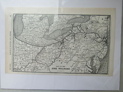
$6.20 Shipping Location: Mount Washington, United States 1910 VINTAGE RAILROAD MAP SIDE ONE- ERIE SYSTEM SIDE TWO- GRAND TRUNK SYSTEM From a bound book entitled: The New Encyclopedic Atlas and Gazetteer of the ... moreWorld(Special 1910 Census Edition) by William Patten and J. E. Homans Published by P. F. Collier& Son. New York ©1910 Each print is accompanied by both a Title and Details. Each full page measures approximately 8" x 9 1/2" There may be small tears. Stains or blemishes on the page edges or borders, but, unless otherwise noted, the actual print is in excellent condition. Any minor‘edge’ flaws do not in any way affect either the value of this item or your ability to have a beautifully framed Vintage print. We will ship your item'flat' via First-Class Mail® Large Envelope(2- 5 Days) Item is Suitable for Framing or Visual Presentations Our Return Policy: We are committed to your satisfaction! Return any item for any reason you like within 14 days. International Buyers– Please Note: Import duties. Taxes and charges are not included in the item price or shipping charges. These charges are the buyer's responsibility. Please check with your country's customs office to determine what these additional costs will be prior to bidding/buying. These charges are normally collected by the delivering freight(shipping) company or when you pick the item up– do not confuse them for additional shipping charges. We do not mark merchandise values below value or mark items as"gifts" US and International government regulations prohibit such behavior. di,RcmdId ViewItemDescV4,RlogId p4%60bo7%60jtb9%3Fuk%601d72f%2Bishhov%3C%3Edi-1454fdc89c5-0x109-
Buy It Now
$6.15 Shipping Location: Cambridge, United States From the 1st Edition Harper's Geography HC Book 1879. In good Victorian antique condition with typical wear/staining and foxing.as seen in pics. Opposite ... moreside may have images or printing related to or unrelated to item shown.
Buy It Now
Free Shipping Location: Iowa City, United States This color map ofNevada is dated 1907 on the face. Counties, County Seats,Cities; many Small Towns and Villages, Ports; Military Airfields and Forts; ... moreRivers and Streams, Lakes; and other topographical features are located on this map.
Buy It Now
$4.95 Shipping Location: Willow Grove, United States This is an ORIGINAL Illinois map taken from a 1920s atlas. There are 4 small City vicinity map images and text on the reverse side of this map page. (different ... moreorientation).
Buy It Now
$5.50 Shipping Location: Easton, United States Washington: Norris Peters, 1895. Fine copy, folded, as issued.
Buy It Now
$4.95 Shipping Location: Willow Grove, United States On the reverse side of this map page is a similar map of New Jersey.
Buy It Now
$4.95 Shipping Location: Willow Grove, United States This is an ORIGINAL 1921 Montana map taken from a 1921 atlas. There is a map image and text on the reverse side of this map page.
Buy It Now
Free Shipping Location: Iowa City, United States This color map ofUtah is dated 1906 on the face. Counties, County Seats,Cities; many Small Towns and Villages, Ports; Military Airfields and Forts; Rivers ... moreand Streams, Lakes; and other topographical features are located on this map.
Buy It Now
$6.20 Shipping Location: Mount Washington, United States Ener litit l st here Enter listing title here Enter listing title here Enter listing title here Enter listing title here Enter list tle here Dimensions: ... moreapproximately 8 x 12 1/2 Enter listing title here Enter title list herDimensions No Reasonable Offer Refused SKU 965.
Buy It Now
$6.20 Shipping Location: Mount Washington, United States Ener litit l st here Enter listing title here Enter listing title here Enter listing title here Enter listing title here Enter list1tle here Dimensions: ... moreapproximately 8 x 12 1/2 Enter listing title here Enter title list herDimensions No Reasonable Offer Refused SKU 1059.
Buy It Now
$4.95 Shipping Location: Willow Grove, United States
Buy It Now
$5.65 Shipping Location: Saint Louis, United States Of Missouri Atlas dated 1876. The reverse is blank. Makes a great present for Real Estate. The Page is not as Dark on the full page picture or White as ... morei t appears on. my scanner and picture processor.
Buy It Now
$10.20 Shipping Location: Tonawanda, United States Includes Counties, County Seats, Cities; many Small Towns and Villages; Ports, Military Airfields and Forts; Rivers, Streams, Lakes, Mountains, and other ... moretopographical features are located on this map.
Buy It Now
$4.95 Shipping Location: Willow Grove, United States (different orientation).
Buy It Now
$4.95 Shipping Location: Willow Grove, United States There is a map image and text on the reverse side of this map page.
Buy It Now
$4.95 Shipping Location: Willow Grove, United States This is an ORIGINAL 1914 ALABAMA map (dated) taken from a 1918 atlas. There is a map image and text on the reverse side of this map page.
Buy It Now
Free Shipping Location: Iowa City, United States This color map ofIndiana is dated 1907 on the face. Counties, County Seats,Cities; many Small Towns and Villages; Ports, Canals, Military Airfields and ... moreForts; Rivers, Streams, and Lakes; and other topographical features are located on this map.
Buy It Now
$5.55 Shipping Location: Cambridge, United States One edge is raw. Opposite side may or may not have prints or text which may or may not be related to one shown. Your opinion may differ.
Buy It Now
$10.20 Shipping Location: Tonawanda, United States Includes Counties, County Seats, Cities; many Small Towns and Villages; Ports, Military Airfields and Forts; Rivers, Streams, Lakes, Mountains, and other ... moretopographical features are located on this map.
Buy It Now
$4.95 Shipping Location: Willow Grove, United States There is a map image and text on the reverse side of this map page.
Buy It Now
$10.20 Shipping Location: Tonawanda, United States Includes Counties, County Seats, Cities; many Small Towns and Villages; Ports, Military Airfields and Forts; Rivers, Streams, Lakes, Mountains, and other ... moretopographical features are located on this map.
Buy It Now
$6.00 Shipping Location: Greenacres, United States Interurban electric railways include lines serving the Columbia area as well as those connecting Iola and Clinton, through Anderson, Greenville, and Spartanburg. ... moreOriginal 1919 color lithographed map of South Carolina.
Buy It Now
$10.20 Shipping Location: Tonawanda, United States Includes Counties, County Seats, Cities; many Small Towns and Villages; Ports, Military Airfields and Forts; Rivers, Streams, Lakes, Mountains, and other ... moretopographical features are located on this map.
Buy It Now
$4.95 Shipping Location: Willow Grove, United States There is a map image and text on the reverse side of this map page.
Buy It Now
$4.95 Shipping Location: Willow Grove, United States There is text on the reverse side of this map page.
Buy It Now
$10.20 Shipping Location: Tonawanda, United States Includes Counties, County Seats, Cities; many Small Towns and Villages; Ports, Military Airfields and Forts; Rivers, Streams, Lakes, Mountains, and other ... moretopographical features are located on this map.
Buy It Now
$10.20 Shipping Location: Tonawanda, United States Includes Counties, County Seats, Cities; many Small Towns and Villages; Ports, Military Airfields and Forts; Rivers, Streams, Lakes, Mountains, and other ... moretopographical features are located on this map.
Buy It Now
Free Shipping Location: Iowa City, United States This color map ofKansas is dated 1908 on the face. Counties, County Seats,Cities; many Small Towns and Villages; Ports, Military Airfields and Forts; ... moreRivers, Streams, and Lakes; and other topographical features are located on this map.
Buy It Now
$6.20 Shipping Location: Mount Washington, United States Ener litit l st here Enter listing title here Enter listing title here Enter listing title here Enter listing title here Enter list tle here Dimensions: ... moreapproximately 8 x 12 1/2 Enter listing title here Enter title list herDimensions No Reasonable Offer Refused SKU 899.
Buy It Now
$13.00 Shipping Location: Rockville, United States Published in 1843 by Harper & Brothers, New York. The map was engraved by Charles Copley. Map is generally in Fair condition. There are several creases ... morein the map, where it has been folded within the book.
|
|
|
In
|
1915 Rare Railroad Route Map Spearville to Mansfield Kansas
Click the K.I.S.S. Logo for more Maps. Ads and Images 1915 Rare Railroad Route Map Spearville to Mansfield Kansas Part of the Sante Fe Route from Kansas City. Missouri, to Los Angeles, California Surveys supplied by the Atchison Topeka and Sante Fe Railway These maps were produced to accompany American and Foreign travelers on an extended trip via Railroad. They allow the user to experience not only the Topography. But also the Geologic beauty of our country in a more casual setting. Alternate Railroads, geographic resources, and cities along the routes may be listed on these maps. Ebay" insert is a watermark and not part of the image Includes: 1915 Geologic and Topographic Map of the Sante Fe Route with a side trip to the Grand Canyon of the Colorado Taken from: Geological Survey Guidebook of the Western United States Published by: ... moreGPO Government Printing Office Washington. 1916 Size: 9" X 14" Including attached Printed, Dated, Title Page Condition is: Excellent to Near Mint. Tri-folded as issued Some light even toning(may just be the paper color) Page edge wrinkles(I don't believe these are from moisture. Probably from tight binding) Frameable area is near perfect Shipping $1.75 United States. $3 Canada and $5 Worldwide Reduced shipping always available for multiple purchases Ebay prefers PayPal Payments for all transactions Or go to my store and click on the"Maps Us Government" Tab on the left THANKS AS ALWAYS! 1915santeferoute,
|
|
|
1902 Old Map Louisiana New Orleans Railroad Lines County City Town Topography
Atlas Plate#45: Louisiana with New Orleans and Vicinity Insert Original 1902(revised from 1897) Atlas Plate from a Century Atlas prepared under the supervision of Benjamin E. Smith and engraved by The Matthews-Northrup Works. Buffalo and New York. Details may include: railroad lines in red- counties- cities- towns- battles- height of land and depth of water- historic landmarks- etc. Condition good or better for 111 year old paper: may have very light edge soiling- back is blank except for plate number and description. Map measures 16 1/4 wide and 11 3/4 inches tall with fold in center. If you need more info or have any questions please contact us Shipping and handling charge = FREE Shipped via USPS Mail with Delivery Confirmation/Tracking SHIPPING MONDAY THRU FRIDAY ONLY Be sure to checkout the other great items we are offering Just a quick ... morenote to thank you for checking out our item and to let you know alittle about us We are Karen and John. Wife and husband from the beautiful Lakes Region of New Hampshire We have been sellers since 1999 making some extra money and finding homes for interesting items We use different names to sort the items we offer that way we can be somewhat organized! Our names are IBEEBACK. IBEADULT, and SHOPNH4U And our items can be found by doing an advanced search by seller name You can also review our feedback files and ME page for more info how we treat all sales We hope we can do business with you soon. Karen and John inkfrog terapeak. InkFrog Analytics.
|
|
|
1921 Original Vintage Railroad Map INDIANA / IOWA Dated 92 Yrs old
1921 Original Vintage Railroad Map INDIANA/ IOWA Dated 92 Yrs old MAP FROM A COLLIERS ATLAS& GAZETTEER OF CITIES& TOWNS OF THE WORLD Offered here is a old great detailed map of the areas(back to back) The map shows roads railroads cities towns and a lot more The map measures approx. 10 x 11 inches(larger than my Scanner) The overall page size is 11 x 14 inches. The map is in fair condition. Light age stains, no markings and would frame nicely. This is a great map ideal for collecting, framing& decorating or for tracing the travels of your ancestors. Check out my STORE for a great selection of 1.00& 2.00 Maps. S&H 5.00 to the United States 5=2.RcmdId ViewItemDescV4,RlogId p4%60bo7%60jtb9%3Fvo%7B2d71f%2B%3E5%3D2-13dacf713c4-0xfa-
|
|
|
1908 Railroad map of Missouri. 18 X 27 inches. Genuine.
1908 Railroad map of Missouri. Map is from a scarce 1908 edition of Cram's Railway Atlas. It measures 27 X 18 1/2 inches. To double check the scarcity of this map. Type in the title at worldcat.org, a site that lists all major holdings of rare books and maps. Very few if any of these are still in existence. This map shows its age. Has a few light stains. See upper scan. Railroads on this map. Thumbnail view to show detail.
|
|
|
1906 Railroad & Street Map of St. Louis, Mo. Genuine.
This is a large 1906 map of St.Louis. Mo. It measures 22 X 14 1/2 inches. It is quite detailed,showing all rail traffic, depots, rail yards, and most streets, buildings, and points of interest as existed in 1906. This map is genuine, not a copy or reprint. It may have few minor handling flaws as to be expected in a map this age and large. Map is from a Cram's Atlas which is very expensive when found. Six dollars postage and packing. Which includes a triple wall PVC tube in which map will be sent rolled in kraft paper and protected. Thumbnail view of map. RcmdId ViewItemDescV4,RlogId p4%60bo7%60jtb9%3Fvo%7B2d71f%2Bb%3A%60%3E-13df3498c59-0x100-
|
|
|
Iowa w/ railroad lines overprinted 1901 Rand McNally massive antique folio map
Iowa w/ railroad lines overprinted 1901 Rand McNally massive antique folio map Iowa Issued 1901. Chicago. Published by Rand McNally and Co. Massive early 20th century offset color printed map. Overprinted in red to show a profusion of railroad lines then in existence across the state. A monumental early 20th century map of this state. With hundreds of place names not typically found on smaller maps and a level of detail approaching wall map. In VG+ clean fine condition. Will look very nice for display. Once framed a huge map. Not to be confused with the much more common small quarto format issues of similar titled maps. This map is close to wall sized if framed. Sheet size measures c. 28" W x 20 1/2" H. Engraved area c. 26 5/8" W x 18 1/2" H. 7403] Any defects along the sheet edges and in the margins may be seen in the ... morephotos. note: All old sheets of printed paper possibly have short edge splits. Each sheet has existed for a very long time and has probably been handled repeatedly in the course of it's existence. It has a history unique to it as an object. Most of the time any edge splits are short. Minor, insignificant and have been closed- either long ago or more recently with small pieces of archival tape. Most often these splits are trivial and easy to overlook visually. Basically, they would not significantly affect the piece adversely. The item is offered as seen. Please look carefully and make your decision knowing this antique image is nice. But it is not in perfect"like new" condition. However, with whatever flaws it possesses, it remains entirely worthy of ownership and inclusion in any related collection. We feel it will prove very pleasing to its new owner. We stand behind everything we sell. Everything we offer is guaranteed to be an authentic original antique item as described. We do not sell modern reproductions. Please visit our. We happily accept PayPal! WE OFFER FLAT RATE SHIPPING WORLD WIDE
|
|
|
1900 Railroad map of Kansas. Genuine. Must read. Great find.
1900 Railroad map of Kansas. Genuine. 28 X 20 inches. From a 1900 Rand McNally Enlarged Business Atlas. Base map copyrighted 1888/1898. Railroad information current for 1900. Yardstick to estimate current population of this map. One of the joys natural to most collectors is to find and own a scarce or illusive item. If a U.S. Coin or stamp were to exist with only four to five copies known. The value of such an item would be out of most collectors price range. Here is a chance to own just such an item. According to worldcat.org only two copies of this atlas are in the major reference collections. These are located at the Warren Library Association. Warren, PA 16365 and Yale University, Sterling Memorial Library, New Haven, CT 06520 United States. We have found one dealer that has a few single maps from this atlas for sale. Name on request. ... moreThe maps we are selling come from a salvaged 1900 Rand McNally Enlarged Business Atlas. 30th edition. See bottom scans. Don't mistake this map from the later editions that state they contain the(1900 Census& Entire Railroad System) Those were printed in 1901 and later. We will be listing railroad maps from a 1901 in the near future. Green Green Green. We are also going Green. All packing material. Ie, strong tube, plastic caps, kraft paper to insure maps don't slip in tube, can be recycled. All maps purchased over $24.95 are insured by us at no cost to you. This includes international shipments. This map measures 28 X 20 inches. Overall condition is good. Shows minor handling. Paper shows normal aging. Railroads shown on this map. Thumbnail to show detail achieved by the wax engraving process. The following is for informational use only and will not be sent with the map. Atlas that maps were salvaged from. Outer cover of Atlas. Details from index page. ShipSaver.
|
|
|
1908 Railroad map of Iowa. 18 X 27 inches. Genuine.
1908 Railroad map of Iowa. Map is from a scarce 1908 edition of Cram's Railway Atlas. It measures 27 X 18 1/2 inches. To double check the scarcity of this map. Type in the title at worldcat.org, a site that lists all major holdings of rare books and maps. Very few if any of these are still in existence. This map shows its age. Has a few light stains. See upper scan. Railroads on this map. Thumbnail view to show detail.
|
|
|
1931 Railroad Map of Kansas. Genuine.
This is a large 1931 Railroad Map of Kansas. It measures 13 X 20 inches. Map was taken from the Hammond's Superior Loose Leaf Atlas which is very rare and highly sought after. This map is genuine. Not a copy or reprint. It may have a few minor handling flaws as to be expected in a map this age and large. It is rare to see a large map this size without creases or folds, map will be carefully mailed in a rolled tube. Please see scan. List of Railroads found on this map. Thumbnail of map showing railroads. RcmdId ViewItemDescV4,RlogId p4%60bo7%60jtb9%3Fuk%601d72f%2Bi%3Ahtpqto%3E%7B-13e12fc2bef-0xf9-
|
|
|
1900 Railroad map of Iowa. Genuine. Must read. Great find.
1900 Railroad map of Iowa. Genuine. 28 X 20 inches. From a 1900 Rand McNally Enlarged Business Atlas. Base map copyrighted 1895/1898. Railroad information current for 1900. Yardstick to estimate current population of this map. One of the joys natural to most collectors is to find and own a scarce or illusive item. If a U.S. Coin or stamp were to exist with only four to five copies known. The value of such an item would be out of most collectors price range. Here is a chance to own just such an item. According to worldcat.org only two copies of this atlas are in the major reference collections. These are located at the Warren Library Association. Warren, PA 16365 and Yale University, Sterling Memorial Library, New Haven, CT 06520 United States. We have found one dealer that has a few single maps from this atlas for sale. Name on request. The ... moremaps we are selling come from a salvaged 1900 Rand McNally Enlarged Business Atlas. 30th edition. See bottom scans. Don't mistake this map from the later editions that state they contain the(1900 Census& Entire Railroad System) Those were printed in 1901 and later. We will be listing railroad maps from a 1901 in the near future. Green Green Green. We are also going Green. All packing material. Ie, strong tube, plastic caps, kraft paper to insure maps don't slip in tube, can be recycled. All maps purchased over $24.95 are insured by us at no cost to you. This includes international shipments. This map measures 28 X 20 inches. Overall condition is good. Shows minor handling. Paper shows normal aging. Railroads shown on this map. Thumbnail to show detail achieved by the wax engraving process. The following is for informational use only and will not be sent with the map. Atlas that maps were salvaged from. Outer cover of Atlas. Details from index page. ShipSaver.
|
|
|
7584#28 Old Map Atlas Iowa Railroad Lines County City Town Topography 1902 Atlas
Atlas Plate#28: Iowa Original 1902(revised from 1897) Atlas Plate from a Century Atlas prepared under the supervision of Benjamin E. Smith and engraved by The Matthews-Northrup Works. Buffalo and New York. Details may include: railroad lines in red- counties- cities- towns- battles- indian reservations- height of land and depth of water- historic landmarks- etc. Condition very good for 111 year old paper: may have very light edge soiling- back is blank except for plate number and description. Map measures 16 1/4 wide and 11 3/4 inches tall with fold in center. Shipped flat and secure in acid free bag and backing board. If you need more info or have any questions please contact us Shipping and handling charge = FREE Shipped via USPS 1st Class Mail with Delivery Confirmation/Tracking SHIPPING MONDAY THRU FRIDAY ONLY Be sure to checkout the ... moreother great items we are offering Just a quick note to thank you for checking out our item and to let you know alittle about us We are Karen and John. Wife and husband from the beautiful Lakes Region of New Hampshire We have been sellers since 1999 making some extra money and finding homes for interesting items We use different names to sort the items we offer that way we can be somewhat organized! Our names are IBEEBACK. IBEADULT, and SHOPNH4U And our items can be found by doing an advanced search by seller name You can also review our feedback files and ME page for more info how we treat all sales We hope we can do business with you soon. Karen and John. Inkfrog terapeak. InkFrog Analytics.
|
|
|
1902 Railroad Map ARKANSAS Little Rock Hot Springs Hope Bentonville Saline River
1902 Railroad Map ARKANSAS Little Rock Hot Springs Hope Bentonville Saline River Handsome original antique lithographed map of Arkansas. Printed more than 100 years ago. The image area measures 10" x 12-3/4" And the map was engraved by the Matthews-Northrup Company. Details include railroads, cities, county seats, and natural features. Longitude is measured from Greenwich and Washington. Among the named places and features on the map are the St. Louis. Iron Mountain& Southern Railroad, Little Rock, Eureka Springs, Arkadelphia, Hope, Bentonville, the Hot Springs Railroad, Ozone, El Dorado, Saline River, Osceola, Jericho, and hundreds more. Population figures are from the 1900 census, and the map is copyrighted © Mast, Crowell& Kirkpatrick. The scans below give a closer look: This is an original. Authentic antique map, ... morenot a reproduction or modern reprint. And it is fully guaranteed to be genuine. It was published by the Crowell Publishing Company of Springfield, Ohio in 1902. Condition: This map is in very good condition. Bright and clean, with no marks, rips, or tears. On the reverse side there is a map of North and South Dakota with similar detail: This map is a great resource for researching family history. And it would make an impressive display in your den or office. It would also make a perfect gift, and we'll include our helpful framing tips, along with a photocopy of the dated title page from the book in which it was published. We are pleased to offer it with our unconditional. Money-back guarantee. SHIPPING: We gladly ship anywhere in the World. And we use sturdy, professional packing materials to assure safe delivery. The shipping charges are as follows: Within the United States. Including Alaska, Hawaii, and APO addresses: $4.59 To Canada or Mexico: $9.99 To all other international destinations: $14.29(These charges reflect recent increases made by the United States Postal Service for international delivery. We will appreciate your prompt payment for this item. If you need mor
|
|
|
1911 Railroad map of St.Louis. Detailed. Genuine.
This is a beautiful Railroad map of St.Louis. showing steam and street Railways. Detailed. It is from a salvaged 1911 Cram's Atlas. Map measures 22.5 X 15 inches. This map would look fantastic framed under glass. Investment quality. We have shown the cover of the atlas. And the index page giving the date the map was published. Copies of both the cover and the index page will be sent, printed out on standard printer sized paper for anyone that would like confirmation of date and publication it was extracted from. Please request this when you purchase the map so we will make sure copies are inclosed with the map. Map will come carefully rolled in kraft paper and inside a strong mailing tube. Tracking number will be sent and we get our maps out in one business day.
|
|
|
1920 Orig. IOWA RAILROAD MAP- State of IA from Rand McNally RR ATLAS -19x25 inch
Vintage RailRoad Map 2 FULL Pages Removed From Vintage Atlas( NOT a Reproduction/ Facsimile) = NO REPRO Please View the 9 Images BELOW State/Territory: Iowa# Different RR Companies Whose Routes are Shown: 21 NOT# of Routes BUT All of the Routes of 21 Different RR Companies ALL Scheduled RailRoad Stops Shown on Map( with a Number Corresponding to Each Company in RED) Size of Both Pages Opened: 20.5 x 28 inches Size of ENTIRE Rectangular MAP AREA: 19 x 25.75 inches Source: Atlas: Commercial Atlas of America(51st Edition) Publisher: Rand McNally and Company/ Chicago IL Date Published: 1920 Plate Numbers: 248/ 249 Verso/ Back of Page: Text(NOT Visible) FLAWS NOT Visible in the Image Below: several VERY short closed tears along edges in MARGIN ONLY NOTE: Item Has a CLEAN Publishers FOLD at Center AND is Ready to be Framed and/or Matted Fine Print: ... moreUSPS Shipping Fees( First Class/ Priority Mail) Can Be Calculated Above. will COMBINE Shipments Whenever Possible to Reduce Shipping Fee) Insurance Available AT COST- Please Let Us Know IF Desired. M aps Shipped Gently ROLLED in a 3 mil. Plastic Sleeve in a Sturdy CardBoard Tube(3-Inch Diameter- See Below) NO Handling Fees and QUICK Handling Time! SAFE Packaging. We Accept PayPal ONLY. Mass. Residents MUST Add 6.25% Sales Tax. Do NOT Ship Any Items Outside the U.S.A. this includes APOs/FPOs. NOTES: Scans and Photos Below are of the EXACT Item(s) You Will Receive Auctions: Will Not End Early Buy It Now Items: Will Not Entertain Offers(Unless"Best Offer" Link Present) Have Been Selling on eBay Since 2004 View the other Vintage and Antique Images in our eBay Store by Clicking on the Link Below: The Paper Merchant eBay Store Thanks For Looking! Photos are of the EXACT Item You Will Receive Black& White PhotoCopy of Title Page BELOW Included with THIS Lot keywords: vintage map. Vintage maps, vintage atlas, vintage atlases, vintage plate, vintage plates, vintage engraving, vintage engravings, vintage color engraving, vintage color engravings,
|
|
|
Authentic Antique Map Northern Missouri Kansas City St Louis RR Railroad Old Vtg
Atlas Plate#30: Northern Part Missouri- Inserts: Kansas City- St Louis Original 1902(revised from 1897) Atlas Plate/Map from a Century Atlas prepared under the supervision of Benjamin E. Smith and engraved by The Matthews-Northrup Works. Buffalo and New York. Details may include: railroad lines in red- counties- cities- towns- battles- indian reservations- height of land and depth of water- historic landmarks- etc. Condition very good for 111 year old paper: may have very light edge soiling- back is blank except for plate number and description. Map measures 16 1/4 wide and 11 3/4 inches tall with fold in center. Shipped flat and secure in acid free bag and backing board. If you need more info or have any questions please contact us Shipping and handling charge = FREE Shipped via USPS 1st Class Mail with Delivery Confirmation/Tracking SHIPPING ... moreMONDAY THRU FRIDAY ONLY Be sure to checkout the other great items we are offering Just a quick note to thank you for checking out our item and to let you know alittle about us We are Karen and John. Wife and husband from the beautiful Lakes Region of New Hampshire We have been sellers since 1999 making some extra money and finding homes for interesting items We use different names to sort the items we offer that way we can be somewhat organized! Our names are IBEEBACK. IBEADULT, and SHOPNH4U And our items can be found by doing an advanced search by seller name You can also review our feedback files and ME page for more info how we treat all sales We hope we can do business with you soon. Karen and John inkfrog terapeak. Analyzing"Smart Counters" only at inkFrog inkFrog Analytics.
|
|
|
Authentic Antique Atlas Map Nebraska RR Railroad Indian Reservation 1902 Old VTG
Atlas Plate#29 Nebraska Original 1902(revised from 1897) Atlas Plate/Map from a Century Atlas prepared under the supervision of Benjamin E. Smith and engraved by The Matthews-Northrup Works. Buffalo and New York. Details may include: railroad lines in red- counties- cities- towns- battles- indian reservations- height of land and depth of water- historic landmarks- etc. Condition very good for 111 year old paper: may have very light edge soiling- back is blank except for plate number and description. Map measures 16 1/4 wide and 11 3/4 inches tall with fold in center. Shipped flat and secure in acid free bag and backing board. If you need more info or have any questions please contact us Shipping and handling charge = FREE Shipped via USPS 1st Class Mail with Delivery Confirmation/Tracking SHIPPING MONDAY THRU FRIDAY ONLY Be sure to checkout ... morethe other great items we are offering Just a quick note to thank you for checking out our item and to let you know alittle about us We are Karen and John. Wife and husband from the beautiful Lakes Region of New Hampshire We have been sellers since 1999 making some extra money and finding homes for interesting items We use different names to sort the items we offer that way we can be somewhat organized! Our names are IBEEBACK. IBEADULT, and SHOPNH4U And our items can be found by doing an advanced search by seller name You can also review our feedback files and ME page for more info how we treat all sales We hope we can do business with you soon. Karen and John inkfrog terapeak. Analyzing"Smart Counters" only at inkFrog inkFrog Analytics.
|
|
|
1923 Vintage 1 Folded MAP ARKANSAS Cities Counties Railroad Lines PRINT
Original book page map art print from"The New International Encyclopaedia" Published in 1923 Size: Approximately 12.5" x 9.75" Unframed Page from Volume IL. Page 124 Arkansas Payment is due within three(3) days after end of auction. All customs charges and duties for international shipments are to be paid by buyer. We promise to do our part to help save the planet by using recycled material to ship items. If you are not happy with your purchase. Please let us know within fourteen(14) days after receipt. Item can be returned for a refund of purchase price. Return shipping costs to be paid by buyer. We are a family-owned and operated business. We are not a representative. Distributor, or retailer. We strive to give each customer individual attention in a prompt, courteous and professional manner.
|
|
|
IOWA 1909 Rand McNally Pocket Color Map And Index - Shippers Guide & Railroad
You are bidding on a IOWA 1909 Rand McNally Pocket Color Map And Index- Shippers Guide& Railroad. Map and index are in good condition. But map is detached from index. All pages and cover in index are firmly attached at binding. Thank you for bidding! Posted with
|
|
|
VINTAGE 1900 RAND, MCNALLY &CO'S, IOWA RAILROAD MAP
VINTAGE 1900 RAND. MCNALLY& CO'S IOWA RAILROAD MAP. IS IN FAIR TO GOOD CONDITION. DOES HAVE SOME BENDS AND HAS BEEN USED. HAS A COUPLE OD BROWN STAINS ON IT ON THE RIGHT HAND SIDE. IS MARKED IN RED AND NUMBERED OF THE RAILROADS AND THE NAMES OF THE RAIL LINES. AT THE BOTTOM IT SAYS RAND, MCNALLY& CO, MAP PUBLISHINS AND ENGRAVERS, CHICAGO 1900. THIS IS A NEAT PIECE, GREAT FOR MAP COLLECTORS OR RAILROD COLLECTORS. WOULD LOOK REALLY NEAT IN A FRAME.
|
|
|
1901 Rand McNally Pocket Folding Map of Nebraska with Railroad Depots Antique
Click to Enlarge Click to Enlarge Click to Enlarge Click to Enlarge This is an original 1901 Rand. McNally& Company folding map of Nebraska. This map folds out to about 28” x 20” and was presumably issued with covers which are no longer present here. This is the map only. The lower margin is printed with 1895, 1898 and 1901 copyrights to thus the date. This map also has a overprinted red numbers showing the location of railroad depots in the state with a legend in one corner listing the railroads by name for each number used. This map has a small piece missing off one edge outside the map area. The map is rather fragile with partial separation on the fold lines in several places. This map was folded irregularly but could still be matted and framed for an attractive display. This is an original antique published in 1901. Email any questions. ... moreThanks for looking. Payment Terms Winning bidders will receive an email at the end of the auction explaining the option for paying with Paypal. If you have questions about how to pay for this item please let me know. If you made multiple purchases for a single shipment contact us for combined shipping charges which will normally be less than the amount shown on Paypal invoice. You will receive an email notifying you when your item ships. Buyers outside the USA. Please provide a telephone number for customs forms. Shipping Terms Please click on the Shipping& Payment tab above to access the eBay shipping calculator which will give you the options and costs for shipping your item depending on your zip code or country. Our shipping charges are based on actual postage cost plus less than one dollar to cover the cost of materials. Handling and delivery confirmation which is included on all domestic shipments. All items are professionally packed and well protected for shipment. All paper items are shipped in a plastic archival sleeve with rigid backing and marked"DO NOT BEND" If you have special shipping instructions please let us know and we'll try to comply. I
|
|
|
Vintage 1942 Map Of Iowa Post Mail Route Air Mail Railroad Airplane
This is a wonderful large. Old map of the"Post Route Map Of The State Of Iowa, Showing Post Offices With The Intermediate Distances On Mail Routes" January 1, 1942" The map is folded and when opened measures appx 35" by 51" Listed are Counties in Iowa. The"Explanation" lists Post Offices. Both Summer and Discontinued, Railroads, Routes including, one, twice, three and 6 time a week. The best is the Air Mail Route which shows a red line with small red airplanes flying in the correct direction! There are some tears at the creases. One square is discolored. Very neat map! See photos for condition. I am not an expert. Please ask all questions before bidding. Thanks! I do not end Auctions early. Will combine shipping. All items offered are previously owned and come from Estate Sales and Auctions. All flaws. Manufacturer ... moreglitches and damage will be noted. All sales are final. Please email any questions you may have. I also have a retail store and sell at shows and festivals so sometimes things are here. Then gone. Paypal payment within 3 days of auction end. BIN immediate payment. We ship to confirmed Ebay addresses. Items shipped within 3 days of receiving payment. Domestic Buyers: We use USPS for shipping. We usually ship Priority mail although some items will go 1st Class or Media Mail. Occasionally we will ship UPS for heavier items.
|
|
|
1924 New Orleans, La. Large Commercial Railroad map* Numerous Points of Interest
1924 New Orleans. La. Large Commercial Railroad map* Numerous Points of Interest Original and Large 1924 New Orleans. Louisiana& Vicinity Commercial Railroad Map. NOTE: The map has a 3" tear Please read the description below This is an original Black& White COMMERCIAL MAP.NOT A REPRINT. that measures 20 1/2" x 14" with the borders and would look fantastic matted and framed. The map shows numerous points of interest; Railroads. Electric Lines, Parks, City Hall. Court House, Custom House, Post Office. Passenger Stations. Hospital, U.S. Mint, Immigration Station, U.S. Naval Station, Jockey Club Tracks, Water Works, Theatres, Driving Park, French Market, Poydras Market, Cemeteries, and several others, etc. NOTE: The map doesn't show streets and roads. Great. Historic Item. NOTE CONDITION: It has a little border and ... morecorner wear and NOTE: There is a 3" tearon the upper side border that extends in to the map just under"Lake Pontchartrain" There is a small piece of clear tape on the back to keep it from tearing more. Otherwise it is in Nice Condition. Please see the attached photo to view the Map and a couple closeup sections of the map* Please note that the map is too large for my scanner.also. All of the printing is much clearer than the scan illustrates; points of interest, railroads, etc. are very clear and readable even for an old blind guy like me* Purchase this vintage old map for only $19.95. U.S. Buyer pays $4.00 for shipping. 1-4 maps can be combined to save on shipping. NO INTERNATIONAL SHIPPING PLEASE READ: This is an original undated 1921 Commercial atlas map.I prefer satisfied customers and try to accurately describe all of my maps and Ebay items so there is not any misunderstandings.If you have any questions about this map or any of my Ebay items. Please email me before bidding.Thanks! 0 32913 NOrl21. 4(R) Please Visit My Ebay Store To View My New Orleans. Louisiana, Mississippi, Texas and Other Vintage Maps. Thanks for looking! NO INTERNATIONAL SHIPPING
|
|
|
1908 ANTIQUE MAP: HARTLAND, KS KANSAS, ARKANSAS RIVER, ATCHISON TOPEKA RAILROAD
Click to Enlarge Click to Enlarge 1908 ANTIQUE MAP/CHART: HARTLAND. KS KANSAS, ARKANSAS RIVER, ATCHISON TOPEKA RAILROAD PUBLISHED BY THE GOVERNMENT PRINTING OFFICE. WASHINGTON, DC. 1908 FOR THE UNITED STATES GEOLOGICAL SURVEY. Size: Approx 11.5 X 9 INCHES(ENTIRE SHEET) IMAGE AREA A LITTLE SMALLER. Condition: IMAGE AREA IS FINE. MARGINS ARE VERY GOOD. SEE PHOTO. DUE TO AGE. SMALL IMPERFECTIONS ARE TO BE EXPECTED, Please view the photos to make your own assessment. Returns: Any item may be returned for a refund. Please contact us within 7 days of receipt of your item if you feel an error has been made. WE COMBINE SHIPPING. PURCHASE ADDITIONAL MAPS& PRINTS FROM OUR STORE WITH NO ADDITIONAL SHIPPING CHARGES. We do not deal in modern reproductions. All of our prints& maps are original and authentic. Please browse other prints& maps ... moreat our store. Inv# MPP2 inkfrog terapeak. I000000.
|
|
|
1908 ANTIQUE MAP: STANWOOD, IOWA, IA NEAR TIPTON. RAILROAD, TOPOGRAPHY.
1908 ANTIQUE MAP: STANWOOD. IOWA, IA NEAR TIPTON. RAILROAD, TOPOGRAPHY. PLATE 6 PUBLISHED BY THE GOVERNMENT PRINTING OFFICE. WASHINGTON, DC. 1908 FOR THE UNITED STATES GEOLOGICAL SURVEY. Size: Approx 11.5 X 9 INCHES(ENTIRE SHEET) IMAGE AREA A LITTLE SMALLER. Condition: LIGHTLY DINGED AT CORNERS. WITH SMALL CHIP AT LOWER AREA. NOT AFFECTING IMAGE AREA, WHICH IS IN FINE CONDITION. SEE PHOTO. DUE TO AGE. SMALL IMPERFECTIONS ARE TO BE EXPECTED, Please view the photos to make your own assessment. Returns: Any item may be returned for a refund. Please contact us within 14 days of receipt of your item if you feel an error has been made. We do not deal in modern reproductions. All of our prints& maps are original and authentic. Please browse other prints& maps at our store. Inv# MPP1 inkfrog terapeak. I000000.
|
|
|
Street Map City St. Louis Missouri 1903 Shows st. names, railroad, ferry lines
This is a chromolithograph print from the influential New International Encyclopaedia. 1903 The printer is Julius Bien& Co. NY. Bien was a New York printer who pioneered the field of chromolithography. 11x8¼" Print Area One Fold I hope to provide you the buyer with good service and a good product at a fair price. If you win more than one auction. I will combine shipping. Just let me know that you have won more than one auction. Shipping prices are for the contiguous USA. If you are outside of the USA. Please contact me first. Thanks for looking at my auctions.
|
|
|
Old Map Louisiana Railroad RR Baton Rouge Shreveport Alexandria Pickering 1921
GUARANTEED TO BE ORIGINAL AS STATED BELOW Authentic 1921 Color Map of Louisiana Nothing Printed On The Back Page Measures Approximately 6 3/4 by 8 5/8(un-trimmed) Map Measures Approximately 5 by 7 Publication: Winston's Cumulative Loose-Leaf Encyclopedia Map Maker: C.S. Hammond and Co. NY Publisher: John C Winston Company See pictures of title page below(not included in sale) Condition Very Good or Better Plenty of margin for mat and frame if so desired Shipped flat and secure Placed in acid free bag with backing board Sandwiched between 2 pieces of stiff cardboard Shipped via USPS 1st Class Parcel Mail SHIPPING MONDAY THRU FRIDAY ONLY We do not destroy good books. We save pages with historical information and images From books that are not usable in their current condition. Saving the past one page at a time! Be sure to checkout the ... moreother great items we are offering We use different names to sort the items we offer that way we can be somewhat organized! Our names are ibeeback. Ibeadult. And shopnh4u Other items can be found by doing an advanced search by seller name inkfrog terapeak. InkFrog Analytics.
|
|
|
AR, CA. Vintage 1948 ARKANSAS RAILROAD Map CALIFORNIA Map Model Train Room Decor
Use the shopping cart to combine shipping. Arkansas on one side. California on the other. Not a reproduction or copy. You will receive the ORIGINAL map in the photos. I do not use stock photos. All railroads are numbered per accompanying list. Making possible quick and accurate identification of each line. Includes many of the old steam lines that were abandoned long ago. Carefully removed from a 1948 copyright date atlas. About 12" x 9" quality atlas type non sheen paper with a map in the border of about 11" x 8" Brilliant yellow detail. Single sheet. Overall fine. Typical minor toning in the margins. Zoom the photos. More California maps here: http:www.ebay.com/sch/m.html?odkw=&osacat=0&ssn=stereoview&trksid=p2046732.m570.l1313.TR12.TRC2.A0.H0.XCalifornia.TRS0&nkw=California&sacat=0&from=R40 More ... moreArkansas maps here: Search my listings for your state: http:www.ebay.com/sch/stereoview/m.html Shipped flat with cardboard. fast! Indiana residents add 7% sales tax. Returns only if item is not as described. The photos are part of the description. INV:mtn48-1.51.52
|
|
|
Antique Origin. 1906 KANSAS RAILROAD Wall Map 21x30 1901 Matthews Co Buffalo NY
Original Official 1906 Kansas Railroad Map.Issued by the State Board of Railroad Commissioners. Copyright. 1901, by the J.N. Matthews Co. Buffalo, N.Y. 21"x30" Canvas backing. Condition: the front of the map is clean. The bak has stains. Please see photos for this. The canvas backing is intact, the front paper part has fallen apart in some places where the map was folded. This was meant to be a wall map and there are some pin holes along the edge. There are no other holes or markings on the map. From smoke free environment Contact: Please feel free to contact me for questions. Shipping: 1-2 business days after payment has cleared to locations in the US. Payment: via Paypal within 4 days after auction has ended. di,RcmdId ViewItemDescV4,RlogId p4%60bo7%60jtb9%3Fuk%601d72f%2Bishhov%3C%3Edi-14a19de7260-0x10a-
|
|
|
Original 1930 Railroad Map MISSOURI Kansas City St. Louis Jefferson City Kennett
Original 1930 Railroad Map MISSOURI Kansas City St. Louis Jefferson City Kennett Handsome color lithographed railroad map of Missouri. Printed more than 85 years ago. The legend key identifies railroad lines in the state. And the map also shows railroads not in operation, county seats, and natural features. An inset shows the southeast corner of the state, including Kennett and New Madrid. There are two maps on the reverse side. One shows Kansas City. St. Joseph and vicinity. The other shows St. Louis and vicinity, including Jefferson City, St. Charles, and Rolla. Named railroads include the Baltimore& Ohio. Chicago& Alton, Deering Southwestern, Illinois Central, Louisville& Nashville, Missouri-Kansas-Texas, and 40 more. This is an original. Authentic 1930 map, not a reproduction or modern reprint. And it is fully guaranteed to ... morebe genuine. It was published by C.S. Hammond& Company, New York, and the image area measures 8" x 11" Condition: This map is in very good condition. Bright and clean, with a faint spot in the lower corner and no rips or tears. Please see the scans and feel free to ask any questions. It would make a very handsome display. And we'll include our helpful framing tips for your reference, along with a photocopy of the dated title page from the book in which it was published. We are pleased to offer it with our unconditional. Money-back guarantee. =" SHIPPING: We gladly ship anywhere in the World. And we use sturdy, professional packing materials to assure safe delivery. The shipping charges are as follows: Within the United States. Including Alaska, Hawaii, and APO addresses: $4.59 To Canada or Mexico: $9.99 To all other international destinations: $14.29(These charges reflect rates set by the United States Postal Service for domestic and international delivery. We will appreciate your prompt payment for this item. We welcome payments via PayPal. And we also accept direct payments via credit or debit card(MasterCard/Visa, Discover, and American Express) Simply
|
|
|
Original 1930 Railroad Map LOUISIANA New Orleans Baton Rouge Shreveport Monroe
Original 1930 Railroad Map LOUISIANA New Orleans Baton Rouge Shreveport Monroe Handsome color lithographed railroad map of Louisiana. Printed more than 85 years ago. The legend key identifies railroad lines in the state. And the map also shows railroads not in operation, parish seats, and natural features. Named railroads include the Angelina& Neches River. Illinois Central, Kansas City Southern, Louisville& Nashville, Mississippi Export, Missouri Pacific, Ouachita& Northwestern, Yazoo& Mississippi Valley, and 30 more. This is an original. Authentic 1930 map, not a reproduction or modern reprint. And it is fully guaranteed to be genuine. It was published by C.S. Hammond& Company, New York, and the image area measures 8" x 11" Condition: This map is in very good condition. Bright and clean, with no marks. Rips, ... moreor tears. Please see the scans and feel free to ask any questions. It would make a very handsome display. And we'll include our helpful framing tips for your reference, along with a photocopy of the dated title page from the book in which it was published. We are pleased to offer it with our unconditional. Money-back guarantee. =" SHIPPING: We gladly ship anywhere in the World. And we use sturdy, professional packing materials to assure safe delivery. The shipping charges are as follows: Within the United States. Including Alaska, Hawaii, and APO addresses: $4.59 To Canada or Mexico: $9.99 To all other international destinations: $14.29(These charges reflect rates set by the United States Postal Service for domestic and international delivery. We will appreciate your prompt payment for this item. We welcome payments via PayPal. And we also accept direct payments via credit or debit card(MasterCard/Visa, Discover, and American Express) Simply contact us after you make your purchase. Please also let us know if you need more time or have any other questions about making your payment. Or if you may desire any special services, such as overnight delivery. Florida residents
|
|
|
LARGE GORGEOUS ANTIQUE 1905 IOWA RAILROAD MAP DAVENPORT DUBUQUE DES MOINES NR
Click Here. Double your traffic. Get Vendio Gallery- Now FREE! Vintage antique 1905 color lithographed map. The map is titled, in fancy antique lettering, Iowa, printed at upper right hand side is a chart with Electric Lines are shown thus, corresponding to the map itself, Printed on thick paper, with no printing on reverse. The map has some clean seperation at bottom middle, this is common in large old antique maps, if framed would be fine. Printed on thick paper, with no printing on reverse, nice outside ornate border as well. Fascianting, detailed and attractive period map of this area. This is an antique map and not a reprint or reproduction. The map is from the very rare 1905 Iowa Publishing Company Atlas of Scott County Iowa. The map is a fascinating and historic period look at this area at this time. The photo wont show the full beauty ... moreof the map. The map is in nice shape and would frame and display quite beautifully. The size of the map is 18" by 30" Winning bidder pays $4.00 shipping domestic, more foreign. Payment I accept the following forms of payment: PayPal Click to View Image Album Shipping& Handling US Shipping. $4.00 USPS First-Class Mail® International Shipping. $11.50 USPS First-Class Mail International FREE scheduling. Supersized images and templates. Get Vendio Sales Manager. FREE scheduling. Supersized images and templates. Get Vendio Sales Manager.
|
|
 |