-
Christian Collectibles
-
Christian Sheet Music
-
Vatican Stamps
-
Vatican Coins & Paper Money
-
Antiques
-
Antiquities
-
Architectural & Garden
-
Decorative Arts
-
Ethnographic
-
Furniture
-
Maps, Atlases & Globes
-
United States (Pre-1900)
-
United States (1900-Now)
-
AK, HI
-
AL, FL, GA, MS, NC, SC
-
AR, IA, KS, LA, MO, NE
-
AZ, CA, CO, NM, NV, UT
-
CT, MA, ME, NH, RI, VT
-
DC, DE, MD, NJ, NY, PA
-
ID, OR, WA
-
IL, IN, MI, OH, WI
-
MN, MT, ND, SD, WY
-
OK, TX
-
VA, WV, KY, TN
-
Entire US
-
United States (Date Unknown)
-
Africa
-
Asia
-
Australasia/ Oceania
-
Canada
-
Central America/ Caribbean
-
Europe
-
India
-
Ireland
-
Mexico
-
Middle East
-
North America
-
South America
-
United Kingdom
-
Maps on CD
-
World Maps
-
Globes
-
Mixed Lots
-
Reproductions
-
Price Guides & Publications
-
Other
|
In
Order by: Available to: This site contains affiliate links for which I may be compensated
|
Buy It Now
$6.00 Shipping Location: Greenacres, United States Collinwood Village, which had been established in 1883, was annexed to the city of Cleveland in 1910, seven years after this map was printed. © 1903 in ... morethe lower corner.
Buy It Now
$4.69 Shipping Location: Greenacres, United States Original 1893 antique color lithographed map of Toledo, Ohio, printed more than 130 years ago. This map was published by George Franklin Cram, Chicago ... morein 1893.
Buy It Now
$4.69 Shipping Location: Greenacres, United States Original 1897 antique color lithographed map of northern Ohio, with decorative piano-key border, printed more than 115 years ago. This map is a great ... moreresource for researching family history, and it would make an impressive display in your den or office.
Buy It Now
$6.00 Shipping Location: Greenacres, United States Genuine original 1903 antique color lithographed map of Bedford, Maple Heights, Walton Hills, and vicinity, Cuyahoga County, Ohio, printed more than 115 ... moreyears ago. The map is titledBedford and shows the town boundaries as they existed at the beginning of the last century.
Free Shipping Location: Schertz, United States This antique original map of Ohio from 1886 features all the townships and railroads of the state. With vibrant colors, the map measures 17x27 inches ... moreand was published by J.T. Barker and H.R. Page & Co. The map is a rare find, printed over a century ago and still in great condition. The cartographer and publisher put careful attention to detail, making it a valuable piece for collectors of North American maps and antiques. This map is a unique representation of Ohio's history and would make a great addition to any collection.
Buy It Now
Free Shipping Location: Monroeville, United States Date - 1876. Source - Illustrated Atlas of Noble County, Ohio. Size - about - 17.5x27", hand-colored.
Buy It Now
Free Shipping Location: Carefree, United States ORIGINAL ANTIQUE 1897 COLOR MAP OFNORTHERN OHIO. ALSO SHOWN IS PARK OF LAKE ERIE, LIGHTHOUSE LOCATIONS AND WATER DEPTHS IN LAKE ERIE. MAP HAS SCALES BELOW ... moreTITLE. GOOD CONDITION, DISCOLORATION, CENTER CREASE AS ISSUED.
Buy It Now
Free Shipping Location: Carefree, United States TITLE AT TOP WITH BORDER SURROUNDING MAP. SCARCE AND VERY DETAILED ORIGINAL PLAT MAP.
Buy It Now
Free Shipping Location: Carefree, United States PORTIONS OF THE SURROUNDING STATES ARE ALSO SHOWN. MAP HAS SCALE BELOW TITLE AT BOTTOM RIGHT CORNER WITH POPULATION AND AREA IN SQUARE MILES. LAST PICTURE ... moreIS THE TITLE PAGE FROM THE ATLAS WHICH THIS MAP WAS REMOVED FROM, NOT INCLUDED.
Buy It Now
Free Shipping Location: Schertz, United States The map is not " new " or in " new " condition, it was printed in 1889. The map is dated. Study the photos carefully, this is the actual map you will ... morereceive. The page is approx. 20" x 28.
Buy It Now
Free Shipping Location: Monroe, United States GEORGE F. CRAM, CHICAGO. RARE ORIGINAL 1906 ANTIQUE COLOR MAP OF THE CITY OF COLUMBUS OHIO. RARE ORIGINAL 1906 ANTIQUE MAP OF THE CITY OF COLUMBUS OHIO.
Buy It Now
Free Shipping Location: Kennebunk, United States This Map was removed from a 1874 Atlas and is in good acceptable condition. Study the photos carefully, this is the actual map you. Including Hundreds ... moreof RareCivil War.
Buy It Now
$4.95 Shipping Location: Willow Grove, United States This is an ORIGINAL Ohio map taken from a 1945 atlas. There is a map image and text on the reverse side of this map page.
Buy It Now
$4.69 Shipping Location: Greenacres, United States Original 1889 antique color lithographed map of Columbus, Ohio, printed more than 133 years ago. This map was published by George Franklin Cram, Chicago ... morein 1889.
Buy It Now
$6.00 Shipping Location: Greenacres, United States Genuine original antique color lithographed plat map of the town and village of Brecksville, printed more than 117 years ago. © 1903 below the title. ... moreIt is blank on the back, with no printing on the reverse side.
Buy It Now
$4.69 Shipping Location: Greenacres, United States Original 1889 antique lithographed map of Cincinnati, printed more than 130 years ago.
Buy It Now
Free Shipping Location: Johnstown, United States LIST OF EXCEPTIONS AT TOP LEFT AND TITLE AT BOTTOM RIGHT CORNER. TITLE- MAP NO. 8 GROUPING OF CENTRAL FREIGHT ASSOCIATION TERRITORY FOR EASTBOUND RATES ... moreON GRAIN AND GRAIN PRODUCTS. DATE-1920, NOT ON MAP.
Free Shipping Location: Monroe, United States ORIGINAL ANTIQUE 1897 COLOR MAP OFSOUTHERN OHIO. MAP HAS SCALES BELOW TITLE.
Buy It Now
Free Shipping Location: Iowa City, United States This color map ofOhio is dated 1891 on the face. Counties, County Seats,Cities; many Small Towns and Villages; Canals, Ports, Military Airfields and Forts; ... moreRivers, Streams, and Lakes; and other topographical features are located on this map.
Buy It Now
Free Shipping Location: Monroeville, United States Click Here. Double your traffic. Get Vendio Gallery- Now FREE! Gorgeous. Antique 1875 handcolored map, the map is a large folding map, titled New Map ... moreof Ohio, Prepared Especialy for Evert's Illustratd Historical Atlas, by H.H. Lloyd& Co, 21 John St N.Y. Has Population of Ohio, by Counties, 1870, also United States and Principal Cities, alldated 1870. This dates the map nicely. The map has some large tears repaired on reverse with archival paper and tape, the tears were at the bottom and some of the map is lost at lower right, but has archival paper replacing it, see my photo, still a fascianting gorgeous huge period Ohio map. The map is printed on very thick paper. The superb handcoloring is period to the map. The map is from the rare 1875 Everts Atlas of Tuscarawas County Ohio. The map is in nice condition, and would frame and display beautifully. The size of the map is 23" by 25.5" Rare. Winning bidder pays $4.00 shipping domestic, more foreign. Payment I accept the following forms of payment: PayPal Click to View Image Album Shipping& Handling US Shipping. $4.00 USPS First-Class Mail® International Shipping. $9.00 USPS First-Class Mail International FREE scheduling. Supersized images and templates. Get Vendio Sales Manager. FREE scheduling. Supersized images and templates. Get Vendio Sales Manager. di,RcmdId ViewItemDescV4,RlogId p4%60bo7%60jtb9%3Fuk%601d72f%2Bishhov%3C%3Edi-13cf165eb66-0xf7-
Buy It Now
$8.00 Shipping Location: Bristol, United States Very Rare and Original Hand Drawn map of Cincinnati Ohio Dated April 1, 1882Showing United Railroads stockyard, houses, Rivers, roads and even the baseball ... moregrounds 56” X 20”
Buy It Now
Free Shipping Location: Seattle, United States ORIGINAL ANTIQUE 1940 MAP OF OHIO. ALSO SHOWN ARE PORTIONS OF THE SURROUNDING STATES. MAP HAS LEGEND WITH SCALE BELOW TITLE. RARE ORIGINAL 1940 ANTIQUE ... moreMAP OF OHIO. DATE-1940, NOT ON MAP. GOOD CONDITION, DISCOLORATION, MAP ON REVERSE.
Free Shipping Location: Schertz, United States The map is not " new " or in " new " condition, it was printed in 1892. The map is not dated. Study the photos carefully, this is the actual map you will ... morereceive. The page is approx. 17" x 25".
Buy It Now
Free Shipping Location: Monroe, United States ORIGINAL 1867 ANTIQUE MAP OF OHIO AND INDIANA. MAP IS HAND-COLORED BY COUNTIES WITH OUTLINE COLOR. MAP HAS A SCALE BELOW TITLE AT BOTTOM RIGHT CORNER. ... moreDATE-1866, DATED AT BOTTOM LEFT (LAST PICTURE).
Buy It Now
Free Shipping Location: Kennebunk, United States This Map was removed from a 1874 Atlas and is in good acceptable condition. Study the photos carefully, this is the actual map you. Only Authentic Originals.
Buy It Now
$4.00 Shipping Location: Winter Springs, United States The map is titled 2nd & 3d Wards of Cleveland. Beautiful map. Printed on thick paper, with no printing on reverse. The condition of the map is amazing. ... moreNice outside ornate border as well. This is an antique map and not a reprint or reproduction.
Buy It Now
$10.00 Shipping Location: Montrose, United States Date: 1871. Publisher:Pickaway County Ohio Atlas G.O. Titus. Condition: good, normal aging, a little stain on bottom left (see pictures).
Buy It Now
Free Shipping Location: Kennebunk, United States This Map was removed from a 1874 Atlas and is in good acceptable condition. Study the photos carefully, this is the actual map you. Only Authentic Originals.
Buy It Now
$4.69 Shipping Location: Greenacres, United States Original 1900 antique color lithographed map of Columbus, Ohio, printed more than 120 years ago.
Buy It Now
$4.69 Shipping Location: Greenacres, United States This is the 1932 edition of the LaCenter quadrangle, based on surveys in 1926 and 1928. Genuine original color lithographed fold-out dissected topographical ... moremap of parts of Ballard and McCracken counties, Kentucky, and Pulaski and Massac counties, Illinois, printed more than 90 years ago.

Buy It Now
$6.00 Shipping Location: Greenacres, United States 1903 Connecticut Reserve USGS Railroad Map WOOSTER Ohio Menonite Chautauqua Erie Genuine original lithographed topographical map of part of Wayne County. ... morePrinted more than 75 years ago. This map locates the south boundary of the Connecticut Reserve. Dividing Medina and Wayne counties, in northeastern Ohio. It also labels steam railroad lines, including Wheeling& Lake Erie, the Baltimore& Ohio, and the Pittsburg, Fort Wayne& Chicago Division of the Pennsylvania System. This map was published by the United States Geological Survey and is identified as the 1903 edition of the Wooster quadrangle. Reprinted 1938. The coverage area is bounded by longitude 81°45' W to 82°00' W and latitude 40°45' N to 41°00' N. The scans below give a closer look at some of the detail: The map is drawn on a scale of 1:62.500 and is based on surveys conducted in 1901. Details include wagon roads, towns, and natural features. It shows township and range lines and even locates individual houses and farms! Among the specific named places and features are: Wooster University, Orrville, Sugar Creek, State Experiment Station, Canaan, Burbank, Menonite Home, Little Chippewa Creek, Chautauqua, East Union, Sterling, Rittman, Creston, Golden Corners, Smithville, Apple Creek, and more, This is an original. Authentic antique map, not a reproduction or modern reprint. And it is fully guaranteed to be genuine. The image area measures 17-1/2" x 13-1/2" on a larger sheet, with generous margins on all sides. Condition: It is in very good condition. Bright and clean, with some faint wrinkling in the lower margin, outside of the image area, and no rips or tears. Early maps are often the only record we have of how a particular place"looked" at a given point in its history. And this offers a view back at this historic part of the Buckeye State as it was early in the last century. It was drawn using the classic mapping technique called plane-table surveying. Plane-table surveying took great sk
Buy It Now
$6.00 Shipping Location: Greenacres, United States The map locates two ferry crossings on the Ohio River, and it shows work in progress on the John A. Roebling Suspension Bridge, originally known as the ... moreCincinnati-Covington Bridge. When the bridge opened in 1866, three years after this map was printed, it was the longest suspension bridge in the world.
Buy It Now
$4.50 Shipping Location: United States Dated 1870 at uppper left hand side. Has large tape repaair at bottom. Map is very detailed and huge. This is an antique map and not a reprint or reproduction. ... moreThe handcoloring on the map is period to the map, this is before color printing.
Buy It Now
Free Shipping Location: Sayville, United States See photo's.
Buy It Now
$10.00 Shipping Location: Montrose, United States Publisher:Pickaway Ohio Atlas G.O. Titus. Date: 1871.
Buy It Now
Free Shipping Location: Carefree, United States CRAM GEORGE F. ALSO SHOWN IS PART OF LAKE ERIE, WADE PARK, BREAKWATER AND LAKE VIEW PARK. RARE ORIGINAL 1906 ANTIQUE MAP OF THE CITY OF CLEVELAND OHIO. ... moreRARE ORIGINAL 1906 ANTIQUE MAP OF THE CITY OF CLEVELAND OHIO.
$8.00 Shipping Location: Ukraine
Buy It Now
$4.99 Shipping Location: Fairview, United States Illustrated Atlas of Guyahoga County Ohio, published in Philadelphia by Titus & Simmons, 1874. A copy of the title page is included with the map for authenticity. ... moreCondition: It is in Fair condition for its age with a strong impression, bright hand coloring, blank on reverse, printed on a heavy page with a vertical and horizontal fold.
Buy It Now
$4.69 Shipping Location: Greenacres, United States It is listed as item # 222691223810.
Buy It Now
$4.69 Shipping Location: Greenacres, United States Original 1893 antique lithographed map of Cincinnati, printed more than 125 years ago. It is an original, authentic antique map,not a reproduction or ... moremodern reprint.
Buy It Now
Free Shipping Location: Cincinnati, United States RARE ORIGINAL 1875 HAND-COLORED ANTIQUE PLAT OF SWAN CREEK OHIO. FAIR CONDITION, DISCOLORATION, STAINING, TEXT ON REVERSE.
Buy It Now
$6.35 Shipping Location: New York, United States Original 1870 Atlas of Clarke County by C.O. Titus. Final fold out map is ripped, see pictures for details.
Buy It Now
Free Shipping Location: Kennebunk, United States This Map was removed from a 1874 Atlas and is in good acceptable condition. Study the photos carefully, this is the actual map you. Only Authentic Originals.
Buy It Now
Free Shipping Location: Sayville, United States See photo's.
Buy It Now
$4.00 Shipping Location: United States The map is dated 1870 in several areas. The map has wear, tears, and the lower right hand side piece is seperated. Still a fascianting study map and could ... morebe repaired as well. Printed on fine paper with no printing on reverse.
Buy It Now
Free Shipping Location: Sayville, United States Plate 17 from the 1897/1902 Century Atlas.
Buy It Now
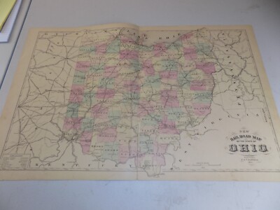
$8.85 Shipping Location: Aumsville, United States ohio vintage map 1891 railroads and counties int cyclopedia.
Buy It Now
Free Shipping Location: Kennebunk, United States This Map was removed from a 1874 Atlas and is in good acceptable condition. Study the photos carefully, this is the actual map you. Only Authentic Originals.
Buy It Now
$10.00 Shipping Location: Montrose, United States Date: 1871. Here is an overview of the history of Deer Creek and its surrounding area They were attracted to the fertile lands and abundant water sources, ... moreincluding Deer Creek.
Buy It Now
Free Shipping Location: Kennebunk, United States This Map was removed from a 1874 Atlas and is in good acceptable condition. Study the photos carefully, this is the actual map you. Including Hundreds ... moreof RareCivil War.
Buy It Now
Free Shipping Location: Kennebunk, United States ASHTABULA,OHIO1874/072021. This Map was removed from a 1874 Atlas and is in good acceptable condition. Study the photos carefully, this is the actual ... moremap you. Only Authentic Originals. Including Hundreds of RareCivil War.
Buy It Now
$3.65 Shipping Location: United States The size of the map is 11" by 14". FREE scheduling, supersized images.
Free Shipping Location: Schertz, United States This Map was removed from a 1902 CRAM'S ATLAS and is in very good condition. The map is not " new " or in " new " condition, it was printed in 1902. The ... moremap is not dated.
Buy It Now
$4.55 Shipping Location: Oakland, United States This beautiful antique map of Ohio from 1923 is a must-have for any collector of historical maps. Measuring 9x6 inches, it showcases the state's topography, ... moremajor cities, and landmarks during that time period. The map is in excellent condition and will make a great addition to any home or office.Featuring Ohio's counties, rivers, railroads, and more, this map provides a wealth of information about the state's geography. Whether you're a history buff or simply looking for a unique piece of decor, this antique map is sure to impress. Don't miss out on the opportunity to own a piece of Ohio's past.
Buy It Now
Free Shipping Location: Kennebunk, United States ASHTABULA,OHIO1874/072021. This Map was removed from a 1874 Atlas and is in good acceptable condition. Study the photos carefully, this is the actual ... moremap you. Only Authentic Originals.
Buy It Now
Free Shipping Location: Kennebunk, United States ASHTABULA,OHIO1874/072021. This Map was removed from a 1874 Atlas and is in good acceptable condition. Study the photos carefully, this is the actual ... moremap you. Only Authentic Originals.
Buy It Now
Free Shipping Location: Sayville, United States THE CENTURY COMPANY ATLAS MAP PLATE#18 OHIO SOUTHERN PART 1897 VINTAGE The Century Atlas Company of New York City map plate#18 Ohio Southern Part circa ... more1897. Measures 11 3/4 X 16 1/4 inches in size(30 X 41cm) Map is an authentic original in good condition as shown in photos. Map printed on high quality paper suitable for framing.
Buy It Now
$10.00 Shipping Location: Montrose, United States Publisher:Pickaway County Ohio Atlas G.O. Titus. Date: 1871.
Buy It Now
$6.20 Shipping Location: Mount Washington, United States Ener litit l st here Enter listing title here Enter listing title here Enter listing title here Enter listing title here Enter list1tle here Dimensions: ... moreapproximately 8 x 12 1/2 Enter listing title here Enter title list herDimensions No Reasonable Offer Refused SKU 1088.
Buy It Now
$6.20 Shipping Location: Mount Washington, United States Ener litit l st here Enter listing title here Enter listing title here Enter listing title here Enter listing title here Enter list tle here Dimensions: ... moreapproximately 8 x 12 1/2 Enter listing title here Enter title list herDimensions No Reasonable Offer Refused SKU 944.
|
|
|
In
|
1908 Electric Railroad Map CHILLICOTHE Ross County Ohio
1908 Electric Railroad Map CHILLICOTHE Ross County Ohio Genuine original lithographed topographical map of part of Ross and Pickaway counties. Printed more than 68 years ago. This map labels the electric railway operated by the Scioto Valley Traction Company. Which served the Columbus area, with extensions to Lancaster, Circleville and Chillicothe. By the time this map had been printed, many of the city-to-city electric train lines in the Buckeye State had stopped providing passenger service. The map also locates the Ohio& Erie Canal, which is marked"Abandoned" near Renick. This map was published by the United States Geological Survey and is identified as the March 1908 edition of the Chillicothe quadrangle. Reprinted 1943. The coverage area is bounded by longitude 82°45' W to 83°0' W and latitude 39°15' ... moreN to 39°30' N. The scans below give a closer look at some of the detail: The map is drawn on a scale of 1:62.500 and is based on surveys conducted in 1905-1906. Details include wagon roads, steam railroads, towns, and natural features. It even locates individual houses and farms! Among the specific named places and features are: Rattlesnake Knob, Baltimore& Ohio Southwestern Railroad, Kingston, Hallsville, Kinnikinnick, Norfolk& Western Railroad, Londonderry, Lickskiller, Charleston, Walnut Creek, Slickaway Hollow, Cincinnati. Hamilton& Dayton Railroad, Peppers, Paint Creek Pike, Whisler, and more, This is an original. Authentic antique map, not a reproduction or modern reprint. And it is fully guaranteed to be genuine. The image area measures 17-1/2" x 13-1/2" on a larger sheet, with generous margins on all sides. Condition: It is in very good condition. Bright and clean, with no rips or tears. A previous owner has made a few stray pencil marks and written a number in the upper corner. Early maps are often the only record we have of how a particular place"looked" at a given point in its history. And this offers a view back at this
|
|
|
1911 Electric Railroad Map EATON Preble County Ohio
1911 Electric Railroad Map EATON Preble County Ohio Genuine original lithographed topographical map of part of Preble and Butler counties. Printed more than 79 years ago. This map labels the Ohio Electric Railway. One of many interurban electric railroads that were then operating in Ohio. Shortly after this map was printed the combined effects of the Great Depression and an increase in automobile travel led to the closing of many of the city-to-city electric train lines in the Buckeye State. This map was published by the United States Geological Survey and is identified as the August 1911 edition of the Oxford quadrangle. Reprinted 1932. The coverage area is bounded by longitude 84°30' W to 84°45' W and latitude 39°30' N to 39°45' N. The scans below give a closer look at some of the detail: The map is drawn ... moreon a scale of 1:62.500 and is based on surveys conducted in 1909. Details include wagon roads, steam railroads, towns, and natural features. It even locates individual houses and farms! Among the specific named places and features are: Oxford Retreat, Cincinnati Northern Railroad, Miami University, Hamilton& Richmond Road, Morning Sun, Pittsburgh. Cincinnati& St. Louis Railroad, Devil's Backbone, West Alexandria, Friendship Church, Phare School, Winchester, Germantown Turnpike, Sugar Valley, Somerville, Cotton Run School, Ingomar, Camden, and more, This is an original. Authentic antique map, not a reproduction or modern reprint. And it is fully guaranteed to be genuine. The image area measures 17-1/2" x 13-1/2" on a larger sheet, with generous margins on all sides. Condition: It is in very good condition. Bright and clean, with no rips or tears. A previous owner has written a number in the upper corner. Early maps are often the only record we have of how a particular place"looked" at a given point in its history. And this offers a view back at this historic part of the Buckeye State as it was early in the last century. It was drawn using the c
|
|
|
1909 Ohio Electric Railroad Map NEWARK HEATH Indian Mounds Licking County Canal
1909 Ohio Electric Railroad Map NEWARK HEATH Indian Mounds Licking County Canal Genuine original lithographed topographical map of part of Licking County. Printed more than 92 years ago. This map labels the Ohio Electric Railway. One of Ohio's early 20th-century interurban railroad lines. It also shows steam railroads, including the Pittsburg, Cincinnati, Chicago& St. Louis, the Baltimore& Ohio, and the Toledo& Ohio Central. It locates two large areas of Indian mounds. Southwest of Newark, today known as the Octagon Earthworks and Moundbuilders Earthworks. It labels the Ohio& Erie Canal as"abandoned" and shows roads, villages, schools, and natural features, and even locates individual houses and farms! The coverage area includes what is today the city of Heath, although it had yet been incorporated as a village ... morewhen this was printed. Other named places and features include Hanover. Claylick, Brushy Fork School, Newton Chapel, Central City, Lloyd Corners, Smoot Lake, St. Louisville, Rain Rock, Hickman, Chatham, Hog Hollow, Cedar Hill Cemetery, Wilkins Run, Purity, Utica, Swans, and more. The scans below give a closer look: The map shows township and range lines. And it is drawn on a scale of 1:62,500 and based on surveys conducted in 1906-1907. The coverage area is bounded by longitude 82°15' W to 82°30' W and latitude 40°00' N to 40°15' N. This map was published by the United States Geological Survey and is identified as the August 1909 edition of the Newark quadrangle. Reprinted 1920. It is an original. Authentic antique map, not a reproduction or modern reprint. And it is fully guaranteed to be genuine. The image area measures 17-1/2" x 13-1/2" on a larger sheet, with generous margins on all sides. Condition: It is in very good condition. With some faint toning in the right margin, outside of the image area and no marks. Rips, or tears. Early maps are often the only record we have of how a particular place"looked" at a given p
|
|
|
1907 Kanawha Railroad Map POMEROY Meigs County Ohio River Ferry Albany Bradbury
1907 Kanawha Railroad Map POMEROY Meigs County Ohio River Ferry Albany Bradbury Genuine original lithographed topographical map of part of Meigs. Athens, and Gallia counties, printed more than 93 years ago. This map labels the Kanawha& Michigan Railroad and shows the ferry across the Ohio River between Pomeroy and Mason. West Virginia. The bridge had not yet been built when this was printed. It also locates the village of Albany. One of several stops in Athens County for the Underground Railroad. Other named places and features include Pagetown, Carpenter, Leading Creek, Dyesville, Dexter, Bradbury, Middleport, Muddy Fork, Harrisonville, and more. The map shows township and range lines. Wagon roads, and natural features. It even locates individual houses and farms! It is drawn on a scale of 1:62,500 and is based on surveys conducted in ... more1904-1905. The coverage area is bounded by longitude 82°00' W to 82°15' W and latitude 39°00' N to 39°15' N. The scans below give a closer look: This map was published by the United States Geological Survey and is identified as the November 1907 edition of the Pomeroy quadrangle. Reprinted 1920. It is an original. Authentic antique map, not a reproduction or modern reprint. And it is fully guaranteed to be genuine. The image area measures 17-1/2" x 13-1/2" on a larger sheet, with generous margins on all sides. Condition: It is in very good condition. Bright and clean, with no rips or tears. A previous owner has written a number in the upper corner. Outside of the image area. Early maps are often the only record we have of how a particular place"looked" at a given point in its history. And this offers a view back at this historic part of the Buckeye State as it was early in the last century. It was drawn using the classic mapping technique called plane-table surveying. Plane-table surveying took great skill and. Depending on the mapping site, equal daring. Carrying a plane table— essentially a portable drawing board on a tr
|
|
|
1903 Connecticut Reserve USGS Railroad Map WOOSTER Ohio Menonite Chautauqua Erie
1903 Connecticut Reserve USGS Railroad Map WOOSTER Ohio Menonite Chautauqua Erie Genuine original lithographed topographical map of part of Wayne County. Printed more than 75 years ago. This map locates the south boundary of the Connecticut Reserve. Dividing Medina and Wayne counties, in northeastern Ohio. It also labels steam railroad lines, including Wheeling& Lake Erie, the Baltimore& Ohio, and the Pittsburg, Fort Wayne& Chicago Division of the Pennsylvania System. This map was published by the United States Geological Survey and is identified as the 1903 edition of the Wooster quadrangle. Reprinted 1938. The coverage area is bounded by longitude 81°45' W to 82°00' W and latitude 40°45' N to 41°00' N. The scans below give a closer look at some of the detail: The map is drawn on a scale of ... more1:62.500 and is based on surveys conducted in 1901. Details include wagon roads, towns, and natural features. It shows township and range lines and even locates individual houses and farms! Among the specific named places and features are: Wooster University, Orrville, Sugar Creek, State Experiment Station, Canaan, Burbank, Menonite Home, Little Chippewa Creek, Chautauqua, East Union, Sterling, Rittman, Creston, Golden Corners, Smithville, Apple Creek, and more, This is an original. Authentic antique map, not a reproduction or modern reprint. And it is fully guaranteed to be genuine. The image area measures 17-1/2" x 13-1/2" on a larger sheet, with generous margins on all sides. Condition: It is in very good condition. Bright and clean, with some faint wrinkling in the lower margin, outside of the image area, and no rips or tears. Early maps are often the only record we have of how a particular place"looked" at a given point in its history. And this offers a view back at this historic part of the Buckeye State as it was early in the last century. It was drawn using the classic mapping technique called plane-table surveying. Plane-table surveying took great sk
|
|
|
1913 Railroad Map Michigan Illinois Michigan Ohio RR
Lake Erie Maps& Prints! An Original Antique Map: Not a Reproduction! See Our Ebay Store for other! Free Shipping on Purchases of 5 or More Maps and Prints Description: It is an authentic Antique map with a copyright date of 1913 printed on the map as stated in the bottom margin: Copyright: 1913. By LeSalle Extension University, Chicago. It is from an Atlas of Railway Traffic Maps published in Chicago by the LaSalle Extension University. 1913, a copy of the title page is included for autenticitiy. The map is not mounted nor matted, being sold as a single sheet as seen in the first pic. A very nice map in great shape. Size: The map image measures approximately 10 1/2 by 17 inches on a 11 1/2 by 18 1/2" page with a margin all around for matting as seen in the pic. Condition: It is in Very Good condition for its age with very light tonal ... moreageing and a centerfold as issued. Overall. The paper is very flexible, bright and clean, basically as seen in the pics. The pics are of the actual map and accurate of the condition and color. Payment Details: We accept most major credit cards through Paypal and Ebay. Please ask if you have any questions about payment. International and New Bidders are welcomed and encouraged. Payment is expected within 7 days. After which Nonpaying Bidders will be reported to Ebay to recoup our listing fees. Shipping: $2.90 for First Class or $4.95 for Priority Mail with Delivery Confirmation in the USA; $3.95 for First Class International to Canada; $6.00 for International Airmail elsewhere in the World or $23 for Priority International. Which includes Paypal insurance. We ship daily, so if still bidding send us a quick email to hold or better just pay all at once at the end. Save on Shipping: We only charge one shipping fee based on the largest map or print with multiple items shipped along with it for no extra costs. Purchase 5 or more maps or prints and receive Free First Class shipping in USA or First Class International elsewhere in the world. Although registration may be required on
|
|
|
1914 Electric Railroad Map CINCINNATI Ohio Covington KY
1914 Electric Railroad Map CINCINNATI Ohio Covington KY Genuine original lithographed topographical map of part of Hamilton County. Ohio and adjoining Kentucky, printed more than 73 years ago. This map labels the interurban electric railway lines from Cincinnati through Cumminsville. College Hill, and Mount Holiday, and from Covington to Fort Mitchell. It also locates a dam, four bridges, and a ferry crossing on the Ohio River. This map was published by the United States Geological Survey and is identified as the 1914 edition of the West Cincinnati quadrangle. Reprinted 1938. The coverage area is bounded by longitude 84°30' W to 84°45' W and latitude 39°00' N to 39°15' N. The scans below give a closer look at some of the detail: The map is drawn on a scale of 1:62.500 and is based on surveys conducted in ... more1898, with revisions in 1912. Details include roads, steam railroads, towns, schools, and natural features. It even locates individual houses and farms! Among the specific named places and features are: Miamitown, Louisville& Nashville Railroad, Mill Creek Stockyards, Cheviot, Miami River, Crescent Springs, Ludlow, Cincinnati. New Orleans& Texas Pacific Railroad, Ohio Military Institute, Creedville, Latonia, Cincinnati& Westwood Railroad, Winsome Hill School, Baltiimore& Ohio Southwestern Railroad Fairmount, Erlanger, Anderson's Ferry, Sedansville, Chesapeake& Ohio Railroad, Sayler Park, Delphi, and many more, This is an original. Authentic antique map, not a reproduction or modern reprint. And it is fully guaranteed to be genuine. The image area measures 17-1/2" x 13-1/2" on a larger sheet, with generous margins on all sides. Condition: It is in very good condition. Bright and clean, with no rips or tears. Early maps are often the only record we have of how a particular place"looked" at a given point in its history. And this offers a view back at this historic part of the Buckeye State as it was early in the last century. It was draw
|
|
|
1900 Railroad map of Ohio. Genuine. Must read. Great find.
1900 Railroad map of Ohio. Genuine. 28 X 20 inches. From a 1900 Rand McNally Enlarged Business Atlas. Base map copyrighted 1895/1898. Railroad information current for 1900. Yardstick to estimate current population of this map. One of the joys natural to most collectors is to find and own a scarce or illusive item. If a U.S. Coin or stamp were to exist with only four to five copies known. The value of such an item would be out of most collectors price range. Here is a chance to own just such an item. According to worldcat.org only two copies of this atlas are in the major reference collections. These are located at the Warren Library Association. Warren, PA 16365 and Yale University, Sterling Memorial Library, New Haven, CT 06520 United States. We have found one dealer that has a few single maps from this atlas for sale. Name on request. The ... moremaps we are selling come from a salvaged 1900 Rand McNally Enlarged Business Atlas. 30th edition. See bottom scans. When looking for maps to compare prices or condition. Don't mistake the later editions of this atlas, that state they contain the(1900 Census& Entire Railroad System) The latter were published in 1901 and later. We will be listing more railroad maps from a 1901 in the near future, to replace the 1901 maps that have been sold. Green Green Green. We are also going Green. All packing material. Ie, strong tube, plastic caps, kraft paper to insure maps don't slip in tube, can be recycled. All maps purchased over $24.95 are insured by us at no cost to you. This includes international shipments. This map measures 28 X 20 inches. Overall condition is good. Shows minor handling. Paper shows normal aging. Railroads shown on this map. Thumbnail to show detail achieved by the wax engraving process. The following is for informational use only and will not be sent with the map. Atlas that maps were salvaged from. Outer cover of Atlas. Details from index page. ShipSaver. RcmdId ViewItemDescV4,RlogId p4%60bo7%60jtb9%3Fuk.rp*60%3F3%3Aa%3E-13dd28937a1-0xf7-
|
|
|
1908 Electric Railroad Map WEST SALEM Ohio Mohican Polk
1908 Electric Railroad Map WEST SALEM Ohio Mohican Polk Genuine original lithographed topographical map of part of Ashland and Wayne counties. Printed more than 91 years ago. This map labels the West Salem& Mansfield Electric Railroad. One of the interurban railways that operated in the late 19th and early 20th centuries, until the combined effects of the Great Depression and an increase in automobile travel led to the closing of many of Ohio's city-to-city electric train lines. This map was published by the United States Geological Survey and is identified as the February 1908 edition of the West Salem quadrangle. Reprinted 1920. The coverage area is bounded by longitude 82°00' W to 82°15' W and latitude 40°45' N to 41°00' N. The scans below give a closer look at some of the detail: The map is ... moredrawn on a scale of 1:62.500 and is based on surveys conducted in 1905-1906. Details include roads, steam railroads, towns, and natural features. It even locates individual houses and farms! Among the specific named places and features are: Cedar Valley, Lorain. Ashland& Southern Railroad, Mohican River, Polk, Armstrong, Baltimore& Ohio Railroad, County Ditch, Jefferson, Plain Church, Erie Railroad, Pleasant Home, Eight Square, Jeromeville, Albion, Congress, Funk, and more, This is an original. Authentic antique map, not a reproduction or modern reprint. And it is fully guaranteed to be genuine. The image area measures 17-1/2" x 13-1/2" on a larger sheet, with generous margins on all sides. Condition: It is in very good. Lightly used condition, with four repaired tears on the right edge. A tiny piece of the upper corner has been torn off and there are a few light pencil marks. Early maps are often the only record we have of how a particular place"looked" at a given point in its history. And this offers a view back at this historic part of the Buckeye State as it was early in the last century. It was drawn using the classic mapping technique called plan
|
|
|
Original 1903 Plat Map OLMSTED FALLS Cuyahoga County Ohio CE&W Electric Railroad
Original 1903 Plat Map OLMSTED FALLS Cuyahoga County Ohio CE&W Electric Railroad Genuine original antique color lithographed plat map of Olmsted Township and Olmsted Falls. Printed more than 110 years ago. The map names property owners and labels the Cleveland. Elyria& Western Railway, an interurban electric railroad which was the first suburban streetcar line running into Cleveland. The CE&W runs diagonally across the northwest corner of the township, through North Olmsted and what 100 years earlier had been part of the Western Reserve. The map also labels two steam railroad lines— the Lake Shore& Michigan Southern and the Cleveland. Cincinnati, Chicago& St. Louis. It locates the village of West View in the southern part of the township; West View later merged with Olmsted Falls Village. The scans below give a closer ... morelook at the township map, which is drawn on a scale of three inches to one mile: To the right of the township map there is a detailed plan of Olmsted Falls Village. Drawn on a scale of 400 feet to one inch. It locates the Public Square and School on Water Street, Plum Creek, Congregational Church, Columbia Street, and the LS&MS Railroad Depot. It locates a cemetery on the east bank of the Rocky River at Seminary Street. The scans below give a closer look: The township map and village plan are on a single sheet which measures 17" x 28" and is copyrighted © 1903 by H.B. Stranahan. It identifies individual property owners. With lot sizes in acres, and labels various tracts and subdivisions, including the Nichols Partition and Northrop Estate. Condition: This map is in very good condition. Bright and clean, with no marks. Rips, or tears. It is blank on the back, with no printing on the reverse side, and there is a vertical fold at the center, as issued. Early maps are often the only record we have of how a particular place"looked" at a given point in its history. And this map offers a view back at this part of Cuyahoga County as it was early in the last c
|
|
|
Original 1903 Electric Streetcar Railroad Map EUCLID Cuyahoga County Ohio Noble
Original 1903 Electric Streetcar Railroad Map EUCLID Cuyahoga County Ohio Noble Genuine original antique color lithographed map of Euclid. Printed more than 110 years ago. This map labels two electric railroads that served the area during the early years of the last century: the Cleveland. Painesville& Eastern and the Cleveland& Eastern. Like many of Ohio's interurban lines, these railroads had ceased operation by the 1930s, thanks to an increase in automobile travel and the effects of the Great Depression. The map measures a generous 15-3/4" x 26-1/2" and has wonderful detail throughout. With six insets of allotments and subdivisions, including Noble Beach, Wickliffe on the Lake, and Terrace View. It was published by H.B. Stranahan& Company, Cleveland and is copyrighted © 1903. It identifies property owners ... moreand gives lot size. Among the named places and features are the Euclid Railroad. Frissell's Allotment, Ammon Road, the Lake Shore& Michigan Southern Railroad, Collinwood, Highland Road, Nottingham, Claribel, the New York, Chicago& St. Louis Railroad, Chardon Road, South Euclid, and more. The scans below give a closer look at some of the detail: The map is drawn on a scale of three inches to one mile. It is blank on the back. With no printing on the reverse side, and there is a horizontal fold at the center, as issued. Condition: It is in very good condition. Bright and clean, with no marks. Rips, or tears. Early maps are often the only record we have of how a particular place"looked" at a given point in its history. And this offers a view back at this historic part of the Buckeye State as it was early in the last century. It is an original. Authentic antique map, not a reproduction or modern reprint. And it is fully guaranteed to be genuine. It would make a handsome display in your den or office. It would also make a perfect gift, and we'll include our helpful framing tips for your reference. We will ship the map to you carefully rolled in a sturdy tube
|
|
|
Original 1903 Railroad Map SOLON Cuyahoga County Ohio Glenwillow Austin Powder
Original 1903 Railroad Map SOLON Cuyahoga County Ohio Glenwillow Austin Powder Genuine original antique color lithographed map of Solon and Solon Township. Printed more than 110 years ago. Solon Township is now defunct. Basically annexed by the municipalities of Solon, today a city whose population is more than 20,000, and Glenwillow, which was at the time this map was printed a small village at the railroad junction near Tinkers Creek and home to the Austin Powder Company, one of America's oldest and largest explosives manufacturers. The map measures a generous 15-3/4" x 26-1/2" and has wonderful detail throughout. Including steam railroads, churches, and individual property owners, with lot sizes. Among the named places and features are the Wheeling& Lake Erie Railroad, the Congregational Church at the Public Square, Tinkers ... moreCreek, Glenwillow Post Office, the Erie Railroad, the Solon Road Cemetery, the Austin Powder Company, the Presbyterian Church, and more. The map was published by H.B. Stranahan& Company. Cleveland and is copyrighted © 1903. The township map is drawn on a scale of three inches to one mile. The scale of the village plat map is 400 feet to one inch. The scans below give a closer look: Condition: This map is in excellent condition, bright and clean. With no marks. Rips, or tears. It is blank on the back, with no printing on the reverse side, and there is a vertical fold at the center, as issued. Early maps are often the only record we have of how a particular place"looked" at a given point in its history. And this offers a view back at this historic part of the Buckeye State as it was early in the last century. It is an original. Authentic antique map, not a reproduction or modern reprint. And it is fully guaranteed to be genuine. It would make a handsome display in your den or office. It would also make a perfect gift, and we'll include our helpful framing tips for your reference. We will ship the map to you carefully rolled in a sturdy tube, and we are
|
|
|
Circa 1900 Railroad Map of Ohio
Neat railroad map of Ohio. One corner damage with a piece lacking but could be rebacked an made to look good. Undated map done by the state and mounted on a roller.
|
|
|
Original 1912 Topo Map HOCKING HILLS Ohio Indian Mound Railroad Laurelville Cave
Original 1912 Topo Map HOCKING HILLS Ohio Indian Mound Railroad Laurelville Cave Genuine original lithographed topographical map of part of Hocking and Vinton counties in southeastern Ohio. Printed more than 74 years ago. This map locates an Indian mound southeast of Laurelville. And it shows the Columbus& Southern Railroad, running east to South Bloomingville and labeled as"abandoned. Other details include roads. Schools, churches, township and range lines, and natural features, as well as individual houses and farms! Among the named places and features on the map are Ash Cave. Salt Creek, Haynes, Pine Cottage School, Macedonia Church, Ratcliffburg, Chillicothe& McArthur Road, Adelphi, South Perry, Gibisonville, Jimtown, Wesley Chapel, Crane Hollow, Cedar Falls, Apple, and many more. The coverage area of the map is bounded by ... morelongitude 82°30' W to 82°45' W and latitude 39°15' N to 39°30' N. The map is drawn on a scale of 1:62.500 and is based on surveys conducted in 1910. The scans below give a closer look: This map was published by the United States Geological Survey and is identified as the 1912 edition of the Laurelville quadrangle. Reprinted 1939. It is an original. Authentic antique map, not a reproduction or modern reprint. And it is fully guaranteed to be genuine. The image area measures 17-1/2" x 13-1/2" on a larger sheet, with generous margins on all sides. Condition: It is in very good condition. With no rips or tears. This map has never been folded. And we will ship it to you carefully rolled in a sturdy tube. Early maps are often the only record we have of how a particular place"looked" at a given point in its history. And this offers a view back at this historic part of the Buckeye State as it was early in the last century. It was drawn using the classic mapping technique called plane-table surveying. Plane-table surveying took great skill and. Depending on the mapping site, equal daring. Carrying a plane table— essentially a porta
|
|
|
Rand McNally Railroad Map of Northeast Indiana Ohio Michigan Pennsylvania 1927
Click to Enlarge Click to Enlarge Click to Enlarge Click to Enlarge Railroad Map of Northeastern United States by Rand McNally. 1927. Excellent lithographic map of Indiana. Michigan, Ohio, Pennsylvania, and the rest of the northeastern U.S. Printed by Rand McNally for the LaSalle University Commercial Atlas in 1927. Second-run printing in red denotes Contral Freight Association territory. Text on reverse. Map is in fine condition and would look great framed. Measures 19.75 x 10.75 inches. Will ship folded in package. Please note we do not ship internationally. And all California residents will be charged 8.75% sales tax. Thanks for looking! Learn more about our store on our About Me page: inkfrog terapeak. Inkfrog terapeak. I000000. InkFrog Analytics.
|
|
|
Original 1930 Electric Railroad Map OHIO Columbus Cleveland Cincinnati Toledo
Original 1930 Electric Railroad Map OHIO Columbus Cleveland Cincinnati Toledo Handsome original antique color lithographed map of Ohio. Printed more than 80 years ago. The map is drawn on a scale of 1:1.255,000 and labels steam railroads. It also shows electric railway lines serving Cleveland, Cincinnati, Lima, Toledo, Circleville, Columbus, Akron, Canton, Bucyrus, Eaton, and other cities. Other details include counties. Cities, and towns. The image area measures a generous 31.6 x 48.2 cm[12-1/2" x 19" The scans below give a closer look: There's an index to principal cities in the margins at left and right. Among the named railroads are the Baltiimore& Ohio. The Northern& Western, the Pennsylvania, the Lorain, Ashland& Southern, the New York Central, the Wabash, the Wheeling& Lake Erie, the Hocking Valley, and ... moremore. Condition: This map is in very good condition, bright and clean. With no marks. Rips, or tears. There's a break on the center fold, reinforced on the reverse side with archival tape, and there is a full-page of information on the topography, agriculture, and history of the Buckeye State. This is an original. Authentic 1930 map, not a reproduction or modern reprint. And it is fully guaranteed to be genuine. It was published by Rand McNally, and we'll include a dated photocopy of the title page from the book in which it appeared. Buy with confidence! We are pleased to offer this map with our unconditional. Money-back guarantee. SHIPPING: We gladly ship anywhere in the World. And we use sturdy, professional packing materials to assure safe delivery. The shipping charges are as follows: Within the United States. Including Alaska, Hawaii, and APO addresses: $6.00 To Canada or Mexico: $11.59 To all other international destinations: $16.49(These charges reflect recent increases made by the United States Postal Service for international delivery. We will appreciate your prompt payment for this item. If you need more time or have any other questions about making your payme
|
|
|
Original 1903 Railroad Map STRONGSVILLE Albion Rocky River Cuyahoga County Ohio
Original 1903 Railroad Map STRONGSVILLE Albion Rocky River Cuyahoga County Ohio Genuine original antique color lithographed map of Strongsville Township. Printed more than 110 years ago. The map is map is drawn on a scale of three inches to one mile. Which provides wonderful detail, including property owners, with lot sizes in acres. It also locates schools and shows roads, steam and electric railroads, and natural features. The map labels the Cleveland& Suburban Railway. An interurban line that ran from Cleveland to Medina. Other specific named places and features include Rocky River, the Virgil post office and school, the Village of Albion, and the Cleveland, Lorain& Wheeling Railroad. There are inset plans of Albion and Strongsville Center on a scale of 400 feet to the inch, as well as three allotments: Sprague's, Stearn's, ... moreand Dorland's. The map was published by H.B. Stranahan& Company. Cleveland and is copyrighted © 1903. Fifty years earlier. The family of young John D. Rockefeller had moved to Strongsville, and the boy who would later become the world's richest man attended Cleveland's Central High School. Twenty years after the map was printed, Strongsville became a village, and in 1961 it was designated a city. Condition: This map is in excellent condition, bright and clean. With no marks. Rips, or tears. It is blank on the back, with no printing on the reverse side, and there is a horizontal fold at the center, as issued. Overall size is a generous 28" x 17" The scans below give a closer look: It is an original. Authentic antique map, not a reproduction or modern reprint. And it is fully guaranteed to be genuine. It would make a handsome display in your den or office. It would also make a perfect gift, and we'll include our helpful framing tips for your reference. Early maps are often the only record we have of how a particular place"looked" at a given point in its history. And this offers a view back at this historic part of the Buckeye State
|
|
|
1910 Antique Ohio Railroad Folding Map Book
This is a folding map in pocket book form of the railroads in Ohio in 1910 showing both steam and electric lines. The book itself is a hard cover 8-1/2 x 4" The only damage to the book is some deterioration at the bottom of the spine. The picture illustrates this area. The fold out map is printed on linen and when folded out measures 32 x 28" The linen portion is attached to the hardcover of the book. An interesting stamp appears on the inside from cover of the book"Compliments of H.L. Yount Ohio Senate" The folding portion of the map to me is remarkable conditon for being 104 years old. While the folds show age there are no major rips or tears. For either an antique map collector or a railroad history enthusiast this is a very rare and interesting item. Hopefully the pictures give you a good idea of the content and condition ... moreof the map. Let me know if you have any questions.
|
|
|
Old Map Ohio Railroad Lines 1921 Columbus Springfield Canton Youngstown Marion
GUARANTEED TO BE ORIGINAL AS STATED BELOW Authentic 1921 Color Map of Ohio Nothing Printed On The Back Page Measures Approximately 6 3/4 by 8 5/8(un-trimmed) Map Measures Approximately 5 by 7 Publication: Winston's Cumulative Loose-Leaf Encyclopedia Map Maker: C.S. Hammond and Co. NY Publisher: John C Winston Company See picture of title page below(not included in sale) Condition Very Good or Better Plenty of margin for mat and frame if so desired Shipped flat and secure Placed in acid free bag with backing board Sandwiched between 2 pieces of stiff cardboard Shipped via USPS 1st Class Parcel Mail with Delivery Confirmation/ Tracking SHIPPING MONDAY THRU FRIDAY ONLY We do not destroy good books. We save pages with historical information and images From books that are not usable in their current condition. Saving the past one page at a ... moretime! Be sure to checkout the other great items we are offering Just a quick note to thank you for checking out our item and to let you know alittle about us We are Karen and John. Wife and husband from the beautiful Lakes Region of New Hampshire We have been sellers since 1999 making some extra money and finding homes for interesting items We use different names to sort the items we offer that way we can be somewhat organized! Our names are IBEEBACK. IBEADULT, and SHOPNH4U And our items can be found by doing an advanced search by seller name You can also review our feedback files and ME page for more info how we treat all sales We hope we can do business with you soon. Thank you. Karen and John inkfrog terapeak. InkFrog Analytics.
|
|
|
Canvas Backed Folding Ohio Railway Map Railroad Color Counties Columbus OH 1912
We are offering a Ohio Railway Map from 1812. This map measures 32" X 28" And is folded, bound into scuffed and worn, gilt stamped brown cloth covers, with the lower hinge cracked. The map is canvas backed, with wear and some loss at the folds. Color. Shipping Anywhere In The United States Media Mail $4; International Shipping $25. Please Note: We accept PayPal. But also accept all credit cards. Everything we sell is Returnable for any reason. We only ask for prompt notification, within 14 days. We generally do try to"combine shipping" when you purchase more than one item-except in cases of large lots or very heavy shipments. Don't hesitate to ask for more info/detail on any of our listings.
|
|
|
Original 1903 Plat Map MAYFIELD HEIGHTS GATES MILLS Ohio C&E Electric Railroad
Original 1903 Plat Map MAYFIELD HEIGHTS GATES MILLS Ohio C&E Electric Railroad Genuine original antique color lithographed map of Mayfield Township. Comprising today's Mayfield Heights, Gates Mills, Highland Heights, and Mayfield Village, printed more than 110 years ago. This map labels the Cleveland& Eastern Electric Railway. Also known as"The Maple Leaf Route, which crossed the Chagrin River at Gates Mills. Like many of Ohio's interurban lines, this traction railroad had ceased operation by the 1930s, thanks to an increase in automobile travel and the effects of the Great Depression. The map has much more wonderful detail. Including schools, roads, and individual property owners, with lot sizes. Two large insets give a closer look at Gates Mills and Mayfield Heights, then called Mayfield Center. The map was published ... moreby H.B. Stranahan& Company. Cleveland and is copyrighted © 1903. The overall image area measures a generous 15-3/4" x 26-1/2" The main part of the map is drawn on a scale of three inches to one mile. It is blank on the back. With no printing on the reverse side, and there is a vertical fold at the center, as issued. Condition: It is in excellent condition, bright and clean. With no marks. Rips, or tears. Please see the scans and feel free to ask any questions. Early maps are often the only record we have of how a particular place"looked" at a given point Cuyahoga County as it was early in the last century. Mayfield Township was first settled in the summer of 1809. It existed until 1920. When the entire township was incorporated into several villages. Today, the township is basically defunct or what is known as a"paper township. This is an original. Authentic antique map, not a reproduction or modern reprint. And it is fully guaranteed to be genuine. It would make a handsome display in your den or office. It would also make a perfect gift, and we'll include our helpful framing tips for your reference. We will ship the map to you carefully ro
|
|
|
Antique 1914 Ohio Railroad Railway Map Book Lithograph Printing Columbus EXC
Railroad Map Of Ohio. Published by the State. Prepared under the direction of. Commisioners of Public Printing of State of Ohio. Copyrighted 1914 by The Columbus Lithograph Co. Columbus, O. Printed on heavy canvas material, map meaures 32" x 28" Lithograph print depicts a train passing under a cable car overpass as a man watches. One tiny tear along bottom center edge of map. Exquisite condition. The black cover is in great condition also, very minor edge wear. The paper on inner cover has a 3/8" hairline tear along top spine. Ohio Railway Map in gold lettering on front cover. Measures 8 1/4" x 3 3/4" x 3/4" when map is folded inside cover.
|
|
|
Giant Vintage 1914 Ohio STEAM RAILROAD & ELECTRIC RAILWAY Train R.R. Map RARE!!!
Here is a RARE vintage 1914 Railway Map that was found in a very old Ohio house. It's the official Railroad Map of Ohio and it's in nice shape! This high quality linen-back map looks just like a hardcover book but open it up and it unfolds to an impressive 28 by 32 inch size featuring both Steam Railroads and Electric Railways operating in Ohio at the time. Also included are: Canals. Tunnels, Prisons, Hospitals, Universities, as well as Telegraph, Express, and Sleeping Car Companies. This 100 year old RR map has very nice printwork done by the Columbus Lithograph Company and also features a beautiful graphic image of a steam locomotive. Has only minor wear and condition is at least Very Good+ to EXCELLENT+ or better! It would make a great gift or a wonderful addition to any collection. U.S. buyer pays $6 for carefully packed shipping. ... moreFor more cool, old, rare items.see my other auctions!
|
|
|
HUGE ANTIQUE 1937 WEST CLEVELAND OHIO ATLAS 20 FOLIO MAP WHISKEY ISLAND RAILROAD
Click Here. Double your traffic. Get Vendio Gallery- Now FREE! Huge. Gorgeous, very rare, antique 1937 Hopkins Atlas of Cleveland, Vol 2, this covers a western area of Cleveland, with Whiskey Island railroad areas, the city hospital, which I believe was also an insane asylum, and much more, this has 20 huge folio size linenbacked maps, with no printing on reverse. The linenbacking really protected the map. The atlas is missing maps 1 to 12, and 14-17, 20 huge 2 page maps are left. The map have superb period handcoloring. Typically these atlases were made in editions of about 200 copies each, making them very rare these days, not many survive. Probably at most 50 have survived. The maps are very detailed, with named home and land owners, named business and industry, named streets, named railroads, named schools, named churches, size and locations ... moreof buildings, named parks and much much more of the period, making them fascianting historical time capsules. The maps are in excellent condition, the atlas boards have some wear, mostly at the spine. The size of the atlas is 18" by 24.5" the the size of the maps is a large 24 by 34" Rare and amazing Cleveland atlas. Winning bidder pays $15.00 shipping domestic, more foreign. Payment I accept the following forms of payment: PayPal Click to View Image Album Click to View Image Album Click to View Image Album Click to View Image Album Click to View Image Album Click to View Image Album Click to View Image Album Click to View Image Album Click to View Image Album Click to View Image Album Click to View Image Album Click to View Image Album Shipping& Handling US Shipping. $15.00 USPS Media Mail® International Shipping. $65.00 USPS First-Class Mail International FREE scheduling. Supersized images and templates. Get Vendio Sales Manager. FREE scheduling. Supersized images and templates. Get Vendio Sales Manager.
|
|
|
1940 Central Section Cleveland Ohio City Map Lake Erie railroad routes ++
Vintage 1940 full page city map from an atlas. Page is 14 x 11 inches. Condition is overall nice. As seen in photos. Would frame nicely. Please note auction description details and photos and email us with any concerns you might have before bidding. Items are vintage and as described* Payment should be made within 3 days of winning auction. Please contact us with any payment concerns immediately after auction ends. Payment through PayPal. Shipping via U.S.P.S. Items are shipped as soon as possible after payment is received. Our items are vintage or antique and described as thoroughly as possibl e; therefore. As is. We strive for complete customer satisfaction. So do not hesitate to send us a message! Other Items. Contact. Txzj pxzj1155 txzj-4 txzj1
|
|
 |