-
Christian Collectibles
-
Christian Sheet Music
-
Vatican Stamps
-
Vatican Coins & Paper Money
-
Antiques
-
Antiquities
-
Architectural & Garden
-
Decorative Arts
-
Ethnographic
-
Furniture
-
Maps, Atlases & Globes
-
United States (Pre-1900)
-
United States (1900-Now)
-
AK, HI
-
AL, FL, GA, MS, NC, SC
-
AR, IA, KS, LA, MO, NE
-
AZ, CA, CO, NM, NV, UT
-
CT, MA, ME, NH, RI, VT
-
DC, DE, MD, NJ, NY, PA
-
ID, OR, WA
-
IL, IN, MI, OH, WI
-
MN, MT, ND, SD, WY
-
OK, TX
-
VA, WV, KY, TN
-
Entire US
-
United States (Date Unknown)
-
Africa
-
Asia
-
Australasia/ Oceania
-
Canada
-
Central America/ Caribbean
-
Europe
-
India
-
Ireland
-
Mexico
-
Middle East
-
North America
-
South America
-
United Kingdom
-
Maps on CD
-
World Maps
-
Globes
-
Mixed Lots
-
Reproductions
-
Price Guides & Publications
-
Other
|
In
Order by: Available to: This site contains affiliate links for which I may be compensated
|
Buy It Now
$5.95 Shipping Condition: New Location: Las Vegas, United States “Vibrant and bright! Pic does not do it justice.looks amazing!”. Each of our prints are custom reproductions printed on 68lb Heavyweight Enhanced Matte ... moreArt Paper. These Historic Art Prints are suitable for framing, mounting or direct display on any wall!
Buy It Now
$3.07 Shipping Location: Meredith, United States This vintage atlas map features the state of Ohio in the late 1800s. The intricate details and beautiful coloring make it a perfect addition to any gallery ... morewall or antique map collection. This map is an authentic vintage original from 1895 and is in excellent condition for its age. It is a world atlas map, showcasing the location of Ohio within the United States of America. This unique piece is a must-have for any history or map enthusiast.
Buy It Now
$6.95 Shipping Location: Dover, United States Issued 1888, United States by Rand McNally. Note this map did not appear in many versions of atlases and is uncommon. Original fold lines as issued.
Buy It Now
$4.00 Shipping Location: Harborton, United States This is an antique map of Ohio which was carefully removed from a Rand McNally atlas published in 1913. It is dated 1911 on the bottom left corner. ANTIQUE ... moreOHIO STATE MAP. and there is another map on the reverse side.
Buy It Now
$3.00 Shipping Location: Winter Springs, United States Click Here. Double your traffic. Get Vendio Gallery- Now FREE! Very fine antique circa 1940 map. Titled Guernsey County. The map shows the period highways, ... moreroads, cities, towns, villages, townships and more of this period. Printed on fine paper, with no printing on reverse. The map is in excellent condition, and would frame and display quite nicely. Rare. The size is 8.25" by 11" Winning bidder pays $3.00 shipping domestic, more foreign. Payment I accept the following forms of payment: PayPal Click to View Image Album Shipping& Handling US Shipping. $3.00 USPS First-Class Mail® International Shipping. $9.00 USPS First-Class Mail International FREE scheduling. Supersized images and templates. Get Vendio Sales Manager. FREE scheduling. Supersized images and templates. Get Vendio Sales Manager.
Buy It Now
$3.75 Shipping Location: Winter Springs, United States Very fine antique 1910 map, titled Paulding County. The map is printed on fine paper, with no printing on reverse. The size of the map is 13.75" by 17". ... moreFREE scheduling, supersized images.
Buy It Now
$3.00 Shipping Location: Winter Springs, United States Click Here. Double your traffic. Get Vendio Gallery- Now FREE! Very fine antique circa 1940 map. Titled Henry County. The map shows the period highways, ... moreroads, cities, towns, villages, townships and more of this period. Printed on fine paper, with no printing on reverse. The map is in excellent condition, and would frame and display quite nicely. Rare. The size is 8.25" by 11" Winning bidder pays $3.00 shipping domestic, more foreign. Payment I accept the following forms of payment: PayPal Click to View Image Album Shipping& Handling US Shipping. $3.00 USPS First-Class Mail® International Shipping. $9.00 USPS First-Class Mail International FREE scheduling. Supersized images and templates. Get Vendio Sales Manager. FREE scheduling. Supersized images and templates. Get Vendio Sales Manager.
Buy It Now
$3.75 Shipping Location: Shrewsbury, United States One side is Lucas County, reverse is Lorain County. Map is printed on thick paper, you can't see what is on reverse looking at the front map. The size ... moreof the map is 11" by 14". Very rare. FREE scheduling, supersized images.
Buy It Now
$4.95 Shipping Location: Willow Grove, United States There is an index of Ohio taken from a 1920 census on the back of this map page.
Buy It Now
$3.50 Shipping Location: Winter Springs, United States Click Here. Double your traffic. Get Vendio Gallery- Now FREE! Antique 1902 Ohio map. Titled, Map of Ohio Showing Main Market Roads, As Provided for by ... morethe Hudson-Hite Bill. Fascianting and detailed period map. The map is from the very rare 1902 Ohio Atlas, published by the Ohio Good Roads Association, the Ohio Division of the National Highways Association. The size of the map is 11" by 14" Very rare. Winning bidder pays $3.50 shipping domestic, more foreign. Payment I accept the following forms of payment: PayPal Click to View Image Album Shipping& Handling US Shipping. $3.50 USPS First-Class Mail® International Shipping. $9.50 USPS First-Class Mail International FREE scheduling. Supersized images and templates. Get Vendio Sales Manager. FREE scheduling. Supersized images and templates. Get Vendio Sales Manager.
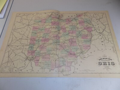
Free Shipping Location: Schertz, United States This antique original map of Ohio from 1886 features all the townships and railroads of the state. With vibrant colors, the map measures 17x27 inches ... moreand was published by J.T. Barker and H.R. Page & Co. The map is a rare find, printed over a century ago and still in great condition. The cartographer and publisher put careful attention to detail, making it a valuable piece for collectors of North American maps and antiques. This map is a unique representation of Ohio's history and would make a great addition to any collection.
Buy It Now
$4.95 Shipping Location: Willow Grove, United States There is text and a partial map image on the reverse side of this map page.

Buy It Now
$3.50 Shipping Location: Winter Springs, United States Click Here. Double your traffic. Get Vendio Gallery- Now FREE! Antique 1902 Ohio 2 sided map. Either side would frame and display beautifully. One side ... moreis Clermont County, reverse is Clinton County. On the map is a detailed chart with Inter-County Highways and County Roads, corresponding to the map itself. The map also has fine art symbols at each corners, The Ohio Good Roads Federations, Ohio Division of the National Highways Association, Nation Highways Association and an Eagle symbol related to this association as well. The map is from the very rare 1902 Ohio Atlas, published by the Ohio Good Roads Association, the Ohio Division of the National Highways Association. Very detailed and fascianting period Ohio highway and county maps. The size of the map is 11" by 14" Very rare. Winning bidder pays $3.50 shipping domestic, more foreign. Payment I accept the following forms of payment: PayPal Click to View Image Album Click to View Image Album Shipping& Handling US Shipping. $3.50 USPS First-Class Mail® International Shipping. $9.50 USPS First-Class Mail International FREE scheduling. Supersized images and templates. Get Vendio Sales Manager. FREE scheduling. Supersized images and templates. Get Vendio Sales Manager.
Buy It Now
$6.05 Shipping Location: Brooklyn, United States This antique fold-out map from 1928 showcases the State Highway System of Ohio. It was created by Harry J. Kirk and is a unique piece of cartography that ... morerepresents an important part of Ohio's history. The map is in its original form and has not been altered or restored, making it an authentic antique original.The map is a folding format and measures approximately 8” x 4”, closed. The details depicted on the map include major highways, cities, and towns in Ohio, making it an excellent addition to any collection of antique maps. The map is in good overall condition with minor signs of wear and tear that are typical for an item of this age.
Buy It Now
Free Shipping Location: Rochester, United States Great map, from a book.
Buy It Now
$5.00 Shipping Location: Costa Mesa, United States Act fast on this one!
Buy It Now
$3.75 Shipping Location: United States One side is Stark County, reverse is Shelby County. Map is printed on thick paper, you can't see what is on reverse looking at the front map. The size ... moreof the map is 11" by 14". Very rare. FREE scheduling, supersized images.
Buy It Now
$3.00 Shipping Location: Winter Springs, United States Click Here. Double your traffic. Get Vendio Gallery- Now FREE! Very fine antique circa 1940 map. Titled Van Wert County. The map shows the period highways, ... moreroads, cities, towns, villages, townships and more of this period. Printed on fine paper, with no printing on reverse. The map is in excellent condition, and would frame and display quite nicely. Rare. The size is 8.25" by 11" Winning bidder pays $3.00 shipping domestic, more foreign. Payment I accept the following forms of payment: PayPal Click to View Image Album Shipping& Handling US Shipping. $3.00 USPS First-Class Mail® International Shipping. $9.00 USPS First-Class Mail International FREE scheduling. Supersized images and templates. Get Vendio Sales Manager. FREE scheduling. Supersized images and templates. Get Vendio Sales Manager.
Buy It Now
$4.00 Shipping Location: Columbus, United States 1937 This map is folded. HOFFMAN BOOKS, ABAA, IOBA.
Buy It Now
$3.75 Shipping Location: United States One side is Defiance County, reverse is Darke County. Map is printed on thick paper, you can't see what is on reverse looking at the front map. The size ... moreof the map is 11" by 14". Very rare. FREE scheduling, supersized images.
Buy It Now
$3.00 Shipping Location: Winter Springs, United States Click Here. Double your traffic. Get Vendio Gallery- Now FREE! Very fine antique circa 1940 map. Titled Ashland County. The map shows the period highways, ... moreroads, cities, towns, villages, townships and more of this period. Printed on fine paper, with no printing on reverse. The map is in excellent condition, and would frame and display quite nicely. Rare. The size is 8.25" by 11" Winning bidder pays $3.00 shipping domestic, more foreign. Payment I accept the following forms of payment: PayPal Click to View Image Album Shipping& Handling US Shipping. $3.00 USPS First-Class Mail® International Shipping. $9.00 USPS First-Class Mail International FREE scheduling. Supersized images and templates. Get Vendio Sales Manager. FREE scheduling. Supersized images and templates. Get Vendio Sales Manager.
Buy It Now
$3.75 Shipping Location: United States Very detailed and fascianting period USA highway map. The size of the map is 11" by 14". Very rare. FREE scheduling, supersized images.

Buy It Now
$3.50 Shipping Location: Winter Springs, United States Click Here. Double your traffic. Get Vendio Gallery- Now FREE! Antique 1902 Ohio 2 sided map. Either side would frame and display beautifully. One side ... moreis Perry County, reverse is Paulding County. On the map is a detailed chart with Inter-County Highways and County Roads, corresponding to the map itself. The map also has fine art symbols at each corners, The Ohio Good Roads Federations, Ohio Division of the National Highways Association, Nation Highways Association and an Eagle symbol related to this association as well. The map is from the very rare 1902 Ohio Atlas, published by the Ohio Good Roads Association, the Ohio Division of the National Highways Association. Very detailed and fascianting period Ohio highway and county maps. The size of the map is 11" by 14" Very rare. Winning bidder pays $3.50 shipping domestic, more foreign. Payment I accept the following forms of payment: PayPal Click to View Image Album Click to View Image Album Shipping& Handling US Shipping. $3.50 USPS First-Class Mail® International Shipping. $9.50 USPS First-Class Mail International FREE scheduling. Supersized images and templates. Get Vendio Sales Manager. FREE scheduling. Supersized images and templates. Get Vendio Sales Manager.
Buy It Now
$3.00 Shipping Location: Winter Springs, United States Click Here. Double your traffic. Get Vendio Gallery- Now FREE! Very fine antique circa 1940 map. Titled Fayette County. The map shows the period highways, ... moreroads, cities, towns, villages, townships and more of this period. Printed on fine paper, with no printing on reverse. The map is in excellent condition, and would frame and display quite nicely. Rare. The size is 8.25" by 11" Winning bidder pays $3.00 shipping domestic, more foreign. Payment I accept the following forms of payment: PayPal Click to View Image Album Shipping& Handling US Shipping. $3.00 USPS First-Class Mail® International Shipping. $9.00 USPS First-Class Mail International FREE scheduling. Supersized images and templates. Get Vendio Sales Manager. FREE scheduling. Supersized images and templates. Get Vendio Sales Manager.
Buy It Now
$3.75 Shipping Location: United States One side is Ashtabula County, reverse is Ashland County. Map is printed on thick paper, you can't see what is on reverse looking at the front map. The ... moresize of the map is 11" by 14". Very rare. FREE scheduling, supersized images.
Buy It Now
$5.50 Shipping Location: Easton, United States Lots of details on this map! Overall in good condition.
Buy It Now
$4.95 Shipping Location: Willow Grove, United States The reverse side of this map page is blank except for a single number.
Buy It Now
Free Shipping Location: Schertz, United States The map is not " new " or in " new " condition, it was printed in 1889. The map is dated. Study the photos carefully, this is the actual map you will ... morereceive. The page is approx. 20" x 28.
Buy It Now
Free Shipping Location: Sayville, United States Plate 17 from the 1897/1902 Century Atlas.
Buy It Now
$11.60 Shipping Location: Woodsfield, United States Set Of Maps Ohio Southeast Bin#14. Shipped with USPS Priority Mail.
Buy It Now
$4.55 Shipping Location: Oakland, United States This beautiful antique map of Ohio from 1923 is a must-have for any collector of historical maps. Measuring 9x6 inches, it showcases the state's topography, ... moremajor cities, and landmarks during that time period. The map is in excellent condition and will make a great addition to any home or office.Featuring Ohio's counties, rivers, railroads, and more, this map provides a wealth of information about the state's geography. Whether you're a history buff or simply looking for a unique piece of decor, this antique map is sure to impress. Don't miss out on the opportunity to own a piece of Ohio's past.
Buy It Now
$6.15 Shipping Location: Greenville, United States Travel Roads Highways Highway Detour Bulletin Map State of Ohio 1928.
Buy It Now
Free Shipping Location: Iowa City, United States This color map ofOhio is dated 1891 on the face. Counties, County Seats,Cities; many Small Towns and Villages; Canals, Ports, Military Airfields and Forts; ... moreRivers, Streams, and Lakes; and other topographical features are located on this map.

Buy It Now
$3.75 Shipping Location: Winter Springs, United States Click Here. Double your traffic. Get Vendio Gallery- Now FREE! Vintage antique 1875 handcolored map. The map is large. Very detailed, fine period map ... moreof Ohio, has censuses dated 1870, and at lower left hand side of 1866. This dates the map nicely. The bottom right hand piece is missing, upper left hand side piece is torn, but still a fascianting large period map of Ohio. The map is printed on thick paper with no printing on reverse. Many fascianting areas on the map. The map is from the very rare 1875 Andreas and Baskin Atlas of Lucas and Wood County Ohio. The photo wont show the true beauty of the map. The map is in nice shape and would frame and display quite beautifully. The size of the map is 22" by 28" Winning bidder pays $3.75 shipping domestic, more foreign. Payment I accept the following forms of payment: PayPal Click to View Image Album Shipping& Handling US Shipping. $3.75 USPS First-Class Mail® International Shipping. $11.50 USPS First-Class Mail International FREE scheduling. Supersized images and templates. Get Vendio Sales Manager. FREE scheduling. Supersized images and templates. Get Vendio Sales Manager.
Buy It Now
Free Shipping Location: Schertz, United States This Map was removed from a 1897 Century Atlas and is in good acceptable condition. The map is not " new " or in " new " condition, it was printed in ... more1897. The map is dated. Study the photos carefully, this is the actual map you will receive.
Buy It Now
$6.00 Shipping Location: North Wales, United States 1897 RARE ANTIQUE CENTURY ATLAS MAP-OHIO-SOUTHERN PART-EXCELLENT DETAIL ORIGINAL ANTIQUE ATLAS MAP PLEASE SEE PHOTOS AS PART OF THE DESCRIPTION CONDITION: ... moreMAP IS IN GOOD CONDITION. SIZE: APPROXIMATELY 10.5" X 15" SHIPPING: U.S. FIRST CLASS RATE - $6.00 - ANY ITEM WHICH SELLS FOR OVER $100 WILL REQUIRE INSURANCE WE COMBINE SHIPPING FOR MULTIPLE WINS. THANK YOU FOR YOUR INTEREST IN OUR AUCTIONS!.
Buy It Now
$5.40 Shipping Location: Fort Wayne, United States Ohio, Auto Road Map. Official 1929. Wall Map. U. S. Interstate Shown in Red. Pre-owned. Acceptable Condition. For any and all Questions, Please Contact ... moreMe Thank You.
Buy It Now
Free Shipping Location: Schertz, United States This piece was removed from an 1892 ATLAS and is in good condition. (VIVID COLORS). The map is not " new " or in " new " condition, it was printed in ... more1892. The map is not dated. Study the photos carefully, this is the actual map you will receive.
Buy It Now
Free Shipping Location: Schertz, United States This Map was removed from a 1897 Century Atlas and is in good acceptable condition. The map is not " new " or in " new " condition, it was printed in ... more1897. The map is dated. Study the photos carefully, this is the actual map you will receive.
Buy It Now
Free Shipping Location: Monroeville, United States Click Here. Double your traffic. Get Vendio Gallery- Now FREE! Gorgeous. Antique 1875 handcolored map, the map is a large folding map, titled New Map ... moreof Ohio, Prepared Especialy for Evert's Illustratd Historical Atlas, by H.H. Lloyd& Co, 21 John St N.Y. Has Population of Ohio, by Counties, 1870, also United States and Principal Cities, alldated 1870. This dates the map nicely. The map has some large tears repaired on reverse with archival paper and tape, the tears were at the bottom and some of the map is lost at lower right, but has archival paper replacing it, see my photo, still a fascianting gorgeous huge period Ohio map. The map is printed on very thick paper. The superb handcoloring is period to the map. The map is from the rare 1875 Everts Atlas of Tuscarawas County Ohio. The map is in nice condition, and would frame and display beautifully. The size of the map is 23" by 25.5" Rare. Winning bidder pays $4.00 shipping domestic, more foreign. Payment I accept the following forms of payment: PayPal Click to View Image Album Shipping& Handling US Shipping. $4.00 USPS First-Class Mail® International Shipping. $9.00 USPS First-Class Mail International FREE scheduling. Supersized images and templates. Get Vendio Sales Manager. FREE scheduling. Supersized images and templates. Get Vendio Sales Manager. di,RcmdId ViewItemDescV4,RlogId p4%60bo7%60jtb9%3Fuk%601d72f%2Bishhov%3C%3Edi-13cf165eb66-0xf7-
Buy It Now
Free Shipping Location: Schertz, United States This authentic atlas map from 1897 measuring 22x29 inches. Created by cartographer Rand McNally and published during the late 19th century, this antique ... moreoriginal is a unique piece of history. The map is not *new* or in *new* condition, it was printed in 1897. See photo for best description. The map showcases the boundaries, cities, and topography of the region, providing a glimpse into the past. Ideal for collectors of North America maps or antique maps, this piece would make a great addition to any collection. Its format as an atlas map allows for easy referencing and studying of the territory. Free shipping and handling are included in the purchase of this item. Calculated S&H Worldwide.
Buy It Now
Free Shipping Location: Schertz, United States This antique map showcases the State of Ohio in 1875, with a size of 24x24 inches. The colors of the map are all original, and it was printed by D.J. ... moreLake/Titus, Simmons & Titus. The map is an original from 1875 and is perfect for collectors. Free shipping is available for customers based in the USA, while shipping charges are calculated for international orders. (NOTE SMALL TEAR ON FOLD, PHOTO #2)
Buy It Now
Free Shipping Location: Schertz, United States This antique map of Ohio from 1887 is a beautiful piece of history that will enrich any collection. The map was created by M. Bradley and S. A. Mitchell ... moreand has been hand tinted with highlights to add to its unique character. Measuring at 12" x 15", this map is over 130 years old and is in its original condition. The item includes free shipping within the USA, and shipping costs will be calculated for worldwide orders. Please note that the book cover shown in the photos is for reference purposes only and is not included with the map. Don't miss out on the opportunity to own a piece of history with this stunning antique Ohio map.
Buy It Now
$4.95 Shipping Location: Dover, United States Ohio North Half. Ohio South Half. Original fold line as issued. A small wall map in size and appearance when displayed together.
Buy It Now
Free Shipping Location: Riverside, United States From the 1891 Textbook. Antique Color Map. See High Resolution Photo for details. King's Handbook of the United States.
Buy It Now
$4.15 Shipping Location: Portland, United States 1951 Ohio Official Highway Map (r2169). This map is in very good condition and is a great look at this state as it was 72 years ago. The map you get may ... morebe worn or lightly torn along the fold lines due to the acidity of the paper and being folded for years.
Buy It Now
$7.00 Shipping Location: North Wales, United States 1899 ANTIQUE PEERLESS ATLAS MAP OF OHIO-UNITED STATES-EXCELLENT DETAIL ORIGINAL ANTIQUE ATLAS MAP PLEASE SEE PHOTOS AS PART OF THE DESCRIPTION CONDITION: ... moreMAP IS IN GOOD CONDITION. SIZE: APPROXIMATELY 10" X 13" SHIPPING: U.S. FIRST CLASS RATE - $7.00 - ANY ITEM WHICH SELLS FOR OVER $100 WILL REQUIRE INSURANCE WE COMBINE SHIPPING FOR MULTIPLE WINS. THANK YOU FOR YOUR INTEREST IN OUR AUCTIONS!.
Buy It Now
Free Shipping Location: Monroeville, United States Date - 1895.
Buy It Now
Free Shipping Location: Monroeville, United States Date - 1895.
Buy It Now
Free Shipping Location: Monroeville, United States Date - 1876. Source - Illustrated Historical Atlas of Clinton County, Ohio. Condition - Very Nice.
Buy It Now
$5.00 Shipping Location: United States Above the title is a detailed wexplanation chart corresponding to the map itself. Nice outside ornate border. This is an antique map and not a reprint ... moreor reproduction. The handcoloring on the map is period to the map, this is before color printing.
Buy It Now
Free Shipping Location: Monroeville, United States Date - 1895.

Buy It Now
$12.45 Shipping Location: Santa Barbara, United States Click Here. Double your traffic. Get Vendio Gallery- Now FREE! Huge. Gorgeous, vintage, antique 1874 handcolored map. The map is titled, in very fancy ... moreantique lettering, Railroad& Township Map of the State of Ohio, with superb engraved view of the State Capitol, which is at Columbus. This is a Colton map. Fine detail, qwith detailed Reference charts corresponding to the map itself, Railroads Constructing, Railroads Finished, Canals, Post Roads and so forth, corresponding to the map itself. Fine outside ornate border. The map is printed on thick paper with no printing on reverse. The condition of the map is very nice, with some clean seperation along the lower right hand side fold, this is common in very large old antique mps, 2 very small stains at right hand side. This is an antique map and not a reprint or reproduction. The handcoloring on the map is period to the map, this is before color printing. The map is from the very rare 18764Titus Atlas of Mahoning County Ohio. The map is a fascinating and historic period look at this area at this time. The photo wont show the full beauty of the map. The size of the map is 24" by 24" Winning bidder pays $4.00 shipping domestic, more foreign. Payment I accept the following forms of payment: PayPal Click to View Image Album Shipping& Handling US Shipping. $4.00 USPS First-Class Mail® International Shipping. $11.50 USPS First-Class Mail International FREE scheduling. Supersized images and templates. Get Vendio Sales Manager. FREE scheduling. Supersized images and templates. Get Vendio Sales Manager.
Buy It Now
$5.99 Shipping Location: Bodega Bay, United States THE CENTURY COMPANY ATLAS MAP PLATE#18 OHIO SOUTHERN PART 1897 VINTAGE The Century Atlas Company of New York City map plate#18 Ohio Southern Part circa ... more1897. Measures 11 3/4 X 16 1/4 inches in size(30 X 41cm) Map is an authentic original in good condition as shown in photos. Map printed on high quality paper suitable for framing.
Buy It Now
Free Shipping Location: Monroeville, United States Date - 1898. Source - Atlas of Lake County Ohio. Size - about 17x28", double page as published.
Buy It Now
$3.95 Shipping Location: Catonsville, United States Beautiful Original 1899 Ohio Large Color Map/11x14. Edges frayed but does not show on map. Small rip near top in map. All Original Map. Map Size 10"x10.5". ... moreOverall Condition: Very Good Original Condition.
Buy It Now
$6.80 Shipping Location: Eagle, United States Presented is an authentic, old map takenf rom a dis-bound plat book published in 1875. Original hand color.
Buy It Now
$4.15 Shipping Location: Saco, United States
Buy It Now
$6.00 Shipping Location: Gardner, United States EXCELLENT Condition. The MAP is on ONE SIDE and the list of CITIES and where their place on the map is on the OTHER SIDE.
Buy It Now
$8.00 Shipping Location: Coupland, United States The map is as shown: signs of normal wear/age/folds. Any new item will be unused.
|
|
|
In
|
ANTIQUE 1902 ATHENS AUGLAIZE COUNTY OHIO WAPKONETA HIGHWAY ROAD MAP RARE NR
Click Here. Double your traffic. Get Vendio Gallery- Now FREE! Antique 1902 Ohio 2 sided map. Either side would frame and display beautifully. One side is Auglaize County, reverse is Athens County. This is an early road map of this area. On the map is a detailed chart with Inter-County Highways and County Roads, corresponding to the map itself. The map also has fine art symbols at each corners, The Ohio Good Roads Federations, Ohio Division of the National Highways Association, Nation Highways Association and an Eagle symbol related to this association as well. The map is from the very rare 1902 Ohio Atlas, published by the Ohio Good Roads Association, the Ohio Division of the National Highways Association. Very detailed and fascianting period Ohio highway and county maps. The size of the map is 11" by 14" Very rare. Winning bidder ... morepays $3.50 shipping domestic, more foreign. Payment I accept the following forms of payment: PayPal Click to View Image Album Click to View Image Album Shipping& Handling US Shipping. $3.50 USPS First-Class Mail® International Shipping. $9.50 USPS First-Class Mail International FREE scheduling. Supersized images and templates. Get Vendio Sales Manager. FREE scheduling. Supersized images and templates. Get Vendio Sales Manager.
|
|
 |