|
|
Order by: Available to: This site contains affiliate links for which I may be compensated
|
Buy It Now
$6.95 Shipping Location: Dover, United States Early 20th century color lithographed map. Original center fold as issued, short split at base of centerfold.
Buy It Now
$14.99 Shipping Location: Ivanhoe, Australia At their greatest reported extent, around 1st century AD, these tribes ranged from the Vistula River to the mouth of the Danube and eastward to the Volga, ... morebordering the shores of the Black and Caspian seas as well as the Caucasus to the south.
Buy It Now
$9.99 Shipping Location: Ivanhoe, Australia (Barentsz died during the expedition, and may have been buried on the Northern island.). During a later voyage by Fyodor Litke in 1821–1824, the west ... morecoast was mapped. Henry Hudson was another explorer who passed through Novaya Zemlya while searching for the Northeast Passage.

Buy It Now
$15.00 Shipping Location: Brooklyn, United States 1843 Malte-Brun Map of European Russia WE SELL ONLY ORIGINAL ANTIQUE MAPS- NOT REPRODUCTIONS Title: Russie d'Europe. Description: This is a fine example ... moreof Conrad Malte-Brun's 1843 map of european Russia. The map covers Russia from Arctic Ocean to Turkey and from Sweden to Tartary. In 1825. A few years before this map was drawn, Russian army officers, called the Decembrists, protested against Nicholas I’s ascension to the throne. The Decembrists, so named because their revolt started in December, favored Nicholas's brother, Constantine, who seemed amenable to a British style constitutional monarchy. When Constantine abdicated the throne in 1825, the Decembrists refused to accept the more autocratic rule of Nicholas I. Had Constantine not abdicated and the Decembrists been successful, the bloody Bolshevik Revolution may never have occurred. Various cities, towns, rivers, lakes and other topographical details are marked, with relief shown by hachure. Boundaries are color coded according to states and districts. This map was issued as plate nos. 54 and 55 in Conrad Malte-Brun's 1843 Precis de la Geographie Universelle. Size: Printed area measures 17.5 inches high by 13.5 inches wide. Condition: Very good. Original centerfold visible. Blank on verso. Shipping: Due to recent increases in United States Postal Service rates we have been forced to increase our shipping rates. Shipping rates are not negotiable. Items are shipped within three business days of receiving payment. We are happy to consolidate shipping where possible. The following shipping options are available: 1. USPS Domestic Express Mail(35 USD) USA Only. 2. FedEx Ground or Home Delivery(15 USD) USA Only. 1- 10 days. If your address is a P.O.Box and cannot ship FedEx we will ship USPS Priority and. While we ship promptly, recent postal personnel cutbacks mean that delivery may take up to 1 month. 3. DHL International EXPRESS(40- 50 USD) 4. We can use your Federal Express Account. Insurance: All shipments are insured privately against loss a
$25.00 Shipping Location: Perugia, Italy An interesting map of the Eastern Roman Empire in the 4th century AD.

Buy It Now
$15.00 Shipping Location: Brooklyn, United States 1834 Malte-Brun Map of European Russia WE SELL ONLY ORIGINAL ANTIQUE MAPS- NOT REPRODUCTIONS Title: Russie d'Europe. Description: This is a fine example ... moreof Conrad Malte-Brun's 1834 map of european Russia. The map covers Russia from Arctic Ocean to Turkey and from Sweden to Tartary. In 1825. A few years before this map was drawn, Russian army officers, called the Decembrists, protested against Nicholas I’s ascension to the throne. The Decembrists, so named because their revolt started in December, favored Nicholas's brother, Constantine, who seemed amenable to a British style constitutional monarchy. When Constantine abdicated the throne in 1825, the Decembrists refused to accept the more autocratic rule of Nicholas I. Had Constantine not abdicated and the Decembrists been successful, the bloody Bolshevik Revolution may never have occurred. Various cities, towns, rivers, lakes and other topographical details are marked, with relief shown by hachures. Boundaries are color coded according to states and districts. This map was issued as plate no. 45 in Conrad Malte-Brun's 1837 Atlas Complet du Precis de la Geographie Universelle. Size: Printed area measures 18 inches high by 14 inches wide. Condition: Very good. Original centerfold. Light foxing. Blank on verso. Shipping: Due to recent increases in United States Postal Service rates we have been forced to increase our shipping rates. Shipping rates are not negotiable. Items are shipped within three business days of receiving payment. We are happy to consolidate shipping where possible. The following shipping options are available: 1. USPS Domestic Express Mail(35 USD) USA Only. 2. FedEx Ground or Home Delivery(15 USD) USA Only. 1- 10 days. If your address is a P.O.Box and cannot ship FedEx we will ship USPS Priority and. While we ship promptly, recent postal personnel cutbacks mean that delivery may take up to 1 month. 3. DHL International EXPRESS(40- 50 USD) 4. We can use your Federal Express Account. Insurance: All shipments are insured privately ag
Buy It Now
$12.49 Shipping Location: BATH, United Kingdom This map was published in 'Atlas de la Geographie Ancienne du moyen age, et moderne' by Felix Delamarche (Charles Francois grandson) in 1833. Blank on ... morereverse. Map area is in good condition for age, engravings are clear.
Buy It Now
$12.49 Shipping Location: BATH, United Kingdom This map was published in 'Atlas de la Geographie Ancienne du moyen age, et moderne' by Felix Delamarche (Charles Francois grandson) in 1833. Blank on ... morereverse. Map area is in good condition for age, engravings are clear.
Buy It Now
$12.95 Shipping Location: Stamford, United States The A.R. Ohman Map Co., H. Buchardt Petersen, Pres. I doubt you could find a better condition map than this one. Has been folded and probably unopened ... morefor over 100 years. Map is in just near mint condition, bright, crisp and clean.
Buy It Now
$9.99 Shipping Condition: Unspecified Location: LONDON, United Kingdom Large antique early 19th century atlas wall map with original hand colouring, on four sheets, unjoined, 1817. DATE PRINTED: Published in 1817. Engraved ... morein 1816; this date is marked on the map. CONDITION: Good; suitable for framing.
Buy It Now
$19.99 Shipping Location: New Hope, United States Russia Siberia Asia Tartary China. The geographical extent of Chinese Tartary largely corresponds with that of the "Feudatory Regions", as defined by ... morethe Qing court. "Partie Orientale de l'Empire de Russie en Asie, ou se Trouvent les Provinces de Jakuckskoy, Nerckzinskoy, Selinginskoy, Ilimskoy, Krasnojarskoy, Narimskoy, Jenisseiskoy, Mangajeiskoy, & c. et les Confins de La Tatarie Chinoise.".
Buy It Now
$9.99 Shipping Condition: Unspecified Location: LONDON, United Kingdom PROVENANCE: "The Victoria Regina Atlas"; Published by W & A.K. Johnston, Ltd, Edinburgh & London: 2nd Edition. Antique colour map, 1906. DATE PRINTED: ... more1906. CONDITION: Good; suitable for framing.
Buy It Now
Free Shipping Location: RICHMOND, United Kingdom 'Engraved and printed by W. & A.K. Johnston of Edinburgh.'. Published by William Blackwood and Sons of Edinburgh and London. Published in 1879 with original ... moreoutline colouring. Condition: Minor age related discolouration and wear to edges.
Buy It Now
$44.99 Shipping Location: Ivanhoe, Australia Jansson, Jan (Janssonius) 1588-1664. Date: - 1652. The newly discovered northern coastline of Nova Zembla is shown with a notation concerning the Dutch ... moreexpedition led by Willem Barents in 1594-96. Interesting in Siberia, Ung quae Gog and Sumongul quae Mogog, which refers to the mythological lands of Gog and Magog.
Buy It Now
$18.43 Shipping Location: United Kingdom Ideal for framing, display and research material. Authenticity: This is a genuine antique period print and not a modern reproduction. ORIGINAL ANTIQUE ... moreMAP PRINT. Approximate print size including page number where appropriate for Mounting or Mat Board purposes - 54cm x 41cm.

Buy It Now
$9.99 Shipping Condition: Unspecified Location: LONDON, United Kingdom Russia(Central& East) Inset map of Moscow Vintage colour map. 1920 Title of map: Russia(Central& East) Inset map of Moscow' The image below ... moreshows an enlarged cross section from the centre of the map to show the level of printed detail: DATE PRINTED: 1920 IMAGE SIZE: Approx 34.0 x 45.0cm. 13.25 x 17.5 inches(Large) ARTIST/CARTOGRAPHER/ENGRAVER: Unsigned PROVENANCE: Harmsworth's new Atlas" Please note that virtually all antique and vintage maps and prints have been extracted from books. Atlases or newspapers. TYPE: Vintage colour map VERSO: There is interesting related text and images printed on the reverse side of the picture. The paper is thick. And the verso text does not show through to the front of the map CONDITION: Good; suitable for framing. However. Please note: This map was originally printed as two separate pages which have been professionally joined to form a single sheet. Please check the scan for any blemishes prior to making your purchase. Virtually all antiquarian maps and prints are subject to some normal aging due to use and time which is not obtrusive unless otherwise stated. I offer a no questions asked return policy- see below. AUTHENTICITY: This is an authentic historic print. Published at the date stated above. I do not offer reproductions. It is not a modern copy. The term'original' when applied to a print means that it was printed at the first or original date of publication; it does not imply that the item is unique. Print' means any image created by applying an inked block to paper or card under pressure by any method including wood engraving, steel engraving, copperplate, wood cut and lithography. REMARKS: FRANCE: Gravures et Cartes anciennes. DEUTSCHLAND: Alte Lankarten und Stadt ansichten. ITALIA: Stampe& Mappe antiche. ESPAÑA: Mapas antiquos y impresiones antiguas. E and OE. Force Majeure. English law shall apply. RETURNS POLICY: I offer a no questions returns policy. All I ask is that you pay return shipping and mail back to me in original co
Buy It Now
$9.99 Shipping Condition: Unspecified Location: LONDON, United Kingdom Antique colour atlas map, 1900. DATE PRINTED: 1900. AUTHENTICITY: This is an authentic historic print, published at the date stated above. It is not a ... moremodern copy. The image below shows an enlarged cross section from the centre of the map to show the level of printed detail.
Buy It Now
$9.99 Shipping Condition: Used Location: LONDON, United Kingdom Antique colour atlas map, c1925. PROVENANCE: "Stanford's London Atlas of Universal Geography, 'Whitehall' Edition", London: Edward Stanford Ltd. 12, 13 ... more& 14 Long Acre, WC2, and Whitehall House, 29 & 30 Charing Cross, SW1.
Buy It Now
$9.99 Shipping Condition: Unspecified Location: LONDON, United Kingdom PROVENANCE: "The World-Wide Atlas of Modern Geography"; by J. Scott Keltie; published by W. & A.K. Johnston, London: 5th Edition [World wide atlas]. Antique ... morecolour map, 1900. DATE PRINTED: 1900. CONDITION: Good; suitable for framing.
Buy It Now
$2.14 Shipping Location: Gengenbach, Germany Hildburghausen, Bibliographic Institute, approx. 1850. Sheet size approx. 30x25cm. Slightly browned, overall in good condition. Language: GermanOrder ... morenumber: 119232.
Buy It Now
$16.00 Shipping Location: Estonia Action Battle on The Prut River (South Russia, Ukraine) between Turks and Moscowites in 1711. военная план-карта, оригинальная гравюра на меди Мериан ... more(Германия) 1723. Germany ND(1723). One side printed b/w map in size 420 x 330 mm.
Buy It Now
$18.76 Shipping Location: YORK, United Kingdom An antique map on quality paper printed for:Â The London Atlas Of Universal Geography, published by Edward Stanford 1926 Sheet size approximately 14 inches ... morex 11 inches ****CONDITION**** PLEASE VIEW IMAGES TO SEE ANY HANDLING/AGE MARKS /REPAIRS/DAMAGE/EXTENT OF MARGINS etc Please message with any questions regarding this item.
Buy It Now
$9.99 Shipping Condition: Unspecified Location: LONDON, United Kingdom PROVENANCE: "The World-Wide Atlas of Modern Geography"; By J. Scott Keltie; published by W. & A.K. Johnston, London: 2nd Edition [World wide atlas]. Antique ... morecolour map, 1895. DATE PRINTED: 1895. CONDITION: Good; suitable for framing.
Buy It Now
$13.62 Shipping Location: BOURNEMOUTH, United Kingdom PRINTED AREA - 460 mm x 365 mm.
Buy It Now
$15.00 Shipping Location: Brooklyn, United States This map was prepared by S. A. Mitchell for publication as plate no. 60 in the 1846 edition ofMitchell's New General Atlas. When this map was printed, ... moreRussia was ruled by Tsar Nicholas I who adopted the doctrine of 'Orthodoxy, Autocracy, and Nationality' and was known to be one of the most reactionary monarchs in Russia.
Buy It Now
$9.99 Shipping Condition: Unspecified Location: LONDON, United Kingdom PROVENANCE: "The World Wide Atlas of Modern Geography Political and Physical"; by J. Scott Keltie; Published by W. & A. K. Johnston, Edinburgh & London. ... more7th Edition [World wide atlas]. Colour antique map, 1906.

Buy It Now
$9.99 Shipping Condition: Unspecified Location: LONDON, United Kingdom European Soviet Russia Vintage colour map; Scale 1:10.000,000, 1940 Title of map: European Soviet Russia' The image below shows an enlarged cross ... moresection from the centre of the map to show the level of printed detail: DATE PRINTED: March 1940 IMAGE SIZE: Approx 27.0 x 21.5cm. 10.5 x 8.25 inches(Medium) ARTIST/CARTOGRAPHER/ENGRAVER: George Philip& Son PROVENANCE: Daily Mail War Atlas" Published by George Philip& Son. Ltd. London[Edition updated to macrh 1940 to reflect the Russo-Finnish Winter War] TYPE: Vintage colour map; Scale 1:10.000,000 VERSO: There are images and/or text printed on the reverse side of the picture. In some cases this may be visible on the picture itself(please check the scan prior to your purchase) or around the margin of the picture CONDITION: Good; suitable for framing. However. Please note: The image shown may have been taken from a different example of this map than that which is offered for sale. The map you will receive is in good condition but there may be minor variations in the condition from that shown in the image. Please check the scan for any blemishes prior to making your purchase. Virtually all antiquarian maps and prints are subject to some normal aging due to use and time which is not obtrusive unless otherwise stated. I offer a no questions asked return policy- see below. AUTHENTICITY: This is an authentic historic print. Published at the date stated above. I do not offer reproductions. It is not a modern copy. The term'original' when applied to a print means that it was printed at the first or original date of publication; it does not imply that the item is unique. Print' means any image created by applying an inked block to paper or card under pressure by any method including wood engraving, steel engraving, copperplate, wood cut and lithography. REMARKS: FRANCE: Gravures et Cartes anciennes. DEUTSCHLAND: Alte Lankarten und Stadt ansichten. ITALIA: Stampe e Mappe antiche. ESPAÑA: Mapas antiquos y impresiones antiguas. E and OE. Force Maje
Buy It Now
$28.00 Shipping Location: Ukraine We try to be as close to the image as possible, but actual colors may vary slightly from what you see on your display. Complete set of goods as in the ... morephoto, you buy what you see in the photo. follow the link, we are always glad to see you.
Buy It Now
$14.99 Shipping Location: Ivanhoe, Australia Prepared for US Govt Report. Map of Alaska and adjoining Regions 1886. Complied from the Russian Charts of Tebenkov, Sarychev, Lutke. Date: - 1886. Pricing ... moreis based on a number of different factors, the most important of which is regional.
Buy It Now
$14.99 Shipping Location: Ivanhoe, Australia Bellin, despite his extraordinary success, may not have enjoyed his work, which is described as \\\"long, unpleasant, and hard. Bellin, Jacques Nicholas ... more1703-72. Claims of discovery date back to the 16th century, but no consensus exists on whether early explorers discovered the Falklands or other islands in the South Atlantic.
Buy It Now
$14.99 Shipping Location: Ivanhoe, Australia Louis Vivien, or Vivien de Saint-Martin was a French geographer who was born in Saint-Martin-de-Fontenay and died in Versailles, France in 1896. This ... morefinely engraved original large antique map of Siberia or Russia in Asia by Louis Vivien in his Elephant Folio atlas,Atlas Universal.

Buy It Now
$9.99 Shipping Condition: Unspecified Location: LONDON, United Kingdom Russia in Europe Northern section; Inset maps of St. Petersburg; Moscow Antique coloured map. 1909 Title of map: Russia in Europe Northern section; Inset ... moremaps of St. Petersburg; Moscow' The image below shows an enlarged cross section from the centre of the map to show the level of printed detail. This map is folding hence the centrefold line may show on the image below: DATE PRINTED: 1909 IMAGE SIZE: Approx 24.5 x 32.0cm. 9.5 x 12.5 inches(Large) Please note that this is a folding map. ARTIST/CARTOGRAPHER/ENGRAVER: Engraved by John Bartolomew& Co; Drawn by The Edinburgh Geographical Institute PROVENANCE: Cassell's Atlas" by J. G. Bartholomew. Published by Cassell and Company, Limited, London. Please note that virtually all antique and vintage maps and prints have been extracted from books, atlases or newspapers. TYPE: Antique coloured map VERSO: There is nothing printed on the reverse side. Which is plain CONDITION: Good; suitable for framing. Please check the scan for any blemishes prior to making your purchase. Virtually all antiquarian maps and prints are subject to some normal aging due to use and time which is not obtrusive unless otherwise stated. I offer a no questions asked return policy- see below. AUTHENTICITY: This is an authentic historic print. Published at the date stated above. I do not offer reproductions. It is not a modern copy. The term'original' when applied to a print means that it was printed at the first or original date of publication; it does not imply that the item is unique. Print' means any image created by applying an inked block to paper or card under pressure by any method including wood engraving, steel engraving, copperplate, wood cut and lithography. REMARKS: FRANCE: Gravures et Cartes anciennes. DEUTSCHLAND: Alte Lankarten und Stadt ansichten. ITALIA: Stampe& Mappe antiche. ESPAÑA: Mapas antiquos y impresiones antiguas. E and OE. Force Majeure. English law shall apply. RETURNS POLICY: I offer a no questions returns policy. All I ask is that
Buy It Now
$9.00 Shipping Location: New Hope, United States Paris; 1781. Overall size 10 1/4 by 14".

Buy It Now
$15.00 Shipping Location: Brooklyn, United States 1887 Bradley Map of European Russia. Scandinavia, Holland, Belgium and Denmark. WE SELL ONLY ORIGINAL ANTIQUE MAPS- NOT REPRODUCTIONS Title: Russia in ... moreEurope. Sweden and Norway. Map of Denmark. Map of Holland and Belgium. Description: This is a fine example of William M. Bradley's 1887 map of Russia. Norway, Sweden, Holland Belgium and Denmark. Maps of Denmark, Holland and Belgium relegated to insets on the left hand side of the sheet. The larger map covers Scandinavia and the European portion of Russia from the Arctic Ocean to Turkey, including the European portions of Russia as well as Finland, Ukraine, Latvia, Lithuania and Estonia. Denmark is covered in full, from the Skagerrak to the Baltic Sea. Holland and Belgium are covered from the North Sea to France. Russia at this time was under the suzerainty of Tzar Alexander the II. Alexander is best known for his liberal reforms including the Emancipation Reform of 1861. The Reform, considered the most important event in 19th century Russian history, liberated Russia's countless serfs. In 1830, the Belgian Revolution led to the secession of Belgium from the United Kingdom of Netherlands into the independent Kingdom of Belgium. Though Belgium had successfully made itself independent, the Netherlands refused to recognize the new country until the 1839 Treaty of London. Meanwhile Scandinavia and Denmark at the time were in the midst of a prolonged period of peace and prosperity that led to a cultural and economic boom. Various towns, cities, rivers and an assortment of additional topographical details are noted. Map is color coded according to regional and political boundaries with elevation rendered by hachure. Copyrighted 1887 by Wm. M. Bradley& Bro. for inssue as plate no. 112 in the 1887 edition of Mitchell's New General Atlas. Size: Printed area measures 11.5 inches high by 14.5 inches wide. Condition: Very good. Blank on verso. Shipping: Due to recent increases in United States Postal Service rates we have been forced to increase our shipping ra
Buy It Now
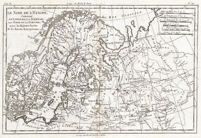
$15.00 Shipping Location: Brooklyn, United States 1780 Raynal and Bonne Map of Northern Europe and European Russia WE SELL ONLY ORIGINAL ANTIQUE MAPS- NOT REPRODUCTIONS Title: Le Nord de L'Europe. ... moreContenant Le Danemark, La Norwege; La Suede et La Laponie avec la Majeure Partie de al Russie Europeenne. Description: A fine example of Rigobert Bonne and Guillaume Raynal’s 1780 map of Northern Europe and European Russia. Covers the modern day countries of Norway. Sweden, Finland, Denmark, and Finland as well as parts of Russia(including Moscow) Poland, Lithuania, Latvia, Estonia. Highly detailed, showing towns, rivers, some topographical features and political boundaries. Drawn by R. Bonne for G. Raynal’s Atlas de Toutes les Parties Connues du Globe Terrestre, Dressé pour l'Histoire Philosophique et Politique des Établissemens et du Commerce des Européens dans les Deux Indes. Size: Printed area measures 9 inches high by 13 inches wide. Condition: Very good. Original centerfold. Platemark visible. Blank on verso. Shipping: Shipping rates are not negotiable. Items are shipped within three business days of receiving payment. We are happy to consolidate shipping where possible. The following shipping options are available: 1. USPS Domestic Express Mail(35 USD) USA Only. 2. FedEx Ground or Home Delivery(15 USD) USA Only. 1- 10 days. If your address is a P.O.Box and cannot ship FedEx we will ship USPS Priority and. While we ship promptly, recent postal personnel cutbacks mean that delivery may take up to 1 month. 3. DHL International EXPRESS(40- 50 USD) 4. We can use your Federal Express Account. Insurance: All shipments are insured privately against loss and damage. All of our shipments require a signature. If you have any questions please feel free to email us through eBay or contact us by telephone at 646-320-8650. Additional Services Conservation Framing Services: Geographicus recommends basic conservation framing services for any antique paper. Read about it here. We do not offer this service. Antique Map Restoration Services: Geographicus can
Buy It Now
$100.00 Shipping Location: Canada Gerritsz’s reputation grew quickly. Gerritsz was born in Assum. His first exposure to mapmaking was as an apprentice to Willem Janszoon Blaeu, beginning ... morein 1607. AUTHOR: Willem Janszoon Blaeu / Hessel Gerritsz.
Buy It Now
Free Shipping Location: Netherlands Description: This old antique map originates from: 'Atlas Universel de Geographie ancienne et moderne.', by A. Tardieu and A. Vuillemin for 'L'Intelligence ... morede la Geographie Universelle de Malte-Brun LaVallee, Paris, 1863. (Transl.: World Atlas of old and modern geography by Tardieu and Vuillemin for the knowledge of geography of Malte-Brun.) Artists and Engravers: The authors / cartographers are Ambroise Tardieu and A. Vuillemin. Ambroise Tardieu (Paris 1788-1841) was an eminent French cartographer and engraver, and is celebrated for his version of John Arrowsmith's 1806 map of the United States. The maps are etched / engraved by Lemercier.
Buy It Now
$9.99 Shipping Location: Ivanhoe, Australia Bellin, despite his extraordinary success, may not have enjoyed his work, which is described as \\\"long, unpleasant, and hard. Bellin, Jacques Nicholas ... more1703-72. Sensing these feelings, Charles III of Spain progressively eased the trade restrictions and finally declared Buenos Aires an open port in the late 18th century.
Buy It Now
$9.99 Shipping Location: Rosanna, Australia A Plan of the Battle of Zorndorf in the Marche Aug 25th 1758; Plan of the Battle at Anrat in the Plain of Creeveld.Published by Ja. MacGowan June 16, ... more1781. This original copper plate engraved antique map of two battles during the Seven Years War,The Battle of Zorndorf & The Battle of Krefeld by John Cary was published in 1781, dated at the bottom of map.
Buy It Now
$7.95 Shipping Location: New Providence, United States It played a predominant role in global affairs from the 16th century onwards, especially after the beginning of colonialism. PRINT DATE : This engraving ... morewas printed in 1876; it is not a modern reproduction in any way.
Buy It Now
$4.95 Shipping Location: Dover, United States Mit Kasan, Astrachan, & c., p. 110; 2.5.1.13. Issued 1834, Gotha Germany by Perthes for Ad. Scarce and charming little mid-19th century antique map. Engraved ... morewith original outline hand color. Wolter & Grim.
Buy It Now
$9.99 Shipping Condition: Unspecified Location: LONDON, United Kingdom Antique colour map, 1891. DATE PRINTED: 1891. CONDITION: Good; suitable for framing. The map you will receive is in good condition but there may be minor ... morevariations in the condition from that shown in the image.

Buy It Now
$9.99 Shipping Condition: Unspecified Location: LONDON, United Kingdom European Russia Antique colour map. 1897 Title of map: European Russia' The image below shows an enlarged cross section from the centre of the map ... moreto show the level of printed detail: DATE PRINTED: 1897 IMAGE SIZE: Approx 26.0 x 20.0cm. 10.25 x 7.75 inches(Medium) ARTIST/CARTOGRAPHER/ENGRAVER: W. A.K. Johnston PROVENANCE: The World Wide Atlas of Modern Geography Political and Physical" by J. Scott Keltie; Published by W. A. K. Johnston. London: 3rd Edition TYPE: Antique colour map VERSO: There are images and/or text printed on the reverse side of the picture. In some cases this may be visible on the picture itself(please check the scan prior to your purchase) or around the margin of the picture CONDITION: Good; suitable for framing. However. Please note: The image shown may have been taken from a different example of this map than that which is offered for sale. The map you will receive is in good condition but there may be minor variations in the condition from that shown in the image which may include some light spotting. Please check the scan for any blemishes prior to making your purchase. Virtually all antiquarian maps and prints are subject to some normal aging due to use and time which is not obtrusive unless otherwise stated. I offer a no questions asked return policy- see below. AUTHENTICITY: This is an authentic historic print. Published at the date stated above. I do not offer reproductions. It is not a modern copy. The term'original' when applied to a print means that it was printed at the first or original date of publication; it does not imply that the item is unique. Print' means any image created by applying an inked block to paper or card under pressure by any method including wood engraving, steel engraving, copperplate, wood cut and lithography. REMARKS: FRANCE: Gravures et Cartes anciennes. DEUTSCHLAND: Alte Lankarten und Stadt ansichten. ITALIA: Stampe e Mappe antiche. ESPAÑA: Mapas antiquos y impresiones antiguas. E and OE. Force Majeure. English law shall apply. RE

Buy It Now
$9.99 Shipping Condition: Unspecified Location: LONDON, United Kingdom European Soviet Russia Vintage colour map; Scale 1:10.000,000, 1940 Title of map: European Soviet Russia' The image below shows an enlarged cross ... moresection from the centre of the map to show the level of printed detail: DATE PRINTED: March 1940 IMAGE SIZE: Approx 27.0 x 21.5cm. 10.5 x 8.25 inches(Medium) ARTIST/CARTOGRAPHER/ENGRAVER: George Philip& Son PROVENANCE: Daily Mail War Atlas" Published by George Philip& Son. Ltd. London[Edition updated to macrh 1940 to reflect the Russo-Finnish Winter War] TYPE: Vintage colour map; Scale 1:10.000,000 VERSO: There are images and/or text printed on the reverse side of the picture. In some cases this may be visible on the picture itself(please check the scan prior to your purchase) or around the margin of the picture CONDITION: Good; suitable for framing. However. Please note: The image shown may have been taken from a different example of this map than that which is offered for sale. The map you will receive is in good condition but there may be minor variations in the condition from that shown in the image. Please check the scan for any blemishes prior to making your purchase. Virtually all antiquarian maps and prints are subject to some normal aging due to use and time which is not obtrusive unless otherwise stated. I offer a no questions asked return policy- see below. AUTHENTICITY: This is an authentic historic print. Published at the date stated above. I do not offer reproductions. It is not a modern copy. The term'original' when applied to a print means that it was printed at the first or original date of publication; it does not imply that the item is unique. Print' means any image created by applying an inked block to paper or card under pressure by any method including wood engraving, steel engraving, copperplate, wood cut and lithography. REMARKS: FRANCE: Gravures et Cartes anciennes. DEUTSCHLAND: Alte Lankarten und Stadt ansichten. ITALIA: Stampe e Mappe antiche. ESPAÑA: Mapas antiquos y impresiones antiguas. E and OE. Force Maje
Buy It Now
$9.99 Shipping Condition: Unspecified Location: LONDON, United Kingdom Antique engraved map by J Rapkin, published by John Tallis. Original outline hand colour, decorative border, and attractive inset vignette views, 1851. ... morePublished by John Tallis & Co. TYPE: Antique engraved map by J Rapkin, published by John Tallis.
Buy It Now
$18.11 Shipping Location: DONCASTER, United Kingdom Map is in colour and suitable for framing. Map at scale 1:6,000,000. Slightly darkened edges with occasional light foxing in margins, sheet is otherwise ... moreclean and crisp. First Edition. Language: English.

Buy It Now
$9.99 Shipping Condition: Unspecified Location: LONDON, United Kingdom Russia(European) Inset map of Petrograd Vintage colour map. 1920 Title of map: Russia(European) Inset map of Petrograd' The image below shows an enlarged ... morecross section from the centre of the map to show the level of printed detail: DATE PRINTED: 1920 IMAGE SIZE: Approx 34.0 x 45.0cm. 13.25 x 17.5 inches(Large) ARTIST/CARTOGRAPHER/ENGRAVER: Unsigned PROVENANCE: Harmsworth's new Atlas" Please note that virtually all antique and vintage maps and prints have been extracted from books. Atlases or newspapers. TYPE: Vintage colour map VERSO: There is interesting related text and images printed on the reverse side of the picture. The paper is thick. And the verso text does not show through to the front of the map CONDITION: Good; suitable for framing. However. Please note: This map was originally printed as two separate pages which have been professionally joined to form a single sheet. Please check the scan for any blemishes prior to making your purchase. Virtually all antiquarian maps and prints are subject to some normal aging due to use and time which is not obtrusive unless otherwise stated. I offer a no questions asked return policy- see below. AUTHENTICITY: This is an authentic historic print. Published at the date stated above. I do not offer reproductions. It is not a modern copy. The term'original' when applied to a print means that it was printed at the first or original date of publication; it does not imply that the item is unique. Print' means any image created by applying an inked block to paper or card under pressure by any method including wood engraving, steel engraving, copperplate, wood cut and lithography. REMARKS: FRANCE: Gravures et Cartes anciennes. DEUTSCHLAND: Alte Lankarten und Stadt ansichten. ITALIA: Stampe& Mappe antiche. ESPAÑA: Mapas antiquos y impresiones antiguas. E and OE. Force Majeure. English law shall apply. RETURNS POLICY: I offer a no questions returns policy. All I ask is that you pay return shipping and mail back to me in original condition. Sui
Buy It Now
Free Shipping Location: De Fryske Marren - Langweer, Netherlands Date : 1846. by S.A. Mitchell. Condition : Good, original/contemporary hand coloring. Image size : 26 x 30.5 cm.
Buy It Now
$9.99 Shipping Condition: Unspecified Location: LONDON, United Kingdom PROVENANCE: "Russland nebst Teheran, Port Arthur, Peking. Handbuch fur Reisende", by Karl Baedeker, Published by Karl Baedeker, Leipzig. Seventh edition. ... moreSiebente auflage. Übersichtskarte von Russland [Overview map of Russia].
Buy It Now
$9.99 Shipping Condition: Unspecified Location: LONDON, United Kingdom Antique engraved map by J Rapkin, published by John Tallis. Original outline hand colour, decorative border, and attractive inset vignette views, 1851. ... morePublished by John Tallis & Co. TYPE: Antique engraved map by J Rapkin, published by John Tallis.
Buy It Now
$8.70 Shipping Location: Harrisburg, United States A beautiful and scarce piece, engraved by Selina Hall (c. 1780-1853), a British printer and widow of engraver Sidney Hall (c. 1788-1831). To differentiate ... morefrom her husband, her engravings were markedS.
Buy It Now
$25.00 Shipping Location: Belvedere Tiburon, United States Th century. The four angling players are England, France, Tsarist Russia, and the Ottoman Empire. They have been poignantly represented on the map, with ... morethe national characters of each holding physical lines, representing the direction in which their interests as a nation lie.
Buy It Now
$8.95 Shipping Location: Avondale, United States This map of the Kuril islands between Japan & Russia shows the northern part of the Japanese island of Hokkaido, then the islands stretching towards Kamchatka ... moreas well as Sakhalin island and the mouth of the Amur river.
Buy It Now
$19.99 Shipping Location: New Hope, United States Paris; 1781. Overall size 10 1/4 by 14".

Buy It Now
$6.00 Shipping Location: Santa Barbara, United States Europe c.1860 Wyld original antique engraved hand color map Europe Issued c. 1860. London by Wyld Fine original antique engraved map. Printed on quality ... morepaper which retains its inherent structural flexibility and soundness. With lovely original hand color. In Good+ or better condition. Light minor dustiness to sheet which is not offensive or severe[note: we grade very conservatively and always seek to disclose any noteworthy flaws] The printed area remains visually pleasing. A nice impression of an interesting antique map. Any minor defects along the sheet edges and in the margins may be seen in the photos. Sheet measures c. 13" W x 9 3/4" H. Engraved area measures c. 10 3/4" W x 8 3/4" H. 19769] note: All old sheets of printed paper possibly have short edge splits. Each sheet has existed for a very long time and has probably been handled repeatedly in the course of it's existence. It has a history unique to it as an object. Most of the time any edge splits are short. Minor, insignificant and have been closed- either long ago or more recently with small pieces of archival tape. Most often these splits are trivial and easy to overlook visually. Basically, they would not significantly affect the piece adversely. The item is offered as seen. Please look carefully and make your decision knowing this antique image is nice. But it is not in perfect"like new" condition. However, with whatever flaws it possesses, it remains entirely worthy of ownership and inclusion in any related collection. We feel it will prove very pleasing to its new owner. We stand behind everything we sell. Everything we offer is guaranteed to be an authentic original antique item as described. We do not sell modern reproductions. Please visit our eBay Store. We happily accept PayPal! WE OFFER FLAT RATE SHIPPING WORLD WIDE! Please request an invoice before paying for multiple items so that we can ensure that you are not overcharged for ship
Buy It Now
$6.00 Shipping Location: Greenacres, United States The map was compiled and engraved by Adam & Charles Black, Edinburgh, and published by Charles Scribner's Sons inThe Scribner-Black Atlas of the World, ... moreNew York, 1890. It was published during the reign of Tsar Alexander III — the Emperor of Russia, King of Poland, and Grand Duke of Finland until his death in 1894, four years after this map was printed.
Buy It Now
$18.81 Shipping Location: YORK, United Kingdom Beautiful ANTIQUE MAP on quality paper in very good condition KEITH JOHNSTON'S HANDY ROYAL ATLAS 1910 THIS MAP IS AN ORIGINAL - OVER 105 YEARS OLD PRINTED ... moreON THICK PAPER WITH VIBRANT OUTLINE COLOUR "The Handy Royal Atlas Of Modern Geography Exhibiting The Present Condition Of Geographical Discovery And Research In The Several Countries, Empires And States Of The World by Keith Alexander Johnston." map measures approximately 18 1/2 inches by 14 1/2 inches PLEASE VIEW IMAGE TO SEE HANDLING & AGE RELATED MARKS The map is free from any text or image on the reverse A superb map in very good condition Please message with any questions regarding this item QUICK SALE AT A FAIR PRICE If you like the item, but do not like the price, then make a realistic offer to us using the Powered b.
Buy It Now
$14.99 Shipping Location: Ivanhoe, Australia La Condamine was born in Paris. His was the first scientific exploration of the Amazon. Bellin, despite his extraordinary success, may not have enjoyed ... morehis work, which is described as \\\"long, unpleasant, and hard.
Buy It Now
$14.99 Shipping Location: Ivanhoe, Australia Louis Vivien, or Vivien de Saint-Martin was a French geographer who was born in Saint-Martin-de-Fontenay and died in Versailles, France in 1896. Vivien, ... moreLouis 1802 - 1896. Vivien was foremost a geographer but was also a publisher of works in other fields, including historical books on the General History of the French Revolution and the History of Napoleon.
|
|
|
|