|
|
Order by: Available to: This site contains affiliate links for which I may be compensated
|
Free Shipping Location: Schertz, United States This vintage map of Taos, New Mexico is a colorful and whimsical representation of the town and its surroundings. Created in 1940 by Artist Ward Lockwood, ... morethis pictorial map is a unique piece of history. All colors are original and the map page was printed in 1940, making it a true vintage original. The map is approx. 8.5" x 11", a folding format and suitable for framing. It features a humorous and cartoonish depiction of the city, labeled "More or Less Inaccurate Map of Taos, New Mexico" It is a must-have for anyone interested in the history and geography of Taos, New Mexico.
Buy It Now
$43.50 Shipping Location: Richmond, United States
Free Shipping Location: Schertz, United States This vintage pictorial folding map titled "THE YOUNG FOURTY-NINERS - RADIO SHOW" is a unique piece of history. Printed in 1933 and designed by H. C. Holling, ... morethis novelty map features a colorful and humorous depiction of the United States during the gold rush era. The map is in its original vintage condition and is suitable for framing. All colors are original and the map is original & dated 1933. This piece is both hysterical and funny, with cartoon illustrations of the forty-niners long trip across our country. The map is 20" by 30" and is in good condition with a small tear (PHOTOS #6&7) and small tape (support) repairs on some fold lines on the back of the print. Don't miss the chance to own this exceptional piece of history.
Buy It Now
$5.95 Shipping Condition: New Location: Las Vegas, United States “Vibrant and bright! Pic does not do it justice.looks amazing!”. A very interesting double hemisphere map with polar projections by Oronce Finé. Each ... moreof our prints are custom reproductions printed on 68lb Heavyweight Enhanced Matte Art Paper.
$25.00 Shipping Location: Perugia, Italy The map is adorned with several Native Animals and Plants, A view of New York, a view of the Amazon Rainforest, several plants & fruits, 10 views, a lettered ... morekey and a numbered key adorn the map. Very strong and dark impression on good paper.
Buy It Now
$4.50 Shipping Location: Houston, United States Map shows points of interest and culture of the state from a 1940s perspective. Approximate Size of map Size of map 9"H x 5.75"W.
$5.95 Shipping Location: Lake Zurich, United States In addition to the map, there is a PICTORIAL REVIEW and aBUS LINE MAP.
Buy It Now
$5.95 Shipping Condition: New Location: Las Vegas, United States This is a Classic Civil War Military Map, originally Published in 1862. This map is color coded to reflect the divide of the country during the war: "Free ... moreor Non-Slaveholding States" are colored green, "Border Slave States" are yellow, and "Seceded or Confederate States" are in red.
$8.00 Shipping Location: Greenfield, United States A pictorial map of the State of Vermont published by the National Survey circa 1960. The year is a guess. Size 23” x 33”. An attractive piece filled with ... morenotes about historic sites in Vermont. This is a coated paper print – the surface is smooth and feels as if it is a plastic coating.
Buy It Now
$5.95 Shipping Condition: New Location: Las Vegas, United States This is a great Classic Map originally Published circa 1771. Year: 1771. “Vibrant and bright! Pic does not do it justice.looks amazing!”. Beautiful map! ... moreEach of our prints are custom reproductions printed on 68lb Heavyweight Enhanced Matte Art Paper.
$4.21 Shipping Location: Danielsville, United States You are bidding on an original pictoral map of the U.S.during the Civil War. Published by Gosset & Dunlap, New York. 1956
Buy It Now
$5.95 Shipping Condition: New Location: Las Vegas, United States This is a great Classic Map originally Published circa 1757. Year: 1757. “Vibrant and bright! Pic does not do it justice.looks amazing!”. Beautiful map! ... moreEach of our prints are custom reproductions printed on 68lb Heavyweight Enhanced Matte Art Paper.
Buy It Now
$5.95 Shipping Condition: New Location: Las Vegas, United States “Vibrant and bright! Pic does not do it justice.looks amazing!”. Each of our prints are custom reproductions printed on 68lb Heavyweight Enhanced Matte ... moreArt Paper. These Historic Art Prints are suitable for framing, mounting or direct display on any wall!
Buy It Now
$20.49 Shipping Location: Medlow Bath, Australia This is an unusual map published by John Tallis & Co. London & New York. The map was drawn and engraved by J. Rapkin and the vignettes drawn by H. Warren ... moreand engraved by J. B. Allen.
Buy It Now
$11.85 Shipping Location: Dover, United States This example has been rolled up for years and hence remains quite clean and free of issues. Picture Map of the Civil War. Issued 1956, NY by Grosset and ... moreDunlap for Otto Eisenschiml, Ralph Newman and E.B. Long.
Buy It Now
$6.95 Shipping Location: Dover, United States Delightful little map, unique to the era and maker.
Buy It Now
$5.95 Shipping Condition: New Location: Las Vegas, United States Year: 1892. Comanche, Apache, Cheyenne, Cherokee Indian districts are represented. Cities, Towns and Military forts are clearly labelled. Map of the Indian ... moreand Oklahoma Territories. Each of our prints are custom reproductions printed on 68lb Heavyweight Enhanced Matte Art Paper.
Buy It Now
$5.95 Shipping Condition: New Location: Las Vegas, United States “Vibrant and bright! Pic does not do it justice.looks amazing!”. Each of our prints are custom reproductions printed on 68lb Heavyweight Enhanced Matte ... moreArt Paper. These Historic Art Prints are suitable for framing, mounting or direct display on any wall!
Buy It Now
$5.95 Shipping Condition: New Location: Las Vegas, United States Each of our prints are custom reproductions printed on 68lb Heavyweight Enhanced Matte Art Paper. These Historic Art Prints are suitable for framing, ... moremounting or direct display on any wall! “Vibrant and bright!
Buy It Now
$5.95 Shipping Condition: New Location: Las Vegas, United States Year: 1846. “Vibrant and bright! Pic does not do it justice.looks amazing!”. Each of our prints are custom reproductions printed on 68lb Heavyweight Enhanced ... moreMatte Art Paper. These Historic Art Prints are suitable for framing, mounting or direct display on any wall!
Buy It Now
$5.95 Shipping Condition: New Location: Las Vegas, United States This is a great Classic Map originally Published circa 1771. Year: 1771. “Vibrant and bright! Pic does not do it justice.looks amazing!”. Beautiful map! ... moreEach of our prints are custom reproductions printed on 68lb Heavyweight Enhanced Matte Art Paper.
Buy It Now
$5.95 Shipping Condition: New Location: Las Vegas, United States Year: 1876. Canton 1885. These Historic Art Prints are suitable for framing, mounting or direct display on any wall! New York City 1876. New York City, ... moreNew York. “Vibrant and bright! Pic does not do it justice.looks amazing!”.
Buy It Now
$5.95 Shipping Condition: New Location: Las Vegas, United States Year: 1823. This is a great Classic Map originally Published circa 1823. “Vibrant and bright! Pic does not do it justice.looks amazing!”. Each of our ... moreprints are custom reproductions printed on 68lb Heavyweight Enhanced Matte Art Paper.
Buy It Now
$5.95 Shipping Condition: New Location: Las Vegas, United States Year: 1747. Early Map of the Gulf Coast. “Vibrant and bright! Pic does not do it justice.looks amazing!”. Each of our prints are custom reproductions ... moreprinted on 68lb Heavyweight Enhanced Matte Art Paper.
Buy It Now
$5.95 Shipping Condition: New Location: United States Year: 1898. Milwaukee, Wisconsin. Milwaukee 1898. Milwaukee 1854. Milwaukee 1872. Milwaukee 1879. Milwaukee 1882. These Historic Art Prints are suitable ... morefor framing, mounting or direct display on any wall!
Buy It Now
$5.95 Shipping Condition: New Location: Las Vegas, United States Year: 1835. “Vibrant and bright! Pic does not do it justice.looks amazing!”. Each of our prints are custom reproductions printed on 68lb Heavyweight Enhanced ... moreMatte Art Paper. These Historic Art Prints are suitable for framing, mounting or direct display on any wall!

Buy It Now
$5.95 Shipping Condition: New Location: Las Vegas, United States Title: nbsp Schönberg's map of Texas Subject: nbsp Classic Early Texas Map Year: nbsp 1866 Size: nbsp 24" x 28" As settlers spread ... morewest. Schönberg's map of Texas shows the growing state of Texas and the contemporary counties as of 1866. This map is a custom reproduction printed on 68lb Heavyweight Enhanced Matte Art Paper using Ultrachrome inks. Suitable for framing. Mounting or direct display, this print has a colorfast life of 125+ years. Example of Poster Detail       More Posters available from Artscape Galleries Online Shipping and Payment Information U.S. nbsp $4.95- USPS 1st Class   or   $6.95- Priority Mail Worldwide: nbsp Please Use the Shipping Calculator - nbsp                    (Both First Class International and Priority Mail International are available) Shipping price includes delivery confirmation. We combine shipping for multiple purchases- add $1.00 for each additional poster. All posters are professionally packaged to ensure that they arrive safely and undamaged: nbsp Your poster is first rolled and inserted into a plastic sleeve. That sleeve is then placed into a Heavy-Duty mailing tube and securely sealed. Pay me securely with any major credit card through PayPal! nbsp 30 Day Money Back Guarantee! nbsp Artscape Galleries stands behind the quality of every poster. If you are not satisfied with your purchase. Please contact us within 30 days to arrange for either an exchange or a full refund. Posters Pictures Classic Vintage Style Art Print Paintings Decorative Decorations Decor Artist Classic American Large Restored Antique Print Old Print Classic Canvas Impressionist Replica Historic Classic Travel Poster Antique Map Poster Civil War Map Military Map Republic of Texas Texas Territory Great Plains Old West_gsrx_vers_468(GS

Buy It Now
$5.95 Shipping Condition: New Location: Las Vegas, United States Map of Florida 1823 Size: 20" x 24" 51 cm x 61 cm) x Also Available in 24" x 28" from our eBay Store This is a great Classic Map originally ... morePublished circa 1823. This map by Charles Blacker Vignoles. Shows Florida and the Gulf of Mexico in the early 1800's. This poster. Which evokes the vivid images of a simpler time, is a custom reproduction printed on 68lb Heavyweight Enhanced Matte Art Paper. This Historic Art Print is suitable for framing. Mounting or direct display on any wall! 000 Artscape Galleries/ Posters Past More Prints and Posters Available from our eBay Store! Shipping price includes delivery confirmation. We combine shipping for multiple purchases- add $1.00 for each additional poster. All posters are professionally packaged to ensure that they arrive safely and undamaged: Your poster is first rolled and inserted into a plastic sleeve before being placed into a Heavy-Duty mailing tube for delivery. We stand behind the quality of every poster. If you are not satisfied with your purchase. Please contact us within 30 days to arrange for either an exchange or a full refund. gsrx_vers_468(GS 6.4(468)
Buy It Now
$6.95 Shipping Location: Dover, United States Map of Old Cambridge in the Vicinity of Harvard University.
Buy It Now
$6.95 Shipping Location: Dover, United States Delightful little map, unique to the era and maker.
Buy It Now
$5.95 Shipping Condition: New Location: Las Vegas, United States Comanche, Apache, Cheyenne, Cherokee Indian districts are represented. Cities, Towns and Military forts are clearly labelled. Map of the Indian and Oklahoma ... moreTerritories. “Vibrant and bright! Pic does not do it justice.looks amazing!”.
Buy It Now
Free Shipping Location: Effingham, United States The text of the title, written in a faux "Olde English" style, gives a sense of the natural beauty and abundance of the Carolina coast, highlighting the ... moreregion's stunning beaches, abundant fishing, unique wildlife, and verdant flora.
5d 6h 35m 10s 0 bids
$195.00 Now
$21.38 Shipping Location: Buffalo, United States It was drawn by Mildred C. Green (a well known Buffalo NY artist). All others I've seen have been blue and are done by a different printer. I believe ... morethe date is 1931. CONDITION: Very good condition with any nominal wear or aging as seen.
Buy It Now
$5.95 Shipping Condition: New Location: Las Vegas, United States Year: 1846. “Vibrant and bright! Pic does not do it justice.looks amazing!”. Each of our prints are custom reproductions printed on 68lb Heavyweight Enhanced ... moreMatte Art Paper. These Historic Art Prints are suitable for framing, mounting or direct display on any wall!
Buy It Now
$5.95 Shipping Condition: New Location: Las Vegas, United States New Orleans 1885. Year: 1885. New Orleans, Louisiana. New Orleans 1851. New Orleans 1851 (different). These Historic Art Prints are suitable for framing, ... moremounting or direct display on any wall! “Vibrant and bright!
Buy It Now
$5.95 Shipping Condition: New Location: Las Vegas, United States “Vibrant and bright! Pic does not do it justice.looks amazing!”. Beautiful map! Each of our prints are custom reproductions printed on 68lb Heavyweight ... moreEnhanced Matte Art Paper. These Historic Art Prints are suitable for framing, mounting or direct display on any wall!
Buy It Now
$5.95 Shipping Condition: New Location: Las Vegas, United States “Vibrant and bright! Pic does not do it justice.looks amazing!”. Each of our prints are custom reproductions printed on 68lb Heavyweight Enhanced Matte ... moreArt Paper. These Historic Art Prints are suitable for framing, mounting or direct display on any wall!
Buy It Now
$5.95 Shipping Condition: New Location: United States Year: 1877. Boston 1877. Canton 1918. These Historic Art Prints are suitable for framing, mounting or direct display on any wall! Boston, Massachusetts. ... morePeabody 1877. Provincetown 1877. Spencer 1877.
Buy It Now
$7.49 Shipping Location: Colonia, United States Inc., Chicago U.S.A." along lower edge of map. The text on the verso in German is an illustrated travel guide.
Buy It Now
$12.00 Shipping Location: Glendale, United States The map was originally published in 1940, making it an antique original.

Buy It Now
$5.95 Shipping Condition: New Location: Las Vegas, United States Colton's Railroad and Military Map of the United States. Mexico, and the West Indies Size: 24" x 32" 61 cm x 81 cm) x Also Available in ... more18" x 24" from our eBay Store This is a great Classic Map originally Published circa 1862. This is a detailed general map of portions of North America. Framed in decorative borders. Showing drainage, international and state boundaries, cities and towns, forts. Railroads in operation, and proposed lines. Insets: Colton's map of the Americas, Africa and a portion of Europe showing the Atlantic and part of the Pacific oceans. New Orleans and delta of the Mississippi. Louisiana.Mobile harbor, Alabama. Key West and Tortugas. Florida reefs.Wilmington and vicinity, N. Carolina. Beaufort and vicinity. N. Carolina.Norfolk, fortress Monroe, James River, Richmond, Petersburg&c&c. Map of Charleston. Port Royal& Savannah vicinities. Washington, Manassas Junction. Harpers Ferry, Baltimore, Annapolis This poster. Which evokes the vivid images of a simpler time, is a custom reproduction printed on 68lb Heavyweight Enhanced Matte Art Paper. This Historic Art Print is suitable for framing. Mounting or direct display on any wall! 000 Artscape Galleries/ Posters Past More Prints and Posters Available from our eBay Store! Shipping price includes delivery confirmation. We combine shipping for multiple purchases- add $1.00 for each additional poster. All posters are professionally packaged to ensure that they arrive safely and undamaged: Your poster is first rolled and inserted into a plastic sleeve before being placed into a Heavy-Duty mailing tube for delivery. We stand behind the quality of every poster. If you are not satisfied with your purchase. Please contact us within 30 days to arrange for either an exchange or a full refund. gsrx_vers_468(GS 6.4(468)
Buy It Now
$5.95 Shipping Condition: New Location: Las Vegas, United States La Floride (Florida). Year: 1657. A nice early map of Florida c.1657. “Vibrant and bright! Pic does not do it justice.looks amazing!”. Each of our prints ... moreare custom reproductions printed on 68lb Heavyweight Enhanced Matte Art Paper.
Buy It Now
$5.95 Shipping Condition: New Location: Las Vegas, United States Year: 1650. Each of our prints are custom reproductions printed on 68lb Heavyweight Enhanced Matte Art Paper. These Historic Art Prints are suitable for ... moreframing, mounting or direct display on any wall!
Buy It Now
$5.95 Shipping Condition: New Location: Las Vegas, United States Early Map of the Gulf Coast. “Vibrant and bright! Pic does not do it justice.looks amazing!”. Each of our prints are custom reproductions printed on 68lb ... moreHeavyweight Enhanced Matte Art Paper. These Historic Art Prints are suitable for framing, mounting or direct display on any wall!
Buy It Now
$5.95 Shipping Condition: New Location: United States Year: 1873. Boston 1873. Canton 1918. These Historic Art Prints are suitable for framing, mounting or direct display on any wall! Boston, Massachusetts. ... moreBoston 1870. Boston 1877. Boston 1879.
Buy It Now
$5.95 Shipping Condition: New Location: Las Vegas, United States This is an early (1837) map of the Republic of Texas, showing the land grants that make up the territory. Featured Land Grants and Points of Interest ... moreare Year: 1837. Map of Texas with Parts of the Adjoining States / Compiled by Stephen F. Austin.
Buy It Now
$5.95 Shipping Condition: New Location: Las Vegas, United States This is a great map of the Counties of the State of Texas & Indian Territory Circa 1875. Year: 1875. County map of Texas, and Indian Territory. “Vibrant ... moreand bright! Pic does not do it justice.looks amazing!”.
Buy It Now
$5.95 Shipping Condition: New Location: Las Vegas, United States Year: 1891. Seattle 1891. Seattle, Washington. These Historic Art Prints are suitable for framing, mounting or direct display on any wall! Seattle 1878. ... moreSeattle 1884. “Vibrant and bright! Pic does not do it justice.looks amazing!”.
Buy It Now
$5.95 Shipping Condition: New Location: Las Vegas, United States Year: 1627. This is a German version of John Smith’s definitive map of the Virginia Colony. John Smith’s Map of Virginia. “Vibrant and bright! Pic does ... morenot do it justice.looks amazing!”. Each of our prints are custom reproductions printed on 68lb Heavyweight Enhanced Matte Art Paper.
Buy It Now
$5.95 Shipping Condition: New Location: United States Year: 1869. Attica 1869. These Historic Art Prints are suitable for framing, mounting or direct display on any wall! “Vibrant and bright! Pic does not ... moredo it justice.looks amazing!”. Beautiful map!
Buy It Now
$5.95 Shipping Condition: New Location: Las Vegas, United States Year: 1851. Canton 1885. New York City 1851. These Historic Art Prints are suitable for framing, mounting or direct display on any wall! New York City, ... moreNew York. “Vibrant and bright! Pic does not do it justice.looks amazing!”.
Buy It Now
$5.95 Shipping Condition: New Location: Las Vegas, United States Toledo, Ohio. Year: 1876. Circleville 1876. Toledo 1876. These Historic Art Prints are suitable for framing, mounting or direct display on any wall! “Vibrant ... moreand bright! Pic does not do it justice.looks amazing!”.
Buy It Now
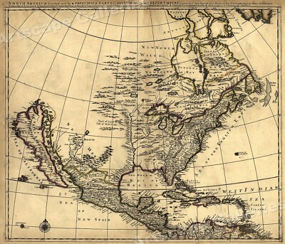
$5.95 Shipping Condition: New Location: Las Vegas, United States North America 1685 Size: 24" x 28" 61 cm x 86 cm) x Also Available in from our eBay Store This is a great Classic Map originally Published circa ... more1685. This Map shows what was known of America(North America) in1685. The wording reads: North America divided into its III principall parts. Features include: New North Wales" Canada) Bay of Mexico" Gulf of Mexico) Sea of the English Empire" Atlantic Ocean) West Indian Sea" Caribbean) Sea of California" Sea of New Spain" Pacific Ocean) New Mexico" Western United States) and"Tract of Land full of Wild Bulls" Great Plains) This poster. Which evokes the vivid images of a simpler time, is a custom reproduction printed on 68lb Heavyweight Enhanced Matte Art Paper. This Historic Art Print is suitable for framing. Mounting or direct display on any wall! 000 Artscape Galleries/ Posters Past More Prints and Posters Available from our eBay Store! Shipping price includes delivery confirmation. We combine shipping for multiple purchases- add $1.00 for each additional poster. All posters are professionally packaged to ensure that they arrive safely and undamaged: Your poster is first rolled and inserted into a plastic sleeve before being placed into a Heavy-Duty mailing tube for delivery. We stand behind the quality of every poster. If you are not satisfied with your purchase. Please contact us within 30 days to arrange for either an exchange or a full refund. gsrx_vers_468(GS 6.4(468)
Buy It Now
$5.95 Shipping Condition: New Location: Las Vegas, United States A striking map of the Southwestern United States from 1861, this map presents the land between the Pacific Ocean stretching to the Colorado Territory. ... more“Vibrant and bright! Pic does not do it justice.looks amazing!”.
Buy It Now
$5.95 Shipping Condition: New Location: Las Vegas, United States Year: 1814. State of Louisiana. Each of our prints are custom reproductions printed on 68lb Heavyweight Enhanced Matte Art Paper. These Historic Art Prints ... moreare suitable for framing, mounting or direct display on any wall!
Buy It Now
$5.95 Shipping Condition: New Location: Las Vegas, United States 1660 Map of New York (New Amsterdam - Manhattan). Year: 1660 (redrafted in 1916). Each of our prints are custom reproductions printed on 68lb Heavyweight ... moreEnhanced Matte Art Paper. These Historic Art Prints are suitable for framing, mounting or direct display on any wall!
Buy It Now
$5.95 Shipping Condition: New Location: Las Vegas, United States This is a great Classic Map originally Published circa 1757. “Vibrant and bright! Pic does not do it justice.looks amazing!”. Beautiful map! Each of our ... moreprints are custom reproductions printed on 68lb Heavyweight Enhanced Matte Art Paper.
Buy It Now
Free Shipping Location: Schertz, United States This Map was removed from a 1959 Picture Map Geography of the USA and is in very good condition. The map is not " new " or in " new " condition, it was ... moreprinted in 1959. The map is not dated. Study the photos carefully, this is the actual map you will receive.
Buy It Now
$6.95 Shipping Location: Dover, United States Delightful little map, unique to the era and maker.
Buy It Now
$6.95 Shipping Location: Dover, United States A remarkable survival. A food placemat for this specific White Mts. Three vignette views showing the camp grounds surround the central map. Issued c. ... more1950's, likely New England (NH?).
|
|
|
|
1947 PICTORIAL MAP OF STAMPS OF AMERICA BY EARNEST DUDLEY CHASE SIGNED
1947 THE PICTORIAL MAP STAMPS OF AMERICA DEDICATED TO PHILATELISTS EVERYWHERE. DESIGNED. DRAWN AND PUBLISHED BY ERNET DUDLEY CHASE, WINCHESTER, MASSACHUSETTS. SIGNED IN PENCIL ON THE LOWER LEFT NEALY IN FRAMED IN VERY GOOD CONDITION. THERE IS ONE WATER MARK OR STAIN ALONG THE BOTTOM RIGHT IN THE WHITE AREA ONLY SHIPPING IS FOR FRAMED MAP. I AM WILLING TO REMOVE THE PICTURE AND SEND JUST THE MAP IN MAILING TUBE. RATE WILL BE AVAILABLE AFTER AUCTION AND A REQUEST IS MADE FOR MAP ONLY. CLICK BELOW TO SEE MY STORE AND OTHER AUCTIONS Check out my other items! ALWAYS HAPPY TO COMBINE SHIPPING TO SAVE YOU MONEY. PLEASE EMAIL FOR DETAILS BEFORE PAYING. PLEASE EMAIL IF YOU HAVE ANY QUESTIONS Powered by The free listing tool. List your items fast and easy and manage your active items.
|
|
|
Pictorial Map of USA, Stati Uniti, carta in litografia,mappe,cartine d'epoca.
Pictorial Map of the United States. Published by Ensigns& Thayer, USA, 1848-Dimensioni 80x110cm. Carta in litografia acquerellata; litografia incollata in epoca su tela; con bastoncini in legno d'epoca. Ottime condizioni di conservazione. Con alcuni piccoli strappi riparati e spelature in alto a sinistra(come da foto) Splendido esemplare di mappa d'epoca. Raffigurante la conformazione territoriale degli Stati Uniti d'America nel 1848; arricchita ai lati con raffigurazioni di momenti storico-politici fondamentali per la formazione della Repubblica americana( i Padri fondatori ritratti durante la stesura della carta costituente. Le battaglie contro gli inglesi e contro i nativi americani,ecc. Pictorial Map of the United States. Published by Thayer& ensigns. USA. 1848 Size- 80x110cm. Watercolor paper lithography, lithography ... morestuck in time on canvas with wooden sticks vintage. Excellent condition. With some small tears repaired and peeling on the top left side(see photo) A wonderful example of vintage map depicting the territorial structure of the United States of America in 1848. And expanded to the sides with depictions of historical and political moments required for the formation of the American republic( the Founding Fathers portraits during the writing of the paper forming the battles against the British and against the Native Americans. Etc.
|
|
|
1992 U.S. Geological Survey Pictorial Map of Dione, Moon of Saturn
1992 U.S. Geological Survey Pictorial Map of Dione. Moon of Saturn WE SELL ONLY ORIGINAL ANTIQUE MAPS- NOT REPRODUCTIONS Title: Pictorial Map of Dione. Description: A beautiful 1992 example of the U.S. Geological Survey pictorial map of Dione. Moon of the planet Saturn. This map, based on the images from Voyager 1 and 2, shows the Saturn-facing hemisphere, North Polar Region and South Polar Region of the fifteenth largest moon in our Solar System. It identifies several Chasmata(chasms) craters, linea and other geological features on Dione's surface. The primary mission of the Voyager 1 and 2 at the time of launch was to explore Jupiter and Saturn. Since then, the mission objective has been extended to exploring the Solar System beyond the outer planets, as far as the Sun's sphere of influence and possibly even beyond the outer limits ... moreof our Solar System. Voyager 2, launched in August 1977, flew by Jupiter and Saturn and continued on to explore Uranus and Neptune, becoming the only spacecraft to visit these outer planets. It is also the only spacecraft to have studied all four giant planets of our Solar System at close range. Voyager 1, launched in September 1977, also flew by Jupiter and Saturn and continued on toward interstellar space. Both space crafts are carrying a golden record explaining their origins and containing sounds and images portraying Earths life and its culture in all its diversity. Although departing the Solar System in different directions, both Voyagers have reached the Heliosheath, where the solar wind mixes with interstellar wind. This map was prepared for the National Aeronautics and Space Administration and published by the U.S. Geological Survey as Atlas of Saturnian Satellites Topographic Series map I-2158 sheet 1. Size: Printed area measures 32 inches high by 29 inches wide. Condition: Very good. Original fold lines visible. Blank on verso. Shipping: Due to recent increases in United States Postal Service rates we have been forced to increase our shipping rates. Shipping rates
|
|
|
1979 U.S. Geological Survey Pictorial Map of Callisto, Moon of Jupiter
1979 U.S. Geological Survey Pictorial Map of Callisto. Moon of Jupiter WE SELL ONLY ORIGINAL ANTIQUE MAPS- NOT REPRODUCTIONS Title: Preliminary Pictorial Map of Callisto. Description: This is an attractive 1979 U.S. Geological Survey's pictorial map of Callisto. A moon of the planet Jupiter. This map was compiled from images from Voyager 1 and 2 and is centered on Callisto's and the Solar System's largest multi-ring crater basin Valhalla. The Asgard formation, the second largest multi-ring structure, is also shown in this map. The North Polar Region and the South Polar Region are represented in two insets in the upper left and right quadrants respectively. The primary mission of the Voyager 1 and 2 at the time of launch was to explore Jupiter and Saturn. Since then, the mission objective has been extended to exploring the Solar ... moreSystem beyond the outer planets, as far as the Sun's sphere of influence and possibly even beyond the outer limits of our Solar System. Voyager 2, launched in August 1977, flew by Jupiter and Saturn and continued on to explore Uranus and Neptune, becoming the only spacecraft to visit these outer planets. It is also the only spacecraft to have studied all four giant planets of our Solar System at close range. Voyager 1, launched in September 1977, also flew by Jupiter and Saturn and continued on toward interstellar space. Both space crafts are carrying a golden record explaining their origins and containing sounds and images portraying Earths life and its culture in all its diversity. Although departing the Solar System in different directions, both Voyagers have reached the Heliosheath, where the solar wind mixes with interstellar wind. This map was prepared for the Voyager Imaging Team in cooperation with the Jet Propulsion Laboratory, California Institute of Technology, and the National Aeronautics and Space Administration and published as Atlas of Callisto Topographic Series Jc 25M 2RMN map I-1239 by the U.S. Geological Survey. Size: Printed area measures 30 inches high
|
|
|
Pictorial Cartton Map Of Bermuda By Elizabeth Shurtleff
This is a lovely very rare large map of Bermuda by Elizabeth shurtleff from 1930 Posted with
|
|
|
c.1940's Christmas Advertising Pictorial Comic Fantasy Map Brochure Unique
Here is a very unique advertising brochure featuring a fold-out 12 1/4" x 9" Pictorial Comical Map of a fantastic Christmas La nd called the" State of Happiness" Which is located along the" Yultide Trail" The brochure is a very attractive and cleverly conceived Holiday Season design by the Amstadter Storage& Van Company. Inc. Chicago, Illinois. The map and the entire brochure has a 1950's look. But judging from the look of the automobiles drawn on the map, I think it dates from the 1940's. But most probably, post WWII vintage. There is no date on the map. The map has a very Christmasy look to it and it a true pictorial map. Which was revived for advertising and other purposes during the post-War period until the early 1960's. The only indication of an illustrator on the map are the initials" ... moreLM" The ficticous place mentioned on the map is" Peaceful Valley" Which is a small village in the State of Happiness. By taking the Yultide Trail you end up on the map at Merry Christmas, and you are on your way to Happy New Year. The colors of this piece are still bright and true without any fading that I can see. The map takes up 1/2 of the unfolded sheet; the reverse half of the sheet is blank. The sheet is divided into six 4 1/8" x 9" panels; the map is drawn on 3 panels. This piece is in better than very good condition- please see the Description Section where I go into details as to condition. A map with a Christmas or holiday theme is fairly unique. This map. Although off-beat and depicting a fantastic place, appeals to adults as much as children, in my opinion. As a pictorial map, it is fairly well done, and the illustrator was clearly a talented artist. I ship USPS. Fedex, or UPS, depending on which is the most practicable given the item being shipped. This would come USPS First Class Mail. I reimburse immediately via Pay Pal for any shipping fees sent that are not needed. Pay Pal only. No Buy-it-Now on this one. I ship within 12-24 hours of
|
|
|
Vintage 1966 AJ Nystrom Africa Pictorial Pulldown School Map
This old vintage 1964 Nystrom school pull down wall map of Africa came from an estate map collection. The map itself is approx. 64 by 40 inches and pulls down all the way It is in reasonably nice condition. Please email with any questions.
|
|
|
Rare Map This World of Ours New National Boundaries Art Deco Pictorial Daugherty
This World of Ours: Showing the New National Boundaries James Henry Daugherty(1889-1974) after) Mercedes Clifton. Joseph De Felice, G.J. Harris and Charles Rosner(cartographers) Historical Map Society. New York: c. 1930s Sheet dimensions: 25.5" x 36.25" Lithograph- Colors remain vibrant. Very minor edge wear. Image excellent. A rare and attractive map for the serious collector Please utilize the Zoom feature for a close-up viewing. NOTE TO OUR INTERNATIONAL EBAYERS: The United States Postal Service is our sole carrier. And when possible, our items are shipped via the USPS First Class method. This method of shipment is available with packages weighing 4 pounds or less. Packages exceeding 4 pounds in weight are required by the USPS to be shipped via Priority Mail. When items sell at a final value exceeding $100. We must ship via the ... moreUSPS Express Mail method to meet eBay and PayPal seller protection requirements in the event of damage or loss in transit. REFUNDS: Please be sure of what you are purchasing or bidding on. As we cannot issue partial refunds to buyers. If additional information or photos are needed, please send us an email. We will, however, issue a full refund, including all related shipping costs, if an item is in any way not as described. Purchase with Confidence- Satisfaction Guaranteed- 100% Feedback Rating In fairness to all. Auctions are not ended early unless a listing error is discovered. All of our auctions start at the opening price. We do not use reserves. Combined shipping discounts are applied to all multiple-item purchases when possible. All purchases are shipped within 24 business hours following payment.
|
|
|
Vintage 1962 AJ Nystrom South America Pictorial Relief Pulldown School Map
This old vintage 1962 Nystrom school pull down wall map of South America came from an estate map collection. The map itself is approx. 65 by 42 inches and pulls down all the way It is in very nice condition. Please email with any questions.
|
|
|
Vintage 1962 African Pictorial Pulldown School Map
This old vintage 1962 A J Nystrom school pull down wall map of Africa came from an estate map collection. The map itself is approx. 64 by 42 inches and pulls down all the way It is in very nice condition. Please email with any questions.
|
|
|
1930'S PICTORIAL MAP OF THE AMERICAS /THE PAN AMERICAN HIGHWAY
This is an early pictorial map of THE AMERICAS(Canada. United States and South America) by the General Drafting Co. of America for The Standard Oil Co. This map,which is in very good to excellent condition, has historical and economic information on the countries at the time. The map features The Pan American Highway. Please see pictures to help you decide the condition for yourself since my definition of very good to excellent and your definition may not be the same. Any questions about this item please write before bidding and I will answer to the best of my ability. I accept Pay Pal as method of payment. I will ship your item within 3 business days of recieving payment and confirmed shipping address. If insurance is desired please contact me before paying for item. I will include insurance and send a revised invoice. International buyers ... moreare welcome. International buyers will be responsible for their country's Custom's Fees and Duties and actual shipping/handling costs. Your item will be in the mail to you within 3 business days. Not including Saturday and Sunday. Please do not hold me responsible for any delay in recieving your item due to shipping carrier. Thanks for looking. Powered by The free listing tool. List your items fast and easy and manage your active items.
|
|
|
c1940s Pictorial Map in Grtg. Cd - A Road Map for Santa North Pole to Your House
A two-fold 4" x 8" Christmas greeting card. The cover depicts Santa Claus in a"sled mobile(sleigh with tires and runners) reading a map. It is captioned A Road Map for Santa- Here's your copy of the map That I sent to old Saint Nick. To help him find your house with EASE- Sure hope it DOES THE TRICK. When the cover is lifted depicts another caption and image of Santa"taking off" When opened completely it depicts a pictorial map from the North Pole to"your house" Every street attraction and body of water are named for good luck, cheer, wishes or friends. Charming. Forget-me-Not greeting card. No. T-2891. Our P olicies Buyer pays shipping. We ship through the Postal Service and recommend insurance on your purchase. As we cannot accept responsibility for lost or damaged goods. If payment is not received ... morewithin two weeks of the completion of the auction. We reserve the right to relist or sell the item to the underbidder. We prefer PayPal. But will discuss other options. We welcome inquiries if additional information is needed. NOTES: Import duties. Taxes and charges are not included in the item price or shipping charges. These charges are the buyer's responsibility. Please check with your country's customs office to determine what these additional costs will be prior to bidding/buying. Ask us about the Ephemera Society of America- Thanks. on ebay.
|
|
|
1930'S ESSO Pictorial Map of the Americas PAN AMERICAN HIGHWAY Transportation PA
Vintage ESSO Pictorial Map of the Americas PAN AMERICAN HIGHWAY Transportation This auction is for one vintage ESSO Pictorial Map of the Americas Featuring the Pan American Highway. This great map is double sided and is in good clean condition but there are a few splits at the fold edges and some discoloration due to age. It measures approximately 18" by 25" when unfolded and was published by The Standard Oil Co. Great item for any collector! I try to describe all of the items I put up for auction honestly and to the best of my ability. So that there will be no surprises or disappointments to the buyer. Please view the pictures and judge accordingly. If you are disappointed with the item after you receive it. Please contact me within in five days of receipt and I will accept returns for the purchase price less shipping and handling. ... moreItems must be returned timely and in the same condition shipped. My house is a non-smoking and pet free home. I am happy to answer questions by email and will send additional photos if requested. I will combine shipping to save you money so please take a look at my other auctions. Within the continental United States. I offer FREE shipping and packing. Alaska and Hawaii may have additional shipping charges. If you wish to have the package insured. Please add $1.70 for every $50 dollars of the final value. If you do not request insurance for your package, you bear any loss occurring in shipment. Outside of United States, buyer pays all actual shipping charges plus $3.00 for packing materials. Thank you for looking and have fun bidding. Powered by The free listing tool. List your items fast and easy and manage your active items.
|
|
 |