|
|
Order by: Available to: This site contains affiliate links for which I may be compensated
|
Buy It Now
$9.99 Shipping Location: Ivanhoe, Australia After leaving Raiatea (Society Islands) on 18 September 1773, Cook directed his course towards Amsterdam Island (Tongatapu), discovered by Tasman in 1643, ... moreintending to verify Tasman\'s charting against his own charts.
Buy It Now
$12.43 Shipping Location: West Hempstead, United States And the Atlantic Ocean. Double sided Map: One side is the Arctic Pole. Very colorful and well detailed, on VERY thick, heavy paper! This is an amazing ... moreantique map dating back to the 19th Century! The reverse is the Antarctic Pole, Polynesian Islands.
Buy It Now
Free Shipping Location: Columbia, United States He produced John Elphinstone's map of Scotland (1746), Geographia Scotiae (1749), and The Small English Atlas (1749) with Thomas Jefferys. The Large English ... moreAtlas (with Bowen 1749–60) was a serious attempt to cover England at large scale.
Buy It Now
$9.99 Shipping Location: Ivanhoe, Australia After leaving Raiatea (Society Islands) on 18 September 1773, Cook directed his course towards Amsterdam Island (Tongatapu), discovered by Tasman in 1643, ... moreintending to verify Tasman\'s charting against his own charts.
Buy It Now
$7.95 Shipping Location: New Providence, United States PRINT DATE : This engraving was printed in 1876; it is not a modern reproduction in any way. The continental coastline is long and irregular. Others include ... morethe Gulf of Saint Lawrence and the Gulf of California.
Buy It Now
$14.45 Shipping Location: Belvedere Tiburon, United States Rare Vintage Chart Of The World Map* Mercator Projection*Nautical Use*Nautical Use*Great Sailor’s Aid*1884 This is a wonderful old vintage Chart Of World ... moreMap from an 1884 atlas utilizing the"Mercator’s Projection" This type of map was an aid to ocean navigation and was used for nautical purposes. The map measures 21 ½ inches and 13 ½ inches and is in great condition. Very colorful and interesting to see how the world has changed. By gone country names such as Arabia. Hindoostan, Persia, Turkestan, East Turkestan, Baffin Land, Dominion of Canada, Chinese Empire, Russian Empire, Labradoe, New Siberia, etc have all gone by the wayside. When viewing a map in terms of Mercator’s projection. There is a distortion at the north and south poles. The land sizes of the continents closest to the equator are smaller than they really are. But Mercator maps are very useful for sailors or pilots for finding direction.
Buy It Now
$12.50 Shipping Location: Boulder, United States Map is attached to a cloth backing that is in perfect condition.
Buy It Now
$15.00 Shipping Location: Brooklyn, United States It is a legacy of Peter the Great's obsession over the search for a Northeast Passage. Dezhnyov described rounding a large mountainous promontory identified ... moreas Chukchi, Tschuktschi, or Chukotka Peninsula.
Buy It Now
$7.95 Shipping Location: New Providence, United States It played a predominant role in global affairs from the 16th century onwards, especially after the beginning of colonialism. PRINT DATE : This engraving ... morewas printed in 1876; it is not a modern reproduction in any way.
Buy It Now
$25.00 Shipping Location: Belvedere Tiburon, United States [Baccalaos ], Canada, Newfoundland and Labrador [. Corterealis ]. Luminously made by Cornelis de Jode.”. Joao Vaz Corte-Real (Corterealis), John Scolvus, ... moreand the Pining Expedition of the 1470s. All the annotations are written in Latin to give the map more status and applicability.
Buy It Now
$22.49 Shipping Location: LONDON, United Kingdom The following map was produced by Nicholas Bellin for Prevost d'Exiles influential travel book "L'Histoire Generale des Voyages". Sea chart of the North ... moreAtlantic, Arctic and Baltic seas with the coastlines of Greenland, Canada, Iceland, Norway, Sweden and Great Britain.
Buy It Now
$9.99 Shipping Condition: Unspecified Location: LONDON, United Kingdom DATE PRINTED: 1952. The image below shows an enlarged cross section from the centre of the map to show the level of printed detail. This map is folding ... morehence the centrefold line may show on the image below.
Buy It Now
Free Shipping Location: Monroeville, United States Date - 1758. The border in the lower right corner was re-enforced on the reverse with neutral archival tape. Size - about 9.5x15", was folded to fit into ... morethe publication, printed on Laid paper.
Buy It Now
$9.99 Shipping Location: Ivanhoe, Australia This fine original copper-plate engraved antique map of Russian Island of Novaya Zemlya, parts of the Russian northern mainland region of Nenets and the ... moreenvirons of the Arctic Barents & Kara Sea by Jacques Nicolas Bellin was published in the 1760 edition of Antoine François PrevostsHistoire Generale des Voyages.
Buy It Now
$9.99 Shipping Location: Ivanhoe, Australia He went on three expeditions to the far north in search for a Northeast passage. During his third expedition, the crew was stranded on Novaya Zemlya for ... morealmost a year. The map depicts the Détroit de Waeigats - currently the Kara Straits - that divides the island of Novaya Zemlya from the northern Russian mainland.
Buy It Now
$9.99 Shipping Location: Ivanhoe, Australia London: A.W. Webster. Short periods of service on HMS Clyde and HMS Diligence followed, during which he acted as a lieutenant. From 1803 he served on ... morevarious vessels, mainly with the Baltic station.
Buy It Now
$15.00 Shipping Location: Brooklyn, United States The title states that the purpose of the map is to illustrate the distribution of Genera Chamæcyparis and Cupressus trees, each of which is a genus ... moreof cypress. A legend along the left border explains that the seven different colors present on the map indicate that seven different species of cypress tree inhabit the United States and Canada.
Buy It Now
$8.50 Shipping Location: Croatia (1875-94), great work of Elisee Reclus. Apart from the station personnel, the island is uninhabited. Nice map titledJan Mayen, from wood engraving with ... morefine detail and clear impression. Overall size approx.
Buy It Now
$15.00 Shipping Location: Brooklyn, United States This map was engraved for George Henry Millar'sNew Complete and Universal System of Geography published in 1783. Another version was issued by Alexander ... moreHogg. Also of note is the interesting illustration of an insular Alaska and the Aleutian Islands.
Buy It Now
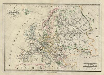
$15.00 Shipping Location: Brooklyn, United States 1835 Malte-Brun Map of Europe WE SELL ONLY ORIGINAL ANTIQUE MAPS- NOT REPRODUCTIONS Title: Europe. Description: This is a fine example of Conrad Malte-Brun's ... more1835 map of europe. The map covers the entire continent from the Atlantic Ocean to the Ural Mountains and from the Arctic Ocean to northern Africa and Turkey. It includes Spain. Portugal, France, Italy, european Russia, Sweden, Denmark, Norway, Germany, Ireland, Great Britain, Turkey in europe and Greece. Issued following the defeat of Napoleonic France and the Congress of Vienna, europe is shown under a new peaceful balance of power, centered around the five most important powers(also referred to as the five'Great Powers' the United Kingdom, France, Russia, Prussia and the Austrian empire. Alas, the'peace' was but an illusion as the treaties ending the Napoleonic era were inherently flawed. Old rivalries festered and nationalism, liberalism, revolution(industrial and otherwise) was once again on the rise throughout europe. Various cities, countries, towns, islands, rivers, lakes and various other topographical details are marked, with relief shown by hachures. Boundaries are color coded according to countries and regions. This map was issued as plate no. 29 in Conrad Malte-Brun's 1837 Atlas Complet du Precis de la Geographie Universelle. Size: Printed area measures 13 inches high by 18 inches wide. Condition: Very good. Original centerfold. Blank on verso. Shipping: Due to recent increases in United States Postal Service rates we have been forced to increase our shipping rates. Shipping rates are not negotiable. Items are shipped within three business days of receiving payment. We are happy to consolidate shipping where possible. The following shipping options are available: 1. USPS Domestic Express Mail(35 USD) USA Only. 2. FedEx Ground or Home Delivery(15 USD) USA Only. 1- 10 days. If your address is a P.O.Box and cannot ship FedEx we will ship USPS Priority and. While we ship promptly, recent postal personnel cutbacks mean that de
Buy It Now
$6.05 Shipping Location: Brooklyn, United States It compiles several hugely important voyages that took place over the previous years; Captain Cook's exploration of Alaska & the western coast, as well ... moreas Samuel Herne and Alexander Mackenzie's enormous overland expeditions to the Arctic Sea.
Buy It Now
$9.99 Shipping Condition: Unspecified Location: LONDON, United Kingdom DATE PRINTED: 1952. The image below shows an enlarged cross section from the centre of the map to show the level of printed detail AUTHENTICITY: This ... moreis an authentic historic print, published at the date stated above.
Buy It Now
$126.21 Shipping Location: San Francisco, United States Sanson locates a few Indian tribes in the Texas region, but the area's river system (including the Mississippi) remains clearly unknown and undescribed. ... moreBorn in 1600, Sanson exhibited in his earliest years a special aptitude towards and interest in geography.
Buy It Now
$15.00 Shipping Location: Brooklyn, United States Visually striking, two different 'systems' are illustrated: the mountain (the Rocky, Sierra Nevada, and Cascade Mountains) as a 'unit' and the 'Great ... moreCalcareous Plain' in detail. Our research did not provide us with a satisfactory explanation of this phrase.
Buy It Now
$6.95 Shipping Location: Arlington, United States

$7.50 Shipping Location: Delray Beach, United States Title: ASIE' Author: Dufour. Auguste-Henri( 1798- 1865) Engraver: Dyonnet. Charles(1822- 1880) Source: Grand atlas Universel physique. Historique ... moreet politique geographie ancienne et moderne' Date: 1870ca. Paris. Technique: Steel Engraving. Paper size: 82.5x60 cm. Condition: Dark impression on good paper. Original watercolor. Small restoration of the bottom centerfold. Almost unnoticeable foxings on engraved area. Some pen marks. Good conditions. Conditions are as you can see in the images. All of the engravings and books I sell are original. I guarantee all of my engravings to be authentic. Please examine the images provided carefully. And if you have any questions, please ask and I will be happy to help. Any item purchased from me may be returned for any reason for a full refund. If you buy more than one item. You have to pay only one shipping cost. 3.RcmdId ViewItemDescV4,RlogId p4%60bo7%60jtb9%3Fud.ro77%2861m25%3E3-13cd530bc21-0x10d-
Buy It Now
$6.00 Shipping Location: Waukegan, United States 1925 Map of The Arctic Ocean North Pole Region and State of Arkansas USA. Approximately 10 x 14. You will get a two-sided map from a 1927 edition of a ... moreChicago based Publisher. Never being folded this will be sent rolled up in a tube.

Buy It Now
$3.25 Shipping Location: Winter Springs, United States Click Here. Double your traffic. Get Vendio Gallery- Now FREE! Very fine antique 1805 copperplate engraved map. Titled, in fancy antique lettering, Northern ... morePart of Russia in Europe. The condition of the map is amazing. Many fascianting areas, I see large Archangel, large Frozen Ocean at top, Finland, Riga, Novogorod, Kasan, Russian Lapland, White sea, and much more. The map is printed on fine paper, with no printing on reverse. The size of the map is 8.25" by 10" Rare. This would frame and display beautifully. Winning bidder pays $3.25 shipping domestic, more foreign. Payment I accept the following forms of payment: PayPal Click to View Image Album Shipping& Handling US Shipping. $3.25 USPS First-Class Mail® International Shipping. $9.00 USPS First-Class Mail International FREE scheduling. Supersized images and templates. Get Vendio Sales Manager. FREE scheduling. Supersized images and templates. Get Vendio Sales Manager.
Buy It Now
$9.99 Shipping Location: Ivanhoe, Australia This original copper plate engraved antique map of North Africa by Alexander Findlay was published in the 1835 edition of Findlay'sClassical Atlas, W. ... moreTegg and Co. Findlay was born in London, 6 January 1812, a descendant of the Findlays of Arbroath, Forfarshire.
Buy It Now
$9.99 Shipping Location: Ivanhoe, Australia London: A.W. Webster. The Canadian Arctic Archipelago, also known as the Arctic Archipelago, is a group of islands north of the Canadian mainland. We ... morehave, however, the consolation that the results of this expedition have been conclusive and to science highly important, and may be briefly comprehended in the following words.
Buy It Now
$9.99 Shipping Location: Ivanhoe, Australia He went on three expeditions to the far north in search for a Northeast passage. During his third expedition, the crew was stranded on Novaya Zemlya for ... morealmost a year. The map depicts the Détroit de Waeigats - currently the Kara Straits - that divides the island of Novaya Zemlya from the northern Russian mainland.
Buy It Now
$9.99 Shipping Location: Millbrook, United States It’s very interesting to see that California is shown as an island/peninsula.
Buy It Now
$12.50 Shipping Location: Boulder, United States This is a map of Alaska, compiled from the official Records of the General Land Office. U.S. Coast & Geodetic Survey, U.S. Geological Survey, Canadian ... moreand other sources. Under the direction of Harry King, C.E., Chief of drafting division G.L.O. and printed in 1898.
$12.00 Shipping Location: Delray Beach, United States Engraved by Stiles. Image area is16.0" wide x 8.0.". Original hand colored engraving as issued. The Arctic Ocean is "The Frozen Ocean.".

Buy It Now
$15.00 Shipping Location: Brooklyn, United States Nord-America 38.5 cm x 31 cm copperplate engraving. 43 cm x 34 cm sheet size, original hand colour, Justus Perthes, Gotha, 1848 We are pleased to offer ... morethis scarce example of the map of North America compiled under the direction of Friedrich von Stülpnagel(1786-1865) for the world atlas issued by the renowned Stieler publishing firm established by Adolf Stieler(1775-1836) Trained as a military cartographer during the Napoleonic wars. Stülpnagel's cartographic skills and aesthetic sensibility are perhaps overshadowed by the brilliance of August Petermann in the overall Stieler universe. But Adolf Stieler called him"the tireless Captain of our workshop" perhaps a bit of a joke as Captain was then Stülpnagel's rank in the Prussian military. The map is notable for its depiction of the rapidly expanding United States in the year that saw the election of the semi-literate slaveholder Zachary Taylor as President. Alaska is of course shown as Russian territory and the map seems to hint at the possibility of a Northern Passage by what is left uncharted in the Arctic. With Greenland shown as connected to an uncertain part of the American continent. Elegantly engraved with fine original handcolour, the map would make a handsome presentation if matted and framed. To get a sense of map detail consider that the distance from San Francisco to New York as seen below measures just 5 cm actual size. The west divided into territories with Indian tribes dispersed throughout as the genocidal of the United States government such as the"Indian Removal" laws continued apace. Map shows some voids of knowledge from the Great Salt Lake to the Sierra Nevadas and some rather speculative hachure topography for Rocky Mountains; German Colony" shown in Texas west of Austin. Note in California- then the largest freshwater lake west of the Mississippi but all but gone by the end of the 19th century: Alaska is shown as"Russian Coastal Settlements" while Great Bear Lake and Great Slave Lake
Buy It Now
$6.00 Shipping Location: Greenacres, United States It was published in Greenleaf'sA New Universal Atlas, printed in Brattleboro, Vermont by G. R. French, 1842. Topography is delineated with hachure lines, ... moreand the map is colored by oblast, or administrative district.
Buy It Now
$15.00 Shipping Location: Rochester, United States 5 from 1967 - Vietnam, Cambodia, Laos And Thailand ( Feb ), Eastern Soviet Union ( Atlas Plate 46 ) With Parts Of China, Afghanistan, And Iran. ( March ... more). Indian Ocean Floor ( Oct ). 3 From 1968.
Buy It Now
$9.99 Shipping Location: Ivanhoe, Australia (In his defense, Hawkesworth also had been a victim of misunderstanding.). Cook had trouble recognizing himself. Still, the work was popular; the first ... moreedition sold out in several months. all located north of Carlos III island, on Punta Arenas in the Chilean Arctic - from Bachelor River north to York Bay - in the Straits of Magellan, Chile.
Buy It Now
$9.99 Shipping Location: Rosanna, Australia This original steel-plate engraved antique map by Alexander Findlay was published by Thomas Kelly in the 1835 edition of Barclays English Dictionary. ... more(Ref: M&B; Tooley). Findlay was born in London, 6 January 1812, a descendant of the Findlays of Arbroath, Forfarshire.
Buy It Now
$15.00 Shipping Location: Brooklyn, United States Also, the northern border of the United States contains a gap, likely reflecting the still undecided dispute between Britain and the United States over ... morewhat is now British Columbia, known as the 54°40' dispute.
Buy It Now
$4.95 Shipping Location: Reading, United States
Buy It Now
$42.95 Shipping Location: Amherst, United States A New & Accurate Map of the Whole Russian Empire, as contain’d both in Europe and Asia. Engraved Map. 1747-48 1747-48. Framed under glass. Frame size ... moreis 23 ¾ x 19 ¼ inches. Nice condition. Beautiful Bowen’s map of the Russian Empire from “A Complete System of Geography”. With an elaborate allegorical cartouche and a compass rose. Decorative map, from St. Petersburg and the Caspian Sea to Kamtchatka and the Arctic Circle. Also includes Tibet, Korea and part of China, with the Great Wall shown. Emanuel Bowen was a printer, publisher and map engraver in London during the mid-eighteenth century. From 1714 onwards he worked in London and began to produce some of the finest and most attractive maps of the century.

Buy It Now
$15.00 Shipping Location: Brooklyn, United States This Auction is for an Unframed MODERN REPRINT of an Antique Map as detailed below. This map is reproduced on specially coated. Matte finish, paper for ... moresharper print quality and colors that are vivid. These maps are created from VERY high resolution uncompressed TIFF files(averaging 200+ megabytes) and are much sharper that the image shown here. Description. Approximate Image Size 16.5 X 20 inches, Original Atlas Title A New American Atlas Containing Maps Of The Several States of the North American Union. Projected and drawn on a Uniform Scale from Documents found in the public Offices of the United States and State Governments, and other Original and Authentic Information, By Henry S. Tanner. Philadelphia: Published By H.S. Tanner. 1825. title page only) Writing Drawn and Engraved by Joseph Perkins. Barralet del. Humphrys sc. WE HAVE MANY HISTORIC REPRINT MAPS AND OTHER ITEMS ON MANY DIFFERENT SUBJECTS Please check out store for additonal products NO ADDITIONAL SHIPPING ON MULTIBLE ITEM ORDERS-FREE SHIPPING BY MAIL(GENERALLY 2 TO 5 DAY DELIVERY) FOR ANY NUMBER OF MAPS SHIPPED IN THE US. SHIPPING IS $15 FOR THE FIRST AND $1 FOR EACH FOR ADDTIONAL MAPS TO ANYWHERE ELSE IN THE WORLD. WE SHIP ALL MAPS ROLLED IN A MAILING TUBE TO PROTECT THE MAP. IF YOU ARE UNHAPPY WITH YOUR PURCHASE SIMPLY RETURN IT AND WE WILL REFUND YOUR MONEY. Ad copyright 2013 All Rights Reserved Powered by The free listing tool. List your items fast and easy and manage your active items.
Buy It Now
$15.58 Shipping Location: Mount Cotton, Australia As a traveller cruises the east coast of the United States, for example, the declination varies from 16 degrees west in Maine, to 6 in Florida, to 0 degrees ... morein Louisiana, to 4 degrees east in Texas. A Chart of Magnetic Curves of Equal Variation by Peter Barlow, engraved by G Aikman for A&C Black, Edinburgh c1854.
Buy It Now
$9.99 Shipping Condition: Unspecified Location: LONDON, United Kingdom The defence of Convoy JW.51B 8:30-10:30 a.m.31st December 1942'. Caption below picture:'Map 28. This map was published in 1956 but it may depict an earlier ... morerepresentation of the area shown dated 1942 and the mapmaker may have drawn on an earlier original work.
Buy It Now
$4.95 Shipping Location: Reading, United States
Buy It Now
$15.00 Shipping Location: Brooklyn, United States The United States is labeled in detail, including the Western Territory, New England, and the states of Pennsylvania, New York, Virginia, Tennessee, Kentucky, ... moreSouth Carolina, and Georgia. To the north of the continent, the vast Icy Sea is labeled, along with Baffin Bay.
Buy It Now
$10.00 Shipping Location: Dunakeszi, Hungary Maker: Jacques Nicolas Bellin. Hand-coloured map of the Siberia area of Russia. ShowsNouvelle Zemle (Nova Zembla) in the Arctic Ocean off the coast of ... moreRussia.
Buy It Now
$15.00 Shipping Location: Brooklyn, United States Poland is also included, as it was divided and its constituent parts were absorbed into Russia, Prussia, and Austria following the Napoleonic Wars. Towns, ... morerivers, mountains, important battle sites, and various other important topographical details are noted.

Buy It Now
Free Shipping Location: Cyprus . Title: Carte Reduite des Mers Nord Description: Large sea chart of the North Atlantic. Arctic andBaltic seas with the coastlines of Greenland, Canada, ... moreincludingIceland, Norway, Sweden, and Great Britain. A voyage round the world. Author: Jacques Nicolas Bellin(1703– 21 March 1772) Royal Hydrographer. Engineer of the French Navy and member of theRoyal Society) For: Antoine-François Prevost's" L`Histoire Generale des Voyages" Published by Pierre de Hondt. The Hague between 1747-1780. With fine hand coloring. Engraving is Absolutely Guaranteed authentic original map. A Certificate of Authenticity will be on request forwarded for eachindividual map or print. Sheet app. 48 x 37 cm. 19 x 14.5 inches. Image app. 45.5 x 33.5 cm. 18 x 13.5 inches. Condition: Very good clean engraving. folds as published, leftborder margin has been widened. All maps and prints are genuine. Authentic, published at the date stated in this listing! For better quality pictures please go to our web site: WWW.MAPANDMAPS.COM I offer a no questions returns policy. All maps and prints are genuine. Authentic, published at the date stated above. Shipping: Worldwide shipping by signed registered mail or Global Express courier . Standard Int'l Shipping means registered airmail of Europe. If you want to receive the item quickly. Ask for Expedited Int'l Shipping or a 3 days Shipping by FedEx. between $ 25.95 and $ 38.50) Shipping fee is per combined shipment. Including handling and insurance. Free shipping worldwide if three items or more purchased. . . Di,RcmdId ViewItemDescV4,RlogId p4%60bo7%60jtb9%3Fuk%601d72f%2Bishhov%3C%3Edi-141cd48267e-0xf9-
Buy It Now
$30.00 Shipping Location: Paris VI, France In 1716 Homann published his "Grosser Atlas ueber die ganze Welt" (Grand Atlas of all the World). Homann died in Nuremberg. Large detailed antique copper ... moreengraved map of the Russian Empire and northern China, by Johan Baptist Homann (1664-1724).
Buy It Now
$10.00 Shipping Location: Cyprus Russia map Detroit de Waeigats antique map Bellin 1759. Jacques Nicolas Bellin (1703 – 21 March 1772). Condition: Very good folded map, adequate narrow ... moreleft hand border. Between 23 and 29 June, Barentsz stayed at Kildin Island.
Buy It Now
$15.00 Shipping Location: Brooklyn, United States In Asia, the wolverine, polar bear, Mandarin duck, golden pheasant, Indian rhinoceros, sun bear, pangolin, yak, snow leopard, and giant panda make an ... moreappearance. Each color represents a different zone of vegetation.
Buy It Now
$30.00 Shipping Location: Paris VI, France Edition : Paris, 1683, 17th Century. Title of the map The map shows a part of Iceland, and Arctic.
Buy It Now
$4.93 Shipping Location: BLACKWOOD, United Kingdom A school atlas of English history - S. R. Gardiner 1910. A sketch of historical geography - K Johnston 1909. Atlas Of Ancient Egypt by The Egypt Exploration ... moreFund 1894. Archeological Atlas of Ohio - W. C. Mills 1914.
Buy It Now
$9.99 Shipping Condition: Unspecified Location: LONDON, United Kingdom Caption below picture:'Map 29. This map was published in 1956 but it may depict an earlier representation of the area shown dated 1942 and the mapmaker ... moremay have drawn on an earlier original work. DATE PRINTED: 1956.
Buy It Now
$6.00 Shipping Location: Greenacres, United States The map is titledJohnson's Russia and was published by Johnson and Ward, New York, in 1862. It was published by Johnson and Ward as plate 76 in the 1862 ... moreedition ofJohnson’s New Illustrated (Steel Plate) Family Atlas.
Buy It Now
$9.99 Shipping Location: Ivanhoe, Australia (Barentsz died during the expedition, and may have been buried on the Northern island.). During a later voyage by Fyodor Litke in 1821–1824, the west ... morecoast was mapped. Henry Hudson was another explorer who passed through Novaya Zemlya while searching for the Northeast Passage.
Buy It Now
$9.99 Shipping Location: Ivanhoe, Australia Findlay was born in London, 6 January 1812, a descendant of the Findlays of Arbroath, Forfarshire. Findlay\\\'s father, Alexander Findlay was one of the ... moreoriginal fellows of the Royal Geographical Society.
|
|
|
|