-
Christian Collectibles
-
Christian Sheet Music
-
Vatican Stamps
-
Vatican Coins & Paper Money
-
Antiques
-
Antiquities
-
Architectural & Garden
-
Decorative Arts
-
Ethnographic
-
Furniture
-
Maps, Atlases & Globes
-
United States (Pre-1900)
-
AK, HI
-
AL, FL, GA, MS, NC, SC
-
AR, IA, KS, LA, MO, NE
-
AZ, CA, CO, NM, NV, UT
-
CT, MA, ME, NH, RI, VT
-
DC, DE, MD, NJ, NY, PA
-
ID, OR, WA
-
IL, IN, MI, OH, WI
-
MN, MT, ND, SD, WY
-
OK, TX
-
VA, WV, KY, TN
-
Entire US
-
United States (1900-Now)
-
United States (Date Unknown)
-
Africa
-
Asia
-
Australasia/ Oceania
-
Canada
-
Central America/ Caribbean
-
Europe
-
India
-
Ireland
-
Mexico
-
Middle East
-
North America
-
South America
-
United Kingdom
-
Maps on CD
-
World Maps
-
Globes
-
Mixed Lots
-
Reproductions
-
Price Guides & Publications
-
Other
|
In
Order by: Available to: This site contains affiliate links for which I may be compensated
|
Buy It Now
$6.95 Shipping Location: Dover, United States Issued 1830, Connecticut by D.H. Robinson. Early 19th century antique engraved map with original hand color. Spain insets Lisbon Madrid Cadiz 1856 Weiland ... morehuge old engraved map hand colored. Southeast Asia Philippines Siam Sumatra 1811 John Cary lovely large old map.
Buy It Now
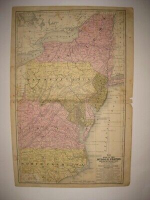
$6.95 Shipping Location: Dover, United States Issued 1848, Connecticut by S. Augustus Mitchell. Mid 19th century engraved map with original hand color. Map No. 11 - Map of the Middle States and Part ... moreof the Southern.
Buy It Now
$6.95 Shipping Location: Dover, United States Issued c. 1850, Hildburghausen, Germany by the Bibliographic Institute. Die Staaten von New York, Pennsylvania, Maryland, New Jersey, Delaware, & Virginia. ... moreMid 19th century antique engraved map with original outline hand color.
Buy It Now
$6.95 Shipping Location: Dover, United States Issued 1830, Connecticut by H. & F.J. Huntington. The Middle States, Maryland and Virginia. Early 19th century antique engraved map with original hand ... morecolor. Original center fold as issued.
Buy It Now
$3.50 Shipping Location: United States Fine antique 1852 handcolored map, the map is titled Map of the Middle States and Part of the Southern. I see New York, New Jersey, Pennsylvania, Maryland, ... moreDelaware, Virginia and North Carolina. Mitchell was a highly regarded mapmaker of this period.
Buy It Now
$4.99 Shipping Location: Fairview, United States It is fromThe Eclectic Complete Geography, 1896, a copy of the title page is included. An Authentic Antique Map: Not a Modern Reproduction! Condition: ... moreIt is in Good condition for its age, with text on the reverse and overall light tonal ageing.
Buy It Now
$6.95 Shipping Location: Dover, United States Issued 1839, Connecticut by S. Augustus Mitchell. Engraved by J.H. Young. Early 19th century engraved map with original hand color. Map of the Middle ... moreStates and Part of the Southern. Original center fold as issued.
Buy It Now
$5.95 Shipping Location: Dover, United States Issued 1852, Philadelphia by S. Augustus Mitchell. Engraved by J.H. Young. Map of the Middle States and Part of the Southern. Mid 19th century antique ... moreengraved map with original hand color. Original center fold as issued.
Buy It Now
$4.75 Shipping Location: Wortham, United States ORIGINAL 1880. EASTERN UNITED STATES INCLUDING NEW YORK PENNSYLVANIA VIRGINIA WEST VIRGINIA NEW JERSEY MARYLAND AND MORE. COLORED MAP.
Buy It Now
$3.75 Shipping Location: United States Huge, very fine, antique 1922 color lithographed map, titled at top North-Eastern States. The colors on the map are gorgeous, very vivid and attractive. ... moreThe map is large, detailed and attractive, amazing period map.

Buy It Now
$3.75 Shipping Location: United States Click Here. Double your traffic. Get Vendio Gallery- Now FREE! Fine antique 1858 handcolored Augustus Mitchell map. The map is printed on thick fine paper. ... moreWith no printing on reverse. The map is titled Map of the Middle States. The map shows New York, New Jersey, Pennsylvania, Maryland, Virginia, with no West Virginia yet, and North Carolina. The ocean areas are detailed as well, with tall ships in the water. Very fascianting and detailed period map. Printed at the bottom is Entered according to Act of Congress in the year 1852 by S. Augustus Mitchell in the Clerk's Office of the District Court of the eastern district of Pennsylvania. This dates the map nicely.The map is in excellent condition, with a small bit of clean seperation at right hand side middle, this can be common in old antique maps, if framed will be fine. The superb handcoloring on the map is period to the map, this is before color printing. The size of the map is 12" by 18" Rare. Winning bidder pays $3.50 shipping domestic, more foreign. Payment I accept the following forms of payment: PayPal Click to View Image Album Shipping& Handling US Shipping. $3.50 USPS First-Class Mail® International Shipping. $11.50 USPS First-Class Mail International FREE scheduling. Supersized images and templates. Get Vendio Sales Manager. FREE scheduling. Supersized images and templates. Get Vendio Sales Manager. 1?RcmdId ViewItemDescV4,RlogId p4%60bo7%60jtb9%3Feog4d72f%2B%3E%3B1%3F-1417412e953-0x105-
Buy It Now
$5.00 Shipping Location: Canada DATE OF ISSUE: 1922.
Buy It Now
$3.50 Shipping Location: United States Fine antique circa 1875 color lithographed map, titled Map of the Middle States by A. von. I see New York, New Jersey, Pennsylvania West Virginia and ... moreVirginia. Printed on fine paper, there is text on reverse, but you cant see it looking at the map, as the paper is too thick.
Buy It Now
$6.95 Shipping Location: Dover, United States Issued c. 1850, Hildburghausen, Germany by the Bibliographische Institut. Die Staaten von New York, Pennsylvania, Maryland, New Jersey, Delaware, & Virginia. ... moreMid 19th century engraved map with original outline hand color.
Buy It Now
$6.95 Shipping Location: Dover, United States Issued 1854-62, London & Edinburgh by A. Fullarton & Co. Map engraved by Swanston. Original center fold as issued.
Buy It Now
$6.95 Shipping Location: Dover, United States Issued c. 1855-60, Edinburg by A. Fullarton & Co. Mid 19th century color lithographed map. Sheet was backed by linen at a very early date, likely by the ... morepublisher.
Buy It Now
$3.25 Shipping Location: Winter Springs, United States Printed at bottom is London, Published for the Proprietors by Geo. Virtue, 26, Ivy Lane. Fascianting, early and rare period map of this area. The size ... moreis 8.5" by 10.5". FREE scheduling, supersized images.
Buy It Now
$3.75 Shipping Location: United States Lake Erie Maps& Prints An Authentic Antique Map: Not a Modern Reproduction! Click Here for more Antique Maps and Prints No Additional Shipping Fees ... moreon Multiple Maps Shipped with the Largest Free Shipping on 5 or More Maps and Prints Description: It is an authentic antique copper engraved map over 175 years old with original hand coloring as issued with plate indentions embossed around the margins. It is from Smith's Atlas for Schools. Academies and Families by Roswell Smith(Hartford: Daniel Burgess& Co. 1839) a copy of the atlas title page is included for authenticity. There is a copyright date of 1839 by Burgess printed in the bottom margin of the map. The map is not mounted, matted nor framed being sold as seen in the main pic, photographed against a dark background. Overall, a very nice rare example, printed on a heavy page, blank on the reverse. Size: The image area measures 10 1/2 by 16 1/2 inches(27x42cm) within the neat lines and the entire page measures 12 by 19(35x50cm) as seen in the pic. Condition: It is in Good condition for its age. Printed on a light buff page, blank on the reverse with original handcoloring and a centerfold as issued. It is basically as seen in the pics. There is some backprinting and general handling with age, otherwise it has a real classic antique appearance with strong color and a rich patina very desireable. Pics are of the actual map, although the actual map look much better. Payment Details: We accept most major credit cards through Paypal and Ebay. Please ask if you have any questions about payment. International and New Bidders are welcomed and encouraged. Payment is expected within 7 days. After which Nonpaying Bidders will be reported to Ebay to recoup our listing fees. Save on Shipping: We only charge one shipping fee based on the largest map or print with multiple items shipped along with it for no extra costs. Purchase 5 or more maps or prints and receive Free First Class shipping in USA or First Class International elsewhere in the world. Although registr
Buy It Now
$4.99 Shipping Location: Fairview, United States It is fromWarren's Common- School Geography, published in Philadelphia by Cowperthwait & Co., 1882, a copy of the title page is included. An Authentic ... moreAntique Map: Not a Modern Reproduction! The pics are of the actual map.
Buy It Now
$3.25 Shipping Location: United States Fine antique 1856 handcolored map, titled Map of the Middle States and Maryland & Virginia. given the age. This is an Augustus Mitchell map, Mitchell ... morewas a highly regarded mapmaker of this period. There is text and an image on reverse.
Buy It Now
$3.25 Shipping Location: United States Fine antique circa 1890 color lithographed map, titled Middle Atlantic States. I see New York, New Jersey, Pennsylvania, West Virginia, Virginia, Maryland ... moreand Delaware. The size of the map is 9" by 11".
Buy It Now
Free Shipping Location: Monroe, United States RARE ORIGINAL 1853 ANTIQUE HAND-COLORED MAP OF NEW YORK, PENNSYLVANIA AND NEW JERSEY. RARE ORIGINAL 1853 ANTIQUE HAND-COLORED MAP OF NEW YORK, PENNSYLVANIA ... moreAND NEW JERSEY. ALSO SHOWN ARE PARTS OF CANADA, VIRGINIA AND DELAWARE.
Buy It Now
$5.95 Shipping Location: Dover, United States Issued 1852, Philadelphia by S. Augustus Mitchell. Map engraved by J.H. Young. The map looks its age and still looks nice. Map of the Middle States and ... morePart of the Southern. Interesting mid-19th century engraved map with original hand color.
Buy It Now
Free Shipping Location: Carefree, United States RARE ORIGINAL 1853 ANTIQUE HAND-COLORED MAP OF NEW YORK, PENNSYLVANIA AND NEW JERSEY. RARE ORIGINAL 1853 ANTIQUE HAND-COLORED MAP OF NEW YORK, PENNSYLVANIA ... moreAND NEW JERSEY. ALSO SHOWN ARE PARTS OF CANADA, VIRGINIA AND DELAWARE.
Buy It Now
$5.85 Shipping Location: Sun City West, United States Antique Original 1890 Color Map PENNSYLVANIA Maryland New York by Rand McNally Co. Map portion measures 10” x 7.5” with off white border. Please inspect ... moreand enlarge all photos as they are an important part of the description. Upper left corner of edge cut off.
Buy It Now
$3.00 Shipping Location: Winter Springs, United States Click Here. Double your traffic. Get Vendio Gallery- Now FREE! Very fine. Antique 1869 handcolored map, titled in fancy antique lettering, Map of The ... moreMiddle States, Maryand, and Virginia. Many fascianting areas, much has changed. Fine attractive period map of this area at this time. The size of the map is 7" by 9" The superb handcoloring is period to the map, this is before color printing. Rare. Winning bidder pays $3.00 shipping domestic, more foreign. Payment I accept the following forms of payment: PayPal Click to View Image Album Shipping& Handling US Shipping. $3.00 USPS First-Class Mail® International Shipping. $9.00 USPS First-Class Mail International FREE scheduling. Supersized images and templates. Get Vendio Sales Manager. FREE scheduling. Supersized images and templates. Get Vendio Sales Manager.
Buy It Now
$3.75 Shipping Location: United States Superb, rare, antique 1852 handcolored map, titled Map of the Middle States and Part of the Southern. I see New York, New Jersey, Pennsylvania, Maryland, ... moreDelaware, Virginia, and North Carolina. Mitchell was a highly regarded and important mapmaker of this period.
Buy It Now
Free Shipping Location: Monroe, United States RARE ORIGINAL 1853 ANTIQUE HAND-COLORED MAP OF NEW YORK, PENNSYLVANIA AND NEW JERSEY. ALSO SHOWN ARE PARTS OF CANADA, VIRGINIA AND DELAWARE. MAP HAS A ... moreSCALE BELOW TITLE AT TOP LEFT. RARE ORIGINAL 1853 ANTIQUE HAND-COLORED MAP OF NEW YORK, PENNSYLVANIA AND NEW JERSEY.
Buy It Now
$5.95 Shipping Condition: New Location: Las Vegas, United States A New and Accurate Map of New Jersey, Pensilvania, New York and New England. “Vibrant and bright! Pic does not do it justice.looks amazing!”. Each of ... moreour prints are custom reproductions printed on 68lb Heavyweight Enhanced Matte Art Paper.
Buy It Now
$11.85 Shipping Location: Dover, United States Issued 1797-1804, United States by Bradley. Map is perfect candidate for basic cleaning restoration but worthy of display as it survives.
Buy It Now
$6.95 Shipping Location: Dover, United States Issued 1895, New York by Julies Bien & Co. Very large and detailed late 19th century historical color lithographed map depicting battlefields of the Civil ... moreWar. General Topographical Map Sheet 1.
Buy It Now
$7.00 Shipping Location: Rockville, United States Published by Johnson and Ward, New York - 1863. Up for sale is a great, colored antique MAP - JOHNSON'S MAP OF PENNSYLVANIA, VIRGINIA, DELAWARE AND MARYLAND ... more- 1863. NOTE: West Virginia - on June 20, 1863, President Abraham Lincoln admitted West Virginia to the United States.
Buy It Now
Free Shipping Location: Schertz, United States This antique 1839 school atlas map showcases the Middle Atlantic and parts of the Southern States, including Virginia, New York, Pennsylvania, Delaware, ... moreMaryland, New Jersey, and North Carolina. The lithographic printing technique used in this map complements its hand-colored features, providing an exceptional reference for collectors and enthusiasts. The cartographer/publisher of this antique original is Thomas, Cowperthwait & Co. The book cover is not available but is shown for reference only. Free shipping and handling are provided for customers in the USA, while calculated S&H is available for worldwide delivery. This map measuring 12x17 in size is a stunning addition to any collection and an amazing gift for map enthusiasts.
Buy It Now
$6.95 Shipping Location: Dover, United States Issued 1895, New York by Julies Bien & Co. Very large and detailed late 19th century historical color lithographed map depicting battlefields of the Civil ... moreWar. General Topographical Map Sheet 1.
Buy It Now
$3.65 Shipping Location: United States This dates the map nicely, esp. The map is printed on fine paper, no printing on reverse. The size of the map is 6" by 8". FREE scheduling, supersized ... moreimages.
Buy It Now
$4.99 Shipping Location: Fairview, United States The first editions have the red printers mark of the castle in the bottom right corner stating "Printed by AMS.". A copy of the title page is included ... morefor authenticity. Condition: It is in Excellent condition for its age with overall tonal aging, blank on reverse, printed on an off-white page, basically as seen in the pics.
Buy It Now
$4.13 Shipping Location: Gillette, United States RARE German colored antique map circa 1846 featuring New York, Pennsylvania, Maryland, New Jersey, Delaware, Virginia including New York City, Philadelphia, ... moreNiagara Falls, Albany, Pittsburgh, Baltimore and Washington.Measures at 8 7/8” x 11 3/8”
Buy It Now
Free Shipping Location: Monroeville, United States Source - Mitchell’s School and Family Atlas. Size - about 11.5x18", double page as published, hand-colored.
Buy It Now
$6.95 Shipping Location: Dover, United States Issued 1868, New York by Virtue, Yorston & Co. Engraved by W. Kemble. Mid 19th century color lithographed Civil War map. Virginia, Maryland, Delaware, ... moreand Part of Pennsylvania.
Buy It Now
$6.95 Shipping Location: Dover, United States Issued c. 1830's-40's, United States. Early 19th century engraved map with original hand color.
Buy It Now
$18.81 Shipping Location: YORK, United Kingdom 1881 GERMAN ATLAS MAP This is from a series of maps produced for the GERMAN LANGUAGE atlas Allgemeiner Handatlas Published 1881 THIS LISTING IS FOR THE ... moreSINGLE MAP SHOWN Approximate size of sheet 16 inches x 10 1/2 inches ****CONDITION**** PLEASE VIEW IMAGES TO SEE ANY HANDLING/AGE MARKS /REPAIRS/ DAMAGE/EXTENT OF MARGINS etc Please message with any questions regarding this item .
Buy It Now
$11.80 Shipping Location: Eagle, United States Antique Map 1839 Smith's Geography, New York, Pennsylvania, Virginia, New Jersey. Presented is an authentic, old map taken from a dis-bound atlas published ... morein 1839. Original hand color. Map is pleasingly age toned with an occasional fox spot or stain.
Buy It Now
$5.65 Shipping Location: Saint Louis, United States Missouri Atlas dated 1876. and the Provinces of Ontario from 1876. The reverse is blank. Jersey, Pennsylvania, Ohio, Delaware, Maryland, Virginia, West ... moreVirginia. Subject - Eastern States Map. Makes a great present for Real Estate.
Buy It Now
$18.95 Shipping Location: YORK, United Kingdom The map measures approximately 16 inches x 10 inches 1895 ANTIQUE MAP over 125 years old. This map is from a series produced for the Times Atlas: Published ... more1895 THIS LISTING IS FOR THE SINGLE MAP SHOWN ****CONDITION**** PLEASE VIEW IMAGES TO SEE ANY HANDLING/AGE MARKS /REPAIRS/ DAMAGE/EXTENT OF MARGINS etc Please message with any questions regarding this item .
Buy It Now
$4.99 Shipping Location: Fairview, United States The first editions have the red printers mark of the castle in the bottom right corner stating "Printed by AMS.". A copy of the title page is included ... morefor authenticity. Condition: It is in Excellent condition for its age with overall tonal aging, blank on reverse, printed on an off-white page, basically as seen in the pics.
Buy It Now
$3.75 Shipping Location: Winter Springs, United States ANY UNUSUAL SHADOWS OR FUZZINESS IS ON THE PHOTO ONLY. This is the finest map of this area I've ever seen, the condition is amazing, just an overall very ... moreattractive period handcoloring map, fine colors, detail, nice outside ornate border.
Buy It Now
$4.75 Shipping Location: Wortham, United States VIRGINIA, WEST VIRGINIA, NORTH CAROLINA, SOUTH CAROLINA. NEW YORK, PENNSYLVANIA, NEW JERSEY, DELAWARE, MARYLAND, DC. ORIGINAL 1874.
$25.00 Shipping Location: Perugia, Italy Bellin, despite his extraordinary success, may not have enjoyed his work, which is described as "long, unpleasant, and hard.". Jacob Van der Schley (1715 ... more- 1779) was a prominent Amsterdam engraver and draftsman based out of Amsterdam.
Buy It Now
$3.65 Shipping Location: United States Fine and detailed map of New York, New Jersey, Pennsylvania, Maryland, Delaware, West Virginia, Virginia and more. Many more fascianting areas and details. ... moreThe gorgeous delicate handcoloring is period to the map, this is before widescale color printing.
Buy It Now
$5.00 Shipping Location: Canada 1887 ANTIQUE MAP OF PITTSBURGH PENNSYLVANIA / VERSO CINCINNATI OHIO / RICHMOND AND MANCHESTER VIRGINIA. ORIGIN OF THE MAP:"Cram's Unrivaled Atlas of the ... moreWorld", published by Geo. F. Cram Publisher, Chicago / New York, USA.
Buy It Now
$15.00 Shipping Location: Brooklyn, United States The map depicts the region from Ohio and Kentucky to the Atlantic Ocean and from New York to North Carolina. This is the first edition of Johnson's map ... moreto depict a partitioned Virginia, as West Virginia was admitted to the Union in June of 1863.
$20.00 Shipping Location: Poland Date of issue: 1869. THIS IS AN ORIGINAL MAP, NOT A RECENT COPY OR REPRODUCTION. by Graf A., publ. HAND COLORED.
Buy It Now
$10.00 Shipping Location: Denver, United States In original maroon cloth with gold spine title. Complete except for the Tama County map. The portfolio case has fallen apart, lacks a board, and is barely ... moreuseful. Old accession number to lower spine.
Buy It Now
$44.99 Shipping Location: Ivanhoe, Australia This large finely engraved beautifully hand coloured original antique map of Virginia, Chesapeake Bay, Maryland, the Carolina\'s, New Jersey, Pennsylvania, ... moreMaryland, New York and parts west of the Apalchians, was published by J.B Homann in 1715. An exceptionally beautiful example of J. B. Homann\'s 1715 map of Virginia, Carolina, Maryland, and New Jersey; considered one of the most important and decorative maps of is region to appear in the 18th century. This fine decorative map covers from New York City and Long Island south along the Atlantic Cost as far as modern day Georgia, and as far west as Lake Erie.
Buy It Now
$7.99 Shipping Location: Kalamazoo, United States New Athens-Okawville folio, Illinois, 1921, Folios of the Geologic Atlas 213. Syracuse-Lakin folio, Kansas, 1920, Folios of the Geologic Atlas 212. Newell ... morefolio, South Dakota, 1919, Folios of the Geologic Atlas 209.
$4.00 Shipping Location: Los Angeles, United States He moved toPhiladelphia, Pennsylvania in either 1829 or 1830. From Wikipedia, the free encyclopedia. Mitchell's School Atlas, 1845—1857. Samuel Augustus ... moreMitchell. Samuel Augustus Mitchell (1790. Mitchell's 1864 map ofIndia ,Tibet ,China andSoutheast Asia. ).
Buy It Now
$18.26 Shipping Location: YORK, United Kingdom
Buy It Now
$30.00 Shipping Location: Paris VI, France This impression is Laurie & Whittle's re-issue of the Sayer & Bennet's plate of 1776. In Henry Stevens reference book on Lewis Evans he states that the ... moreonly difference between the earlier Sayer & Bennett map and this one is the removal of the headline title "The Seat of War" and the addition of a dotted line throughout the lakes to show the boundary of Canada and the United States.
Buy It Now
$6.95 Shipping Location: Dover, United States Issued 1818, Augsburg, Germany by Johann Walch. Scarce and interesting early 19th century engraved map with attractive original hand color. Note the boundaries ... moreof Georgia (still encompassing Alabama and Mississippi) and all the other areas west of the eastern seaboard states including a huge Northwest Territory.

Buy It Now
$14.95 Shipping Location: Netherlands ABOUT US VISIT OUR STORE SALES SPECIALS Antique Map-VIRGINIA-PENNSYLVANIA-MARYLAND-USA-Karl Baedeker-Wagner& Debes-1909 Description: This plate originates ... morefrom: The United States with excursions to Mexico. Cuba, Porto Rico, and Alaska. Hnadbook for travellers by Karl Baedeker. 4 th ed. published in Leipzig, New York and London, 1909. Maps by Wagner& Debes, Leipzig. Artists and Engravers: Karl Baedeker(1801-1859) was a German publisher whose company'Verlag Karl Baedeker' set the standard for authoritative guidebooks for tourists. Subject: Map/ plan: Pennsylvania- Virginia- Maryland- Delaware- New Jersey' Condition: Excellent. General age related toning. Original folding as issued. Please study scan carefully. Size(in cm) The overall size is ca. 26 x 22 cm. The image size is ca. 24 x 20.5 cm. Size(in inch) The overall size is ca. 10.2 x 8.7 inch. The image size is ca. 9.4 x 8.1 inch. Medium: Colour lithograph. Location: C174-23 ThePrintsCollector Peter Cornelissen. Margo van Latum- van Dongen, Frank van Latum Zeeland- The Netherlands Phone: +31 654 21 23 78 Worldwide free shipping on all orders. We ship within one business day upon receipt of payment. We ship by Registered Mail. Insurance is included. We guarantee our items to be genuine original. Visit our Store: we would like to invite you to review similar items in our Store or to browse through all other items in our Store. We are confident that you will find very special unique antique maps and prints in our Store. It is our privilege to have you as a customer. We accept Paypal payments and payment by bank transfer. Combined auction/ buy it now orders are possible! We will send a Paypal invoice on request! THE PRINTSCOLLECTOR GUARANTEES ITEMS SOLD THROUGH EBAY ARE GENUINE ORIGINAL ANTIQUE PRINTS IN THE CONDITION/TECHNIC AS DESCRIBED. ITEMS CAN BE RETURNED WITHIN 7 DAYS. Powered by
|
|
|
In
|
1839 SMITH'S Map of the Middle States New York, Pennsylvania, Virginia, Carolina
11.25" x 18.5" For your consideration is one ORIGINAL 1839 map entitled"Map of Middle States" Designed to Accompany SMITH'S Geography for Schools. THIS IS AN ORIGINAL MAP. NOT A REPRODUCTION. Entered According to Act of Congress in the year 1853 by Daniel Burgess& Co. in the Clerks Office of the Southern District Court of New York" bottom left of map. States shown are NEW YORK. NEW JERSEY, PENNSYLVANIA, DELAWARE, NORTH CAROLINA, VIRGINIA, and portions of Ohio, South Carolina, Massachusetts, Connecticut, Vermont, plus Lake Ontario and Lake Erie. Would display very well! Please refer to the photographs as they accurately depict the condition of the map. As expected. There are very small tears on the center fold, very small loss of the outermost corners outside the map image, along with browning ... moreas would be expected for a map of this age. Good lick bidding!
|
|
|
ANTIQUE MAP OF NEW YORK NEW JERSEY PENNSYLVANIA VIRGINIA NC BY MITCHELL 1852
Map Maker: M ITCHELL& YOUNG Region: MIDDLE STATE S& PART OF SOUTHERN Date: 1852 Size: 17.75" x 11.5" Information: Excellently hand-colored. Double page map of middle states and part of the south ern. Rare. Antique double-page map of the New York. New Jersey. Maryland, D elaware. Virginia, No rth Carolina by Mitchell from c. 1852 on verso. Excellent impression. Original hand color: red. Yellow, and green in good condition. Minimal tanning at fore-edge. Corner tip is bent with wear. Faint beginings of foxing. The edges of the map are in good condition. With the exception of a tear bottom that has been repaired with archival tape. This historic document is a great find for collectors of antique maps! Samuel Augustus Mitchell Sr. 1792-1868) was an American teacher who became the most prominent map publisher of 19th century. ... moreDissatisfied by the inaccuracies and dismal quality of textbooks. Mitchell became a publisher in an attempt to fix this problem. Mitchell was neither a cartographer nor an engraver. His primary function was as the editor and business manager of his publishing company. With J H Young working as the primary maker of maps. He changed the copperplates to lithography. Utilizing Peter S. Duval in Philadelphia to produce the stones. Mitchell re-issued the atlas at least annually until 1850, when he sold the rights to the work to Thomas, Cowperthwait& Company, who published the atlas until 1853. We guarantee that this is a real. Genuine, high quality antique map, not a facsimile, reproduction, or copy. Genuine antique maps are an excellent investment and have consistently increased in value over the years. Their unique combination of history and visual beauty and interest makes antique maps a pleasure to own or give to friends. Please view our selection of other genuine. Affordable antique maps in our Ebay Store. Also take time to view feedback from the many satisfied map collectors who have purchased from our gallery. We guarantee that this map is of superior investment quality and
|
|
|
Vintage Map New York, Pennsylvania, Virginia, Maryland & Delaware 1883
Here is a map of New York. Pennsylvania, Virginia, West Virginia, Maryland, Delaware& New Jersey with an inset of Philadelphia& New York City dated 1883. It measure 9 x 11 and is in very good condition. This page was carefully removed from an old atlas. Shipping will be $2.50 for first class mail. Any additional paper items purchased at the same time will be shipped at no additional cost.
|
|
|
New York Pennsylvania Maryland Virginia Carolina 1858 antique engraved color map
Map of the Middles States and Part of the Southern(Virginia- Penn. North Carolina- Maryland) Issued 1858. Philadelphia by S.A. Mitchell Engraved by JH Young. Uncommon antique engraved map with lithographed color. Printed on quality paper which retains its inherent structural flexibility and soundness. In Good+ or better condition. Mostly clean and attractive, minor light surface age wear and some small spotting but the image remains very presentable worthy of display[note: we grade very conservatively and always seek to disclose any noteworthy flaws] The printed area remains visually pleasing. A nice impression of an interesting antique map. Any minor defects along the sheet edges and in the margins may be seen in the photos. Sheet measures c. 18 1/2" H x 11 3/4" W. Engraved area measures c. 16 7/8" H x 10 5/8" W. Original ... morefold line as issued. 41655] Guaranteed Authentic! We do not sell modern reproductions. Condition All of our items are original antique pieces and it is important to keep in mind that many of them have been around for 100 years or more. Individual pieces may have seen many owners and been handled many times over the course of their existence and as a result each piece has developed a history of it's own. Short edge splits(often repaired with archival tape) Foxing, discoloration, etc. are all things to expect on items of this type. They rarely distract from the piece and often add to the overall character of the item. Keep in mind when you receive your item that you are not handling a modern copy, you are holding a piece of history, an item that has been around for a very long time and will, with proper care, be around for a long time to come. We try to note any significant flaws in the description, but less noticeable or common characteristics may not be mentioned. As we are a US based company all of our measurements are in Inches. If you need the size in Centimeters please multiply the supplied measurement by 2.53. Payment and Shipping We happily accept PayPal! Payment i
|
|
|
Pennsylvania New York Maryland Virginia 1830 Robinson antique old hand color map
Middle and Part of the Southern States Issued 1830. Connecticut by D. F. Robinson Fine original antique American engraved map. With lovely original hand color. Printed on quality paper which retains its inherent structural flexibility and soundness. In near VG or better condition. Mostly clean and attractive, minor light surface age wear as typical, the map remains very presentable and well worthy of ownership. Nicer than typical[note: we grade very conservatively and always seek to disclose any noteworthy flaws] The printed area remains visually pleasing. A nice impression of an interesting antique map. Any minor defects along the sheet edges and in the margins may be seen in the photos. Sheet measures c. 9" W x 11 3/4" H. Engraved area measures c. 7 3/8" W x 9 1/2" H. 44939] Guaranteed Authentic! We do not sell modern ... morereproductions. Condition All of our items are original antique pieces and it is important to keep in mind that many of them have been around for 100 years or more. Individual pieces may have seen many owners and been handled many times over the course of their existence and as a result each piece has developed a history of it's own. Short edge splits(often repaired with archival tape) Foxing, discoloration, etc. are all things to expect on items of this type. They rarely distract from the piece and often add to the overall character of the item. Keep in mind when you receive your item that you are not handling a modern copy, you are holding a piece of history, an item that has been around for a very long time and will, with proper care, be around for a long time to come. We try to note any significant flaws in the description, but less noticeable or common characteristics may not be mentioned. As we are a US based company all of our measurements are in Inches. If you need the size in Centimeters please multiply the supplied measurement by 2.53. Payment and Shipping We happily accept PayPal! Payment is appreciated within 5 days of invoicing. Once payment has been received we
|
|
|
1839 Smith Map New York Jersey Pennsylvania Virginia Maryland North Carolina DC
Lake Erie Maps& Prints An Authentic Antique Map: Not a Modern Reproduction! Click Here for more Antique Maps and Prints No Additional Shipping Fees on Multiple Maps Shipped with the Largest Free Shipping on 5 or More Maps and Prints Description: It is an authentic antique copper engraved map over 175 years old with original hand coloring as issued with plate indentions embossed around the margins. It is from Smith's Atlas for Schools. Academies and Families by Roswell Smith(Hartford: Daniel Burgess& Co. 1839) a copy of the atlas title page is included for authenticity. There is a copyright date of 1839 by Burgess printed in the bottom margin of the map. The map is not mounted, matted nor framed being sold as seen in the main pic, photographed against a dark background. Overall, a very nice rare example, printed on a heavy page, ... moreblank on the reverse. Size: The image area measures 10 1/2 by 16 1/2 inches(27x42cm) within the neat lines and the entire page measures 12 by 19(35x50cm) as seen in the pic. Condition: It is in Good condition for its age. Printed on a light buff page, blank on the reverse with original handcoloring and a centerfold as issued. It is basically as seen in the pics. There is some backprinting and general handling with age, otherwise it has a real classic antique appearance with strong color and a rich patina very desireable. Pics are of the actual map, although the actual map look much better. Payment Details: We accept most major credit cards through Paypal and Ebay. Please ask if you have any questions about payment. International and New Bidders are welcomed and encouraged. Payment is expected within 7 days. After which Nonpaying Bidders will be reported to Ebay to recoup our listing fees. Save on Shipping: We only charge one shipping fee based on the largest map or print with multiple items shipped along with it for no extra costs. Purchase 5 or more maps or prints and receive Free First Class shipping in USA or First Class International elsewhere in the world. Although registr
|
|
|
1857 NEW YORK PENNSYLVANIA VIRGINIA NORTH CAROLINA Map MITCHELL ATLAS CIVIL WAR
An ORIGINAL antique map of the Mid ATLANTIC States from NEW YORK to NORTH CAROLINA from MITCHELL's SCHOOL ATLAS. 1857. The States are individually HAND WATER COLORED and even the individual counties are named. Dozens of railroads and hundreds of towns are shown. The copyright date 1852 is printed along the lower border but the map is from an 1857 atlas as shown in the picture of the Title Page. The map measures 18 by 12 inches. This ORIGINAL antique map is guaranteed over 150 years old. Published just prior to the opening of the CIVIL WAR. I do not sell reproductions, just honest maps at honest prices. Discounted shipping too. NO International shipping. NO exceptions. All items shipped within 2 business days after payment. If you have not received an item in a reasonable amount of time please email me. It has been delayed by the Post ... moreOffice. I also accept returns on ANY item for ANY reason, please email me I am very easy to work with. Feedback is not the same thing as an email, please email first. On Oct-19-07 at 13:06:06 PDT. Seller added the following information:
|
|
|
1855 Mitchell Map New York Pennsylvania Virginia Jersey North South Carolina USA
Lake Erie Maps& Prints! An Authentic Antique Map: Not a Modern Reproduction! See Our Ebay Store for other! Free Shipping on Purchases of 5 or More Maps and Prints Description: It is an authentic Antique map over 150 years old with original handcoloring and a centerfold as issued. It has a copyright date of 1852 by S. Augustus Mitchell in small print at the bottom. Although it is from an 1855 edition of Mitchell's School Atlas(Philadephia: Butler. 1855) A copy of the title page is included for authenticity. The map is not mounted nor matted, being sold as a single sheet as seen in the first pic. Size: The map image measures approximately 10 1/2 by 17 inches(27x42cm) on a 12 by 17 1/2" 31x45cm) page with a margin all around for matting as seen in the pic. Condition: It is in Fair to Good condition for its age with overall light ... moretonal ageing. Blank on the reverse with original hand coloring as issued. There is some light browning, stains, spots as seen in the pics.The pics are of the actual map and very accurate of the condition and color. Payment Details: We accept most major credit cards through Paypal and Ebay. Please ask if you have any questions about payment. International and New Bidders are welcomed and encouraged. Payment is expected within 7 days. After which Nonpaying Bidders will be reported to Ebay to recoup our listing fees. Save on Shipping: We only charge one shipping fee based on the largest map or print with multiple items shipped along with it for no extra costs. Purchase 5 or more maps or prints and receive Free First Class shipping in USA or First Class International elsewhere in the world. Although registration may be required on shipments of high value. International Customs and VAT Fees: It is the responsibility of the buyer to pay all Customs Taxes. VAT or other fees that may be due upon arrival. These fees vary greatly from country to country and ebay policy is that the buyer is responsible for their country's taxes and fees. Please consult your country's Customs Regula
|
|
|
USA 1852 New York Pennsylvania Maryland New Jersey Delaware Virginia Antiq 60173
Title: Die Staaten von New York. Pennsylvania Maryland, New Jersey, Delaware, Virginia, Year: 1852, Edition: 0.00, Size: 22x29cm, Condition: Very good, Publisher: Bibliographischen Instituts in Hildburghausen, Publication Loc: Hildburghausen, Pages: 1, Our Item# 60173, Original. Period map of New York, Pennsylvania Maryland, New Jersey, Delaware, Virginia, along with inset closeups of St Augustine, the Gold Area of North Carolina, Newberne, and Charleston areas. On heavier paper in very good condition, with some hand coloring. Contact: Guarantee: Any item returned by a competent authority(BPP.APS,VoB,etc) may be returned within three months of receipt and we will immediately refund the cost of the item and our shipping fees, but we will not be responsible for the cost of the expertization itself. Payment: According to eBay rules. We accept ... morePayPal for payment. Please add 6.7% sales tax for all Colorado deliveries. Shipping: We ship a heavy gauge flat container(not a flimsy envelope) for stamps/covers or a very heavy-gauge tube for maps. PLEASE NOTE: We lose money on shipping- look at the postage when you get the package. Factor in the free private ins_urance. And see how much you paid. Please keep this in mind when giving stars for shipping costs. International Shipping: For shipment out of the USA. Items in value over $100 are shipped registered insured, which is why the high shipping fee. Even so, we lose money on shipping- look at the postage when you get the package, factor in the free private ins_urance and see how much you paid. Please keep this in mind when giving stars for shipping costs. International Buyers– Please Note: Import duties. Taxes and charges are not included in the item price or shipping charges. These charges are the buyer's responsibility. Please check with your country's customs office to determine what these additional costs will be prior to bidding/buying. We cannot mark items as'gift' We are required to put the actual value of the items won on each p
|
|
|
1852 ORIGINAL Pre Civil War Map Virginia, New York, Pennsylvania, N. Carolina
Original hand colored engraving as issued. Blank on verso. Dated in the plate. Engraved by J.H. Young. Entered into US Congress by S. Augustus Mitchell. Image area is 10.5" w by 16.75" h. Interesting and detailed county and railroad map. Shows chief cities and county seats. Pre Civil War Virginia is not yet divided. Extends from New York to North Carolina. Beautifully executed with attractive hand color will frame nicely. Overall average condition with moderate ageing. Centerfold has been reinforced with acid free material. Some typical toning and offset for an item of this age. Low starting bid with no reserve. Postage charge is for domestic insured priority mail.
|
|
|
Middle States Maryland Virginia Pennsylvania West Virginia New York 1870 Map
Middle States Maryland Virginia Pennsylvania West Virginia New York 1870 Map MIDDLE STATES Original 1870 map"Middle States Maryland" This 144 year old map is in good condition. Overall size 10 1/2' x 8 1/2' Purchase with confidence. We have been in the antique print, map, and document business since 1976 and guarantee our items as advertised. To See More Photos/Scenes Powered by
|
|
|
1872 NEW YORK PENNSYLVANIA VIRGINIA Map WARREN ATLAS Civil War Era Original
An ORIGINAL antique map of the MID ATLANTIC STATES from NEW YORK to VIRGINIA from D. M. WARREN'S Common School Geography. 1872. The States are individually hand water colored and dozens of early railroads are shown. The map measures 9 1/2 by 12 inches. The second photo shows the title page of the book with the publication date(Warren never dated his maps individually) The Title Page is shown puurely for reference and is not included with the map. Published just a decade after the CIVIL WAR. This ORIGINAL antique map is guaranteed over 130 years old. I do not sell reproductions, just honest maps at honest prices. Discounted shipping too. NO International shipping. NO exceptions. All items shipped within 2 business days after payment. If you have not received an item in a reasonable amount of time please email me. It has been delayed by ... morethe Post Office. I also accept returns on ANY item for ANY reason, please email me I am very easy to work with. Feedback is not the same thing as an email, please email first. On Oct-19-07 at 13:06:06 PDT. Seller added the following information:
|
|
|
VIRGINIA NEW YORK PENNSYLVANIA CAROLINAS USA 1692 MULLER UNUSUAL ANTIQUE MAP
Click Here. Double your traffic. Get Vendio Gallery- Now FREE! Normal 0 14 false false false IT JA X-NONE[Untitled Map of the Carolinas. Virginia, the Cheapeake, Pennsylvania, New York and New England] Description: Striking and highly detailed unusual miniature copper engraved map of the east coast of the US. Centered on the Chesapeake. With excellent detail throughout. Date: 1692( un dated) 0 0 1 30 175 Old Times 1 1 204 14.0 Normal 0 14 false false false IT JA X-NONE Source: Müller. Johann Ulrich: Kurtz-bündige Abbild- und Vorstellung der Gantzen Welt. Ulm, In Verlag Georg Wilhelm Ruhnen Im Jahr 1692. Dimension: Paper size approx. cm 9.2 x 7,4 Condition: Very strong and dark impression on good paper. Map uncolored as published. Short margins. Small foxing. Conditions are as you can see in the images. Normal 0 14 false false false ... moreIT JA X-NONE View My Feedback View My Other Items For Sale Visit my eBay Store All of the maps we sell are ORIGINALS. We guarantee all of our maps to be authentic. We do our best to describe the condition of our maps as accurately as possible. Due to the age and type of paper. Some imperfections are to be expected. Please examine the images provided carefully, and if you have any questions please ask and we will be happy to help. A Certification of Authenticity( COA) can be issued on request I will send you all your item by Registered and Insured Airmal or by TNT/DHL with covering Insurance If you buy more than one item you have to pay just one only shipping cost Any map purchased from us may be returend for any reason for a full refund. About old times rare antiquarian bookS& maps sellers Our Firm was founded in 1983 and we are specialized on antiquarian works on paper concerning Antique Rare Maps. Atlases and Travel Books of all the World. Our Firm adheres to the Codes of Ethics outlined by the Italian Antiquarian Booksellers Association( ALAI) and International League of Antiquarian Booksellers( ILAB) All items sold by OLD TIMES are genuine and a Certificate o
|
|
 |