-
Christian Collectibles
-
Christian Sheet Music
-
Vatican Stamps
-
Vatican Coins & Paper Money
-
Antiques
-
Antiquities
-
Architectural & Garden
-
Decorative Arts
-
Ethnographic
-
Furniture
-
Maps, Atlases & Globes
-
United States (Pre-1900)
-
AK, HI
-
AL, FL, GA, MS, NC, SC
-
AR, IA, KS, LA, MO, NE
-
AZ, CA, CO, NM, NV, UT
-
CT, MA, ME, NH, RI, VT
-
DC, DE, MD, NJ, NY, PA
-
ID, OR, WA
-
IL, IN, MI, OH, WI
-
MN, MT, ND, SD, WY
-
OK, TX
-
VA, WV, KY, TN
-
Entire US
-
United States (1900-Now)
-
United States (Date Unknown)
-
Africa
-
Asia
-
Australasia/ Oceania
-
Canada
-
Central America/ Caribbean
-
Europe
-
India
-
Ireland
-
Mexico
-
Middle East
-
North America
-
South America
-
United Kingdom
-
Maps on CD
-
World Maps
-
Globes
-
Mixed Lots
-
Reproductions
-
Price Guides & Publications
-
Other
|
In
Order by: Available to: This site contains affiliate links for which I may be compensated
|
Buy It Now
$6.95 Shipping Location: Papillion, United States
Buy It Now
$5.95 Shipping Condition: New Location: United States Shows a bird’s eye view as it looked in the 19th century. Year: 1849. These Historic Art Prints are suitable for framing, mounting or direct display on ... moreany wall! “Vibrant and bright! Pic does not do it justice.looks amazing!”.
Buy It Now
$8.70 Shipping Location: Vero Beach, United States From Black's General Atlas comprehending sixty-one maps engraved in steel in the first style of the art by Sidney Hall, Hughes, etc. Published by Adam ... more& Chas. Black. 12.5" x 17.25"
Buy It Now
$6.99 Shipping Location: Saratoga Springs, United States This antique original atlas map features Nubia and Abyssinia regions, with lithography printing technique used in 1849. The map covers Egypt, Algeria, ... moreand Ethiopia, and falls under the category of Africa maps. The date range is 1800-1899, and the format is Atlas map. This unique piece would make a great addition to any antique map collection.
Buy It Now
Free Shipping Location: Schertz, United States This piece was removed from an 1849 MITCHELL'S SCHOOL ATLAS and is in good condition. The map is not " new " or in " new " condition, it was printed in ... more1849. The map is dated. Study the photos carefully, this is the actual map you will receive.
Buy It Now
$7.00 Shipping Location: North Wales, United States 1849 SMITH'S GEOGRAPHY ATLAS MAP-TEXAS, INDIAN TERRITORY, LOUISIANA-HAND COLORED ORIGINAL ANTIQUE ATLAS MAP PLEASE SEE PHOTOS AS PART OF THE DESCRIPTION ... moreCONDITION: MAP IS IN GOOD CONDITION. SIZE: APPROXIMATELY 14" X 21" SHIPPING: U.S. FIRST CLASS RATE - $7.00 - ANY ITEM WHICH SELLS FOR OVER $100 WILL REQUIRE INSURANCE WE COMBINE SHIPPING FOR MULTIPLE WINS. THANK YOU FOR YOUR INTEREST IN OUR AUCTIONS!.
Buy It Now
$7.00 Shipping Location: Jacksonville, United States A beautiful and colorful map from the Mitchell General Atlas, published in 1849. This map of New Jersey has great presence and nice original hand coloring! ... more1849 Samuel Augustus Mitchell antique map of New Jersey.
Buy It Now
$4.00 Shipping Location: Easton, United States Date: 1849. Suitable for framing. You can wait for an invoice, or ask for one at checkout.
Buy It Now
$5.95 Shipping Condition: New Location: United States Shows a bird’s eye view as it looked in the 19th century. Year: 1849. These Historic Art Prints are suitable for framing, mounting or direct display on ... moreany wall! “Vibrant and bright! Pic does not do it justice.looks amazing!”.
Buy It Now
$5.50 Shipping Location: Kissimmee, United States HERE IS A RARE TREAT! This is a look at THE WORLD reflected in this 1844 map. This is the original 1844 (1849) map, not a reprint or reproduction. It ... moreshould be noted that this is from a book, Olney's Quarto Geography For Families And Schools.
Buy It Now
$7.00 Shipping Location: Jacksonville, United States A beautiful and colorful map from the Mitchell General Atlas, published in 1849. This map of Mississippi has great presence and nice original hand coloring! ... moreOverall, very good condition.
Buy It Now
Free Shipping Location: Schertz, United States This piece was removed from an 1849 MITCHELL'S SCHOOL ATLAS and is in good condition. The map is not " new " or in " new " condition, it was printed in ... more1849. The map is dated. Study the photos carefully, this is the actual map you will receive.
Buy It Now
$5.95 Shipping Condition: New Location: Las Vegas, United States Year: 1849. Lengths of the Principal Rivers in the World Heights of the Principal Mountains in the World. This great Historic Map print shows the "Lengths ... moreof the Principal Rivers in the World" and the "Heights of the Principal Mountains in the World" by way of an index and graphical representation.
Buy It Now
$90.86 Shipping Location: Long Beach, United States This is an original antique, beautiful and well engraved wall map, that was drawn by J.H. Young and engraved by J.H. Brightly. This remarkable map extends ... moreinto Texas, Indian Territory, and Minnesota which contains Dakota.
Buy It Now
$6.95 Shipping Location: Dover, United States Issued c. 1849, Glogau, Germany by Flemming. Keys at bottom corners show by nationality the domain and regions where it has spread. Mid 19th century lithographed ... moremap with original outline hand color.
Buy It Now
$6.95 Shipping Location: Dover, United States Issued 1849, Philadelphia by S. Augustus Mitchell. Mid 19th century engraved map with original hand color.
Buy It Now
$4.99 Shipping Location: Fairview, United States Title: Map of the Extra-Peloponnesian Greece: As it Stood at the Beginning of the Peloponnesian War. (London: John Murray, 1847-56). It was engraved by ... moreJ & C Walker as stated in bottom right. It is a very rare map to find, especially intact and as well preserved as this one.
Buy It Now
$5.00 Shipping Location: Dayton, United States This map was carefully removed from an 1849 book. It is a map of Niagara River and Straits Between Lakes Erie and Ontario by Geo Dember. I did not trim ... moreany edges.
Buy It Now
Free Shipping Location: Schertz, United States This piece was removed from an 1849 MITCHELL'S SCHOOL ATLAS and is in good condition. The map is not " new " or in " new " condition, it was printed in ... more1849. The map is dated. Study the photos carefully, this is the actual map you will receive.
Buy It Now
$5.95 Shipping Condition: New Location: Las Vegas, United States Lengths of the Principal Rivers in the World Heights of the Principal Mountains in the World. This great Historic Map print shows the "Lengths of the ... morePrincipal Rivers in the World" and the "Heights of the Principal Mountains in the World" by way of an index and graphical representation.
Buy It Now
Free Shipping Location: Schertz, United States This piece was removed from an 1849 MITCHELL'S SCHOOL ATLAS and is in good condition. The map is not " new " or in " new " condition, it was printed in ... more1849. The map is dated. Study the photos carefully, this is the actual map you will receive.
Buy It Now
$7.00 Shipping Location: Jacksonville, United States 1849 Samuel Augustus Mitchell antique map of Louisiana with large New Orleans inset. A beautiful and colorful map from the Mitchell General Atlas, published ... morein 1849. This map of Louisiana & New Orleans has great presence and nice original hand coloring!
Buy It Now
Free Shipping Location: San Antonio, United States The open page is approx. 13" x 16".
Buy It Now
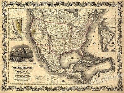
$5.95 Shipping Condition: New Location: Las Vegas, United States United States and British Provinces- 1849 Size: 24" x 32" 61 cm x 81 cm) x Also Available in 18" x 24" from our eBay Store This is ... morea great Classic Map originally published circa 1849. This Map shows the United States California's gold region and popular western trails as they were in 1849. This poster. Which evokes the vivid images of a simpler time, is a custom reproduction printed on 68lb Heavyweight Enhanced Matte Art Paper. This Historic Art Print is suitable for framing. Mounting or direct display on any wall! 000 Artscape Galleries/ Posters Past More Prints and Posters Available from our eBay Store! Shipping price includes delivery confirmation. We combine shipping for multiple purchases- add $1.00 for each additional poster. All posters are professionally packaged to ensure that they arrive safely and undamaged: Your poster is first rolled and inserted into a plastic sleeve before being placed into a Heavy-Duty mailing tube for delivery. We stand behind the quality of every poster. If you are not satisfied with your purchase. Please contact us within 30 days to arrange for either an exchange or a full refund. gsrx_vers_468(GS 6.4(468)
Buy It Now
$6.00 Shipping Location: Blue Bell, United States CONDITION: MAP IS IN GOOD. OVER 100 YEARS OLD! Over 100,000,000 served. FREE scheduling, supersized images. MULTIPLE WINS.
Buy It Now
$6.95 Shipping Location: Dover, United States Charming small mid 19th century map with original outline hand color.
Buy It Now
$7.00 Shipping Location: Jacksonville, United States 1849 Samuel Augustus Mitchell antique map of Kentucky with Insets of Falls of Ohio & Lexington with surrounding environs. A beautiful and colorful map ... morefrom the Mitchell General Atlas, published in 1849.
Buy It Now
$6.95 Shipping Location: Dover, United States Mid 19th century engraved map with original hand color. Dictionary of Mapmakers, vol.
Buy It Now
$6.95 Shipping Location: Dover, United States Issued 1858, Hildburghausen by the Bibliographische Institut. Map by Renner. Mid 19th century engraved map with original hand color. Eight insets around ... morethe map. Original center fold as issued.
Buy It Now
$6.95 Shipping Location: Dover, United States Russland: Gouv. Issued 1849, Hildburghausen, Germany by the Bibliographic Institute. Mid 19th century antique engraved map with original outline hand ... morecolor.
Buy It Now
$6.95 Shipping Location: Dover, United States Charming small mid 19th century map with original outline hand color.
Buy It Now
$6.95 Shipping Location: Dover, United States Charming small mid 19th century map with original outline hand color. Despite the relatively small size nicely engraved with a remarkable level of tiny ... moredetail. Dictionary of Mapmakers, vol.
Buy It Now
$6.95 Shipping Location: Dover, United States Charming small mid 19th century map with original outline hand color. Despite the relatively small size nicely engraved with a remarkable level of tiny ... moredetail.
Buy It Now
$6.95 Shipping Location: Dover, United States Kingdom of Bohemia Prague Karlsbad Teplitzc. Charming small mid 19th century map with original outline hand color. Despite the relatively small size nicely ... moreengraved with a remarkable level of tiny detail.
4d 14h 6m 2s 0 bids
$12.99 Now
$4.47 Shipping Location: Sebastian, United States Rome in 1802. R. H. Pease. Albany: Weed, Parsons & Co., 1849. *** A lithographed map with later hand coloring which appeared in The Documentary History ... moreof the State of New-York. The map depicts this New York town in the early years of the United States. It is located in an historical region known as Leatherstocking Country. Kind of weird if one is not familiar with the writings of James Fenimore Cooper. The early Rome Canal was completed in 1797, eliminating a major travel barrier at Rome known as the “Oneida Carry.” *** Clean image with good colors, some light foxing in left and right margins. Verso is blank. *** The sheet is 5.5 inches high by approx. 9 inches. The image is 4.5 inches high by 7 inches.
Buy It Now
$4.99 Shipping Location: Fairview, United States It is from Houze's. Atlas Universel Historique et Geographique, published in Paris in 1849. A copy of the Atlas title page is included for authenticity. ... moreIt is an antique historical map. Condition: It is in Very Good condition for its age printed on heavy paper, blank on the reverse with original hand color outlining as issued.
Buy It Now
Free Shipping Location: Monroe, United States ORIGINAL 1849 ANTIQUE SURVEY MAP OF INDIANA. ALSO SHOWN IS THE DONATION TRACT (VINCENNES TRACT) AT LEFT SIDE AND CLARK'S GRANT AT LOWER RIGHT. THE DONATION ... moreTRACT WAS THE ORIGINAL AREA ALLOCATED FOR THE ORIGINAL FRENCH SETTLERS.
Buy It Now
$6.95 Shipping Location: Dover, United States Issued c. 1849, Glogau, Germany by Flemming.
Buy It Now
$6.95 Shipping Location: Dover, United States Issued 1849, Hildburghausen, Germany by the Bibliographic Institute. Map by Radefeld. Mid 19th century antique engraved map with original outline hand ... morecolor.
Buy It Now
$4.99 Shipping Location: Fairview, United States It is from Houze's. Atlas Universel Historique et Geographique, published in Paris in 1849. A copy of the Atlas title page is included for authenticity. ... moreIt is an antique historical map. Condition: It is in Good condition for its age printed on heavy paper, blank on the reverse with original hand color outlining as issued.
Buy It Now
$5.00 Shipping Location: Galena, United States A lovely, bold copy of this exceptional pictorial lithographed map, printed on unusually thin paper -- making this a rare survivor indeed. Printed label ... moreon front case board lists title as "Johnson's New Map of Niagara Falls" and includes a small steel-engraved vignette, while the front pastedown is a full-length portrait of an Indian.
Buy It Now
$4.99 Shipping Location: Fairview, United States Stieler's Hand Atlas., published in Gotha by Justus Perthes, a copy of the title page is included. The map has dates of 1822, revised 1855 & 1846 in the ... moretitle area.Stieler's Hand Atlas appears in the top right margin.
Buy It Now
$4.99 Shipping Location: Fairview, United States It is drawn and engraved by J. Archer, as stated in the bottom margin and was published in London by H.G. Collins, 22 Pternoster Row. A facsimile copy ... moreof the title page is included for authenticity.
Buy It Now
Free Shipping Location: San Antonio, United States The open page is approx. 12" x 15".
Buy It Now
$4.99 Shipping Location: Fairview, United States Stieler's Hand Atlas., published in Gotha by Justus Perthes, a copy of the title page is included. There are dates of 1838, revised 1845 printed on map.Stieler's ... moreHand Atlas appears in the top right margin.
Buy It Now
$6.00 Shipping Location: Jacksonville, United States A beautiful and colorful map from the Mitchell General Atlas, published in 1849. This map of New York has great presence and nice original hand coloring! ... more1849 Samuel Augustus Mitchell antique map of New York.
Buy It Now
$9.10 Shipping Location: Atlanta, United States (ORIGINAL 1849 Antique Engraved Map - BOSTON, MASSACHUSETTS - G.W. Boynton - Previously Folded. Pre-Owned).
Buy It Now
$4.99 Shipping Location: Fairview, United States Stieler's Hand Atlas., published in Gotha by Justus Perthes, a copy of the title page is included. The map is dated 1849 in the bottom right.Stieler's ... moreHand Atlas appears in the top right margin. This is from an enlarged edition with no centerfold, making it great for framing.
Buy It Now
$11.60 Shipping Location: San Diego, United States
Buy It Now
$22.64 Shipping Location: LONDON, United Kingdom Antique Old steel plate engraved map with full coloring by Victor Levasseurs taken from Atlas National Illustré published in Paris by Amable Combette, ... more1849.Blank Verso.Sheet size: 35 x 52 cm.Excellent condition.Shipment to be arranged via registered mail.
Buy It Now
$7.00 Shipping Location: Jacksonville, United States A beautiful and colorful map from the Mitchell General Atlas, published in 1849. Overall, very good condition.
Buy It Now
Free Shipping Location: Easton, United States "Sketch J Showing the progress of the Survey of the Western Coast 1849-56". Condition of item: Map has light toning along the edges of the paper and at ... morefold line.
Buy It Now
$4.13 Shipping Location: Northport, United States Albany 1849.
Buy It Now
Free Shipping Location: Ypsilanti, United States Antique map of Africa from 1849.
Buy It Now
$6.95 Shipping Location: Dover, United States Charming small mid 19th century map with original outline hand color.
Buy It Now
Free Shipping Location: Schertz, United States This piece was removed from an 1849 MITCHELL'S SCHOOL ATLAS and is in good condition. The map is not " new " or in " new " condition, it was printed in ... more1849. The map is dated. Study the photos carefully, this is the actual map you will receive.
Buy It Now
$4.13 Shipping Location: Northport, United States Antique original 1849 map titled of Nuou Anglia and Nuou Belgia (New England and New Belgium). Map is a 1849 printing of the Italian 1634 Lucini map and ... moreis by Richard Pease of Albany.
Buy It Now
$6.95 Shipping Location: Dover, United States Das Herzogthum Schleswig. Charming small mid 19th century map with original outline hand color.
Buy It Now
$6.95 Shipping Location: Dover, United States Despite the relatively small size nicely engraved with a remarkable level of tiny detail. Charming small mid 19th century map with original outline hand ... morecolor. Dictionary of Mapmakers, vol.
|
|
|
In
|
New Jersey Philadelphia Long Island 1849 Map Railroad Routes Hand Colored
Click Here. Double your traffic. Get Vendio Gallery- Now FREE! New Jersey Philadelphia Long Island 1849 Map Railroad Routes Hand Colored NEW YORK- PHILADELPHIA Original 1849"Map of the traveling routes between N York& Philadelphia with other Railroads And Places. hand colored. This 163 year old map features Railroad routes, Roads, Rivers, Cities, and Towns. Very good condition, overall size 7 1/2" x 6" Purchase with confidence. We have been in the antique print, map, and document business since 1976 and guarantee our items as advertised. See additional photos below! To See More Photos/Scenes Pay via PayPal. US Funds only. We ship 7 business days(excludes Saturday and Sunday) from receipt of payment. Shipping if buying multiple items within 7 day period. We will ship in one package for one item's shipping fee( as long ... moreas size permits) International shipping please contact us for a quote prior to bidding. Thank you for your business. Powered by We ship in 5 business days form receipt of payment. If you need it faster please advise. We can usually meet most dead lines.
|
|
|
New York Fort Schuyler 1849 antique engraved map L. Flury Indian Interest
I believe this is from a book. It is folded and I will send as such. The folds have not worn the paper and there are no holes. Please note the edge where it was extracted from a book. I have no date for this map. It has a companion piece that is a sketch that is a separate auction. Title: A Sketch of the Siege of Fort Schuyler Presented to Col. Gansevoort by L. Flury I guess L. Flury is the surveyor/mapmaker. Little to no foxing on paper. Paper is thin but sturdy. Great Indian/Native American piece. If you have questions. Please email. Shipping is free. f04.RcmdId ViewItemDescV4,RlogId p4%60bo7%60jtb9%3Fuk.rp*6%3D%3F%3Ef04-13f48c786a0-0xf2-
|
|
|
1849 Mitchell: A New Map of Pennsylvania
Fine. Original, copper-engraved map of Pennsylvania, by Samuel Augustus Mitchell: A New Map Of Pennsylvania with its Canals, Rail-Roads&c. Published By S. Augustus Mitchell, N.E. corner of Market& 7th Street Philada. From A New Universal Atlas. Philadelphia, Published By S. Augustus Mitchell, 1849. Original hand color. Overall dimensions 13 1/2" x 17 1/4" overall. Minor browning to edges, minor edge wear, engraved surface fine. The New Universal Atlas, was first published by Henry Tanner starting in 1836. Mitchell published it under his own name starting in 1846, and he continued publishing it until 1849. In 1850, the copyright to Mitchell’s atlas was first acquired by Thomas, Cowperthwait& Co. and then in 1856 by Charles DeSilver, both Philadelphia publishers. Thomas, Cowperthwait added five maps for their 1853 edition. ... moreDeSilver still owned the copyright in 1859, when another edition came out published by Cushings& Bailey, Baltimore, which added 23 more maps. In 1860, when S. Augustus Mitchell, Jr. succeeded his father, the Mitchells published the atlas again, and the name of the atlas was changed to the New General Atlas. High bidder pays 8.00 shipping and handling.
|
|
|
Philadelphia 1849 Map, M. H. Traubel, surveyer; McElroy's Map, Duvall, Friend
This auction is for an 1849 map of Philadelphia by M. H. Traubel. Surveyor/lithographer and published by McElroy, in their 1853 directory. It was lithographed at N. Friend’s and P. S. Duval’s in Philadelphia, both of whom are named at the bottom of the map. It shows built-up areas and named localities, streets, parks, and selected buildings from the Delaware River to the Scyulkill River and from the Richmond and Kensington sections in the North to Kean St in South Philly. In the square at the bottom left hand corner is printed"Entered according to act of Congress in the year 1849 by A. McElroy. In the Clerk's Office of the District Court of the eastern district of Penna. It is in a black painted wood frame with glass, and is 15” x 17” There is brown paper on the paper of the frame and the name of the frame shop in Orange, Virginia. ... moreThe map appears to be in very good condition with no folds or tears noted. Check out the pictures and ask any questions.
|
|
|
Huge 1849 Antique Map of the "Province of New York, Connecticut, Long Island"
Richard Pease(after Claude Sauthier) A Chorographical Map of the Province of New York in North America. Divided into Counties, Manors, Patents, and Townships Date: 1849 Size: 38 x 29 inches This is an original 1849 stone engraving by Richard H. Pease. And it is an absolute tour de force of cartography, showing both the topography and the chronology of New York City and Southern New England through 1700s to the end of the Revolutionary War, with spectacular detail identifying individual landowners as well as cities, roads, towns, lakes, streams, and mountains as of 1779. This map was created in 1849 on the model of the famous 1779 map by Claude Joseph Sauthier(the Sauthier version last sold at auction for well over $100.000, and is now thought to be unattainable) Beautifully colored. I n very good to excellent condition. On strong paper, with ... moreonly mild toning and foxing, F olded as issued(note that photographs are taken of map loosely laid on carpet. No effort was made to flatten folds for the pictures. And I haven’t got a scanner anywhere near large enough for this map) with little or no exaggerated toning along fold lines and generally strong paper integrity along folds. Archival repair on verso.
|
|
|
Very Rare Wall-Sized 1849 Map of New York at the end of Revolutionary War
Richard Pease A Chorographical Map of the Province of New York in North America. Divided into Counties, Manors, Patents, and Townships Date: 1849 Size: 38 x 29 inches This is an original 1849 stone engraving by Richard H. Pease. And it is an absolute tour de force of cartography, showing both the topography and the chronology of New York City and Southern New England through 1700s to the end of the Revolutionary War, with spectacular detail identifying individual landowners as well as cities, roads, towns, lakes, streams, and mountains as of 1779. This map was created in 1849 on the model of the famous 1779 map by Claude Joseph Sauthier(the Sauthier version last sold at auction for well over $100.000, and is now thought to be unattainable) Beautifully colored. I n very good to excellent condition. On strong paper, with only mild toning and ... morefoxing, F olded as issued(note that photographs are taken of map loosely laid on carpet. No effort was made to flatten folds for the pictures. And I haven’t got a scanner anywhere near large enough for this map) with little or no exaggerated toning along fold lines and generally strong paper integrity along folds. Archival repair on verso.
|
|
|
Philadelphia Street Railroad 1849 Map Hand Colored Banks Theatres Colleges
Philadelphia Street Railroad 1849 Map Hand Colored Banks Theatres Colleges PHILADELPHIA Original 1849 map"Philadelphia. hand colored. This 162 year old map features, streets, railroads,and the waterfront. Reference chart at upper right list 21 buildings and institutions that can be found on the map. Very good condition, overall size 8" x 7 3/4" Map is dated in lower margin. Purchase with confidence. We have been in the antique print, map, and document business since 1976 and guarantee our items as advertised. See additional photos below! The black circles that show in some of the listings are magnets that we use to hold image. To See More Photos/Scenes Powered by Click Here. Double your traffic. Get Vendio Gallery- Now FREE! 2p5ddv.RcmdId ViewItemDescV4,RlogId p4%60bo7%60jtb9%3Fuk%601d72f%2B26rk%3E2p5ddv-1450556424d-0x12b-
|
|
|
Hudson River New York Long Island New Jersey 1849 Map Hand Color Railroads
Hudson River New York Long Island New Jersey 1849 Map Hand Color Railroads HUDSON RIVER Original 1849"Map of the Hudson River and Vicinity showing the Railroads. hand colored. This 163 year old map features Railroad lines, Cities, Towns, Rivers, Roads, and Canals. Very good condition, overall size 7 1/2" x 6" Map is dated in lower margin. Purchase with confidence. We have been in the antique print, map, and document business since 1976 and guarantee our items as advertised. See additional photos below! The black circles that show in some of the listings are magnets that we use to hold image. To See More Photos/Scenes Powered by Click Here. Double your traffic. Get Vendio Gallery- Now FREE!
|
|
|
New York City Brooklyn 1849 Map Hand Colored Railroad Lines Banks Colleges
New York City Brooklyn 1849 Map Hand Colored Railroad Lines Banks Colleges NEW YORK Original 1849 map"City of New York and Brooklyn etc. hand colored. This 162 year old map features Streets by name, Railroad lines, Navy yard, and Governors Island. Lower left is a list of 25 major buildings and Historical sites. Very good condition, overall size 8 3/4" x 7 1/2" Purchase with confidence. We have been in the antique print, map, and document business since 1976 and guarantee our items as advertised. See additional photos below! The black circles that show in some of the listings are magnets that we use to hold image. To See More Photos/Scenes Powered by Click Here. Double your traffic. Get Vendio Gallery- Now FREE!
|
|
|
Long Island New York Rail Road Line 1849 Map Hand Color Connecticut Shore
Long Island New York Rail Road Line 1849 Map Hand Color Connecticut Shore LONG ISLAND Original 1849"Map of Long Island Id Railroad. hand colored. This 162 year old map features Railroad lines, Cities, Towns, Roads, Beaches, and Islands. Map is dated in lower margin. Very good condition, overall size 7 1/2" x 5 3/4" Purchase with confidence. We have been in the antique print, map, and document business since 1976 and guarantee our items as advertised. See additional photos below! The black circles that show in some of the listings are magnets that we use to hold image. To See More Photos/Scenes Powered by Click Here. Double your traffic. Get Vendio Gallery- Now FREE!
|
|
|
Albany Buffalo Rochester Niagara Falls New York 1849 Map Railroads Lakes
Albany Buffalo Rochester Niagara Falls New York 1849 Map Railroads Lakes NEW YORK RAILROADS Original 1849 map"Continuation of the Albany& Buffalo routes to Rochester" Termination of the routes from Albany to Buffalo and Niagara Falls with distances. hand colored. This 163 year old map features Railroad lines in upstate New York, also shown are Cities, Towns, Roads, Rivers, and the Finger Lakes. Very good condition, overall size 7 1/2" x 5 1/2" Map is dated in lower margin. Purchase with confidence. We have been in the antique print, map, and document business since 1976 and guarantee our items as advertised. See additional photos below! The black circles that show in some of the listings are magnets that we use to hold image. To See More Photos/Scenes Powered by Click Here. Double your traffic. Get Vendio Gallery- ... moreNow FREE! 1?RcmdId ViewItemDescV4,RlogId p4%60bo7%60jtb9%3Feog4d72f%2B%3E%3B1%3F-14505564273-0x11c-
|
|
|
Baltimore Maryland 1849 Map Hand Colored Railroad Lines College City Hall
Baltimore Maryland 1849 Map Hand Colored Railroad Lines College City Hall BALTIMORE Original 1849 map"Baltimore. hand colored. This 162 year old map features Streets, and Patapslo River. Reference at top left list 25 buildings and Historic places, also shown are railroad lines. Very good condition, overall size 9" x 8" Map is dated in lower margin. Hand colored maps of Baltimore are scarce. Purchase with confidence. We have been in the antique print, map, and document business since 1976 and guarantee our items as advertised. See additional photos below! The black circles that show in some of the listings are magnets that we use to hold image. To See More Photos/Scenes Powered by Click Here. Double your traffic. Get Vendio Gallery- Now FREE! RcmdId ViewItemDescV4,RlogId p4%60bo7%60jtb9%3Fvo%7B%3Dd70f%2Bf54%3E-14505564383-0x10f-
|
|
|
1849, Antique Guide to Hudson River, Map, and Street Directory of NYC
Wilson's Illustrated Guide to the Hudson River. With a Map and Street Directory of New York City. H. wilson, 523 Pearl Street, New York. This is the original 1849 version of this guide. The guide includes detailed descriptions of key locations in the city. A street guide, and a long narrative about the Hudson River and the towns along it's course. There is a map of the river in sections interspersed in the text. The front cover is no longer attached. It is torn along its edges but is still clearly readable. The book itself with the back cover still attached. Is in very good condition. The pages are mostly clean, white, and without tears or stains. The spine is still tight and relatively strong. This guide also includes a fold-out map of New York City 7x9 inches. It is in very fragile condition and will need restoration. See photos) ... morePlease do not hesitate to ask questions if you need further information. i will do my best to answer. Posted with
|
|
|
Forts on Lake Ontario & Oswego River New York 1756 Hand Colored Map pub 1849
Forts on Lake Ontario& Oswego River New York 1756 Hand Colored Map pub 1849 FORTS LAKE ONTARIO& OSWEGO Original 1849 map"English Plan of the Forts Ontario& Oswego with part of the River Onondago and Lake Ontario 1786" Hand colored. This 165 year old map features forts, islands, and important locations as described in reference key at right. Folds as issued, good condition. Overall size 9" X 7" Purchase with confidence. We have been in the antique print, map, and document business since 1976 and guarantee our items as advertised. See additional photos below! The black circles that show in some of the listings are magnets that we use to hold image. To See More Maps The black circles that show in some of the listings are magnets that we use to hold image. Powered by
|
|
|
Fort Niagara New York Lake Ontario 1750 Map pub 1849 Hand Colored
Fort Niagara New York Lake Ontario 1750 Map pub 1849 Hand Colored FORT NIAGARA Original 1849 map" Plan of Fort Niagara with its Environ" Hand colored. This 165 year old map features Fort Niagara c. 1750 on Lake Ontario and the Niagara River, New York. Information key at lower right identifies important locations. Good condition. Overall size 8 1/2" X 5 1/2" Powered by:RcmdId ViewItemDescV4,RlogId p4%60bo7%60jtb9%3Fuk.rp73%28e013%3F%3E%3A-1454c7e2054-0x111-
|
|
|
1849 Pre-Civil War Hand-Colored Map MIDDLE STATES
Auction Wizard 2000 Listing Template- AW2KLOT#5169 tincuptom Auctions 1849 Pre-Civil War Hand-Colored Map MIDDLE STATES 1849.Pre-Civil War map of Middle States Original.Not a reproduction. Full Page Map. no printing on backside Custom matted. Cresent Mat. Frame ready Fits any 8 x 10 Frame Great Condition-some foxing see photo Engraved by G. W. Boynton Wash color added later Mat measures 8 x 10 inches with a 6 1/4 x 4 1/2 inch beveled cut-out map window The USA Shipping is First Class mail. View my other listings for more antiques. Shipping and handling in the USA is $0.00. Payments are due in 7 day. You may pay by Paypal only. Please E-mail for International Shipping rates.
|
|
|
1849 2nd EDITION OF RARE 1790 MAP OF UPSTATE NEW YORK GENESEE WALNUTTS BLOWOUT
WALNUTT'S BLOWOUT Rare 1849 edition of the 1790 Land Sales Map of the Finger Lakes Region of New York State/ Genesee. Titles"A Map of the Genesee Lands in the County of Ontario and State of New York According to an Accurate Survey Which Was Made of the Same. 1790" and one of the first, Western Land Promotional Maps published in the United States. We believe that this is the second edition published in 1849 and not the 1790 edition. Printed maps were used in at least a few publicity efforts to attract investors or settlers to newly opened lands in central and western New York. The earliest production of this kind appears to be"A Map of the Genesee Lands in the County of Ontario and State of New York According to an Accurate Survey Which Was Made of the Same. 1790. This map was originally included in a booklet, which was ... moreprobably published in London for Robert Morris by his agent William Temple Franklin. Both booklet and map were intended to induce British investors to buy lands in the Morris Purchase. This map is based on the earliest survey made for Phelps and Gorham. It provides a reasonably detailed overview of the slice of land between the Pennsylvania border and Lake Ontario, bounded roughly on the east by Seneca Lake, and on the west by the Genesee River. It shows the few settlements existing in 1790, along with lakes and streams, as well as township boundaries. The eastern boundary(the“Preemption Line” is drawn somewhat ambiguously, and the town of Geneva appears to be deliberately misplaced to include it within the Morris Purchase. Measure 8 3/4" by 13 1/2" Very Good condition with folds(as issued) and some edge wear. As seen in the scans below! A great addition to any collection! Walnutt's Blowout- We are trying to list a large number of small items this week- Blowout Items have short descriptions and start at $5.00 or less with no reserve. If you have additional questions about any Blowout Item(or any of our items for that matter) please feel free to contact us! Overseass
|
|
|
Saratoga Whitehall Albany Buffalo Syracuse New York 1849 Map Hand Colored
Saratoga Whitehall Albany Buffalo Syracuse New York 1849 Map Hand Colored NEW YORK Original 1849 map" Routes from Albany to Saratoga and with part of the Albany& Buffalo Routes" and County of the Albany& Buffalo routes to Syracuse. hand colored. This 163 year old map features Railroad routes in New York also shown are Cities, Counties, Towns, Rivers, Cannel, and Lakes. Very good condition, overall size 7 1/2" x 5 1/2" Map is dated in lower margin. Purchase with confidence. We have been in the antique print, map, and document business since 1976 and guarantee our items as advertised. See additional photos below! To See More Photos/Scenes The black circles that show in some of the listings are magnets that we use to hold image. Powered by
|
|
|
1849 Sauthier "PROVINCE OF NEW YORK in NORTH AMERICA". William Faden Map
1849 Sauthier"PROVINCE OF NEW YORK in NORTH AMERICA" William Faden Map PLEASE NOTE: If you click on the photos. They will enlarge, and the map's wonderful detail is then very readable. A Chorographical Map of the PROVINCE of NEW YORK in North America. Divided into Counties, Manors, Patents and Townships; Exhibiting likewise all the private Grants of Land made and located in that Province, Compiled from Actual Surveys deposited in the Patent Office at New York. By Order of His Excellency Major General William Tryon. By Claude Joseph Sauthier. Esqr. London. Engraved and Published by William Fadden(sic) Charing Cross, Jan. 1, 1779. Claude Joseph Sauthier. Reduced from the original large London map by David Vaughan. 1849" Engraved on stone by Richd. H. Pease. Albany. N.Y. 1849. 31 1/2' X 40 1/2" Professionally mended ... moretear in the lower margin area. An extremely detailed and attractive sheet. On clean and strong quality stock. Please click on the photos to view close-ups. The shipping cost includes insurance.
|
|
|
1849: Engraved Map New York City Manhattan, Wards. After Lyne, 1728. ANTIQUE MAP
1849 Map: A Plan of the City of New York from an Actual Survey. Made by James Lyne. Nice Scarce map. From Senate Documents. Second Session of the Thirtieth Congress 1848-49. Published by the Government Printing Office, 1849. This map of New York City is after a map& survey first made by James Lyne in 1728. Size: Approx 23 X 18.5 INCHES(ENTIRE PAGE) Condition: VERY GOOD. Several folds. As published& bound into book. Some folds slightly squeezed, a few fox spots. Closed tear at upper left margin, extending a half inch into image area. SEE PHOTO. Please view the photos to make your own assessment. Returns: Any item may be returned for a refund. Please contact us within 14 days of receipt of your item if you feel an error has been made. We do not deal in modern reproductions. All of our prints& maps are original and authentic. Please ... morebrowse other prints& maps at our store. inkfrog terapeak. I000000.
|
|
|
1849 New York City. Manhattan, North River Piers & Proposed Contruction. Map
1849 Map: New York City. Manhattan. North River Piers& Proposed Contruction. Nice Scarce map. From Senate Documents. Second Session of the Thirtieth Congress 1848-49. Published by the Government Printing Office, 1849. Size: Approx 11.25 X 8.75 INCHES(ENTIRE Sheet) Condition: VERY GOOD. Light toning. One fold, as published& bound into book. SEE PHOTOS. Please view the photos to make your own assessment. Returns: Any item may be returned for a refund. Please contact us within 14 days of receipt of your item if you feel an error has been made. We do not deal in modern reproductions. All of our prints& maps are original and authentic. Please browse other prints& maps at our store. inkfrog terapeak. I000000.
|
|
|
1849 New York City Manhattan, East River Pier, Grand St to Bellevue/33rd St. Map
1849 Map: New York City Manhattan. Great East River Pier, Grand St. to Bellevue/33rd St. Map Nice Scarce map. From Senate Documents. Second Session of the Thirtieth Congress 1848-49. Published by the Government Printing Office, 1849. Size: Approx 4 X 19 INCHES(ENTIRE Sheet) Condition: VERY GOOD. Several folds. As published& bound into book. SEE PHOTOS. Please view the photos to make your own assessment. Returns: Any item may be returned for a refund. Please contact us within 14 days of receipt of your item if you feel an error has been made. We do not deal in modern reproductions. All of our prints& maps are original and authentic. Please browse other prints& maps at our store. inkfrog terapeak. I000000.
|
|
|
1849 New York City Manhattan, East River Piers, Montgomery to Whitehall St. Map
1849 Map: New York City. Manhattan. East River Piers, Montgomery St/Corlears Hook Park to Whitehall St. Map"The Piers and Parts of piers marked'C' belong the Corporation" sic) Nice Scarce map. From Senate Documents. Second Session of the Thirtieth Congress 1848-49. Published by the Government Printing Office, 1849. Size: Approx 4.25 X 18 INCHES(ENTIRE Sheet) Condition: Scarce Antique Map. VERY GOOD. Several folds, as published& bound into book. SEE PHOTOS. Please view the photos to make your own assessment. Returns: Any item may be returned for a refund. Please contact us within 14 days of receipt of your item if you feel an error has been made. We do not deal in modern reproductions. All of our prints& maps are original and authentic. Please browse other prints& maps at our store. inkfrog terapeak. I000000.
|
|
|
1849 New York City Manhattan, Hudson/North River Wharves, Battery to 42nd St Map
1849 Map: New York City Manhattan. Hudson/North River Wharves, Battery to 42nd St Map. Plan& Location of the Great Pier for the North River-also-the Soundings of that River. And delineation showing the present state of the Shore, from the Battery to 42nd St. Note: The Figures denote the Soundings below High Water. Surveyed 1836 by Edward Ewen, Civil Engineer. Nice Scarce map. From Senate Documents. Second Session of the Thirtieth Congress 1848-49. Published by the Government Printing Office, 1849. Size: Approx 4.75 X 37.5 INCHES(ENTIRE Sheet) Over 3 feet long! Condition: Scarce Antique Map. VERY GOOD. Several folds, as published& bound into book. A few chips at upper& lower edges. SEE PHOTOS. Please view the photos to make your own assessment. Returns: Any item may be returned for a refund. Please contact us within 14 days of ... morereceipt of your item if you feel an error has been made. We do not deal in modern reproductions. All of our prints& maps are original and authentic. Please browse other prints& maps at our store. inkfrog terapeak. I000000.
|
|
|
1849: New York City Manhattan, Brooklyn, Atlantic Basin, Williamsburg. Map
1849 Map: New York City. Manhattan, Brooklyn, Atlantic Basin, Williamsburg, East River, Wallabout Bay, Gowanus Bay. Nice Scarce map. From Senate Documents. Second Session of the Thirtieth Congress 1848-49. Published by the Government Printing Office, 1849. Size: Approx 24 X 9.5 INCHES(ENTIRE PAGE) Condition: Scarce Antique Map. VERY GOOD. Several folds, as published& bound into book. Some toning at far left(upper) Short tear at lower left side, mended on verso with archival tissue. SEE PHOTOS. Please view the photos to make your own assessment. Returns: Any item may be returned for a refund. Please contact us within 14 days of receipt of your item if you feel an error has been made. We do not deal in modern reproductions. All of our prints& maps are original and authentic. Please browse other prints& maps at our store. inkfrog ... moreterapeak. I000000.
|
|
|
1849 Map of Montgomery County PA from Original Surveys Genealogy Historic Places
1849 Map of Montgomery County PA from Original Surveys 22" x 32" Map Reproduction This map is perfect for the researcher. The map shows hundreds of names and locations of homes. Stores, churches, schools, graveyards, and more!
|
|
|
1849 Map of Mercer County New Jersey Trinton Princeton Genealogy
1849 Map of Mercer County New Jersey 23" x 30" Full Color Map Reproduction A very colorful map of Mercer County. Shows a nice inset of Trenton and Princeton. Map also shows hundreds of historic places. Names, family names, buildings, roads, towns, and more! Perfect for research or to display!
|
|
|
Pennsylvania Washington Adams York County 1849 antique engraved hand color map
A New Map of Pennsylvania with it Canal. Railroads& c. Profile of Pennsylvania Canal. Indiana County, Philadelphia, Delaware River) Issued 1849. Philadelphia, by S. Augustus Mitchell Fine original antique lithographed map. Withoriginal hand color. In near VG or better condition. Light minor age wear, trivial scattered spotting or foxing, light edge wear, slight creases, overall very presentable and attractive, well worthy of hanging for display. Please examine the pictures closely as the picture forms a central part of the description. There is a zoom feature so you can see close up. note: we grade very conservatively and always seek to disclose any noteworthy flaws] The printed area remains visually pleasing. A nice impression of an interesting antique map which will look nice when displayed. Sheet measures c. 13 1/2" H x 16 7/8" ... moreW. Printed area measures c. 11 3/8" H x 14 1/8" W. 82416] Everything we offer is guaranteed to be an authentic original antique item as described. We stand behind everything we sell. Important information for International Buyers* You may be charged customs. Taxes or other import duties by your country! this has nothing at all to do with us. Please do not hold us responsible if your Government wants to collect tax when you buy something outside of your country] Import duties. Taxes, and customs fees are not included in the item price or shipping cost. These charges are normally collected by the shipping service when the package is delivered or when you pick the item up. They are the buyer's responsibility and are not additional shipping charges. Please understand they have nothing to do with us and we have no control over them] Please check with your country's customs office to determine what these additional costs will be prior to bidding or buying. We do not know the various rules of your Customs office. There are a lot of countries in the world. Most with complex detailed variable laws in languages we don't read. Plus these laws are constantly bein
|
|
|
Gorgeous 1849 oversized map of New York and Westchester County by Richard Pease
Richard Pease A Chronographical Map of the Province of New York in North America. Divided into Counties, Manors, Patents, and Townships Date: 1849 Size: 38 x 29 inches This is an original 1849 stone engraving by Richard H. Pease. And it is an absolute tour de force of cartography, showing both the topography and the chronology of New York City and Southern New England from the 1700s to the end of the Revolutionary War, with spectacular detail identifying individual landowners as well as cities, roads, towns, talks, streams, and mountains as of 1779. This map was created in 1849 on the model of the famous 1779 map by Claude Joseph Sauthier(the Sauthier version last sold at auction for well over $100.000, and is now thought to be unattainable) Attractively hand colored. Archival repair on verso. Otherwise in very good to excellent condition, ... moreon strong paper, mild toning and foxing, folded as issued(note that photographs are taken of map loosely laid on carpet. No effort was made to flatten folds for the pictures, and I haven’t got a scanner anywhere near large enough for this map)
|
|
|
English plan of the Forts Ontario and Oswego 1849 reprint of 1756 map
English plan of the Forts Ontario and Oswego with part of the River Onondago and Lake Ontario. 1756(1849 reprint) Please contact me if you have any questions. Good condition and very suitable for framing. Size: 7 x 10.25 inches.
|
|
|
1849 Map of Burlington County New Jersey
1849 Map of Burlington County New Jersey 22" x 43" Full Color Map Reproduction This large colorful map shows many historic places of Burlington County New Jersey. Place names. Family names, building locations, roads, railroads, streams, towns, and more! Great for research and to display!
|
|
|
Original 1849 Map Philadelphia Pittsburgh Wheeling Virginia Springs Railroad
Original 1849 Map Philadelphia Pittsburgh Wheeling Virginia Springs Railroad RAILROAD ROUTES Original 1849 map"Termination of routes from Phil. Baltimore to Pitts. Wheeling and also to the Virginia Springs. hand colored. This 163 year old map features Cities, Towns, Rivers, Roads, Counties, and Railroad Routes in Pennsylvania& Virginia. Very good condition, overall size 7 1/2" x 5 3/4" 100% MONEY BACK GUARANTEE. If you are not pleased with your purchase for any reason. Contact us within 14 days of receipt, and we will refund 100% of your purchase price upon return of the item. We have been a leader in the historical print, and map business since 1976. We strive to build repeat and satisfied clients. To See More Photos/Scenes 16.RcmdId ViewItemDescV4,RlogId p4%60bo7%60jtb9%3Feog4d71f%2B%3E16%3E-14bed985a3f-0x10d-
|
|
|
1849 G.W. Colton Map - MOUNTAINS & RIVERS in The WORLD - RARE EARLY VERSION J.H.
A Combined View of The Principal Mountains& Rivers in the World. Published by J.H. Colton& drawn by: G.W. Colton. New York. 1849 Map/Chart. Principal Rivers, Mountains, 1849, large, hand colored, by Colton Album Size; 29.5 x 22 inch. Extremely thin paper. Please note tear at fold on left that needs to be repaired. This is a Wonderful Example of this Specific Example. This is the earliest version of this map I've seen. As most were printed in mid 1850's. Hand Colored.
|
|
|
1849 Map of Salem & Gloucester County New Jersey from actual surveys Genealogy
1849 Map of Salem& Gloucester County New Jersey from actual surveys 22" x 32" Full Color Map Reproduction This colorful map shows a nice inset of the town of Salem. The map contains hundreds of historical place names. Family names, building locations, roads, railroads, towns, streams, and more! Perfect for research or to display!
|
|
 |