-
Christian Collectibles
-
Christian Sheet Music
-
Vatican Stamps
-
Vatican Coins & Paper Money
-
Antiques
-
Antiquities
-
Architectural & Garden
-
Decorative Arts
-
Ethnographic
-
Furniture
-
Maps, Atlases & Globes
-
United States (Pre-1900)
-
United States (1900-Now)
-
AK, HI
-
AL, FL, GA, MS, NC, SC
-
AR, IA, KS, LA, MO, NE
-
AZ, CA, CO, NM, NV, UT
-
CT, MA, ME, NH, RI, VT
-
DC, DE, MD, NJ, NY, PA
-
ID, OR, WA
-
IL, IN, MI, OH, WI
-
MN, MT, ND, SD, WY
-
OK, TX
-
VA, WV, KY, TN
-
Entire US
-
United States (Date Unknown)
-
Africa
-
Asia
-
Australasia/ Oceania
-
Canada
-
Central America/ Caribbean
-
Europe
-
India
-
Ireland
-
Mexico
-
Middle East
-
North America
-
South America
-
United Kingdom
-
Maps on CD
-
World Maps
-
Globes
-
Mixed Lots
-
Reproductions
-
Price Guides & Publications
-
Other
|
In
Order by: Available to: This site contains affiliate links for which I may be compensated
|
Buy It Now
$14.40 Shipping Location: Fredonia, United States Edition of 1914, reprinted 1942.
Buy It Now
$8.50 Shipping Location: Bentonville, United States Tokyo Northwest Pacific Countries.
Buy It Now
$5.75 Shipping Location: Malden, United States Great OLD Map from the "COLLIER'S WORLD ATLAS & GAZETTEER". World War II Era. Very Educational. See what the City used to look like! A Really Nice Gift! ... moreNOT a Copy! 82 Years Old! The Actual Page!
Buy It Now
$5.55 Shipping Location: Cambridge, United States One edge is raw. Opposite side may or may not have prints or text which may or may not be related to one shown. Your opinion may differ.
Buy It Now
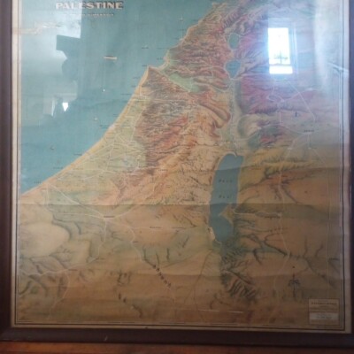
$4.43 Shipping Location: Clinton, United States Turkey Syria Iraq Palestine Lebanon Cyprus 1942 vintage Rand McNally color map Turkey. Syria and Iraq Issued 1942. New York by Rand McNally Fine original ... moreantique offset color map. Printed on quality paper which retains its inherent structural flexibility and soundness. In VG or better condition. Light trivial age wear but the image remains clean, attractive and very presentable[note: we grade very conservatively and always seek to disclose any noteworthy flaws] The printed area remains visually pleasing. A nice impression of an interesting antique map. Any minor defects along the sheet edges and in the margins may be seen in the photos. Sheet measures c. 14 1/8" W x 11" H. Engraved area measures c. 12 3/8" W x 9 1/8" H. 38707] note: All old sheets of printed paper possibly have short edge splits. Each sheet has existed for a very long time and has probably been handled repeatedly in the course of it's existence. It has a history unique to it as an object. Most of the time any edge splits are short. Minor, insignificant and have been closed- either long ago or more recently with small pieces of archival tape. Most often these splits are trivial and easy to overlook visually. Basically, they would not significantly affect the piece adversely. The item is offered as seen. Please look carefully and make your decision knowing this antique image is nice. But it is not in perfect"like new" condition. However, with whatever flaws it possesses, it remains entirely worthy of ownership and inclusion in any related collection. We feel it will prove very pleasing to its new owner. We stand behind everything we sell. Everything we offer is guaranteed to be an authentic original antique item as described. We do not sell modern reproductions. Please visit our eBay Store. We happily accept PayPal! WE OFFER FLAT RATE SHIPPING WORLD WIDE! Please request an invoice before paying for multiple items so that we can ensure that y
$16.00 Shipping Location: Israel
Buy It Now
Free Shipping Location: Los Angeles, United States One large 1942 fold-out map of the Geology of Brazil, titled The map shows pinholes in the corners from previous display.
$16.00 Shipping Location: Israel For Condition Watch Photos.
Buy It Now
$5.55 Shipping Location: Cambridge, United States One edge is raw. Opposite side may or may not have prints or text which may or may not be related to one shown. Your opinion may differ.
Buy It Now
$5.55 Shipping Location: Cambridge, United States Opposite side may or may not have prints or text which may or may not be related to one shown. Your opinion may differ. One edge is raw.
Buy It Now
Free Shipping Location: Easton, United States Map of Omaha Nebraska. N.p.: Western Map Co., 1942. Very good with two corner fold tears with no loss. No copies located in OCLC or elsewhere.
Buy It Now
$4.00 Shipping Location: Harborton, United States ANTIQUE OREGON STATE MAP. There is another map on the reverse side.
Buy It Now
$4.00 Shipping Location: Harborton, United States ANTIQUE LOUISIANA STATE MAP. There is another map on the reverse side.
Buy It Now
$4.95 Shipping Location: Willow Grove, United States This is an ORIGINAL San Francisco map which was taken from a 1942 atlas. There is text on the reverse side of this map page.
Buy It Now
$5.55 Shipping Location: Cambridge, United States One edge is raw. Opposite side may or may not have prints or text which may or may not be related to one shown. Your opinion may differ.
Buy It Now
$4.00 Shipping Location: Harborton, United States It is in very good condition - note light stain on the right border between "L" and the "M," light scuffing, and there is another map on the reverse side.
Buy It Now
$4.99 Shipping Location: Fairview, United States NY" in the bottom margin. It is fromHammond's New Era Atlas of the World, New York 1942, a copy of the title page with the publishing details is included. ... moreThe pics are of the actual map.
Buy It Now
$4.00 Shipping Location: Harborton, United States
Buy It Now
$5.55 Shipping Location: Cambridge, United States One edge is raw. Opposite side may or may not have prints or text which may or may not be related to one shown. Your opinion may differ.
Buy It Now
Free Shipping Location: Elmer, United States
Buy It Now
$4.00 Shipping Location: Harborton, United States The map is in very good condition, note tiny dark spot near Eureka.
Buy It Now
Free Shipping Location: Portland, United States This is a page from a 1942 atlas. A map of Indiana is on one side and a map of Illinois is on the other side. They are ready for framing.
Buy It Now
$4.95 Shipping Location: Willow Grove, United States There is a map image and text on the reverse side of this map page. This is an ORIGINAL Hawaii map taken from a 1942 atlas.
Buy It Now
$4.50 Shipping Location: Portland, United States This is a page from a 1942 atlas. It a map of the airlines in 1942.
Buy It Now
$10.00 Shipping Location: Falls Church, United States Opposite side has black and white photos concerning Mississippi agriculture along with write-up. Colorful map on one side. Very good condition for the ... moreage. Map colors are crisp. A tiny hole in the top fold.
Buy It Now
Free Shipping Location: Willow Grove, United States This is an ORIGINAL MASSACHUSETTS STATE map taken from a 1942 atlas. There is a map image and text on the reverse side of this map page.
Buy It Now
Free Shipping Location: Portland, United States This is a page from a 1942 atlas. It is ready for framing.
Buy It Now
$5.55 Shipping Location: Cambridge, United States One edge is raw. Opposite side may or may not have prints or text which may or may not be related to one shown. Your opinion may differ.
Buy It Now
$3.54 Shipping Location: Mishawaka, United States Peever South Dakota Antique Original USGS Topographic Map 1942 16x20 and would look great in a frame and will shipped rolled. If you have any questions ... moreplease ask. Feel free to visit my store for more antique maps and prints on American History and many other subjects. Most offers accepted.
Buy It Now
$17.52 Shipping Location: Battle Ground, United States
Buy It Now
$7.00 Shipping Location: Rockville, United States Photolithographed at War Office 1941. (British/US Map). It is blank on the reverse side. There are creases in the corners. This old, historic map would ... morebe a great addition to any collection!
Buy It Now
$3.54 Shipping Location: Mishawaka, United States Punxsutawney Pennsylvania Original Antique USGS Topographic Map Printed 1942 Art 16x20 Inches and would look great in a frame. If you have any questions ... moreplease ask. Feel free to visit my store for more antique maps and prints. Most offers accepted. I will combine shipping and be sure to ask about bulk pricing or if you are looking for a map of a specific area as I have thousands in my inventory.

Buy It Now
$5.75 Shipping Location: Malden, United States Vintage 1943 WWII Era Atlas City Map of Los Angeles. California A Wonderful Gift! L.A. Great OLD Map from the"COLLIER'S WORLD ATLAS& GAZETTEER" ... moreCopyright 1943 World War II Era 70 Years Old! The Actual Page! NOT a Copy! Los Angeles. California(Contact Us For More Scans) This Map Measures About 10 3/4 x 14 1/8" Map Shows Points of Interest. Airport, Parks, Golf Courses, Loyola University, Country Clubs, Mountains, Hollywood, Universal City, Watts, Compton, Beaches, Many Airports, Cemetaries, Etc. Very Educational. See what the City used to look like! WWII Black& White Will look great Matted& Framed See All Pics! A Nice Gift! A GREAT House Warming Gift! The Perfect Anytime Gift! Teachers& Politicians LOVE Them! Super For a Local Business or Office! Shipping by 1st Class Mail We Will Combine Shipping on Up To 4 Maps for the same shipping fee Email Us With Any Questions or For an International Shipping Quote Check out my other items! Be sure to add me to your favorites list! Thanks For Looking! International Buyers– Please Note: Import duties. Taxes, and charges are not included in the item price or shipping cost. These charges are the buyer's responsibility. Please check with your country's customs office to determine what these additional costs will be prior to bidding or buying. Certain images and/or photos used in this template are the copyrighted property of JupiterImages and are being used with permission under license.
Buy It Now
$8.00 Shipping Location: Santa Fe, United States MAPA PARA EL TURISTA. Two tears in lower margin.
Buy It Now
$4.88 Shipping Location: Rochester, United States Map is an authentic original in good condition as shown in photos. Map will be folded to fit in envelope.
Buy It Now
$5.95 Shipping Location: Malden, United States Great OLD Map from the "COLLIER'S WORLD ATLAS & GAZETTEER". New York City. City Hall, The Financial District, Jersey City, Hoboken, Tunnels, Ferries, ... moreWelfare Island, The Lower Half of Central Park, Madison Square .
Buy It Now
Free Shipping Location: Lincoln, United States Overall condition is very good.
Buy It Now
$7.09 Shipping Location: Irene, United States
Buy It Now
$4.00 Shipping Location: Harborton, United States There is another map on the reverse side. It is in very good condition - note very light creasing and there is another map on the reverse side.
Buy It Now
$14.56 Shipping Location: Mount Morris, United States This vintage topographical map of Lake Tapps in Washington state is a rare find for any collector or enthusiast. The sheet map, originally surveyed in ... more1942, showcases the city in stunning detail and highlights its unique features. The map is in excellent shape and comes in its original form, making it a true treasure for any antique or map lover. With its intricate details and historical significance, this vintage original map is a must-have for those who appreciate the beauty of topographical maps and the artistry of vintage cartography. It is perfect for display in a home, office, or any space that requires a touch of sophistication and elegance.
Buy It Now
$4.00 Shipping Location: Harborton, United States A Rand McNally atlas published in 1942.
Buy It Now
$4.00 Shipping Location: Harborton, United States This is an antique Colorado map which was carefully removed from a Rand McNally atlas published in 1942.
Buy It Now
$4.99 Shipping Location: Fairview, United States NY" in the bottom margin. It is fromHammond's New Era Atlas of the World, New York 1942, a copy of the title page with the publishing details is included. ... moreThe pics are of the actual map.
Buy It Now
$5.55 Shipping Location: Cambridge, United States One edge is raw. Opposite side may or may not have prints or text which may or may not be related to one shown. Your opinion may differ.
Buy It Now
$4.99 Shipping Location: Fairview, United States NY" in the bottom margin. It is fromHammond's New Era Atlas of the World, New York 1942, a copy of the title page with the publishing details is included. ... moreThe pics are of the actual map.
Buy It Now
Free Shipping Location: Bakersfield, United States YOU RECIEVE WHAT YOU SEE. HARD TO FIND MAP FOR THE SERIOUS COLLECTOR OR FOR DECO IN THE HOUSE, OFFICE, OR MAN CAVE. THIS MAP IS AN ORIGINAL RESTRICTED ... more1942 AERONAUTICAL MAP OF THE LA GRANDE, OREGON AREA.
Buy It Now
$7.00 Shipping Location: Huntington, United States 20 x 27" aprox. As well as handling and general signs of a LOT of age. I have to call this "as is".
Buy It Now
$4.88 Shipping Location: Rochester, United States Map is an authentic original in good condition as shown in photos. Map will be folded to fit in envelope.
Buy It Now
$4.99 Shipping Location: Fairview, United States An Authentic 1942 Antique Map: Not a Modern Copy! Condition: The map is in Very Good condition, blank on reverse. There is light tonal ageing and a slight ... morebend on the upper right corner in margin, otherwise it is very clean on a strong page that is still very flexible, not brittle, see the pics for more on condition.
Buy It Now
Free Shipping Location: Willow Grove, United States This is an ORIGINAL Lower Manhattan map taken from a 1942 atlas. There is text on the reverse side of this map page.
Buy It Now
Free Shipping Location: Portland, United States This is a page from a 1942 atlas. It is ready for framing.
Buy It Now
$4.00 Shipping Location: Harborton, United States This is an antique Colorado map which was carefully removed from a Rand McNally atlas published in 1942.
Buy It Now
$4.95 Shipping Location: Willow Grove, United States This is an ORIGINAL OKLAHOMA STATE map taken from a 1942 atlas. There is a map image and text on the reverse side of this map page.

Buy It Now
Free Shipping Location: Elmer, United States NEW MEXICO Issued New York. 1942 by C.S. Hammond& Co. Fine original antique color lithographed map. Made approximately 70 years ago. Printed in the ... moremid 20th century, on quality paper which retains its inherent structural flexibility and soundness. Nicely detailed. Showing military reservations at this WWII date. Also shows Indian reservations, private land grants, etc. In near VG or better condition[note: we grade very conservatively and always seek to disclose any noteworthy flaws] The printed area remains visually pleasing. A nice impression of an interesting image. sheet measures c. 19 3/4" H x 12 1/2" W. printed area measures c. 16" H x 11 1/2" W. Folio. 9590] Guaranteed Authentic! We do not sell modern reprints. Condition All of our items are original antique pieces and it is important to keep in mind that many of them have been around for 100 years or more. Individual pieces may have seen many owners and been handled many times over the course of their existence and as a result each piece has developed a history of it's own. Short edge splits(often repaired with archival tape) Foxing, discoloration, etc. are all things to expect on items of this type. They rarely distract from the piece and often add to the overall character of the item. Keep in mind when you receive your item that you are not handling a modern copy, you are holding a piece of history, an item that has been around for a very long time and will, with proper care, be around for a long time to come. We try to note any significant flaws in the description, but less noticeable or common characteristics may not be mentioned. As we are a US based company all of our measurements are in Inches. If you need the size in Centimeters please multiply the supplied measurement by 2.53. Payment and Shipping We happily accept PayPal! Payment is appreciated within 5 days of invoicing. Once payment has been received we do our best to make sure all orders are shipped within two business days and often have them shipped within one. We
Buy It Now
$29.82 Shipping Location: Marengo, United States A complicating aspect of this historical USGS printing process is that prints were not directly made from the plates. USGS transferred the image from ... morethe engraved plate to a special lithographic stone in order to make large numbers of prints, an approach that preserved the crispness of the engraving.
Buy It Now
$4.95 Shipping Location: Willow Grove, United States This is an ORIGINAL Wisconsin map taken from a 1942 atlas. There is text and a map on the reverse side of this map page.
Buy It Now
$4.00 Shipping Location: Harborton, United States Removed from a Rand McNally atlas published in 1942.
Buy It Now
$6.90 Shipping Location: Newark, United States Topo Map Tulare California 17 X 22". See dates in photos of bottom edge.
Buy It Now
$10.10 Shipping Location: Lewisville, United States Preowned condition. See photos. Ships fast
Buy It Now
$9.00 Shipping Location: Dover, United States Hydrographic Office U.S NAVY 1942 Mercator Projection Maps WW2 1ST EDITION 4 different maps Maps are in great condition These are original vintage ww2 ... moremaps and not reproductions Also contains 1945 weather map issued by the US Dept of Commerce
|
|
|
In
|
NEW HAMPSHIRE authentic WW2 vintage map VERMONT genuine made in 1942
NEW HAMPSHIRE and VERMONT Authentic 71-Year-Old Vintage Map Created during World War 2 FREE SHIPPING ANYWHERE IN THE USA! Printed in 1942. This is a beautiful, 71-year-old color map of the State of New Hampshire together with Vermont. It measures about 10 1/2 by 14 1/2 inches(about 26 by 37 cm. and is in Fine condition. This map is very detailed showing latitude and longitude, topographical features, counties, cities and villages, railroads, and more. This is a guaranteed genuine vintage map! Ideal for genealogy and other historical researches. Not to mention being highly decorative, this map was printed on a single sheet of stock and bound into an antique book. There are no folds, creases, marks or stains. Highly suitable for framing, it would look gorgeous in your office, den, library or study. It is similar to many of the maps shown in ... moreexpensive mail-order catalogues, only this is an actual antique. NOT a modern copy or reproduction! An excellent investment. This map is certain to appreciate in value over time. Please ask all questions before making your purchase. FREE SHIPPING anywhere in the USA by USPS First Class Mail. Priority and Express services also available. Shipped rolled in a sturdy tube. We ship worldwide! nia42
|
|
|
MASSACHUSETTS authentic WW2 vintage map 12x16in genuine made in 1942
MASSACHUSETTS Authentic 71-Year-Old Vintage Map Large 31 by 41 cm. 12 by 16 in. Created during World War 2 FREE SHIPPING ANYWHERE IN THE USA! Printed in 1942. This is a beautiful, 71-year-old color map of the State of Massachsetts. It measures about 12 by 16 inches(about 31 by 41 cm. and is in Fine condition. This map is VERY detailed showing latitude and longitude, topographical features, counties, cities and villages, railways(in red) and more. A chart lists the Railroad Companies operating within the state and numbers them for easy identification of each line on the map. This is a guaranteed genuine vintage map! Ideal for genealogy purposes. Not to mention being highly decorative, this map was printed on a single sheet of stock and bound into an antique book. There are no folds, creases, marks or stains. A similar map is printed on the ... morereverse. Highly suitable for framing, it would look gorgeous in your office, den, library or study. It is similar to many of the maps shown in expensive mail-order catalogues, only this is an actual antique. NOT a modern copy or reproduction! An excellent investment. This map is certain to appreciate in value over time. Please ask all questions before making your purchase. FREE SHIPPING within the USA by USPS First Class Mail. Priority and Express services also available. I ship worldwide! ebwa42
|
|
|
NEW HAMPSHIRE authentic WW2 vintage map 12x16in genuine made in 1942
NEW HAMPSHIRE Authentic 71-Year-Old Vintage Map Large 31 by 41 cm. 12 by 16 in. Created during World War 2 FREE SHIPPING ANYWHERE IN THE USA! Printed in 1942. This is a beautiful, 71-year-old color map of the State of New Hampshire. It measures about 12 by 16 inches(about 31 by 41 cm. and is in Fine condition. This map is VERY detailed showing latitude and longitude, topographical features, counties, cities and villages, railways(in red) and more. A chart lists the Railroad Companies operating within the state and numbers them for easy identification of each line on the map. This is a guaranteed genuine vintage map! Ideal for genealogy purposes. Not to mention being highly decorative, this map was printed on a single sheet of stock and bound into an antique book. There are no folds, creases, marks or stains. A similar map is printed on the ... morereverse. Highly suitable for framing, it would look gorgeous in your office, den, library or study. It is similar to many of the maps shown in expensive mail-order catalogues, only this is an actual antique. NOT a modern copy or reproduction! An excellent investment. This map is certain to appreciate in value over time. Please ask all questions before making your purchase. FREE SHIPPING within the USA by USPS First Class Mail. Priority and Express services also available. I ship worldwide! ebwa42?265ae.RcmdId ViewItemDescV4,RlogId p4%60bo7%60jtb9%3Fuk.rp73%28%3E%3F265ae-13d7af5e01d-0xf3-
|
|
|
Camels Hump Vermont Quadrangle c.1942 antique lithograph topographical map
Camels Hump Vermont Quadrangle c.1942 antique lithograph topographical map Camels Hump Quadrangle. Vermont Issued c. 1942. United States Geological Survey, Washington D.C. Fine original antique map. Printed in the mid-20th century. On quality paper which retains its inherent structural flexibility and soundness. In near VG or better condition. Light minor age wear, overall very presentable and attractive, some minor edge tears but does not detract from the image[note: we grade very conservatively and always seek to disclose any noteworthy flaws] The printed area remains visually pleasing. A nice impression of an interesting antique map which will look nice when displayed. Sheet measures c. 20" H x 16 3/4" W. Printed area measures c. 17 1/2" H x 12 1/2" W. 18326] Any defects along the sheet edges and in the margins may ... morebe seen in the photos. note: All old sheets of printed paper possibly have short edge splits. Each sheet has existed for a very long time and has probably been handled repeatedly in the course of it's existence. It has a history unique to it as an object. Most of the time any edge splits are short. Minor, insignificant and have been closed- either long ago or more recently with small pieces of archival tape. Most often these splits are trivial and easy to overlook visually. Basically, they would not significantly affect the piece adversely. The item is offered as seen. Please look carefully and make your decision knowing this antique image is nice. But it is not in perfect"like new" condition. However, with whatever flaws it possesses, it remains entirely worthy of ownership and inclusion in any related collection. We feel it will prove very pleasing to its new owner. We stand behind everything we sell. Everything we offer is guaranteed to be an authentic original antique item as described. We do not sell modern reproductions. Please visit our. We happily accept PayPal! WE OFFER FLAT RATE SHI
|
|
|
Rhode Island Providence Kingstown Newport 1942 vintage Rand McNally color map
Rhode Island Providence Kingstown Newport 1942 vintage Rand McNally color map Rhode Island Issued 1942. New York by Rand McNally Fine original antique offset color map. Printed on quality paper which retains its inherent structural flexibility and soundness. In VG or better condition. Light trivial age wear but the image remains clean, attractive and very presentable[note: we grade very conservatively and always seek to disclose any noteworthy flaws] The printed area remains visually pleasing. A nice impression of an interesting antique map. Any minor defects along the sheet edges and in the margins may be seen in the photos. Sheet measures c. 14 1/8" H x 11" W. Engraved area measures c. 12 3/8" H x 9 1/8" W. 38734] note: All old sheets of printed paper possibly have short edge splits. Each sheet has existed for a very ... morelong time and has probably been handled repeatedly in the course of it's existence. It has a history unique to it as an object. Most of the time any edge splits are short. Minor, insignificant and have been closed- either long ago or more recently with small pieces of archival tape. Most often these splits are trivial and easy to overlook visually. Basically, they would not significantly affect the piece adversely. The item is offered as seen. Please look carefully and make your decision knowing this antique image is nice. But it is not in perfect"like new" condition. However, with whatever flaws it possesses, it remains entirely worthy of ownership and inclusion in any related collection. We feel it will prove very pleasing to its new owner. We stand behind everything we sell. Everything we offer is guaranteed to be an authentic original antique item as described. We do not sell modern reproductions. Please visit our eBay Store. We happily accept PayPal! WE OFFER FLAT RATE SHIPPING WORLD WIDE! Please request an invoice before paying for multiple items so that we can ensure that you are not
|
|
|
WW2 Era 1942 City Map Of Baltimore Me. 1940s 40s Coller's Atlas 11 x 14 1/4
Up for bid I have this 1942 map of Baltimore. The sheet is about 11 x 14 1/4 in.Has a small spot on the bottom edge and a bit larger one at the top in the margins with plenty of room to frame out the spot no folds good shape for 70 year old paper Any questions please ask and have a great day! Terms we have a total return policy if you dont like it send it back. I will have no contact through e-mail if you have a question or problem use the item and message board there is a record of all dealings that way. If you any problem or need time to pay contact me I will be more than fair and thanks for looking at gotalotastuff123.
|
|
|
WW2 Era 1942 City Map Of Boston Ma. 1940s 40s Coller's Atlas 11 x 14 1/4
Up for bid I have this 1942 map of B oston. The sheet is about 11 x 14 1/4 in.Has a small spot on the left edge in the margin with plenty of room to frame out the spot no folds good shape for 70 year old paper Any questions please ask and have a great day! Terms we have a total return policy if you dont like it send it back. I will have no contact through e-mail if you have a question or problem use the item and message board there is a record of all dealings that way. If you any problem or need time to pay contact me I will be more than fair and thanks for looking at gotalotastuff123.
|
|
|
ISLAND FALLS Topo Map Maine 1942 Mattawamkeag River Hersey Moro Patten 15-Minute
Topographic Map Island Falls Quadrangle Maine This United States Department of the Interior Geological Survey. 15-minute topo map covers the Island Falls area in northern Maine. Includes all or parts of the towns and townships of: T7 R6W, T7 R5W, T7 R4W, T6 R6W, Moro, Merrill, Mount Chase, Hersey, Dyer Brook, Patten, Crystal, Island Falls. Prominent geological features include: Mattawamkeag River. Pleasant Lake, Rockabema Lake, Mount Chase. Distributed by: War Department Edition of 1942 width = 14 ½ inches. Height = 20 inches scale 1: 62.500 contour interval: 20 feet coverage: 46º 00' to 46º 15' latitude. 68º 15' to 68º 30' longitude Good condition. No tears or holes. Top edge is creased. Light black ink smudge near bottom. The map has never been folded. Previous owner's name stamped in the bottom ... moreleft corner. Please see my other listings for more Maine topo maps from the 1930's and 1940's. Shipping& Handling is FREE by USPS First Class Mail in the US. Please use the Shipping Calculator to determine the S&H charge to all International addresses. I will gladly discount shipping for multiple auction winners if it is possible to pack the items together. And they are paid for with a single invoice/payment. Please feel free to email with any questions. I will respond to all questions privately by email and will not post questions or answers in this listing. THANK YOU FOR LOOKING! RcmdId ViewItemDescV4,RlogId p4%60bo7%60jtb9%3Fuk.rp*60c23f%60%3E-13df34eaed5-0xf8-
|
|
|
PITTSFIELD Topo Map Maine 1942 Palmyra St Albans Newport Sebasticook Corinna ME
Topographic Map Pittsfield Quadrangle Maine This United States Department of the Interior Geological Survey. 15-minute topo map covers the Pittsfield area in central Maine including all or parts of the towns of: Harmony, Ripley, Dexter, Corinna, Newport, Plymouth, Detroit, Pittsfield, Hartland, St. Albans and Palmyra. Prominent geological features include: Moose Pond. Indian Pond, Sebasticook Lake, Sebasticook River, Douglas Pond. Distributed by: State of Maine represented by the Public Utilities Commission printed 1942 width = 16 ½ inches. Height = 20 inches scale 1: 62.500 contour interval: 20 feet coverage: 44º 45' to 45º 00' latitude. 69º 15' to 69º 30' longitude Fair to good condition. The left and bottom edges are wrinkled, with a short tear on the left edge. The map has never been folded. There ... moreis a previous owner's name stamped in the bottom left corner. Please see my other listings for more Maine topo maps from the 1930's and 1940's. Shipping& Handling is FREE by USPS First Class Mail in the US. Please use the Shipping Calculator to determine the S&H charge to all International addresses. I will gladly discount shipping for multiple auction winners if it is possible to pack the items together. And they are paid for with a single invoice/payment. Please feel free to email with any questions. I will respond to all questions privately by email and will not post questions or answers in this listing. THANK YOU FOR LOOKING!
|
|
|
GORHAM Topo Map New Hampshire 1942 Berlin Shelburne Androscoggin River Mahoosuc
GORHAM QUADRANGLE Topographic Map 15-Minute Series This 15-minute topo map of the Gorham Quadrangle in New Hampshire and Maine. Is from the United States Department of the Interior Geological Survey. The back features information about the topographic maps of the United States with a legend of standard symbols. Title: GORHAM. N.H.ME. N 4415- W 7100/15 Edition: 1942 Survey Date: 1936 and 1937 Size: 14.5 x 20 inches Scale: 1:62.500 Contour Interval: 20 feet Towns/Cities: all or part of: Berlin. Success, Randolph, Gorham, Shelburne, Thomas and Meserves Purchase, Martins Location, Greens Grant, Sargents Purchase, Pinkhams Grant, Beans Purchase and Chatham in New Hampshire; Riley, Gilead, Batchelders Grant and Stow in Maine Other Features: Pinkham Notch. Wildcat Mountain, Peabody River, Carter Dome, Pine Mountain, Jericho Mountain, Mount Forist, ... moreMount Hayes, Androscoggin River, Moose River, Mount Success, Mount Carlo, Mount Moriah, Wild River, Royce Mountain, Mount Meader, and the White Mountain National Forest Condition: Fair. The left and right edges are trimmed. No tears or holes. Map title at the bottom of the page has been marked, and the title is handwritten on the back. The map is creased across the middle where it was folded in half. The map will be mailed rolled in a tube. Please see my other listings for many more New England topo maps. Shipping& Handling is FREE by USPS First Class Mail in the US. Please use the Shipping Calculator to determine the S&H charge to all International addresses. I will gladly discount shipping for multiple auction winners if it is possible to pack the items together. And they are paid for with a single invoice/payment. Please feel free to email with any questions. I will respond to all questions privately by email and will not post questions or answers in this listing. THANK YOU FOR LOOKING!
|
|
|
Vtg 1942 Geological Survey Relief Topographic Map 1947 Reprint Oquossoc Maine
Vtg 1942 Geological Survey Relief Topographic Map 1947 Reprint Oquossoc Maine We recently acquired a bunch of maps of New England area maps. They are all in very good condition. Having been owned by a collector. There are no rips, tears, holes or handwriting. Some corners/edges may be dog earred. Please view all photos of each individual map. These are all original 1940's reprints. They were never folded but they were rolled. Back shows symbols etc. Only $1.00 ship for each additional survey map. Each map measures 20.5" x 17" Paypal is prefered form of payment. We allow 3 days for payment unless otherwise agreed upon. After that. We reserve the right to relist the item and file a non payment claim with ebay. Free shipping on items which is listed as"free shipping" is for the US only. We may be able to negotiate a shipping ... morediscount for international buyers. Please contact us. We ship very fast. Usually within 3 business days after payment is received. We"pad like mad" We do not skimp on any packing material including bubble wrap, peanuts, styrofoam, double boxing etc. Every attempt is made to ensure safe delivery of your item. Tracking information can always be located below the item after it is shipped. If an item arrives damaged. Please contact us prior to leaving feedback. International Buyers: Please Note: Import duties. Taxes, and charges are not included in the item price or shipping cost. These charges are the buyer's responsibility. Please check with your country's customs office to determine what these additional costs will be prior to bidding or buying. We will not mark items as"Gift" or reduce the customs values. Please do not even ask. This is merchandise regardless if you are giving it as a gift. Size and weights limits differ from country to country. Please contact us prior to bidding on large items so that we can be sure it can be shipped. Import regulations differ from country to country. Please be sure any item we are selling is not restricted fr
|
|
|
Vtg 1903 Geological Survey Relief Topographic Map 1942 Reprint Beingham Maine ME
Vtg 1903 Geological Survey Relief Topographic Map 1942 Reprint Beingham Maine ME We recently acquired a bunch of maps of New England area maps. They are all in very good condition. Having been owned by a collector. There are no rips, tears, holes or handwriting. Some corners/edges may be dog earred. Please view all photos of each individual map. These are all original 1942 reprints. They were never folded but they were rolled. Back shows symbols etc. Only $1.00 ship for each additional survey map. Each map measures 20.5" x 17" Paypal is prefered form of payment. We allow 3 days for payment unless otherwise agreed upon. After that. We reserve the right to relist the item and file a non payment claim with ebay. Free shipping on items which is listed as"free shipping" is for the US only. We may be able to negotiate a shipping ... morediscount for international buyers. Please contact us. We ship very fast. Usually within 3 business days after payment is received. We"pad like mad" We do not skimp on any packing material including bubble wrap, peanuts, styrofoam, double boxing etc. Every attempt is made to ensure safe delivery of your item. Tracking information can always be located below the item after it is shipped. If an item arrives damaged. Please contact us prior to leaving feedback. International Buyers: Please Note: Import duties. Taxes, and charges are not included in the item price or shipping cost. These charges are the buyer's responsibility. Please check with your country's customs office to determine what these additional costs will be prior to bidding or buying. We will not mark items as"Gift" or reduce the customs values. Please do not even ask. This is merchandise regardless if you are giving it as a gift. Size and weights limits differ from country to country. Please contact us prior to bidding on large items so that we can be sure it can be shipped. Import regulations differ from country to country. Please be sure any item we are selling is not restricted from
|
|
|
Vtg 1932 Geological Survey Relief Topographic Map 1942 Reprint Phillips Maine ME
Vtg 1932 Geological Survey Relief Topographic Map 1942 Reprint Phillips Maine ME We recently acquired a bunch of maps of New England area maps. They are all in very good condition. Having been owned by a collector. There are no rips, tears, holes or handwriting. Some corners/edges may be dog earred. Please view all photos of each individual map. These are all original 1940's reprints. They were never folded but they were rolled. Back shows symbols etc. Only $1.00 ship for each additional survey map. Each map measures 20.5" x 17" Paypal is prefered form of payment. We allow 3 days for payment unless otherwise agreed upon. After that. We reserve the right to relist the item and file a non payment claim with ebay. Free shipping on items which is listed as"free shipping" is for the US only. We may be able to negotiate ... morea shipping discount for international buyers. Please contact us. We ship very fast. Usually within 3 business days after payment is received. We"pad like mad" We do not skimp on any packing material including bubble wrap, peanuts, styrofoam, double boxing etc. Every attempt is made to ensure safe delivery of your item. Tracking information can always be located below the item after it is shipped. If an item arrives damaged. Please contact us prior to leaving feedback. International Buyers: Please Note: Import duties. Taxes, and charges are not included in the item price or shipping cost. These charges are the buyer's responsibility. Please check with your country's customs office to determine what these additional costs will be prior to bidding or buying. We will not mark items as"Gift" or reduce the customs values. Please do not even ask. This is merchandise regardless if you are giving it as a gift. Size and weights limits differ from country to country. Please contact us prior to bidding on large items so that we can be sure it can be shipped. Import regulations differ from country to country. Please be sure any item we are selling is not restricted
|
|
|
LINCOLN Quad Topo Map Maine 1942 Howland Enfield Mattamiscontis Penobscot ME
Topographic Map Lincoln Quadrangle Maine This United States Department of the Interior Geological Survey. 15-minute topo map covers the Lincoln area in northern Maine including all or parts of the towns and townships of: T3 R9N, T2 R9N, Woodville, Seboeis, T2 R8N, Chester, Maxfield, Mattamiscontis, Lincoln, Howland, Enfield, Lowell. Prominent geological features include: Penobscot River, South Branch Lake, Mattamiscontis Lake, Mattamiscontis Mountain, Cold Stream Pond, Piscataquis River, Seboeis Stream. Distributed by: War Department Edition of 1942 width = 14 ½ inches. Height = 20 inches scale 1: 62.500 contour interval: 20 feet coverage: 45º 15' to 45º 30' latitude. 68º 30' to 68º 45' longitude Very good condition. No tears or holes. Slight wrinkling on the edges. The map has never been folded. Previous ... moreowner's name stamped in the bottom left corner. Please see my other listings for more Maine topo maps from the 1930's and 1940's. Shipping& Handling is FREE by USPS First Class Mail in the US. Please use the Shipping Calculator to determine the S&H charge to all International addresses. I will gladly discount shipping for multiple auction winners if it is possible to pack the items together. And they are paid for with a single invoice/payment. Please feel free to email with any questions. I will respond to all questions privately by email and will not post questions or answers in this listing. THANK YOU FOR LOOKING!
|
|
|
1942 Antique Map of Marblehead MA original
The map is a lithograph printed in 1942. The sheet measures 27 X 19 inches and is in fair condition due to several folds& bends. Light surface soiling, four stains and three tabs of linen mounting tape on the top edge of the back side. The image is titled"Map of Marblehead Massachusetts 1933. C.M. Blenkhorn. Draughtsman. H. B. Breae, Town Engineer. Revisions Jul 1936, AUgust 1937[etc. July 1942. It is inscribed in the lower left corner in pencil"Presented Apr. 13. 1945 by Bessie G. Phillips, Lumberville, Pa. There is nothing printed on the reverse side. This is an antique map guaranteed to be over 70 years old. Shipping Costs: Buyer to pay $2.95 postage and handling in US. International at shipping cost calculated by location. The map will be mailed in a mailing tube. I accept Pay Pal as payment. You can still pay me without ... morehaving a PayPal account. You can pay using your credit card without creating a PayPal account. Just enter via the eBay'Pay Now' button and you'll be directed to a page where you can enter your credit card information. If you don't have a PayPal account. You'll be automatically redirected to a secure page in eBay checkout where you can enter your credit card information. Thanks for looking! Please see my! Please visit my
|
|
|
BUXTON Quad Topo Map Maine 15 Minute 1942/1965 Hollis Dayton Lyman Waterboro ME
Buxton Quadrangle Topographic Map 15-Minute Series This 15-minute topo map of the Buxton Quadrangle in Maine is a reprint from the United States Department of the Interior Geological Survey. The back is blank. Title: BUXTON. ME. N4330- W7030/15 AMS 6871 II- SERIES V711 Edition: 1942 Reprint Date: 1965 Survey Date: 1942 Size: 17 x 21 inches Scale: 1:62.500 Contour Interval: 20 feet Towns/Cities: Limington. Standish, Gorham, Limerick, Buxton, Hollis, Waterboro, Dayton, Saco, Biddeford, Lyman, Alfred Other Features: Watchit Pond. Saco River, Bonny Eagle Pond, Little Ossipee River, Little Ossipee Pond, Bunganut Pond, Kennebunk Pond Condition: Fair. Wrinkled around the edges, staple holes in bottom right corner. The map will be mailed rolled in a tube with no folds or creases. Please see my other listings for many more New England topo maps. Shipping& ... moreHandling is FREE by USPS First Class Mail in the US. Please use the Shipping Calculator to determine the S&H charge to all International addresses. I will gladly discount shipping for multiple auction winners if it is possible to pack the items together. And they are paid for with a single invoice/payment. Please feel free to email with any questions. I will respond to all questions privately by email and will not post questions or answers in this listing. THANK YOU FOR LOOKING!
|
|
|
Vintage World War WWII 1942 World Atlas City Map Boston, MA Massachusetts Mass
Vintage WWII 1942 World Atlas City Map Boston. Mass. Vintage WWII 1940 World Atlas City Map Boston. MA With Cambridge& Charlestown MA A Wonderful Christmas Gift! Great OLD Map from the"COLLIER'S WORLD ATLAS& GAZETTEER" Copyright 1942 WWII 71 Years Old! Boston Massachusetts(Contact Us For More Scans) The Page Measures About 10 3/4 x 14 1/8" Map Shows Points of Interest. Fenwat Park, State House, Parks, Museum of Fine Arts, M.I.T. Cambridge, The Charles River, Bridges, Public Gardens, Harvard, Many Hospitals, U.S.S. Constitution, Mass General Hospital, Etc. World War II! Very Educational. See what the City used to look like! Black& White See All Pics Will look great Matted& framed A Nice Gift! A GREAT House Warming Gift! Teachers& Politicians LOVE Them! Super For a Local Business or Office! Shipping by ... more1st Class or Priority Mail We Will Combine Shipping on Up To 4 Maps for the same shipping fee Email Us With Any Questions or For an International Shipping Quote Check out my other items! Be sure to add me to your favorites list! Thanks For Looking! International Buyers– Please Note: Import duties. Taxes, and charges are not included in the item price or shipping cost. These charges are the buyer's responsibility. Please check with your country's customs office to determine what these additional costs will be prior to bidding or buying.
|
|
|
Vintage USGS TOPO MAP Maine Bucksfield Quadrangle 1942 War Department 17" x 22"
This is a vintage USGS topographical map of the Maine Bucksfield Quadrangle.it is a War Department Corps of Engineers U. S. Army Tactical Map. It measures 17" x 22" and was printed in 1942. Places it shows are Dixfield. Sumner, Hartford and Bucksfield. It had been folded in quarters but has been pressed out to be as flat as possible. The reverse side has no printing. It has just some slight chips out of the top edge but nothing too serious and overall it is in very good condition. A nice map to frame. It will be shipped rolled up. Check Out my other listings too as I am going to listing many more maps in the next few weeks.Shipping can be combined. Purchaser prepays for item before shipping. All shipping fees will be paid by the buyer except when free shipping is offered. I ship primarily to the USA. Any international shipping is ... morevia USPS International Priority.no exceptions. Payments are accepted through PayPal and should be received within 7 days except for BuyItNow purchases which require immediate payment. Yes I can combine items to reduce shipping.please wait for a revised invoice if you purchase more than one item Maine residents are subject to 5% sales tax Buyer will be contacted after the auction ends or purchase is completed RETURN POLICY(Please read carefully) All items are used and/or antique and therefore sold in as is as found condition and carry no guarantees. RETURNS ARE NOT ACCEPTED UNLESS the item is not what is described and/or pictured as per Ebay policy. Any return must be shipped back within 14 days from when the buyer receives it and be in the exact same condition as when seller shipped it. Refund will be made for the bid amount only. Return shipping is paid by the buyer. Refunds will not be issued for buyer’s remorse. Thanks for shopping with The Dusty Rose Vintage Marketplace!
|
|
|
Vintage 1942 USGS TOPO MAP Penobscot County Maine, ORONO QUADRANGLE
This is a vintage 1942 USGS topographic map of Penobscot County Maine. Orono Quadrangle. It measures 16 1/2" x 20" It shows Old Town, Bradley, Orono, Eddington, and bits of Brewer, Holden, Clifton and Milford; and the Penobscot River with the islands of Marsh and Orson. It has a a black ink stamp, Wright's State St. Bangor, Me" This has a bit of the history of US topo maps on the back side along with a key to the symbols. There is a bit of age yellowing along one edge but overall is very good condition. A nice map to frame. It will be shipped rolled up. Check Out my other listings too as I am going to listing many more maps in the next few weeks.Shipping can be combined. Purchaser prepays for item before shipping. All shipping fees will be paid by the buyer except when free shipping is offered. I ship primarily to the USA. ... moreAny international shipping is via USPS International Priority.no exceptions. Payments are accepted through PayPal and should be received within 7 days except for BuyItNow purchases which require immediate payment. Yes I can combine items to reduce shipping.please wait for a revised invoice if you purchase more than one item Maine residents are subject to 5% sales tax Buyer will be contacted after the auction ends or purchase is completed RETURN POLICY(Please read carefully) All items are used and/or antique and therefore sold in as is as found condition and carry no guarantees. RETURNS ARE NOT ACCEPTED UNLESS the item is not what is described and/or pictured as per Ebay policy. Any return must be shipped back within 14 days from when the buyer receives it and be in the exact same condition as when seller shipped it. Refund will be made for the bid amount only. Return shipping is paid by the buyer. Refunds will not be issued for buyer’s remorse. Thanks for shopping with The Dusty Rose Vintage Marketplace!
|
|
|
SCRAGGLY LAKE, MAINE area USGS map, 1942
Maine. Scraggly Lake Quadrangle, Department of the Interior, U. S. Geological Survey, edition of 1941, topographic map measures 17 1/2"H x 12 3/4"W plus margins, number written in bottom margin, clean paper. Includes all or parts of these towns- T8 R3. T7 R2m/carrikkm Topsfield, Talmadge, T6 R1, T5 R1, T6 ND, Grand Lake Stream. This item is guaranteed to be as described. SHIPPING: Shipping is FREE for any destination in United States. Foreign buyers are welcome. However expect to pay additional postage according to where shipped. Maine residents pay sales tax. Auction items are added on Thursdays. Please visit our eBay Store for hundreds of fine antiquarian and collectible items! Powered by The free listing tool. List your items fast and easy and manage your active items.
|
|
|
OQUOSSOC, MAINE area USGS map, 1942
Maine. Oquossoc Quadrangle, Department of the Interior, U. S. Geological Survey, edition of 1932, topographic map measures 17 1/2"H x 12 3/4"W plus margins, mild toning to paper, mild soiling to margins. Includes all or parts of these towns- Lincoln. Adamstown, Rangeley, Richardsontown, Magalloway, Upton, TC, TD. This item is guaranteed to be as described. SHIPPING: Shipping is FREE for any destination in United States. Foreign buyers are welcome. However expect to pay additional postage according to where shipped. Maine residents pay sales tax. Auction items are added on Thursdays. Please visit our eBay Store for hundreds of fine antiquarian and collectible items! Powered by The free listing tool. List your items fast and easy and manage your active items.
|
|
|
DEAD RIVER, MAINE area USGS map, 1928 / 1942
Maine. Dead River Quadrangle, Department of the Interior, U. S. Geological Survey, edition of 1928, reprinted 1942, topographic map measures 17 1/2"H x 12 3/4"W plus margins(trimmed) mild toning to clean paper. Includes all or parts of these towns- 3R4. Pierce Pond, Bowtown, Carrying Place Plantation, Carrying Place, Dead River Plantation, Jerusalem, Highland Plantation, Kingfield, Lexington Plantation, Pleasant Ridge. This item is guaranteed to be as described. SHIPPING: Shipping is FREE for any destination in United States. Foreign buyers are welcome. However expect to pay additional postage according to where shipped. Maine residents pay sales tax. Auction items are added on Thursdays. Please visit our eBay Store for hundreds of fine antiquarian and collectible items! Powered by The free listing tool. List your items fast and ... moreeasy and manage your active items.
|
|
|
LOVEWELL MOUNTAIN, NEW HAMPSHIRE area USGS map, 1942 / 1948
New Hampshire. Lovewell Mountain Quadrangle, Department of the Interior, U. S. Geological Survey, edition of 1942 reprinted 1948, topographic map measures 17 1/2"H x 12 3/4"W plus margins, old folds, mild toning to clean paper. Includes all or parts of these towns- Ackworth. Lempster, Washington, Bradford, Hillsboro, Windsor, Antrim, Hancock, Nelson, Stoddard, Sullivan, Gilsum, Marlow. This item is guaranteed to be as described. SHIPPING: Shipping is FREE for any destination in United States. Foreign buyers are welcome. However expect to pay additional postage according to where shipped. Maine residents pay sales tax. Auction items are added on Thursdays. Please visit our eBay Store for hundreds of fine antiquarian and collectible items! Powered by The free listing tool. List your items fast and easy and manage your active items.
|
|
|
VINTAGE WAR DEPT. USGS TOPO MAP of BAR HARBOR MAINE QUADRANGLE 1942
1948 REPRINT OF1942 USGS WAR DEPARTMENT BAR HARBOR MAINE QUADRANGLE SHOWS SOME WEAR CREASING SLIGHT STAIN TEARS AROUND EDGES APPROX 17 X 221/2' SOLD AS IS ANY QUESTIONS PLEASE ASK SELLER IS AWAY NOTHING WILL BE SHIPPED UNTIL JUNE 30TH. CONSIDER PAYING ON THE 29TH
|
|
|
ALTON, NEW HAMPSHIRE area USGS map, 1919 / 1942
New Hampshire. Alton Quadrangle, Department of the Interior, U. S. Geological Survey, edition of 1919, reprinted 1942, topographic map measures 17 1/2"H x 12 3/4"W plus margins, old folds, mild toning to clean paper. Includes all or parts of these towns- Alton. New Durham, Middleton, Milton, Barnstead, Farmington, Rochester, Barrington, Strafford, Northwood. This item is guaranteed to be as described. SHIPPING: Shipping is FREE for any destination in United States. Foreign buyers are welcome. However expect to pay additional postage according to where shipped. Maine residents pay sales tax. Auction items are added on Thursdays. Please visit our eBay Store for hundreds of fine antiquarian and collectible items! Powered by The free listing tool. List your items fast and easy and manage your active items.
|
|
|
1942 USGS Map of Plymouth, Cape Cod Canal, Bourne ... Sagamore Quadrangle
Handsome USGS map of the Sagamore Quadrant. Covering most of Plymouth, parts of Sandwich and Bourne. Edition of 1940, reprinted 1942. This interesting old map would make a great addition to any home or business office in the Plymouth area. Approximately 16 inches by 20 inches. Shipped in tube.
|
|
|
NORTH CONWAY, NEW HAMPSHIRE area USGS map 1942
New Hampshire-Maine. North Conway Quadrangle, Department of the Interior, U. S. Geological Survey, 1942, topographic map measures 17 1/2"H x 12 3/4"W plus margins, clean paper. Includes all or parts of these towns- Jackson. Chatham, Bartlett, Conway, Albany, Bartlett, Beans Purchase. This item is guaranteed to be as described. SHIPPING: Shipping is for any destination in United States. Foreign buyers are welcome. However expect to pay additional postage according to where shipped. Maine residents pay sales tax. Auction items are added on Thursdays. Please visit our eBay Store for hundreds of fine antiquarian and collectible items! Powered by The free listing tool. List your items fast and easy and manage your active items.
|
|
|
Lovewell Mountain Sullivan New Hampshire 1942 vintage color lithograph map
Lovewell Mountain(New Hampshire) Issued 1945. Washington D.C. Surveyed in 1926-27 Uncommon and very detailed original vintage color lithograph topographical map. Printed on nice period paper as issued which retains its inherent structural flexibility and soundness. In fair to average used[or better] condition: numerous old soft fold-lines from the map having once been folded almost pocket size. Displays normal uniform age toning as typical, trivial scattered small spotting, light foxing, noticeable creases and short edge splits as would be expected for a large paper map intended to be handled for usage; overall the sheet& image remains clean and very attractive- please inspect zoomable visual scan closely- note the zoom feature which allows for very close inspection. note: we grade conservatively and always seek to disclose any noteworthy ... moreflaws. Pleasing old printed paper image entirely worthy of any collection and/ or display. A depiction captured in a manner entirely unique to this particular historical era. This renders the sheet of paper utterly historically unique. As you will observe when you see it in person. Any minor defects along the sheet edges and in the margins may be seen in the photos. Sheet measures c. 17" W x 21 1/8" H. Printed area measures c. 13" W x 17 1/2" H. We guarantee this printed sheet of paper to be old. Printed many years ago, not recently. We stand behind the authenticity of everything we sell- forever. 76489] Guaranteed Authentic! We do not sell modern reprints. Condition: We only handle. Sell& ship original vintage and antique items. Old sheets of paper, printed long ago. Items which are really old, like we say. Not modern copies or modern reproductions. It's amazing how many people still ask us if an item is truly old& genuine. We strive to describe our items accurately. We understand you cannot see it in person. We are trying to present it accurately and convey condition correctly with careful digital photography. Accurate flat-bed scans of the
|
|
|
1942 KATAHDIN REGION MAP - 1950 CAMPING PERMIT - MAINE APPALACHIAN TRAIL CLUB
For your consideration is a Maine Appalachian Trail Club. Katahdin Region Map, Third edition, 1942. This map was obtainable from The Appalachian Trail Conference, Inc. Washington, D.C. Also included is a State of Maine, Baxter State Park camping permit for the Chimney Pond Campground and dated Aug. 21st, 1950. Both items are in good condition with general soiling and handling wear. The map has some pencil notations on the reverse. See scans to judge condition. Please contact me with any questions. Over the coming months we will be thinning out our collection focused on the mountains of the Northeast. This collection includes the White Mountains(New Hampshire) Green Mountains(Vermont) Adirondacks(New York) and other miscellaneous mountains in the region. Also items concerning the Appalachian Trail. We will be listing hundreds of White Mountain ... morestereoviews in the next several months depicting towns, hotels, Mount Washington, the Cog railway, etc. If you are looking for a particular view by Kilburn, Soule, Weller, Franklin White, or any of the period photographers feel free to inquire whether we have one to offer. We will also be listing many books including Appalachian Mountain Club and Randolph Mountain Club guides, early histories, maps, photos, etc. Please check our auctions regularly and if you are seeking a particular item for your collection contact us and we will let you know if we will be selling one.
|
|
|
MASSACHUSETTS authentic WW2 vintage map made in 1942 12x16in genuine 72 yrs old
MASSACHUSETTS Authentic 72-Year-Old Vintage Map Large 31 by 41 cm. 12 by 16 in. Created during World War 2 Printed in 1942. This is a beautiful, 72-year-old color map of the State of Massachsetts. It measures about 12 by 16 inches(about 31 by 41 cm. and is in Fine condition. This map is VERY detailed showing latitude and longitude, topographical features, counties, cities and villages, railways(in red) and more. A chart lists the Railroad Companies operating within the state and numbers them for easy identification of each line on the map. This is a guaranteed genuine vintage map! Ideal for genealogy purposes. Not to mention being highly decorative, this map was printed on a single sheet of stock and bound into an antique book. There are no folds, creases, marks or stains. A similar map is printed on the reverse. Highly suitable for framing, ... moreit would look gorgeous in your office, den, library or study. It is similar to many of the maps shown in expensive mail-order catalogues, only this is an actual antique. NOT a modern copy or reproduction! An excellent investment. This map is certain to appreciate in value over time. Please ask all questions before making your purchase. FREE SHIPPING within the USA by USPS First Class Mail. Priority and Express services also available. I ship worldwide! ebwa42
|
|
|
WAITE USGS Topo Map 1942 GRAND FALLS FLOWAGE TOMAH STREAM Bingo MAINE
UNITED STATES DEPARTMENT OF THE INTERIOR GEOLOGICAL SURVEY Map WAITE Quadrangle- Maine- 15 minute series(Topographic) Edition of 1942 Some of the areas shown: Northeasterly portion of Grand Lake Stream; Indian Township; Berry Brook Flowage; George Brook Flowage; westerly portions of T1. R1, 2& 3; Bingo; easterly portion of Talmage and Topsfield; southerly portion of Codyville; Keefe Camp; Simquish Brook; Tomah Stream, Lake and Mountains; etc. All these are located in Washington County and it shows the tiniest portion of the St. Croix River in Canada. Map shows wear and has been folded. Has a tiny rip in the bottom where it was folded and looks like it has some moisture damage in a couple places. Would look good on the wall of a camp. Map size is 17” by 21” It will be folded up and sent in a manilla envelope.
|
|
|
1942 US Geological Survey Topographic Map of GORHAM NH MAINE Quadrangle 16x21
1942 US Geological Survey Topographic Map of GORHAM NH MAINE Quadrangle 16x21
|
|
|
MASSACHUSETTS authentic WW2 vintage map made in 1942 12x16in genuine 73 yrs old
MASSACHUSETTS Authentic 73-Year-Old Vintage Map Large 31 by 41 cm. 12 by 16 in. Created during World War 2 Printed in 1942. This is a beautiful, 73-year-old color map of the State of Massachsetts. It measures about 12 by 16 inches(about 31 by 41 cm. and is in Fine condition. This map is VERY detailed showing latitude and longitude, topographical features, counties, cities and villages, railways(in red) and more. A chart lists the Railroad Companies operating within the state and numbers them for easy identification of each line on the map. This is a guaranteed genuine vintage map! Ideal for genealogy purposes. Not to mention being highly decorative, this map was printed on a single sheet of stock and bound into an antique book. There are no folds, creases, marks or stains. A similar map is printed on the reverse. Highly suitable for framing, ... moreit would look gorgeous in your office, den, library or study. It is similar to many of the maps shown in expensive mail-order catalogues, only this is an actual antique. NOT a modern copy or reproduction! An excellent investment. This map is certain to appreciate in value over time. Please ask all questions before making your purchase. FREE SHIPPING within the USA by USPS First Class Mail. Priority and Express services also available. I ship worldwide! ebwa42
|
|
|
New Hampshire authentic 1942 WW2 vintage map VERMONT genuine 73 years old
NEW HAMPSHIRE and VERMONT Authentic 73-Year-Old Vintage Map Created during World War 2 Printed in 1942. This is a beautiful, 73-year-old color map of the State of New Hampshire together with Vermont. It measures about 10 1/2 by 14 1/2 inches(about 26 by 37 cm. and is in Fine condition. This map is very detailed showing latitude and longitude, topographical features, counties, cities and villages, railroads, and more. This is a guaranteed genuine vintage map! Ideal for genealogy and other historical researches. Not to mention being highly decorative, this map was printed on a single sheet of stock and bound into an antique book. There are no folds, creases, marks or stains. Highly suitable for framing, it would look gorgeous in your office, den, library or study. It is similar to many of the maps shown in expensive mail-order catalogues, only ... morethis is an actual antique. NOT a modern copy or reproduction! An excellent investment. This map is certain to appreciate in value over time. Please ask all questions before making your purchase. FREE SHIPPING anywhere in the USA by USPS First Class Mail. Priority and Express services also available. Shipped rolled in a sturdy tube. I ship worldwide! nia42
|
|
|
NEW HAMPSHIRE authentic 1942 WW2 vintage map 12x16in genuine 73 years old
NEW HAMPSHIRE Authentic 73-Year-Old Vintage Map Large 31 by 41 cm. 12 by 16 in. Created during World War 2 Printed in 1942. This is a beautiful, 73-year-old color map of the State of New Hampshire. It measures about 12 by 16 inches(about 31 by 41 cm. and is in Fine condition. This map is VERY detailed showing latitude and longitude, topographical features, counties, cities and villages, railways(in red) and more. A chart lists the Railroad Companies operating within the state and numbers them for easy identification of each line on the map. This is a guaranteed genuine vintage map! Ideal for genealogy purposes. Not to mention being highly decorative, this map was printed on a single sheet of stock and bound into an antique book. There are no folds, creases, marks or stains. A similar map is printed on the reverse. Highly suitable for framing, ... moreit would look gorgeous in your office, den, library or study. It is similar to many of the maps shown in expensive mail-order catalogues, only this is an actual antique. NOT a modern copy or reproduction! An excellent investment. This map is certain to appreciate in value over time. Please ask all questions before making your purchase. FREE SHIPPING within the USA by USPS First Class Mail. Priority and Express services also available. I ship worldwide! ebwa42
|
|
|
Post Route Map, State of Maine, 1942. 35"wide x 50 1/4"tall
Vintage POST ROUTE MAP of THE STATE of MAINE. Nov. 1. 1942. WOW! This small map is 70+ years old! It measures 35" wide x 50 1/4" tall. It has the seal of"The Post Office Department, United States of America" on it. See photo. It's still white and crisp with one small tear/rip and fold creases but its in Nice, presentable condition and a Nice piece of History. Happy New Year!
|
|
|
Hyannis Harbor Vicinity Nantucket Sound Massachusetts 1942 vintage nautical map
Hyannis Harbor and Vicinity(Massachusetts) Issued 1942. Washington D.C. First printed in 1942 Uncommon and very detailed original vintage color lithographed large format nautical chart. In fair to average used[or better] condition: displays uniform age toning as typical. Scattered small spotting, light dampstaining, and some noticeable wrinkling as would be expected for a large nautical map intended to be handled for usage on a boat; overall the sheet& image remains clean and very attractive- please inspect zoomable visual scan closely- note the zoom feature which allows for very close inspection. note: we grade conservatively and always seek to disclose any noteworthy flaws. Pleasing old printed nautical chart entirely worthy of display. Very large-Wall sized map. Any minor defects along the sheet edges and in the margins may be seen ... morein the photos. Sheet measures c. 39 1/4" W x 34 1/2" H. Printed area measures c. 37" W x 32" H Original fold lines as issued. 84909] Everything we offer is guaranteed to be an authentic original antique item as described. We stand behind everything we sell. Important information for International Buyers* You may be charged customs. Taxes or other import duties by your country! this has nothing at all to do with us. Please do not hold us responsible if your Government wants to collect tax when you buy something outside of your country] Import duties. Taxes, and customs fees are not included in the item price or shipping cost. These charges are normally collected by the shipping service when the package is delivered or when you pick the item up. They are the buyer's responsibility and are not additional shipping charges. Please understand they have nothing to do with us and we have no control over them] Please check with your country's customs office to determine what these additional costs will be prior to bidding or buying. We do not know the various rules of your Customs office. There are a lot of countries in the world. Most with complex detailed va
|
|
|
Old New Hampshire NH Seacoast Map 1942 State Planning & Development Commmisson
Original June 1942 map titled Seacoast Region of New Hampshire published by the Seacoast Regional Association and prepared by the State Planning and Development Commission. Measures 17 by 22 inches tall. Backside is blank. Condition very good: folds as issued- very light age toning. Shipping and handling charge = $4.00 Shipped flat and secure via USPS 1st Class Mail Monday thru Friday Only Sandwiched between 2 pieces of stiff cardboard and placed in envelope SHIPPING DISCOUNT ON SAME DAY PURCHASES(THIS ID ONLY) YOU PAY ONLY THE HIGHEST SHIPPING COST LISTED ON ANY ITEM PURCHASED ALL OTHERS WILL SHIP FREE Be sure to checkout the other great items we are offering We use different names to sort the items we offer so that we can be somewhat organized! Our names are ibeeback. Ibeadult, and shopnh4u Other items can be found by doing an advanced ... moresearch by seller name* And sort results by ending soonest* inkfrog terapeak. InkFrog Analytics.
|
|
|
Buxton Maine Waterboro Dayton Lyman 1942 vintage scientific color lithograph map
Buxton(Maine) Issued 1942. By the U.S. Geological Survey(Latest imprint date on sheet is 1942. But this impression is almost certainly ca. 1953-58) Surveyed in 1942 Fine original vintage color lithographed map. Printed in the 20th century for the U.S. Geological Survey. In VG or better condition. Light minor age wear, trivial scattered spotting or foxing, light wrinkling, soft creases, overall very presentable and attractive, well worthy of hanging for display. Please examine the scan closely as the picture forms a central part of the description. There is a zoom feature so you can see close up. note: we grade very conservatively and always seek to disclose any noteworthy flaws] The printed area remains visually pleasing. A nice impression of an interesting antique map which will look nice when displayed. Sheet measures c. 22" H x 14 ... more1/2" W. Printed area measures c. 17 1/2" H x 12 5/8" W[89205] Everything we offer is guaranteed to be an authentic original antique item as described. We stand behind everything we sell. Important information for International Buyers* You may be charged customs. Taxes or other import duties by your country! this has nothing at all to do with us. Please do not hold us responsible if your Government wants to collect tax when you buy something outside of your country] Import duties. Taxes, and customs fees are not included in the item price or shipping cost. These charges are normally collected by the shipping service when the package is delivered or when you pick the item up. They are the buyer's responsibility and are not additional shipping charges. Please understand they have nothing to do with us and we have no control over them] Please check with your country's customs office to determine what these additional costs will be prior to bidding or buying. We do not know the various rules of your Customs office. There are a lot of countries in the world. Most with complex detailed variable laws in languages we don't read. Plus these laws are constantly b
|
|
 |