|
|
Order by: Available to: This site contains affiliate links for which I may be compensated
|
Buy It Now
$10.04 Shipping Condition: Unspecified Location: LONDON, United Kingdom 'Kronstadt'. Title of the map:'Kronstadt'. Antique map; Scale 1:25,000, 1896. DATE PRINTED: 1896. CONDITION: Good; suitable for framing. The map you will ... morereceive is in good condition but there may be minor variations in the condition from that shown in the image.
Buy It Now
$27.60 Shipping Condition: Unspecified Location: LONDON, United Kingdom Giacomo de Rossi nella sua Stamperia in Roma alla Pace, all Insegna di Parigi co Priu. Del S. Pont. La Grecia Universale Antica [Ancient Greece]. Title ... moreof map:'La Grecia Universale Antica [Ancient Greece]'.
Buy It Now
$11.85 Shipping Location: Dover, United States Issued 1685, Paris/ Frankfurt for A.M. Mallet by Zunner. Charming 17th century copper engraved map with lovely hand color. The image has a near folk-art ... morefeel, a style unique to this historical era.
Buy It Now
$11.85 Shipping Location: Dover, United States (Middle East / Holy Land/ Jerusalem/ Bethlehem/ Nazareth view prints ). Die Graeber der Koenige bey Jerusalem. Zion bey Jerusalem. Jerusalem innere Ansicht ... morebeym jetzt verschutteten Teieche von Bethesda.
Buy It Now
$10.04 Shipping Condition: Unspecified Location: LONDON, United Kingdom Antique wood-engraved map; Scale 1:24,000,000, 1885. DATE PRINTED: 1885. The image below shows an enlarged cross section from the centre of the map to ... moreshow the level of printed detail CONDITION: Good; suitable for framing.
Buy It Now
$6.95 Shipping Location: Dover, United States Issued 1850, Philadelphia by Thomas Cowperthwait. Fine uncommon mid 19th century lithographed map with original hand color. Large detailed inset of Liberia ... moreRepublic with text discussing slaves and geography.
Buy It Now
$10.04 Shipping Condition: Unspecified Location: LONDON, United Kingdom Chicago & Wilwaukee are marked on the map. Antique steel engraved map with original outline hand colouring, 1846. DATE PRINTED: 1846. CONDITION: Good; ... moresuitable for framing. TYPE: Antique steel engraved map with original outline hand colouring.
Buy It Now
$6.95 Shipping Location: Dover, United States Issued c. 1789, London. Engraved by Sparrow. (Old Prints, 18th Century Prints, Holy Roman Empire, Germany, Dresden, City View, Bridge, River Boats, Fortifications, ... moreChurches). Late 18th century engraved prospect city view of Dresden.
Buy It Now
$6.95 Shipping Location: Dover, United States (Old Prints, Mallet Prints, Africa, East Africa, Abyssinia, Red Sea, Somalia, Ethiopia, Nubia, Egypt). Issued 1719, Frankfurt, for A.M. Mallet. Shows ... morethe apocryphal source of the Nile. Charming 18th century copper engraved map with lovely hand color.
Buy It Now
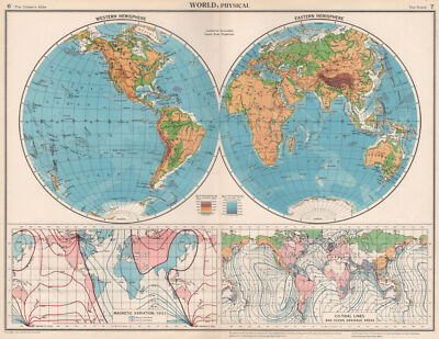
$10.04 Shipping Condition: Unspecified Location: LONDON, United Kingdom World. Physical; Western Hemisphere; Eastern Hemisphere; Magnetic Variation, 1951; Co-Tidal lines and Ocean Drainage Areas Vintage colour map. 1952 Title ... moreof map: World. Physical; Western Hemisphere; Eastern Hemisphere; Magnetic Variation, 1951; Co-Tidal lines and Ocean Drainage Areas' The image below shows an enlarged cross section from the centre of the map to show the level of printed detail. This map is folding hence the centrefold line may show on the image below: DATE PRINTED: 1952 IMAGE SIZE: Approx 34.0 x 44.5cm. 13.5 x 17.5 inches(Large) Please note that this is a folding map. ARTIST/CARTOGRAPHER/ENGRAVER: John Bartholomew PROVENANCE: The Citizen's Atlas of the World" by John Bartholomew; Published by John Bartholomew& Son limited. Edinburgh; 10th Edition. Please note that virtually all antique and vintage maps and prints have been extracted from books, atlases or newspapers. TYPE: Vintage colour map VERSO: There is another map or maps printed on the reverse side of the picture. The paper is thick. And the printing on the reverse does not show through to the front CONDITION: Good; suitable for framing. However. Please note: The image shown may have been taken from a different example of this map than that which is offered for sale. The map you will receive is in good condition but there may be minor variations in the condition from that shown in the image. Please check the scan for any blemishes prior to making your purchase. Virtually all antiquarian maps and prints are subject to some normal aging due to use and time which is not obtrusive unless otherwise stated. I offer a no questions asked return policy- see below. AUTHENTICITY: This is an authentic historic print. Published at the date stated above. I do not offer reproductions. It is not a modern copy. The term'original' when applied to a print means that it was printed at the first or original date of publication; it does not imply that the item is unique. Print' means any image created by applying an inked block to pa
Buy It Now
$10.04 Shipping Condition: Unspecified Location: LONDON, United Kingdom Antique colour wine region map, 1976. TYPE: Antique colour wine region map. DATE PRINTED: 1976. AUTHENTICITY: This is an authentic historic print, published ... moreat the date stated above. It is not a modern copy.
Buy It Now
$27.60 Shipping Condition: Unspecified Location: LONDON, United Kingdom 'Southern hemisphere'. Title of map:'Southern hemisphere'. Antique early 19th century atlas map with original hand colouring, 1817. DATE PRINTED: Published ... morein 1817. The image below shows an enlarged cross section from the centre of the map to show the level of printed detail.
Buy It Now
$10.04 Shipping Condition: Unspecified Location: LONDON, United Kingdom Antique colour missionary map, 1911. DATE PRINTED: 1911. The image below shows an enlarged cross section from the centre of the map to show the level ... moreof printed detail. This map is folding hence the centrefold line may show on the image below.
Buy It Now
$10.04 Shipping Condition: Unspecified Location: LONDON, United Kingdom 'Greenland, Spitzbergen & Franz Josef Land'. Title of map:'Greenland, Spitzbergen & Franz Josef Land'. Seventh edition. Antique colour map, 1904. DATE ... morePRINTED: 1904. TYPE: Antique colour map.
Buy It Now
$6.95 Shipping Location: Dover, United States Issued 1683, Paris, for A.M. Mallet. The image has a near folk-art feel, a style unique to this historical era. Charming 17th century copper engraved ... moremap with lovely hand color.
Buy It Now
$6.95 Shipping Location: Dover, United States Coire, Capitale des Grisons. Issued c.1715-20, by Van der Aa. Fine engraved panoramic birds-eye city view. Delightful level of detail, well printed with ... morenice range of dark and lights.
Buy It Now
$10.04 Shipping Condition: Unspecified Location: LONDON, United Kingdom 'Willesden'. Title of map:'Willesden'. DATE PRINTED: 1935. CONDITION: Good; suitable for framing.
Buy It Now
$10.04 Shipping Condition: Unspecified Location: LONDON, United Kingdom 'Georgetown British Guiana'. Title of map:'Georgetown British Guiana'. DATE PRINTED: 1914. The image below shows an enlarged cross section from the centre ... moreof the map to show the level of printed detail.
Buy It Now
$6.95 Shipping Location: Dover, United States Issued c. 1730, London by Gordon. Early 18th century engraved map with attractive hand color.
Buy It Now
Free Shipping Location: Jamaica, United States Material : Brass & Wood. This is a Reproduction Item, Not Sold As Antique. Good Piece of Collection. Best For Gift.
Buy It Now
$27.60 Shipping Condition: Unspecified Location: LONDON, United Kingdom 'THE ENVIRONS OF DUBLIN'. Title of map:'THE ENVIRONS OF DUBLIN'. Antique steel engraved map with original hand colouring (color), 1844. DATE PRINTED: ... moreThis map was originally published by Baldwin & Cradock in 1837; this date is printed on the map.
Buy It Now
$6.95 Shipping Location: Dover, United States Issued 1793, London by Trusler. Engraved by Neele. Plan of the City of Turin. Late 18th century engraved city plan with attractive hand color. Numbered ... morekey identifies 30 important locations.
Buy It Now
$10.04 Shipping Condition: Unspecified Location: LONDON, United Kingdom DATE PRINTED: 1954. The image below shows an enlarged cross section from the centre of the map to show the level of printed detail.
Buy It Now
$10.04 Shipping Condition: Unspecified Location: LONDON, United Kingdom 'Bagamoyo'. Title of map:'Bagamoyo'. Antique wood-engraved map; Scale 1:150;000, 1885. DATE PRINTED: 1885. The image below shows an enlarged cross section ... morefrom the centre of the map to show the level of printed detail.
Buy It Now
$10.04 Shipping Condition: Unspecified Location: LONDON, United Kingdom Title of the map:'Cercle de Basse-Saxe'. Original 17th century copperplate map, 1683. DATE PRINTED: 1683. The image below shows an enlarged cross section ... morefrom the centre of the map to show the level of printed detail.
Buy It Now
$10.04 Shipping Condition: Unspecified Location: LONDON, United Kingdom 'Mapa de la Provincia de Alicante'. Title of map:'Mapa de la Provincia de Alicante'. DATE PRINTED: 1913. The image below shows an enlarged cross section ... morefrom the centre of the map to show the level of printed detail.
Buy It Now
$10.04 Shipping Condition: Unspecified Location: LONDON, United Kingdom PROVENANCE: "Bacon's Pocket Atlas of London"; Published by G.W. Bacon & Co., Ltd., London (1928 edition). DATE PRINTED: 1928. Title of map:'Sheet 16 of ... moreLondon'. 'Sheet 16 of London'. CONDITION: Good; suitable for framing.
Buy It Now
$10.04 Shipping Condition: Unspecified Location: LONDON, United Kingdom 'Lincolnshire'. Title of map:'Lincolnshire'. Antique map with original outline colour, 1863. DATE PRINTED: 1863. CONDITION: Good; suitable for framing. ... moreThe colouring used varies slightly between different examples of the map; the colouring applied to the map you receive may differ slightly from that shown in the image.
Buy It Now
$33.88 Shipping Condition: Unspecified Location: LONDON, United Kingdom Antique copperplate map, 1746. DATE PRINTED: 1746. CONDITION: Good; suitable for framing. The map you will receive is in good condition but there may ... morebe minor variations in the condition from that shown in the image.
Buy It Now
$10.04 Shipping Condition: Unspecified Location: LONDON, United Kingdom Title of the map:'M�xico'. Antique colour map; Scale 1:20.000, 1909. DATE PRINTED: 1909. The image below shows an enlarged cross section from the centre ... moreof the map to show the level of printed detail.
Buy It Now
$10.04 Shipping Condition: Unspecified Location: LONDON, United Kingdom Title of map:'Louvain'. The image below shows an enlarged cross section from the centre of the map to show the level of printed detail. This map is folding ... morehence the centrefold line may show on the image below.

Buy It Now
$10.04 Shipping Condition: Unspecified Location: LONDON, United Kingdom Cuba. Lesser Antilles, and British Honduras Antique colour map. 1897 Title of map: Cuba. Lesser Antilles, and British Honduras' The image below shows ... morean enlarged cross section from the centre of the map to show the level of printed detail: DATE PRINTED: 1897 IMAGE SIZE: Approx 26.5 x 20.5cm. 10.5 x 8 inches(Medium) ARTIST/CARTOGRAPHER/ENGRAVER: W. A.K. Johnston PROVENANCE: The World Wide Atlas of Modern Geography Political and Physical" by J. Scott Keltie; Published by W. A. K. Johnston. London: 3rd Edition TYPE: Antique colour map VERSO: There are images and/or text printed on the reverse side of the picture. In some cases this may be visible on the picture itself(please check the scan prior to your purchase) or around the margin of the picture CONDITION: Good; suitable for framing. However. Please note: The image shown may have been taken from a different example of this map than that which is offered for sale. The map you will receive is in good condition but there may be minor variations in the condition from that shown in the image which may include some light spotting. Please check the scan for any blemishes prior to making your purchase. Virtually all antiquarian maps and prints are subject to some normal aging due to use and time which is not obtrusive unless otherwise stated. I offer a no questions asked return policy- see below. AUTHENTICITY: This is an authentic historic print. Published at the date stated above. I do not offer reproductions. It is not a modern copy. The term'original' when applied to a print means that it was printed at the first or original date of publication; it does not imply that the item is unique. Print' means any image created by applying an inked block to paper or card under pressure by any method including wood engraving, steel engraving, copperplate, wood cut and lithography. REMARKS: FRANCE: Gravures et Cartes anciennes. DEUTSCHLAND: Alte Lankarten und Stadt ansichten. ITALIA: Stampe e Mappe antiche. ESPAÑA: Mapas antiquos y impresiones antiguas.
Buy It Now
$10.04 Shipping Condition: Unspecified Location: LONDON, United Kingdom The map includes the towns of Greyabbey, Newtownards, Donaghadee, Mount Stewart, Kircubbin and covers part of the county of Down. VERSO: There is another ... moremap printed on the reverse side: #9 From Portaferry to Newtown-Ardes and to Donaghadee which includes the towns of Downpatrick, Killough, Strangford, Portaferry, Raholp and covers part of the county of Down.
Buy It Now
$10.04 Shipping Condition: Unspecified Location: LONDON, United Kingdom Antique steel engraved map with original outline hand colouring (coloring), 1844. DATE PRINTED: This map was originally published by Baldwin & Cradock ... morein 1835; this date is printed on the map. This edition of the map was printed and published by Chapman & Hall in 1844.
Buy It Now
$10.04 Shipping Condition: Unspecified Location: LONDON, United Kingdom Antique steel engraved map with original outline hand colouring (coloring), 1844. This edition of the map was printed and published by Chapman & Hall ... morein 1844. Title of map:'SPAIN AND PORTUGAL, Modern'.
Buy It Now
$10.04 Shipping Condition: Used Location: LONDON, United Kingdom 'The Isle of Wight'. Title of map:'The Isle of Wight'. Antique engraved sketch map, 1885. DATE PRINTED: 1885. TYPE: Antique engraved sketch map. The image ... morebelow shows an enlarged cross section from the centre of the map to show the level of printed detail.
Buy It Now
$10.04 Shipping Condition: Unspecified Location: LONDON, United Kingdom Places shown on the map include: Železná Ruda/Zelezna Ruda (Markt Eisenstein). Antique colour map; Scale 1:150,000, 1914. DATE PRINTED: 1914. AUTHENTICITY: ... moreThis is an authentic historic print, published at the date stated above.
Buy It Now
$10.04 Shipping Condition: Used Location: LONDON, United Kingdom Antique wood-engraved map; Scale 1:30,000, 1885. DATE PRINTED: 1885. CONDITION: Good; suitable for framing. VERSO: There are images and/or text printed ... moreon the reverse side of the picture. TYPE: Antique wood-engraved map; Scale 1:30,000.
Buy It Now
$10.04 Shipping Condition: Used Location: LONDON, United Kingdom 'Zones of the Terai and Bhaver'. Title of map:'Zones of the Terai and Bhaver'. Antique engraved sketch map, 1885. DATE PRINTED: 1885. TYPE: Antique engraved ... moresketch map. The image below shows an enlarged cross section from the centre of the map to show the level of printed detail.
Buy It Now
$10.04 Shipping Condition: Used Location: LONDON, United Kingdom Title of map:'Nablus'. Antique engraved sketch map, 1885. DATE PRINTED: 1885. TYPE: Antique engraved sketch map. The image below shows an enlarged cross ... moresection from the centre of the map to show the level of printed detail.
Buy It Now
$10.04 Shipping Condition: Used Location: LONDON, United Kingdom Title of map:'Macao'. Antique engraved sketch map, 1885. DATE PRINTED: 1885. TYPE: Antique engraved sketch map. The image below shows an enlarged cross ... moresection from the centre of the map to show the level of printed detail.
Buy It Now
$10.04 Shipping Condition: Unspecified Location: LONDON, United Kingdom Title of map:'Roma I'. DATE PRINTED: 1958. AUTHENTICITY: This is an authentic historic print, published at the date stated above. It is not a modern copy. ... moreThe image below shows an enlarged cross section from the centre of the map to show the level of printed detail.
Buy It Now
$10.04 Shipping Condition: Unspecified Location: LONDON, United Kingdom PROVENANCE: "Le vin de Bourgogne (La C�te d'Or)", by Camille Rodier. Dijon [Third edition]. Camille Rodier was one of the founders of the Confrerie des ... moreChevaliers du Tastevin. DATE PRINTED: 1948. The image below shows an enlarged cross section from the centre of the map to show the level of printed detail.

Buy It Now
$10.04 Shipping Condition: Unspecified Location: LONDON, United Kingdom Isle de Candie Original 17th century copperplate map. 1683 Title of the map: Isle de Candie' The image below shows an enlarged cross section from ... morethe centre of the map to show the level of printed detail: The map depicts Candia(Crete) with Standia(Dia) and the Cycladic islands of Milo(Milos) Santorini, Stampalia(Astypalaia) Namphio(Anafi) Sichino(Sikinos) DATE PRINTED: 1683 IMAGE SIZE: Approx Overall page size 13 x 21cm approximately(5 x 8 inches) image size 10.5 x 14.5cm approximately(4 x 5.5 inches) ARTIST/CARTOGRAPHER/ENGRAVER: Allain Manesson Mallet PROVENANCE: Description de l'Univers. Contenant les differents systemes du Monde, les Cartes generales& particulieres de la Geographie Ancienne& Moderne: Les Plans& les Profils des principales Villes& des autres lieux considerables de la Terre; avec les portraits de Souverains qui y commandent, leurs Blasons, Titres& Livrees: Et les Moeurs, Religions, Gouvernements& divers habillemens de chaque Nation" dedie'e au Roy, par Allain Manesson Mallet. Paris, Chez Denys Thierry, Rue S. Jacques, MDCLXXXIII[First edition, Paris, 1683] TYPE: Original 17th century copperplate map VERSO: There are images and/or text printed on the reverse side CONDITION: Good; suitable for framing. However. Please note: The image shown may have been taken from a different example of this map than that which is offered for sale. The map you will receive is in good condition but there may be minor variations in the condition from that shown in the image. Please check the scan for any blemishes prior to making your purchase. Virtually all antiquarian maps and prints are subject to some normal aging due to use and time which is not obtrusive unless otherwise stated. I offer a no questions asked return policy- see below. AUTHENTICITY: This is an authentic historic print. Published at the date stated above. I do not offer reproductions. It is not a modern copy. The term'original' when applied to a print means that it was printed at the first or origi

Buy It Now
$10.04 Shipping Condition: Unspecified Location: LONDON, United Kingdom Western Asia under the Abb?sid Caliphs A.D. 786; Inset map of Southern Arabia Antique colour map. 1902 Title of map: Western Asia under the Abb?sid Caliphs ... moreA.D. 786; Inset map of Southern Arabia' The image below shows an enlarged cross section from the centre of the map to show the level of printed detail: DATE PRINTED: 1902 IMAGE SIZE: Approx 25.0 x 32.5cm. 9.75 x 12.75 inches(Large) ARTIST/CARTOGRAPHER/ENGRAVER: Unsigned PROVENANCE: Historical Atlas of Modern Europe" Edited by Reginald Lane Poole. Published by Henry Frowde, London. Please note that virtually all antique and vintage maps and prints have been extracted from books, atlases or newspapers. TYPE: Antique colour map VERSO: There is nothing printed on the reverse side. Which is plain CONDITION: Good; suitable for framing. However. Please note: The image shown may have been taken from a different example of this map than that which is offered for sale. The map you will receive is in good condition but there may be minor variations in the condition from that shown in the image. Please check the scan for any blemishes prior to making your purchase. Virtually all antiquarian maps and prints are subject to some normal aging due to use and time which is not obtrusive unless otherwise stated. I offer a no questions asked return policy- see below. AUTHENTICITY: This is an authentic historic print. Published at the date stated above. I do not offer reproductions. It is not a modern copy. The term'original' when applied to a print means that it was printed at the first or original date of publication; it does not imply that the item is unique. Print' means any image created by applying an inked block to paper or card under pressure by any method including wood engraving, steel engraving, copperplate, wood cut and lithography. REMARKS: FRANCE: Gravures et Cartes anciennes. DEUTSCHLAND: Alte Lankarten und Stadt ansichten. ITALIA: Stampe& Mappe antiche. ESPAÑA: Mapas antiquos y impresiones antiguas. E and OE. Force Majeure. English law

Buy It Now
$10.04 Shipping Condition: Unspecified Location: LONDON, United Kingdom North Africa Vintage colour map; Scale 1/20.000,000, 1973 Title of map: North Africa' The image below shows an enlarged cross section from the centre ... moreof the map to show the level of printed detail: DATE PRINTED: 1973 IMAGE SIZE: Approx 24.0 x 31.5cm. 9.5 x 12.5 inches(Large) ARTIST/CARTOGRAPHER/ENGRAVER: Unsigned PROVENANCE: The Atlas of Africa" Editions jeune afrique. Please note that virtually all antique and vintage maps and prints have been extracted from books. Atlases or newspapers. TYPE: Vintage colour map; Scale 1/20.000,000 VERSO: There are images and/or text printed on the reverse side of the picture. In some cases this may be visible on the picture itself(please check the scan prior to your purchase) or around the margin of the picture CONDITION: Good; suitable for framing. However. Please note: Verso text quite apparent. Please check the scan for any blemishes prior to making your purchase. Virtually all antiquarian maps and prints are subject to some normal aging due to use and time which is not obtrusive unless otherwise stated. I offer a no questions asked return policy- see below. AUTHENTICITY: This is an authentic historic print. Published at the date stated above. I do not offer reproductions. It is not a modern copy. The term'original' when applied to a print means that it was printed at the first or original date of publication; it does not imply that the item is unique. Print' means any image created by applying an inked block to paper or card under pressure by any method including wood engraving, steel engraving, copperplate, wood cut and lithography. REMARKS: FRANCE: Gravures et Cartes anciennes. DEUTSCHLAND: Alte Lankarten und Stadt ansichten. ITALIA: Stampe& Mappe antiche. ESPAÑA: Mapas antiquos y impresiones antiguas. E and OE. Force Majeure. English law shall apply. RETURNS POLICY: I offer a no questions returns policy. All I ask is that you pay return shipping and mail back to me in original condition. Suitably packed& insured, within 14 days of receip
Buy It Now
$10.04 Shipping Condition: Unspecified Location: LONDON, United Kingdom 'Bathy-Orographical Map of the World in Hemispheres'. Title of map:'Bathy-Orographical Map of the World in Hemispheres'. PROVENANCE: "The World-Wide Atlas ... moreof Modern Geography"; by J. Scott Keltie; published by W. & A.K. Johnston, London: 5th Edition [World wide atlas].
Buy It Now
$10.04 Shipping Condition: Unspecified Location: LONDON, United Kingdom 'Marylebone - Divisions of new borough'. Title of map:'Marylebone - Divisions of new borough'. The map includes the following divisions/places: St John's ... moreWood. PROVENANCE: "Report of the Boundary Commissioners for England and Wales 1885"; printed by Eyre and Spottiswoode.
Buy It Now
$10.04 Shipping Condition: Unspecified Location: LONDON, United Kingdom 'British Isles Industrial products Textile manufactures Hardware manufactures, &c.'. Title of map:'British Isles Industrial products Textile manufactures ... moreHardware manufactures, &c.'. Antique colour map, 1904.
Buy It Now
$10.04 Shipping Condition: Unspecified Location: LONDON, United Kingdom Antique colour map, 1901. DATE PRINTED: 1901. Title of map:'Greece and the Archipelago; Inset map of Athens'. 'Greece and the Archipelago; Inset map of ... moreAthens'. The image below shows an enlarged cross section from the centre of the map to show the level of printed detail.
Buy It Now
$10.04 Shipping Condition: Unspecified Location: LONDON, United Kingdom 'Municipalities of the state of Rio de Janeiro'. Title of map:'Municipalities of the state of Rio de Janeiro'. Antique wood-engraved map; Scale 1:45,000,000, ... more1885. DATE PRINTED: 1885. CONDITION: Good; suitable for framing.
Buy It Now
$10.04 Shipping Condition: Unspecified Location: LONDON, United Kingdom The map shows the "Colonies of Poles and Germans" within Bessarabia. Antique steel engraved map with original outline hand colouring (coloring), 1844. ... moreDATE PRINTED: This map was originally published by Baldwin & Cradock in 1835; this date is printed on the map.
Buy It Now
$10.04 Shipping Condition: Unspecified Location: LONDON, United Kingdom 'Hebron (El-Khalil)'. Title of map:'Hebron (El-Khalil)'. Antique tourist map, 1912. DATE PRINTED: 1912. The image below shows an enlarged cross section ... morefrom the centre of the map to show the level of printed detail.
Buy It Now
$10.04 Shipping Condition: Unspecified Location: LONDON, United Kingdom Semarang - Magelang - Jogjakarta - Soerakarta [Mid-Java]. Caption below picture:'Semarang - Magelang - Jogjakarta - Soerakarta [Mid-Java]'. DATE PRINTED: ... more1930. CONDITION: Good; suitable for framing. The map you will receive is in good condition but there may be minor variations in the condition from that shown in the image.
Buy It Now
$10.04 Shipping Condition: Unspecified Location: LONDON, United Kingdom 'Moscow - centre'. Title of map:'Moscow - centre'. DATE PRINTED: 1929. PROVENANCE: "Guide-Book to The Soviet Union"; complied by A. Radó, published by ... moreNeuer Deutscher Verlag, Berlin. 1st edition. The image below shows an enlarged cross section from the centre of the map to show the level of printed detail.
Buy It Now
$33.88 Shipping Condition: Unspecified Location: LONDON, United Kingdom Antique railway system map, c1918. The Elsenham - Thaxted line is shown, opened 1913. The Great Eastern Railway was grouped into the London and North ... moreEastern Railway in 1923. 'Great Eastern Railway - Main lines and connections'.
Buy It Now
$10.04 Shipping Condition: Unspecified Location: LONDON, United Kingdom Plan de Ste. Marguerite - Antibe - Cane [Cannes, Antibes, Juan-les-Pins and Iles de Lérins]. Title of map:'Plan de Ste. Marguerite - Antibe - Cane [Cannes, ... moreAntibes, Juan-les-Pins and Iles de Lérins]'.
Buy It Now
$10.04 Shipping Condition: Unspecified Location: LONDON, United Kingdom Antique engraved sketch map, 1886. DATE PRINTED: 1886. 'Ancient lakes and defiles of Aluta'. Title of map:'Ancient lakes and defiles of Aluta'. TYPE: ... moreAntique engraved sketch map. The image below shows an enlarged cross section from the centre of the map to show the level of printed detail.
Buy It Now
$6.95 Shipping Location: Dover, United States The Ethnography map at the bottom has a vignette diagram showing the principal varieties of mankind. An even smaller inset map shows rain and snow zones. ... moreIssued 1890, NY by Scribner & Black. Scarce oversized folio sheet late 19th century color lithographed map.
Buy It Now
$16.60 Shipping Location: Dover, United States John Cary 1821 Cheshire Co. England UK linen-backed folding pocket map. A New Map of Cheshire. Parks, &c. by John Cary, Engraver, 1821. Issued London, ... more1821 by John Cary. Lovely antique linen-backed folding "pocket" map, with fine full original hand color.
|
|
|
|