|
|
Order by: Available to: This site contains affiliate links for which I may be compensated
|
Buy It Now
Free Shipping Location: Cyprus Condition: Very good clean engraving, Original 18th century historical map with old coloring, no defects. For the complete Map and Print collection see ... moreour online site. Sheet app.: 24 x 32 cm. - Image app.: 17 x 21.5 cm.
Buy It Now
$6.00 Shipping Location: Neuendettelsau, Germany Original engraving from.
Buy It Now
Free Shipping Location: Cyprus Autor: Bellin, Jacques Nicolas, 1703-1772. Bellin was born in Paris. He was an important maker of charts for the French Ministère de la Marine. Étienne-François, ... moreMarquis de Stainville, 1er Duc de Choiseul provided financial support for the publication of Berlins atlas.
Buy It Now
$20.08 Shipping Location: NORWICH, United Kingdom Jakob van der Schley & Jacques Nicolas Bellin. Jakob van der Schley was a skilled draftsman and engraver who operated out of Amsterdam and had strong ... moreties with the Hague. He signed most of the plates used in the Hague edition of the Abbe Prevost's Histoire generale des voyages.
Buy It Now
$10.04 Shipping Condition: Unspecified Location: LONDON, United Kingdom Isles de Machian & de Bachian [The islands of Makian & Bacan]. Caption below picture:'Isles de Machian & de Bachian [The islands of Makian & Bacan]'. ... moreMakian & Bacan Island, Moluccas / Maluku islands. A La Haye, Chez Pierre de Hondt, avec Privil�ge de sa Majest� Imp�riale & de Nos Seignuers les Etats de Hollande & de West-Frise.
Buy It Now
$10.04 Shipping Condition: Unspecified Location: LONDON, United Kingdom A La Haye, Chez Pierre de Hondt, avec Privil�ge de sa Majest� Imp�riale & de Nos Seignuers les Etats de Hollande & de West-Frise. Plan du Fort Anglois ... moreet de la ville du Cap de Corse, situ� � la Coste de Guin�e par 4.
Buy It Now
$10.04 Shipping Condition: Unspecified Location: LONDON, United Kingdom Xavier/Savi, Ouidah. A La Haye, Chez Pierre de Hondt, avec Privil�ge de sa Majest� Imp�riale & de Nos Seignuers les Etats de Hollande & de West-Frise. ... moreAntique copperplate map, 1748. DATE PRINTED: 1748.
Buy It Now
$20.08 Shipping Location: NORWICH, United Kingdom Bellin, Jacques Nicolas "Plan de la Baye et Ville de Portobelo en 1736" Size: 12.9 x 7.5 inches 32.8 x 19.1 cm This attractive chart shows Portobelo, ... morethe important Spanish port city on the northern coast of Panama. Numerous soundings are located and a key at right identifies important locations. The chart is surrounded by a boldly engraved border. Not in Kapp's carto-bibliography of Panama.
Buy It Now
$40.00 Shipping Location: De Fryske Marren - Langweer, Netherlands Antique map China titled ‘Villes de la Province de Chensi’. Interesting set of two local town plans of "Si-Ngan-Fu: Capitale, Hoofdstad.". and "Tchang ... moreLan, Ou Tchouang Lan."., both cities in the province of Shanxi.
Buy It Now
$30.00 Shipping Location: Paris VI, France Edition : Paris, French edition,1753, 18th century. Australia and New Zealand are well known. Title of the map.
Buy It Now
Free Shipping Location: De Fryske Marren - Langweer, Netherlands Artists and Engravers: Made by 'Jakob van Schley' after 'Jacques Nicolas Bellin'. A map of the city of Nanking or Nanjing. A second map shows Suzhou (?). ... morein the Jiangsu region. Date : 1758. Condition : Very good, given age.
Buy It Now
$30.00 Shipping Location: Paris VI, France Antique detailed copper engraved map of Caribbean, by Jacques-Nicolas BELLIN (1703-1772). Edition : Dutch edition, La Haye, c. 1770, 18th Century. The ... moreisland is divided in 5 areas : Goacanacario, Behechio, Coanabio, Cayacoa, Guarionex.
Buy It Now
$10.04 Shipping Condition: Unspecified Location: LONDON, United Kingdom Antique copperplate map, 1761. DATE PRINTED: 1761. CONDITION: Good; suitable for framing. The map you will receive is in good condition but there may ... morebe minor variations in the condition from that shown in the image.
Buy It Now
$33.88 Shipping Condition: Unspecified Location: LONDON, United Kingdom Antique copperplate map, 1756. DATE PRINTED: 1756. CONDITION: Good; suitable for framing. The map you will receive is in good condition but there may ... morebe minor variations in the condition from that shown in the image.

Buy It Now
$40.00 Shipping Location: De Fryske Marren - Langweer, Netherlands ABOUT US VISIT OUR STORE SALES SPECIALS Antique Map-NORTH AMERICA-USA-KAMCHATKA-SIBERIA-CANADA-Diderot-Jefferys-1751 Description: This old antique print ... moreoriginates from: The Encyclopédie ou Dictionnaire raisonné des sciences. Des arts et des métiers, par une Société de Gens de lettres. which was published under the direction of Diderot and d'Alembert, with 17 volumes of text and 11 volumes of plates between 1751 and 1772. It contained 72,000 articles written by more than 140 contributors. This encyclopdia was a massive reference work for the arts and sciences, as well as a means to propagate the ideas of the French Enlightment. The impact of this encyclopedia was enormous. Artists and Engravers: Denis Diderot(1713-1784) was a French philosopher. Art critic and writer. Jean le Rond d'Alembert(1717-1783) was a French mathematician, mechanician, physicist and philosopher. These plates are engraved by J.A.Defehrt and Bonaventure/Benoit-Louis Prevost after J.R Lucotte or Goussier. Thomas Jefferys(c.1719â1771) Geographer to King George III" was an English cartographer who was the leading map supplier of his day.1] He engraved and printed maps for government and other official bodies and produced a wide range of commercial maps and atlases, especially of North America. Subject: Map 8: Carte Generale des Decouvertes de l'Amiral de Fonte. Map of the discoveries of Admiral de Fonte. Showing the possibility of a north-west passage. Interesting map of the NW Coast of America and the NE Coast of Asia, based upon Jefferys' map of 1768. Prior to Cook's 1st Voyage, the English, French and Russians were actively debating the cartography of the region in the North Pacific between Asia and North America. The Russian explorations of the first half of the 18th Century, including those by Behring, Tchirikow and others, had been reported by JN De L'Isle, who had worked with the Russians and was privy to their latest discoveries. The mythical voyages of De Fuca, d'Aguilar
Buy It Now
$6.00 Shipping Location: Neuendettelsau, Germany Original engraving from.
Buy It Now
$20.08 Shipping Location: NORWICH, United Kingdom Detailed regional map of the coast of Brazil, from Maracana to Baye de Tous les Saints. Upper margin tight.
Buy It Now
Free Shipping Location: Cyprus The Island of Juan Fernandes Anson's voyage Chile 1748. Title: The East Prospect of The Island of Juan Fernandes In The South Sea. Author: Anson, George ... moreAnson, Baron, 1697-1762. Condition: Nice engraving in very good condition, folds as published.
Buy It Now
$10.04 Shipping Condition: Unspecified Location: LONDON, United Kingdom A La Haye, Chez Pierre de Hondt, avec Privil�ge de sa Majest� Imp�riale & de Nos Seignuers les Etats de Hollande & de West-Frise. Antique copperplate ... moremap, 1748. DATE PRINTED: 1748. The Gulf of Guinea, from the Niger delta to Port-Gentil, Gabon.
Buy It Now
$6.00 Shipping Location: Neuendettelsau, Germany Original engraving from Prevost/Bellin: Histoire generale des voyages.
Buy It Now
$10.04 Shipping Condition: Unspecified Location: LONDON, United Kingdom Degr� de Latitude Septentrionale, jusqu�au XIe. Antique copperplate map, 1746. DATE PRINTED: 1746. CONDITION: Good; suitable for framing. The map you ... morewill receive is in good condition but there may be minor variations in the condition from that shown in the image.
$98.73 Shipping Location: Phoenix, United States World map, Essay D'Une Carte Reduite Contenant, Bellin 1748. Shipped with USPS Ground Advantage.
Buy It Now
$10.04 Shipping Condition: Unspecified Location: LONDON, United Kingdom A La Haye, Chez Pierre de Hondt, avec Privil�ge de sa Majest� Imp�riale & de Nos Seignuers les Etats de Hollande & de West-Frise. C�te du Nord-Est de ... moreI�Isle de Juan Fernandez // Vue de la Baye de Cumberland [North east coast of Isla Robinson Crusoe, Juan Fernandez Island // View of Cumberland Bay].
Buy It Now
$18.22 Shipping Location: YORK, United Kingdom
Buy It Now
$18.82 Shipping Location: Portugal CARTE DE L' ARABIE. DU GOLFE PERSIQUE, ET DE LA MER ROUGE. Detailed copper line engraved map on paper by Rigobert Bonne. Published Paris circa Paris ... morecirca 1780. Measures approx. 215 x 320 mm. Generally in good condition. See photo. Mounted ready for framing. Hand coloured. For further information please feel free to email us. A guaranteed genuine antique map. SEE MORE GENUINE ANTIQUE MAPS AND PRINTS IN MY SHOP ON EBAY.CO.UK
Buy It Now
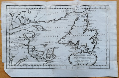
$6.00 Shipping Location: Neuendettelsau, Germany MORE HISTORY COPPER ENGRAVING MAPS IN OUR AUCTIONS! WEITERE HISTORISCHE KUPFERSTICH KARTEN IN UNSEREN AUKTIONEN! Original and decorative coloured copper ... moreengraving map by Jaques-Nicolas Bellin. Published in Nuremberg about 1750 AD map of Newfoundland- Canada"Carte von der Insel Terre-Neuve. Cartographer: Jaques-Nicolas Bellin(1703- 21st March 1772) was a hydrographer and geographer as well as chief cartographer of the French Navy. Description: We offer an original and detailed coloured copper engraving map by Jaques-Nicolas Bellin. The map shows Newfoundland- Canada. With many detailed and recorded villages and towns. Very rare collection item! Size: Leaf app. 27.0 x 42,8 cm engraving app. 22.7 x 23,0 cm Condition: in good condition strong print and paper marginal stained Please have a look at the pictures! Combine shipping is possible with only 1x calculated shipping cost! Please note all items auctioned are genuine. We do not sell reproductions. A Certificate of Authenticity(COA) can be issued on request. Original und dekorative kolorierte Kupferstich Karte von Jaques-Nicolas Bellin. Veröffentlicht in Nürnberg um 1750 AD Karte von Neufundland- Kanada"Carte von der Insel Terre-Neuve. Kartograph: Jaques-Nicolas Bellin(1703- 21. März 1772) war ein französischer Hydrograph und Geograph sowie Oberster Marineingenieur und-geograph. Beschreibung: Wir bieten eine originale und detaillierte kolorierte Kupferstichkarte von Jaques-Nicolas Bellin an. Diese interessante Karte zeigt Neufundland- Kanada mit den Ortschaften und Städten. Sehr dekoratives Sammelobjekt! Maße: Blatt ca. 27.0 x 42,8 cm Kupferstich ca. 22.7 x 23,0 cm Zustand: guter Zustand kräftiger Druck& festes Papier geringfügig fleckig Sehen Sie sich die Bilder an! Kombiversand ist möglich mit nur 1x Portoberechnung! Bitte beachten Sie. Alle Einzelteile die versteigert werden sind echt, wir verkaufen keine Reproduktionen. Ein Echtheitszertifikat(COA) kann auf Wunsch ausgestellt werden. Powered by The free

Buy It Now
$15.00 Shipping Location: Portugal Title: Carte de L’Isle de Taiti par le Lieutenant J. Cook 1769 Fine antique hand colored map of Tahiti and Moorea(An older name for the island is Eimeo) ... morewere Capt. Cook arrived at Otaheite on April 13 1769. The map shows the volcanic mountains and coral reefs around the islands. Cook voyages In 1766 the Royal Society engaged Cook to travel to the Pacific Ocean to observe and record the transit of Venus across the Sun. Cook. At the age of 39, was promoted to lieutenant and named as commander of the expedition. The expedition sailed from England on 26 August 1768, rounded Cape Horn and continued westward across the Pacific to arrive at Tahiti on 13 April 1769, where the observations of the Venus Transit were made. http:en.wikipedia.org/wiki/Jacques-Nicolas_Bellin ORIGINAL ANTIQUE COPPER PLATE ENGRAVING. HAND COLORED. Engraving is Absolutely Guaranteed authentic original map. A Certificate of Authenticity(in one shipment) will be enclose on request. Sheet app. 42x 25.5 cm. 16.75 x 10 inches. Image app. 40 x 23.5 cm. 15.75 x 9.25 inches. Condition: Fine hand colored map in excellent condition. Folds as published. The map is suitable for framing. All maps and prints are genuine. Authentic, published at the date stated in this listing! We sell Real Antique. No Reproduction, no Copy! THE PERFECT GIFT! For better quality pictures please go to our web site: WWW.MAPANDMAPS.COM I offer a no questions returns policy. All maps and prints are genuine. Authentic, published at the date stated above. Shipping: Worldwide shipping by signed registered mail or Global Express courier. Standard Int'l Shipping means registered airmail of Europe. If you want to receive the item quickly. Ask for Expedited Int'l Shipping or a 3 days Shipping by FedEx. ask for price) Shipping fee is per combined shipment. Including handling and insurance. Free shipping worldwide if three items or more purchased.
Buy It Now
$30.00 Shipping Location: Paris VI, France Antique copper engraved map of northern Brazil, by Rigobert Bonne (1727-1794). Bonne died in 1794, his son Charles-Marie Rigobert Bonne continued to publish ... morehis work after his death. Edition : Paris, 1780, 18th century.
Buy It Now
$6.00 Shipping Location: Neuendettelsau, Germany Original engraving from.
Buy It Now
$10.04 Shipping Condition: Unspecified Location: LONDON, United Kingdom A La Haye, Chez Pierre de Hondt, avec Privil�ge de sa Majest� Imp�riale & de Nos Seignuers les Etats de Hollande & de West-Frise. Antique copperplate ... moremap, 1748. DATE PRINTED: 1748.
Buy It Now
$18.82 Shipping Location: Portugal He was appointed the first Ingnieur Hydrographe de la Marine, and also Official Hydrographer to the King. The present map is dated 1750. Bellin was born ... morein Paris. JACQUES BELLIN. containing 580 finely detailed charts.
Buy It Now
$10.04 Shipping Condition: Unspecified Location: LONDON, United Kingdom Plan du Fort Fran�ois de Whidah ou Juida [Plan of the French fort at Ouidah]. Caption below picture:'Plan du Fort Fran�ois de Whidah ou Juida [Plan of ... morethe French fort at Ouidah]'. A La Haye, Chez Pierre de Hondt, avec Privil�ge de sa Majest� Imp�riale & de Nos Seignuers les Etats de Hollande & de West-Frise.
Buy It Now
$10.04 Shipping Condition: Unspecified Location: LONDON, United Kingdom A La Haye, Chez Pierre de Hondt, avec Privil�ge de sa Majest� Imp�riale & de Nos Seignuers les Etats de Hollande & de West-Frise. Antique copperplate ... moremap, 1757. DATE PRINTED: 1757.
Buy It Now
Free Shipping Location: Cyprus Peru, Antique old map. Bonne 1778. Map maker: Rigobert Bonne (France, 1727–1795). A Certificate of Authenticity will be on request forwarded for each ... moreindividual map or print. For the complete Map and Print collection see our online site.
Buy It Now
$10.04 Shipping Condition: Unspecified Location: LONDON, United Kingdom A La Haye, Chez Pierre de Hondt, avec Privil�ge de sa Majest� Imp�riale & de Nos Seignuers les Etats de Hollande & de West-Frise. Cap-Vert, Senegal, location ... moreof modern Dakar. Antique copperplate map, 1747.
Buy It Now
$6.00 Shipping Location: Neuendettelsau, Germany Original engraving from.
Buy It Now
$20.08 Shipping Location: NORWICH, United Kingdom J.N. Bellin; A. V. Krevelt. Strongly engraved map describes this island of the Greater Antilles. 32 x 21.1 cm.
Buy It Now
$10.04 Shipping Condition: Unspecified Location: LONDON, United Kingdom A La Haye, Chez Pierre de Hondt, avec Privil�ge de sa Majest� Imp�riale & de Nos Seignuers les Etats de Hollande & de West-Frise. Vue du Cap de Bonne-Esp�rance ... more[View of the Cape of Good Hope]. Caption below picture:'Vue du Cap de Bonne-Esp�rance [View of the Cape of Good Hope]'.
Buy It Now
$6.00 Shipping Location: Neuendettelsau, Germany Original engraving from.

Buy It Now
$40.00 Shipping Location: De Fryske Marren - Langweer, Netherlands COrrespondances Fluviales du Tonkin(North Vietnam) Issued 1902. Paris Scarce original antique lithographed map. Uncommon early 20th century map. Showing ... moredetails rarely cartograhically encountered elsewhere in this manner. Tiny villages along smaller tributaries as well as along the coast are named. Printed on period thin paper. As issued, which retains its inherent structural flexibility and soundness. In close to VG[or better] condition: displays normal light age toning as typical. And light trivial soiling; overall the image remains clean and very attractive- please inspect visual scan closely and note the zoom feature which allows for close inspection[note: we grade very conservatively and always seek to disclose any noteworthy flaws] Great image entirely worthy of an album or hanging for display. A depiction captured in a manner entirely unique to this era. The printed area remains visually pleasing. A nice impression of an interesting map. Any minor defects along the sheet edges and in the margins may be seen in the photos. Sheet measures c. 6 1/2" W x 6 3/8" H. Printed area measures c. 5 1/4" W x 4 3/4" H. Original fold line0 as issued. 70797] Guaranteed Authentic! We do not sell modern reprints. Condition: We only handle. Sell& ship original vintage and antique items. Old sheets of paper, printed long ago. Items which are really old, like we say. Not modern copies or modern reproductions. It's amazing how many people still ask us if an item is truly old& genuine. We strive to describe our items accurately. We understand you cannot see it in person. We are trying to present it accurately and convey condition correctly with careful digital photography. Accurate flat-bed scans of the item which are zoomable, precise printed sheet& image sizes and knowledgeable descriptive words. It is important to understand& remember that many old printed paper items survive merely by chance. And all are somewhat unique if you inspect them closely. Few of the same type match exactly if
$44.99 Shipping Location: Ivanhoe, Australia Africae Accurata Tabula ex officina.Nic Visscher. This large beautifully hand coloured original antique map of Africa was published by Nicholas Visscher ... morein 1690. Here the legends of Prester John lingered on and, as so often happened in other remote parts of the world, the only certain knowledge of the region was provided by Jesuit missionaries.
Buy It Now
$6.00 Shipping Location: Neuendettelsau, Germany Original engraving from.
Buy It Now
$6.00 Shipping Location: Neuendettelsau, Germany Original engraving from Prevost/Bellin: Histoire generale des voyages.
Buy It Now
$15.00 Shipping Location: Cyprus Japan, Korea, Tartary map. Tartarie Chinoice, Bonne 1771. Title: Tartarie Chinoice Roy de Coree et Isles du Japon. Map maker: Rigobert Bonne (France, ... more1727–1795). A Certificate of Authenticity will be on request forwarded for each individual map or print.
Buy It Now
$10.00 Shipping Location: Cyprus Info: Cape Verde or Cabo Verde, officially the Republic of Cabo Verde, is an island country spanning an archipelago of 10 volcanic islands in the central ... moreAtlantic Ocean. Cape Verde Islands Old map Cabo Verde islands by Bonne 1780.
Buy It Now
$6.00 Shipping Location: Neuendettelsau, Germany Original engraving from Prevost/Bellin: Histoire generale des voyages.
Buy It Now
Free Shipping Location: De Fryske Marren - Langweer, Netherlands Artists and Engravers: Made by 'Jakob van Schley' after 'Jacques Nicolas Bellin'. Date : 1758. Condition : Very good, given age. Original folds, as issued. ... moreLater hand colouring. General age-related toning and/or occasional minor defects from handling.
Buy It Now
$30.00 Shipping Location: Paris VI, France Very large antique map of the west coast of Africa, by Rigobert BONNE (1727-1795) & LATTRE (1743-1795), XVIIIe Century, titled du R., 1771". The map shows ... morethe west coast of Africa, from Senegal to Angola, and Cape Verde islands.
Buy It Now
Free Shipping Location: Argentina Title: P lan du port de Valparaiso. Place / Date: Paris 1764. Map Maker: Jacque Nicolas Bellin. Condition: Good condition. Size: ( 270 x 210 mm) x ( 215 ... morex 165 mm).
Buy It Now
Free Shipping Location: De Fryske Marren - Langweer, Netherlands Antique map of the island of Ambon, Indonesia. This map originates from 'Historische beschryving der Reizen' published 1756. Artists and Engravers: Made ... moreby 'Jakob van Schley' after 'Jacques Nicolas Bellin'.
Buy It Now
$18.22 Shipping Location: YORK, United Kingdom
Buy It Now
$6.00 Shipping Location: Neuendettelsau, Germany Original engraving from Prevost/Bellin: Histoire generale des voyages.

Buy It Now
Free Shipping Location: De Fryske Marren - Langweer, Netherlands . . Asia Continent Japon China India antique map Bonne 1780 L’Asie Par M. Bonne… 1780. Genuine antique copperplate engraved map of Asia by Rigobert ... moreBonne. Published in Paris in 1780. Rigobert Bonne(France. 1727–1795) Royal Cartographer to France in the office of the Hydrographer at Depot de la Marine. In 1773 Bonne succeeded Jacques Bellin as Royal Cartographer to France in the office of the Hydrographer at the Depôt de la Marine. Working in his official capacity. Bonne compiled some of the most detailed and accurate maps of the period. Bonne’s work represents an important step in the evolution of the cartographic ideology away from the decorative work of the 17th and early 18th century towards a more detail oriented and practical aesthetic. With regard to the rendering of terrain Bonne maps bear many stylistic similarities to those of his predecessor, Bellin. However, Bonne maps generally abandon such common 18th century decorative features such as hand coloring, elaborate decorative cartouches, and compass roses. Fine original antique engraving with hand coloring. Engraving is Guaranteed authentic. A Certificate of Authenticity will be on request forwarded for each individual map or print. See: Bellin: http:en.wikipedia.org/wiki/Jacques-Nicolas_Bellin Size: Sheet app. 36 x 25 cm. 14.25 x 9.75 inches. Image app. 32 x 21 cm. 12.75 x 8.25 inches. Condition: View overall very good. Short left border with repaired tear till 5 mm in image. see image) All maps and prints are genuine. Authentic, published at the date stated in this listing! For better quality pictures please go to our web site: WWW.MAPANDMAPS.COM I offer a no questions returns policy. All maps and prints are genuine. Authentic, published at the date stated above. Worldwide shipping by signed registered mail or Global Express courier. Shipping fee is per combined shipment. Including handling and insurance. Free shipping worldwide if three items or more purchased. . Asia.
Buy It Now
Free Shipping Location: Hammelburg, Germany Caribbean, anno 1760, BellinCoppermap, edited anno 1760, size of the leaf: 31x41 cm..
Buy It Now
$10.04 Shipping Condition: Unspecified Location: LONDON, United Kingdom A La Haye, Chez Pierre de Hondt, avec Privil�ge de sa Majest� Imp�riale & de Nos Seignuers les Etats de Hollande & de West-Frise. Antique copperplate ... moremap, 1757. DATE PRINTED: 1757.
Buy It Now
$10.04 Shipping Condition: Unspecified Location: LONDON, United Kingdom Suite de la Coste de Guin�e, depuis le Cap Apollonia, jusqu�a la Rivi�re de Volta [Continuation of the coast of Guinea, from Cape Apollonia to the Volta ... moreRiver]. Caption below picture:'Suite de la Coste de Guin�e, depuis le Cap Apollonia, jusqu�a la Rivi�re de Volta [Continuation of the coast of Guinea, from Cape Apollonia to the Volta River]'.
Buy It Now
$30.00 Shipping Location: Paris VI, France From the atlas edited in St Petersburg in 1793: "Новый атлас, или собрание карт всех частей земного шара, почерпнутый из разных сочинителей и напечатанный ... moreв Санкт-Петербурге для употребления юношества в 1793 году при Горном училище".
Buy It Now
$33.52 Shipping Location: Seubersdorf, Germany Paris 1754. original copper engraving map by Bellin from 1754 - sheet size approx. 25 x 38 cm - in good condition | original copper engraved map by Bellin ... morefrom 1754 - in good condition. | This is an original! - No emphasis! - No copy! -- This is an original! No copy! - No reprint!Order number: 263399.
Buy It Now
$6.00 Shipping Location: Neuendettelsau, Germany Original engraving from Prevost/Bellin: Histoire generale des voyages.
|
|
|
|
Bellin Map of Trincomalee Sri Lanka Ceylon - 1750
O riginal engraving from: Prevost: Histoire Generale des Voyages. Published: approx. 1750 Sheetsize: approx. 43 x 41 cm Condition: please see photo Shipping-costs: see description. We combine shipping at no extra cost, if more than one item is bought
|
|
|
1757 Bellin Map of North West Africa, Canary Islands
1757 Bellin Map- Coste Occidentale D'Afrique J.N. Bellin provided a huge number of maps for L'Abbe Prevost's'Histoire Generale des Voyages' A 25 volume plus work describing the discoveries, journeys and settlements of seventeenth and early eighteenth century European powers. Many of these maps were issued in Dutch and German as well as French. This map comes from a 1757 Dutch edition of"Histoire. It shows north west Africa from the Straits of Gibraltar south to the coast of Gambia. Only coastal detail is shown and offshore lie the island of Madeira. The Canary Islands and the Cape Verde Islands. The engraving measures 10" by 8" Has outline hand colouring, several folds(as issued) and is in very good condition. The map is guaranteed to be over 250 years old. Shipping United States- Regular airmail $5.00US. ... moreTrackedairmail(optional) is an additional US$12.00 for a total of US$17.00. Canada- $3.00US for regular mail. $9.00US for registered mail. Canadian customers please add GST or HST where applicable. Rest of the world- Regular air mail $8.00US. Registered/insured airmail(optional) is is an additional US$15.00 for a total of US$23.00. Terms and Conditions Please note- We can only take responsibility for delivery if the optional registration/insurance is added. Regular airmail is usually very safe and reliable. But items sent by regular airmail are at the buyers risk- regular airmail provides no tracking number, no proof of shipping or delivery, and no insurance in case of loss or damage. Please note- Mailing from Canada to the United States and all other international destinations can sometimes take over three weeks for delivery. We will combine shipment of multiple purchases- several items can be shipped together for one shipping cost. Payment Options We accept Paypal. Beach Antique Maps& Prints International antique map and print dealers for over 30 years Please check our other map& print auctions on ebay. To learn more about Antique Maps please click on'me' on t
|
|
|
1755 Bellin antique Map of The Island of Barbados
Helpful Links: Company Details- About ME View seller's other items Cartographer's Profile Ask Seller a q uestion Return Policy We have over 2.000 items for sale on our Ebay stores site. Please click here to enter the stores and use the search engine to the left to search specifically for maps. Prints, Atlases on the Classical Images Stores. Thank you Carte De L' Isle De La Barbade. click image to enlarge Thi s beautiful ly engraved hand coloured original antique map of the Island of Barbados was published in 1755 by Jacques Nicolas Bellin for Antoine-François Prevosts 20 volume edition of L`Histoire Generale des Voyages published by Pierre de Hondt. The Hag ue between 1747& 1785. Ref: Tooley; M&B) Please note all items auctioned are genuine. We do not sell reproductions. A Certificate of Authenticity(COA) can be issued ... moreon request. If you wish to discuss this or any other item please email or call- good luck. Simon. Classical Images 61(0) 409 551910 Tel Condition Report General Description: Paper thickness and quality: Light and stable Paper color: off white Age of map color: Early Colors used: Red. Green, yellow General color appearance: Authentic Paper size: 13 1/2in x 11 1/2in(350mm x 270mm) Plate size: 8 1/4in x 6 1/2in(250mm x 170mm) Margins: Min 2in(50mm) Imperfections: Margins: Light age toning Plate area: None Verso: None Overall Quality(in Bold) Perfect/ Fine/Very Good/Good/Fair/Poor Jacques Nicholas Bellin 1703-72 Bellin spent over fifty years at the French Hydrographic Service where he was appointed the first `Ingenieur hydrographe de la Marine’ During his term of office there he was commissioned to carry out major surveys. First of the coast of France and later of all the known coasts of the world. These tremendous undertakings resulted in the production of a very large number of sea charts of the highest quality, which appeared in many editions with varying numbers of charts to the end of the century. He was appointed Hydrographer to the King and was a member of
|
|
|
MADEIRA PORTO SANTO ISLANDS PORTUGAL 1773 BELLIN ANTIQUE MAP
Title: CARTE DES ISLES DE MADERE ET PORTO SANTO' Author: Bellin. Jacques Nicolas(Map maker) 1703- 1772) Van Schley. Jakob(draftsman)1715- 1779) Publisher: Raynal. Guillaume Thomas(1713- 1796) Source: Atlas Portatif' Date: 1773. Amsterdam. Technique: Copper Engraving. Sheet size: 27.5x20 cm. Engraving size: 22x17 cm. Condition: Dark impression on slightly wavy paper with chains and wiremarks. Sheet's border slightly worn with some tears. Very light foxings along borders. No noticeable imperfections on engraved area. Very good conditions. Conditions are as you can see in the images. All of the engravings and books I sell are original. I guarantee all of my engravings to be authentic. Please examine the images provided carefully. And if you have any questions, please ask and I will be happy to help. Any item purchased from me may ... morebe returned for a full refund if not as described. If you buy more than one item. You have to pay only one shipping cost. Il costo di spedizione e imballaggio per l'Italia è 12$. Indipendentemente dal numero degli oggetti acquistati. IMPORTANTE! Aspettare la fattura con spese di spedizione aggiornate prima di procedere al pagamento.
|
|
|
ALDERNEY CHANNEL ISLAND GREAT BRITAIN SEA CHART ORIG. ENGR. BELLIN 1752 #B453S
MORE HISTORY COPPER ENGRAVING MAPS IN OUR AUCTIONS! WEITERE HISTORISCHE KUPFERSTICH KARTEN IN UNSEREN AUKTIONEN! Original and decorative coloured copper engraving map by Jaques-Nicolas Bellin. Published in Paris, 1752 AD Splendid map of Alderney Island- Channel Island"Carte Reduite de L' isle D' Aurigni. Cartographer: Jaques-Nicolas Bellin(1703- 21st March 1772) was a hydrographer and geographer as well as chief cartographer of the French Navy. Description: We offer an original and large-size coloured copper engraving map by Jaques-Nicolas Bellin. This interesting and detailed engraved map shows the Alderney island in the English Channel and the smaller neighboring island Burhou and France with the"Cap de la Hague" North is oriented to the right of the page. The map was originally published in the"Neptune Francois" ... morein Paris in 1693 by Alexis Hubert Jaillot. This example is from a later publication of the"Neptune Francois" by J. N. Bellin. Very rare collection item! Size: Leaf app. 62.2 x 44,8 cm engraving app. 55.5 x 40,9 cm Condition: in good condition strong print and paper fine colour slightly brownish and stained.Few small tears at the edges bottom margin is tightly trimmed small defect. Left bottom corner Please have a look at the pictures! Kombiversand ist möglich mit nur 1x Portoberechnung! Please note all items auctioned are genuine. We do not sell reproductions. A Certificate of Authenticity(COA) can be issued on request. Original und dekorativ kolorierte Kupferstich Karte von Jaques-Nicolas Bellin. Veröffentlicht in Paris, 1752 AD Prächtige Karte von Alderney Insel- Kanalinseln"Carte Reduite de L' isle D' Aurigni. Kartograph: Jaques-Nicolas Bellin(1703- 21. März 1772) war ein französischer Hydrograph und Geograph sowie Oberster Marineingenieur und-geograph. Beschreibung: Wir bieten eine originale und großformatige kolorierte Kupferstichkarte von Jaques-Nicolas Bellin an. Diese interessante und detaillierte Kupferstich
|
|
|
Indian Ocean Arabia SE Asia Siam Australia 1746 Bellin fine antique Nautical map
Carte de l'Ocean Oriental ou Mer des Indes(Indian Ocecan. Arabia, Africa, India, Siam, New Holland, Java, West Coast of Australia) Issued 1746. Paris by J.N. Bellin Fine and uncommon old engraved nautical chart map with beautiful hand color. A dramatic rendering. With rhumb lines imparting a strong nautical feel to the map. Note how the western coastline of Australia at bottom right is undefined in areas and with virtually no place names. A picture is worth a thousand words. The photos are a major part of the item description. Please examine them closely. As what you see is what we will send you. note: we grade conservatively and always seek to disclose any noteworthy flaws. Map remains well preserved. Some light age wear or surface spotting/ soiling which is visible within the scan. Overall visually appealing. Paper and image remains ... moreoverall clean& sound. Old maps& prints often display small minor repairs on the back. Could have uneven blank margins, might have extraneous fold-lines or other small minor age flaws which do not detract from the visual appeal or value. Condition is carefully considered in arriving at our price. Great antique map entirely worthy of hanging for display. A depiction captured in a manner entirely unique to this era. Original fold lines as issued. Left top blank margin trimmed very narrow to neatline also as issued. Sheet measures c. 14 7/8" H x 19 5/8" W. Printed area measures c. 13 1/4" H x 18 5/8" W Tooleys Dictionary of Mapmakers. V.1, p.116. R1755] Everything we offer is guaranteed to be an authentic original antique item as described. We stand behind everything we sell. Important information for International Buyers* You may be charged customs. Taxes or other import duties by your country! this has nothing at all to do with us. Please do not hold us responsible if your Government wants to collect tax when you buy something outside of your country] Import duties. Taxes, and customs fees are not included in the item price or shipping cost. These charg
|
|
|
Providence, RI, Portrait of a Young Woman, by Bellin, circa 1900s
An old cabinet card by Louis H. Bellin. Providence, Rhode Island, circa 1900s. A portrait of a young woman standing next to a curule chair. Fancy back with red-brown imprint on white background. The edges at top. Left and right have been trimmed down, touch of foxing. If you purchase more than one lot in my sale. I will reduce the shipping total, but please wait for the combined shipping invoice before you pay. ☺☺☺+++Please Read+++☺☺☺ Goracoin Terms of Sale I aim to please. As you may gather from my feedback! Please do not hesitate to contact me if you have any questions about a listing. Or problems with an order! ☺☺Shipping☺☺: I always try to send things out on the same day or at least within two or three days of receiving an order. And that is my usual schedule for shipments. As soon as I mail an item. I always use the ebay“contact buyer” ... morebutton to send you an email letting you know that it is on its way. If you have special packaging instructions and/or prefer to pay extra for special shipping. Please let let me know before you checkout, and I will be happy to oblige by emailing an ebay invoice with the desired shipping charge. IMPORTANT I base my shipping charges on the cost of mailing at the local post offices. Plus reasonable handling charges to help cover my costs. Foreign buyers If your address is outside of the United States. Please contact me for shipping cost before completing your order. Buyers outside of the United States must pay an extra $13.65 for Registered Mail. If a foreign shipment requires a customs form. It will be filled in with the actual sale price of the item or items listed on it. In my experience the post office very very rarely loses a package. But there are those rare times when items get damaged in transit. Once a piece of mail leaves my hands at the post office. I have no control over it! ☺☺Ebay Checkout☺☺: If you purchase more than one lot in my sale. Please do not complete the ebay checkout until I have emailed you an invoice with the reduced postage amount. When you buy more t
|
|
|
BELLIN Atlas Engraved Map of China Corea Taiwan - 1780
Original engraving from: Bellin: Atlas pour l´abrege des Voyages Published: 1780 Sheetsize: 34 x 43 cm Condition: please see photo. Original folds Shipping-costs: see description. We combine shipping at no extra cost, if more than one item is bought Payment: Paypal or Banktransfer.RcmdId ViewItemDescV4,RlogId p4%60bo7%60jtb9%3Feog4d71f%2B%3F4f%3E-14c015f1908-0x11e-
|
|
|
BRILLIANT HAND COLOR 1757 map Japan Kuril Islands Asia - BELLIN exquisite detail
BEAUTIFUL 1757 map of northern Japan and the Kuril Islands by Bellin Stunning hand coloring- map includes cartouche in lower right corner Title reads. Carte des Isles Kouriles dapres la Carte Russe, Dressee et Gravee par Laurent. excellent condition- bright and clean- wonderful hand coloring- see photos 13 in. x 11 in. 33 cm. x 28 cm.
|
|
|
CARTE DES ISLES CANARIES Old map Canary Islands Spain BELLIN 1746
Detailed hand colored antique atlas map of the Canary Island showing the Spanish islands Lanzarote. La Palma, La Gomera, El Hierro, La Graciosa, Alegranza, Isla de Lobos, Montaña Clara and Roque del Oeste. A nice title cartouche. Compass rose and rhumblines complete the map. Original antique map taken from Bellins Atlas(the leather atlas with gilt edges) De Exiles Histoire Generale des Voiages published by Prevost. Chez didot, PARIS, 1757. Jacques Nicolas Bellin(1703– 21 March 1772) was a French hydrographer. Geographer, and member of the French intellectual group called the philosophes. 17th-18th Century maps& atlases& prints. ORIGINAL ANTIQUE COPPER PLATE ENGRAVING. HAND COLORED. Engraving is Absolutely Guaranteed authentic original map. A Certificate of Authenticity(in one shipment) will be enclose on request. Size: Sheet ... moreapp. 37 x 25.5 cm. 14.75 x 10 inches. Image app. 28 x 20.5 cm. 11 x 8 inches. Condition: Fine hand colored map in very good condition. Folds as published. The map is suitable for framing. All maps and prints are genuine. Authentic, published at the date stated in this listing! We sell Real Antique. No Reproduction, no Copy! THE PERFECT GIFT! For better quality pictures please go to our web site: WWW.MAPANDMAPS.COM I offer a no questions returns policy. All maps and prints are genuine. Authentic, published at the date stated above. Shipping: Worldwide shipping by signed registered mail or Global Express courier. Standard Int'l Shipping means registered airmail of Europe. If you want to receive the item quickly. Ask for Expedited Int'l Shipping or a 3 days Shipping by FedEx. ask for price) Shipping fee is per combined shipment. Including handling and insurance. Free shipping worldwide if three items or more purchased.
|
|
|
Antique map, Bellin - RIVER PLATE, c 1754
Antique map titled"Carte de la Riviere de la Plata" published by J.N. Bellin. Paris, circa 1754 for Histoire Generale des Voyages. This map is an authentic old copperplate engraving(not a modern reprint) The map shows the River Plate with Buenos Aires. Argentina, and Montevideo, Uruguay. There is some minor age-toning but it is a very attractive map with fine hand coloring. Size 10 x 14.5 inches
|
|
|
AMBON MOLUKU Deux Alfouriens qui se Battent old engraving Bellin 1754
For: Antoine-François Prevost's monumental 20 volume edition of L`Histoire Generale des Voyages published by Pierre de Hondt. The Hague between 1747– 1780. Engraver: Schley van. Jacob Jakob van der Schley aka Jakob van Schley(26 July 1715 Amsterdam- 12 February 1779 Amsterdam) was a Dutch draughtsman and engraver. He studied under Bernard Picart(1673-1733) whose style he subsequently copied. ORIGINAL ANTIQUE COPPER PLATE ENGRAVING. Engraving is Absolutely Guaranteed authentic original. A Certificate of Authenticity( COA) will be supplied on request. Sheet app. 18x 25 cm. 7 x 10 inches. Image app. 38 x 30.5 cm. 15 x 12 inches. Condition: Fine hand colored engraving in very good condition. All maps and prints are genuine. Authentic, published at the date stated in this listing! We sell Real Antique. No Reproduction, no Copy! THE PERFECT ... moreGIFT! For better quality pictures please go to our web site: WWW.MAPANDMAPS.COM I offer a no questions returns policy. All maps and prints are genuine. Authentic, published at the date stated above. Shipping: Worldwide shipping by signed registered mail or Global Express courier. Standard Int'l Shipping means registered airmail of Europe. If you want to receive the item quickly. Ask for Expedited Int'l Shipping or a 3 days Shipping by FedEx. between $ 25.95 and $ 38.50) Shipping fee is per combined shipment. Including handling and insurance. Free shipping worldwide if three items or more purchased. Ambon.
|
|
|
Carte Particuliere des Isles Moluques Old map Spice Islands Maluku BELLIN 1752
Title: Carte Particuliere des Isles Moluques. Description: 18e century hand colored map of the North Moluka islands and the Bacan islands with the old Dutch names. Ternate, Tidore, Pottenbackers, Timor, Machian, fort Tabillola) Manen, and Bachian See also: Author: Jacques Nicolas Bellin(1703– 21 March 1772) Royal Hydrographer. Engineer of the French Navy and member of the Royal Society) For Antoine-François Prevost's" L`Histoire Generale des Voyages" Published by Pierre de Hondt. The Hague between 1747-1780. ORIGINAL ANTIQUE COPPER PLATE ENGRAVING. HAND COLORED. Engraving is Absolutely Guaranteed authentic original map. A Certificate of Authenticity( COA) will be supplied on request. Image app. 15.5 x 22 cm. 6 x 8.5 inches. All maps and prints are genuine. Authentic, published at the date stated in this listing! We sell ... moreReal Antique. No Reproduction, no Copy! THE PERFECT GIFT! For better quality pictures please go to our web site: WWW.MAPANDMAPS.COM I offer a no questions returns policy. All maps and prints are genuine. Authentic, published at the date stated above. Shipping: Worldwide shipping by signed registered mail or Global Express courier. Standard Int'l Shipping means registered airmail of Europe. If you want to receive the item quickly. Ask for Expedited Int'l Shipping or a 3 days Shipping by FedEx. ask for price) Shipping fee is per combined shipment. Including handling and insurance. Free shipping worldwide if three or more items are purchased.
|
|
|
Antique map, Bellin - XIAMEN, Jiulong River, FUJIAN PROVINCE, c1760
Antique map titled"Carte de la Baye de Chin-Chew ou Chang-Chew. Avec les Isles d'Emowi et de Quemowi" by J.N. Bellin. This map is an authentic old copperplate engraving(not a modern reprint) There is some age toning but the condition is very good for its age. Size 10 x 14 inches
|
|
|
1753 Fine Bellin Map of Luzon, Philippines - Manilla
1753 Bellin Map- Carte des Isles Philippines J.N. Bellin provided a huge number of maps for L'Abbe Prevost's'Histoire Generale des Voyages' A 25 volume plus work describing the discoveries, journeys and settlements of seventeenth and early eighteenth century European powers. Many of these maps were issued in Dutch and German as well as French. This map of the northern Philippines comes from a 1753 French edition of"Histoire Generale. The main island is that of Luzon containing the capital city. Manilla. Other islands include Mindoro and Samar. There is an excellent cartouche title in the top right corner. The map measures 8.5" by 6" Has outline hand colouring and is in very good condition The map is guaranteed to be over 250 years old. Shipping United States- Regular airmail $5.00US. Tracked airmail(optional) ... moreis an additional US$12.00 for a total of US$17.00. Canada- $3.00US for regular mail. $9.00US for registered mail. Canadian customers please add GST or HST where applicable. Rest of the world- Regular air mail $8.00US. Registered/insured airmail(optional) is is an additional US$15.00 for a total of US$23.00. Terms and Conditions Please note- We can only take responsibility for delivery if the optional registration/insurance is added. Regular airmail is usually very safe and reliable. But items sent by regular airmail are at the buyers risk- regular airmail provides no tracking number, no proof of shipping or delivery, and no insurance in case of loss or damage. Please note- Mailing from Canada to the United States and all other international destinations can sometimes take over three weeks for delivery. We will combine shipment of multiple purchases- several items can be shipped together for one shipping cost. Payment Options We accept Paypal. Beach Antique Maps& Prints International antique map and print dealers for over 30 years Please check our other map& print auctions on ebay. To learn more about Antique Maps please click on'me' on this page and visit our we
|
|
|
ATLANTIC OCEAN NORTH SOUTH AMERICA EUROPE AFRICA 1746 BELLIN ANTIQUE MAP
Title: CARTE DE L'OCEAN OCCIDENTAL' Author: Bellin. Jacques Nicolas(1703- 1772) Source: Historie General des Voyages' Date: 1746. Technique: Copper engraving. Sheet size: 50.5x37 cm. Engraving size: 46x32 cm. Condition: Dark impression on thin foldable paper with chains and wiremarks. Uncolored as issued. Few tiny tears on sheet's borders. Barely visible foxings. Few tiny holes at folds' crosses. Very good conditions. Conditions are as you can see in the images. All of the engravings and books I sell are original. I guarantee all of my engravings to be authentic. Please examine the images provided carefully. And if you have any questions, please ask and I will be happy to help. Any item purchased from me may be returned for any reason for a full refund. If you buy more than one item. You have to pay only one shipping cost.
|
|
|
FINE - Caroline ISLANDS - 1750 HUGE Bellin map - PACIFIC OCEAN Philippines Palau
1750 BELLIN map of The Caroline Islands- located in the Pacific Ocean near the Philippines Wonderful Detailed map. In very good condition- Striking cartouche- strong and dark envgraving paper with chains- uncolored as issued- some toning. Primarily in bottom margin- see photos very large- 16.5 in. x 11 in. 42 cm. x 28 cm.
|
|
|
RARE Queen Charlotte ISLANDS - c1780 LARGE Bellin map - CANADA exploration
c1780 BELLIN map of QUEEN CHARLOTTE ISLANDS- located in present day British Columbia. Canada RARE exploration map- very BEAUTIFUL- w/ 3 insets showing coastline and islands good condition- strong engraving- brown stain and wormholes in bottom margin- wear around edges- see photos very large- 18 in. x 12.5 in. 46 cm. x 32 cm.
|
|
|
EASTERN CANADA NEW ENGLAND NEWFOUNDLAND LARGE MAP 1755 BELLIN MONTREAL QUEBEC
Large coloured copper engraving by Jacques-Nicolas Bellin/ Nuremberg: Homann Heirs.1755 Map of Eastern Canada Title: Partie Orientale de la Nouvelle France Ou Du Canada" Cartographer: Jacques Nicolas Bellin(1703– 21 March 1772) was a French cartographer and hydrographer. Details: For sale is a large. Beautifully coloured engraved map by Bellin. Splendid full hand-color example of the Homann Heirs edition of Bellin's influential map of New England and Eastern Canada, extending from Lake Ontario, the St. Lawrence River and Cape Cod in the south to Hudson Bay, Cap Rond and Newfoundland in the northeast. Plate size: about 54.5 x 44 cm/ leaf: c. 59 x 51 cm Condition: minor stains. Weak vertical creases around the middle fold- otherwise very well-preserved This is an original. More than 250 years old, no reproduction! Please have a look ... moreat our further offers with rare graphics! Große kolorierte Kupferstich-Karte von Jacques-Nicolas Bellin/ Nürnberg: Homann Erben. 1755 Karte des östlichen Kanada Title: Partie Orientale de la Nouvelle France Ou Du Canada" Kartograph: Jacques-Nicolas Bellin( 1703 in Paris; 21. März 1772 in Versailles) war ein französischer Kartograph. Ingenieur-Geograph, Hydrograph der Marine. Details: Zum Verkauf steht eine große. Dekorativ kolorierte Kupferstichkarte von Bellin. Einflußreiche Karte von New England und dem östlichen Kanada, mit dem Gebiet zwischen Ontario-See und St. Lawrence-Strom, bis Cape Cod im Süden und Hudson-Bucht im Nordwesten sowie Cap Rond und Neufundland im Nordosten. Größe(ohne Rand) ca. 54.5 x 44 cm/ Blatt: ca. 59 x 51 cm Zustand: leicht fleckig. Um die Mittelfalte schwache vertikale Falten- sonst sehr gut erhalten Dies ist ein Original. Mehr als 250 Jahre alt, keine Reproduktion! Bitte beachten Sie auch unsere weiteren Auktionen mit seltenen Graphiken! Es gelten unsere Allgemeinen Geschäftsbedingungen. Shipping costs/ Versandkosten: USA 19.90 USD International/ Worldwide 19.90 USD P
|
|
|
1752 BELLIN ANTIQUE MAP EASTERN RUSSIA, SIBERIA, KAMCHATKA PENINSULA RARE
1752 BELLIN MAP SUITE DE LA CARTE DE LA SIBERIE ET LA PAYS DE KAMTSCHATKA RARE ABOUT THIS ITEM Map of Eastern Russia showing Siberia and the Kamchatka peninsula. Good accuracy and extensive detail of the complex river systems of Siberia The map includes a partial voyage track for the 1648 voyage of Semen Dezhnev who led the first voyage around Eurasia through what later became known as the Bering Strait. There is also a track for the route between Okhotsk and Kamchatka. Sailed by Bering in 1740 CONDITION Good condition. Some creasing to extremities and center. Some general light toning. Original double fold as issued. Measures 14 by 11 inches SHIPPING USA/CANADA- All items are sent USPS First Class unless otherwise stated in the auction listing. On dispatch you will be issued with a tracking number. Higher value items(over $50) will always ... morebe fully insured at no extra cost to you. WORLDWIDE- All items are sent USPS First Class and trackable(please note that costs for postage will vary depending on your country. Higher value items will always be fully insured and trackable at no extra cost to you. We pack all shipments with great care so that all items arrive exactly as they left us. We also combine items so if you win more than one auction. The cost of postage will be greatly lower. BID WITH CONFIDENCE Please note that we always collate and describe the items we sell to the very best of our ability. If you have questions regarding an item please get in contact so we can help you further before the auction's close. If for whatever reason an item you have received does not match our listing we will always issue you a hassle-free full refund on return of the item which will also include any postage costs you have incurred. On Feb-26-15 at 19:14:57 PST. Seller added the following information:
|
|
|
1758 BELLIN ANTIQUE MAP BARENTS SEA, RUSSIA, NOVAYA ZEMLYA, NOUVELLE ZEMBLE
1758 BELLIN ANTIQUE MAP BARENTS SEA. RUSSIA, NOVAYA ZEMLYA NOUVELLE ZEMBLE ABOUT THIS ITEM Finely engraved map by Bellin measures 16 by 10 inches CONDITION Good condition. Some small tears and creasing to extremities. Some general light toning. Original double fold running down the length of the map. SHIPPING USA/CANADA- All items are sent USPS First Class unless otherwise stated in the auction listing. On dispatch you will be issued with a tracking number. Higher value items(over $50) will always be fully insured at no extra cost to you. WORLDWIDE- All items are sent USPS First Class and trackable(please note that costs for postage will vary depending on your country. Higher value items will always be fully insured and trackable at no extra cost to you. We pack all shipments with great care so that all items arrive exactly as they left us. ... moreWe also combine items so if you win more than one auction. The cost of postage will be greatly lower. BID WITH CONFIDENCE Please note that we always collate and describe the items we sell to the very best of our ability. If you have questions regarding an item please get in contact so we can help you further before the auction's close. If for whatever reason an item you have received does not match our listing we will always issue you a hassle-free full refund on return of the item which will also include any postage costs you have incurred. On Feb-26-15 at 19:14:57 PST. Seller added the following information:
|
|
|
WORLDMAP OCEANIA 1750 BELLIN/DE HONDT LARGE ANTIQUE COPPER ENGRAVED SEA CHART
Click Here. Double your traffic. Get Vendio Gallery- Now FREE! 0 0 1 12 73 Old Times 1 1 84 14.0 Normal 0 14 false false false IT JA X-NONE 0 0 1 28 161 Old Times 1 1 188 14.0 Normal 0 14 false false false IT JA X-NONE 0 0 1 29 170 Old Times 1 1 198 14.0 Normal 0 14 false false false IT JA X-NONE 0 0 1 59 339 Old Times 2 1 397 14.0 Normal 0 14 false false false IT JA X-NONE 0 0 1 36 208 Old Times 1 1 243 14.0 Normal 0 14 false false false IT JA X-NONE 0 0 1 28 161 Old Times 1 1 188 14.0 Normal 0 14 false false false IT JA X-NONE 0 0 1 10 62 Old Times 1 1 71 14.0 Normal 0 14 false false false IT JA X-NONE 0 0 1 27 154 Old Times 1 1 180 14.0 Normal 0 14 false false false IT JA X-NONE Normal 0 14 false false false IT JA X-NONE Normal 0 14 false false false IT JA X-NONE Normal 0 14 false false false IT JA X-NONE Normal 0 14 false false false ... moreIT JA X-NONE Normal 0 14 false false false IT JA X-NONE An essay of a new and compact map containing the known parts of the terrestral globe by N. Bellin. Engineer of the Marine at the Hague by P. de Hondt. Normal 0 14 false false false IT JA X-NONE Description: Striking and highly detailed copper engraved very large world chart on Mercator's projection with English title cartouche(the map has French text) North America is shown with a Fl. de L'Ouest connecting through a series of rivers and lakes from Lake Superior to the Pacific. The Russian discoveries in the North Pacific show Alaska as an island(I. Unamak) Australia is labeled Nouvelle Hollande with Terre de Diemen linked to the mainland. New Zealand and the Solomon Islands appear in the Pacific. A large. Decorative title cartouche and two fine compass roses with rhumb lines make this a very attractive chart. On the lower side the charte presents two alternative french& dutch titles: Essay d'une carte reduite contenant les parties connues du globe terrestre par N. Bellin, Ingenieur Ordinaire de la Marine a la Haye chez Pierre de Hondt 1750 and Proef van eene Aan-eengeschakelde kaart der Bekende-Deelen des Gan
|
|
|
1750 BELLIN ANTIQUE MAP RUSSIA FINELY ENGRAVED
1750 BELLIN ANTIQUE MAP RUSSIA FINELY ENGRAVED ABOUT THIS ITEM Beautiful Original Bellin finely engraved map of Russia published c 1750/60 Entitled. Carte Des Pais Habites Par Les SAMOJEDES ET OSTIACS. CONDITION Some very light creasing. Old price marked in pencil bottom right. Map measures 14 by 10 inches SHIPPING USA/CANADA- All items are sent USPS First Class unless otherwise stated in the auction listing. On dispatch you will be issued with a tracking number. Higher value items(over $50) will always be fully insured at no extra cost to you. WORLDWIDE- All items are sent USPS First Class and trackable(please note that costs for postage will vary depending on your country. Higher value items will always be fully insured and trackable at no extra cost to you. We pack all shipments with great care so that all items arrive exactly as they ... moreleft us. We also combine items so if you win more than one auction. The cost of postage will be greatly lower. BID WITH CONFIDENCE Please note that we always collate and describe the items we sell to the very best of our ability. If you have questions regarding an item please get in contact so we can help you further before the auction's close. If for whatever reason an item you have received does not match our listing we will always issue you a hassle-free full refund on return of the item which will also include any postage costs you have incurred. On Feb-26-15 at 19:14:57 PST. Seller added the following information:
|
|
 |