|
|
Order by: Available to: This site contains affiliate links for which I may be compensated
|

Buy It Now
$6.00 Shipping Location: Greenacres, United States Original 1901 Map YELLOWSTONE NATIONAL PARK Wyoming Geyser Basin Firehole Hotel Handsome original antique color lithographed map of Yellowstone National ... morePark. Printed more than 113 years ago. The map has good detail of the terrain in our nations' first national park. With topography shown in relief. It labels the continental divide, Yellowstone Lake, Geyser Basin, Pitchstone Plateau, Fossil Forests, Mount Washburn, Sheepeater Creek, Shoshone Lake, and other natural features. Among the other named places and features on the map are the Riverside Mail Station. Firehole Hotel, Camp Reunion, Gamekeeper's Cabin, Park Headquarters, Baronettes Bridge, Old Ruin, Storm Point Indian Camp, and more. Longitude is measured from Greenwich and Washington. This map was published by George Franklin Cram of Chicago in 1899. And the image area measures 11-1/2" x 9-1/2" Condition: This map is in very good condition. Bright and clean, with no marks. Rips, or tears. The scans below show some of the detail: This is an original. Authentic antique map, not a reproduction or modern reprint. And it is fully guaranteed to be genuine. It would make a handsome display in your den or office. It would also make a perfect gift. And we'll include our helpful framing tips for your reference, along with a photocopy of the dated title page from the book in which it was published. We are pleased to offer it with our unconditional. Money-back guarantee. SHIPPING: We gladly ship anywhere in the World. And we use sturdy, professional packing materials to assure safe delivery. The shipping charges are as follows: Within the United States. Including Alaska, Hawaii, and APO addresses: $4.59 To Canada or Mexico: $9.99 To all other international destinations: $14.29(These charges reflect recent increases made by the United States Postal Service for international delivery. We will appreciate your prompt payment for this item. If you need more time or have any other questions about making your payment. Or if you may desire any special ser
Buy It Now
$5.00 Shipping Location: Old Orchard Beach, United States They are previously owned and may show very fine handling marks and shelf wear and will not be perfect. In antique condition with yellowing, staining, ... morespotting and discoloration of paper. It has rounded corners, creases, small tears along edges, ragged edges and is wrinkled.
Buy It Now
Free Shipping Location: Schertz, United States This antique original atlas map was printed in 1901 by the famous cartographer/publisher Geo. A. Ogle & Co. It features Mascoutah Township in St. Clair ... moreCounty in Illinois, USA, and is a great resource for those interested in ancestry, genealogy, and family history research. The map is over 120 years old and is in excellent condition. Free shipping is available within the USA, and calculated shipping rates are available for worldwide delivery. Please note that the cover and title page are not included, they are only for reference. Don't miss out on the opportunity to own this rare and historic piece!
Buy It Now
$6.00 Shipping Location: Columbia, United States
Buy It Now
Free Shipping Location: Augusta, United States "An Authentic Original Map Not A Reproduction".
$6.00 Shipping Location: Blue Bell, United States THIS MAP IS IN GOOD CONDITION AND PUBLISHED BY THE CHICAGO DAILY NEWS. CONDITION: MAP IS IN GOOD. MULTIPLE WINS.
Buy It Now
Free Shipping Location: Augusta, United States "An Authentic Original Map Not A Reproduction".
Free Shipping Location: San Antonio, United States This Map was removed from a 1901 Cram's Atlas of the World. The map is not " new " or in " new " condition, it was printed in 1901. ~ CRAM1901/071122. ... moreIncluding Hundreds of RareCivil War. The full page is approx.
Buy It Now
$4.55 Shipping Location: Oakland, United States This antique map of South America by Rand McNally & Co. is a true gem for any collector or lover of vintage maps. The intricate details and artistry on ... morethis piece is a testament to the skill of the cartographer and publisher. The map dates back to 1901, making it a rare find and a valuable addition to any collection.The map measures 7x6 inches and features the geography, towns, and cities of South America as they were depicted over a century ago. Whether you're a history buff, a cartography enthusiast, or just appreciate the beauty of antique maps, this piece is sure to impress. Don't miss your chance to own a piece of history!
Buy It Now
$4.55 Shipping Location: Oakland, United States This antique map of Maryland and Delaware was published by Rand McNally & Co. in 1901. It measures 7 inches by 6 inches and is a great addition to any ... moremap collection. The map features detailed depictions of the two states, including cities, towns, and geographical features. It is a perfect item for history enthusiasts or those interested in cartography.The map is in great shape, with no tears or stains. It has been well preserved over the years and is ready for display. This item is perfect for collectors or as a gift for someone who appreciates antique maps. Don't miss out on the chance to own a piece of history.
Buy It Now
Free Shipping Location: Schertz, United States This antique plat atlas map was printed in 1901 by Geo. A. Ogle & Co. and features Clayton Township in Adams County, Illinois. Measuring at 15x17 inches, ... morethis map is great for ancestry, genealogy, and family history research. The map is over 120 years old and is in its original condition. Please note that the title page is not included, it is only for reference. Free shipping is available for the USA, while calculated shipping is available worldwide.
Buy It Now
Free Shipping Location: Augusta, United States This 14 1/2" x 22" map is in VERY GOOD+ condition with light tone, soil, and a fold in the middle as issued, from a disbound George Cram atlas ©1901. ... more"An Authentic Original Map Not A Reproduction".
Buy It Now
Free Shipping Location: Schertz, United States This antique original atlas map was printed in 1901 by the famous cartographer/publisher Geo. A. Ogle & Co. It features Freeburg in St. Clair County in ... moreIllinois, USA, and is a great resource for those interested in ancestry, genealogy, and family history research. The map is over 120 years old and is in excellent condition. Free shipping is available within the USA, and calculated shipping rates are available for worldwide delivery. Please note that the cover and title page are not included, they are only for reference. Don't miss out on the opportunity to own this rare and historic piece!
Buy It Now
$4.29 Shipping Location: Greenacres, United States
Buy It Now
Free Shipping Location: Schertz, United States This antique original atlas map was printed in 1901 by the famous cartographer/publisher Geo. A. Ogle & Co. It features Marissa Township in St. Clair ... moreCounty in Illinois, USA, and is a great resource for those interested in ancestry, genealogy, and family history research. The map is over 120 years old and is in excellent condition. Free shipping is available within the USA, and calculated shipping rates are available for worldwide delivery. Please note that the cover and title page are not included, they are only for reference. Don't miss out on the opportunity to own this rare and historic piece!
Buy It Now
$4.13 Shipping Location: Columbia, United States
Buy It Now
Free Shipping Location: Augusta, United States "An authentic original map, not a reproduction".
Buy It Now
$4.00 Shipping Location: Pinetop, United States On offer, an original USGS topographic map depicting coast of California OCEANSIDE to ENCINITAS 1925 Edition. It is clean and uncreased and in very good ... morecondition. It measures 19.75 inches long and 15.75 inches wide. Scale is 1 over 62,500. It will frame up beautifully and immediately become a personalized antique heirloom. This map could be your favorite gift to your Southern California friends and family. Make any reasonable offer. Four dollar USPS shipping.
Buy It Now
Free Shipping Location: Schertz, United States This antique original atlas map was printed in 1901 by the famous cartographer/publisher Geo. A. Ogle & Co. It features Freeburg Township in St. Clair ... moreCounty in Illinois, USA, and is a great resource for those interested in ancestry, genealogy, and family history research. The map is over 120 years old and is in excellent condition. Free shipping is available within the USA, and calculated shipping rates are available for worldwide delivery. Please note that the cover and title page are not included, they are only for reference. Don't miss out on the opportunity to own this rare and historic piece!
Buy It Now
Free Shipping Location: Augusta, United States This 11" x 14 1/2" map is in VERY GOOD condition with light tone and soil, from a disbound Cram's atlas ©1901. "AN AUTHENTIC ORIGINAL MAP NOT A REPRODUCTION".
Buy It Now
$4.55 Shipping Location: Oakland, United States This antique map of Wyoming from 1901 by Rand, McNally & Co. is a rare find for collectors and enthusiasts alike. Featuring detailed cartography and published ... moreover a century ago, this piece provides a glimpse into the state's history and geography. The map measures 7x6 inches and is in good condition considering its age. Perfect for display or research purposes, this item would make a great addition to any collection of North America maps or antique memorabilia.
Buy It Now
Free Shipping Location: Augusta, United States "An Authentic Original Map Not A Reproduction".
Buy It Now
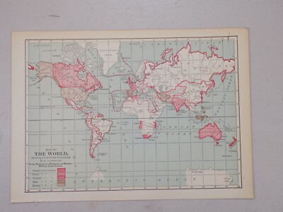
Free Shipping Location: Monroeville, United States Genuine original antique and historical maps. Prints, engravings and illustrated books Antique& old vintage pictures prints& maps from POSTAPRINT: ... moreTopography. Good town views& city plans. Fine art engravings, WORLD 1901: Collectable Antique Map by Longmans Green. Projected on centre of Atlantic + Pacific Ocean, Authentic vintage& antique pictures prints and maps by mail order. There is printing on the back. Item I/D VM-2862 OVERALL SIZE incl. margins: 13.5x10.5 Inches. 34x27 Cms. FOLDING. IMAGE Size Varies: 12x9 Inches. 30x23 Cms All measurements are approximate. VERIFY THE DATE FOR MORE MAPS FROM THIS SERIES THE SCAN BELOW IS AN ENLARGED SECTION AS AN EXAMPLE OF THE DETAIL PROVENANCE THE PUBLIC SCHOOL ATLAS OF MODERN GEOGRAPHY IN 33 MAPS EXHIBITING CLEARLY THE MORE IMPORTANT PHYSICAL FEATURES OF THE COUNTRIES DELINEATED AND NOTING ALL THE CHIEF PLACES OF HISTORICAL. COMMERCIAL OR SIMILAR INTEREST. Edited…by the Rev. George Butler PUBLISHED 1901 BY Longmans Green& Co. 39 Paternoster Row London. New York and Bombay. This was issued as an illustration in the above book. AUTHENTICITY WARRANTED TO BE A GENUINE OLD ITEM. PRINTED AT THE DATE STATED. We NEVER offer modern day copies. The buyer may wish to print this page. CONDITION Good. Suitable for framing. Please see the scan. All old maps and prints are subject to normal ageing which is not obtrusive unless otherwise stated. PAYMENT PAYPAL PREFERRED PLEASE. RETURNS POLICY SATISFACTION GUARANTEED or your money back. Buyer pays return postage. Orders are normally mailed within 1 business day of payment. Except for vacations etc. UK DELIVERY BY 1st CLASS MAIL: Normally 1-2 working days. INTERNATIONAL BY AIR MAIL: Normally 5-10 working days. Please understand we cannot guarantee the efficiency of the Postal Services. Although they are generally reliable. More information WE HAVE BEEN IN BUSINESS FOR OVER 30 YEARS MANY 1000'S OF AUTHENTIC ANTIQUE COLLECTABLE and VINTAGE ITEMS ON OFFER France: Gravures et Cartes anciennes. Deutschland: Alte Lankart
Buy It Now
Free Shipping Location: Schertz, United States This antique original atlas map was printed in 1901 by the famous cartographer/publisher Geo. A. Ogle & Co. It features Millstadt in St. Clair County ... morein Illinois, USA, and is a great resource for those interested in ancestry, genealogy, and family history research. The map is over 120 years old and is in excellent condition. Free shipping is available within the USA, and calculated shipping rates are available for worldwide delivery. Please note that the cover and title page are not included, they are only for reference. Don't miss out on the opportunity to own this rare and historic piece!
Buy It Now
$4.95 Shipping Location: Willow Grove, United States This is an ORIGINAL 1901 St Louis map taken from a 1908 atlas. There is a map and text on the reverse side of this map page.
Buy It Now
Free Shipping Location: Augusta, United States "An Authentic Original Map Not A Reproduction".
Buy It Now
Free Shipping Location: Augusta, United States This 14 1/2" x 11" map is in VERY GOOD+ condition with very light tone, soil and two black spots from publishing as seen in the last photo, from a disbound ... moreGeorge Cram atlas ©1901. "An Authentic Original Map Not A Reproduction".
Buy It Now
$8.51 Shipping Location: Medford, United States In Bromley's Atlas of 1901, this map is identified as Plate 16. Assessors and various other city officials (planners, fire and police forces, utility ... moreand service providers, etc.) thereby had critical information readily available.
Buy It Now
$4.69 Shipping Location: Greenacres, United States Original 1901 antique color lithographed map of pre-statehood Arizona, printed more than 120 years ago. This map was published by George Franklin Cram, ... moreChicago in 1901 and is an original, authentic antique map,not a reproduction or modern reprint.
Buy It Now
$4.59 Shipping Location: Greenacres, United States It is dated 1901 in the lower corner. The map is color coded to identify the types of soil in the area, with keys to soil types and profiles in the margins ... moreat left and right.
Buy It Now
$4.59 Shipping Location: Greenacres, United States
Buy It Now
$4.69 Shipping Location: Greenacres, United States It is dated 1901 in the lower corner.
Buy It Now
$4.13 Shipping Location: Columbia, United States
Buy It Now
Free Shipping Location: Schertz, United States This antique original atlas map was printed in 1901 by the famous cartographer/publisher Geo. A. Ogle & Co. It features O'Fallon Township in St. Clair ... moreCounty in Illinois, USA, and is a great resource for those interested in ancestry, genealogy, and family history research. The map is over 120 years old and is in excellent condition. Free shipping is available within the USA, and calculated shipping rates are available for worldwide delivery. Please note that the cover and title page are not included, they are only for reference. Don't miss out on the opportunity to own this rare and historic piece!
Buy It Now
Free Shipping Location: Augusta, United States "An Authentic Original Map Not A Reproduction".
Buy It Now
Free Shipping Location: Augusta, United States "An Authentic Original Map Not A Reproduction".
Buy It Now
Free Shipping Location: San Antonio, United States This Map was removed from a 1901 Cram's Atlas of the World. The map is not " new " or in " new " condition, it was printed in 1901. ~ CRAM1901/071122. ... moreIncluding Hundreds of RareCivil War. The full page is approx.
Buy It Now
Free Shipping Location: Schertz, United States This antique plat atlas map was printed in 1901 by Geo. A. Ogle & Co. and features La Prairie, Kingston, New Liberty, Meyer, Paloma & Fowler Townships ... morein Adams County, Illinois. Measuring at 17x29 inches, this map is great for ancestry, genealogy, and family history research. The map is over 120 years old and is in its original condition. Please note that the title page is not included, it is only for reference. Free shipping is available for the USA, while calculated shipping is available worldwide.
Buy It Now
$4.69 Shipping Location: Greenacres, United States # This map was published by George Franklin Cram, Chicago in 1901.
Buy It Now
$4.69 Shipping Location: Greenacres, United States
Buy It Now
Free Shipping Location: Augusta, United States "An Authentic Original Map Not A Reproduction".
Buy It Now
Free Shipping Location: Augusta, United States "An Authentic Original Map Not A Reproduction".
Buy It Now
Free Shipping Location: Augusta, United States "An Authentic Original Map Not A Reproduction".
Buy It Now
$6.95 Shipping Location: Dover, United States Issued 1901, Chicago by George Cram. Southern Half - California. Uncommon detailed large early 20th century color lithographed map.
Buy It Now
Free Shipping Location: Schertz, United States This antique original atlas map was printed in 1901 by the famous cartographer/publisher Geo. A. Ogle & Co. It features New Athens Township in St. Clair ... moreCounty in Illinois, USA, and is a great resource for those interested in ancestry, genealogy, and family history research. The map is over 120 years old and is in excellent condition. Free shipping is available within the USA, and calculated shipping rates are available for worldwide delivery. Please note that the cover and title page are not included, they are only for reference. Don't miss out on the opportunity to own this rare and historic piece!
Buy It Now
Free Shipping Location: Augusta, United States "AN AUTHENTIC ORIGINAL MAP NOT A REPRODUCTION".
Buy It Now
Free Shipping Location: Willow Grove, United States This is an ORIGINAL Pennsylvania map taken from a 1901 atlas. There is text on the reverse side of this map page.
Buy It Now
Free Shipping Location: Augusta, United States This 22" x 14 1/2" map is in VERY GOOD condition with light tone, soil, edge wear, and a fold in the middle as issued, from a disbound Cram's atlas ©1901. ... more"An Authentic Original Map Not A Reproduction".
Buy It Now
Free Shipping Location: Augusta, United States "An Authentic Original Map Not A Reproduction".
Buy It Now
Free Shipping Location: Augusta, United States "An Authentic Original Map Not A Reproduction".
Buy It Now
Free Shipping Location: Augusta, United States "An Authentic Original Map Not A Reproduction".
Buy It Now
Free Shipping Location: Augusta, United States "An Authentic Original Map Not A Reproduction".
Buy It Now
Free Shipping Location: Marana, United States This Map was removed from a 1901 Atlas and is in good acceptable condition. ~ NATIONAL1901/020821. Including Hundreds of RareCivil War. the page edges, ... morefoxing, spots, paper browning & brittle paper from over.
Buy It Now
Free Shipping Location: Schertz, United States This original atlas map was printed in 1901 by the famous cartographer/publisher Geo. A. Ogle & Co. It features Marissa Township in St. Clair County in ... moreIllinois, USA, and is a great resource for those interested in ancestry, genealogy, and family history research. The map is over 120 years old and is in excellent condition. Free shipping is available within the USA, and calculated shipping rates are available for worldwide delivery. Please note that the cover and title page are not included, they are only for reference. Don't miss out on the opportunity to own this rare and historic piece!
Buy It Now
Free Shipping Location: Schertz, United States This antique original atlas map was printed in 1901 by the famous cartographer/publisher Geo. A. Ogle & Co. It features Lebanon Township in St. Clair ... moreCounty in Illinois, USA, and is a great resource for those interested in ancestry, genealogy, and family history research. The map is over 120 years old and is in excellent condition. Free shipping is available within the USA, and calculated shipping rates are available for worldwide delivery. Please note that the cover and title page are not included, they are only for reference. Don't miss out on the opportunity to own this rare and historic piece!
Buy It Now
Free Shipping Location: San Antonio, United States This Map was removed from a 1901 Cram's Atlas of the World. The map is not " new " or in " new " condition, it was printed in 1901. ~ CRAM1901/071122. ... moreIncluding Hundreds of RareCivil War. The full page is approx.
Buy It Now
$11.60 Shipping Location: Belton, United States Map is about 20 1/2 " wide x 28 1/8". 11 2023 Map Box 2, Folder AC, #19.
Buy It Now
Free Shipping Location: Augusta, United States "An Authentic Original Map Not A Reproduction".
Buy It Now
$8.51 Shipping Location: Medford, United States In Bromley's Atlas of 1901, this map is identified as Plate 24. Assessors and various other city officials (planners, fire and police forces, utility ... moreand service providers, etc.) thereby had critical information readily available.
Buy It Now
$8.51 Shipping Location: Medford, United States In Bromley's Atlas of 1901, this map is identified as Plate 9. Assessors and various other city officials (planners, fire and police forces, utility and ... moreservice providers, etc.) thereby had critical information readily available.
|
|
|
|
MAP OF BEDFORD & HUNTINGDON 1898-1901
WE ARE PLEASED TO OFFER THIS MAP OF BEDFORD& HUNTINGDON FOR THE YEARS 1898-1901 SHEET 153 ALSO INCLUDES AMPTHILL. BIGGLESWADE, GAMLINGAY, RAUNDS, RUSHDEN, SANDY, ST IVES& ST NEOTS Britain’s late-Victorian landscape re-projected and enlarged to match the present-day Ordnance Survey Landrangers® This is a Revised New Series one inch to the mile map which has been enlarged& re-projected to match Ordnance Survey Landranger® These maps are taken from Ordnance Survey's Revised New Series(in colour) maps which were first published between 1896 and 1904. They have all been carefully scanned. Digitally re-projected and enlarged to match the present-day Ordnance Survey Landranger® series. All the Revised New Series maps of England& Wales(122 in all) have now been published. By the late 1890s. The Ordnance Survey had ... moreproduced two complete series of maps of England& Wales but the increasingly rapid pace of change and development meant that revising them was now a never-ending task. The main cause of this change was the growth of the railways. From being little more than a good idea in 1830, the network covered over 18,000 miles by the end of the century, enabling the spread of goods, people and ideas and changing the character of every place it touched. The late 19th-century was without doubt the age of the railway, and the Revised New Series is the definitive record of its glory years. Another. Quieter, technological revolution was also taking place at this time: the development of colour printing. Information could now be displayed in more subtle and varied ways, and at a reasonable cost. The government, the military and, increasingly, the public were demanding that the map-makers responded to this. After a new survey in the early 1890s, the Revised New Series(in colour) was published from 1896. This captured both the variety of the natural landscape and the human influence of Britain’s late-Victorian heyday in delicate shades of sepia, blue and ochre. The Revised New Series is an imm
|
|
|
MAP OF WOLVERHAMPTON SOUTH EAST 1901
Here we have this lovely reproduction map of WOLVERHAMPTON SOUTH EAST showing the area as it was back in 1901 Detailed map of Wolverhampton(SE) Staffs 62.11 Historical introduction by Elizabeth Rees Area from St James Square to East Park and Priestfield PLACES SHOWN ALONG THE TOP INCLUDE CASTLE STREET. ST JAMES'S SQUARE, UNION MILL STREET, COVENTRY STREET PLACES SHOWN DOWN THE LEFT SIDE INCLUDE TOWER STREET. VANE STREET, GREEN LANE COOPERAGE WORKS, FORESTER'S ARMS PUB, ELM FARM BRICK WORKS PLACES SHOWN ALONG THE BOTTOM INCLUDE ROPE WALK. MAJOR STREET, ETTINGSHALL ROAD PLACES SHOWN DOWN THE RIGHT SIDE INCLUDE BRICK WORKS. STOW HEATH, PRIESTFIELD THE SCALE IS 15 INCHES TO THE MILE& THE MAP WHEN OPENED FLAT IS APPROXIMATELY 2FT X 1.5FT It makes for a great reference source when trying to pinpoint the residences of your ancestors. ... moreJust a handy size for walking around with& equally nice to frame! Please note that we cannot consult maps. For instance to tell you if a specific street is listed on it. We offer you an overview i.e from one point to another in most cases, but to start looking at maps for individual streets is not possible, most people take the view that for the small amount of money involved it's worth taking a gamble on the map showing what they are looking for. STOP PRESS! TAKE A LOOK AT A FANTASTIC RANGE OF OLD ORDNANCE SURVEY MAPS THAT WE HAVE FOR SALE ON EBAY" JUST CLICK ON VIEW SELLERS OTHER ITEMS" FROM THIS PAGE. OVER 2.000 ARE AVAILABLE COVERING VIRTUALLY EVERY REGION THROUGHOUT THE UNITED KINGDOM We have Town Directories. Census, Parish Registers, Quarter Sessions, Military Information on CD ROM, please browse our pages to see what we are currently selling! COPYRIGHT NOTICE Buyers are granted a read only licence. Anyone found to be reproducing our CD ROMs WILL BE TRACKED DOWN& PROSECUTED Powered by
|
|
|
MAP OF CENTRAL PETERBOROUGH 1901
We are pleased to offer this lovely reproduction map of CENTRAL PETERBOROUGH showing the area as it was back in 1901 PLACES SHOWN ALONG THE TOP INCLUDE ALLOTMENTS. WESTWOOD BRIDGE, SCHOOL, SEXTON BARNS, EIGHT BELLS INN PLACES SHOWN DOWN THE LEFT SIDE INCLUDE WESTWOOD GRANGE. WESTWOOD HOUSE PLACES SHOWN ALONG THE BOTTOM INCLUDE THORPE PARK. THE GABLES, WOOTTON HOUSE, THORPE LEA ROAD, NARROW BRIDGE STREET PLACES SHOWN DOWN THE RIGHT SIDE INCLUDE ALL SAINT'S CHURCH. KING'S SCHOOL, STANLEY RECREATION GROUND, DEANERY, ST PETER'S CATHEDRAL THE SCALE IS 15 INCHES TO THE MILE& THE MAP WHEN OPENED FLAT IS APPROXIMATELY 2FT X 1.5FT It makes for a great reference source when trying to pinpoint the residences of your ancestors. Just a handy size for walking around with& equally nice to frame! Please note that we cannot consult maps. ... moreWe offer you an overview i.e from one point to another in most cases. But to start looking at maps for individual Streets is not possible, most people take the view that for the small amount of money involved it's worth taking a gamble on the map showing what they are looking for. STOP PRESS! TAKE A LOOK AT THE FANTASTIC RANGE OF PRODUCTS THAT WE HAVE FOR SALE ON EBAY WE HAVE WELL OVER 2.000 OLD ORDNANCE SURVEY MAPS COVERING VIRTUALLY EVERY REGION THROUGHOUT THE UNITED KINGDOM We have Town Directories. Census, Parish Registers, Quarter Sessions, Military Information on CD ROM. We stock a large range of books on Family& Local History as well as many military titles. Please browse our pages to see what we are currently selling! THANK YOU FOR BUSINESS& FOR MAKING US ONE OF THE LARGEST SUPPLIERS OF FAMILY HISTORY& MILITARIA. SHOP eddie10_10 OTHERWISE KNOWN AS GENERATIONS GONE BY Check us out today! Powered by
|
|
|
ENGLAND and WALES 1901: Collectable Antique Map by Longmans Green.
Genuine original antique and historical maps. Prints, engravings and illustrated books Antique& old vintage pictures prints& maps from POSTAPRINT: Topography. Good town views& city plans. Fine art engravings, ENGLAND and WALES 1901: Collectable Antique Map by Longmans Green, Authentic vintage& antique pictures prints and maps by mail order. There is printing on the back. Item I/D VM-2867 OVERALL SIZE incl. margins: 13.5x10.5 Inches. 34x27 Cms. FOLDING. IMAGE Size Varies: 12x9 Inches. 30x23 Cms All measurements are approximate. VERIFY THE DATE FOR MORE MAPS FROM THIS SERIES THE SCAN BELOW IS AN ENLARGED SECTION AS AN EXAMPLE OF THE DETAIL PROVENANCE THE PUBLIC SCHOOL ATLAS OF MODERN GEOGRAPHY IN 33 MAPS EXHIBITING CLEARLY THE MORE IMPORTANT PHYSICAL FEATURES OF THE COUNTRIES DELINEATED AND NOTING ALL THE CHIEF PLACES OF HISTORICAL. ... moreCOMMERCIAL OR SIMILAR INTEREST. Edited…by the Rev. George Butler PUBLISHED 1901 BY Longmans Green& Co. 39 Paternoster Row London. New York and Bombay. This was issued as an illustration in the above book. AUTHENTICITY WARRANTED TO BE A GENUINE OLD ITEM. PRINTED AT THE DATE STATED. We NEVER offer modern day copies. The buyer may wish to print this page. CONDITION Good. Suitable for framing. Please see the scan. All old maps and prints are subject to normal ageing which is not obtrusive unless otherwise stated. PAYMENT PAYPAL PREFERRED PLEASE. RETURNS POLICY SATISFACTION GUARANTEED or your money back. Buyer pays return postage. Orders are normally mailed within 1 business day of payment. Except for vacations etc. UK DELIVERY BY 1st CLASS MAIL: Normally 1-2 working days. INTERNATIONAL BY AIR MAIL: Normally 5-10 working days. Please understand we cannot guarantee the efficiency of the Postal Services. Although they are generally reliable. More information WE HAVE BEEN IN BUSINESS FOR OVER 30 YEARS MANY 1000'S OF AUTHENTIC ANTIQUE COLLECTABLE and VINTAGE ITEMS ON OFFER France: Gravures et Cartes anciennes. Deutschland: Alte Lankarten und Stadt ansichten. Italia: Stamp
|
|
|
BRITISH ISLES PHYSICAL: Rainfall Tidal Flow Temperature W-E Sections;1901 map
British Isles-Physical Charts; Inset maps of Annual Rainfall and Tidal Flow; Actual Temperature(Annual) Bathy-Orographical Map; January Temperature Isotherms; July Temperature Isotherms Antique colour map. 1901 Title of map: British Isles-Physical Charts; Inset maps of Annual Rainfall and Tidal Flow; Actual Temperature(Annual) Bathy-Orographical Map; January Temperature Isotherms; July Temperature Isotherms' The image below shows an enlarged cross section from the centre of the map to show the level of printed detail. This map is folding hence the centrefold line may show on the image below: DATE PRINTED: 1901 IMAGE SIZE: Approx 32.0 x 43.5cm. 12.5 x 17 inches(Large) Please note that this is a folding map. ARTIST/CARTOGRAPHER/ENGRAVER: John Bartholomew PROVENANCE: The XXth Century Citizen's Atlas of the World” Edited by J.G. Bartholomew. ... morePublished by George Newnes, Limited, London; 2nd Edition. Please note that virtually all antique and vintage maps and prints have been extracted from books, atlases or newspapers. TYPE: Antique colour map VERSO: There is nothing printed on the reverse side. Which is plain CONDITION: Good; suitable for framing. Please check the scan for any blemishes prior to making your purchase. Virtually all antiquarian maps and prints are subject to some normal aging due to use and time which is not obtrusive unless otherwise stated. I offer a no questions asked return policy- see below. AUTHENTICITY: This is an authentic historic print. Published at the date stated above. I do not offer reproductions. It is not a modern copy. The term'original' when applied to a print means that it was printed at the first or original date of publication; it does not imply that the item is unique. Print' means any image created by applying an inked block to paper or card under pressure by any method including wood engraving, steel engraving, copperplate, wood cut and lithography. REMARKS: FRANCE: Gravures et Cartes anciennes. DEUTSCHLAND: Alte Lankarten und Stadt ansichten. ITALIA: Stampe&
|
|
|
ENGLAND SOUTH: Thames Valley Midlands S Coast Cotswolds. Birmingham;1901 map
England& Wales(Section IV) Inset map of Birmingham Antique colour map. 1901 Title of map: England& Wales(Section IV) Inset map of Birmingham' The image below shows an enlarged cross section from the centre of the map to show the level of printed detail. This map is folding hence the centrefold line may show on the image below: DATE PRINTED: 1901 IMAGE SIZE: Approx 44.5 x 33.0cm. 17.5 x 12.75 inches(Large) Please note that this is a folding map. ARTIST/CARTOGRAPHER/ENGRAVER: John Bartholomew PROVENANCE: The XXth Century Citizen's Atlas of the World” Edited by J.G. Bartholomew. Published by George Newnes, Limited, London; 2nd Edition. Please note that virtually all antique and vintage maps and prints have been extracted from books, atlases or newspapers. TYPE: Antique colour map VERSO: There is nothing printed on the reverse ... moreside. Which is plain CONDITION: Good; suitable for framing. Please check the scan for any blemishes prior to making your purchase. Virtually all antiquarian maps and prints are subject to some normal aging due to use and time which is not obtrusive unless otherwise stated. I offer a no questions asked return policy- see below. AUTHENTICITY: This is an authentic historic print. Published at the date stated above. I do not offer reproductions. It is not a modern copy. The term'original' when applied to a print means that it was printed at the first or original date of publication; it does not imply that the item is unique. Print' means any image created by applying an inked block to paper or card under pressure by any method including wood engraving, steel engraving, copperplate, wood cut and lithography. REMARKS: FRANCE: Gravures et Cartes anciennes. DEUTSCHLAND: Alte Lankarten und Stadt ansichten. ITALIA: Stampe& Mappe antiche. ESPAÑA: Mapas antiquos y impresiones antiguas. E and OE. Force Majeure. English law shall apply. RETURNS POLICY: I offer a no questions returns policy. All I ask is that you pay return shipping and mail back to me in original conditio
|
|
|
BRITISH ISLES RAILWAYS: Glasgow Edinburgh Manchester Birmingham London;1901 map
British Isles-Railways; Inset maps of Glasgow; Edinburgh; Dublin. Manchester; Birmingham; London Antique colour map. 1901 Title of map: British Isles-Railways; Inset maps of Glasgow; Edinburgh; Dublin. Manchester; Birmingham; London' The image below shows an enlarged cross section from the centre of the map to show the level of printed detail. This map is folding hence the centrefold line may show on the image below: DATE PRINTED: 1901 IMAGE SIZE: Approx 44.0 x 34.5cm. 17.25 x 13.5 inches(Large) Please note that this is a folding map. ARTIST/CARTOGRAPHER/ENGRAVER: John Bartholomew PROVENANCE: The XXth Century Citizen's Atlas of the World” Edited by J.G. Bartholomew. Published by George Newnes, Limited, London; 2nd Edition. Please note that virtually all antique and vintage maps and prints have been extracted from books, atlases or ... morenewspapers. TYPE: Antique colour map VERSO: There is nothing printed on the reverse side. Which is plain CONDITION: Good; suitable for framing. However. Please note: Spot. Please check the scan for any blemishes prior to making your purchase. Virtually all antiquarian maps and prints are subject to some normal aging due to use and time which is not obtrusive unless otherwise stated. I offer a no questions asked return policy- see below. AUTHENTICITY: This is an authentic historic print. Published at the date stated above. I do not offer reproductions. It is not a modern copy. The term'original' when applied to a print means that it was printed at the first or original date of publication; it does not imply that the item is unique. Print' means any image created by applying an inked block to paper or card under pressure by any method including wood engraving, steel engraving, copperplate, wood cut and lithography. REMARKS: FRANCE: Gravures et Cartes anciennes. DEUTSCHLAND: Alte Lankarten und Stadt ansichten. ITALIA: Stampe& Mappe antiche. ESPAÑA: Mapas antiquos y impresiones antiguas. E and OE. Force Majeure. English law shall apply. RETURNS POLICY: I offer a
|
|
|
BRITISH ISLES & NW EUROPE TRANSPORT: Steamer routes canals railways;1901 map
British Isles-Commercial Antique colour map. 1901 Title of map: British Isles-Commercial' The image below shows an enlarged cross section from the centre of the map to show the level of printed detail. This map is folding hence the centrefold line may show on the image below: DATE PRINTED: 1901 IMAGE SIZE: Approx 33.0 x 43.0cm. 13 x 17 inches(Large) Please note that this is a folding map. ARTIST/CARTOGRAPHER/ENGRAVER: John Bartholomew PROVENANCE: The XXth Century Citizen's Atlas of the World” Edited by J.G. Bartholomew. Published by George Newnes, Limited, London; 2nd Edition. Please note that virtually all antique and vintage maps and prints have been extracted from books, atlases or newspapers. TYPE: Antique colour map VERSO: There is nothing printed on the reverse side. Which is plain CONDITION: Good; suitable for framing. Please ... morecheck the scan for any blemishes prior to making your purchase. Virtually all antiquarian maps and prints are subject to some normal aging due to use and time which is not obtrusive unless otherwise stated. I offer a no questions asked return policy- see below. AUTHENTICITY: This is an authentic historic print. Published at the date stated above. I do not offer reproductions. It is not a modern copy. The term'original' when applied to a print means that it was printed at the first or original date of publication; it does not imply that the item is unique. Print' means any image created by applying an inked block to paper or card under pressure by any method including wood engraving, steel engraving, copperplate, wood cut and lithography. REMARKS: FRANCE: Gravures et Cartes anciennes. DEUTSCHLAND: Alte Lankarten und Stadt ansichten. ITALIA: Stampe& Mappe antiche. ESPAÑA: Mapas antiquos y impresiones antiguas. E and OE. Force Majeure. English law shall apply. RETURNS POLICY: I offer a no questions returns policy. All I ask is that you pay return shipping and mail back to me in original condition. Suitably packed& insured, within 14 days of receipt.
|
|
|
WALES:Showing counties & railways.Inset Liverpool & Cardiff.BARTHOLOMEW;1901 map
England& Wales(Section V) Inset maps of Liverpool; Cardiff Antique colour map. 1901 Title of map: England& Wales(Section V) Inset maps of Liverpool; Cardiff' The image below shows an enlarged cross section from the centre of the map to show the level of printed detail. This map is folding hence the centrefold line may show on the image below: DATE PRINTED: 1901 IMAGE SIZE: Approx 44.0 x 33.0cm. 17.25 x 13 inches(Large) Please note that this is a folding map. ARTIST/CARTOGRAPHER/ENGRAVER: John Bartholomew PROVENANCE: The XXth Century Citizen's Atlas of the World” Edited by J.G. Bartholomew. Published by George Newnes, Limited, London; 2nd Edition. Please note that virtually all antique and vintage maps and prints have been extracted from books, atlases or newspapers. TYPE: Antique colour map VERSO: There is nothing printed ... moreon the reverse side. Which is plain CONDITION: Fair: Spot. Please note any other blemishes on the scan prior to purchasing this picture. Virtually all antiquarian maps and prints are subject to some normal aging due to use and time which is not obtrusive unless otherwise stated. I offer a no questions asked return policy- see below. AUTHENTICITY: This is an authentic historic print. Published at the date stated above. I do not offer reproductions. It is not a modern copy. The term'original' when applied to a print means that it was printed at the first or original date of publication; it does not imply that the item is unique. Print' means any image created by applying an inked block to paper or card under pressure by any method including wood engraving, steel engraving, copperplate, wood cut and lithography. REMARKS: FRANCE: Gravures et Cartes anciennes. DEUTSCHLAND: Alte Lankarten und Stadt ansichten. ITALIA: Stampe& Mappe antiche. ESPAÑA: Mapas antiquos y impresiones antiguas. E and OE. Force Majeure. English law shall apply. RETURNS POLICY: I offer a no questions returns policy. All I ask is that you pay return shipping and mail back to me in original con
|
|
|
MAP OF STOURBRIDGE (NORTH) & AMBLECOTE 1901
Here we have this lovely modern reproduction map of STOURBRIDGE(NORTH) AMBLECOTE showing the area as it was back in 1901 PLACES SHOWN ALONG THE TOP INCLUDE THE PLATTS. DENNIS HALL, COLLIS STREET, WITHYMOOR, AMBLECOTE WORKS, DELPH COLLIERY PLACES SHOWN DOWN THE LEFT SIDE INCLUDE PLATTS CRESCENT. WOLLASTON HALL, PUMPING STATION PLACES SHOWN ALONG THE BOTTOM INCLUDE ROPE WALK. ALBERT STREET, MARKET STREET, VAUXHALL STREET, FIRECLAY& BRICK WORKS PLACES SHOWN DOWN THE RIGHT SIDE INCLUDE AMBLECOTE ROAD. RAVENSITCH, ASTON'S FOLD, BOTT LANE, STOURBRIDGE ROAD The scale is an impressive 15 inches to the mile. Clearly showing street names, buildings, farm houses etc! THIS MAP IS IN PAPER FORM AND WHEN OPENED MEASURES APPROXIMATELY 2FT x 1.5FT It makes for a great reference source when trying to pinpoint the residences of your ancestors. Just ... morea handy size for walking around with& equally nice to frame! Please note that we cannot consult maps. For instance to tell you if a specific street is listed on it. We offer you an overview i.e from one point to another in most cases, but to start looking at maps for individual streets is not possible, most people take the view that for the small amount of money involved it's worth taking a gamble on the map showing what they are looking for. STOP PRESS! TAKE A LOOK AT A FANTASTIC RANGE OF OLD ORDNANCE SURVEY MAPS THAT WE HAVE FOR SALE ON EBAY" JUST CLICK ON VIEW SELLERS OTHER ITEMS" FROM THIS PAGE. OVER 2.000 ARE AVAILABLE COVERING VIRTUALLY EVERY REGION THROUGHOUT THE UNITED KINGDOM We have Town Directories. Census, Parish Registers, Quarter Sessions, Military Information on CD ROM, please browse our pages to see what we are currently selling! COPYRIGHT NOTICE Buyers are granted a read only licence. Anyone found to be reproducing our CD ROMs WILL BE TRACKED DOWN& PROSECUTED Powered by
|
|
|
MAP OF BERWICK UPON TWEED 1901
WE ARE PLEASED TO OFFER THIS MAP OF THE BERWICK UPON TWEED AREA FOR THE YEAR 1901 INCLUDING BERWICK UPON TWEED. HOLY ISLAND, SEAHOUSES& WOOLER Britain’s late-Victorian landscape re-projected and enlarged to match the present-day Ordnance Survey Landrangers® These maps are taken from Ordnance Survey's Revised New Series(in colour) maps which were first published between 1896 and 1904. They have all been carefully scanned. Digitally re-projected and enlarged to match the present-day Ordnance Survey Landranger® series. All the Revised New Series maps of England& Wales(122 in all) have now been published. By the late 1890s. The Ordnance Survey had produced two complete series of maps of England& Wales but the increasingly rapid pace of change and development meant that revising them was now a never-ending task. The main ... morecause of this change was the growth of the railways. From being little more than a good idea in 1830, the network covered over 18,000 miles by the end of the century, enabling the spread of goods, people and ideas and changing the character of every place it touched. The late 19th-century was without doubt the age of the railway, and the Revised New Series is the definitive record of its glory years. Another. Quieter, technological revolution was also taking place at this time: the development of colour printing. Information could now be displayed in more subtle and varied ways, and at a reasonable cost. The government, the military and, increasingly, the public were demanding that the map-makers responded to this. After a new survey in the early 1890s, the Revised New Series(in colour) was published from 1896. This captured both the variety of the natural landscape and the human influence of Britain’s late-Victorian heyday in delicate shades of sepia, blue and ochre. The Revised New Series is an immaculate record of a vibrant society on the threshold of a still greater period of development and urbanisation. It records countless reminders of the past. Many of which were abou
|
|
|
NORTHAMPTONSHIRE (NORTH). Constituencies, boroughs & parks. BACON, 1901 map
Northamptonshire. N Antique colour lithographic map. 1901 Title of map: Northamptonshire. N' The image below shows an enlarged cross section from the centre of the map to show the level of printed detail. This map is folding hence the centrefold line may show on the image below: DATE PRINTED: 1901 IMAGE SIZE: Approx 32.5 x 49.0cm. 12.75 x 19.25 inches(Large) Please note that this is a folding map. ARTIST/CARTOGRAPHER/ENGRAVER: GW Bacon PROVENANCE: Bacon's Popular Atlas of the British Isles" Edited by G.W. Bacon; Published by G.W. Bacon& Co. London TYPE: Antique colour lithographic map VERSO: There is nothing printed on the reverse side. Which is plain CONDITION: Good; suitable for framing. However. Please note: The image shown may have been taken from a different example of this map than that which is offered for sale. The ... moremap you will receive is in good condition but there may be minor variations in the condition from that shown in the image. Please check the scan for any blemishes prior to making your purchase. Virtually all antiquarian maps and prints are subject to some normal aging due to use and time which is not obtrusive unless otherwise stated. I offer a no questions asked return policy- see below. AUTHENTICITY: This is an authentic historic print. Published at the date stated above. I do not offer reproductions. It is not a modern copy. The term'original' when applied to a print means that it was printed at the first or original date of publication; it does not imply that the item is unique. Print' means any image created by applying an inked block to paper or card under pressure by any method including wood engraving, steel engraving, copperplate, wood cut and lithography. REMARKS: FRANCE: Gravures et Cartes anciennes. DEUTSCHLAND: Alte Lankarten und Stadt ansichten. ITALIA: Stampe e Mappe antiche. ESPAÑA: Mapas antiquos y impresiones antiguas. E and OE. Force Majeure. English law shall apply. RETURNS POLICY: I offer a no questions returns policy. All I ask is that you
|
|
|
LONDON ENVIRONS. Home counties. Railways & parks. BACON, 1901 antique map
The Environs of London Antique colour lithographic map. 1901 Title of map: The Environs of London' The image below shows an enlarged cross section from the centre of the map to show the level of printed detail. This map is folding hence the centrefold line may show on the image below: DATE PRINTED: 1901 IMAGE SIZE: Approx 32.0 x 47.0cm. 12.75 x 18.5 inches(Large) Please note that this is a folding map. ARTIST/CARTOGRAPHER/ENGRAVER: GW Bacon PROVENANCE: Bacon's Popular Atlas of the British Isles" Edited by G.W. Bacon; Published by G.W. Bacon& Co. London TYPE: Antique colour lithographic map VERSO: There is nothing printed on the reverse side. Which is plain CONDITION: Good; suitable for framing. However. Please note: The image shown may have been taken from a different example of this map than that which is offered for sale. ... moreThe map you will receive is in good condition but there may be minor variations in the condition from that shown in the image. Please check the scan for any blemishes prior to making your purchase. Virtually all antiquarian maps and prints are subject to some normal aging due to use and time which is not obtrusive unless otherwise stated. I offer a no questions asked return policy- see below. AUTHENTICITY: This is an authentic historic print. Published at the date stated above. I do not offer reproductions. It is not a modern copy. The term'original' when applied to a print means that it was printed at the first or original date of publication; it does not imply that the item is unique. Print' means any image created by applying an inked block to paper or card under pressure by any method including wood engraving, steel engraving, copperplate, wood cut and lithography. REMARKS: FRANCE: Gravures et Cartes anciennes. DEUTSCHLAND: Alte Lankarten und Stadt ansichten. ITALIA: Stampe e Mappe antiche. ESPAÑA: Mapas antiquos y impresiones antiguas. E and OE. Force Majeure. English law shall apply. RETURNS POLICY: I offer a no questions returns policy. All I ask is tha
|
|
|
SHROPSHIRE (NORTH). Showing Parliamentary divisions & parks. BACON, 1901 map
Salop. N Antique colour lithographic map. 1901 Title of map: Salop. N' The image below shows an enlarged cross section from the centre of the map to show the level of printed detail. This map is folding hence the centrefold line may show on the image below: DATE PRINTED: 1901 IMAGE SIZE: Approx 32.0 x 47.5cm. 12.5 x 18.75 inches(Large) Please note that this is a folding map. ARTIST/CARTOGRAPHER/ENGRAVER: GW Bacon PROVENANCE: Bacon's Popular Atlas of the British Isles" Edited by G.W. Bacon; Published by G.W. Bacon& Co. London TYPE: Antique colour lithographic map VERSO: There is nothing printed on the reverse side. Which is plain CONDITION: Good; suitable for framing. However. Please note: The image shown may have been taken from a different example of this map than that which is offered for sale. The map you will receive ... moreis in good condition but there may be minor variations in the condition from that shown in the image. Please check the scan for any blemishes prior to making your purchase. Virtually all antiquarian maps and prints are subject to some normal aging due to use and time which is not obtrusive unless otherwise stated. I offer a no questions asked return policy- see below. AUTHENTICITY: This is an authentic historic print. Published at the date stated above. I do not offer reproductions. It is not a modern copy. The term'original' when applied to a print means that it was printed at the first or original date of publication; it does not imply that the item is unique. Print' means any image created by applying an inked block to paper or card under pressure by any method including wood engraving, steel engraving, copperplate, wood cut and lithography. REMARKS: FRANCE: Gravures et Cartes anciennes. DEUTSCHLAND: Alte Lankarten und Stadt ansichten. ITALIA: Stampe e Mappe antiche. ESPAÑA: Mapas antiquos y impresiones antiguas. E and OE. Force Majeure. English law shall apply. RETURNS POLICY: I offer a no questions returns policy. All I ask is that you pay return shipping an
|
|
|
SURREY. Showing Parliamentary divisions, boroughs & parks. BACON, 1901 old map
Surrey Antique colour lithographic map. 1901 Title of map: Surrey' The image below shows an enlarged cross section from the centre of the map to show the level of printed detail. This map is folding hence the centrefold line may show on the image below: DATE PRINTED: 1901 IMAGE SIZE: Approx 31.5 x 48.5cm. 12.5 x 19 inches(Large) Please note that this is a folding map. ARTIST/CARTOGRAPHER/ENGRAVER: GW Bacon PROVENANCE: Bacon's Popular Atlas of the British Isles" Edited by G.W. Bacon; Published by G.W. Bacon& Co. London TYPE: Antique colour lithographic map VERSO: There is nothing printed on the reverse side. Which is plain CONDITION: Good; suitable for framing. However. Please note: The image shown may have been taken from a different example of this map than that which is offered for sale. The map you will receive is in good ... morecondition but there may be minor variations in the condition from that shown in the image. Please check the scan for any blemishes prior to making your purchase. Virtually all antiquarian maps and prints are subject to some normal aging due to use and time which is not obtrusive unless otherwise stated. I offer a no questions asked return policy- see below. AUTHENTICITY: This is an authentic historic print. Published at the date stated above. I do not offer reproductions. It is not a modern copy. The term'original' when applied to a print means that it was printed at the first or original date of publication; it does not imply that the item is unique. Print' means any image created by applying an inked block to paper or card under pressure by any method including wood engraving, steel engraving, copperplate, wood cut and lithography. REMARKS: FRANCE: Gravures et Cartes anciennes. DEUTSCHLAND: Alte Lankarten und Stadt ansichten. ITALIA: Stampe e Mappe antiche. ESPAÑA: Mapas antiquos y impresiones antiguas. E and OE. Force Majeure. English law shall apply. RETURNS POLICY: I offer a no questions returns policy. All I ask is that you pay return shipping and mail
|
|
|
NORTHERN ENGLAND Liverpool Bradford Manchester Newcastle environs.BACON 1901 map
England& Wales; Inset maps of Liverpool; Bradford; Manchester; Newcastle Antique colour lithographic map. 1901 Title of map: England& Wales; Inset maps of Liverpool; Bradford; Manchester; Newcastle' The image below shows an enlarged cross section from the centre of the map to show the level of printed detail. This map is folding hence the centrefold line may show on the image below: DATE PRINTED: 1901 IMAGE SIZE: Approx 33.5 x 50.0cm. 13.25 x 19.75 inches(Large) Please note that this is a folding map. ARTIST/CARTOGRAPHER/ENGRAVER: GW Bacon PROVENANCE: Bacon's Popular Atlas of the British Isles" Edited by G.W. Bacon; Published by G.W. Bacon& Co. London TYPE: Antique colour lithographic map VERSO: There is nothing printed on the reverse side. Which is plain CONDITION: Good; suitable for framing. However. Please note: ... moreThe image shown may have been taken from a different example of this map than that which is offered for sale. The map you will receive is in good condition but there may be minor variations in the condition from that shown in the image. Please check the scan for any blemishes prior to making your purchase. Virtually all antiquarian maps and prints are subject to some normal aging due to use and time which is not obtrusive unless otherwise stated. I offer a no questions asked return policy- see below. AUTHENTICITY: This is an authentic historic print. Published at the date stated above. I do not offer reproductions. It is not a modern copy. The term'original' when applied to a print means that it was printed at the first or original date of publication; it does not imply that the item is unique. Print' means any image created by applying an inked block to paper or card under pressure by any method including wood engraving, steel engraving, copperplate, wood cut and lithography. REMARKS: FRANCE: Gravures et Cartes anciennes. DEUTSCHLAND: Alte Lankarten und Stadt ansichten. ITALIA: Stampe e Mappe antiche. ESPAÑA: Mapas antiquos y impresiones antiguas. E and OE. Fo
|
|
|
BUCKINGHAMSHIRE. Showing Parliamentary divisions,boroughs & parks.BACON 1901 map
Buckinghamshire Antique colour lithographic map. 1901 Title of map: Buckinghamshire' The image below shows an enlarged cross section from the centre of the map to show the level of printed detail. This map is folding hence the centrefold line may show on the image below: DATE PRINTED: 1901 IMAGE SIZE: Approx 48.0 x 33.0cm. 19 x 13 inches(Large) Please note that this is a folding map. ARTIST/CARTOGRAPHER/ENGRAVER: GW Bacon PROVENANCE: Bacon's Popular Atlas of the British Isles" Edited by G.W. Bacon; Published by G.W. Bacon& Co. London TYPE: Antique colour lithographic map VERSO: There is nothing printed on the reverse side. Which is plain CONDITION: Good; suitable for framing. However. Please note: The image shown may have been taken from a different example of this map than that which is offered for sale. The map you will ... morereceive is in good condition but there may be minor variations in the condition from that shown in the image. Please check the scan for any blemishes prior to making your purchase. Virtually all antiquarian maps and prints are subject to some normal aging due to use and time which is not obtrusive unless otherwise stated. I offer a no questions asked return policy- see below. AUTHENTICITY: This is an authentic historic print. Published at the date stated above. I do not offer reproductions. It is not a modern copy. The term'original' when applied to a print means that it was printed at the first or original date of publication; it does not imply that the item is unique. Print' means any image created by applying an inked block to paper or card under pressure by any method including wood engraving, steel engraving, copperplate, wood cut and lithography. REMARKS: FRANCE: Gravures et Cartes anciennes. DEUTSCHLAND: Alte Lankarten und Stadt ansichten. ITALIA: Stampe e Mappe antiche. ESPAÑA: Mapas antiquos y impresiones antiguas. E and OE. Force Majeure. English law shall apply. RETURNS POLICY: I offer a no questions returns policy. All I ask is that you pay return sh
|
|
|
WORCESTERSHIRE AND GLOUCESTERSHIRE SOUTH. Parliamentary divisions.BACON 1901 map
Worcestershire and Gloucestershire. S Antique colour lithographic map. 1901 Title of map: Worcestershire and Gloucestershire. S' The image below shows an enlarged cross section from the centre of the map to show the level of printed detail. This map is folding hence the centrefold line may show on the image below: DATE PRINTED: 1901 IMAGE SIZE: Approx 33.0 x 48.5cm. 13 x 19.25 inches(Large) Please note that this is a folding map. ARTIST/CARTOGRAPHER/ENGRAVER: GW Bacon PROVENANCE: Bacon's Popular Atlas of the British Isles" Edited by G.W. Bacon; Published by G.W. Bacon& Co. London TYPE: Antique colour lithographic map VERSO: There is nothing printed on the reverse side. Which is plain CONDITION: Good; suitable for framing. However. Please note: The image shown may have been taken from a different example of this map than that ... morewhich is offered for sale. The map you will receive is in good condition but there may be minor variations in the condition from that shown in the image. Please check the scan for any blemishes prior to making your purchase. Virtually all antiquarian maps and prints are subject to some normal aging due to use and time which is not obtrusive unless otherwise stated. I offer a no questions asked return policy- see below. AUTHENTICITY: This is an authentic historic print. Published at the date stated above. I do not offer reproductions. It is not a modern copy. The term'original' when applied to a print means that it was printed at the first or original date of publication; it does not imply that the item is unique. Print' means any image created by applying an inked block to paper or card under pressure by any method including wood engraving, steel engraving, copperplate, wood cut and lithography. REMARKS: FRANCE: Gravures et Cartes anciennes. DEUTSCHLAND: Alte Lankarten und Stadt ansichten. ITALIA: Stampe e Mappe antiche. ESPAÑA: Mapas antiquos y impresiones antiguas. E and OE. Force Majeure. English law shall apply. RETURNS POLICY: I offer a no questions retu
|
|
|
LEICESTERSHIRE AND RUTLANDSHIRE. Parliamentary divisions & parks. BACON 1901 map
Leicestershire and Rutlandshire Antique colour lithographic map. 1901 Title of map: Leicestershire and Rutlandshire' The image below shows an enlarged cross section from the centre of the map to show the level of printed detail. This map is folding hence the centrefold line may show on the image below: DATE PRINTED: 1901 IMAGE SIZE: Approx 31.5 x 47.5cm. 12.5 x 18.75 inches(Large) Please note that this is a folding map. ARTIST/CARTOGRAPHER/ENGRAVER: GW Bacon PROVENANCE: Bacon's Popular Atlas of the British Isles" Edited by G.W. Bacon; Published by G.W. Bacon& Co. London TYPE: Antique colour lithographic map VERSO: There is nothing printed on the reverse side. Which is plain CONDITION: Good; suitable for framing. However. Please note: The image shown may have been taken from a different example of this map than that which ... moreis offered for sale. The map you will receive is in good condition but there may be minor variations in the condition from that shown in the image. Please check the scan for any blemishes prior to making your purchase. Virtually all antiquarian maps and prints are subject to some normal aging due to use and time which is not obtrusive unless otherwise stated. I offer a no questions asked return policy- see below. AUTHENTICITY: This is an authentic historic print. Published at the date stated above. I do not offer reproductions. It is not a modern copy. The term'original' when applied to a print means that it was printed at the first or original date of publication; it does not imply that the item is unique. Print' means any image created by applying an inked block to paper or card under pressure by any method including wood engraving, steel engraving, copperplate, wood cut and lithography. REMARKS: FRANCE: Gravures et Cartes anciennes. DEUTSCHLAND: Alte Lankarten und Stadt ansichten. ITALIA: Stampe e Mappe antiche. ESPAÑA: Mapas antiquos y impresiones antiguas. E and OE. Force Majeure. English law shall apply. RETURNS POLICY: I offer a no questions returns policy
|
|
|
HERTFORDSHIRE. Showing Parliamentary divisions, boroughs & parks. BACON 1901 map
Hertfordshire Antique colour lithographic map. 1901 Title of map: Hertfordshire' The image below shows an enlarged cross section from the centre of the map to show the level of printed detail. This map is folding hence the centrefold line may show on the image below: DATE PRINTED: 1901 IMAGE SIZE: Approx 32.0 x 48.5cm. 12.5 x 19 inches(Large) Please note that this is a folding map. ARTIST/CARTOGRAPHER/ENGRAVER: GW Bacon PROVENANCE: Bacon's Popular Atlas of the British Isles" Edited by G.W. Bacon; Published by G.W. Bacon& Co. London TYPE: Antique colour lithographic map VERSO: There is nothing printed on the reverse side. Which is plain CONDITION: Good; suitable for framing. However. Please note: The image shown may have been taken from a different example of this map than that which is offered for sale. The map you will receive ... moreis in good condition but there may be minor variations in the condition from that shown in the image. Please check the scan for any blemishes prior to making your purchase. Virtually all antiquarian maps and prints are subject to some normal aging due to use and time which is not obtrusive unless otherwise stated. I offer a no questions asked return policy- see below. AUTHENTICITY: This is an authentic historic print. Published at the date stated above. I do not offer reproductions. It is not a modern copy. The term'original' when applied to a print means that it was printed at the first or original date of publication; it does not imply that the item is unique. Print' means any image created by applying an inked block to paper or card under pressure by any method including wood engraving, steel engraving, copperplate, wood cut and lithography. REMARKS: FRANCE: Gravures et Cartes anciennes. DEUTSCHLAND: Alte Lankarten und Stadt ansichten. ITALIA: Stampe e Mappe antiche. ESPAÑA: Mapas antiquos y impresiones antiguas. E and OE. Force Majeure. English law shall apply. RETURNS POLICY: I offer a no questions returns policy. All I ask is that you pay return ship
|
|
|
MAP OF THE GROWTH OF THE BRITISH EMPIRE 1801 -1901 INC COATS OF ARMS HARDBACK
SELLING A LARGE PORTFOLIO OF OLD BOOKS MAPS AND PRINTS. MANY ITEMS FROM MY OWN LIBRARY HAVING BEEN COLLECTED FOR OVER FIFTY YEARS THIS ITEM A RARE MAP OF THE BRITISH EMPIRE SHOWING THE GROWTH OF THE EMPIRE FROM 1801 TO 1901 MAP ISOVER 100 YEARS OLD NOT A MODERN COPY Published c1906 the map has since been mounted on acid free material for protection and to ensure longevity Condition. Clean and bright well preserved as nearly new condition. 28 x 22 cm Hardback Postage and packing. UK £2.95 Europe £4.95 Rest of the world £6.95 FREE OK POSTAGE IF TWO OR MORE ITEMS POSTED TOGETHER REDUCED POSTAGE IF OUTSIDE UK
|
|
 |