|
|
Order by: Available to: This site contains affiliate links for which I may be compensated
|
Buy It Now
$5.00 Shipping Location: Canada DATE OF ISSUE: 1927. ORIGIN OF THE MAP: "Great Britain", 8th edition, published by Leipzig, Germany by Karl Baedeker, London, George Allen & Unwin and ... moreNew York, Charles Scribner's Sons.
Buy It Now
Free Shipping Location: Monroeville, United States Inventory# j68388. Condition - Very Nice. Size - about 7.75x10.5".
Buy It Now
$6.95 Shipping Location: Dover, United States Issued 1826, Boston by Cummings & Hilliard. Britain, Or the United Kingdom of England, Scotland, and Ireland. Scarce early 19th century antique engraved ... moremap with original outline hand color.
Buy It Now
$6.95 Shipping Location: Dover, United States Greenfield Center Franklin Co. Massachusetts 1871 Beers detailed city plan. Issued 1871, New York by F.W. Beers & Co. Engraved by Neuman & lithographed ... moreby C. Hart. Greenfield Center. Original fold lines as issued.The linen is splitting along much of one of the horizontal fold lines (invisible if map is laid flat open for display).
Buy It Now
Free Shipping Location: Schertz, United States This is an Authentic / Original Antique Atlas Map. It is not *NEW* or in *NEW* condition, it was printed in the year indicated. We sell only Old Antique ... moreMaps, not prints, copies or posters. See Photo for best description, this is the actual map you will receive.
Buy It Now
$6.95 Shipping Location: Dover, United States Dunstable - Tyngsborough. Issued 1889, Boston by George H. Walker & Co.
Buy It Now
$12.46 Shipping Location: BATH, United Kingdom He was a prolific, but not at all original, worker and indeed was frequently accused of plagiarism, although it must be said for him that he usually made ... moreno attempt to hide his sources. Folds as issued.
Buy It Now
$6.95 Shipping Location: Dover, United States Published 1872, Philadelphia, by Sanford, Everts & Co. Very detailed mid-19th century lithographed map, of great interest for historical genealogical ... morepurposes.
Buy It Now
$6.95 Shipping Location: Dover, United States Issued 1864, Philadelphia by Butler. Map by J.H. Young. Engraved by E. Yeager. Mid 19th century engraved map with attractive original hand color.
Buy It Now
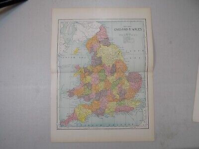
$5.00 Shipping Location: Wilmington, United States England & Wales. Published in 1892 By: Mast, Crowell & Kirkpatrick. Heavy weight soft paper. Each country is highlighted in color.
Buy It Now
$4.95 Shipping Location: Dover, United States Issued 1808, London by Vernor, Hood, Sharpe, & Poultry. Engraved by J. Roper. Fine engraved map depicting the English county of Yorkshire around the Humber ... moreriver. Yorkshire: Parts of the East & West Ridings.
Buy It Now
$8.00 Shipping Location: Reno, United States 1869 ORIGINAL ANTIQUE MAP DISTRICT CUMBERLAND Westward / ENGLAND. Shipped with USPS Ground Advantage.
Buy It Now
$20.05 Shipping Location: Deerfield, United States Very good condition for it's age. Small fold in the center, small chunk out of bottom margin.
Buy It Now
Free Shipping Location: Augusta, United States "An Authentic Original Map Not A Reproduction".
Buy It Now
$11.85 Shipping Location: Dover, United States (Suffolk, England / United Kingdom / Great Britain). Issued c.1700, Amsterdam by Valk & Schenk. Lovely antique engraved map with original hand color. ... moreOriginal fold line as issued.
Buy It Now
$6.95 Shipping Location: Dover, United States Published 1871, New York, by F.W. Beers. Very detailed mid-19th century lithographed map, of great interest for historical genealogical purposes. Original ... morecenter fold as issued.
Buy It Now
$33.71 Shipping Location: Seubersdorf, Germany Amsterdam, Hondius c. 1606. Rare map with original color from a French edition of Mercator's Atlas Major. -- With rare original color, no modern coloring! ... moreWith French text on verso. -- Format: c. 47.5x56.5cm. -- with some staining on the outer margin, otherwise in very good condition. || Rare map with original old coloring from a French edition of Mercator's Atlas Major. No modern color! With French text on the back. -- slightly stained in the outer edge, otherwise in good condition. || This is an original! - No emphasis! - No copy! -- This is an original! - No copy! - No reprint!Order number: 225215.
Buy It Now
$16.84 Shipping Location: HULL, United Kingdom This is a fabulous County Map by Thomas Moule. This was originally published in 1830 by Moule who was one of the most distinctive and best loved of the ... moreEarly Victorian Map Makers. This edition was published in 1991.
Buy It Now
$6.95 Shipping Location: Dover, United States Ashland, Town of Ashland. Issued 1875, New York by F.W. Beers. Very detailed mid-19th century lithographed map with original hand color. Of great interest ... morefor historical genealogical purposes.
Buy It Now
$11.85 Shipping Location: Dover, United States New Colored Map of Boston and Vicinity. [Map of Boston Showing New Division of Wards]. Scarce 19th century city plan pocket map.
Buy It Now
Free Shipping Location: Nampa, United States Ask The Watch.
Buy It Now
$6.95 Shipping Location: Dover, United States Issued 1850, New York by E & GW Blunt. Engraved by Hooker. Boston Harbor from the Survey of A. Wadsworth. Any age flaws mostly minor and easy to overlook ... moreor forgive. Original fold lines as issued.
$29.91 Shipping Location: NORTHWICH, United Kingdom I have here for sale a large b/wPLAN OF THE TOWN AND FORTIFICATIONS OF GIBRALTAR, exactly taken on the Spot in the Year 1738. It appeared in Mr Tindal's ... moreContinuation of Mr Rapin's History of England.
Buy It Now
$9.85 Shipping Location: Shelburne, United States
Buy It Now
$5.00 Shipping Location: Canada DATE OF ISSUE: 1924.
Buy It Now
$6.85 Shipping Location: HORNCASTLE, United Kingdom County map of Stafforshire printed circa 1860 for Barclay's Universal Dictionary. Hand painted district borders. Misprinted line across top.
Buy It Now
$6.85 Shipping Location: HORNCASTLE, United Kingdom County map of Lancashire printed circa 1860 for Barclay's Universal Dictionary. Hand painted district borders. Misprinted line across top.
Buy It Now
$8.60 Shipping Location: Cincinnati, United States First is the Historical Map of England and Wales from 1971 by L.G. Bullock. THe other is a factory sealed Replogle World Map from 2008. Good Luck!
Buy It Now
$5.95 Shipping Condition: New Location: Las Vegas, United States Nova Belgica et Anglia Nova 1635 (New England and the East Coast). Year: 1635. Ellis Island is prominently featured as Oesters (Oysters) Island. It also ... moredepicts Indian canoes and villages. Orientation is North toward the bottom.
Buy It Now
$4.65 Shipping Location: Saco, United States Page will have normal wear, browning and slightly rough or torn edges. No Book Killer Here! Plenty of border for matte and framing. No Copies or Reprints!
Buy It Now
$3.50 Shipping Location: United States Fascianting, detailed and attractive period map of these areas in 1866. The superb handcoloring is period to the map, this is before color printing. The ... moresize of the map is 10" by 12". FREE scheduling, supersized images.
Buy It Now
$23.05 Shipping Location: SHREWSBURY, United Kingdom FRUGIFERI (Herefordshire). A fine copper engraved original early 17th century antique map of Herefordshire, England enhanced with attractive later hand ... morecolouring. Engraved by William Hole after Christopher Saxton.
Buy It Now
$4.30 Shipping Location: Simpsonville, United States TITLE: Suffolk, England. Very detail map. DATE: 1888. A QUALITY ANTIQUE MAP . CONDITION: Very Good. This is an Original Print ----- NOT A REPRODUCTION ... more. A BIT OF HISTORY - OVER 100 YEARS OLD.
Buy It Now
Free Shipping Location: Monroeville, United States Genuine original antique and historical maps. Prints, engravings and illustrated books Antique& old vintage pictures prints& maps from POSTAPRINT: ... moreTopography. Good town views& city plans. Fine art engravings, ENGLAND and WALES 1901: Collectable Antique Map by Longmans Green, Authentic vintage& antique pictures prints and maps by mail order. There is printing on the back. Item I/D VM-2867 OVERALL SIZE incl. margins: 13.5x10.5 Inches. 34x27 Cms. FOLDING. IMAGE Size Varies: 12x9 Inches. 30x23 Cms All measurements are approximate. VERIFY THE DATE FOR MORE MAPS FROM THIS SERIES THE SCAN BELOW IS AN ENLARGED SECTION AS AN EXAMPLE OF THE DETAIL PROVENANCE THE PUBLIC SCHOOL ATLAS OF MODERN GEOGRAPHY IN 33 MAPS EXHIBITING CLEARLY THE MORE IMPORTANT PHYSICAL FEATURES OF THE COUNTRIES DELINEATED AND NOTING ALL THE CHIEF PLACES OF HISTORICAL. COMMERCIAL OR SIMILAR INTEREST. Edited…by the Rev. George Butler PUBLISHED 1901 BY Longmans Green& Co. 39 Paternoster Row London. New York and Bombay. This was issued as an illustration in the above book. AUTHENTICITY WARRANTED TO BE A GENUINE OLD ITEM. PRINTED AT THE DATE STATED. We NEVER offer modern day copies. The buyer may wish to print this page. CONDITION Good. Suitable for framing. Please see the scan. All old maps and prints are subject to normal ageing which is not obtrusive unless otherwise stated. PAYMENT PAYPAL PREFERRED PLEASE. RETURNS POLICY SATISFACTION GUARANTEED or your money back. Buyer pays return postage. Orders are normally mailed within 1 business day of payment. Except for vacations etc. UK DELIVERY BY 1st CLASS MAIL: Normally 1-2 working days. INTERNATIONAL BY AIR MAIL: Normally 5-10 working days. Please understand we cannot guarantee the efficiency of the Postal Services. Although they are generally reliable. More information WE HAVE BEEN IN BUSINESS FOR OVER 30 YEARS MANY 1000'S OF AUTHENTIC ANTIQUE COLLECTABLE and VINTAGE ITEMS ON OFFER France: Gravures et Cartes anciennes. Deutschland: Alte Lankarten und Stadt ansichten. Italia: Stamp
Buy It Now
$6.95 Shipping Location: Dover, United States Issued c. 1795-1806, Paris by Delamarche. Map by Vaugondy, revised and reissued by Delamarche. Engraved by Dussy. Late 18th/ early 19th century engraved ... moremap with original outline hand color. Dictionary of Mapmakers, vol.
Buy It Now
$11.84 Shipping Location: ILKLEY, United Kingdom Ideally suited for framing and display, if desired. Part the First. ', published by Edward Mogg, London, 1817. Date: 1817.
Buy It Now
Free Shipping Location: Sayville, United States Blank reverse.
Buy It Now
$12.46 Shipping Location: BATH, United Kingdom He was a prolific, but not at all original, worker and indeed was frequently accused of plagiarism, although it must be said for him that he usually made ... moreno attempt to hide his sources. Folds as issued.
Buy It Now
$7.00 Shipping Location: Weatherly, United States
Buy It Now
$5.00 Shipping Location: Canada DATE OF ISSUE: 1927. ORIGIN OF THE MAP: "Great Britain", 7th edition, published by Leipzig, Germany by Karl Baedeker, London, T. Fisher Unwin and New ... moreYork, Charles Scribner's Sons.
Buy It Now
Free Shipping Location: Sayville, United States Printed in 1905 by Longmans Green & Co.

Buy It Now
$25.00 Shipping Location: Belvedere Tiburon, United States This is an exquisite full-color Reproduction printed on heavyweight(7.0 MIL) Glossy Photo Paper. These maps are perfect for framing. Or a wonderful and ... moreunique gift for family members, friends or co-workers! All Information is Carefully Compiled from Actual Surveys Original Maps are often difficult to find and usually have fold lines. Identifying stamps or markings, tears, ragged edges, and assorted other natural signs of age that detract from their beauty. All of our maps have been professionally restored to depict their original beauty, while keeping all historical data intact. These maps are fabulous pieces of history full of information useful to Historians. Genealogists, Cartographers, Relic Hunters, Others. They make fascinating conversation pieces and splendid works of art for the home or office. This historic map captures history through a unique perspective. Event maps are authentic records of battles fought throughout the history of American wars. Dating back to the French& Indian War and recorded through the eyes of the noble military men themselves. They would make an excellent addition to any history buff's collection. Map Size: 23.00 x 27.56 Site Specifics To This Map Are: Arundel. Petersburg, Albany, Boston, Plymouth, Woodstock, Danbury, Harlem, Newcastle, Canterbury, and several other cities and towns throughout eastern North America. The following towns are featured: Province of New Hampshire. Part of New York, Colony of Connecticut, Province of Massachusets, Eastern Part of Massachusets, Rhode Island, Long Island, Hudson River, Connecticut River, Kusumpe Pond, Sunape Pond, and Lake George. Also Features a close-up insert of the town of Boston. This Map is Situated in: Eastern United States SKU: REWA0107 and Powered By: `0d.RcmdId ViewItemDescV4,RlogId p4%60bo7%60jtb9%3Fuk.rp*fc%3E%3E%600d-13deb7fd3e6-0xf7-
Buy It Now
$9.00 Shipping Location: Rockland, United States
Buy It Now
$12.40 Shipping Location: BOURNE END, United Kingdom ORIGINAL MAP of ENGLAND & WALES c1860. "By Edward Weller F.R.G.S". published by the Weekly Dispatch and engraved by Edward Weller in London. NOTE: Highly ... moredetailed 4 sheet map of England & Wales, which appeared in the Dispatch Atlas.
Buy It Now
$4.00 Shipping Location: Burlington, United States Antique map of Cathedral in England. Originally from a travel guide.
Buy It Now
$6.95 Shipping Location: Dover, United States (Grafton - New England Village. Atlas of Worcester County Massachusetts). Published 1870, New York, by F.W. Beers. Very detailed mid-19th century lithographed ... moremap, of great interest for historical genealogical purposes.
Buy It Now
$5.00 Shipping Location: Canada DATE OF ISSUE: 1924.
Buy It Now
$8.72 Shipping Location: BATH, United Kingdom England by John Senex printed in 1744. This map was published in 'Geography Anatomiz'd' by Patrick Gordon in 1744. Blank on reverse. Map area is in fair ... morecondition for age, engravings are clear. Considerable age browning to paper.
Buy It Now
$15.45 Shipping Location: Middletown, United States The globe was made by Comoy's of London, a renowned manufacturer based in England.
Buy It Now
$5.95 Shipping Condition: New Location: Las Vegas, United States Nova Belgica et Anglia Nova 1635 (New England and the East Coast). Year: 1635. Ellis Island is prominently featured as Oesters (Oysters) Island. It also ... moredepicts Indian canoes and villages. Orientation is North toward the bottom.
Buy It Now
Free Shipping Location: Spokane, United States Includes Lancashire,Yorkshire,and Cumberland.It really looks very nice,as you can see in the pictures.
Buy It Now
Free Shipping Location: North Wales, United States 1879 ANTIQUE GUYOT'S ATLAS MAP-NEW ENGLAND STATES-MASSACHUSETTS, VERMONT, MAINE ORIGINAL ANTIQUE ATLAS MAP PLEASE SEE PHOTOS AS PART OF THE DESCRIPTION ... moreCONDITION: MAP IS IN GOOD CONDITION. SIZE: APPROXIMATELY 10" X 13" SHIPPING: U.S. FIRST CLASS RATE - $7.00 - ANY ITEM WHICH SELLS FOR OVER $100 WILL REQUIRE INSURANCE WE COMBINE SHIPPING FOR MULTIPLE WINS. THANK YOU FOR YOUR INTEREST IN OUR AUCTIONS!.
Buy It Now
Free Shipping Location: Schertz, United States This is an Authentic / Original Antique Atlas Map. It is not *NEW* or in *NEW* condition, it was printed in the year indicated. We sell only Old Antique ... moreMaps, not prints, copies or posters. See Photo for best description, this is the actual map you will receive.
Buy It Now
$23.34 Shipping Location: BATH, United Kingdom Buckinghamshire by Christopher Saxton engraved by William Kip 1637. Map area is in fair condition for age, engravings are clear. Repair to the margins ... morewith the bottom margin replaced in facsimile. Hand colouring.
Buy It Now
$5.75 Shipping Location: Malden, United States On The Back Of The Other Page Is A Small Map Of The City Of Liverpool, England And Environs. There Is Also A Continuation Of The Index Of London From ... moreThe Front Of The Pages. One Page Is The Western Half Of London, The Other, The Eastern Half.
Buy It Now
$9.97 Shipping Location: POOLE, United Kingdom BERKSHIRE OXFORD ROAD MAP BY JOHN OWEN & EMANUEL BOWEN c1720 SHOWING THE ROAD FROM OXFORD THROUGH BERKSHIRE TO WILTSHIRE WITH THE ARMS OF OXFORD ON ONE ... moreSIDE AND THE DIRECTIONS FROM OXFORD TO BRISTOL WITH A DESCRIPTION OF OXFORD UNIVERSITY ON THE OTHER. THIS ORIGINAL ANTIQUE MAP WAS PRODUCED FOR "BRITANNIA DEPICTA" PUBLISHED BY THOMAS BOWLES THIS ENGRAVED MAP IS IN GOOD CONDITION WITH A CLEAR IMPRESSION AND HAND COLOUR. THE MAP MEASURES APPROX 7.75 x 5.5 ins (20 x 14 cms) THERE IS A PRINTERS CREASE TO THE MARGIN PLEASE NOTE THIS IS A MAP AND A DESCRIPTION OF OXFORD UNIVERSITY PRINTED BACK TO BACK ON ONE SHEET EMANUEL BOWEN (1694-1767) was a very accomplished map maker who worked in Fleet St, London.
Buy It Now
$4.69 Shipping Location: Greenacres, United States
Buy It Now
$5.90 Shipping Location: Trumbull, United States ordinance survey Winchester vintage map printed 1897 England Portsmouth District. Map measures 22 1/2“ x 13 3/8“. Item comes from a smoke free home. Excellent ... morecondition considering age! What a beauty!
Buy It Now
$11.85 Shipping Location: Dover, United States Issued ca. 1700, Amsterdam by Schenk Family & Valk. Fine, Decorative and uncommon old map of coastal central England, United Kingdom. With original hand ... morecolor. North is oriented to the right.
Buy It Now
$6.95 Shipping Location: Dover, United States Issued 1891, Boston by George H. Walker & Co. Massachusetts Atlas Plate No. 26. Large oversized late 19th century color lithographed regional map.
|
|
|
|
1765 Gentlemans Magazine Road Map: London to Aberystwyth, Briston to Exeter.
1765 Gentlemans Magazine Road Map: London to Aberystwyth. Briston to Exeter. WE SELL ONLY ORIGINAL ANTIQUE MAPS- NOT REPRODUCTIONS Title: A Map of the Roads from London thro Oxford. Worchester&c. to Aberistwith. The Road from Bristol to Exeter. Description: This is a scarce 1765 example of the map of the roads from London to Aberystwyth and from Bristol to Exeter published in the Gentleman's Magazine. Essentially two maps on one sheet. Features ten road strip maps through Middlesex, Oxfordshire, Gloucestershire, Worchestershire, Herefordshire, Radnorshire, Cardiganshire, Somersetshire and Devonshire. Several towns with distances are noted, including London, Oxford, Worcester, Evesham, Aberystwyth, Bristol and Glastenbury. This map was issued in 1765 as part of the Gentleman's Magazine. Size: Printed area measures 7 inches high ... moreby 11.5 inches wide. Condition: Good. Mild acid burn at center of map- more apparent from verso. Blank on verso. Original platemark visible. Shipping: Due to recent increases in United States Postal Service rates we have been forced to increase our shipping rates. Shipping rates are not negotiable. Items are shipped within three business days of receiving payment. We are happy to consolidate shipping where possible. The following shipping options are available: 1. USPS Domestic Express Mail(35 USD) USA Only. 2. USPS Priority Mail(15 USD) USA Only. 3. USPS International Express(35 to 55 USD) Recommended service for all international parcels. You will be invoiced at the lowest Express Mail rate possible. 4. USPS Priority Mail(35 USD) Available to only certain countries. Due to high instances of loss. This service is specifically NOT AVAILABLE to MAINLAND CHINA or INDIA. 5. Federal Express is available upon request. This is the only service option available to India and Africa. Price is quoted upon request following the auction. We can also use your Federal Express Account. Insurance: All shipments are insured privately against loss and damage. All of our shipments require a signa
|
|
|
1755 Stow Map of Tower Street Map, London
1755 Stow Map of Tower Street Map. London WE SELL ONLY ORIGINAL ANTIQUE MAPS- NOT REPRODUCTIONS Title: Tower Street Ward With its Division into the Parishes. Taken from the last Survey with Corrections. Description: A fine c. 1720 map of the Tower Street Ward. London, england by Richard Blome and John Strype. The map covers the region between and St. Mary's Hill and the Tower of London and from the Clothworkers Hall(still present) to the Thames River, including the gardens and Church of St. Dunstan. Blome identifies numerous important buildings, many of which still exist, including the Customs House, The Clothworker's Hall, and St. Dunstan. A director featuring 28 locations appears in the upper right quadrant just below the decorative title cartouche. The Customs House, the Navy Office, St. Dunstan, and All Hallows-by-the-Tower are ... morerendered pictorially– as are ten merchant ships plying the Thames. Blome prepared this map in the late 17th century, but it was not published until it was included in John Stow's 1720 Survey of London. Size: Printed area measures 21.5 inches high by 15.5 inches wide. Condition: Very good. Original fold lines visible. Original platemark visible. Blank on verso. Shipping: Due to recent increases in United States Postal Service rates we have been forced to increase our shipping rates. Shipping rates are not negotiable. Items are shipped within three business days of receiving payment. We are happy to consolidate shipping where possible. The following shipping options are available: 1. USPS Domestic Express Mail(35 USD) USA Only. 2. USPS Priority Mail(15 USD) USA Only. 3. USPS International Express(35 to 55 USD) Recommended service for all international parcels. You will be invoiced at the lowest Express Mail rate possible. 4. USPS Priority Mail(35 USD) Available to only certain countries. Due to high instances of loss. This service is specifically NOT AVAILABLE to MAINLAND CHINA or INDIA. 5. Federal Express is available upon request. This is the only service option available
|
|
|
1753 Bowles and Carver View of London, England
1753 Bowles and Carver View of London. England WE SELL ONLY ORIGINAL ANTIQUE MAPS- NOT REPRODUCTIONS Title: A General View of the City of London. Next the River Thames. Vue Generale de la Ville de Londres qui comprend la partie la plus voisine de la Tamise. Description: An attractive 1753 view of London set midstream on the Thames. Looking west. Set amidst busy river commerce, this view shows London Bridge(foreground) Blackfriars Bridge(middle ground) and, around the bend, Westminster Bridge and Abbey. St. Paul's Church appears just to the right of Blackfriars Bridge. This view was printed by Carrington Bowles and Carver, 69 St. Paul's Church Yard, London, and listed in their 1753 catalogue under Perspective views in and about London. Another version was printed for C. Bowles' brother, John Bowles, located at Black Horse in Cornhill.1 ... moreSize: Printed area measures 11 inches high by 17 inches wide. Condition: Average. This view. While still attractive, shows clear signs of age, including several verso repairs, overall oxidization, and browning. Still, it remains highly attractive piece. Shipping: Due to recent increases in United States Postal Service rates we have been forced to increase our shipping rates. Shipping rates are not negotiable. Items are shipped within three business days of receiving payment. We are happy to consolidate shipping where possible. The following shipping options are available: 1. USPS Domestic Express Mail(35 USD) USA Only. 2. USPS Priority Mail(15 USD) USA Only. 3. USPS International Express(35 to 55 USD) Recommended service for all international parcels. You will be invoiced at the lowest Express Mail rate possible. 4. USPS Priority Mail(35 USD) Available to only certain countries. Due to high instances of loss. This service is specifically NOT AVAILABLE to MAINLAND CHINA or INDIA. 5. Federal Express is available upon request. This is the only service option available to India and Africa. Price is quoted upon request following the auction. We can also use your Federal Exp
|
|
|
1747 Seale Map of Ireland and St. Georges Channel
1747 Seale Map of Ireland and St. Georges Channel WE SELL ONLY ORIGINAL ANTIQUE MAPS- NOT REPRODUCTIONS Title: A Correct Chart of St. Georges Channel and the Irish Sea. Including all the Coast of Ireland, and ye West Coast of Great Britain from Cantire to Portland Isle: From the latest& best Observations. Description: An extreme attractive 1747 nautical chart or maritime map of Ireland and St. Georges Channel. Engraved by R. W. Seale. This map covers the entirety of Ireland as well as adjacent parts of Scotland, England, and Wales. Being essentially a nautical chart, only coastal cities and towns are noted and rhumb lines are present throughout. Shoals and other underwater dangers are identified here and there. An elaborate cartouche of a rococo ethic is set in the lower left quadrant. Seale engraved this chart for includes in M. Tindal's ... moreEnglish language translation of M. Rapin de Thoyras's History of England. Size: Printed area measures 19 inches high by 15 inches wide. Condition: Very good. Some toning and wear on original fold lines. Shipping: Due to recent increases in United States Postal Service rates we have been forced to increase our shipping rates. Shipping rates are not negotiable. Items are shipped within three business days of receiving payment. We are happy to consolidate shipping where possible. The following shipping options are available: 1. USPS Domestic Express Mail(35 USD) USA Only. 2. USPS Priority Mail(15 USD) USA Only. 3. USPS International Express(35 to 55 USD) Recommended service for all international parcels. You will be invoiced at the lowest Express Mail rate possible. 4. USPS Priority Mail(35 USD) Available to only certain countries. Due to high instances of loss. This service is specifically NOT AVAILABLE to MAINLAND CHINA or INDIA. 5. Federal Express is available upon request. This is the only service option available to India and Africa. Price is quoted upon request following the auction. We can also use your Federal Express Account. Insurance: All shipments are insure
|
|
|
1747 La Feuille Map of England
1747 La Feuille Map of England WE SELL ONLY ORIGINAL ANTIQUE MAPS- NOT REPRODUCTIONS Title: Generale Kaart van Engeland. Description: A stunning map of England first drawn by Daniel de la Feuille in 1706. Depicts the entirety of England with parts of Ireland. Scotland and the Netherlands. Dutch language title in lower right quadrant. This is Paul de la Feuille’s 1747 reissue of his father Daniel’s 1706 map. The De La Feuille name has been removed from the map and replaced with Ratelband’s. Note in the bottom right quadrant dates this engraving to 1734 and attributes it to J. van Jagen, a prominent Dutch engraver. It was most likely Jagen who re-engraved and updated De La Feuille’s map per Ratelband’s instruction. Prepared for issue as plate no. 16 in J. Ratelband’s 1747 Geographisch-Toneel. Size: Printed area measures 7 inches high by 10.25 ... moreinches wide. Condition: Very good condition. Minor discoloration along original foldlines. Original platemark visible. Shipping: Due to recent increases in United States Postal Service rates we have been forced to increase our shipping rates. Shipping rates are not negotiable. Items are shipped within three business days of receiving payment. We are happy to consolidate shipping where possible. The following shipping options are available: 1. USPS Domestic Express Mail(35 USD) USA Only. 2. USPS Priority Mail(15 USD) USA Only. 3. USPS International Express(35 to 55 USD) Recommended service for all international parcels. You will be invoiced at the lowest Express Mail rate possible. 4. USPS Priority Mail(35 USD) Available to only certain countries. Due to high instances of loss. This service is specifically NOT AVAILABLE to MAINLAND CHINA or INDIA. 5. Federal Express is available upon request. This is the only service option available to India and Africa. Price is quoted upon request following the auction. We can also use your Federal Express Account. Insurance: All shipments are insured privately against loss and damage. All of our shipments require a signature. If y
|
|
|
1741 Homann View and Map of London, England and Environs
1741 Homann View and Map of London. England and Environs WE SELL ONLY ORIGINAL ANTIQUE MAPS- NOT REPRODUCTIONS Title: Regionis quae est circa Londinum. Specialis representatio geographica, ex autographo majori Londinensi desumta, curantibus HOMANIANIS Heredibus, 1741. Description: A fine example of Homann Heirs’ iconic 1741 map of London and its environs. Based heavily upon an earlier map of the region by Thomas Bowles. This map covers the London area from Berkshire(including Windsor Castle) in the west to Shamel in the east, extending north north as far as Bedford. Specifically focuses on Hertfordshire, Middlesex, Surrey, Essex and Kent. Offers extraordinary detail throughout, showing roadways, villages, London Streets, estates, and in many cases, individual homes. The lower portion of the sheet is dominated by a dramatic bird's-eye ... moreview of London and Westminster from Southwark across the Thames. View reveals a densely populated showing numerous boats, barges, and sailing vessels. Size: Printed area measures 20 inches high by 22.5 inches wide. Condition: Very good. Original centerfold exhibits some minor wear. A couple of minor stains including an ink stain in view. Lower left near border. Two old margin repairs and a penned dedication on verso. Shipping: Due to recent increases in United States Postal Service rates we have been forced to increase our shipping rates. Shipping rates are not negotiable. Items are shipped within three business days of receiving payment. We are happy to consolidate shipping where possible. The following shipping options are available: 1. USPS Domestic Express Mail(35 USD) USA Only. 2. USPS Priority Mail(15 USD) USA Only. 3. USPS International Express(35 to 55 USD) Recommended service for all international parcels. You will be invoiced at the lowest Express Mail rate possible. 4. USPS Priority Mail(35 USD) Available to only certain countries. Due to high instances of loss. This service is specifically NOT AVAILABLE to MAINLAND CHINA or INDIA. 5. Federal Express is availabl
|
|
|
1736 Ogilby Map of Flintshire w/ Road Map: Shrewsbury to Holywell on Verso.
1736 Ogilby Map of Flintshire w/ Road Map: Shrewsbury to Holywell on Verso. WE SELL ONLY ORIGINAL ANTIQUE MAPS- NOT REPRODUCTIONS Title: Flintshire. The Road from Shrewsbury to Holywell. Description: This is a scarce 1736 example of John Ogilby's map of the County of Flintshire. Wales. The map is printed on both sides. The map on recto features a detailed map of the County of Flintshire with a decorative title cartouche ornamented with leaves, fruit, grapes and dogs. Information about Flintshire is included along the bottom of the map proper. The verso featuring the three road strip maps from Shrewsbury to Caergwrle in Flintshire. Several towns with distances are noted, including Ortney, Didleston Green, Elismere, Oatley Park, Wrexham, in the Counties of Shropshire& Denbighsire. Several buildings, bridges, topographic features, vegetation ... moreand water bodies are noted. This map also features information about Flint and Wrexham along the bottom and left of the map. Issued as page nos. 265 and 266 in Britannia depicta, or, Ogilby improv'd. Size: Printed area measures 7.5 inches high by 5 inches wide. Condition: Very good. Minor toning with some offsetting. Original platemark visible. Printed on both sides. Shipping: Due to recent increases in United States Postal Service rates we have been forced to increase our shipping rates. Shipping rates are not negotiable. Items are shipped within three business days of receiving payment. We are happy to consolidate shipping where possible. The following shipping options are available: 1. USPS Domestic Express Mail(35 USD) USA Only. 2. USPS Priority Mail(15 USD) USA Only. 3. USPS International Express(35 to 55 USD) Recommended service for all international parcels. You will be invoiced at the lowest Express Mail rate possible. 4. USPS Priority Mail(35 USD) Available to only certain countries. Due to high instances of loss. This service is specifically NOT AVAILABLE to MAINLAND CHINA or INDIA. 5. Federal Express is available upon request. This is the only se
|
|
|
1736 Ogilby Map of Somersetshire w/ Road Map: Chester to Cardiff on verso
1736 Ogilby Map of Somersetshire w/ Road Map: Chester to Cardiff on verso WE SELL ONLY ORIGINAL ANTIQUE MAPS- NOT REPRODUCTIONS Title: A Map of Somerset Shire. The Road from Darmouth in Devon Shire to Minhead in Somerset S. Description: This is a scarce 1736 example of John Ogilby's map of the County of Somerset. England. The map is printed on both sides. The map on recto features a detailed map of the County of Somerset(commonly known as Somersetshire until the late 19th century) with a decorative title cartouche. Detailed information about Somersetshire is included along the bottom of the map proper. The armorial crest of the Duke of Somerset is also included. Verso features the three strip road map from Chester to Cardiff and notes several towns along the way. Rivers, bridges, forests, and other topographical details are also noted. ... moreEach strip map contains a compass rose and notes distances, in miles. This map also features information about Cardiff along the bottom of the map along with a Coat of Arms of Cardiff. Issued as page nos. 167 and 168 in Britannia depicta, or, Ogilby improv'd. Size: Printed area measures 7.5 inches high by 5 inches wide. Condition: Very good. Minor toning. Original platemark visible. Printed on both sides. Shipping: Due to recent increases in United States Postal Service rates we have been forced to increase our shipping rates. Shipping rates are not negotiable. Items are shipped within three business days of receiving payment. We are happy to consolidate shipping where possible. The following shipping options are available: 1. USPS Domestic Express Mail(35 USD) USA Only. 2. USPS Priority Mail(15 USD) USA Only. 3. USPS International Express(35 to 55 USD) Recommended service for all international parcels. You will be invoiced at the lowest Express Mail rate possible. 4. USPS Priority Mail(35 USD) Available to only certain countries. Due to high instances of loss. This service is specifically NOT AVAILABLE to MAINLAND CHINA or INDIA. 5. Federal Express is available upon re
|
|
|
1736 Ogilby Map of Brecknockshire w/ Road Map: Chester to Mongomery
1736 Ogilby Map of Brecknockshire w/ Road Map: Chester to Mongomery WE SELL ONLY ORIGINAL ANTIQUE MAPS- NOT REPRODUCTIONS Title: A Map of Brecknock Shire. The Road from Chester to Cardiff. Description: This is a scarce 1736 example of John Ogilby's map of the County of Brecknockshire. Wales. The map is printed on both sides. The map on recto features a detailed map of the County of Brecknockshire(also known as Brecknock or the County of Brecon) with a decorative title cartouche. Detailed information about Brecknockshire is included along the bottom of the map proper. Verso features the three strip road map from West Chester to Montgomery. Several towns and distances are noted, including Rosset, Wrexham, Ilansylen(Llansilin) and Llangedwin(Llangedwyn) in the Counties of Cheshire, Flintshire and Denbighshire. Several buildings, bridges, ... moretopographic features, vegetation and water bodies are noted. This map also features information about Chester along the bottom and left of the map and includes the Coat of Arms of Chester. Each strip map contains a compass rose and notes distances, in miles. Issued as page nos. 163 and 164 in Britannia depicta, or, Ogilby improv'd. Size: Printed area measures 7.5 inches high by 5 inches wide. Condition: Very good. Minor toning. Original platemark visible. Printed on both sides. Shipping: Due to recent increases in United States Postal Service rates we have been forced to increase our shipping rates. Shipping rates are not negotiable. Items are shipped within three business days of receiving payment. We are happy to consolidate shipping where possible. The following shipping options are available: 1. USPS Domestic Express Mail(35 USD) USA Only. 2. USPS Priority Mail(15 USD) USA Only. 3. USPS International Express(35 to 55 USD) Recommended service for all international parcels. You will be invoiced at the lowest Express Mail rate possible. 4. USPS Priority Mail(35 USD) Available to only certain countries. Due to high instances of loss. This service is specifically NOT AV
|
|
|
1695 Visscher and Overton Map of England and Wales
1695 Visscher and Overton Map of England and Wales WE SELL ONLY ORIGINAL ANTIQUE MAPS- NOT REPRODUCTIONS Title: A New Mapp of the Kingdome of England. Representing the Princedome of Wales, and other Provinces, Cities, Market Towns, with the Roads from Town to Town. Description: A fine c. 1695 old color example of the deluxe John Overton edition of Visscher's stunning map of england and Wales. Constructed on the model established by the John Adams map of 1679. Anglia Totius Tabula, Visscher's map covers all of england and Whales as well as adjacent parts of Scotland and Ireland. Towns, cities, and counties are identified and mileage between towns noted via a network of intersecting lines overlaying the map. A bold and flamboyant title cartouche appears in the upper right quadrant features numerous putti as well as the royal crests ... moreof england and Wales. To the right and left of the map proper explanatory tables, a rare addition that appears only in scarce'deluxe' editions of this map, detail market schedules for towns and cities throughout the region- no doubt an invaluable reference for anyone researching 17th century english country trade. A dedication to William III(Guilielmo III) appears below the title cartouche, allowing us to date the map with some precision. earlier editions bear an inscription to the unpopular Catholic king of england, James II. Around 1685 attention turned to William III of Orange, who earlier had married Mary II(James' daughter) putting himself in line for the British throne. William had the distinct advantage of being protestant and consequently more appealing to the anti-Catholic British. William was formally invited to invade england by group of bishops known as the'Immortal Seven' Around this time, 1688, editions of this map began appearing without any dedication- reflecting the uncertainty of the time. On November 5th, 1688, William arrived in Britain with an army of approximately 11,000 foot and 4,000 horse soldiers, proclaiming'the liberties of engl
|
|
|
CROYDON, MITCHAM COMMON, BACON'S GEOGRAPHICAL ESTAB. PUBLISHED 1920
CROYDON. MITCHAM GREEN. Detailed map of the area published by Bacon's Geographical Establishment. London circa 1920. 4 inches to the mile. Measures approx. 315 x 390 mm. Good condition. See photo for condition. Small repaired split at lower centrefold. Attractive original colour. For further information please feel free to contact us. A guaranteed genuine vintage map. SEE MORE GENUINE ANTIQUE MAPS AND PRINTS IN MY SHOP ON EBAY.CO.UK
|
|
|
BUCKINGHAMSHIRE BY ROBERT MORDEN FOR CAMDEN'S BRITANNIA 1695.
BUCKINGHAMSHIRE An attractive 17th Century map of the county by Robert Morden. Originally produced for the 1695 edition of William Camden's"Britannia" W hen they were first published these county maps were advertised as being"much the fairest and most correct of any that have yet appear'd" Decorative title cartouche and scale bars. Measures approx. 415 x 340 mm. See photos for condition. Good condition. Hand coloured. For further information please feel free to contact us. A guaranteed genuine antique map. SEE MORE GENUINE ANTIQUE MAPS AND PRINTS IN MY SHOP ON EBAY.CO.UK On 06-Dec-06 at 16:29:18 GMT. Seller added the following information: On 11-Feb-11 at 11:22:16 GMT. Seller added the following information:
|
|
|
THE OLD HALL WEOBLY, HEREFORD LITHOGRAPHED BY T. G. DUTTON. CIRCA 1840.
THE OLD HALL. WEOBLY An good sized and attractive lithograph of The Old Hall in Weobly. Herefordshire by T. G. Dutton after a sketch by J. Clayton. The parish Church is shown in the background. Measures approx. 260 x 355 mm. Marginal crease at top right corner not affecting the image. Excellent condition. Uncoloured. For further information please feel free to contact us. A guaranteed genuine antique print. SEE MORE GENUINE ANTIQUE MAPS AND PRINTS IN MY SHOP londonmapgallery ON EBAY.CO.UK
|
|
|
CANTIUM VERNACULE KENT BY JANSSONIUS. 1646.
CANTIUM VERNACULE KENT A highly decorative map of the county produced to accompany Volume IV of the"Novus Atlas" published by Janssonius family of Amsterdan in 1646. Measures approx. 380 x 500 mm. Some overall age toning but in good condition. See photos for condition. Fine hand colour. 110945 For further information please feel free to email us at info@philipsharpegallery.com A guaranteed genuine antique map. SEE MORE GENUINE ANTIQUE MAPS AND PRINTS IN MY SHOP londonmapgallery ON EBAY.CO.UK
|
|
|
LONDON. SADLERS WELLS THEATRE 1809
SADLERS WELLS THEATRE. Attractive etching and aquatint on paper by Rowlandson& Pugin. Produced to accompany Ackermann's"Microcosm of London" originally published 1808-10. Measures 195 x 270 mm. For condition see photo. Original hand coloured. For further information please feel free to email us at info@philipsharpegallery.com SEE MORE GENUINE ANTIQUE MAPS AND PRINTS IN MY SHOP ON EBAY.CO.UK ka.RcmdId ViewItemDescV4,RlogId p4%60bo7%60jtb9%3Fuk%601d72f%2Bjw%60%60wk6%3Eka-13eb9c28130-0xfc-
|
|
|
NORFOLK. NORFOLCIAE COMITATUS FOR CAMDEN'S "BRITANNIA" 1607-37.
NORFOLCIAE COMITATUS QUEM OLI ICENI. Decorative copper engraved map prepared for Camden's"Britannia" published London. 1607-37. This map originally published in 1607 dates from the 1637 edition. The information for this map was taken from an earlier map published by Christopher Saxton in 1579. This map represents one of the earliest printed maps of the County. Measures 220 x 380 mm. Excellent condition. Narrow left lateral margin. Attractive hand colour. A guaranteed genuine antique map. For further information please feel free to contact us. SEE MORE GENUINE ANTIQUE MAPS AND PRINTS IN MY SHOP ON EBAY.CO.UK On 06-Dec-06 at 16:29:18 GMT. Seller added the following information: On 11-Feb-11 at 11:22:15 GMT. Seller added the following information:
|
|
|
PIGOT & CO.'S MAPS - SHROPSHIRE CIRCA 1830.
SHROPSHIRE. Detailed map of the county with original colour published by Pigot& Co. as"An Appendage to the Midland County Volume of their National and Commercial Directories" London& Manchester circa 1830. the maps later appeared in Pigot's"British Atlas" The present map pre-dates that publication. Vignette view of St. Lawrence's Church, Ludlow. Measures approx 360 x 220 mm. Good condition. Original hand colour. A guaranteed genuine antique map. For further information please feel free to email us at info@philipsharpegallery.com SEE MORE GENUINE ANTIQUE MAPS AND PRINTS IN MY SHOP londonmapgallery ON EBAY.CO.UK On 06-Dec-06 at 16:29:18 GMT. Seller added the following information: On 11-Feb-11 at 11:22:27 GMT. Seller added the following information:
|
|
|
CHANNEL ISLANDS BY JOHN TALLIS 1850
CHANNEL ISLANDS. A highly decorative map of The Channel Islands issued by John Tallis. Probably one of the best known map-makers and publishers of the 19th Century. The maps were published circa 1850 and are considered the last series of decorative maps of the world, Contained within an elaborate border the maps are generally decorated with vignettes and scenes depicting particular views and local inhabitants. The present map of"Channel Islands" has a number of vignette views including St. Peters Port and Jersey. The map was drawn and engraved by John Rapkin while the illustrations are drawn by H. Winkles and were engraved by E. Radclyffe. Measures approx. 240 x 320 mm. Excellent unfolded example. See photo. Attractive h and colour. For further information please feel free to contact us. A guaranteed genuine antique map. SEE MORE ... moreGENUINE ANTIQUE MAPS AND PRINTS IN MY SHOP londonmapgallery ON EBAY.CO.UK 260.RcmdId ViewItemDescV4,RlogId p4%60bo7%60jtb9%3Fvo%7B%3Dd70f%2B%3E260-13eb9c2813b-0x107-
|
|
|
CORNWALL ENGRAVED BY J & C WALKER CIRCA 1835.
CORNWALL. Detailed steel line engraving on paper by J& C Walker. After a draught by Richard Creighton. The present map was published in Samuel Lewis's Topographical Dictionary of England. Circa 1835. The plans were originally produced by Creighton to illustrate the boundaries of cities and boroughs in relation to the Reform Act of 1832. Measures approx. 195 x 230 mm. Good condition. See photo for condition. Original outline h and colour. For further information please feel free to contact us. A guaranteed genuine antique map. SEE MORE GENUINE ANTIQUE MAPS AND PRINTS IN MY SHOP London Map Gallery ON EBAY.CO.UK
|
|
|
VANITY FAIR. "A GREAT CELLIST" JOSEPH HOLLMAN 02/12/97
A GREAT CELLIST. Chromolithograph produced to accompany the famous society magazine"Vanity Fair" in 1897. This portrait Shows the cellist Mr Joseph Hollman. Measures approx. 320 x 190 mm. Good condition. See photo. Original colour. A guaranteed genuine antique print. For further information please feel free to email us at info@philipsharpegallery.com SEE MORE GENUINE ANTIQUE MAPS AND PRINTS IN MY SHOP ON EBAY.CO.UK
|
|
|
SOUTHWARK LAMBETH AND CHRIST CHURCH PARISH 1720.
LAMBETH AND CHRISTCHURCH PARISH SOUTHWARK An interesting copper line engraved map showing an area of London South of the River from Southwark to Lambeth. Probably engraved by Richard Blome to accompany the 1720 edition of Stow's"Survey of London" There is an detailed table of references to the parish. Measures approx. 350 x 280 mm. Some marginal toning and a small blind stamp to the lower margin. See photo for condition. Hand coloured. 07080665 For further information please feel free to email us at info@philipsharpegallery.com A guaranteed genuine antique map. SEE MORE GENUINE ANTIQUE MAPS AND PRINTS IN MY SHOP londonmapgallery ON EBAY.CO.UK On 06-Dec-06 at 16:29:18 GMT. Seller added the following information: On 10-Sep-10 at 11:51:49 BST. Seller added the following information: RcmdId ViewItemDescV4,RlogId p4%60bo7%60jtb9%3Fvo%7B%3Dd70f%2Bf52%3E-13eb9c2812c-0x105-
|
|
|
THE PANTOMIMES FOR THE ILLUSTRATED LONDON NEWS. 1853.
THE PANTOMIMES FOR THE ILLUSTRATED LONDON NEWS. 1853. Interesting and entertaining wood engraving showing nine different pantomimes during the season of 1853. These include"Romeo and Juliet" at The Oympic. Dick Whittington" at Sadlers Wells and"Harlequin Hudibras" at Drury Lane. Produced to accompany The"Illustrated London News" for January 1853. Measures approx. 370 x 510 mm. Good condition. See photo. Attractive hand colour. For further information please feel free to contact us. A guaranteed genuine antique print. SEE MORE GENUINE ANTIQUE MAPS AND PRINTS IN MY SHOP ON EBAY.CO.UK
|
|
|
LONDON. COVENT GARDEN THEATRE 1808
COVENT GARDEN THEATRE. Attractive etching and aquatint on paper by Rowlandson& Pugin. Produced to accompany Ackermann's"Microcosm of London" originally published 1808-10. Measures 195 x 270 mm. For condition see photo. Original hand coloured. For further information please feel free to email us at info@philipsharpegallery.com SEE MORE GENUINE ANTIQUE MAPS AND PRINTS IN MY SHOP ON EBAY.CO.UK 5v.RcmdId ViewItemDescV4,RlogId p4%60bo7%60jtb9%3Fuk%601d72f%2Bkw72shq%3E5v-13eb9c2816f-0xf6-
|
|
|
GLOUCESTERSHIRE BY JOSEPH ELLIS CIRCA 1777.
A MODERN MAP OF GLOUCESTERSHIRE Copper line engraving on paper by Joseph Ellis. Published by Robert Sayer and Carrington Bowles, London circa 1777. Measures 195 x 250 mm. Good condition. Repaired split at lower centrefold. Hand coloured. A guaranteed genuine antique map. For further information please feel free to email us at info@philipsharpegallery.com SEE MORE GENUINE ANTIQUE MAPS AND PRINTS IN MY SHOP londonmapgallery ON EBAY.CO.UK On 06-Dec-06 at 16:29:18 GMT. Seller added the following information: On 11-Feb-11 at 11:21:50 GMT. Seller added the following information:
|
|
|
GLOUCESTERSHIRE BY JOHN SELLER 1773.
GLOUCESTERSHIRE Copper line engraving on paper. Published with Francis Grose's"Antiquities" London 1773-87. But printed from John Seller's original"Anglia Contracta" plate of about 1694. Measures approx. 120 x 145 mm. Some faint foxing. See photo for condition. Text under map as issued. Original hand colour with later additions. 100554 For further information please feel free to email us at info@philipsharpegallery.com A guaranteed genuine antique map. SEE MORE GENUINE ANTIQUE MAPS AND PRINTS IN MY SHOP londonmapgallery ON EBAY.CO.UK On 06-Dec-06 at 16:29:18 GMT. Seller added the following information: On 11-Feb-11 at 11:22:16 GMT. Seller added the following information:
|
|
|
CORNWALL & DEVON. ROYAUME D' WESTSEX. BY SANSON, PUBLISHED PARIS 1654..
PROVINCES D'WEST AUTREFOIS ROYAUME D'WESTSEX. Interesting copper line engraving on paper. Covering the South West region of England. Produced by N. Sanson and published in Paris 1654. Attractive titlecartouche. Measures 400 x 300 mm. Good condition. Some uniform faint spotting across the map. SEE PHOTO) Original hand colour with later additions. A genuine antique map. For further information please feel free to email us. SEE MORE GENUINE ANTIQUE MAPS AND PRINTS IN MY SHOP ON EBAY.CO.UK
|
|
|
SURREY BY THOMAS MOULE CIRCA 1840.
SURREY Steel line engraving on paper in the elaborate 19th Century"gothic" style. Originally produced for Thomas Moule's"English Counties Delineated" published in part-work form between 1830-36. Measures 200 x 270 mm. Good condition. Hand finished mount ready for framing. Hand coloured. A guaranteed genuine antique map. For further information please feel free to contact us. 020 8694 5796 SEE MORE GENUINE ANTIQUE MAPS AND PRINTS IN MY SHOP ON EBAY.CO.UK On 06-Dec-06 at 16:29:18 GMT. Seller added the following information: On 11-Feb-11 at 11:21:50 GMT. Seller added the following information:
|
|
|
HENDON, MILL HILL, FINCHLEY. BACON'S GEOGRAPHICAL ESTAB. PUBLISHED 1920
HENDON. MILL HILL, FINCHLEY. Detailed map of the area published by Bacon's Geographical Establishment. London circa 1920. 4 inches to the mile. Measures approx. 315 x 390 mm. Good condition. See photo for condition. Small repaired split at lower centrefold. Attractive original colour. For further information please feel free to contact us. A guaranteed genuine vintage map. SEE MORE GENUINE ANTIQUE MAPS AND PRINTS IN MY SHOP ON EBAY.CO.UK
|
|
|
LONDON. NARROW STREET LIMEHOUSE SECTION FROM ROCQUE 1749
LIMEHOUSE Attractive section from John Rocque's large map of London. Covering the Limehouse and Narrow Street area of Docklands. Salmon(Sermon) Lane to the North, Butcher Row to the West and Lime Kiln Dock to the East. Very detailed and rural. Measures 315 x 420mm. A few marks. See photo. Nice item once framed. Uncoloured. For further information please feel free to contact us. SEE MORE GENUINE ANTIQUE MAPS AND PRINTS IN MY SHOP stores.ebay.co.uk/londonmapgallery On 03-Dec-06 at 17:59:16 GMT. Seller added the following information: On 11-Feb-11 at 11:22:26 GMT. Seller added the following information:
|
|
|
RICHMOND FROM PETERSHAM FIELDS. 1822.
RICHMOND FROM PETERSHAM FIELDS. Decorative lithograph with full original hand colour. Drawn by William Westall and published by Rodwell and Martin of Bond Street, London, 1822. Measures approx. 200 x 330 mm. Good condition. Some light dust marks. See photo for condition. Original hand colour. For further information please feel free to email us at info@philipsharpegallery.com A guaranteed genuine antique map. SEE MORE GENUINE ANTIQUE MAPS AND PRINTS IN MY SHOP londonmapgallery ON EBAY.CO.UK
|
|
|
RICHMOND ENGRAVED BY VAN DER GUCHT (1660-1725)
RICHMOND. Attractive copper engraving showing Richmond Palace from the North bank of The Thames by Michiel van der Gucht(1660- 1725) V an der Gucht was a pupil of Philip Bouttats and was admitted to the Antwerp Guild of St Luke in 1673. By 1688. He had moved to England. He was employed mainly to engrave portraits, book illustrations and architectural prints Measures approx. 110 x 330 mm. Excellent condition. See photo for condition(original fold) Mounted ready for framing. Uncoloured. For further information please feel free to contact us 020 8694 5796 A guaranteed genuine antique map. SEE MORE GENUINE ANTIQUE MAPS AND PRINTS IN MY SHOP ON EBAY.CO.UK On 06-Dec-06 at 16:29:18 GMT. Seller added the following information: On 11-Feb-11 at 11:22:23 GMT. Seller added the following information:
|
|
|
LONDON. PLAN DE LONDRES BY BELLIN CIRCA 1750.
PLAN DE LONDRES A highly decorative miniature map of London. Published by Bellin in Paris circa 1750. Measures approx. 150 x 110 mm. Good condition. Some age toning, see photo. Hand coloured. For further information please feel free to contact us. A guaranteed genuine antique map. SEE MORE GENUINE ANTIQUE MAPS AND PRINTS IN MY SHOP LONDON MAP GALLERY ON EBAY.CO.UK
|
|
|
ST. SAVIOUR'S SOUTHWARK (CATHEDRAL) BY H. W. BREWER. CIRCA 1850.
ST. SAVIOUR'S. SOUTHWARK(CATHEDRAL) Stunning view of Southwark Cathedral by H. W. Brewer. Proof on India paper without title. Signed in pencil by the artist and engraver( Published London circa 1850. Measures approx. 225 x 375 mm. Good condition. Some surface dust, see photo. Uncoloured. For further information please feel free to contact us. A guaranteed genuine antique map. SEE MORE GENUINE ANTIQUE MAPS AND PRINTS IN MY SHOP ON EBAY.CO.UK
|
|
|
BRITISH ISLES INSULARUM BRITANNIC. BY JANSSONIUS. 1646.
INSULARUM BRITANNICARUM ACURATA DELINEATIO EX GEOGRAPHICIS CONATIBUS ABRAHAMI ORTELII A highly decorative map based on the work of Abraham Ortelius and engraved Pieter Van den Keere. Produced to accompany Volume IV of the"Novus Atlas" published by Janssonius family of Amsterdan in 1646. Measures approx. 380 x 500 mm. Some overall age toning but in good condition. Unobtrusive printers crease. See photos for condition. Fine hand colour. 1009152 For further information please feel free to email us at info@philipsharpegallery.com A guaranteed genuine antique map. SEE MORE GENUINE ANTIQUE MAPS AND PRINTS IN MY SHOP londonmapgallery ON EBAY.CO.UK
|
|
|
LONDON. ST JOHN'S GATEWAY, CLERKENWELL 1909.
ST. JOHN'S GATEWAY. CLERKENWELL. Attractive etching on paper by William Monk R.A. Died 1937) Published 1909. Measures 180 x 250 mm. For condition see photo. An attractive item. Uncoloured. For further information please feel free to email us at info@philipsharpegallery.com SEE MORE GENUINE ANTIQUE MAPS AND PRINTS IN MY SHOP ON EBAY.CO.UK
|
|
|
LONDON. SUNDAY MORNING IN KENSINGTON GARDENS 1893.
SUNDAY MORNING IN KENSINGTON GARDENS: AFTER THE SERVICE AT CHRIST'S CHURCH. LANCASTER GATE. An attractive wood engraving on paper showing Kensington Gardens in 1893. Published with The Graphic in 1893. Measures approx. 300 x 480 mm. Good condition. Attractive hand colour. For further information please feel free to email us at info@philipsharpegallery.com A guaranteed genuine antique print. SEE MORE GENUINE ANTIQUE MAPS AND PRINTS IN MY SHOP londonmapgallery ON EBAY.CO.UK On 06-Dec-06 at 16:29:18 GMT. Seller added the following information: On 11-Feb-11 at 11:22:02 GMT. Seller added the following information: f3d.RcmdId ViewItemDescV4,RlogId p4%60bo7%60jtb9%3Feog4d72f%2B%3Ef3d-13eb9c280e7-0x102-
|
|
|
LONDON. THE SOUTH PROSPECT OF ST. BARTHOLOMEW'S HOSPITAL. 1755.
THE SOUTH PROSPECT OF ST. BARTHOLOMEW'S HOSPITAL. Attractive copper line engraving on paper by Benjamin Cole. Produced to accompany William Maitland's part-work"The History of London" published 1754-6. Measures 310 x 200 mm. Good condition see photo. Hand coloured. For further information please feel free to email us. SEE MORE GENUINE ANTIQUE MAPS AND PRINTS IN MY SHOP ON EBAY.CO.UK,RcmdId ViewItemDescV4,RlogId p4%60bo7%60jtb9%3Fuk.rp*4a24%60%3C%3E-13eb9c281ec-0xfe-
|
|
|
BAYSWATER, NOTTING HILL, KENSAL GREEN SHEPHERDS BUSH.
BAYSWATER. NOTTING HILL, KENSAL GREEN, SHEPHERDS BUSH. An interesting map showing an area bordered on the South by Uxbridge Road and to the North by Kensal Green Cemetery. Drawn and engraved by Edward Weller F.R.G.S. for the Weekly Dispatch Atlas circa 1860. Measures approx. 180 x 310 mm. Some marginal toning and tears. Well away from the engraved surface. See photo for condition. Hand coloured. 07080623 For further information please feel free to email us at info@philipsharpegallery.com A guaranteed genuine antique map. SEE MORE GENUINE ANTIQUE MAPS AND PRINTS IN MY SHOP londonmapgallery ON EBAY.CO.UK On 06-Dec-06 at 16:29:18 GMT. Seller added the following information: On 11-Feb-11 at 11:22:16 GMT. Seller added the following information: f04.RcmdId ViewItemDescV4,RlogId p4%60bo7%60jtb9%3Fuk.rp*6%3D%3F%3Ef04-13eb9c28106-0xf4-
|
|
|
LONDON. FLEET PRISON 1808.
FLEET PRISON. Attractive etching and aquatint on paper by Rowlandson& Pugin. Produced to accompany Ackermann's"Microcosm of London" originally published 1808-10. Measures 195 x 270 mm. For condition see photo. Original hand colour. For further information please feel free to contact us. SEE MORE GENUINE ANTIQUE MAPS AND PRINTS IN MY SHOP ON EBAY.CO.UK
|
|
|
HYDE PARK REGENT'S PARK TOWER BACON'S GEOGRAPHICAL ESTAB. PUBLISHED 1920
HYDE PARK. REGENT'S PARK, TOWER OF LONDON- CENTRAL LONDON. Detailed map of the area published by Bacon's Geographical Establishment. London circa 1920. 4 inches to the mile. Measures approx. 315 x 390 mm. Good condition. See photo for condition. Small repaired split at lower centrefold. Attractive original colour. For further information please feel free to contact us. A guaranteed genuine vintage map. SEE MORE GENUINE ANTIQUE MAPS AND PRINTS IN MY SHOP ON EBAY.CO.UK
|
|
|
LONDON. MIDDLESEX HOSPITAL 1808.
MIDDLESEX HOSPITAL. Attractive etching and aquatint on paper by Rowlandson& Pugin. Produced to accompany Ackermann's"Microcosm of London" originally published 1808-10. Measures 195 x 270 mm. For condition see photo. Original hand colour. For further information please feel free to contact us. SEE MORE GENUINE ANTIQUE MAPS AND PRINTS IN MY SHOP ON EBAY.CO.UK
|
|
|
CAMBRIDGE COMITATUS FOR CAMDEN'S "BRITANNIA" 1607-37.
CAMBRIDGE COMITATUS QUEM OLIM ICENI INSEDERUNT Decorative copper engraved map prepared for Camden's"Britannia" published London. 1607-37. This map originally published in 1607 dates from the 1637 edition. The information for this map was taken from an earlier map published by Christopher Saxton in 1579. This map represents one of the earliest printed maps of the county. Measures 280 x 320 mm. Excellent condition. Attractive hand colour. A guaranteed genuine antique map. For further information please feel free to email us at info@philipsharpegallery.com SEE MORE GENUINE ANTIQUE MAPS AND PRINTS IN MY SHOP londonmapgallery ON EBAY.CO.UK On 06-Dec-06 at 16:29:18 GMT. Seller added the following information:
|
|
|
A MAP OF HERTFORDSHIRE BY JOHN HARRISON. 1788.
A MAP OF HERTFORD ENGRAVED FROM AN ACTUAL SURVEY Scarce and decorative copper line engraving of the county by John Harrison. There is a reference to the hundreds. Published London 1788. Measures 330 x 460mm. Old folds and age toning. See photo. Nice item once framed. Attractive hand colour. For further information please feel free to contact us. SEE MORE GENUINE ANTIQUE MAPS AND PRINTS IN MY SHOP stores.ebay.co.uk/londonmapgallery On 03-Dec-06 at 17:59:16 GMT. Seller added the following information: On 11-Feb-11 at 11:22:26 GMT. Seller added the following information:
|
|
|
CHARLTON, SHOOTERS HILL, WOOLWICH. BACON'S GEOGRAPHICAL ESTAB. PUBLISHED 1920
CHARLTON. SHOOTERS HILL, WOOLWICH. Detailed map of the area published by Bacon's Geographical Establishment. London circa 1920. 4 inches to the mile. Measures approx. 315 x 390 mm. Good condition. See photo for condition. Small repaired split at lower centrefold. Attractive original colour. For further information please feel free to contact us. A guaranteed genuine vintage map. SEE MORE GENUINE ANTIQUE MAPS AND PRINTS IN MY SHOP ON EBAY.CO.UK
|
|
|
VIEW OF GREENWICH FROM DEPTFORD YARD 1796. BY J STADLER
VIEW OF GREENWICH FROM DEPTFORD YARD. Attractive aquatint on paper by Joseph Constantine Stadler after Joseph Farington. Shipping in the foreground with Greenwich Hospital in the distance. Measures approx. 220 x 320 mm. Good condition. Attractive hand colour. For further information please feel free to email us. SEE MORE GENUINE ANTIQUE MAPS AND PRINTS IN MY SHOP ON EBAY.CO.UK
|
|
|
CANTIUM QUOD..KENT. FOR CAMDEN'S "BRITANNIA" 1607-37.
CANTIUM QUOD NUNC KENT. Decorative copper engraved map prepared for Camden's"Britannia" published London. 1607-37. This map originally published in 1607 dates from the 1637 edition. The information for this map was taken from an earlier map published by Christopher Saxton in 1579. This map represents the earliest printed map of the county. Measures 280 x 380 mm. Excellent condition. Attractive hand colour. A guaranteed genuine antique map. For further information please feel free to email us at info@philipsharpegallery.com SEE MORE GENUINE ANTIQUE MAPS AND PRINTS IN MY SHOP londonmapgallery ON EBAY.CO.UK On 06-Dec-06 at 16:29:18 GMT. Seller added the following information: On 11-Feb-11 at 11:22:18 GMT. Seller added the following information:
|
|
|
WILTSHIRE BY THOMAS BOWEN 1767. ATLAS ANGLICANUS.
WILTSHIRE DIVIDED INTO IT HUNDREDS A detailed map of the county by Thomas Bowen. Produced to accompany the"Atlas Anglicanus" first published in 1767 by Thomas Kitchin. There is a decorative rococo cartouche and many of the blank spaces are filled with text describing the main towns. Measures approx. 318 x 215 mm. Centrefold as issued. See photos for condition. Hand coloured. For further information please feel free to email us at info@philipsharpegallery.com A guaranteed genuine antique map. 100584 SEE MORE GENUINE ANTIQUE MAPS AND PRINTS IN MY SHOP londonmapgallery ON EBAY.CO.UK On 06-Dec-06 at 16:29:18 GMT. Seller added the following information: On 11-Feb-11 at 11:22:16 GMT. Seller added the following information:
|
|
|
LONDON. STAPLES INN HOLBORN 1910.
STAPLES INN HOLBORN. Attractive etching on paper of the old buildings in Holborn opposite Grays Inn Road. Published circa1910. Measures 180 x 250 mm. For condition see photo. An attractive item. Uncoloured. For further information please feel free to email us at info@philipsharpegallery.com SEE MORE GENUINE ANTIQUE MAPS AND PRINTS IN MY SHOP ON EBAY.CO.UK
|
|
|
PIGOT & CO.'S MAPS - NOTTINGHAMSHIRE CIRCA 1830.
NOTTINGHAMSHIRE. Detailed map of the county with original colour published by Pigot& Co. as"An Appendage to the Midland County Volume of their National and Commercial Directories" London& Manchester circa 1830. the maps later appeared in Pigot's"British Atlas" The present map pre-dates that publication. Vignette view of St.Mary's Church, Nottingham. Measures approx 360 x 220 mm. Good condition. Original hand colour. A guaranteed genuine antique map. For further information please feel free to email us at info@philipsharpegallery.com SEE MORE GENUINE ANTIQUE MAPS AND PRINTS IN MY SHOP londonmapgallery ON EBAY.CO.UK On 06-Dec-06 at 16:29:18 GMT. Seller added the following information: On 11-Feb-11 at 11:22:27 GMT. Seller added the following information:
|
|
|
STAPLES INN HALL, HOLBORN BY T H SHEPHERD. c1829.
STAPLES INN HALL. HOLBORN Attractive steel line engraving on paper. Produced from an original drawing by Thomas Shepherd. Originally published in 1829 with the famous series of views. London in the nineteenth century, or, Metropolitan Improvements. Measures approx. 100 x 150 mms. Good condition. Mounted and ready for framing. Hand coloured A GENUINE ANTIQUE ENGRAVING. For further information please feel free to contact us. SEE MORE GENUINE ANTIQUE MAPS AND PRINTS IN MY SHOP London Map Gallery ON EBAY.CO.UK On 22-Nov-06 at 17:29:00 GMT. Seller added the following information: On 11-Feb-11 at 11:22:12 GMT. Seller added the following information:
|
|
|
NOTTINGHAMSHIRE BY ROBERT MORDEN FOR CAMDEN'S BRITANNIA 1695.
NOTTINGHAMSHIRE An attractive 17th Century map of the county by Robert Morden. Originally produced for the 1695 edition of William Camden's"Britannia" W hen they were first published these county maps were advertised as being"much the fairest and most correct of any that have yet appear'd" Decorative title cartouche and scale bars. Measures approx. 345 x 425 mm. See photos for condition. Hand coloured. For further information please feel free to email us at info@philipsharpegallery.com A guaranteed genuine antique map. SEE MORE GENUINE ANTIQUE MAPS AND PRINTS IN MY SHOP londonmapgallery ON EBAY.CO.UK On 06-Dec-06 at 16:29:18 GMT. Seller added the following information: On 11-Feb-11 at 11:22:16 GMT. Seller added the following information:
|
|
|
PUTNEY, WANDSWORTH, WILHAM GREEN BACON'S GEOGRAPHICAL ESTAB. PUBLISHED 1920
PUTNEY. WANDSWORTH, WILHAM GREEN. Detailed map of the area published by Bacon's Geographical Establishment. London circa 1920. 4 inches to the mile. Measures approx. 315 x 390 mm. Good condition. See photo for condition. Small repaired split at lower centrefold. Attractive original colour. For further information please feel free to contact us. A guaranteed genuine vintage map. SEE MORE GENUINE ANTIQUE MAPS AND PRINTS IN MY SHOP ON EBAY.CO.UK
|
|
|
HUNTINGDONSHIRE FOR THE WEEKLY DISPATCH ATLAS. CIRCA 1860.
HUNTINGDONSHIRE. Detailed lithograph on paper by John Dower. Produced to accompany the"Weekly Dispatch Atlas" Published London circa 1860. Measures approx. 425 x 300 mm. See photo for condition. Attractive h and colour. For further information please feel free to contact us. A guaranteed genuine antique map. SEE MORE GENUINE ANTIQUE MAPS AND PRINTS IN MY SHOP londonmapgallery ON EBAY.CO.UK
|
|
|
ALBERT DOCK, BECKTON, ROYAL ARSENAL, BACON'S GEOGRAPHICAL ESTAB. PUBLISHED 1920
ALBERT DOCK. BECKTON, ROYAL ARSENAL. Detailed map of the area published by Bacon's Geographical Establishment. London circa 1920. 4 inches to the mile. Measures approx. 315 x 390 mm. Good condition. See photo for condition. Small repaired split at lower centrefold. Attractive original colour. For further information please feel free to contact us. A guaranteed genuine vintage map. SEE MORE GENUINE ANTIQUE MAPS AND PRINTS IN MY SHOP ON EBAY.CO.UK
|
|
|
LONDON. THE GROSVENOR VICTORIA STATION 1860 FOR THE ILN
THE GROSVENOR HOTEL. IN COURSE OF ERECTION ON THE SITE OF THE OLD GROSVENOR BASIN, BELGRAVIA. An attractive wood engraving on paper showing the Grosvenor hotel above what is now Victoria Station. Published with the Illustrated London News in 1860. Measures approx. 235 x 330 mm. Good condition. Attractive hand colour. For further information please feel free to email us at info@philipsharpegallery.com A guaranteed genuine antique print. SEE MORE GENUINE ANTIQUE MAPS AND PRINTS IN MY SHOP londonmapgallery ON EBAY.CO.UK On 06-Dec-06 at 16:29:18 GMT. Seller added the following information: On 11-Feb-11 at 11:22:02 GMT. Seller added the following information: 1?RcmdId ViewItemDescV4,RlogId p4%60bo7%60jtb9%3Feog4d72f%2B%3E%3B1%3F-13eb9c282c1-0x105-
|
|
|
THE CHANNEL ISLANDS BY EDWARD WELLER 1860
THE CHANNEL ISLANDS. Detailed lithograph on paper by Edward Weller. Produced to accompany the"Weekly Dispatch Atlas" Published London circa 1860. Two maps on one sheet. The upper map shows Guernsey and Sark, with insets of Alderney and a map showing the relative positions of the Channel Islands. The lower map shows the island of Jersey. Measures approx. 440 x 300 mm. See photo for condition. Attractive h and colour. For further information please feel free to contact us. A guaranteed genuine antique map. SEE MORE GENUINE ANTIQUE MAPS AND PRINTS IN MY SHOP londonmapgallery ON EBAY.CO.UK
|
|
|
THE EARL OF HARRINGTON'S SEAT AT PETERSHAM. 1770.
THE GARDEN FRONT OF THE EARL OF HARRINGTON'S SEAT AT PETERSHAM IN SURREY. Attractive copper line engraving dating from the later part of the 18th Century. Circa 1770. Measures approx. 105 x 190 mm. Excellent condition. See photo for condition. Mounted ready for framing. Attractive hand colour. For further information please feel free to contact us 020 8694 5796 A guaranteed genuine antique map. SEE MORE GENUINE ANTIQUE MAPS AND PRINTS IN MY SHOP ON EBAY.CO.UK On 06-Dec-06 at 16:29:18 GMT. Seller added the following information: On 11-Feb-11 at 11:22:23 GMT. Seller added the following information:
|
|
|
A MAP OF NORTHUMBERLAND T. JEFFERYS & T. KITCHIN 1775
A MAP OF NORTHUMBERLAND Copper line engraving on paper by Thomas Kitchin and Thomas Jefferys. Produced to accompany their"Small English Atlas" published in 1775. There is an interesting panel of engraved text below the map listing the market days in the County. Measures 170 x 140 mm(including text panel) Good condition. See photo. A few professionally repaired small marginal tears. Hand coloured. 100427 For further information please feel free to email us at info@philipsharpegallery.com SEE MORE GENUINE ANTIQUE MAPS AND PRINTS IN MY SHOP ON EBAY.CO.UK
|
|
|
CORNWALL BY LAURIE & WHITTLE 1806
CORNWALL. Copper line engraving on paper. By E. Jones. and originally published in London to accompany Laurie and Whittle's"New Traveller's Companion" and dated in the plate, 1806, but corrected to 1815. The map shows the roads to Dartmouth, Plymouth, Fowey, Falmouth, Padstow, Biddeford and Barnstaple. Measures approx. 295 x 255 mm. Good condition. With some light offsetting. See photo. Original hand colour. For further information please feel free to contact us. A guaranteed genuine antique map. SEE MORE GENUINE ANTIQUE MAPS AND PRINTS IN MY SHOP ON EBAY.CO.UK
|
|
|
SOMERSET TENSIS COMITATUS SOMERSET BY JANSSONIUS. 1646.
SOMERSET=TENSIS COMITATUS SOMERSETSHIRE A highly decorative map of the county produced to accompany Volume IV of the"Novus Atlas" published by Janssonius family of Amsterdan in 1646. Measures approx. 380 x 490 mm. Some overall age toning but in good condition. See photos for condition. Fine hand colour. 110949 For further information please feel free to email us at info@philipsharpegallery.com A guaranteed genuine antique map. SEE MORE GENUINE ANTIQUE MAPS AND PRINTS IN MY SHOP londonmapgallery ON EBAY.CO.UK
|
|
|
LONDON AND WESTMINSTER IN THE REIGN OF QUEEN ELIZABETH ANNO DOM. 1563 C. 1780
LONDON AND WESTMINSTER IN THE REIGN OF QUEEN ELIZABETH ANNO DOM. 1563 Scarce and highly attractive panoramic birds-eye view of London during the Reign of Queen Elizabeth I. Based on the famous first large scale plan of London. Published in 1560 by Ralph Agas. M any of the key sites such as St. Paul's. The Tower of London and The Globe are show. There is an explanatory table along with a 10 point legend. Measures approx. 190 x 525 mm. Excellent condition. Folds as issued. Hand coloured. A GENUINE ANTIQUE ENGRAVING. For further information please feel free to contact us. SEE MORE GENUINE ANTIQUE MAPS AND PRINTS IN MY SHOP London Map Gallery ON EBAY.CO.UK On 22-Nov-06 at 17:29:00 GMT. Seller added the following information: On 11-Feb-11 at 11:22:12 GMT. Seller added the following information:
|
|
|
LONDON. CUSTOM HOUSE BY THOMAS SHOTTER BOYS
THE CUSTOM HOUSE. An original lithograph produced by Thomas Shotter Boys for his famous series of views"London As It Is" First published, London 1842 Measures 430 x 315 mm. For condition see photo. Hand coloured. For further information please feel free to email us at info@philipsharpegallery.com SEE MORE GENUINE ANTIQUE MAPS AND PRINTS IN MY SHOP ON EBAY.CO.UK
|
|
|
ACKERMANN'S MICROCOSM OF LONDON. GUILDHALL COURT OF KINGS BENCH. 1808.
GUILDHALL. EXAMINATION OF A BANKRUPT BEFORE HIS CREDITORS, COURT OF KINGS BENCH. Attractive etching and aquatint on paper by Rowlandson& Pugin. Produced to accompany Ackermann's"Microcosm of London" originally published 1808-10. Measures 195 x 270 mm. For condition see photo. Original hand colour. For further information please feel free to contact us. SEE MORE GENUINE ANTIQUE MAPS AND PRINTS IN MY SHOP ON EBAY.CO.UK
|
|
|
MIDDLESEX & HERTFORDSHIRE BY JANSSONIUS. 1646.
MIDDLESEXIAE CUM HERTFORDIAE COMITATU MIDLESEX& HERTFORDSHIRE A highly decorative map of the two counties published by Janssonius family of Amsterdam in 1646. Measures approx. 445 x 545 mm. Some overall age toning but in good condition. See photos for condition. Fine hand colour. For further information please feel free to email us at info@philipsharpegallery.com A guaranteed genuine antique map. SEE MORE GENUINE ANTIQUE MAPS AND PRINTS IN MY SHOP londonmapgallery ON EBAY.CO.UK
|
|
|
CORNWALL BY BADESLADE AND TOMS. 1742.
CORNWALL Copper line engraving on paper by Thomas Badeslade. Published by W.H.Toms in 1742(dated in the plate) The panel on the left lists major towns in each county with details of market and fair days. Measures 141 x 145 mm. Excellent condition. Attractive hand colour. For further information please feel free to contact us. A guaranteed genuine antique map. SEE MORE GENUINE ANTIQUE MAPS AND PRINTS IN MY SHOP ON EBAY.CO.UK
|
|
|
SURREY BY ANTONIO ZATTA VENICE 1779..
SURREY A decorative copper engraved map of Surrey by Antonio Zatta. Published in Venice in 1779. Measures approx. 190 x 300 mm. Good condition. See photo for condition. Attractive original hand colour. For further information please feel free to contact us. A guaranteed genuine antique map. SEE MORE GENUINE ANTIQUE MAPS AND PRINTS IN MY SHOP ON EBAY.CO.UK
|
|
|
LONDON BRIDGE TOOLEY ST. PARISH OF ST. OLAVE 1720.
A MAP OF THE PARISHES OF ST. OLAVE AND ST. THOMAS SOUTHWARK An interesting copper line engraved map showing an area of London South of the River from The Old London Bridge to St. Savory Dock. Probably engraved by Richard Blome to accompany the 1720 edition of Stow's"Survey of London" There is an detailed table of references to the parish. Measures approx. 280 x 350 mm. Some marginal toning and tears. Well away from the engraved surface. See photo for condition. Hand coloured. 07080599 For further information please feel free to email us at info@philipsharpegallery.com A guaranteed genuine antique map. SEE MORE GENUINE ANTIQUE MAPS AND PRINTS IN MY SHOP londonmapgallery ON EBAY.CO.UK On 06-Dec-06 at 16:29:18 GMT. Seller added the following information: On 11-Feb-11 at 11:22:23 GMT. Seller added the following information:
|
|
|
MICROCOSM OF LONDON. CORN EXCHANGE MARK LANE, 1808.
CORN EXCHANGE. MARK LANE. Attractive etching and aquatint on paper by Rowlandson& Pugin. Produced to accompany Ackermann's"Microcosm of London" originally published 1808-10. Measures 195 x 270 mm. For condition see photo. Original hand colour. For further information please feel free to contact us. SEE MORE GENUINE ANTIQUE MAPS AND PRINTS IN MY SHOP ON EBAY.CO.UK 336.RcmdId ViewItemDescV4,RlogId p4%60bo7%60jtb9%3Fvo%7B%3Dd70f%2B%3E336-13eb9d23d48-0x106-
|
|
|
HUNTINGTONSHIRE BY ROBERT MORDEN FOR CAMDEN'S BRITANNIA 1695.
HUNTINGTONSHIRE An attractive 17th Century map of the county by Robert Morden. Originally produced for the 1695 edition of William Camden's"Britannia" W hen they were first published these county maps were advertised as being"much the fairest and most correct of any that have yet appear'd" Decorative title cartouche and scale bars. Measures approx. 345 x 425 mm. See photos for condition. Good condition. Hand coloured. For further information please feel free to contact us. A guaranteed genuine antique map. SEE MORE GENUINE ANTIQUE MAPS AND PRINTS IN MY SHOP ON EBAY.CO.UK On 06-Dec-06 at 16:29:18 GMT. Seller added the following information: On 11-Feb-11 at 11:22:16 GMT. Seller added the following information:
|
|
|
LONDON. THE POST OFFICE. 1809.
THE POST OFFICE. Attractive etching and aquatint on paper by Rowlandson& Pugin. Produced to accompany Ackermann's"Microcosm of London" originally published 1808-10. Measures 195 x 270 mm. For condition see photo. Original hand colour. For further information please feel free to contact us. SEE MORE GENUINE ANTIQUE MAPS AND PRINTS IN MY SHOP ON EBAY.CO.UK
|
|
|
THE PROSPECT OF GRAYS INN, FOR STOW'S SURVEY 1720.
THE PROSPECT OF GRAYS INN An elegant"Bird's Eye View" of Grays Inn from the South. Copper line engraving on paper produced to accompany the 1720 edition of Stow's"Survey of London" Measures approx. 200 x 320 mm. Excellent condition. See photo for condition. Attractive hand colour. For further information please feel free to contact us 020 8694 5796 A guaranteed genuine antique map. SEE MORE GENUINE ANTIQUE MAPS AND PRINTS IN MY SHOP ON EBAY.CO.UK On 06-Dec-06 at 16:29:18 GMT. Seller added the following information: On 11-Feb-11 at 11:22:23 GMT. Seller added the following information:
|
|
|
CIRENCESTER THE SEAT OF ALLEN BATHUST ESQ BY J. KIP. 1768.
CIRENCESTER THE SEAT OF ALLEN BATHURST A decorative copper engraved"Bird's Eye View" of Cirencester by Johannes Kip. Produced to accompany Sir Robert Atkyns's"The Ancient and Present State of Glocestershire" published London 1768. Measures approx. 340 x 430 mm. Good condition. See photo for condition. A few chips to the extremities of upper margin. Attractive hand colour. For further information please feel free to contact us. A guaranteed genuine antique print. SEE MORE GENUINE ANTIQUE MAPS AND PRINTS IN MY SHOP LONDON MAP GALLERY ON EBAY.CO.UK
|
|
|
RUTLAND BY ROBERT MORDEN FOR CAMDEN'S BRITANNIA 1695.
RUTLAND An attractive 17th Century map of the county by Robert Morden. Originally produced for the 1695 edition of William Camden's"Britannia" W hen they were first published these county maps were advertised as being"much the fairest and most correct of any that have yet appear'd" Decorative title cartouche and scale bars. Measures approx. 285 x 360 mm. See photos for condition. Good condition. Hand coloured. For further information please feel free to contact us. A guaranteed genuine antique map. SEE MORE GENUINE ANTIQUE MAPS AND PRINTS IN MY SHOP ON EBAY.CO.UK On 06-Dec-06 at 16:29:18 GMT. Seller added the following information: On 11-Feb-11 at 11:22:16 GMT. Seller added the following information:
|
|
|
A VIEW OF RICHMOND PALACE FRONTING THE GREEN AS BUILT BY HENRY VIII. 1765.
A VIEW OF RICHMOND PALACE FRONTING THE GREEN. Decorative copper line engraved view of Richmond Palace as built by Henry VIII. engraved by Isaac Basire and published by the Society of Antiquaries. London 1765. Measures approx. 220 x 320 mm. Good condition. Unobtrusive blind stamp. See photo for condition. Uncoloured. For further information please feel free to email us at info@philipsharpegallery.com A guaranteed genuine antique map. SEE MORE GENUINE ANTIQUE MAPS AND PRINTS IN MY SHOP londonmapgallery ON EBAY.CO.UK
|
|
|
CORNWALL BY EMANUEL BOWEN 1755/64.
CORNWALL Copper line engraving on paper. Originally produced by Emanuel Bowen for the"General Magazine" Published in monthly parts, 1755-1764. Measures approx. 175 x 195 mm. Excellent condition. Folds as issued. Hand coloured. A guaranteed genuine antique map. For further information please feel free to email us. SEE MORE GENUINE ANTIQUE MAPS AND PRINTS IN MY SHOP ON EBAY.CO.UK On 06-Dec-06 at 16:29:18 GMT. Seller added the following information: On 11-Feb-11 at 11:22:29 GMT. Seller added the following information: RcmdId ViewItemDescV4,RlogId p4%60bo7%60jtb9%3Fvo%7B%3Dd70f%2Bf%60%60%3E-13eb9d23d95-0x105-
|
|
|
LONDON. INDIA HOUSE THE SALE ROOM. 1808. TEA AUCTION.
INDIA HOUSE. THE SALE ROOM. Attractive etching and aquatint on paper by Rowlandson& Pugin. Produced to accompany Ackermann's"Microcosm of London" originally published 1808-10. Measures 195 x 270 mm. For condition see photo. Original hand colour. For further information please feel free to contact us. SEE MORE GENUINE ANTIQUE MAPS AND PRINTS IN MY SHOP ON EBAY.CO.UK
|
|
|
LONDON. WEST INDIA DOCKS 1810. CANARY WHARF.
WEST INDIA DOCKS. Attractive etching and aquatint on paper by Rowlandson& Pugin. Produced to accompany Ackermann's"Microcosm of London" originally published 1808-10. Measures 195 x 270 mm. For condition see photo. Original hand coloured. For further information please feel free to email us at info@philipsharpegallery.com SEE MORE GENUINE ANTIQUE MAPS AND PRINTS IN MY SHOP ON EBAY.CO.UK
|
|
|
LONDON. ST. MARGARETS WESTMINSTER 1809.
ST. MARGARETS WESTMINSTER. Attractive etching and aquatint on paper by Rowlandson& Pugin. Produced to accompany Ackermann's"Microcosm of London" originally published 1808-10. Measures 195 x 270 mm. For condition see photo. Original hand colour. For further information please feel free to contact us. SEE MORE GENUINE ANTIQUE MAPS AND PRINTS IN MY SHOP ON EBAY.CO.UK
|
|
|
GREAT AND LITTLE ILFORD - OLD VICTORIAN STREET MAP ESSEX LONDON
AMAZINGLY DETAILED 3 INCHES TO ONE MILE VICTORIAN 1890s STREET MAP OF THE ILFORD AREA TAKEN FROM A DISBOUND PHILIPS HANDY ATLAS OF LONDON. RIVER RODING CROSSES THROUGH THE MIDDLE. CITY OF LONDON CEMETERY ON THE LEFT, MANOR PARK STATION BELOW, GREAT AND LITTLE ILFORD IN THE MIDDLE WITH EXTREME TOP END OF BARKING BOTTOM RIGHT. MEASURES 8 AND A HALF BY 7 INCHES. FOLD DOWN THE MIDDLE. WOULD LOOK GOOD FRAMED.
|
|
|
LARGE ORIGINAL Picot & Co 1830s Map of Suffolk England
REF NO B 54 LARGE ORIGINAL Picot& Co 1830s Map of Suffolk England 21 ITEM DETAILS Map Title- LARGE ORIGINAL Picot& Co 1830s Map of Suffolk England Description- Original Pigot& Co Lithograph map circa late 1830s. County borders and map border colored by hand. Use the zoom function to view the large amount of detail and fine engraving on this antique map. Map will be sent rolled in a mailing tube due to its size. Date printed- Late c 1830s Printed in- England Authenticity- 100% genuine and over 180 years old Map size with margin- cm Approximate 27 x 41- inchs Approximate 10 1/2 x 16 Map image size- cm Approximate 22 X 35- inchs Approximate 8 3/4 x 13 3/4 Condition- Good used condition with slight yellowing to the paper due to age. Slight foxing of paper around margins. 100% Satisfaction Garantee. Premium Packing information Prints ... moreare packed in Photo Mailing Boxs or similar. Depending on print size, if large than A4 Plastic sleeve covering your prized item. CONDITION AND OTHER OPINIONS Condition. And other opinions I state in the listing, are what I see, and may not be yours. My refund policy, is my opinion of what I say in my listings, and based on my Ebay purchases, and how I want to be treated as the buyer FEEDBACK POLICY I leave feedback by automated system. As soon as your payment is received. Feedback is left. I am human, so if there is a problem let me fix it, then leave feedback based on that. Should I receive a negative feedback, I use it as a way to improve my service,to my customers, so my new customers are happier than my old ones AUTHENTICITY OF ITEMS There are no photo copies or modern prints sold.Unless clearly stated. All items are genuine and the age stated and taken form a publication of the age stated in the listing IF APPLICABLE. IMPORT DUTIES,TAXES,CUSTOMS DUTIES AND FORMS ETC ARE NOT INCLUDED IN THE SALE PRICE AND ARE THE RESPONSIBILITY OF THE BUYER. THE BUYER iIS TO CONFIRM IF ANY OF THESE APPLY Powered by The free listing tool. List your items fast and easy and manage
|
|
|
HUGE MAP Middlesex ,Surry,Kent,Essex,c1830s England
REF NO B 54 HUGE MAP Middlesex.Surry,Kent,Essex,c1830s England 001 ITEM DETAILS Map Title- HUGE MAP Middlesex.Surry,Kent,Essex,c1830s England Description- Original Pigot& Co Lithograph map circa late 1830s. County borders and map border colored by hand. Use the zoom function to view the large amount of detail and fine engraving on this antique map. Map will be sent flat folded along its original fold lines Condition Below. Date printed- Late c 1830s Printed in- England Authenticity- 100% genuine and over 180 years old Map size with margin- cm Approximate 44 x 50- inchs Approximate 17 1/4 x 19 3/4 Map image circle diameter- cm Approximate 41 x 41- inchs Approximate 16 x 16 Condition- Good used condition with slight yellowing to the paper due to age. Slight foxing of paper around margins. 2 old paper repairs as seen in rear scans. one repair ... morehas a second repair next to it in a clear archival tape- one unrepaired paper tear right corner just short of waterline of engraving-Originaly folded approximatley in half. With a second fold about 5 cm along one side- Shadow of map circle through word Pigot and legend top left and legend on right 100% Satisfaction Garantee. Premium Packing information Prints are packed in Photo Mailing Boxs or similar. Depending on print size, if large than A4 Plastic sleeve covering your prized item. CONDITION AND OTHER OPINIONS Condition. And other opinions I state in the listing, are what I see, and may not be yours. My refund policy, is my opinion of what I say in my listings, and based on my Ebay purchases, and how I want to be treated as the buyer FEEDBACK POLICY I leave feedback by automated system. As soon as your payment is received. Feedback is left. I am human, so if there is a problem let me fix it, then leave feedback based on that. Should I receive a negative feedback, I use it as a way to improve my service,to my customers, so my new customers are happier than my old ones AUTHENTICITY OF ITEMS There are no photo copies or modern prints sold.Unless clea
|
|
|
1858 PRINT THE ISLE OF WIGHT BY E.WILLIAMS
On offer is a Print taken from the London Illustrated News in 1858 Vol XXXII on a single page.The date is printed in the top margin which shows its authenticity.Please note this print is from a periodical and has print on both sides.This print is actually over 150 years old.Size of main print 9"x13"220mmx320mm)Size of page is approx 15"x11"380mmx270mm) Own a super piece of History which will look good when trimmed and framed.Print is in good condition for its age has a corner crease. Title of Print The Isle of Wight Drawn and Glyphographed by E.Williams with article. I try to describe as best i can i just add the other articles as cursory and am only selling the Print if i do not mention accompanied article the article is elsewhere in the periodical.So if its the article you are interested in please contact me before buying ... moreand i will check that the article is intact. Any subsequent purchases within a 7 day period will be sent free of charge only the postage/shipping for the initial/highest cost will be charged so if you maybe intend on buying more let me know as i tend to post quite quickly every Monday and Thursday. I ACCEPT CHEQUES/POSTAL ORDERS/NOCHEX/PAYPAL FROM UK BIDDERS. ITEMS ARE NOT DESPATCHED UNTIL CHEQUES ARE CLEARED. WE GO TO THE BANK WITH CHEQUES A COUPLE OF TIMES A WEEK SO ITEMS ARE SENT AS SOON AS POSSIBLE WHEN CHEQUES CLEAR AFTER THIS. PLEASE DO NOT SEND ANY PAYMENTS UNTIL AN INVOICE HAS BEEN SENT. WE CANNOT BE HELD RESPONSIBLE FOR ITEMS LOST OR DAMAGED IN THE POST UNLESS INSURANCE HAS BEEN PAID FOR. I GO TO THE POST OFFICE TWICE A WEEK. OVERSEAS BUYERS MUST PAY BY PAYPAL OTHER METHODS INCUR BANK CHARGES AS FOLLOWS-INTERNATIONAL DRAFT GBP10.00- ELECTRONIC PAYMENTS RECEIVED FROM ABROAD GBP7.00- CHEQUES RECEIVED FROM ABROAD GBP8.00. THESE ARE NOT MY CHARGES THEY ARE THE CHARGES WHICH ARE CHARGED BY LLOYDS/TSB SO ITS OUT OF MY HANDS. POSTAGE COSTS MORE AND INSURANCE IS HIGHER FOR ABROAD. PLEASE ONLY BID IF YOU ARE SERIOUS ABOUT BUYING. ITEMS MUST BE SENT AIRMAIL. BUYERS PAY P/P.A
|
|
|
RUTLANDSHIRE - John Cary Fine Original Hand Coloured, Antique County Map 1809
RUTLANDSHIRE- John Cary Fine Original Hand Coloured. Antique County Map 1809 Description: CARY. John, 1754- 1835) Rutlandshire. London: Published by John Cary. Circa 1809] A fine highly detailed antique map of Rutlandshire with fine original handcolour published by John Cary and credited to him at the bottom of the plate. The map printed on hand-made paper with printed title cartouche with compass rose and separate scale of distance. Image size approx. 260mm x 210mm(10.5" x 8.5" with good margins beyond. A VG+ bright clean impression. John Cary(1754- 1835) was a renowned and active map engraver and publisher. Working between 1787 and 1834 in London. Cary’s publications did much to advance the quality and clarity of data presentation on maps. His county maps for Richard Gough’s edition of Camden’s Britannia in 1789 evidenced much ... moreimproved hachuring(shading to show land relief and physical features) when compared with earlier examples– Cary’s hachuring was much less overbearing than that used by other mapmakers at this time and did not obscure map data. Cary’s career really began when he was apprenticed to William Palmer. A noted engraver, in 1770, and he soon gained a reputation as a maker of globes, both terrestrial and celestial, becoming the foremost globe-maker of his day. Under Palmer he also learned the delicate art of engraving that was to stand him in good stead for the rest of his career. He set up his own publishing business c.1783 and, with his understanding of engraving and his interest in the country’s growing transport networks at this time, his map publications were well received. Cary was also to foster the talent of later mapmakers. Aaron Arrowsmith worked for Cary and did much of the research(making measurements and producing drawings) for Cary’s 1784 publication. Great Post-Roads Between London& Falmouth. This relatively early and scarce work illustrates Cary’s interest in the transport network. Many of his later atlases were directed at the traveller and his works were often u
|
|
|
NOTTINGHAMSHIRE - John Cary Fine Original Hand Coloured, Antique County Map 1809
NOTTINGHAMSHIRE- John Cary Fine Original Hand Coloured. Antique County Map 1809 Description: CARY. John, 1754- 1835) Nottinghamshire. London: Published by John Cary. Circa 1809] A fine highly detailed antique map of Nottinghamshire with fine original handcolour published by John Cary and credited to him at the bottom of the plate. The map printed on hand-made paper with printed title cartouche with compass rose and separate scale of distance. Image size approx. 260mm x 210mm(10.5" x 8.5" with good margins beyond. A VG+ bright clean impression. John Cary(1754- 1835) was a renowned and active map engraver and publisher. Working between 1787 and 1834 in London. Cary’s publications did much to advance the quality and clarity of data presentation on maps. His county maps for Richard Gough’s edition of Camden’s Britannia in 1789 evidenced ... moremuch improved hachuring(shading to show land relief and physical features) when compared with earlier examples– Cary’s hachuring was much less overbearing than that used by other mapmakers at this time and did not obscure map data. Cary’s career really began when he was apprenticed to William Palmer. A noted engraver, in 1770, and he soon gained a reputation as a maker of globes, both terrestrial and celestial, becoming the foremost globe-maker of his day. Under Palmer he also learned the delicate art of engraving that was to stand him in good stead for the rest of his career. He set up his own publishing business c.1783 and, with his understanding of engraving and his interest in the country’s growing transport networks at this time, his map publications were well received. Cary was also to foster the talent of later mapmakers. Aaron Arrowsmith worked for Cary and did much of the research(making measurements and producing drawings) for Cary’s 1784 publication. Great Post-Roads Between London& Falmouth. This relatively early and scarce work illustrates Cary’s interest in the transport network. Many of his later atlases were directed at the traveller and his works wer
|
|
|
Bacon's Geographical Establishment - Plan of Manchester - c. 1890's
A 19th century map/plan of Manchester by Bacon's Geographical Establishment. c. late 1890's. Divided into 1/2 Mile Squares& circles coloured to show the different Wards. Full page Dimensions approx. 53 x 35 cms. Map in VG condition with centre fold& feint signs of use. Enjoy your purchase. If not satisfied. contact me in the first instance, BEFORE entering Feedback comments. I aim to please. THANKS. Check out my!
|
|
|
Vintage Map - Plan of Liverpool - by J. Bartholomew - c.1898
A 19th century map/plan of Liverpool. by J. Bartholomew. Co.Ltd. C.1898. Page/leaf taken from the Royal Atlas of England& Wales.1898. Full page Dimensions approx. 46 x 36 cms. Map in VG/Good condition with feint marks/signs of use. Enjoy your purchase. If not satisfied, contact me in the first instance, BEFORE entering Feedback comments. I aim to please. THANKS. Check out my! 5v.RcmdId ViewItemDescV4,RlogId p4%60bo7%60jtb9%3Fuk%601d72f%2Bkw72shq%3E5v-13ee09dd1cb-0xf4-
|
|
|
Vintage Map - Plan of Chatham, Rochester - by G W. Bacon - Ordnance Atlas c.1883
A 19th century map/plan of Chatham. Rochester etc. by G W. Bacon. c.1883. Map is a Page/Leaf taken from the New Ordnance Atlas. Full page Dimensions approx. 51.5 x 34.5 cms. Map in VG/Good condition with very small defect to top left corner& feint marks/signs of use. Enjoy your purchase. If not satisfied, contact me in the first instance, BEFORE entering Feedback comments. I aim to please. THANKS. Check out my! 336.RcmdId ViewItemDescV4,RlogId p4%60bo7%60jtb9%3Fvo%7B%3Dd70f%2B%3E336-13ee09dd191-0xfd-
|
|
|
Old Somerset Replica Speed map c.1610. 100% Hand Coloured unique GIFT idea
Somerset Replica John Speed c.1610 Map. 100% ALL Hand Coloured A Unique and Unusual Gift Idea! Posted to you Worldwide in a Mailing tube. DESCRIPTION NB.The red writing in the centre of this map is a'watermark' and will NOT appear on your purchase. SOMERSET This is a brilliant hand coloured. Reproduction map of Somerset. C.1610. The city of Bath is shown in the top left corner along with a legend of places within the city. And illustrations of five of the baths, and of the Arms of the city. In the bottom left hand corner are depictions of the coats of arms of the Earls of Bath and the Earls and Dukes of Somerset. The detail gone into on this map is fantastic. The Mendip hills and Cheddar are marked, with a description of a nearby spring which"driveth 12 mills within one quarter of a mile from it's head" also marked are ... morefamous places such as Glastonbury(the legendary burial place of King Arthur) along with it's Tor, Wookey Hole, and neighbouring Wells, Britain's smallest city. This map was in use before the advent of motor cars. Railways, canals, and even before the English Civil War and the loss of Charles' head! John Speed was the most famous of all English map-makers. He published an atlas of the counties of Britain. Entitled"The Theatre of the Empire of Great Britaine" in 1611. His original maps are highly prized and fetch many hundreds of pounds when they come on the market. Measuring c. 21" x 16" This map has been reproduced onto quality cream vellum 220 gsm paper, and painstakingly hand coloured. With no other mechanical colouring involved. Every bit of colour on this map has been applied by hand with sable brushes using traditional watercolours and inks. THERE IS NO PRINTED COLOUR ON THIS MAP WHATSOEVER! The buyer of this map will also receive FREE of CHARGE.a full size copy(c.21"x 17" of the original reverse side of this map. A portion of which is shown below. In the past if you wanted a John Speed Map. You either had to pay hundreds, if not,
|
|
|
Fascinating Antiqued Parchment Replica Old Map of Berkshire 1610 by John Speede
Fascinating Antiqued Parchment Replica Old Map of Berkshire 1610 by John Speede This is in very good condition. Still in its cardboard sleeve, as it was a gift some time ago to my husband when we moved to Berkshire but has only ever been opened once as he really wasn’t interested. I really should have remembered that although he’s very interested in history he has a problem with maps– I used to drive while he navigated, but it’s so long since I allowed him to navigate that I’d forgotten! Antiqued parchment Replicas from The Olde Map Company who say“The map has been hand folded to minimise creasing. It may be ironed flat or. To retain its texture, lightly misted with water and rolled end to end a number of times to remove the creases. Speede’s maps are valued today for their amazing ability to combine function with beauty. As well as showing ... moretowns. Villages and boundaries as they were during the reign of Elizabeth I, he portrayed the first‘aerial views’ of many cities and embellished his work with a wealth of heraldic detail, decoration illustration of battles and royal portraits which elevate his craft into an elaborate work of art. Thank you for looking at my auction. Happy bidding! Please do feel free to contact me if you have any questions. I’m selling in the spirit of decluttering. Recycling and downsizing. Please help me rehome my pre-loved stuff. And look at my other auctions coming of quirky bits, useful things and sparkly stuff. All my items are from a smoke-free home. I do have 2 small Chihuahuas. But they don’t climb over my clothes and merchandise! I hope you're happy with your item. But if not please get in touch and I'll try and put it right. Payment I only accept PayPal– easy for both of us. Payments are due within 3 days of an auction ending. If you have any problems with this or want to combine several items please do let me know. If you want to buy several items and combine postage. Please contact me before the first item ends, as I pack quickly after the auction end in order to post prom
|
|
|
ANTIQUE GLOUCESTERSHIRE COLOR MAP PRINT FRAMED J BINGLEY ENGRAVING DATED 1830
ANTIQUE GLOUCESTERSHIRE COLOR MAP PRINT FRAMED J BINGLEY ENGRAVING DATED 1830 Search Item offered is a: ANTIQUE GLOUCESTERSHIRE COLOR MAP PRINT FRAMED J BINGLEY ENGRAVING DATED 1830. GREAT EXAMPLE. NICELY DONE. We always welcome any information. Thank you. Ubid4savings is an auction that encourages bidders to buy multiple items for savings. Most bidders ASSUME that shipping costs is the total of all the shipping amounts shown. WRONG! USPS and UPS charges by ZONE and WEIGHT! You already paid the zone fee for one item. By selecting more items,you will only be charged the extra weight, which is in most cases it's JUST A FEW DOLLARS MORE! For multiple items. Please email us with the items you are interested in and YOUR ZIP CODE for a shipping rate quote. You will be surprised how much you can save on shipping charges vs. buying singles. We ... moreconsider ourselves expert packers. If not the best packers on eBay! OUR DESCRIPTION IS OUR PICTURES! Please ask any questions before bidding. Most of our items are in the same state as we find them! Some cleaning may be required. This allows us to list in volume and keep handling costs down. PLEASE REVIEW ALL PICTURES before bidding. As they will provide maker, size, and condition! We take multiple pictures. Just like you would see, if you were reviewing the items in your hands. Enjoy searching our active listings regularly, as items are always being added. ATTENTION: ALL OF IT MUST GO! THIS IS AN ALL SALES FINAL AUCTION! We have a hoard of items. From decades of collecting anything and everything that caught our eye. DUE TO RECESSION AND RISING PRICES. we are forced to liquidate. ALL ITEMS will be listed at EXTREME DISCOUNTS! Most of these listings are Antique and Collectible. As well as Anything and Everything! BY BIDDING. You are accepting all terms of our auctions. DO NOT ASSUME ANYTHING! Please email us with any questions. As we welcome answering any concerns you may have. We only answer emails in the EBAY system. Which is the safest way to communicate. Thank you. Please
|
|
|
18th Century - Suffolk & Norfolk - Old Road Map Old Laid Paper - From Old Book
Here for auction is an original old map on old chain line laid paper dating to the 18th century not sure what type of map this is but probably road typ map of Suffolk& Norfolk on both sides- photo 3 I have photographed with light behind so you can see the age& paper. Measures 7.75 x 5.5 inches approx. Postage will be- UK- Royal Mail 2nd Class Recorded International- Royal Mail International Signed For. I will give a good postage discount for joint postage.
|
|
|
Original c1695 'Britannia Saxonica' - by Robert Morden
Normal 0 false false false EN-GB X-NONE X-NONE Normal 0 false false false EN-GB X-NONE X-NONE Britannia Saxonica- Robert Morden c1695 An engraved antique map of England and Wales in Saxon times by Robert Morden. Engraved by John Sturt. Published in Camden's Britannia 1695. The colouring is later. Two decorative cartouches. The Saxon kingdoms are the focus of this historical map of England and Wales. Saxon place names and battlefields are shown. The distance scale cartouche includes a key to the symbols used and gives examples of Saxon lettering. The map was engraved by John Stuart. With his imprint at bottom. Ref: Shirley(BI) Morden 12. Mint condition with hand colouring… Approx 29.5cms by 37cms. Posted rolled in a plan tube Normal 0 false false false EN-GB X-NONE X-NONE
|
|
|
THE COUNTY OF MONMOUTH BY ROBERT MORDEN FOR CAMDEN'S BRITANNIA 1695
THE COUNTY OF MONMOUTH An attractive large map of the county by Robert Morden. Originally produced for the 1695 edition of William Camden's"Britannia" these county maps when were published were advertised as being"much the fairest and most correct of any that have yet has appeared" Decorative title cartouche and scale bars. Engraved surface measures approx. 345 x 415 mm. Good condition. See photo for condition. A very attractive hand colour. For further information please feel free to contact us. A guaranteed genuine antique map. SEE MORE GENUINE ANTIQUE MAPS AND PRINTS IN MY SHOP ON EBAY.CO.UK
|
|
|
1857 Desilver Map England & Wales London Liverpool Cornwall Thames Great Britain
Lake Erie Maps& Prints An Original Antique Map: Not a Modern Reproduction! We are Happy to Combine Multiple Purchases to Save on Shipping! Free US Shipping on purchases of 5 or more maps. Description: It is an authentic Antique Map: Not a modern reproduction! It is a steel plate engraved map with original handcoloring as issued. The most sought after of all the Mitchell Maps. It is from a rare edition of Charles Desilver's New Universal Atlas. Published by Desliver in Philadelphia in 1857. The map has a copyright date by Desliver of 1856 in small print in the bottom margin. Desilver's name and address 251 Market St. Philladelphia appears under the title area. The American Cartographer, Charles Desilver, bought the copyrights and plates of Mitchell's atlas of the same name and updated the maps and made some minor changes particularly ... morein the title block, added his own border style, choices of color and published the atlas from 1856 to 1859. The run of the Desilver atlas was more limited in number than the previous Cowperthwait publishing, thus the Desilver maps are the rarest of all the Mitchell maps published and difficult to find. A copy of the title page is included. Size: The map image measures approximately 12 1/2 by 15 3/4 inches on a 13 3/4 by 17" page. Condition: The map is in Very Good condition for its age with overall tonal aging and original handcoloring as issued. Blank on the reverse, printed on a strong flexible page, not brittle, basically as seen in the pics. There is some darkening around the edges, otherwise it is very clean with a nice anttique quality that would frame up nicely. The pic is of the actual map you are bidding. Payment Details: We accept most major credit cards through Paypal and Ebay. Please ask if you have any questions about payment. International and New Bidders are welcomed and encouraged. Payment is expected within 7 days. After which Nonpaying Bidders will be reported to Ebay to recoup our listing fees. Save on Shipping: We only charge one shipping fee b
|
|
|
ORIGINAL ANTIQUE MAP LINCOLNSHIRE JOHN SELLER 1773-1787 FROM GROSE'S ANTIQUITIES
Original 18th Century Antique Map of Lincolnshire By John Seller Taken from Grose's Antiquities published between 1773 and 1787 A very good example with original colouring. Which can be seen to reverse, some minor spots of browning(see scans) overall size 9" by 6" Map size 6" by 5" Please view my other interesting collectables and 1st Edition Books Please note watermark not on original 3j.RcmdId ViewItemDescV4,RlogId p4%60bo7%60jtb9%3Fuk%601d72f%2Bij%7Fil7g%3E3j-13ee399b7e5-0xf1-
|
|
|
1800s antique REYNOLDS'S foldout MAP OF LONDON AND VISITOR'S GUIDE BOOK
VACATIONX] We combine shipping charges on multiple winning bids. Check out my other listings. save $$$: on eBay. ♥1800s antique REYNOLDS'S foldout MAP OF LONDON AND VISITOR'S GUIDE BOOK. Nice early 32 page illustrated book. With foldout map(29.25" x 20" which is backed with linen. Hardcover, green cloth over board with blind embossing. Not bad condition with wear as shown including some holes in map at creases. Etc. Still a very nice complete book with a really nice cover. Book cover measures approx 4" x 7" Nice engravings. We combine shipping charges on multiple winning bids. Check out my other listings. save $$$: on eBay. our promise to you: 1.Our items are mostly 100 years old or so. Expect that their will be flaws consistent with antique items and it is not possible to note every flaw. Be sure to send us a ... moremessage if you need more specifics on an item. 2. We sometimes make mistakes in our listings. But we never intentionally misrepresent. To give you peace of mind, we offer an easy, no hassle return policy. We have a staff of four, and an occasional mistake will happen. Please be kind with feedback as we will make it right with our return refund policy. 3.We do not offer partial refunds or"discounts" after you receive the item. We will offer full refund for return. Please be kind with feedback as we will make it right with our return refund policy. Please contact us first through ebay message system before leaving bad feedback. Often there is just a misunderstanding and we appreciate being given the opportunity to explain or make things right. It is our desire to work with you and appreciate your business and kindness. LOC: smallbooks11-KM Powered by
|
|
|
1835 Plan Of Land Mount Vernon Liverpool Folded Paper Map 39insx26ins Mr W.Comer
1835 Large fold ed hand drawn plan titled A Plan Of Land Mount Vernon In Liverpool good complete condition but has damage around edges and on folds size opened out 39insx26ins great rare period detailed plan/map showing all plots Plan is in possesion of Messrs Crook&Sons Accountants in the Estate of William Comer a Bankrupt
|
|
|
Antique Map of the County of HAMPSHIRE - Bacon - 1896.
Antique Map of the County of HAMPSHIRE- Bacon- 1896. An Original Antique Map for the County of HAMPSHIRE( Northern Section) PRINTED IN: 1896 MAP SIZE: Folio: approx 52 x 35 cm. 20.5 x 15.5 inches. IMAGE SIZE: Approx 45 x 30 cm. 17.5 x 13.5 inches. PROVENANCE: POPULAR ATLAS OF THE BRITISH ISLES" or The Commercial and Library Atlas of The British Isles from the Ordnance Survey. Edited by G.W. Bacon. Please note that virtually all antique and vintage maps and prints have been rescued from old disbound from books or atlas's. MAP DESCRIPTION: 19th CENTURY ENGRAVING WITH ORIGINAL OUTLINE COLOUR( Please note the listing is for the map as described only. Any photo's showing the atlas from where the map came from is for information/ provenance purposes only. VERSO: There are no images and/or text printed on the reverse side. CONDITION: ... moreA large 19th Century map of Northern Hampshire in Very Good condition- suitable for framing. An original 19th Century map in very good condition. Suitable for framing. Large map with centre fold(unobtrusive small repair) Usual guide remains to back, else clear. Normal aging/ marking consistent with light usage only. VG. Important Note: Virtually all antiquarian maps and prints are subject to some normal aging due to use and time which is not obtrusive unless otherwise stated. Most higher quality 19th C atlas's mounted maps on" guides" Traces of this will often remain to the back, with no detrimental effect to the map itself. We grade our maps to the following criteria. We do not sell maps below these standards; Excellent Condition- Clean and bright. With crisp engraved lines. On sound paper with wide margins. Very Good Condition- Clean and bright. With crisp engraved lines. On sound paper with no imperfections in the image. Small tears or minor discoloration in the margin only. Good Condition- No significant imperfections. Minor spotting/ foxing. Reinforcement/ repair to centerfold with no image loss, or light overall age toning may be present. Ma
|
|
|
Antique Map of the County of NORFOLK - Bacon - 1896.
Antique Map of the County of NORFOLK- Bacon- 1896. An Original Antique Map for the County of NORFOLK PRINTED IN: 1896 MAP SIZE: Folio: approx 52 x 35 cm. 20.5 x 15.5 inches. IMAGE SIZE: Approx 45 x 30 cm. 17.5 x 13.5 inches. PROVENANCE: POPULAR ATLAS OF THE BRITISH ISLES" or The Commercial and Library Atlas of The British Isles from the Ordnance Survey. Edited by G.W. Bacon. Please note that virtually all antique and vintage maps and prints have been rescued from old disbound from books or atlas's. MAP DESCRIPTION: 19th CENTURY ENGRAVING WITH ORIGINAL OUTLINE COLOUR( Please note the listing is for the map as described only. Any photo's showing the atlas from where the map came from is for information/ provenance purposes only. VERSO: There are no images and/or text printed on the reverse side. CONDITION: A large 19th Century ... moremap of Norfolk in Very Good condition- suitable for framing. An original 19th Century map in very good condition. Suitable for framing. Large map with centre fold. Usual guide remains to back, else clear. Normal aging/ marking consistent with light usage only. VG. Important Note: Virtually all antiquarian maps and prints are subject to some normal aging due to use and time which is not obtrusive unless otherwise stated. Most higher quality 19th C atlas's mounted maps on" guides" Traces of this will often remain to the back, with no detrimental effect to the map itself. We grade our maps to the following criteria. We do not sell maps below these standards; Excellent Condition- Clean and bright. With crisp engraved lines. On sound paper with wide margins. Very Good Condition- Clean and bright. With crisp engraved lines. On sound paper with no imperfections in the image. Small tears or minor discoloration in the margin only. Good Condition- No significant imperfections. Minor spotting/ foxing. Reinforcement/ repair to centerfold with no image loss, or light overall age toning may be present. May have narrow margins but paper is still sound. DECLARATION O
|
|
|
Antique Map of the County of DURHAM - Bacon - 1896.
Antique Map of the County of DURHAM- Bacon- 1896. An Original Antique Map for the County of Durham PRINTED IN: 1896 MAP SIZE: Folio: approx 52 x 35 cm. 20.5 x 15.5 inches. IMAGE SIZE: Approx 45 x 30 cm. 17.5 x 13.5 inches. PROVENANCE: POPULAR ATLAS OF THE BRITISH ISLES" or The Commercial and Library Atlas of The British Isles from the Ordnance Survey. Edited by G.W. Bacon. Please note that virtually all antique and vintage maps and prints have been rescued from old disbound from books or atlas's. MAP DESCRIPTION: 19th CENTURY ENGRAVING WITH ORIGINAL OUTLINE COLOUR( Please note the listing is for the map as described only. Any photo's showing the atlas from where the map came from is for information/ provenance purposes only. VERSO: There are no images and/or text printed on the reverse side. CONDITION: A large 19th Century map ... moreof Durham in Very Good condition- suitable for framing. An original 19th Century map in very good condition. Suitable for framing. Large map with centre fold, usual guide remains to back, else clear. Normal aging/ marking consistent with light usage only. VG. Important Note: Virtually all antiquarian maps and prints are subject to some normal aging due to use and time which is not obtrusive unless otherwise stated. Most higher quality 19th C atlas's mounted maps on" guides" Traces of this will often remain to the back, with no detrimental effect to the map itself. We grade our maps to the following criteria. We do not sell maps below these standards; Excellent Condition- Clean and bright. With crisp engraved lines. On sound paper with wide margins. Very Good Condition- Clean and bright. With crisp engraved lines. On sound paper with no imperfections in the image. Small tears or minor discoloration in the margin only. Good Condition- No significant imperfections. Minor spotting/ foxing. Reinforcement/ repair to centerfold with no image loss, or light overall age toning may be present. May have narrow margins but paper is still sound. DECLARATION OF AU
|
|
 |