-
Christian Collectibles
-
Christian Sheet Music
-
Vatican Stamps
-
Vatican Coins & Paper Money
-
Antiques
-
Antiquities
-
Architectural & Garden
-
Decorative Arts
-
Ethnographic
-
Furniture
-
Maps, Atlases & Globes
-
United States (Pre-1900)
-
United States (1900-Now)
-
AK, HI
-
AL, FL, GA, MS, NC, SC
-
AR, IA, KS, LA, MO, NE
-
AZ, CA, CO, NM, NV, UT
-
CT, MA, ME, NH, RI, VT
-
DC, DE, MD, NJ, NY, PA
-
ID, OR, WA
-
IL, IN, MI, OH, WI
-
MN, MT, ND, SD, WY
-
OK, TX
-
VA, WV, KY, TN
-
Entire US
-
United States (Date Unknown)
-
Africa
-
Asia
-
Australasia/ Oceania
-
Canada
-
Central America/ Caribbean
-
Europe
-
India
-
Ireland
-
Mexico
-
Middle East
-
North America
-
South America
-
United Kingdom
-
Maps on CD
-
World Maps
-
Globes
-
Mixed Lots
-
Reproductions
-
Price Guides & Publications
-
Other
|
In
Order by: Available to: This site contains affiliate links for which I may be compensated
|
Buy It Now
Free Shipping Location: Willow Grove, United States This is an ORIGINAL Lower Manhattan map taken from a 1942 atlas. There is text on the reverse side of this map page.
Buy It Now
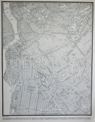
$5.75 Shipping Location: Malden, United States Brooklyn, New York (Part of The Borough of Kings) New York City, NY. NEW ENCYCLOPEDIC ATLAS & GAZETTEER of The WORLD". World War I. New York City. Great ... moreOLD Map from the "COLLIER'S. New Yorkers, Teachers, Students, Authors, Travel Agents, Tourists, Historians, Artists, Musicians, Real Estate Agents, Interior Decorators & Politicians LOVE Them!
Buy It Now
$5.75 Shipping Location: Malden, United States Great OLD Map from the "COLLIER'S WORLD ATLAS & GAZETTEER". World War II ERA. New York City. Very Educational. See what the City used to look like! New ... moreYorkers, Teachers, Students, Historians, Authors, Travel Agents, Tourists, Artists, Musicians, Actors, Interior Decorators, Real Estate Agents & Politicians LOVE Them!

Buy It Now
$5.75 Shipping Location: Malden, United States Vintage 1940 WWII World Atlas City Map Rochester NY OLD New York A Fantastic Christmas Gift! Great Genealogical Source! Great OLD Map from the"COLLIER'S ... moreWORLD ATLAS& GAZETTEER" Copyright 1940 73 Years Old! The Actual Page! NOT a Copy! The Business Center of Rochester. New York(Contact Us For More Scans) This Map Measures About 10 3/4 x 14 1/8" Map Shows Points of Interest. Schools, Masonic Temple, Parks, Churches, Public Bath, Eastman Kodak Factory, Theatres, Many Businesses With The Names, Hotels, Hardware Store Etc. Very Educational. See what the City used to look like! WWII Black& White Will look great Matted& framed A Nice Gift! A GREAT House Warming Gift! The Perfect Anytime Gift! Teachers& Politicians LOVE Them! Super For a Local Business or Office! We Have Many Maps From This Era.Ask Us Shipping by 1st Class or Priority Mail We Will Combine Shipping on Up To 4 Maps for the same shipping fee After Ordering. We will send an Invoice Email Us With Any Questions or For an International Shipping Quote Check out my other items! Be sure to add me to your favorites list! Thanks For Looking! International Buyers– Please Note: Import duties. Taxes, and charges are not included in the item price or shipping cost. These charges are the buyer's responsibility. Please check with your country's customs office to determine what these additional costs will be prior to bidding or buying.
Buy It Now
$5.95 Shipping Location: Malden, United States Great OLD Map from the "COLLIER'S WORLD ATLAS & GAZETTEER". New York City. City Hall, The Financial District, Jersey City, Hoboken, Tunnels, Ferries, ... moreWelfare Island, The Lower Half of Central Park, Madison Square .
Buy It Now
$5.75 Shipping Location: Malden, United States Beautiful Vintage 1942 Brooklyn Atlas City Map NYC New York City A Wonderful Gift! Great OLD Map from the"COLLIER'S WORLD ATLAS& GAZETTEER" ... moreCopyright 1942 71 Years Old! The Actual Page! NOT a Copy! Brooklyn, New York City. NY(Contact Us For More Scans) This Map Measures About 10 3/4 x 14 1/8" Map Shows Points of Interest. Brooklyn College. Parks, Cemetaeries, Bridges, Navy Yard, Naval Hospital, Parade Grounds. Etc. On The Back Is A Picture of The Empire State Building Very Educational. See what the City used to look like! It Will Look GREAT When Matted& Framed World War II Black& White A Nice Gift! A GREAT House Warming Gift! The Perfect Gift! It Will Look GREAT Matted& Framed Teachers& Politicians LOVE Them! Super For a Local Business or Office! Shipping by 1st Class Mail We Will Combine Shipping on Up To 4 Maps for the same shipping fee Email Us With Any Questions or For an International Shipping Quote Check out my other items! Be sure to add me to your favorites list! Thanks For Looking! International Buyers– Please Note: Import duties. Taxes, and charges are not included in the item price or shipping cost. These charges are the buyer's responsibility. Please check with your country's customs office to determine what these additional costs will be prior to bidding or buying. Certain images and/or photos used in this template are the copyrighted property of JupiterImages and are being used with permission under license.
Buy It Now
$5.75 Shipping Location: Malden, United States Great OLD Map from the "COLLIER'S WORLD ATLAS & GAZETTEER". Teachers, Students, Parents, Historians, Artists, Musicians, Authors, Real Estate Agents, ... moreTravel Agents, Tourists, Interior Decorators & Politicians LOVE Them!
Buy It Now
$5.75 Shipping Location: Malden, United States Beautiful Antique 1924 Upper Manhattan And The Bronx Atlas City Map NYC. Great OLD Map from the "COLLIER'S WORLD ATLAS & GAZETTEER". New Yorkers, Teachers, ... moreStudents, Parents, Artists, Musicians, Travel Agents, Tourists, Historians, Real Estate Agents, Authors, Interior Decorators & Politicians LOVE Them!
Buy It Now
$5.75 Shipping Location: Malden, United States Rochester, NY. NEW ENCYCLOPEDIC ATLAS & GAZETTEER of The WORLD". 120 Years Old! Great OLD Map from the "COLLIER'S. Very Educational. See what the City ... moreused to look like! Map Shows Points of Interest.
Buy It Now
$5.75 Shipping Location: Malden, United States Antique 1924 World War I Era Atlas City Map of. Lower Manhattan, New York City. The New York Map Shows. Great, Inexpensive, Antique Wall Art! U.S. Navy ... moreYard, Bridges, Tunnels, Ferries, Hospitals, Islands, The Lower Half of Central Park, Freight Yards, Etc.
Buy It Now
Free Shipping Location: Schertz, United States This Map was removed from a 1938 Pictorial Atlas and is in good acceptable condition. The map is not " new " or in " new " condition, it was printed in ... more1938. The map is not dated. Study the photos carefully, this is the actual map you will receive.
Buy It Now
$5.75 Shipping Location: Malden, United States Great OLD Map from the "COLLIER'S WORLD ATLAS & GAZETTEER". NOT A COPY! Buy It Now! A GREAT House Warming Gift!
Buy It Now
$6.95 Shipping Location: Dover, United States Issued 1864, New York by Johnson & Ward. Large civil war era mid 19th century lithographed map with original hand color. A decorative scrolled border ... moreadds to the visual appeal of the map. Johnson's New York.
Buy It Now
$6.95 Shipping Location: Dover, United States Issued 1871, New York. by Hayward for Valentine. A Map of the Common Lands Between the Three and Six Mile Stones Belonging to the Corporation of the City ... moreof New York, 1796. Left blank edge uneven and slightly narrow as issued from inset tab.
Buy It Now
$6.95 Shipping Location: Dover, United States Issued 1870, New York by Peabody & Co. Map by William Hooker. Uncommon Civil War era mid-19th century color lithographed city plan. Hudson River is at ... moreright side, East river along left, the Battery at Manhattan tip at top right corner.
Buy It Now
$11.85 Shipping Location: Dover, United States Issued 1860, Edinburgh & London by Blackie & Sons. Map consists of three sheets. Mid 19th century lithographed map with original outline hand color. United ... moreStates.
Buy It Now
Free Shipping Location: Schertz, United States This antique map from 1863 depicts the New York City area and surrounding regions. Measuring 18x27 inches, it is an original map by Johnson & Ward from ... morethe Civil War period, making it over 150 years old. The map is in good condition and comes with free shipping within the USA, with calculated shipping available worldwide. Please note that the title page is not included, it is for reference purposes only.
Buy It Now
Free Shipping Location: Schertz, United States This Map was removed from a 1904 WAYNE COUNTY, NEW YORK Plat Atlas and is in good condition. The map is not " new " or in " new " condition, it was printed ... morein 1904. Study the photos carefully, this is the actual map you will receive.
Buy It Now
$5.75 Shipping Location: Malden, United States OLD Rhode Island. Great OLD Map from the "COLLIER'S NEW ENCYCLOPEDIC ATLAS & GAZETTEER OF THE WORLD". It Is Very Lightly Yellowed From Age, Less Than ... moreWould Be Expected. 120 Years Old! There Is Yellowing On The Map But Amazing For The Age!
Buy It Now
$5.75 Shipping Location: Malden, United States On The Reverse Of One Of The Pages Is A Small Map of Christiania (Oslo), Norway. Great OLD Map from the "COLLIER'S NEW ENCYCLOPEDIC ATLAS & GAZETTEER ... moreOF THE WORLD". On The Reverse Of The Other Is A Photo Of A View Of Cincinnati, Ohio In 1912.

Buy It Now
$4.99 Shipping Location: Fairview, United States Lake Erie Maps& Prints! An Original Antique Map: Not a Reproduction! See Our Ebay Store for other! Free Shipping on Purchases of 5 or More Maps and ... morePrints Description: It is an original antique Pre-Civil War era US Coast Survey Map in its original uncolored state with multiple folds as issued. It was published by the US Coastal Survey Office for House of Representative as Ex. Doc. No. 26. 32d Congress, 2d Session Sketches Acompanying Report of Coast Survey. 1851. A copy of the Index page with the date and publishing details is included for authenticity. It has a date of 1851 printed on the map. It is being sold as a single sheet not matted nor framed. As seen in the main pic. A large mapfocused on New Jersey and New York City area including Staten Island, Delaware River, Philadelphia and other places. Interesingly Sandy Hook is shown as an island at this time. Nice accurate detail of the coast line for the period. Size: The image area measures 19 by 23 inches on a 20 by 24" page as seen in the main pic. Condition: It is in Very Good condition for its age. Espeically for a folding map. It is blank on the reverse with multiple folds as issued, basically as seen in the pics. There is one short tear of about an inch along the edge of a fold and the bottom margin was clipped as issued for folding into the publication. Otherwise it is very clean on still very pliable paper. There is some light browning along the folds that is accentuated in the pics, which is not very noticeable on the actual map, see the detail pic. The pics are of the actual map. Payment Details: We accept most major credit cards through Paypal and Ebay. Please ask if you have any questions about payment. International and New Bidders are welcomed and encouraged. Payment is expected within 7 days. After which Nonpaying Bidders will be reported to Ebay to recoup our listing fees. Shipping: $2.50 for First Class or $4.95 for Priority Mail with Delivery Confirmation in the USA; $3.50 for First Class International to Canada; $7 for International
Buy It Now
$5.75 Shipping Location: Malden, United States Great OLD Map from the "COLLIER'S WORLD ATLAS & GAZETTEER". 80 Years Old! NOT A Copy! A "Must" for Your Genealogy Research Project!
Buy It Now
Free Shipping Location: Schertz, United States This antique original map from 1863 depicts New York City and adjacent cities. The map measures 18x26 inches and features hand-tinted highlights. It was ... morecreated during the Civil War period, making it over 160 years old. The cartographer/publisher is Johnson & Ward. The map comes with free shipping within the USA, and shipping rates will be calculated for worldwide delivery. Please note that the title page is not included and is for reference purposes only.

Buy It Now
$3.99 Shipping Location: Spokane, United States MAPS COLLECTION NEW YORK VINTAGE PANORAMIC MAP COLLECTION 191 MAPS IN JPEG FORMAT ON 1 DVD-ROM The panoramic map was a popular cartographic form used ... moreto depict U.S. and Canadian cities and towns during the late nineteenth and early twentieth centuries. Known also as bird's-eye views. Perspective maps, and aero views, panoramic maps are non photographic representations of cities portrayed as if viewed from above at an oblique angle. Although not generally drawn to scale, they show street patterns, individual buildings, and major landscape features in perspective. Victorian America's panoramic maps differ dramatically from the Renaissance city perspectives. The post-Civil War town views are more accurate and are drawn from a higher oblique angle. Small towns as well as major urban centers were portrayed. Panoramic mapping of urban centers was unique to North America in this era. Most panoramic maps were published independently. Not as plates in an atlas or in a descriptive geographical book. Preparation and sale of nineteenth-century panoramas were motivated by civic pride and the desire of the city fathers to encourage commercial growth. Many views were prepared for and endorsed by chambers of commerce and other civic organizations and were used as advertisements of a city's commercial and residential potential. HERE ARE INCLUDED HIGH DETAILED MAPS. SAMPLE BELOW HAS BEEN REDUCED IN SIZE SO THAT THE PAGE COULD LOAD IN A REASONABLE TIME. YOU WILL RECEIVE HIGH QUALITY JPEGS THAT ARE IN THE THOUSANDS OF PIXEL SIZES IN WIDTH AND HEIGHT AND AT 300 DPI. YOU CAN ZOOM IN AND FIND FINE DETAIL OF STREETS. HOUSES AND MORE. WE HAVE PAINSTAKINGLY RE-DIGITIZED THESE TO BRING OUT THE FULL BEAUTY AND DETAIL OF THESE MAPS. THIS GREAT COLLECTION INCLUDES 191 NEW YORK MAPS IN JPEG FORMAT RE-DIGITIZED FROM THE ORIGINALS. ALL FOR ONE LOW PRICE. THE LARGEST COLLECTION FOR SALE. COMPARE ANYWHERE. A WEALTH OF KNOWLEDGE AND HISTORY AT YOUR FINGERTIPS. GREAT FOR RESEARCH. JUST LOOK AT THE MAPS INCLUDED Albany. 1879 Albion Altamo

Buy It Now
$5.75 Shipping Location: Malden, United States Antique 1914 Atlas City Map of The City of Newark. New Jersey! An Unbelievable Gift! WWI RARE! The Atlas Is Copyright 1914 101 Years Old! The Newark Map ... moreIs Copyright 1904 by The J.N. Matthews Co. Buffalo, New York 111 Years Old! The Actual Page! On One Side Is A Map of Newark. New Jersey This Map Measures About 8 3/4" x 12" The Page Measures About 10 1/8" x 15" On The Other Side Is a Small Map of Newcastle. England& Environs This Small Map Measures About 3 1/2" x 3 1/4" This Newark Map Shows Points of Interest. Parks, Cemeteries, City Hall, Railroads, Public Library, St. Benedict's College, Newark City Hospital, Newark Erie Depot, Freight Depot, Court House, Historical Society, Passaic River, Etc. An Amazing Map!RARE! Very Educational. See what this City used to look like! Black& White The Map Will look great Matted& Framed! A Really Nice Gift! A GREAT House Warming Gift! The Perfect Anytime Gift! Fantastic Gift For A Preferred Client! A Wonderful Genealogy Resource Teachers& Politicians LOVE Them! Super For a Local Business or Office! Shipping by 1st Class or Priority Mail We Will Combine Shipping on Up To 4 Maps for the same shipping fee Email Us With Any Questions or For an International Shipping Quote Check out my other items! Be sure to add me to your favorites list! Thanks For Looking! International Buyers– Please Note: Import duties. Taxes, and charges are not included in the item price or shipping cost. These charges are the buyer's responsibility. Please check with your country's customs office to determine what these additional costs will be prior to bidding or buying. Great OLD Map from the COLLIER'S"THE ENCYCLOPEDIC ATLAS& GAZETTEER OF THE WORLD" 1914
$25.00 Shipping Location: Perugia, Italy Colton's firm arose from humble beginnings when he moved to New York in 1831 and befriended the established engraver Samuel Stiles. He worked under Stiles ... moreas the 'Co.' in Stiles and Co. from 1833 to 1836.
Buy It Now
Free Shipping Location: Schertz, United States This Map was removed from a 1904 WAYNE COUNTY, NEW YORK Plat Atlas and is in good condition. The map is not " new " or in " new " condition, it was printed ... morein 1904. Study the photos carefully, this is the actual map you will receive.
Buy It Now
Free Shipping Location: Schertz, United States This Map was removed from a 1904 WAYNE COUNTY, NEW YORK Plat Atlas and is in good condition. The map is not " new " or in " new " condition, it was printed ... morein 1904. Study the photos carefully, this is the actual map you will receive.
Buy It Now
$11.85 Shipping Location: Dover, United States Decorative large antique wood engraved map with original hand color. Portraits of Abraham Lincoln at top left, W. Scott bottom left, Seward top right ... moreand McClellan bottom right. Issued 1863-6, New York by Harper Brothers.
Buy It Now
$6.95 Shipping Location: Dover, United States Issued 1862, New York by Johnson & Ward. Johnson's Africa. Uncommon mid 19th century lithographed map, with original hand color. Decorative map with vignette ... moreviews.
Buy It Now
$11.85 Shipping Location: Dover, United States This example has been rolled up for years and hence remains quite clean and free of issues. Picture Map of the Civil War. Issued 1956, NY by Grosset and ... moreDunlap for Otto Eisenschiml, Ralph Newman and E.B. Long.
Buy It Now
$9.99 Shipping Location: Ivanhoe, Australia Using prints from Germany. It was settled by Dutch colonists who in 1614, built Fort Nassau for fur trading and Fort Orange in 1624. The city was officially ... morechartered in 1686 under English rule. During the late 18th century and throughout most of the 19th, Albany was a center of trade and transportation.
Buy It Now
$4.99 Shipping Location: Fairview, United States The title of the atlas appears in the top left margin, the plate number in the upper right and the Printer Julius Bien & Co. NY (Lithography). A copy ... moreof the title page is included with all the publishing details for authenticity.
Buy It Now
$5.00 Shipping Location: Los Angeles, United States See history below. A handful of titles in the northeastern United States remained in print into the 1990s. Printed color. No date but circa 1920. Good ... morecondition with a few tears to the borders - see scan.
Buy It Now
Free Shipping Location: Schertz, United States This Map was removed from a 1904 WAYNE COUNTY, NEW YORK Plat Atlas and is in good condition. The map is not " new " or in " new " condition, it was printed ... morein 1904. Study the photos carefully, this is the actual map you will receive.
Buy It Now
Free Shipping Location: Schertz, United States This Map was removed from a 1904 WAYNE COUNTY, NEW YORK Plat Atlas and is in good condition. The map is not " new " or in " new " condition, it was printed ... morein 1904. Including Hundreds of RareCivil War.
Buy It Now
$7.35 Shipping Location: Washington, United States I will do my best to answer them!
Buy It Now
$5.00 Shipping Location: Los Angeles, United States See history below. A handful of titles in the northeastern United States remained in print into the 1990s. Printed color. No date but circa 1920. Good ... morecondition with a few tears to the borders - see scan.
Buy It Now
$6.95 Shipping Location: Dover, United States Issued 1862, New York by Johnson & Ward. Johnson's New York. Uncommon mid 19th century lithographed map, with original hand color.
Buy It Now
$6.95 Shipping Location: Dover, United States Issued 1862, New York by Johnson & Ward. Johnson's Germany No. 2 & No. 3. Uncommon mid 19th century lithographed map, with original hand color. Original ... morecenter fold as issued.
Buy It Now
Free Shipping Location: Schertz, United States This Map was removed from a 1904 WAYNE COUNTY, NEW YORK Plat Atlas and is in good condition. The map is not " new " or in " new " condition, it was printed ... morein 1904. Study the photos carefully, this is the actual map you will receive.
Buy It Now
$6.95 Shipping Location: Dover, United States Issued 1863, New York by Johnson & Ward. Johnson's New York. Uncommon mid 19th century lithographed map, with original hand color. With six inset city ... moreplans and an inset of the vicinity around Manhattan.
Buy It Now
$4.99 Shipping Location: Fairview, United States Condition: The map is in Good condition with another map on the reverse. The pics are of the actual map. An Authentic Antique Map: Not a Modern Reproduction! ... moreIt is from the.
Buy It Now
$18.90 Shipping Location: Poughkeepsie, United States This rare and original folding map by J.H. Colton is a must-have for any serious antique map collector. The map was created using the engraving printing ... moretechnique and is in excellent condition for its age, with ONE SMALL tear NO markings.
Buy It Now
$4.95 Shipping Location: Dover, United States Map Showing the Entire Field of Operations under Grant, Sherman, and Farragut. Issued 1864, New York, by Harper & Brothers. Nice looking, clean, well ... morepreserved example, any age flaws easy to overlook or forgive.
Buy It Now
$8.79 Shipping Location: Greenacres, United States
Buy It Now
$5.75 Shipping Location: Malden, United States Great OLD Map from the "P.F. COLLIER'S NEW ENCYCLOPEDIC ATLAS & GAZETTEER OF THE WORLD". There Is Light Yellowing, From Age, As Expected Of Paper Over ... more100 Years Old. 110 Years Old! The Western Half On One Page, The Eastern Half On The Other.
Buy It Now
$44.99 Shipping Location: Ivanhoe, Australia On April 16, 1861, President Lincoln issued a proclamation declaring the blockade of ports from South Carolina to Texas. Baches Notes on the Coast provided ... morevaluable information for Union naval forces.
Buy It Now
Free Shipping Location: Schertz, United States This Map was removed from a 1904 WAYNE COUNTY, NEW YORK Plat Atlas and is in good condition. The map is not " new " or in " new " condition, it was printed ... morein 1904. Study the photos carefully, this is the actual map you will receive.
Buy It Now
$12.70 Shipping Location: Wayne, United States Armin Lobeck accepted a position as associate professor at the University of Wisconsin–Madison, and worked there for 10 years from 1919-1929. He was born ... morein New York City on August 16, 1886, but his family moved to Haworth, New Jersey, three years later.
Buy It Now
Free Shipping Location: Schertz, United States This Map was removed from a 1904 WAYNE COUNTY, NEW YORK Plat Atlas and is in good condition. The map is not " new " or in " new " condition, it was printed ... morein 1904. Including Hundreds of RareCivil War.
Buy It Now
$6.95 Shipping Location: Dover, United States Issued 1864, New York by Johnson & Ward. The key beside this inset relates to the Parishes of Jamaica. Large civil war era mid 19th century lithographed ... moremap with original hand color.
Buy It Now
$6.00 Shipping Location: Greenacres, United States The map was published by Johnson & Browning, New York, 1862, and it is an original, authentic antique map, published during the Civil War. Original 1862 ... moreantique hand colored map of New Jersey, with decorative scrollwork border.
Buy It Now
Free Shipping Location: Schertz, United States This Map was removed from a 1904 WAYNE COUNTY, NEW YORK Plat Atlas and is in good condition. The map is not " new " or in " new " condition, it was printed ... morein 1904. Study the photos carefully, this is the actual map you will receive.
Buy It Now
Free Shipping Location: Schertz, United States This Map was removed from a 1938 Pictorial Atlas and is in good acceptable condition. The map is not " new " or in " new " condition, it was printed in ... more1938. The map is not dated. Study the photos carefully, this is the actual map you will receive.
Buy It Now
Free Shipping Location: Schertz, United States This Map was removed from a 1904 WAYNE COUNTY, NEW YORK Plat Atlas and is in good condition. The map is not " new " or in " new " condition, it was printed ... morein 1904. Including Hundreds of RareCivil War.
Buy It Now
Free Shipping Location: Schertz, United States This Map was removed from a 1904 WAYNE COUNTY, NEW YORK Plat Atlas and is in good condition. The map is not " new " or in " new " condition, it was printed ... morein 1904. Including Hundreds of RareCivil War.
Buy It Now
Free Shipping Location: Schertz, United States This Map was removed from a 1904 WAYNE COUNTY, NEW YORK Plat Atlas and is in good condition. The map is not " new " or in " new " condition, it was printed ... morein 1904. Including Hundreds of RareCivil War.
Buy It Now
$6.95 Shipping Location: Dover, United States Issued 1862, New York by Johnson & Ward. Engraved and lithographed with original hand color. Uncommon and pleasingly decorative large mid 19th century ... morelithographed map of these two Great Lakes states.
Buy It Now
$6.95 Shipping Location: Dover, United States (Asia, Middle East, Holy Land, Palestine, Israel, Judea, Jerusalem City Plan, Damascus, Dead Sea, Jordan River). Johnson's Palestine. Issued 1862, New ... moreYork by Johnson & Ward. Fine decorative issue which displays a prospect view of the city of Damascus (Syria) at top left and an inset city plan of Jerusalem which has a key.
|
|
|
In
|
Vintage 1940 World War II Atlas City Map Buffalo, NY, New York WWII Great Gift!
Vintage 1940 World Atlas City Map Buffalo. NY, New York A Wonderful Gift! Great OLD Map from the"COLLIER'S WORLD ATLAS& GAZETTEER" Copyright 1940 73 Years Old! The Actual Page! NOT a Copy! Buffalo. NY(Contact Us For More Scans) This Map Measures About 10 3/4 x 14 1/8" Map Shows Points of Interest. The Niagara River, Buffalo State Normal School, Buffalo State Hospital, Reservoir, Pullman Palace Car Works, City Hall, Central Station, Railroads, University of Buffalo,Grover Cleveland Park, Ford Motor Car Co. Stock Yards, 106th Armory, Etc. On The Back Is a Photo Of The Hassan Refa Mosque in Cairo. Egypt Very Educational. See what the City used to look like! WWII Black& White It Will look GREAT Matted& Framed A Nice Gift! A GREAT House Warming Gift! The Perfect Anytime Gift! Teachers& Politicians LOVE Them! ... moreSuper For a Local Business or Office! Shipping by 1st Class Mail We Will Combine Shipping on Up To 4 Maps for the same shipping fee Email Us With Any Questions or For an International Shipping Quote Check out my other items! Be sure to add me to your favorites list! Thanks For Looking! International Buyers– Please Note: Import duties. Taxes, and charges are not included in the item price or shipping cost. These charges are the buyer's responsibility. Please check with your country's customs office to determine what these additional costs will be prior to bidding or buying. Certain images and/or photos used in this template are the copyrighted property of JupiterImages and are being used with permission under license.
|
|
|
Vintage 1924 Upper Manhattan Bronx Atlas Map NY New York City World War WWI Era
Vintage 1924 Upper Manhattan& Bronx Atlas City Map NYC New York City A Wonderful Gift! Great OLD Map from the"COLLIER'S THE NEW ENCYCLOPEDIC ATLAS& GAZETTEER OF THE WORLD" The Atlas Is Copyright 1924 89 Years Old! The Actual Page! NOT a Copy! Upper Manhattan& The Bronx. New York City, NY(Contact Us For More Scans) On the other side is The Index of Streets This Map Measures About 10 1/4 x 15 1/8" Map Shows Points of Interest. The East, The Harlem& The Hudson Rivers, Emigrant Hospital, The University of The City of New York, Central Park, The Bronx, Polo Grounds, Ball Grounds, Columbia University, Convent of The Sacred Heart, Deaf and Dumb Institute, Fort George, New York& Harlem Railroad, Hells Gate, Etc. Very Educational. See what the City used to look like! On The Back There Is a Guide To Streets In ... moreNorthern& Southern Manhattan. Points of Interest& Piers It Will Look GREAT When Matted& Framed Post World War I Black& White A Nice Gift! A GREAT House Warming Gift! The Perfect Gift! It Will Look GREAT Matted& Framed This Map Can Line Up& Be Framed With The"Lower Manhattan" Map From The Same Year! Teachers& Politicians LOVE Them! Super For a Local Business or Office! Shipping by 1st Class Mail We Will Combine Shipping on Up To 4 Maps for the same shipping fee Email Us With Any Questions or For an International Shipping Quote Check out my other items! Be sure to add me to your favorites list! Thanks For Looking! International Buyers– Please Note: Import duties. Taxes, and charges are not included in the item price or shipping cost. These charges are the buyer's responsibility. Please check with your country's customs office to determine what these additional costs will be prior to bidding or buying. Certain images and/or photos used in this template are the copyrighted property of JupiterImages and are being used with permission under license.
|
|
|
L@@K! Vintage 1944 Brooklyn Atlas Map NY New York City World War WWII Era
Beautiful Vintage 1944 Brooklyn Atlas City Map NYC New York City A Wonderful Gift! Great OLD Map from the"COLLIER'S WORLD ATLAS& GAZETTEER" Copyright 1944 69 Years Old! The Actual Page! NOT a Copy! Brooklyn, New York City. NY(Contact Us For More Scans) This Map Measures About 10 3/4 x 14 1/8" Map Shows Points of Interest. Brooklyn College. Parks, Cemetaeries, Bridges, Navy Yard, Naval Hospital, Parade Grounds. Etc. On The Back Is A Picture of The Empire State Building Very Educational. See what the City used to look like! It Will Look GREAT When Matted& Framed World War II Black& White A Nice Gift! A GREAT House Warming Gift! The Perfect Gift! It Will Look GREAT Matted& Framed Teachers& Politicians LOVE Them! Super For a Local Business or Office! Shipping by 1st Class Mail We Will Combine Shipping on ... moreUp To 4 Maps for the same shipping fee Email Us With Any Questions or For an International Shipping Quote Check out my other items! Be sure to add me to your favorites list! Thanks For Looking! International Buyers– Please Note: Import duties. Taxes, and charges are not included in the item price or shipping cost. These charges are the buyer's responsibility. Please check with your country's customs office to determine what these additional costs will be prior to bidding or buying. Certain images and/or photos used in this template are the copyrighted property of JupiterImages and are being used with permission under license.
|
|
|
Vintage 1943 World War WWII Atlas City Map Rochester NY New York With Businesses
Vintage 1943 WWII World Atlas City Map Rochester NY OLD New York A Fantastic Gift! Great Genealogical Source! Great OLD Map from the"COLLIER'S WORLD ATLAS& GAZETTEER" Copyright 1943 70 Years Old! The Actual Page! NOT a Copy! The Business Center of Rochester. New York(Contact Us For More Scans) This Map Measures About 10 3/4 x 14 1/8" Map Shows Points of Interest. Schools, Masonic Temple, Parks, Churches, Public Bath, Eastman Kodak Factory, Theatres, Many Businesses With The Names, Hotels, Hardware Store Etc. Very Educational. See what the City used to look like! WWII Black& White Will look great Matted& framed A Nice Gift! A GREAT House Warming Gift! The Perfect Anytime Gift! Teachers& Politicians LOVE Them! Super For a Local Business or Office! We Have Many Maps From This Era.Ask Us Shipping by 1st Class ... moreor Priority Mail We Will Combine Shipping on Up To 4 Maps for the same shipping fee After Ordering. We will send an Invoice Email Us With Any Questions or For an International Shipping Quote Check out my other items! Be sure to add me to your favorites list! Thanks For Looking! International Buyers– Please Note: Import duties. Taxes, and charges are not included in the item price or shipping cost. These charges are the buyer's responsibility. Please check with your country's customs office to determine what these additional costs will be prior to bidding or buying.
|
|
|
L@@K! Vintage 1944 Lower Manhattan Atlas Map NY New York City World War WWII Era
Beautiful Vintage 1944 Lower Manhattan Atlas City Map NYC New York City A Wonderful Gift! Great OLD Map from the"COLLIER'S WORLD ATLAS& GAZETTEER" Copyright 1944 RARE! 69 Years Old! The Actual Page! NOT a Copy! Lower Manhattan, New York City. NY(Contact Us For More Scans) This Map Measures About 10 3/4 x 14 1/8" Map Shows Points of Interest. Chinatown. City Hall, The Financial District, Jersey City, Hoboken, Tunnels, Ferries, Welfare Island, The Lower Half of Central ParkMadison Square. Etc. Very Educational. See what the City used to look like! It Will Look GREAT When Matted& Framed World War II Black& White A Nice Gift! A GREAT House Warming Gift! The Perfect Gift! It Will Look GREAT Matted& Framed This Map Can Line Up& Be Framed With The"Upper Manhattan" Map From The Same Year! Teachers& ... morePoliticians LOVE Them! Super For a Local Business or Office! Shipping by 1st Class Mail We Will Combine Shipping on Up To 4 Maps for the same shipping fee Email Us With Any Questions or For an International Shipping Quote Check out my other items! Be sure to add me to your favorites list! Thanks For Looking! International Buyers– Please Note: Import duties. Taxes, and charges are not included in the item price or shipping cost. These charges are the buyer's responsibility. Please check with your country's customs office to determine what these additional costs will be prior to bidding or buying. Certain images and/or photos used in this template are the copyrighted property of JupiterImages and are being used with permission under license.
|
|
|
L@@K! Vintage 1942 Brooklyn Atlas Map NY New York City World War WWII Era
Beautiful Vintage 1942 Brooklyn Atlas City Map NYC New York City A Wonderful Gift! Great OLD Map from the"COLLIER'S WORLD ATLAS& GAZETTEER" Copyright 1942 71 Years Old! The Actual Page! NOT a Copy! Brooklyn, New York City. NY(Contact Us For More Scans) This Map Measures About 10 3/4 x 14 1/8" Map Shows Points of Interest. Brooklyn College. Parks, Cemetaeries, Bridges, Navy Yard, Naval Hospital, Parade Grounds. Etc. On The Back Is A Picture of The Empire State Building Very Educational. See what the City used to look like! It Will Look GREAT When Matted& Framed World War II Black& White A Nice Gift! A GREAT House Warming Gift! The Perfect Gift! It Will Look GREAT Matted& Framed Teachers& Politicians LOVE Them! Super For a Local Business or Office! Shipping by 1st Class Mail We Will Combine Shipping on ... moreUp To 4 Maps for the same shipping fee Email Us With Any Questions or For an International Shipping Quote Check out my other items! Be sure to add me to your favorites list! Thanks For Looking! International Buyers– Please Note: Import duties. Taxes, and charges are not included in the item price or shipping cost. These charges are the buyer's responsibility. Please check with your country's customs office to determine what these additional costs will be prior to bidding or buying. Certain images and/or photos used in this template are the copyrighted property of JupiterImages and are being used with permission under license.
|
|
|
Vintage 1943 World War II Atlas City Map Buffalo, NY, New York WWII Great Gift!
Vintage 1943 World Atlas City Map Buffalo. NY, New York A Wonderful Gift! Great OLD Map from the"COLLIER'S WORLD ATLAS& GAZETTEER" Copyright 1943 70 Years Old! The Actual Page! NOT a Copy! Buffalo. NY(Contact Us For More Photos) This Map Measures About 10 3/4 x 14 1/8" Map Shows Points of Interest. The Niagara River, Buffalo State Normal School, Buffalo State Hospital, Reservoir, Pullman Palace Car Works, City Hall, Central Station, Railroads, University of Buffalo,Grover Cleveland Park, Ford Motor Car Co. Stock Yards, 106th Armory, Etc. Very Educational. See what the City used to look like! WWII Black& White It Will look GREAT Matted& Framed A Nice Gift! A GREAT House Warming Gift! The Perfect Anytime Gift! Teachers& Politicians LOVE Them! Super For a Local Business or Office! Shipping by 1st Class Mail ... moreWe Will Combine Shipping on Up To 4 Maps for the same shipping fee Email Us With Any Questions or For an International Shipping Quote Check out my other items! Be sure to add me to your favorites list! Thanks For Looking! International Buyers– Please Note: Import duties. Taxes, and charges are not included in the item price or shipping cost. These charges are the buyer's responsibility. Please check with your country's customs office to determine what these additional costs will be prior to bidding or buying. Certain images and/or photos used in this template are the copyrighted property of JupiterImages and are being used with permission under license.
|
|
|
Vintage 1940 World War WWII Atlas City Map Rochester NY New York With Businesses
Vintage 1940 WWII World Atlas City Map Rochester NY OLD New York A Fantastic Christmas Gift! Great Genealogical Source! Great OLD Map from the"COLLIER'S WORLD ATLAS& GAZETTEER" Copyright 1940 73 Years Old! The Actual Page! NOT a Copy! The Business Center of Rochester. New York(Contact Us For More Scans) This Map Measures About 10 3/4 x 14 1/8" Map Shows Points of Interest. Schools, Masonic Temple, Parks, Churches, Public Bath, Eastman Kodak Factory, Theatres, Many Businesses With The Names, Hotels, Hardware Store Etc. Very Educational. See what the City used to look like! WWII Black& White Will look great Matted& framed A Nice Gift! A GREAT House Warming Gift! The Perfect Anytime Gift! Teachers& Politicians LOVE Them! Super For a Local Business or Office! We Have Many Maps From This Era.Ask Us Shipping by ... more1st Class or Priority Mail We Will Combine Shipping on Up To 4 Maps for the same shipping fee After Ordering. We will send an Invoice Email Us With Any Questions or For an International Shipping Quote Check out my other items! Be sure to add me to your favorites list! Thanks For Looking! International Buyers– Please Note: Import duties. Taxes, and charges are not included in the item price or shipping cost. These charges are the buyer's responsibility. Please check with your country's customs office to determine what these additional costs will be prior to bidding or buying.
|
|
|
L@@K! Vintage 1943 Lower Manhattan Atlas Map NY New York City World War WWII Era
Beautiful Vintage 1943 Lower Manhattan Atlas City Map NYC New York City A Wonderful Christmas Gift! Great OLD Map from the"COLLIER'S WORLD ATLAS& GAZETTEER" Copyright 1943 RARE! 70 Years Old! The Actual Page! NOT a Copy! Lower Manhattan, New York City. NY(Contact Us For More Scans) This Map Measures About 10 3/4 x 14 1/8" Map Shows Points of Interest. Chinatown. City Hall, The Financial District, Jersey City, Hoboken, Tunnels, Ferries, Welfare Island, The Lower Half of Central ParkMadison Square. Etc. Very Educational. See what the City used to look like! It Will Look GREAT When Matted& Framed World War II Black& White A Nice Gift! A GREAT House Warming Gift! The Perfect Gift! It Will Look GREAT Matted& Framed This Map Can Line Up& Be Framed With The"Upper Manhattan" Map From The Same Year! ... moreTeachers& Politicians LOVE Them! Super For a Local Business or Office! Shipping by 1st Class Mail We Will Combine Shipping on Up To 4 Maps for the same shipping fee Email Us With Any Questions or For an International Shipping Quote Check out my other items! Be sure to add me to your favorites list! Thanks For Looking! International Buyers– Please Note: Import duties. Taxes, and charges are not included in the item price or shipping cost. These charges are the buyer's responsibility. Please check with your country's customs office to determine what these additional costs will be prior to bidding or buying. Certain images and/or photos used in this template are the copyrighted property of JupiterImages and are being used with permission under license.
|
|
|
Vintage 1940 Upper Manhattan Bronx Atlas Map NY New York City World War WWII Era
Vintage 1940 Upper Manhattan& Bronx Atlas City Map NYC New York City A Wonderful Gift! Great OLD Map from the"COLLIER'S WORLD ATLAS& GAZETTEER" Copyright 1940 73 Years Old! The Actual Page! NOT a Copy! Upper Manhattan& The Bronx. New York City, NY(Contact Us For More Scans) This Map Measures About 10 3/4 x 14 1/8" Map Shows Points of Interest. Yankee Stadium. The East, The Harlem& The Hudson Rivers, Hell Gate, The Botanical& Zoological Gardens, Central Park, The Bronx, Polo Grounds, Fordham University, Palisade AmusementPark, Etc. Very Educational. See what the City used to look like! On The back There Are Photos Of The Columbia Presbeyterian Medical Center& Rockefeller Center It Will Look GREAT When Matted& Framed World War II Black& White A Nice Gift! A GREAT House Warming Gift! The Perfect ... moreGift! It Will Look GREAT Matted& Framed This Map Can Line Up& Be Framed With The"Lower Manhattan" Map From The Same Year! Teachers& Politicians LOVE Them! Super For a Local Business or Office! Shipping by 1st Class Mail We Will Combine Shipping on Up To 4 Maps for the same shipping fee Email Us With Any Questions or For an International Shipping Quote Check out my other items! Be sure to add me to your favorites list! Thanks For Looking! International Buyers– Please Note: Import duties. Taxes, and charges are not included in the item price or shipping cost. These charges are the buyer's responsibility. Please check with your country's customs office to determine what these additional costs will be prior to bidding or buying. Certain images and/or photos used in this template are the copyrighted property of JupiterImages and are being used with permission under license.
|
|
|
Vintage 1919 Upper Manhattan Bronx Atlas Map NY New York City World War WWI Era
Vintage 1919 Upper Manhattan& Bronx Atlas City Map NYC New York City What A Wonderful Christmas Gift! Great OLD Map from the"COLLIER'S THE NEW ENCYCLOPEDIC ATLAS& GAZETTEER OF THE WORLD" The Atlas Is Copyright 1919 94 Years Old! The Map Is Copyright 1917 96 Years Old! The Actual Page! NOT a Copy! Upper Manhattan& The Bronx. New York City, NY(Contact Us For More Scans) On the other side is The Index of Streets For Upper& Lower Manhattan This Map Measures About 10 1/4 x 15 1/8" Map Shows Points of Interest. The East, The Harlem& The Hudson Rivers, Emigrant Hospital, The University of The City of New York, Central Park, The Bronx, Polo Grounds, Ball Grounds, Columbia University, Convent of The Sacred Heart, Deaf and Dumb Institute, Fort George, New York& Harlem Railroad, Hells Gate, Etc. Very Educational. ... moreSee what the City used to look like! On The Back There Is a Guide To Streets In Northern& Southern Manhattan. Points of Interest& Piers There Are Some Water Stains On The Bottom But They Are In The Margin They Can Be Hidden When Matted& Framed It Will Look GREAT When Matted& Framed World War I Era Black& White A Nice Gift! A GREAT House Warming Gift! The Perfect Gift! It Will Look GREAT Matted& Framed This Map Can Line Up& Be Framed With The"Lower Manhattan" Map From The Same Year! Teachers& Politicians LOVE Them! Super For a Local Business or Office! Shipping by 1st Class Mail We Will Combine Shipping on Up To 4 Maps for the same shipping fee Email Us With Any Questions or For an International Shipping Quote Check out my other items! Be sure to add me to your favorites list! Thanks For Looking! International Buyers– Please Note: Import duties. Taxes, and charges are not included in the item price or shipping cost. These charges are the buyer's responsibility. Please check with your country's customs office to determine what these additional costs will be prior to bidding or buying. Certain images and/or photos used in this
|
|
|
Vintage 1917 Upper Manhattan Bronx Atlas Map NY New York City World War WWI Era
Vintage 1917 Upper Manhattan& Bronx Atlas City Map NYC New York City What A Wonderful Christmas Gift! Great OLD Map from the"COLLIER'S THE NEW ENCYCLOPEDIC ATLAS& GAZETTEER OF THE WORLD" The Atlas Is Copyright 1917 96 Years Old! The Map Is Copyright 1908 105 Years Old! The Actual Page! NOT a Copy! Upper Manhattan& The Bronx. New York City, NY(Contact Us For More Scans) On the other side is The Index of Streets For Upper& Lower Manhattan. Points of Interest& Piers in Manhattan This Map Measures About 10 1/4 x 15 1/8" Map Shows Points of Interest. The East, The Harlem& The Hudson Rivers, Emigrant Hospital, The University of The City of New York, Central Park, The Bronx, Polo Grounds, Ball Grounds, Columbia University, Convent of The Sacred Heart, Deaf and Dumb Institute, Fort George, New York& ... moreHarlem Railroad, Hells Gate, Etc. Very Educational. See what the City used to look like! On The Back There Is a Guide To Streets In Northern& Southern Manhattan. Points of Interest& Piers It Will Look GREAT When Matted& Framed World War I Era Black& White A Nice Gift! A GREAT House Warming Gift! The Perfect Gift! It Will Look GREAT Matted& Framed Teachers& Politicians LOVE Them! Super For a Local Business or Office! Shipping by 1st Class Mail We Will Combine Shipping on Up To 4 Maps for the same shipping fee Email Us With Any Questions or For an International Shipping Quote Check out my other items! Be sure to add me to your favorites list! Thanks For Looking! International Buyers– Please Note: Import duties. Taxes, and charges are not included in the item price or shipping cost. These charges are the buyer's responsibility. Please check with your country's customs office to determine what these additional costs will be prior to bidding or buying. Certain images and/or photos used in this template are the copyrighted property of JupiterImages and are being used with permission under license.
|
|
|
Vintage 1937 Upper Manhattan Bronx Atlas Map NY New York City World War WWII Era
Vintage 1937 Upper Manhattan& Bronx Atlas City Map NYC New York City A Wonderful Gift! Great OLD Map from the"COLLIER'S WORLD ATLAS& GAZETTEER" Copyright 1937 77 Years Old! The Actual Page! NOT a Copy! Upper Manhattan& The Bronx. New York City, NY(Contact Us For More Photos) This Map Measures About 10 3/4 x 14 1/8" Map Shows Points of Interest. Yankee Stadium. The East, The Harlem& The Hudson Rivers, Hell Gate, The Botanical& Zoological Gardens, Central Park, The Bronx, Polo Grounds, Fordham University, Palisade AmusementPark, Etc. Very Educational. See what the City used to look like! On The back There Are Photos Of The New York Medical Center& Rockefeller Center It Will Look GREAT When Matted& Framed World War II ERA Black& White A Nice Gift! A GREAT House Warming Gift! The Perfect Gift! ... moreIt Will Look GREAT Matted& Framed This Map Can Line Up& Be Framed With The"Lower Manhattan" Map From The Same Year! Ask Us If We Have The Map of The Same Year If It Is Not Listed Teachers& Politicians LOVE Them! Super For a Local Business or Office! Shipping by 1st Class Mail We Will Combine Shipping on Up To 4 Maps for the same shipping fee Email Us With Any Questions or For an International Shipping Quote Check out my other items! Be sure to add me to your favorites list! Thanks For Looking! International Buyers– Please Note: Import duties. Taxes, and charges are not included in the item price or shipping cost. These charges are the buyer's responsibility. Please check with your country's customs office to determine what these additional costs will be prior to bidding or buying. Certain images and/or photos used in this template are the copyrighted property of JupiterImages and are being used with permission under license.
|
|
|
L@@K! Vintage 1941 Lower Manhattan Atlas Map NY New York City World War WWII Era
Beautiful Vintage 1941 Lower Manhattan Atlas City Map NYC New York City A Wonderful Gift! Great OLD Map from the"COLLIER'S WORLD ATLAS& GAZETTEER" Copyright 1941 RARE! 73 Years Old! The Actual Page! NOT a Copy! Lower Manhattan, New York City. NY(Contact Us For More Scans) This Map Measures About 10 3/4 x 14 1/8" Map Shows Points of Interest. Chinatown. City Hall, The Financial District, Jersey City, Hoboken, Tunnels, Ferries, Welfare Island, The Lower Half of Central ParkMadison Square. Etc. Very Educational. See what the City used to look like! It Will Look GREAT When Matted& Framed World War II Black& White A Nice Gift! A GREAT House Warming Gift! The Perfect Gift! It Will Look GREAT Matted& Framed This Map Can Line Up& Be Framed With The"Upper Manhattan" Map From The Same Year! Ask Us If ... moreWe Have The Map From The Same Year If It Is Not Listed Teachers& Politicians LOVE Them! Super For a Local Business or Office! Shipping by 1st Class Mail We Will Combine Shipping on Up To 4 Maps for the same shipping fee Email Us With Any Questions or For an International Shipping Quote Check out my other items! Be sure to add me to your favorites list! Thanks For Looking! International Buyers– Please Note: Import duties. Taxes, and charges are not included in the item price or shipping cost. These charges are the buyer's responsibility. Please check with your country's customs office to determine what these additional costs will be prior to bidding or buying.
|
|
|
L@@K Antique 1914 World War I Atlas City Map Buffalo NY New York WWI Great Gift!
Antique 1914 World Atlas City Map Buffalo. NY, New York A Wonderful Gift! Great OLD Map from the COLLIER'S"NEW ENCYCLOPEDIC ATLAS& GAZETTEER OF THE WORLD" Copyright 1914 100 Years Old! The Actual Page! NOT a Copy! Buffalo. NY(Contact Us For More Photos) This Map Measures About 9" x 12" The Page Measures About 10 1/4" x 15 1/8" Map Shows Points of Interest. Lake Erie, The Niagara River, Erie County Hospital, New York State Hospital, Providence Retreat, U.S. Life Saving Station, City Hall, Post Office, Court House, Railroad Depots, Fair Ground, Parks, Lighthouses, Squaw Island, Lehigh Valley Railroad Coal Docks, Etc. Very Educational. See what the City used to look like! WWI Black& White It Will look GREAT Matted& Framed See All Photos A Nice Gift! A GREAT House Warming Gift! The Perfect Anytime ... moreGift! Teachers& Politicians LOVE Them! Super For a Local Business or Office! If You Purchase More Than 1 Map. Wait Until We Send You a Revised Invoice With 1 Shipping Fee Shipping by 1st Class or Priority Mail We Will Combine Shipping on Up To 4 Maps for the same shipping fee Email Us With Any Questions or For an International Shipping Quote Check out my other items! Be sure to add me to your favorites list! Thanks For Looking! International Buyers– Please Note: Import duties. Taxes, and charges are not included in the item price or shipping cost. These charges are the buyer's responsibility. Please check with your country's customs office to determine what these additional costs will be prior to bidding or buying. Certain images and/or photos used in this template are the copyrighted property of JupiterImages and are being used with permission under license.
|
|
|
L@@K! Vintage 1943 Brooklyn Atlas Map NY New York City World War WWII Era
Beautiful Vintage 1943 Brooklyn Atlas City Map NYC New York City A Wonderful Christmas Gift! Great OLD Map from the"COLLIER'S WORLD ATLAS& GAZETTEER" Copyright 1943 70 Years Old! The Actual Page! NOT a Copy! Brooklyn, New York City. NY(Contact Us For More Scans) This Map Measures About 10 3/4 x 14 1/8" Map Shows Points of Interest. Brooklyn College. Parks, Cemetaeries, Bridges, Navy Yard, Naval Hospital, Parade Grounds. Etc. On The Back Is A Picture of The Empire State Building Very Educational. See what the City used to look like! It Will Look GREAT When Matted& Framed World War II Black& White A Nice Gift! A GREAT House Warming Gift! The Perfect Gift! It Will Look GREAT Matted& Framed Teachers& Politicians LOVE Them! Super For a Local Business or Office! Shipping by 1st Class Mail We Will Combine Shipping ... moreon Up To 4 Maps for the same shipping fee Email Us With Any Questions or For an International Shipping Quote Check out my other items! Be sure to add me to your favorites list! Thanks For Looking! International Buyers– Please Note: Import duties. Taxes, and charges are not included in the item price or shipping cost. These charges are the buyer's responsibility. Please check with your country's customs office to determine what these additional costs will be prior to bidding or buying. Certain images and/or photos used in this template are the copyrighted property of JupiterImages and are being used with permission under license.
|
|
|
Vintage 1942 World War WWII Atlas City Map Rochester NY New York With Businesses
Vintage 1942 WWII World Atlas City Map Rochester NY OLD New York A Fantastic Gift! Great Genealogical Source! Great OLD Map from the"COLLIER'S WORLD ATLAS& GAZETTEER" Copyright 1942 72 Years Old! The Actual Page! NOT a Copy! The Business Center of Rochester. New York(Contact Us For More Photos) This Map Measures About 10 3/4 x 14 1/8" Map Shows Points of Interest. Schools, Masonic Temple, Parks, Churches, Public Bath, Eastman Kodak Factory, Theatres, Many Businesses With The Names, Hotels, Hardware Store Etc. Very Educational. See what the City used to look like! WWII Black& White There Is a Small Area With Foxing. Brown Spots, Near The Intersection of North St. University(Photo# 6) There Is Also a Small Tear In The Bottom Left Margin Which Can Be Hidden When Matted& Framed It Will Look Great Matted& Framed! ... moreA Really Nice Gift! A GREAT House Warming Gift! The Perfect Anytime Gift! Teachers& Politicians LOVE Them! Super For a Local Business or Office! We Have Many Maps From This Era.Ask Us Shipping by 1st Class or Priority Mail We Will Combine Shipping on Up To 4 Maps for the same shipping fee After Ordering. We will send an Invoice Email Us With Any Questions or For an International Shipping Quote Check out my other items! Be sure to add me to your favorites list! Thanks For Looking! International Buyers– Please Note: Import duties. Taxes, and charges are not included in the item price or shipping cost. These charges are the buyer's responsibility. Please check with your country's customs office to determine what these additional costs will be prior to bidding or buying. RcmdId ViewItemDescV4,RlogId p4%60bo7%60jtb9%3Fvo%7B2d71f%2Bb41%3E-143d11129bf-0xec-
|
|
|
Vintage 1926 Upper Manhattan, Bronx Atlas Map NY New York City World War WWI Era
Vintage 1926 Upper Manhattan& Bronx Atlas City Map NYC New York City What A Wonderful Gift! Great OLD Map from the"COLLIER'S THE NEW ENCYCLOPEDIC ATLAS& GAZETTEER OF THE WORLD" The Atlas Is Copyright 1926 88 Years Old! The Actual Page! NOT a Copy! Upper Manhattan& The Bronx. New York City, NY(Contact Us For More Photos) On the other side is The Index of Streets For Upper& Lower Manhattan. Points of Interest& Piers in Manhattan This Map Measures About 10 1/4 x 15 1/8" Map Shows Points of Interest. The East, The Harlem& The Hudson Rivers, Emigrant Hospital, The University of The City of New York, Central Park, The Bronx, Polo Grounds, Ball Grounds, Columbia University, Convent of The Sacred Heart, Deaf and Dumb Institute, Fort George, New York& Harlem Railroad, Hells Gate, Etc. Very Educational. ... moreSee what the City used to look like! On The Back There Is a Guide To Streets In Northern& Southern Manhattan. Points of Interest& Piers It Will Look GREAT When Matted& Framed! World War I Era Black& White A Really Nice Gift! A GREAT House Warming Gift! The Perfect Gift! It Will Look GREAT Matted& Framed Teachers& Politicians LOVE Them! Super For a Local Business or Office! Shipping by 1st Class or Priority Mail We Will Combine Shipping on Up To 4 Maps for the same shipping fee Email Us With Any Questions or For an International Shipping Quote Check out my other items! Be sure to add me to your favorites list! Thanks For Looking! International Buyers– Please Note: Import duties. Taxes, and charges are not included in the item price or shipping cost. These charges are the buyer's responsibility. Please check with your country's customs office to determine what these additional costs will be prior to bidding or buying. Certain images and/or photos used in this template are the copyrighted property of JupiterImages and are being used with permission under license.
|
|
|
Vintage 1923 Upper Manhattan, Bronx Atlas Map NY New York City World War WWI Era
Vintage 1923 Upper Manhattan& Bronx Atlas City Map NYC New York City What A Wonderful Gift! Great OLD Map from the"COLLIER'S THE NEW ENCYCLOPEDIC ATLAS& GAZETTEER OF THE WORLD" The Atlas Is Copyright 1923 91 Years Old! The Actual Page! NOT a Copy! Upper Manhattan& The Bronx. New York City, NY(Contact Us For More Photos) On the other side is The Index of Streets For Upper& Lower Manhattan. Points of Interest& Piers in Manhattan This Map Measures About 10 1/4 x 15 1/8" Map Shows Points of Interest. The East, The Harlem& The Hudson Rivers, Emigrant Hospital, The University of The City of New York, Central Park, The Bronx, Polo Grounds, Ball Grounds, Columbia University, Convent of The Sacred Heart, Deaf and Dumb Institute, Fort George, New York& Harlem Railroad, Hells Gate, Etc. Very Educational. ... moreSee what the City used to look like! On The Back There Is a Guide To Streets In Northern& Southern Manhattan. Points of Interest& Piers It Will Look GREAT When Matted& Framed! Post-World War I Era Black& White A Really Nice Gift! A GREAT House Warming Gift! The Perfect Gift! Teachers& Politicians LOVE Them! Super For a Local Business or Office! Shipping by 1st Class or Priority Mail We Will Combine Shipping on Up To 4 Maps for the same shipping fee Email Us With Any Questions or For an International Shipping Quote Check out my other items! Be sure to add me to your favorites list! Thanks For Looking! International Buyers– Please Note: Import duties. Taxes, and charges are not included in the item price or shipping cost. These charges are the buyer's responsibility. Please check with your country's customs office to determine what these additional costs will be prior to bidding or buying. Certain images and/or photos used in this template are the copyrighted property of JupiterImages and are being used with permission under license.
|
|
|
L@@K! Vintage 1937 Brooklyn Atlas Map NY New York City World War WWII Era
Beautiful Vintage 1937 Brooklyn Atlas City Map NYC New York City A Wonderful Gift! Great OLD Map from the"COLLIER'S WORLD ATLAS& GAZETTEER" Copyright 1937 77 Years Old! The Actual Page! NOT a Copy! Brooklyn, New York City. NY(Contact Us For More Photos) This Map Measures About 10 3/4 x 14 1/8" Map Shows Points of Interest. Brooklyn College. Parks, Cemetaeries, Bridges, Navy Yard, Naval Hospital, Parade Grounds. Etc. On The Back Is A Picture of The Empire State Building Very Educational. See what the City used to look like! It Will Look GREAT When Matted& Framed! World War II Black& White A Really Nice Gift! A GREAT House Warming Gift! The Perfect Gift! It Will Look GREAT Matted& Framed Teachers& Politicians LOVE Them! Super For a Local Business or Office! Shipping by 1st Class or Priority Mail We Will ... moreCombine Shipping on Up To 4 Maps for the same shipping fee Email Us With Any Questions or For an International Shipping Quote Check out my other items! Be sure to add me to your favorites list! Thanks For Looking! International Buyers– Please Note: Import duties. Taxes, and charges are not included in the item price or shipping cost. These charges are the buyer's responsibility. Please check with your country's customs office to determine what these additional costs will be prior to bidding or buying. Certain images and/or photos used in this template are the copyrighted property of JupiterImages and are being used with permission under license.
|
|
|
Vintage 1937 World War WWII Atlas City Map Rochester NY New York With Businesses
Vintage 1937 WWII World Atlas City Map Rochester NY. OLD New York A Fantastic Gift! Great Genealogical Source! Great OLD Map from the"COLLIER'S WORLD ATLAS& GAZETTEER" Copyright 1937 77 Years Old! The Actual Page! NOT a Copy! The Business Center of Rochester. New York(Contact Us For More Photos) This Map Measures About 10 3/4 x 14 1/8" Map Shows Points of Interest. Schools, Masonic Temple, Parks, Churches, Public Bath, Eastman Kodak Factory, Theatres, Many Businesses With The Names, Hotels, Hardware Store Etc. Very Educational. See what the City used to look like! WWII Black& White It Will Look Great Matted& Framed! A Really Nice Gift! A GREAT House Warming Gift! The Perfect Anytime Gift! Teachers& Politicians LOVE Them! Super For a Local Business or Office! We Have Many Maps From This Era.Ask Us Shipping ... moreby 1st Class or Priority Mail We Will Combine Shipping on Up To 4 Maps for the same shipping fee After Ordering. We will send an Invoice Email Us With Any Questions or For an International Shipping Quote Check out my other items! Be sure to add me to your favorites list! Thanks For Looking! International Buyers– Please Note: Import duties. Taxes, and charges are not included in the item price or shipping cost. These charges are the buyer's responsibility. Please check with your country's customs office to determine what these additional costs will be prior to bidding or buying. 1.RcmdId ViewItemDescV4,RlogId p4%60bo7%60jtb9%3Fuk.rp73%28b0g%60%60%3E1-146de23f69b-0x106-
|
|
|
Antique 1918 Lower Manhattan & Bronx Atlas Map NY New York City World War WWI
Beautiful Vintage 1918 Upper Manhattan Atlas City Map NYC New York City A Wonderful Gift! Great OLD Map from the"COLLIER'S WORLD ATLAS& GAZETTEER" Copyright 1918 96 Years Old! WWI The Map Is Copyright 1917 by L.L. Poates Engraving Co. RARE! The Actual Page! NOT a Copy! Upper Manhattan, New York City. NY(Contact Us For More Photos) On The Other Side Is An Index of Streets For Northern& Southern Manhattan& The Bronx. Points of Interest, Piers In Manhattan This Page Measures About 10 1/8 x 15" Map Shows Points of Interest. Polo Grounds. Ball Grounds, Bridges, Tunnels, Ferries, University of The City of New York, Islands, The Upper Half of Central Park, Metropolitan Museum of Art. Etc. Very Educational. See what the City used to look like! There Is a Water Stain In The Top Margin That Won't Show When Matted& ... moreFramed It Will Look GREAT When Matted& Framed! World War I Black& White A Really Nice Gift! A GREAT House Warming Gift! The Perfect Gift! Teachers& Politicians LOVE Them! Super For a Local Business or Office! Shipping by 1st Class or Priority Mail We Will Combine Shipping on Up To 4 Maps for the same shipping fee Email Us With Any Questions or For an International Shipping Quote Check out my other items! Be sure to add me to your favorites list! Thanks For Looking! International Buyers– Please Note: Import duties. Taxes, and charges are not included in the item price or shipping cost. These charges are the buyer's responsibility. Please check with your country's customs office to determine what these additional costs will be prior to bidding or buying.
|
|
|
L@@K! Vintage 1940 Lower Manhattan Atlas Map NY New York City World War WWII Era
Beautiful Vintage 1940 Lower Manhattan Atlas City Map NYC New York City A Wonderful Gift! Great OLD Map from the"COLLIER'S WORLD ATLAS& GAZETTEER" Copyright 1940 RARE! 74 Years Old! The Actual Page! NOT a Copy! Lower Manhattan, New York City. NY(Contact Us For More Photos) This Map Measures About 10 3/4 x 14 1/8" Map Shows Points of Interest. Chinatown. City Hall, The Financial District, Jersey City, Hoboken, Tunnels, Ferries, Welfare Island, The Lower Half of Central ParkMadison Square. Etc. Very Educational. See what the City used to look like! It Will Look GREAT When Matted& Framed! World War II Black& White A Really Nice Gift! A GREAT House Warming Gift! The Perfect Gift! Teachers& Politicians LOVE Them! Super For a Local Business or Office! Shipping by 1st Class or Priority Mail We Will Combine Shipping ... moreon Up To 4 Maps for the same shipping fee Email Us With Any Questions or For an International Shipping Quote Check out my other items! Be sure to add me to your favorites list! Thanks For Looking! International Buyers– Please Note: Import duties. Taxes, and charges are not included in the item price or shipping cost. These charges are the buyer's responsibility. Please check with your country's customs office to determine what these additional costs will be prior to bidding or buying.
|
|
|
Vintage 1942 Upper Manhattan Bronx Atlas Map NY New York City World War WWII Era
Vintage 1942 Upper Manhattan& Bronx Atlas City Map NYC New York City A Wonderful Gift! Great OLD Map from the"COLLIER'S WORLD ATLAS& GAZETTEER" Copyright 1942 72 Years Old! The Actual Page! NOT a Copy! Upper Manhattan& The Bronx. New York City, NY(Contact Us For More Photos) This Map Measures About 10 3/4 x 14 1/8" Map Shows Points of Interest. Yankee Stadium. The East, The Harlem& The Hudson Rivers, Hell Gate, The Botanical& Zoological Gardens, Central Park, The Bronx, Polo Grounds, Fordham University, Palisade AmusementPark, Etc. Very Educational. See what the City used to look like! On The back There Are Photos Of The New York Medical Center& Rockefeller Center It Will Look GREAT When Matted& Framed! World War II ERA Black& White A Really Nice Gift! A GREAT House Warming Gift! The Perfect ... moreGift! This Map Can Line Up& Be Framed With The"Lower Manhattan" Map From The Same Year! Ask Us If We Have The Map of The Same Year If It Is Not Listed Teachers& Politicians LOVE Them! Super For a Local Business or Office! Shipping by 1st Class or Priority Mail We Will Combine Shipping on Up To 4 Maps for the same shipping fee Email Us With Any Questions or For an International Shipping Quote Check out my other items! Be sure to add me to your favorites list! Thanks For Looking! International Buyers– Please Note: Import duties. Taxes, and charges are not included in the item price or shipping cost. These charges are the buyer's responsibility. Please check with your country's customs office to determine what these additional costs will be prior to bidding or buying. Certain images and/or photos used in this template are the copyrighted property of JupiterImages and are being used with permission under license.
|
|
|
L@@K Antique 1917 World War I Atlas City Map Buffalo NY New York WWI Great Gift!
Antique 1917 World Atlas City Map Buffalo. NY, New York A Wonderful Christmas Gift! Great OLD Map from the COLLIER'S"NEW ENCYCLOPEDIC ATLAS& GAZETTEER OF THE WORLD" Copyright 1917 97 Years Old! The Actual Page! NOT a Copy! Buffalo. NY(Contact Us For More Photos) This Map Measures About 9" x 12" The Page Measures About 10 1/4" x 15 1/8" Map Shows Points of Interest. Lake Erie, The Niagara River, Erie County Hospital, New York State Hospital, Providence Retreat, U.S. Life Saving Station, City Hall, Post Office, Court House, Railroad Depots, Fair Ground, Parks, Lighthouses, Squaw Island, Lehigh Valley Railroad Coal Docks, Etc. Very Educational. See what the City used to look like! WWI Black& White There Is a Light Water Stain In The Lower Right(Last Photo) Not On The Map, It Shouldn't Show When Matted& ... moreFramed It Will Look GREAT Matted& Framed! See All Photos A Really Nice Gift! A GREAT House Warming Gift! The Perfect Anytime Gift! Teachers& Politicians LOVE Them! Super For a Local Business or Office! If You Purchase More Than 1 Map. Wait Until We Send You a Revised Invoice With 1 Shipping Fee Shipping by 1st Class or Priority Mail We Will Combine Shipping on Up To 4 Maps for the same shipping fee Email Us With Any Questions or For an International Shipping Quote Check out my other items! Be sure to add me to your favorites list! Thanks For Looking! International Buyers– Please Note: Import duties. Taxes, and charges are not included in the item price or shipping cost. These charges are the buyer's responsibility. Please check with your country's customs office to determine what these additional costs will be prior to bidding or buying. Certain images and/or photos used in this template are the copyrighted property of JupiterImages and are being used with permission under license.
|
|
|
Vintage 1941 Upper Manhattan Bronx Atlas Map NY New York City World War WWII Era
Vintage 1941 Upper Manhattan& Bronx Atlas City Map NYC New York City A Wonderful Gift! Great OLD Map from the"COLLIER'S WORLD ATLAS& GAZETTEER" Copyright 1941 74 Years Old! The Actual Page! NOT a Copy! Upper Manhattan& The Bronx. New York City, NY(Contact Us For More Photos) This Map Measures About 10 3/4 x 14 1/8" Map Shows Points of Interest. Yankee Stadium. The East, The Harlem& The Hudson Rivers, Hell Gate, The Botanical& Zoological Gardens, Central Park, The Bronx, Polo Grounds, Fordham University, Palisade AmusementPark, Etc. Very Educational. See what the City used to look like! On The back There Are Photos Of The New York Medical Center& Rockefeller Center There Are Some Small Brown Marks On The Map In The Area Of North Brother& South Brother Islands. They May Be Able To Be Removed. They ... moreMay Be a Defect In The Paper? See Last Photo It Will Look GREAT When Matted& Framed! World War II ERA Black& White A Really Nice Gift! A GREAT House Warming Gift! The Perfect Gift! This Map Can Line Up& Be Framed With The"Lower Manhattan" Map From The Same Year! Ask Us If We Have The Map of The Same Year If It Is Not Listed Teachers& Politicians LOVE Them! Super For a Local Business or Office! Shipping by 1st Class or Priority Mail We Will Combine Shipping on Up To 4 Maps for the same shipping fee Email Us With Any Questions or For an International Shipping Quote Check out my other items! Be sure to add me to your favorites list! Thanks For Looking! International Buyers– Please Note: Import duties. Taxes, and charges are not included in the item price or shipping cost. These charges are the buyer's responsibility. Please check with your country's customs office to determine what these additional costs will be prior to bidding or buying. Certain images and/or photos used in this template are the copyrighted property of JupiterImages and are being used with permission under license.
|
|
|
Antique 1914 World War I Long Island Atlas Map NY New York City Long Island WWI
Beautiful Antique 1914 Brooklyn Atlas City Map of Long Island. New York City New York City A Wonderful Christmas Gift! Great OLD Map from the"COLLIER'S NEW ENCYCLOPEDIC ATLAS& GAZETTEER of The WORLD" Copyright 1914 101 Years Old! The Actual Page! NOT a Copy! Long Island. New York(Contact Us For More Photos) This Page Measures About 10 1/8 x 15 1/8" The Long Island Map Is In 2 Sections& Measures About 9 1/4" x 12" Map Shows Points of Interest. Long Islad Sound. The Atlantic Ocean, Fire Island, Coney Island, Amityville, Etc. Very Educational. See what the City used to look like! It Will Look GREAT When Matted& Framed! World War I WWI Black& White A Really Nice Gift! Perfect For a Preferred or Prospective Customer! A GREAT House Warming Gift! The Perfect Gift! Teachers& Politicians LOVE Them! ... moreSuper For a Local Business or Office! Shipping by 1st Class or Priority Mail We Will Combine Shipping on Up To 4 Maps for the same shipping fee Email Us With Any Questions or For an International Shipping Quote Check out my other items! Be sure to add me to your favorites list! Thanks For Looking! International Buyers– Please Note: Import duties. Taxes, and charges are not included in the item price or shipping cost. These charges are the buyer's responsibility. Please check with your country's customs office to determine what these additional costs will be prior to bidding or buying. Certain images and/or photos used in this template are the copyrighted property of JupiterImages and are being used with permission under license. RcmdId ViewItemDescV4,RlogId p4%60bo7%60jtb9%3Feog4d71f%2B0a7%3E-14ab3bf0728-0xff-
|
|
|
Antique 1914 Upper Manhattan & Bronx Atlas Map NY New York City World War WWI
Beautiful Vintage 1914 Upper Manhattan Atlas City Map NYC New York City A Wonderful Gift! RARE! Great OLD Map from the"COLLIER'S WORLD ATLAS& GAZETTEER" Atlas Is Copyright 1914 101 Years Old! WWI The Map Is Copyright 1908 by L.L. Poates Engraving Co. RARE! The Actual Page! NOT a Copy! Upper Manhattan, New York City. NY(Contact Us For More Photos) On The Other Side Is An Index of Streets For Northern& Southern Manhattan& The Bronx. Points of Interest, Piers In Manhattan This Page Measures About 10 1/8 x 15" Map Shows Points of Interest. Polo Grounds. Ball Grounds, Bridges, Tunnels, Ferries, University of The City of New York, Islands, The Upper Half of Central Park, Metropolitan Museum of Art. Etc. Very Educational. See what the City used to look like! It Will Look GREAT When Matted& Framed! World War I Black& ... moreWhite A Really Nice Gift! A GREAT House Warming Gift! The Perfect Gift! Teachers& Politicians LOVE Them! Super For a Local Business or Office! Shipping by 1st Class or Priority Mail We Will Combine Shipping on Up To 4 Maps for the same shipping fee Email Us With Any Questions or For an International Shipping Quote Check out my other items! Be sure to add me to your favorites list! Thanks For Looking! International Buyers– Please Note: Import duties. Taxes, and charges are not included in the item price or shipping cost. These charges are the buyer's responsibility. Please check with your country's customs office to determine what these additional costs will be prior to bidding or buying.
|
|
|
Nice Antique 1918 Lower Manhattan Atlas Map NY New York City World War WWI L@@K!
Beautiful Vintage 1918 Lower Manhattan Atlas City Map NYC New York City A Wonderful Gift! Great OLD Map from the"COLLIER'S WORLD ATLAS& GAZETTEER" Atlas Is Copyright 1918 97 Years Old! WWI The New York Map Is Copyright 1917 by L.L. Poates Engraving Co. RARE! The Actual Page! NOT a Copy! Lower Manhattan, New York City. NY(Contact Us For More Photos) This Page Measures About 10 1/8 x 15" Map Shows Points of Interest. U.S. Navy Yard. Charity Hospital, Bridges, Tunnels, Ferries, Ball Ground, Islands, The Lower Half of Central Park, Squares. Etc. Very Educational. See what the City used to look like! It Will Look GREAT When Matted& Framed! World War I Black& White A Really Nice Gift! A GREAT House Warming Gift! The Perfect Gift! Teachers& Politicians LOVE Them! An Amazing Gift For a Preferred Client! Super For ... morea Local Business or Office! Shipping by 1st Class or Priority Mail We Will Combine Shipping on Up To 4 Maps for the same shipping fee Email Us With Any Questions or For an International Shipping Quote Check out my other items! Be sure to add me to your favorites list! Thanks For Looking! International Buyers– Please Note: Import duties. Taxes, and charges are not included in the item price or shipping cost. These charges are the buyer's responsibility. Please check with your country's customs office to determine what these additional costs will be prior to bidding or buying.
|
|
 |