-
Christian Collectibles
-
Christian Sheet Music
-
Vatican Stamps
-
Vatican Coins & Paper Money
-
Antiques
-
Antiquities
-
Architectural & Garden
-
Decorative Arts
-
Ethnographic
-
Furniture
-
Maps, Atlases & Globes
-
United States (Pre-1900)
-
United States (1900-Now)
-
AK, HI
-
AL, FL, GA, MS, NC, SC
-
AR, IA, KS, LA, MO, NE
-
AZ, CA, CO, NM, NV, UT
-
CT, MA, ME, NH, RI, VT
-
DC, DE, MD, NJ, NY, PA
-
ID, OR, WA
-
IL, IN, MI, OH, WI
-
MN, MT, ND, SD, WY
-
OK, TX
-
VA, WV, KY, TN
-
Entire US
-
United States (Date Unknown)
-
Africa
-
Asia
-
Australasia/ Oceania
-
Canada
-
Central America/ Caribbean
-
Europe
-
India
-
Ireland
-
Mexico
-
Middle East
-
North America
-
South America
-
United Kingdom
-
Maps on CD
-
World Maps
-
Globes
-
Mixed Lots
-
Reproductions
-
Price Guides & Publications
-
Other
|
In
Order by: Available to: This site contains affiliate links for which I may be compensated
|
Buy It Now
$132.05 Shipping Location: Lansing, United States That region is the focal point of the present map. A lot of ink has been spilled speculating on the original source of the view, but it is generally thought ... moreto have been drawn in 1652, while Visscher’s version is regarded as the earliest obtainable version thereof and thus the earliest obtainable printed view of New York City.

Buy It Now
$3.95 Shipping Location: Clarkston, United States Rare Map Collection This DVD is part of our Historic Map and Atlas Collection. We have dozens of Atlas maps on DVD and CD ranging from the 1500s to the ... more1900s covering many areas and topics. Please Check our Ebay Store for what's available. FOR MANY MORE EDUCATIONAL CD TITLES ON THIS AND MANY OTHER SUBJECTS PLEASE VISIT OUR EBAY STORE VERY LARGE HIGH RESOLUTION MAP COLLECTION ON DVD! please see full table of contents and sample illustrations below) This DVD Contains 381 Maps of New York Including 204 PANORAMIC MAPS of various New York Cities These are scans of the ORIGINAL maps by various Cartographers. on DVD System requirements PC or Mac compatible. Files are simple PDF files with a basic HTML interface(just like viewing a webpage) Works with ALL versions of Windows. 5810025a 0065001 0089001 0089014 0102016 0103001 0103002 0109002 0122011 0149023 0162002 0173001 0179002 0278005 0280005 0289004 0300045 0358026 0469003 0536001 0536002 0537011 0537012 0545014 0565010 0579018 0586015 0594016 0845010 0887011 0977010 1510004 1550027 1568006 2036003 2134057 2135002 2255000 2483013 2489001 2499002 2501007 2512002 2531002 2542008 2556003 2585069 2587002 2680016 2710026 2755009 2782005 2808003 2848002 2862031 2866036 2905013 3186003 3186004 3211002 3211003 3223002 3228002 3386002 3472000 3540001 3540007 3545000 3547000 3565073 3574000 3803014 3884005 4055002 4083003 4242001 4247000 4328014 4331002 4337002 4524004 4534016 4550001 4557012 4566002 4570002 4577012 4584052 4587029 4835017 4850036 4862015 4863031 4864017 4865008 4922003 4966006 4970000 4971000 4977004 4999001 5022023 5041017 5073002 5128003 5135003 5157002 5182001 5198012 5285002 5298000 5301000 5327000 5363011 5370002 5371128 5371129 5387000 5388015 5399005 ar100600 ar108400 ar108600 ar109100 ar109200 ar109601 ar109900 ar110000 ar110100 ar110400 ar110700 ar110900 ar111300 ar114800 ar115300 ar115500 ar115700 ar115800 ar116001 ar116300 ar116500 ar116600 ar117000 ar117100 ar119900 ar120200 ar120900 ar121000 ar121400 ar121500 ar121600 ar122700 ar122900 ar12300
Buy It Now
$4.99 Shipping Location: Fairview, United States Land Book of the Borough of Manhattan City of New York, published in New York by Bromley & co., 1934. A facsimile copy of the title page will also be ... moreincluded for authenticity. An Authentic Antique Map: Not a Modern Reproduction!
Buy It Now
$9.99 Shipping Location: Ivanhoe, Australia After the Second Session of Congress on July 31, 1789 Sag Harbor was declared the first official port on entering the United States. Such namings were ... morenot unusual. Sag Harbour. The port supplanted the East Hampton community of Northwest which is about 5 miles (8 km) east of Sag Harbor.
Buy It Now
$4.99 Shipping Location: Fairview, United States Lake Erie Maps& Prints! An Authentic Antique Map: Not a Modern Reproduction! Click here for more! Free Shipping on Purchases of 5 or More Maps and ... morePrints Description: It is an original antique map from G.W. Bromley's Land Book of the Borough of Manhattan City of New York. Published in New York by Bromley& co. 1921. A facsimile copy of the title page will also be included for authenticity. The maps were mainly used by developers and real estate agents who periodically would receive updates of the building changes such as ownership or new structures that were issued as small cutouts that were then glued to update the map thus giving the map a unique character over time. It is handcolored probably with the use of stencils typical of the period. We have currenly listed many additional plates, click here New York City Maps. Please Note: There are two maps printed back to back on one sheet so if framing one would need to chose a side. It is not mounted. Matted nor framed, being sold as shown in the main pic. Size: The map image measures approximately 10 by 15 inches(25x38cm) on a 11 1/2 by 16 1/4" 29x41cm) page with a margin all around for framing as seen in the pic. Condition: The map is in Very Good overall condition with original hand coloring. There is light tonal ageing. Darkening around the edges, crimping along the binding edge, see the pics for more on condition. Overall, it is very clean with bright hand coloring that would frame up nicely. The pics are of the actual map. Payment Details: We accept most major credit cards through Paypal and Ebay. Please ask if you have any questions about payment. International and New Bidders are welcomed and encouraged. Payment is expected within 7 days. After which Nonpaying Bidders will be reported to Ebay to recoup our listing fees. Save on Shipping: We only charge one shipping fee based on the largest map or print with multiple items shipped along with it for no extra costs. Purchase 5 or more maps or prints and receive Free First Class shipping in USA o
Buy It Now
$4.99 Shipping Location: Fairview, United States Land Book of the Borough of Manhattan City of New York, published in New York by Bromley & co., 1925. A facsimile copy of the title page will also be ... moreincluded for authenticity. It is handcolored probably with the use of stencils typical of the period.
Buy It Now
$4.99 Shipping Location: Fairview, United States Land Book of the Borough of Manhattan City of New York, published in New York by Bromley & co., 1934. A facsimile copy of the title page will also be ... moreincluded for authenticity. An Authentic Antique Map: Not a Modern Reproduction!
Buy It Now
$4.99 Shipping Location: Fairview, United States Land Book of the Borough of Manhattan City of New York, published in New York by Bromley & co., 1921. A facsimile copy of the title page will also be ... moreincluded for authenticity. It is handcolored probably with the use of stencils typical of the period.
Buy It Now
$4.99 Shipping Location: Fairview, United States Land Book of the Borough of Manhattan City of New York, published in New York by Bromley & co., 1955. A facsimile copy of the title page will also be ... moreincluded for authenticity. There are a couple of updates on most of these map that are not obvious unless you look for them.
Buy It Now
$4.99 Shipping Location: Fairview, United States Land Book of the Borough of Manhattan City of New York, published in New York by Bromley & co., 1934. A facsimile copy of the title page will also be ... moreincluded for authenticity. An Authentic Antique Map: Not a Modern Reproduction!
Buy It Now
$4.99 Shipping Location: Fairview, United States Land Book of the Borough of Manhattan City of New York, published in New York by Bromley & co., 1934. A facsimile copy of the title page will also be ... moreincluded for authenticity. An Authentic Antique Map: Not a Modern Reproduction!
Buy It Now
$4.99 Shipping Location: Fairview, United States Land Book of the Borough of Manhattan City of New York, published in New York by Bromley & co., 1934. A facsimile copy of the title page will also be ... moreincluded for authenticity. An Authentic Antique Map: Not a Modern Reproduction!
Buy It Now
$4.99 Shipping Location: Fairview, United States Land Book of the Borough of Manhattan City of New York, published in New York by Bromley & co., 1955. A facsimile copy of the title page will also be ... moreincluded for authenticity. An Authentic Antique Map: Not a Modern Reproduction!
Buy It Now
$4.99 Shipping Location: Fairview, United States Land Book of the Borough of Manhattan City of New York, published in New York by Bromley & co., 1955. A facsimile copy of the title page will also be ... moreincluded for authenticity. It is handcolored probably with the use of stencils typical of the period.
Buy It Now
$4.99 Shipping Location: Fairview, United States Land Book of the Borough of Manhattan City of New York, published in New York by Bromley & co., 1955. A facsimile copy of the title page will also be ... moreincluded for authenticity. There are a couple of updates on most of these map that are not obvious unless you look for them.
Buy It Now
$4.99 Shipping Location: Fairview, United States Land Book of the Borough of Manhattan City of New York, published in New York by Bromley & co., 1925. A facsimile copy of the title page will also be ... moreincluded for authenticity. It is handcolored probably with the use of stencils typical of the period.
Buy It Now
$4.99 Shipping Location: Fairview, United States Land Book of the Borough of Manhattan City of New York, published in New York by Bromley & co., 1934. A facsimile copy of the title page will also be ... moreincluded for authenticity. An Authentic Antique Map: Not a Modern Reproduction!
Buy It Now
$15.00 Shipping Location: Brooklyn, United States Manhattan, NYC. The northern 2/3rd Manhattan was dotted with farm lands and sprawling gentlemanly estates, many with great manor houses overlooking the ... moreHudson River. While this work occurred early in lower Manhattan, central and upper Manhattan were not formally acquired by the city until the mid-19th century.
Buy It Now
$4.99 Shipping Location: Fairview, United States Land Book of the Borough of Manhattan City of New York, published in New York by Bromley & co., 1955. A facsimile copy of the title page will also be ... moreincluded for authenticity. There are a couple of updates on most of these map that are not obvious unless you look for them.
Buy It Now
$4.99 Shipping Location: Fairview, United States Desk Atlas Borough of Brooklyn City of New York, by E. Belcher Hyde Map Co., Inc: New York, 1929. A facsimile copy of the title page will also be included ... morefor authenticity. Condition: The map is in Fair overall condition, basically as seen in the pic.
Buy It Now
$15.00 Shipping Location: Brooklyn, United States The northern 2/3rd Manhattan was dotted with farm lands and sprawling gentlemanly estates, many with great manor houses overlooking the Hudson River. ... moreWhile this work occurred early in lower Manhattan, central and upper Manhattan were not formally acquired by the city until the mid-19th century.
Buy It Now
$4.99 Shipping Location: Fairview, United States Land Book of the Borough of Manhattan City of New York, published in New York by Bromley & co., 1934. A facsimile copy of the title page will also be ... moreincluded for authenticity. An Authentic Antique Map: Not a Modern Reproduction!
Buy It Now
$4.99 Shipping Location: Fairview, United States Desk Atlas Borough of Brooklyn City of New York, by E. Belcher Hyde Map Co., Inc: New York, 1929. A facsimile copy of the title page will also be included ... morefor authenticity. Condition: The map is in Good to Very Good overall condition, basically as seen in the pic.

Buy It Now
$15.00 Shipping Location: Brooklyn, United States 1873 Beers Map of New Lots. Brooklyn, New York City(East New York, Jamaica Bay) WE SELL ONLY ORIGINAL ANTIQUE MAPS- NOT REPRODUCTIONS Title: New Lots. ... moreKings Co. Description: A scarce example of Fredrick W. Beers’ map parts of the region of New Lots. Brooklyn, New York City. Published in 1873. Includes the communities of East New York and Jamaica Bay– essentially the region between Flatlands and Jamaica. Detailed to the level of individual properties and buildings with land owners noted. This is probably the finest atlas map these Brooklyn communities to appear in the 19th century. Prepared by Beers, Comstock& Cline out of their office at 36 Vesey Street, New York City, for inclusion in the first published atlas of Long Island, the 1873 issue of Atlas of Long Island, New York. Size: Printed area measures 13.5 inches high by 10 inches wide. Condition: Very good condition. Minor marginal discoloration. Part of map on verso. Shipping: Due to recent increases in United States Postal Service rates we have been forced to increase our shipping rates. Shipping rates are not negotiable. Items are shipped within three business days of receiving payment. We are happy to consolidate shipping where possible. The following shipping options are available: 1. USPS Domestic Express Mail(35 USD) USA Only. 2. USPS Priority Mail(15 USD) USA Only. 3. USPS International Express(35 to 55 USD) Recommended service for all international parcels. You will be invoiced at the lowest Express Mail rate possible. 4. USPS Priority Mail(35 USD) Available to only certain countries. Due to high instances of loss. This service is specifically NOT AVAILABLE to MAINLAND CHINA or INDIA. 5. Federal Express is available upon request. This is the only service option available to India and Africa. Price is quoted upon request following the auction. We can also use your Federal Express Account. Insurance: All shipments are insured privately against loss and damage. All of our shipments require a signature. If you have any questions please feel f
Buy It Now
$15.00 Shipping Location: Brooklyn, United States One such detail is Fourth Avenue. Here, dashed lines mark the present sides of the avenue, several feet into the lots on either side. The northern 2/3rd ... moreManhattan was dotted with farm lands and sprawling gentlemanly estates, many with great manor houses overlooking the Hudson River.
Buy It Now
$4.99 Shipping Location: Fairview, United States Land Book of the Borough of Manhattan City of New York, published in New York by Bromley & co., 1934. A facsimile copy of the title page will also be ... moreincluded for authenticity. An Authentic Antique Map: Not a Modern Reproduction!
Buy It Now
$4.99 Shipping Location: Fairview, United States Desk Atlas Borough of Brooklyn City of New York, by E. Belcher Hyde Map Co., Inc: New York, 1929. A facsimile copy of the title page will also be included ... morefor authenticity. Condition: The map is in Good to Very Good overall condition, basically as seen in the pic.
Buy It Now
$15.00 Shipping Location: Brooklyn, United States The bulk of the map is occupied by the northern reaches of the Common Lands, including the boundary between the Common Lands and the village of Harlem. ... moreThe northern 2/3rd Manhattan was dotted with farm lands and sprawling gentlemanly estates, many with great manor houses overlooking the Hudson River.
Buy It Now
$15.00 Shipping Location: Brooklyn, United States Signature Required. Services include deacidification cleaning flattening and backing.
Buy It Now
$4.99 Shipping Location: Fairview, United States Land Book of the Borough of Manhattan City of New York, published in New York by Bromley & co., 1921. A facsimile copy of the title page will also be ... moreincluded for authenticity. It is handcolored probably with the use of stencils typical of the period.
Buy It Now
$15.00 Shipping Location: Brooklyn, United States The map is gridded in quarter-mile sections. Also if interest is a revision to include both Masonic and Odd Fellows Lodges. Walker was an Odd Fellow and ... moreman have been a Mason as well - hence this usual addition to the original Burr plate.
Buy It Now
$15.00 Shipping Location: Brooklyn, United States Title: Map of the Country Twenty Five Miles Round the City of New York. Signature Required. Services include deacidification cleaning flattening and backing. ... moreCondition: Very good. Minor foxing. Original platemark visible.
Buy It Now
$12.75 Shipping Location: Montgomery, United States Fine condition as shown, with one expertly repaired short 1" marginal tear, light fold marks, and two small holes from corner folds. Mistakes happen.
Buy It Now
$15.00 Shipping Location: Brooklyn, United States These lands were once part of the West Bayard Farm. The map exists in only one edition, as here, published in 1868. It is of considerable rarity. Bayard ... moreFarm The map shows the 100-acre farm of Nicholas and Stephen Bayard, which was in their family in the 17th century.
Buy It Now
$6.00 Shipping Location: Los Angeles, United States Great detail of the surrounding area extending from Germantown and Frankford in the north to Greenwich Island in the south. The map is dated 1905 but ... morewas published between 1910 and 1915 in Collier's "World Atlas and Gazetteer" - see below.
Buy It Now
$15.00 Shipping Location: Brooklyn, United States Published in 1873. Roughly covers from Bayside Avenue south to Walnut Avenue. Detailed to the level of individual properties and buildings with landowners ... morenoted. This is probably the finest atlas map of this part of Queens, New York, to appear in the 19th century.

Buy It Now
$15.00 Shipping Location: Brooklyn, United States 1856 Colton Map of Northeastern Africa WE SELL ONLY ORIGINAL ANTIQUE MAPS- NOT REPRODUCTIONS Title: Africa North Eastern Sheet. Description: A beautiful ... more1855 first edition example of Colton's map of north eastern Africa. Like most of Colton's Africa maps. This map is derived from an earlier wall map of the world produced by Colton and D. Griffing Johnson. The map covers from the Mediterranean south as far as Mount Kenya, west as far as Tripoli, and east to include most of Arabia. An inset map in the upper right quadrant details the Nile Delta. The explorations of the Arab explorer Mohammad Ali in search of the source of the White Nile are noted. Colton also names numerous African tribes and nations throughout– though admittedly most of his information is outdated. The semi-apocryphal Mountains of the Moon, or Jebel el Kumert, speculative source of the White Nile, are shown running in an unusual speculative north-south configuration between Mt. Kenya and Abyssinia– in fact Mt. Kenya is identified as part of this range. This is one of the first American maps to depict Mt. Kenya, first sighted by western explorers in 1849, just a few years. This map also identifies various cities, towns, rivers, deserts, desert oases, mountains, and an assortment of additional topographical details. Surrounded by Colton's typical spiral motif border. Dated and copyrighted to J. H. Colton, 1855. Published from Colton's 172 William Street Office in New York City. Issued as page no. 34 in volume 2 of Colton's 1856 Atlas of the World. Size: Printed area measures 17 inches high by 14 inches wide. Condition: Very good. Blank on verso. Even overall toning. Shipping: Items are shipped within three business days of receiving payment. We are happy to consolidate shipping where possible. The following shipping options are available: 1. USPS Domestic Express Mail(25 USD) USA Only. 2. USPS Priority Mail(12 USD) USA Only. 3. USPS International Express(35 to 55 USD) Recommended service for all international parcels. 4. USPS Pri
Buy It Now
$15.00 Shipping Location: Brooklyn, United States Focused on the southern tip of Manhattan, the map depicts the region from the Hudson River to the East River and from Midtown to the Battery. The idea ... morethat the city could expand through obstacles instead of around them is also apparent, as MacCoun references that the swamp north of the city was granted to Anthony Rutgers, on the condition that he drain it.
Buy It Now
$15.00 Shipping Location: Brooklyn, United States Published in 1873. Detailed to the level of individual properties and buildings with land owners noted. This is probably the finest atlas map these Long ... moreIsland Towns to appear in the 19th century. Signature Required.

Buy It Now
$15.00 Shipping Location: Brooklyn, United States 1873 Beers Map of Ravenswood. Long Island City, Queens, New York City WE SELL ONLY ORIGINAL ANTIQUE MAPS- NOT REPRODUCTIONS Title: Ravenswood. Part ofLong ... moreIsland City, Queens, Co. L.I. Newtown Queens Co. L.I. Corona or West Flushing, Town of Newtown, Queens Co. Description: A scarce example of Fredrick W. Beers’ two map set of Ravenswood. Queens, New York City. Published in 1873. Maps printed on both sides of sheet. Ravenswood side details Ravenswood, Queen from the East River to what was then 6th Avenue. Bounded on the north by Broadway and on the south by Webster Avenue. Verso features Maps of Corona or West Flushing and of Newtown, including the areas of East Williamsburgh, Ridgewood, Columbusville, Hopedale and Charlottville, among others. Detailed to the level of individual buildings and properties with land holders noted. This is probably the finest atlas map of Ravenswood and the Newtown area of Queens, New York City to appear in the 19th century. Prepared by Beers, Comstock& Cline out of their office at 36 Vesey Street, New York City, for inclusion in the first published atlas of Long Island, the 1873 issue of Atlas of Long Island, New York. Size: Printed area measures 14 inches high by 22.25 inches wide. Condition: Very good condition. Original centerfold. Printed maps on both recto and verso. Shipping: Due to recent increases in United States Postal Service rates we have been forced to increase our shipping rates. Shipping rates are not negotiable. Items are shipped within three business days of receiving payment. We are happy to consolidate shipping where possible. The following shipping options are available: 1. USPS Domestic Express Mail(35 USD) USA Only. 2. USPS Priority Mail(15 USD) USA Only. 3. USPS International Express(35 to 55 USD) Recommended service for all international parcels. You will be invoiced at the lowest Express Mail rate possible. 4. USPS Priority Mail(35 USD) Available to only certain countries. Due to high instances of loss. This service is specifically NOT AVAILAB
Buy It Now
$22.07 Shipping Location: Pelham, United States When You receive your item,There will be an inner tube inside the outer tube. The Item is rolled onto the inner tube NOT inside the inner tube. It is ... moreNot a Reprint, Giclee Print nor Ink Jet Print but the Original Authorized Hammond Map Offset Lithograph.

Buy It Now
$15.00 Shipping Location: Brooklyn, United States 1668 Doncker Map of the Atlantic. With early Dutch New York(New Amsterdam) WE SELL ONLY ORIGINAL ANTIQUE MAPS- NOT REPRODUCTIONS Title: Pas Caart van ... moreBrazil en Nieu-Nederland van corvo en Flores tot de Barbados. Description: A fascinating and extremely rare 1668 nautical chart or maritime map depicting the northern Atlantic Ocean by Hendrick Doncker. Oriented with the East. This map covers from Newfoundland south to modern day Paraiba, Brazil; east as far as the Azores and Cape Verde Islands; and west as far as Hispaniola. Doncker derived this map from similar map issued in 1650 by Theunis Jacobsz. Although the usual projection, blank at the center with the eastern parts of North American and Brazil defined by the distant Azores and Cape Verde Islands, might seem bizarre to the modern eye, this was in fact a well-considered. Jacobsz drew this based upon Blaeu's monumental 1630 West Indische Paskaert. His intention was to present the most important information on Blaeu's great map in easily accessible form. This this map focuses on those areas most interesting to the 17th century Dutchman, the Dutch VOC colonies in Nieu-Nederland(New Amsterdam/ New York City) and in Brazil(where the VOC was faring poorly in a war with Portugal over domination of the valuable sugar trade) The Canary Islands and the Azores have no doubt been included as the map's eastern most coverage because they are the traditional gateways to Europe. The Spanish controlled territories to the west, in Mexico, the Caribbean, and the Gulf of Mexico, were of little comparative interest. While Doncker draws on Jacobsz for this map's basic form, it is by no means a slavish copy. The map has been updated throughout with more advanced toponymy(for example'Gebroken Lant' is introduced for Long Island) and an updated presentation of the inland waterways, particularly the St. Lawrence and Amazon Rivers. Shading has also been added to illustrate offshore shoals and reefs. In New York and New England, New Amsterdam is named and the Hud
Buy It Now
$15.00 Shipping Location: Brooklyn, United States History of the Map There are four known editions of the De Wit plate. The first, issued in 1675, has 22 at top right. Title: Terra Nova ac Maris Tractus ... morecirca Novam Franciam, Angliam, Belgium, Venezuelam Novam Andalusium, Guianam, Brasiliam.
Buy It Now
$8.99 Shipping Location: Sherwood, United States Part 3:Biology : races of mankind, dwellings of early man, oceans and seas, short bit onDarwin 's Decent of Man. Published : NY, Hunt and Eaton, 1893. ... moreTitle: World We Live In. A Pictorial Survey of the Universe.
Buy It Now
$15.00 Shipping Location: Brooklyn, United States Centered on th colony of Massachusetts, Neal's map covers from the Hudson River and New York City east to Nova Scotia, it extend north to Lake Champlain ... more(Lake Iroquois) and south to Long Island and the Nantucket Shoals.

Buy It Now
$15.00 Shipping Location: Brooklyn, United States 1856 Colton Map of Quebec. Montreal and New Brunswick, Canada WE SELL ONLY ORIGINAL ANTIQUE MAPS- NOT REPRODUCTIONS Title: Canada East or Lower Canada ... moreAnd New Brunswick. Description: A beautiful 1855 first edition example of Colton's map of Quebec(Canada East or Lower Canada) and New Brunswick. Like most of Colton's regional maps. This map was derived from an earlier wall map of North America produced by Colton and D. Griffing Johnson. Following the St. Lawrence River Valley from Montreal eastward to the Gulf of St. Lawrence, this map covers what is today Montreal, Quebec, and New Brunswick. Canadian provinces and territories were under British and French control from the 16th century, until France gave up its claims in the Treaty of Paris in 1763. Canada would remain a collection of British colonies until its confederation in 1867, when the British Province of Canada was divided into Quebec and Ontario and the British colonies of New Brunswick and Nova Scotia incorporated as Canadian provinces. With the signing of the 1854 Treaty of Reciprocity between the United States and Canada, this area experienced a period of sustained growth and prosperity. The increased international trade that flowed into Quebec via the Hudson Valley inspired popular interest in the region. Montreal, Three Rivers, and St. Francis in particular benefited from the cross-border trade. This map also identifies various forts, rivers, mountain passes, fords, and an assortment of additional topographical details. Map is hand colored in pink, green, yellow and blue pastels to define state and territorial boundaries. Surrounded by Colton's typical spiral motif border. Dated and copyrighted to J. H. Colton, 1855. Published from Colton's 172 William Street Office in New York City. Issued as page no. 5 in volume 1 of Colton's 1856 Atlas of the World. Size: Printed area measures 13.5 inches high by 17 inches wide. Condition: Very good. Blank on verso. Even overall toning. Shipping: Due to recent increases in United States Postal
Buy It Now
$15.00 Shipping Location: Brooklyn, United States Colton's success with this attractive map was such that it was issued in various editions for over 50 years. Haskell notes eight different editions between ... more1846 and 1873 and Rumsey has a variant dated 1891.

Buy It Now
$15.00 Shipping Location: Brooklyn, United States 1856 Colton Map of the Eastern Hemisphere(Asia. Africa, Europe, Australia) WE SELL ONLY ORIGINAL ANTIQUE MAPS- NOT REPRODUCTIONS Title: Eastern Hemisphere. ... moreDescription: An excellent 1855 first edition example of Colton's map of the Eastern Hemisphere. Offering a fascinating snapshot of the world during a period of rapid globalization and discovery. This map includes the entirety of Asia, Europe and Africa as well as Australia and much of the Pacific. Much of central Africa is marked'Unexplored Regions' and both Lake Victoria and Lake Tanganyika have yet to appear. Similarly, the coasts of Australia are accurate but the interior is vague and unknown. The Antarctic continent is shown only embryonically, representing the relatively primitive state of Antarctic exploration in the mid-19th century. This map also identifies various cities, towns, rivers, rapids, mountain passes and an assortment of additional topographical details. Map is hand colored in pink, green, yellow and blue pastels to define national and regional boundaries. Surrounded by Colton's typical spiral motif border. Dated and copyrighted to J. H. Colton, 1855. Published from Colton's 172 William Street Office in New York City. Issued as page no. XI in volume 2 of Colton's 1856 Atlas of the World. Size: Printed area measures 16.5 inches high by 15 inches wide. Condition: Very good. Blank on verso. Even overall toning. Shipping: Due to recent increases in United States Postal Service rates we have been forced to increase our shipping rates. Shipping rates are not negotiable. Items are shipped within three business days of receiving payment. We are happy to consolidate shipping where possible. The following shipping options are available: 1. USPS Domestic Express Mail(35 USD) USA Only. 2. USPS Priority Mail(15 USD) USA Only. 3. USPS International Express(35 to 55 USD) Recommended service for all international parcels. You will be invoiced at the lowest Express Mail rate possible. 4. USPS Priority Mail(35 USD) Available to only ce
Buy It Now
$15.00 Shipping Location: Brooklyn, United States The map depicts the region from Barren Inlet, North Carolina to Point Judith, Rhode Island and from Washington, D.C. to the Atlantic Ocean. Highly detailed, ... moremyriad depth soundings are indicated all along the coast and in Long Island Sound, Delaware Bay, Chesapeake Bay, and along the Potomac River to Washington, D.C. Manuscript notations appear along the coast from Ocracock Inlet, North Carolina to Montauk Point on Long Island, complete with course information and other notes.

Buy It Now
$15.00 Shipping Location: Brooklyn, United States 1856 Colton Map of Sweden and Norway WE SELL ONLY ORIGINAL ANTIQUE MAPS- NOT REPRODUCTIONS Title: Sweden and Norway. Description: An excellent 1855 first ... moreedition example of Colton's map of Sweden and Norway. Like most of Colton's Europe maps. This map was derived from an earlier wall map of the world produced by Colton and D. Griffing Johnson. The map covers Sweden and Norway from the Arctic Ocean south to Denmark and east as far as the Gulf of Finland. It also includes parts of adjacent Denmark and Finland. At this time in history Scandinavia was in the midst of a prolonged period of peace and prosperity that led to a cultural and population boom. The legendary Lofoten Maelstrom in northwestern Norway. This legendary whirlpool was the inspiration for Edgar Allen Poe's classic tale Descent into the Maelstrom. In reality, it is a periodic and powerful current caused by tidal variations in the region. This map also identifies various cities, towns, rivers, rapids, mountain passes, and an assortment of additional topographical details. Map is hand colored in pink, green, yellow and blue pastels to define national and regional boundaries. Surrounded by Colton's typical spiral motif border. Dated and copyrighted to J. H. Colton, 1855. Published from Colton's 172 William Street Office in New York City. Issued as page no. 20 in volume 2 of Colton's 1856 Atlas of the World. Size: Printed area measures 17 inches high by 14 inches wide. Condition: Very good. Blank on verso. Even overall toning. Shipping: Due to recent increases in United States Postal Service rates we have been forced to increase our shipping rates. Shipping rates are not negotiable. Items are shipped within three business days of receiving payment. We are happy to consolidate shipping where possible. The following shipping options are available: 1. USPS Domestic Express Mail(35 USD) USA Only. 2. USPS Priority Mail(15 USD) USA Only. 3. USPS International Express(35 to 55 USD) Recommended service for all international parcels. You wi

Buy It Now
$15.00 Shipping Location: Brooklyn, United States . Argentina Le Maire Strait antique map by Bellin 1753 Title: Carte DéTROIT DE LE MAIRE The Le Maire Strait(Estrecho de le Maire) is a sea passage ... morebetween Isla de los Estados and the eastern extremity of the Argentine portion of Tierra del Fuego. Jacob Le Maire and Willem Schouten discovered the strait in 1616. While attempting to find a navigation link between the Atlantic and Pacific Oceans, and shortly before their discovery of Cape Horn. The strait was named in honor of Le Maire. The La Maire Strait has been Argentine controlled, but has been a historical access route for Chilean vessels. In lower left margin: Tome XI in 4° N° 5. In lower right margin: Tome 6 in 8° page 154. Copper etching by Bellin in modern hand coloring Jacques Nicolas Bellin(1703– 21 March 1772) Royal Hydrographer. Engineer of the French Navy and member of the Royal Society) For Antoine-François Prevost's monumental 20 volume edition of L`Histoire Generale des Voyages published The Hague between 1747– 1780 MARITIME MAPS FINE ANTIQUE COPPER PLATE ENGRAVING HAND COLORED. Size: Sheet app. 30.5 x 23 cm. 12 x 9 inches. Image app. 28 x 19.5 cm. 11 x 7.5 inches. Condition: Overall very good. Folds as published. All maps and prints are genuine. Authentic, published at the date stated in this listing! For better quality pictures please go to our web site: WWW.MAPANDMAPS.COM I offer a no questions returns policy. All maps and prints are genuine. Authentic, published at the date stated above. Worldwide shipping by signed registered mail or Global Express courier. Shipping fee is per combined shipment. Including handling and insurance. Free shipping worldwide if three items or more purchased. . .
Buy It Now
$14.95 Shipping Location: Rochester, United States Map has ink advertising stamp of Nelson Weed Druggist, Albert Lea, Minn. Bound in salmon wrappers, title printed on cover. Statistics of Dakota and Minnesota ... moreoccupy the final two pages of this booklet.

Buy It Now
$15.00 Shipping Location: Brooklyn, United States Lake Erie Maps& Prints! An Original Antique Map: Not a Reproduction! See Our Ebay Store for other! Free Shipping on Purchases of 5 or More Maps and ... morePrints Description: It is an original antique Pre-Civil War era US Coast Survey Map in its original uncolored state with multiple folds as issued. It was published by the US Coastal Survey Office for House of Representative as Ex. Doc. No. 26. 32d Congress, 2d Session Sketches Acompanying Report of Coast Survey. 1851. A copy of the Index page with the date and publishing details is included for authenticity. It has a date of 1851 printed on the map. It is being sold as a single sheet not matted nor framed. As seen in the main pic. A large mapfocused on New Jersey and New York City area including Staten Island, Delaware River, Philadelphia and other places. Interesingly Sandy Hook is shown as an island at this time. Nice accurate detail of the coast line for the period. Size: The image area measures 19 by 23 inches on a 20 by 24" page as seen in the main pic. Condition: It is in Very Good condition for its age. Espeically for a folding map. It is blank on the reverse with multiple folds as issued, basically as seen in the pics. There is one short tear of about an inch along the edge of a fold and the bottom margin was clipped as issued for folding into the publication. Otherwise it is very clean on still very pliable paper. There is some light browning along the folds that is accentuated in the pics, which is not very noticeable on the actual map, see the detail pic. The pics are of the actual map. Payment Details: We accept most major credit cards through Paypal and Ebay. Please ask if you have any questions about payment. International and New Bidders are welcomed and encouraged. Payment is expected within 7 days. After which Nonpaying Bidders will be reported to Ebay to recoup our listing fees. Shipping: $2.50 for First Class or $4.95 for Priority Mail with Delivery Confirmation in the USA; $3.50 for First Class International to Canada; $7 for International

Buy It Now
$3.95 Shipping Location: Rochester, United States RARE Old Pocket Map Colton's Township Map of Pennsylvania and the Southern Counties of New York 1876 For offer. A very interesting American imprint! ... moreFresh from a local estate- never offered on the market until now! I could not locate a copy of this book for sale anywhere. Vintage. Old, Original, Antique- NOT a Reproduction- Guaranteed! New York: Colton. 1876. Nicely Hand colored. 44 x 30 inches when fully unfolded. COMPLETE. In very good condition. Acid free archival repair to rips on back and a few fold joints. Front cover nearly detached, hanging on by small piece of paper. Light age toning/ minimal foxing. Please see photos. If you collect 19th century American imprints. Americana illustration, atlas, State of PA- Southern Tier NY, etc. this is a nice one for your bibliophile library or paper/ ephemera collection. Combine shipping on multiple bid wins! Pennsylvania Listeni/ˌpɛnsɨlˈveɪnjə/ Pennsylvania German: Pennsilfaani) Officially the Commonwealth of Pennsylvania, is a U.S. state that is located in the Northeastern and Mid-Atlantic regions of the United States, and the Great Lakes region. The state borders Delaware to the southeast, Maryland to the south, West Virginia to the southwest, Ohio to the west, Lake Erie and Ontario, Canada to the northwest, New York to the north and New Jersey to the east. The Appalachian Mountains run through the middle of the state. Pennsylvania is the 33rd largest. The 6th most populous, and the 9th most densely populated of the 50 United States. The state's five most populous cities are Philadelphia, Pittsburgh, Allentown, Erie, and Reading. The state capital is Harrisburg. Pennsylvania has 51 miles(82 km) of coastline along Lake Erie and 57 miles(92 km)6] of shoreline along the Delaware Estuary. The state is one of the 13 original founding states of the United States. Geography Further information: Geography of Pennsylvania and List of counties in Pennsylvania Counties of Pennsylvania Pennsylvania is 170 miles(274 km) north to south and 283 miles(455 km) ea

Buy It Now
$9.97 Shipping Condition: Unspecified Location: LONDON, United Kingdom United States Coastal and Geodetic Survey: United States Coast and Geodetic survey progress sketch sec. VI East Coast of Florida Halifax river to cape ... moreCanaveral Antique map; Scale 1:200.000, 1881 Title of map: United States Coast and Geodetic survey progress sketch sec. VI East Coast of Florida Halifax river to cape Canaveral' The image below shows an enlarged cross section from the centre of the map to show the level of printed detail. This map is folding hence the centrefold line may show on the image below: National Geodetic Survey National Geodetic Survey. Formerly called the U.S. Coast and Geodetic Survey(U.S.C.G.S. is a United States federal agency that defines and manages a national coordinate system, providing the foundation for transportation and communication; mapping and charting; and a large number of applications of science and engineering. Since 1970, it has been part of the National Oceanic and Atmospheric Administration(NOAA) of the U.S. Department of Commerce. The original predecessor agency of the NGS was the United States Coast Survey. Created by Congress in 1807 to conduct a"Survey of the Coast" This organization represented the Jefferson administration's interest in science and stimulation of international trade. The Jackson administration expanded and extended the coast surveys scope and organization.468 Progress moved ahead slowly and haltingly during the first 25 years. Not until August 29, 1811, did F. R. Hassler sail for Europe to purchase the proper instruments. He remained in Europe during the War of 1812, and then he returned to the United States, arriving on August 16, 1815. Hassler's plan was to employ triangulation to establish his system. Work began in the vicinity of New York City in 1816. The first baseline was measured and verified in 1817. A further Act of Congress in 1818 interfered with Hassler's work. The U.S. Army and U.S. Navy were placed in charge of the survey work. This generated a lull in activity which lasted from 1818 to 1832. The Coast sur
|
|
|
In
|
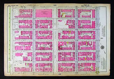
ORIG 1928 Brooklyn Brownsville & East New York NYC 10.5 x 12 Map P. 156 & 157
ORIGINAL 1928 Brooklyn Map New York City NYC Vintage& Original 10.5 X 12 inch plate from Belcher Hyde's 1929 Desk Atlas. Double sided. Maps are color coded. Show every lot dimension, hydrants, building material. Suitable for local history. Research or display, very informative maps Glare& reflections are due to nature of the scan Satisfaction Guaranteed! Powered by The free listing tool. List your items fast and easy and manage your active items. RcmdId ViewItemDescV4,RlogId p4%60bo7%60jtb9%3Fuk.rp*a4%601gc%3E-14190d899f0-0xfe-
|
|
|