-
Christian Collectibles
-
Christian Sheet Music
-
Vatican Stamps
-
Vatican Coins & Paper Money
-
Antiques
-
Antiquities
-
Architectural & Garden
-
Decorative Arts
-
Ethnographic
-
Furniture
-
Maps, Atlases & Globes
-
United States (Pre-1900)
-
United States (1900-Now)
-
AK, HI
-
AL, FL, GA, MS, NC, SC
-
AR, IA, KS, LA, MO, NE
-
AZ, CA, CO, NM, NV, UT
-
CT, MA, ME, NH, RI, VT
-
DC, DE, MD, NJ, NY, PA
-
ID, OR, WA
-
IL, IN, MI, OH, WI
-
MN, MT, ND, SD, WY
-
OK, TX
-
VA, WV, KY, TN
-
Entire US
-
United States (Date Unknown)
-
Africa
-
Asia
-
Australasia/ Oceania
-
Canada
-
Central America/ Caribbean
-
Europe
-
India
-
Ireland
-
Mexico
-
Middle East
-
North America
-
South America
-
United Kingdom
-
Maps on CD
-
World Maps
-
Globes
-
Mixed Lots
-
Reproductions
-
Price Guides & Publications
-
Other
|
In
Order by: Available to: This site contains affiliate links for which I may be compensated
|
Buy It Now
$7.00 Shipping Location: Rockville, United States This map is from the "ATLAS OF SUSQUEHANA CO. FROM ACTUAL SURVEYS BY AND UNDER THE DIRECTION OF F.W. BEERS. Engravings on stone by Louis E. Neuman. Power ... morePress Print of Charles Hart. Up for sale is a great, colored, original ANTIQUE MAP OF SUSQUEHANA COUNTY, PENNSYLVANIA - 1872.
Buy It Now
$7.83 Shipping Location: Indiana, United States Massachusetts State USGS Topographical Geological Geologic Survey Quadrangle Topo Topographic Map. Map has heavier corner and edge wear. A few small tears ... moreand creases along right borders. Has staining in bottom left corner area.
Buy It Now
$7.83 Shipping Location: Indiana, United States Massachusetts State USGS Topographical Geological Geologic Survey Quadrangle Topo Topographic Map. Map has heavier corner and edge wear. Picture details ... moreare best viewed on a computer.
Buy It Now
$7.00 Shipping Location: Rockville, United States Published by D. H. Hurd & Co., Boston, Massachusetts - 1892".
Buy It Now
$16.07 Shipping Location: Napa, United States Front cover disbound but present (i.e. laid on loosely). I can't find any held copies of the Franklin Survey Real Estate Atlas of Princeton. Genealogists, ... morelocal history buffs, city planners, architects, and countless others have been drawn to the quality of detail found in them.
Buy It Now
$7.83 Shipping Location: Indiana, United States Pennsylvania USGS Topographical Geological Survey Quadrangle Topo Topographic Map 22 " x 27". Map has minor wear from handling.
Buy It Now
$4.95 Shipping Location: Reading, United States Atlas of Susquehanna Co., Pennsylvania From Actual Surveys By and Under the Direction of F.W. Beers.
Buy It Now
$4.69 Shipping Location: Greenacres, United States This is the 1932 edition of the Big Clifty quadrangle, based on surveys in 1926 and 1928. Both of the rock-asphalt mines located on this map ceased operations ... morein the 1940s. Genuine original color lithographed fold-out dissected topographical map of parts of Hardin, Breckenridge, and Grayson counties, in central Kentucky, printed more than 89 years ago.
Buy It Now
$4.69 Shipping Location: Greenacres, United States It is identified as the 1911 edition of the Dawson Springs quadrangle, based on surveys in 1909. Genuine original color lithographed fold-out dissected ... moretopographical map of parts of Hopkins, Christian, and Caldwell counties in western Kentucky, printed more than 90 years ago.
Buy It Now
$10.85 Shipping Location: Athol, United States Interesting old map of Franklin, Ohio, from the Atlas of Columbiana County, Ohio, From actual Surveys by D. J. Lake, C.E. Published by C. O. Titus. Hand ... morecolored.
Buy It Now
$10.85 Shipping Location: Athol, United States From actual Surveys by D. J. Lake, C.E., assisted by G. P. Sanford & F. A. Gould. Eng'd by Worley & Bracher, Printed by Fred. Hand colored. Smudged and ... moreage-browned. See scans. This map is larger than my oversized scanner, so see all scans to see all margins.
Buy It Now
$4.15 Shipping Location: Saco, United States ………and a variety.
Buy It Now
Free Shipping Location: Hampton, United States An original antique map from an 1871 Atlas of Franklin Country, Massachusetts, from actual surveys by and under the direction of F. W. Beers, assisted ... moreby Geo. P. Sanford and Others. Published by F. W. Beers & Co., 1871.
Buy It Now
$7.00 Shipping Location: Rockville, United States Up for sale is a great, original, colored, ANTIQUE MAP from the THE OFFICIAL ATLAS OF KANSAS - 1887.
Buy It Now
$3.95 Shipping Location: Clarkston, United States This DVD is part of our Historic Map and Atlas Collection. at Falmouth, 4th September 1765. Joseph Noyes, surveyr. Joseph Noyes, survayor. Falmouth, May ... more22nd, 1766. This DVD Contains. Bird's eye view of the City of Bangor, Penobscot County, Maine, 1875.

Buy It Now
$3.95 Shipping Location: Clarkston, United States Rare Map Collection This DVD is part of our Historic Map and Atlas Collection. We have dozens of Atlas maps on DVD and CD ranging from the 1500s to the ... more1900s covering many areas and topics. Please Check our Ebay Store for what's available. FOR MANY MORE EDUCATIONAL CD TITLES ON THIS AND MANY OTHER SUBJECTS PLEASE VISIT OUR EBAY STORE VERY LARGE HIGH RESOLUTION MAP COLLECTION ON DVD! please see full table of contents and sample illustrations below) This DVD Contains 170 Maps of Mississippi These are scans of the ORIGINAL maps by various Cartographers. on DVD System requirements PC or Mac compatible. Files are simple PDF files with a basic HTML interface(just like viewing a webpage) Works with ALL versions of Windows. Maps of Mississippi 0089033 Mississippi. Bradford. Thomas G. 1838, 0122024 Map Of Mississippi. Carey. H. C. Lea, I. 1822, 0149038 Mississippi. Colton. G.W. 1856, 0285028 Mississippi. Finley. Anthony 1831, 0537024 New Map Of Mississippi. Mitchell. Samuel Augustus 1846, 0977020 New Map Of Mississippi. Tanner. Henry S. 1836, 1070012 Mississippi. U.S. General Land Office 1866, 2301028 Mississippi. Morse. Sidney E. Sidney Edwards) Breese, Samuel 1845, 2788011 Map of the Seat of War among the Creek Indians. Melish. John 1815, 3565097 Mississippi. Rand McNally and Company 1897, 4453035 Mississippi. Goodrich. S.G. Bradford, Thomas G. 1841, 4520031 Mississippi. Rand McNally and Company 1879, 4584064 Mississippi. Lucas. Fielding Jr. 1823, 4628054 Mississippi. Burr. David H 1835, 4664022 Plan Of Nogales. The earliest map of the area of Vicksburg. With a key decoding the letters on the map. Uncolored with scale in fathoms. Collot. George Henri Victor; Tardieu, P.F. 1796, 4664024 Town and Fort of Natchez. Probably the earliest map of Natchez. Uncolored with the scale in fathoms. Collot. George Henri Victor; Tardieu, P.F. 1796, 4807154 Mississippi. Grassl. J. Joseph) Meyer, Joseph 1852, 4850054 Mississippi. Greenleaf. Jeremiah 1840, 5455000 State of Mississippi. U.S. General Land Office 1878, ct0006
Buy It Now
Free Shipping Location: Hampton, United States Erving Centre, Wendell Centre, Wendell Depot, Furnace Village. An original antique map from an 1871 Atlas of Franklin Country, Massachusetts, from actual ... moresurveys by and under the direction of F. W. Beers, assisted by Geo.

Buy It Now
$3.50 Shipping Location: Clarkston, United States Rare Map Collection This DVD is part of our Historic Map and Atlas Collection. We have dozens of Atlas maps on DVD and CD ranging from the 1500s to the ... more1900s covering many areas and topics. Please Check our Ebay Store for what's available. FOR MANY MORE EDUCATIONAL CD TITLES ON THIS AND MANY OTHER SUBJECTS PLEASE VISIT OUR EBAY STORE VERY LARGE HIGH RESOLUTION MAP COLLECTION ON DVD! please see full table of contents and sample illustrations below) This DVD Contains 133 Maps of Nebraska Including 6 PANORAMIC MAPS of various Nebraska Cities These are scans of the ORIGINAL maps by various Cartographers. on DVD System requirements PC or Mac compatible. Files are simple PDF files with a basic HTML interface(just like viewing a webpage) Works with ALL versions of Windows. Maps of Nebraska 0149055 Colton. G.W. Date: 1856 Nebraska And Kanzas. 2719001 Everts& Kirk Date: 1885 Nebraska. 2773001 Fremont. J.C. Preuss, Charles Date: 1846 Map Of The Road From Missouri To Oregon. Section I. 2773002. J.C. Preuss, Charles Date: 1846 Map Of The Road From Missouri To Oregon. Section II. 2773003 Fremont. J.C. Preuss, Charles Date: 1846 Map Of The Road From Missouri To Oregon. Section III. 2905028 Johnson. A.J. Date: 1860 Nebraska And Kansas. 3565136 Rand McNally and Company Date: 1897 Nebraska. 3825008 Rogers. Henry Darwin; Johnston, Alexander Keith, 1804-1871 Date: 1857 Territory of Nebraska. 3919A Mid West Map Company Date: 1920 Cover: Nebraska highway map. 3919B Mid West Map Company Date: 1920 Text Page: Nebraska highway map 4520038 Rand McNally and Company Date: 1879 Nebraska. 4648000 U.S. General Land Office Date: 1879 State Of Nebraska. 5370018 Cram Atlas Company Date: 1875 Nebraska. ct000891 J.H. Colton& Co. Coltons Kansas and Nebraska. New York. 1855 ct001342 Hartley French Dickson& Co. Map of the recently discovered gold regions in Western Kansas& Nebraska/ from actual surveys notes& observations by Hartley French Dickson& Co. S.l. s.n. 1859? ct001346 Mitchell. D. T. David T. Mitchells sec
Buy It Now
$3.95 Shipping Location: Clarkston, United States Old plat of the grounds in the NE part of the pasture of Mount Vernon from the summit of the hills on which the log’d cabbins are. 0632016 Virginia, Maryland ... moreand Delaware. 4577017 Map of Virginia. Walteri Raleigh, Equestris ordinis Viri, Anno Dn¯i. MDLXXXV regni Vero Sereniss.
Buy It Now
Free Shipping Location: Hampton, United States Bernardston, Massachusetts. An original antique map from an 1871 Atlas of Franklin Country, Massachusetts, from actual surveys by and under the direction ... moreof F. W. Beers, assisted by Geo. P. Sanford and Others.
Buy It Now
$10.85 Shipping Location: Athol, United States Lots of interesting information here for realtors, genealogists, local historians, etc.
Buy It Now
Free Shipping Location: Hampton, United States Munroe & Rowe, Massachusetts. An original antique map from an 1871 Atlas of Franklin Country, Massachusetts, from actual surveys by and under the direction ... moreof F. W. Beers, assisted by Geo. P. Sanford and Others.
Buy It Now
Free Shipping Location: Hampton, United States Heath, Heath Centre & Rowe Centre, Massachusetts. An original antique map from an 1871 Atlas of Franklin Country, Massachusetts, from actual surveys by ... moreand under the direction of F. W. Beers, assisted by Geo.
Buy It Now
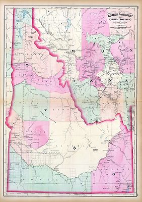
$3.95 Shipping Location: Clarkston, United States Rare Map Collection This DVD is part of our Historic Map and Atlas Collection. We have dozens of Atlas maps on DVD and CD ranging from the 1500s to the ... more1900s covering many areas and topics. Please Check our Ebay Store for what's available. FOR MANY MORE EDUCATIONAL CD TITLES ON THIS AND MANY OTHER SUBJECTS PLEASE VISIT OUR EBAY STORE VERY LARGE HIGH RESOLUTION MAP COLLECTION ON DVD! please see full table of contents and sample illustrations below) This DVD Contains 101 Maps of Idaho Including 44 PANORAMIC MAPS of various Idaho Cities These are scans of the ORIGINAL maps by various Cartographers. on DVD System requirements PC or Mac compatible. Files are simple PDF files with a basic HTML interface(just like viewing a webpage) Works with ALL versions of Windows. Maps of Idaho 0041037 Idaho. Montana west Asher& Adams 1874, 0586049 Idaho. Hand colored. Relief shown by hachures. Shows counties. Indian reservations, townships, settlements, rivers, etc. Mitchell. Samuel Augustus 1880, 0806001 Road map Idaho. Mont. Wyo. Rand McNally and Company; Texas Company 1937, 2212244 Partie des Etats-Unis. Amer. Sep. 39. Hand col. lithographed map. Relief shown by hachures. Shows Indians tribes with populations. Lewis and Clarke's route, etc. Covers parts of Idaho, Montana and Wyoming. Vandermaelen. Philippe 1827, 2738014 32D. Part Of South-Eastern Idaho Part Of South-Eastern Idaho. Atlas Sheet No. 32(D) Issued June 30, 1879. Weyss, Lang& Herman Del. Expedition of 1877, Under the Command of 1st Lieut. Geo. M. Wheeler, Corps of Engineers, U.S. Army. U.S. Geographical Surveys West Of The 100th Meridian. 1879, 2738015 32D. Land Classification Map Of Part Of South-Eastern Idaho. showing land classification. In full color with area and percentage of classifications noted. Wheeler. G.M. 1879, 2738020 41A. Parts Of Southern Idaho& Northern Utah Wheeler. G.M 1880, 2773005 Map Of The Road From Missouri To Oregon. Section V. Fremont. J.C. Preuss, Charles 1846, 2773006 Map Of The Road From Missouri To Oregon. Section VI.
Buy It Now
$3.95 Shipping Location: Clarkston, United States This DVD is part of our Historic Map and Atlas Collection. Arkansas Map Collection. 0041014 Arkansas, Indian Territory. 0089035 Arkansas. 0149042 Arkansas. ... more0537026 New Map Of Arkansas. 0977022 New Map Of Arkansas.
Buy It Now
$9.00 Shipping Location: Rockville, United States This map has property specific detail of the town in 1883. "Compiled, Drawn and Published From Personal Examinations and Surveys" by W. H. Kirk, & Co., ... morePhiladelphia, 1883. hand coloring to it. Map is blank on the reverse side.
Buy It Now
$14.99 Shipping Location: Ivanhoe, Australia This large rare, original lithograph early antique map of Galveston Island & Galveston Bay, Texas by Alexander Dallas Bache (great-grandson of Benjamin ... moreFranklin) in 1855 - dated - was published by the official chart-maker of the United States, the office of The US Coast Survey.
Buy It Now
$14.99 Shipping Location: Ivanhoe, Australia Alexander Dallas Bache, great-grandson of Benjamin Franklin, was the second Coast Survey superintendent. Under Bache, Coast Survey quickly applied its ... moreresources to the Union cause during the Civil War.
Buy It Now
$14.99 Shipping Location: Ivanhoe, Australia Buchon, Jean Alexandre 1791 – 1849. Buchon was an ardent Liberal and took an active part in party struggles under the Restoration, while throwing himself ... moreinto the historical regeneration then taking place.
Buy It Now
$14.99 Shipping Location: Ivanhoe, Australia Buchon, Jean Alexandre 1791 – 1849. Buchon was an ardent Liberal and took an active part in party struggles under the Restoration, while throwing himself ... moreinto the historical regeneration then taking place.
Buy It Now
$14.99 Shipping Location: Ivanhoe, Australia Buchon, Jean Alexandre 1791 – 1849. Buchon was an ardent Liberal and took an active part in party struggles under the Restoration, while throwing himself ... moreinto the historical regeneration then taking place.
Buy It Now
$14.99 Shipping Location: Ivanhoe, Australia Buchon, Jean Alexandre 1791 – 1849. Buchon was an ardent Liberal and took an active part in party struggles under the Restoration, while throwing himself ... moreinto the historical regeneration then taking place.
Buy It Now
$12.85 Shipping Location: Rochester, United States See also: List of artists and writers from Alaska. A dog team in the Iditarod Trail Sled Dog Race, arguably the most popular winter event in Alaska. Alaska ... moreMining District. Alaska Interstate Highways.
$14.99 Shipping Location: Ivanhoe, Australia Buchon, Jean Alexandre 1791 – 1849. Buchon was an ardent Liberal and took an active part in party struggles under the Restoration, while throwing himself ... moreinto the historical regeneration then taking place.
Buy It Now
$44.99 Shipping Location: Ivanhoe, Australia To these the author added An Introduction to The Mammals of Australia (1863) in a separate work. With the addition of those contained in the later Introduction ... morethe total of species described reached 166.
Buy It Now
$14.99 Shipping Location: Ivanhoe, Australia Buchon, Jean Alexandre 1791 – 1849. Buchon was an ardent Liberal and took an active part in party struggles under the Restoration, while throwing himself ... moreinto the historical regeneration then taking place.
Buy It Now
$14.99 Shipping Location: Ivanhoe, Australia Buchon, Jean Alexandre 1791 – 1849. Buchon was an ardent Liberal and took an active part in party struggles under the Restoration, while throwing himself ... moreinto the historical regeneration then taking place.
Buy It Now
$14.99 Shipping Location: Ivanhoe, Australia Buchon, Jean Alexandre 1791 – 1849. Buchon was an ardent Liberal and took an active part in party struggles under the Restoration, while throwing himself ... moreinto the historical regeneration then taking place.
Buy It Now
$12.85 Shipping Location: Floral Park, United States
Buy It Now
$12.85 Shipping Location: Floral Park, United States Published by Franklin Survey Co. Includes: MAINLINE INDEX. Each color represents a different type of building. Pink is Brick; Yellow is Wood and Brown ... moreis Stone. Square box with an X = Garage, Stable or Shed.
Buy It Now
$12.85 Shipping Location: Floral Park, United States
Buy It Now
$12.85 Shipping Location: Floral Park, United States
Buy It Now
$12.85 Shipping Location: Floral Park, United States
Buy It Now
$17.60 Shipping Location: Floral Park, United States This is a mint 24x36 high quality high resolution reproduction on 70 lb. Map is dated at the bottom of the page.
Buy It Now
$17.60 Shipping Location: Floral Park, United States It is dated 1937 in the lower right corner.
Buy It Now
$17.60 Shipping Location: Floral Park, United States This is a high quality, high resolution reproduction on 70 lb. It is dated 1937 in the lower right corner.
Buy It Now
$17.60 Shipping Location: Floral Park, United States Map is date 1937 at the bottom of the page.
Buy It Now
$17.60 Shipping Location: Floral Park, United States Map is dated 1937 at the bottom of the page.
Buy It Now
$12.85 Shipping Location: Floral Park, United States This is a 24x36 high quality high resolution reproduction in mint condition on 70 lb.
Buy It Now
$17.60 Shipping Location: Floral Park, United States This is a mint 24x36 high quality high resolution reproduction on 70 lb. Map is dated at the bottom of the page. I have included the Explanation key that ... moreappears in the last photograph is for reference only and is not on the map.
Buy It Now
$17.60 Shipping Location: Floral Park, United States Map is dated 1937 at the bottom of the page.
Buy It Now
$17.60 Shipping Location: Floral Park, United States The last image before the Explanation key is on the reverse side of the plat. Map is date 1937 at the bottom of the page.
Buy It Now
$17.60 Shipping Location: Floral Park, United States Map is date 1937 at the bottom of the page.
Buy It Now
$17.60 Shipping Location: Floral Park, United States This is a mint 24x36 high quality high resolution reproduction on 70 lb. Map is dated at the bottom of the page.
Buy It Now
$12.85 Shipping Location: Floral Park, United States This is a mint 24x36 high quality high resolution reproduction on 70 lb. Each color represents a different type of building: Yellow is Wood; Pink is Brick; ... moreBlue is Stone, Brown is Stucco. Box with an X = Garage.
Buy It Now
$12.85 Shipping Location: Floral Park, United States This is a 24x36 high quality high resolution reproduction in mint condition on 70 lb. Each color represents a different type of building: Yellow is Wood; ... morePink is Brick; Brown is Stone or Concrete; Blue is Stucco and Box with Black Lines = Iron Clad.
Buy It Now
$17.60 Shipping Location: Floral Park, United States This is a mint 24x36 high quality high resolution reproduction on 70 lb. Map is dated at the bottom of the page.
Buy It Now
$12.85 Shipping Location: Floral Park, United States This is a 24x36 high quality high resolution reproduction in mint condition on 70 LB. Each color represents a different type of building: Yellow is Wood; ... morePink is Brick; Brown is Stone or Concrete; Blue is Stucco and Box with Black Lines = Iron Clad.
Buy It Now
$17.60 Shipping Location: Floral Park, United States Map is dated 1937 at the bottom of the page.
Buy It Now
$17.60 Shipping Location: Floral Park, United States Map is date 1937 at the bottom of the page.
|
|
|
In
|
WARMINSTER TWP PA BUCKS COUNTY 1948 FRANKLIN SURVEY CO FARM ATLAS MAP 24" x 34"
Warminster Twp. Bucks County, PA map from the 1948 Franklin Survey Company Farm Atlas. Map shows land owners names, farms, sub divisions, roads etc in Warminster. It is made of heavy rag paper and measures 24" x 34" This is an original map in color removed from the 1948 Atlas. It is in perfect condition ready to be framed. It has the center fold from the book. Will to USA only. Flat rate shipping $8.00. Always glad to answer any questions.
|
|
|
DOYLESTOWN PA BUCKS COUNTY 1948 FRANKLIN SURVEY CO FARM ATLAS MAP 23.5" x 34"
Doylestown Township. Bucks County, PA map from the 1948 Franklin Survey Company Farm Atlas. Map shows land owners names, farms, sub divisions, roads etc in Doylestown Twp. Incudes Doylestown and New Britian Boro's streets. It is made of heavy linen backed paper and measures 23.5" x 34" This is an original map in color removed from the 1948 Atlas. It is in perfect condition ready to be framed. It has the center fold from the book. Will to USA only. Flat rate shipping $8.00. Always glad to answer any questions.
|
|
|
Map of Havertown PA Del Co. 1939. Franklin Survey Co. Plate 27
This auction is for a single map. This is the plate 27 from a 1939 zoning and property atlas produced by the Franklin Survey Company. This map covers Rolling Hill Road. Darby Road, Brookline Blvd, and City Ave. See photo for exact inclusions. Covers Havertown. Includes old location of Pennsylvania Golf Club, now location of Chatham Park Elementary school, the Grange, and Llanerch Fire Company. Map measures 23" x 17" It is in good condition. No rips or tears. But some discoloration at the corners. Has very few light pencil marks and no pen marks to be seen. Top left corner creased. Paper still bright. Overall very clean for 75 years old. We have more than 30 other maps from this same atlas available as well. We can custom frame before shipping for an additional charge. Please contact me for details or with questions. RcmdId ViewItemDescV4,RlogId ... morep4%60bo7%60jtb9%3Fvo%7B%3Dd70f%2Bf%60%60%3E-14786a590d5-0x10e-
|
|
 |